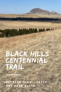
Mild, winter days make great weather for hiking the northern portions of the Black Hills Centennial Trail. Today’s post is going to focus specifically on the sections that run between the Alkali Creek trailhead and Bear Butte State Park (Fort Meade is included in this).
Where can you find the Alkali Creek, Fort Meade, and Bear Butte trailheads of the Centennial Trail?
When hiking the Centennial Trail from these trailheads you can choose to start from whichever one you’d like and can travel northbound or southbound from any of them. All of these are pretty easy to find as they are all close to populated areas (namely I-90 and Sturgis, South Dakota). See below for specific directions to each:
-
- Alkali Creek trailhead: located adjacent to I-90 across the highway from the Black Hills National Cemetery at Exit 34.
- Bear Butte trailhead: found at Bear Butte State Park which is northeast of Sturgis, SD on Route 79.
- Fort Meade trailhead: located on the eastern edge of the Fort Meade historical site off of Route 34, just east of Sturgis.
What will you see on the Black Hills Centennial Trail in the Northern Hills?
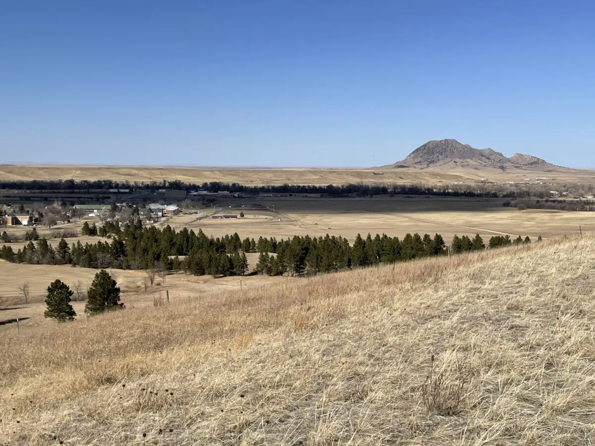
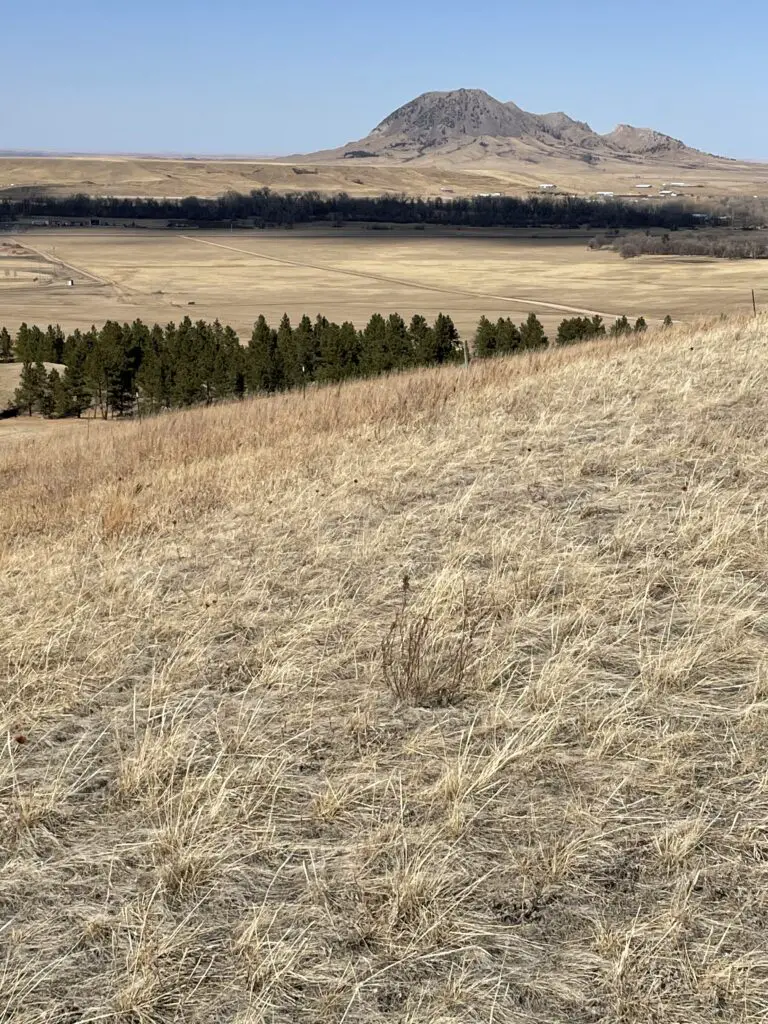
This whole area sits in the shadow of Bear Butte, meaning it offers spectacular views of that unique formation.
Bear Butte is a “sister” volcanic plug to Devils Tower that is located in eastern Wyoming. The American Indians who named this geological formation gave it this name as they thought it resembled a sleeping bear. (I think it more resembles a sleeping stegosaurus or dragon, but the tribal people probably wouldn’t have been familiar with these critters, so I’ll give it to them. 😀)
The idea of the bear plays into the American Indian legend of the giant bear who scored the sides of the Tower with his claws, leaving the large columns of igneous rock behind.
The Centennial Trail between Alkali Creek and Fort Meade trailheads
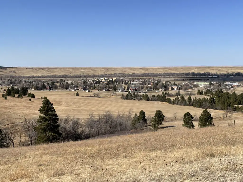
My favorite of these sections is the portion between Alkali Creek and the Fort Meade historical site in Sturgis. As its name would imply, Fort Meade was originally built as a fort in the late 1800s. It now features a museum, multiple historical buildings, and a VA hospital.
As you venture near the fort you start to see many historical buildings popping up along the hiking route. One was just an old ( but beautiful) stone fireplace and chimney. Another looked to be old, stone barracks.
On the Alkali Creek portion, we made a loop of the Centennial Trail and through the Fort Meade Recreation Area. This place is awesome! I had heard about it before but had never been there. We’d definitely like to go back and do more of the trails. They would be perfect for mountain biking or horseback riding, in addition to hiking.
We brought roads 11 and 12 back to the Alkali Creek trailhead to complete our loop. They were much easier and quicker than the way out as they were mostly on old forest roads. Be aware though, that this section has no shade as it traverses the grassland portion of this trail.
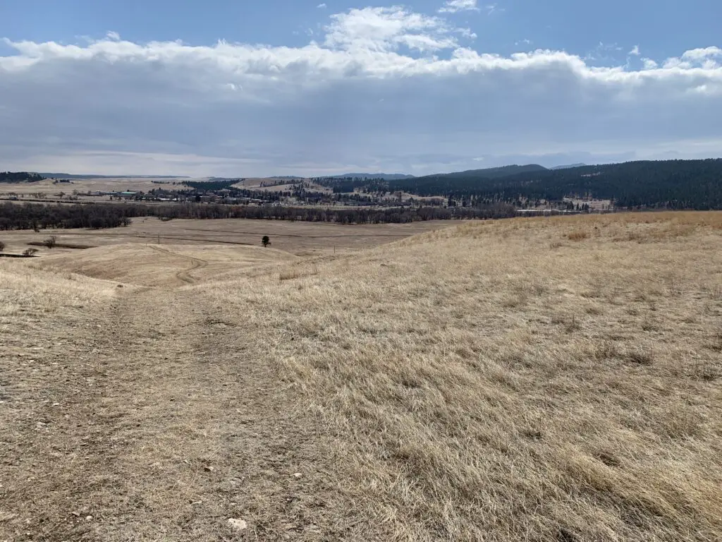
This section of the Centennial Trail is VERY pretty. It is comprised of forested hills (much like the rest of the Black Hills) and prairie sections. There are lots of different ecosystems and flora represented here, ranging from pine forests to prairie grassland. It made me wonder if this is what Bear Butte looked like, before the fire in 1996?
This portion of the trail is comprised of a bunch of up-and-down sections, but nothing too terribly steep or long. It reminded us of some of the Devils Tower hikes in Wyoming where you are hiking through the trees but can still look out over the plains.
While one portion of this hike is VERY close to I-90 (the highway is maybe half a mile away?) it isn’t very noisy because you’re in the forest on the “other” side of the hill! Yay, science!
The Black Hills Centennial Trail between Fort Meade and Bear Butte trailheads
The rest of this section of trails is comprised mostly of just prairie and prairie dogs. 😊 We did spot a grass fire to the north as we were hiking along. That was a little disconcerting as were surrounded by highly flammable material. 😮
We weren’t too worried as it was quite a ways off, we could see the authorities were already on the scene, and the wind was blowing the fire away from us. It did get us thinking about what we would do if a fire was to come racing across the grassland while we were hiking through it. 😝 There was a farmhouse nearby we could have run to or there were some small cow ponds scattered nearby. These may not have been very clean or nice but they would have sufficed in a pinch! 😂
Take note that these portions of trails could be VERY warm in the summer (which is partially why we enjoyed them in the winter). Much of the Centennial Trail in this region traverses grassland with no shade to speak of ANYWHERE. While the brisk, South Dakota breeze usually accompanies you, you won’t be able to escape the unrelenting sun.
Between the hot sun and that breeze–plus the fact that the air is usually quite dry here–you can dehydrate quickly and easily. Not only do they dry you out, but the constant breeze and dryness can make it so that you don’t even realize how much you are sweating.
That being said, this portion of the Centennial Trail is a great hike! It offers some amazing views and it is easier than many portions of the trail that are further south. This is because the altitude is lower here and the elevation changes are far more minimal. So if you’re looking for something fun to do, check out the Centennial Trail in the Northern Black Hills!
Have you tried out any of these routes? What did you think? Tell me about your hike in the comments!
Did you enjoy this post? Pin it!
Like what you read here today? Please feel free to leave a comment, like or share this post! Add your email at the bottom of the page, or the sidebar to the right, to be notified when a new post is published. By signing up for the email list, you will also receive a free copy of the Tranquil Trekker’s Top 10 Tips of Trekking Do’s and Don’ts!
You can also follow the blog on social media by clicking the links below!