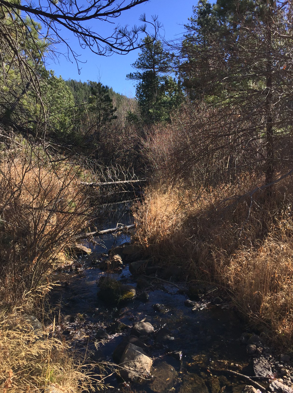
In this post, I review a trip to the “secret” site of the Empire Mine, found in the central Black Hills.
Author’s Note: I struggled with whether or not to write this post. I wanted to blog about this location because it is a cool place and I love sharing the history and beauty of our Black Hills with others. However, it is a bit of a secret spot and I didn’t want to be “that guy” who gives away closely-held, local secrets. My personal policy is to not offer more directions to these types of sites than are already available on Google. Unfortunately, there isn’t much to be found regarding the Empire Mine…
My main goal with this policy is to protect the site from vandalism and/or destruction. We have unfortunately had these types of issues in some local places such as the Spokane ghost town and the iconic Poet’s Table, as of late. For this reason, my directions below are intentionally vague. If you want clearer instructions on how to reach the site, you may contact me via social media as indicated below, or by using my contact form, and I may be able to help you a little more. (I got some helpful directions from a friendly and helpful local so I am willing to pay their goodwill forward and do you the same favor. 😀)
There is a somewhat well-known, secret location many people enjoy hiking to in the central Black Hills. It is the site of the now-defunct Empire Gold Mine! You can reach the ruins of this mine via the Samelius trailhead, which is part of the Black Hills Centennial Trail.
That’s it. Those are my directions. 😇 I told you they would be vague! 😉 I don’t feel like these approximate instructions are giving anything away as this much is available on the AllTrails site. That page also offers a little more information as to the whereabouts of the mine, including a vague map. Also, I knew the mine could be reached from this trailhead for quite some time and that didn’t aid me in finding this secret locale (maybe I’m just not that bright? 😂)
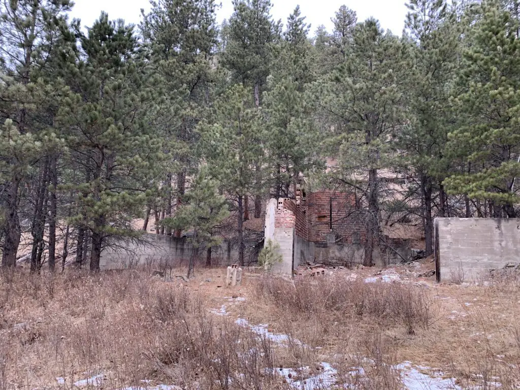
The storehouse at Empire Mine. At one point in time, trucks could drive here.
What is the trail to the Empire Mine like?
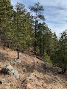
The trail to the Empire Mine is about 4.2 miles in total length, out-and-back. You should be aware, a goodly portion of the route going out is downhill…you know what that means for a goodly portion of the path coming back?! 😝 The trail is also fairly obvious the entire way. Much of it follows old forest roads and the portions that don’t are heavily used so they are well-trodden.
When is the best time of year to visit the Empire Mine?
The hike is a bit lengthy but it isn’t overly difficult. Some of the trail sections could become quite icy during the colder months, especially as this route sees a lot of traffic that can pack the snow into hard ice. If the weather has been particularly wet recently, or during the spring thaw when snow is melting, mud could also make this trail slippery.
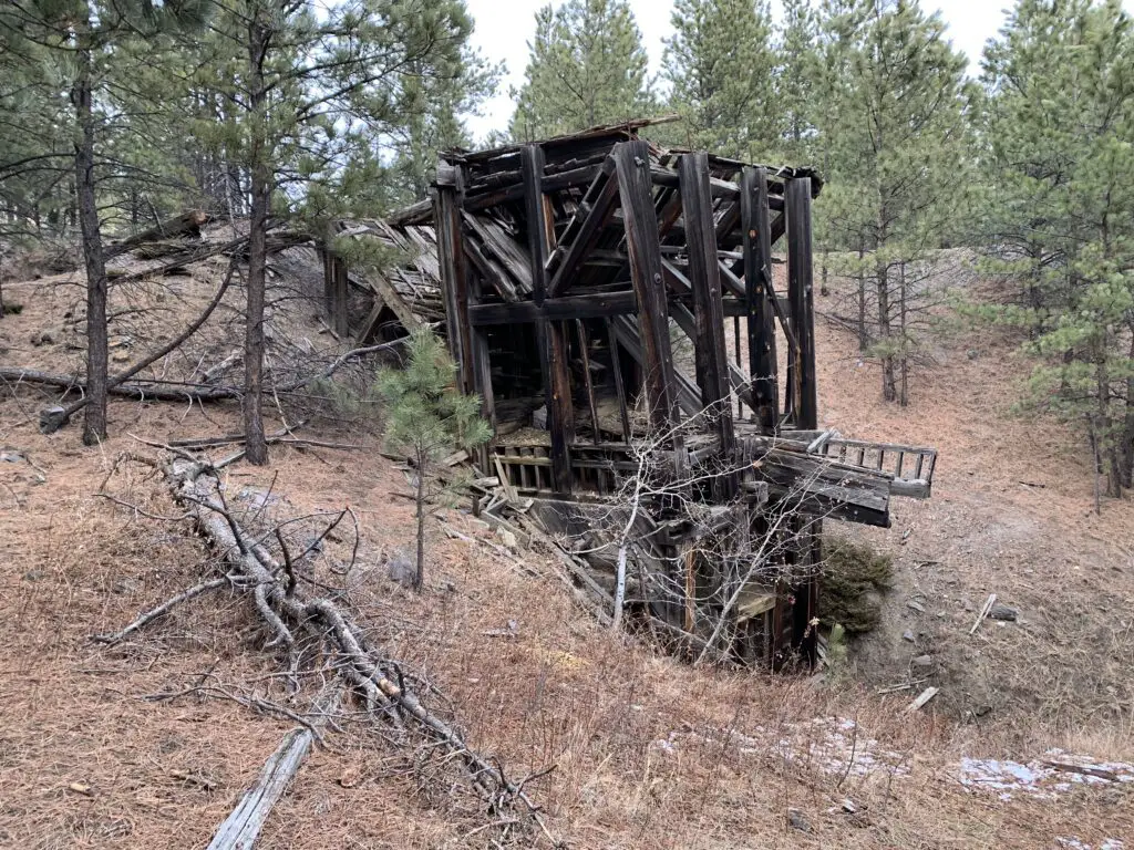
Another ruin from the site’s mining days. You can see how dilapidated the buildings are becoming.
These factors could make the downhill portions of the route troublesome, so please use caution. The hike is especially lovely in fall when the trees change color! This is because along the way you walk near several aspen groves that turn a brilliant, golden hue (hey look, another clue as to the location of the mine! 😉)
What is there to see at the Empire Mine?
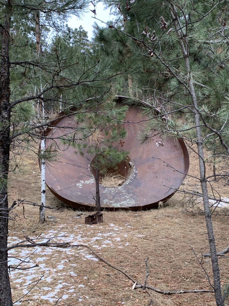
Some of the main ruins that remain of the mine are the brick loading area and a VERY large copper funnel. Those are found at the bottom of the hill. As you work your way up the hill you will encounter a number of buildings and mine equipment that still remain in the forest.
A WORD OF WARNING! The mine was built in the late 1930s so these buildings are OLD! They are made of wood that has weathered and has not been maintained in many years. PLEASE do NOT enter them. Also, watch your step throughout this area as portions of the ground (especially near some of the buildings) are degrading into sinkholes.
A large funnel that was used at the mine
This is a pretty neat site to visit. It is also not that far from several nearby, Black Hills’ towns and it isn’t really that hard to reach IF you know where to look. If you’re interested in some of the mining history of the Black Hills I encourage you to look into this secret locale. Just please, treat it with the historical respect it deserves, and don’t ruin the site for those who come after you. *stepping off my soapbox now* 😇
Have you visited the site of the Empire Mine in the central Black Hills? Share your experience with me in the comments!
Did you enjoy this post? Pin it!
Like what you read here today? Please feel free to leave a comment, like or share this post! Add your email at the bottom of the page, or the sidebar to the right, to be notified when a new post is published. By signing up for the email list, you will also receive a free copy of the Tranquil Trekker’s Top 10 Tips of Trekking Do’s and Don’ts!
You can also follow the blog on social media by clicking the links below!
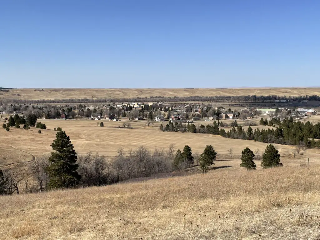
In this post, I review the northern portion of the Centennial Trail that runs between Bear Butte State Park and the Alkali Creek trailheads (this also includes Fort Meade) in the northern Black Hills.
Mild, winter days make great weather for hiking the northern portions of the Black Hills Centennial Trail. Today’s post is going to focus specifically on the sections that run between the Alkali Creek trailhead and Bear Butte State Park (Fort Meade is included in this).
Where can you find the Alkali Creek, Fort Meade, and Bear Butte trailheads of the Centennial Trail?
When hiking the Centennial Trail from these trailheads you can choose to start from whichever one you’d like and can travel northbound or southbound from any of them. All of these are pretty easy to find as they are all close to populated areas (namely I-90 and Sturgis, South Dakota). See below for specific directions to each:
Alkali Creek trailhead: located adjacent to I-90 across the highway from the Black Hills National Cemetery at Exit 34.
Bear Butte trailhead: found at Bear Butte State Park which is northeast of Sturgis, SD on Route 79.
Fort Meade trailhead: located on the eastern edge of the Fort Meade historical site off of Route 34, just east of Sturgis.
What will you see on the Black Hills Centennial Trail in the Northern Hills?
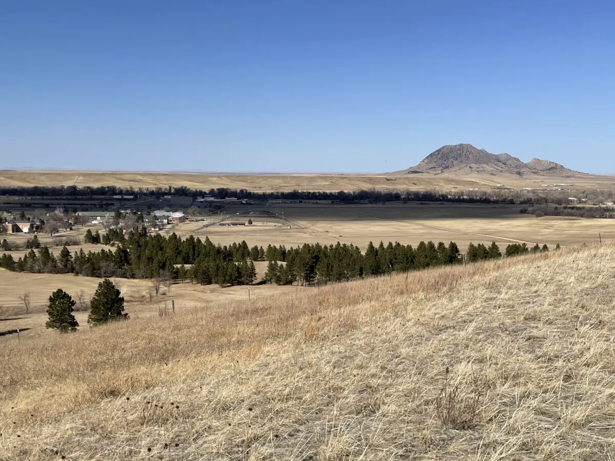
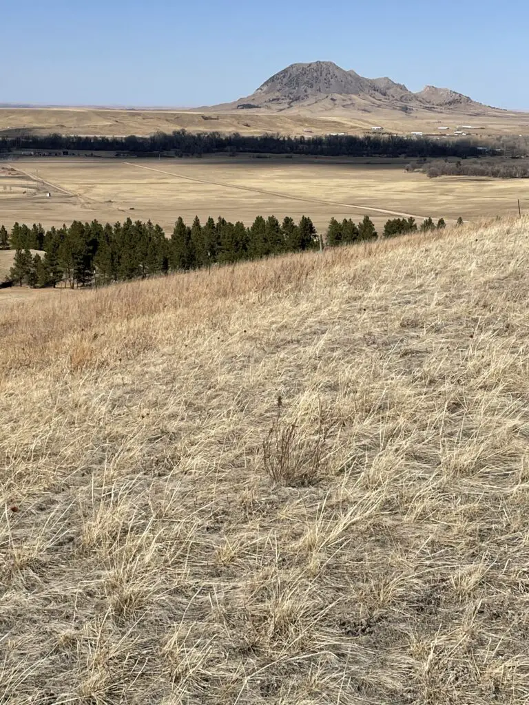
This whole area sits in the shadow of Bear Butte, meaning it offers spectacular views of that unique formation.
Bear Butte is a “sister” volcanic plug to Devils Tower that is located in eastern Wyoming. The American Indians who named this geological formation gave it this name as they thought it resembled a sleeping bear. (I think it more resembles a sleeping stegosaurus or dragon, but the tribal people probably wouldn’t have been familiar with these critters, so I’ll give it to them. 😀)
The idea of the bear plays into the American Indian legend of the giant bear who scored the sides of the Tower with his claws, leaving the large columns of igneous rock behind.
The Centennial Trail between Alkali Creek and Fort Meade trailheads
My favorite of these sections is the portion between Alkali Creek and the Fort Meade historical site in Sturgis. As its name would imply, Fort Meade was originally built as a fort in the late 1800s. It now features a museum, multiple historical buildings, and a VA hospital.
As you venture near the fort you start to see many historical buildings popping up along the hiking route. One was just an old ( but beautiful) stone fireplace and chimney. Another looked to be old, stone barracks.
On the Centennial Trail, looking towards Fort Meade from the north
On the Alkali Creek portion, we made a loop of the Centennial Trail and through the Fort Meade Recreation Area. This place is awesome! I had heard about it before but had never been there. We’d definitely like to go back and do more of the trails. They would be perfect for mountain biking or horseback riding, in addition to hiking.
We brought roads 11 and 12 back to the Alkali Creek trailhead to complete our loop. They were much easier and quicker than the way out as they were mostly on old forest roads. Be aware though, that this section has no shade as it traverses the grassland portion of this trail.
The Fort Meade historical site
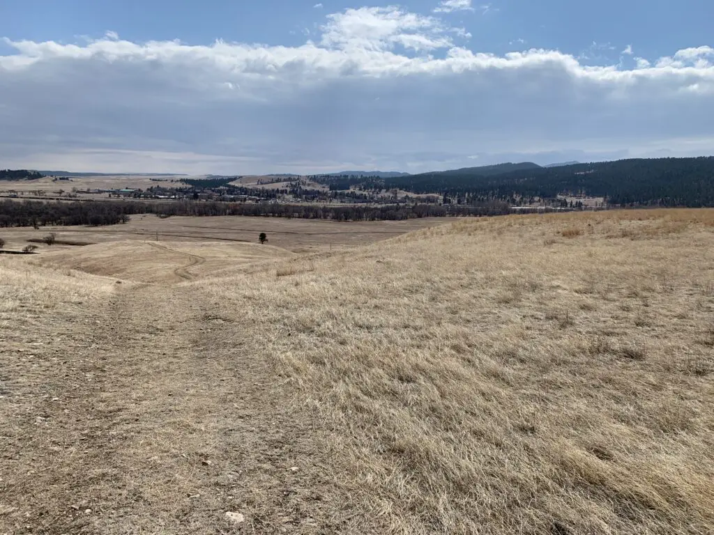
This section of the Centennial Trail is VERY pretty. It is comprised of forested hills (much like the rest of the Black Hills) and prairie sections. There are lots of different ecosystems and flora represented here, ranging from pine forests to prairie grassland. It made me wonder if this is what Bear Butte looked like, before the fire in 1996?
Bear Butte, the sleeping bear (or sleeping stegosaurus, if you prefer. 😉 )
This portion of the trail is comprised of a bunch of up-and-down sections, but nothing too terribly steep or long. It reminded us of some of the Devils Tower hikes in Wyoming where you are hiking through the trees but can still look out over the plains.
While one portion of this hike is VERY close to I-90 (the highway is maybe half a mile away?) it isn’t very noisy because you’re in the forest on the “other” side of the hill! Yay, science!
The Black Hills Centennial Trail between Fort Meade and Bear Butte trailheads
The rest of this section of trails is comprised mostly of just prairie and prairie dogs. 😊 We did spot a grass fire to the north as we were hiking along. That was a little disconcerting as were surrounded by highly flammable material. 😮
We weren’t too worried as it was quite a ways off, we could see the authorities were already on the scene, and the wind was blowing the fire away from us. It did get us thinking about what we would do if a fire was to come racing across the grassland while we were hiking through it. 😝 There was a farmhouse nearby we could have run to or there were some small cow ponds scattered nearby. These may not have been very clean or nice but they would have sufficed in a pinch! 😂
Take note that these portions of trails could be VERY warm in the summer (which is partially why we enjoyed them in the winter). Much of the Centennial Trail in this region traverses grassland with no shade to speak of ANYWHERE. While the brisk, South Dakota breeze usually accompanies you, you won’t be able to escape the unrelenting sun.
Between the hot sun and that breeze–plus the fact that the air is usually quite dry here–you can dehydrate quickly and easily. Not only do they dry you out, but the constant breeze and dryness can make it so that you don’t even realize how much you are sweating.
That being said, this portion of the Centennial Trail is a great hike! It offers some amazing views and it is easier than many portions of the trail that are further south. This is because the altitude is lower here and the elevation changes are far more minimal. So if you’re looking for something fun to do, check out the Centennial Trail in the Northern Black Hills!
Have you tried out any of these routes? What did you think? Tell me about your hike in the comments!
Did you enjoy this post? Pin it!
Like what you read here today? Please feel free to leave a comment, like or share this post! Add your email at the bottom of the page, or the sidebar to the right, to be notified when a new post is published. By signing up for the email list, you will also receive a free copy of the Tranquil Trekker’s Top 10 Tips of Trekking Do’s and Don’ts!
You can also follow the blog on social media by clicking the links below!
In this post, I review the northbound portion of the Centennial Trail from the Elk Creek Trailhead
In this post, I’ll be discussing the portion of the Black Hills Centennial Trail heading north from the Elk Creek Trailhead.
Where in the Black Hills is the Elk Creek Trailhead?
The Elk Creek trailhead is located on Runkle Road. The easiest route to get there is I-90, via the northern portion of Vanocker Canyon Road, south of Sturgis. The turnoff for Runkle Road is almost seven miles to the south of I-90. You can also reach the trailhead from Sturgis Road to the east, though the route to get there is longer and will likely require a high-clearance, 4WD vehicle.
What will you see when traveling on this portion of the Centennial Trail?
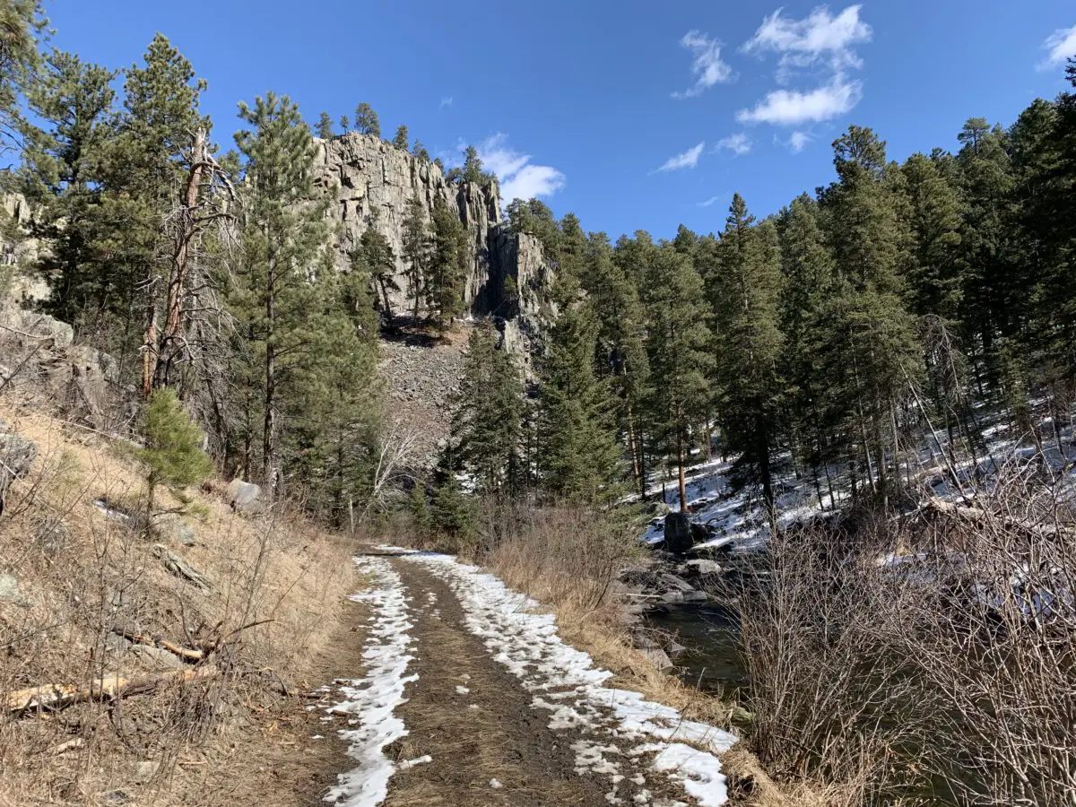
This trail is quite lovely. It offers numerous vantage points of sprawling valleys in the Black Hills. It also provides access to several local summits which give you expansive views of the surrounding area. In summer, you will notice the lighter, spring-green color of the aspen trees contrasting against the darker, forest green of the ponderosa pines. In the fall, the contrast is even more noticeable when the aspens turn a bright yellow.
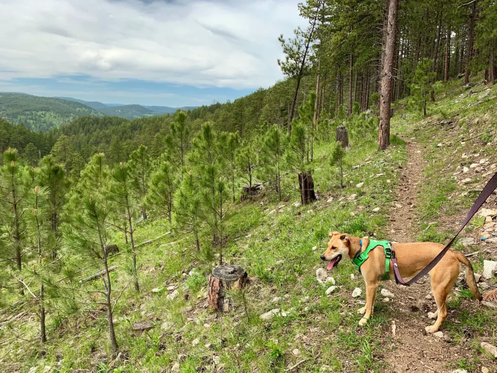
Puppers enjoying the hike!
The trail traverses the northern portion of the Black Hills National Forest which features a wetter climate than the southern part. This allows for more lush and varied vegetation. Mr. Trekker says the scene reminds him of his childhood days in New England.
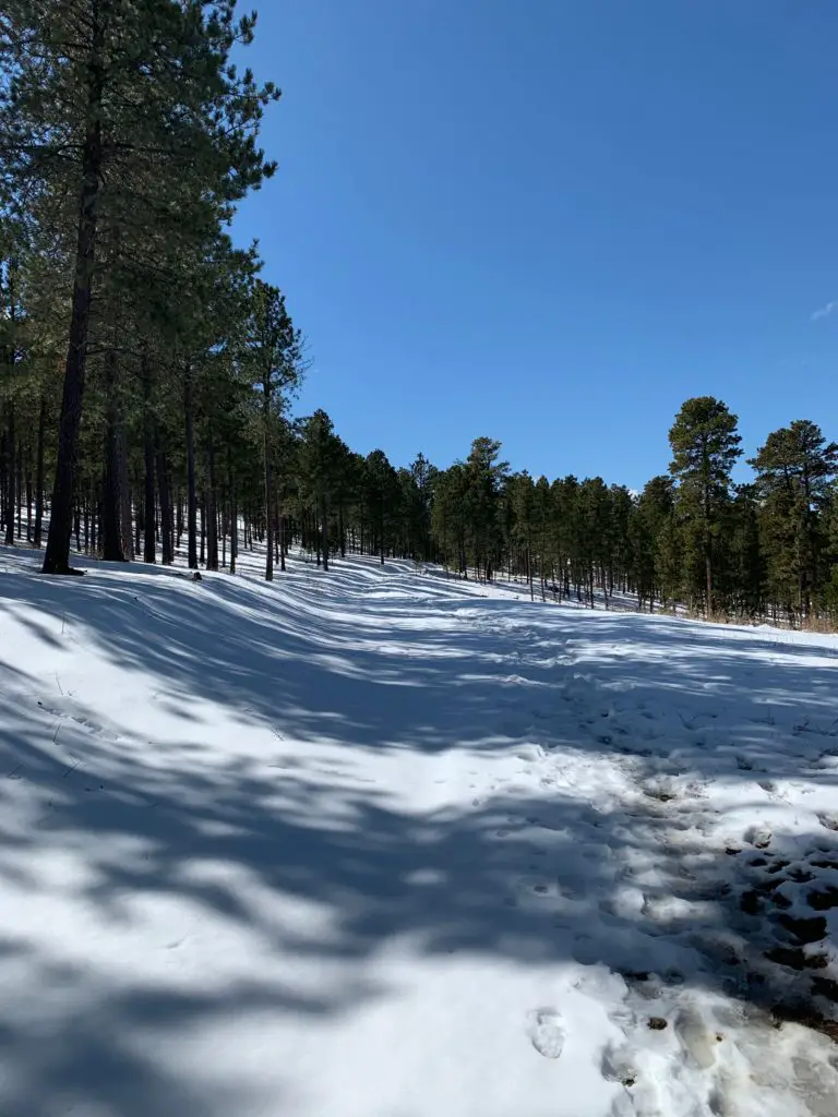
You can enjoy the Elk Creek portion of the Centennial Trail almost any time of year
This is a good trail for both biking and hiking as it is wide and well-graded in most places. In a few sections, it actually follows sections of old fire roads (and occasionally roads that are still in use, so be watchful for other recreators). This means you won’t find many places with roots that can trip you up or that require lengthy scrambling over rocks.
This is a good trail at almost any time of the year but especially during the warmer months. It’s fairly shaded (depending on the time of day) so it’s a cooler option when it’s hot out. There also aren’t many long climbs as it mostly consists of undulating terrain. I would give this trek an overall rating of easy to moderate. The moderate portions come in as there are a few areas where the “ups” can get your heart pumping a bit.
Below are a few more pics from the trail (thanks, as usual, to Mr. Trekker for these!):
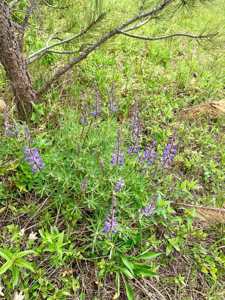
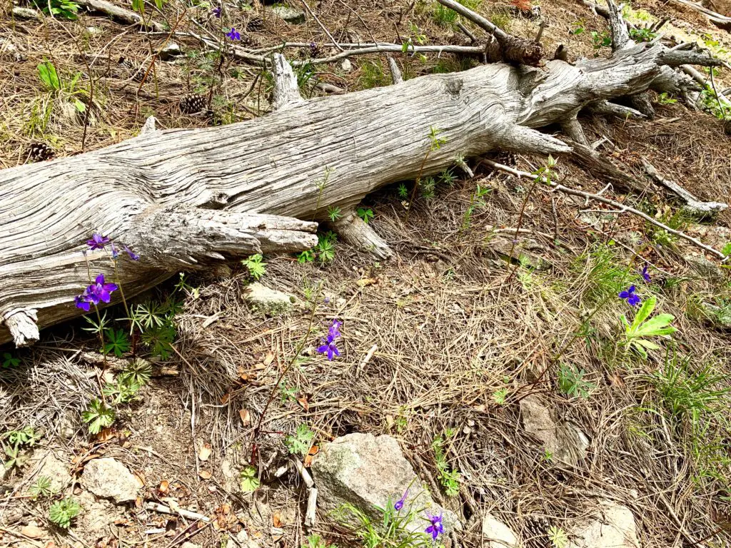
The wildflowers are lovely in the Black Hills in the summer!
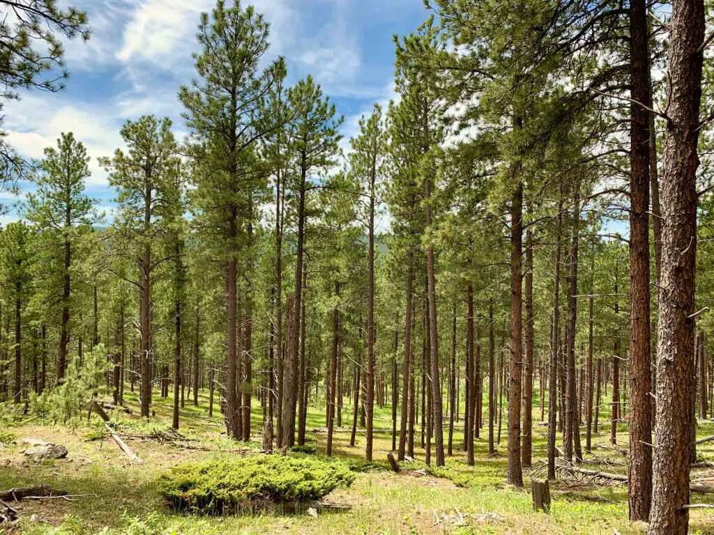
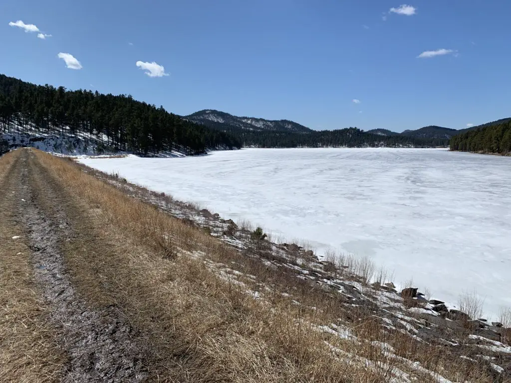
A nice view of the Black Hills National Forest
Have you tried out this portion of the Centennial Trail? Tell me about it in the comments!
Did you enjoy this post? Pin it!
Like what you read here today? Please feel free to leave a comment, like or share this post! Add your email at the bottom of the page, or the sidebar to the right, to be notified when a new post is published. By signing up for the email list, you will also receive a free copy of the Tranquil Trekker’s Top 10 Tips of Trekking Do’s and Don’ts!
You can also follow the blog on social media by clicking the links below!
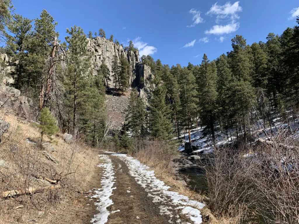
In this post, I review a trail loop we made of the Dakota Point, Flume and Centennial Trails in the central Black Hills.
For another great, Black Hills hike check out a loop that can be made of the Dakota Point, Centennial, and Flume trails near Spring Creek and Sheridan Lake.
It’s funny because we’ve done each of these hikes several times in the past, we just haven’t ever combined them (mostly because water levels on the creek were high or footbridges were out).
The entire loop is between three to four miles in total length.
Where is the Dakota Point Trailhead?
We started and ended our loop at the Dakota Point Trailhead which is located off of Sheridan Lake Road. Dakota Point Road branches off of Sheridan Lake Road and gives access to both the trail and the lake. You will find it about 13 miles west of the Sheridan Lake Road/Catron Boulevard intersection on the southwest side of Rapid City.
This is another, somewhat obscure trailhead found off Sheridan Lake Road, but at least this one has a sign! At certain times, it could be difficult to reach (especially with a regular passenger car) due to mud or snow, as the road to it is not usually plowed (though it is heavily used throughout the year).
What is the Centennial/Dakota Point Loop Hike like?
The first portion of this trail is fairly easy. You will follow a rolling route up and down some shorter hills. The majority of it follows old forest roads that are wide, and fairly well-graded. In a few spots the trek reverts back to more of a regular trail, but even these are fairly easy to navigate.
You should be aware, while you can navigate this loop from either direction, both arms basically wander down the side of the hill towards the creek and lake. This means on the return trip, you will be facing a moderately strenuous, uphill climb, regardless of which direction you choose.
The Dakota Point trail leads you to the dam on Sheridan Lake. This route is very heavily used, especially in the summer. About 1/2 mile into this trail, you’ll come to a fork. If you take the right fork, you’ll continue on the shorter route to Dakota Point. If you take the left fork (which we did) you’ll join the Centennial Trail that runs almost the entire length of the Black Hills.
The Dakota Point trail with snow on it!
You’ll follow the Centennial Trail for about a mile, traipsing downhill the majority of the time–sometimes steeply–until you join up with the Flume Trail coming from the Spring Creek Trailhead. If you turn left, you’ll go to the Spring Creek Trailhead, if you turn right, you’ll eventually end up at the Sheridan Lake dam.
There are a number of other trails that break off from the dam that join the Flume Trail, in places, and traverse around Sheridan Lake. There is also a loop of the Flume Trail that you can join. As you can see there are many choices for hiking in this area!
Once you cross the Sheridan Lake dam, you will climb the lovely, stone steps, to a picturesque view of the backside of the lake. You can then continue back to the Dakota Point Trail and make the long climb back to the trailhead.
A frozen Sheridan Lake
Footbridges on the Flume Trail, Black Hills
Once you reach the Flume Trail, be prepared for multiple creek crossings. There are usually footbridges that allow you to cross with little effort but be warned, they can be a bit intimidating. They are literally, basically just wide railroad ties that span the creek.
Part of the Flume Trail
There are no handrails on the bridges. You aren’t that high above the water (though it would probably still hurt to fall) but this can cause an intimidating trip across the bridge if you’re afraid of heights. Also, if more than one person is on the bridge at a time, they tend to bounce a little which is even more unnerving.
Often you can cross the creek on foot (unless the water is overly high) but this can be a COLD trip when the weather is cool. Also, every few years, these footbridges tend to wash out when the creek floods. 😝
To Conclude
This is a great trail loop! It isn’t overly long though it is moderately-strenuous. This would be a perfect option for a family hike and it is located close to town so it’s easy to reach. Why not check it out the next time you’re looking for a weekend hike in the Black Hills?
Have you tried any of these trails or done the entire loop? What was your experience? Tell me about it in the comments!
Did you enjoy this post? Pin it!
Like what you read here today? Please feel free to leave a comment, like or share this post! Add your email at the bottom of the page, or the sidebar to the right, to be notified when a new post is published. By signing up for the email list, you will also receive a free copy of the Tranquil Trekker’s Top 10 Tips of Trekking Do’s and Don’ts!
You can also follow the blog on social media by clicking the links below!
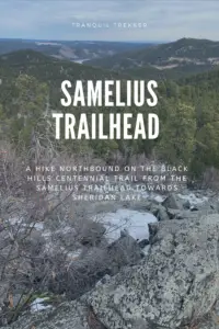
In this post, I review the hike on the Centennial Trail between the Samelius Trailhead and Sheridan Lake
One interesting hike that is part of the Black Hills Centennial Trail runs between the Samelius trailhead and Sheridan Lake.
This section of the Centennial Trail is about seven miles in total length and ends at the Calumet trailhead at Sheridan Lake–obviously you can hike the trail from either direction, starting at either trailhead.
Hiking North from the Samelius Trailhead
The Centennial Trail runs in two directions from this trailhead, northbound towards Sheridan Lake and south, to the vicinity of Mount Rushmore and Horsethief Lake. These are both good hikes. We’ve only completed a small portion of the southbound route, so I’ll leave that review for another day.
The Trekkers have now hiked portions of this route from each direction/trailhead. You’ll notice I said “portions” because…this trail is ROUGH and it kicks our sorry butts every time we try it!
It is a LOVELY route though and definitely worth the effort! I would dub this trail as a fair unknown and hidden gem in the Black Hills! It won’t take you to the summits of any of the major, nearby mountains on its own. (There are several in the local area that you can climb to though, if you’re daring enough to trek off-trail. Mt. Samelius is one of these.) Also, if you know where to look, there is a Black Hills Secret Spot that can be reached somewhere off this portion of the Centennial Trail…😇
We have attempted this route at least four separate times and have never traversed the entirely of the trail between these two trailheads!
Try 1) it started lightning and thundering so we turned back…(I think this actually happened a few times…)
Try 2) I rolled my ankle SEVERELY about halfway up–we continued on to the summit before turning around…but in hindsight I probably should have turned back sooner…
Try 3) We attempted this route starting at the Calumet Trailhead at Sheridan Lake and did ok but never made it to the summit (that we reached on “Try 2”). To be fair, it was a pretty hot day!
Try 4) We attempted from the Samelius trailhead again and got further than we’ve ever reached before but STILL didn’t make it to the point we reached on “Try 3” *sigh*
Did I mention this section of trail kicks our butts EVERY. SINGLE. TIME.?!
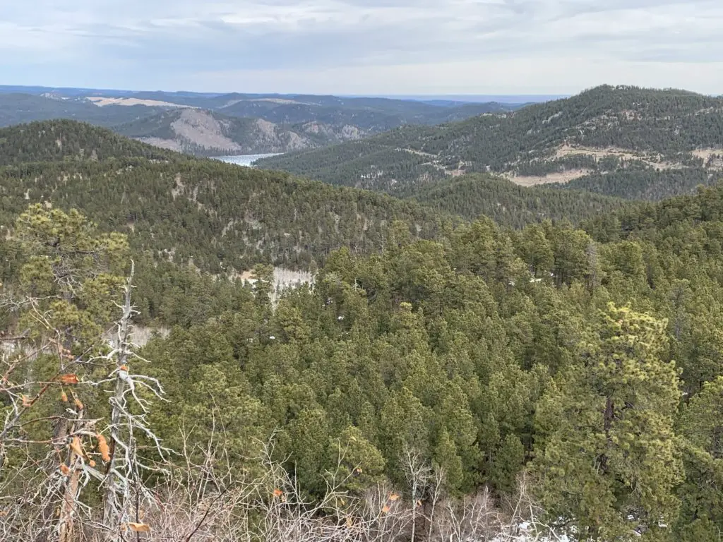
What is the hike from the Samelius Trailhead like?
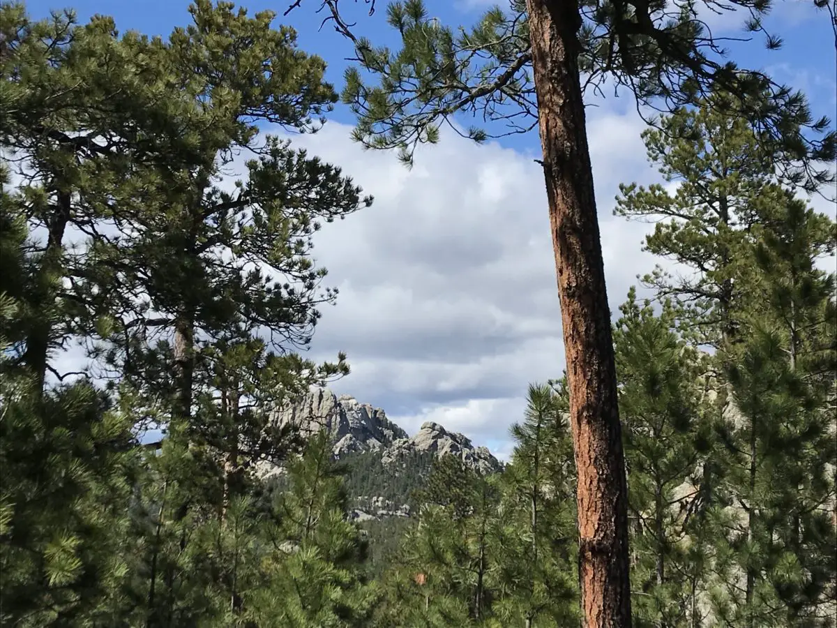
While the route from either trailhead ends up quite steep, we enjoy the hike from Samelius the best. For the first mile or so it follows an old, forest road so the path is wide and not too steep. (It reminded us of some old, carriage roads we’ve been on in parks out East!) After that it ventures back into the woods on a one-track trail that gets more rocky.
This is the begining of the rockier section of the trail
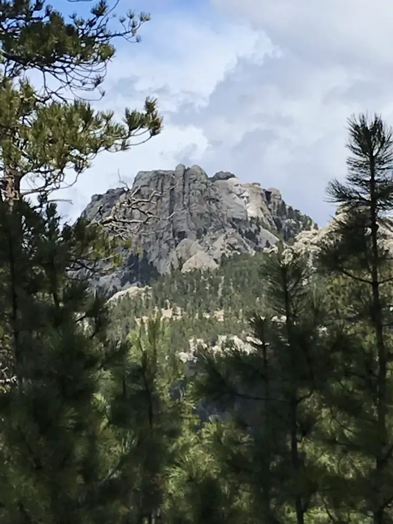
You will be treated to scenic vistas of Black Elk Peak (formerly Harney Peak) and the Cathedral Spires from the trail and there are several places you can spot portions of Sheridan Lake and the prairies that extend east of the Hills!
If you look closely in the background, you can see a portion of Sheridan Lake.
The steepest part of the trail coming from either trailhead is in the middle–though we found the entirety of the route from the Calumet trailhead to be steeper and not quite as pretty–you do get more glimpses of Sheridan Lake on this side.
The Samelius portion of the Centennial Trail is tough!
The path can be challenging, so you need to watch your step (as I found out when I made a misstep on a small rock–this was “Try #2″….)
I rolled my ankle the worst I ever have less than a mile into the hike. At first, it didn’t seem that bad. It really didn’t hurt and there wasn’t any real evidence of bruising or swelling, so I decided to continue on. When we stopped for lunch at our turnaround point is when the stiffness and pain really settled in and I realized I may have pushed on too far. (Of course, we were also several miles from the truck at that point. 😝 ) Fortunately, Mr. Trekker fashioned a perfect hiking pole for me, out of a downed tree branch we found nearby. It made the trip back far more bearable for my ankle.–he’s never had to do that before or since. (This was the worse ankle injury I’d ever had…until I broke the other ankle in two places, dislocated it and tore a tendon falling on the ice several years later. 😝 In another hindsight, I probably should have named this blog The Clutzy Trekker. 🙄)
The bruise from rolling my ankle wrapped all the way around the outer ankle!
Don’t Hike Alone!
Ok, time for a little tangent–bear with me, I truly feel this is IMPORTANT!
My ankle injury on “Try #2” is another good example of why I stress that it isn’t safe to hike alone. (And no, your incredibly adorable, four-legged companion does NOT count as a hiking partner. 😐)
I know this opinion isn’t popular but it is a hill I will die on! It is always astounding to me how quickly accidents can happen on the trail, and how silly things can cause them. 😔
On “Try #2” I didn’t fall (for once) or slip on ice, I can’t even blame the dog for pulling on me too much. We were just walking down a dry section of trail that was relatively flat. It happened to be a bit rocky and I stepped on one of the rocks protruding from the ground wrong, which turned my ankle. Unfortunately, my momentum was already carrying me forward so I proceeded to–heavily–put my full weight on that ankle, and felt a *pop!* (not to mention numbing shocks running from my ankle bone up my shin and down my foot. 😝)
Some may argue that my decision to continue hiking was foolish, and they may have a point. The Trekkers have had some First Aid training so we implemented what we learned. The pain subsided fairly quickly, I had full range of motion with my foot and I could put my full weight on it. This suggested I wasn’t hurt too badly and this wasn’t the first time I rolled my ankle on the trail. (I have a tendency to underpronate when I walk so this happens easily and regularly to me.)
We examined the ankle and it showed no signs of visible swelling or bruising. Since it wasn’t really a struggle to continue hiking I decided to press onward. Some of this was also pure stubbornness. As we had already attempted this trail several times before and had never gotten very far due to the “Tries” mentioned above. I really wanted to continue on and keep enjoying the warm weather, so I chose to plod on.
As we slowly made our way back to the car, I couldn’t help thinking how things would have been different if it had been just me on the trail. I probably could have gotten back on my own, we weren’t that far out and I wasn’t hurting that badly. However, if it had been just me and the (barely) one-year-old, rambunctious pup…
I did ok navigating the route on my own with a walking stick, but if I had needed to be tethered to an energetic pup in addition, that feat would have been far more difficult (especially if the injury had occurred further along on the trail where the terrain became more strenuous).
To further belabor my point…
I feel the need to stress my warning is NOT a gendered statement–mens’ ankles twist and snap! just as easily and quickly as women’s!
Several years later when I fell on the ice and actually broke my ankle I WAS alone with the dog–THANKFULLY we were in our local neighborhood, only about a block from the house, and some WONDERFUL strangers stopped to help!
…if you read the post linked below you’ll learn about the time I fell through a snow drift and the foot of my snowshoe got stuck under a buried, fallen log. While I wasn’t injured, if I had been alone it would have been VERY difficult for me to reach to dig out or unhook the snowshoe. I was off trail, stuck in a gulley, with no cell service and would have had to scream for help until someone *hopefully* heard me. And to top it off I was buried up to my waist in wet snow and it was a fairly chilly, windy day…at that point hypothermia would have become a very, real threat…
This incident also further demonstrated to me why it’s important to ALWAYS bring extra gear. I almost didn’t bring a warm coat the day I rolled my ankle just to save weight and space. Even though it was early February the forecast was calling for fairly warm temperatures (not that unusual to have warm days occasionally in the Black Hills in the winter!) I did end up–wisely–including my winter “puffy” coat at the last minute, as it’s super light and packs well. I just couldn’t bare the thought of not bringing it along in the middle of winter, just in case…
As it turned out, I didn’t end up using the coat. HOWEVER, if my injury had been worse to the point where I had needed to wait for rescue, I easily could have become chilled and potentially even hypothermic if I hadn’t had a warm coat with me (I was sweaty and it was a breezy day).
Accidents can happen on the trail in a split-second folks, and it doesn’t have to be in wet, slippery, cold, or even difficult conditions. A fun walk through the woods on a warm day can become a rescue scenario in a matter of seconds. Please, learn from my experience, and ALWAYS BE PREPARED!!!
To Conclude
If you’re looking for a little tougher hike and you want to explore a lesser-known but beautiful trail in the Black Hills, check out the Samelius area of the Centennial Trail!
Have you ever hurt yourself while out hiking? Did you learn anything from the experience? If so, let me know in the comments!
If you enjoyed this post, feel free to Pin it!
Like what you read here today? Please feel free to leave a comment, like or share this post! Add your email at the bottom of the page, or the sidebar to the right, to be notified when a new post is published. By signing up for the email list, you will also receive a free copy of the Tranquil Trekker’s Top 10 Tips of Trekking Do’s and Don’ts!
You can also follow the blog on social media by clicking the links below!
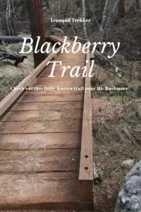
In this post, I review the Blackberry Trail in the Black Elk Wilderness!
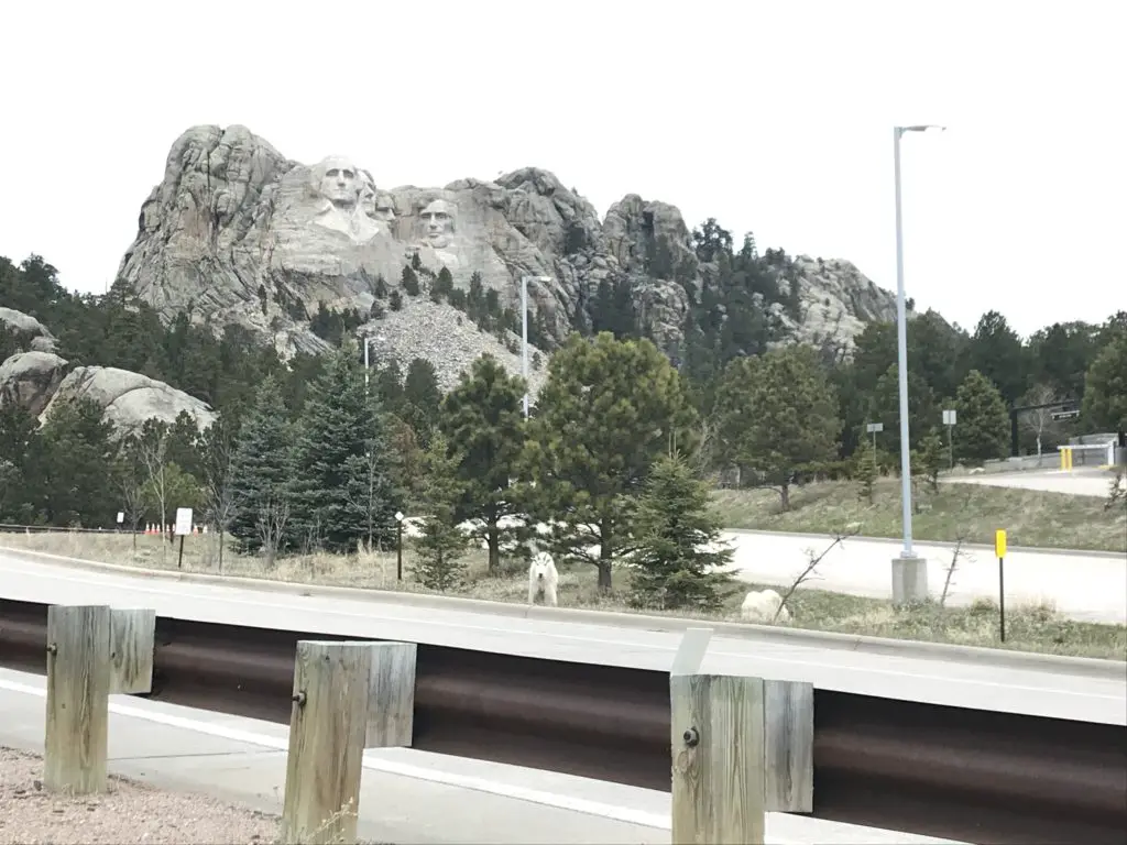
The Blackberry Trail is a great hike into the Black Elk Wilderness. This trail is fairly unknown, which is ironic because it sits directly across from one of the biggest tourist spots in the Black Hills, Mount Rushmore!
Where is the Blackberry Trail in the Black Hills?
The Blackberry trailhead is found in an old gravel parking area (that is sometimes roped off) directly across the road from Mt. Rushmore.
If the gravel parking area is roped off, you can actually park in the Mt. Rushmore parking deck. (This means you will have to pay the parking fee at the site. It used to be that once you bought a pass it was good for a year. Now it’s only good for the day. 😛–Insert rant here, from Mr. Trekker, about the evil, automated kiosks they installed to replace humans 😂.)
We had interesting weather the day we trekked this trail, typical of spring in the Black Hills. It was windy, with precipitation varying between light rain, heavy snow showers, and pelting mini-ice balls! This was all mixed in with blue sky and warm sun, and we experienced all of these conditions within about 30 minutes of each other! 😛
Bring Extra Clothes when Hiking
As we were navigating the route, Mr. Trekker proved why you always bring extra supplies along, especially a change of socks! You never know when you’re going to slip off a mossy rock and fall knee-deep into a swollen creek!
(I can’t make fun of him too much, he was actually trying to find an easy way across so he could then help me across. 😳 Of course, if he had listened to his wife and taken the route I suggested in the first place…😉.)
The water level seemed much higher than usual, as many of these creeks are just suggestions in drier times. With the recent snowmelt and wet conditions of spring, the local waters were definitely running higher than normal.
What you’ll see on the Blackberry Trail
This is an absolutely GORGEOUS trail! While it does climb the majority of the way, the route undulates through the hills and beautiful canyons that are common in the Black Hills National Forest. There were a few lengthy, steep spots, but for the most part, they didn’t become overbearing. The first half mile or so of the trail actually runs downhill. (You know what that means for the return trip! Everyone loves a good, uphill climb to finish! 😛)
We did an out-and-back trek, taking the Blackberry Trail south to where it meets up with the Centennial Trail (just in the last few years, this portion of the route earned the classification of a National Recreation Trail.) Then we took the Centennial Trail south, to its junction with the Grizzly Bear Creek Trail, which I discuss in this post.
I’m not sure why it’s called Grizzly Bear Creek. There may be been grizzlies in this area at one time, but that was MANY years ago (we’re talking centuries. 😛)
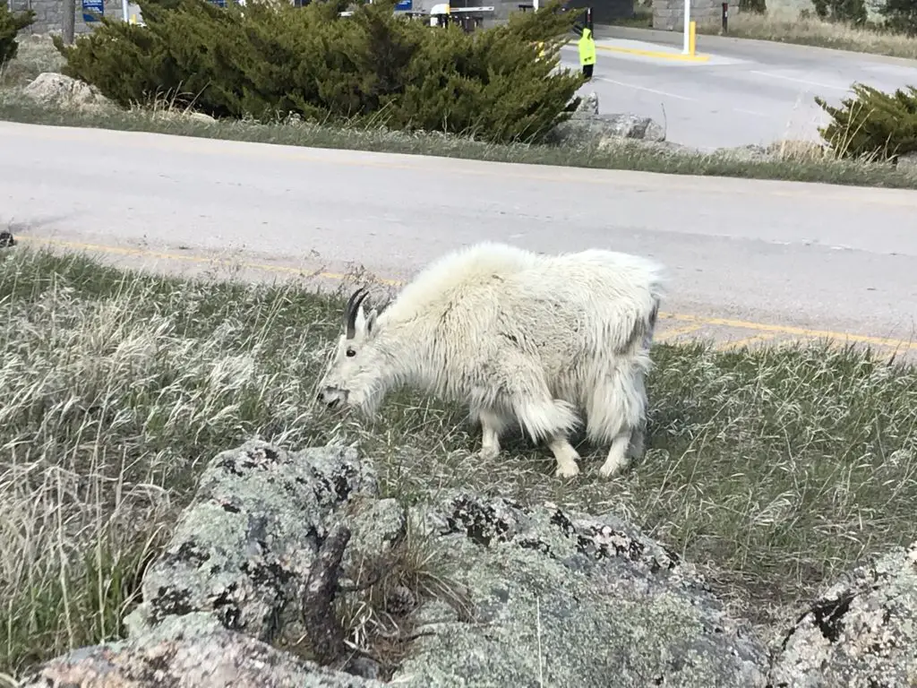
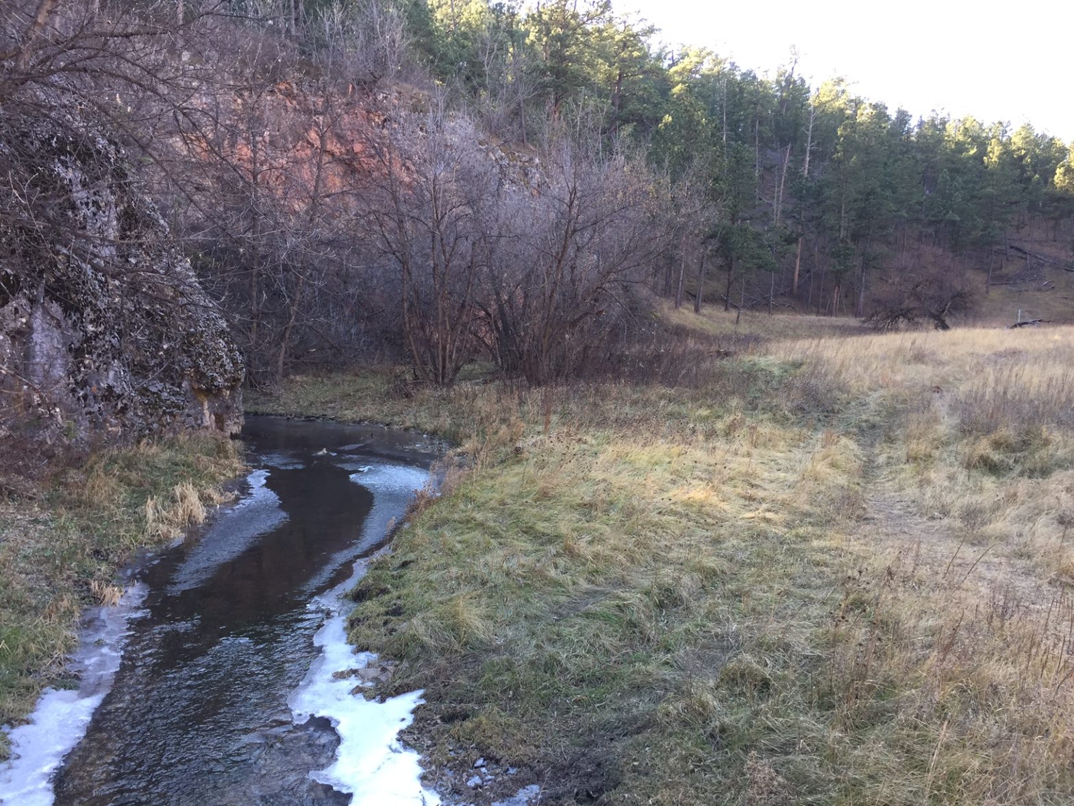
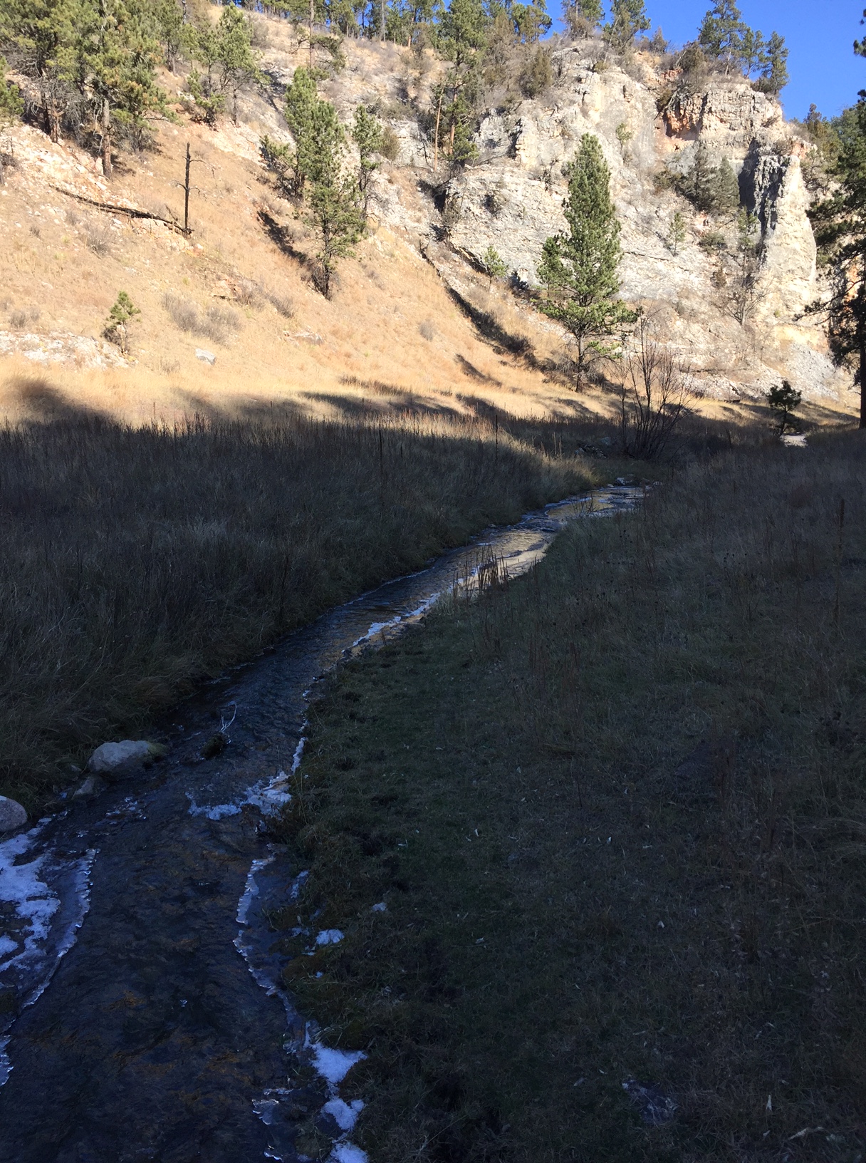
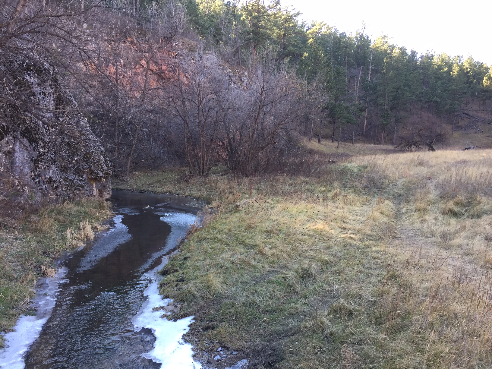
A portion of the way, the path runs along with Grizzly Bear Creek, which helps to make it so picturesque. There were numerous water crossings and very few bridges throughout the trek. Again, in drier times of the year, this may not be an issue, but I would recommend wearing either waterproof hiking boots or sandals you don’t mind getting wet if you’re planning to tackle this hike. Also, be on the lookout for mountain goats and marmots, as they tend to frequent this area!
Marmot!You see these guys A LOT at Mt. Rushmore!One of the only bridges we encountered. It was quite picturesque!
How Long is the Blackberry Trail?
This route was about eight miles, out-and-back. Not a bad day’s hike for us, though you could easily make it shorter or longer, to suit your tastes. Depending on how adventurous you are, this is a great area for backpacking, as it would allow you more time to fully explore the various trails that wander through the Black Elk Wilderness Area. One other unique thing about this trail is that it offers cool views of Mt. Rushmore along the way!
Harney Range in the Black Hills National Forest
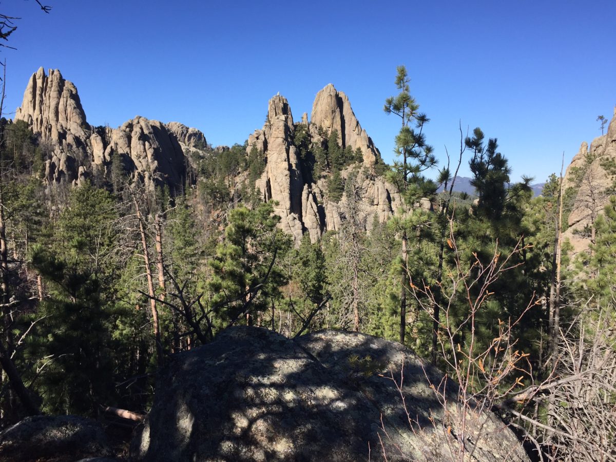
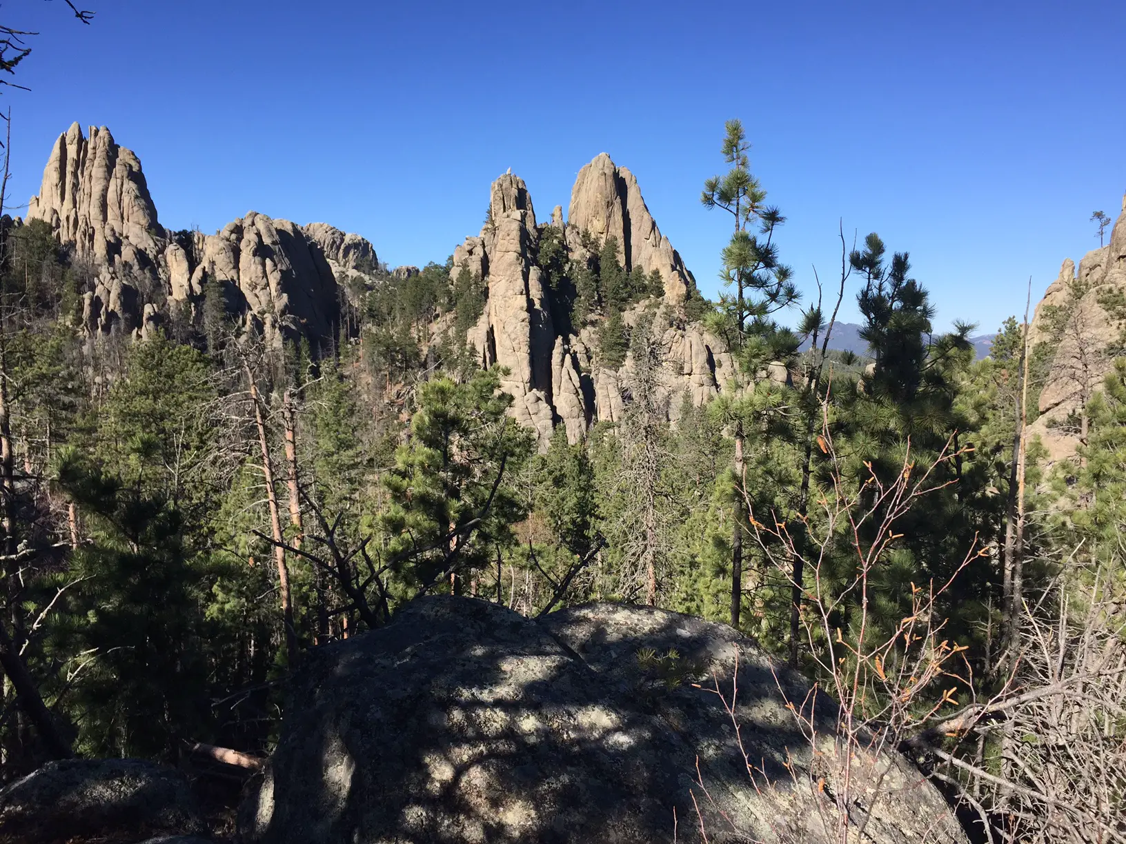
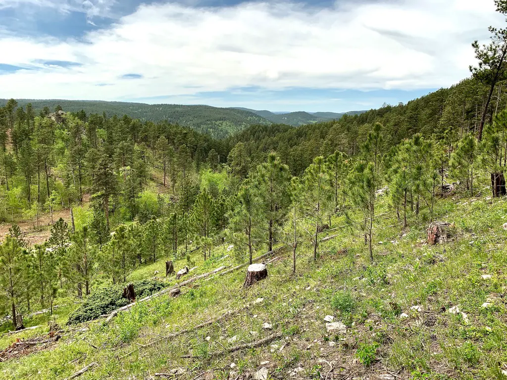
I know I’ve mentioned it in the past, but I LOVE hiking in the Harney Range. The granite mounds and spires that are frequently found throughout the area give the region its own, unique flair. The Ponderosa Pines that grow here allow a lot of light through their branches. Also, the drier conditions (usually) found in the Hills lend themselves to little or no undergrowth on the forest floor. This means, even in the midst of the forest, you can actually see for quite a distance.
This is pretty unique compared to many forests we’ve visited. Some areas of Colorado and Wyoming are similar, but these definitely contrast with forests that you find in many other parts of the country. Most of those are comprised of dark, foreboding woods with trees so thick it’s hard to see between them. Even in North Carolina, with the almost-tropical plants and ferns that covered the forest floor, it was easy to lose the trail.
There are all sorts of trails winding around the Black Elk Wilderness. These aren’t the big trails that all the tourists hear about throughout the Wilderness Area and Custer State Park, though many of these do connect with the better-known trails, such as Black Elk Peak Trail, Trail #9 (formerly the Harney Trail) or the Cathedral Spires/Little Devil’s Tower Trails.
But if you’re looking for a nice, afternoon jaunt through the woods on a warm day, these are perfect. Because they aren’t as well known, they tend to be far less crowded. They aren’t overly difficult either. I would give the majority of these side trails a moderate rating, with some strenuous spots. They are sometimes single-track, rather than wide and graded, and you do have to watch for roots and rocks that you may need to clamber over or around. But there aren’t any large, rocky areas that need to be navigated.
More pics from our day on the Blackberry Trail!
I LOVE “tunnels”!Our “Greeter” at Mt. Rushmore!
So the next time you’re looking for an interesting hike in the Black Hills, consider one of the lesser-known trails in the Black Elk Wilderness like the Blackberry Trail. You may be surprised how much you enjoy these hidden gems!
Have you enjoyed this trail or do you have any questions on how to reach it? Feel free to leave your experiences or any questions in the comments!
Did you enjoy this post? Pin it!
Like what you read here today? Please feel free to leave a comment, like or share this post! Add your email at the bottom of the page, or the sidebar to the right, to be notified when a new post is published. By signing up for the email list, you will also receive a free copy of the Tranquil Trekker’s Top 10 Tips of Trekking Do’s and Don’ts!
You can also follow the blog on social media by clicking the links below!
In this post, I discuss activities available above-ground at Wind Cave National Park.
**Author’s note: Just a word of warning, as this is a National Park, no dogs are allowed on any trails (exceptions for Service Animals). They are only permitted in the campgrounds and parking lots.**
Wind Cave National Park, located near Hot Springs, South Dakota, is best known for the sites it offers below-ground. However, it also provides plenty of opportunities for hiking above-ground, as well!
Hiking trails at Wind Cave National Park
There are several trails found throughout Wind Cave National Park and countless route combinations and loops can be made depending on how long of a hike you are interested in. These include the Rankin Ridge Trail, and one of our favorites, a loop formed by the Lookout Point Trail.
It includes a short skirt where the Sanctuary/Centennial Trails run together and then continues on to the final portion of the hike which is solely comprised of the Centennial Trail. This is all located in the southern portion of the park.
Where is the trailhead for the Lookout Point Trail?
The trailhead we use for this hike (the Norbeck Trailhead) also marks the southern terminus of the 111-mile Centennial Trail. This route traverses the spine of the Black Hills.
The Lookout Point trailhead can be found off Route 87 in Wind Cave National Park. There are numerous ways to reach it but we usually take SD 79 south out of Rapid City, to US 18 west heading to Hot Springs. We then take US 385 north out of Hot Springs until it connects with Route 87 north.
To return to Rapid City you can retrace your steps, or if you’re interested in a longer, more scenic route, you can choose from a variety of options north through Wind Cave, Custer State Park, and the Black Hills. Have I mentioned a map is helpful when adventuring in the Hills? 😉
What You Will See on the Lookout Point Trail
The Lookout Point loop can be completed in either direction though we prefer starting on the Lookout Point Trail (the climbs going this direction are less steep). The hike starts off along a small creek and then almost immediately takes you up a steep hill (fortunately the climb is of relatively short duration and once you reach the ridge above, the terrain is fairly flat for some time).
The correct route through this area isn’t always clear due to NUMEROUS game trails left by the many four-legged critters traveling to the creek for water, so be very watchful so as not to lose the path. The signage on the trail is decent but (even with previous experience) we’ve ended up following well-worn buffalo paths instead of the actual trail. Luckily, we were able to recognize our error early on and quickly correct it.
Once you jump on the Sanctuary Trail portion of the loop (about halfway through), the ecosystem makes a clear change as you descend from the open grassland of the prairie into a forested canyon. The descent is rather steep so take care not to slip on loose scree (or if ice is present).
See if you can spot an unusual item in the Black Hills, cedar trees! They appear to favor this protected, damper area.
This portion of the trail is also characterized by the rock cliffs towering far overhead.
The creek through the canyon
The bottom of the canyon consists of a long, narrow meadow. When you reach the floor of the canyon, be sure to turn left onto the Centennial Trail to keep to the loop (a right turn will put you on the Highland Creek Trail).
There are several prime lunch spots along the creek and watch for remnants of the ungulates (deer and elk) whose bones are scattered throughout this area (whether they met their demise by flood or they were drug here by fanged animals, we will never know).
Follow the canyon and its babbling creek for about two miles until you emerge dramatically into an open meadow. A portion of the Centennial Trail will soon break off on an uphill branch to the right, while you will continue straight along the creek and eventually the trail will curve to the left. It then ascends one final rise which brings you back to the trailhead.
The creek through the meadow (notice how it is just beginning to freeze)
Wildlife on the Lookout Point Trail
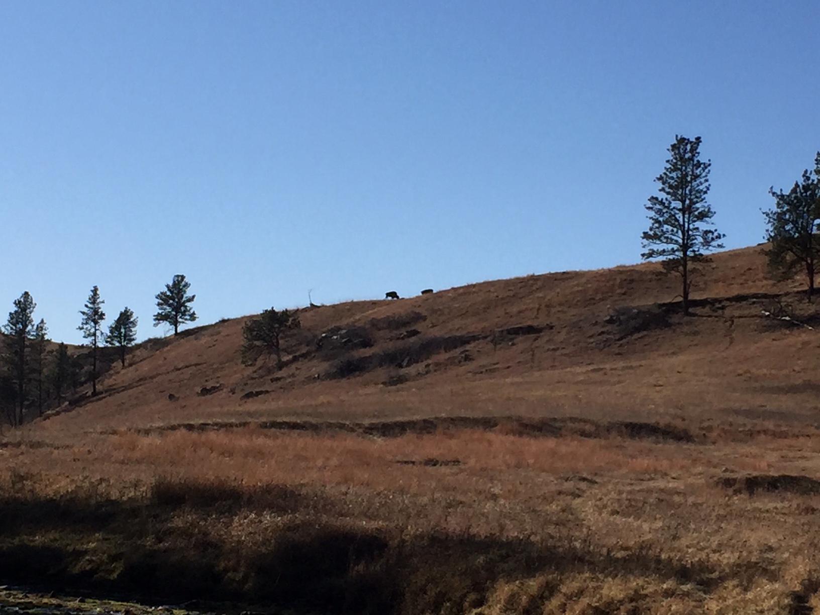
Be sure to keep VERY ALERT for buffalo in this area. They are numerous and we see them every time we hike in this park. It is rare that we don’t have to alter our route to skirt a buffalo (or 30). They seem to favor the same trails the humans use so be prepared to go off-trail and give them a wide berth.
Fortunately, this area is highly visible, open prairie so even if you have to go well off-trail you’re usually able to keep at least one trail marker in sight. It’s always advisable to bring a topographical trail map and compass when hiking these areas (or anywhere, really) to assist you in maintaining your direction if you need to go off-trail.
Always remember, if the animal is reacting to you (acting agitated in any way, huffing, stomping its feet, etc.) you are TOO CLOSE and should move away (calmly and slowly) as soon as possible. As long as the animal’s space is respected there are rarely any altercations but it should always be remembered that these are wild (not to mention LARGE) animals and they may react aggressively if they feel threatened (this is especially true in the spring when calves are present).
Buffalo on the ridge, near the end of the hike
On this day’s hike the buffalo we saw didn’t even bother to get up and stop chewing their cud as they watched us wander by. We have had buffalo turn to follow our every step until we’re out of sight when calves were present (and we were intentionally skirting them at the time). We’re also often scolded by prairie dogs for “invading” their area when altering our course away from the buffalo.
This brings up another safety point, give the prairie dogs space too. According to the Forest Service, their fleas carry plague (yes, as in the Black Plague) which can be passed to you if you get too close and are bitten by said flea. Also, the animals may bite if they feel threatened, though they aren’t usually aggressive. In addition, rattlesnakes and black widow spiders favor abandoned prairie dog holes (not to mention these holes offer a prime opportunity to twist an ankle if you aren’t careful) so it’s best to treat these “prairie dog towns” with respect, as well.
Be sure to keep a sharp eye out for coyote, elk, and deer in this area as this is prime viewing territory for that type of wildlife. Be careful to also watch trail signs at junctions in these locales as there are several intersections and it is easy to get on the wrong trail.
To Conclude
This entire loop can be completed in about three hours (dependent on your skill level, speed, and how many sightseeing breaks you choose to take). The trail is relatively easy with only short, moderate-difficulty climbs and is around five miles in distance for the entire loop. This area is also lower in altitude than many areas in the Hills and may be easier for the “Lowlanders” to handle. 😉 In the summer, be prepared for unrelenting heat and little shade on the prairie section (though the ever-present prairie wind will offer some respite).
So, when visiting Wind Cave, don’t let the amazing sights below ground deter you from enjoying the numerous opportunities available above ground as well!
Have you hiked in Wind Cave? Tell me about your experience in the comments!
Did you enjoy this post? Pin it!
Like what you read here today? Please feel free to leave a comment, like or share this post! Add your email at the bottom of the page, or the sidebar to the right, to be notified when a new post is published. By signing up for the email list, you will also receive a free copy of the Tranquil Trekker’s Top 10 Tips of Trekking Do’s and Don’ts!
You can also follow the blog on social media by clicking the links below!
In this post, I review some hiking trails found in the Black Elk Wilderness, in the Black Hills of South Dakota.
The Black Elk Wilderness covers a portion of the central Black Hills, in the Mount Rushmore/Horsethief Lake portion of the Harney range (now the Black Elk range) of South Dakota. There are some great hiking trails that traverse this area!
Hike the Horsethief Lake Trail to Grizzly Bear Creek Trail in the Black Hills
One great option is to begin at the Horsethief Lake Trail. The trailhead can be found at the Horsethief Lake Fishing/Rec area which is located off of Hwy 244, west of Mt. Rushmore.
Note: this is one turnoff east of the drive for the Horsethief Lake Campground.
There is a larger parking area right at the lake. The trailhead is located at a small parking area just to the east of here–there is a sign.
We took the Horsethief Lake Trail (Trail #14) to the Grizzly Bear Creek Trail (Trail #7) which traverses a lovely canyon area and parallels Grizzly Bear Creek for a time.
This portion of the Black Hills is particularly vulnerable to storm damage as it was decimated by the Pine Beetle plague in recent years. Due to this, there are several hazards to watch out for in this area, including blow-down sections of trees and falling limbs/trees if windy conditions are occurring.
What you’ll see hiking through the Black Elk Wilderness
The hike was lovely. Much of it traverses canyons, surrounded on all sides by towers of granite. There are several beautiful, lookout points with views of the surrounding Hills and the prairie stretching far to the east. The trail is in a largely wooded area so it would be fairly shaded in the warmer months, and as you climb there is usually at least a moderate, cooling breeze (that can be downright chilling in the cooler months).
Portions of this trail are open to horses as well so be watchful for the equines (and be careful not to step in what they leave behind).
The portion of the trail we completed was of moderate difficulty, was well-developed, and was fairly wide. There weren’t many rocks/large steps to negotiate and while there were few trail markers, they weren’t needed as the path was evident.
It should be noted that the lower part of the Horsethief Trail is frequently wet and muddy so waterproof shoes/boots are suggested. In the winter/early spring, thanks to snow-melt and the nearby creek it is often extremely icy and slick. This portion of the trail is located in a canyon under a canopy of trees so it doesn’t get much sunlight to melt the ice. We have seen several inches of thick, hazardous ice on this trail in the early spring that required our Yaktrax to navigate safely.
Other trail loops in the Black Elk Wilderness
If you’re up to the challenge, a loop can be made of this trail using the Horsethief Lake Trail to the Grizzly Bear Creek Trail to the Centennial Trail (Trail # 89). This will then eventually take you back to the Horsethief Lake trail almost at the Trailhead (the loop can be completed in either direction). This entire loop would be around 10 – 12 miles. While this is within our ability level, we weren’t sure about the steepness/difficulty of the remainder of the trail, and daylight was growing short so we chose to stop at about the halfway point, have some lunch along the creekside, and return the way we had come.
Numerous trails connect throughout the Harney (Black Elk) range. Depending on your skill level and how long you are willing to commit to being out in the wild you can hike any combination of these, ranging from a simple hike of a few hours to a backpacking trek of several days.
For those non-locals who may be wondering why I keep referring to this area as the Harney (Black Elk) range, I’ll explain. Harney Peak is the highest mountain in the Black Hills (and the tallest east of the Rockies). It stands out among the surrounding peaks of the Harney Range. The Black Elk Wilderness area comprises much of this range.
Black Elk was a Lakota, Holy Man who lived around the turn of the century, the Wilderness area is named after him.* A few years ago, it was decided that Harney Peak would be renamed Black Elk Peak in honor of this great man and as a tribute to the local, Lakota culture. As it has been such a short duration of time since the change, many of the books/maps regarding this local area (and the signs currently posted) will still carry the former name of the mountain/range.
*If you’re a history buff or just interested in American Indian culture, I highly recommend the book Black Elk Speaks by John Neihardt. It’s a biography of the Holy Man’s life based on interviews Neihardt completed with him in his final years. It is a very interesting, fairly objective account of a man growing up in a changing world. It discusses Black Elk’s nomadic life before General Custer and his soldiers arrived and the way this life changed after gold–or as Black Elk called it, “the yellow metal that makes white men crazy”–was found in the Black Hills.
Below are two pics that Mr. Trekker took of our hike:
The granite spires surrounding the canyon we were hiking inGrizzly Creek
Save/span</
For more information on other trails available in the Black Elk Wilderness, click here.
Have you hiked this portion of the Black Elk Wilderness? Tell me what you thought of the beauty here in the comments!
Did you enjoy this post? Pin it!
Like what you read here today? Please feel free to leave a comment, like or share this post! Add your email at the bottom of the page, or the sidebar to the right, to be notified when a new post is published. By signing up for the email list, you will also receive a free copy of the Tranquil Trekker’s Top 10 Tips of Trekking Do’s and Don’ts!
You can also follow the blog on social media by clicking the links below!
We use cookies on our website to give you the most relevant experience by remembering your preferences and repeat visits. By clicking “Accept”, you consent to the use of ALL the cookies.
This website uses cookies to improve your experience while you navigate through the website. Out of these cookies, the cookies that are categorized as necessary are stored on your browser as they are as essential for the working of basic functionalities of the website. We also use third-party cookies that help us analyze and understand how you use this website. These cookies will be stored in your browser only with your consent. You also have the option to opt-out of these cookies. But opting out of some of these cookies may have an effect on your browsing experience.
Necessary cookies are absolutely essential for the website to function properly. This category only includes cookies that ensures basic functionalities and security features of the website. These cookies do not store any personal information.


 Ok, time for a little tangent–bear with me, I truly feel this is IMPORTANT!