Excited to Turn 40!

The Trekkers turned 40 recently! In this post, I ruminate on how it feels to turn over a new decade and dreams I have for Part 2 of our lives.


Both of the Trekkers turned 40 years young recently! 😮 🤭  It’s ok though, we’re excited for the next decade!

I always assumed that by now I’d have everything figured out.  It’s silly, but when you watch tv, and there’s a character who’s in their 40s, they usually seem so mature.  They seem like “real” adults.  They have a “real” job, they’re married, they have kids, they own a house…I see them and I think, “I hope I’m like that when I grow up”… 🤔

Wait!  I’m married, we own a house, and we both have real jobs.  We don’t have kids but Puppers comes in a close second, right? 😉 Wow! I am that person!  But why don’t I feel like it?

Metaphorically old

I started feeling “old” when my doctors began responding with, “that’s normal with age” when I would point out oddities I had noticed. 😝  Don’t get me wrong, that is a far better response than the alternative could be, but still…

…you also start to notice your age when things start failing on your body and the only true cure for them requires surgery and a 6 – 8 week recovery period to fix! 😝 (Bunions on your feet, carpal tunnel in your hands…my knees have started to lock up from time to time…I knew all that hiking would catch up to me one day! 😝)

Delayed adulthood?

Part of the reason we still feel like “kids” could be partially due to the fact that Mr. Trekker and I didn’t begin “adulting” until we were almost 30. When one of you spends seven years in grad school, other life events tend to get put on hold.

So, while most of our friends and family members were getting married, buying houses, and having kids at 22 (or earlier), we didn’t get to really start the process till almost 30.  So, we’re basically eight years behind everybody else.  Does that mean in “adult years” we’re actually only 32?  Could that explain why I don’t feel “that old”…or maybe I’m just immature?  😉😝

I feel as though there were themes to our recent, lived decades:

Our 20s were about finding ourselves in this adult world and figuring out what we wanted to be when we grow up (we’re still working on that one! 😝)…

Our 30s were about paying off the debt we accrued in our 20s, 😂 and building an adult life (“real” jobs, buying a house, starting to accrue a nest egg, etc.)

Hoping for a great decade to come

And now we’re looking forward to our 40s!  I’m optimistic that 40 will be the beginning of a great, new decade.  Plus, I get to be an even-numbered age again.  I like even numbers, so hopefully, that’s a good omen. 😉

I am prayerfully hopeful that our 40s can be about starting to move toward what we really want in life.  For me, I’d LOVE to be able to “retire” by 50.  I pray for good planning and a little luck to accomplish that.

To be clear, I use the word “retire” VERY loosely.  I see it more as “removing oneself from the Monday – Friday, 9 – 5 grind” rather than “stopping work for the rest of what will hopefully be a very long life.” 😇

Our Dreams for the Future

Now that I’m 40, I feel like my priorities in life are changing.  Instead of being motivated to pursue that great new job or promotion, I instead find myself wanting to pursue “living our best life”.  This looks different for every person but for us, it looks like traveling to amazing places and having awesome adventures.

We’ve already done a decent job of traveling all over the country. We excel at taking random weekend (or multi-week) trips from:

We want to do even more adventures like this though. We’ve got some pretty epic trips we want to take in the next 10, 20, or even 30 years. As John Muir said, “The world is big and I want to have a good look at it before it gets dark.”

What else are we hoping to see and do in our 40s?  Well…

          • In the short term, check out these posts for info on our Epic, 40th Birthday, Spring break trip!: Viva Las Vegas!7 Things to See in Death Valley National Park, and Driving the Extraterrestrial (ET) Highway
          • we have goals to FINALLY make our epic, Alaska vacation a reality…
          • …and if we see Alaska we’ll only have one more state to visit to see all 50 US states so…I guess Hawaii it is then!
          • we want to drive ALL of Route 66…
          • we want to check out and camp on the North Rim of the Grand Canyon…
          • we’ve had Nova Scotia/Newfoundland on our list for some time…
          • there are still a ton of ghost towns we want to visit in Colorado, Utah, Montana…

…and these are just the big trips within and near the US, these don’t include all the smaller trips we’d like to take…we’ve got a bunch of international locales we’re excited about too, but those may have to wait till our 50s. 😉

  • I also have some personal goals I want to achieve:
      • Now that the world is entering the “Post-COVID era” I want to FINALLY get to a blogging conference!
      • I have one book I’ve been working on writing for quite some time and another I have ideas about…
      • I want to write guidebooks to help people easily see/experience this amazing world we’ve been blessed to live in…
      • I want to continue pursuing my freelance/consulting career…

Final Takeaways from my 30s…

      • I haven’t achieved all my dreams from my 30’s…
          • I had the opportunity to attempt to start my own business/work for myself.  I was doing pretty well too until a little thing called COVID came along and kind of killed that dream 😡 –at least temporarily–though I’m still trying to press ahead with this in some form or another.
          • Several years ago I did leave a job that failed to make me happy, and while I’m back working a “somewhat” normal, 9-5 it tends to be one of the weirdest versions of that type of job that exists, I think 😂 (and I mean that in a good way!)

        Easily 60% of my job is paperwork that I can do from home pretty much WHENEVER I feel like it. On top of that, even the meetings I do have I usually schedule myself.  This means I can more or less work whenever I feel like it (as long as the necessary stuff gets done).  And thanks to laptops and mobile internet I can often work from anyWHERE I want, as well (with a little time to plan.)  My job is also based on Billable Hours which is a whole other, weird thing.  It makes for an incredibly flexible job that plays well into my plans for lots of travel in our future. 😁 

    What does “getting older” mean for me?

    I feel like I pretty much stopped “growing older” at around 30–and I’ve had a number of people tell me I don’t look “that old”–enough so that I don’t think they’re “just” being nice! 😇

    Based on genetics, I have two possible physical paths to follow as I age.  My dad’s side of the family tends to avoid getting grey hair as they get older.  My mom’s side, on the other hand, has an infamous “Curse” where everyone has a head full of white (albeit BEAUTIFUL) hair by the time they’re 50! (So far I seem to be taking my dad’s family’s fork in the road.  Only the next 10 years will tell if that continues or not! 😯)

  • I don’t feel old…Ok, maybe I do “a little”:  when I stay up too late and feel like I have a hangover the next day…or when I tweak my back with a violent sneeze (thanks COVID! 😝)…or when I feel a random *crack!* in my neck when raking leaves!  I’m more mature now (I think? 🤔) and I definitely feel much more secure in who I am and what I want out of this life (and the world).
  • My 30s were pretty good to me and I feel like I’ve really come into my own in the last few years.  So what does it mean to notch another year on the proverbial stick of life?

    Another birthday means being hopeful about the future!

    The good news is both Mr. Trekker and I have longevity in our families.  We are blessed to have some pretty good genes in our family trees, so I have every intention of us living to be 85 or so, at least.  Almost all of our grandparents lived into their 80s (and many of our family members have lived at least that long, sometimes FAR longer).

  • While nothing is guaranteed, of course (my anxiety forces me to put that qualifier in, we don’t want to jinx anything now do we? 🙄) it’s a fair guess (hope?) that we’re not even halfway through our lifespans yet…which is a WONDERFUL thing.  Hopefully *fingers crossed*, we have MANY years left to adventure together!
  • I have grand plans for the future.  I want to travel, I want to write, I want to see and learn new things, I want to leave my impact on the world.  I don’t have time to feel old!

    Getting older means energy!

    I’ve got just as much energy as ever.  I still don’t need coffee to wake me up in the morning (Mr. Trekker will tell you the LAST thing I need in the morning is MORE energy 😇).  Everything just seems to move so fast these days, I feel like life is racing by!   The hours, the days, the weeks, the months, the seasons, the years!  I want to embrace life and enjoy it as much as I can, and that can be hard to do when it feels like it’s just whipping by you! (This feels especially true after the craziness of the last few years.)

    I pray our 40s are blessed

    My goals for my 40s are similar to my goals from past years.  I want to continue striving to appreciate the little positives that each day brings.  I want to continue to embrace life’s small moments, so maybe each year won’t race by so quickly anymore.

    I thank God for these first four decades, and I pray He chooses to bless both Mr. Trekker and me with MANY more!  I always try to celebrate birthdays and don’t complain too much about getting another year older.  After all folks, it’s better than the alternative, right?!

    To help celebrate getting older, check out this great song by one of my favorite Celtic bands. One More Day Above the Roses, by Gaelic Storm!


    What do you hope to accomplish in the next decade of your life? Let me know in the comments! 

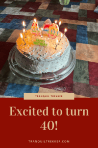
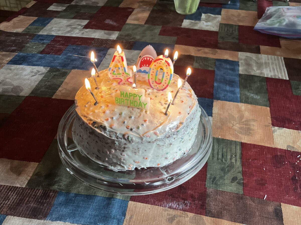
  • Did you enjoy this post? Pin it!Birthday cake with "40", "Happy Birthday" and other lit candles sit on a table. Pin reads, "Excited to turn 40!"
  • Like what you read here today?  Please feel free to leave a comment, like or share this post!  Add your email at the bottom of the page, or the sidebar to the right, to be notified when a new post is published.  By signing up for the email list, you will also receive a free copy of the Tranquil Trekker’s Top 10 Tips of Trekking Do’s and Don’ts!You can also follow the blog on social media by clicking the links below!FacebookTwitterInstagram
    Pinterest

Visiting Garden of the Gods and Pikes Peak

In this post, I highlight our visit to Garden of the Gods, Pikes Peak and other locations around Colorado Springs!


The Trekkers’ enjoyed another lovely, anniversary trip to Colorado!  This time we visited the Front Range, the one part of the state we haven’t spent much time in.  We also knocked several long-held items off our bucket list:  the National Museum of World War II Aviation, Garden of the Gods, and Pikes Peak!

I find I have a love-hate relationship with Colorado.  I LOVE visiting there! If I had to pick one state in the entire nation to vacation the rest of my life it would be Colorado, hand’s down. It’s just SO beautiful and there are so many things to do!

That being said though, to actually live in Colorado, you have to either choose a crowded big city or live isolated, in the middle of nowhere, with weather that can be incredibly harsh for much of the year. *sigh*

We’ve spent extensive time in the northern, western, southwestern, and southeastern portions of this awesome state.  The only place we hadn’t really visited was the Front Range.  So, as Mr. Trekker had a work meeting there on our anniversary weekend we thought we’d make use of the opportunity! (I’m very blessed that, as long as I have internet access, my flexible job allows me to work from hotel rooms in random states. 😉)

On the drive down to Colorado Springs we opted for the “Nebraska Route” from the Black Hills.  This is a great drive to avoid traffic but it includes a unique trip through the nuclear missile fields of far southwest Nebraska and far northeast Colorado.  The dichotomy between these weapons of death and destruction that sit just off the road and the relatively benign, green energy, wind turbines that watch over them from the nearby hills is enough to leave a chill down your spine. 😮  

The Colorado Front Range

For those who don’t know, the Front Range is essentially a conglomeration of cities and towns that run for almost 200 miles, north-to-south, along I-25 and the “front range”–hence the name–or eastern border, of the Colorado Rockies.  This region basically runs from Fort Collins to Pueblo and includes the other highly populated areas of Boulder, Colorado Springs, and, of course, Denver.

I get why people like to live on the Front Range. It’s got many cultural opportunities, easy access to shopping (basically anything you could want), and easy access to incredible sites and all the outdoor activities you can think of at any time of the year.

Now for the bad news…THERE ARE SO MANY DAMN PEOPLE!!! 😝  This region is one of the fastest-growing areas of the country (not to mention one of the most expensive places to live) and it keeps expanding!  This equates to it being incredibly busy and hectic. 🤯  Sorry kids, there is nothing tranquil about the Front Range. 😂  The Trekkers have spent too much time living in small-town America to handle all that craziness.  Plus, you’re talking to the girl who grew up in rural Indiana and liked it!  FAR too many curses emit from my lips when trying to navigate Front Range traffic! 😂  

So, Colorado, while I love you and will forever enjoy vacationing there, I don’t EVER see myself living there! 😇

Pikes Peak

The summit of Pikes Peak sits at over 14,000 feet of elevation. This is VERY high!  The air is much thinner up here and the oxygen level is much lower. Do not be surprised if you feel short of breath, dizzy, and lightheaded with even the most minimal exertion. Also, if it is summertime know that you can get sunburned FAST at this altitude. 

Altitude sickness can occur at this height (though it is rare if you are only visiting for a short time and is a larger concern if you are heavily exerting yourself.)  Symptoms to watch for include nausea, dizziness, and shortness of breath.  In most cases, these will subside once you return to a lower elevation. 

How do I visit Pikes Peak?

There are multiple ways to visit Pikes Peak!  You can drive your car, ride a shuttle bus, hike up or take a train!   Details on each option are below:

Drive the Pikes Peak Toll Road

You will find the entrance to the Pikes Peak Toll Road off of US 24, about 10 miles west of Colorado Springs.  There is a fee to reach Pikes Peak using this route.  Please note:  this mountain is VERY popular.  So much so that during the summer season (Memorial Day through the end of September) you must have a reservation to drive all the way to the summit. (You can purchase tickets online here.)   There are also guided tours during the summer months that allow you to let someone else drive. 

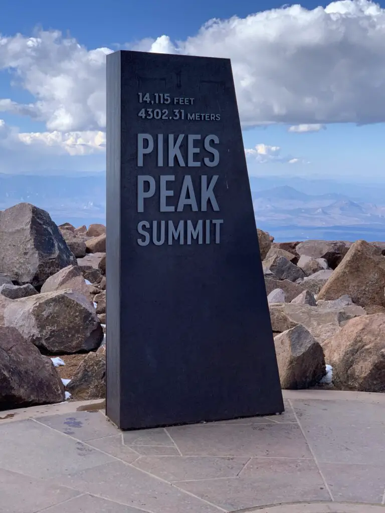
Black, stone sign that reads, "14,115 feet (4302.31 meters) Pikes Peak Summit"
This picture speaks for itself 😁
Click here for a video of our drive UP Pikes Peak and here for a video of our drive down the mountain (complete with police escort! 😮
Ride Bikes up Pikes Peak Highway

You can also ride a bike to the top of the mountain via the Pikes Peak Highway.  Fees and reservations still apply.

This wouldn’t be my preferred method as you’re sharing this winding, narrow road with about a million of your closest friends (mostly tourists who are trying to navigate large machines that could easily kill you while they’re looking around at the amazing views)…but you do you. 😉

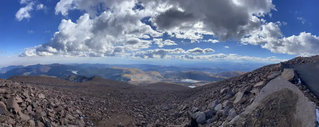
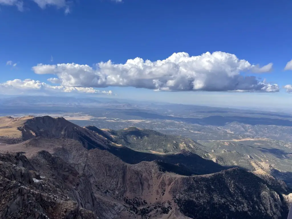
Panoramic view of rocky slopes of a mountain in the foreground. Lower mountains and plains are in the background with puffy, white clouds and blue sky overhead.
A panorama, 14,000 feet up from the top of Pikes Peak!
Hike Pikes Peak

If you’re the ambitious type, you can hike the Barr Trail up Pikes Peak.  This would be an incredibly scenic way to see the mountain although I’ve heard the hike is not for the faint of heart.  We didn’t do it but I know some people who have, successfully. For a first-hand account of the hike up Pikes Peak please see the blog of a friend of mine!

This hike is no joke!  The trail is 13.5 miles long (one-way) and gains more than 7000 feet in elevation!  It also reaches heights of over 14,000 feet and much of it is incredibly exposed both to sun and thunderstorms that can easily pop up. 

Many people like to hike up the mountain and then take the Pikes Peak Cog Railway on the return trip (see below)!

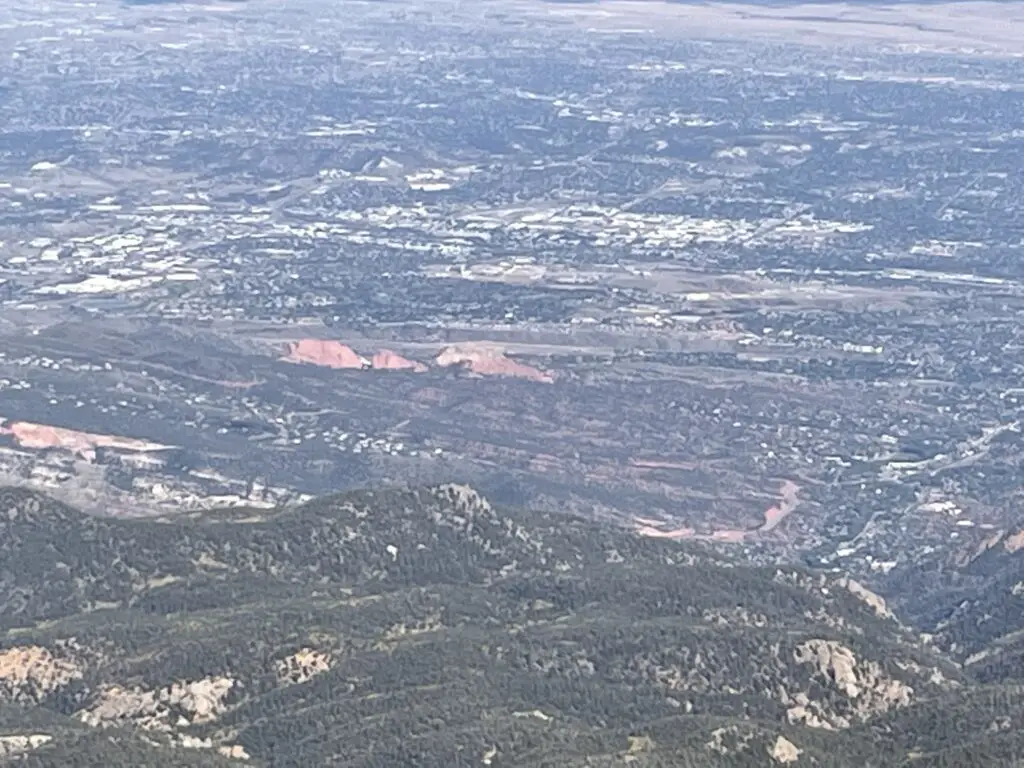
Hazy view of tree and grass-covered hills. A city and red rocks rising from the green are in the distance and far below.
Garden of the Gods as seen from Pikes Peak!
Pikes Peak Cog Railway

One of the more popular ways to reach the summit is via the cog railway. This way someone else gets to “drive” (while you enjoy the views!) and you don’t have to deal with the crowded roadway on the way up!  Click here for information on getting tickets for the cog railway!

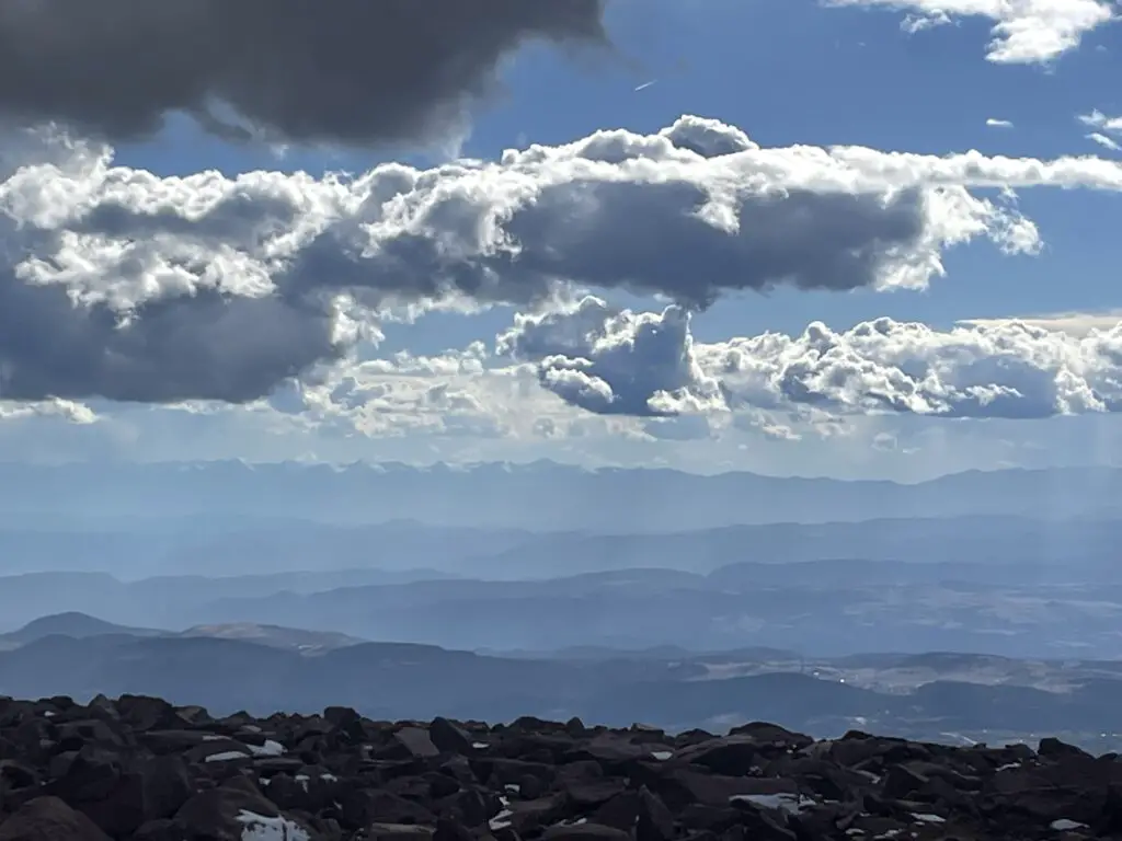
Smoky view of slightly snow-covered mountains in the far distance
This hazy pic is of the east side of the Sangre de Cristos mountains as seen from Pikes Peak.  We visited the west side for the Festival of the Cranes earlier in the year!

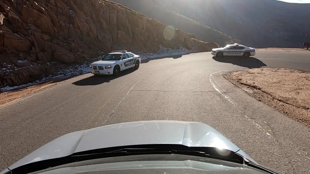
Police escort off Pikes Peak (not a joke!)

We had quite the adventure as we left the summit of Pikes Peak.  The story starts when we initially arrived at the gated entrance to the attraction around 2 in the afternoon. (That gave us a good four hours to enjoy the views and get down before dark.)  When we paid our entrance fee the “gatekeeper” told us THE MOST IMPORTANT THING to know is to keep the vehicle in low gear on the return trip to save the car’s breaks.  Note: he stressed the importance of this tip and this is the ONLY THING he told us.

We reached the summit and went to check out the summit building when I realized this was the place that had the awesome donuts I had heard so much about! (They ran out WHILE we were standing in line! 😝)  We also saw some signs that said the summit building closes at 4:00 pm.

That’s fine, we’re used to buildings in our local national parks closing around that time, it just means you need to find an outhouse if you need a bathroom after that time…or so we thought.  Note again, this is the ONLY thing the signs or the brochure said–stay with me, this is important for later in the story…

A short while after leaving the summit we stopped at a pull-off where a number of people had stopped and were hiking around.  We wandered down the trail and around the corner of some rocks for about 20 minutes.  We were upwards of 14,000 feet in altitude so we weren’t moving very fast 😇 but it was a nice day and we were enjoying our walk.

Mountans stretching to the horizon under blue sky and puffy clouds

As we were returning to the car we noted the pull-off was now completely devoid of other vehicles save the ranger truck with flashing lights sitting next to our car (and another police truck sitting on the road just before the pull-off.)  We talked to a VERY friendly, older-gentlemen ranger who said they close the summit at 4 in hopes everyone will be off the mountain by 5-ish–ok, we were heading down anyway.  Note: Again, this is ALL he said…

So we left the pull-off and got back onto the road with a friendly wave to the police truck who then…basically escorted us, with flashing lights, off the mountain.  We thought, “wow, they aren’t kidding about closing the summit!” (That’s way more intense than we’re used to but whatever, we were on our way down anyway.)

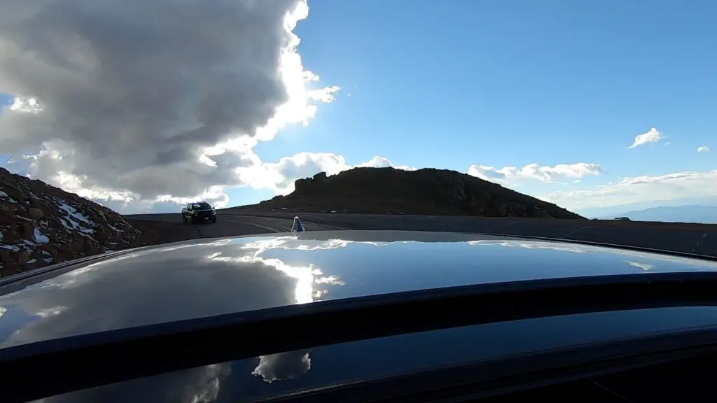
View from a car's sunroof looking behind the car at a police truck following behind.
I wasn’t kidding about the police! 😂

About halfway down the mountain, we came to another pull-off where several vehicles and people were still milling about.  As we slowed down for the curve we were finally able to make out the muffled noise coming from the police truck behind us…”I told you all once before, if you’re not off the mountain by 5 pm it’s a $1000 fine!” (For the record, he was talking to the people still parked, not us.)

I should also note, it was currently about 4:55 and there was NO WAY we were going to make it off the mountain in the next five minutes!  Fortunately, he was busy with those people and ignored us and we merrily continued our way down the mountain with no further problems.

Two police cruisers round a curve in the road
Really…not kidding! 😂

With the rise in van life and “stealth camping,” not to mention the winding road, steep dropoffs, and large wildlife (and close proximity to a large, metro area) I can understand their desire to keep people off the mountain in the dark.  However a few suggestions come to mind…

–Maybe…when a park gate employee tells you “THE MOST IMPORTANT THING TO REMEMBER…” three hours from park closing time, he should actually mention that there is a closing time? (Especially if there is a monetary fine involved?…)

–Maybe…on the brochures for the park (not to mention the signs on actual park buildings) they note this closing time as well?…

…these are just suggestions, of course. 😝

***I should also note we visited the park in mid-October, during the summer I believe it closes at 8…JUST MAKE SURE YOU’RE OFF THE ROAD BY THEN! 😝***

Garden of the Gods

Garden of the Gods has to be one of the more famous “city parks” in the country!  The main entrance is off 30th street on the west side of Colorado Springs (though there is another entrance on the south side from US 24.)  Also of note, this park is open till around 9 each night, and there were signs ALL OVER clearly stating this…*ahem* 😝

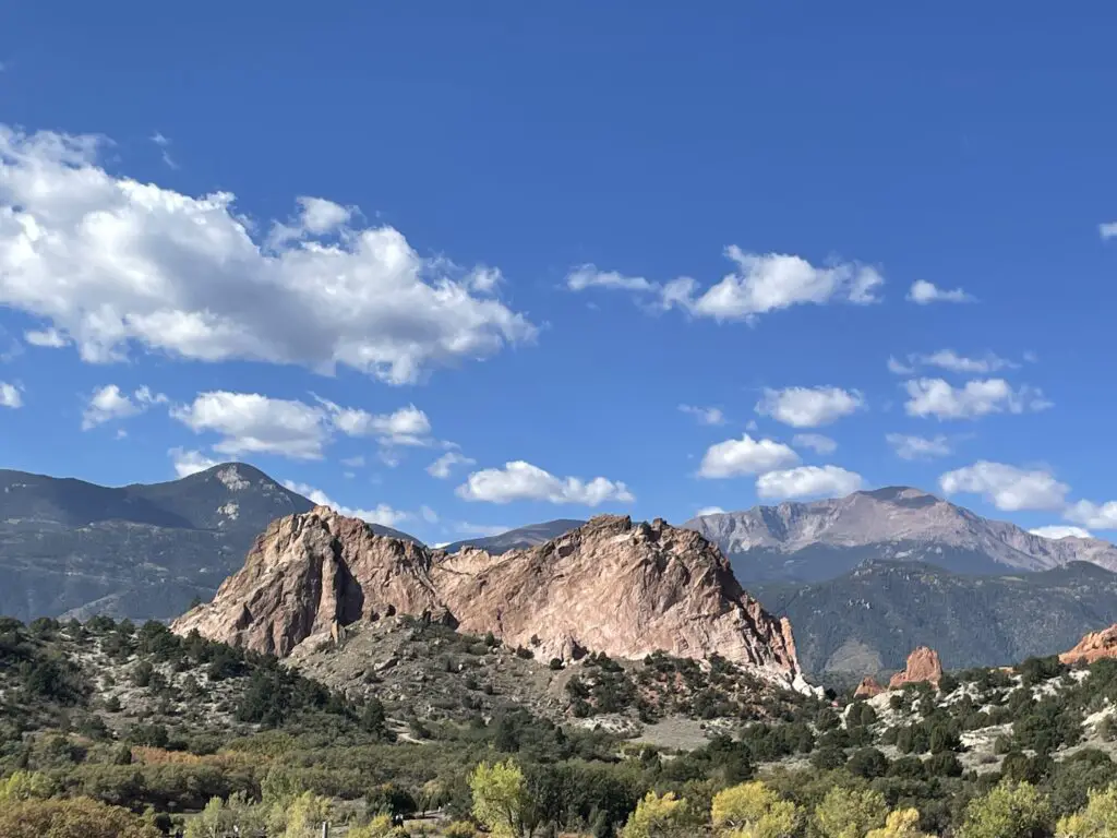
Green, scrub brush with a large rock rising out of it in the foreground, much taller mountains in the background including one that rises above tree line.
Garden of the Gods with Pikes Peak looming overhead (to the right)

This is a great attraction! It’s found right in town so it’s easy to access for Out-of-Towners or Locals wanting a nice place to exercise or walk the dog.  Rock climbing is also available at certain places within the park.  Another cool thing about Garden of the Gods…admission is completely FREE! 

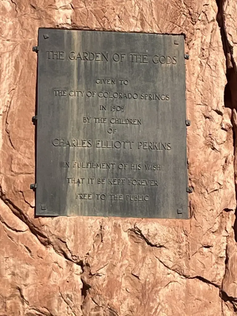
Black sign against red rock that reads, "The Garden of the Gods given to the city of Colorado Springs in 1909 by the children of Charles Eliott Perkins in fulfilment of his wish that it be kept forever free to the public."
Sign at the front of the park

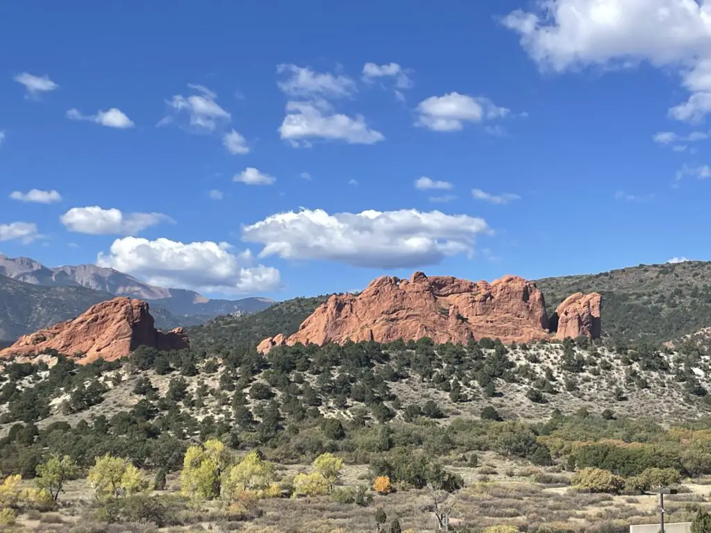
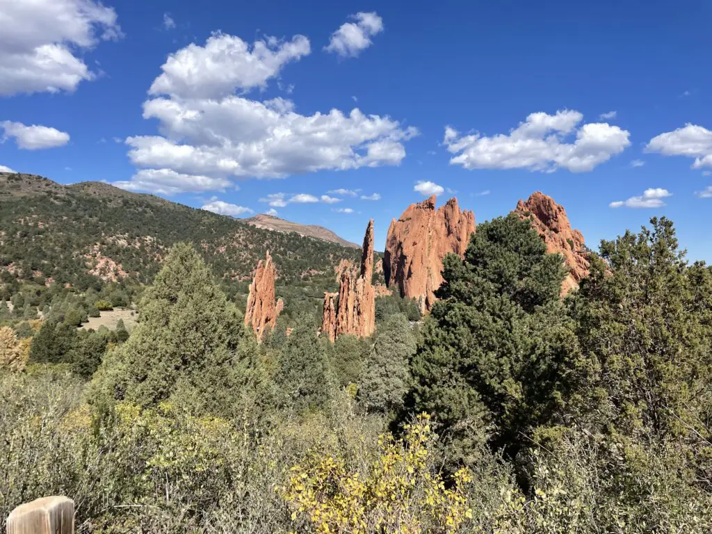
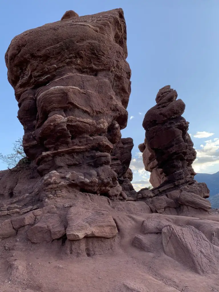
This locale is characterized by a number of red rock formations rising from the dry, green scrubland that is common in this part of Colorado.

Red rock shapes rise above green scrubland. Two shapes that resemble camels with their heads touching sit on the top of one of the red rocks.
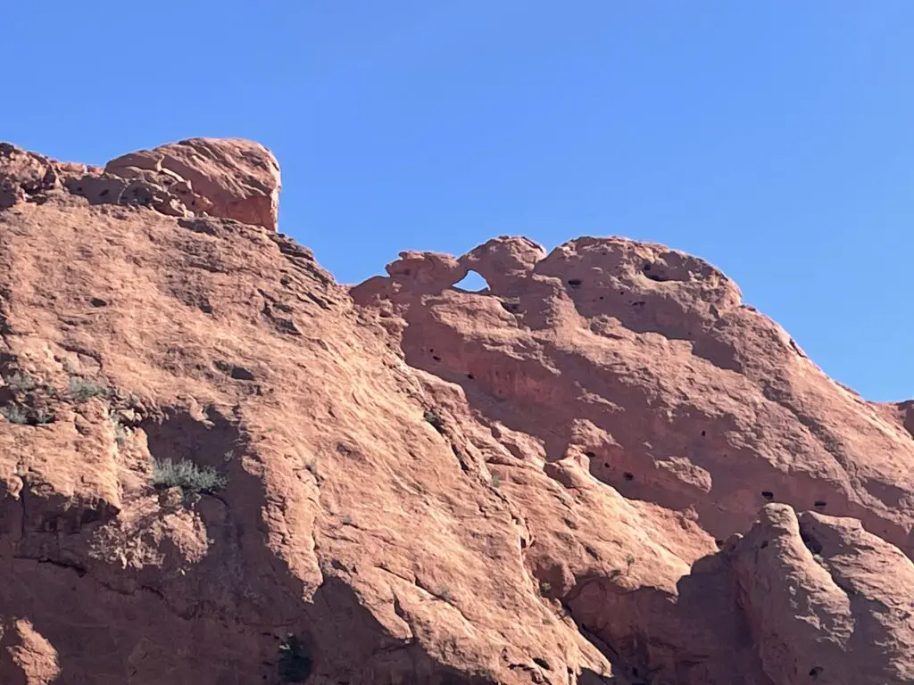
This formation is called the “kissing camels” (though from this distance it looks more like a sea turtle. 😝)
Red rock wall. Two shapes on top resemble the head of a cow and a bird with its wings back sit facing each other with their heads touching.
Up-close view of the “kissing camels”. We thought they looked more like a calf laying down, kissing a vulture with its wings folded…but whatever. 😝

Tall, narrow, red rocks rise from a scrub brush, desert landscape on a blue sky, white, puffy cloud day. One rock has a hole through the middle. Red rocks rise from green, scrub brush. A tree-covered mountain in the background has a taller, rocky mountain rising behind it.
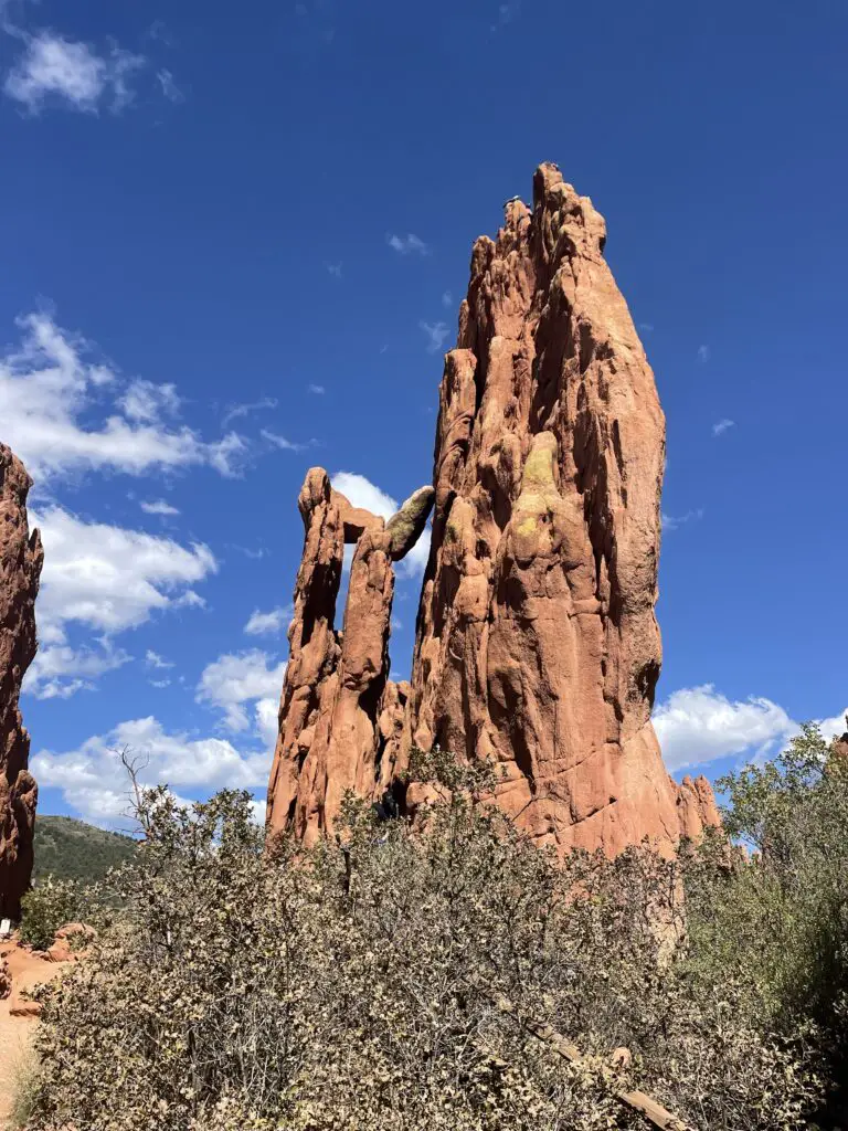
The Twins!

Two tall, narrow, red rock formation rise off a flatter rock formation

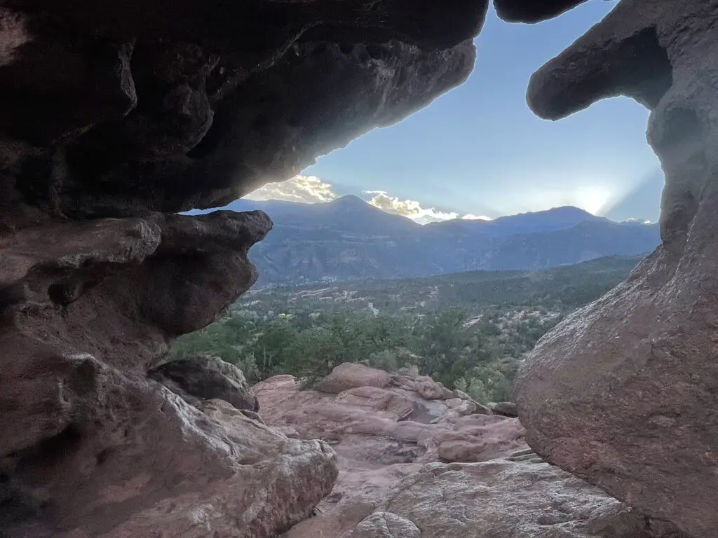
Dark, mountain silhouettes viewed through a whole between two tall, narrow rock formations. The mountains in the background tower over the green, desert landscape in the foreground.
View from “the window” between the Twins!

National Museum of World War II Aviation

While in Colorado Springs we also checked out the National Museum of World War II Aviation which is located just north of the Colorado Springs Airport, just off Aviation Way (which you can reach from US 24).  This was a nice museum!  As Mr. Trekker is a history nerd with a special fondness for WWII airplanes, he especially enjoyed it. 😉  We had enjoyed the Pikes Peak Regional Air Show earlier that fall and many of the warbirds from the museum were featured there.

Places to Eat near Colorado Springs

As usual, we found MANY good places to eat on our trip:

Paninos Restaurant–this is a cute, casual, family-owned, Italian restaurant.  We enjoyed a lovely anniversary dinner there!

Louies Pizza –a tasty, casual place for pizza  in a convenient, downtown location

Sandy’s restaurant –Sandy’s has one of the best breakfasts in Colorado Springs!  This place has HUGE portions! (I’m not kidding. However much you think you should order…halve that!)  You usually need reservations on weekends but the hostess liked us when she found out we were from South Dakota (a certain blogger may have noticed her Mt. Rushmore shirt and casually mentioned we live near there. 😇)  She convinced some friendly locals to let us sit with them at their long table.

This is one thing I LOVE about traveling, road trips, and taking the scenic route.  It often means you get the privilege of visiting local places.  You never know when an opportunity will arise to get to know a complete stranger in a comfortable environment.  I LOVE interacting with Locals like this!  You never know what you’ll learn from their experiences! 

Josh & Johns –this was a yummy  place for a sweet, ice cream treat

Uncle Sam’s Pancake House, Manitou Springs —nothing fancy here but the staff were friendly and attentive and the breakfast was DELICIOUS!

Hoosier Pass, Colorado

After our weekend in Colorado Springs, we needed to get to Boulder as Mr. Trekker had some work meetings there.  Normal people would have driven straight up I-25 from “the Springs” to Boulder…but who wants to be normal?!

Instead, the Trekkers opted for the VERY scenic route!  We took US 24 west to Hartsel, then took Route 9 across one of our favorite parts of Colorado, South Park (click here for a video of another drive through South Park!)  We even got to check out the ghost town of Alma and the skiing area of Breckenridge on this jaunt!

Leave it to the Trekkers to willfully and eagerly turn what could have been a simple, 90-minute drive into an incredibly beautiful, 8-HOUR tour of central Colorado on a GORGEOUS fall day…ALWAYS take the scenic route!

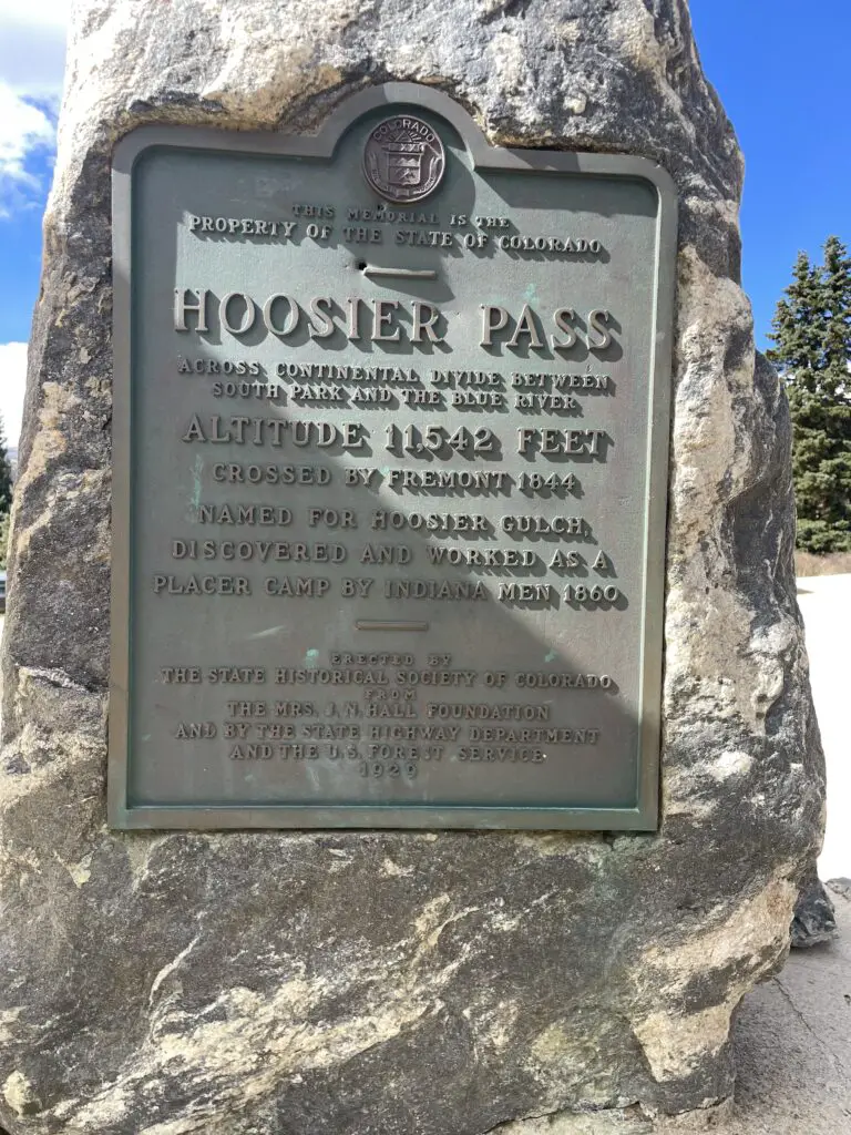
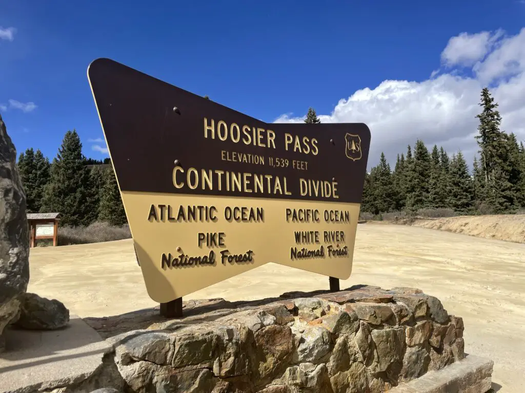
As part of our scenic drive, we randomly stumbled upon a place I’ve had on my list to visit…that’s right, the Hoosier finally found Hoosier Pass! 😁 😁 😁 (Not sure why the two signs differ by three feet in their claim of how high it is? 😮)

Metal sign set into a tall, narrow rock reads, "Hoosier Pass across Continental Divide between South Park and the Blue River. Altitude 11,542 feet. Named for Hoosier Gulch discovered and worked as a placer (gold) camp by Indiana men 1880".

Informational sign on a rock at a gravel parking area reads, "Hoosier Pass elevation 11,539 feet. Continental Divide Left: Atlantic Ocean Pike National Forest Right: Pacific Ocean White River National Forest

Golden Gate Canyon State Park

As part of our scenic drive, we also stumbled upon Golden Gate Canyon State Park, before ending our day in Boulder.

This is a great little park situated in north-central Colorado, around 15 miles west of Golden and about 17 miles north of I-70.  It’s got a number of trailheads that can be accessed from various areas, but the main entrance/ Visitor Center can be found on Route 46 about five miles east of the t-intersection with Route 119.

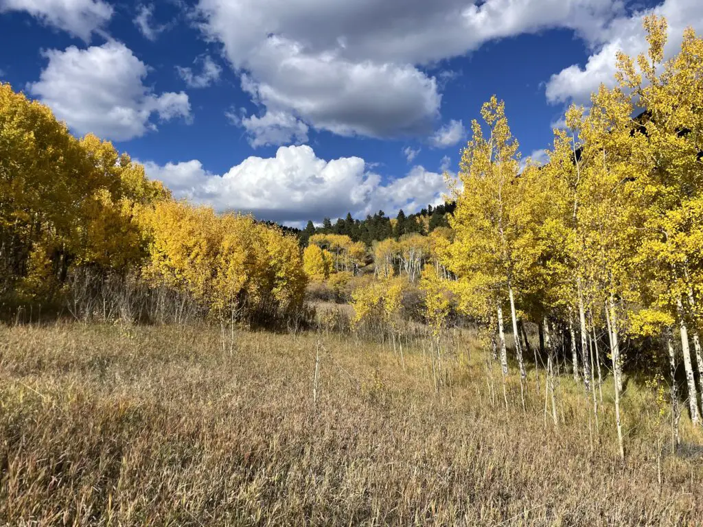
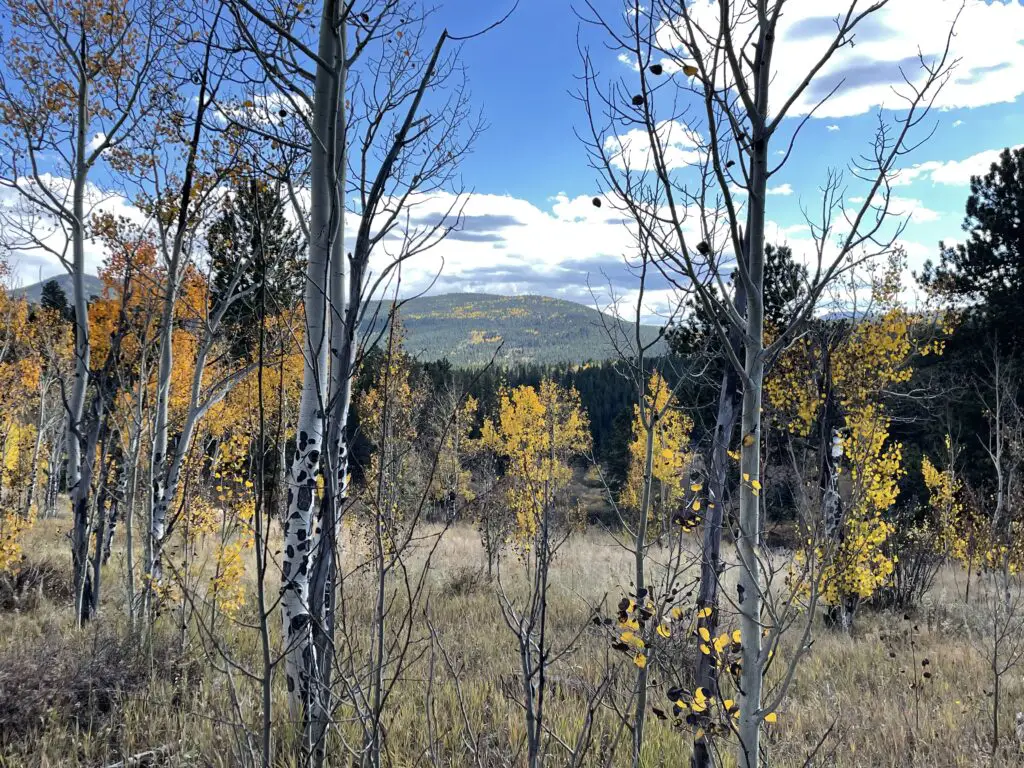
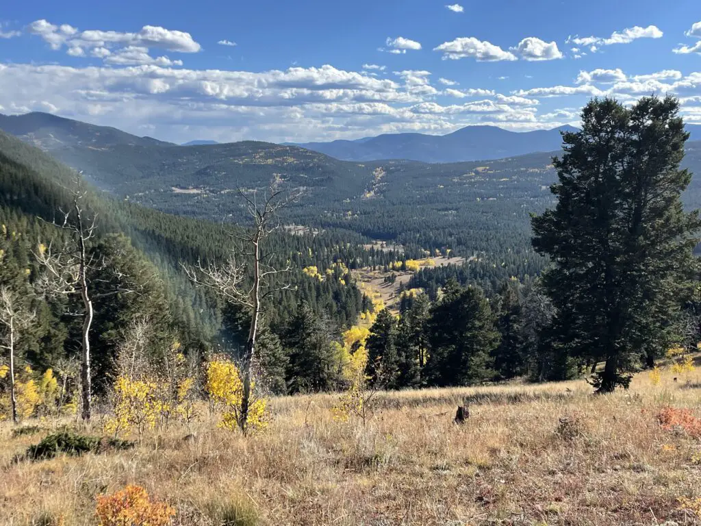
Golden Gate Canyon State Park offers around 35 miles of trails in addition to other activities (like camping) and it’s dog friendly!  If you want to know how the park gets its name, visit in late September/early October, it was beautiful!

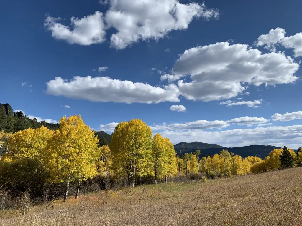
Bright yellow aspen trees surround a dunn-colored, grassy meadow under a blue sky with puffy, white clouds.
Can you see why they call it “Golden Gate”?

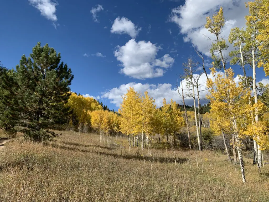
Bright yellow aspen trees surround a dunn-colored, grassy meadow under a blue sky with puffy, white clouds.

Bright yellow aspen trees (and a green pine tree) surround a dunn-colored, grassy meadow under a blue sky with puffy, white clouds.

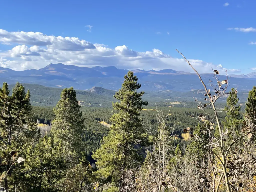
There are places in the park that also offer incredible views of the surrounding Rockies, including some of Rocky Mountain National Park’s most notable peaks (the national park sits only about 60 miles to the north).

Green pine trees and leafless brances in the foreground Tree covered hills behine lead to tall, tree-covered and rocky mountains in the background
The tall peak to the right is the infamous Longs Peak in Rocky Mountain National Park!

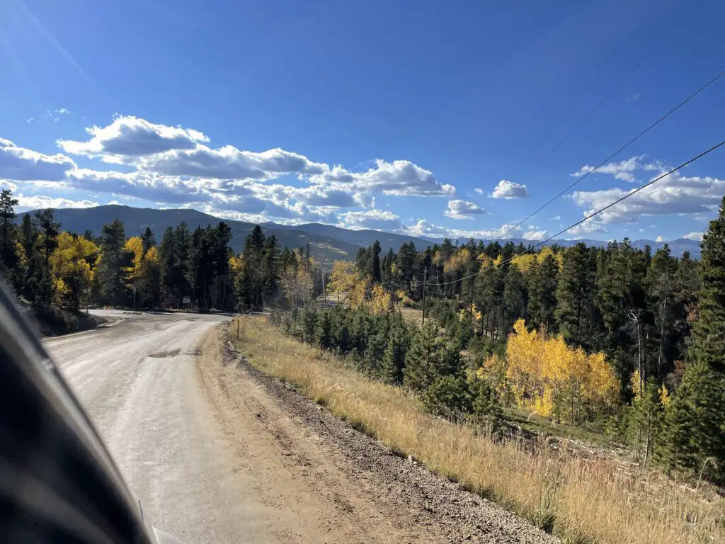
Narrow aspen trees with yellow leaves in a meadow in the foreground. Green and yellow-tree covered mountains rise in the background under a blud sky with white clouds. View down a grass covered hill into a valley of pine trees with yellow-leafed trees running through it. Green, tree-covered mountains rise around the valley with taller mountains in the background. A gravel, forest road surrounded by green pine and yellow aspen trees with dark, mountain silhouettes rising in the background

Places to Eat in Boulder

We were only in Boulder a few days but we enjoyed a few yummy places to eat there, as well!

Sweet Cow –another yummy place for a sweet, ice cream treat!

Chez Thuy–this is a great, Vietnamese restaurant. I highly recommend their Pad Thai!


So if you’re visiting the Colorado Front Range, be sure to check out Garden of the Gods, Pikes Peak, Golden Gate Canyon State Park, and the National Museum for World War II Aviation!  You’ll be glad you did!

Have you visited any of these locales?  What did you enjoy most?  Tell me about it in the comments. 


Did you enjoy this post? Pin it!

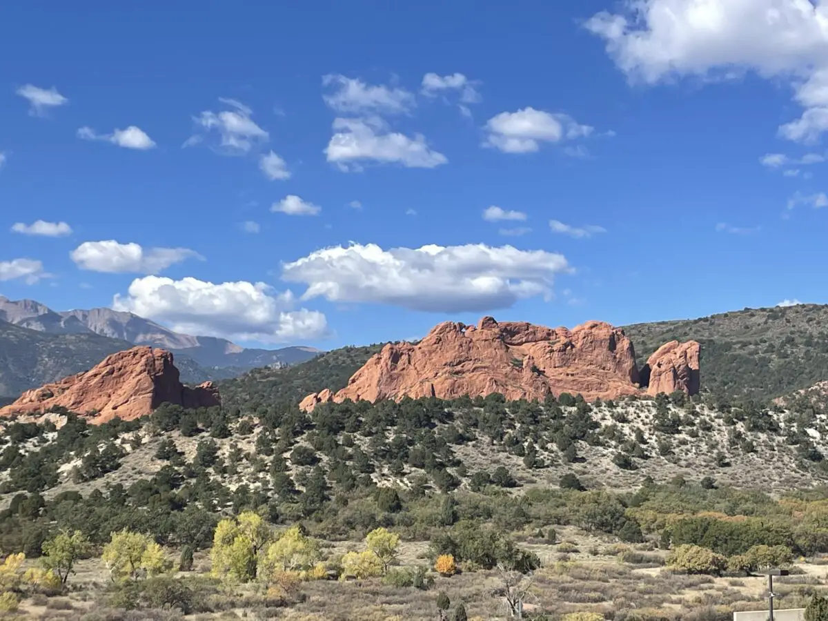
3 pictures on the pin, one of the sign at the Pikes Peak Summit, another of red rock formations rising from green scrubland, and another of mountains and plains spreading to the horizon from a viewpoint on a mountain high above. Pin reads, "Visiting Garden of the Gods and Pikes Peak"


Like what you read here today?  Please feel free to leave a comment, like or share this post!  You can also follow the blog on social media by clicking the links below!

Facebook

Twitter

Instagram
Pinterest


Ghost Towns in Southwestern Montana

In this post, I review several, cool ghost towns in southwestern Montana.


Montana IS the Old West!  It’s full of small, dusty, cowpoke towns where you can just imagine characters like Buffalo Bill Cody and Wyatt Earp walking its streets.  What better way to enjoy that experience than visiting an authentic ghost town?  We’ve enjoyed a few of these unique locales (though there are still plenty more on our list!)  See below for details!

Elkhorn State Park (Ghost Town)

Elkhorn is a tiny town located in the high mountains of southwestern Montana.  It is situated in a lovely valley with a mountain expanse that spreads out before you.  Technically this is a state park but the park portion only encompasses two buildings and a picnic area, the rest of the town is privately owned.  Feel free to walk the local roads though.  There are a number of signs that show where buildings used to be, what they were used for, etc.  

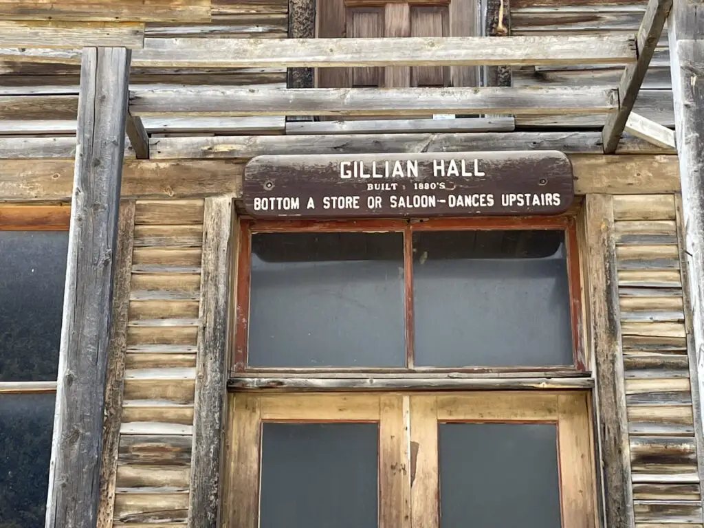
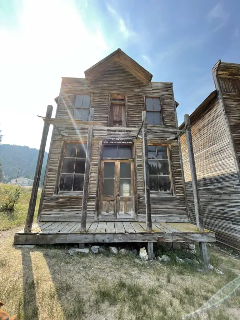
Front of old, wooden building. Sign says, "Gillian Hall: Built 1880's, Bottom a store or saloon, dances upstairs."

You can reach Elkhorn from the south by taking Exit 256, off of I-90, near Cardwell, Montana.  From here you will take Route 69 north.  After about 25 miles you will turn right on White Bridge Road (it’s literally just a short road that crosses the river on a small bridge.)  Once you cross the river turn right at the T-intersection onto Lower Valley Road.  You then take this road to the town.

There are a few signs for the Elkhorn mountains and Elkhorn state park but don’t rely on these to guide you.  It will be about 40 miles until you reach the town going this route.  As long as you stay on the main gravel road once you reach Lower Valley Road, you should be fine.  These roads are almost all dirt but they’re in good shape for basically any vehicle in good weather conditions. 

Old wooden building

You can also reach the town from the north from I-15.  From Exit 164 on I-15 at Boulder, MT, take Route 69 south and then take a left onto White Bridge Road.  The town is about 20 miles from the I-15 exit going this route.

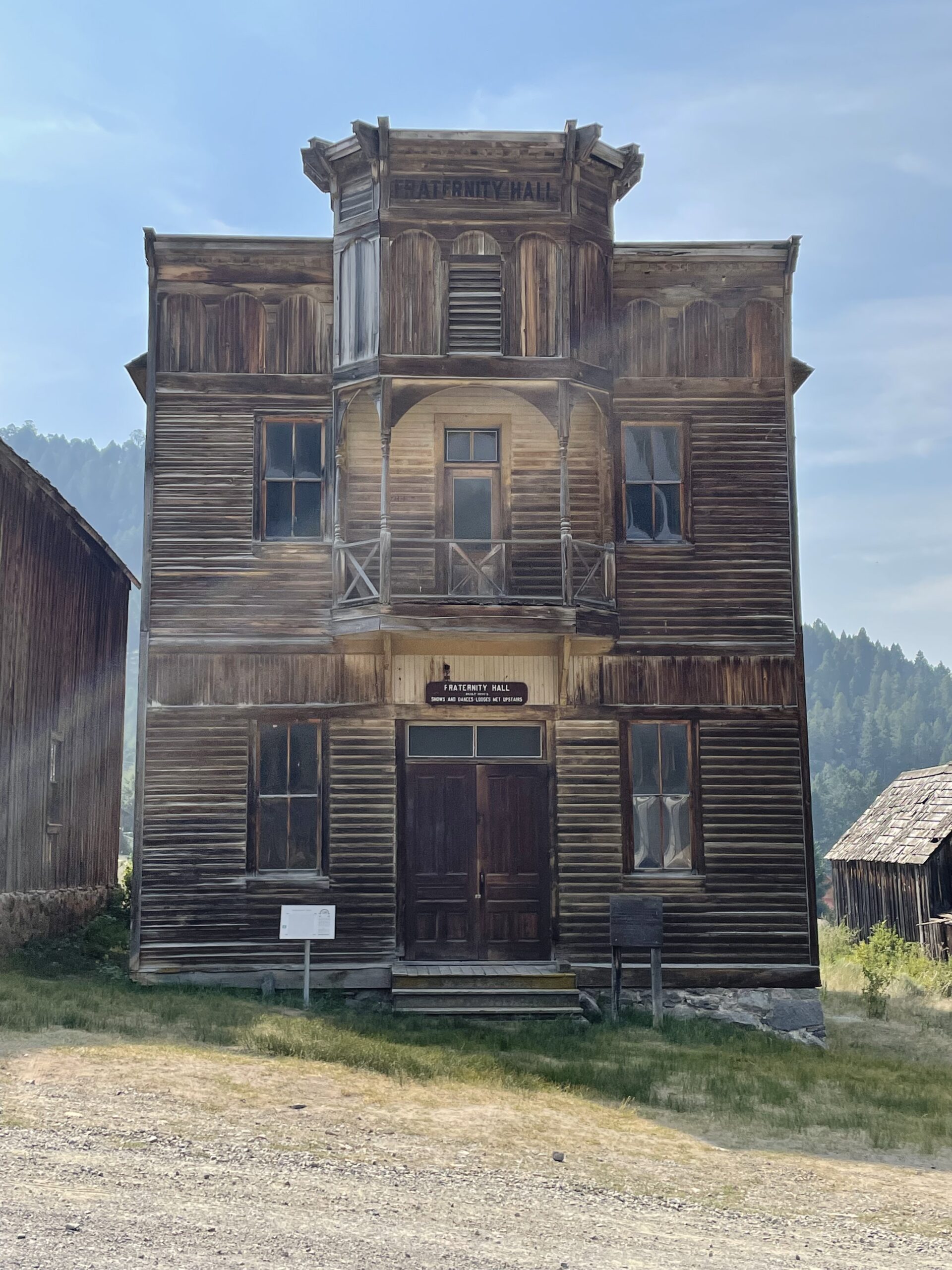
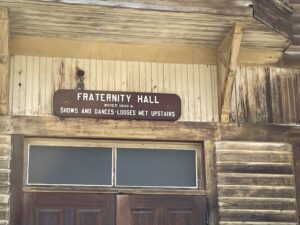
Front of old, wooden building. Sign says, "Fraternity Hall, shows were upstairs"If you continue up the dirt road past town and follow the signs, you will end up at the old cemetery in the woods. (The road is in pretty decent shape in good weather conditions–though we admittedly had a 4×4 truck.  We did see a sedan up there but I’d be careful with any car other than a Subaru or something else with higher clearance.  There were a few ruts and rocks in the road that could damage a lower-clearance vehicle.).

The cemetery was really neat but also very sad.  There were SO MANY graves of babies and children (apparently there was a diphtheria epidemic in the town that killed many children).  You’d see families where multiple children died within just a few days of each other.  I love visiting old cemeteries.  It’s always very sad to see how frequently young people died, but the histories of the area that you can gather are so interesting. 

Old, wooden building

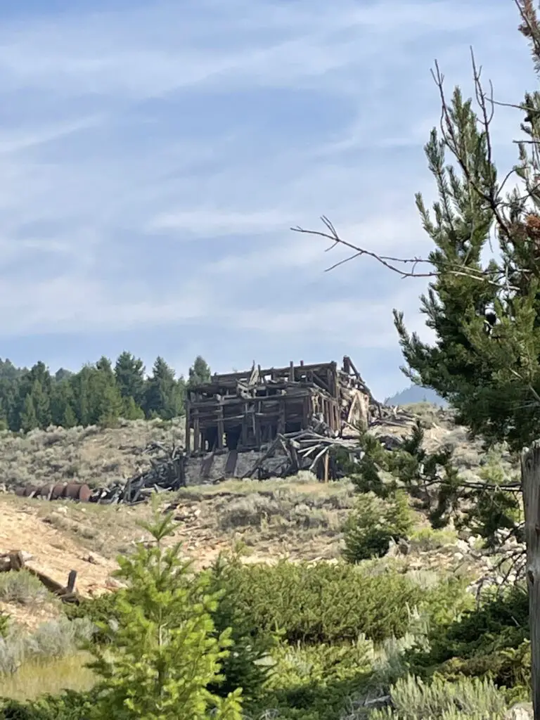
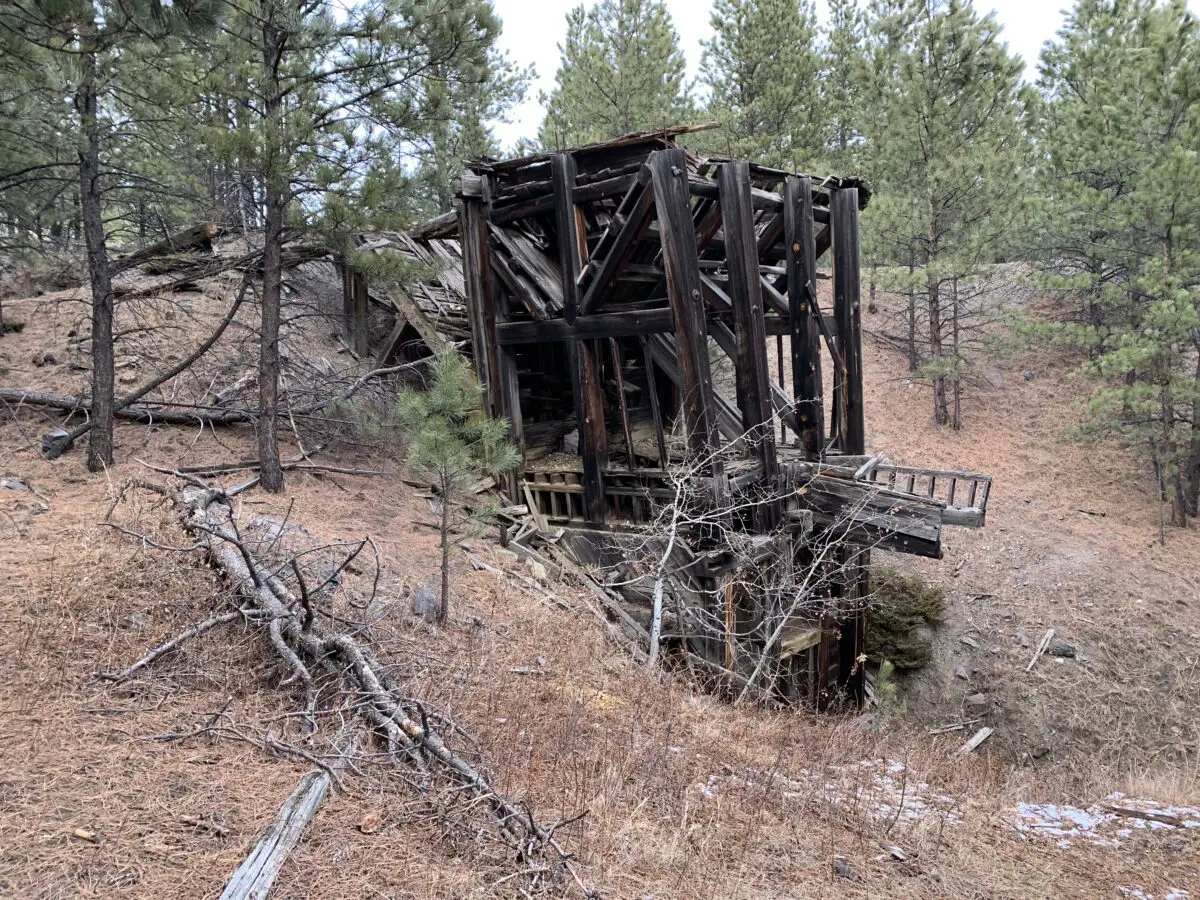
Old, decrepit, wooden mine stands on a mountainside
The mine in Elkhorn

Nevada City and Virginia City Ghost Towns

These two towns are also located in southwest Montana.  They are only about two miles apart.  The easiest way to reach them is probably from Three Forks, Montana.  Take Exit 274 off of I-90 for US 287 south.  Then take this road to the town of Ennis and turn right onto State Route 287 (yes, the roads are the same number. 😉)  This road runs right to the towns.  It is around 60 miles to the towns from I-90.

Related Info:  Activities in Nevada and Virginia Cities, Virginia City history, Nevada City history, Bannack HistoryHistory of Elkhorn; 6 Don’t Miss Places for your Western Montana Road Trip

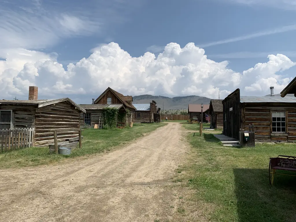
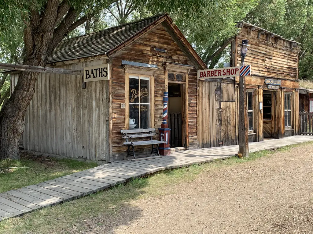
Nevada City was our favorite site of the two.  It is an outdoor museum of sorts.  Once you enter you can then walk around the entire town.  There are many buildings that you can actually go inside that are modeled to look as they would have in their heyday (such as a barbershop, the blacksmith shop, the general store, etc.).  Many of the structures are not native to this exact location, rather they were saved by historical foundations and brought here from around the state to be preserved. (It reminded me a little of the 1880 town in South Dakota.)

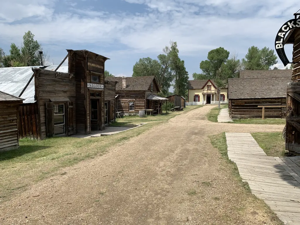
View down dirt, main street of Nevada City ghost town. Old, wooden buildings on each side.
Main Street Nevada City

View down dirt street of a ghost town. Old, wooden buildings on each side. Blue sky with clouds

Barber Shop, Nevada City:

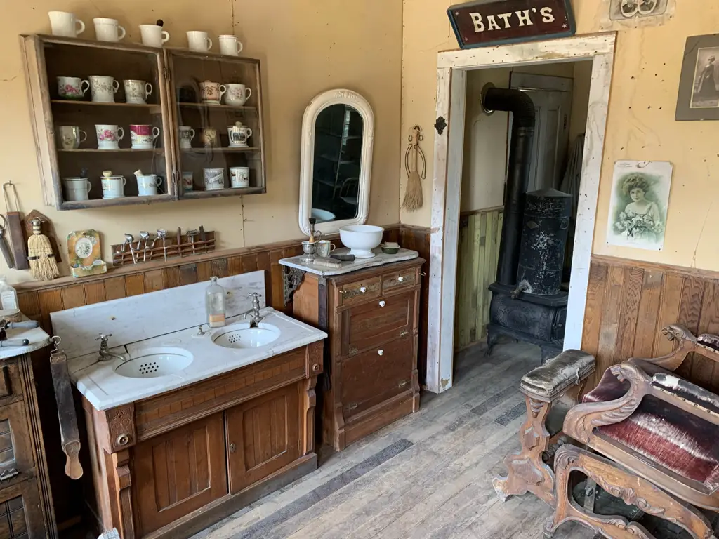
Interior of building. Sinks, mirror and wash basin in foreground, antique chair to the side, antique wood stove through doorway. Sign above door says, "Bath's"

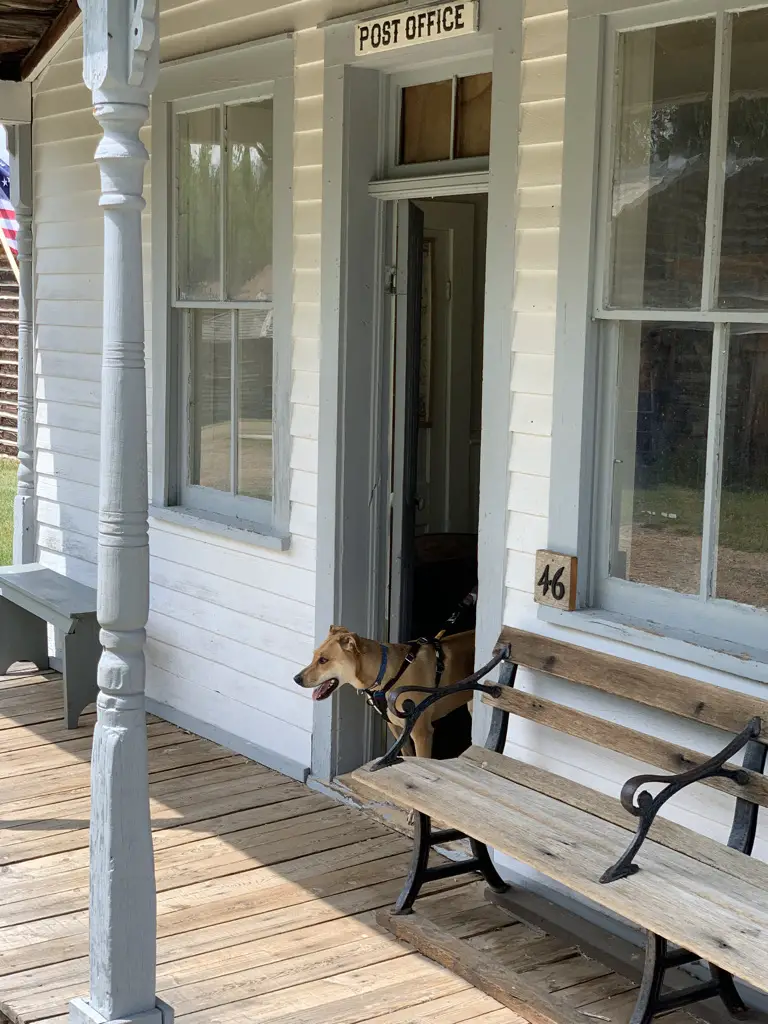
One great part about this museum, it was Puppers friendly!

Front porch of old Post Office, dog walking through front door.
Puppers enjoyed the post office!

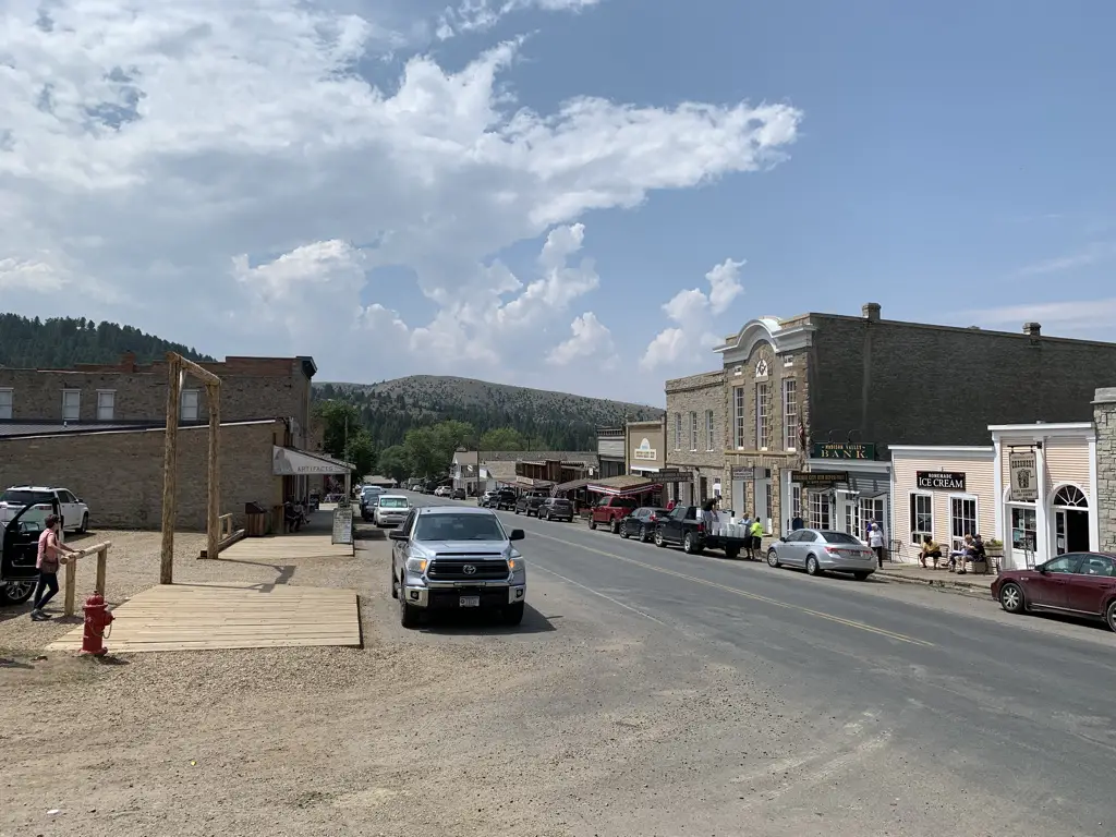
Virginia City was ok.  There were some decent sites to see but mostly it was a busy, commercialized town filled with shops, restaurants, and saloons.  Some people enjoy that atmosphere and that’s fine, but the Trekkers (and Puppers) prefer the quiet and solitude of the real ghost town. 😁  The town did offer some historical tours in horse-drawn stagecoaches that looked kind of cool, though we didn’t partake.

View down modern, paved, main street of Virginia City ghost town. Cars line both sides.
Main Street Virginia City (it isn’t quite so ghostly)

Bannack State Park (Ghost Town)

The easiest way to get to Bannack would be to take I-15 to Exit 59, near Dillon, Montana.  From here you will take Route 278 west.  After about 17 miles, Bannack Bench Road will break off to the south (left).  That takes you right to the state park.

Some of the roads to get to the park are gravel, but they were in great shape!  As long as you take it easy and don’t mind getting your car dirty, any sedan should be able to handle the drive in good weather conditions.

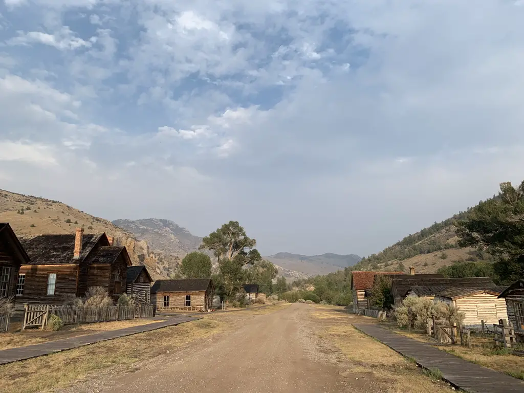
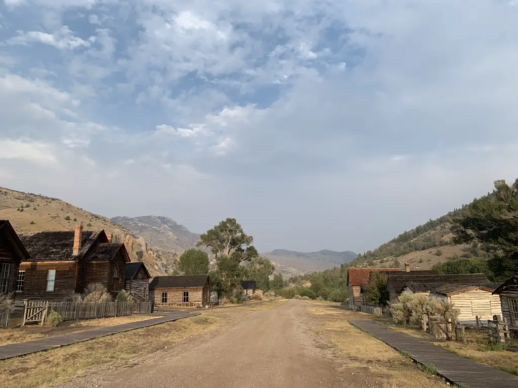
View down dirt, main street of Bannack ghost town, Bannack State Park. Old, wooden buildings on each side, blue, cloud-covered sky, dusty mountains in background..
Main Street Bannack

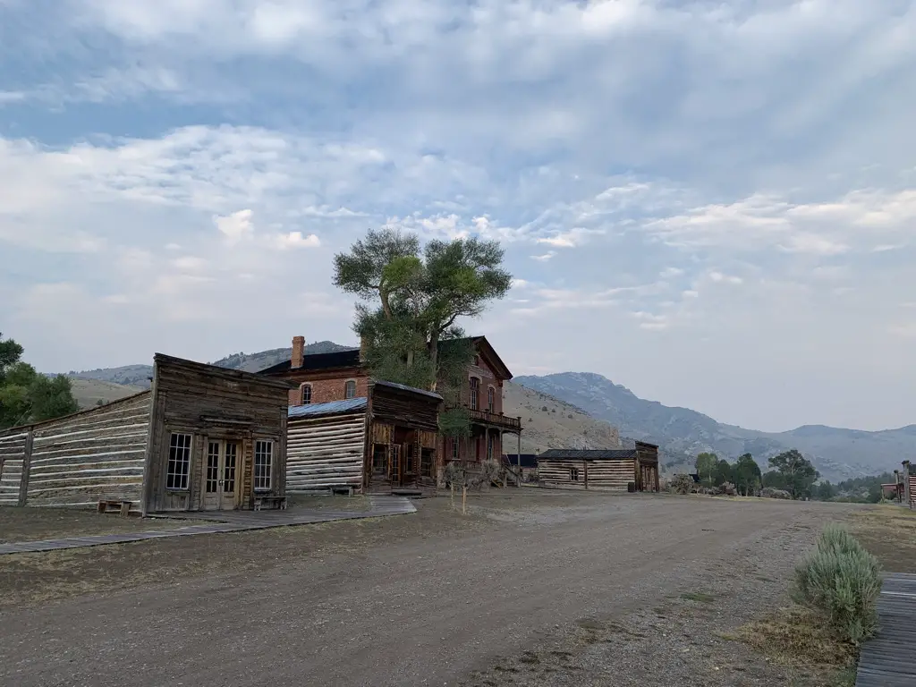
Old, wooden buildings line one side of dirt, street.

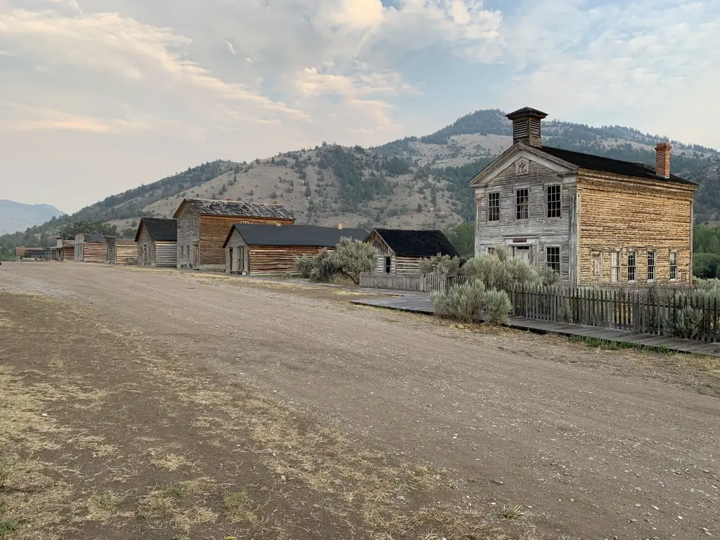
Old, wooden buildings line one side of dirt, street.

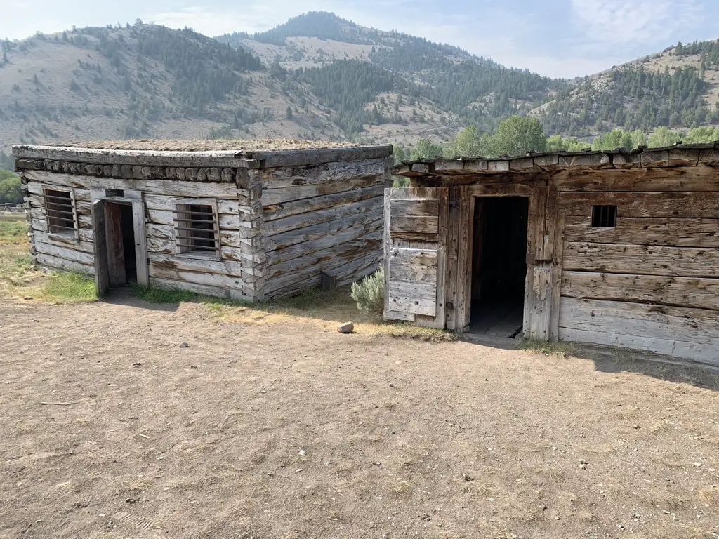
Old, wooden jails. Dusty mountains in background.
The jails in Bannack
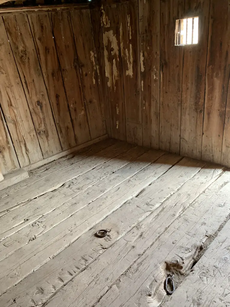
Interior of old, wooden jail. Shackle points in floor.
You can see where the prisoners were chained

Bannack is AWESOME!  It’s one of the better preserved, true ghost towns I’ve ever seen (meaning it’s still in its original location and the buildings are in fairly good shape.)  They let you just wander around the town on your own, you can go in the buildings (that aren’t locked) AND you can bring dogs!

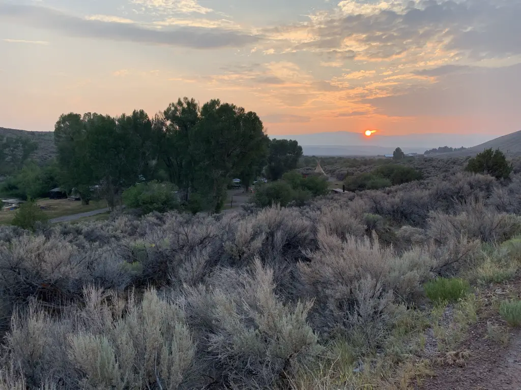
Smoky sunset over scrub-brush covered pastureland.
A smoky sunset over wild Montana
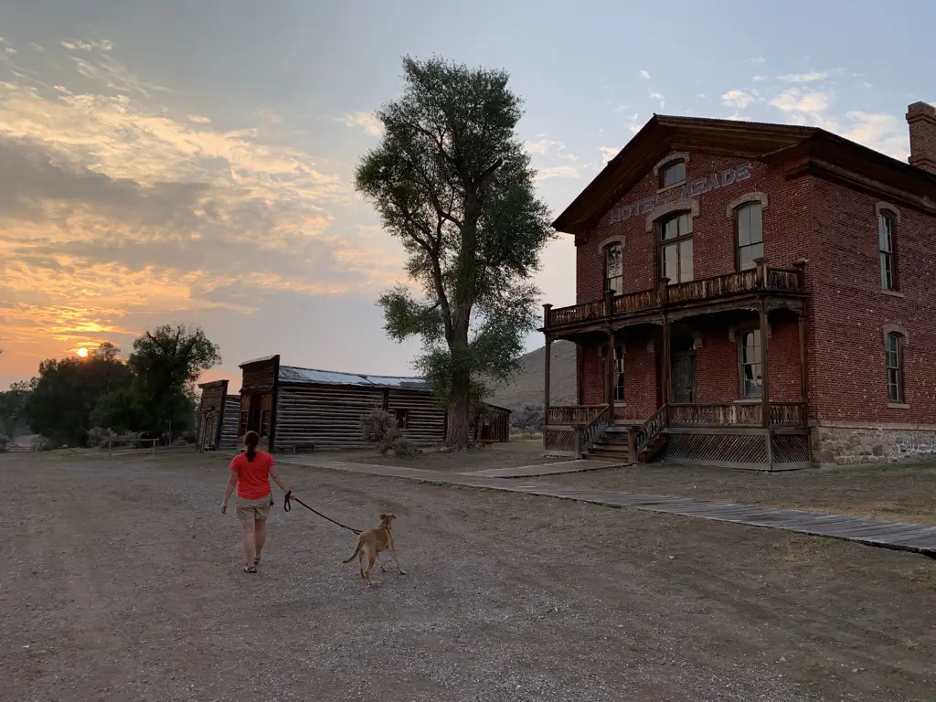
Woman and dog walking away from camera on dirt street of ghost town, sun setting into the clouds in background.
Puppers and I searching for ghosts at sunset
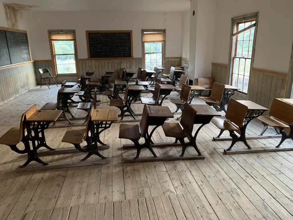
Interior of old, one room schoolhouse. Antique desks fill the room.
Inside the schoolhouse

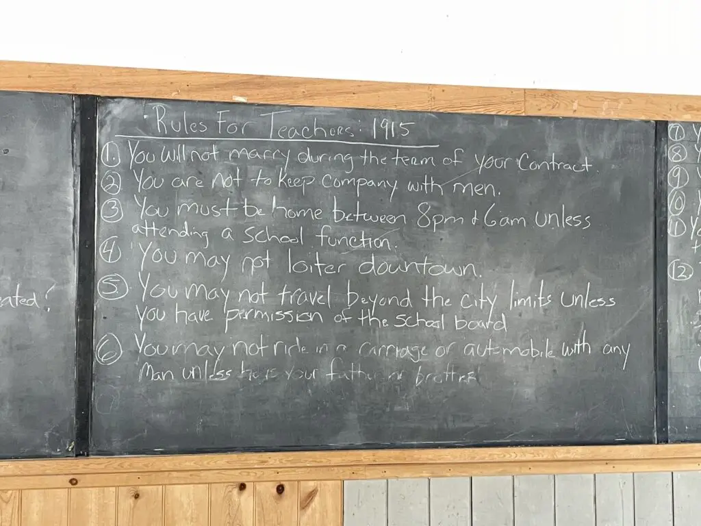
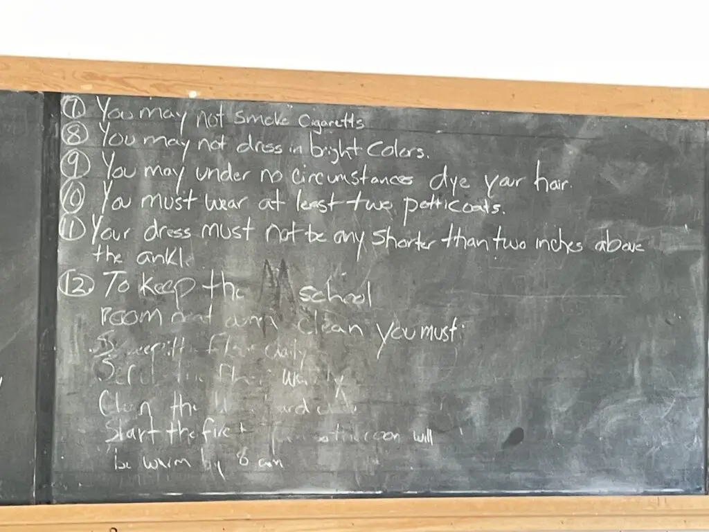
Rules for teachers written on the schoolhouse chalkboard:

Rules for teachers at the schoolhouse in 1915 written on a chalkboard. These include, "you may no loiter downtown."

Rules for teachers at the schoolhouse in 1915 written on a chalkboard, including, "you may not dress in bright colors."

My favorite are no wearing bright colors over that scandalous one petticoat! 🤣 

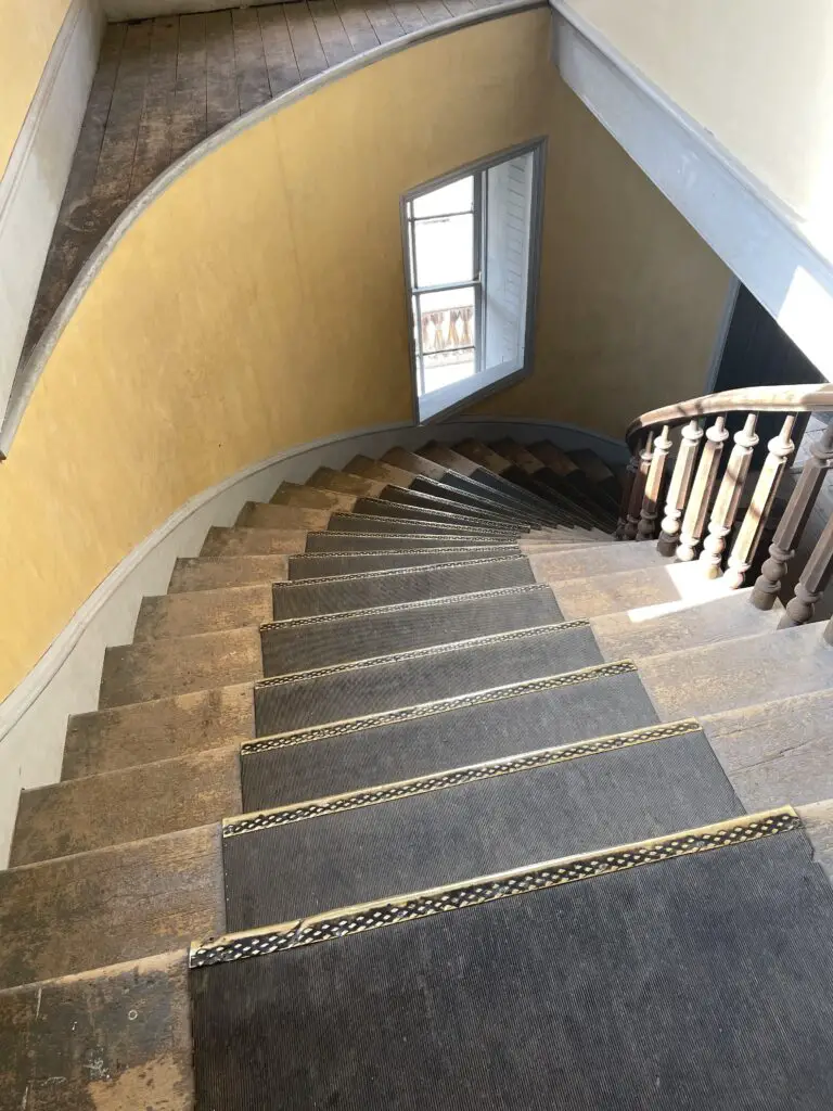
View down spiral, front staircase of old hotel.
Not gonna lie, I couldn’t help imagining myself descending these stairs in a hoop skirt!

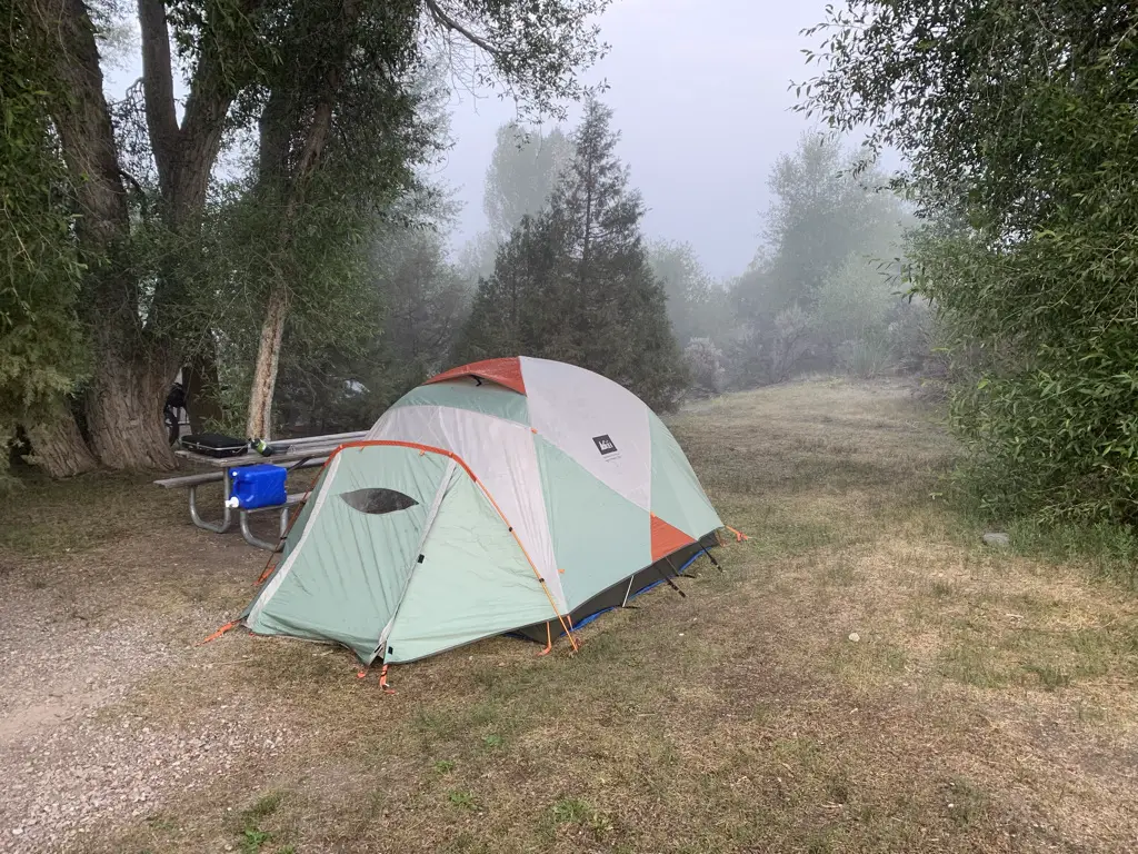
If you can make it work I STRONGLY recommend camping in the park, it’s about a half-mile walk from the campgrounds to the ghost town, and being there in the evening as the light wanes is AMAZING! (If you choose not to camp the park is open till 9 at night, in the summer).  The campgrounds are rustic (read vault toilets) but they were cute, well-maintained, and quiet.  This was our favorite stop of the trip and Mr. Trekker’s favorite campground (mostly because of the access to the ghost town.)

Foggy campsite surrounded by trees, tent in middle.
Our cute little campsite at the Bannack State Park campground
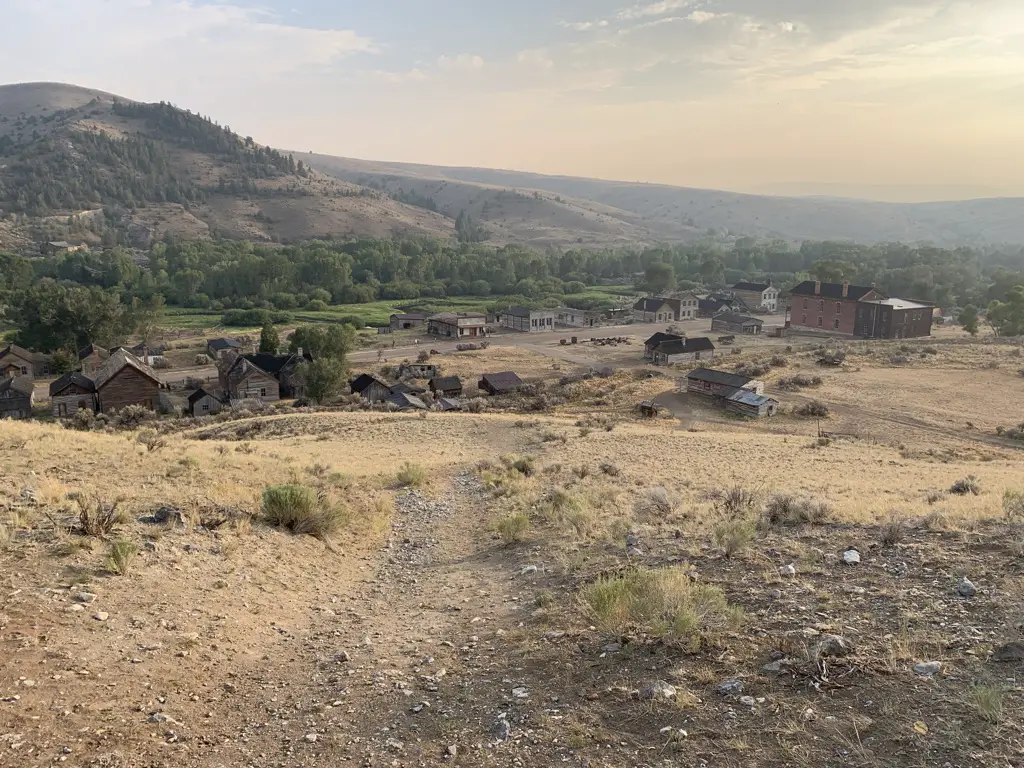
View from top of hill overlooking the ghost town of Bannack, Montana. Smoky mountains in background.
View of Bannack from the hill above the town
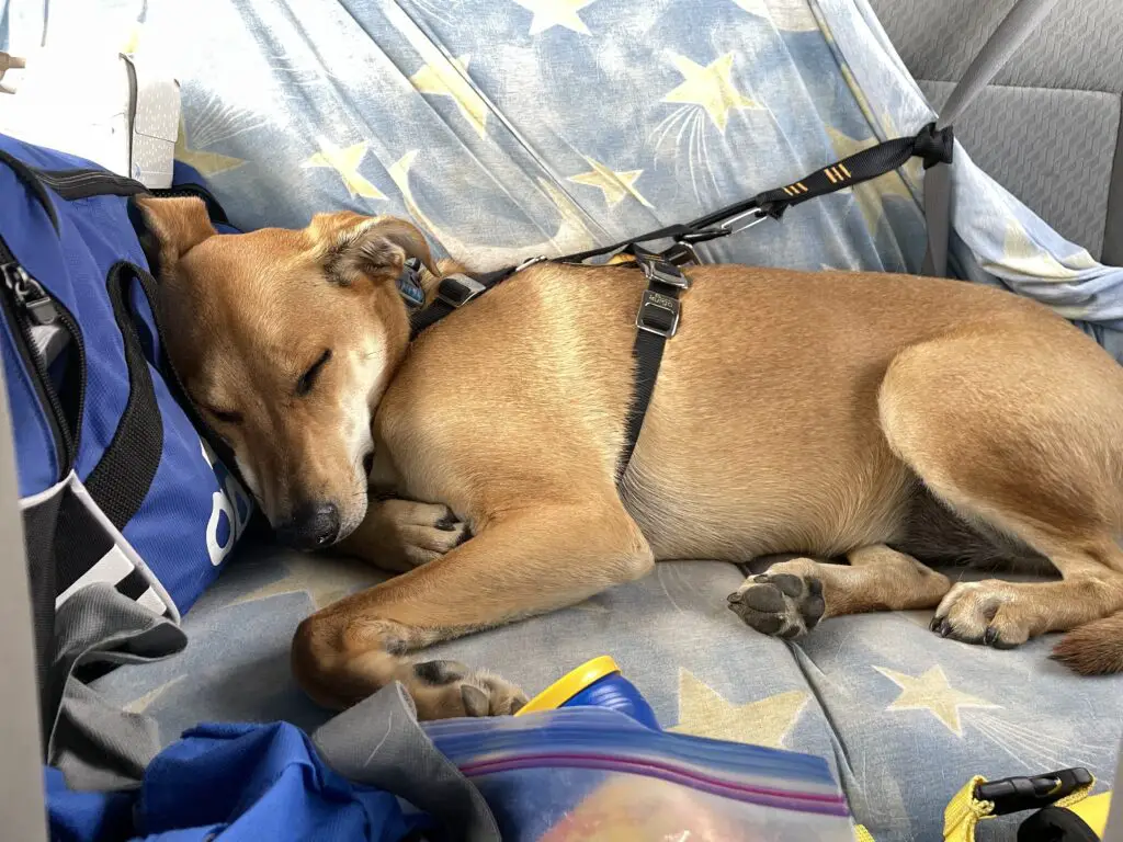
Dog asleep in back of vehicle, strapped into harness and seat belt.
Sleepy puppy after chasing ghosts! (BTW that seatbelt harness she’s wearing is AWESOME!)

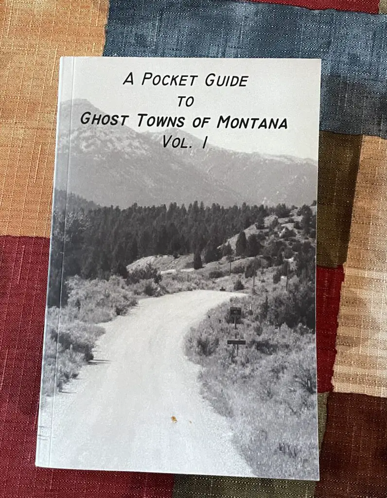
Though they weren’t nearly as good as the ones we found for Colorado, I did find a series of books that is helpful when visiting Montana ghost towns:  

Book, "a pocket guide to ghost towns of Montana, volume 1."

This volume didn’t cover EVERY town we’d like to see but it did review many of them.  I’ll look into getting one of the other volumes when we go out for our next trip.  The book focused mostly on the histories of the towns (which is always interesting) but it did give a quick synopsis of how to find the town at the end of each section.  It even made helpful suggestions such as, “it is not advisable for any vehicles towing trailers to approach using the southern route.”

Bannack and Nevada/Virginia Cities are only about 80 miles apart.  While you can certainly enjoy Nevada City and Virginia City on the same day, I would encourage you to save one whole day for Bannack.  This will allow you to fully enjoy that park and give it the time it deserves.   

Ghost towns are such a great way to experience history and gain an appreciation of the “cushier” lives we lead today.  So if you find yourself in southwestern Montana, check out some of these cool destinations!

Have you been to any of these awesome ghost towns?  Are there others we should put on our list?  Let me know in the comments!

Did you enjoy this post?   Pin it!

Three pictures: 1) Old, wooden buildings line one side of dirt, street; 2) View down dirt, main street of Bannack ghost town, Bannack State Park. Old, wooden buildings on each side, blue, cloud-covered sky, dusty mountains in background; 3) View down modern, paved, main street of Virginia City ghost town. Cars line both sides. Pin reads, Ghost Town in Southwestern Montana

Like what you read here today?  Please feel free to leave a comment, like or share this post!  Add your email at the bottom of the page, or the sidebar to the right, to be notified when a new post is published.  By signing up for the email list, you will also receive a free copy of the Tranquil Trekker’s Top 10 Tips of Trekking Do’s and Don’ts!

You can also follow the blog on social media by clicking the links below!

Facebook

Twitter

Instagram
Pinterest

Empire Mine, Black Hills of South Dakota

In this post, I review a trip to the “secret” site of the Empire Mine, found in the central Black Hills.


Author’s Note:  I struggled with whether or not to write this post.  I wanted to blog about this location because it is a cool place and I love sharing the history and beauty of our Black Hills with others.  However, it is a bit of a secret spot and I didn’t want to be “that guy” who gives away closely-held, local secrets.  My personal policy is to not offer more directions to these types of sites than are already available on Google.  Unfortunately, there isn’t much to be found regarding the Empire Mine…

My main goal with this policy is to protect the site from vandalism and/or destruction.  We have unfortunately had these types of issues in some local places such as the Spokane ghost town and the iconic Poet’s Table, as of late.  For this reason, my directions below are intentionally vague.  If you want clearer instructions on how to reach the site, you may contact me via social media as indicated below, or by using my contact form, and I may be able to help you a little more. (I got some helpful directions from a friendly and helpful local so I am willing to pay their goodwill forward and do you the same favor. 😀)


There is a somewhat well-known, secret location many people enjoy hiking to in the central Black Hills.  It is the site of the now-defunct Empire Gold Mine!  You can reach the ruins of this mine via the Samelius trailhead, which is part of the Black Hills Centennial Trail.

That’s it.  Those are my directions. 😇  I told you they would be vague! 😉  I don’t feel like these approximate instructions are giving anything away as this much is available on the AllTrails site.  That page also offers a little more information as to the whereabouts of the mine, including a vague map.  Also, I knew the mine could be reached from this trailhead for quite some time and that didn’t aid me in finding this secret locale (maybe I’m just not that bright? 😂)

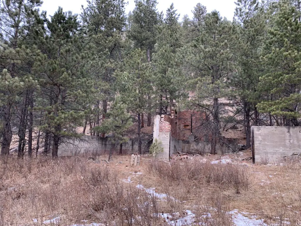
Brick ruins sit amongst trees in the woods
The storehouse at Empire Mine.  At one point in time, trucks could drive here.

What is the trail to the Empire Mine like?

The trail to the Empire Mine is about 4.2 miles in total length, out-and-back.   You should be aware, a goodly portion of the route going out is downhill…you know what that means for a goodly portion of the path coming back?! 😝  The trail is also fairly obvious the entire way.  Much of it follows old forest roads and the portions that don’t are heavily used so they are well-trodden.

When is the best time of year to visit the Empire Mine?

The hike is a bit lengthy but it isn’t overly difficult.  Some of the trail sections could become quite icy during the colder months, especially as this route sees a lot of traffic that can pack the snow into hard ice.  If the weather has been particularly wet recently, or during the spring thaw when snow is melting, mud could also make this trail slippery.

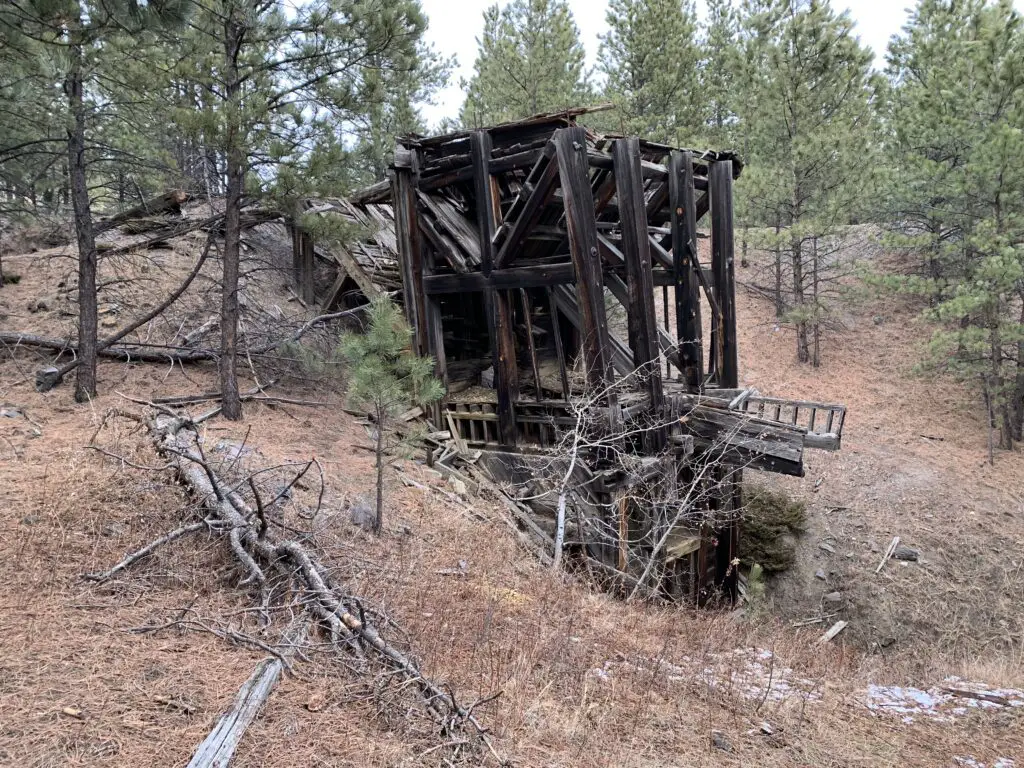
Wooden remains of a mine building in the woods
Another ruin from the site’s mining days. You can see how dilapidated the buildings are becoming.

These factors could make the downhill portions of the route troublesome, so please use caution.  The hike is especially lovely in fall when the trees change color!  This is because along the way you walk near several aspen groves that turn a brilliant, golden hue (hey look, another clue as to the location of the mine! 😉)

What is there to see at the Empire Mine?

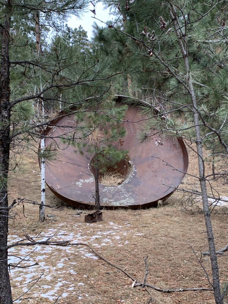
Some of the main ruins that remain of the mine are the brick loading area and a VERY large copper funnel.  Those are found at the bottom of the hill.  As you work your way up the hill you will encounter a number of buildings and mine equipment that still remain in the forest.

A WORD OF WARNING!  The mine was built in the late 1930s so these buildings are OLD!  They are made of wood that has weathered and has not been maintained in many years.  PLEASE do NOT enter them.  Also, watch your step throughout this area as portions of the ground (especially near some of the buildings) are degrading into sinkholes.

A very large, rusty, metal funnel sits in the woods
A large funnel that was used at the mine

This is a pretty neat site to visit.  It is also not that far from several nearby, Black Hills’ towns and it isn’t really that hard to reach IF you know where to look.  If you’re interested in some of the mining history of the Black Hills I encourage you to look into this secret locale.  Just please, treat it with the historical respect it deserves, and don’t ruin the site for those who come after you.  *stepping off my soapbox now* 😇 

Have you visited the site of the Empire Mine in the central Black Hills?  Share your experience with me in the comments!


Did you enjoy this post?  Pin it!

Wooden remains of a mine building in the woods. Pin reads, "Empire Mine, Black Hills of South Dakota".


Like what you read here today?  Please feel free to leave a comment, like or share this post!  Add your email at the bottom of the page, or the sidebar to the right, to be notified when a new post is published.  By signing up for the email list, you will also receive a free copy of the Tranquil Trekker’s Top 10 Tips of Trekking Do’s and Don’ts!

You can also follow the blog on social media by clicking the links below!

Facebook

Twitter

Instagram

Pinterest


Opening Weekend on Beartooth Pass

In this post, I review a Memorial Day road trip on Opening Weekend of the Beartooth Highway in Montana.


One item you should definitely have on your Road Trip Bucket List is to drive the Beartooth Highway on Opening Weekend.  This route connects Red Lodge, Montana, on the north side; Yellowstone National Park, to the west;  and Cody, Wyoming, to the south.  The route usually opens by the Saturday of Memorial Day Weekend, though this is always weather-dependent.  Also, temporary closures may occur after the opening date, also due to weather.

Click here to watch videos of snowplows clearing the route on YouTube (be warned, they are addictive! 😉)  The Montana DOT often has to clear snowdrifts that are over 20 feet deep in some areas! 

Washoe Ghost Town near Red Lodge, Montana

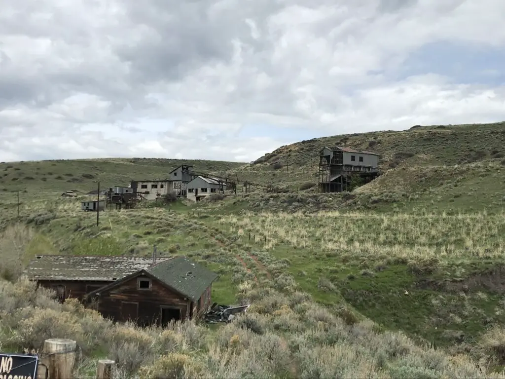
You can travel the road from either direction.  We started in Red Lodge, Montana.  We noted on the map that there was a ghost town not far from our hotel.  The Washoe Ghost Town and mine site is located on Route 308, between Red Lodge and the tiny town of Bearcreek, on the way to Belfry.  The actual site is situated on private land, so you can’t tour it, but it is easily visible from the side of the road. 

This location’s (unfortunate) claim to fame is that it was the site of the worst mining disaster in Montana history in the 1940s. 😐

Scrubbrush prairie dotted with dilapidated buildings
Washoe Ghost Town

Lodging along the Beartooth Highway

We’ve been learning the joy of simple motels on recent trips.  Air B&B’s have become our “lodging of choice”, though we’ve been finding, if we MUST stay in a hotel, the simpler, local options appeal to us the most. 

They have to be clean, and well-maintained, of course, but they often have so much more character than the stale, chain hotels people usually think of.  We also, frequently, stay in smaller towns, where the larger chains don’t often have a large presence.  So, being willing to expand our horizons a bit makes lodging much easier to locate.

We had incredible luck with finding places to stay on this trip.  In Red Lodge, we chose the Red Lodge Inn, which was absolutely ADORABLE. 

It was a simple motel, but it appeared that the rooms had been refurbished recently, and they were quite nice.  We were also impressed by how large they were!  The motel is owned by a young family, and the hosts were incredibly friendly and helpful when we needed information regarding local attractions.

In Cody, Wyoming, we stayed at the Cody Cowboy Village, and it was equally as cute.  This one had more of a “Western” theme, while the room in Red Lodge felt more like a mountain cabin, but both were equally enjoyable. 

At the motel in Cody, large wooden beams made up the small cabins and reminded me of the ADORABLE Grandma’s Cabin that we stayed in, with Mr. Trekker’s family, in Island Park, Idaho, during our Yellowstone trip in 2014!

Places to eat along the Beartooth Highway

We’re also learning that simplicity is our friend when it comes to finding meals out on the road.  We love little cafes and diners, and again, when you stay in small towns, it’s good to enjoy these. 😁 

When in Red Lodge we had dinner at one of our favorite places, Red Lodge Pizza.  The restaurant is housed in the old post office and features creations along that theme such as, the Cliff Claven!  We’ve never had a bad meal there! 

In Cody, we ate breakfast at Our Place, a charming little dive (to be clear, I use that term affectionately) just across the street from our hotel. 

Some of the best meals I’ve eaten at a restaurant were cooked in “dives”.  These places are usually locally-owned by regular, small-town folks.  The owners are often a joy to talk with, and any time the place is crowded with locals, you know you’re in for a treat!

We enjoyed dinner at the Occidental Saloon in Buffalo, Wyoming the final night.  We’ve visited there before and have always been happy with the meals.  This site is attached to a historic hotel in town, where the likes of Teddy Roosevelt, Butch Cassidy, and Calamity Jane once rested their weary feet.  As usual, we ate the final meal of our trip, breakfast on Memorial Day morning, at the Busy Bee Cafe, also in Buffalo.  I’ve waxed lyrical about how much we like this cute little restaurant before.

The drive on Beartooth Pass!

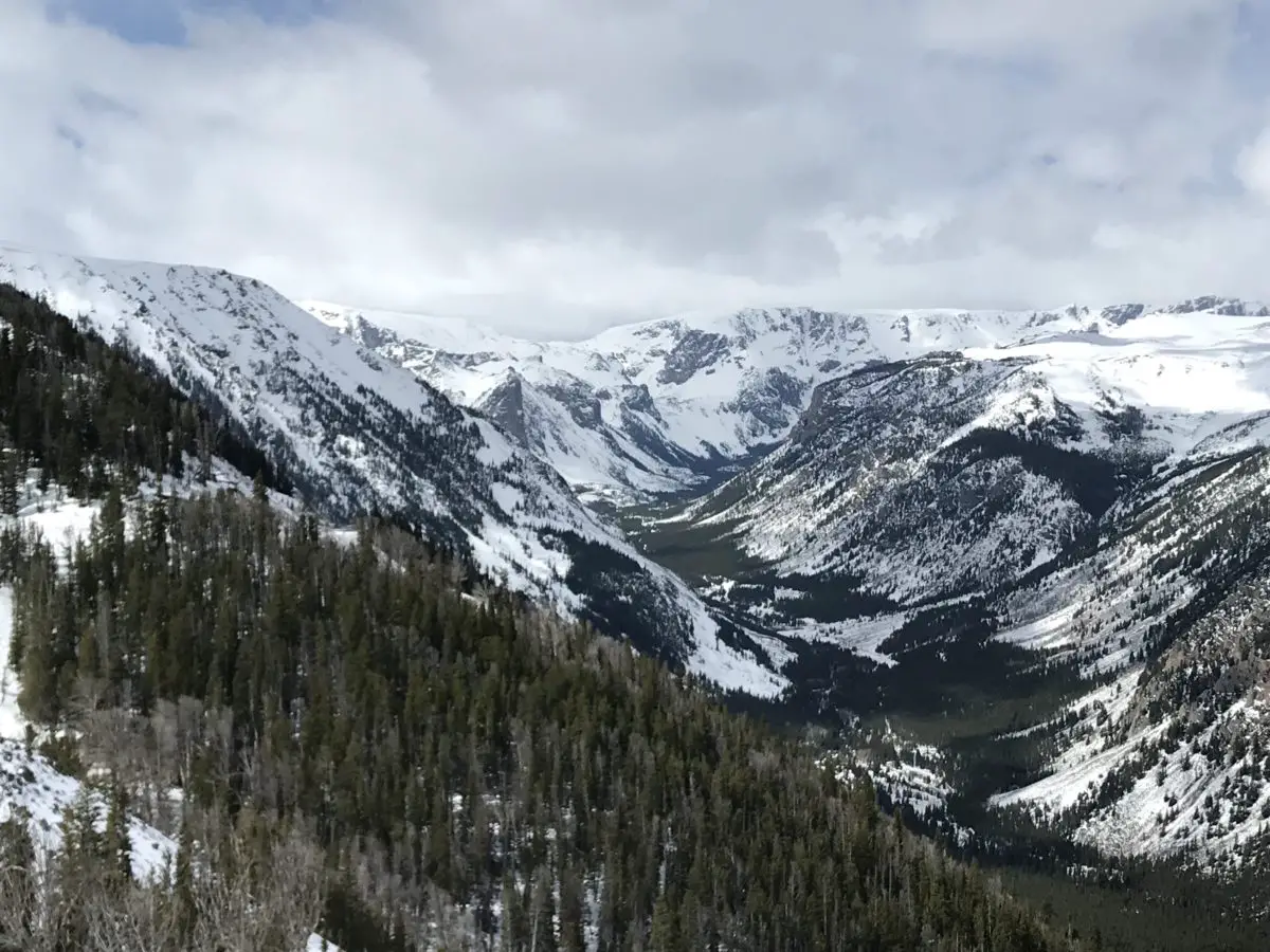
Although weather forecasts made it appear doubtful, we did get to drive the full extent of the road…on the Montana side.  We had to wait 1.5 hours for it to open up but got to enjoy views from one of the main lookout points while we waited.  When we heard whoops of delight from the skiers and snowboarders that were parked near us and saw the snowplows drive by, we knew we were headed to the summit!

Weather had been pretty wild in this part of the country that spring, and this area had received close to a foot of snow just a few days before the road opened. 

The Forest Service had gotten the Wyoming side of the route mostly open, save for the last few miles at the summit.  With the recent lousy weather though, this portion had drifted shut again. Fortunately, we have driven the entire route before (just not on Opening Weekend). 
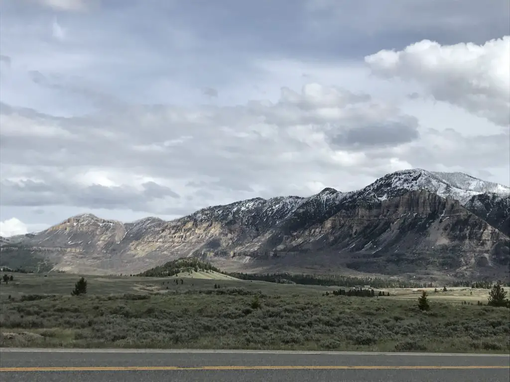
The weather didn’t seem much different from when we were there in July of 2016, there was just–a little–less snow in the summer.  There were still plenty of gloomy gray clouds, and the temperature was, maybe, only 1o degrees warmer. 😛
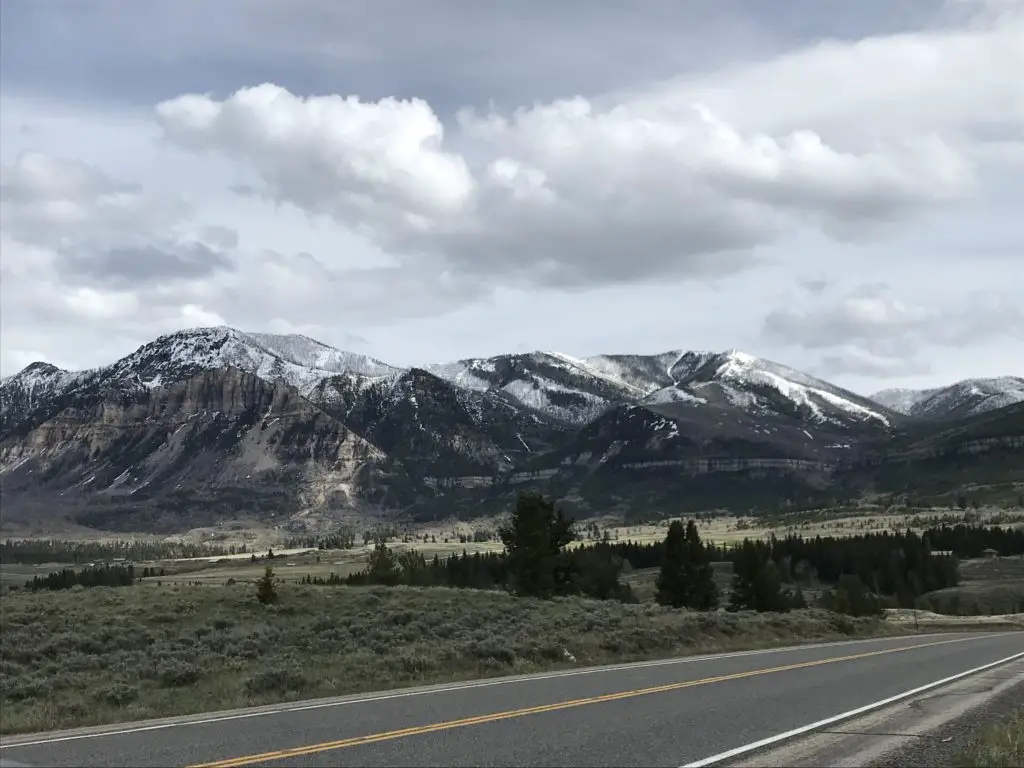
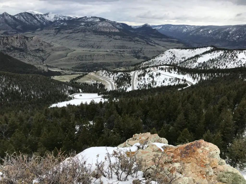
We found it to be almost disorienting near the summit.  The way the white snowfields melded with the pale, gray sky, it was hard to tell where the land ended and the sky began!

To check current conditions on this incredible stretch of road, you can check out these sites:  Montana DOT; Beartooth Highway in Wyoming.

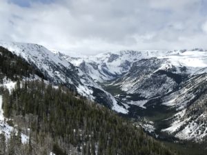
A view over a vista of snow-covered mountains and valleys under a cloudy sky

Because the road was closed, we had to embrace our motto from a previous road trip, and “Just Groove“, and boy, were we glad we did! 

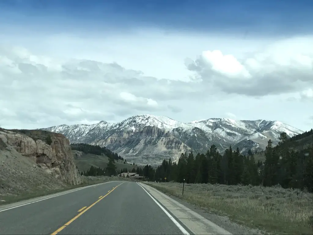
The alternate route we chose was Route 72, south of Belfry, Montana, into Wyoming, and may I say it is absolutely GORGEOUS!  It offers incredible views of the Absaroka Mountains as you drive along their length.

Click here for a video I made of our drive. We definitely saw large piles of snow but didn’t quite get to experience the “snow tunnels” I was hoping for.  I guess we’ll just have to go back and do this route again on another Opening Weekend!

Cooke City, Montana

When we reached Route 296, in Wyoming, we took that road (the Chief Joseph Highway) back to US 212 (the Beartooth Highway) on the Wyoming side, as that portion was open.  This takes you all the way to Cooke City/Silver Gate back in Montana, and eventually on to Yellowstone National Park. 

These two, tiny towns had been on our “must visit” list since our Yellowstone TripThe towns were teensy but enjoyable.  They definitely felt like the type of places you’d visit in the high mountains.  For those who may be interested, I should note that there are several campgrounds in this vicinity.  HOWEVER, they only allow hard-sided campers (no tents) due to regular bear activity.  Just something to be aware of. 😳

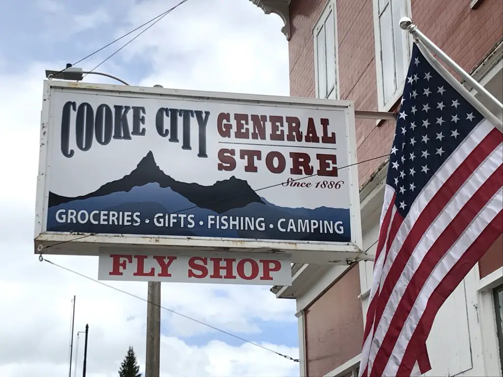
Store sign on a building near an American flag reads, "Cook City General Store, Groceries, Gifts, Fishing, Camping, Fly Shop"

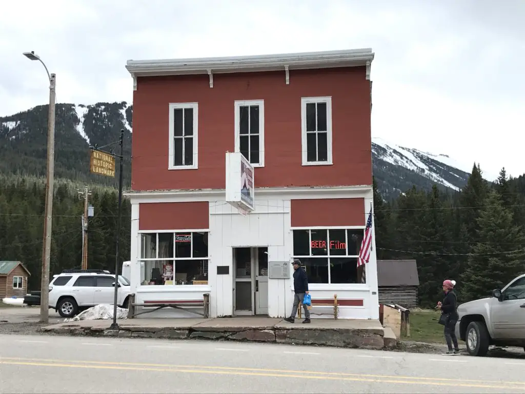
Storefront of an old, brick building on a city street, with some cars parked near it

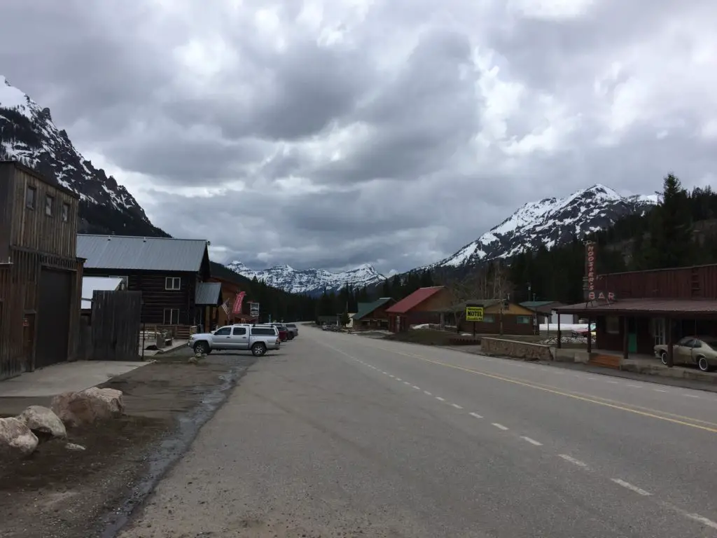
View down the street of a small town with small shops and cars lining both sides, under a cloudy sky

Drive the Chief Joseph Highway in Wyoming

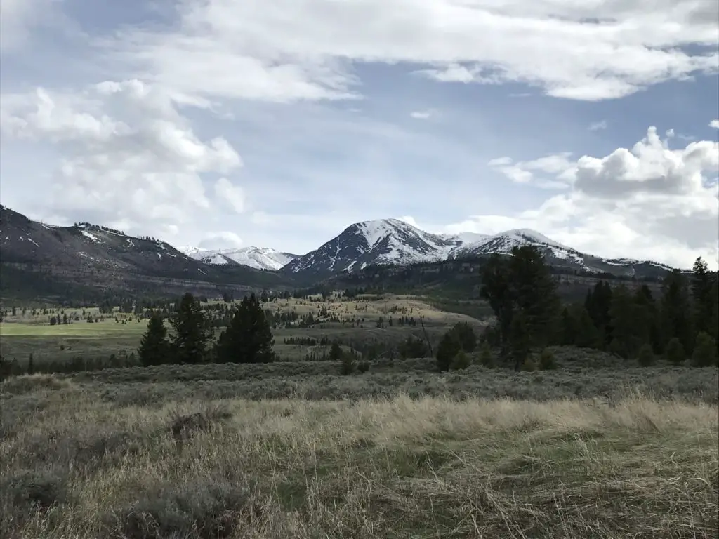
I can never get over how beautiful northeastern Wyoming is.  On our trip, everything was so uncharacteristically green!  This is an unusual sight for this normally dry area, but the early season and recent rain had the grass growing well! 

There were some gray clouds (though we enjoyed more sun than expected) and these, contrasted with the vibrant green of the new grass and the steely, dark gray mountains, with snow still capping their summits, made for quite the scenic view!  The somewhat dreary–yet picturesque–image made both of us think of Scotland (or what we imagine Scotland to look like, having never been there…YET!) 😮😉

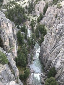
View from above into a rocky canyon with pine trees and a river far at the bottom
There’s a story that goes with this picture. Mr. Trekker had to take it from the bridge because I was too chicken to stand near the edge!

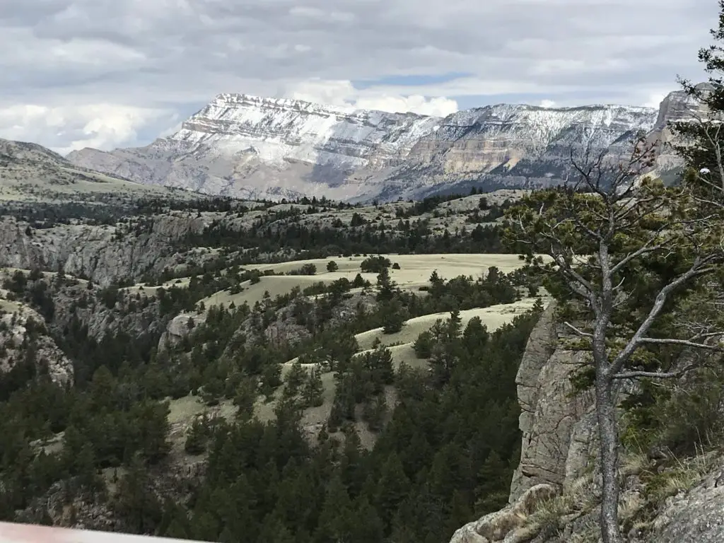
See below for more pictures of our drive.  As you can see, there was still some snow on the upper peaks:

Brown grass and pine tree-spotted meadow leads to snow-covered mountains in the distance Brown grass and pine tree-spotted meadow leads to snow-covered mountains, with the sun shinning on parts of them, in the distance Brown grass and pine tree-spotted meadow leads to snow-covered mountains, with the sun shinning on parts of them, in the distance A paved road with rocks, grass and pine trees on both sides leads to snow-covered mountains in the distance View overlooking a vista of a flatter pine tree and rock-covered area leading to snow-covered mountains in the distance View over a mountain vista from above. Pine trees and snow cover the lower elevations, brown grass covers the higher elevations that leads to tree and snow covered mountains in the distance.

Buffalo Bill Center of the West in Cody, Wyoming

We eventually made our way back down the Beartooth Highway and stayed in Cody, Wyoming Saturday night.  We’ve stayed there several times as a stopover, and each time we thought we should take the time to visit the Buffalo Bill Center of the West (but never got the chance).  Since this was a weekend of “checking things off the list”, we decided now was as good a time as any!
The museum is actually made up of five different areas.  We both enjoyed the Natural History portion the most.  This section comprises multiple levels, as though you were traversing down a mountain, from the tundra ecosystem near the summit to the prairie/grassland found far below. 

We also enjoyed the firearms museum, that showcased items from around the globe and from a wide range of battles throughout history.  There was also a section regarding the life of Buffalo Bill Cody and his Wild West Show that was quite interesting.

Ten Sleep Canyon, Bighorn Mountains

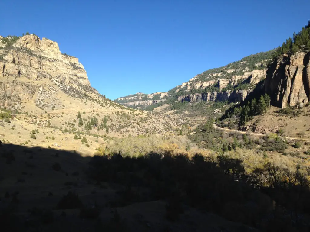
We took one of our favorite routes home through the Big Horns, US 16 through Ten Sleep Canyon, in Wyoming.  This is, absolutely, one of the most beautiful canyons I have ever seen!

They call this the most scenic route through the Big Horns and I believe it!  Route 14 and 14a are pretty in their own right (and you’re much more likely to see moose on one of these roads) but the southern route through the canyon is one that shouldn’t be missed! 

As you’re driving into the canyon from the west, you have the Absaroka Range in your rearview mirror while the Big Horns loom ever larger in front of you.  This area is quite dry and barren, as it’s in the rain shadow of the Absarokas, adding to its rugged beauty.

I know I’ve mentioned it before, but I can’t get enough of the ruggedness that makes up the Wyoming countryside.  The drab yellow of the badlands that contrasts–this time of year–against the almost florescent, green grass of Spring in the foreground, and the imposing, dark mountains in the background (with their bright white caps).  This area is pretty all the time, but especially so this time of year before the hot summer conditions have baked it dry.

This route is also called the Cloud Peak Skyway Scenic Byway, as it is the main road that runs nearest to Cloud Peak, the tallest summit in the Big Horns (though you can’t actually see the summit from the road as it’s in the middle of a Wilderness Area). 

Click here for a video I made of a Labor Day Weekend drive through the canyon.

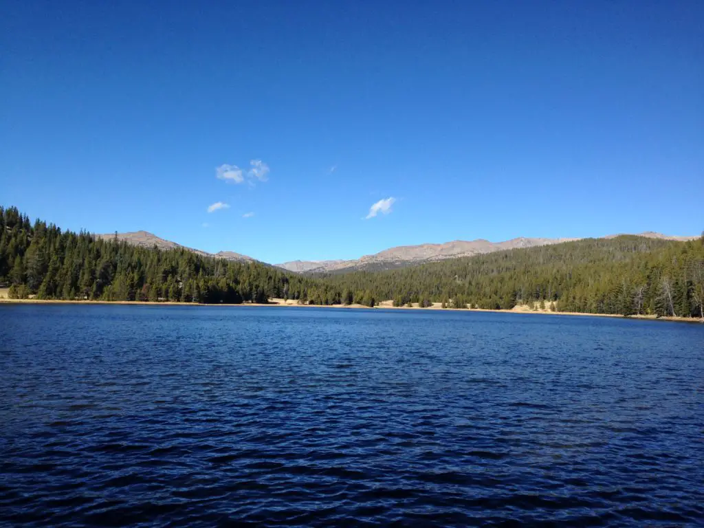
View up a brown rock canyon dotted with trees, all under a clear, blue sky View across a blue lake that is surrounded with pine trees with rocky mountains in the background, all under a clear, blue sky

This route is also a beautiful drive down the east side of the Big Horns into Buffalo, WY.  If you’re there at the right time, you may see yaks grazing on the steep hillside near the side of the road! 😮

I recommend everyone check out these drives if they have a chance, as they are all quite beautiful.  There are LOTS of tiny lakes that make for great pictures (not to mention plenty of marmots posing for photos in the higher elevations!)  Be prepared though, winter conditions can occur at any time in that area (we had thunder and slushy snow falling on us in July!) 😮 

Go tour these highways, you’ll be glad you did! 

Longmire Store, Buffalo, Wyoming

Finally, we were able to cap off our weekend in the best way!  Each time we visit Buffalo, I have hoped to stop at the Longmire store, named after the well-known book and Netflix series.  As we learned, it used to ONLY be open during Longmire Days each year in July, as it was just a satellite store.  Well, it is now open all season and we FINALLY got to partake of its wares!  See, persistence pays off. 😁

Have you visited the Beartooth Highway on Opening Weekend?  Tell me about it in the comments! 


Did you enjoy this post?  Pin it!

3 pictures: 1) View from above into a rocky canyon with pine trees and a river far at the bottom; 2) View overlooking a vista of a flatter pine tree and rock-covered area leading to snow-covered mountains in the distance; 3) A view over a vista of snow-covered mountains under a cloudy sky. Pin reads, "Opening Weekend on Beartooth Pass"


Like what you read here today?  Please feel free to leave a comment, like or share this post!  Add your email at the bottom of the page, or the sidebar to the right, to be notified when a new post is published.  By signing up for the email list, you will also receive a free copy of the Tranquil Trekker’s Top 10 Tips of Trekking Do’s and Don’ts!

You can also follow the blog on social media by clicking the links below!

Facebook

Twitter

Instagram

Pinterest

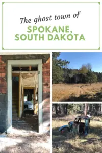
Spokane, South Dakota (ghost town)

I discuss our discovery of the ghost town of Spokane, SD near Custer State Park.

There is a really cool, hidden site in the central Black Hills, the ghost town of Spokane, South Dakota!  I was surprised how long we lived in the Black Hills before we heard about this location! 😳 (This is likely due to it not being well-publicized, even though it’s very near a major tourist attraction in the local area…)

The site was pretty amazing (it didn’t hurt that the day we visited was GORGEOUS!)  I’d encourage you to research the town’s history as it’s pretty interesting.  Spokane was an actual town at one point (rather than just a simple mining camp) complete with a schoolhouse and a general store.

While the majority of the buildings have been destroyed by fire and Mother Nature, we think we found the foundation of the old schoolhouse.  The only structures still completely standing were a house with some outlying buildings.  There is also a root cellar in the main valley and the mine manager’s home still sits on a hill, overlooking the former town that was nestled in the meadow below (or it would overlook the town if there weren’t trees in the way, now. 😉) 

An old house in the woods, surrounded by pine trees
The mine manager’s house

Hazards in a Ghost Town

There are always numerous hazards to be VERY cautious of at these sites. Among a few other foundations, metal remnants, and ancient mining equipment, there was also an old well that had been sealed with a cement cover, but this has since been dislodged.  While you could see the bottom, a fall of 20 – 50 feet could be deadly, and either way, the rescue operation would be difficult for all involved. (This is another time it’s important to remember you can NOT rely on cell service when in the mountains).  

*Let’s talk safety for a bit, shall we?  When you visit ruins of old towns, mines, natural caves, etc. safety should be your #1 priority (respect for the site should be a VERY close #2).  These buildings can be dangerous. The wood is rotting, most are in the process of falling down.  Many have basements/root cellars (that you may not even be aware of).  If you fall through the wood into these, you could be seriously injured.  

Many of these buildings are also havens for rattlesnakes and other critters who may not appreciate you barging in (a mountain lion could be using a cool, abandoned root cellar as a place to nap.)  

Old mines can collapse or cave-ins–even in natural caves–can occur at any time and with little to no warning.  I cringe whenever I see pictures of people venturing into abandoned mines. 🤦‍♀️  So, adventure at your own risk, but, the Trekkers NEVER encourage people to actually venture into any of these structures. They can be enjoyed perfectly well and safely from outside.  (You should be watchful even in the outside areas around these old sites.  You never know when old holes, sharp metal pieces, or even disgruntled snakes may be camouflaged by the tall grass that often surround the structures.)

A hole a foot or more deep sits in the ground, lined with thin, regular rocks placed on top of each other. The hole is overgrown with grass and weeds on the bottom and the sides.
This hole in the ground appeared to be constructed, not sure if it was an old well, or what.  This is what I’m talking about with safety, though.  This hole was in the middle of what used to be the yard, without a cover or barrier around it.

Unique sites in Spokane, South Dakota

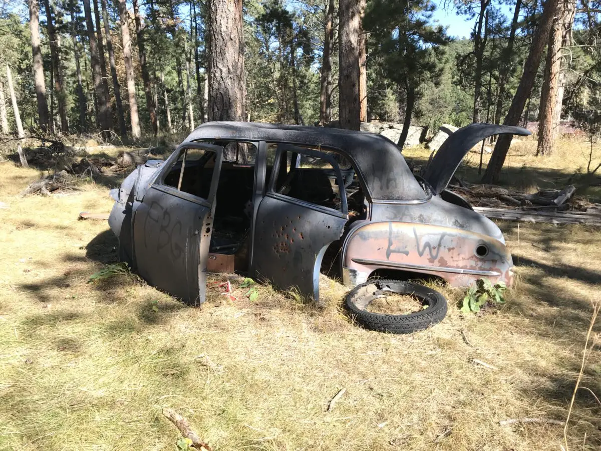
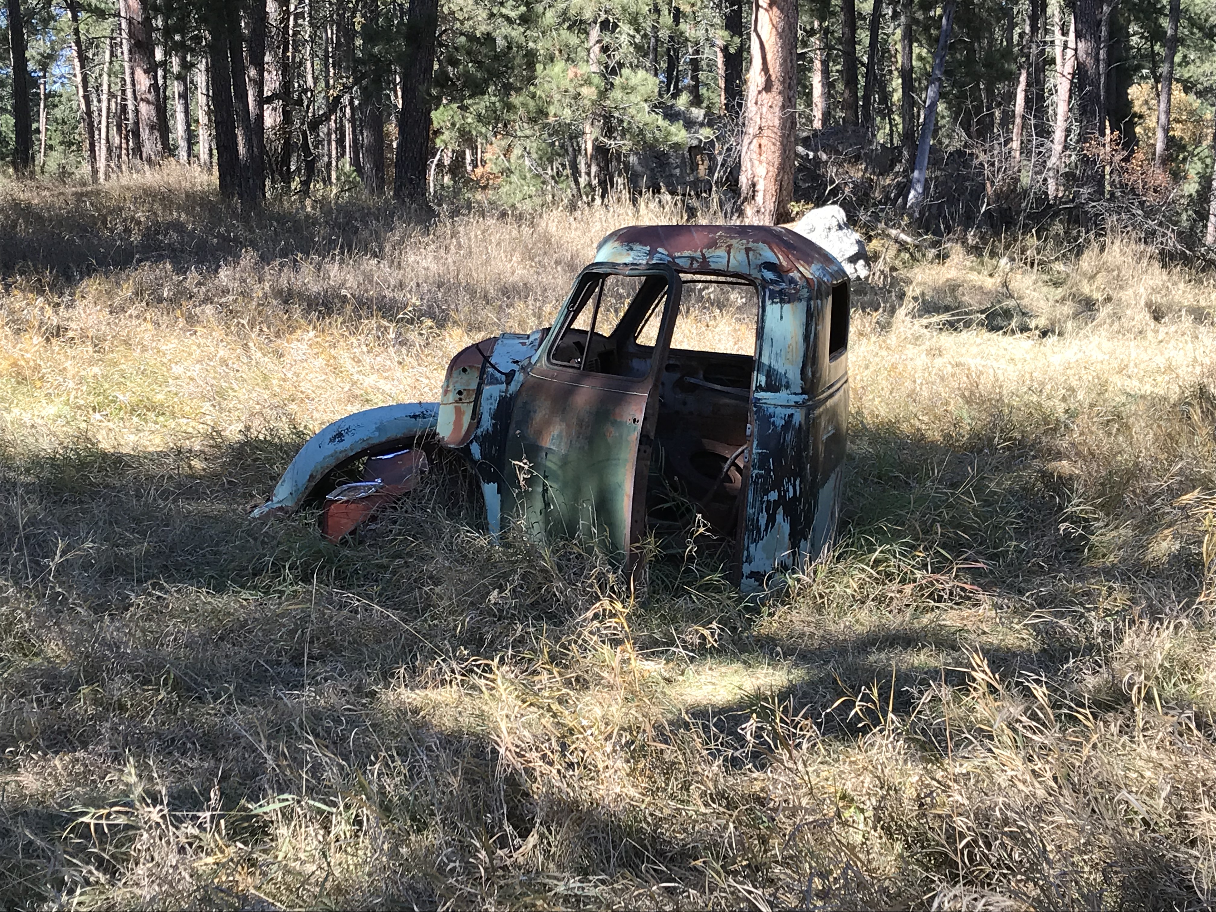
One unique aspect of this ghost town (at least compared to others the Trekkers have visited) is the presence of old cars!  Most of the towns we’ve toured had heydays in the late 1800s when horse and cart were the primary source of travel.  This town hit it’s prime in the 1920s (and wasn’t abandoned until the 1940s) so the unusual site of motor vehicles and evidence of electrical wiring on the buildings felt out of place.

The cab of a rusted, old truck with no windows sits on the ground, in a meadow, surrounded by trees.
I LOVE this old truck!

A rusted, old car with no windows or tires, and the hood and trunk stuck open sits in some overgrown grass on the outskirts of the woods.

Two rusted cars with no tires or windows with graffiti on them sit in an open spot in the woods.

Where is the Spokane ghost town?

In order to help preserve the integrity of the site, I’m not going to give the exact directions to this location–other than what is already available with a simple Google search.  I will give a few hints though:

      • It’s near Custer State Park (VERY, near).  You can reach the site using Playhouse Road and/or Iron Mountain Road.
      • There are two entrances to the site.  The main entrance, described in Google, requires a half-mile (or so) walk up a steep, rocky, abandoned forest road to reach the valley.  We–somewhat accidentally–stumbled on the back entrance with an easy walk of only about 1/8th of a mile to reach the meadow.
      • The rest of the discovery is up to you (as I said, Google is your friend!)Author’s Note:  In recent years the site has become more popular. Unfortunately, that means it’s also been vandalized–it’s too bad there are a few jerks out there who insist on ruining the fun for everyone–Some barriers have been erected in recent years to help keep people away from the buildings to hopefully help mitigate the damage. If you want clearer instructions on how to reach the site, you may contact me via social media as indicated below, or by using my contact form, and I may be able to help you a little more. (I won’t give precise instructions–that ruins the fun!–but I can give a few more helpful hints. 😇) 

The mood this site created was pretty cool.  The sun-dappled trees and forest floor make shadows flit on the ruins.  You can almost smell the musky scent of horse, and hear the horses, wagons–and cars?! 😳–that trundled down the rutted, dirt road, as the wind rattles the dry leaves of the aspen trees that border the ramshackle houses.  

While visiting the ghost town, why not check out Iron Mountain Road found nearby, as well?

This location would also make for a creepy adventure during the Halloween season! 👻  The site was pretty haunting, between the dilapidated old cars and buildings, you got a sense that this is what a post-apocalyptic society would look like (I may have been watching too much Walking Dead lately.) 😜

Below are some more pics of our adventure (thanks, as usual, to Mr. Trekker for many of these)!

An old, two-story home that is broken-down to the frame sits amongst some trees in a meadow.
To be clear, the house is leaning, not the photographer!  😉

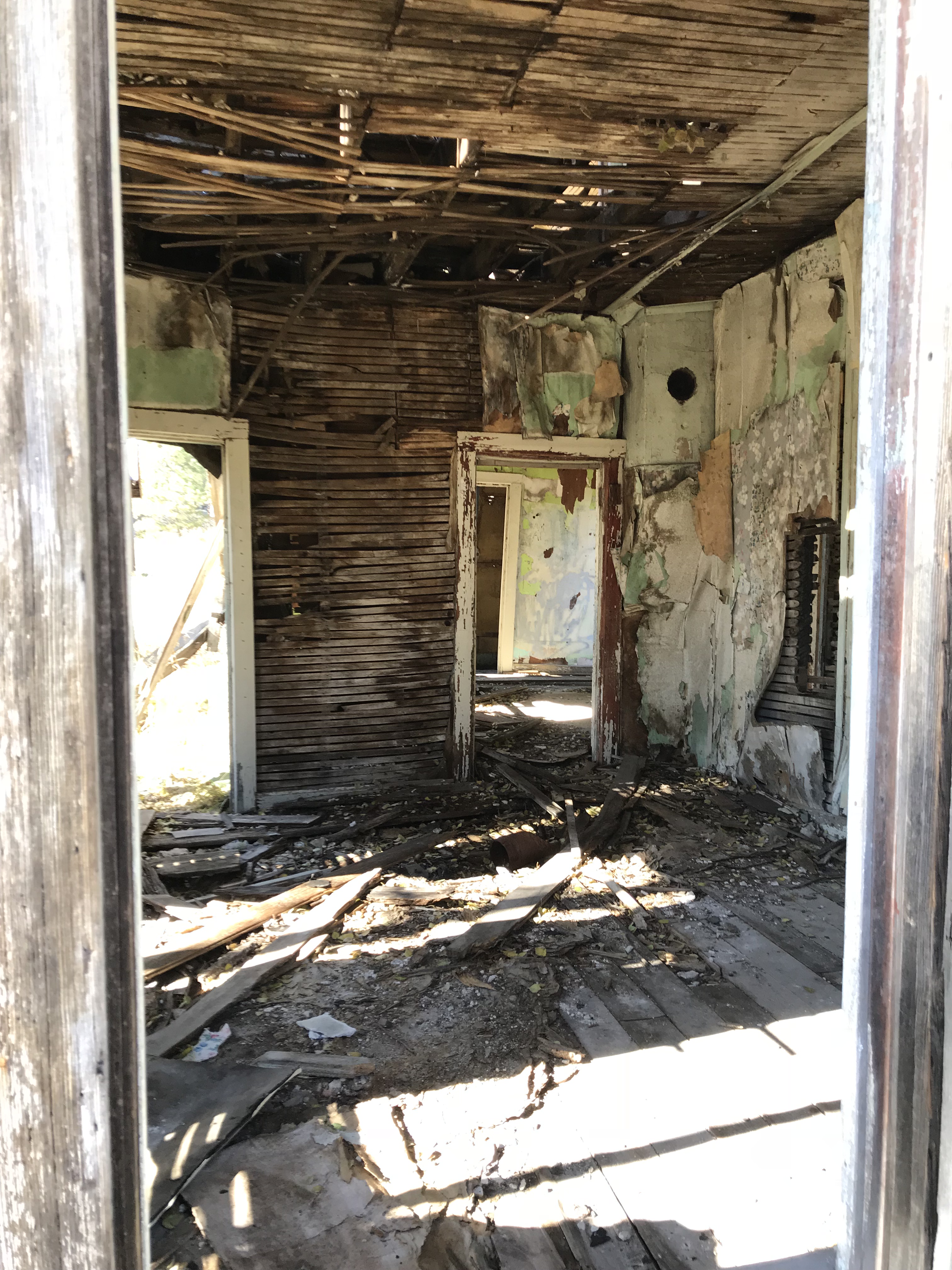
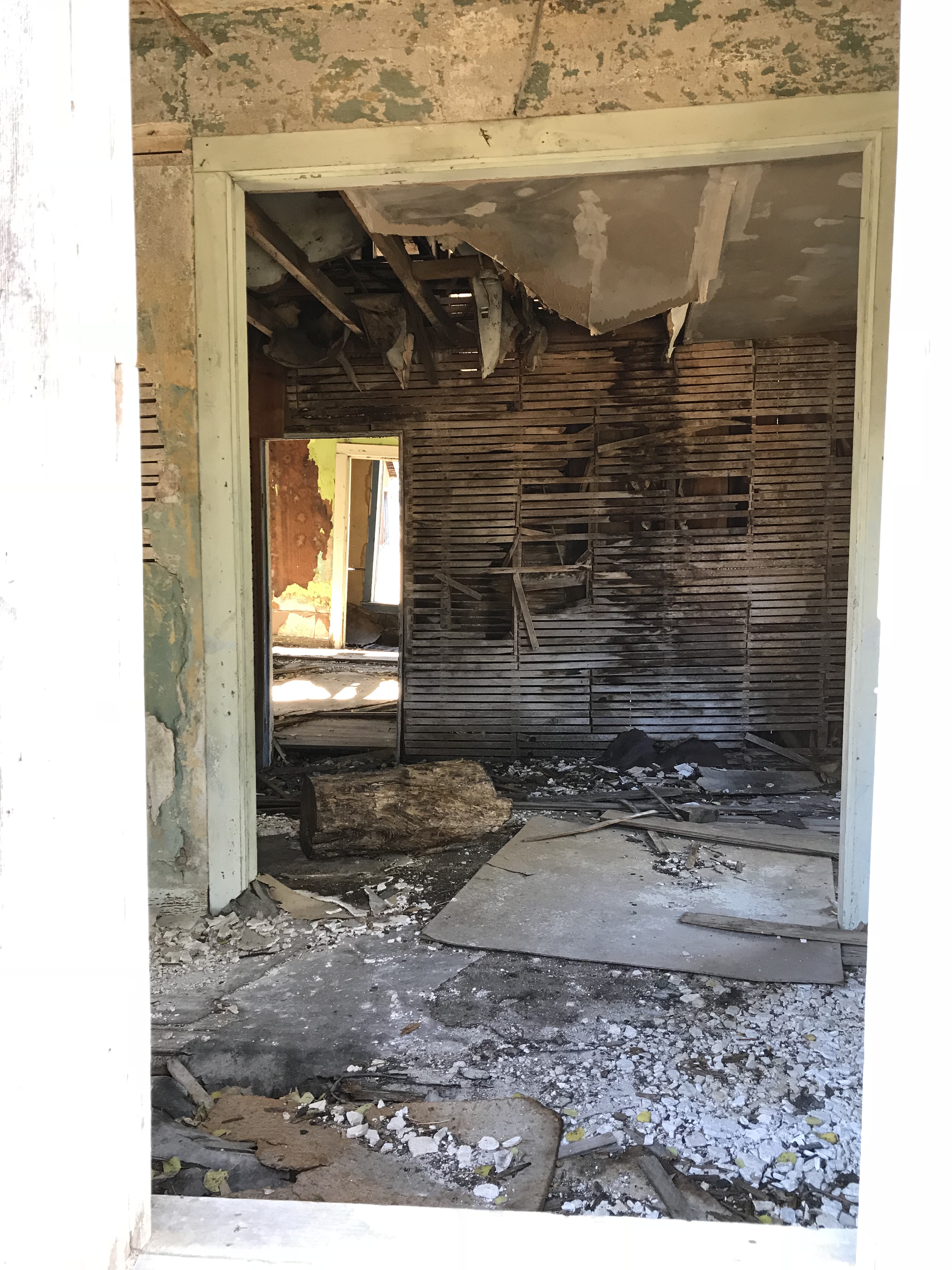
Inside the room of an old house. No doors or windows are left and the frame is visible on the floor/walls/ceiling
Inside the room of an old house. No doors or windows are left and the frame is visible on the floor/walls/ceiling. The floor is messy, covered in plaster and the ceiling sags.

An old, metal container, open in the middle with an agitator sticking out of the open portion
Dishwasher or a washing machine?

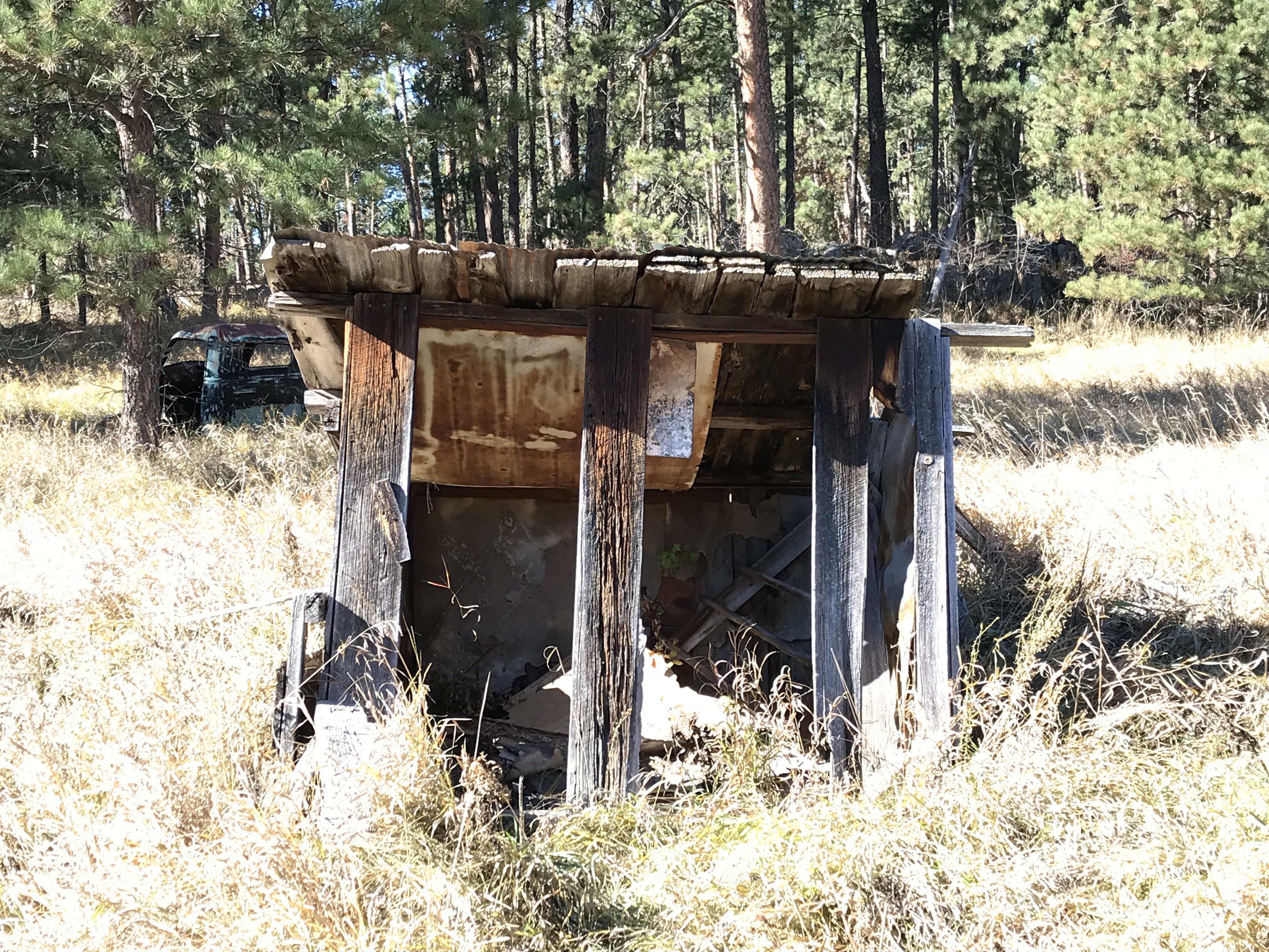
Old metal barn missing windows and doors sits in a grassy meadowOld shed missing windows and doors sits in a grassy meadow

Old wood pallets lay in overgrown grass amongst the trees

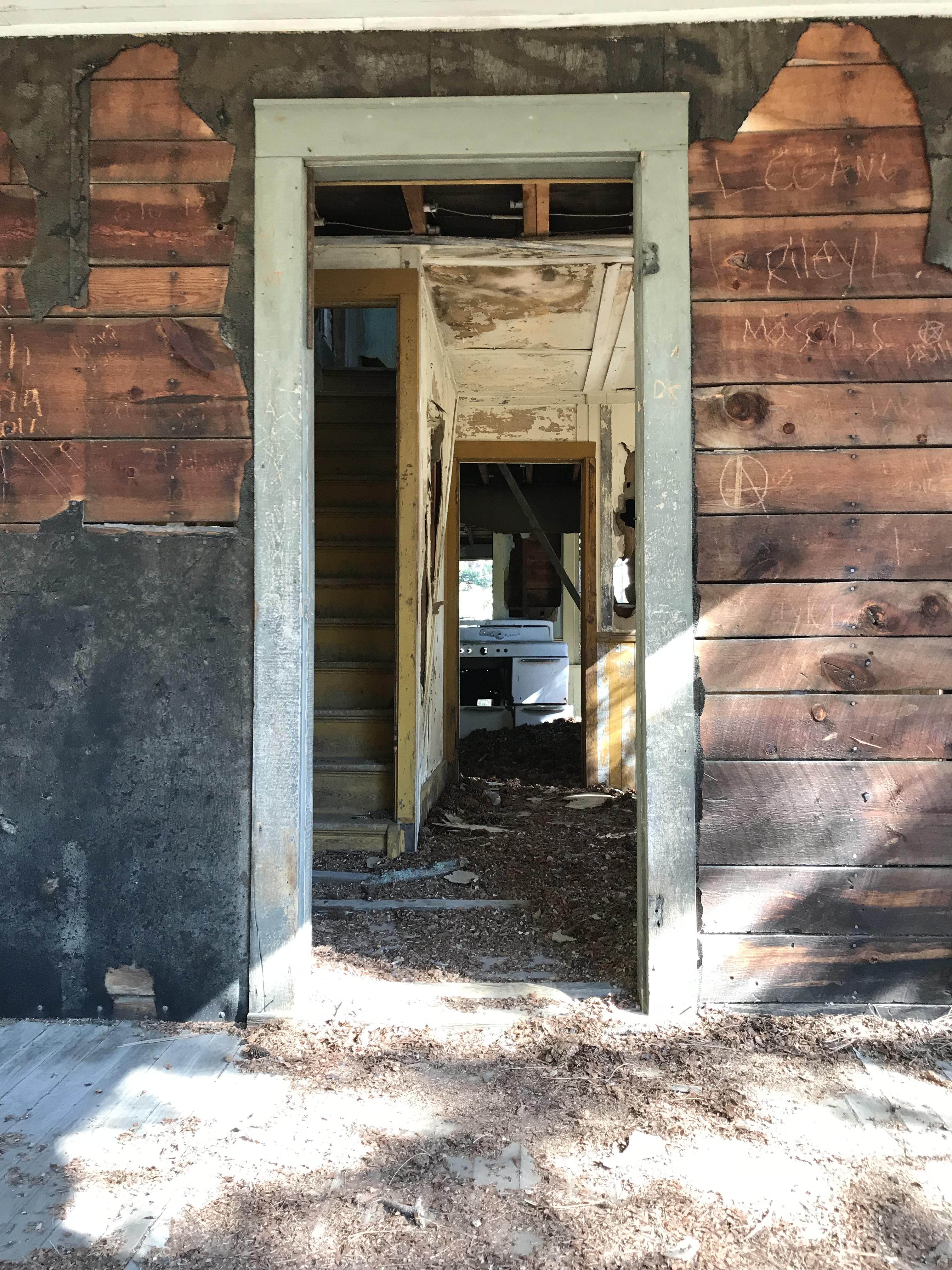
Looking through the doorway from the porch, into an old house. No doors are left and the frame is visible on the floor/walls/ceiling. Stairs lead to the second floor and an old stove is in the kitchen in a room far in back
I’m loving the old stove!  (FYI, those are YEARS of pine cones, left by squirrels, layering the floor in front of it!) 😳

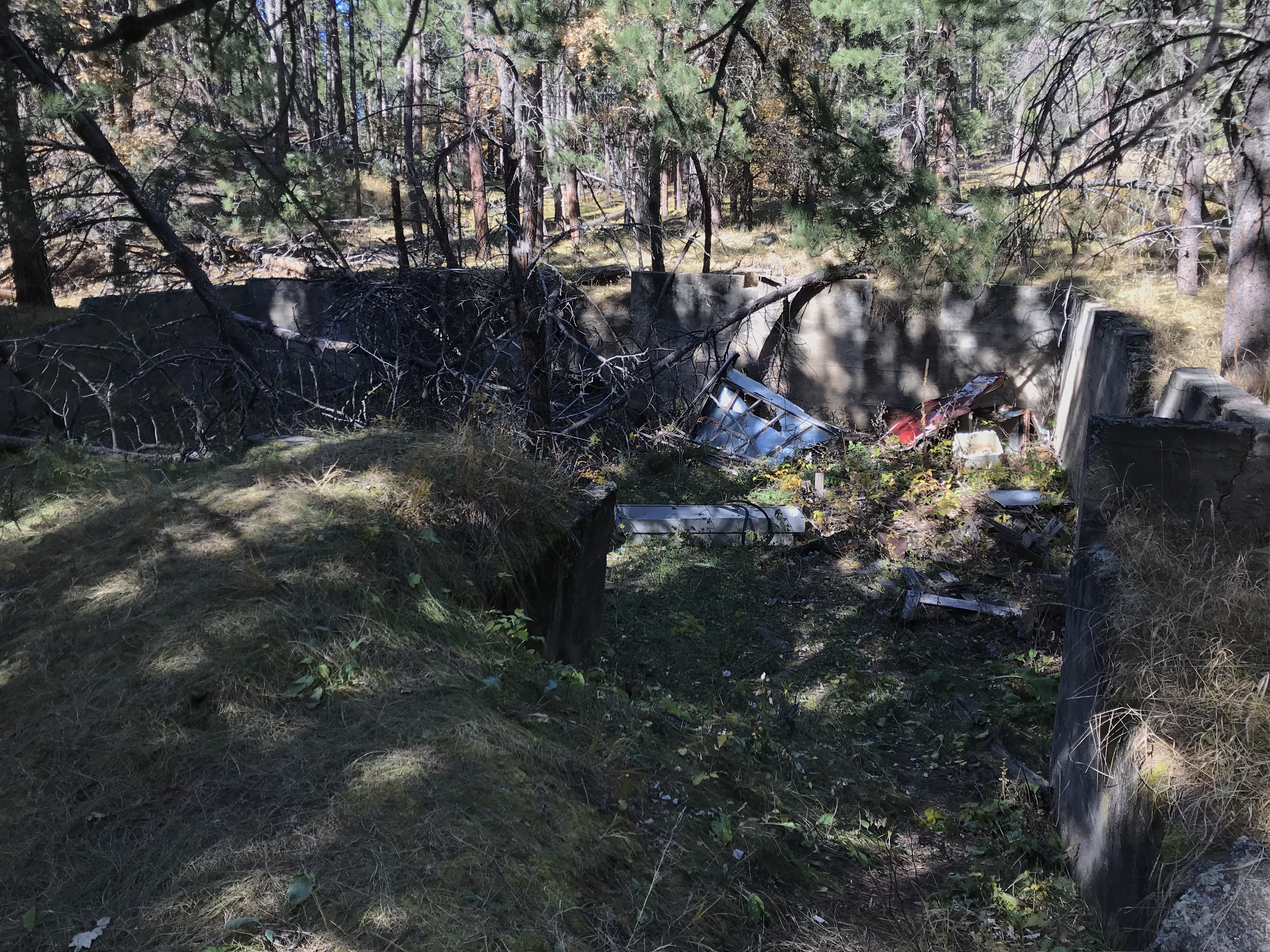
An old, cement foundation now filled with grass, trees and trash


Have you ever visited this unique place?  Tell me about it in the comments!


Did you enjoy this post?  Pin it!

Three pictures: 1) Looking through the doorway from the porch, into an old house. No doors are left and the frame is visible on the floor/walls/ceiling. Stairs lead to the second floor and an old stove is in the kitchen in a room far in back; 2) The cab of a rusted, old truck with no windows sits on the ground, in a meadow, surrounded by trees; 3) dirt lane traverses a meadow surrounded by trees. Pin reads "The Ghost Town of Spokane South Dakota"


Like what you read here today?  Please feel free to leave a comment, like or share this post!  Add your email at the bottom of the page, or the sidebar to the right, to be notified when a new post is published.  By signing up for the email list, you will also receive a free copy of the Tranquil Trekker’s Top 10 Tips of Trekking Do’s and Don’ts!

You can also follow the blog on social media by clicking the links below!

Facebook

Twitter

Instagram

Pinterest

7 “Must-See” Colorado Ghost Towns

I review several ghost towns we toured around the Colorado High Country as well as our drive up Independence Pass.


The Trekkers LOVE visiting ghost towns! We try to include them whenever possible on our trips.  During our 2018 road trip, we got to check out several awesome ghost towns in Colorado.  

Ghost towns give you a true, visual understanding of how people lived “back in the day”.  I’m a very visual person so this helps me fully appreciate what the lives of the inhabitants of these towns must have been like.  I prefer the towns that are restored, with at least several buildings remaining that you can view.  Sometimes, however, the places that are comprised mostly of ruins allow you to use your own imagination of how they must have appeared in their heyday.

Click here for a list of ALL the ghost towns the Trekker’s have visited around the country!

Below is a list of seven ghost towns we visited in central and western Colorado…

Teller City Ghost Town: 

This was the first ghost town we visited and the one that required the most effort to access.  The townsite is near State Forest State Park, in far northern Colorado, around nine miles south of Gould, on Route 740 (Baker Pass Road).  You reach it by driving on a, somewhat rough, 4WD shelf road. (The Guide to Colorado Backroads† book that I mentioned in a previous post, rates this road as “easy”.  I would rate it as “moderate”.  A high clearance, 4WD vehicle should be all you’d need to access this site in good conditions).  

We didn’t actually complete the 4×4 road all the way to Baker Pass, though we spoke with a local who said it was worth the drive.  Alas, daylight was waning (and the mosquitoes were starting to bite!) 😝

 The way was fairly well-marked and obvious, but be watchful.  The road branched off several times and the correct route was only marked with orange, snowmobile trail markers (this is a snowmachine trail in the winter months).  

An old cabin sits amongst small trees in a grassy, open space. Tree-covered mountains are in the background.

An old, abandoned cabin without windows or a door

One plus with this site is that there’s a designated parking area and then you hike a Nature Trail loop to view the remains of the town.  Not much is left, but you could almost hear the voices of the patrons visiting the busy shops, and smell the dust kicked up by the wagons as they rolled along–what used to be–a bustling Main Street.  

At various places along the trail, markers describe the history of that home or business.  At one of the stops, the words of a young girl who came into town one winter night, via the pass, were noted.  Her description of the twinkling town lights flickering through the evening shadows was incredible.  

Below are a few more pics of the ruins at Teller City (as usual, thanks to Mr. Trekker for several of these):

The ruins of an old cabin sits amongst small trees in an open space. Tree-covered mountains are in the background.
The ruined walls of an old cabin sit in an open space. No roof or door remains. Tree-covered mountains are in the background.

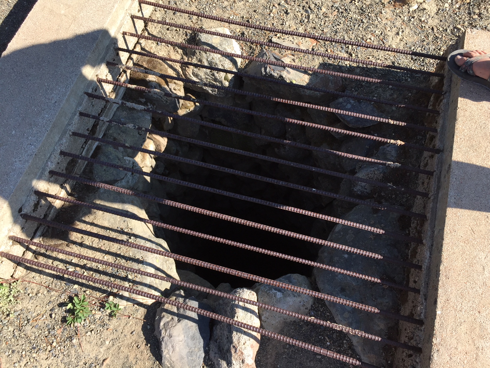
A large, dark hole in the ground is circled by rocks and covered by a wrought-iron cage
An old well pit

Coalmont, Colorado: 

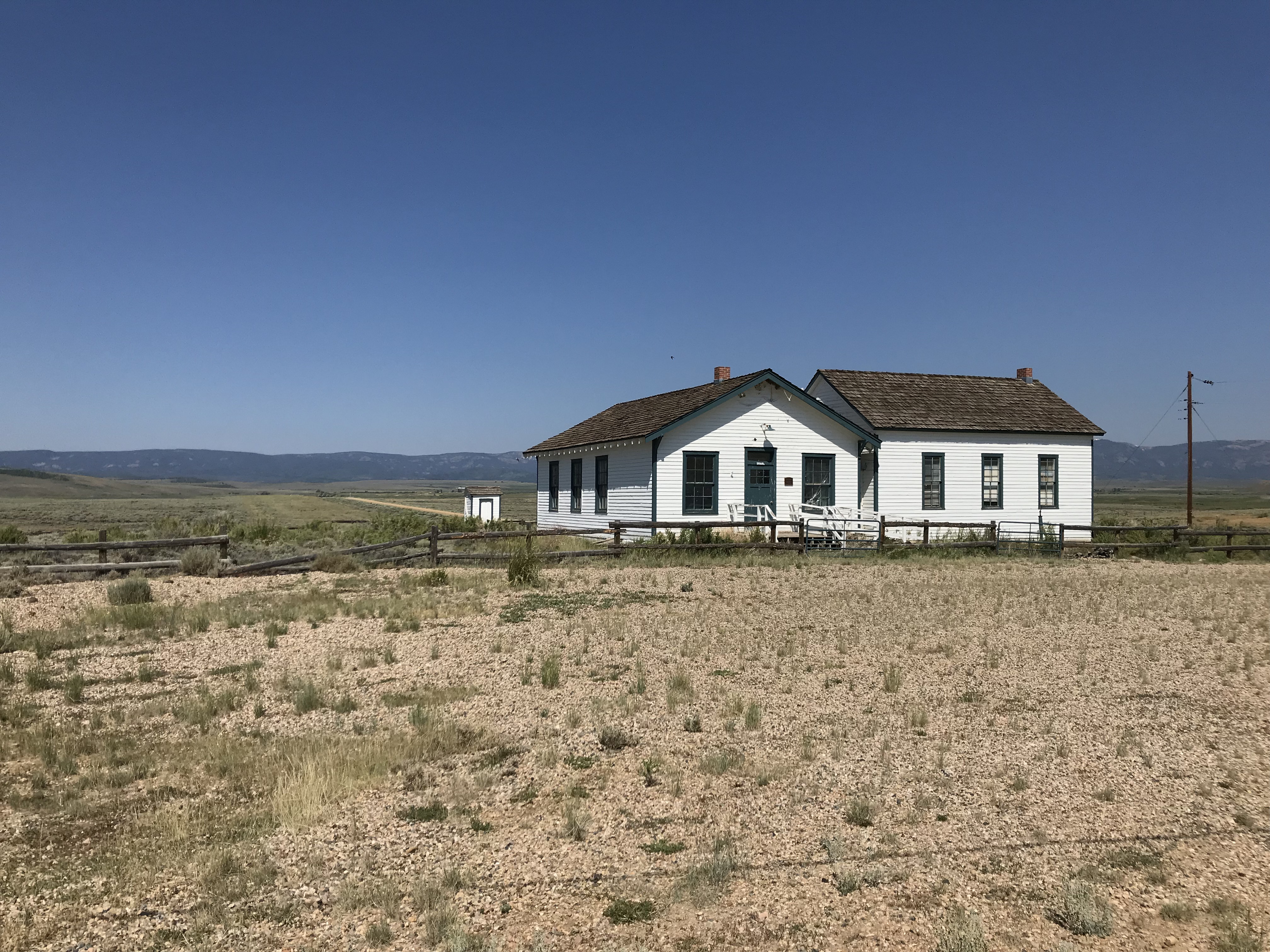
After leaving State Forest State Park, we visited Coalmont on our way to the Flattop Wilderness area.  Only the schoolhouse remains of this dusty hamlet, but from what we could see through the grime-spattered window, it appears to have been restored inside.  It would have been neat to be able to view it in more detail! 

The townsite is located off of Route 14, southwest of Walden, Colorado and can be reached via either Route 24 or Route 26 (they form a half-moon-shaped loop here).  The site is directly off of Route 26.

Old, white-boarded schoolhouse building sits in an arid landscape. Dark mountains are seen far in the background

Remains of an old ranch at Grand Mesa National Forest:

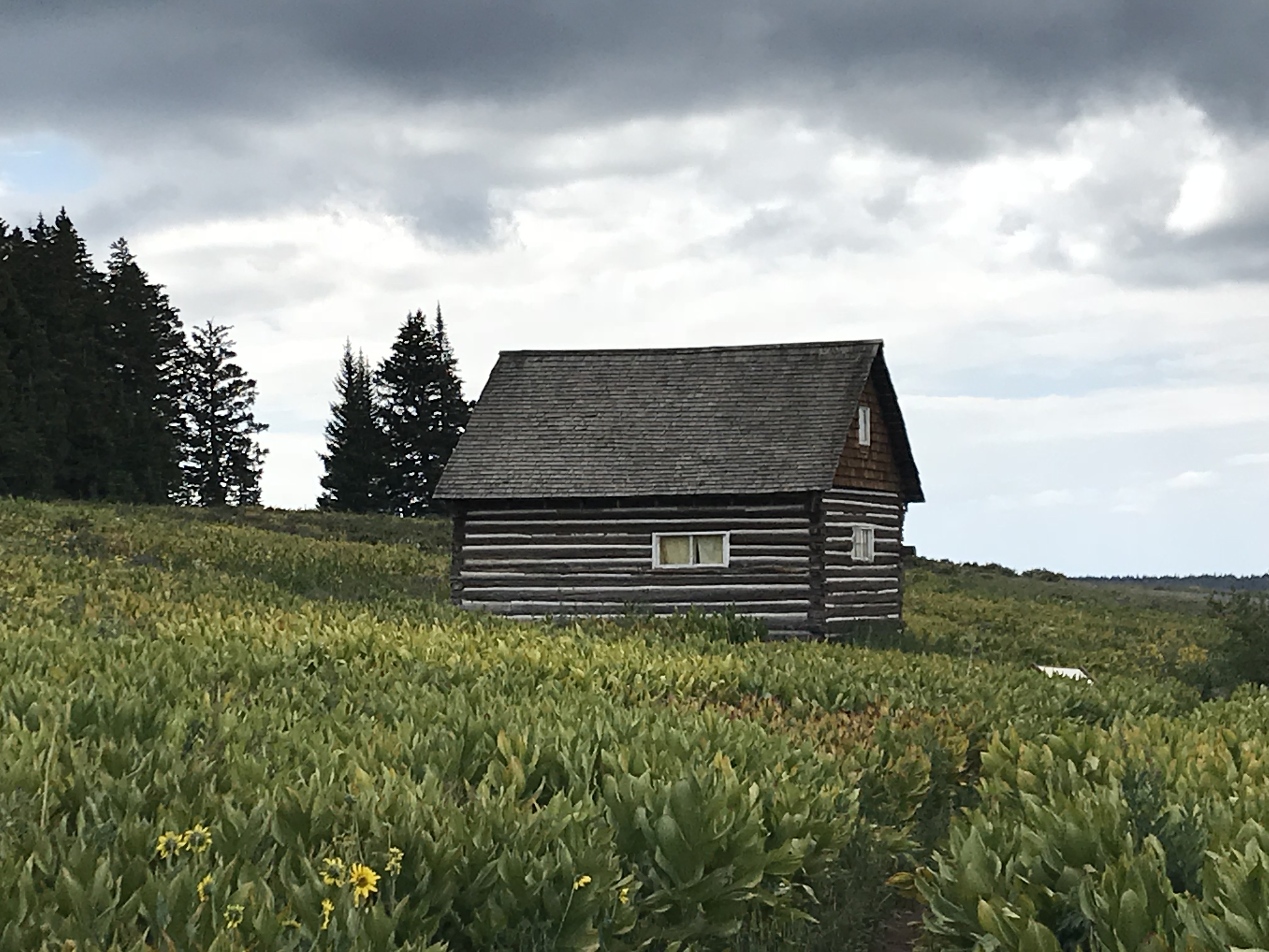
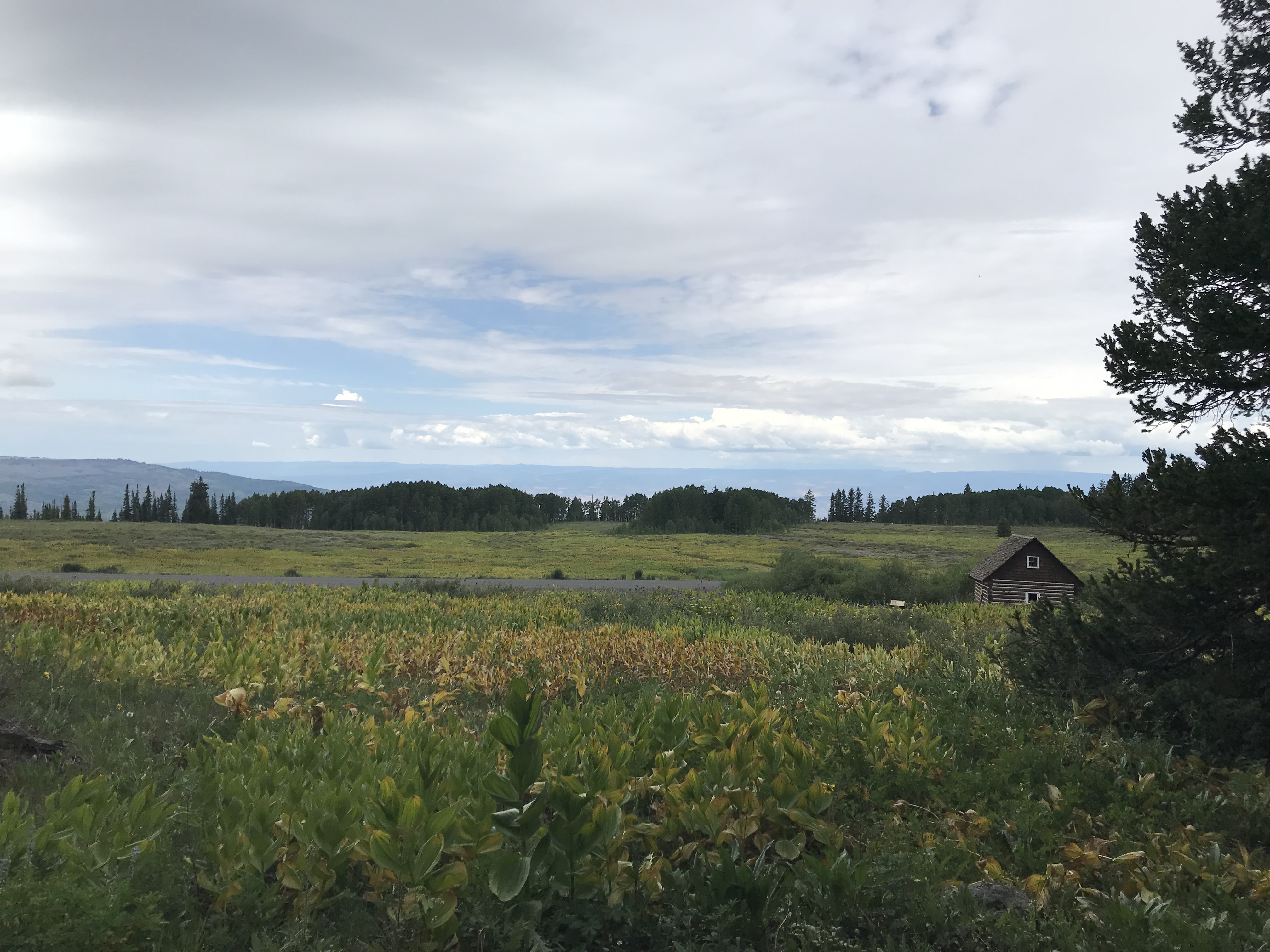
This site is located on top of the mesa, off the Land’s End Road.  It is the remains of a ranch that operated in this area long ago. Several cabins, one of which you can walk inside, and an old livestock corral, have been restored.  They can be viewed on a Nature Trail loop (it is part of a cross-country ski trail in the snowy months).  

A two-story cabin sits amongst tall, green grasses. It is a grey, cloudy day

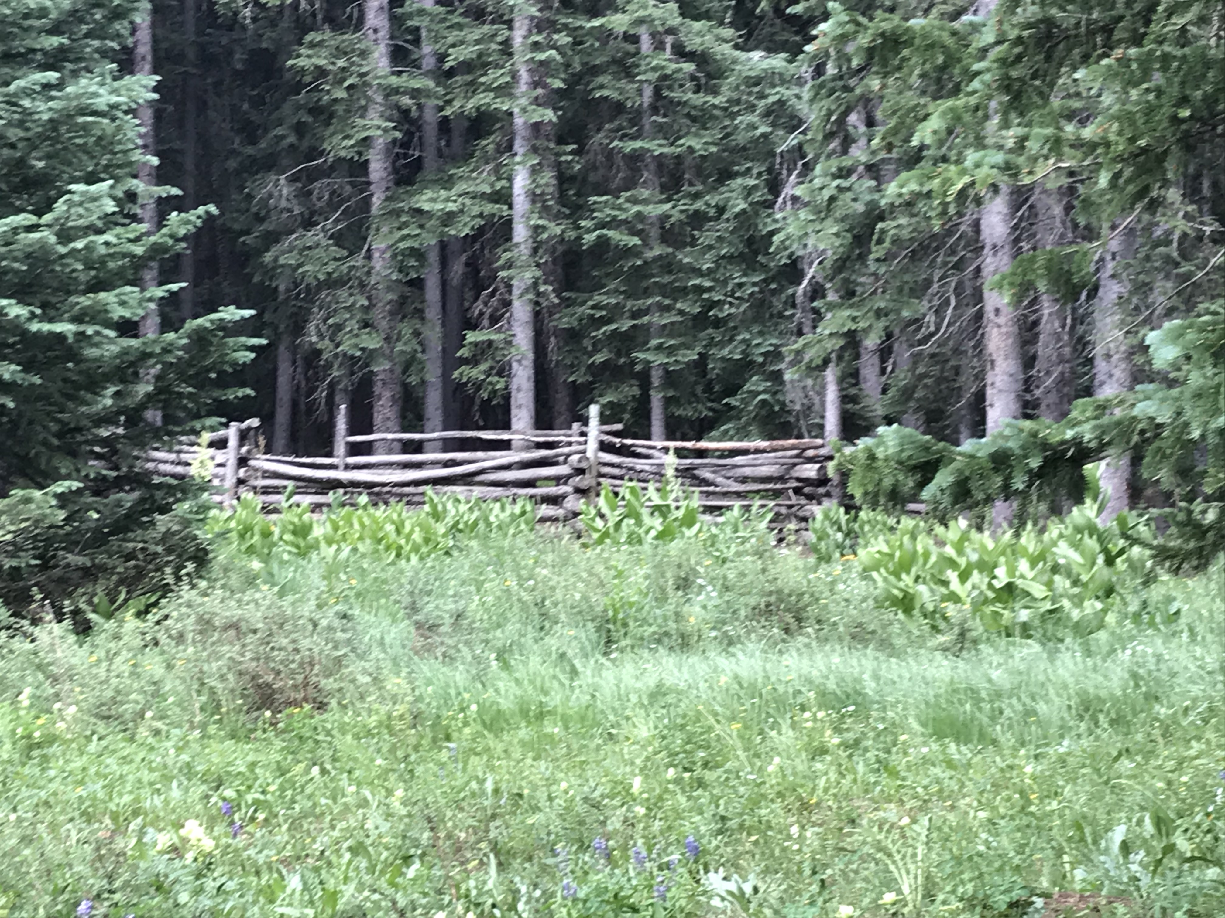
An old, wooden fence-surround sits in a grassy, open space just outside a deep woods surrounded by tall pine trees
The old corral

Yellow wildflowers in a tall, grassy meadow. An old cabin can be seen down the hill

Pitkin Ghost Town: 

This “living” ghost town is located about 27 miles east of Gunnison Colorado.  Take US 50, east, from Gunnison, then turn left onto Route 76 in Parlin.  

As an aside, we enjoyed several good meals in Gunnison.  We had a wonderful breakfast at the W. Café, and, I can attest that the High Alpine Brewing Company makes great pizza!

Old, freshly-painted, one-story building sits on a plot in town. A statue of a prospector sits out front. The sign over the door reads, "Pitkin Assay Office"

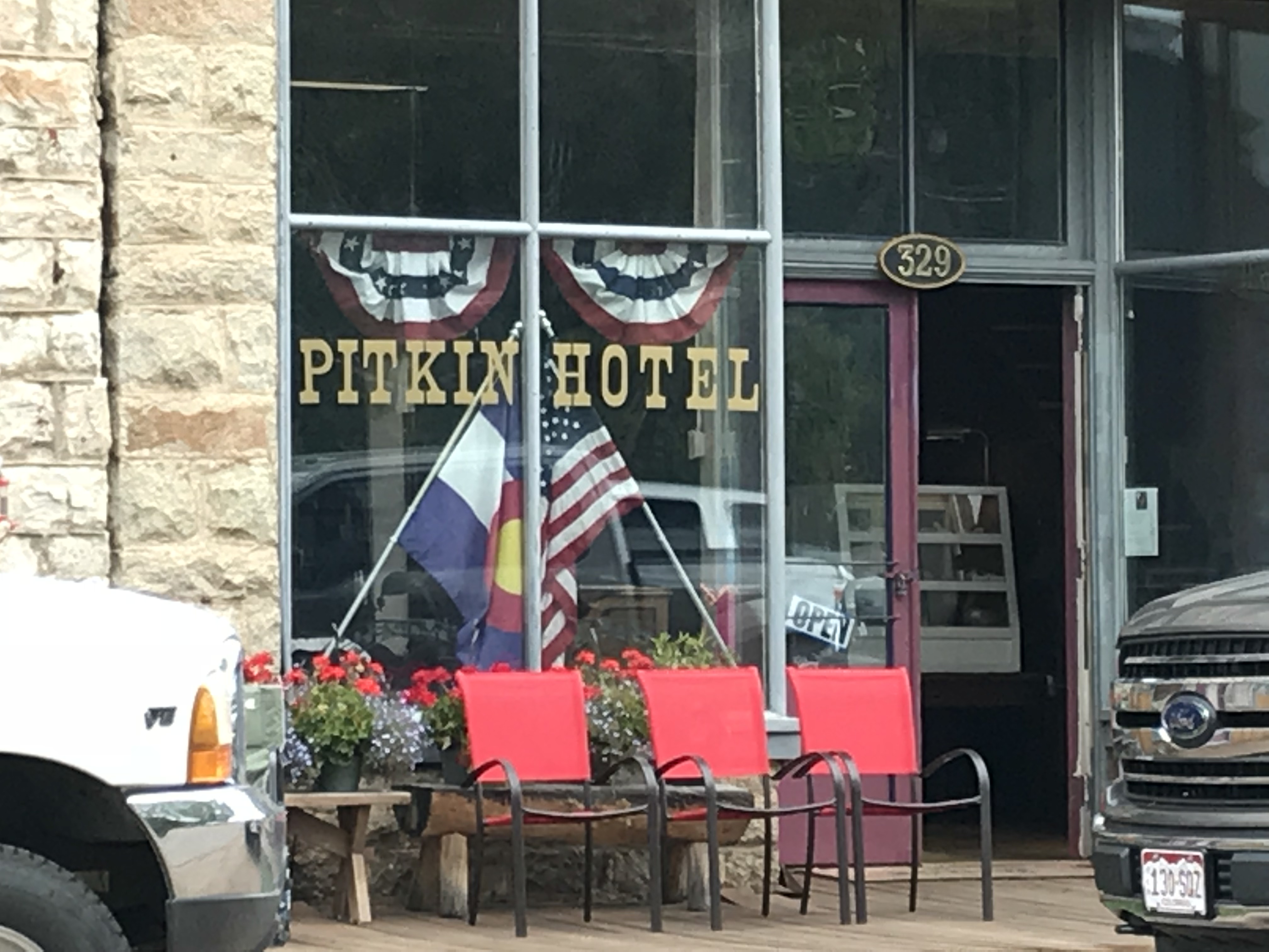
Letters read "Pitkin Hotel" on the glass front of the building. Modern-day trucks sit on the street out front

At about the halfway point on Route 76, you will pass the “living” ghost town of Ohio City. (I call them “living” because some hearty souls are still living in both of these locations!) 

The rain was falling fairly heavily as we passed through Ohio City, so we chose not to stop, but Pitkin should definitely be on your list of places to visit!  It was one of the more “real-feel” ghost towns we toured as it wasn’t crowded with visitors, and enough of the old buildings have been restored that you felt as though you were actually walking down the town’s Main Street.  

The Silver Plume General Store, located on the east side of town at the corner of 9th and State Streets, is a great place to stop for lunch.  We certainly enjoyed our burgers from the outdoor grille! Note: Pitkin is the last chance at civilization if you’re venturing onward to Tincup, Cottonwood Pass, the Alpine Tunnel, or St. Elmo ghost town via Tincup Pass.

We didn’t make it to Tincup on this trip, being that Cottonwood Pass was closed for paving.  We are hoping to, one day, try the Tincup Pass between Tincup and St. Elmo and hike to the Alpine Tunnel.  Another journey for another time, I don’t worry that we’ll be back in Colorado soon!  😁

A two-story building with a belfry on top sits in front of a tree-covered hill. The sign under the belfry reads, "City Hall 1900"
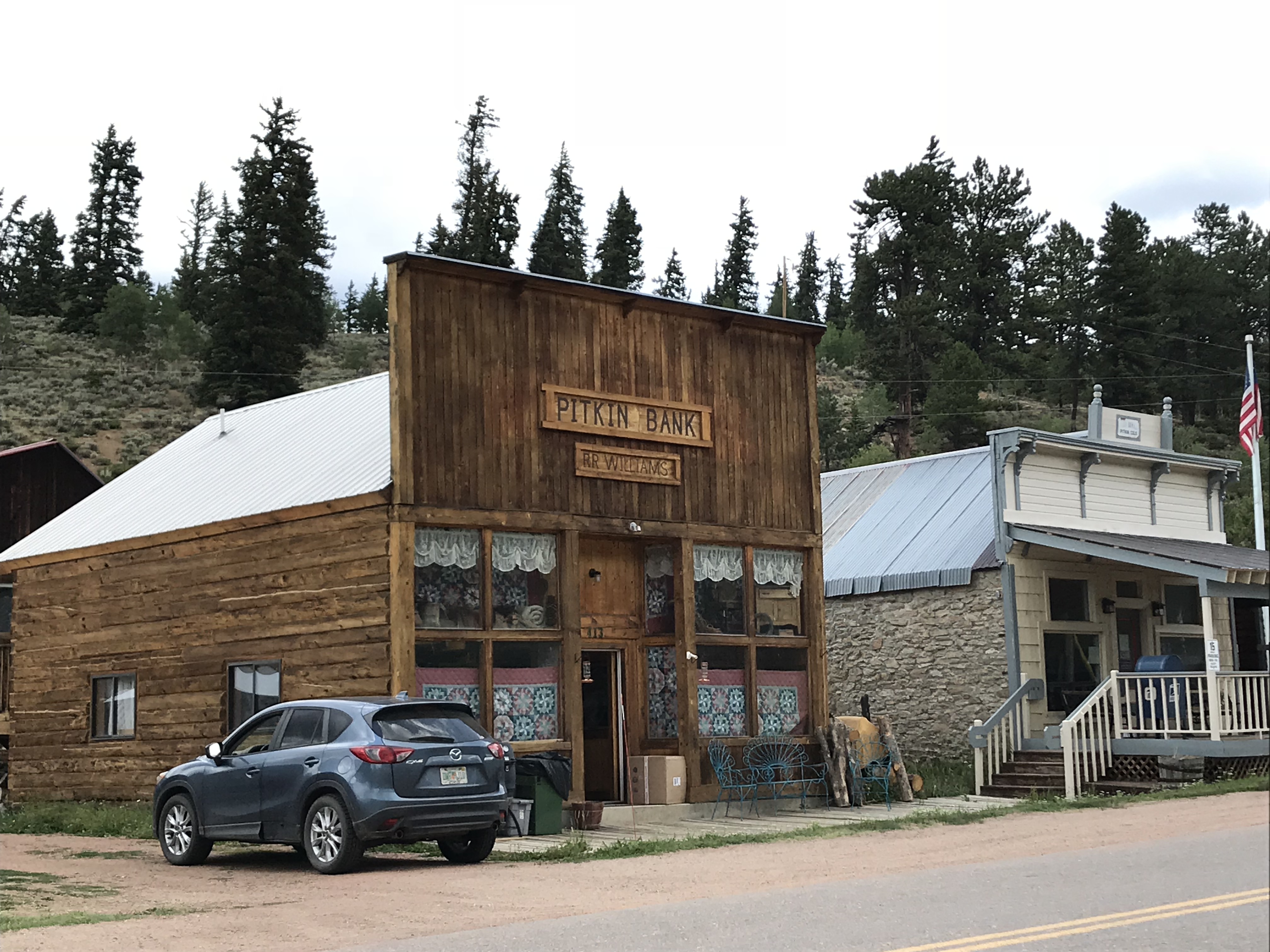
Two old, single-story buildings with false fronts. One reads, "Pitkin Bank". A modern car sits in an alley nearby.
Two old, very small cabins sit so close they appear to connect. One sign reads, "Road Kill Cafe", the other "Stage Stop, Pitkin 1880"
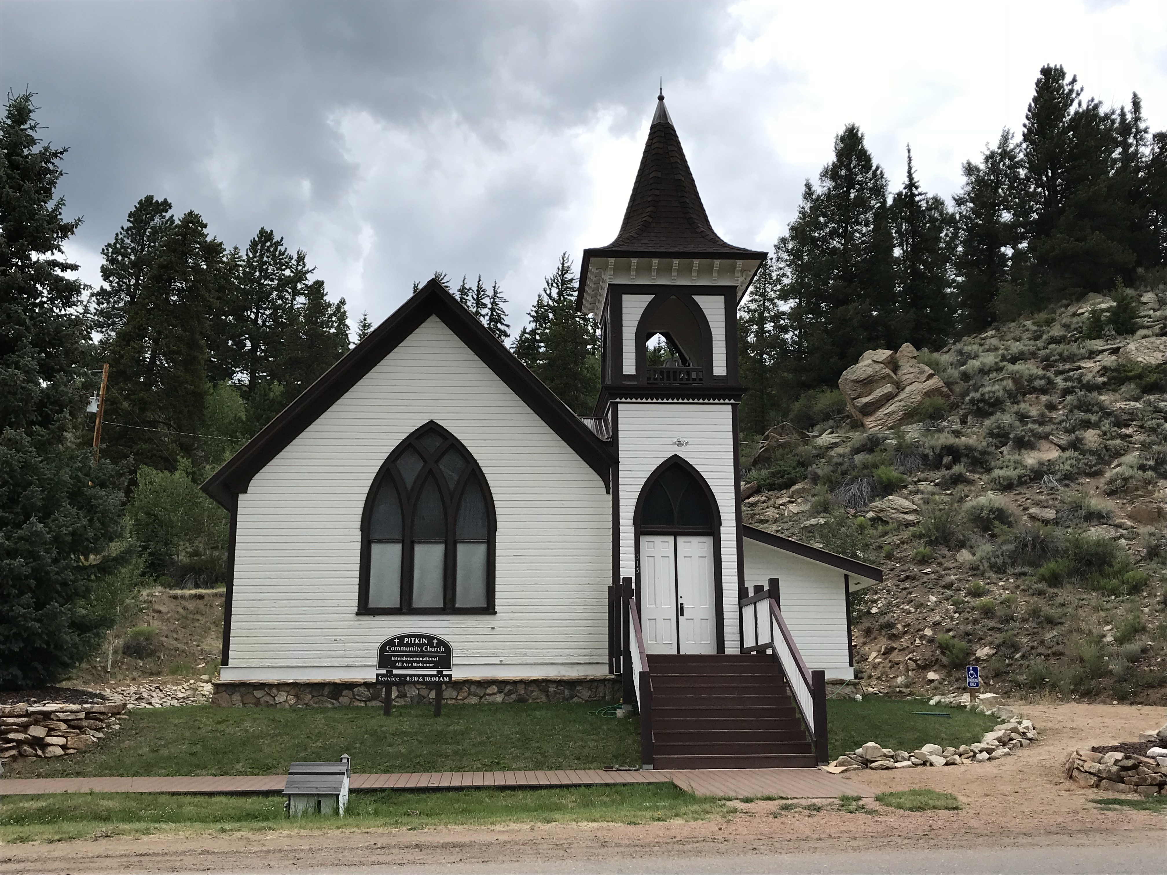
An old, white-clapboard church and steeple

Below is a short video I took of the hummingbirds near the Pitkin Hotel.  I’ve always liked hummingbirds, but I’ve never heard them make this noise outside of Colorado…

St. Elmo Ghost Town: 

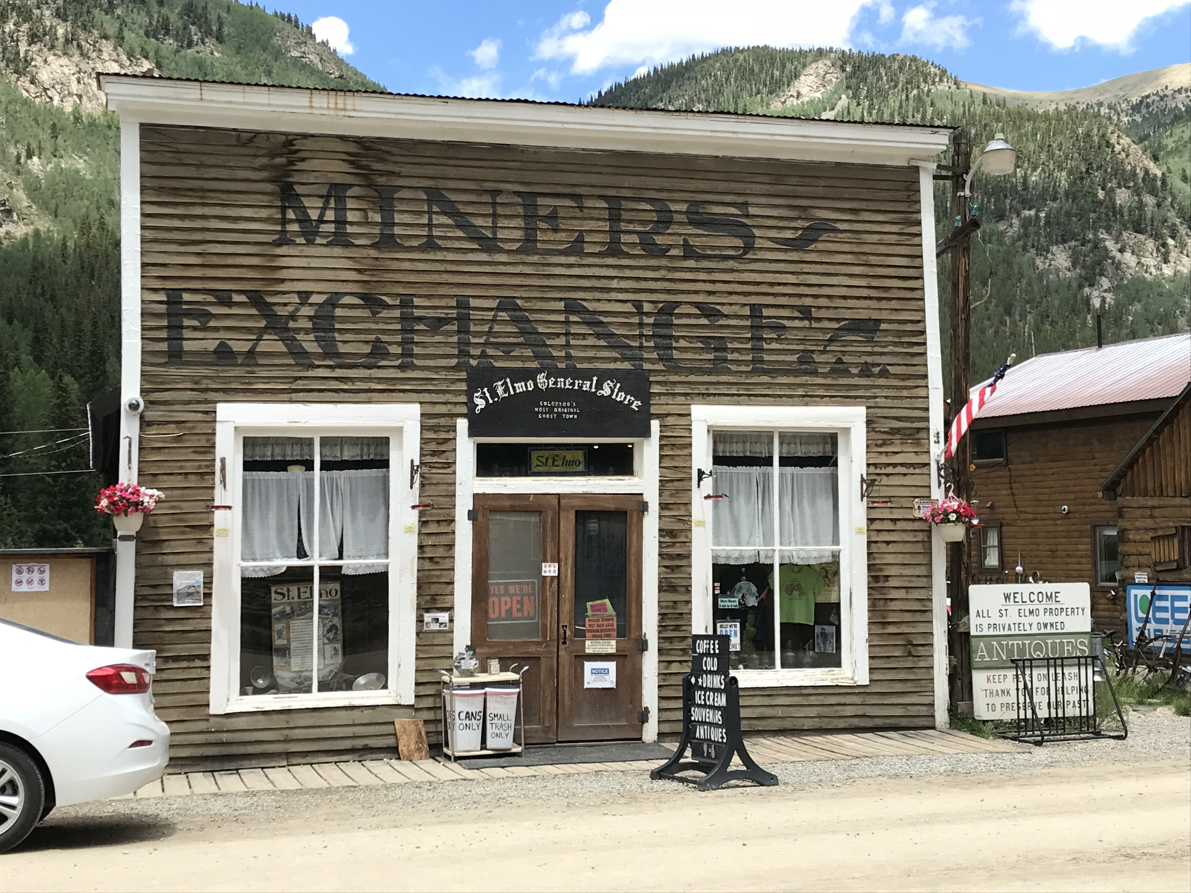
Everyone we talked to (and all the guide books we read) told us we HAD to visit St. Elmo, and it was, definitely, worth the visit!

The only disappointment I had with this site is that vehicles are allowed to park in the town itself.  Its spirit seems to be somewhat ruined when there’s a modern Audi parked in front of Town Hall. 😝  Also, they were restoring several buildings while we were there—which I’m sure is necessary and will be wonderful when it’s completed—but it meant that construction equipment was parked along Main Street.  *sigh*  Guess we’ll have to visit another time! 😉 

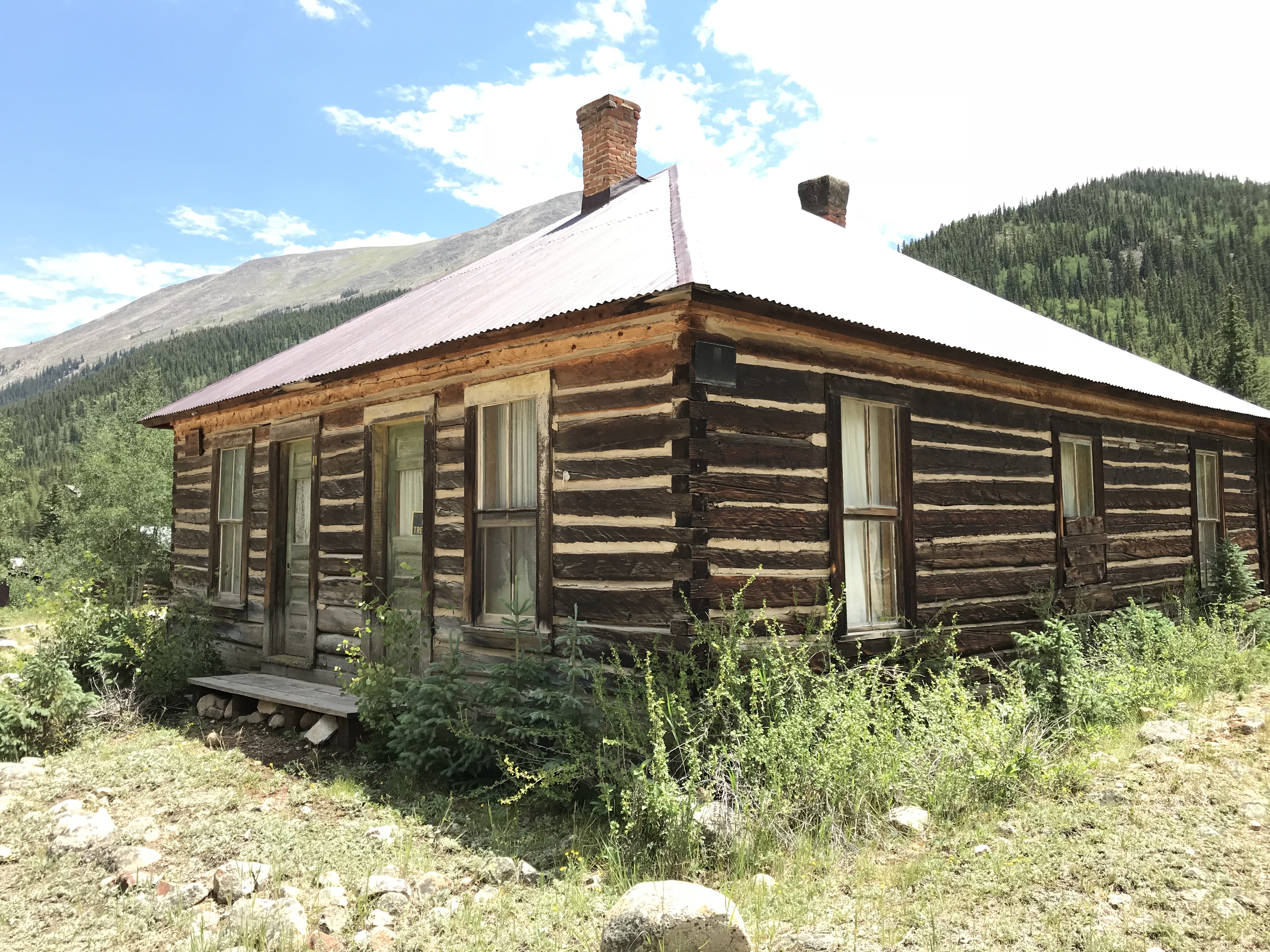
Two old, single-story buildings that look like they were once shops. One appears weathered, the other freshly-painted. A very tall, rocky mountain can be seen in the background

Two old, small, weathered cabins sit next to the dirt road

As I mentioned previously, if you’re daring, you can reach St. Elmo via Tincup Pass.  If you’re looking for a tamer route, you can do what we did and take the long way.  For this trek take Route 50 east of Gunnison through Monarch Pass (another great view) and turn north onto US 285 at Poncha Springs.  Then take Route 162 west–an out-and-back road (for the less daring among us)–toward the Mt. Princeton Hot Springs resort and on to St. Elmo.  

Near this area, there’s also a turnoff for Hagerman Pass Road to the site of another ghost town, Hancock.  From there, you can hike to the Alpine Tunnel from the east, though it sounded as though the hike is longer and the view isn’t quite as good as hiking from the west side–we chose not to complete the hike at this time due to time constraints and the monsoon-fueled thunderheads that were threatening.  

As I stated previously, since we missed a few ghostly spots this time around, we’ll be putting this area on our “must-visit” list for the future.  It’s always a shame when you visit a location and find out you HAVE to come back to explore further (that happens to us regularly on trips, especially in Colorado…have I mentioned that I enjoy vacationing in this state? 😉)

An old, wooden cabin with two chimneys. Two very tall mountains, one rocky, the other tree-covered, can be seen in the backdrop
Two old, wooden cabins sit amongst the trees
An old, one-story shop that reads, "Miners Exchange, St. Elmo General Store"

Much to the Tranquil Trekker’s dismay (we DON’T feed wildlife) one unique feature of St. Elmo is that visitors are encouraged to feed the WAY-overly-friendly and almost-aggressive local chipmunks. You can buy food for them at the General Store. 😝

The Cascades Waterfall near Buena Vista, Colorado:

After leaving Saint Elmo, on our way east, back to US 285, we stopped at The Cascades.  This is a lovely waterfall that’s just off the side of the road.  It’s a beautiful, peaceful location where you can walk right up to the base of the river that creates a picturesque waterfall in this area as it cascades across boulders–hence the name. 😉  

A creek runs over rocks and down a hill, creating a waterfall amongst the mountains and trees
Water from the creek dribbles over large boulders
A creek runs over rocks, creating a mini waterfall amongst the boulders and trees
A creek runs over rocks and down a hill, creating a waterfall amongst the mountains and trees

Gothic Ghost Town, Crested Butte, Colorado: 

I was a bit disappointed by this town.  The Rocky Mountain Biological Laboratory bought the town and did an exceptional job of restoring many of the old buildings which the lab uses for its work.  This we knew going in… what I hadn’t realized is that the lab has taken over almost the entirety of the townsite.  As it’s now, mostly, all private property, it’s almost impossible to tour around and browse the various buildings. 😒

I’m glad the town is being used for something, and I’m thankful to the lab for helping to save its structures, I just wish the historical features were easier to access.  And a note to the general store in town:  you close by four? In the middle of summer?? On a Saturday???  REALLY?!  Afternoons are a good time for people to eat ice cream you know!  😝😳😉

Sign at the edge of town reads, "GOTHIC site of The Rocky Mountain Biological Laboratory founded 1928"

No trespassing/no pets signs on a wooden fence. Old cabins sit in an open field within the fence. Rocky mountains are in the far background
Signs regarding the lab dotted the entire town 😕

You can reach Gothic by taking Gothic Road, Route 317, north of Crested Butte and the ski village.  You can’t miss it, this is, literally, the only main road going north of town! 😉  This will also lead you to Schofield Pass that I discussed in this post.  

Old cabins sit in front of a rocky mountain. Modern day cars and a construction cone are parked on the dirt street
Old cabins sit in a grassy field in front of a rocky mountain

Modern cars line both sides of the dirt street. Old cabins sit in front of a rocky mountain far in the background
Main Street in Gothic

Old cabins sit in an open field within a wooden fence. Tree-covered mountains are in the background

Old, brown, two-story building. Sign on front reads, "1880 Town Hall"
The General Store with its questionable hours of operation 😝

Old cabins sit amongst short trees with the forest in the background

Independence Ghost Town and Independence Pass:

Independence ghost town is located on Independence Pass (Route 82), around 16 miles east of Aspen, and around 21 miles west of Twin Lakes.  

It’s just east of the peak of the Pass itself, and is, actually, easy to miss.  It’s below the grade of the road and the two parking pullouts are small and not well-marked.  There are, blue, “Places of Interest” signs, but you have to be watching for them.  We actually saw the ruins of the mill, on the other side of the road, first.  

The townsite is located in a valley, along the Roaring Fork River, framed by the towering Sawatch Range on both sides.  

Independence Ghost Town:

This was my favorite ghost town of the entire trip!  It’s easy to access as the site is located directly on Independence Pass.  You actually park at a pullout on the Pass road and then hike out to the site, so no vehicles marred the view. 

The walk into the town site is about one-mile in each direction, on an old, two-track, dirt road. (The hike is pretty easy as there is almost no elevation gain.  Beware though, the town site still sits at about 10,000 feet in elevation.)  You can see the town from quite a ways off, which helps you to imagine what it must have felt like riding a horse or wagon along that route during the height of the town’s life.

This would have been an incredibly beautiful place to live! (Had it not been so isolated and suffered such extreme weather.)

Related Posts:  Guide to Colorado Backroads and 4-Wheel-Drive Trails: Book ReviewThe Best Hidden Gems of Northern ColoradoThe Backroads of ColoradoThe Drive to Crystal Mill in Colorado

The wooden remains of an old structure sit on a hill with a tree-covered mountain in the background
The old mill in Independence, Colorado. (This is the first building we saw to clue us in that we were “there”.)

The wooden remains of an old structure that has no roof. Trees are in the background

A two-track dirt road leads over a small, grassy hill. Old cabins in a grassy meadow can be seen far in the distance with tree-covered and rocky mountains in the background
I don’t imagine this view was much different when the town was thriving

An old cabin sits in a grassy meadow with a tree-covered mountain in the backgroundThe wooden remains of an old structure that has no roof or doors. Trees are in the backgroundThe wooden remains of an old, in-tact structure. Trees are in the backgroundA grassy meadow leads down the hill into a valley. Tree-covered and rocky mountains are in the backgroundThe remains of two old cabins sit on a grassy hill. A tree-covered mountain is in the background.

Independence Pass:

Independence Pass was incredibly beautiful, as well.  This one has been on my Colorado Bucket List for some time and it did not disappoint! (It was also the highest altitude we reached on this trip, maxing out at, just over, 12,000 feet!)  The scenic overlook and hiking area at the top of the Pass offer, almost, 360-degree views of the Continental Divide, which the Pass spans.

Looking down into a grassy, mountain valley. Rugged, rocky peaks and tree-covered mountains stretch to the horizon where they meet a blue sky filled with white, puffy clouds

Sign reads, "Independence Pass, elevation 12,095 feet, Continental Divide"

An analog device sits on a vehicle dashboard. It's dial is pointed to just over 12,000 feet
We finally topped 12,000 feet!

You may have noticed I’ve been enjoying using a Sun Company altimeter† in many of these posts.  It responds to changes in barometric pressure caused by weather as well as air pressure at-elevation, so you may have to recalibrate it a little each day to maintain the most accurate readings.  But, for amateur interest, it’s a fun, portable, way to keep track of changes in altitude–it connects to the vehicle using velcro so it can be easily removed and taken on a hike if you’re so inclined. 

A paved road winds down and around a hill. Rocky, rugged and tree-covered mountains are in the background and line both sides of the road

I made another video of our drive up Independence Pass.  I think my videographer skills got a “little” better with this one! 🤔

If you’re looking for something fun to do this summer, definitely check out the ghost towns of the Colorado High Country! 

Have you visited any of these amazing places?  Tell me about it in the comments!


Did you enjoy this post?  Pin it!

Four pictures of old buildings at ghost towns and Rocky Mountain passes. Pin reads, "The Ghost Towns of Colorado's High Country"


†As an Amazon Associate I earn from qualifying purchases

Like what you read here today? Please feel free to leave a comment, like or share this post! Add your email at the bottom of the page, or the sidebar to the right, to be notified when a new post is published. By signing up for the email list, you will also receive a free copy of the Tranquil Trekker’s Top 10 Tips of Trekking Do’s and Don’ts!

You can also follow the blog on social media by clicking the links below!

Facebook

Twitter

Instagram

Pinterest