7 Things to See in Death Valley National Park

In this post, I detail a Spring Break trip we took to Death Valley!


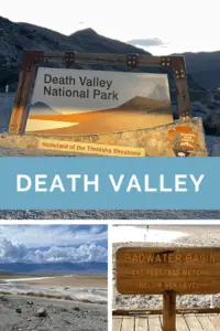
The final stop on our epic, Spring Break trip to celebrate the Trekkers’ 40th birthdays was Death Valley National Park!  We’ve been wanting to visit Death Valley for a long time. We figured early March was hopefully a good (and cooler!) time to do it!

Tips for Your Visit to Death Valley:

–The heat in Death Valley!

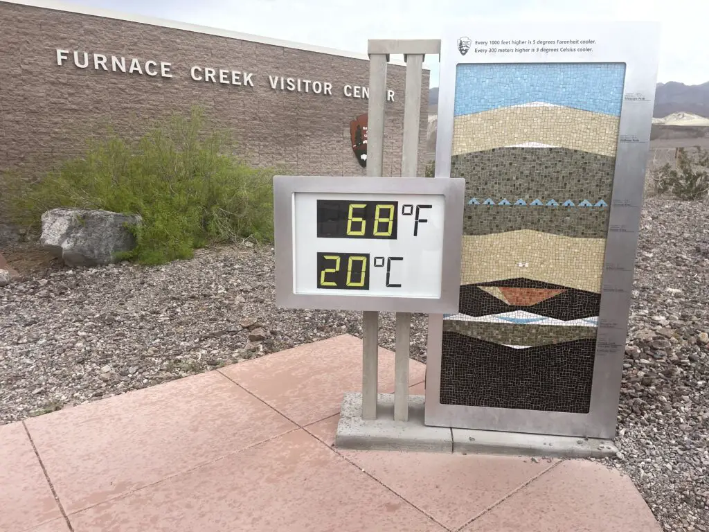
The heat in Death Valley is NOT a joke so PLEASE be careful!  We were SO LUCKY that it was so cool when we were there (FYI, early March is a GREAT time to visit!)  This place is literally on record as being the hottest place on Earth!

Death Valley is also extremely dry and can be very windy, which means you may be sweating (and getting dehydrated) and not even realize it.  Some years, it has been known to be over 100 degrees here for almost HALF THE YEAR!  I cannot stress enough the potential danger this type of heat can bring.  Dehydration/heat stroke are very real dangers here for much of the year.  This park can LITERALLY kill you!

A digital thermometer on a sign reads 68 Fahrenheit, 20 Celsius. The sign on the building reads, Furnace Creek Visitor Center
Check out the name of the Visitor’s Center…Furnace Creek! This area is where the hottest temp ever recorded on Earth was taken. I doubt it’s rarely this “chilly” there.

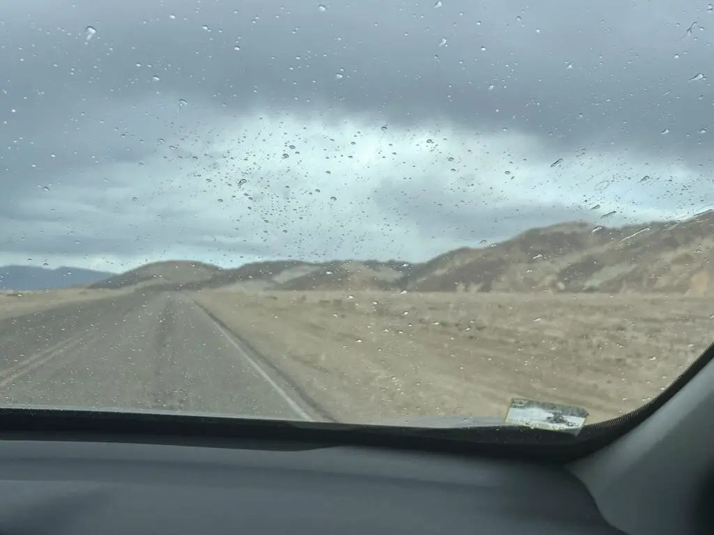
The heat can also be VERY hard on your car, and if it breaks down in the middle of the desert, you’re now stuck in the heat.  There are almost NO TREES in Death Valley so there is also almost NO SHADE.  We even saw one remote section of road where signs told you to turn off your car’s air conditioning to take the stress off the car’s engine (the road was also going uphill)–again, this wasn’t an issue with the cool temps when we were there. 😂

View through the front window of a car onto a road, a brown, sandy desert, and hills. Raindrops spatter the windshield
It rained on us…in DEATH VALLEY! (There was also sleet and a 30 mph wind.  It was COLD during that storm…in Death Valley!)
–No cell coverage in Death Valley

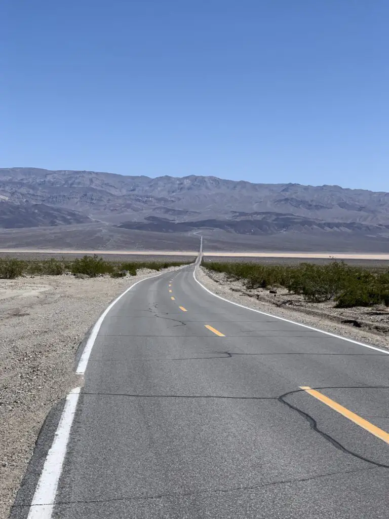
One big thing to plan for when you visit Death Valley is that the park is HUGE!  It covers more than THREE MILLION acres so you should plan to do A LOT of driving!  Also, it is a valley (duh! 😉) surrounded by mountains, so there is very little cell coverage–this adds to the danger the park poses if you encounter a problem.

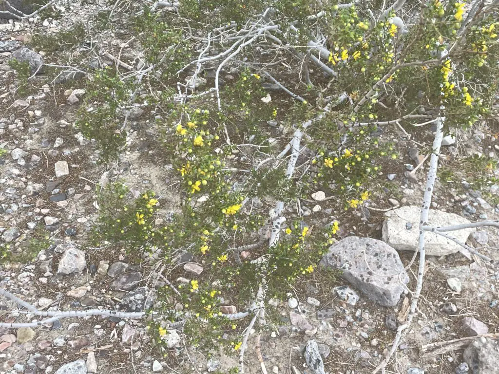
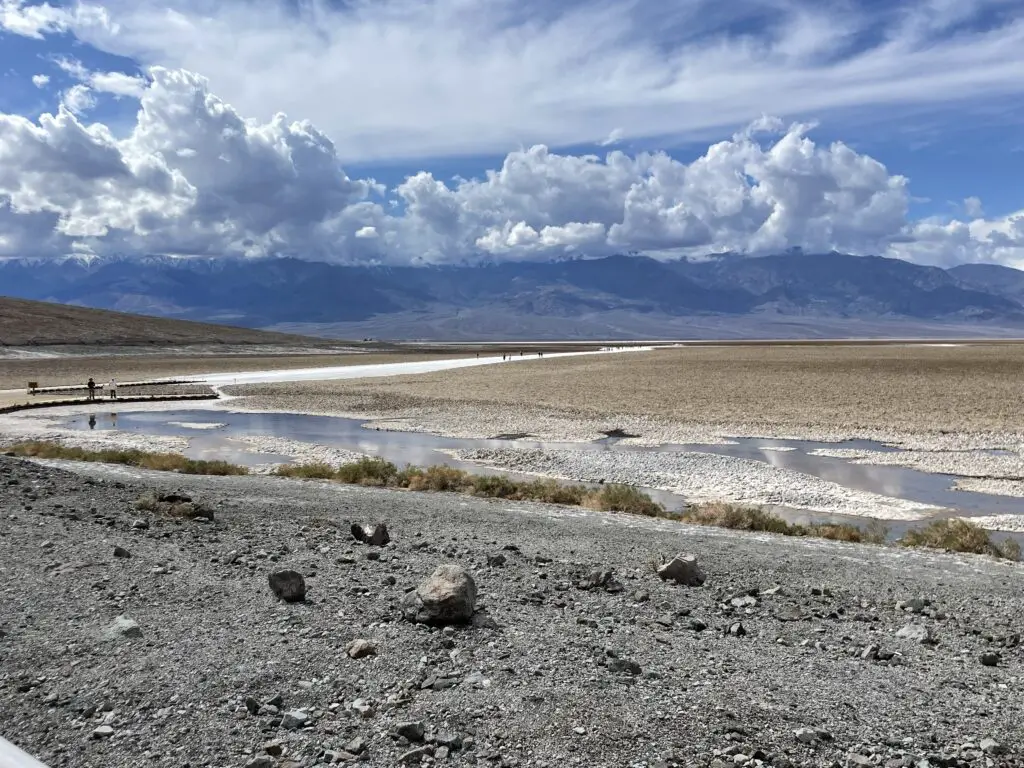
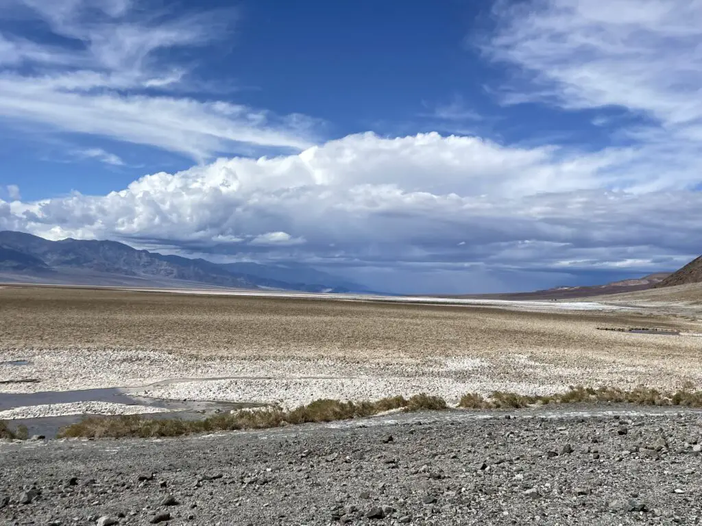
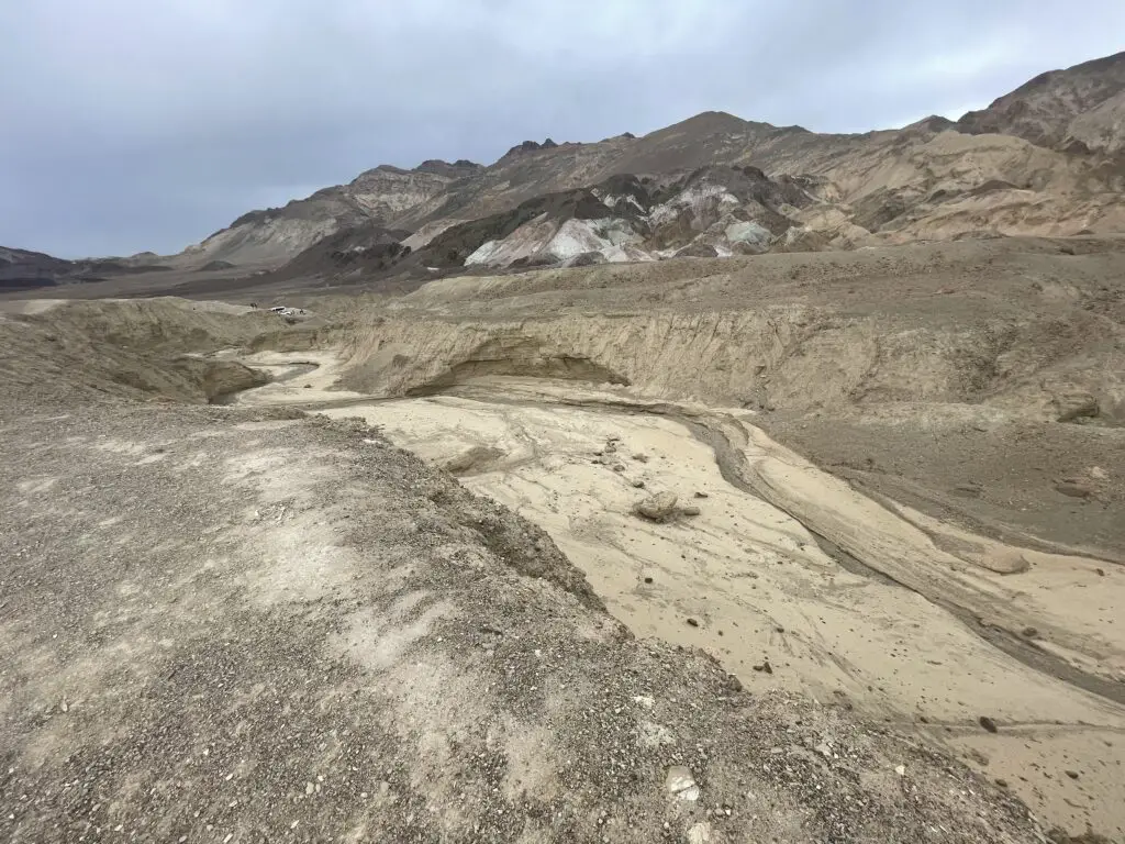
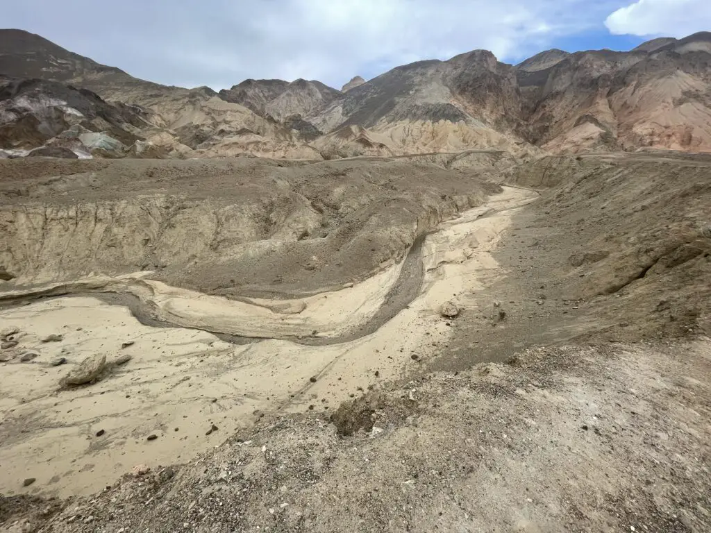
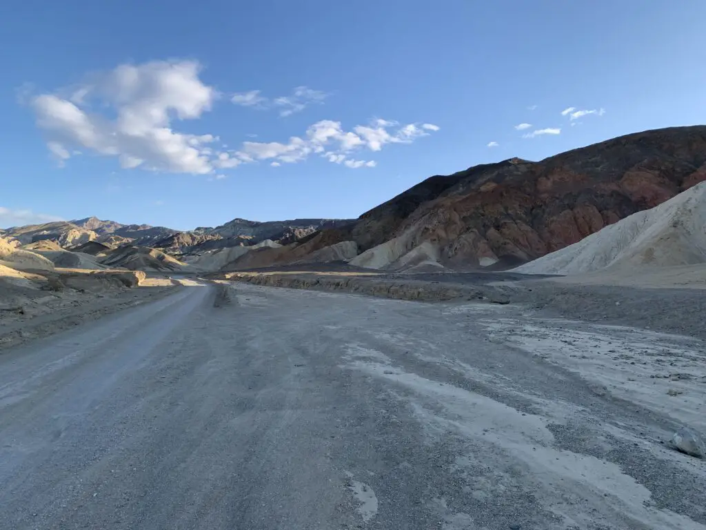
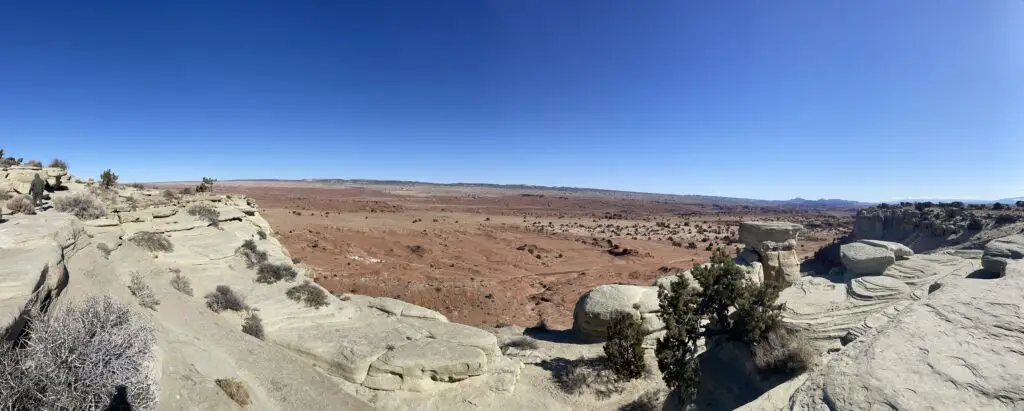
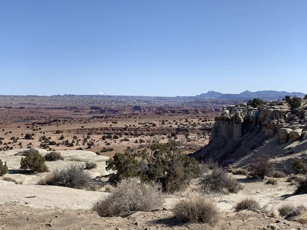
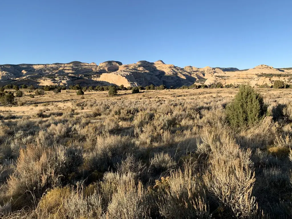
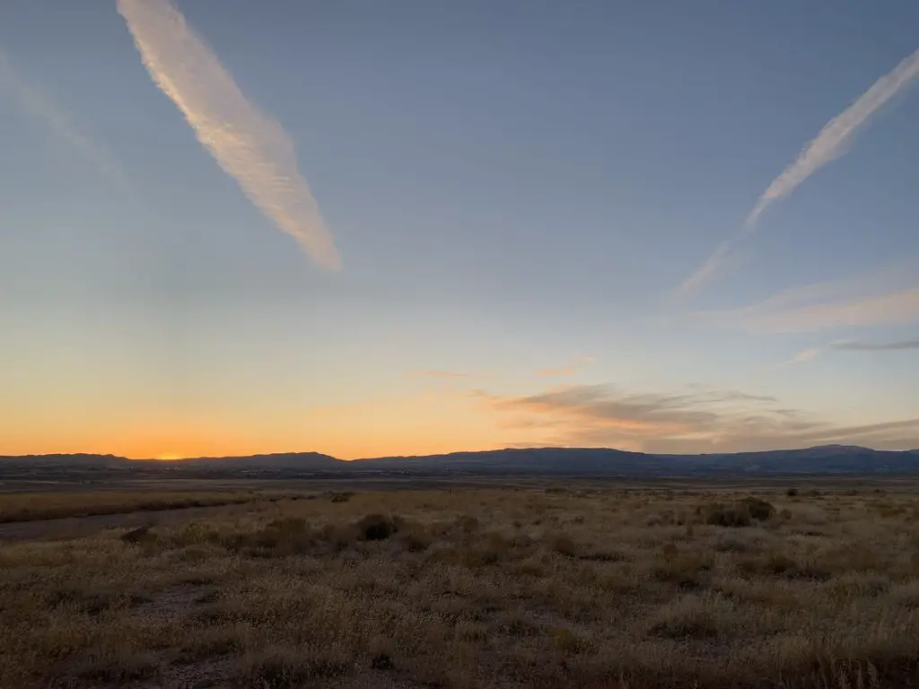
Also, something to be aware of, Death Valley isn’t the prettiest of our national parks.  This comment is not intended to dissuade you from visiting in any way.  I just don’t want you to be disappointed.  Glacier NP this is not! 😇  It’s called DEATH Valley for a reason!  There isn’t much that grows or lives here! 😉

Small, yellow flowers on green plants spread across gravel
The only flowers we saw in Death Valley

Where is Death Valley?

National park entrance sign with rocky, desert mountains and a sunset in the background. The sign reads Death Valley National Park.

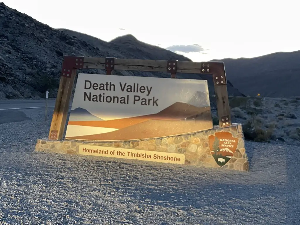
Death Valley is located in southeastern California, right on the border with Nevada.  The park is situated about 130 miles west of Las Vegas and a little more than 200 miles to the northeast of Bakersfield, California.

The easiest way to reach Death Valley is to bring Nevada Route 160 west from Las Vegas to Pahrump.  Then take State Line Road west to the Death Valley Junction on California Route 127.  From there you pick up Route 190 and take that into the park! (Don’t worry, there are signs.  Also, these are basically the only paved roads out there! 😉)

You can also reach Death Valley from the north by taking US 95 south through Nevada to California Route 374, or from the west on California Route 190.

Places you don’t want to miss in Death Valley:

There are a number of awesome sites to see at the park!
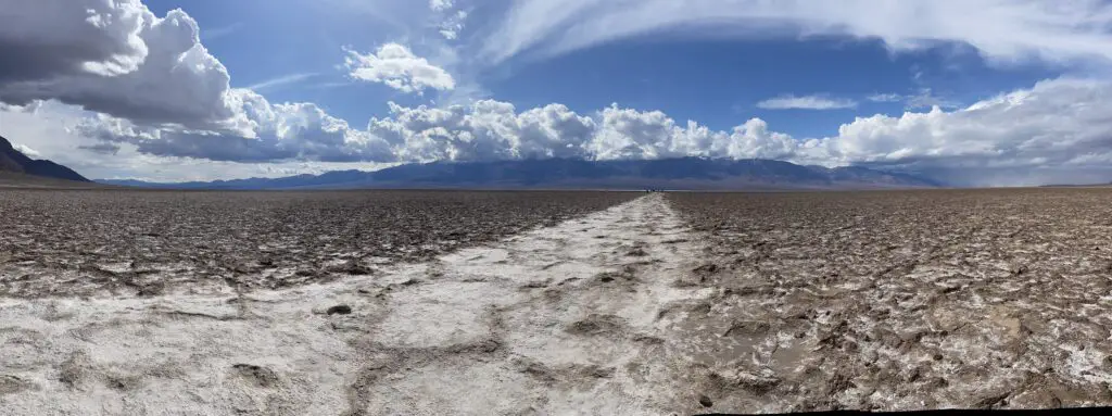
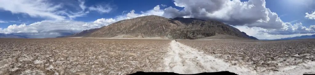
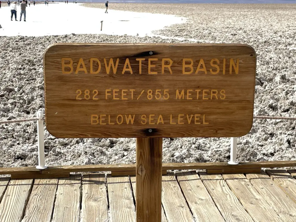
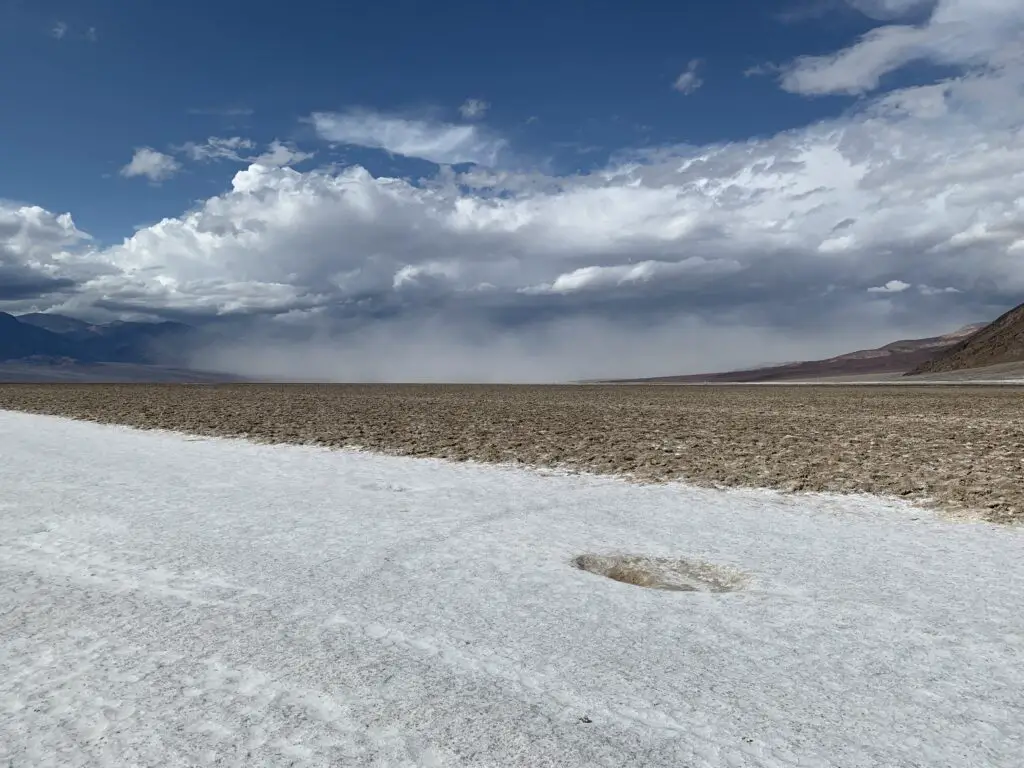
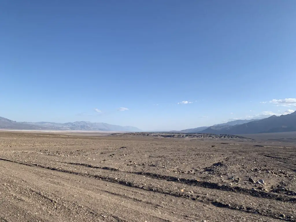
Badwater Basin:

Badwater Basin’s claim to fame is that it is THE lowest point in North America, at more than 200 feet BELOW sea level!

Panoramic picture of a flat valley, filled with a salt-flat, and sand and surrounded by rocky mountains.
Panoramic of Badwater Basin
Panoramic picture of a flat valley, filled with a salt-flat, and sand. A salt-flat path heads toward a towering, rocky mountain.
Dante’s Point is at the top of that mountain (this will be important later.)
A sign on a boardwalk reads, "Badwater Basin, 282 feet/865 meters BELOW sea level!"
Badwater Basin is THE lowest point in North America!


For additional info on Death Valley, please see my friend Megan’s blog posts on Things to do in Death Valley that aren’t hiking and Sites to see on Badwater Road!


A rocky, salt-flat spreads to the rocky mountains on the horizon. A puddle of water reflects the sunlight in the foreground.
The shiny stuff in the foreground IS the water in “Badwater Basin”! This is one of the rare places where water can regularly be seen in Death Valley.
A rocky, salt-flat spreads to the horizon, surrounded by rocky mountains.
Death Valley!
A rocky, salt-flat spreads to the horizon, surrounded by rocky mountains. A dusty cloud fills the valley.
Haboob! (Dust storm)
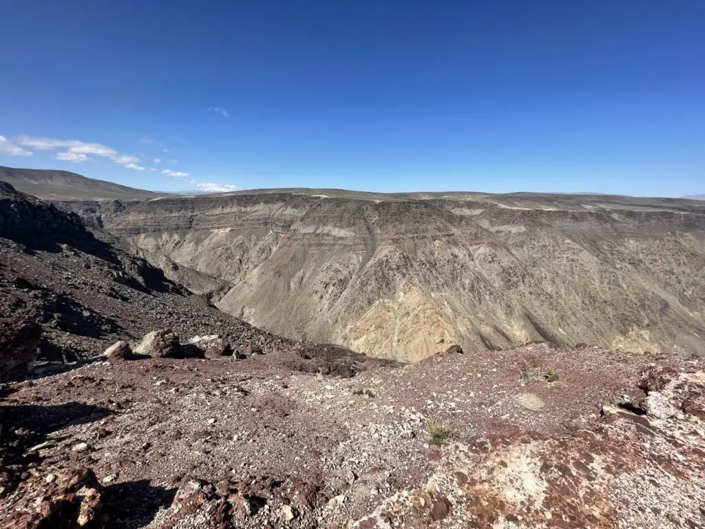
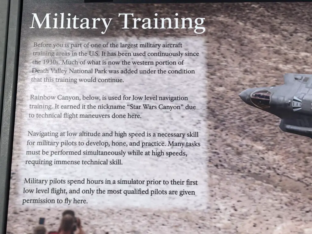
Father Crowley Overlook: 

This locale is otherwise known as, “Star Wars Canyon”! Ironically this was NOT a Star Wars filming site (to learn more about those, scroll down!)–although portions of the new, Top Gun: Maverick were filmed here!

The proper name for this canyon is Rainbow Canyon, from the colorful rock and gravel that comprises it.  However, it got its nickname as fighter jets have often practiced low-altitude moves here (the terrain mimics much of where they fly throughout other parts of the world.)

This has been a Bucket List item on both the Trekkers’ lists since Mr. Trekker heard you could see fighter jets here and I found out it was called Star Wars Canyon (and why!)  This meshed well with our watching planes at Nellis Air Force Base in Vegas and touring the Extraterrestrial Highway earlier in the trip!

Rocky, short, narrow canyon with red, brown, and tan gravel, all under a clear, blue sky.
Rainbow Canyon, otherwise known as…Star Wars Canyon!

Sadly, several years ago there was an accident where the pilot was killed and spectators on the ground were injured so they’ve limited what all the planes can do here…but, you can sometimes catch a plane and…WE DID (two actually)!  We didn’t get any pics or video (literally, we heard it, we saw it, it was gone, all in a total of about three seconds). 😁
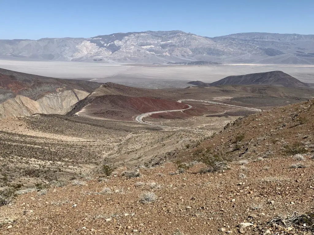
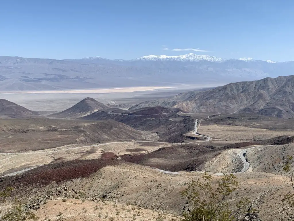
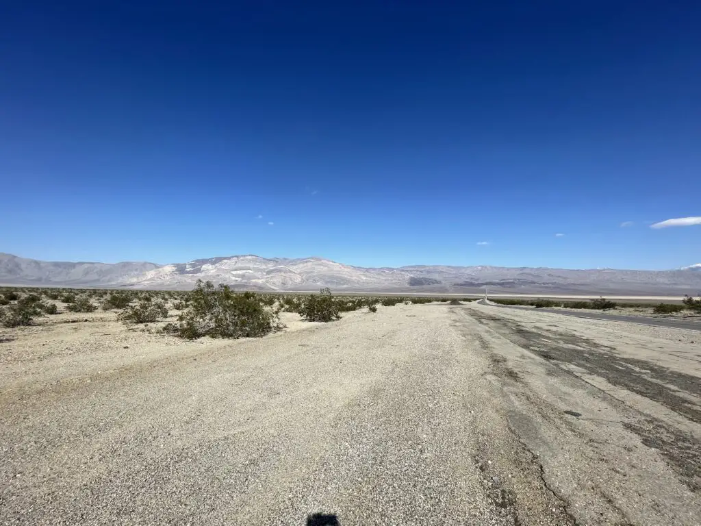
Info sign with a picture of a military jet flying above the canyon reads in part, "...Before you is a part of one of the largest, military aircraft training areas in the US...Rainbow Canyon, below, is used for low-level navigation training. It earned the nickname, 'Star Wars Canyon" due to technical flight maneuvers done here..."

View down a rocky hillside traversed by a road with red, brown, and tan gravel. A grey, flat valley is in the background backed by a rocky mountain.
View from Father Crowley Overlook! (We saw a fighter jet fly down that valley in the distance too!)

View down a rocky hillside with red, brown, and tan gravel. A grey, flat valley is in the background backed by a rocky, snow-capped mountain.

Panamint Valley

This GORGEOUS valley is situated just down the road (about seven miles) to the east of Father Crowley Overlook.  This was my absolute, favorite spot in all of Death Valley (that we saw anyway). (We also saw a fighter jet flying through this valley (from the Father Crowley Overlook!)

One weird thing about this valley was that it was SO QUIET! All you could hear was the light breeze ROARING in your ears (and occasionally a fighter jet flying overhead! 😝)  We realized what was missing, there were no birds and there weren’t even any bugs buzzing about.  I’m not sure if this is unique to Death Valley or because we were there in early March (though a lot of literature on the park talks about the extreme quiet.)
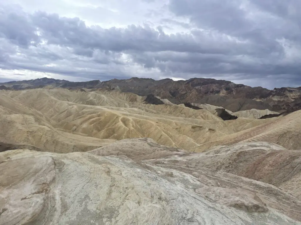
Empty, two-lane road stretches across a rocky, flat desert (with scrub brush) to a rocky mountain towering far in the distance
My favorite place in Death Valley (Remember my love of long, empty roads on this trip?)
Rocky, flat desert (with scrub brush) surrounded by rocky mountains in the distance, all under a clear, cerulean sky
Look at that sky! That is my favorite shade of my favorite color, blue! (Also, this pic is now the background for my work laptop! 😁)
Flat, brown, rocky valley surrounded by rocky mountains, all under a clear, blue sky
This is what a lot of Death Valley looks like. I told you it wasn’t super pretty. 😇 
Zabriskie Point:

This is supposed to be a great place for sunrise/sunset with the varying colors in the rocks!

Yellow-grey dunes made of gravel sit under a grey, cloudy sky

Star Wars Sites in Death Valley National Park

Many people don’t know this but several scenes from the ORIGINAL Star Wars trilogy were filmed in Death Valley!  Most were from Star Wars, Episode 4: A New Hope (SW), but a few were also from Episode 6: Return of the Jedi (ROTJ)!  Prepare yourself, my nerd flag is about to fly high! 😉

Note: There were no signs or literature that we saw at the actual park that show where filming sites are. There is plenty of info on Google about where to look, then you have to kind of use your imagination to put droids, Luke Skywalker, and Obi-Wan Kenobi there. 😉

Artist’s Palette:

The scene where the Sand People attack Luke in SW…

Brown and tan gravel in a dry wash area, hills in the background are made from dark brown, tan, white and red-brown dirt.
This area is especially known for the beautiful colors in the gravel

Brown and tan gravel in a dry wash area, hills in the background are made from dark brown, tan, and red-brown dirt.

Mesquite Sand Dunes:

The droid scene near the beginning of SW was filmed here (where R2-D2 and C-3po walk through the dunes after their spacecraft, life raft crashes.  Jabba the Hutt’s sail barge scenes from ROTJ were also filmed here.)

Yellow-colored hills lead to a mountain in the background, greenish scrub brush is in the foreground.

20-mule canyon:

The scene where the Jawas grab R2-D2 and where Obi-Wan’s home is located/where he meets up with Luke for the first time in SW.  Also, the first droid scene from ROTJ was filmed here.
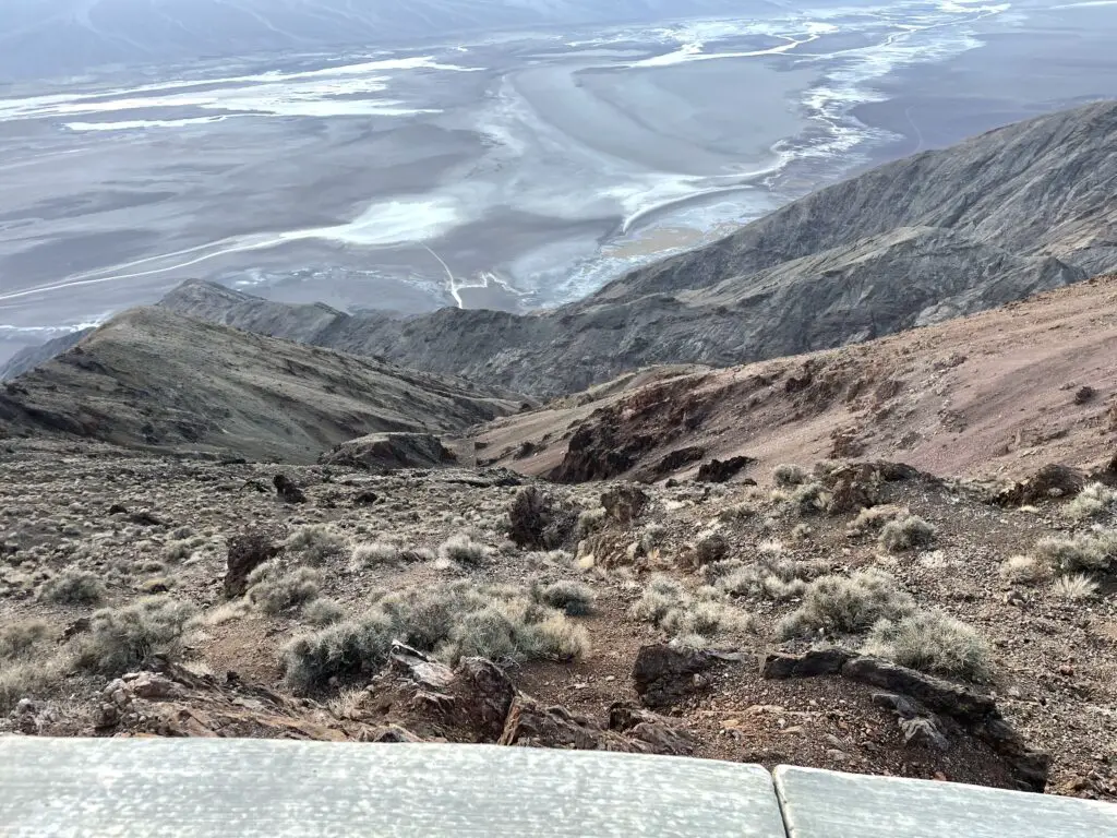
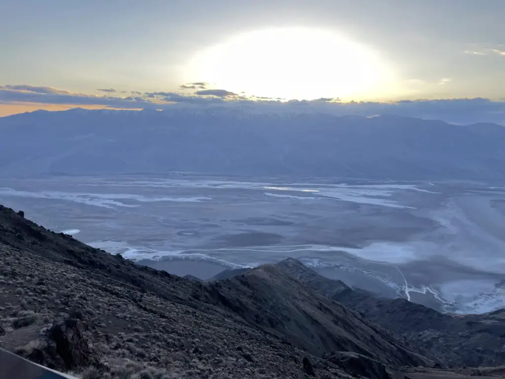
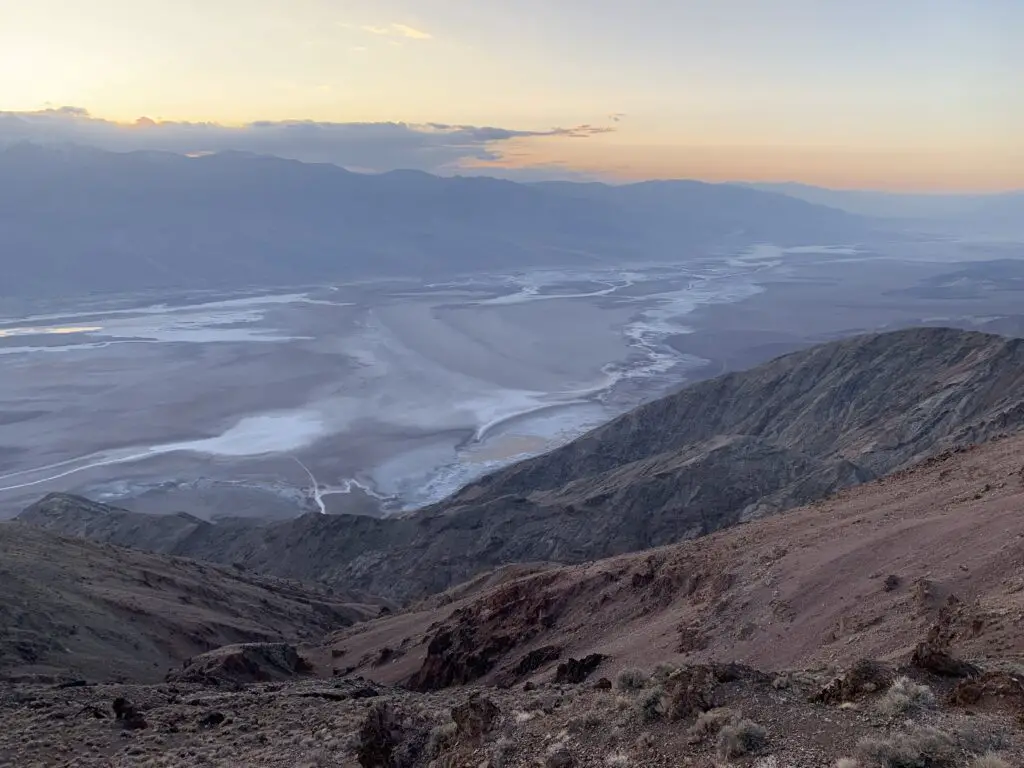
A flat, gravel plain in the foreground with brown, gravel hills rising in the background under a blue sky. Grey-gravel road, in-shadow, with brown hills rising in the background

Dante’s Point:

The lookout on top of the Point gives you this view down into Badwater Basin (this was the filming spot for the Mos Eisley Spaceport in SW–“you will never find a more wretched hive of scum and villainy…” 😁)

View from above, looks down a rocky and scrub brush-covered cliff to a gravely plain streaked with salt stains and water puddles
This is from the top of the mountain I showed the view of from Badwater Basin earlier. Badwater Basin is at the bottom.
Grey valley streaked with salt stains leads to dark, shadowed mountains. A yellow, sun arc rises out of these mountains and clouds as the sun sets.
Sunset over Badwater Basin

View from above, looks down a rocky and scrub brush-covered cliff to a gravely plain streaked with salt stains and water puddles. An orange sunset and clouds cover dark mountains in the distance.

I-70 through Utah is GORGEOUS! 

On our trip home, to South Dakota, we took I-70 through Utah.  I’ve always thought I-70 through Colorado was pretty (and it is!) but the highway through Utah is INCREDIBLE!  And literally, anyone can see these views, all you have to do is drive the highway!

Panoramic picture of grey rock in the foreground overlooking a flat, red-rock plain, all under a clear, blue sky
This is at a rest stop on I-70!

A red-rock mountain rises from a flat, yellow, scrub brush-covered, desert landscape. Scrub brush-covered grey rock in the foreground overlooking a red-dirt, desert plain spotted with scrub brush. Rocky mountains are in the far distance, all under a clear, blue sky.


Incredible views, Hollywood film sites, and potentially VERY hot temperatures.  If you’re looking for a unique vacation check out Death Valley (but maybe not in the summer. 🥵)

Have you visited Death Valley? Tell me about your experience in the comments! 


Did you enjoy this post? Pin it!

3 pictures: 1) National Park Entrance sign reads, "Death Valley National Park"; 2) A rocky, salt-flat spreads to the horizon, surrounded by rocky mountains; 3) A sign on a boardwalk reads, "Badwater Basin, 282 feet/865 meters BELOW sea level!" Pin reads, "Death Valley"


Like what you read here today?  Please feel free to leave a comment, like or share this post!  Add your email at the bottom of the page, or the sidebar to the right, to be notified when a new post is published.  By signing up for the email list, you will also receive a free copy of the Tranquil Trekker’s Top 10 Tips of Trekking Do’s and Don’ts! You can also follow the blog on social media by clicking the links below!

Facebook

Twitter

Instagram

Pinterest


Cement Ridge Lookout Tower

In this post, I review the Cement Ridge Lookout Tower in extreme, eastern Wyoming.


The Cement Ridge Lookout Tower is located in extreme eastern Wyoming, almost on the border with neighboring South Dakota.  It is a National Forest Service fire lookout that is still in active use today.  This is a prime place for 360-degree views of the surrounding countryside and is especially picturesque during the fall.

The back view of a person wearing a hoodie and a dog walking across a brown-grass meadow. Pine trees, mountains and plains stretch to the horizon beyond, all under a gray, cloudy sky.
Puppers and I enjoying the lookout!

From the lookout point, you can see portions of four states, South Dakota, Wyoming, North Dakota, and Montana.  Expect the weather to be different here than in much of the rest of the Black Hills as this is one of the higher elevations you will find in the Hills.  It is frequently windy here and is usually cooler than the surrounding region due to its altitude.  It can also be cloudy/foggy, even when the surrounding areas are not.

Mr. Trekler and I once attempted to take Momma and Poppa Trekker here to view leaf colors.  It was a lovely day and we were raving about the view the entire way.  When we reached the tower, however, it was sacked in with fog. 😕 

Brown grass and green, pine trees cover ridges in the foreground. A sunny plain is in the far background near the horizon.
The view from the lookout tower! This is looking north towards Montana/North Dakota.

How do you get to the Cement Ridge Lookout Tower?

There are a number of different routes you can take to the lookout tower.  Some of them require driving on high-clearance, 4WD roads so I won’t be discussing those here.  The easiest way to reach the tower is via Forest Route 222 (also called Roughlock Falls Road) that traverses Little Spearfish Canyon. (You can reach the “little” canyon via the main Spearfish Canyon and Route 14A.)  In recent years, the Forest Service has actually put up signs directing you to the lookout, so it is much easier to locate than it used to be.

You will take Roughlock Falls Road west, towards Wyoming, past the turnoff for Roughlock Falls.  Continue until this road meets a T-intersection with Tinton Road.  You will then take a right onto Tinton Road and, a short time later, make a left onto Schoolhouse Gulch Road.  Take that route to the intersection with Cement Ridge Road and then follow the signs.

Drivers should be aware that after leaving the main road through Spearfish Canyon, ALL of these roads are dirt.  They are graded, however, and are in quite good condition.  As long as you don’t mind your car getting dirty, any sedan should be able to handle them in good weather.

It should also be noted that in the winter, most of these dirt roads become impassable to all vehicles other than snowmobiles as they are usually not maintained. 

A rocky wall on the left, green and yellow trees on the right, all under a blue sky with puffy, white clouds.
Another pretty fall picture from the Black Hills!

If you’d like to skip the busyness of Spearfish Canyon, you can access Tinton road from the north from Spearfish (take I-90 to Exit 8 for McGuigan Road.  Then take that route to the south until you reach the T-intersection with Tinton Road.)  You can also access it from the south.  Take US 85 west out of Lead (towards Wyoming) for about 18 miles.  Tinton Road will be on your right.

This is a fun place to visit almost any time of the year, which also offers amazing views.  Why not check it out?

Have you been to the Cement Ridge Lookout Tower?  What did you think?  Tell me about it in the comments!


Did you enjoy reading this post?  Pin it!

Dunn-colored rocks, dry grass and bare trees cover this mountainside. Pin reads, "Cement Ridge Lookout Tower"


Like what you read here today?  Please feel free to leave a comment, like or share this post!  Add your email at the bottom of the page, or the sidebar to the right, to be notified when a new post is published.  By signing up for the email list, you will also receive a free copy of the Tranquil Trekker’s Top 10 Tips of Trekking Do’s and Don’ts!

You can also follow the blog on social media by clicking the links below!

Facebook

Twitter

Instagram

Pinterest

4 Don’t Miss Sites in the Bighorn Mountains of Wyoming

In this post, I outline some great day hikes in the northern portion of the Bighorn Mountains of Wyoming!


The Bighorn Mountains in northeastern Wyoming are a great place to hike and camp.  There you can find great campgrounds, historical sites, picturesque waterfalls, and even dinosaur footprints! 

Porcupine Campground, Bighorn Mountains

The Porcupine Campground is located off of Route 14A, in the northern portion of the national forest. (It is not far from the ancient Medicine Wheel that we visited several years ago.)  We drove in from the east, from the Sheridan and the Ranchester area.

This is a MUCH easier drive than coming in from the west, near Lovell.  That way is far steeper with much sharper turns.  When we drove the road from that direction several years ago we both agreed we wouldn’t want to have to do it pulling a 5th wheel.  We talked to someone in the campground who had accomplished this feat, and he confirmed it was quite difficult. 

Climbing the mountains from the west you do get some nice views of the Bighorn Basin, but it was a lovely drive through a canyon coming in from the east, as well.

Porcupine Campground is very nice for a national forest campground. (Far nicer than one we visited in South Dakota in the Black Hills National Forest.)  The sites were large and flat, and also well-spaced apart, some even appeared to be wheelchair-accessible.  They also gave you lantern hooks! (I’m easily impressed, what can I say? 😉) 

There was a goodly amount of shade at the campground and some of the sites offered fantastic views from the hillside.  The mosquitoes weren’t quite as bad as what we’ve experienced elsewhere, though they still gave us a few good bites.   

A stone fire pit in the foreground with pine trees and a colorful sunset in the background
Sunset from the campsite!

Waterfalls in the Bighorns!

Read on for two AMAZING waterfalls that are easy to reach in the Bighorns!

Porcupine Falls in the Bighorn Mountains

For our first hike, we visited Porcupine Falls.  It isn’t on all of the maps but it is easy to find.  It’s located off of Route 14, the same road as Bucking Mule Falls (which IS on most maps) and there is a sign at the turnoff.  The road to the trailhead is short but it does get rather rough. (We saw people in RVs and regular sedans who made it through though.)  In good conditions, most vehicles shouldn’t have too much trouble as long as you are watchful and take it slow.

The trail is short, less than a mile in each direction, but it is STEEP!  We were prepared for this but I strongly recommend GOOD walking shoes with strong tread if you’re attempting this hike.  In dry conditions, it was a little slippy heading down.  If it was muddy or snowy/icy this trail could be downright treacherous!  It’s a downhill hike the whole way to the falls, so you know what that means for your return trip! 😮  Another thing that makes the trek back so difficult is the altitude as you’ll find yourself above 5000 feet in elevation when attempting this hike.

It becomes extra fun when you meet an unleashed, less-than-friendly dog along the trail with no owner in sight, who insists on getting in your pup’s face and growling.  PUBLIC SERVICE ANNOUNCEMENT:  Please be responsible for your pets and respectful of everyone else on the trail.  No one else knows your dog, or if the growls he emits are casual, or a prelude to something more aggressive–this is especially concerning when you have a pup who thinks EVERYBODY just wants to play with her! 🙄

Narrow waterfall amongst rock walls
Porcupine Falls!
Narrow waterfall between rock walls falling into a green, pool of water
Doesn’t that pool look inviting?
A rocky creek travels between a rock wall and a tree-covered mountain
A view down the canyon, past the waterfall and pool!

The view is definitely worth the challenge of getting to the site.  The roaring cascade plummets into a pool at your feet from over 200 feet above you. On hot days, this makes for a perfect place to take a cool dip, but be warned, the water is COLD!

Bucking Mule Falls in the Bighorns

After that adventure, we continued down the road to Bucking Mule Falls.  There were numerous horses and campers at this location and before you ask, yes, there was also a mule!  Poor Puppers didn’t know what to make of the ungodly noise that emanated from him in response to some nickers from other horses. 😂

You get extra points if you know what a mule actually is (hint, it’s a hybrid).  You get EXTRA, extra points if you know a unique characteristic that this hybridization causes…🤔 **(answers at the end)

I was in absolute heaven!  I LOVE the smell of horse (yes, really 😝).  I blame my childhood, growing up on a hobby farm, with horses, in Indiana.  But seriously, there is something cool about those animals.  They’re REALLY intelligent, for one thing, and their smell is divine!  It isn’t anything like other barnyard animals, it’s sweeter. (The only time I’ve ever known a horse to stink is when they’re super sweaty after a hard ride.)  Even their manure smells better than other animals.  That’s right, you heard me!  I like the smell of horse poop! 🤣

Related posts: Lake Helen, Bighorn Mountains, Wyoming; West Tensleep Trail, Bighorn Mountains, Wyoming; Bighorn Medicine Wheel in Wyoming; Camping in the Bighorns

This was a great trail!  It was about four miles round-trip, but there wasn’t much elevation gain.  The route mostly rolled over the lower-lying hills in the local area.  It traversed a beautiful, wooded forest with the pine needles cushioning your footfalls, as well as some more craggy outcrops.  The trek was fairly well-shaded, on a graded path, without a lot of roots or boulders to trip you up.

At the end, you come to a lookout point over Devil Canyon, where you look DOWN on the falls from high above (it emerges from the opposite canyon wall).  It was really cool!  The canyon was HUGE and beautiful, not what I was expecting at all.  It reminded me of the canyon that Green River formed at Dinosaur National Monument, in Colorado.  It leads to the west and opens onto the expansive, hazy plains of Bighorn Basin.

Tree-covered and rocky canyon walls. Taller mountains loom through the haze in the distance
Devil Canyon, isn’t it GORGEOUS?!
Viewed from above, a large, thin waterfall cascades down a rock wall
Bucking Mule Falls!
Shadows of two people on the rocky ground with a waterfall cascading down a rock wall in the background
Shadow Trekkers at the falls!

There is also a Paradise Falls in this area.  I didn’t see it on the map and we didn’t know it existed until someone told us about it.  Apparently it’s a bit of a secret. 🤫  It does show up on Google Maps though and looks rather easy to reach if you want to research this location on your own… 

Later, we drove a loop from 14A to Route 15, to Burgess Overlook.  Then we returned back to our campsite via 14A. This allowed us to FINALLY see a moose (she ended up being the only one we saw the entire trip! 😕)

It’s highly unusual that we see so few moose in the Bighorns.  Usually, we are there in early September so I’m not sure if our lack of moose sightings was a result of the hotter weather over the summer, keeping them at higher elevations, or the crowds encouraging them to stay more isolated.  The babies would still be smaller and younger at that time of year which may explain why the mommas may want to keep them further from people. 

Red Gulch Dinosaur Tracksite

On the third day of the trip, we took Shell Canyon to the west on Route 14.  We’ve traveled this road before but never in this direction, so we got a different perspective on it.  Later we got to view the rain shafts hammering the canyon as we looked up at it from the west.  It was a very cool sight! 

Dry, dusty prairie with dark rain clouds hovering over the landscape in the background

Then we took Red Gulch Road to the Dinosaur Tracksite.  This was very cool and something I had just happened to stumble upon on the map.  They think this location was a beach on the edge of an inland sea during dinosaur times.  The “terrible lizards” would walk in the mud next to the water and leave tracks.  These eventually hardened and were fossilized!

Narrow holes left in rock
Fossilized shrimp holes at the Dinosaur Tracksite!
Three-toed, fossilized footprint left in rock
Dino footprint!

This attraction is small and free.  It was a nice place to visit for lunch and to let the pup run a bit.  I can imagine it being quite hot on a warmer, sunnier day.  They had nice picnic facilities, though.

We then finished this backcountry byway that we had completed the other leg of on another trip.  Ya’ll know how I LOVE finishing things that I start! 😁  This portion of the road was quite rutted and rough too, so it’s not really fit for a typical sedan (though a higher clearance SUV could handle it in dry conditions–we saw some CRV’s do it!)

If you’re looking for some great day hikes in the northern Bighorn mountains, check out some of these cool options! 

Have you visited any of these sites?  Tell me about your experiences in the comments!


**Mules are a hybrid of a male donkey and a female horse.  You can usually spot them because they’re the size of a horse, but with GIGANTIC ears.  And the other characteristic that makes them unique?  Because they are a hybrid, rarely can they reproduce…The More You Know 🌈 😉 !


Did you enjoy reading this post?  Pin it!

Three pictures: two waterfalls and a stormy, landscape scene. Pin reads Hiking in The Bighorns


Like what you read here today?  Please feel free to leave a comment, like or share this post!  Add your email at the bottom of the page, or the sidebar to the right, to be notified when a new post is published.  By signing up for the email list, you will also receive a free copy of the Tranquil Trekker’s Top 10 Tips of Trekking Do’s and Don’ts!

You can also follow the blog on social media by clicking the links below!

Facebook

Twitter

Instagram

Pinterest


Camping near Deerfield, South Dakota

In this post, I review the Castle Peak campground and some old fire towers found nearby in the Black Hills.


After almost a decade of living in the Black Hills….and after camping ALL OVER the rest of the US…the Trekkers finally camped…IN THE BLACK HILLS! 😁 (Mr. Trekker did camp near Pactola Lake on a trip with another friend in 2005, he enjoyed it then too!)

One benefit to COVID was that it offered us an opportunity to stick closer to home and check some items off our Black Hills Bucket List!

Castle Peak Campground

We camped at the Castle Peak campground, which is a National Forest Service camp in the western Black Hills of South Dakota.  It is located on Castle Peak Road about 10 miles northwest of Deerfield Lake.  You can access the campground from both Rochford Road and Mystic Road (if you go in from Rochford Road you won’t have to be on the rutted, dirt road as long).

I’ve waxed lyrical before about our love of National Forest campgrounds.  As always though, I try to warn people that while these types of camps are usually in BEAUTIFUL locations, and you’ll often see more wildlife, they also tend to be more remote, so they can be difficult to reach.  Also, they usually only offer sparse accommodations.  In this case, the campground didn’t even have potable water available.  It provided only a vault toilet, along with fire rings and picnic tables at the campsites.

The campsites here were lovely, sun-dappled spots amongst the tall pine trees.  These reminded both of us of our time spent in the Redwoods in the northwest.  They were large, most were shaded and they sat right along Castle Creek, which meant we got to fall asleep with the sound of flowing water nearby.

This was similar to the campsite we had in Marble, Colorado on our road trip in 2018.  The area was green and lush, which unfortunately meant the mosquitoes were far worse than they’d been in the rest of the Black Hills that summer.  You all know how much I love mosquitoes. 😝

While sitting next to the flowing creek, I couldn’t help but wax poetic a bit, as well 😉:

The creek keeps flowing
never-ending, always constant.
It ignores us entirely.
It is humbling, the little concern that Nature gives us.
It doesn’t actively seek to harm us but it doesn’t help us either.
It just IS, and we exist within It…

A dirt lane runs along a creek and near a hill with pine trees on both sides.
The creek!

Campsites at Castle Peak Campground

The campground was in a canyon, so it didn’t offer the greatest of views.  There were also only around 10 first-come-first-serve campsites, so a spot is not guaranteed.  This camp also requires a lengthy trip down a rutted, dirt road to access.

That particular weekend wouldn’t have been a problem as the weather was dry.  We had the 4×4 truck, but we could have made the trip in my CRV easily enough.  A typical passenger car could manage this road in good conditions (we saw several over the weekend) but you should definitely take it easy.  In snowy or muddy conditions, a 4WD with high clearance may be required.  The biggest issue with this is you may drive to your campsite on a dry road and have to drive out in mud after a night of rain.

As I’ve mentioned previously, this area is in the higher altitudes of the Black Hills, so it’s a great place to go when the weather is supposed to be hot in the lower elevations.  That and sunny-weather days are part of the reason we chose to camp on this particular weekend.

A picnic table and tent sit among tall pine trees
The campsite (the creek was between us and the rock wall behind us).

I’ve also mentioned that this area is a great place to find Christmas trees in the Black Hills.  Other than that and canoeing on the lake, however, we haven’t spent much time up here.  It was fun getting a chance to toodle around some of the roads that we usually only see when snow-covered.

Castle Peak and Flag Mountain Fire Lookouts

We were able to visit the remains of two fire towers, one on Castle Peak, the other on Flag Mountain.  We hadn’t realized either were there.  You can drive to the top of both, though the last half-mile or so to Castle Peak requires a jaunt up a STEEP and ROCKY road.

We took the advice of our campground neighbors and parked the truck in the grassy area at the base of the steep portion of the road and hiked the remainder of the way (Puppers approved of this option!)  Flag Mountain was an easier drive on a dirt, forest road, almost to the base of the tower, and only required us to ascend some rock steps to reach it.

A dog is sleeping with just its head poking out of a sleeping bag, surrounded by other blankets.
Sleepy Puppers!

At Castle Peak, there are only a few remains of the fire tower’s foundation.  On Flag Mountain, much of the rock base remains.  Beautiful, 360-degree views were offered from both, though we found Flag Mountain to be the most striking.

It was a clear day and you could see all the way from Terry Peak, in the northern Hills, to Black Elk Peak, which is situated in Custer State Park.  That granite bank of rock was especially striking and majestic.  The green of the Hills and high prairie that stretches to the horizon contrasted perfectly with the blue of the sky (and the puffy white clouds it contained).

View down a mountain of tree-covered mountains in the distance, all under a clear, blue sky
From the summit of Castle Peak

This little mini-trip was a good reset for me.  Life had been pretty stressful at the time and it was good to be refreshed by nature!

A few more pictures from our weekend:

From the top of Flag Mountain:

View down a mountain of tree-covered mountains in the distance. A dirt lane runs through a green valley at the bottom of the mountain.

Stone steps run between large boulders
Some steps at the old, fire lookout

Rock leading up a hill

A large lake ringed by tree-covered mountains
Deerfield Lake

If you’re looking for a quiet place to camp in the Black Hills, near Deerfield Lake, check out the Castle Peak campground!

Have you ever been to this campground, Castle Peak itself, or the Flag Mountain fire tower?  Tell me about it in the comments!


Did you enjoy reading this post?  Pin it!

4 pictures: 1) A large lake ringed by tree-covered mountains; 2)A dirt lane runs along a creek and near a hill with pine trees on both sides.; 3)Stone steps run between large boulders; 4) A rock overhang is in the foreground. In the background, a green, grassing plain with some trees spreads to the horizon.  Pin reads, "Camping near Deerfield, South Dakota"


Like what you read here today?  Please feel free to leave a comment, like or share this post!  Add your email at the bottom of the page, or the sidebar to the right, to be notified when a new post is published.  By signing up for the email list, you will also receive a free copy of the Tranquil Trekker’s Top 10 Tips of Trekking Do’s and Don’ts!

You can also follow the blog on social media by clicking the links below!

Facebook

Twitter

Instagram

Pinterest

Christmas Tree Hunting in the Black Hills National Forest

In this post, I discuss a delightful holiday pastime, Christmas tree hunting in the Black Hills National Forest.


Well, kids, it’s that time of year again!  Thanksgiving is over, the turkey has been eaten, you may have gotten up REALLY early (or stayed up REALLY late) to get some good deals on shopping…or better yet, you said, “FORGET THAT!” and chose to #optoutside to enjoy some fresh air and work off those Thanksgiving Dinner calories instead.  Either way, it is now, FINALLY time to enjoy the Christmas season!

The tree is decorated, the lights are sparkling (both inside and outside the house), and Trans-Siberian Orchestra is booming from the speakers.  Christmas has now been fully embraced by the Trekker household! (I told ya I wasn’t a Grinch!) 🤶

This time of year the Trekkers take part in what has become an annual tradition:  Christmas Tree Hunting in the Black Hills National Forest for the Trekker Family Christmas Tree!

Some years, thigh-high snowdrifts can make the hunt exceptionally challenging (this is especially true when you find yourself attached to a rambunctious pup who happens to LOVE the snow! 😝 {Mr. Trekker plays lumberjack, carrying the tree and saw. 😮}). 

We load up the “old family sleigh” (otherwise known as Mr. Trekker’s 4WD truck) and head out to our favorite, tree cutting spot (no, I’m not going to tell you exactly where it is.  We’ve got our eyes set on other trees up there for future years! 😉)

Green pine tree on a snowy hill. Much larger trees surround it and tower in the background.
A Trekker Family Christmas Tree in its natural environment

Where do I get a permit for hunting Christmas trees in the Black Hills?

The Forest Service encourages the practice of hunting Christmas trees in the national forest to assist them in maintaining healthy forest spaces.  Also, there is nothing better to compliment the Christmas Season than the smell of pine in your living room!

You do need a permit to cut a Christmas tree in these areas.  They are $10 each (max 5 per person) and you have to go to a Forest Service office or certain private vendors to obtain one.

For information on how to go about acquiring these, and a full list of vendors where you can buy them, click here.  You can also check the Forest Service website (where you can buy and download a pass online).

There are some restrictions on which parcels of land you can acquire the trees from and all usual restrictions pertaining to vehicle travel still apply.  Also, be sure you are on public, Forest Service land and not Private Property when tree hunting.

Something to be aware of if you’re going tree hunting in the Hills…these are not “tree lot” or “tree farm” trees.  These are WILD, “free-range” trees. 😮   They haven’t been trimmed and shaped on a farm with others their size, placed a perfect distance apart for ultimate fullness.  They’ve been forced to fight for sunlight and nutrients among others of their kind, some that are MUCH bigger. 

They may have had to grow around other trees or obstructions or had to survive vicious storms and wind, or the damage caused by animals.  Basically, these trees look how they are SUPPOSED to, without human intervention. 😁  The chances of finding “the perfect tree” are pretty slim, but you’ll know when you find the “right” tree.  It calls to you 😉.

Where are good places to hunt for Christmas trees in the Black Hills National Forest?

There are a variety of pine trees available in the Hills for this purpose, ranging from the stereotypical, Christmasy, spruce tree to ponderosa pines.  I personally recommend the Black Hills Spruce which is usually found on north-facing slopes of hills and wetter, lower-lying areas.  We tend to favor the central to northern Black Hills in our searches.

Be warned, many roads in the Hills are Forest Service roads (or old logging roads) which means they are dirt, rutted, and not maintained AT ALL for winter travel.  Conditions in this area this time of year can range from dry, dusty forest roads, to mud, to–frequently–several inches or even feet of snow!  I would not recommend driving on them without a four-wheel-drive/high-clearance vehicle.  Some of the roads don’t require this but much of it depends upon current conditions and varies year-to-year (or even week-to-week and day-to-day.  Heck, let’s face it, in the mountains, it can vary hour-to-hour!)

Usually, the roads are snow-covered, sometimes deeply.  Some years, there is little snow and the roads aren’t muddy, so even my all-wheel-drive CRV could suffice, though these are not normal years.  Also be aware, as with many places in the Hills, if you were to become stuck or mired…it will likely be quite a hassle (and quite expensive!) to get out–and that’s once you hike somewhere you can get a cell signal to call for a rescue!

A truck with a snow-covered tree sit on a snow-covered ledge. A lake backed by a forest is in the background. The clouds are grey and it appears to be snowing.
Lunch, by Deerfield Lake, after a successful hunt, on a snowy Saturday!

We have a favorite area we frequent (nope, still not going to tell you where it is! )  I will tell you this much, the mountains west of Deerfield Lake have an abundance of spruce trees (assuming that’s the type you’re searching for.)  Flag Mountain Road is one of our favorite routes that takes you to some good hunting spots. (That’s ALL the helpful info you will get from me!)

The difficulty with this location is that it usually receives some of the heavier snowfall in the Hills.  Even if there is little to no snow in the lower elevations, what falls as rain in these locales often falls as snow in the higher portions of the Hills.  And, as I mentioned previously, as is true throughout the Black Hills, cell service in this area is often spotty (if it exists at all).  So if you do get stuck and/or your vehicle becomes disabled, you may have a lengthy walk–possibly in deep snow–before you can call for help. Also, watch your step when you venture off the roads.  The deep snow can easily hide stumps, downed trees, and other deadfall that can trip you up.

A dry, grass meadow with many pine trees in the background under a blue sky.
Our favorite Christmas tree hunting area in less snowy years
A dry, grass meadow with some tire marks heading off into the distance. Tall pine trees are on all sides under a blue sky.
Usually, there are inches to feet of snow in this area.

Mr. Trekker and his truck usually handle the conditions well, we’ve only gotten stuck…a few times. 😇  Mr. Trekker didn’t mind too much though, it gave him a chance to expand his trail, snow-driving skills (and the opportunity to play with his tire chains. 🙄)

To be clear, we know this area well, such as which parts to avoid as the road winds through gullies that tend to drift.  We always carry numerous options of recovery gear with us–and yes mom 😉
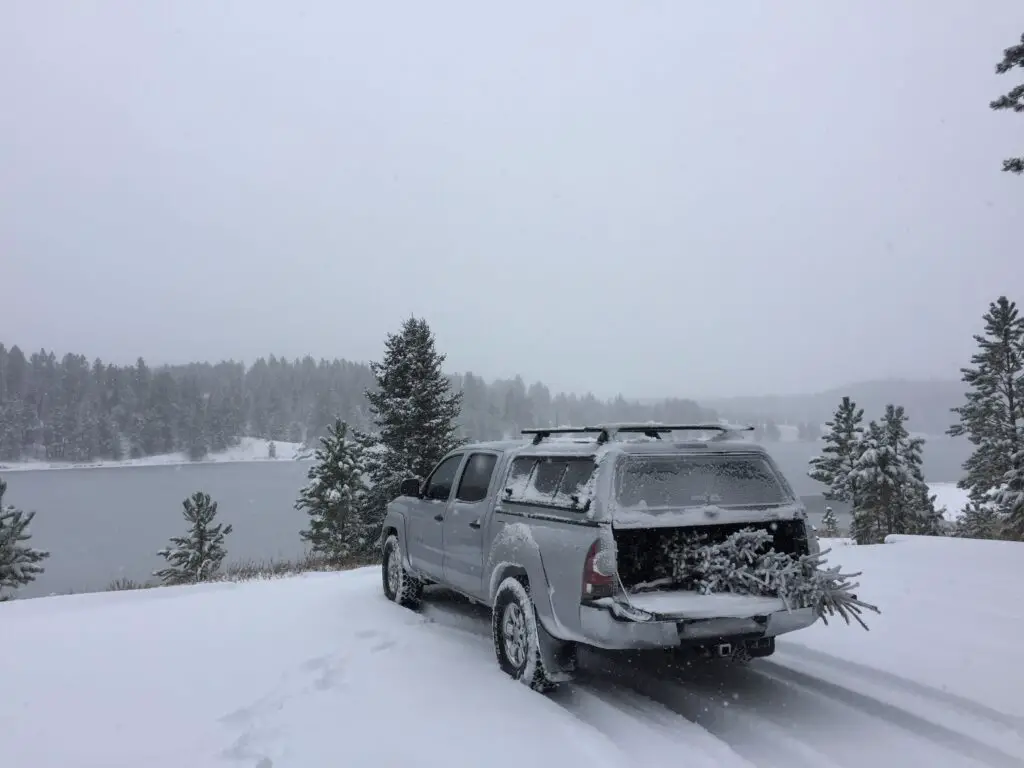
–we always bring extra clothing in case we get stuck out for a lengthy period of time or need to hike out to call for help.  We also have bug-out plans if the conditions prove worse than we had anticipated.  Click here for a short video of one wintery trip in the forest!  

A snowy meadow. Tall pine trees can barely be seen in the background through the gloom and snow. The shape of a truck is in the far background.
The truck stalks its prey (said in my best, nature documentary, narrator voice 😉 )

Our usual MO is to wander around one of our favorite hunting sites for a while…until both of us look across the meadow…and see IT, standing on the border between meadow and forest, with its much larger brothers towering in the background.  You always have to wait for that “Griswold Family Christmas Tree” moment (and yes, Trekker family tradition dictates we watch that movie the night we go tree hunting to start off the Christmas season. 😉)

If you’re really lucky, as you begin the search for the perfect tree it may start to snow gently…then it looks like a Norman Rockwell painting!  A word of advice, we’ve learned the trees look smaller in their “natural habitat”, surrounded by their MUCH larger brothers.  More than once we’ve had to cut a tree more drastically than we initially thought was needed once we got home and tried to fit it in our living room.  We’ve learned if Mr. Trekker’s 6’4 frame can reach the top of the tree…it should fit in the house!

To Conclude

So, if you’re looking for a great place to cut down your own tree, while also helping the local forest stay healthy, don’t be afraid to get your hands a little dirty.  Get out to your nearby national forest and get yourself a “free-range” Christmas tree. (It’s more organic than those tree-farm trees! 😉)

Christmas Tree Hunting in the Black Hills (or anywhere really) is an enjoyable, family-friendly experience.  I encourage everyone to try it out and as always, be safe and smart when venturing out.  The experience of trekking out to the wilds to acquire a tree from its natural habitat is incredibly exhilarating.  It speaks to the instinctual lumberjack who’s hiding in the deepest, darkest depths of all of us. 😉  It’s also a fun, family activity.  As I mentioned earlier, there’s little cell service out there, so gather the kids up in the “old family sleigh” and head out for some good, old fashioned–sans-technology–family time!

…just don’t forget the saw!  😳

A lit Christmas tree in a dark room with other Christmas lights surrounding it
The final product!

Have you ever ventured out to cut down your own family Christmas tree?  Tell me about your experience in the comments!


Did you enjoy reading this post?  Pin it!

A decorated Christmas tree in a house. Mistletoe drawings on the pin which reads, "Christmas Tree Hunting in the Black Hills National Forest"


Like what you read here today?  Please feel free to leave a comment, like or share this post!  Want to be notified when a new post is published?  Add your email and click the “Follow” button at the bottom of the page or the sidebar to the right.  By signing up for the email list, you will also receive a free copy of the Tranquil Trekker’s Top 10 Tips of Trekking Do’s and Don’ts!

You can also follow the blog on social media by clicking the links below!

Facebook

Twitter

Instagram

Pinterest

*I earn from all qualifying Amazon purchases

Dinosaur National Monument: the Colorado Side

In this post, I discuss the Colorado side of Dinosaur National Monument.


In this post, I reviewed the Trekkers’ visit to the Utah side of Dinosaur National Monument.  In this post, I’ll be discussing the Colorado side (as the park spans both states).

Scenic Drives on the Colorado Side of Dinosaur National Monument 

One of the main things we enjoyed on the Colorado side of the monument was the scenic drives.  There are several found throughout this portion of the park, though all but Harper’s Corner Road are suggested for high-clearance vehicles only.

As I mentioned in Part 1, under good conditions most of these roads are great to drive (honestly several of them were less bumpy than some of the paved, county roads we drove on).  I would have felt comfortable taking any vehicle with a higher wheelbase on these (such as an Outback), and we saw several SUVs.

I cannot stress enough though, that we were there in the most ideal weather possible.  According to the park, several of the roads are completely impassable when wet.  This seemed likely as we crossed many dry stream beds that could easily fill with stormwater runoff.  It also makes sense that the powdery dirt that covers the surface of many of these routes could quickly turn into slippery ooze when wet.  Many of the roads also only have one way in or out, so, if you reach the end, and then a rainstorm comes…you may not be able to get back out again.  Several also lead through low-lying canyons which are likely to flood quickly in a heavy rain event.  So please, be wary before attempting these roads if any bad weather conditions are present or expected.

Click here for the NPS website for the park which will have up-to-date info on current road conditions.

Harper’s Corner Road

This is the main road through the Colorado section of Dinosaur National Monument.  You access it near Dinosaur, Colorado.  This is also one of the only paved roads in the park.  At the end of it is the Harper’s Corner Trail which offers INCREDIBLE views.

Hiking on Harper’s Corner Trail

This trail is beautiful! At times you are hiking on an almost knife-edge of rock, with the Green River winding along beside you on one side, and the Yampa River on the other.  Did I mention you are up to 2500 feet ABOVE these waterways throughout the hike? 😮  It got my acrophobic-heart pumping a bit! (It really wasn’t too bad.  I only felt nervous in one spot where you get a healthy view of a chute, down a cliffside. 😋)

I would rate this trail as “easy”.  It’s about three miles in total length (out and back) and it doesn’t have much elevation gain.  Just about anyone wearing tennis shoes should be able to handle it (though I should note the park is at an altitude of over 5000 feet, so “flatlanders” may want to take it slow. 😉)  At the end of the trek you are treated to an AMAZING view down the canyon, and of Steamboat Rock from above, behind which the Yampa and Green Rivers meet.

A narrow river valley in a desert landscape as seen from above. Short trees are in the foreground while a thin, green river can be seen far below.
One of the incredible lookout points from the Harper’s Corner Trail. That’s the Green River far below, you can maybe see how it got its name.
Looking out over a desert, badlands landscape from above. Short trees are in the foreground with a large, rock formation in the background.
Steamboat Rock, from above…

Echo Park Road

This route takes you from Harper’s Corner Road, east, to Echo Park and its campground.  This area is called a “park”, like several other locations in Colorado.  It is really just a flat, meadow-like area.  It was cool!  (Hint, it’s called “Echo Park” for a reason, I encourage you to experiment with this 😁.)

This route traverses the lower “benches” of land that can be seen from above when traversing the Harper’s Corner trail.  They are called this as they are wide sections of terrain.  They literally look like benches, or steps, that rim the lower, river canyons. 

The road winds through an incredible canyon where sheer rock towers over you on both sides.  From here you can see Steamboat Rock from the bottom, where it’s much more impressive.

There is a short hike along the river’s edge that is around two miles long (out-and-back).  It takes you to the confluence of the Yampa and Green Rivers.  There is also a place on this road called Whispering Cave.  It appeared fairly unassuming, at first, as it’s just a vertical slit in the rock wall of the canyon, that you can stand in.  This was until we figured out its secret (and how it got its name).  If people stand at either end of this long slit and whisper REALLY quietly…you can hear each other VERY well (thanks to the unique acoustics of the rock structure).  And it’s far more effective than if you try the same thing outside (we checked! 😉)

Click here for a short video of the drive!

A dirt road snakes through a narrow canyon, rock towers on three sides.
The canyon on Echo Park Road.

A river with a desert landscape and rock rising in the background

A dry, yellowed meadow in a desert landscape and rock rising in the background
Echo Park!
A river with a large rock that resembles a shark's fin rising behind it, all in a desert landscape.
Another view of Steamboat Rock!

Yampa Bench Road

This route takes you from Echo Park Road, east, all the way to US 40 in Elk Springs (though there are a few places you can bug out before you get that far, dependent on road conditions).  This was the most difficult route we encountered.  The drive was beautiful though, with yellow grassland and scrub brush spread before you, all the way to the rock walls that rise above you on two sides.

Even this road wasn’t bad at this time of year, though I could see it being difficult if it was wet.  It was the steepest drive we took and it had the sharpest turns.  This was also the longest route we attempted, by far.  It was fun, but we covered less than half of it (around 20 miles) and that took almost two hours.  This did appear to be the most difficult part of the trek.  According to the map, the rest of it looked flatter and easier (and some parts may have been roughly paved).  We did finally escape, through a blessed hole in the rock wall called Thanksgiving Gorge (I think I know why they give it that name!) just as daylight was waning.  We were rewarded with a herd of elk…and LOTS of cows! 😋

A dry, yellowed grass meadow with rock formations in the background. The sun angle is low and shadows are long.
Sunlight is waning on the Yampa Bench Road

Beautiful Canyons in the Colorado section of Dinosaur National Monument

Flaming Gorge Reservoir

On Sunday we took US 191 north of Vernal, Utah, to the Flaming Gorge Reservoir.  It was named for its vibrant, red cliffs that were cut by the Green River.  The gorge spans both northeastern Utah, and southeastern Wyoming, just to the north.  It is absolutely beautiful, and the dam that created the reservoir is pretty stunning, as well.

A lake sits between two rocky hillsides in a desert landscape
Flaming Gorge Reservoir
A large, concrete dam in a desert landscape
The Flaming Gorge Dam

Gates of Lodore

From the dam, we then continued north on Route 191, just across the Wyoming line, and picked up Brown’s Park Road.  This we took east, back into Colorado.  From here we followed signs to the Gates of Lodore, another INCREDIBLE canyon that was cut by the Green River.  It sits on the northern tip of the monument.  This route was a mixture of well-graded dirt and rough pavement, though any passenger car should be able to handle it, at least in good weather.

I was pronouncing this location like “Gates of Mordor”, from Lord of the Rings, but was quickly corrected by a local.  Apparently, it’s supposed to sound more like “Gates of la-DOOR”. 😂 

There’s an easy, and fairly short, hiking trail that leads to the mouth of the canyon, from the parking area.  Due to its sheer, rock walls, there is no access through this rocky cleft, except by watercraft on the river itself.

A river winds through a desert canyon. Tree-covered, steep, rocky walls line both sides of the canyon.
Gates of Ladore!

A river snakes through a desert landscape with yellow-grass meadows and scrub brush-covered hillsides

Crouse Canyon/Brown’s Park Scenic Backway

We returned back to Vernal by way of the Crouse Canyon/Brown’s Park Scenic Backway.  This is another route that cuts through a beautiful canyon, and then a meadowy area.

This road was one of the rougher routes we traveled on and was basically only one lane wide.  This was unexpected as it was listed as a scenic drive in one of the local tour brochures, and wasn’t suggested to be high-clearance.  Our truck handled it easily but had we known how rough it would be we would have aired the tires down, just for a smoother ride.  In good conditions, any SUV with a higher wheelbase should be able to handle it (we passed a CRV or two) but I wouldn’t suggest attempting it in a typical passenger car (just because there were some rocks and ruts that had to be navigated).  An Outback probably could have managed it, but we would have been extra cautious. 

The drive was BEAUTIFUL though, with the yellow and orange leaf colors set against the red rock of the canyon walls, which contrasted with the blue of the sky above.  Click here for a short video of it!

We returned home via US 40 east, through Craig, Steamboat Springs, and Rabbit Ears Pass.  This is the one portion of northern Colorado we hadn’t been to yet.

Related posts: Conquer Lengthy Trails in Small Portions; The Best Hidden Gems of Northern Colorado

From there we took Route 14 north to Walden, then headed north to Laramie, Wyoming, and back to the Black Hills.  FYI, this is a great way to avoid the traffic in the Denver area, and much of I-25, if you’re heading north from northern Colorado!  It offers some great views too!

You won’t find a better time to visit this park than Fall.  Tree colors are bright, crowds are light and temperatures are cool.  So the next time you’re looking for a good autumn vacation spot, think of the out-of-the-way Dinosaur National Monument!

Have you visited this incredible place?  Tell me about your favorite parts of it in the comments!


Did you enjoy this post? Pin it!

A narrow river valley in a desert landscape as seen from above. Short trees are in the foreground while a thin, green river can be seen far below. Pin reads, "Dinosaur National Monument: the Colorado Side"


Like what you read here today?  Please feel free to leave a comment, like or share this post!  You can also follow the blog on social media by clicking the links below!

Facebook

Twitter

Instagram

Pinterest

Dinosaur National Monument: the Utah Side

In this post, I give a review of the Utah side of Dinosaur National Monument.


To celebrate our 10-year anniversary, the Trekkers headed to Colorado!  We started our trip in Boulder, as Mr. Trekker had some work-related meetings for a few days.  Thanks to my flexible job I was able to work out on the balcony of our hotel room. 😋

We spent the remainder of our week at the Dinosaur National Monument, that spans the northern border between Utah and Colorado.  This is a cool place that we hadn’t heard of until recently (you can learn more about it at the NPS website here.)  It is in a very remote area.  In fact, we think we may have finally found a place in Colorado where planes don’t constantly fly over!

Boulder, Colorado

Boulder is nice, for being a larger city.  It reminds me A LOT of the place we used to live when we were in North Carolina.  I don’t like all the bike lanes, especially when driving Mr. Trekker’s truck, these give me serious anxiety!

I felt like it was just an added stimulus I had to keep track of while trying to navigate the busy traffic and figure out where in the world I was going 😛.  There were also A LOT of boulevards.  While this is certainly aesthetically pleasing, I find it makes getting around town (or just simply turning around, or getting to a business that’s on the other side of the block) difficult.

I will say this, for a larger city and busier place, I have been pleased with how friendly people are here, especially when driving.  I rarely ever get honked at and people are usually willing to let you into a lane quite regularly, even when traffic is heavy.

I hadn’t expected to miss seeing the mountains…being in a town that sits RIGHT NEXT TO the Rockies! 😛  Boulder might actually be closer to these peaks than we are to the Black Hills…and I can see those from our house!  There were just so many taller buildings and trees that blocked the view.  It seemed kind of sad to me, that people live in such a cool place and you don’t get to enjoy its natural beauty every day…

I can definitely understand why people live in Boulder.  It’s very pretty and there’s a lot of culture, nice restaurants, etc.  It seemed to cater more to those who ride bikes or walk, which is fine, I’m all about a green lifestyle that’s full of outdoor time and exercise.

It doesn’t help that Boulderites–whether on bikes or walking–don’t seem to understand the laws of physics.  They barely watch for vehicles!  Yes, I understand you may have the right of way in many situations. However, you should still navigate defensively. If someone in a half-ton vehicle hits you, your “Right Of Way” doesn’t offer any protection whatsoever! 🙄

Boulder seems to be in an odd transition phase.  Some parts of it are “old school” and charming, with Victorian-style homes (such as the one used in the tv show, Mork and Mindy, seen here!)  There is also A LOT of new construction occurring, of very modern, industrial-looking, apartment, condo, and office buildings.  While this type of architecture is cool too, I’m not sure about the mix of the two, especially when they’re squished together like sardines.  It kind of felt like a smorgasbord of building design, and I’m not sure how I felt about it…🤔

Parking was definitely a problem though.  I’m not sure if this may be due to the fact that the area has grown so quickly?  Unfortunately, there were multiple times when I couldn’t get to a business or park that I wanted to visit due to there being no parking available nearby.

As I said, if locals mostly walk or ride a bike, maybe this isn’t a big deal.  It doesn’t make a visitor feel very welcome though.  I find it INCREDIBLY frustrating when I want to go to a place and all I see are “no parking” signs. 😡  Do people just “Uber” everywhere these days?  Yeah, I’m a child of the 80s folks, this old dog likes her car and likes to drive herself, thanks! 😉😜

The only real complaint I had about the town (other than the traffic 😇) was when Target charged me 10¢ per plastic bag (and Safeway charged 20¢!)  I understand that the overuse of plastic is a problem, but don’t just start charging me for bags without any warning.  I don’t even mind using reusable bags that I bring from home, but I wasn’t at home, was I?  It just felt, unwelcoming, frankly.

As an example of why, after paying, I realized one of my bags was a little heavy and I would have preferred to double-bag it.  So then I was faced with a dilemma…do I “steal” an extra bag?  Do I go through the hassle of trying to pay an additional 20¢ for ONE MORE BAG?  Or do I just risk there being a hole in my single-layer bag and dumping my glass bottles all over the parking lot? *sigh*

I had an interesting encounter with a Tesla…we were in a tight parking lot and I was getting back in our truck.  I was being VERY careful to not bump the fancy, shiny car next to me, when all of a sudden, the computer screen on its dash “woke up” and started scrolling something about “security” (there was no one in the car, mind you).

I’m assuming the machine was “sensing” my presence?  It was a little creepy!  I felt like I was dealing with Kitt from Knight Rider! 😜 (Yes, that was a 1980s TV reference, I just dated myself again didn’t I? 😋)  I may not be cut out for this “brave new world” ya’ll! 😋

Things to do in Boulder, including the Mork and Mindy House!

A grey, Victorian-style house sits behind a white, picket fence in town

For those who don’t know, Mork and Mindy was a comedy show starring Robin Willaims as an alien that was on in the late 70s (Note: BEFORE my time folks! 😝)

The show was based in Boulder and the house Mork lived in is still standing. It is located at 1619 Pine St. (I’m telling you this because the info is LITERALLY available on Google. 😇)

And, because we apparently can’t ever go to Colorado for our anniversary without it snowing, this is the–admittedly beautiful–sight we woke up to one morning… 😋 (it was 80 the day before mind you! 😮)…

Dinosaur National Monument

On our route west, toward the monument from Boulder, we drove on I-70 through Glenwood Canyon.  That route through the Colorado Rockies has to be one of the prettiest sections of interstate I’ve ever been on.  Click here for a video of our trip through the canyon…

As long as you aren’t intending to go on a rafting trip on the river, fall is known as one of the BEST times to visit this park.  For one thing, it’s in the desert-scrubland that comprises northeast Utah/northwest Colorado, so it gets HOT in the summer (and you all know how much I “love” the heat 😜).  Also, it’s far less busy this time of year and the tree colors are lovely.  We, actually, intentionally held off visiting here, until we could go in the Fall.

We spent our first day on the west (or Utah) side of the monument.  Here you will find the larger–and in my opinion better–Visitor’s Center.  Also, if you’re there for dinosaur bones (and why else would you be visiting?! 😉) this is the side to start on!

The Quarry Exhibit Hall at Dinosaur National Monument

This place was COOL!  Just an FYI, there’s only a few established places where you can actually see dino bones at Dinosaur National Monument.  The town that holds the name “Dinosaur” is on the Colorado side of the park…but there aren’t many bones actually viewable there. 😋  You have to go to the main entrance, which is found in Jensen, Utah (just a little east of Dinosaur, on US 40).  If you’re there when its busy, there’s a free shuttle that takes you to the quarry from the Visitor’s Center.  If you’re there on slower days (which we were) you can drive yourself.

We stayed at a lovely Air B&B in Vernal, Utah, which is about a 30-minute drive west of Dinosaur, Colorado.  This is the largest town in the local area and we were glad we chose it.  It offers easy access to any of the attractions in or around the monument, and also provides the most options for food and lodging.  If you’re wanting to camp, there are several campgrounds within the monument itself, and there is said to be a nice RV park in Dinosaur (though I don’t have any personal experience with that). 

The Quarry is AMAZING!  It’s an enclosed building that was constructed over the site of a former paleontological dig, that contains massive amounts of dinosaur bones.  They were discovered in the early 1900’s.  After much excavation it was finally decided to preserve the remaining bones as-is, and allow people to view them in their natural state.  It’s thought that this was a place where large, flash floods occurred, helping to explain why so many bones ended up in such close proximity to each other.  I could have stayed there all day!

A wall of rock in a building with white, animal bones sticking out of it
At the Quarry. Those are all dinosaur bones from different species that were fossilized in the mud!

From here, you can also hike the Fossil Discovery Trail which shows some fossils that are still embedded in the rocks …

A rock wall with white arrows painted on it pointing to a specific section
If you look closely, the white arrow is pointing to the fossilized spinal column of a dinosaur!

After leaving the Visitor’s Center, we took Cub Creek Road through the park.  This is one of the only paved roads throughout the monument, and even it turns to dirt the final few miles. (This section is well-graded, though, and passable with any passenger vehicle under good conditions.)  It offers several opportunities to view petroglyphs and pictographs (these are the drawings and etchings that were left on the rock by the ancient people who first tamed this wild land).  I had seen pictures of these creations before, but had never viewed them in person.  Some were absolutely AMAZING! 

Aren’t these incredible?!

A sandstone, rock wall with etchings of animals
This is the only place in the park where you can see the lizards.

A sandstone, rock wall with etchings of animals and other figuresA sandstone, rock wall with etchings of figures

A sandstone, rock wall with an etching of a large figure

I’m sure they all had perfectly logical explanations (some of them can be found here) but some looked pretty “unique”…(I’m not saying it’s aliens but…😲😉👽🖖

This road eventually takes you to Josie’s Cabin, where up until the 1960’s, a woman lived, by herself, until she was well into her 80’s.  This was without electricity or running water, mind you!  We saw a lot of lovely tree colors in this area.  There were several easy hikes that ventured into box canyons that are known for being good for fall colors (they run right along rivers and streams and the cottonwoods that grow there are very pretty).

An old, wooden cabin sits amongst trees
Josie’s Cabin
A brows-grass meadow with green trees in the foreground and fall-colored trees and a rocky mountain in the background, all under a clear, blue sky
Some of the fall colors along the creekbed
Island Park Road

This was another beautiful drive that is located on the Utah side of the park.  I thought this area had the BEST petroglyphs that we saw throughout the entire monument.

Island Park Road was dirt, and, according to the park office, is said to be “impassable” when wet. (It is suggested to only take high-clearance vehicles on this route, but, when we were there, any vehicle could have handled the drive).

We got lucky, as conditions were absolutely perfect throughout the duration of our trip, with clear skies.  So we were visiting under the most opportune conditions.  There were several areas we drove through that appeared to be dry creek beds, and looked like they could flood easily during wet conditions.  This is also an area that only has one way in or out, so if you drive in under dry conditions, and then a summer thunderstorm pops up…you could find yourself trapped!

Below are a couple of pictures of the Green River as seen from this road…

Lake with trees and rock mountains surrounding it and in the backgroundCalm creek runs through scrubbrush-covered canyon walls on both sides

…and some of the scrubland around the monument (and thanks go out, as usual, to Mr. Trekker for most of these pics!)…

View over a desert landscape. Scrubbrush flatland with a creek in the far background leads to mountainsView over a desert landscape. Scrubbrush flatland leads to dry mountains in the background

Sunset over the monument!

Sunset over a desert landscape with the silhouette of dark mountains in the backgroundSunset over a desert landscape with the silhouette of dark mountains in the background


Have you visited this incredible place?  Tell me about your favorite parts of it in the comments!


Like this post? Pin it!

A sandstone, rock wall with an etching of a large figure. Pin reads, "Dinosaur National Monument--the Utah Side"


Like what you read here today?  Please feel free to leave a comment, like or share this post!  You can also follow the blog on social media by clicking the links below!

Facebook

Twitter

Instagram


Camping in the Bighorns

We try to camp in the Bighorns, in northeastern Wyoming, at least once a year!


The Trekkers have a tradition of camping in the Bighorns each Labor Day Weekend!  Puppers has been a trooper on our camping trips.  She enjoys riding in the truck (she doesn’t even mind the BUMPY, jarring journeys we’ve taken her down a few 4×4 roads…too much! 😉)  She can keep up with us on the hiking trails and she even handles the tents like a champ (though she needs a little assistance getting in and out of the rooftop tent).

You do have to wonder about people who drive 3+ hours to the wilderness, where they proceed to pee in a bucket and not shower for three days…and call that fun! 🤔😉😎

A rooftop tent is open on top of a trailer, a separate small tent and truck are behind. All in a woodland scene.
One of our camp setups

We finally caved and bought a privacy shelter for this trip, and we were SO glad we did.  It made life SO MUCH easier.  In the past we’ve used the vestibule that came with the rooftop tent, this worked ok, but even I couldn’t stand up straight in it (not to mention Mr. Trekker’s 6’4 frame).  This could be because we have the tent on the trailer rather than on top of the truck, the vestibule likely works better in that situation.  But the shelter worked great for changing, for a bathroom along with our Luggable Loo†, and for a shower using the solar shower.  It was so cool to look up at night and see the Milky Way shining over you while you were changing or “taking care of business”. 😇

The Bighorn Mountains

I know I’ve said this before, and I hate to sound like a broken record, 😇 but I LOVE the Bighorns.  I always forget we aren’t in the depths of the Colorado High Country when we visit there.  I love their stony summits, some still sporting spots of white leftovers from last winter’s snowpack, just above the treeline far below.

I always think of them as their own tiny island of mountains that rises out of the high prairie of northeastern Wyoming, but according to Wikipedia, they’re actually a spur of the Rockies separated from the main mountain chain by the Bighorn Basin.

A creek runs through a wetland area with trees and stony mountains towering in the background.
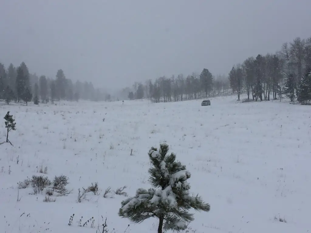
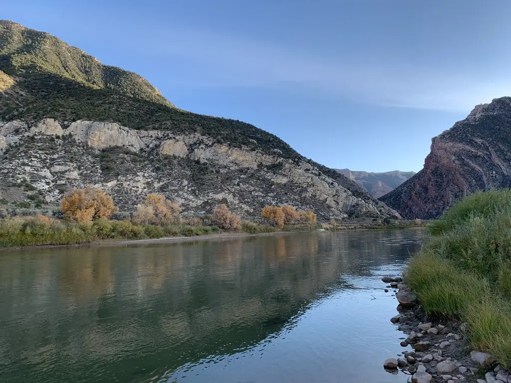
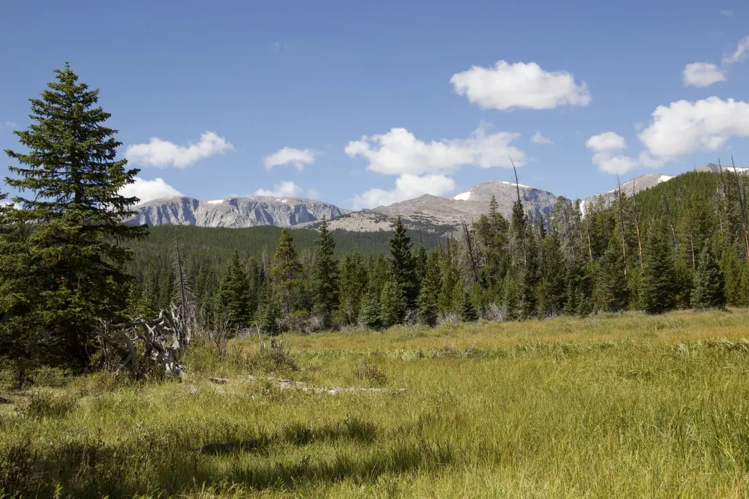
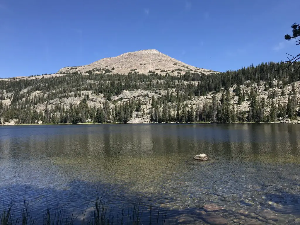
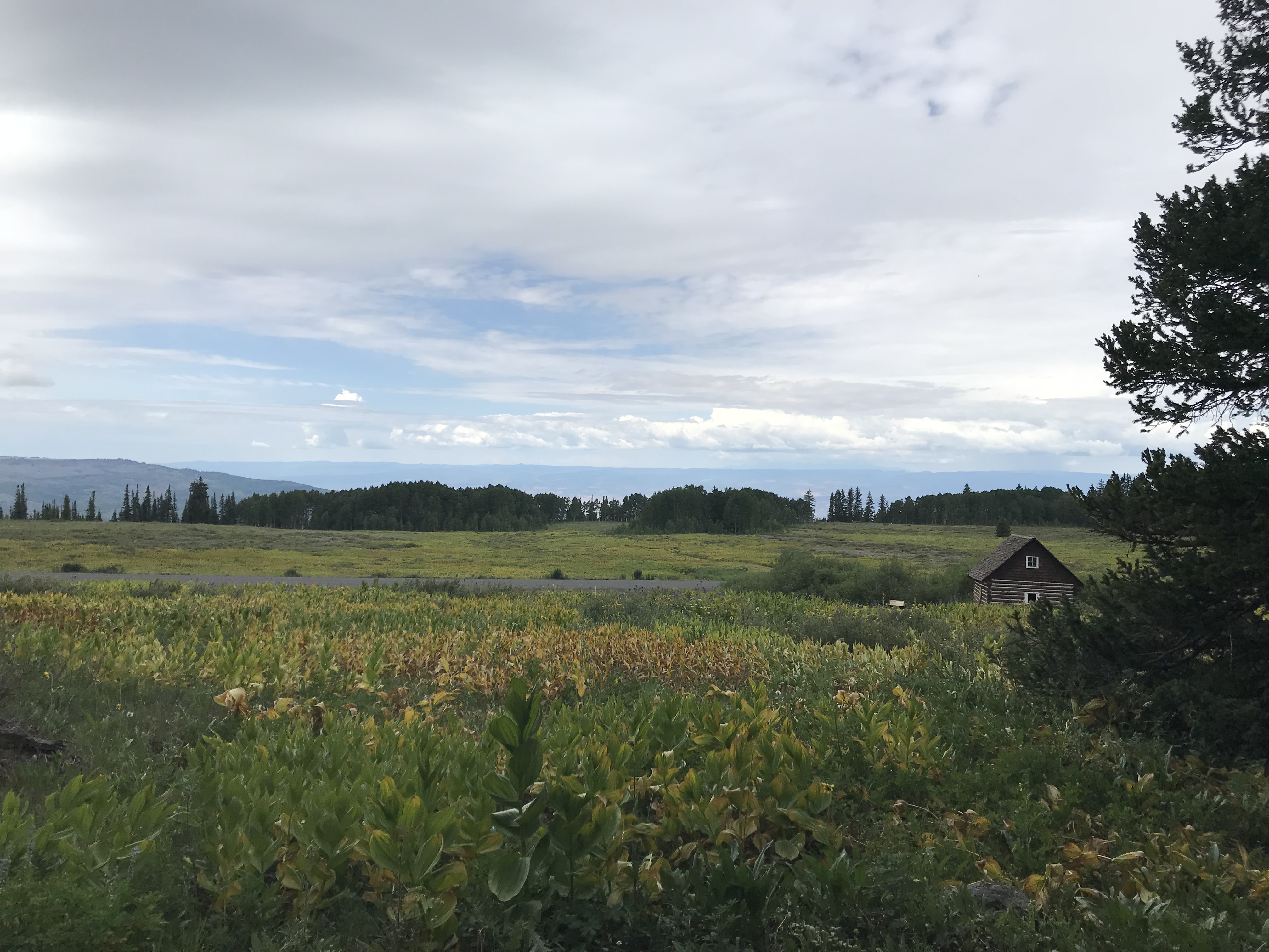
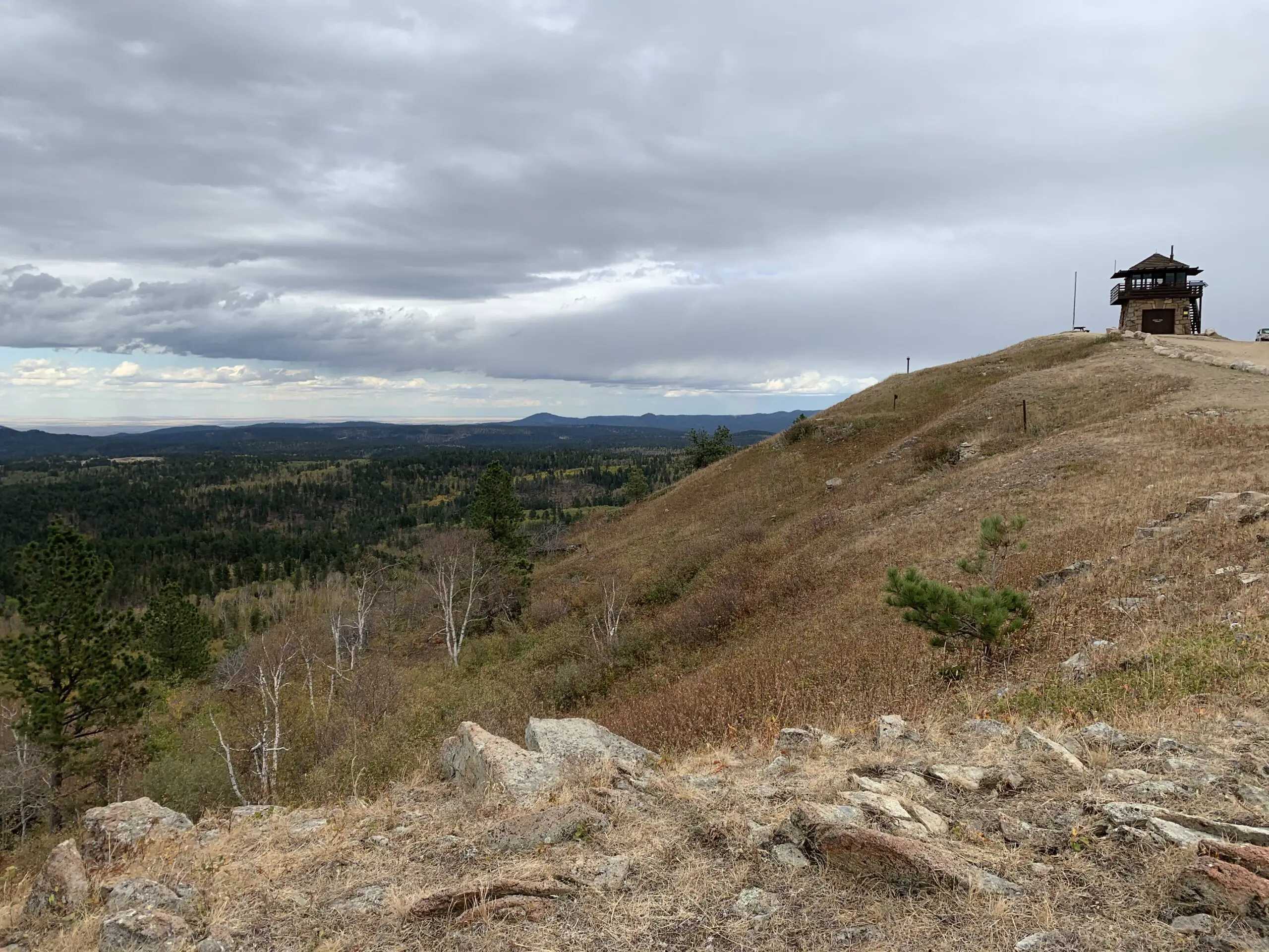
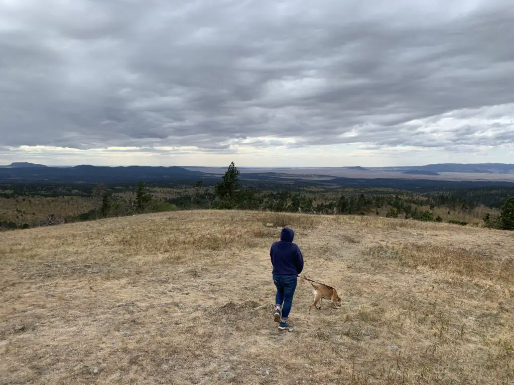
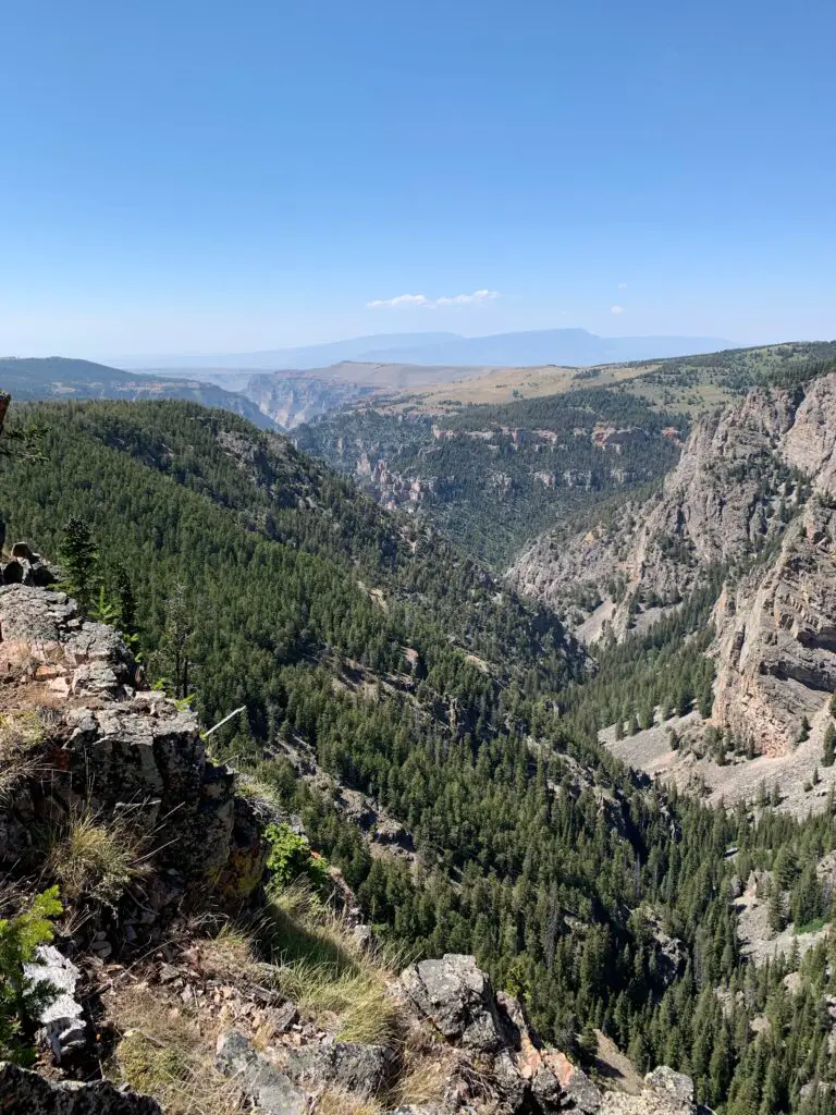
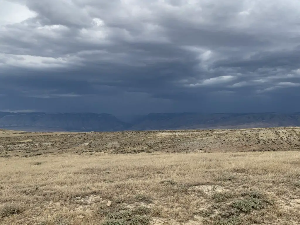
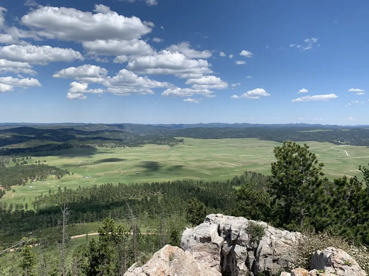
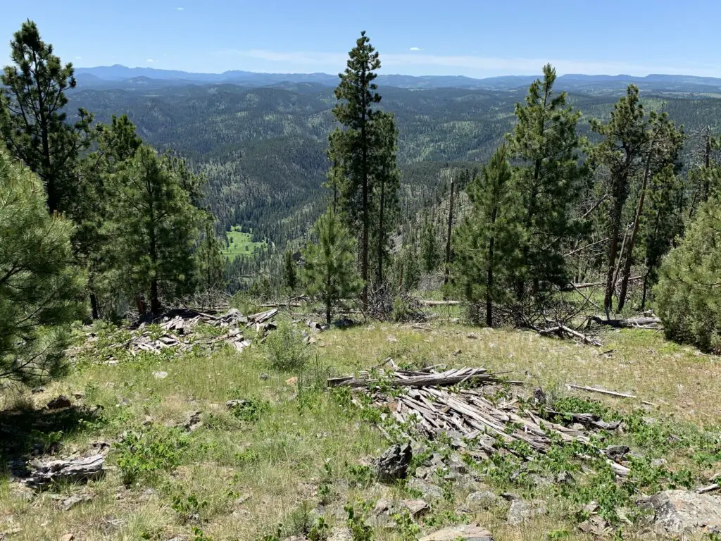
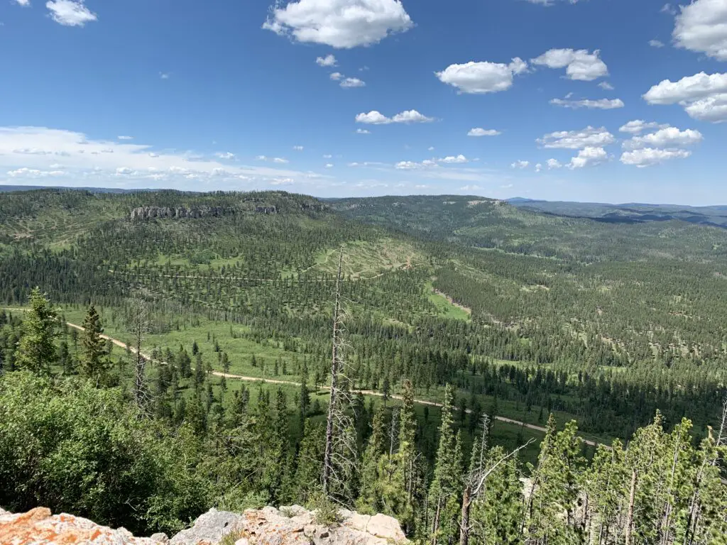
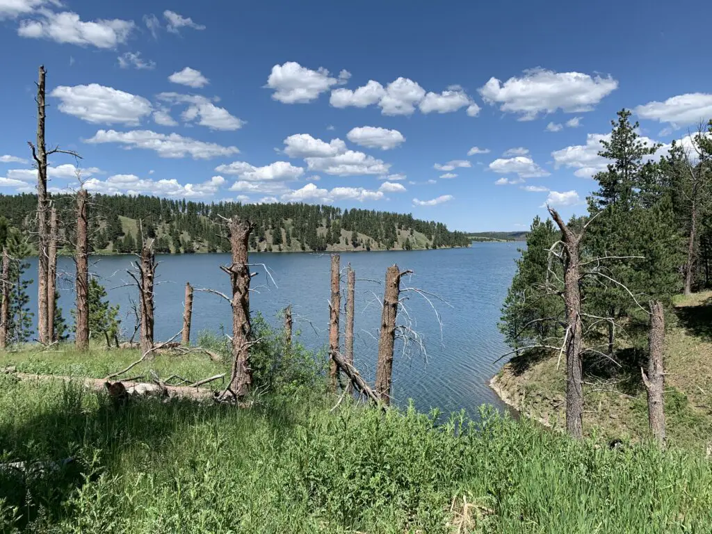
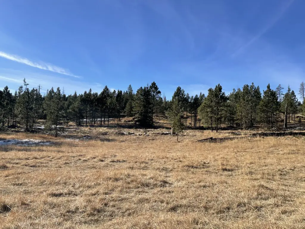
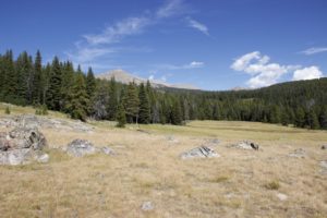
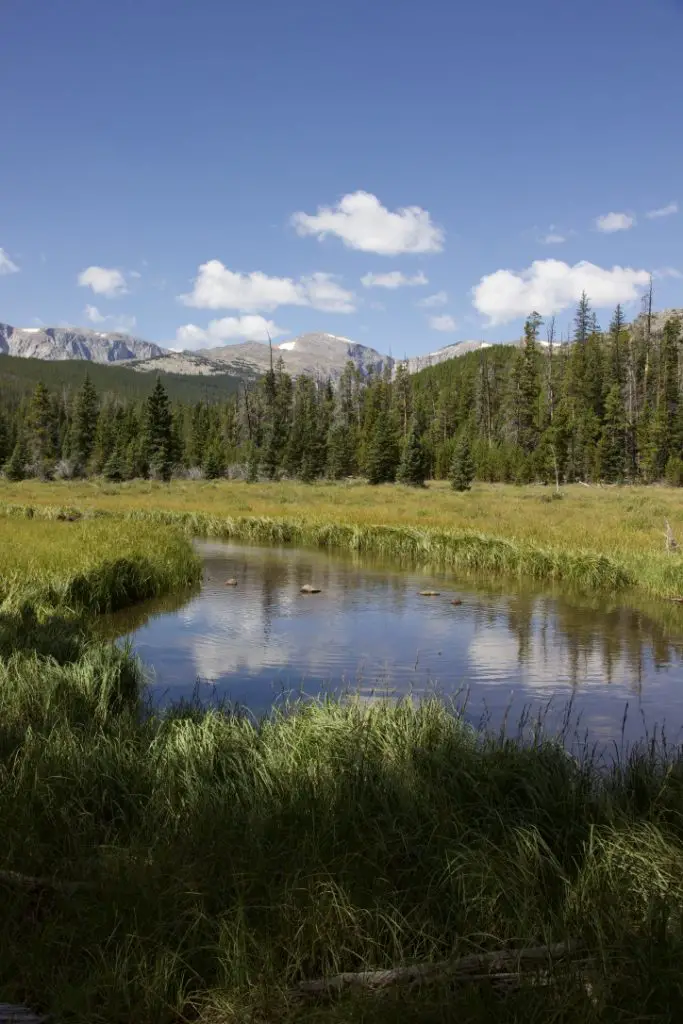
Though this area is just as beautiful as the Rockies, it is FAR less crowded, which makes it so much more pleasant to visit. 😋  There are no lines of people hiking in the Bighorns like we’ve experienced in various places around Colorado.  Also, oftentimes, the lower-elevation plains may be baking in 90-degree weather, while it’s in the 60s-70s, and breezy, in the mountains!

It doesn’t hurt that, depending on which area you are heading to, the Bighorns are a shorter, 3 – 4-hour drive from the Black Hills, rather than the 6 – 8+ hours required to reach the mountains in Colorado ( and that’s just the Front Range, in the east-central portion of the state).  You will still have to drive through rural Wyoming whether you’re going to Colorado or the Bighorns.  However, to reach the mountains in Wyoming, you drive on I-90 the whole way.  It’s a little easier if weather is bad, and you don’t have as much trouble with the Wyoming drivers who like to pass on two-lane roads leaving little room for oncoming cars…(ahem!🤬🤯) ( Of course, all that being said, no one should visit here, ever, it’s just a terrible place to be. 😮😇🙃)

The Bighorns aren’t to be trifled with though.  These mountains are rugged, with little accommodations by way of gas, food, and supplies.  Small towns, such as Buffalo, Ten Sleep, Greybull, and Sheridan dot the area.  But these are few and far between (not to mention pretty tiny, by the standards of “normal” people who aren’t used to the small settlements that are common in the West). 😉  This is a national forest area, not a national park, so even camping accommodations are rustic, rarely offering more than potable water and a pit toilet (and those are the fancy ones)! 😮  So, if you’re looking to visit this area, be prepared to be self-sufficient.  The views will make it worth the trial, though!

The night sky in the Bighorns

There isn’t a lot of light pollution in the Bighorns, so on clear nights, you are treated to an INCREDIBLE light show!  Once the sun sets, the stars and planets come out in abundance.  My whole life, I’ve never seen a night sky that is comparable to what you find in the crisp coolness of the high mountains.  The sky actually looks like it has the measles, as there is almost a rash of stars that covers it.  The cloudy ribbon of the Milky Way is often clearly visible as it stretches across the expanse of darkness.  You can almost sense it glowing from within.  It is truly an incredible sight.

Silent Night in the high mountains

An instrument shows an altitude reading of 7500 feet
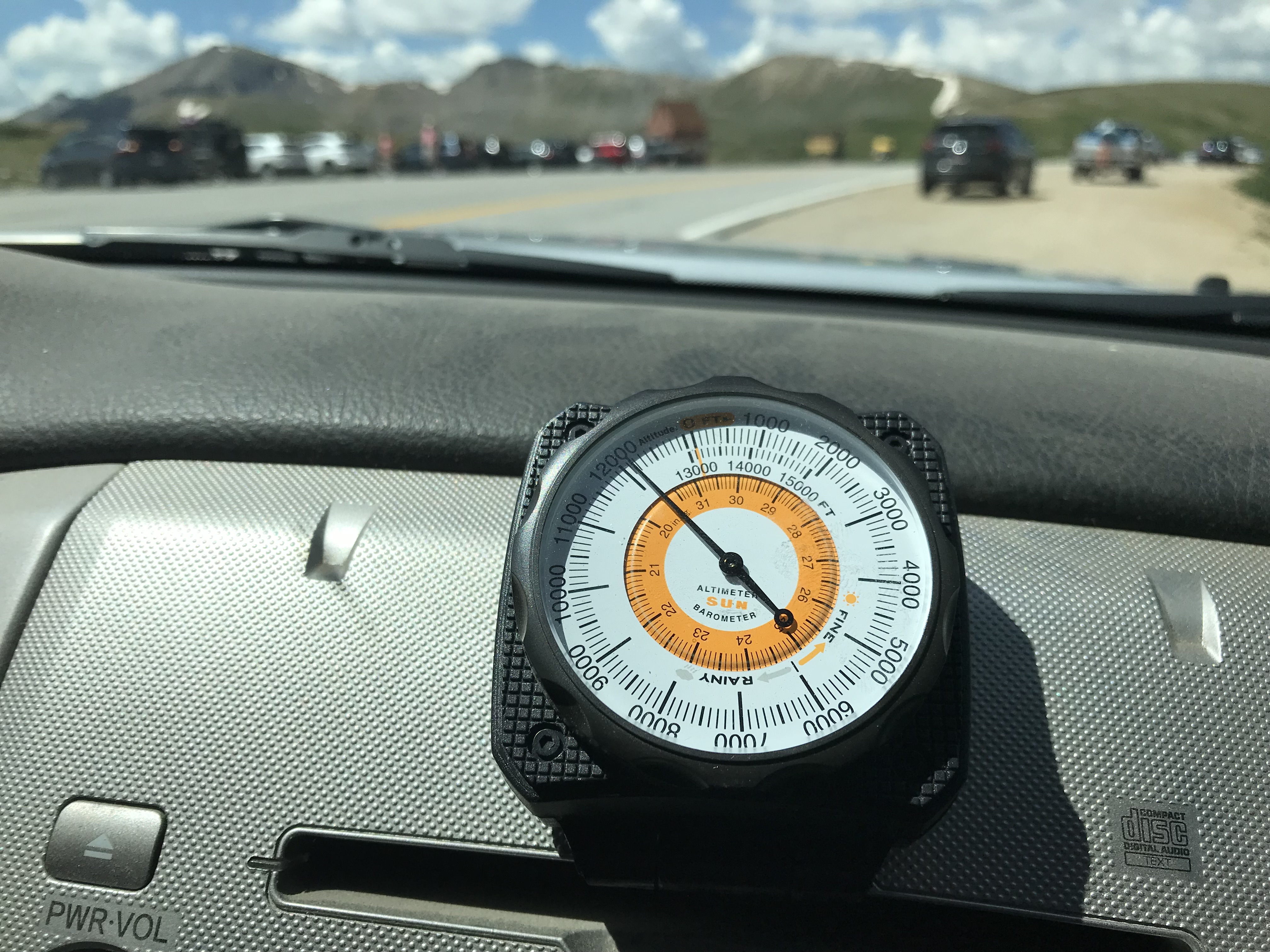
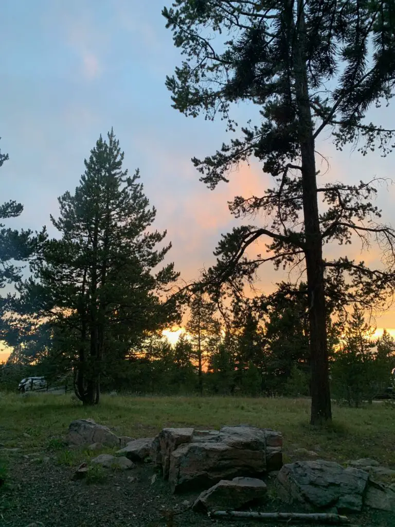
Our campsite was at about 7500 feet on this visit (oftentimes we stay much higher, closer to 9000-10,000 feet).  We’ve noticed something odd at these high altitudes that we have also experienced in Colorado’s High Country.  There is a distinct lack of “night sounds”.  You don’t hear the chirping of crickets or croaking of frogs in that thinner air, even on warmer nights, and I don’t know why.  Nights tend to be pretty cool in those places, so it may be due to this, or just that there is a very short season where the night air would even be warm enough for the creatures to survive.  But whatever the reason, when we’re up so high I do miss the “chirping” sounds of a summer night.

Dispersed camping in the Bighorn National Forest

Morning on a meadow ringed by trees. The sun is just coming up and is shinning on the mountains in the background.
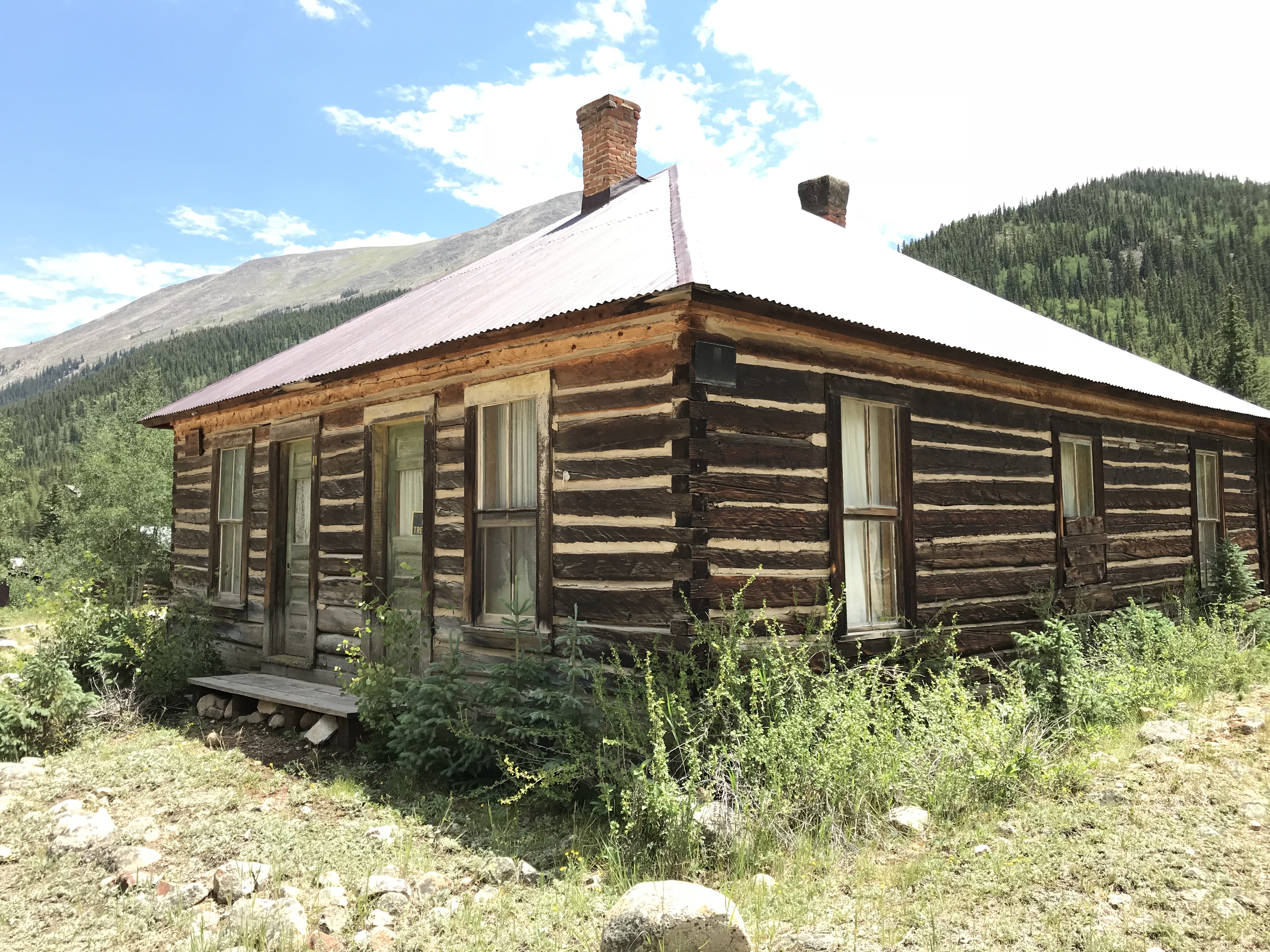
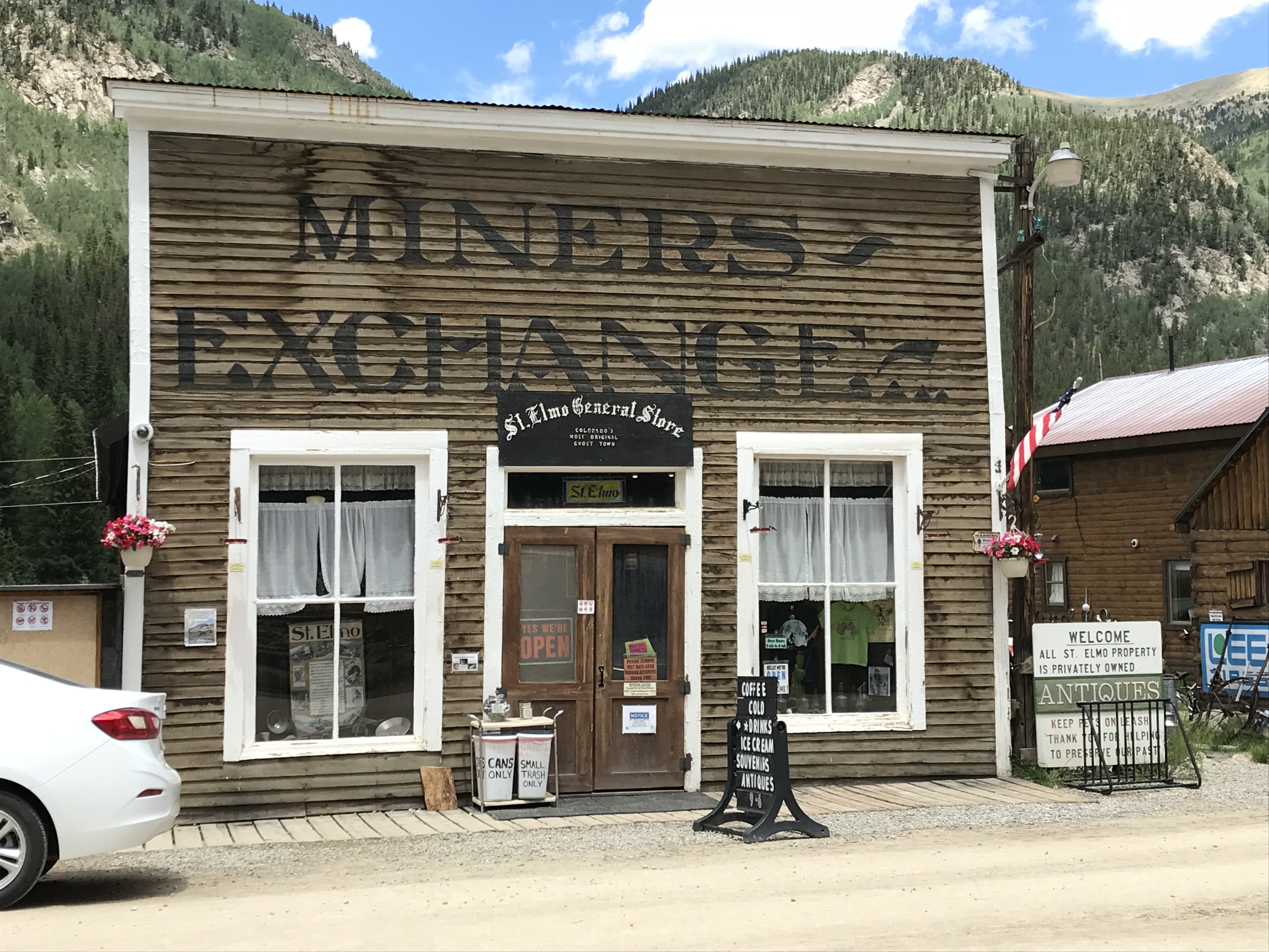
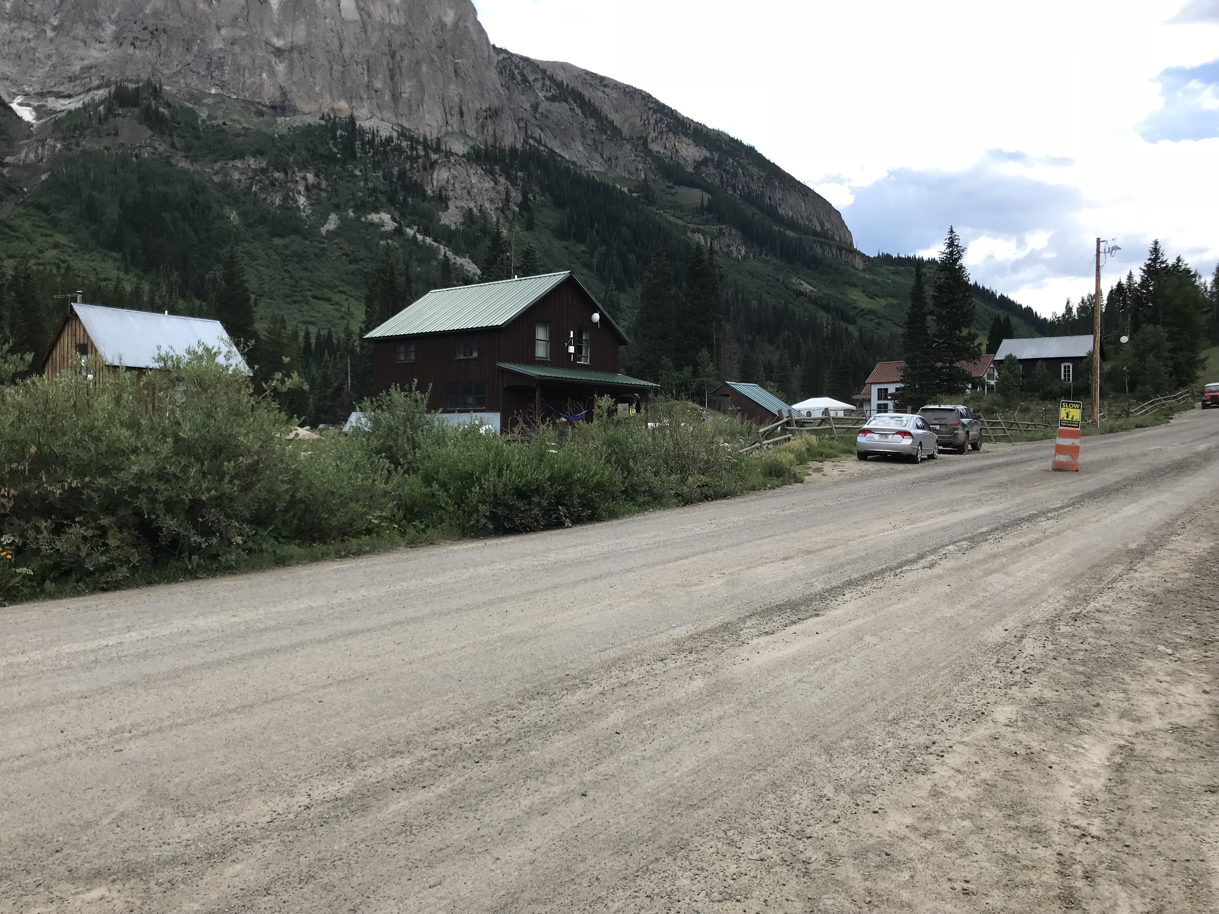
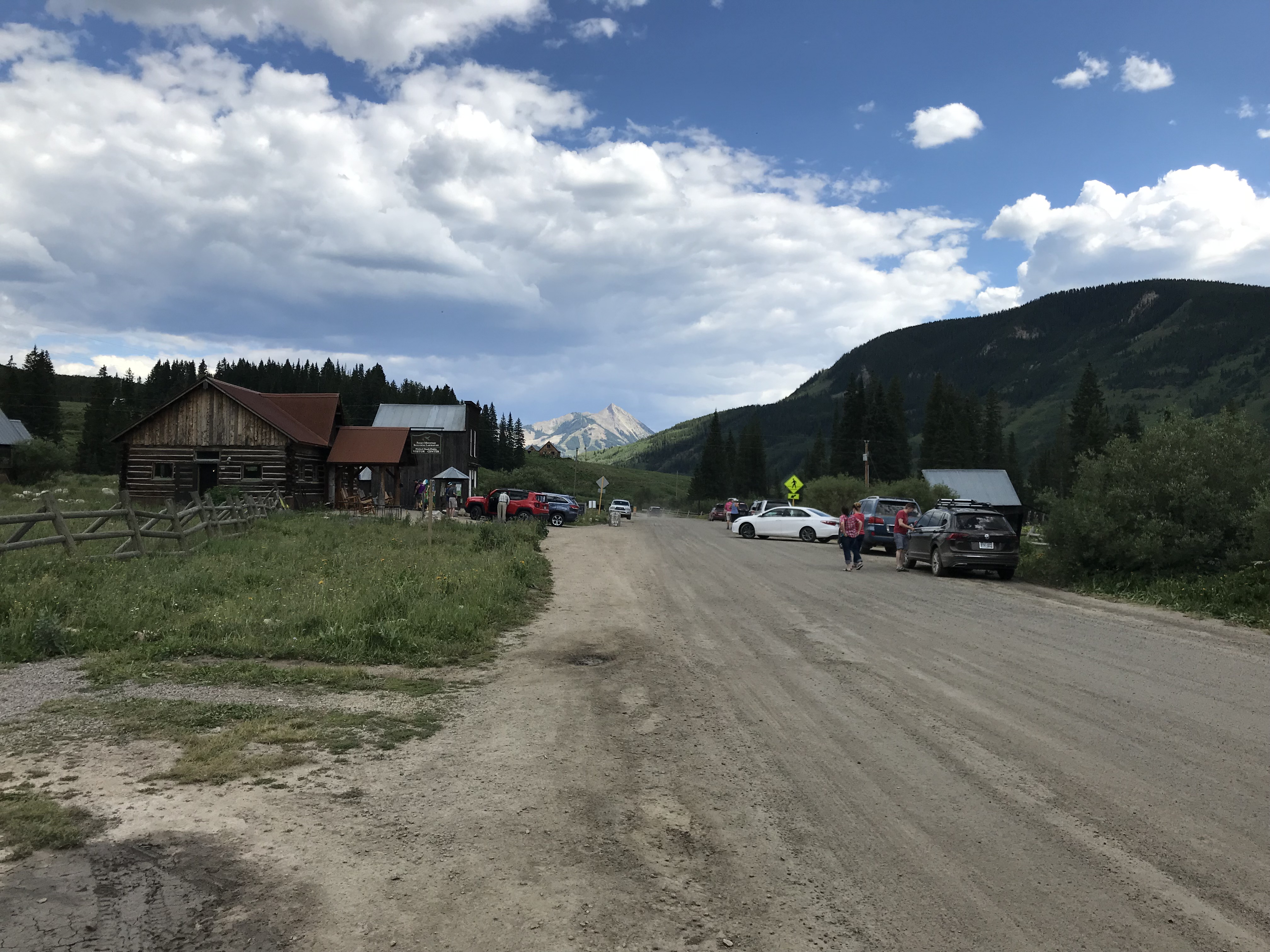
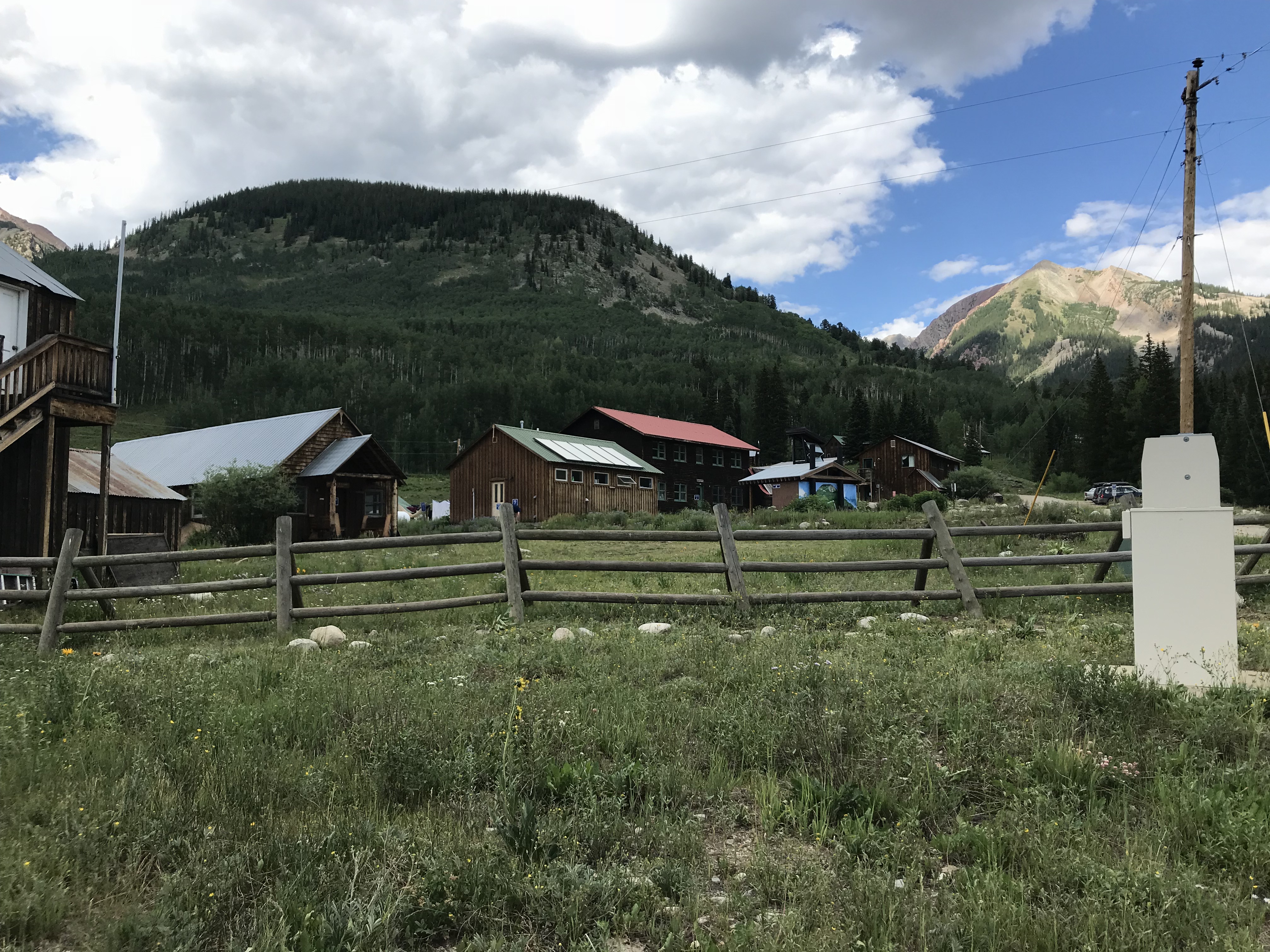
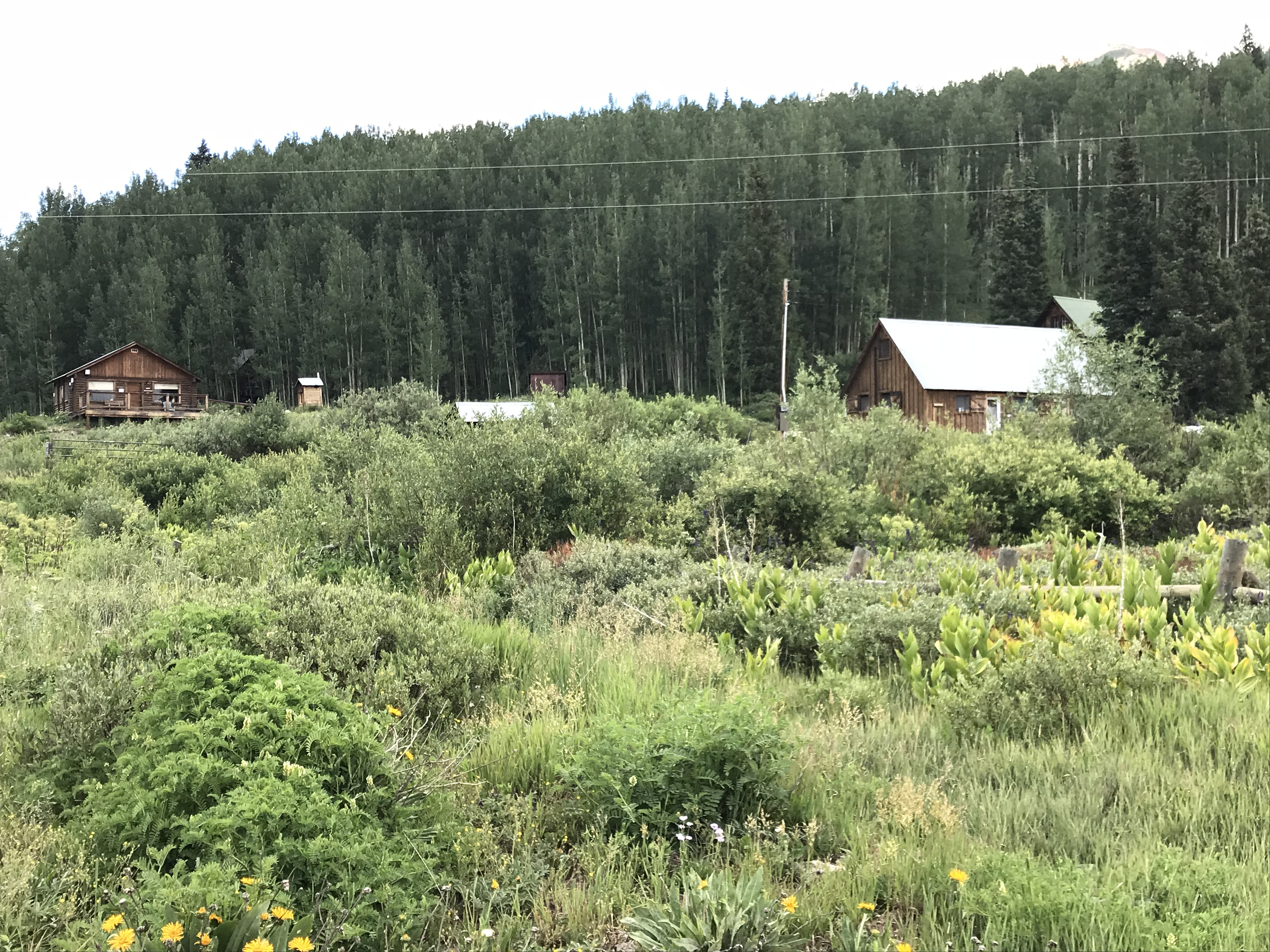
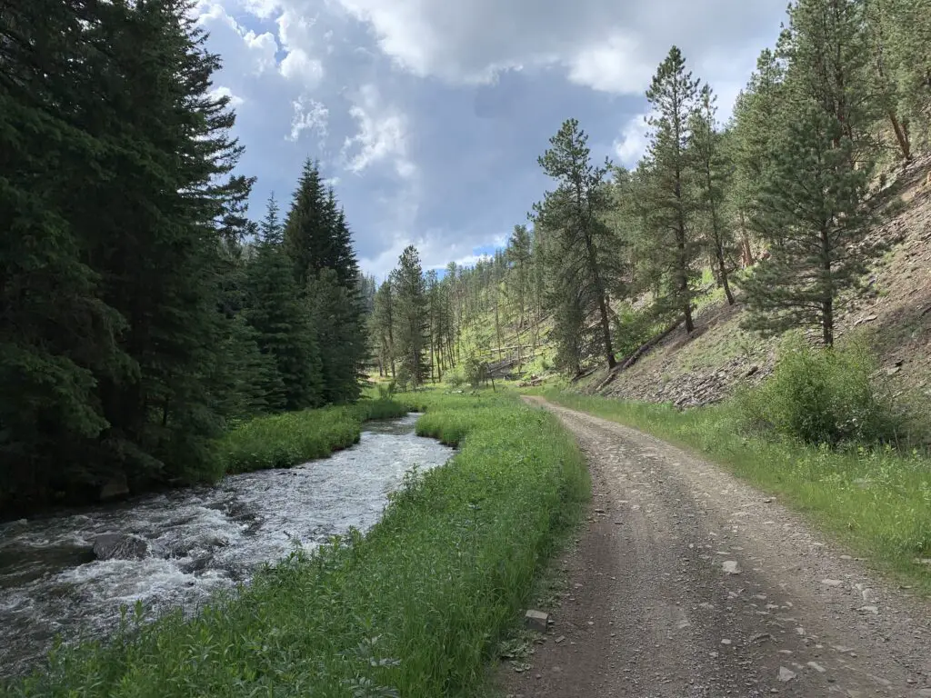
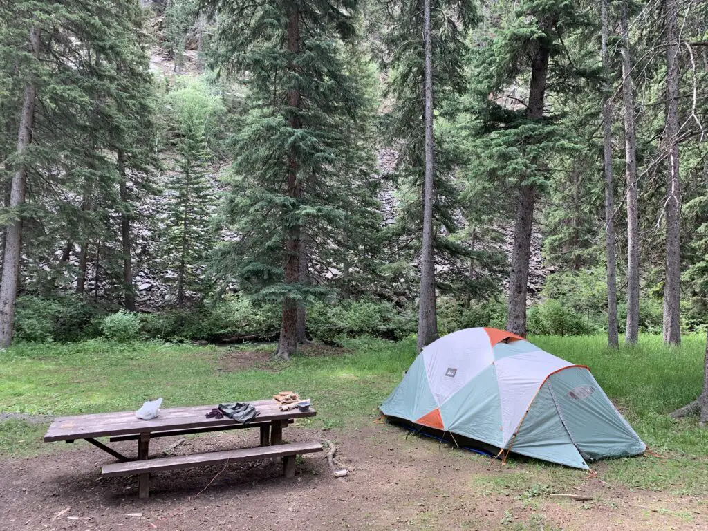
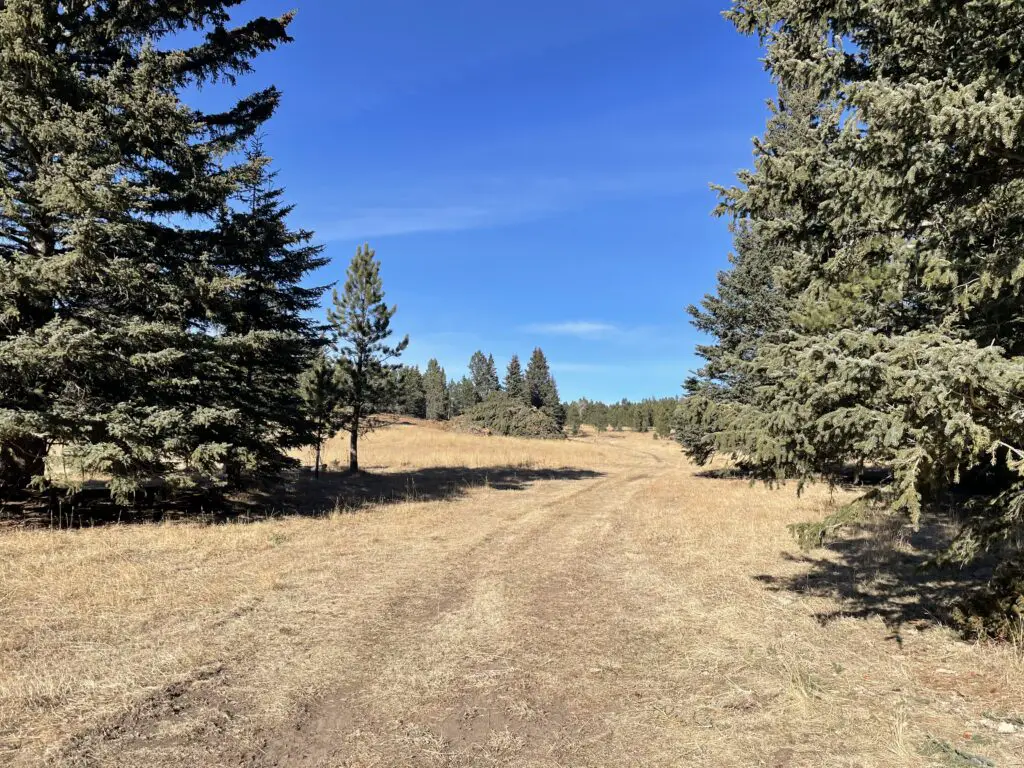
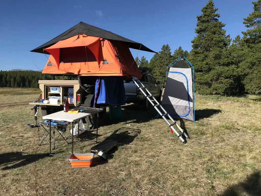
Sometimes when we head out we Disperse Camp.  This is also known as “dry camping”, where you just set up your camp somewhere in the national forest, outside of an established campground.  We tried this for the first time in Colorado, at both State Forest State Park and near Crested Butte.  On both occasions, we did stay at an actual, numbered campsite, it was just away from any campground and we weren’t able to see our neighbors.

On this trip, there were no numbered sites, but they did request that you stay at an already established campsite (designated by fire rings).  I have never experienced such a busy weekend in the Bighorns!  We stayed near Circle Park (there are a lot of “parks” in this region, they are basically just large, meadowy areas amongst the forests).  It was a lovely site with views of the surrounding mountains, but we could see three other campsites from ours (one had a large group in it).  We could hear even more campers, just on the other side of the copse of trees we were camped near.  Next time, we’ll have to try going even farther out if we hope to have more privacy! 😉

Moose in the Bighorns!

Morning in the meadow. A bull moose can be seen at a distance in the grass. The background is forest with the red, morning sun shining on the mountains in the far background.
Ladies and gentlemen, Martin the Moose!

I wasn’t sure if we’d see any moose on this trip since we were sticking mainly to the southern portion of the Bighorns and I wasn’t aware of any waterways running near our campsite (which moose favor).  We lucked out though.  It only happened one time, but at about 6:30 one morning, as the Pup and I were enjoying her “morning constitutional”, I spotted Martin the Bull Moose sauntering through the “park”, down the hill from our campsite!  SUCCESS!!!  Puppers wasn’t sure what to make of that LARGE, funny-looking thing!

Hiking Trails

Circle Park Trail:
A small lake, surrounded by forest
Sherd Lake

We did this same trail on our first trip to the Bighorns, several years ago, in October.  It’s a nice hike, fairly wide and graded, and not terribly steep (though it is quite rocky in several places).  We walked to Sherd Lake, which is absolutely GORGEOUS!  There are views of several nearby mountains, such as Bighorn and Darton Peaks, from here.  This trail is around four miles total, so it’s perfect for a day hike (especially with a not-quite-full-stamina, juvenile, canine friend). 🐶

The trail continues on to several other lakes from there.  It also connects with an 8-mile loop that snakes around the nearby mountain peaks, if you’re looking for a lengthy hike (or a good backpacking trip). 

Maybelle Lake Trail (off Forest Road 430):

A grassy meadow with large rocks sprinkled about, bordered by forest
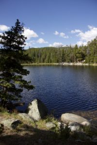
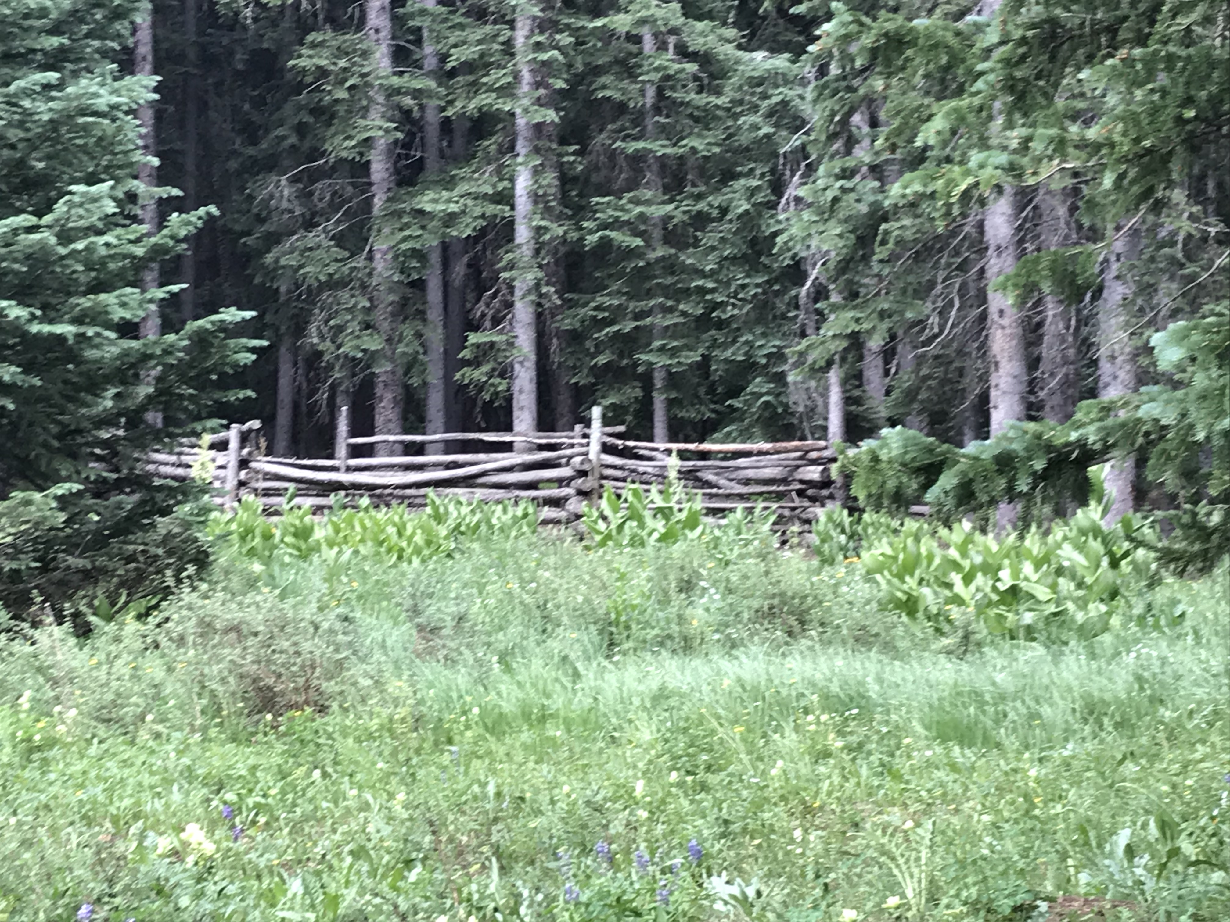
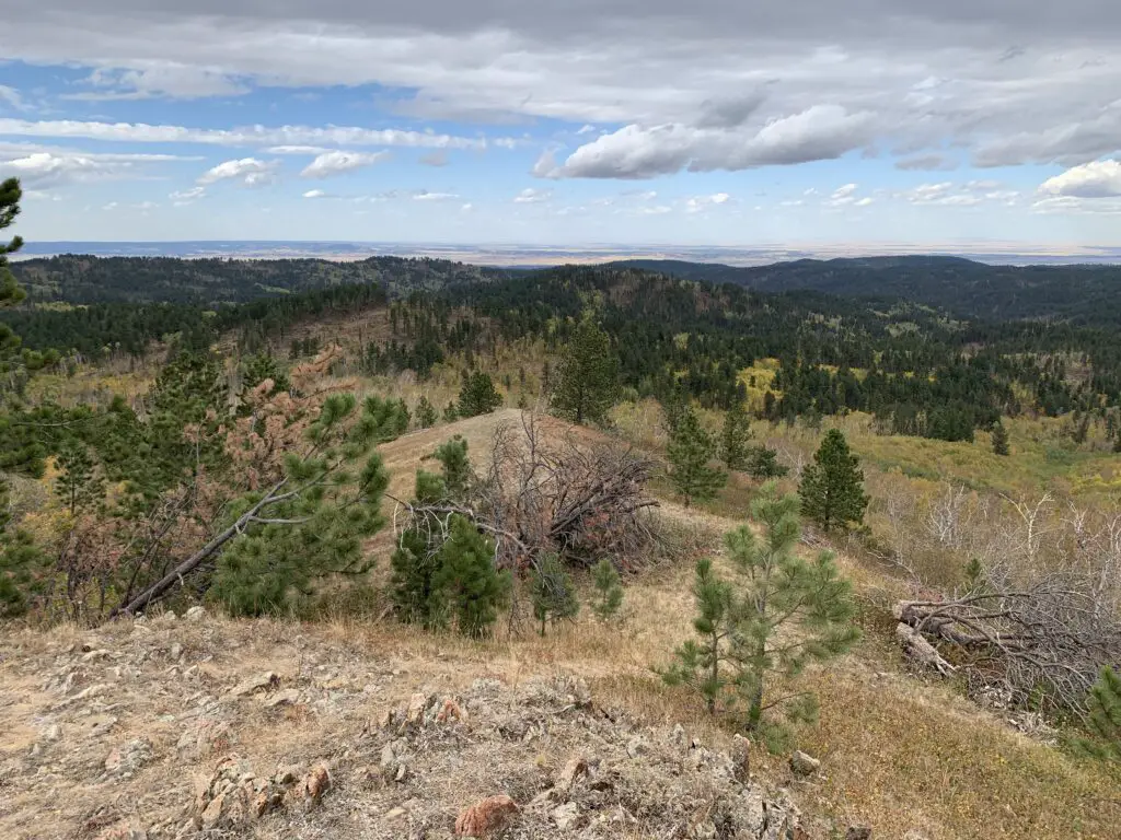
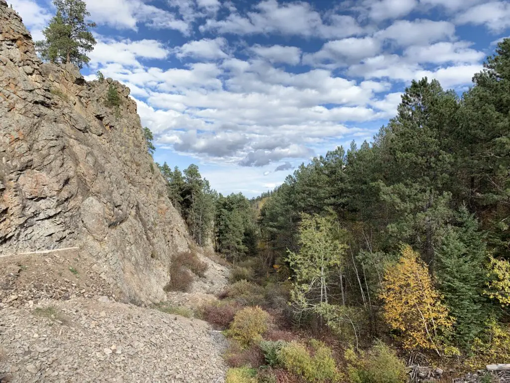
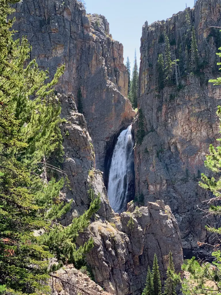
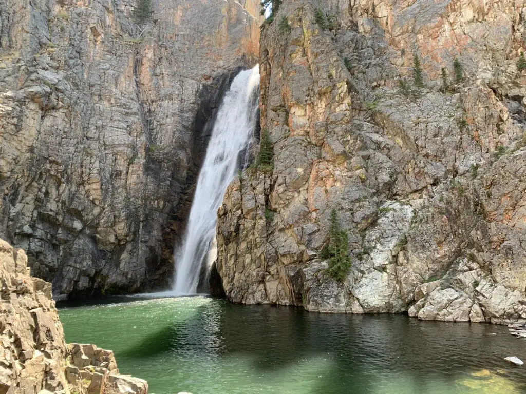
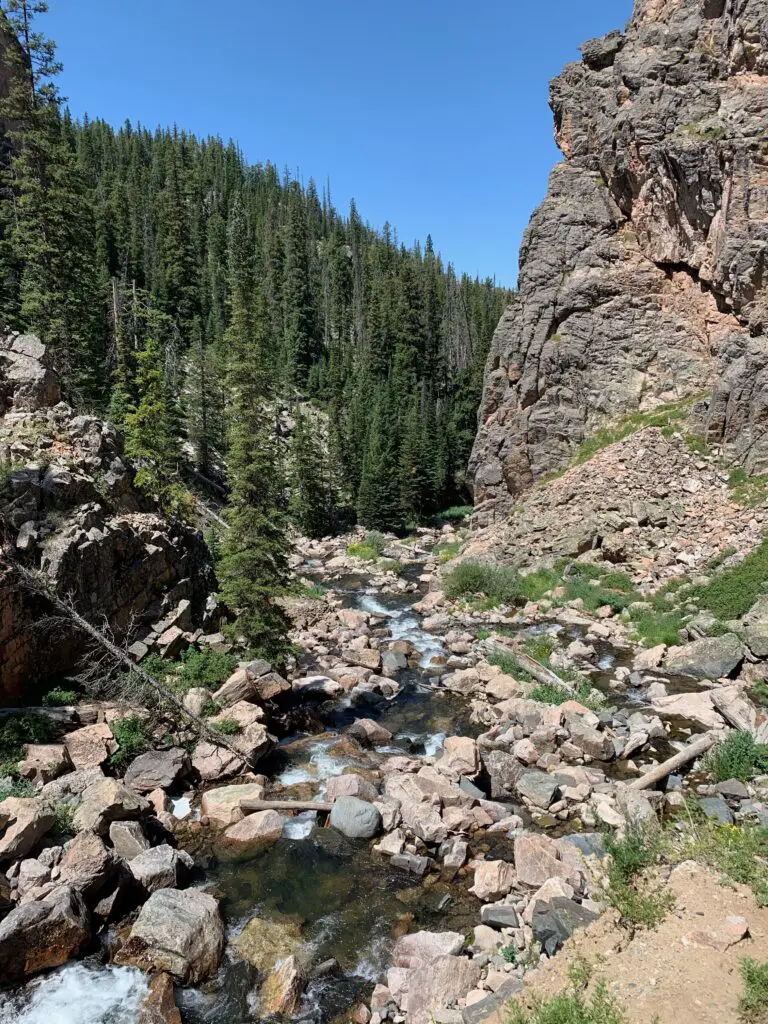
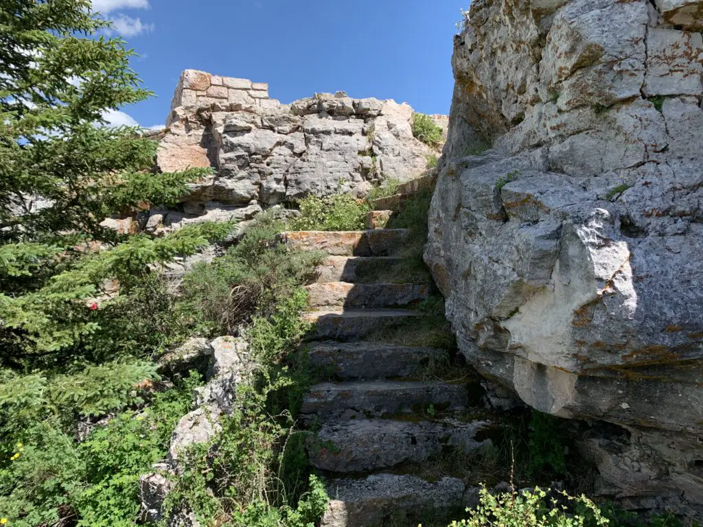
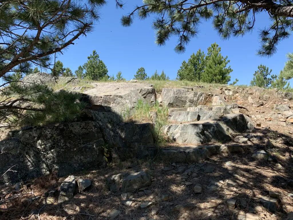
This hike was deceptively tough.  It’s only about three miles in total length, but it’s overgrown in many spots, very rocky and there are lots of downed trees.  We actually lost the trail several times and had to root around to locate it again.  Other parts of it are PERFECT though.  They feature a flat, graded path through a moist, pine forest, that is surrounded on both sides by a green carpet of ferns, moss, and soft undergrowth.  It almost felt like hiking in the cool rainforests of the Pacific Northwest.  It was such an idyllic sight!

The other difficulty is in reaching this trail.  You have to drive about 45 minutes (one way) on a rugged, 4×4 road to get to the trailhead.  We had done this route several years ago, so we knew what to expect, but this would NOT be appropriate for a normal car, or even just a high clearance vehicle.  If you don’t have a 4×4, with gear intended for off-road purposes, you should NOT attempt this road. (As an example, after trying this route a few years ago, we decided skid plates would be an important addition to the truck.)  After completing the road on this adventure, there is some paint hanging from the skid plates in a few spots (we sure were glad they were there!) 😋

Small lake with rocky, tree-covered mountain peaks in the background
Maybelle Lake

Tensleep Canyon

I’ve mentioned this canyon before, but this is one of the most beautiful places in the Bighorns.  If you are anywhere near this national forest and you have the chance to drive the canyon, you absolutely MUST put it on your list.  It is NOT to be missed.  This is one of our favorite areas in this national forest, and we try to enjoy it whenever we’re nearby.

The canyon is surrounded by arid, rocky cliffs on both sides, and is located on the southwest side of the Bighorn mountains.  One great thing about it is that EVERYONE can experience it.  US 16 is the main road that runs through the middle of the canyon.  It’s an easy-to-drive, paved byway.

For the best views, I would travel down the canyon, from east to west, on Route 435.  This is actually a dirt road that runs parallel to US 16 on the canyon’s southern side.  It’s a very well-graded route though, so as long as you don’t mind your car getting a little dusty, any 2WD vehicle can handle it in good weather (beware, the road may be impassable during snowy or muddy conditions. The road is also closed to vehicles November – June).

It’s a two-way road, but it’s fairly narrow, so take your time and be cautious.  There is room to pass a vehicle coming the other way but both drivers need to be aware as the lane gets tight.

Related posts:  Lake Helen, Bighorn Mountains, Wyoming; 4 Don’t Miss Sites in the Bighorn Mountains of WyomingWest Tensleep Trail, Bighorn Mountains, WyomingBighorn Medicine Wheel in Wyoming

This route provides better views down the length of the canyon into the dry expanse of Bighorn Basin, that opens up between the western slopes of the Bighorns and the eastern slopes of the Absarokas (near Yellowstone National Park).  While the Bighorns provide cooler conditions, even on the hottest days of the summer, the Basin sits on a high prairie that lies in the rain shadow of the larger mountains, to the west, and bakes under the heat waves of the summer sun.

On your return trip up the canyon, take the paved, US 16 for incredible views of the dun-colored rock and sparse, short, green trees and bushes that comprise the canyon walls.  They stand out in contrast to the deep blue of the sky above.  These views are SO beautiful!

You aren’t very likely to see moose in this area, it’s too dry and hot for the vittles they enjoy dining on.  The northern side of the Bighorns, near routes like US 14 and 14A, are prime spots for spotting these ungulates.

For the best light, it’s best to drive up the canyon, west to east, in the afternoon when the sun is at your back!  Here is a link to a video I made of our drive up the canyon.

We were glad to enjoy another successful, Labor Day, camping trip to the Bighorns.  We really enjoy returning to this area year after year.  There are so many things to see here, it can’t all be done in one weekend!

Have you hiked to Sherd or Maybelle Lakes?  What did you think of the trails?  Tell me about your experiences in the comments!


Did you enjoy reading this post?  Pin it!

Small lake with rocky, tree-covered mountain peaks in the background. Pin reads, "Camping in the Bighorn Mountains of Wyoming!"


Like what you read here today?  Please feel free to leave a comment, like or share this post!  Add your email at the bottom of the page, or the sidebar to the right, to be notified when a new post is published.  By signing up for the email list, you will also receive a free copy of the Tranquil Trekker’s Top 10 Tips of Trekking Do’s and Don’ts!

You can also follow the blog on social media by clicking the links below!

Facebook

Twitter

Instagram

Pinterest


†As an Amazon Associate I earn from qualifying purchases

Bighorn Medicine Wheel in Wyoming

In this post, I discuss an ancient medicine wheel in the Bighorns!


There is a prehistoric Medicine Wheel hidden in the northern, Bighorn mountains of eastern Wyoming.  It was built by the ancient ancestors of today’s American Indian tribes.  More than 80 tribes claim the wheel in their oral traditions so it can’t be attributed to any one group or culture, though it’s, obviously, a very sacred site.  

What does the Bighorn Medicine Wheel look like?

This is one of the largest, stone medicine wheels in North America (there are at least 150 spread throughout the continent).  It’s constructed with a center cairn with spokes emanating from it to an outer circle that connects six, smaller cairns that appear to be strategically placed.  

Archeologists aren’t sure of the wheel’s exact age, most estimates date it back at least 800 years, but it could be far older.  Archaeological evidence shows human habitation as far back as 12,000 years in this area!  

The ranger we spoke with stated the six rock cairns that dot the outer portion of the circle are believed to have a celestial purpose, but the exact function remains a mystery–it is thought that they may have been used during vision quests.  The last time the six cairns matched up with celestial markers was at least as far back as the 1700s!

Medicine Wheels are Sacred Sites

Religious ceremonies are still held at the wheel on a regular basis as many tribal members make religious pilgrimages to the site.  Some of the ceremonies involve large groups, while others include only a few individuals–two, small, private ceremonies occurred while we were there.  Anyone with American Indian heritage can participate in a ceremony.  

It’s always enthralling for me to observe religious practices that I’m not familiar with.  I’m fascinated by the emotions you see play out on the faces of the participants, and how descriptive their movements can be.  I find their actions evoke emotions within me as well.  You can actually feel the peace and tranquility emanating from them as they dance, pray, or worship in their own way.  

A tour of the wheel may be delayed if a ceremony is occurring, though they usually don’t last longer than 30 minutes, so please be patient and respectful during this time of worship.  Numerous religious offerings are tied to the fence that rings the site (or are placed within the wheel itself).  Please do not touch or photograph these items directly as they are sacred.  It is also requested that people not take photos or videos of the ceremonies, as they are occurring, to respect the privacy of the participants.  

Where is the Bighorn Medicine Wheel?

The wheel is located on Forest Road 12, off of US 14A, in the northern part of the Bighorns.  It’s about 20 miles from Burgess Junction (where 14A branches off from US 14 to the east) and about 30 miles from Lovell, Wyoming, to the west.

Related posts: Lake Helen, Bighorn Mountains, Wyoming; 4 Don’t Miss Sites in the Bighorn Mountains of WyomingWest Tensleep Trail, Bighorn Mountains, WyomingCamping in the Bighorns

The parking lot is a mile-and-a-half walk from the wheel on a graded, dirt road.  The hike isn’t bad, though it is uphill both ways (seriously 😝) and the altitude is over 9,000 feet, so take your time.  The site is also above tree line so bring a hat, water, and sunscreen, and be prepared for the ever-present, Wyoming wind.  It usually takes an hour or so to complete the entire route.  The site is free to visit, though donations are appreciated.  Because this is a sacred site, pets are not permitted and must be left in the parking area.

The only thing that marred the experience was the large, FAA radar placed on the adjoining peak (because none of the numerous, other peaks in the surrounding area, that were a little farther away, wouldn’t have worked?  REALLY?!)  Federal Government, do better! 😤      

Panoramic view of a rocky mountainside. Tree-covered mountains spread in the distance under a crystal clear, blue sky
The incredible view of the Bighorns from the Medicine Wheel site (to the right is the road you hike to reach the wheel)
Small stones on the ground form the center and outer portions of a wheel with stone spokes connecting them
The Medicine Wheel (you can see one of the rock cairns in the foreground to the left)

The Backroads of Wyoming

I’ve suggested before, to always take the scenic route, when time permits.  We enjoyed a good bit of that on this trip!  We started by taking Route 24, west, from where it branches off near the Island Park campground.  We then took Forest Road 408, to BLM Road 1117, on to Hyattville.  

This route is listed in the gazetteer as being Hyattville Road, but we saw NO signs reflecting this.  Similar to what we’ve found in Colorado, even though a road may be listed as a “major connector”, especially in the gazetteer, this could easily mean the road is actually dirt (sometimes wide and graded, other times little more than a narrow, two-track, high-clearance road that I wouldn’t be comfortable taking an Outback on). 😝 

We used three separate maps–the gazetteer, a Bighorns map we picked up at a local, outdoor store, and a road atlas–to gather a–somewhat accurate–estimate of the roads’ actual conditions.  Part of the difficulty was the roads traversed National Forest and BLM land in this area, and each department names and maintains their roads differently.  

Overlooking a rocky cliff with pine trees growing up from below
A view from our backroad trip

The drive was very manageable with Mr. Trekker’s Tacoma (any high-clearance, 4WD vehicle could handle it in good conditions).  There were no steep drop-offs and no, real, technical obstacles like what we’ve encountered on some of the roads in Colorado.  It was also beautiful, ranging from alpine, spruce forests and aspen groves, to dun-colored high prairies dotted with tan and red clay mounds, adorned with the varying greens of the diverse foliage.  Rock-rimmed canyons with their gaping mouths open onto prairie grasses far below, while rocky cliffs of various colors traverse throughout, all with the imposing Bighorns as a backdrop.  

Here is a video I made that showcases the beauty that is eastern Wyoming.

After leaving the Medicine Wheel, we decided we were game to try a few more back roads.  We took another scenic trip, east, on US 14A to Burgess Junction, where we picked up US 14 and took it west.  We took that road to Route 17, another “major connector”, that we then took to Alkali Road/BLM Road 1111/Route 228, back to Hyattville (this is a back way to reach the Medicine Wheel from the south).  

Again, these road numbers and names were listed on the gazetteer and one of the maps–some of these roads didn’t even appear on the Atlas–but were NOT shown on the actual road.  We just trusted the signs that directed us back to Hyattville.  You always need to be flexible when taking back roads, as you never know what kind of obstacles or conditions may cross your path.  I should also note, there was NO cell coverage in this remote location (and GPS can often be inaccurate), so maps are often times your only option–time to go “old school” folks!  

Another road we could have driven was labeled in the Gazetteer as the “Red Gulch, Alkali National Back Country Byway”.  We didn’t actually drive it this time–though we returned at a later date to check out the fossilized dinosaur footprints it leads to! 😯  

The Back Country Byway is more of a two-track, high-clearance path, at least in spots.  I certainly wouldn’t call it a “main road”.  Funnily enough, the roads we took back to Hyattville ended up being in better shape than the back road we brought out from the campground.  They were graded, gravel roads that one could expect to travel 30 – 40 mph on (if the rancher in front of us hadn’t decided a slower speed was better.  Unfortunately, on those roads, that are only about 1.5 lanes wide, passing really isn’t an option unless the person in front of you is feeling charitable and pulls over.  This man didn’t. 😜)  So, we enjoyed a leisurely, scenic stroll through the beautiful Wyoming countryside.  😁  

After reaching Hyattville we took Route R54 (another graded, well-maintained, gravel road) to Ten Sleep and then got to enjoy the, INCREDIBLY beautiful, US 16 east through Ten Sleep Canyon, back to our campground. (Did I mention, almost all of these roads, despite their varying conditions–with the exception of the highways–had the EXACT SAME indicators on the map? 😜)

Peering through the trees across tree-covered mountains out to the dry, high prairie far in the distance

The topography of Wyoming is very unique.  It’s characterized by the towering Bighorns in the northeast, to the Grand Tetons that criss-cross Yellowstone and the Rockies, in the west.  A drier, large, bluff-filled basin sits between Yellowstone and the Bighorns.  

Some parts of the state are prettier than others–while the dry, scrubland that surrounds the mountains can be pretty and green in spring, it usually turns rather drab in the later months.  The basin area is dotted with oil fields and sketchy-looking, government sites with warning signs plastered on the fences, which can be rather intimidating. 😳

Below are some more pics of our scenic drive:

Dry, green meadow with trees and rocky mountains far in the background, under a clear, blue skyWhite, rocky cliffs rise high aboveA dry, scrubland canyon with a dry, high plain in the far distanceDry, grassy meadow with dry, high plains and bluffs in the distanceDry, grassy meadow with dry, high plains and red-rock bluffs in the distanceDry, grassy meadow with tree-covered, white cliffs and dry, high plains and mountains in the backgroundDry, grassy high plains with pine-covered mountains in the background

MOOSE in the Bighorn Mountains!

Earlier that summer, we spent ten days in the Colorado high country during peak season and we didn’t see one moose.  Later that fall, we spent ten seconds in the Bighorn mountains of Wyoming (literally), and TWO moose were waiting to greet us when we arrived at our campsite!  Bighorns for the win!   

Two moose in a field as seen through the trees
Our ungulate friends (this year it was Maggie and Megan)

As I’ve mentioned previously, I’m always surprised at how much this part of Wyoming reminds me of the Colorado mountains.  The scenery and critters are very similar, with the added benefit of being half as long a distance from the Black Hills and FAR less crowded than Colorado. 😉  

If you’re looking for an amazing, historical site to visit in the Bighorn Mountains of Wyoming, check out the Bighorn Medicine Wheel!

Have you ever visited the prehistoric Medicine Wheel in the Bighorns?  Tell me about it in the comments! 

Did you enjoy reading this post?  Pin it!

Small stones on the ground form the center and outer portions of a wheel with stone spokes connecting them. Pin reads, "A Prehistoric Medicine Wheel in the Bighorn Mountains of Wyoming"

Like what you read here today?  Please feel free to leave a comment, like or share this post!  Add your email at the bottom of the page, or the sidebar to the right, to be notified when a new post is published.  By signing up for the email list, you will also receive a free copy of the Tranquil Trekker’s Top 10 Tips of Trekking Do’s and Don’ts!

You can also follow the blog on social media by clicking the links below!

Facebook

Twitter

Instagram

Pinterest

7 “Must-See” Colorado Ghost Towns

I review several ghost towns we toured around the Colorado High Country as well as our drive up Independence Pass.


The Trekkers LOVE visiting ghost towns! We try to include them whenever possible on our trips.  During our 2018 road trip, we got to check out several awesome ghost towns in Colorado.  

Ghost towns give you a true, visual understanding of how people lived “back in the day”.  I’m a very visual person so this helps me fully appreciate what the lives of the inhabitants of these towns must have been like.  I prefer the towns that are restored, with at least several buildings remaining that you can view.  Sometimes, however, the places that are comprised mostly of ruins allow you to use your own imagination of how they must have appeared in their heyday.

Click here for a list of ALL the ghost towns the Trekker’s have visited around the country!

Below is a list of seven ghost towns we visited in central and western Colorado…

Teller City Ghost Town: 

This was the first ghost town we visited and the one that required the most effort to access.  The townsite is near State Forest State Park, in far northern Colorado, around nine miles south of Gould, on Route 740 (Baker Pass Road).  You reach it by driving on a, somewhat rough, 4WD shelf road. (The Guide to Colorado Backroads† book that I mentioned in a previous post, rates this road as “easy”.  I would rate it as “moderate”.  A high clearance, 4WD vehicle should be all you’d need to access this site in good conditions).  

We didn’t actually complete the 4×4 road all the way to Baker Pass, though we spoke with a local who said it was worth the drive.  Alas, daylight was waning (and the mosquitoes were starting to bite!) 😝

 The way was fairly well-marked and obvious, but be watchful.  The road branched off several times and the correct route was only marked with orange, snowmobile trail markers (this is a snowmachine trail in the winter months).  

An old cabin sits amongst small trees in a grassy, open space. Tree-covered mountains are in the background.

An old, abandoned cabin without windows or a door

One plus with this site is that there’s a designated parking area and then you hike a Nature Trail loop to view the remains of the town.  Not much is left, but you could almost hear the voices of the patrons visiting the busy shops, and smell the dust kicked up by the wagons as they rolled along–what used to be–a bustling Main Street.  

At various places along the trail, markers describe the history of that home or business.  At one of the stops, the words of a young girl who came into town one winter night, via the pass, were noted.  Her description of the twinkling town lights flickering through the evening shadows was incredible.  

Below are a few more pics of the ruins at Teller City (as usual, thanks to Mr. Trekker for several of these):

The ruins of an old cabin sits amongst small trees in an open space. Tree-covered mountains are in the background.
The ruined walls of an old cabin sit in an open space. No roof or door remains. Tree-covered mountains are in the background.

A large, dark hole in the ground is circled by rocks and covered by a wrought-iron cage
An old well pit

Coalmont, Colorado: 

After leaving State Forest State Park, we visited Coalmont on our way to the Flattop Wilderness area.  Only the schoolhouse remains of this dusty hamlet, but from what we could see through the grime-spattered window, it appears to have been restored inside.  It would have been neat to be able to view it in more detail! 

The townsite is located off of Route 14, southwest of Walden, Colorado and can be reached via either Route 24 or Route 26 (they form a half-moon-shaped loop here).  The site is directly off of Route 26.

Old, white-boarded schoolhouse building sits in an arid landscape. Dark mountains are seen far in the background

Remains of an old ranch at Grand Mesa National Forest:

This site is located on top of the mesa, off the Land’s End Road.  It is the remains of a ranch that operated in this area long ago. Several cabins, one of which you can walk inside, and an old livestock corral, have been restored.  They can be viewed on a Nature Trail loop (it is part of a cross-country ski trail in the snowy months).  

A two-story cabin sits amongst tall, green grasses. It is a grey, cloudy day

An old, wooden fence-surround sits in a grassy, open space just outside a deep woods surrounded by tall pine trees
The old corral

Yellow wildflowers in a tall, grassy meadow. An old cabin can be seen down the hill

Pitkin Ghost Town: 

This “living” ghost town is located about 27 miles east of Gunnison Colorado.  Take US 50, east, from Gunnison, then turn left onto Route 76 in Parlin.  

As an aside, we enjoyed several good meals in Gunnison.  We had a wonderful breakfast at the W. Café, and, I can attest that the High Alpine Brewing Company makes great pizza!

Old, freshly-painted, one-story building sits on a plot in town. A statue of a prospector sits out front. The sign over the door reads, "Pitkin Assay Office"

Letters read "Pitkin Hotel" on the glass front of the building. Modern-day trucks sit on the street out front

At about the halfway point on Route 76, you will pass the “living” ghost town of Ohio City. (I call them “living” because some hearty souls are still living in both of these locations!) 

The rain was falling fairly heavily as we passed through Ohio City, so we chose not to stop, but Pitkin should definitely be on your list of places to visit!  It was one of the more “real-feel” ghost towns we toured as it wasn’t crowded with visitors, and enough of the old buildings have been restored that you felt as though you were actually walking down the town’s Main Street.  

The Silver Plume General Store, located on the east side of town at the corner of 9th and State Streets, is a great place to stop for lunch.  We certainly enjoyed our burgers from the outdoor grille! Note: Pitkin is the last chance at civilization if you’re venturing onward to Tincup, Cottonwood Pass, the Alpine Tunnel, or St. Elmo ghost town via Tincup Pass.

We didn’t make it to Tincup on this trip, being that Cottonwood Pass was closed for paving.  We are hoping to, one day, try the Tincup Pass between Tincup and St. Elmo and hike to the Alpine Tunnel.  Another journey for another time, I don’t worry that we’ll be back in Colorado soon!  😁

A two-story building with a belfry on top sits in front of a tree-covered hill. The sign under the belfry reads, "City Hall 1900"
Two old, single-story buildings with false fronts. One reads, "Pitkin Bank". A modern car sits in an alley nearby.
Two old, very small cabins sit so close they appear to connect. One sign reads, "Road Kill Cafe", the other "Stage Stop, Pitkin 1880"
An old, white-clapboard church and steeple

Below is a short video I took of the hummingbirds near the Pitkin Hotel.  I’ve always liked hummingbirds, but I’ve never heard them make this noise outside of Colorado…

St. Elmo Ghost Town: 

Everyone we talked to (and all the guide books we read) told us we HAD to visit St. Elmo, and it was, definitely, worth the visit!

The only disappointment I had with this site is that vehicles are allowed to park in the town itself.  Its spirit seems to be somewhat ruined when there’s a modern Audi parked in front of Town Hall. 😝  Also, they were restoring several buildings while we were there—which I’m sure is necessary and will be wonderful when it’s completed—but it meant that construction equipment was parked along Main Street.  *sigh*  Guess we’ll have to visit another time! 😉 

Two old, single-story buildings that look like they were once shops. One appears weathered, the other freshly-painted. A very tall, rocky mountain can be seen in the background

Two old, small, weathered cabins sit next to the dirt road

As I mentioned previously, if you’re daring, you can reach St. Elmo via Tincup Pass.  If you’re looking for a tamer route, you can do what we did and take the long way.  For this trek take Route 50 east of Gunnison through Monarch Pass (another great view) and turn north onto US 285 at Poncha Springs.  Then take Route 162 west–an out-and-back road (for the less daring among us)–toward the Mt. Princeton Hot Springs resort and on to St. Elmo.  

Near this area, there’s also a turnoff for Hagerman Pass Road to the site of another ghost town, Hancock.  From there, you can hike to the Alpine Tunnel from the east, though it sounded as though the hike is longer and the view isn’t quite as good as hiking from the west side–we chose not to complete the hike at this time due to time constraints and the monsoon-fueled thunderheads that were threatening.  

As I stated previously, since we missed a few ghostly spots this time around, we’ll be putting this area on our “must-visit” list for the future.  It’s always a shame when you visit a location and find out you HAVE to come back to explore further (that happens to us regularly on trips, especially in Colorado…have I mentioned that I enjoy vacationing in this state? 😉)

An old, wooden cabin with two chimneys. Two very tall mountains, one rocky, the other tree-covered, can be seen in the backdrop
Two old, wooden cabins sit amongst the trees
An old, one-story shop that reads, "Miners Exchange, St. Elmo General Store"

Much to the Tranquil Trekker’s dismay (we DON’T feed wildlife) one unique feature of St. Elmo is that visitors are encouraged to feed the WAY-overly-friendly and almost-aggressive local chipmunks. You can buy food for them at the General Store. 😝

The Cascades Waterfall near Buena Vista, Colorado:

After leaving Saint Elmo, on our way east, back to US 285, we stopped at The Cascades.  This is a lovely waterfall that’s just off the side of the road.  It’s a beautiful, peaceful location where you can walk right up to the base of the river that creates a picturesque waterfall in this area as it cascades across boulders–hence the name. 😉  

A creek runs over rocks and down a hill, creating a waterfall amongst the mountains and trees
Water from the creek dribbles over large boulders
A creek runs over rocks, creating a mini waterfall amongst the boulders and trees
A creek runs over rocks and down a hill, creating a waterfall amongst the mountains and trees

Gothic Ghost Town, Crested Butte, Colorado: 

I was a bit disappointed by this town.  The Rocky Mountain Biological Laboratory bought the town and did an exceptional job of restoring many of the old buildings which the lab uses for its work.  This we knew going in… what I hadn’t realized is that the lab has taken over almost the entirety of the townsite.  As it’s now, mostly, all private property, it’s almost impossible to tour around and browse the various buildings. 😒

I’m glad the town is being used for something, and I’m thankful to the lab for helping to save its structures, I just wish the historical features were easier to access.  And a note to the general store in town:  you close by four? In the middle of summer?? On a Saturday???  REALLY?!  Afternoons are a good time for people to eat ice cream you know!  😝😳😉

Sign at the edge of town reads, "GOTHIC site of The Rocky Mountain Biological Laboratory founded 1928"

No trespassing/no pets signs on a wooden fence. Old cabins sit in an open field within the fence. Rocky mountains are in the far background
Signs regarding the lab dotted the entire town 😕

You can reach Gothic by taking Gothic Road, Route 317, north of Crested Butte and the ski village.  You can’t miss it, this is, literally, the only main road going north of town! 😉  This will also lead you to Schofield Pass that I discussed in this post.  

Old cabins sit in front of a rocky mountain. Modern day cars and a construction cone are parked on the dirt street
Old cabins sit in a grassy field in front of a rocky mountain

Modern cars line both sides of the dirt street. Old cabins sit in front of a rocky mountain far in the background
Main Street in Gothic

Old cabins sit in an open field within a wooden fence. Tree-covered mountains are in the background

Old, brown, two-story building. Sign on front reads, "1880 Town Hall"
The General Store with its questionable hours of operation 😝

Old cabins sit amongst short trees with the forest in the background

Independence Ghost Town and Independence Pass:

Independence ghost town is located on Independence Pass (Route 82), around 16 miles east of Aspen, and around 21 miles west of Twin Lakes.  

It’s just east of the peak of the Pass itself, and is, actually, easy to miss.  It’s below the grade of the road and the two parking pullouts are small and not well-marked.  There are, blue, “Places of Interest” signs, but you have to be watching for them.  We actually saw the ruins of the mill, on the other side of the road, first.  

The townsite is located in a valley, along the Roaring Fork River, framed by the towering Sawatch Range on both sides.  

Independence Ghost Town:

This was my favorite ghost town of the entire trip!  It’s easy to access as the site is located directly on Independence Pass.  You actually park at a pullout on the Pass road and then hike out to the site, so no vehicles marred the view. 

The walk into the town site is about one-mile in each direction, on an old, two-track, dirt road. (The hike is pretty easy as there is almost no elevation gain.  Beware though, the town site still sits at about 10,000 feet in elevation.)  You can see the town from quite a ways off, which helps you to imagine what it must have felt like riding a horse or wagon along that route during the height of the town’s life.

This would have been an incredibly beautiful place to live! (Had it not been so isolated and suffered such extreme weather.)

Related Posts:  Guide to Colorado Backroads and 4-Wheel-Drive Trails: Book ReviewThe Best Hidden Gems of Northern ColoradoThe Backroads of ColoradoThe Drive to Crystal Mill in Colorado

The wooden remains of an old structure sit on a hill with a tree-covered mountain in the background
The old mill in Independence, Colorado. (This is the first building we saw to clue us in that we were “there”.)

The wooden remains of an old structure that has no roof. Trees are in the background

A two-track dirt road leads over a small, grassy hill. Old cabins in a grassy meadow can be seen far in the distance with tree-covered and rocky mountains in the background
I don’t imagine this view was much different when the town was thriving

An old cabin sits in a grassy meadow with a tree-covered mountain in the backgroundThe wooden remains of an old structure that has no roof or doors. Trees are in the backgroundThe wooden remains of an old, in-tact structure. Trees are in the backgroundA grassy meadow leads down the hill into a valley. Tree-covered and rocky mountains are in the backgroundThe remains of two old cabins sit on a grassy hill. A tree-covered mountain is in the background.

Independence Pass:

Independence Pass was incredibly beautiful, as well.  This one has been on my Colorado Bucket List for some time and it did not disappoint! (It was also the highest altitude we reached on this trip, maxing out at, just over, 12,000 feet!)  The scenic overlook and hiking area at the top of the Pass offer, almost, 360-degree views of the Continental Divide, which the Pass spans.

Looking down into a grassy, mountain valley. Rugged, rocky peaks and tree-covered mountains stretch to the horizon where they meet a blue sky filled with white, puffy clouds

Sign reads, "Independence Pass, elevation 12,095 feet, Continental Divide"

An analog device sits on a vehicle dashboard. It's dial is pointed to just over 12,000 feet
We finally topped 12,000 feet!

You may have noticed I’ve been enjoying using a Sun Company altimeter† in many of these posts.  It responds to changes in barometric pressure caused by weather as well as air pressure at-elevation, so you may have to recalibrate it a little each day to maintain the most accurate readings.  But, for amateur interest, it’s a fun, portable, way to keep track of changes in altitude–it connects to the vehicle using velcro so it can be easily removed and taken on a hike if you’re so inclined. 

A paved road winds down and around a hill. Rocky, rugged and tree-covered mountains are in the background and line both sides of the road

I made another video of our drive up Independence Pass.  I think my videographer skills got a “little” better with this one! 🤔

If you’re looking for something fun to do this summer, definitely check out the ghost towns of the Colorado High Country! 

Have you visited any of these amazing places?  Tell me about it in the comments!


Did you enjoy this post?  Pin it!

Four pictures of old buildings at ghost towns and Rocky Mountain passes. Pin reads, "The Ghost Towns of Colorado's High Country"


†As an Amazon Associate I earn from qualifying purchases

Like what you read here today? Please feel free to leave a comment, like or share this post! Add your email at the bottom of the page, or the sidebar to the right, to be notified when a new post is published. By signing up for the email list, you will also receive a free copy of the Tranquil Trekker’s Top 10 Tips of Trekking Do’s and Don’ts!

You can also follow the blog on social media by clicking the links below!

Facebook

Twitter

Instagram

Pinterest