In this post, I discuss a summer adventure to this great, state park in western Nebraska
Nebraska isn’t all flat cornfields! Looking for some hidden gems for recreation? Check out Fort Robinson State Park and Toadstool Geologic Park, both located in the far, northwestern corner of the state!
Fort Robinson State Park
Fort Robinson State Park is a great place to visit! It is a former fort (hence the name 🙃) that has been transformed into a family-friendly rec area! It offers hiking paths, history, and many of the old soldiers’ Quarters were refurbished and are now available for vacation rentals. This is unique and allows Fort Robinson to actually be known as a great, family reunion destination.
Sometimes called a “gem of Nebraska State Parks”, Fort Robinson was quite nice! (It’s a little-known fact that western Nebraska is actually very pretty! I recommend it over the rest of the state!) The park features LOTS of shade trees!
We did struggle with some ticks and bugs though at least it was quite green when we were there in late May. The mosquitoes weren’t bad though I’m sure they could be at times (and the tent-camping section was all grass, under trees, near the creek. It seemed fairly dark and damp–it looked like a great place to snag a few-hundred mosquito bites! 😝)
To be fair, we’ve only been to two of them, but this has been our experience with Nebraska state parks. We’ve never been impressed with their tent-camping areas (we had another disappointing, tent-camping experience at another Nebraska state park, on a Great Plains road trip, several years ago–though it did result in some Northern Lights viewing!)
For this trip, we actually chose to stay in the RV camping area. Though the sites were pretty tightly packed we were quite happy with this option.
Puppers checking out the old, fort poolThese were Officers’ Quarters that are now available for rent!Western Nebraska is quite beautiful!
Where is Fort Robinson Located?
Fort Robinson sits right on US Hwy 20 in far, northwest Nebraska, less than five miles southwest of the small town of Crawford.
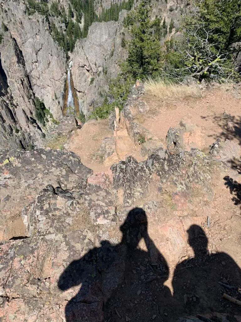
The park has quite a storied past. It started as a fort during the Indian Wars in the 1880s–this was actually the sad location of the death of Crazyhorse, the great Lakota warrior.
The actual site where Crazyhorse died
Fort Robinson also served as a large reservation for many American Indians including Red Cloud and his people.
The fort was also a “remount” location for Calvary horses (meaning the battle horses and their wounds were treated here and new mounts were provided). Fort Robinson was also a war-dog training camp and a German, Prisoner of War camp during World War II.
This is about all that remains of the former, German, POW camp
Horse vet center! That table moves to the vertical. They would strap a standing horse to it, sedate the animal and then move the table–with the horse strapped to it–back to the horizontal to perform procedures–not bad for 1940s technology!
Toadstool Geologic Park
Toadstool Geologic Park is literally in the middle of nowhere! It is situated in the far, northwest corner of Nebraska, about 30 miles north of Fort Robinson, 20 miles northwest of the small town of Crawford and 40 miles west of Chadron, Nebraska.
The park looks a lot like Badlands National Park in South Dakota or the North Dakota Badlands at Teddy Roosevelt National Park–you can read more on that hidden gem here!
Toadstool Geological Park is mostly a place for hiking though it does offer some camping options…
This was my first big hike after severely breaking my ankle a few months prior. It was a little tougher than we were first expecting for a “nature trail” but I finished the route thanks to my awesome trekking poles and help from Mr. Trekker!
The trail said it was a one-mile “nature trail” which are usually fairly easy. This hike wasn’t “difficult” but there was plenty of uneven ground and some scrambling on loose gravel as well as a few steeper ups and downs…
We learned later that I “may” have gotten a little too aggressive with twisting my ankle around on the uneven ground on this hike. A few weeks later, at my next ankle-surgeon checkup, we found out I broke one of my titanium pins! 😅 The doctor was like, “How did you manage that?!”–she had planned to take it out anyway 😇
This is a mockup of a sod house–these were common in this part of the country in the past
If you’re looking for some great, family-friendly outdoor and camping options in western Nebraska, check out Fort Robinson State Park and Toadstool Geologic Park!
Like what you read here today? Please feel free to leave a comment, like, or share this post! Add your email at the bottom of the page, or the sidebar to the right, to be notified when a new post is published.
In this post, I discuss what you’re missing from this national park you may not know exists!
**Author’s note: Just a word of warning, as this is a National Park, no dogs are allowed on any trails (exceptions for Service Animals). They are only permitted in the campgrounds and parking lots.**
The Trekkers have had Theodore Roosevelt National Park, in southwestern North Dakota, on our bucket list for quiet a while. We wanted to go fairly early in the season, so it would still be green, and in mid-June it was BEAU-tiful!
This was one of the first trips we took once I could start hiking again after I had been laid up for MONTHS thanks to surgery for an ankle that was broken in two places (along with being dislocated and a torn tendon) after a NASTY fall on the ice. 😝 I was finally able to start getting back out there!
Teddy Roosevelt National Park is named after the 26th President of the United States as he lived in this area for a while (before becoming President). He credits his time there as inspiring him to the Presidency.
I’ve come to decide “Teddy” may be my favorite President. They did call him the “Conservation President” after all! He originally came west to help him escape the pain of several serious, personal losses (one of the “loves of his life”, his first wife, died from complications after childbirth THE SAME DAY his mother died of typhoid fever! 😪)
Teddy helped create the US Forest Service and was a champion of protecting countless acres of land in the western US, as well as creating a number of national parks and monuments (many of which the Trekkers’ enjoy regularly.) He was also friends with John Muir (another of my favorites!) He was the OG #natureaddict/#natureboy!
A note on this park: the irony is the National Park named after the “Conservation President” sits on the edge of the Baaken Oil Fields!–For those who don’t know these are some of the largest oil fields in the US.
This really won’t affect your experience at Teddy Roosevelt National Park too much. You can see the flames burning off waste-natural gas from some of the overlooks and hiking trails in the North Unit. This is especially troublesome at night when they can affect the Dark Sky status of the park.
I don’t think Teddy would have liked to see his beautiful land in this state but who can stand in the way of progress? 🙃 “Black Gold, Texas Tea baby!” 😡
Where is Teddy Roosevelt National Park?
The park is situated in far, southwestern North Dakota about 130-ish miles west of Bismarck!
This park is also called the “North Dakota Badlands”. While somewhat similar to Badlands National Park in South Dakota, this area is wetter and greener…
Teddy Roosevelt National Park is divided into three separate units. The North Unit was our favorite. It is known for being less developed but also prettier, offers more wildlife and is less busy. The South Unit is more developed and busier but offers more hiking options. (The two units are about a one-hour drive apart–around 70 miles).
There is also a bit of a “satellite” unit centrally-located to the west of the other two, main units. It is called Elkhorn Ranch. This is where Teddy literally lived when he was in North Dakota and it is LITERALLY in the Middle of Nowhere! This one is pretty far out there–about a one-hour drive (around 54 miles) northwest of Medora…
The park basically isn’t near anything except the tiny town of Medora. The town is cute but small. It wasn’t too busy when we were there in mid-June but it can get MUCH busier later in the season.
Driving around North Dakota was kind of weird. 😅 All of their traffic light poles are bright yellow. Not sure if this is to highlight them against the snow they get all winter? Also, they don’t hardly have any good gas stations/Convenience-stores. All throughout Wyoming, rural South Dakota and Montana you have plenty of good, big, gas station stores (some are literally in the middle of nowhere with no other buildings in sight and double as catch-all grocery stores)–in western North Dakota these are HARD to find!
They have plenty of gas stations but they all look like they’re from about 1995–several we stopped at, while small, did at least have clean bathrooms! This was surprising to me because there aren’t a lot of gas stations up there, you’d think the ones they do have would be fairly good-sized and decent–even near major highways, like I-94, the stations were largely disappointing…
Teddy Roosevelt National Park North Unit
We enjoyed camping and hiking around the North Unit more. It was definitely quieter, and it offers a 14-mile scenic drive (each way). Just realize this is NOT a loop, you have to drive out and back!
Camping at Juniper Campground
Juniper Campground, on the North Unit of Teddy Roosevelt National Park, is MUCH easier to get sites at than the Cottonwood Campground on the South Unit. We got into a First-Come-First-Serve site at Juniper, in the middle of the week, in mid-June, with no problem!
The Little Missouri River ran JUST on the north side of Juniper Campground–basically barely across the road from our campsite!
I would not want to be standing there in a flash flood!
I LOVE this pic Mr. Trekker took, it’s SO moody!
There was even a buffalo that hung out with us IN THE CAMPGROUND–watch out for these! #dontpetthefluffycows!
Big boy! Imagine running into him walking to the bathroom in the middle of the night!
A note about buffalo: it is NOT ADVISABLE to get as close to a buffalo as we were in the picture above. However, in this case, we were literally sitting on the truck bed and he came up to us so this was a bit of an exception. He seemed calm and other campers said he’d been there before. As he was showing no signs of agitation we stayed still till he wandered off to a safer distance.
To be clear though, buffalo are known to be completely unpredictable and they can be DANGEROUS if they get irritated. So even in situations like this, DO NOT approach them, give them space, be calm and quiet and try to back off slowly but calmly if possible. DO NOT let dogs get near them (dogs can agitate them and they can easily kill a dog). ESPECIALLY, DO NOT APPROACHif they have babies!!! They may look oafish but these brutes can run at 30 mph–you CANNOT outrun them–and they’re equipped with sharp horns and a VERY hard head!
View from our GoFast Camper the next morning!
For more info on camping at Teddy Roosevelt National Park, click here!
Since the North Unit was so quiet we noted there was SO MUCH birdsong! Teddy actually mentions this in his book about being at his ranch, Ranch Life and the Hunting Trail. He describes the birdsong as:
“…the rider on the plains will hear bird songs unknown in the East…many are characteristic of this region. Throughout June the thickets and groves around the ranch house are loud with bird music from before dawn till well after sunrise.”
Your Moment of Zen: enjoy some birdsong from Teddy Roosevelt National Park (it was breezy too!)–turn UP the volume!:
Some hiking trails and good stops at the North Unit of Teddy Roosevelt Park:
We enjoyed several fun pull-offs and short hiking trails in the North Unit:
The Cannonball Concretions Pullout was the first one we came to and is just across the road from the entrance to Juniper Campground:
The Cannonball Concretions!Whaddya think…a bird or Mickey Mouse?
Buckhorn Trail starts from the Cannonball Concretions pullout. We only did a small portion of this trail, basically just up the hill from the pullout. It’s full length is more than 10 miles long and wanders throughout the North Unit of the park!
Riverbend Overlook was just a quick (but pretty!) jump out of the car:
Oxbow Overlook was an easy, pretty and short hike to and around the overlook–the shelter also makes a great place for a picnic or snack:
Teddy Roosevelt National Park South Unit
The Scenic Loop Drive circumvents the majority of the South Unit of the park. It is about 36 miles round trip though we couldn’t do the whole loop as the southern half was closed for construction…
Note: The time zone change between Central and Mountain time runs along the Little Missouri River. This results in the main, two units of the park being in separate time zones (the North Unit is on Central Time while the South Unit is on Mountain Time.) So the North Unit is one hour ahead of the South Unit–life is weird out West! 😀
This was one of the actual cabins Teddy lived in when he was in North Dakota!
You literally drive through the South Unit on I-94 which is kinda cool. One of the rest stops is literally part of the park and you can hike a bit from here!
This pic was taken from the rest stop on I-94. This is a portion of the Painted Canyon Trail. You can hike around down there and access it from the rest stop!
Painted Canyon trails: These trailheads are locate at the I-94 rest stop that sits in Teddy Roosevelt National Park.
The Painted Canyon Nature Trail is an easy trail, only about 1/2 mile long and it runs along the rim of the canyon, just behind and around the rest stop building. Pets can be on this portion of the trail!
The Painted Canyon Trail departs from this same area. It’s fairly steep to get down into the canyon. It’s about four miles in total length and be aware there is NO SHADE on this trail. It also connects to other backcountry trails throughout the northern portion of the park.
Moment of Zen 2: Buffalo at Teddy Roosevelt National Park!:
Some hiking trails and good stops at the South Unit of Teddy Roosevelt Park:
Boicourt Overlook/trail: The park website says this trail is only .3 miles and handicap accessible–this is “kind of” true. This description is true for the main trail but you can keep going further along the ridge for probably close to another 1/2 mile (that portion is not accessible).
Buck Hill: The entire trail is less than 1/2 mile but it’s quite steep! The steepest portion is paved (though I wouldn’t call it “accessible” as it’s so steep) while the rest of the route is a good, packed-dirt trail.
Wind Canyon Trail: This trail is about 1/2 mile in length. It has a few steep sections but overall this one isn’t too bad. It was a nice overlook of the river!
View of the Little Missouri River from the Wind Canyon Trail
For more info about hiking at the South Unit of Teddy Roosevelt National Park click here!
Teddy Roosevelt National Park Elkhorn Ranch Unit
There are a few ways to get to the Elkhorn Ranch unit:
The easiest (though it is longer) is to take Exit 1, on I-94 at Beach, and go north on Route 16. Then take Black Tail Road to the east until it becomes Belle Lake Road. Then take a left turn at Elkhorn Ranch Road. We went to the Unit this route and found it pretty easy to follow…
The actual location of Teddy Roosevelt’s ranch in western North Dakota
You can also take I-94 west from Medora, to Exit 10 for Belle Lake Road. Google will get you there going this way though it is out in the middle of NOWHERE with a lot of twists and jogs. We brought this route back to the highway and found it fairly easy to follow.
Note: while they were in great condition when we were there, be aware most of these roads are dirt!–Your car may get a little dusty!
View from our campground near Elkhorn Ranch
It’s all dirt roads to get there but they’re in pretty good shape and your sedan can make it, at least in good conditions. 🌞(In mud or snow, you’re on your own! 😇)
Enchanted Highway
On the way back to the Black Hills we checked out the Enchanted Highway!
Most people can only take so much Interstate driving (and that only gets you so far in North Dakota) and the straight, flat, state routes can get a little dull too. So spice things up with this interesting little stretch of highway that runs 32-miles north and south between Exit 72 on I-94 and the tiny town of Regent, ND and Route 21 (that’s right, western North Dakota is so rural they just identify places based on their corresponding exits on the highway!)
An enterprising, local sculptor put a series of large, metal critters (ants, grasshoppers and kinda freaky-looking fairy tale creatures) all along the highway. It’s worth a looksie if you’re heading that way anyway! (There are even signs on the highway to help you find this!)
We had a good time in NoDak! I’m not “dying” to go back again but Teddy Roosevelt National Park is definitely worth a drive to this random state that is often one of the last on everybody’s 50-state list! 😀
Like what you read here today? Please feel free to leave a comment, like, or share this post! Add your email at the bottom of the page, or the sidebar to the right, to be notified when a new post is published.
In this post, I review our recent purchase of a Go Fast Camper!
*Author’s Note: This post is NOT sponsored and I have received NO compensation for it. I’m just REALLY excited about our new camper!*
In Summer 2024 the Trekkers achieved a major goal! After years of discussions, research…and more discussions…we FINALLY agreed on and acquired a Go Fast Camper!
Why a Go Fast Camper?
We started our camping experience with a simple, ground tent Mr. Trekker picked up during our college years, for about $30 at a local Walmart. Eventually we moved on to a fancier and bigger, REI, ground tent we acquired as a wedding present (and still use from time to time!)
Go Fast Camper fully deployed in its natural habitat!
As we aged and our backs got a bit more grouchy 😉 we decided we preferred the FAR more comfortable foam beds offered by the fancier, above-ground tents. We also preferred being off the ground some (especially as we’re spending more time alone, in the Wilds, disperse-camping outside of established campgrounds–sometimes in Grizzly country!)
Our “stuff” packed in the truck bed. Puppers LOVED her bed! You’ll notice that the sides of the camper fold up so they can act like windows (and rain shields) when you’re stopped, they call it, “Cabana Mode”.
Initially we acquired and tried out a rooftop tent on a trailer for several years. While we liked this option it still took a little while to setup and the trailer got kind of annoying on some tight trails, or when trying to park in small, mountain towns.
We could have put the rooftop tent on the “rooftop” of the truck, but that would have meant we needed to acquire another truck capper that could handle the weight–to the tune of several $1000s. Also, rooftop tents are HEAVY and difficult to get on and off the truck so once they’re on, you tend to leave them there as much as possible–this puts a lot of strain on the truck not to mention kills your aerodynamics and gas mileage–all for equipment you only use a few times a year.
So we mostly decided we weren’t interested in another trailer of any sort, so then we considered a regular truck camper. However, we really enjoy the smaller footprint and better gas mileage of the mid-size trucks and the in-bed, truck campers that fit these are TINY–especially for two people and a dog. Also, even the smallest, most basic ones are PRICEY!
Inside the Go Fast Camper shop. What the Camper looks like on it’s own, when it’s folded up!Go Fast Camper all buttoned up and installed on the truck!
So finally we started looking at wedge campers! These offer the benefit and simplicity of a tent, while keeping you well above the heads of any critters that may be lurking around below you! Their footprint also matches that of the truck, meaning if you can fit the truck on a narrow trail or in a tiny parking space, the camper goes right along with it. The uniqueness of the Go Fast Camper also means you don’t lose the utility of the truck bed when the camper isn’t in use–you can literally have your cake (the use of the regular truck bed) and eat it too (the camper)!
The only negative was, we had to travel to Western Montana one weekend to pick up our new toy…or darn! 😉And then we promptly enjoyed it while camping in the BigHorns for a night! 😀
Smoky campsite in the Big Horns the first night with the new Camper!
What is a Go Fast Camper?
A Go Fast Camper is essentially a rooftop tent that sits and opens from the top of a typical, truck-bed capper. It is installed at a factory and stays on the truck permanently–unless you were to take the capper off. When the tent is down the truck bed can be used for any purpose you want as any normal truck bed and the bottom of the tent forms the top of the truck capper. Removable cushions/panels form a pass-through between the truck bed and the tent when the tent is open. Some models also allow for an outside ladder to be installed (like those on regular rooftop tents).
With this setup you are also free to design your truck bed however you want with a power pack, a fridge, or an in-bed drawer system if you want to use the truck more for camping-only.
View is from the truck bed below. These panels are removable and form the pass-through that you climb up through to get into the tent.
How do you use a Go Fast Camper?
Setup/tear down of this camper is incredibly quick! To open the tent you simply unlock it and let it rise on it’s own (it literally takes about 30 seconds!) Tear down takes about 1.5 minutes (grab the top, push the soft sides in, pull down and fold it up!)…LITERALLY, that’s all there is to it! (It takes longer to put the tent away because you have to make sure it folds in well and none of the fabric is pinched.)
Full disclosure: the price point of a Go Fast Camper can be a barrier for some. While not “cheap” per se, a Go Fast Camper is FAR more affordable than any other trailer or regular truck camper out there–comparable in price to a combination rooftop tent/new capper for the truck. This is 1/2 (or less!) the price of a typical truck camper and 1/4 (or FAR less!) than the typical cost of a camper trailer/RV.
View from above! Puppers is demonstrating the pass-thru from the truck bed into the tent (when a removable panel is moved)! It’s blurry because…you try getting an excited dog to hold still for a picture! 😇
The Go Fast team was also great to work with! They are based near Bozeman, Montana, meaning they are a small-town company that employs local, American workers! We have had great luck with this team and appreciate the regular communication and continued service they offer!
They also contract with several other dealers throughout the country including some on the West Coast, and a few in Colorado, Texas, Missouri and North Carolina.
Be aware, there is a fairly lengthy lead time between placing the order and receiving your product. We ordered our camper in March and didn’t receive it until early August. We were aware of this situation when we made the purchase and the Go Fast team stayed in regular contact with us about how our build was proceeding.
In the interim months they actually changed the build platform some from what we’d originally ordered. As our build was still in progress the Go Fast team went ahead and added the upgrades with little-to-no additional cost to us! There were a few upgrade items they weren’t able to add at the time due to supply-line issues. But, they kept us updated regularly on the status of those and shipped them along when they were available.
This requires a power source but these lights were one of the add-ons Go Fast Campers added for us! You can also see here what the regular truck bed looks like when the camper is down.The same lights inside the tent!
Since we got the camper late in the summer we were only able to use it a handful of times, though we’re looking forward to getting out in it quite a bit this coming summer!
Super secret, dispersed camping area in the Black Hills on Labor Day Weekend–though I have it on good authority this is a great place to get a Christmas Tree!
Puppers thoroughly enjoyed having the lengthy meadow to chase her ball!Trekker Feet enjoying the still-usable truck bed and relaxing in the shade on a hot day!
If you’re looking for a fun, affordable alternative to a full truck camper or trailer, consider a Go Fast Camper!
Do you have a Go Fast Camper? Or are you interested in one? Let me know about your experiences or any questions you may have in the comments!
Did you enjoy this post? Pin it!
Like what you read here today? Please feel free to leave a comment, like, or share this post! Add your email at the bottom of the page, or the sidebar to the right, to be notified when a new post is published. By signing up for the email list, you will also receive a free copy of the Tranquil Trekker’s Top 10 Tips of Trekking Do’s and Don’ts! You can also follow the blog on social media by clicking the links below!
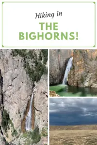
In this post, I detail some great places to hike and camp in the Snowys!
The Trekkers usually go to the Bighorn Mountains each summer. But this particular year the West had a VERY snowy and wet spring/summer (GREAT for avoiding wildfires, not so great for road conditions or mosquitoes). When we were making reservations all the roads/places we enjoy visiting in the Bighorns were closed due to mud and we figured the skeeters would be ATROCIOUS, so we thought why not try out the Medicine Bow Mountains (the Snowys) in south-central Wyoming instead?
Where are the Medicine Bows?
The Medicine Bows are a small area of mountains that run from north-central Colorado (near Rocky Mountain National Park) into south-central Wyoming (near Laramie).
The Wyoming portion is what most people think of as the Medicine Bows. Here they are divided into three main areas: the Sierra Madres to the west, the Snowy Range (the Snowys) in the middle, and the Laramie Peak area to the east. Our trip focused on the Snowys…
The Snowy Range reminded us of Colorado!
—This area felt a lot like that around Walden, Colorado, and State Forest State Park which makes sense as it’s the same National Forest. Also, less than 100 miles separates the two…
—There was still snow on some of the peaks. There is a reason they call this area “the Snowys”! 😉 Fortunately, the bugs weren’t too bad though!
There are multiple Forest Service campgrounds in the Snowy Range. We chose Ryan Park as it was lower than many of the other campgrounds in the Snowys (at “only” around 8,000 feet rather than 10,000 feet.) This proved an obvious benefit as it was slightly warmer (especially at night) and may have had less rain (but was still FAR cooler than the lower elevations of the surrounding plains!)
Our camp protector! (He was there when we arrived and we left him for whoever came next!)
To be clear, Ryan Park is still a Forest Service campground so it is rustic…
I’ve mentioned before that we REALLY enjoy US Forest Service campgrounds as they usually offer more secluded campsites and more rustic locations. Forest Services campgrounds are perfect for tent camping though most can accommodate RVs, as well (at least in some sites). Just be aware of what you’re getting into as most Forest Service campgrounds only offer:
potable water–at least in-season
decent campsites with fire grates and picnic tables (Always check local regulations to see if there are any current fire bans in place!)
…and that’s about it! 😀 Forest Service campgrounds also usually only offer vault toilets. (And, let’s be honest, a vault toilet is still just a hole in the ground that you pee in 😉but, the bathrooms at Ryan Park Campground were some of the cleanest and nicest-smelling outhouses we’ve ever been to! 😉)
I should do a post sometime about decent vault toilets we’ve visited around the country.Note: Yellowstone National Park and State Forest State Park, in Colorado, sport some of the NASTIEST! 🤥)
There wasn’t much shade at the campground. Sadly, this area has been hit BADLY by beetle kill in recent years. The Forest Service has done a good job of cleaning up all the dead trees near the Snowy Range campgrounds which is incredibly important for safety, it just means most of them are fairly bare of trees now. 😕This does equate to lovely views of the night sky and sunsets/sunrises though!
Hiking in the Snowy Range
We found some great hiking trails in the Snowys!
Medicine Bow Peak Trail
We hiked from the Sugarloaf trailhead near Lewis Lake. This is one of the shortest routes to Medicine Bow Peak, though we decided not to hike all the way to the peak–it was less than a mile from where we stopped but it was incredibly steep, rocky, loose, potentially slippy, and exposed on a shelf-like trail. (Thunderstorms were also forecast for the afternoon and we didn’t want to get caught out in such an exposed area.)
In addition to the Sugarloaf Trailhead, there are multiple trailheads you can use to access Medicine Bow Peak. The longest (but relatively easiest) is from Lake Marie. You can also access the trail from Mirror Lake and Brooklyn Lake, though these routes require a longer trek and combining multiple trails.
Lewis Lake
Is Medicine Bow Peak Trail Hard?
The trail from Lewis Lake is only about three miles long in total length but don’t let that fool you. It gains more than 1000 feet in elevation during the hike up. It’s also INCREDIBLY rocky and exposed, not to mention HIGH. (You start at over 10,000 feet and end up at almost 12,000 feet.)
Also, you’re above the tree line for the entire route so there is NO SHADE! This can also cause the trail to become INCREDIBLY slick in the rain, mist or snow–and note, snow and ice lasts LATE into the season and comes EARLY in the High Country. It can snow at any time of the year and thanks to monsoonal moisture, rain was forecast for our entire trip (it rained on us every day). Also, there is absolutely NO PROTECTION from lightning up here during the violent summer thunderstorms that frequently occur.
Libby Lake
We chose to stop at a saddle where the HARD part of the trail starts. Here it also meets up with the other end of the Medicine Bow trail that comes up from Lake Marie. This trail is LOVELY though! You hike along the spine of the Snowy Range getting amazing views of the local lakes, the nearby mountains, and the surrounding landscape. At one point we could make out eight separate, small lakes!
This is the amazing view from the saddle. Medicine Bow Peak is to the right and the trail gets considerably more difficult from here…
I would rate the early portion of the trail (before the saddle) as moderate for sure. It isn’t overly difficult or long–we saw several families with young children. It is a bit rocky and there is some scrambling required in a few, short areas.
The most difficult part about this trail is just that it’s incredibly exposed and high (as I said before, entirely over 10,000 feet). There are no steep drop-offs directly from the trail though, so as long as you are a fairly capable hiker, you take it slow and you respect the conditions, you should do okay.
Though we didn’t have to navigate any actual snow in early August, there were still some snowfields along the trail. I can’t speak for how normal this is due to all the snow the West got that year (though they must call this area the Snowys for a reason!)
Lost Glacier Lakes Trail to Lost Lake
Lost Glacier Lakes trailhead is found on the east side of the Snowys. It starts from Brooklyn Lake and heads west. The route to Lost Lake is about six miles in total length (out and back).
From Lost Lake, the trail continues on to where it meets up with the Medicine Bow Peak trail at Lewis Lake and the Sugarloaf Trailhead (see above). The entire Lost Glacier Lakes Trail from Brooklyn Lake to Lewis Lake is a little over eight miles (in one direction).
Lost Lake
Lost Lake was SO BEAUTIFUL! It reminded me of Lake Helen in the Bighorns!
One of the two Glacier Lakes
Is Lost Lakes Trail Hard?
The Lost Glacier Lake Trail is a lot of fun! It offers very little elevation gain and is mostly a wide, dirt path throughout. Be watchful for the occasional tree root and rock, but there is very little scrambling required. This is a kid-friendly trail! (Just remember the entire trail is still above 8,000 feet!) This trail is also below tree line so there is a lot more shade (and it’s much less exposed) than what you’ll find on the Medicine Bow Peak Trail.
Telephone Lakes as seen from the Lost Lake Trail
We really enjoyed this trail! It offered nice views of the lower lakes and plains of eastern Wyoming. On clear days you can also spot some of the high peaks of the Rockies down in Colorado.
You can see why they are called The Snowys! (This was in early August!)
Below are some pictures of the wildflowers we saw on the Lost Glacier Lakes Trail. The pictures don’t do the colors justice, of course. The flowers were absolutely BEA-Utiful!
Camping in the rain!
As I mentioned earlier, our trip was at the start of Monsoon Season in that area so it rained every day of the trip. That’s okay though, part of “roughing it” in the wild is dealing with whatever weather Mother Nature decides to throw at you! A few tips on tent camping in the rain…
—-Spend money on a NICE tent (I recommend the REI brand) with a rainfly that covers the entire tent and reaches almost to the ground. Our tent stayed completely dry inside even though we got rained on all three days we were out!
—-Make sure nothing important is touching the walls of the tent (clothes, bedding, etc.) I can’t explain it but there is this phenomenon where if the tent is wet outside the water stays outside as long as nothing touches it from the inside. If something does touch it, that thing gets wet and the water seems to start seeping inside the tent.
This is probably some weird phenomenon of physics, but since I’ve never taken a physics class I can’t tell you any more about it. 😇
Scenic Byways!
We also drove several scenic byways in the Snowy Range! (Note: both of these routes are closed in the winter–they’re really only open May through November–and this is weather-dependent).
Snowy Range Scenic Byway
The Snowy Range Scenic Byway is Wyoming Route 130 that travels east-to-west through this portion of the Medicine Bow mountains. It runs from the Encampment/Saratoga areas in the West to Centennial, Wyoming in the East.
There are several nice pullouts along the Byway. Some of our favorites were:
Libby Flats: an open, meadow area in the higher elevations of the Snowys. It offers an observation tower and spectacular views of the surrounding countryside. We also saw a bunch of marmots here!
Lake Marie: a VERY pretty stop on the western side of the Byway. It offers a nice boardwalk and paved walking path that connects to the Mirror Lake picnic area just to the east. Other hiking trails break off from here, as well.
Lake Marie–this was one of my favorite spots in the Snowys!
The Continental Divide! –Battle Pass Byway
Battle Pass Byway is Wyoming Route 70 that travels east-to-west through the Sierra Madre portion of the Medicine Bow mountains. It runs from Baggs, Wyoming in the West to Encampment in the East and crosses the Continental Divide.
The Continental Divide! From this point, water either flows West to the Pacific or East to the Gulf of Mexico/the Atlantic.View to the west!Even more wildflowers!History happened here!
So, if you’re looking for a great place to hike and camp that’s just across the border from the crowded trails in Colorado, check out the Snowys!
Have you spent time in the Snowy Range? Tell me about your experience in the comments!
Did you enjoy this post? Pin it!
Like what you read here today? Please feel free to leave a comment, like or share this post! Add your email at the bottom of the page, or the sidebar to the right, to be notified when a new post is published. By signing up for the email list, you will also receive a free copy of the Tranquil Trekker’s Top 10 Tips of Trekking Do’s and Don’ts! You can also follow the blog on social media by clicking the links below!
In this post, I review the Misty Moon trail starting at the trailhead at West Ten Sleep Lake and continuing to Lake Helen.
Are you looking for a moderate hiking trail that really lets you enjoy the wilderness of the Bighorn Mountains in Wyoming? Check out the Misty Moon trail from West Ten Sleep Lake to Lake Helen in the Cloud Peak Wilderness!
Where is the Misty Moon trail?
Trail #63, the Misty Moon trail, is one of the most accessible, main trails to access Cloud Peak and Bomber Mountain. It starts at the trailhead behind West Ten Sleep Lake (this is also where the trail for Mirror Lake/Lost Twin Lakes begins.
To reach the trailhead take Forest Route 27 to where it terminates. FR 27 is located off of US 16 in the southern Bighorn mountains. You will turn at the sign for (and location of) the Deerhaven Lodge. Boulder Campground, Island Park Campground, and West Ten Sleep Campground are also all located off of this road.
What is the trail to Lake Helen like?
The first few miles of the trail are LOVELY. You start by meandering on a flat trail through the woods around West Ten Sleep Lake.
We saw a momma moose and baby bedded down in the tall grass near the lake! Be sure to give these animals PLENTY of space, especially with dogs. Most momma animals can be INCREDIBLY aggressive when they’re protecting babies, and moose have been known to kill dogs–we kept Puppers on a leash and she was too distracted by smells to be aware of our new friends.
Puppers and I on the Misty Moon Trail
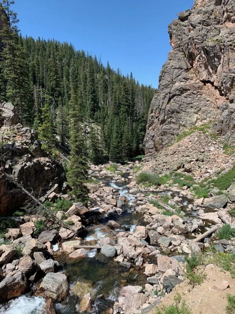
Once past the lake, you start a gradual climb through several grassy meadows and forested areas, with great views of the mountains beckoning you along the way.
The trail undulates the whole way so while there are a few short, steep spots, there are no lengthy, spirit-crushing climbs–I think this contributed to the trail feeling easier than it actually was.
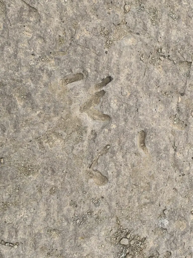
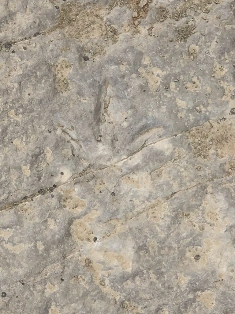
We saw a bunch of these indentations on the rocks, not sure if it’s some kind of fossil? Looks like a plant left them…🤔
About halfway to Lake Helen, the trail becomes steeper. This is where you hit the rocky sections. There are no large boulder fields to cross and no scree slopes to navigate (on this portion of the trail) but the rocks are big enough that they cause a lot of uneven terrain that you’ll need to manage. Hiking boots are definitely recommended for this trek!
I think older kids could do this trail. It’s a longer one and they may need some help in the rocky areas, but overall I would say it is moderately difficult.
The hike didn’t actually seem that bad while we were doing it. Both Mr. Trekker and I were pleased at how good we felt throughout. Especially considering we carried heavier packs than usual (we brought A LOT of water) and we hadn’t hiked much this summer as it’s been so warm. Also, the trail STARTS at around 9000 feet (you gain around 1000 feet in elevation over its five-mile length. Lake Helen sits at almost exactly 10,000 feet.)
Mr. Trekker and I were both pleased that we didn’t feel the altitude too much (it probably helped that we camped at 9000 feet the night before). If you aren’t used to these altitudes though, you’ll definitely want to take it easy.
The Trekkers seem to be doing better with altitude in recent years. It used to be that just driving to Estes Park in Colorado (which sits at around 8000 feet) was enough to make me feel funny. Now we’ve camped and hiked higher than that on multiple excursions in Colorado, Wyoming, and Montana and done quite well. They claim your body “learns” how to adjust to the altitude better the more you experience it and I think that may be true. (Living at 3000+ feet for the last decade probably hasn’t hurt either. 😉)
We considered going all the way to Misty Moon Lake but that would have added several miles to our already 10-mile hike. All three of us were feeling good when we arrived at Lake Helen so we figured we’d just spend a relaxing lunch at the lake and head back.
As it turned out it was good we did decide to turn back. Even though she was raring to keep going when we reached the lake, by the time we got back to camp Puppers was hurting. This was the first time she’s ever really had issues on the trail. This is one of the longer trails we’ve ever done with her (though she’s done 10 miles with us before). This trail is REALLY rocky, in parts, which means it’s probably also one of the toughest trails we’ve ever done with her. We did LOTS of rock hopping on the way down and she was obviously aching by the time we got back. She seemed to make a full recovery within a few days though! (In her defense, my hips were sore for several days afterward, as well.)
Obviously, I can’t speak to the trail past Lake Helen (since we didn’t do it. 😉 I do know that Misty Moon Lake is only about 300 feet higher than Lake Helen but it takes two more miles of hiking (each way) to get there.
Also, my understanding is once you get past Misty Moon Lake the trail gets much tougher. There are some scree slopes and boulder fields (namely on the way to the wreckage site at Bomber Mountain and to reach the actual Cloud Peak). Also, once you get past Lake Helen you are basically above treeline the entire way. This means there is NO SHADE at all so make sure you bring sun hats, LOTS of water, and sunscreen if you’re planning to go this route. There is also NO PROTECTION if you’re caught out in a storm.
I cannot stress this enough: if storms appear imminent PLEASE get below treeline as safely and quickly as possible. It is INCREDIBLY dangerous to be above treeline during a lightning storm. Safety should ALWAYS be your first priority!
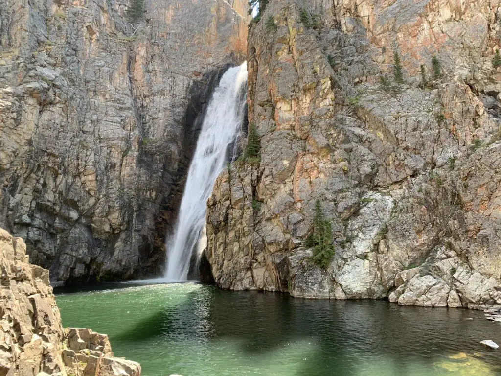
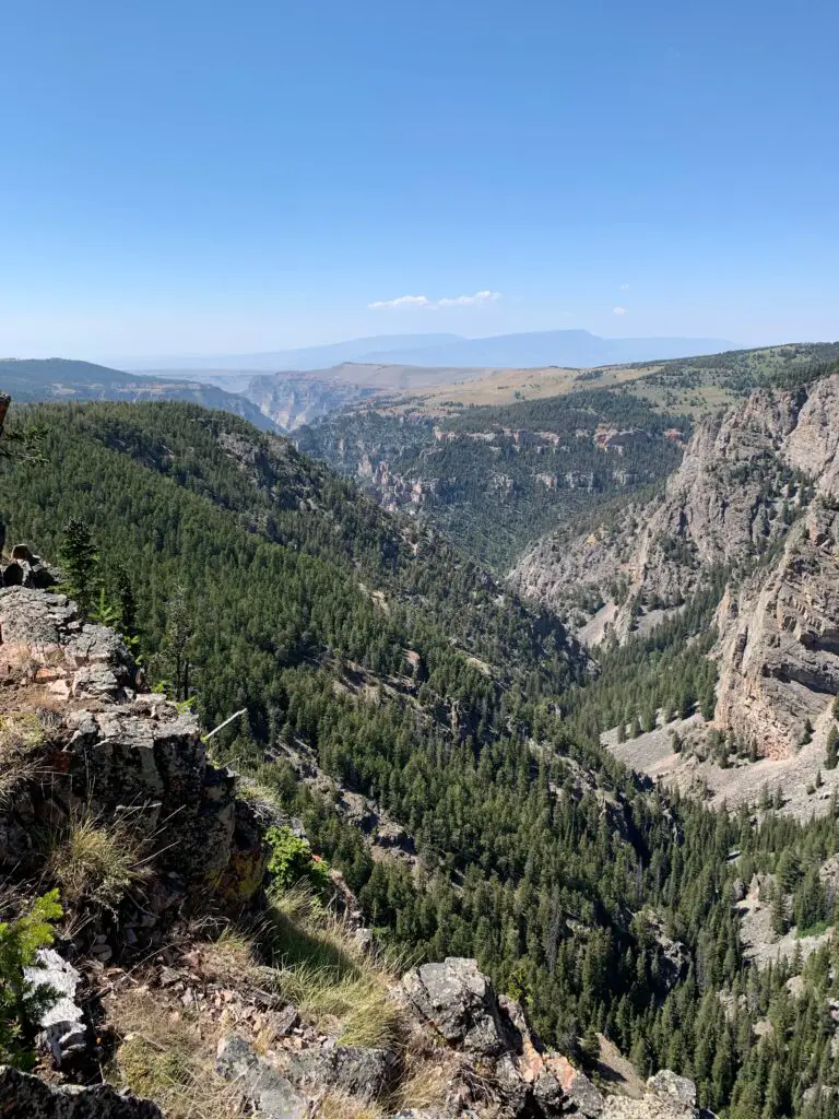
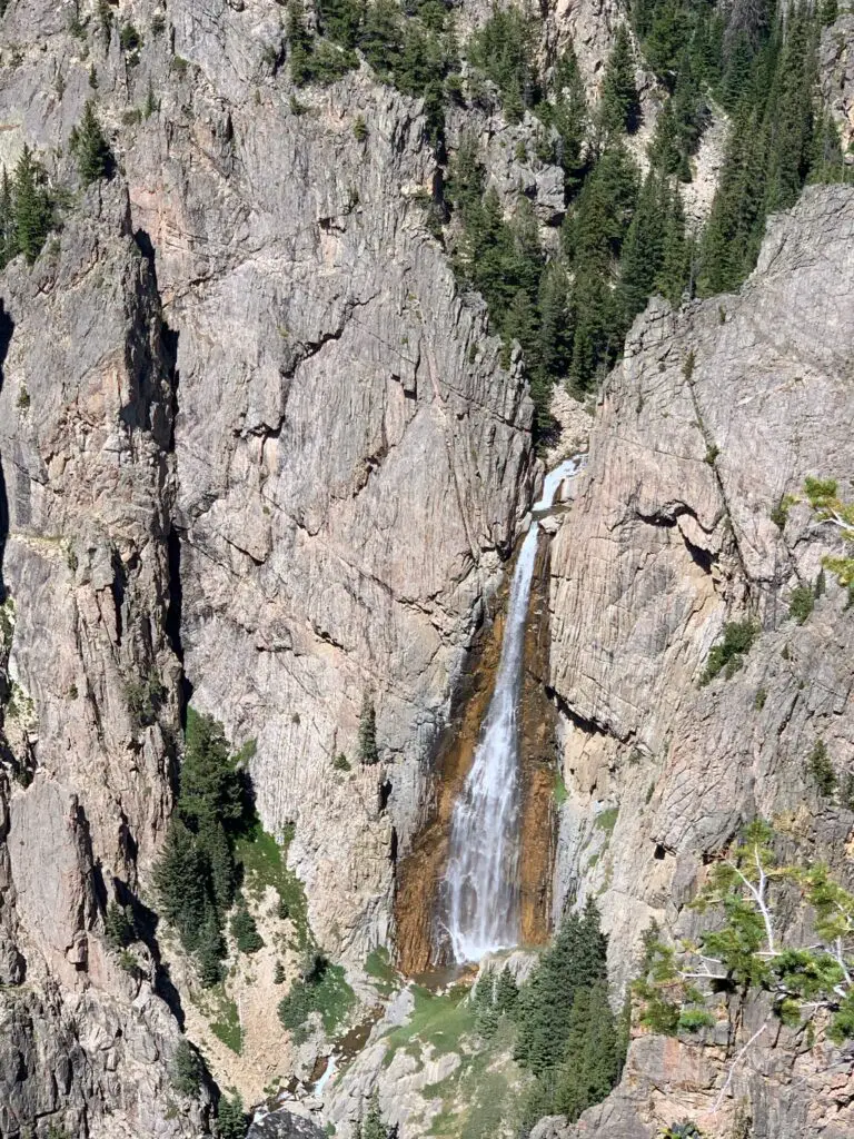
Lake Helen! (Bomber Mountain is near the tall peak straight up from the rock in the water. Florence Pass is through the saddle even further to the right.)
From Lake Helen you can see Bomber Mountain and the high-altitude, Florence Pass to the right. What you cannot see is Cloud Peak (as often as we have visited the Bighorns we have yet to see that site. It’s VERY isolated. 😝) From what I have heard from other hikers though, you CAN get views of Cloud Peak from Misty Moon Lake.
Let’s talk about Bomber Mountain and Cloud Peak
Cloud Peak and Bomber Mountain reach altitudes higher than 12,000 feet so altitude sickness starts to be a concern when you spend lengthy amounts of time at these altitudes. Potential hikers should also be aware the snow can be quite deep on these trails through July! Also, mosquitoes are said to be HORRIBLE in the summer (we had no problems at all on Labor Day weekend and we didn’t use any bug spray. 😁)
Bomber Mountain: This used to be an unnamed mountain in the Bighorns. That is until a World War II-era bomber crashed here while on a training mission in the early 1940s. If you know where to look you can still view the wreckage. (Don’t ask me how to get there, I don’t know. 😉. For more info on this hike you can click here)
You can check with local forest offices for information on how to get to the site. From what I’ve heard there are also rock cairns that help direct the way but you need an idea of where to look.
Please be respectful if you visit this site as several soldiers did lose their lives in the crash.
There are no actual trails that go to Bomber Mountain or Cloud Peak. (This seems a little odd to me as Cloud Peak is the highest point in the Bighorns and is what the wilderness area is named for, but I digress. 😝) There are some rock cairns to guide your way to Cloud Peak. My understanding is for Bomber Mountain, you pretty much just have to know where you are going.
This being said, PLEASE be sure you have a good, topographical map and a compass with you if you are attempting these hikes. Also, be aware there will likely be some bushwacking involved and you could easily become lost. These routes should only be attempted by EXPERIENCED, backcountry hikers! (Cell phone service is spotty at best in this area. DO NOT rely on it!)
Cloud Peak: “can” be done in one day but it would be a VERY long and VERY hard day (it’s around 24 miles total). People have done it but most suggest doing a 2 – 3 day backpacking trip. (Lake Helen and Misty Moon Lake are popular places to camp for these.) The last three miles to the summit are said to be a boulder field with “house-sized” boulders (per the reviews). The “trail” isn’t super clear either. Some people suggested this is actually a more difficult hike than the notorious Longs Peak in Rocky Mountain National Park 😮 so PLEASE think hard and use incredible caution if you’re considering this trek.
West Ten Sleep Lake Campground
On other trips, we’ve stayed at the Island Park campground but since we were leaving from the trailhead at the lake we stayed at the West Ten Sleep campground on this trip.
It was LOVELY! Some sites had views of the lake, ours had forest views. But the sites were nicely shaded with lots of soft, pine fluff. The campground was also relatively quiet and quite pretty. It was also only a couple of hundred yards to the beauty of West Ten Sleep Lake!
West Ten Sleep Lake!
James T. Saban Fire Lookout
The Trekkers have passed this lookout on every trip we’ve made to the Bighorns and we always say, “we should check that out!”…so, we did!
The trailhead for the James T. Saban Fire lookout is found off Route 16 in the Bighorn Mountains, around five miles east of Meadowlark Lake. The turnoff is on the south side of the road. I can’t remember if there are signs telling you to turn but you can see the lookout at the top of the hill from the road. This is also the turnoff for the St. Christopher’s Chapel and there are signs for that site.
The James T. Saban Fire Lookout!Puppers enjoying the view from the fire lookout!
This fire lookout is easy to reach and offers some amazing views of the surrounding area. It requires a short drive on a narrow, dirt road to reach the trailhead. You’ll want to take it slow and watch where you are driving. In good conditions, I would be comfortable taking almost any higher clearance car, SUV, or truck there. In poor conditions (mud or snow) the road may be impassable.
Once you reach the trailhead, it is about a 15-minute walk (in each direction) to the tower at the top of the hill. It isn’t a bad hike. It gets a little steep in spots but the trek is short enough almost anyone in good health should be able to handle it. (Note: you are at an altitude of around 8000 – 9000 feet in this area so take your time as you may feel short of breath.)
That is Meadowlark Lake in the background
Though it is a bit long and strenuous, the Misty Moon Trail to Lake Helen is a great hike if you want to really get a taste of the Cloud Peak Wilderness area in the Bighorn Mountains!
Have you hiked to Lake Helen, Bomber Mountain, Cloud Peak, the James T. Saban Lookout Tower, or Misty Moon Lake? If so, tell me about your adventures in the comments!
Did you enjoy this post? Pin it!
Like what you read here today? Please feel free to leave a comment, like or share this post! You can also follow the blog on social media by clicking the links below!
In this post, I detail a recent trip the Trekkers took to the San Luis Valley in south-central Colorado.
One cool event to check out in early March is the Monte Vista Crane Festival in the beautiful, San Luis Valley of south-central Colorado!
The time we visited our trip started with an interesting drive down I-25 in southeast Wyoming near Cheyenne. We got as far as Wheatland, Wyoming on the interstate, and then saw the flashing sign for “I-25 closed to Cheyenne”! (It had snowed the day before, and even though it was bright and sunny strong winds were causing blowing snow and bad enough winter conditions to close I-25 and I-80 for close to 12 hours!) So, we had to turn around and drive in “a big f-ing circle”–per Mr. Trekker 😂–back to the nearest alternate route through Torrington.
Anyone who’s driven through MANY parts of Wyoming knows, alternate routes (or roads in general) can be hard to come by. 😝
After navigating some black ice…in the dark…and some sketchy drivers (I’m looking at you reckless semi-truck! 😒)we finally made it safely to Cheyenne. From there it was an easy trip to the hotel in Lakewood (with a quick stop at Chick-fil-A for dinner!) This is the price we pay to live in the INCREDIBLE Mountain West and try to travel during the fickle, early spring. 😂
The next day we headed down the GORGEOUS Route 285 southwest of Denver. I LOVE this drive, it is always SO PRETTY! It sweeps through mountain passes and across alpine valleys. It was cool because we’ve never been to the Rockies when they had this much snow before! One of my favorite parts of the drive traverses South Park, an incredible valley in central Colorado. Click here for a video!
Colorado is one of my favorite places to visit. Click here for more posts on this awesome state!
San Luis Valley, Colorado
Eventually, we arrived in the BEAU-tiful San Luis Valley!
The San Luis Valley, in southern Colorado, is an amazing place! It is the world’s largest high-altitude (alpine) valley that stretches over 100 miles north-to-south and is almost 75 miles in width. It was once the bottom of a large lake and this is evident as the valley floor is flat as a pancake! The valley is especially striking as it is lorded over on three sides by the Sangre de Cristo (Blood of Christ) mountains that reach higher than 14,000 feet! The views here are truly incredible! (Click here for a short video of the drive into the valley.)
Driving into the incredible San Luis Valley!
Where is the San Luis Valley?
You will find this amazing valley hidden…in the middle of nowhere. 😉The southern tip of the valley is only about 35 miles north of the state’s southern border with New Mexico. The valley is also situated almost directly in the center of Colorado (going west-to-east). It sits around 150 miles west of the mountain town of Durango and 120 miles from I-25 (nearest to the small town of Trinidad and the larger city of Pueblo.)
Sangre de Cristo mountains living up to their name!
Fun Things to do in the San Luis Valley
The San Luis Valley is chock full of fun (and sometimes downright WEIRD) things to do!
Great Sand Dunes National Park
This is the second time we’ve visited this park. The first was several years ago in October (another lovely time to visit.) We were able to hike higher on the dunes this time but we still haven’t made it to the top. Those things are steep and they’re situated at like 8900 feet of elevation so you’re dealing with thinner air too! It always seems to be windy at the Dunes (but I suppose that makes sense as wind is what created them. 😉)
Great Sand Dunes under the watchful eye of the Sangres!Snow-covered sand dunesPanorama of the Sand Dunes!A view up one of the mid-sized dunes. (We made it to the top of this!)Tranquil Trekker, Queen of the Sand Dune!
Crestone, Colorado
The small town of Crestone, Colorado is found in the northeast corner of the valley. The town has a population of only a little over 100 people but at least eight different religions offer sites here. They range from a co-ed Catholic monastery to Buddhist, Hindu, and New Age offerings. You can see a Ziggurat–a monument commonly found to honor ancient, Mesopotamian gods. There are also Buddhist and Hindu centers. This tiny town even hosts the only open-air funeral pyre (used for open-air cremation) in the country!
Aliens in the San Luis Valley?
This valley is known for one very unique characteristic, a large amount of UFO sightings! This has helped it earn the title of the “Bermuda Triangle of the West”. There have been recorded UFO sightings in the valley since the Spanish Conquistadors first came here in the 1500s! (Before that time there are stories of “Star People” found in the ancient legends of the American Indian tribes who were here far earlier.)
No one knows exactly why there are so many UFO sightings here:
It could be due to the incredibly dark, night sky that is somewhat unique to this area. This is provided by the towering mountains that surround the majority of the valley blocking out light pollution from larger towns in the local area.
This region is also very rural, some of the largest towns in the valley only boast populations of around 10,000 people.
Some also suggest these sightings may be related to covert operations occurring at Cheyenne Mountain, a military base located less than 200 miles to the northeast (not too far as the secret government plane flies. 😮 😉)
Benevolent Guardian of the UFO Watchtower vortices?
Whatever the reason though, there are more UFO sightings here than at the infamous, Roswell, New Mexico.
UFO Watchtower!
Continuing with the “out-of-this-world” tradition of the San Luis Valley is the UFO Watchower! We discovered this unique locale the first time we visited the valley. We literally stumbled on it as we were driving down the road. 😂We didn’t have time to stop then so Mr. Trekker promised we could return on the next trip!
The UFO Watchtower!Panorama from the UFO Watchower
It takes a little imagination and a BIG open mind to fully appreciate the quirkiness of the site. The story goes that two large, energy vortices are found here. One spins clockwise, the other counterclockwise. (They are said to be connections to other dimensions/universes. Supposedly, 25 different psychics have visited the site and have confirmed this.) Several have also claimed that two large “beings” protect the vortices (they’re supposed to be friendly as long as you are respectful. 😇)
I’m not sure I believe any of this, but science has shown the earth has different magnetic fields, so maybe these could influence the area? Neither of us sensed anything strange but maybe we’re just skeptics? 😝
View from the UFO Watchtower
There is “The Garden” where people leave trinkets (I left a bobby pin, it’s all I had in my pocket. 😇) Some of the psychics also claim there is a mile-long mothership buried in the ground underneath the watchtower. (Could this help explain all the UFO sightings? 👽🖖)
“The Garden”
Where is the UFO Watchtower?
The UFO Watchtower sits around three miles north of the tiny community of Hooper, Colorado. You will find it on Route 17, a little more than halfway down the San Luis Valley. It is situated around 25 miles north of one of the largest towns in the valley, Alamosa, and about 60 miles south of the town of Salida.
The friendly proprietor of the site claims that since the destination opened in May of 2000 around 231 “tourists from outer space” have been spied in the night sky over the valley. (The owner claims she’s seen around 28 “things she can’t explain”.)
Sandhill Cranes!
The main reason we chose this weekend to visit the San Luis Valley is that it was the date of the annual, Sandhill Crane Festival (it occurs every year in early March.) We always enjoy watching (and hearing!) the cranes fly over our area every fall and spring, their unique song echoing across the Hills as they fly high on the thermals.
We actually learned while we were down there that the Cranes that fly over the Black Hills are NOT the ones we were watching in the San Luis Valley. These are the greater Sandhill Cranes that migrate to the Yellowstone area for the summer. The ones that fly over our house are the lesser Cranes who summer in Canada.
You can view the cranes, feeding, flying, and “loafing” about all around Monte Vista. We especially enjoyed visiting the Monte Vista National Wildlife Refuge where we saw a bunch of geese too!
Click here for a video of the cranes, their incredible song and their “flight ballet”…
Monte Vista Sandhill Crane Festival!Feeding and “loafing” cranes
Places to Eat in the San Luis Valley
The Trekkers always find great places to eat on our adventures:
—The Cow –a yummy place for breakfast (This locale is not actually in the San Luis Valley. It is located in Morrison, Colorado, not far from the Red Rocks Amphitheater.)
—San Luis Valley Brewing Company–Alamosa, Colorado. A good place for dinner and/or drinks –Campus Cafe–Alamosa, Colorado. Another great place for breakfast (and probably the best meal we had all weekend!)
—Purple Pig Pizzeria–Another fun place for a post-adventure meal!
If you want to explore a lesser-known part of the incredible state of Colorado, check out all the amazing San Luis Valley has to offer!
Have you checked out any of these sites in the San Luis Valley? Tell me about them in the comments!
Did you enjoy this post? Pin it!
Like what you read here today? Please feel free to leave a comment, like or share this post! Add your email at the bottom of the page, or the sidebar to the right, to be notified when a new post is published. By signing up for the email list, you will also receive a free copy of the Tranquil Trekker’s Top 10 Tips of Trekking Do’s and Don’ts!
You can also follow the blog on social media by clicking the links below!
In this post, I give some simple tips for making traveling with your four-legged family member a breeze!
What’s better than going on vacation with the family? Going on vacation with the four-legged members of your family, of course! Read on for the Tranquil Trekker’s tips to make traveling with a dog a relaxing and enjoyable experience!
Frequent Stops when Traveling with a Dog
We find it’s best to stop every couple of hours–and to be clear this means a stop where Doggo can get out and walk around some whenever possible (rest stops are preferable to gas stations, and parks or short hikes are most preferable of all!) This isn’t as easy if you’re traveling through more urban environments. But any time you can stop where there is at least a little grass where the pup can get out and run helps (it’s good for us to get out and stretch our legs too!)
Don’t forget the pups need stops to potty and for snacks and water too, just like us!
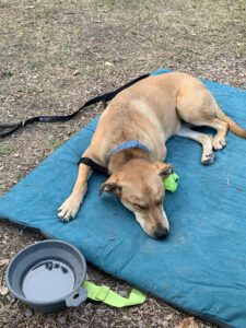
Puppers encourages you to search for green spaces to play!
We especially enjoy stopping at parks or other green areas to get all of us some exercise. This also helps you experience the areas you are visiting (or just driving through) better. This is a great part of road tripping, getting to actually experience the country rather than just flying over it on the way to your final destination.
We’ve had lots of fun stopping at little parks in small towns. Sometimes they have memorials that help you learn about the local area, occasionally they may even have a small museum on-site. We also strive to find waterfalls/dams/historical sites to hike out to whenever possible. Many times this may be a simple walk of less than a mile to see a cool place.
It’s not only good exercise and relaxation for us, we always need to remember a good puppy is a tired puppy, and exercise is a great way to tucker our furry friends out (this is especially important if they tend to sleep in the car. You don’t want to get some place and be tired and all your four-legged friend wants to do is run and play because they’ve been sleeping in the car the last several hours.).
When You Travel Pack Treats and Toys for the Dog
Bring chew toys or something the pup can play with on their own (in the back seat, their crate, the hatch, etc.) Also, bring multiple toys to keep them entertained (a stick to chew on, a ball to chase, a rope.) Bring extra toys in case you lose one in a creek 😮 or you meet a friend who needs one!
Puppers recommends you bring SEVERAL balls on the trip!
Have an in-car bag with treats, water, toys for rest stops, poop bags, and an easy-to-pack bowl. Don’t forget food too, if it’s going to be a long travel day.
Pack Luggage for the Dog When You Travel
Pack luggage for your friend, as well. This keeps their food, treats, bedding, harnesses, water, jackets, toys, etc. all in one place that is easy to pack and easy to find.
I’ve been locked in this back seat a long time Human, don’t you think it’s about time for a break?!
Practice PATIENCE when Traveling with a Dog
Have patience!!! Remember your four-legged friend gets bored, antsy, hungry, cranky, carsick, needs to pee, etc, just like we do! This can especially be true for younger dogs. (Our former dog got horribly car sick until she was around five years old. The vet couldn’t even believe it. He kept asking, “she’s STILL getting sick?!”)
Give Fido His Space in the Car!
Make sure your friend has their own space in the vehicle. This could be a chunk of the back seat or hatch or their own crate in the back of the car. It should be big enough that they can lie down. Treat your furry friend as a passenger that you have to make room for. Don’t pack the car to the gills and then expect the dog to just “fit” into a spot. They are part of the family right? We need to treat them as such in the car. 😀
Puppers says, “I need my space!”
We enjoy traveling with Puppers! Use these tips the next time you travel with a dog to help make your trip as memorable and free from difficulty as possible! Now get out there and enjoy an adventure with both human and canine members of the family!
Do you travel with your dog? Have you learned any additional tips or tricks? Tell me about them in the comments!
Did you enjoy this post? Pin it!
Like what you read here today? Please feel free to leave a comment, like or share this post! Add your email at the bottom of the page, or the sidebar to the right, to be notified when a new post is published. By signing up for the email list, you will also receive a free copy of the Tranquil Trekker’s Top 10 Tips of Trekking Do’s and Don’ts!
You can also follow the blog on social media by clicking the links below!
In this post, I detail sites we saw on a road trip through western Montana.
It all started with some AMAZING huckleberry bear claws… 🤤
In 2016, on our trip to Glacier National Park,we visited Polebridge, Montana. They are famous for their homemade, huckleberry bear claws that are baked at their Mercantile. (They are AMAZING and totally worth the drive!)
Mr. Trekker has had an ongoing craving for these delicious delicacies since that trip. One summer a few years ago, we decided we needed more of these amazing treats, so we crafted an entire road trip around enjoying some! Read on for more info on the bear claws, and several other cool stops to add to your Western Montana Road Trip!
Places to Eat in Western Montana
There are so many great places to eat in Western Montana. I mention a few we tried below:
Montana Wheat bakery (throughout the state): this place has AWESOME cinnamon rolls and pastries that are made locally.
Lake City Bakery and Eatery (Polson, MT): We acquired yummy pastries from this locale and then enjoyed them at Boettcher Park which sits on the southern shores of Flathead Lake. It offers prime views of the lake (where we learned that Puppers is afraid of waves, even small ones. 😂)
Burrito Brothers (also in Polson): We got another AWESOME breakfast from this small shop. They offer a variety of burrito choices including both breakfast and lunch options, and they’re open throughout the day!
Freestone Ice Cream (Hamilton, MT) and the Virginia City Creamery (found in the Virginia City ghost town!): check out the yummy huckleberry ice cream at these locales!
Red Lodge Cafe and Lounge: They make a great breakfast sandwich!
**Author’s note: Technically dogs are allowed in this portion of the Park, however it is recommended that you keep them in your car/camper. There are LARGE bear dogs that roam freely throughout town–to help keep the grizzlies out of town!–that are known to be aggressive with other dogs.**
We made it to Polebridge and got our huckleberry bear claws…and yes, they were DELICIOUS! (For more info about this little piece of paradise, click here!) Polebridge is a TINY hamlet that sits only about 20 miles south of the Canadian border. (For those keeping track at home, the Polebridge Mercantile is exactly 923 miles from our house! 😁) They also make some great sandwiches that we enjoyed by the creek later!
Polson/Flathead Lake KOA Review
I struggled with whether to include this info. I always try to keep this blog positive, however, this experience was so disappointing I felt like I needed to say something. The campground was LOVELY. It was set back from the road so it was fairly quiet, and it offered beautiful views of Flathead Lake and nearby mountains. The RV sites were shaded and lovely, as well. We were excited when we got there because it seemed SO NICE…then we got to the tent sites…
Anyone who reads this blog regularly knows we prefer to stay in national forest campgrounds. They’re usually more secluded, quieter, prettier and you’re more likely to see wildlife. However, western Montana is prime grizzly habitat (and since they scare the CRAP out of me) we decided to opt mostly for KOA’s this trip. I will be the first to admit, KOA’s are basically the most “vanilla” camping experience you can possibly have (but the showers and flush toilets were LOVELY! 😉)
Unfortunately, the tent campsites at the Polson/Flathead Lake KOA were AWFUL! The facility literally parked the tent sites onto a gravel parking lot. It felt like whoever designed them had never tent-camped a day in their life. 😔
The tent sites are on pebble tent pads (which are ok) but they are surrounded by gravel…there was only a small amount of lawn that we could reach next to us (and the sprinklers came on for that at midnight and sprayed half our campsite too, getting our chairs and towels wet and hitting the fence and waking us up. 😒)
The sites offered almost no shade so they just BAKED under the sun. We avoided ours until at least 6 at night as it was so hot. The first night the hot pebbles radiated heat into our tent all night. 🥵 To top it all off they wanted us to park our car elsewhere (not too far away, but still.) Um, we are CAR CAMPING, all our stuff is stored in the truck so we go to it, A LOT! KOA isn’t known for great tent sites but these were the worst we’ve ever had. 😕
I’m sorry but THIS is not worth $50/night. 🙁
I will say the showers and the Pet Exercise area were nice. The views of Flathead Lake were also great and the mountains would have been gorgeous…if we had been able to see them through the wildfire smoke. 😝 (This issue was obviously not the fault of the campground.).
Bottom line, if you want to be an RV resort, that’s fine, just tout yourself as such and don’t bother with the tent sites. Or, if you want to offer options for all types of camping, PLEASE don’t make your tent campers feel like second-class citizens. 😡
Flathead Lake
On a much more positive note, Flathead Lake is situated in far, northwestern Montana, less than 50 miles southwest of Glacier National Park. It’s the largest freshwater lake in the Continental US west of the Mississippi and it is AWESOME! The view reminded me of Sebago Lake in Maine. (I reviewed a trip we took to that lake, several summers ago, here.)
Looking north from the southern tip of Flathead LakeThe sun rising over the haze-enshrouded Rockies (those would be the dark blur below the sun that you can barely make out through the wildfire smoke). 😝The sun reflecting off Flathead Lake
*You may notice a lack of the beautiful, landscape, vista pictures, that I usually post. That would be because on this trip, we could hardly see the mountains due to all the smoke and haze. 😩 Sadly, this is becoming more of a norm as the West tends to burn each summer. 😪 PLEASE pray to Whatever/Whoever you pray to, send positive vibes, good wishes, white light, or whatever your spiritual “thing” is, but the West NEEDS rain, snow, or anything else that can fall as precipitation. It’s crazy seeing some of the flooding in other parts of the country/world while out here the landscape just BAKES under the hot sun. 😭 Climate change SUX!!! 😡
I’m glad we’ve visited this area before so we know how beautiful the landscape actually is. A few times on this trip we could barely make out tall, mountain shapes looming through the yellow-brown gloom. 😪(We did get lucky that even though we drove through some very smoky areas, none of our campsites were inundated with wildfire smoke.) The morning we woke up to the sound of rain on the tent it took me a while to remember what that sound was! 😯 And then I rejoiced! It’s a beautiful sound and we didn’t even mind packing up a wet tent in the drizzle. 😁
Hungry Horse Dam in Hungry Horse, Montana
We also saw the Hungry Horse and Kerr Dams. The Hungry Horse Dam is located just south of Route 2 in Hungry Horse, Montana, just west of Glacier National Park. It dams one of the forks of the Flathead River and creates the very scenic and very LONG Hungry Horse Reservoir. The dam is over 500 feet tall and is one of the tallest ever built by the CCC (and is one of the largest of its type in the country). It was cool to see! If you stop at the Visitor Center there are even some tours available of the dam and its workings.
Hungry Horse DamView from Hungry Horse Dam
Word to the Wise: The view in the picture above is similar to the one we saw from the Gunsight Pass Trail in Glacier National Park–the portion of the trail that starts from the Jackson Glacier Overlook which is found off the Going to the Sun Road. (I reviewed that trek here.). Often, if you know where to look (and have a little bit of luck), you can see similar sites to those found in national parks just outside the park boundaries where there are fewer crowds. After all, it’s all the same countryside!
Kerr Dam in Polson, Montana
The Kerr Dam was REALLY neat! They had a great little boardwalk path down the canyon wall that offered prime views of the structure.
Be warned, the path was a little steep and could be HOT in the sun. It could also be slippery if wet. We had a nice breeze and a rain shower when we were there at 6 pm so it was pretty nice, we also had the place to ourselves at that time of day. This could also be a bit of an uncomfortable walk if you’re afraid of heights. It didn’t bother me as there was a nice railing but you’re basically walking along a knife-edge cliff that drops off on both sides.
The dam is on another fork of the Flathead River on land owned by the Flathead, Salish, and Kootenai tribal people. The US government leases the dam from the tribes which provides them revenue.
Kerr Dam
Views from the Kerr Dam Overlook:
Traveler’s Rest State Park
Traveler’s Rest State Park is pretty cool! It is located near the intersection of Routes 12 and 93 in Lolo, Montana. This site’s claim to fame is that it is the only confirmed campsite of the intrepid explorers, Louis and Clark. How do they KNOW this is the case, you may ask? Well, the answer is kind of gross actually! 😂
A recreation of Louis and Clark’s camp!
The location of the camp was long suspected to be in this area. An archeological study eventually found higher-than-normal amounts of mercury in soil samples gathered here. It was known that the exploration party carried mercury pills to be used to help “expel sickness from the body”. As it turns out, the soil the archeologists had found was the site of the camp’s latrine! 🤥 Once this spot was confirmed, the scientists were then able to locate other remnants of the camp using previously known camp arrangements.
Don’t believe me regarding the story of how they confirmed this was the site of the camp? Read the sign! 😁
Similar to the trees I discussed in my Gettysburg National Battlefield post, Witness Trees have also been identified at the site of the Louis and Clark camp! (These are trees that have been determined to be old enough to have been here when the camp was here.)
The camp’s three Witness Trees:
The Salish Tribe
One of the prominent, early tribes in this area was the Salish People. I loved how many of the local signs are written in both English and Salish. It is a beautiful language to see written. It looks almost Cyrillic (Russian) but is actually completely unique to this tribe. I was also able to purchase a cool book that gives a Salish glossary.
This is so neat! It’s one of those “wildlife bridges” on Route 93 between Missoula, MT and Polson (on the Flathead Reservation). It allows wildlife to safely cross the highway. Notice the Salish language included on the sign.
Our evening with the Hells Angels 😮
When we arrived in Red Lodge, Montana, one evening, near the end of our trip, we noticed LOTS of bikes (motorcycles). We’ve always loved Red Lodge but have only been there in the early summer, it’s a bit busier during the prime season. 😝 We should be used to this living so close to Sturgis but we hadn’t anticipated all these bikers may want to ride the Beartooth Highway (duh!)
So, we were like, “oh, ok, no big deal.” Then we noticed, “Hey, that guy has a Hells Angels cut on…and so does that guy over there…and over there is a cop…and over there is another cop…those guys over there are wearing Hells Angels cuts too….and over there is another cop…”…yeah…the Hells Angels were apparently having their annual gathering in Red Lodge that week. *sigh*🙄 (For the record we had no problems at all and the few HA’s we talked to were VERY friendly–they liked Puppers. 😉)
Beartooth Highway (Beartooth Pass)
On our final day in Montana, we traveled up the Beartooth Pass a bit to see the view.
We were actually killing time until a local store, Lewis and Barks opened. (You’ll notice it’s a play on words of the two explorers mentioned earlier.) As you may guess by the name, it’s a pet-based store. We figured Puppers had done so well on her first real trip with us that she deserved a souvenir too!
Finally, we took a nice, country drive on several back roads (Route 308 east out of Red Lodge, then picked up Route 72 north to Route 310 southeast. We took that to Lovell, WY where we picked up Route Alt-14) to our final campsite of the trip in the northern Bighorn Mountains of Wyoming!
Puppers checking out the view on Beartooth Pass!Puppers enjoyed the OVERLY FRIENDLY chipmunks at the Vista Overlook on the Beartooth Highway.
So there you go, 2000 miles and 7 days later…we saw some great sites, we ate some DELICIOUS huckleberry, bear claws and we had a fun time! Check out some of these great locales for your next road trip around Western Montana!
Have you visited any of these places? Tell me about your experience in the comments!
Like what you read here today? Please feel free to leave a comment, like or share this post! Add your email at the bottom of the page, or the sidebar to the right, to be notified when a new post is published. By signing up for the email list, you will also receive a free copy of the Tranquil Trekker’s Top 10 Tips of Trekking Do’s and Don’ts!
You can also follow the blog on social media by clicking the links below!
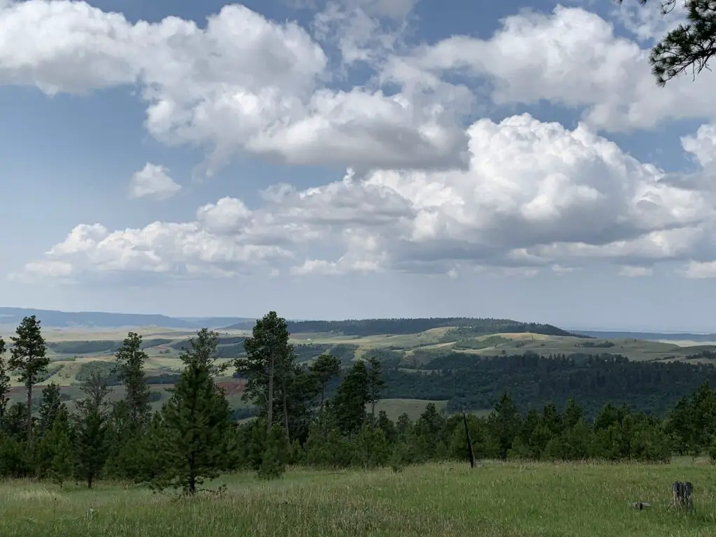
In this post, I review a weekend we spent in the Bear Lodge Mountains of Wyoming.
There is a less-frequently visited portion of the Black Hills in far-eastern Wyoming called the Bear Lodge Mountains. When the Trekkers visited we stayed at the Reuter Campground. It is easy to reach, as it is less than two hours from Rapid City. It is also just a short drive north of Sundance, WY (and I-90).
This was a typical, rustic, National Forest campground. Potable water is available in-season, there are campfire rings and picnic tables at each campsite, and the campground offers vault toilets.
The campsites were decent, this was one of the first times we had an “inner” site so it was closer to other campers. Usually, we go for “outer” sites but there were none available by the time we made reservations. This meant we had to deal with more noise from other campers which is something we are usually able to avoid.
This campground wasn’t my favorite. It was fine, the were plenty of large and shaded sites, but the host wasn’t as available or on top of things as we usually experience. (As an example, the trash DEARLY needed to be changed when we arrived. It’s usually not a good idea to have full trash cans at a campground, at the START of the weekend, in the height of summer. 😝 She also seemed to have a hard time remembering who she had and hadn’t checked in already. 🙄)
We noted another campground in this local area was actually closed and was looking for a host. It seems that campgrounds may be experiencing the same lack of available employees that so many other businesses around the country are right now.
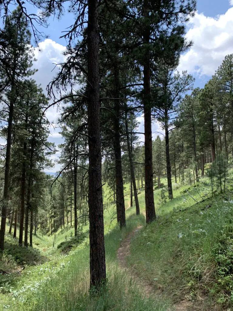
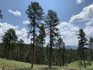
Hiking in the Bear Lodge Mountains of Wyoming
We enjoyed several different hiking trails in the area. Though many were overgrown, they were very well marked with signs and markers. Just watch out for ticks, snakes, and thistles in the tall grass. 😯
Carson Draw Trail including the Carson Draw Spur #1, the Carson Cut Across, and the Reuter Springs Trails
We made a loop out of a portion of the Carson Draw Trail, which we then took to the Carson Draw Spur #1, then went on to the Carson Cut Across, and then the Reuter Springs Trail…
The Carson Draw Trail offers a lengthy and groomed cross-country ski trail in the winter months that is around five miles long. I think this would be a lovely area for skiing. We may also return for a day trip in the fall to check out the leaf colors. We saw several aspen groves that would likely be lovely.
Looking down Reuter Canyon on the Reuter Springs Trail
Unfortunately, going in this direction means that the Carson Draw Spur #1 trail is almost completely an uphill hike. It isn’t overly steep, it’s just a long hill. It was a former forest road so it is plenty wide and graded though it was rather overgrown.
The Carson Cut Across was much nicer. It was short (less than a mile) with only a small amount of elevation gain. It was also nicely shaded and more like a typical, single-track, hiking trail.
Even though it meant a long uphill slog on the Carson Cut Across, I would recommend taking this loop counterclockwise as we did. It means prettier views of the Wyoming prairie and grasslands opening up before you, on your way down the hill, as you exit Reuter canyon on the Reuter Springs Trail. Also, portions of the Carson Draw Spur #1 trail were VERY STEEP as you went downhill shortly before it reached the Carson Cut Across. I was happy we didn’t have to hike UP that!
Warren Peak Fire Lookout Tower
Warren Peak Fire Lookout
The Warren Peak Fire Lookout Tower works in conjunction with the Cement Ridge Tower, which sits to the southeast, on the border of South Dakota and Wyoming. (I discuss that lookout here). It offers 360-degree views of the surrounding mountains and prairie. On a clear day, you can see portions of Montana, Wyoming, the mountain Crow Peak in South Dakota, Devils Tower just a scant 20 miles away, all the way to the Bighorn Mountains much farther to the west!
Devils Tower as seen from the Bear Lodge Mountains:
Cliff Swallow Trail
So, I am NOT trying to be a Negative Nellie here but we did NOT see ANY swallows OR their nests on this trail (and I’ve talked to other people who said the same thing!😝) The only place we could have possibly seen them was one overlook fairly early into the hike where we saw some cliffs across the canyon. They were probably a good half-mile away though and we couldn’t see any birds using the binoculars.We’ve definitely seen more of these cool featherlings on other trails that don’t even advertise themselves as “Cliff Swallow” trails. 😝 So I’m gonna have to give this trail a rating of…FAKE NEWS! 😂
This trail can also be done in a loop. I would again recommend taking it counterclockwise. Going this route you start at the bottom of the canyon and travel along the bubbling, Beaver Creek. The trail went through some very lush greenery, with lots of deciduous trees and ferns (this also meant it was VERY green…and humid. 🥵) There was also little breeze down in the canyon and there were TONS of cobwebs strung amongst the greenery that spanned the trail (thanks to Mr. Trekker for taking one for the team on this one and going first, to knock them all out of the way. See guys, THIS is how you woo a lady. 😉)
Cook Lake as seen from the Cliff Swallow Trail
As you continue down the trail you ascend some mild switchbacks that take you up the hill. Here you will notice a transition to a drier, ponderosa-pine-forest-environment that is more typical of the Black Hills. There was also a blessed breeze at the top and it was less humid (though there could be more sun depending on the time of day as you’re traversing the canyon rim at this point). Our experience was the entire trail was a mix of sun and shade and we were there around the middle of the day.
Again, I strongly suggest you take this loop counterclockwise. The ascent of the hill is more gradual and you’ll have nice views of the lake as you emerge from the canyon. If you go clockwise the trail goes straight up the hill!
This isn’t a bad trail at all, older kids could certainly handle it. It was definitely shorter and easier than the Carson Draw/Carson Draw Spur/Carson Cut Across/Reuter Springs loop (thankfully because it was also HOTTER that day! 🥵) That trail wasn’t bad either, though. I would probably give both a rating of “moderate”, just on opposing ends of the spectrum.
Cook Lake
To finish the second day of hiking, we took a back road out to Devils Tower, just because it was close and we could. 😉 Also, the Devils Tower General Store sells ICE CREAM! 🍦😀😀
That monolith points to ice cream! 😁Sleepy puppy after hiking!
In general, these Hills seem to be more lush and overgrown than is typical in the South Dakota Black Hills. They reminded us more of the lusher ecosystem you find in the northern portions of our Hills.
Not sure if this may indicate they are wetter and may mean they have fewer wildfires here on average (as you don’t hear about them much.) This could also explain why we found there were fewer good lookout/viewpoints here, many of our open spaces in the Black Hills come from burn scars. 😝
I found I didn’t like the Bear Lodge Mountains quite as much as the Black Hills we know and love. They were more rustic and less developed. They actually reminded me a bit of State Forest State Park in Colorado (you can read about that little-known location here and here!) It seemed less organized, you were kind of left more on your own to figure things out.
It wasn’t nearly as busy and touristy as the South Dakota Black Hills though this also meant it was far less crowded. (Admittedly we only experienced a small corner of this area.) It made me think of a green island rising from the sea of brown that is the dry grassland of eastern Wyoming. 😇
Have you ever been to the Bear Lodge Mountains of Wyoming? Tell me about your experience in the comments!
Did you enjoy this post? Pin it!
Like what you read here today? Please feel free to leave a comment, like or share this post! Add your email at the bottom of the page, or the sidebar to the right, to be notified when a new post is published. By signing up for the email list, you will also receive a free copy of the Tranquil Trekker’s Top 10 Tips of Trekking Do’s and Don’ts!
You can also follow the blog on social media by clicking the links below!
In this post, I outline some great day hikes in the northern portion of the Bighorn Mountains of Wyoming!
The Bighorn Mountains in northeastern Wyoming are a great place to hike and camp. There you can find great campgrounds, historical sites, picturesque waterfalls, and even dinosaur footprints!
Porcupine Campground, Bighorn Mountains
The Porcupine Campground is located off of Route 14A, in the northern portion of the national forest. (It is not far from the ancient Medicine Wheel that we visited several years ago.) We drove in from the east, from the Sheridan and the Ranchester area.
This is a MUCH easier drive than coming in from the west, near Lovell. That way is far steeper with much sharper turns. When we drove the road from that direction several years ago we both agreed we wouldn’t want to have to do it pulling a 5th wheel. We talked to someone in the campground who had accomplished this feat, and he confirmed it was quite difficult.
Climbing the mountains from the west you do get some nice views of the Bighorn Basin, but it was a lovely drive through a canyon coming in from the east, as well.
Porcupine Campground is very nice for a national forest campground. (Far nicer than one we visited in South Dakota in the Black Hills National Forest.) The sites were large and flat, and also well-spaced apart, some even appeared to be wheelchair-accessible. They also gave you lantern hooks! (I’m easily impressed, what can I say? 😉)
There was a goodly amount of shade at the campground and some of the sites offered fantastic views from the hillside. The mosquitoes weren’t quite as bad as what we’ve experienced elsewhere, though they still gave us a few good bites.
Sunset from the campsite!
Waterfalls in the Bighorns!
Read on for two AMAZING waterfalls that are easy to reach in the Bighorns!
Porcupine Falls in the Bighorn Mountains
For our first hike, we visited Porcupine Falls. It isn’t on all of the maps but it is easy to find. It’s located off of Route 14, the same road as Bucking Mule Falls (which IS on most maps) and there is a sign at the turnoff. The road to the trailhead is short but it does get rather rough. (We saw people in RVs and regular sedans who made it through though.) In good conditions, most vehicles shouldn’t have too much trouble as long as you are watchful and take it slow.
The trail is short, less than a mile in each direction, but it is STEEP! We were prepared for this but I strongly recommend GOOD walking shoes with strong tread if you’re attempting this hike. In dry conditions, it was a little slippy heading down. If it was muddy or snowy/icy this trail could be downright treacherous! It’s a downhill hike the whole way to the falls, so you know what that means for your return trip! 😮 Another thing that makes the trek back so difficult is the altitude as you’ll find yourself above 5000 feet in elevation when attempting this hike.
It becomes extra fun when you meet an unleashed, less-than-friendly dog along the trail with no owner in sight, who insists on getting in your pup’s face and growling. PUBLIC SERVICE ANNOUNCEMENT: Please be responsible for your pets and respectful of everyone else on the trail. No one else knows your dog, or if the growls he emits are casual, or a prelude to something more aggressive–this is especially concerning when you have a pup who thinks EVERYBODY just wants to play with her! 🙄
Porcupine Falls!Doesn’t that pool look inviting?A view down the canyon, past the waterfall and pool!
The view is definitely worth the challenge of getting to the site. The roaring cascade plummets into a pool at your feet from over 200 feet above you. On hot days, this makes for a perfect place to take a cool dip, but be warned, the water is COLD!
Bucking Mule Falls in the Bighorns
After that adventure, we continued down the road to Bucking Mule Falls. There were numerous horses and campers at this location and before you ask, yes, there was also a mule! Poor Puppers didn’t know what to make of the ungodly noise that emanated from him in response to some nickers from other horses. 😂
You get extra points if you know what a mule actually is (hint, it’s a hybrid). You get EXTRA, extra points if you know a unique characteristic that this hybridization causes…🤔 **(answers at the end)
I was in absolute heaven! I LOVE the smell of horse (yes, really 😝). I blame my childhood, growing up on a hobby farm, with horses, in Indiana. But seriously, there is something cool about those animals. They’re REALLY intelligent, for one thing, and their smell is divine! It isn’t anything like other barnyard animals, it’s sweeter. (The only time I’ve ever known a horse to stink is when they’re super sweaty after a hard ride.) Even their manure smells better than other animals. That’s right, you heard me! I like the smell of horse poop! 🤣
This was a great trail! It was about four miles round-trip, but there wasn’t much elevation gain. The route mostly rolled over the lower-lying hills in the local area. It traversed a beautiful, wooded forest with the pine needles cushioning your footfalls, as well as some more craggy outcrops. The trek was fairly well-shaded, on a graded path, without a lot of roots or boulders to trip you up.
At the end, you come to a lookout point over Devil Canyon, where you look DOWN on the falls from high above (it emerges from the opposite canyon wall). It was really cool! The canyon was HUGE and beautiful, not what I was expecting at all. It reminded me of the canyon that Green River formed at Dinosaur National Monument, in Colorado. It leads to the west and opens onto the expansive, hazy plains of Bighorn Basin.
Devil Canyon, isn’t it GORGEOUS?!Bucking Mule Falls!Shadow Trekkers at the falls!
There is also a Paradise Falls in this area. I didn’t see it on the map and we didn’t know it existed until someone told us about it. Apparently it’s a bit of a secret. 🤫 It does show up on Google Maps though and looks rather easy to reach if you want to research this location on your own…
Later, we drove a loop from 14A to Route 15, to Burgess Overlook. Then we returned back to our campsite via 14A. This allowed us to FINALLY see a moose (she ended up being the only one we saw the entire trip! 😕)
It’s highly unusual that we see so few moose in the Bighorns. Usually, we are there in early September so I’m not sure if our lack of moose sightings was a result of the hotter weather over the summer, keeping them at higher elevations, or the crowds encouraging them to stay more isolated. The babies would still be smaller and younger at that time of year which may explain why the mommas may want to keep them further from people.
Red Gulch Dinosaur Tracksite
On the third day of the trip, we took Shell Canyon to the west on Route 14. We’ve traveled this road before but never in this direction, so we got a different perspective on it. Later we got to view the rain shafts hammering the canyon as we looked up at it from the west. It was a very cool sight!
Then we took Red Gulch Road to the Dinosaur Tracksite. This was very cool and something I had just happened to stumble upon on the map. They think this location was a beach on the edge of an inland sea during dinosaur times. The “terrible lizards” would walk in the mud next to the water and leave tracks. These eventually hardened and were fossilized!
Fossilized shrimp holes at the Dinosaur Tracksite!Dino footprint!
This attraction is small and free. It was a nice place to visit for lunch and to let the pup run a bit. I can imagine it being quite hot on a warmer, sunnier day. They had nice picnic facilities, though.
We then finished this backcountry byway that we had completed the other leg of on another trip. Ya’ll know how I LOVEfinishing things that I start! 😁 This portion of the road was quite rutted and rough too, so it’s not really fit for a typical sedan (though a higher clearance SUV could handle it in dry conditions–we saw some CRV’s do it!)
If you’re looking for some great day hikes in the northern Bighorn mountains, check out some of these cool options!
Have you visited any of these sites? Tell me about your experiences in the comments!
**Mules are a hybrid of a male donkey and a female horse. You can usually spot them because they’re the size of a horse, but with GIGANTIC ears. And the other characteristic that makes them unique? Because they are a hybrid, rarely can they reproduce…The More You Know 🌈 😉 !
Did you enjoy reading this post? Pin it!
Like what you read here today? Please feel free to leave a comment, like or share this post! Add your email at the bottom of the page, or the sidebar to the right, to be notified when a new post is published. By signing up for the email list, you will also receive a free copy of the Tranquil Trekker’s Top 10 Tips of Trekking Do’s and Don’ts!
You can also follow the blog on social media by clicking the links below!
We use cookies on our website to give you the most relevant experience by remembering your preferences and repeat visits. By clicking “Accept”, you consent to the use of ALL the cookies.
This website uses cookies to improve your experience while you navigate through the website. Out of these cookies, the cookies that are categorized as necessary are stored on your browser as they are as essential for the working of basic functionalities of the website. We also use third-party cookies that help us analyze and understand how you use this website. These cookies will be stored in your browser only with your consent. You also have the option to opt-out of these cookies. But opting out of some of these cookies may have an effect on your browsing experience.
Necessary cookies are absolutely essential for the website to function properly. This category only includes cookies that ensures basic functionalities and security features of the website. These cookies do not store any personal information.
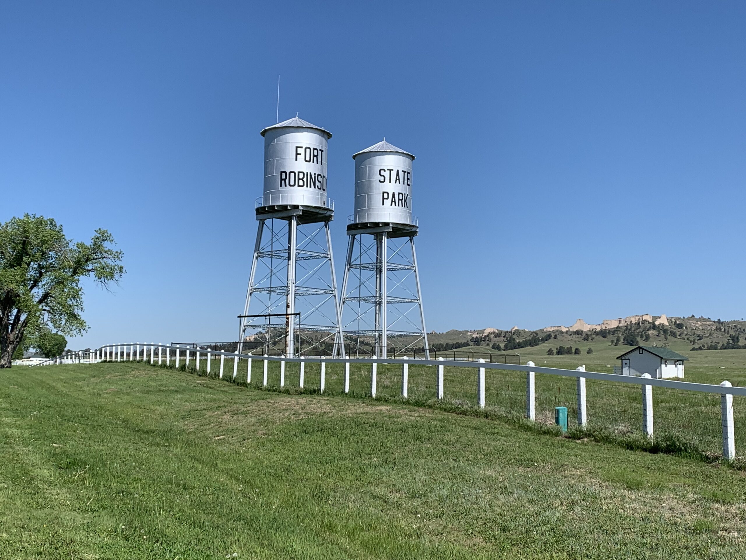
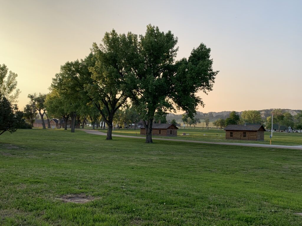
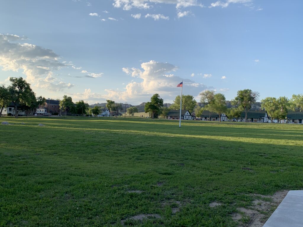
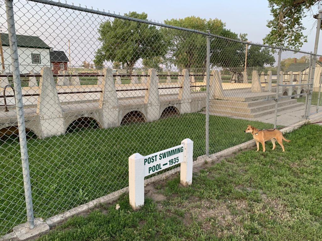
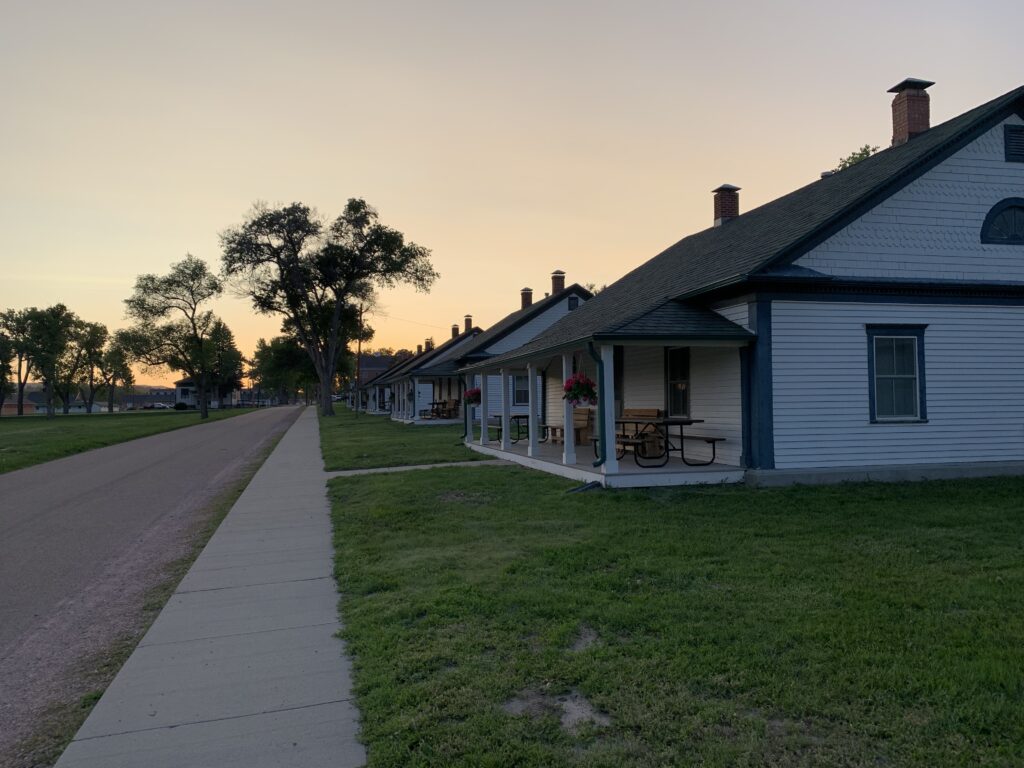
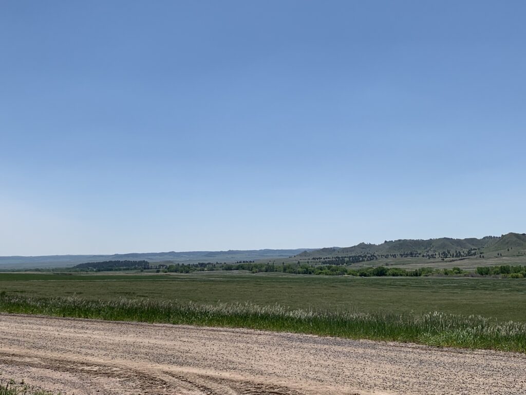
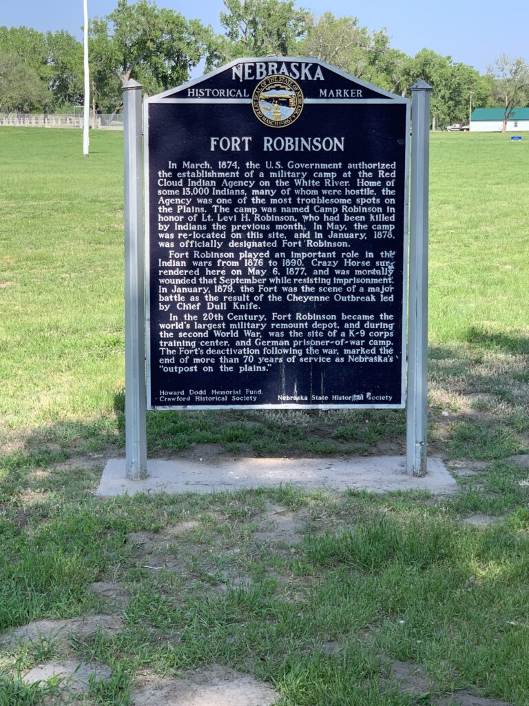
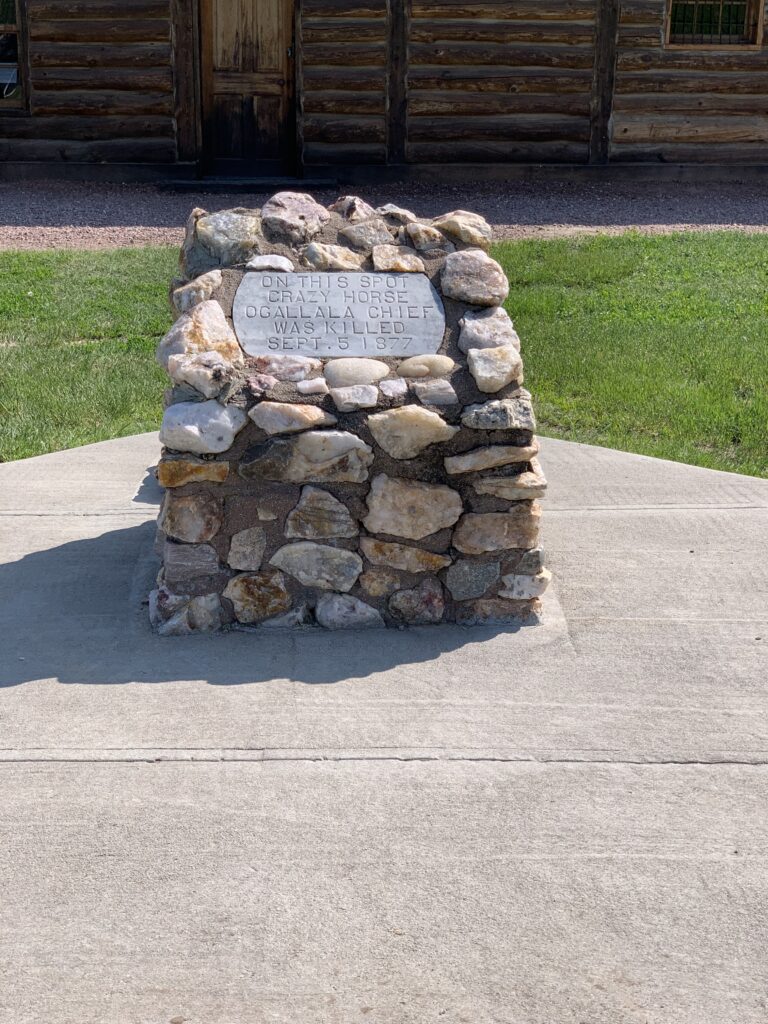
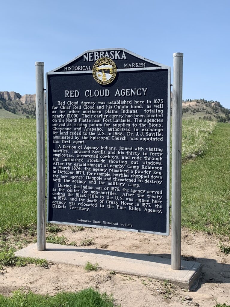
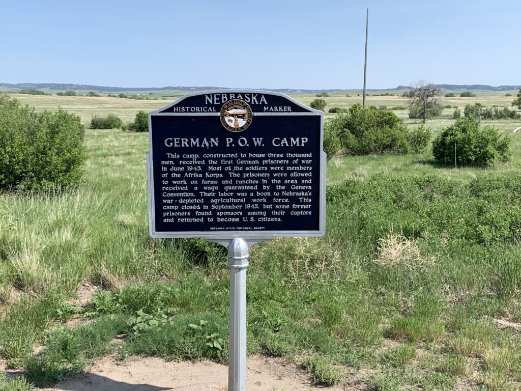
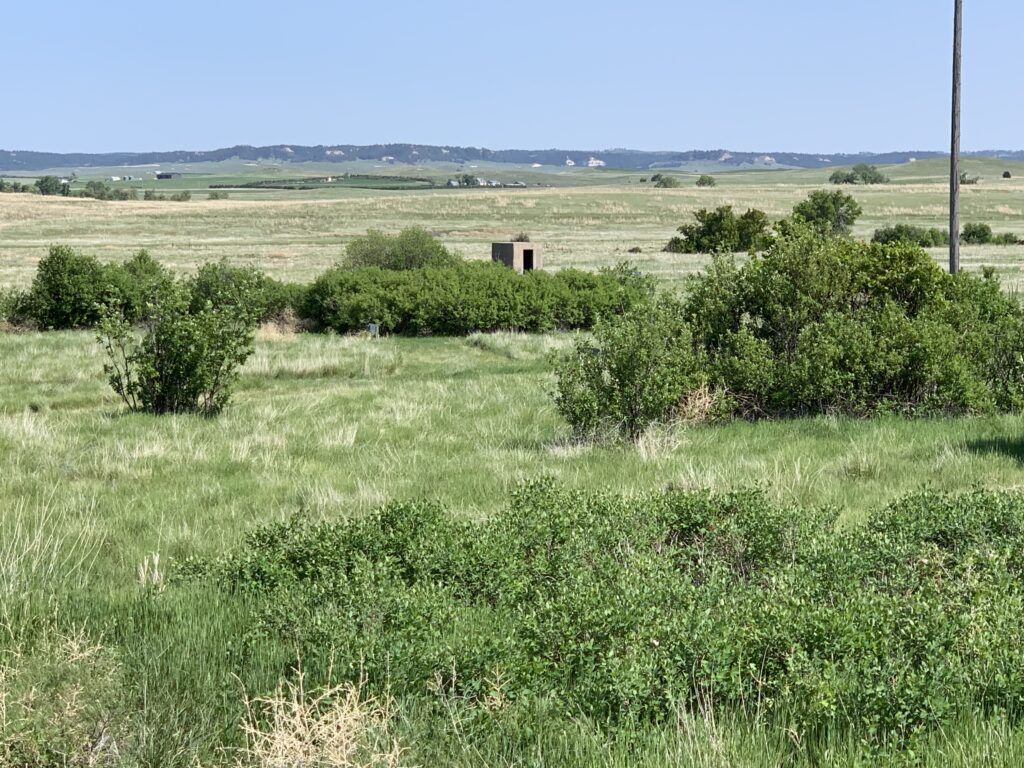
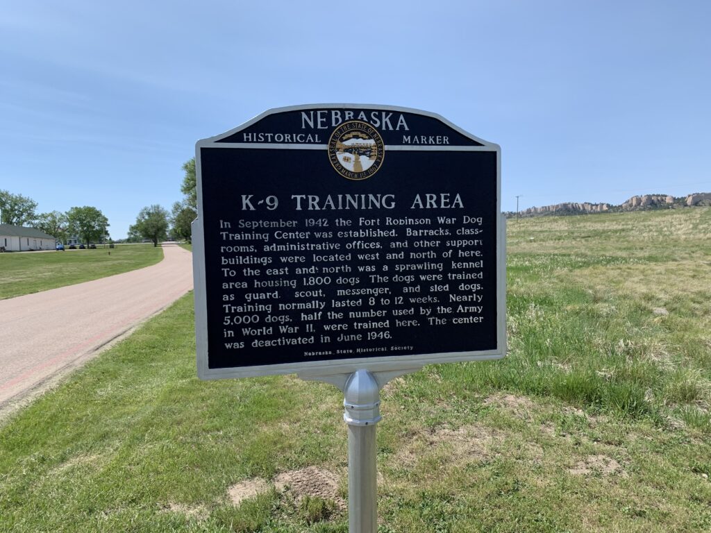
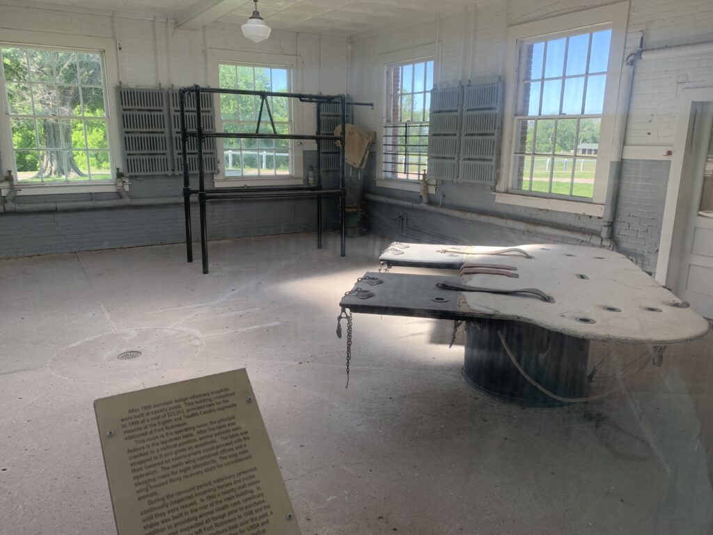
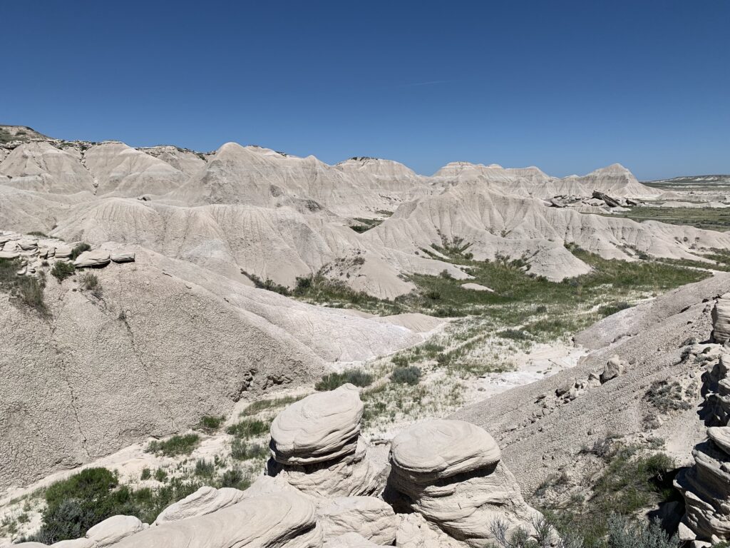
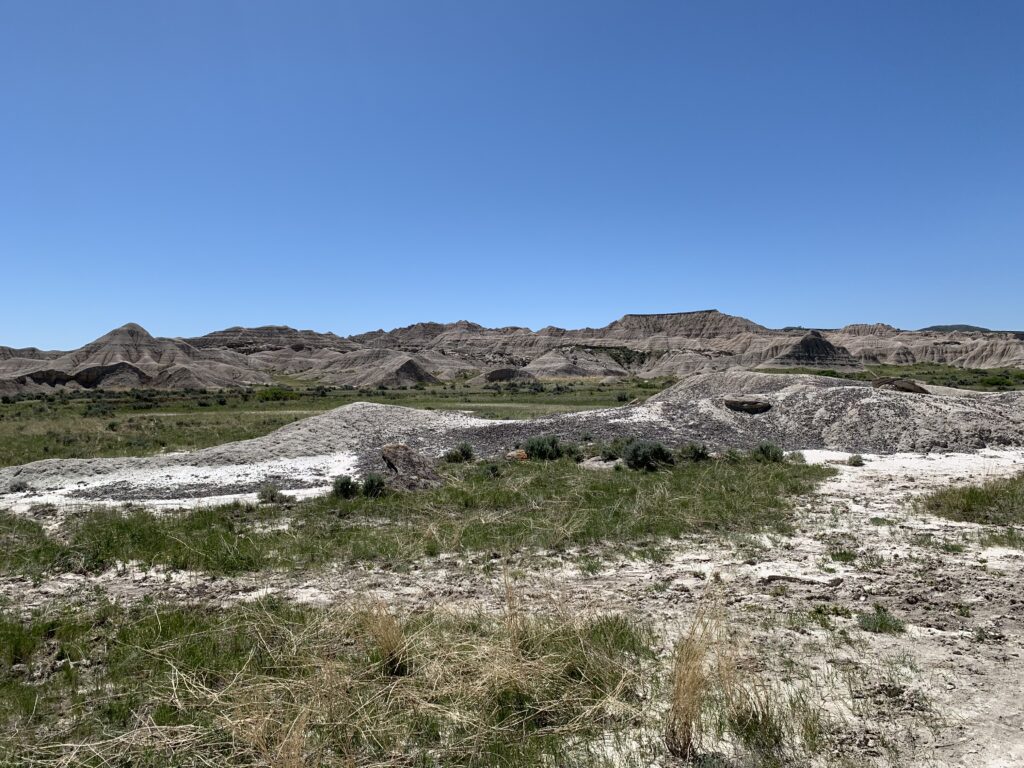
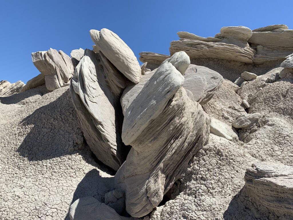
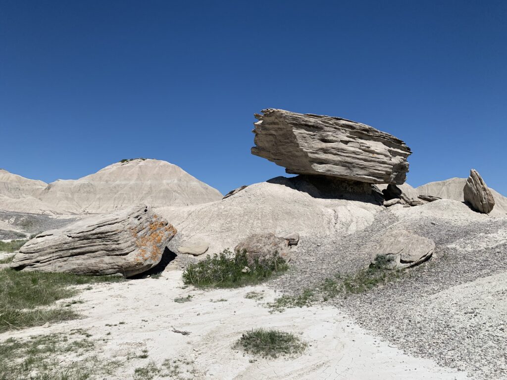
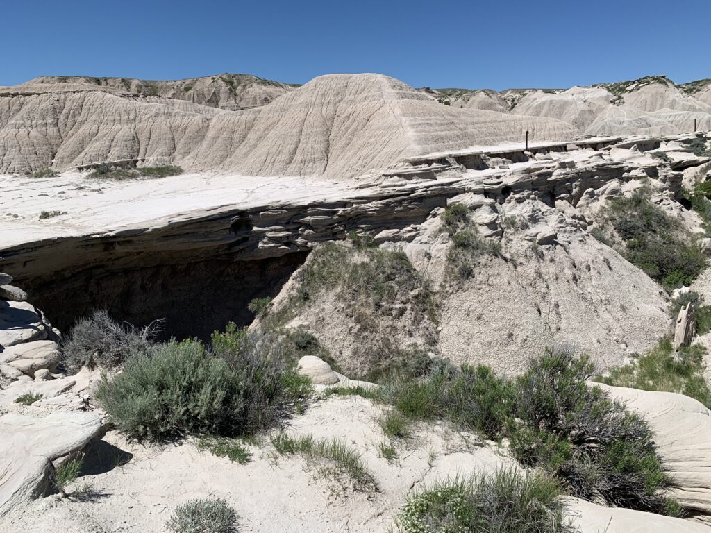
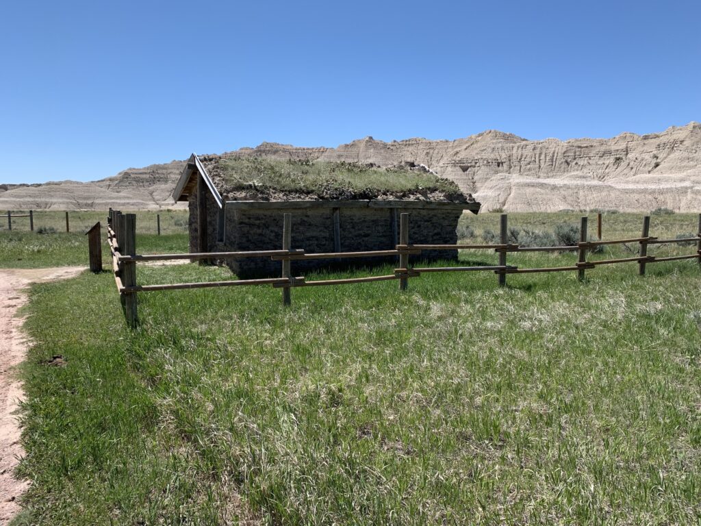
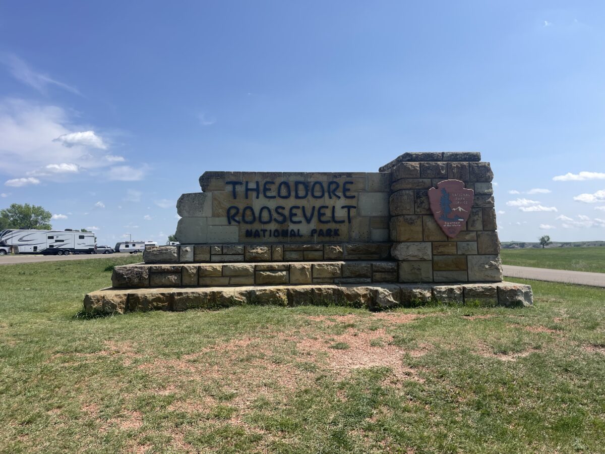
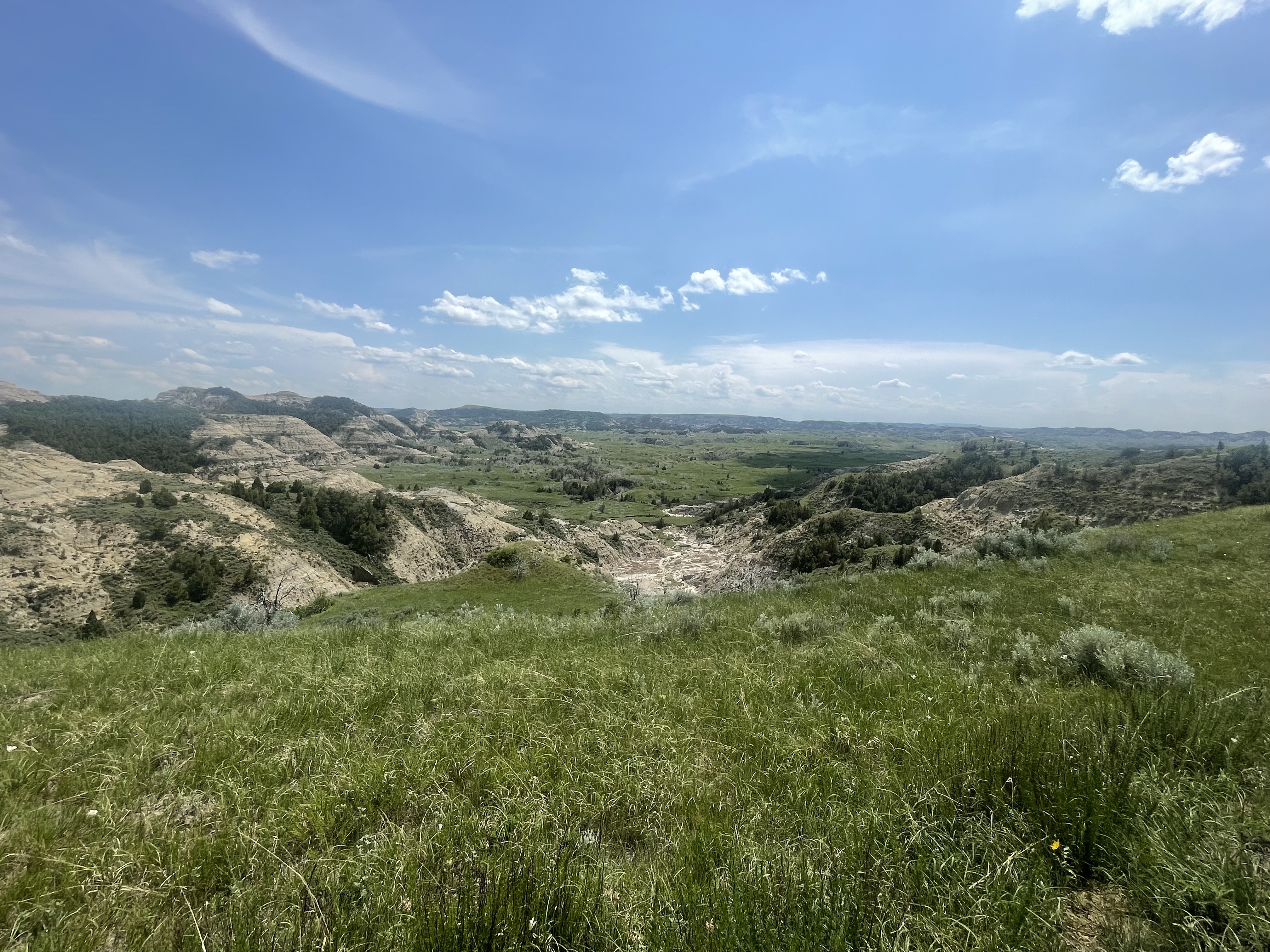
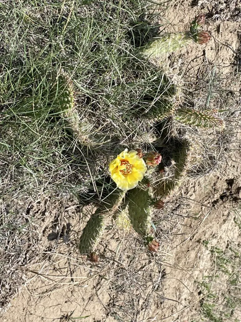
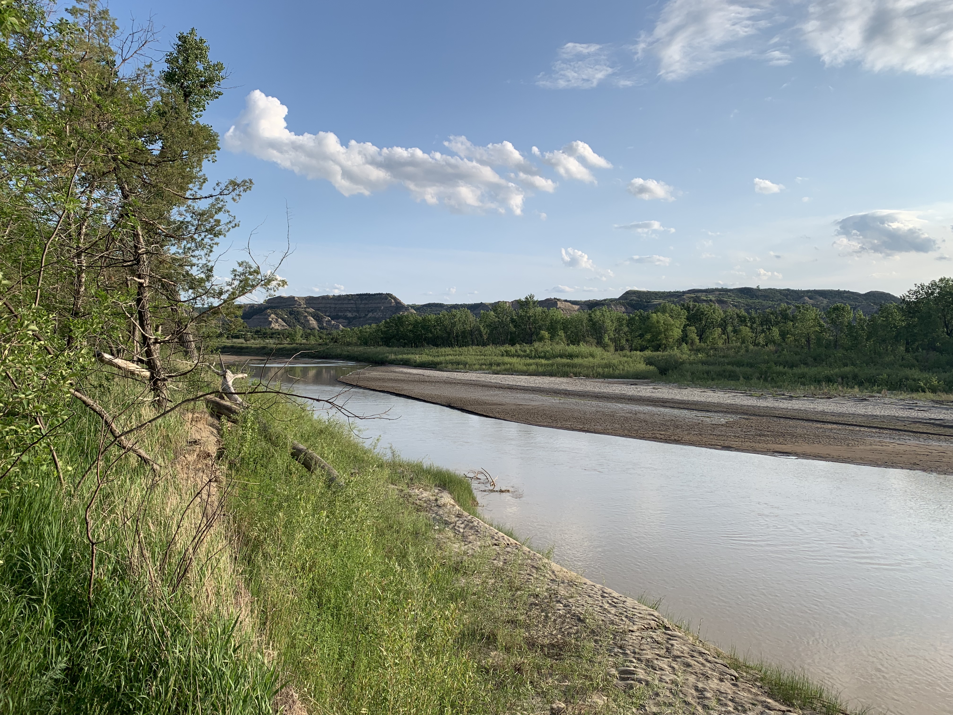
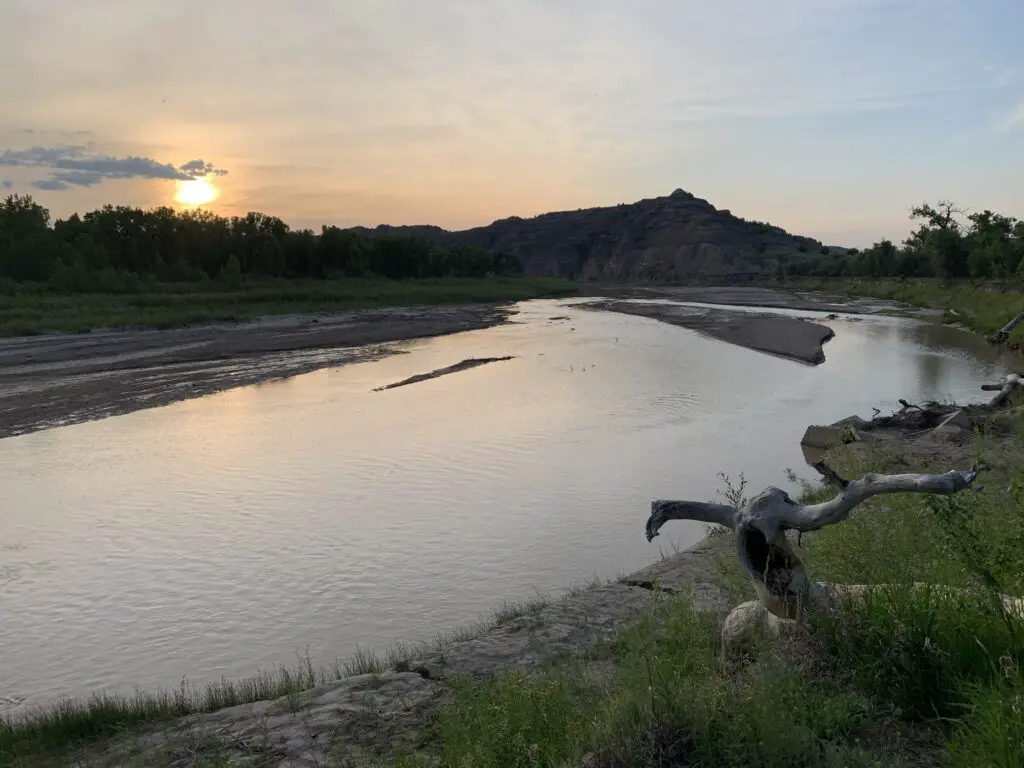
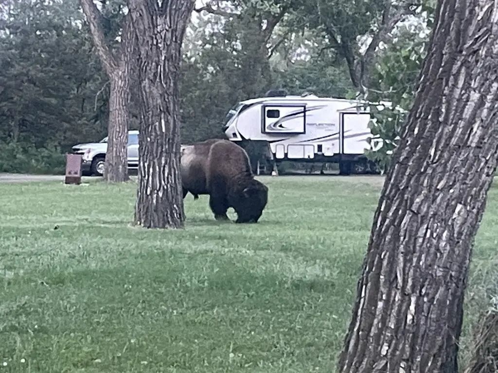
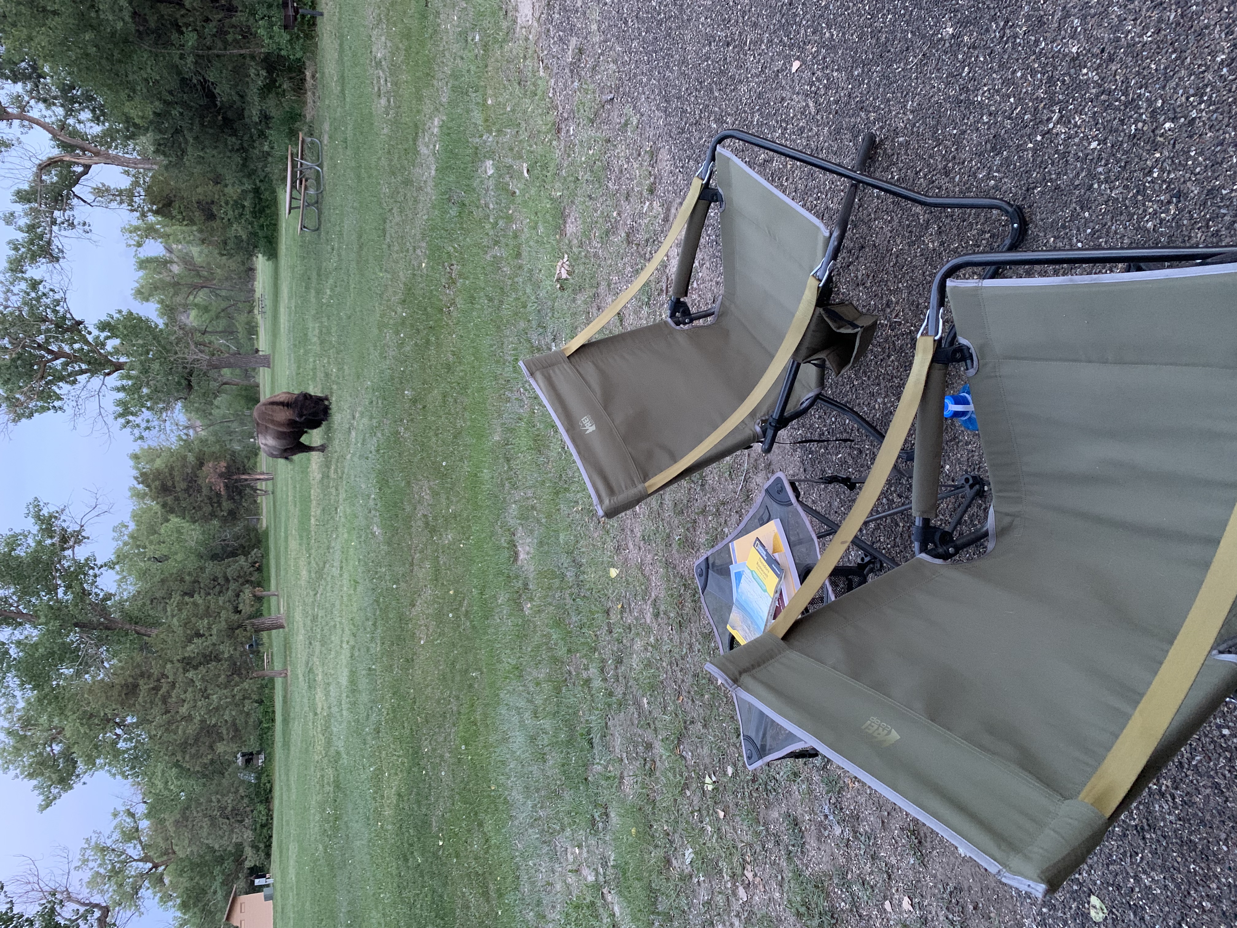
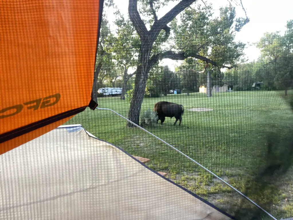
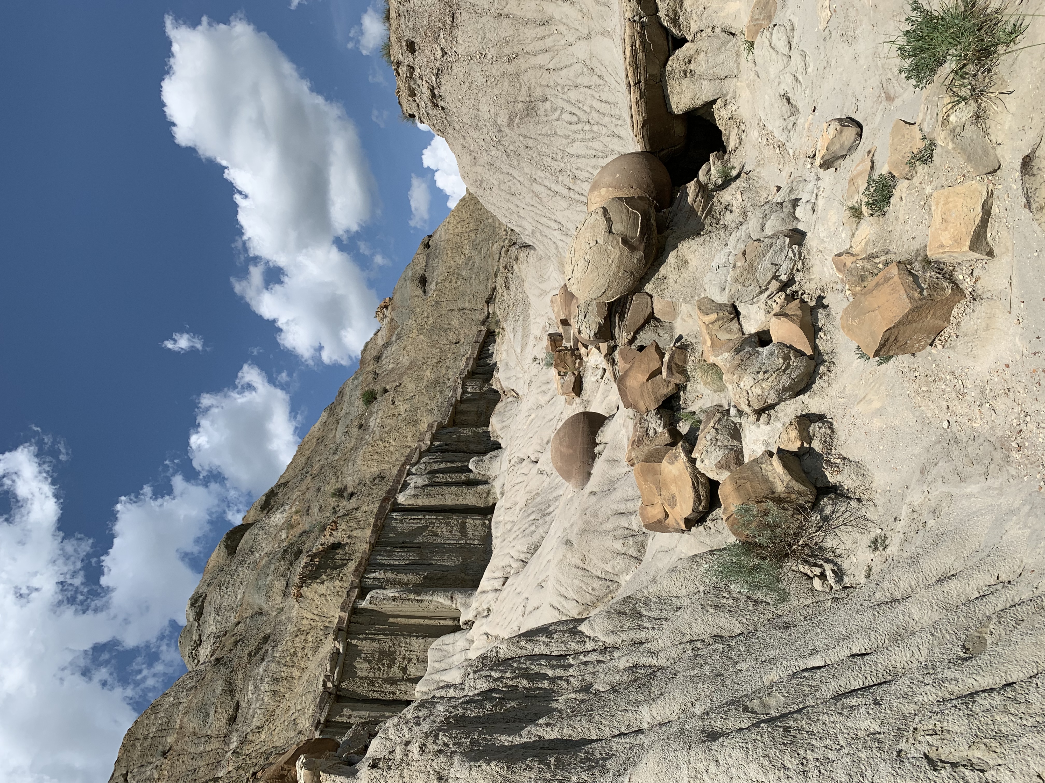
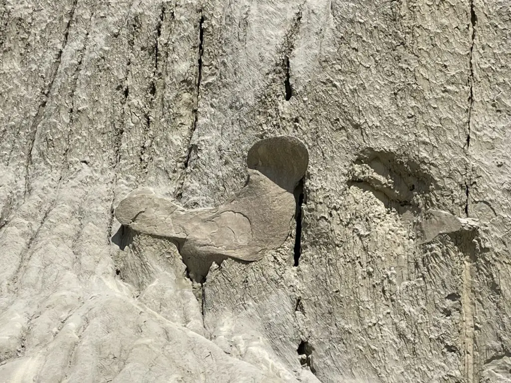
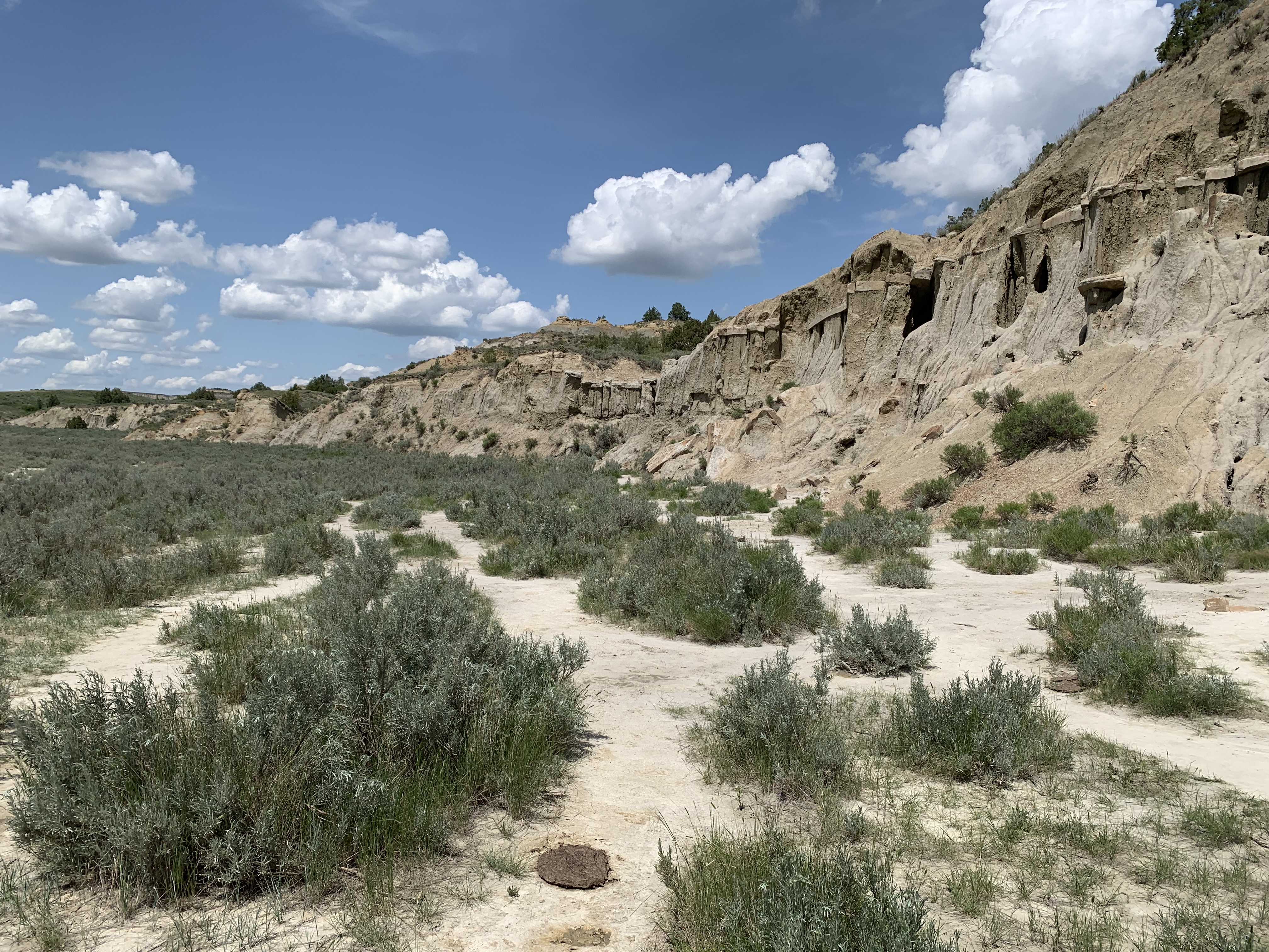
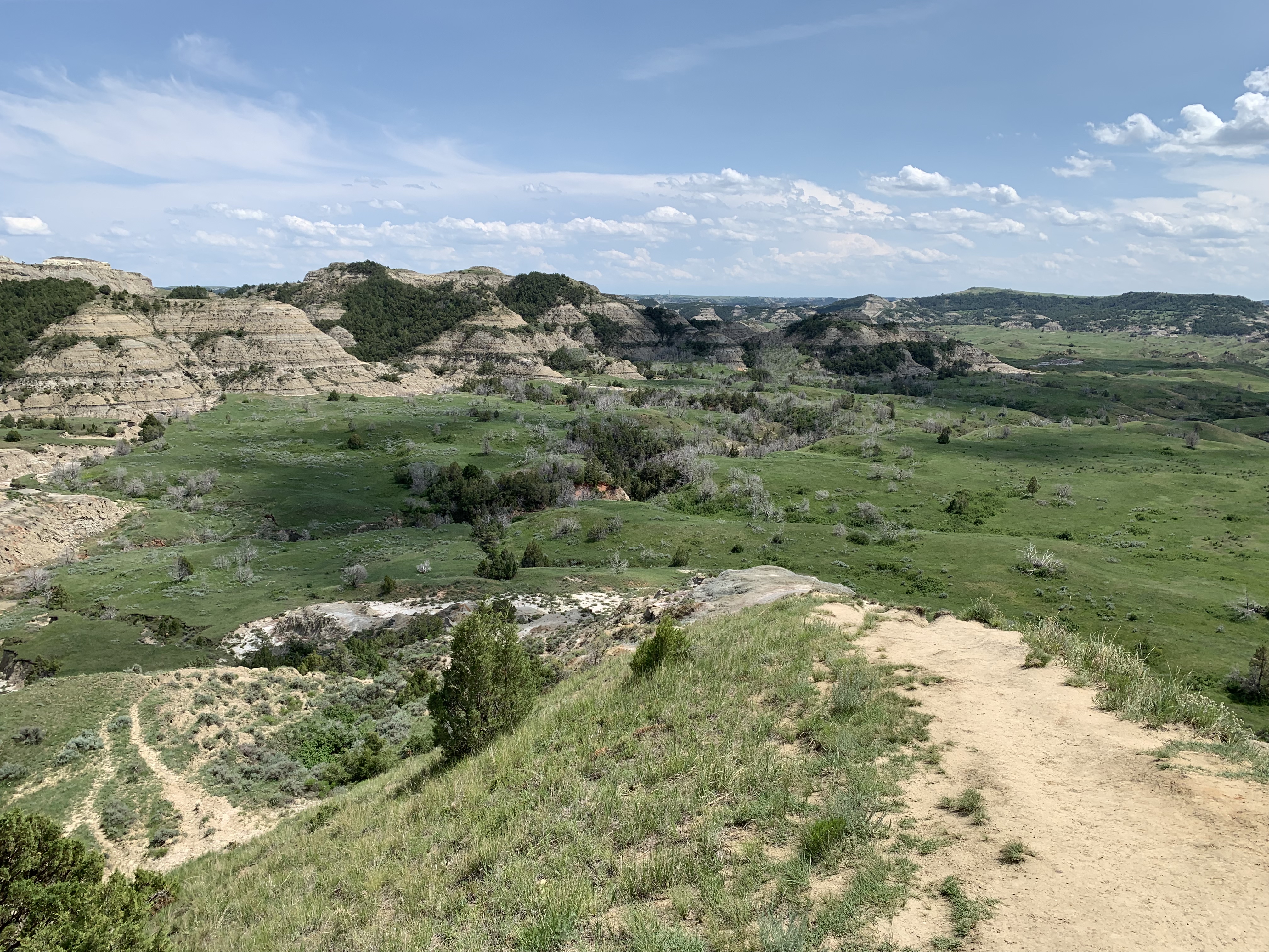
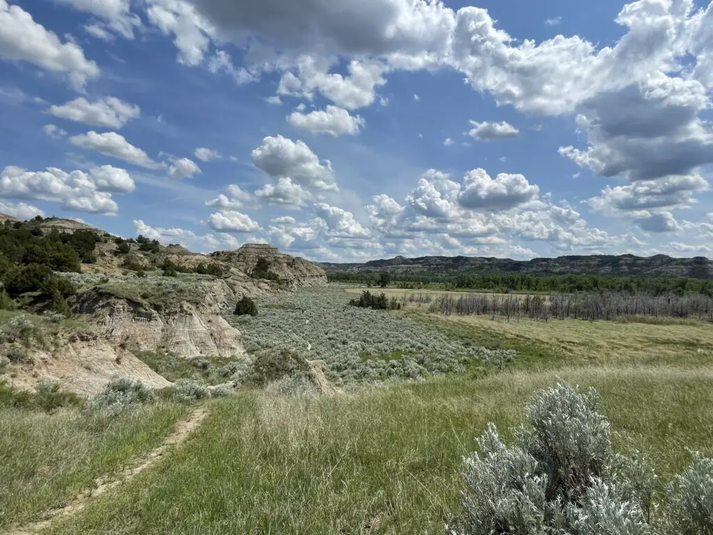
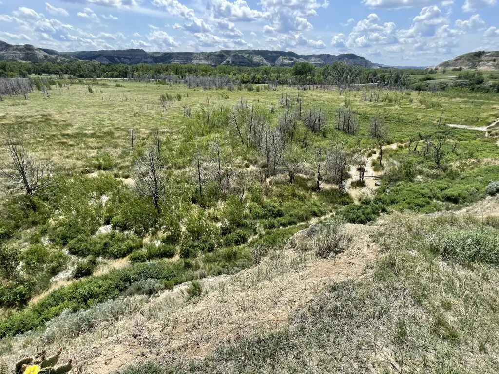
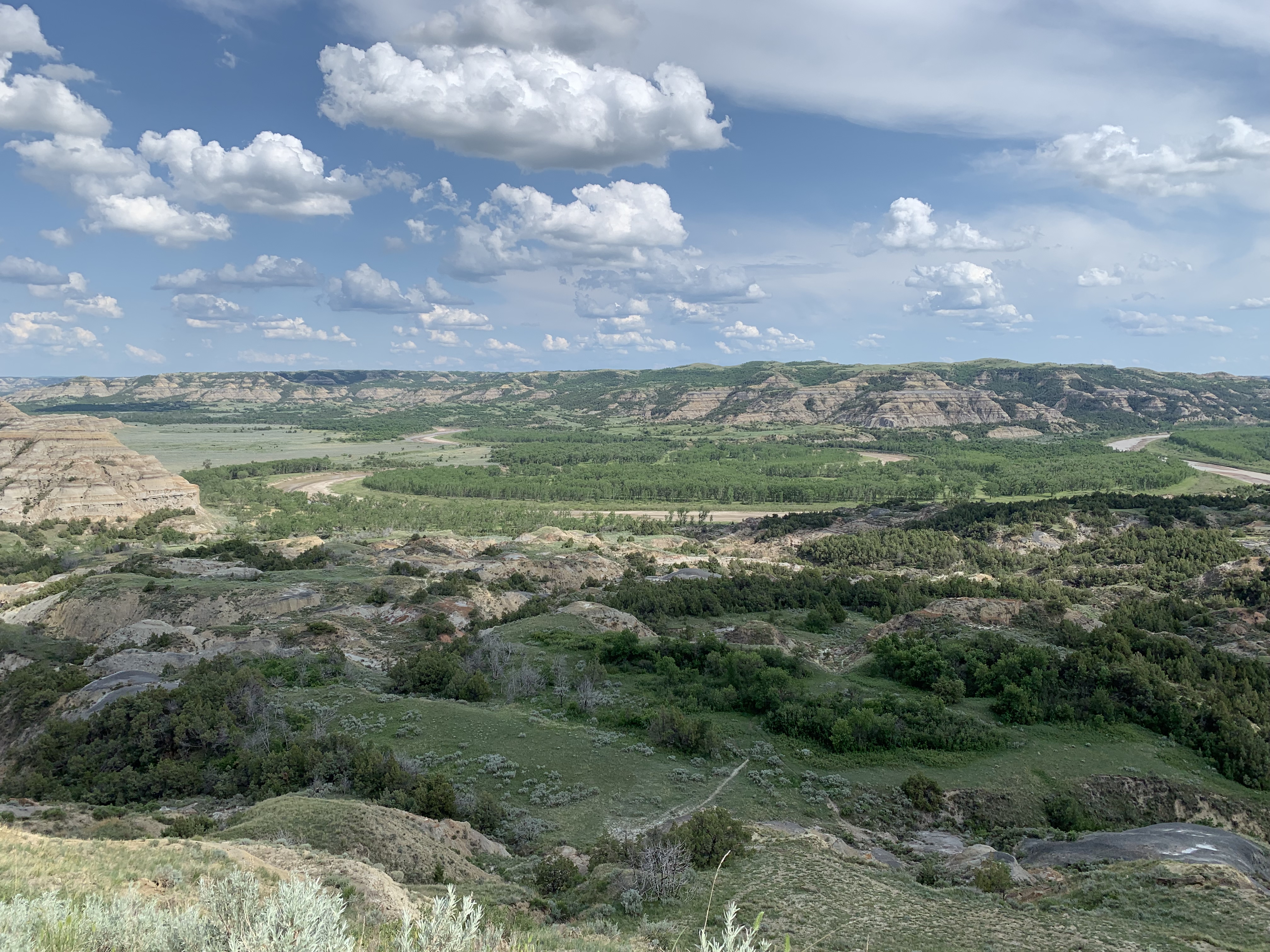
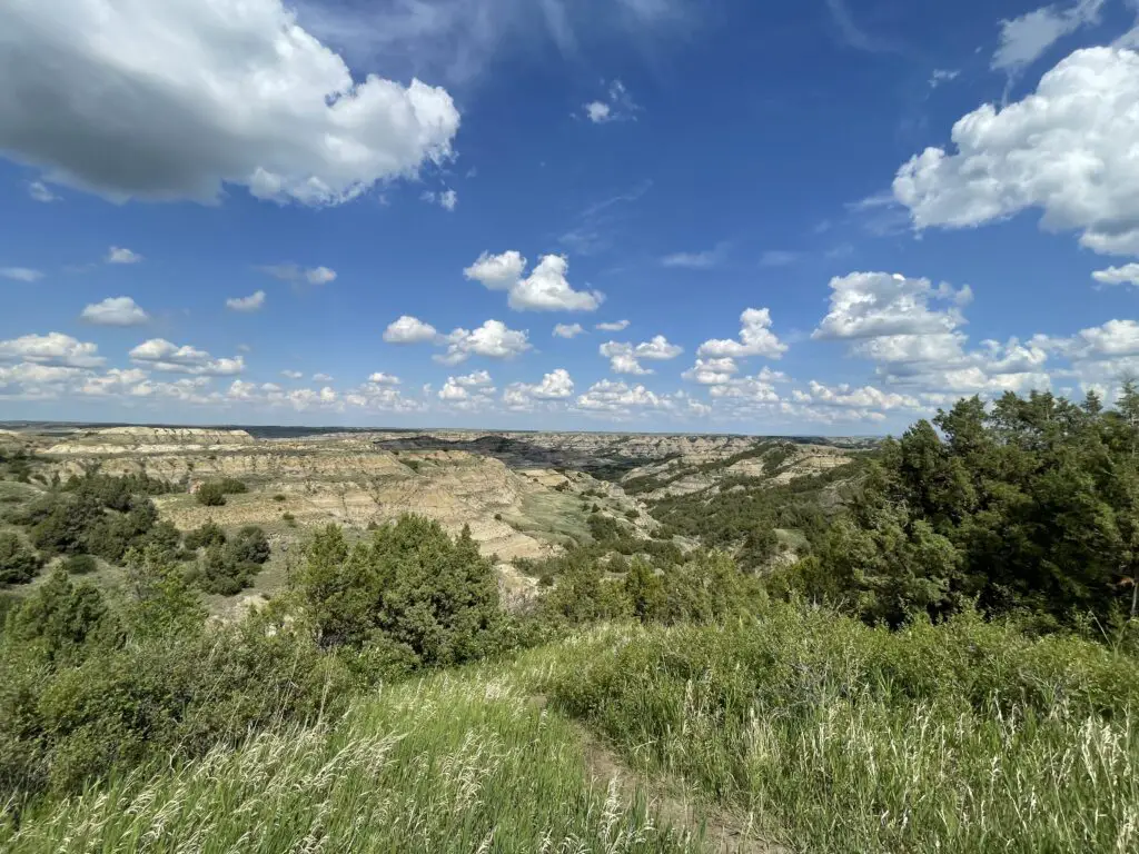
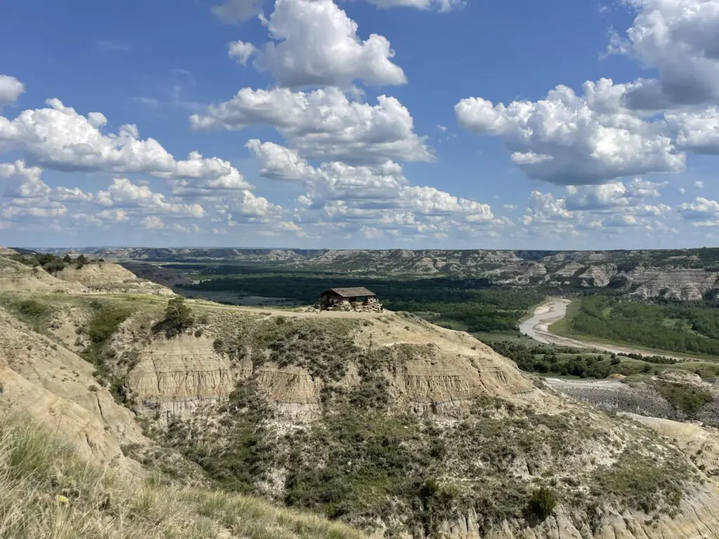
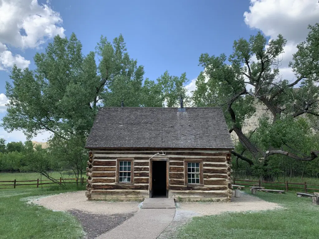
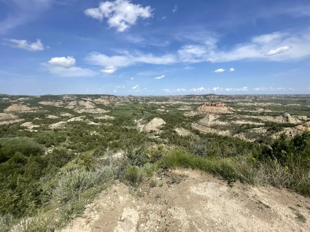
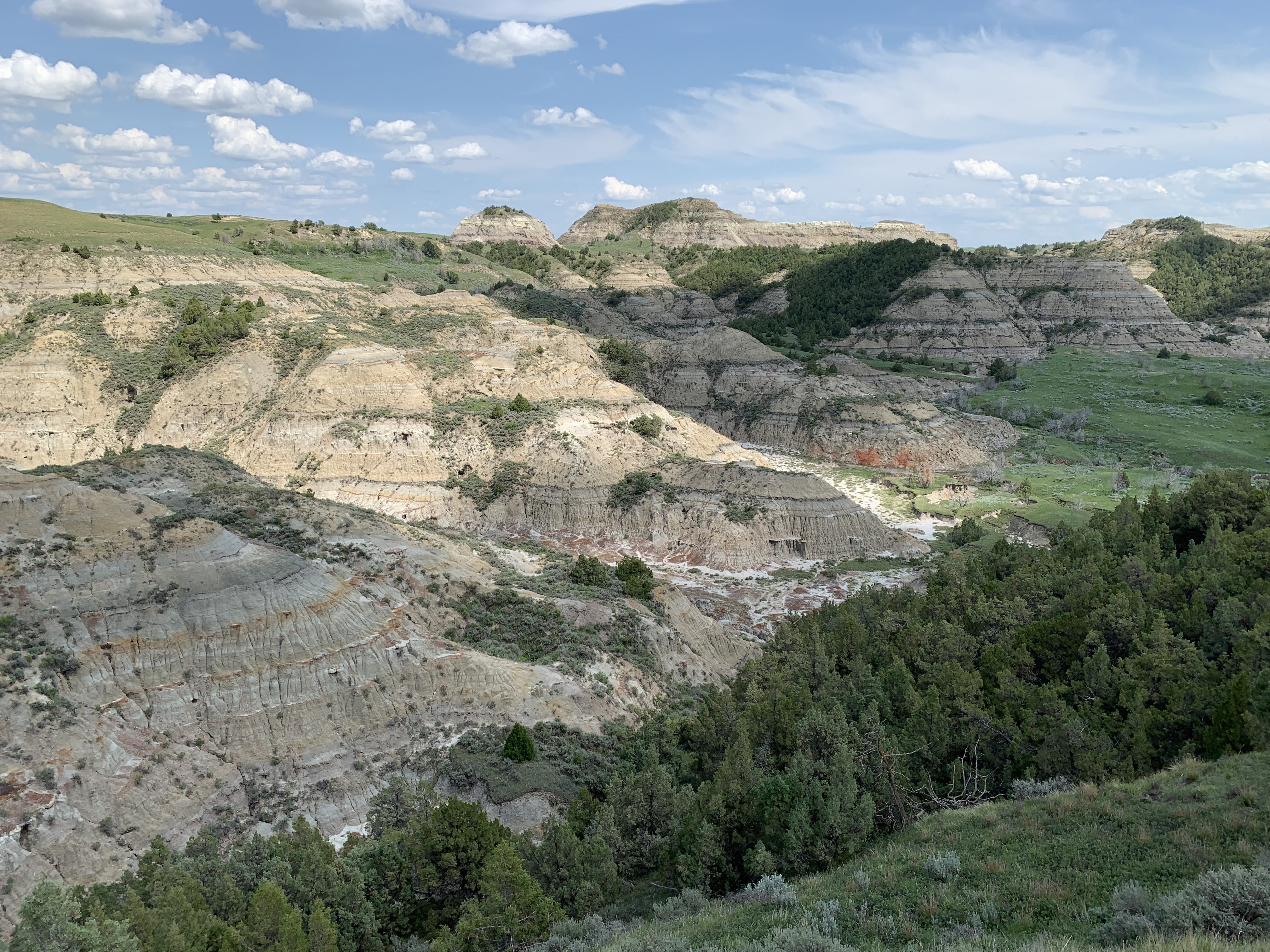
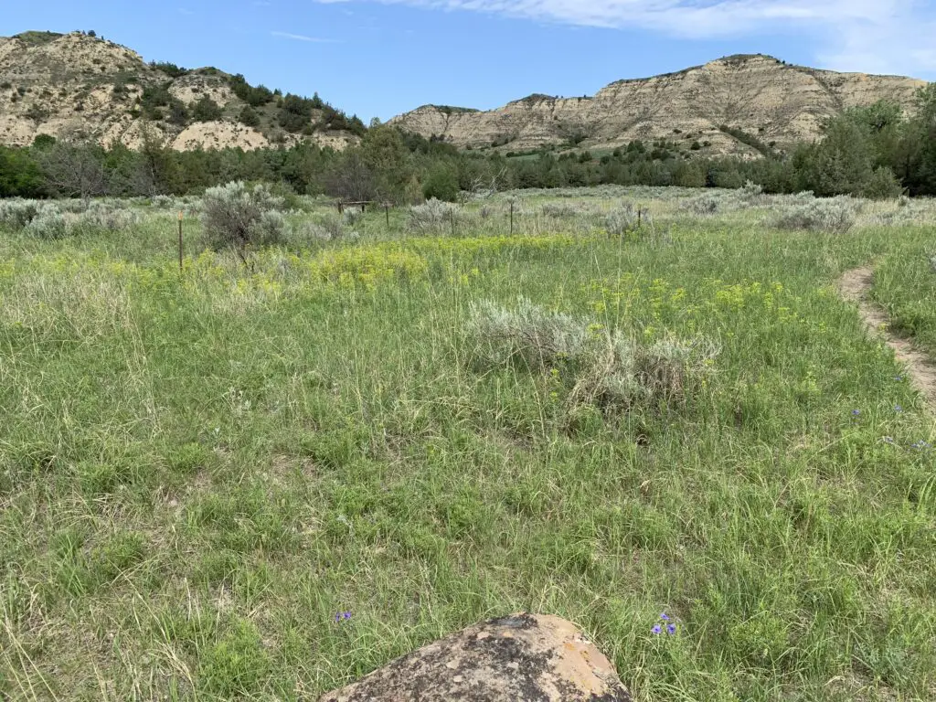
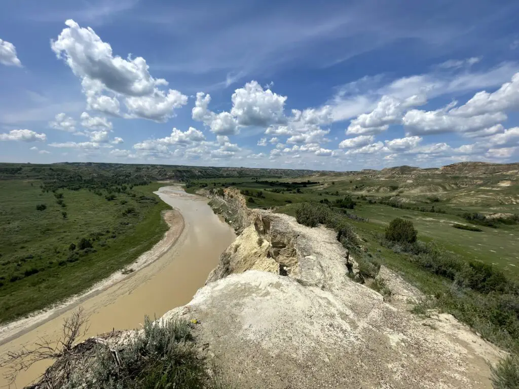
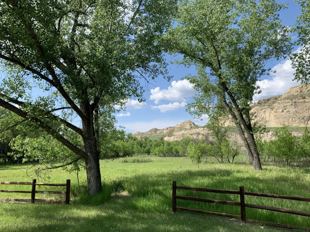
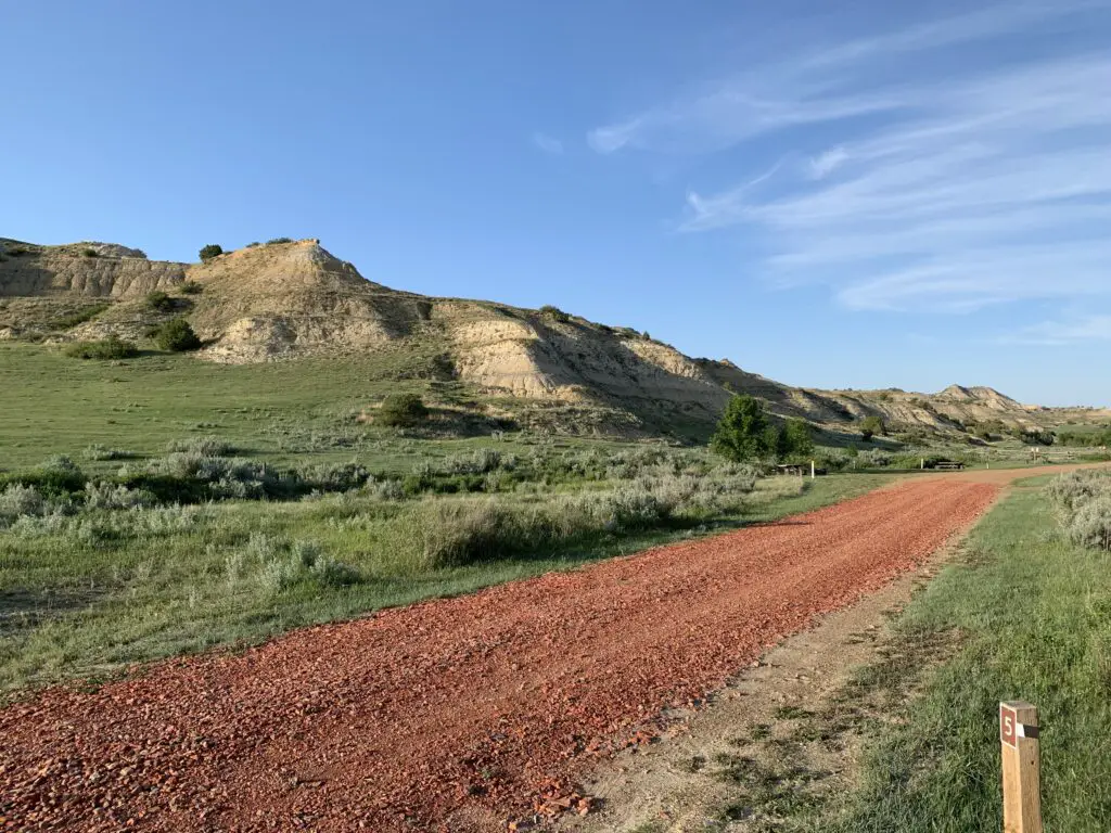
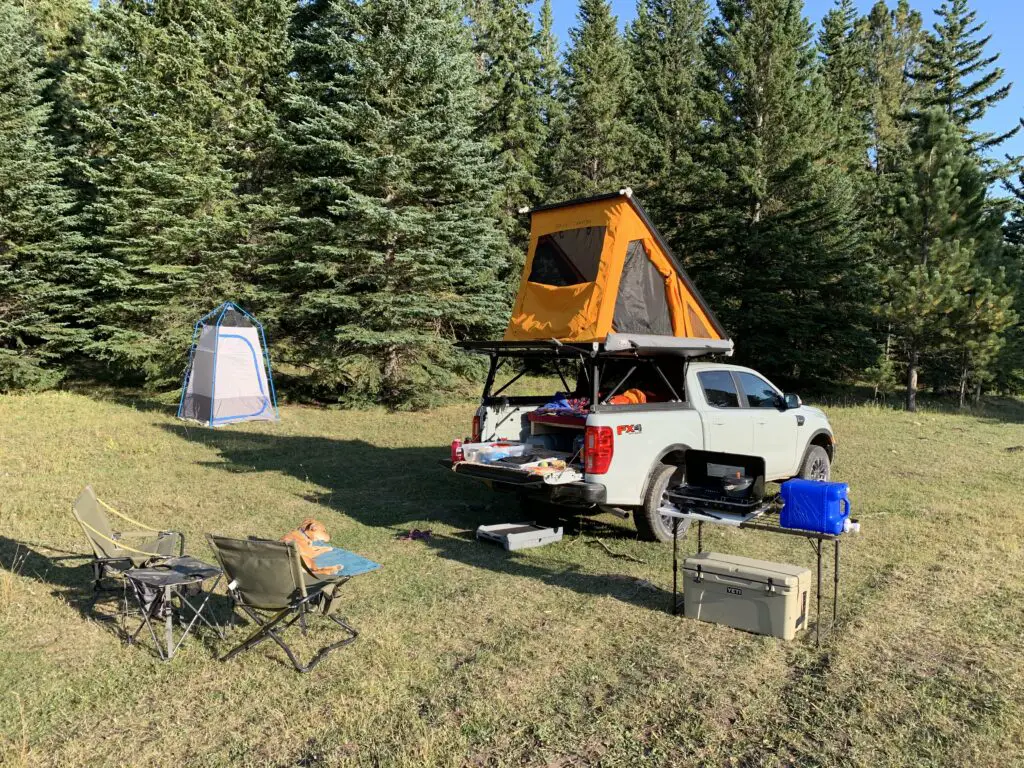
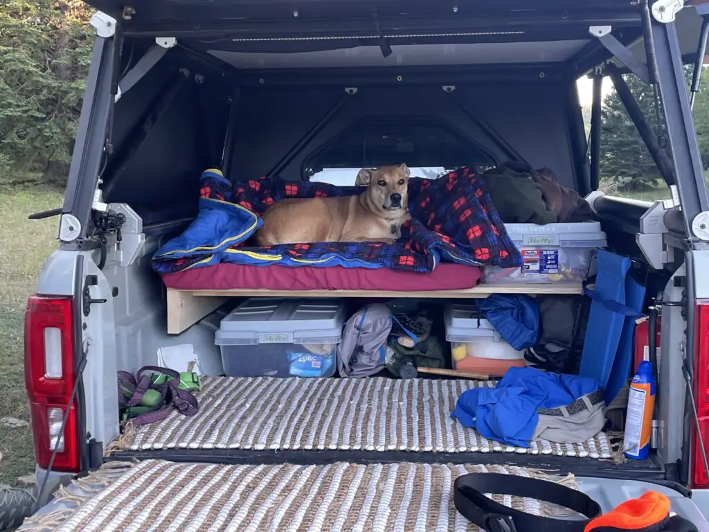
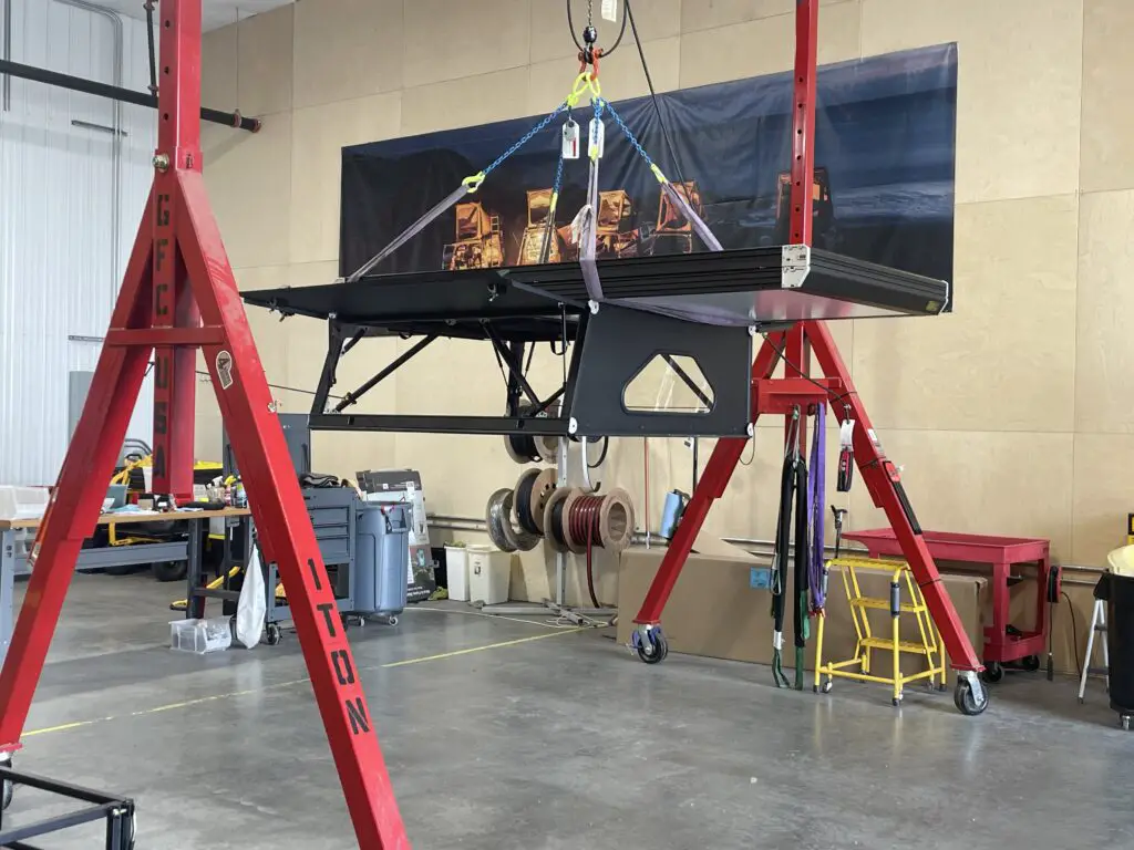
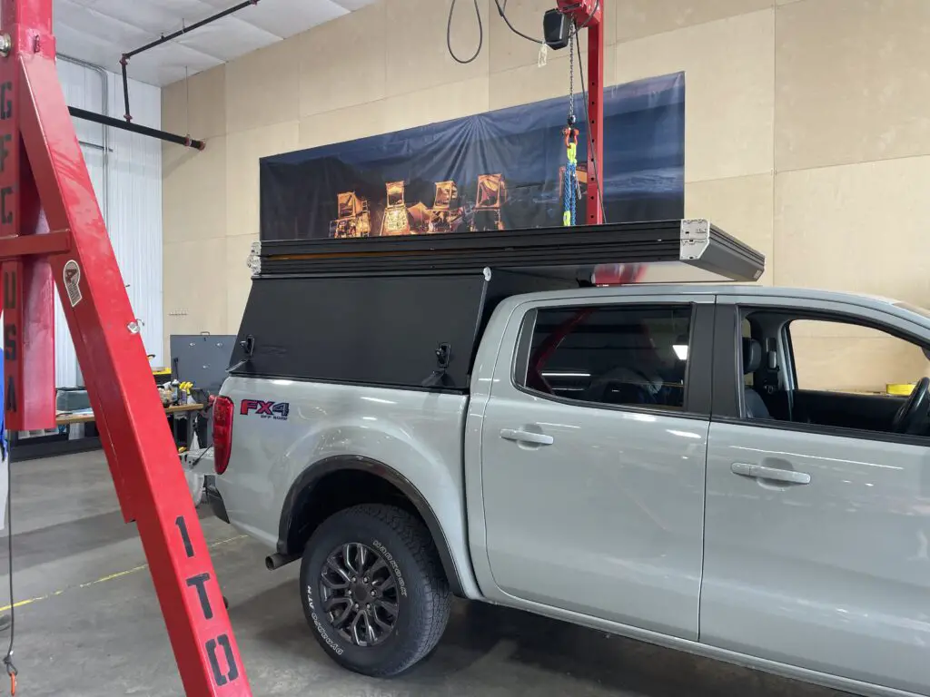
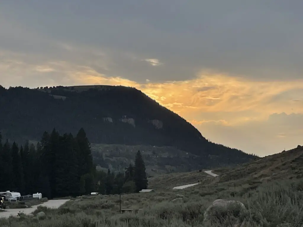
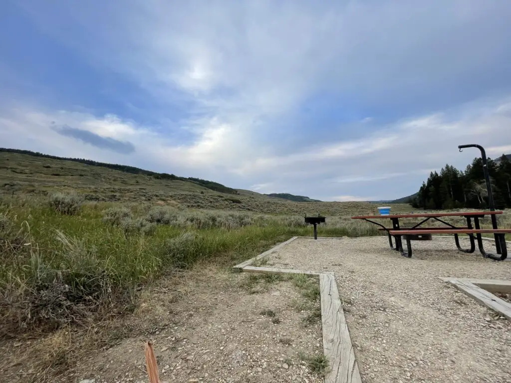
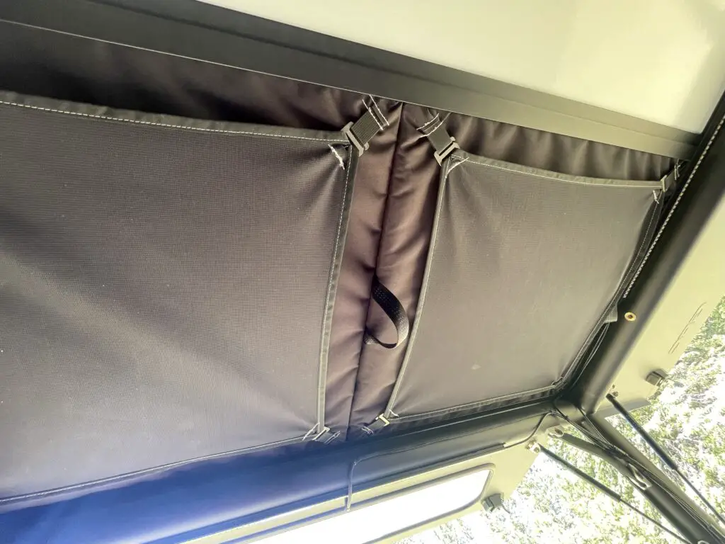
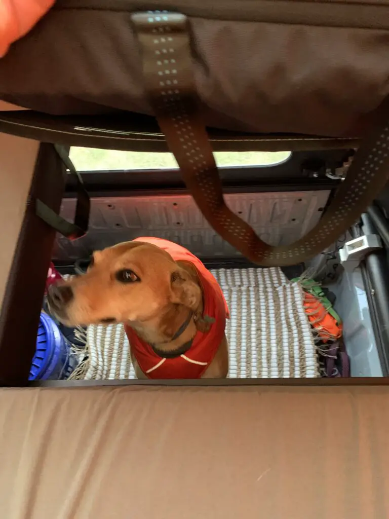
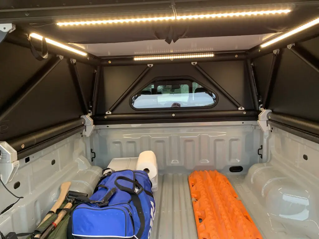
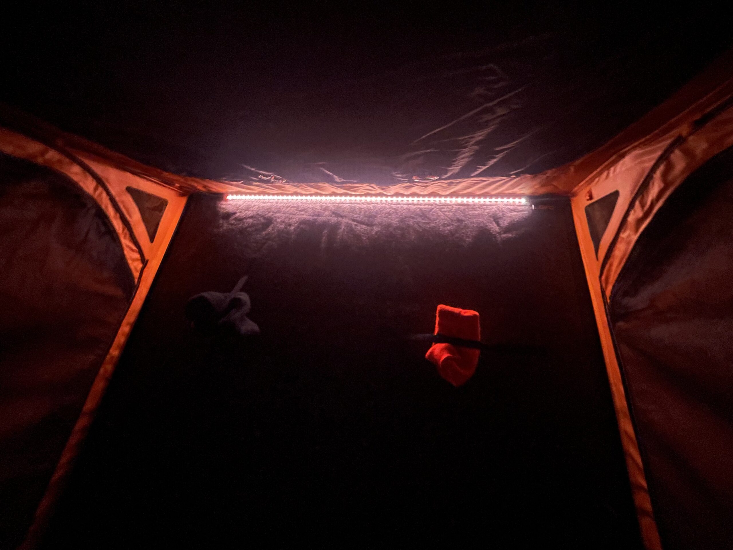
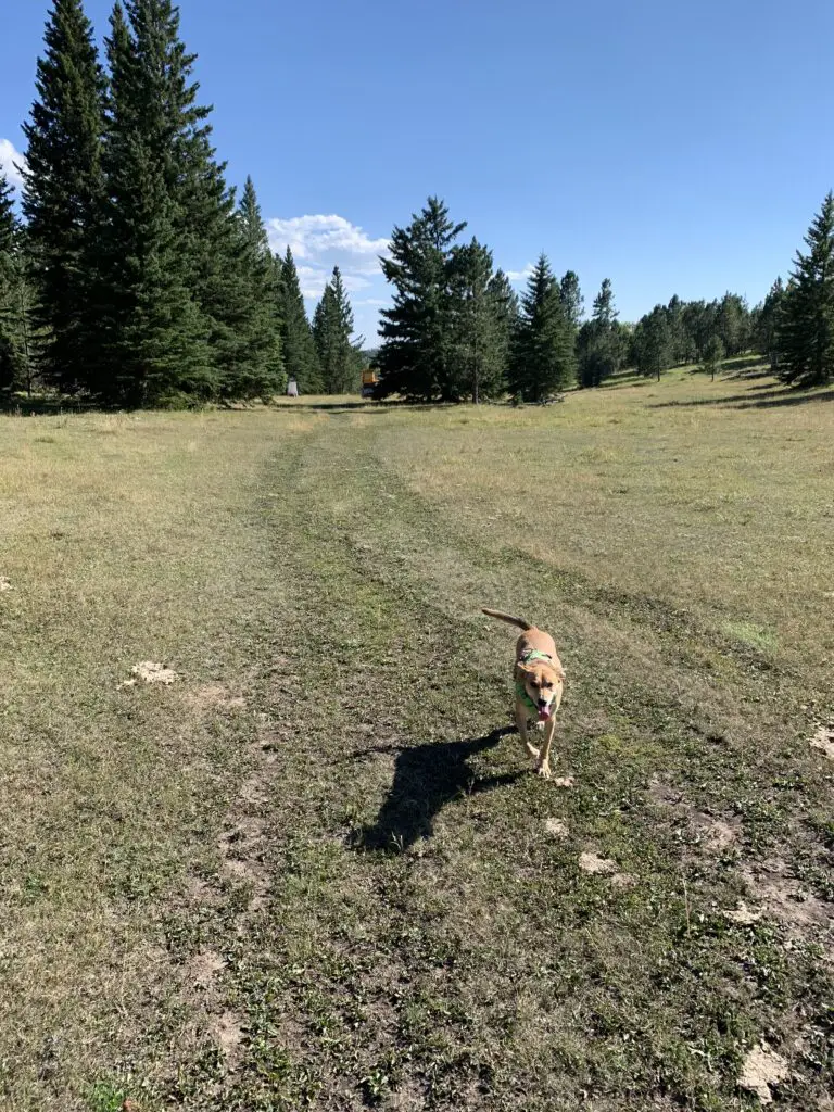
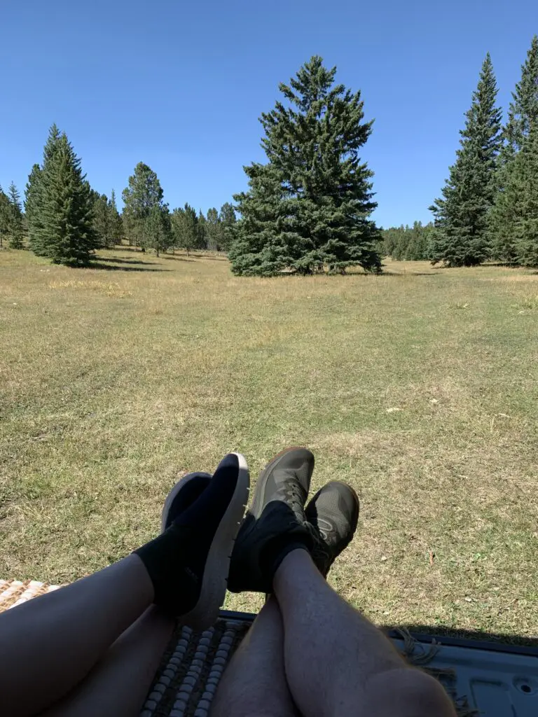
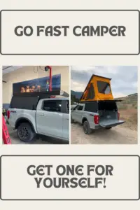

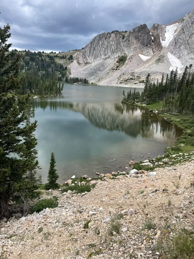
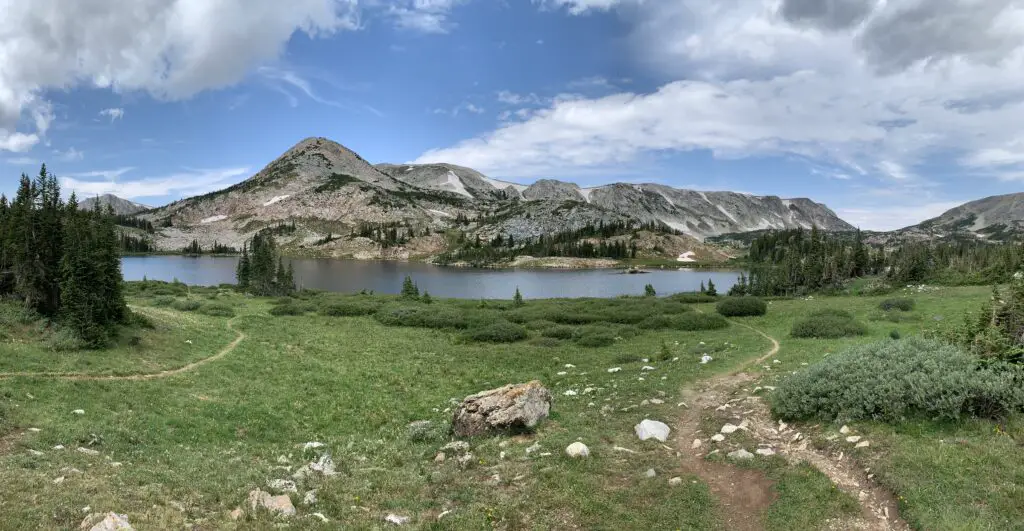
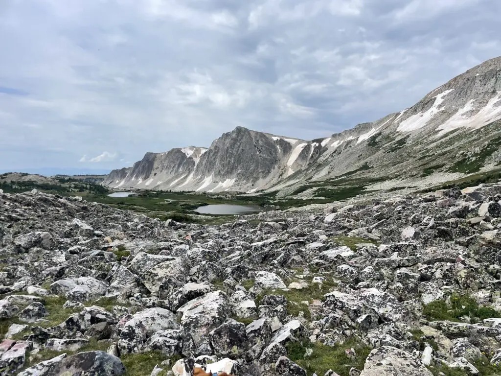
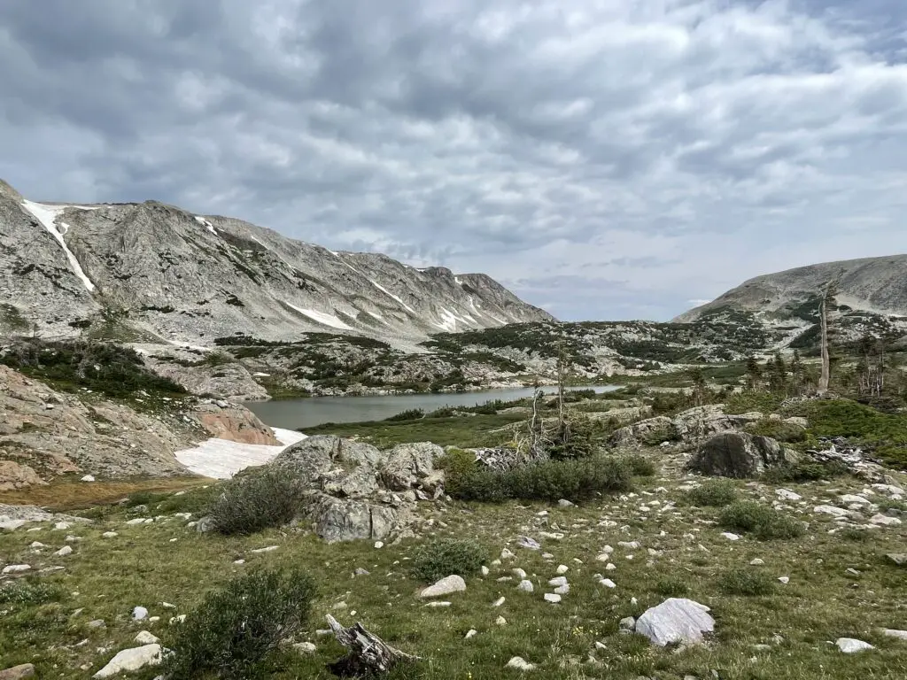
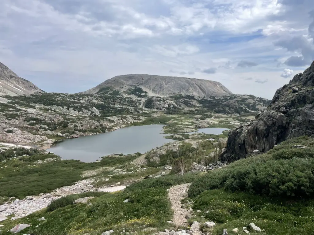
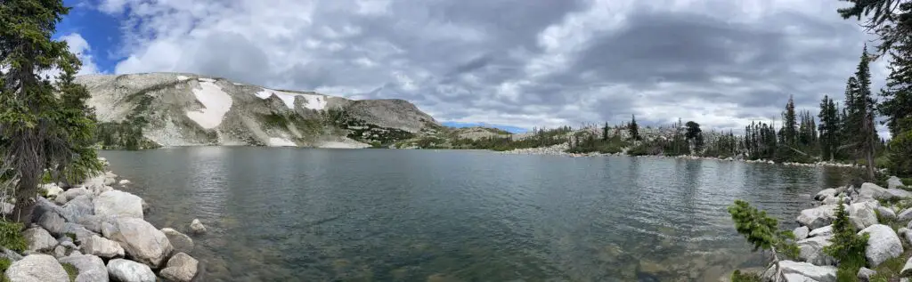
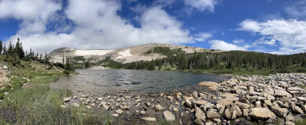
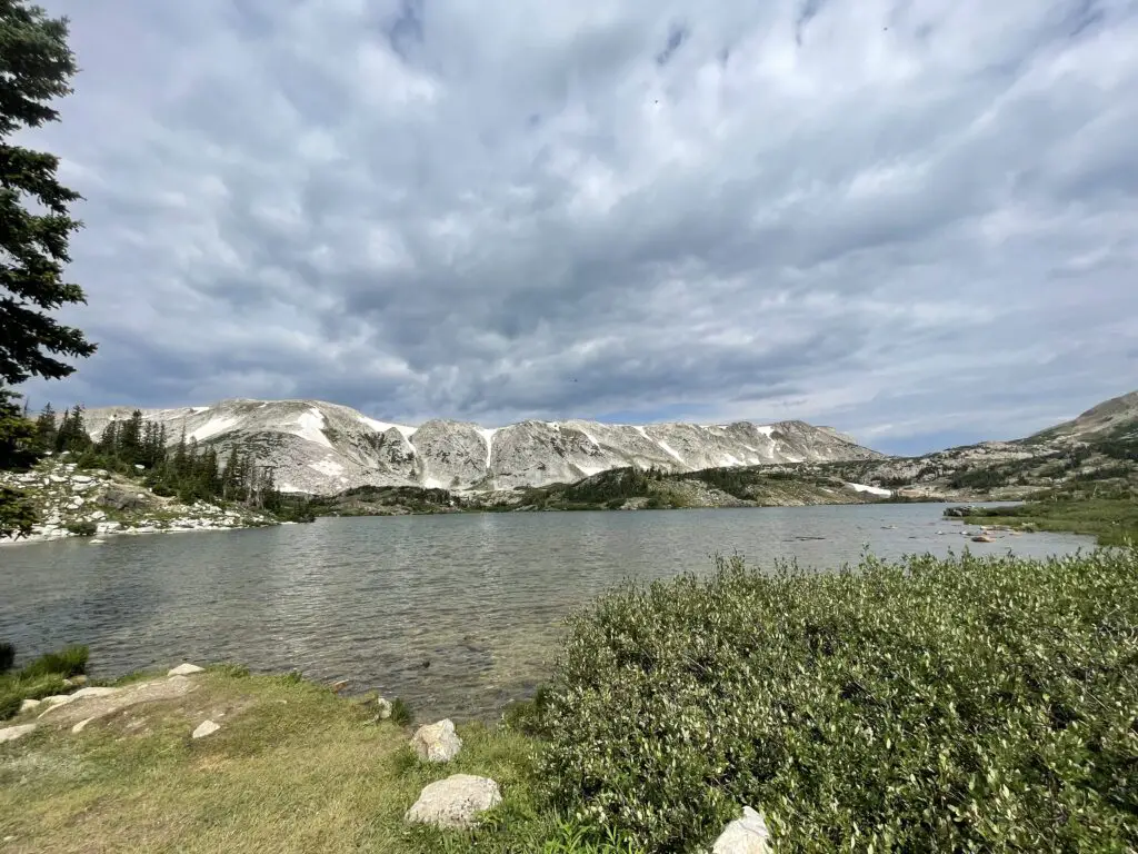
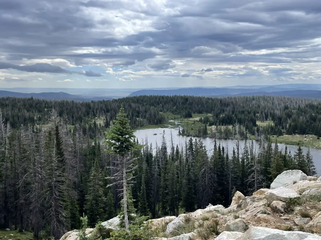
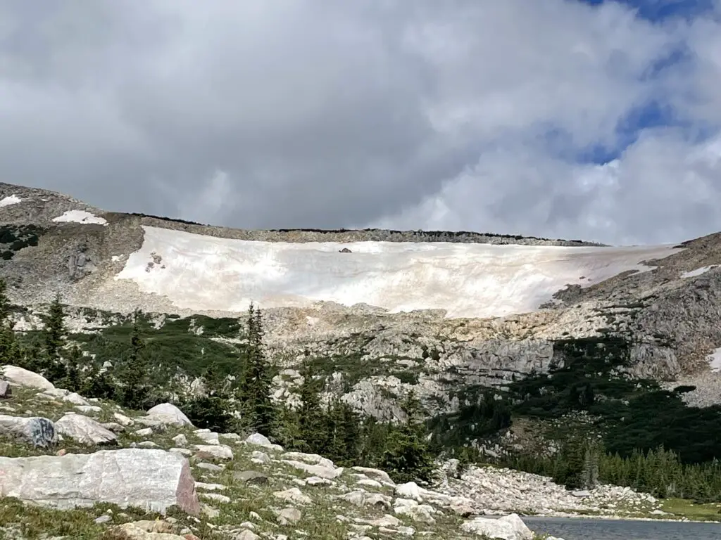
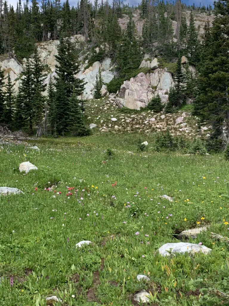
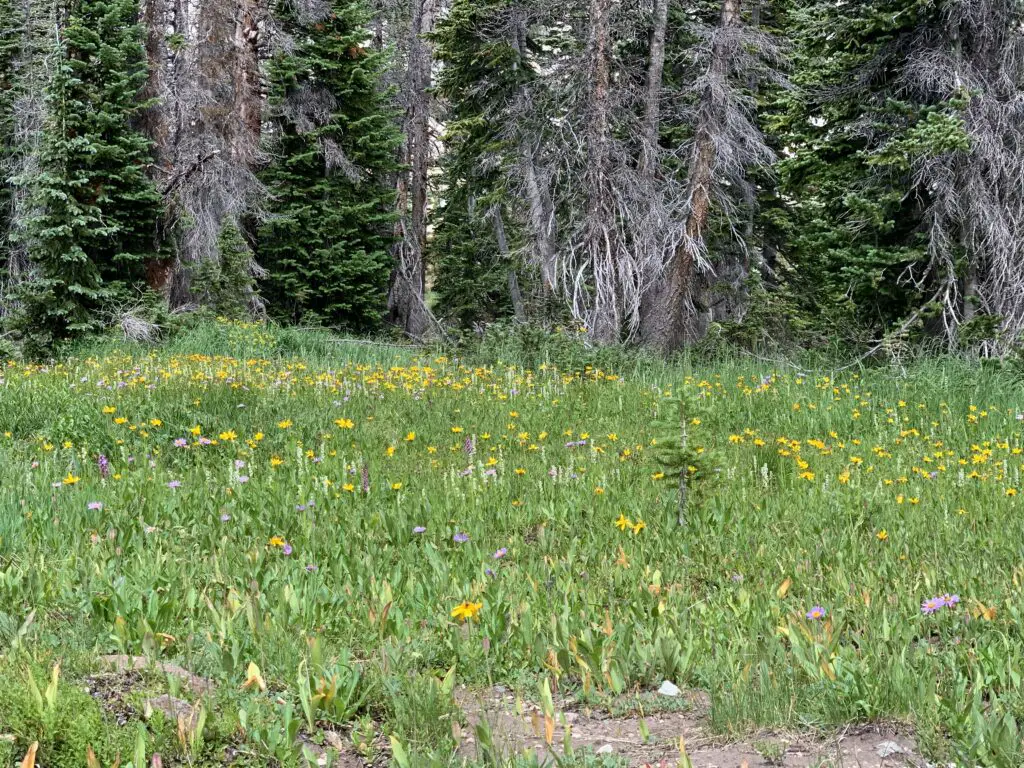
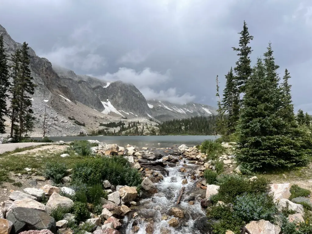
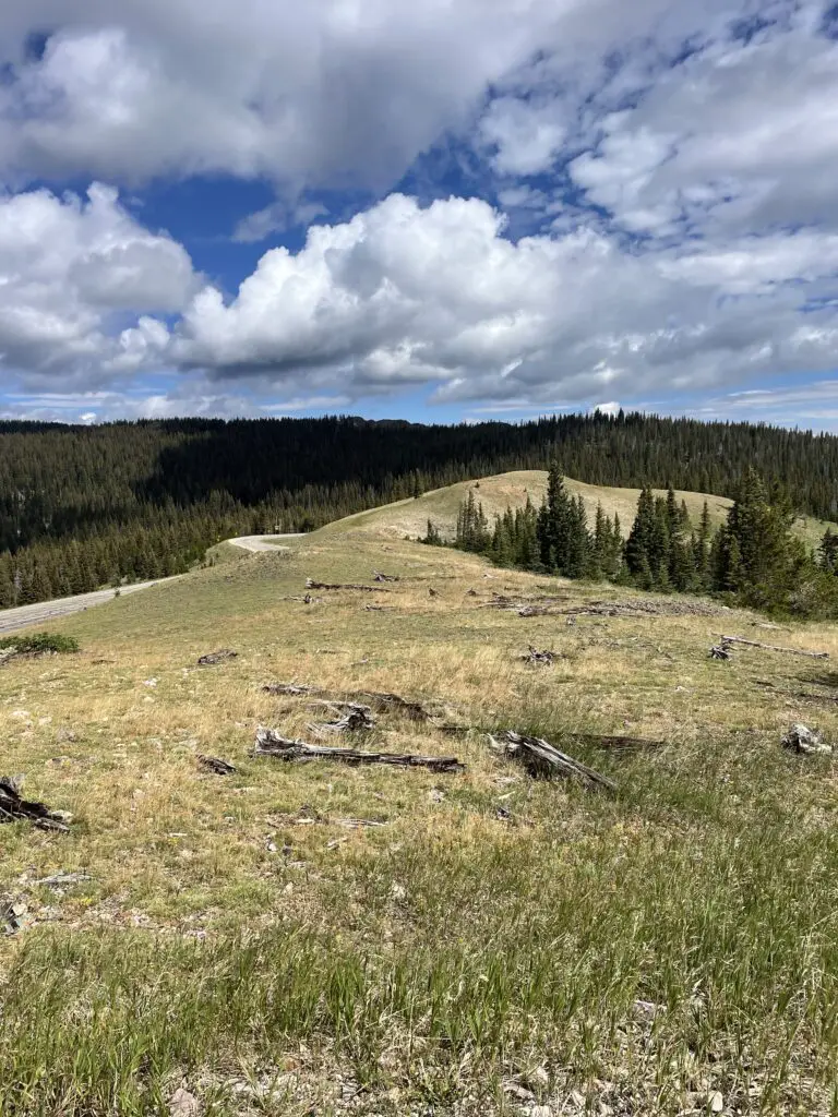
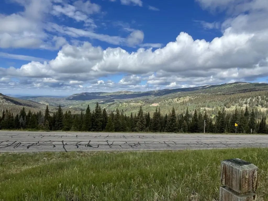
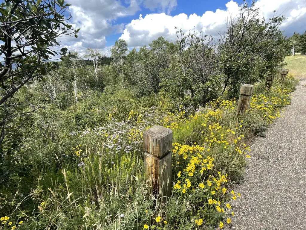
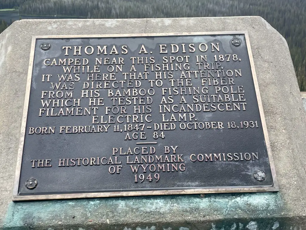

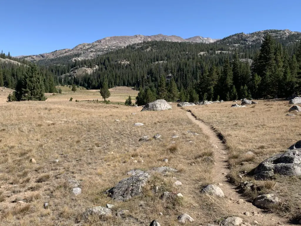
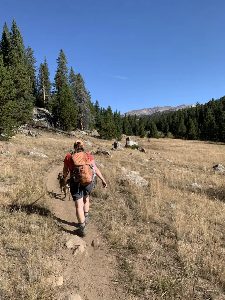
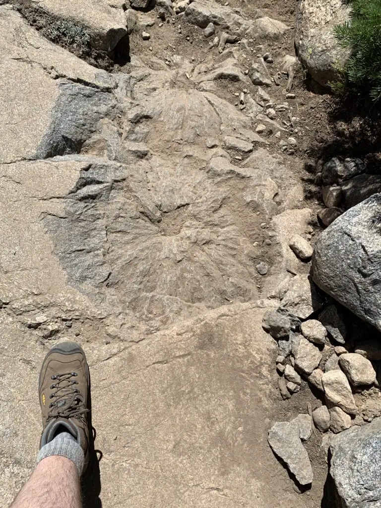
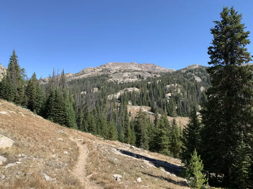
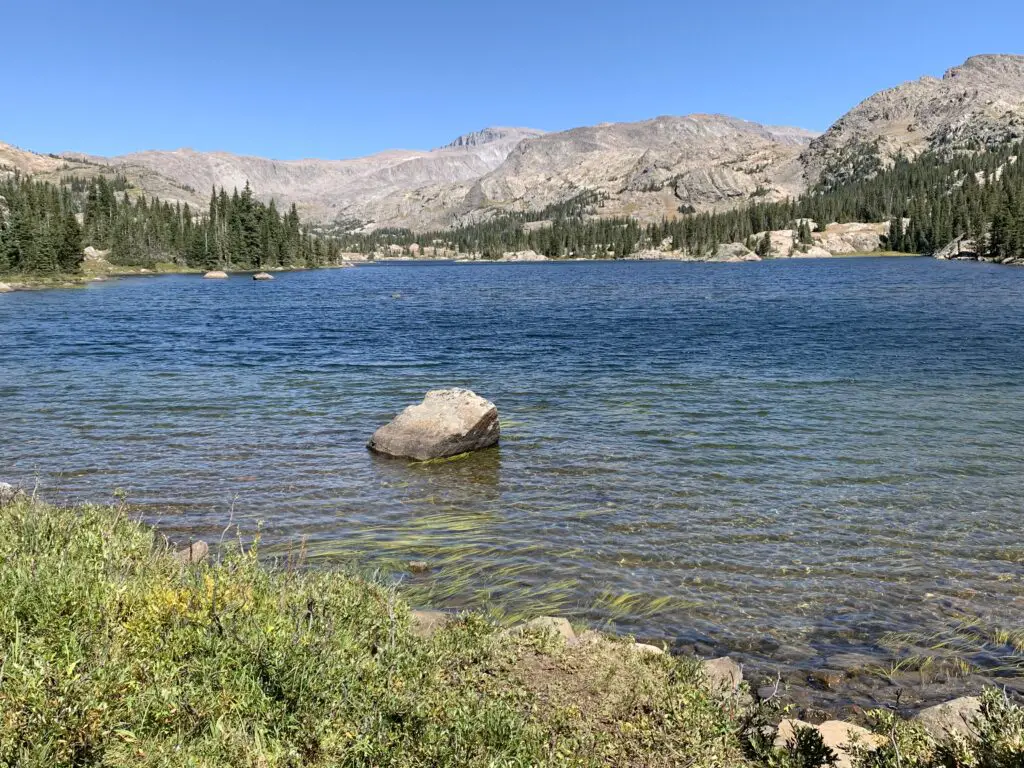
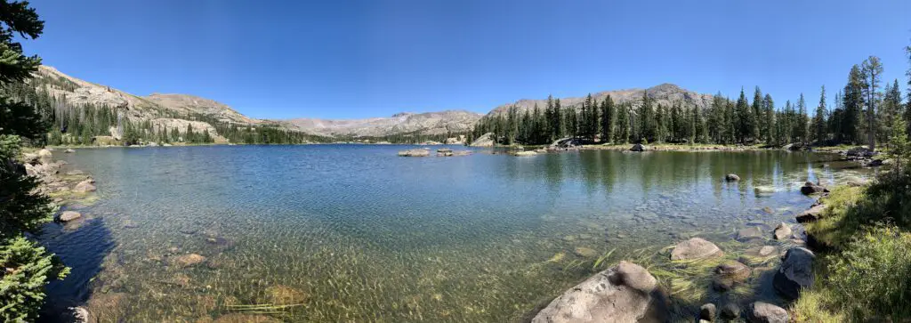
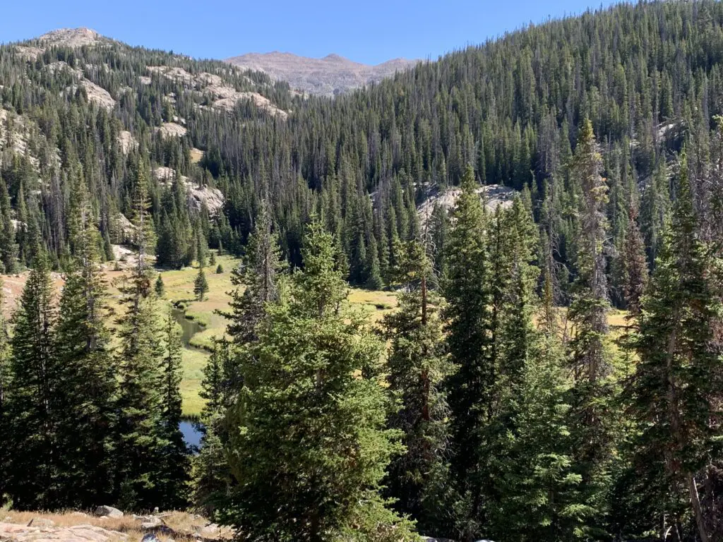
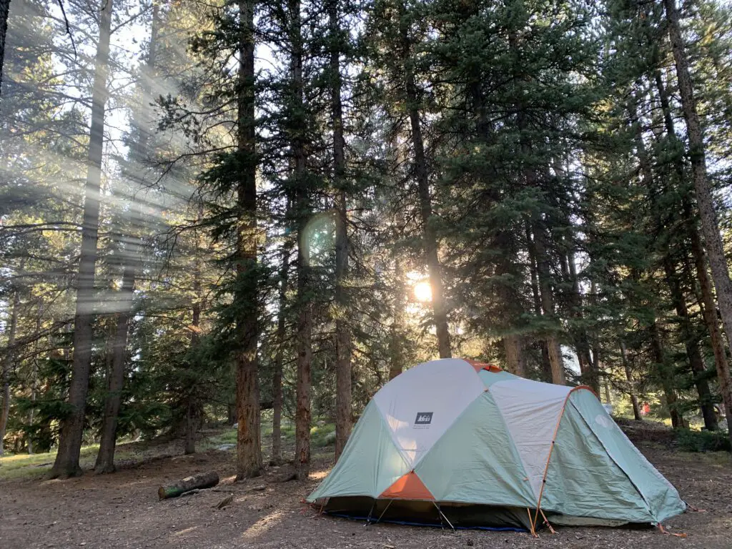
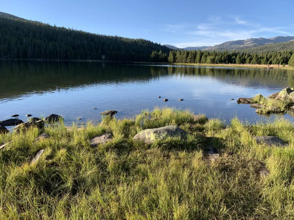
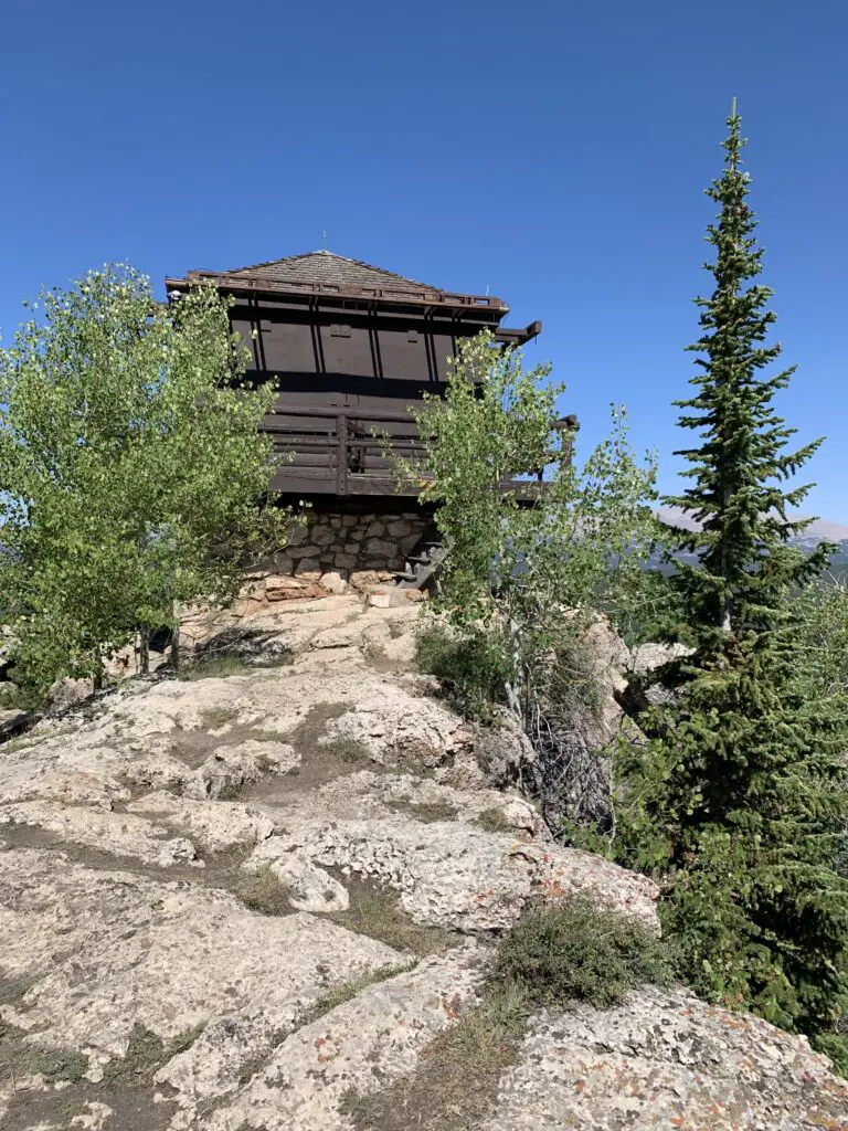
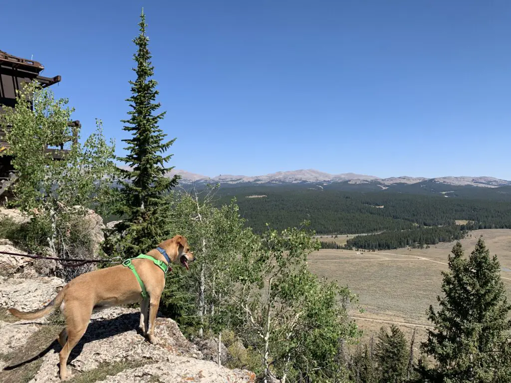
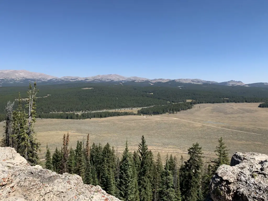
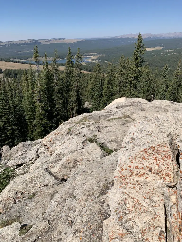
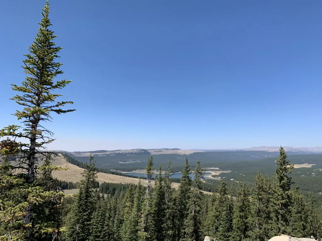
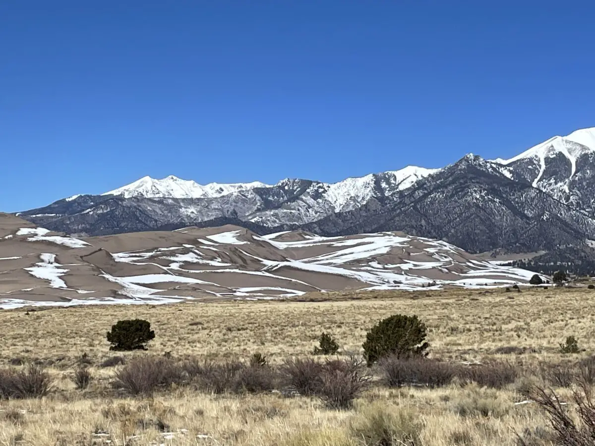
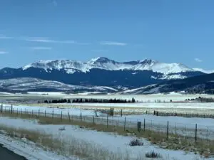
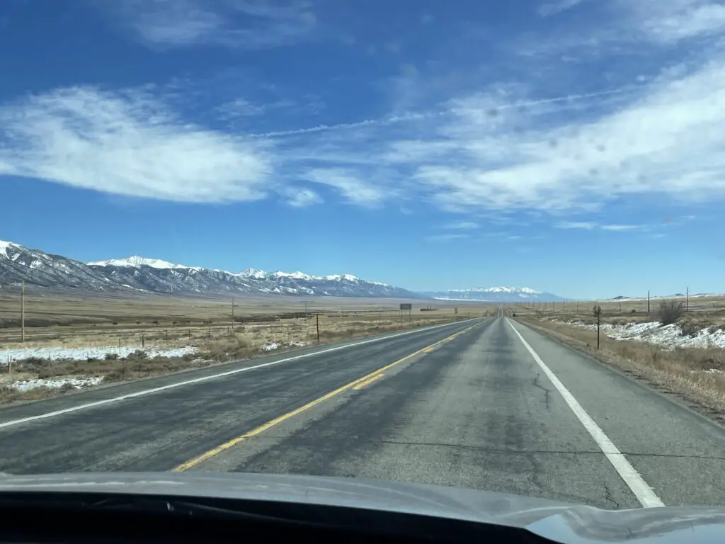
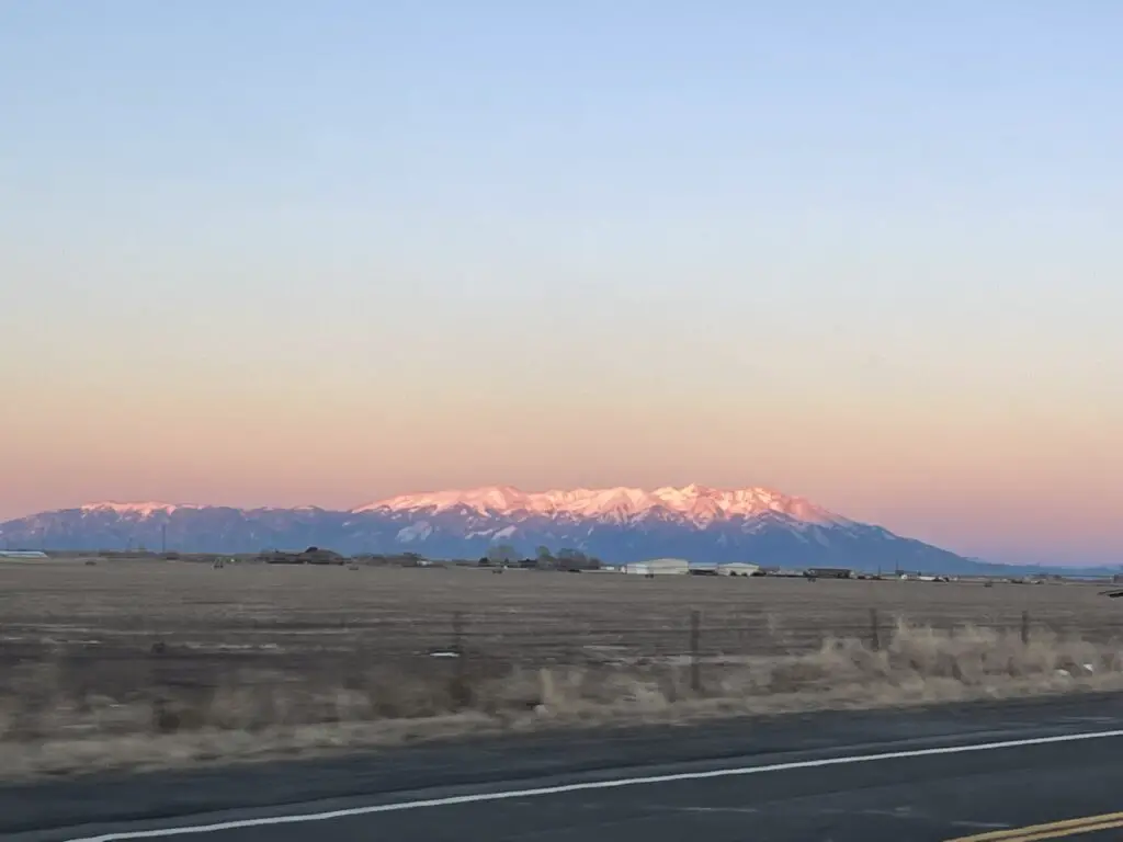

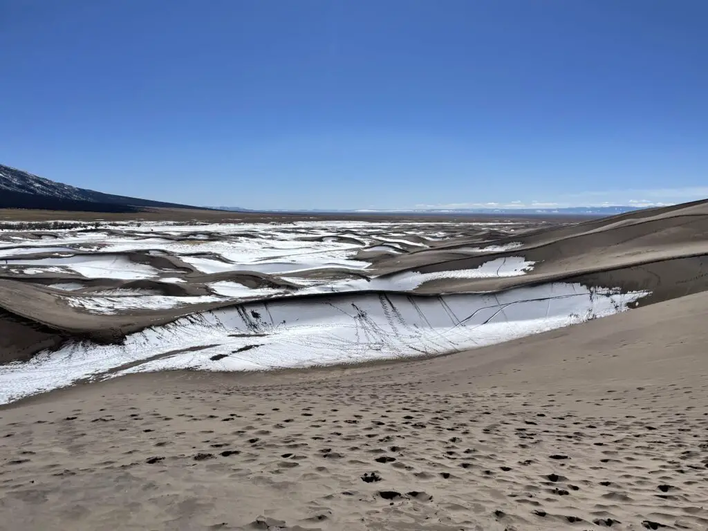
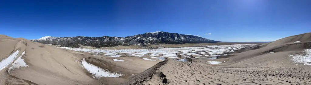
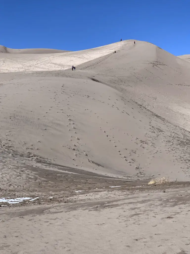
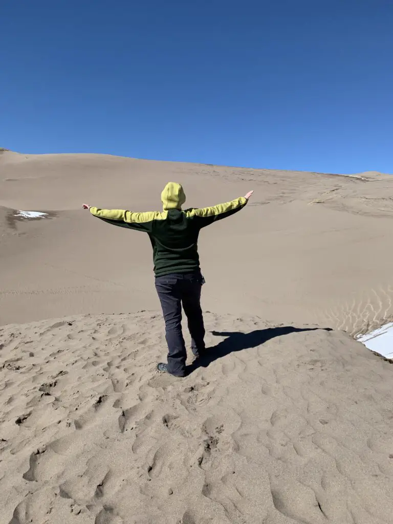
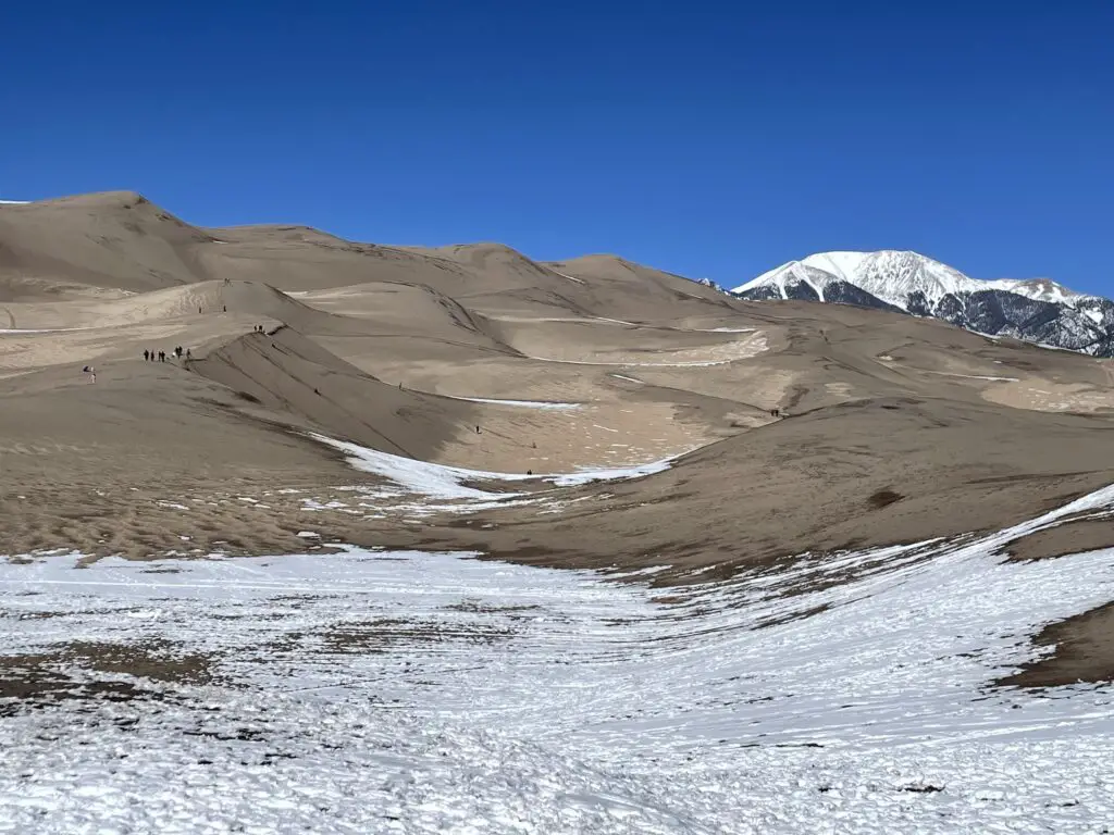
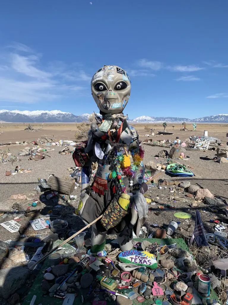
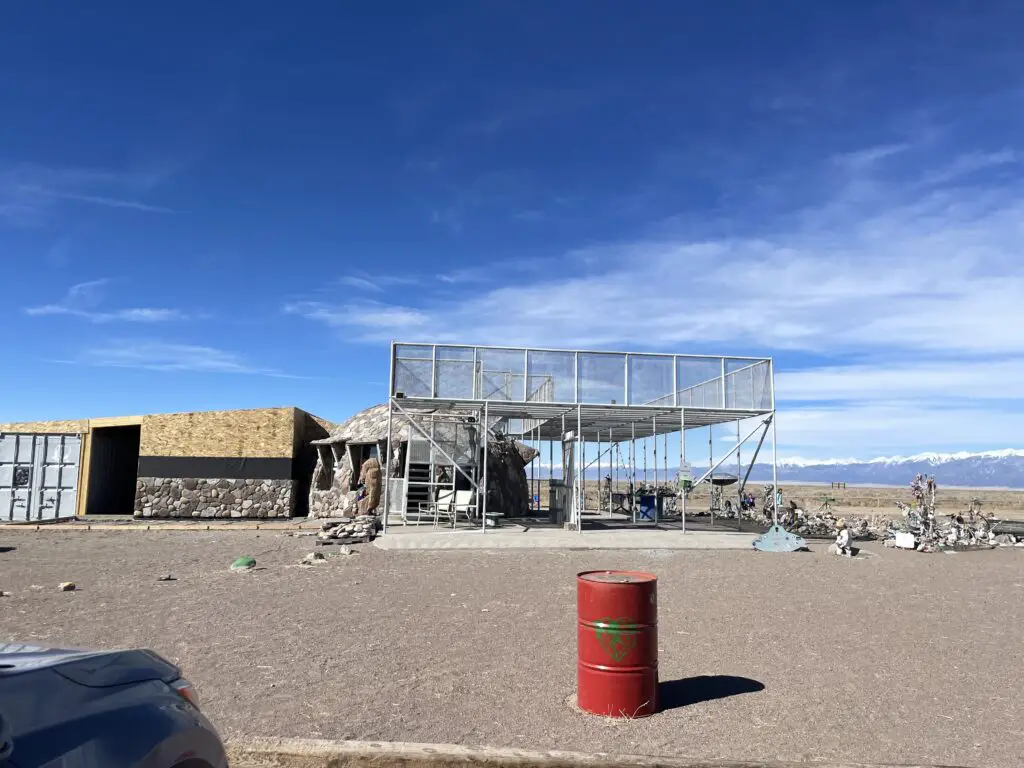
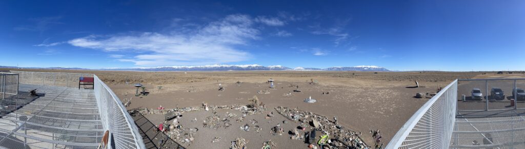
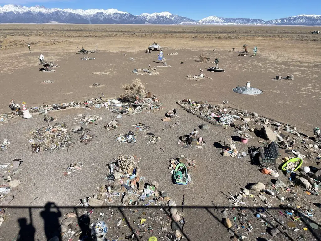
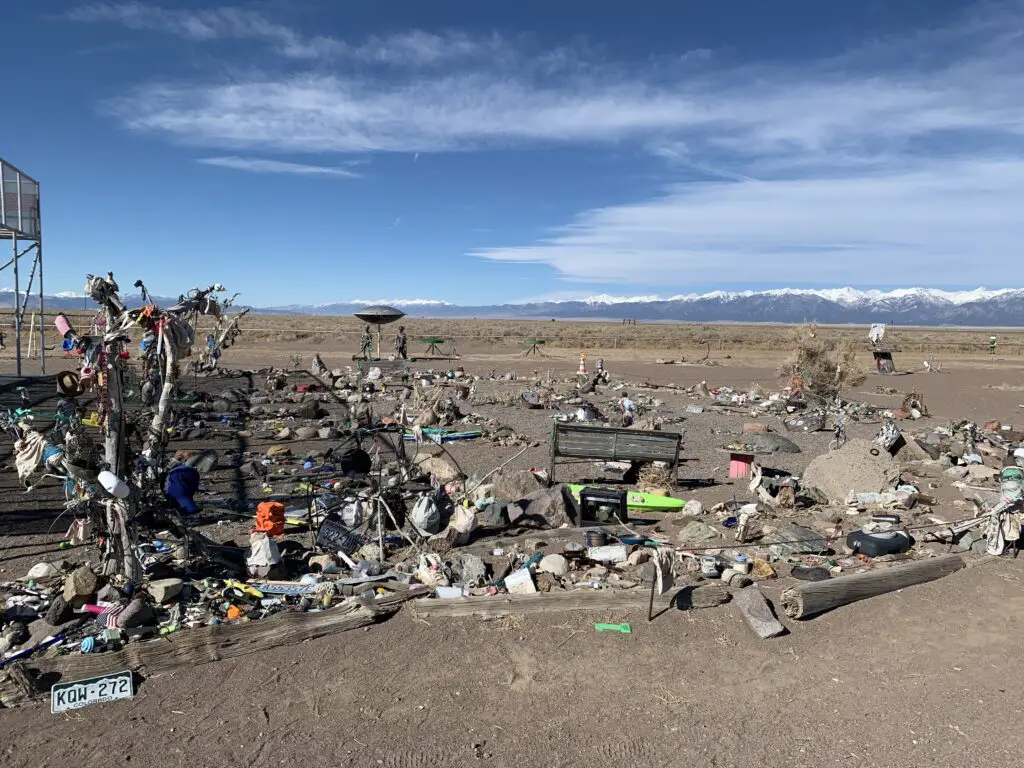
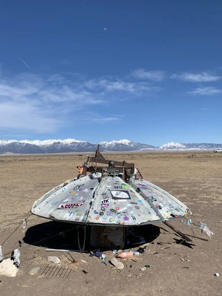
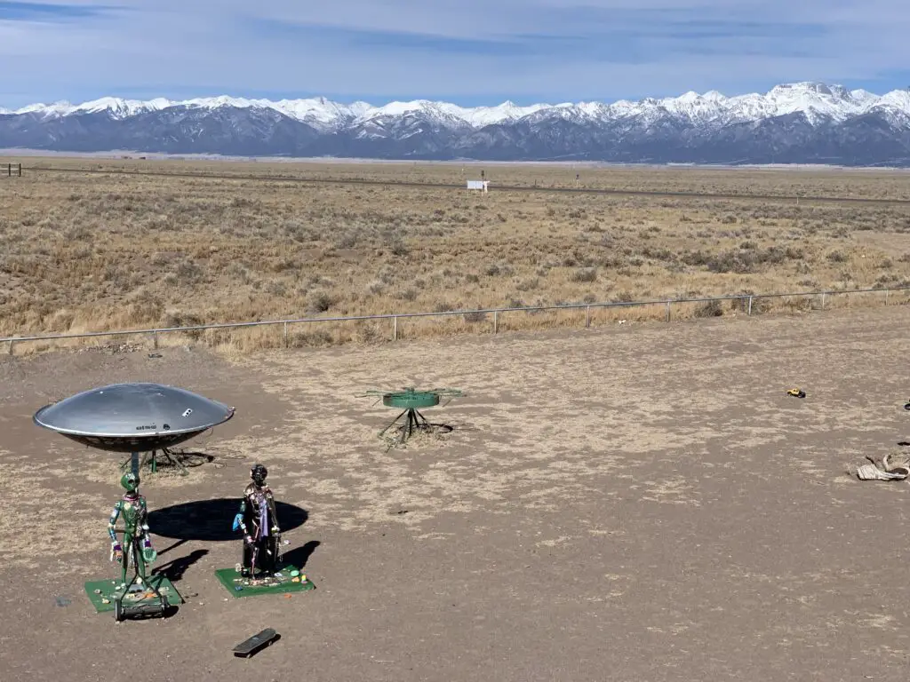
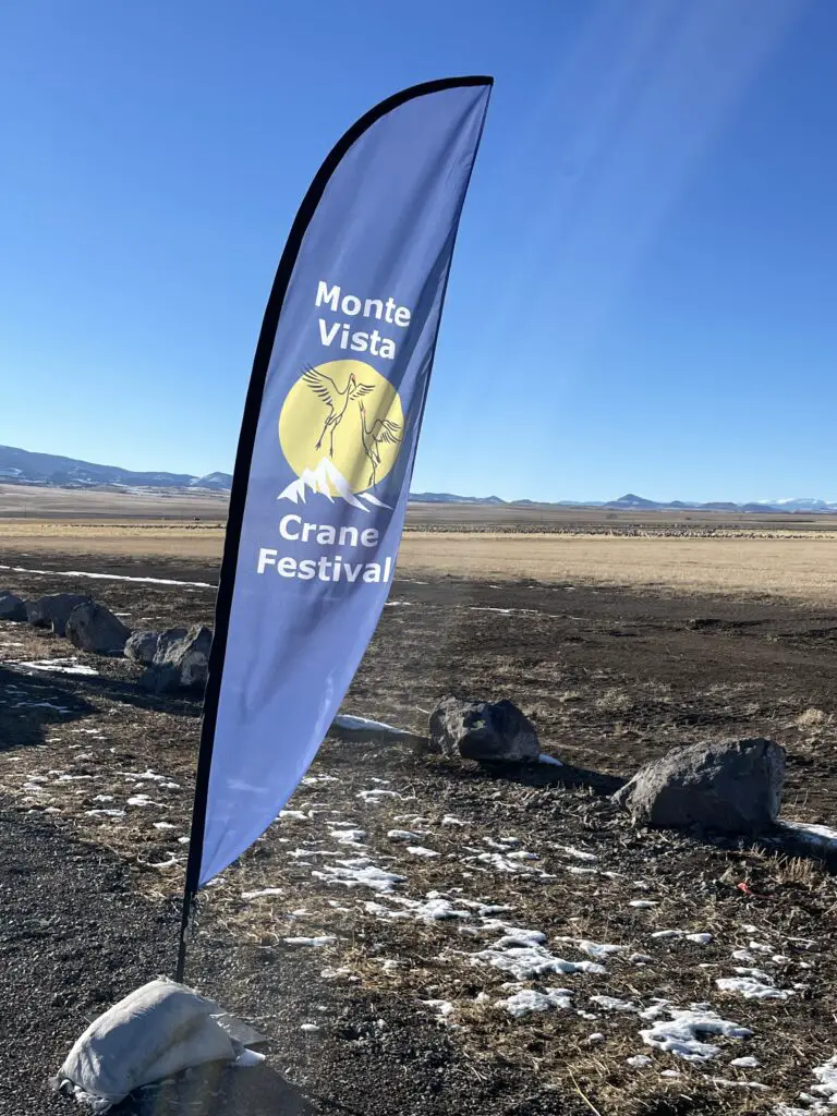
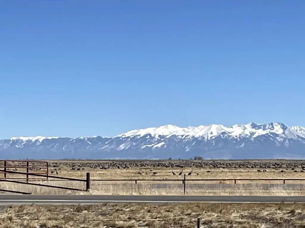
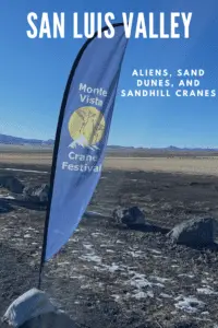
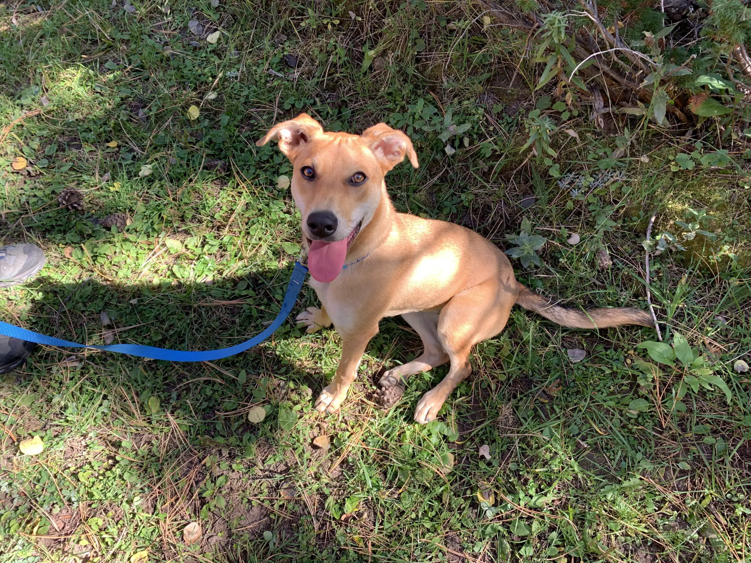
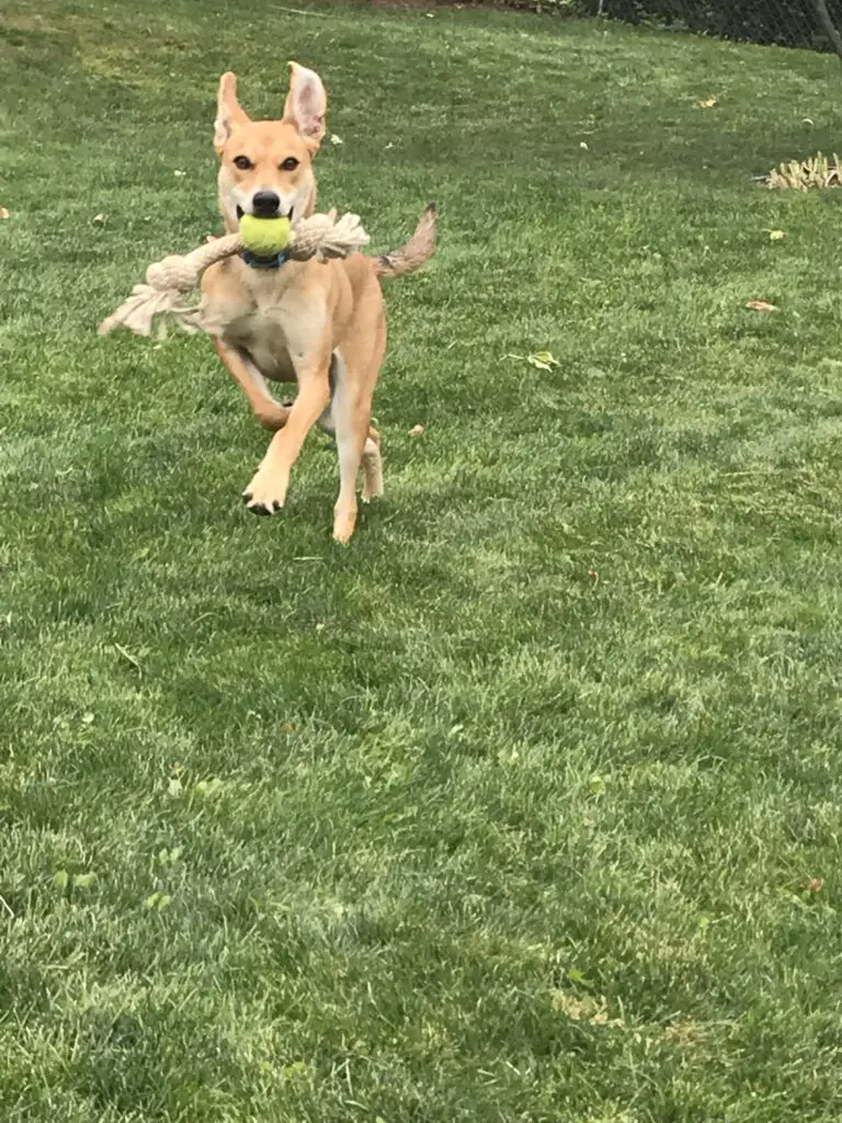

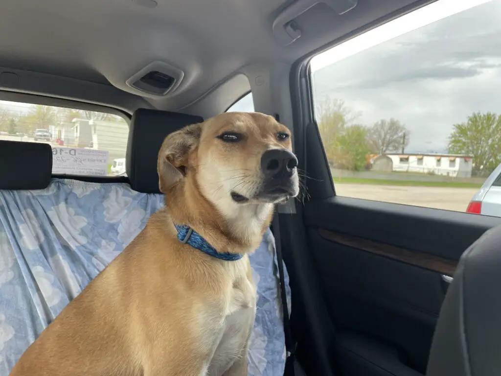
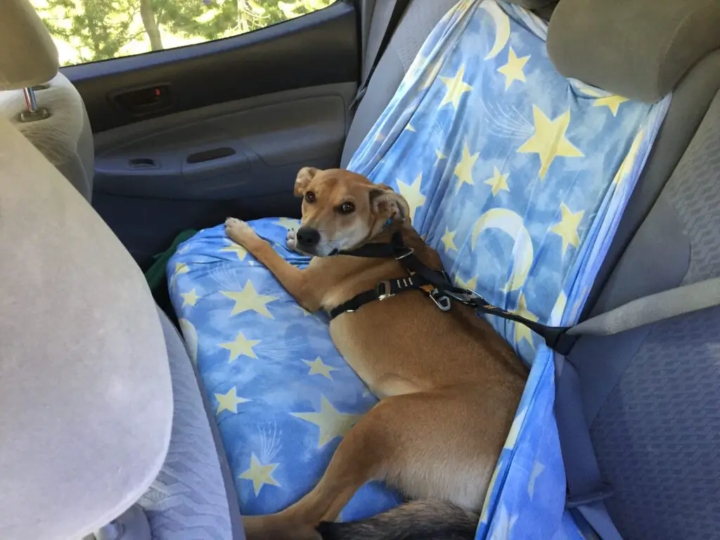
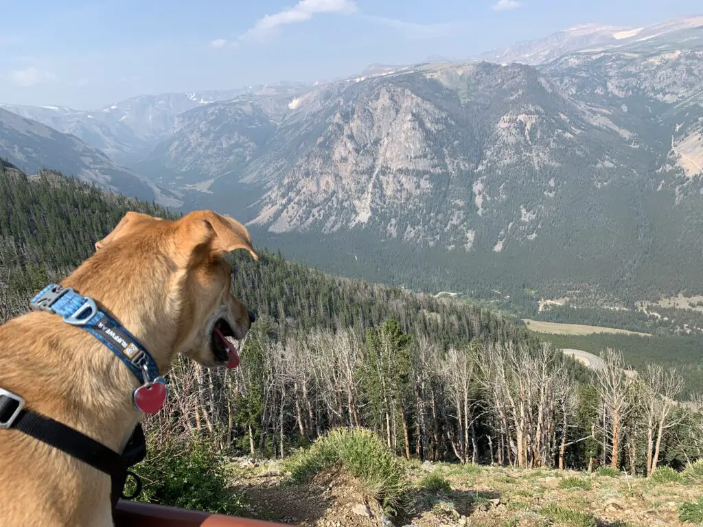

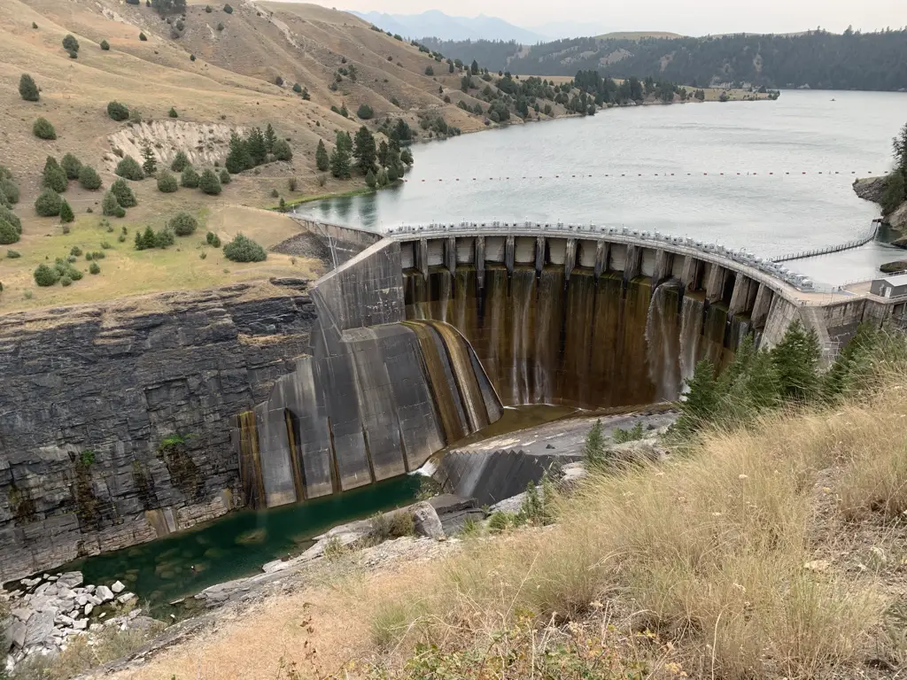
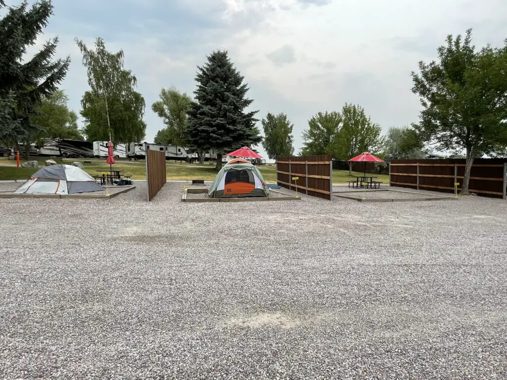
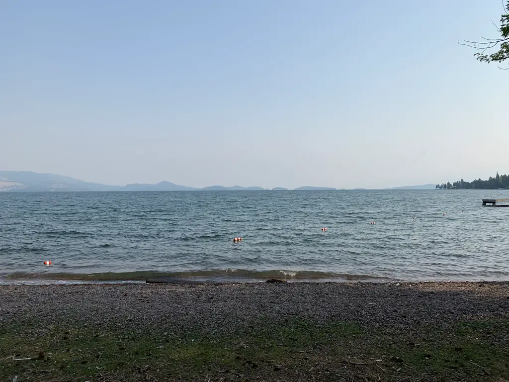
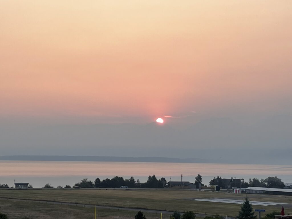
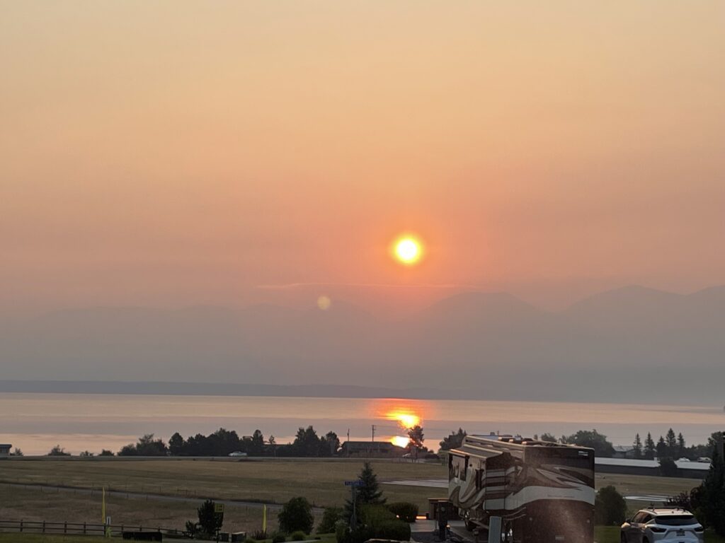
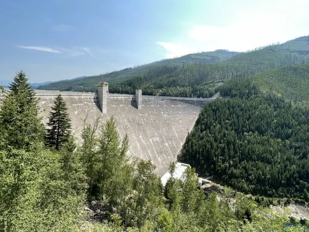
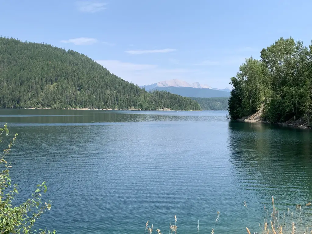
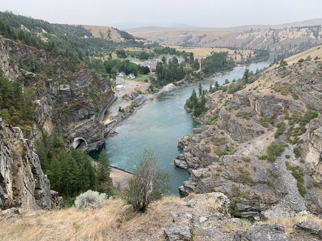
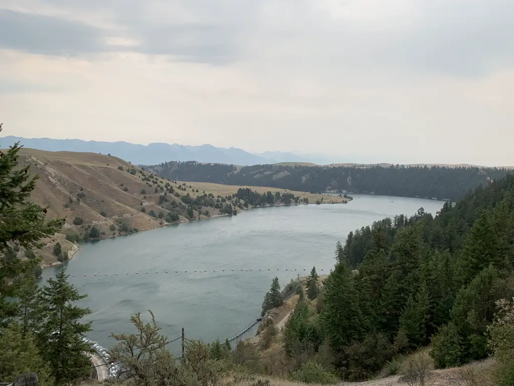
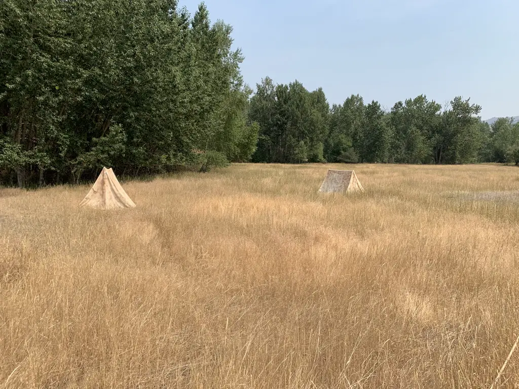
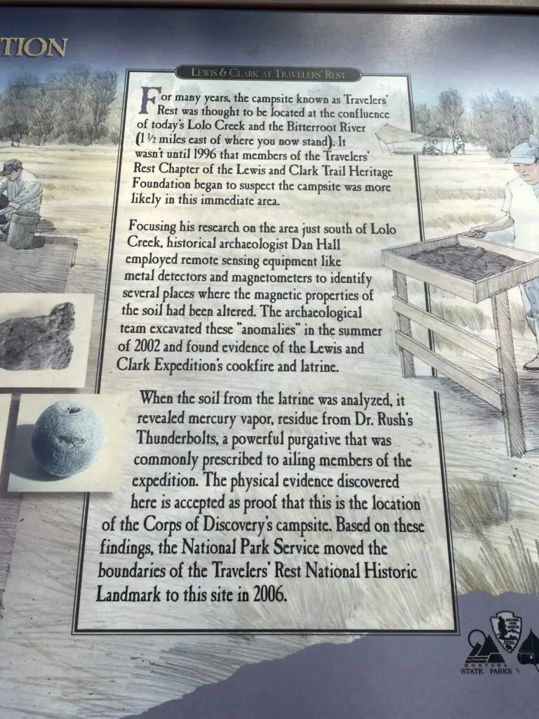
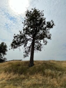
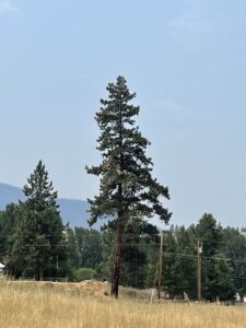
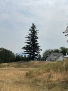
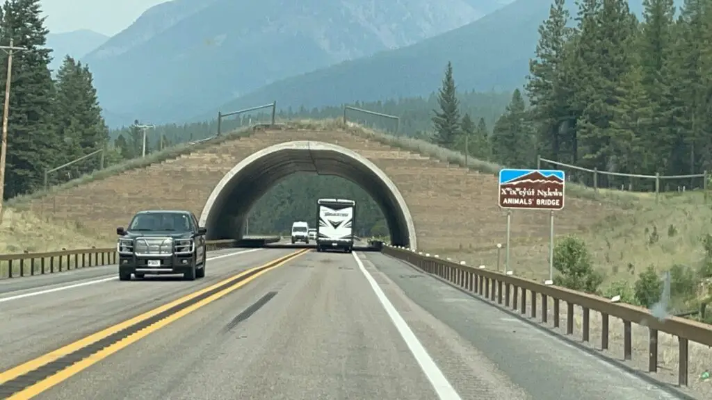
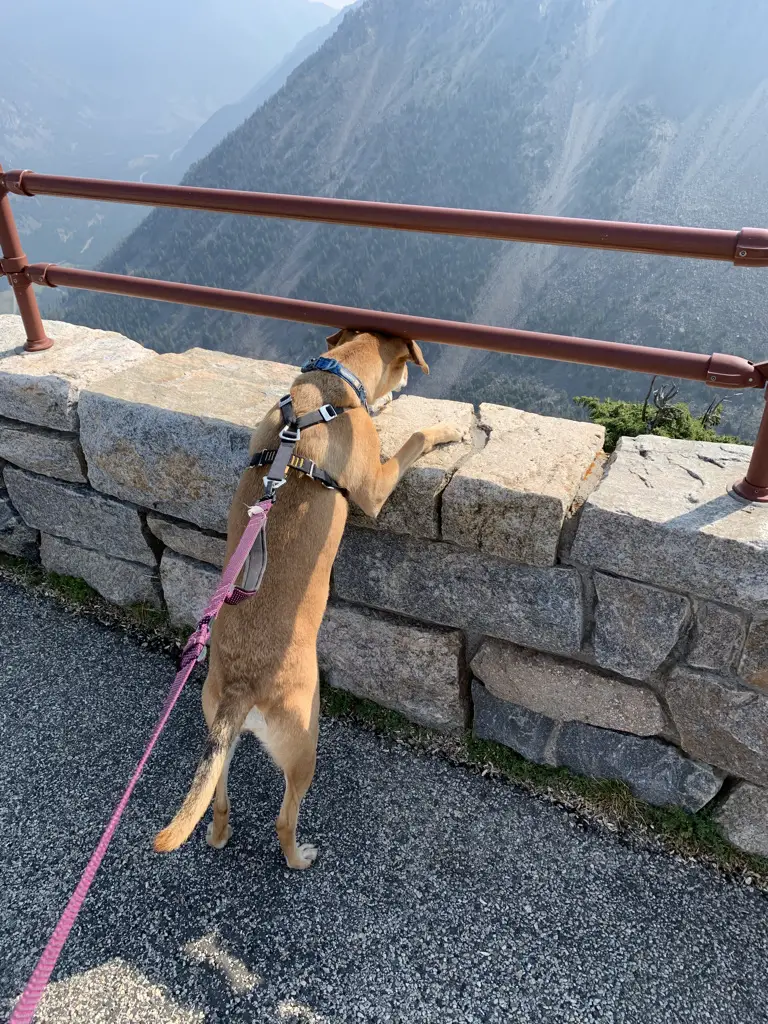
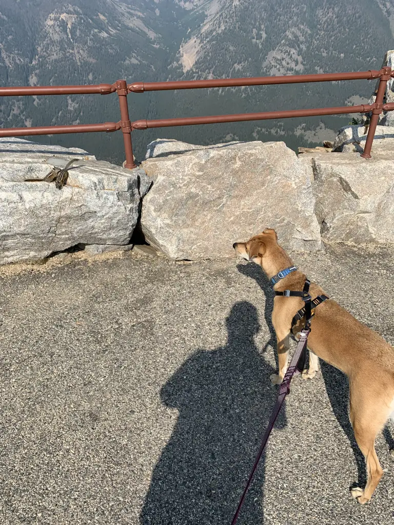

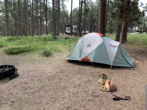 There is a less-frequently visited portion of the Black Hills in far-eastern Wyoming called the Bear Lodge Mountains. When the Trekkers visited we stayed at the Reuter Campground. It is easy to reach, as it is less than two hours from Rapid City. It is also just a short drive north of Sundance, WY (and I-90).