In this post, I review the Castle Peak campground and some old fire towers found nearby in the Black Hills.
After almost a decade of living in the Black Hills….and after camping ALL OVER the rest of the US…the Trekkers finally camped…IN THE BLACK HILLS! 😁 (Mr. Trekker did camp near Pactola Lake on a trip with another friend in 2005, he enjoyed it then too!)
One benefit to COVID was that it offered us an opportunity to stick closer to home and check some items off our Black Hills Bucket List!
Castle Peak Campground
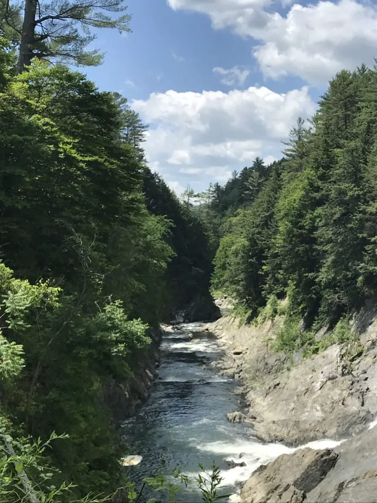
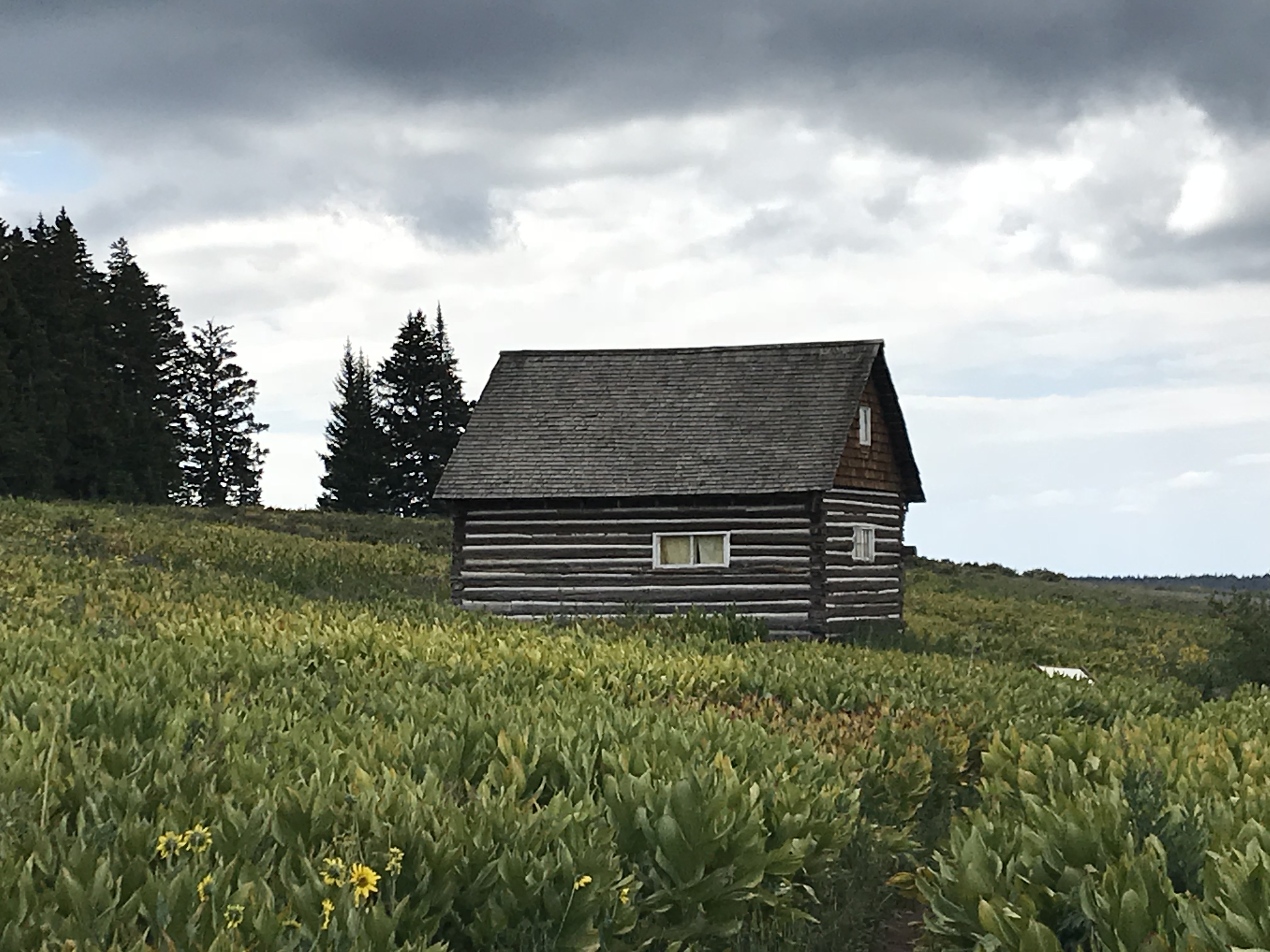
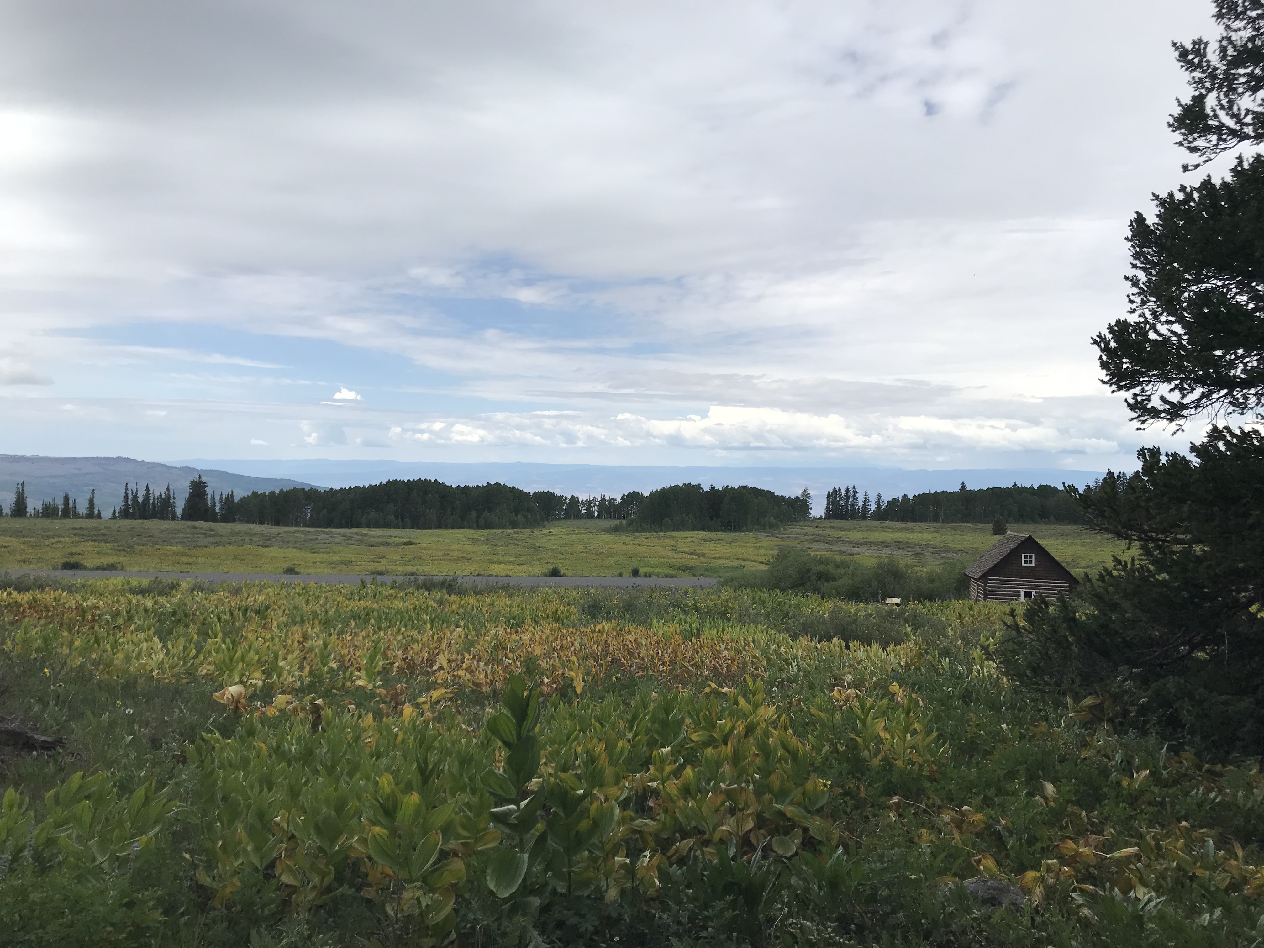
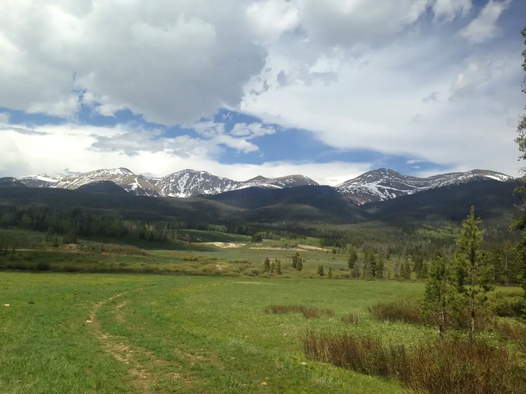
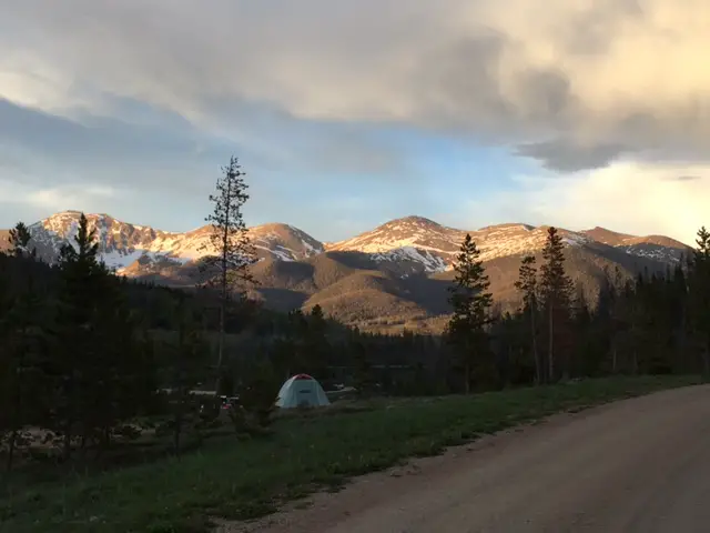
We camped at the Castle Peak campground, which is a National Forest Service camp in the western Black Hills of South Dakota. It is located on Castle Peak Road about 10 miles northwest of Deerfield Lake. You can access the campground from both Rochford Road and Mystic Road (if you go in from Rochford Road you won’t have to be on the rutted, dirt road as long).
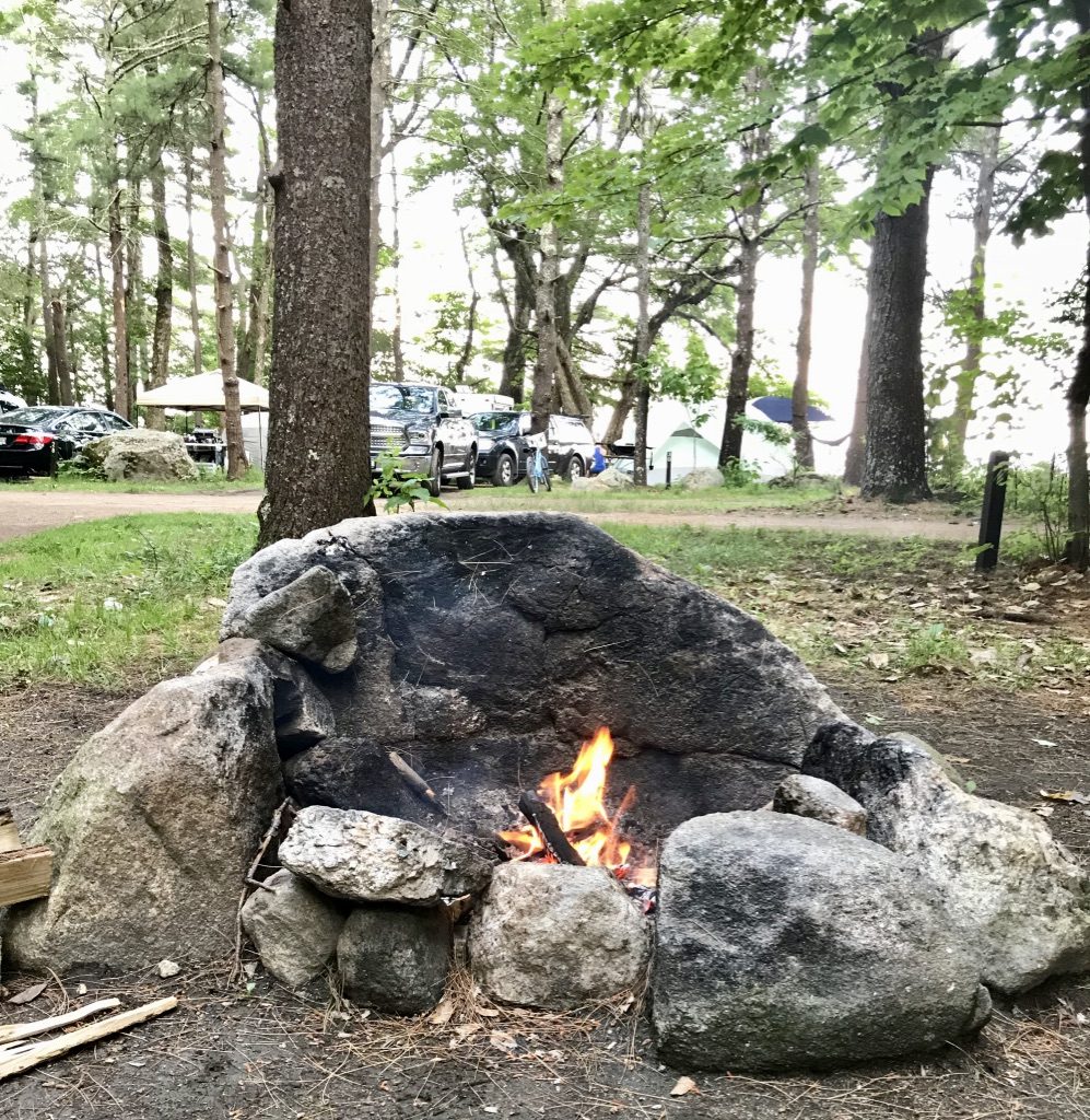
I’ve waxed lyrical before about our love of National Forest campgrounds. As always though, I try to warn people that while these types of camps are usually in BEAUTIFUL locations, and you’ll often see more wildlife, they also tend to be more remote, so they can be difficult to reach. Also, they usually only offer sparse accommodations. In this case, the campground didn’t even have potable water available. It provided only a vault toilet, along with fire rings and picnic tables at the campsites.
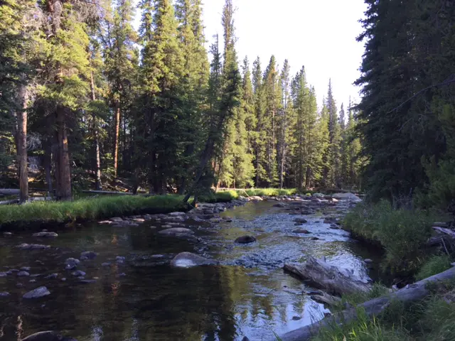
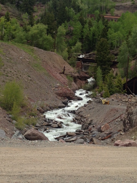
The campsites here were lovely, sun-dappled spots amongst the tall pine trees. These reminded both of us of our time spent in the Redwoods in the northwest. They were large, most were shaded and they sat right along Castle Creek, which meant we got to fall asleep with the sound of flowing water nearby.
This was similar to the campsite we had in Marble, Colorado on our road trip in 2018. The area was green and lush, which unfortunately meant the mosquitoes were far worse than they’d been in the rest of the Black Hills that summer. You all know how much I love mosquitoes. 😝
While sitting next to the flowing creek, I couldn’t help but wax poetic a bit, as well 😉:
The creek keeps flowing never-ending, always constant. It ignores us entirely. It is humbling, the little concern that Nature gives us. It doesn’t actively seek to harm us but it doesn’t help us either. It just IS, and we exist within It…
The creek!
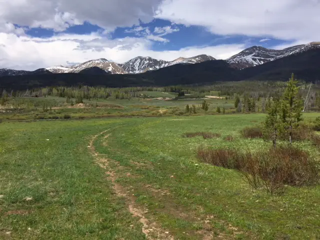
Campsites at Castle Peak Campground
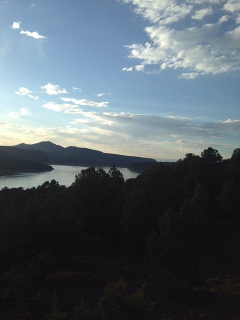
The campground was in a canyon, so it didn’t offer the greatest of views. There were also only around 10 first-come-first-serve campsites, so a spot is not guaranteed. This camp also requires a lengthy trip down a rutted, dirt road to access.
That particular weekend wouldn’t have been a problem as the weather was dry. We had the 4×4 truck, but we could have made the trip in my CRV easily enough. A typical passenger car could manage this road in good conditions (we saw several over the weekend) but you should definitely take it easy. In snowy or muddy conditions, a 4WD with high clearance may be required. The biggest issue with this is you may drive to your campsite on a dry road and have to drive out in mud after a night of rain.
As I’ve mentioned previously, this area is in the higher altitudes of the Black Hills, so it’s a great place to go when the weather is supposed to be hot in the lower elevations. That and sunny-weather days are part of the reason we chose to camp on this particular weekend.
The campsite (the creek was between us and the rock wall behind us).
I’ve also mentioned that this area is a great place to find Christmas trees in the Black Hills. Other than that and canoeing on the lake, however, we haven’t spent much time up here. It was fun getting a chance to toodle around some of the roads that we usually only see when snow-covered.
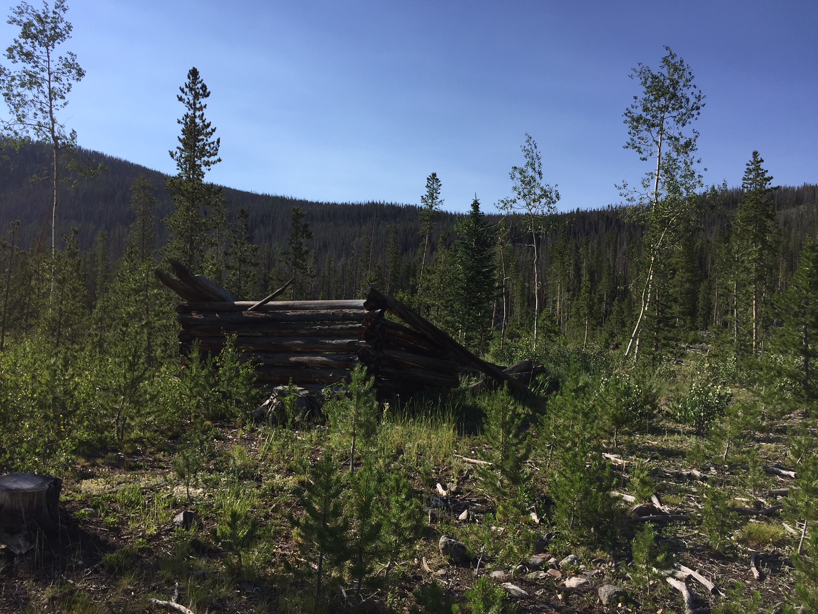
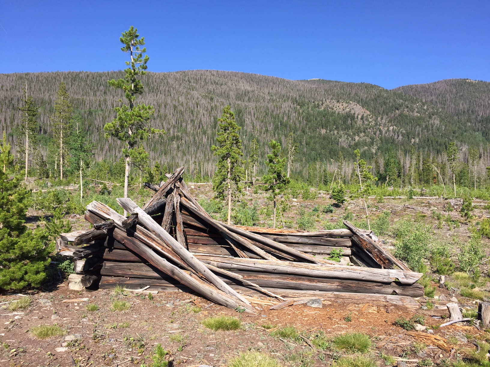
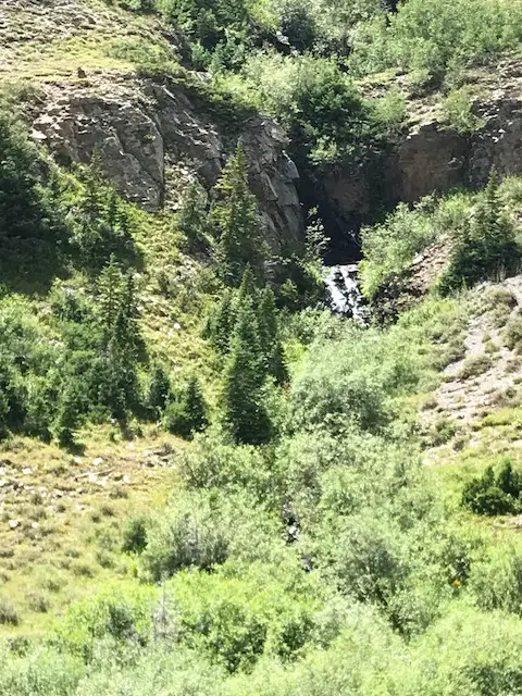
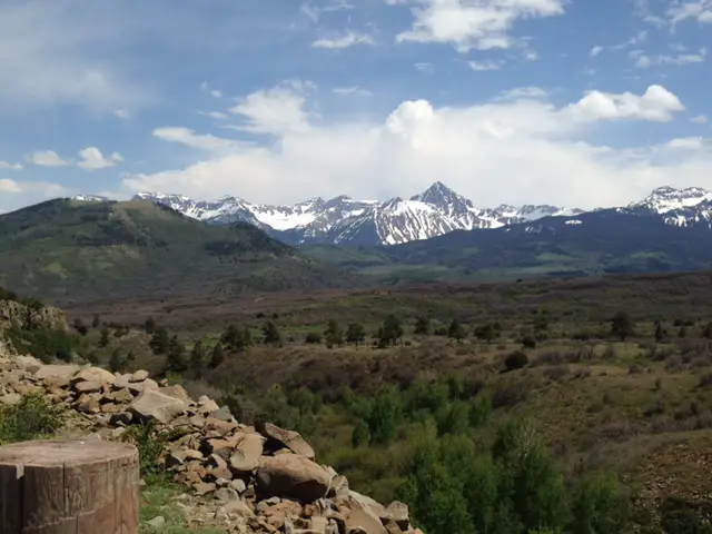
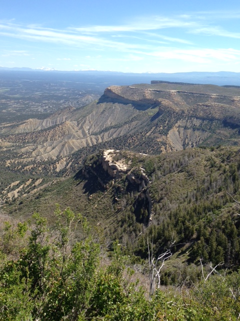
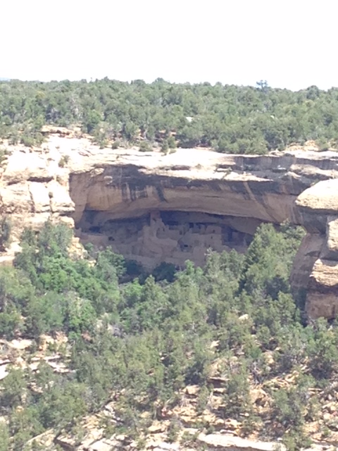
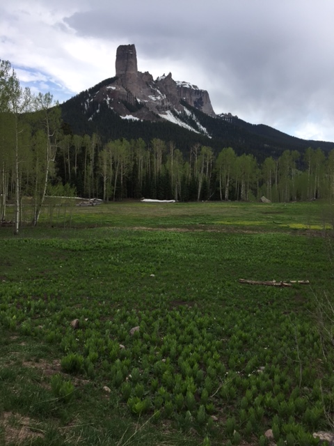
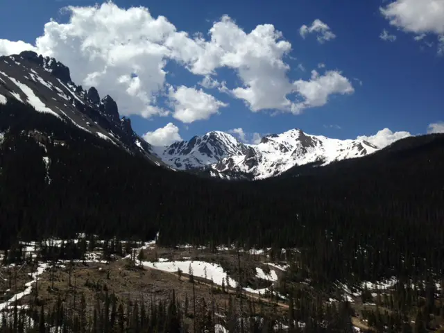
Castle Peak and Flag Mountain Fire Lookouts
We were able to visit the remains of two fire towers, one on Castle Peak, the other on Flag Mountain. We hadn’t realized either were there. You can drive to the top of both, though the last half-mile or so to Castle Peak requires a jaunt up a STEEP and ROCKY road.
We took the advice of our campground neighbors and parked the truck in the grassy area at the base of the steep portion of the road and hiked the remainder of the way (Puppers approved of this option!) Flag Mountain was an easier drive on a dirt, forest road, almost to the base of the tower, and only required us to ascend some rock steps to reach it.
Sleepy Puppers!
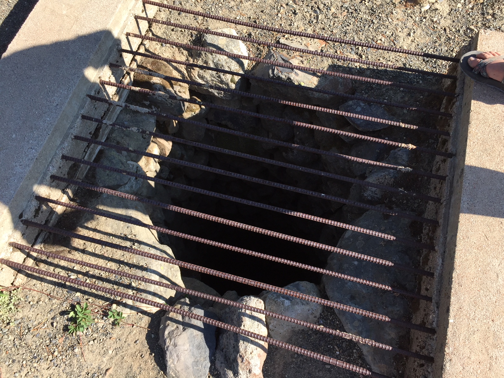
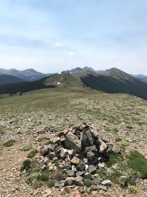
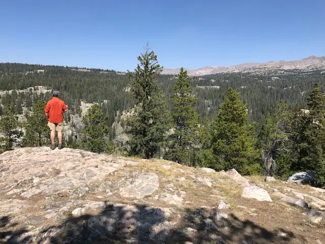
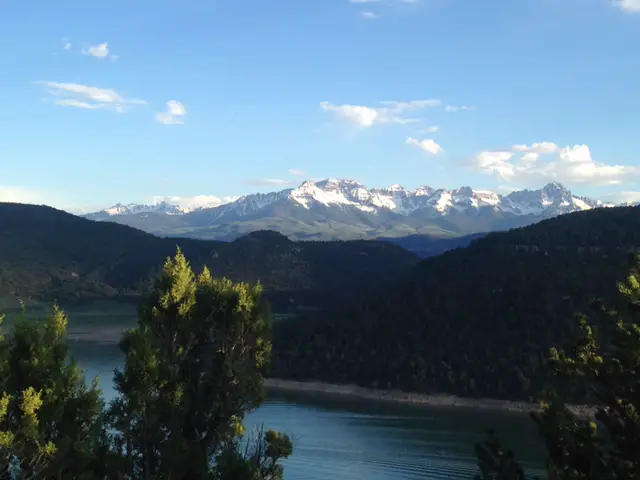
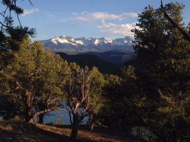
At Castle Peak, there are only a few remains of the fire tower’s foundation. On Flag Mountain, much of the rock base remains. Beautiful, 360-degree views were offered from both, though we found Flag Mountain to be the most striking.
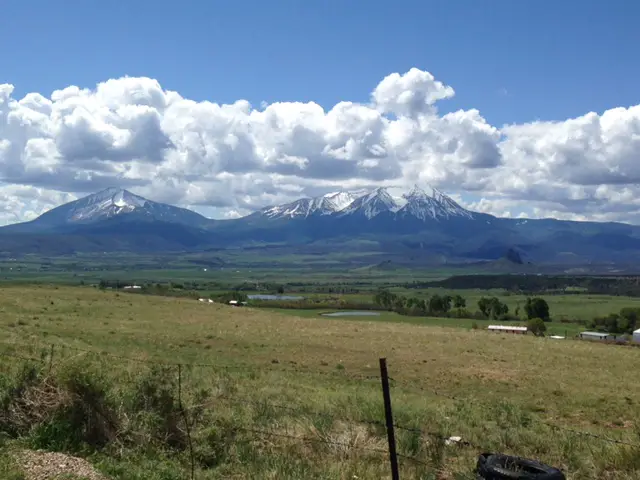
It was a clear day and you could see all the way from Terry Peak, in the northern Hills, to Black Elk Peak, which is situated in Custer State Park. That granite bank of rock was especially striking and majestic. The green of the Hills and high prairie that stretches to the horizon contrasted perfectly with the blue of the sky (and the puffy white clouds it contained).
From the summit of Castle Peak
This little mini-trip was a good reset for me. Life had been pretty stressful at the time and it was good to be refreshed by nature!
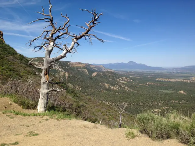
A few more pictures from our weekend:
From the top of Flag Mountain:
Some steps at the old, fire lookout
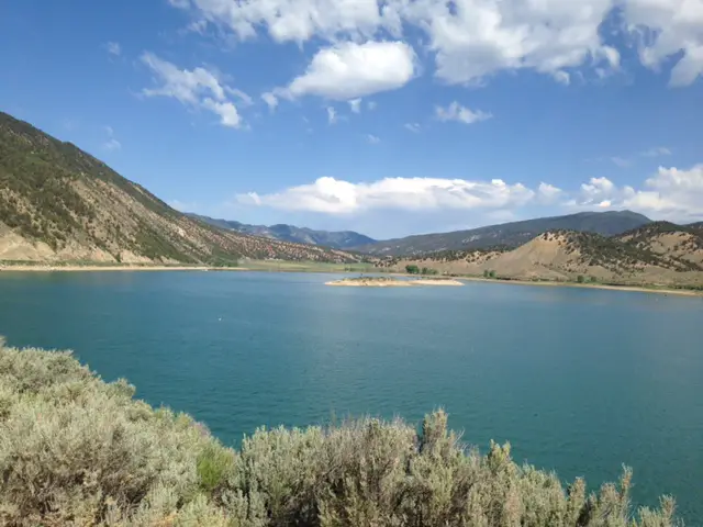
Deerfield Lake
If you’re looking for a quiet place to camp in the Black Hills, near Deerfield Lake, check out the Castle Peak campground!
Have you ever been to this campground, Castle Peak itself, or the Flag Mountain fire tower? Tell me about it in the comments!
Did you enjoy reading this post? Pin it!
Like what you read here today? Please feel free to leave a comment, like or share this post! Add your email at the bottom of the page, or the sidebar to the right, to be notified when a new post is published. By signing up for the email list, you will also receive a free copy of the Tranquil Trekker’s Top 10 Tips of Trekking Do’s and Don’ts!
You can also follow the blog on social media by clicking the links below!
We try to camp in the Bighorns, in northeastern Wyoming, at least once a year!
The Trekkers have a tradition of camping in the Bighorns each Labor Day Weekend! Puppers has been a trooper on our camping trips. She enjoys riding in the truck (she doesn’t even mind the BUMPY, jarring journeys we’ve taken her down a few 4×4 roads…too much! 😉) She can keep up with us on the hiking trails and she even handles the tents like a champ (though she needs a little assistance getting in and out of the rooftop tent).
You do have to wonder about people who drive 3+ hours to the wilderness, where they proceed to pee in a bucket and not shower for three days…and call that fun! 🤔😉😎
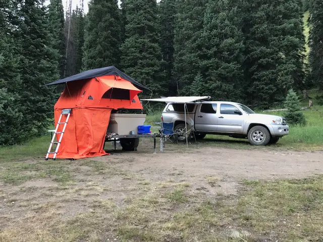
One of our camp setups
We finally caved and bought a privacy shelter for this trip, and we were SO glad we did. It made life SO MUCH easier. In the past we’ve used the vestibule that came with the rooftop tent, this worked ok, but even I couldn’t stand up straight in it (not to mention Mr. Trekker’s 6’4 frame). This could be because we have the tent on the trailer rather than on top of the truck, the vestibule likely works better in that situation. But the shelter worked great for changing, for a bathroom along with our Luggable Loo†, and for a shower using the solar shower. It was so cool to look up at night and see the Milky Way shining over you while you were changing or “taking care of business”. 😇
The Bighorn Mountains
I know I’ve said this before, and I hate to sound like a broken record, 😇 but I LOVE the Bighorns. I always forget we aren’t in the depths of the Colorado High Country when we visit there. I love their stony summits, some still sporting spots of white leftovers from last winter’s snowpack, just above the treeline far below.
I always think of them as their own tiny island of mountains that rises out of the high prairie of northeastern Wyoming, but according to Wikipedia, they’re actually a spur of the Rockies separated from the main mountain chain by the Bighorn Basin.
Though this area is just as beautiful as the Rockies, it is FAR less crowded, which makes it so much more pleasant to visit. 😋 There are no lines of people hiking in the Bighorns like we’ve experienced in various places around Colorado. Also, oftentimes, the lower-elevation plains may be baking in 90-degree weather, while it’s in the 60s-70s, and breezy, in the mountains!
It doesn’t hurt that, depending on which area you are heading to, the Bighorns are a shorter, 3 – 4-hour drive from the Black Hills, rather than the 6 – 8+ hours required to reach the mountains in Colorado ( and that’s just the Front Range, in the east-central portion of the state). You will still have to drive through rural Wyoming whether you’re going to Colorado or the Bighorns. However, to reach the mountains in Wyoming, you drive on I-90 the whole way. It’s a little easier if weather is bad, and you don’t have as much trouble with the Wyoming drivers who like to pass on two-lane roads leaving little room for oncoming cars…(ahem!🤬🤯) ( Of course, all that being said, no one should visit here, ever, it’s just a terrible place to be. 😮😇🙃)
The Bighorns aren’t to be trifled with though. These mountains are rugged, with little accommodations by way of gas, food, and supplies. Small towns, such as Buffalo, Ten Sleep, Greybull, and Sheridan dot the area. But these are few and far between (not to mention pretty tiny, by the standards of “normal” people who aren’t used to the small settlements that are common in the West). 😉 This is a national forest area, not a national park, so even camping accommodations are rustic, rarely offering more than potable water and a pit toilet (and those are the fancy ones)! 😮 So, if you’re looking to visit this area, be prepared to be self-sufficient. The views will make it worth the trial, though!
The night sky in the Bighorns
There isn’t a lot of light pollution in the Bighorns, so on clear nights, you are treated to an INCREDIBLE light show! Once the sun sets, the stars and planets come out in abundance. My whole life, I’ve never seen a night sky that is comparable to what you find in the crisp coolness of the high mountains. The sky actually looks like it has the measles, as there is almost a rash of stars that covers it. The cloudy ribbon of the Milky Way is often clearly visible as it stretches across the expanse of darkness. You can almost sense it glowing from within. It is truly an incredible sight.
Silent Night in the high mountains
Our campsite was at about 7500 feet on this visit (oftentimes we stay much higher, closer to 9000-10,000 feet). We’ve noticed something odd at these high altitudes that we have also experienced in Colorado’s High Country. There is a distinct lack of “night sounds”. You don’t hear the chirping of crickets or croaking of frogs in that thinner air, even on warmer nights, and I don’t know why. Nights tend to be pretty cool in those places, so it may be due to this, or just that there is a very short season where the night air would even be warm enough for the creatures to survive. But whatever the reason, when we’re up so high I do miss the “chirping” sounds of a summer night.
Dispersed camping in the Bighorn National Forest
Sometimes when we head out we Disperse Camp. This is also known as “dry camping”, where you just set up your camp somewhere in the national forest, outside of an established campground. We tried this for the first time in Colorado, at both State Forest State Park and near Crested Butte. On both occasions, we did stay at an actual, numbered campsite, it was just away from any campground and we weren’t able to see our neighbors.
On this trip, there were no numbered sites, but they did request that you stay at an already established campsite (designated by fire rings). I have never experienced such a busy weekend in the Bighorns! We stayed near Circle Park (there are a lot of “parks” in this region, they are basically just large, meadowy areas amongst the forests). It was a lovely site with views of the surrounding mountains, but we could see three other campsites from ours (one had a large group in it). We could hear even more campers, just on the other side of the copse of trees we were camped near. Next time, we’ll have to try going even farther out if we hope to have more privacy! 😉
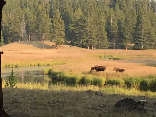
Moose in the Bighorns!
Ladies and gentlemen, Martin the Moose!
I wasn’t sure if we’d see any moose on this trip since we were sticking mainly to the southern portion of the Bighorns and I wasn’t aware of any waterways running near our campsite (which moose favor). We lucked out though. It only happened one time, but at about 6:30 one morning, as the Pup and I were enjoying her “morning constitutional”, I spotted Martin the Bull Moose sauntering through the “park”, down the hill from our campsite! SUCCESS!!! Puppers wasn’t sure what to make of that LARGE, funny-looking thing!
Hiking Trails
Circle Park Trail:
Sherd Lake
We did this same trail on our first trip to the Bighorns, several years ago, in October. It’s a nice hike, fairly wide and graded, and not terribly steep (though it is quite rocky in several places). We walked to Sherd Lake, which is absolutely GORGEOUS! There are views of several nearby mountains, such as Bighorn and Darton Peaks, from here. This trail is around four miles total, so it’s perfect for a day hike (especially with a not-quite-full-stamina, juvenile, canine friend). 🐶
The trail continues on to several other lakes from there. It also connects with an 8-mile loop that snakes around the nearby mountain peaks, if you’re looking for a lengthy hike (or a good backpacking trip).
Maybelle Lake Trail (off Forest Road 430):
This hike was deceptively tough. It’s only about three miles in total length, but it’s overgrown in many spots, very rocky and there are lots of downed trees. We actually lost the trail several times and had to root around to locate it again. Other parts of it are PERFECT though. They feature a flat, graded path through a moist, pine forest, that is surrounded on both sides by a green carpet of ferns, moss, and soft undergrowth. It almost felt like hiking in the cool rainforests of the Pacific Northwest. It was such an idyllic sight!
The other difficulty is in reaching this trail. You have to drive about 45 minutes (one way) on a rugged, 4×4 road to get to the trailhead. We had done this route several years ago, so we knew what to expect, but this would NOT be appropriate for a normal car, or even just a high clearance vehicle. If you don’t have a 4×4, with gear intended for off-road purposes, you should NOT attempt this road. (As an example, after trying this route a few years ago, we decided skid plates would be an important addition to the truck.) After completing the road on this adventure, there is some paint hanging from the skid plates in a few spots (we sure were glad they were there!) 😋
Maybelle Lake
Tensleep Canyon
I’ve mentioned this canyon before, but this is one of the most beautiful places in the Bighorns. If you are anywhere near this national forest and you have the chance to drive the canyon, you absolutely MUST put it on your list. It is NOT to be missed. This is one of our favorite areas in this national forest, and we try to enjoy it whenever we’re nearby.
The canyon is surrounded by arid, rocky cliffs on both sides, and is located on the southwest side of the Bighorn mountains. One great thing about it is that EVERYONE can experience it. US 16 is the main road that runs through the middle of the canyon. It’s an easy-to-drive, paved byway.
For the best views, I would travel down the canyon, from east to west, on Route 435. This is actually a dirt road that runs parallel to US 16 on the canyon’s southern side. It’s a very well-graded route though, so as long as you don’t mind your car getting a little dusty, any 2WD vehicle can handle it in good weather (beware, the road may be impassable during snowy or muddy conditions. The road is also closed to vehicles November – June).
It’s a two-way road, but it’s fairly narrow, so take your time and be cautious. There is room to pass a vehicle coming the other way but both drivers need to be aware as the lane gets tight.
This route provides better views down the length of the canyon into the dry expanse of Bighorn Basin, that opens up between the western slopes of the Bighorns and the eastern slopes of the Absarokas (near Yellowstone National Park). While the Bighorns provide cooler conditions, even on the hottest days of the summer, the Basin sits on a high prairie that lies in the rain shadow of the larger mountains, to the west, and bakes under the heat waves of the summer sun.
On your return trip up the canyon, take the paved, US 16 for incredible views of the dun-colored rock and sparse, short, green trees and bushes that comprise the canyon walls. They stand out in contrast to the deep blue of the sky above. These views are SO beautiful!
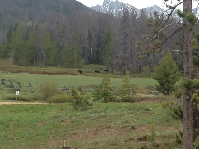
You aren’t very likely to see moose in this area, it’s too dry and hot for the vittles they enjoy dining on. The northern side of the Bighorns, near routes like US 14 and 14A, are prime spots for spotting these ungulates.
For the best light, it’s best to drive up the canyon, west to east, in the afternoon when the sun is at your back! Here is a link to a video I made of our drive up the canyon.
We were glad to enjoy another successful, Labor Day, camping trip to the Bighorns. We really enjoy returning to this area year after year. There are so many things to see here, it can’t all be done in one weekend!
Have you hiked to Sherd or Maybelle Lakes? What did you think of the trails? Tell me about your experiences in the comments!
Did you enjoy reading this post? Pin it!
Like what you read here today? Please feel free to leave a comment, like or share this post! Add your email at the bottom of the page, or the sidebar to the right, to be notified when a new post is published. By signing up for the email list, you will also receive a free copy of the Tranquil Trekker’s Top 10 Tips of Trekking Do’s and Don’ts!
You can also follow the blog on social media by clicking the links below!
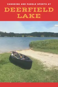
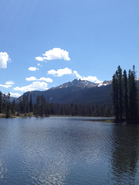
In this post, I review one of our favorite canoeing sites, Deerfield Lake, in the Black Hills of South Dakota.
Deerfield Lake is one of the Trekkers’ favorite spots for canoeing in the Black Hills (another is Jenney Gulch, on Pactola Lake.) This site is the terminus for the lengthy Deerfield Trail, that I’ve mentioned in another post. There are many things to enjoy about this part of the Black Hills. It’s a little more remote, so it does take a little longer to reach, but it’s also higher in elevation so it tends to be cooler. In the winter, this may not be as pleasant, but in the summer, when you are roasting in Rapid City, you can head to the Deerfield area for a less oppressively warm, far more enjoyable day.
Where in the Black Hills is Deerfield Reservoir?
This body of water is easy to reach, just take Deerfield Road west, from Hill City, for about 15 miles. You drive right past it so you can’t miss it! 🙃
What fun things can you do at Deerfield Lake?
There is a hiking trail, that circumvents the lake, which is also good for cross-country skiing and snowshoeing in the colder months. There are several campgrounds available around the lake, as well. You should be aware these are National Forest campgrounds, which we always love,but they usually have very sparse accommodations. Potable water and vault toilets are about all you can expect at these campsites (though they are usually quiet and some spots have WONDERFUL views). This is also one of our favorite areas for acquiring Christmas trees in the Black Hillsif you know where to look…
What makes Deerfield Reservoir so great?
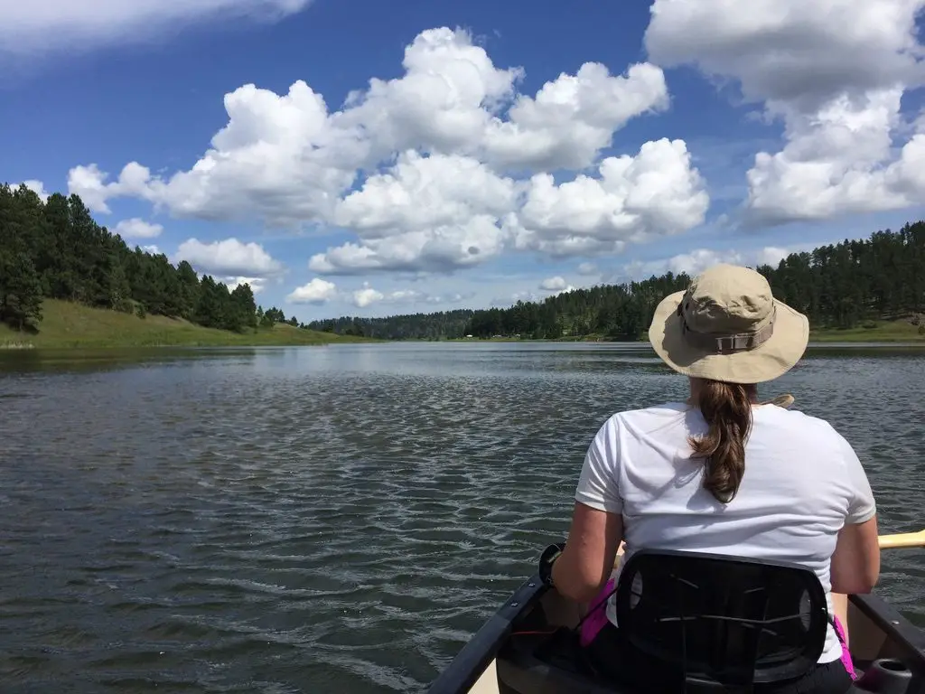
One of the best things about this lake is that it is fairly large in size (comparable to Sheridan Lake farther to the east) but it has a no-wake rule. So, while people can bring motorized boats if they wish (and some do, to fish) they aren’t allowed to go very fast. This regulation makes Deerfield Reservoir an opportune site for the slower, water sports such as canoeing, kayaking, and paddle-boarding.
We are especially thankful for the peacefulness of this place as there was a measure put forth to the State Legislature to drop the no-wake rule. This would have allowed boats to travel at wake-speed which would likely have increased the frequency and amount of larger boats using the lake. Fortunately, after a STRONG public outcry from locals, it was defeated. We were SO glad! This is truly one of the best places to canoe or kayak in the Black Hills (in my opinion). There are other nice lakes around Custer State Park, but they aren’t nearly as large. They don’t offer as nice of views of the surrounding mountains either. (With all that being said, this is a horrible place to visit and everyone should stay away! 😮😉)
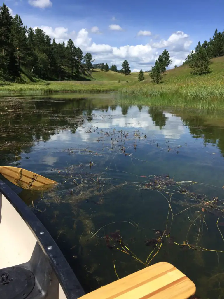
More pictures of our canoe day are below, courtesy of Mr. Trekker!
Just two canoe paddles, in love! 😉
With all this talk of canoeing, I would be remiss not to mention the rack system that we use to safely transport our mighty vessel. 😉 We really like the Yakima KeelOver Rooftop Canoe Rack†. It installs INCREDIBLY easily–and quickly–on the luggage rack on top of your vehicle. It also both protects the canoe from damage and holds it in place very well. Basically, the way it is designed, there are four separate, cushioned feet that attach to the already-installed luggage rack. If the canoe starts to slide to the left or the right, it is held in place by the feet on the opposite side. The kit also comes with tie-down straps that are used side-to-side and front-to-back to strap the canoe to the vehicle. It should be noted that this system is specifically intended for canoes only.
The next time you’re looking to escape the heat of a summer day in Rapid City, check out Deerfield Lake. It makes for a quiet retreat from the hustle and bustle of the busier, tourist towns, and offers scenic views as well. Go out and enjoy it!
Have you canoed at Deerfield Lake? Tell me about your experience in the comments!
Did you enjoy this post? Pin it!
Like what you read here today? Please feel free to leave a comment or share this post! You can also follow the blog on social media by clicking the links below!
In this post, I review the New England road trip we took through Vermont and New Hampshire during the summer of 2019.
3 weeks, 13 states, 5,138 miles, and 2 quarts of oil (FYI, Subarus inhale oil) gives you a grand New England Road Trip! Because, when you live in Western South Dakota, why wouldn’t you drive all the way to the coast of Maine for summer vacation? 😮😛
In 2019 the Trekkers spent three weeks on a whirlwind tour of the Northeast. We spent the first week visiting with Mr. Trekkers’ family in Connecticut, enjoying some of the old haunts from his childhood. Then we spent a weekend toodling around Vermont and New Hampshire, and then enjoyed several days at Acadia National Park, in Maine. We finished with a quick visit with my family in Indiana on the way back. Read on for “Don’t Miss” places for your Vermont and New Hampshire road trip!
Northern New England Countryside
I love northern New England! After traveling the crazy highways that snake all around its southern section, you hit the Vermont state line and life seems to slow down a little, again. You find yourself quickly returning to the small-town charm of country towns; earthy, damp smells radiate from the walls of green trees and ferns in the woods that surround you. It feels different here… most of the trees are deciduous hardwoods, whereas we’re used to the evergreens more commonly found in the Black Hills (and areas of Colorado that we frequent). It feels almost like a rainforest compared to the more arid land we’re used to. It reminded us a bit of the Redwood forests in California (except without the Redwood trees 😛).
“Don’t Miss” sites in Vermont and New Hampshire
Below are some highlights from our whirlwind tour…
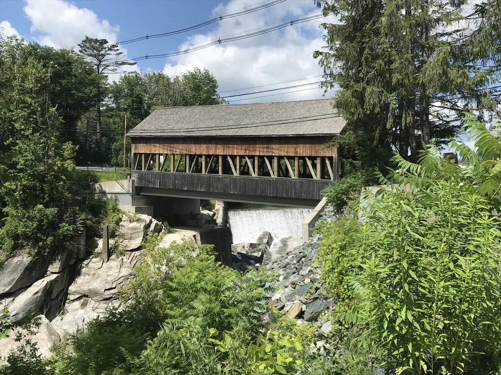
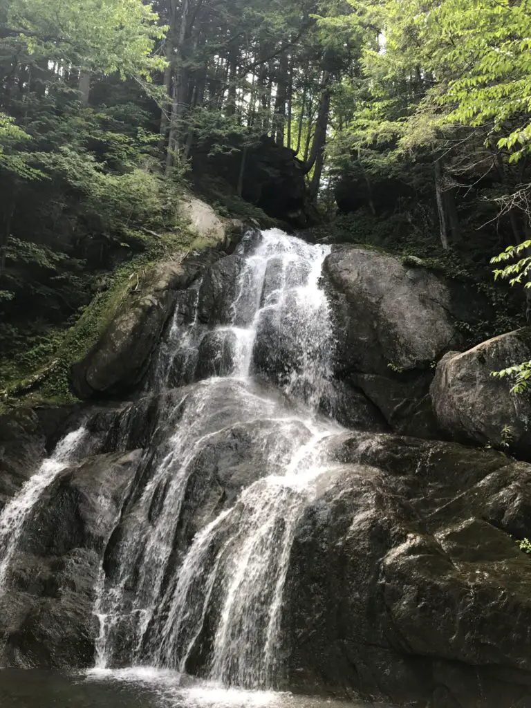
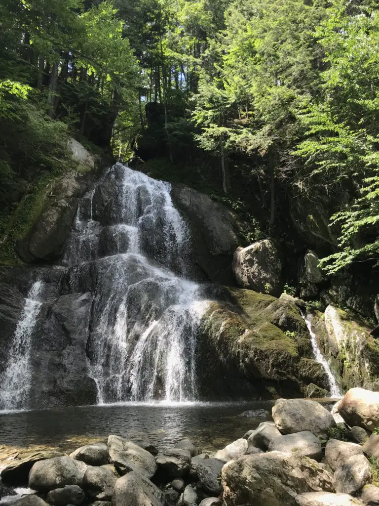
Route 100, Vermont:
We traversed much of this scenic byway that spans the majority of the state, from north to south. Several of the locations listed below were found on or near that road. Throughout these travels, we enjoyed one of Vermont’s prime attractions, covered bridges, as well.
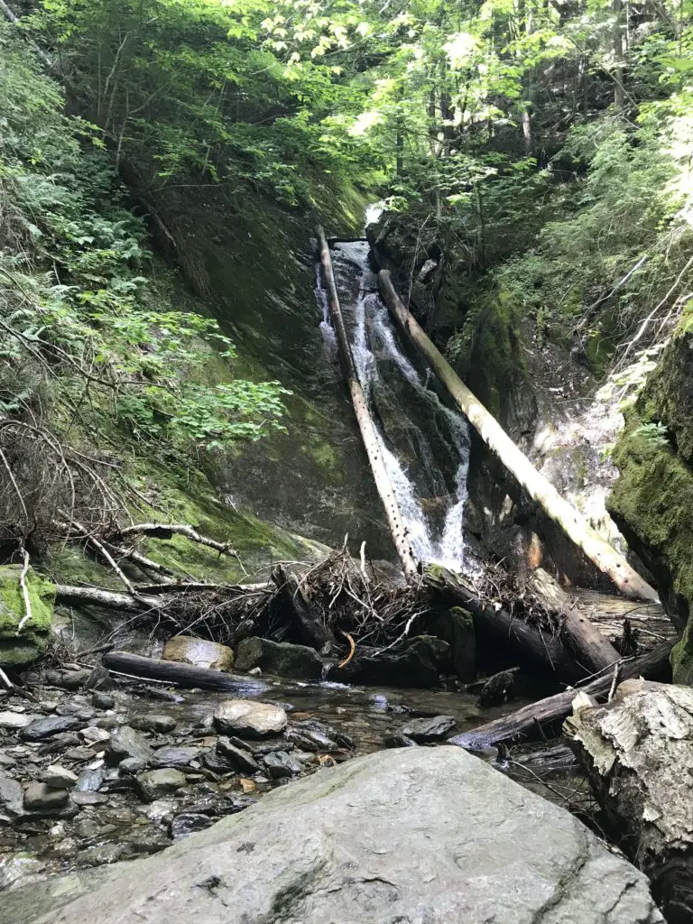
Moss Glen Falls
For more pictures of some great waterfalls around New England, check out my friend, Kathy’s blog here.
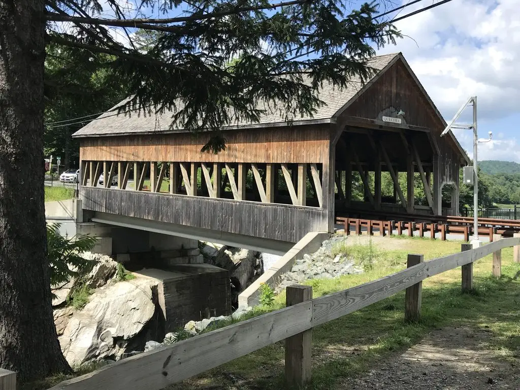
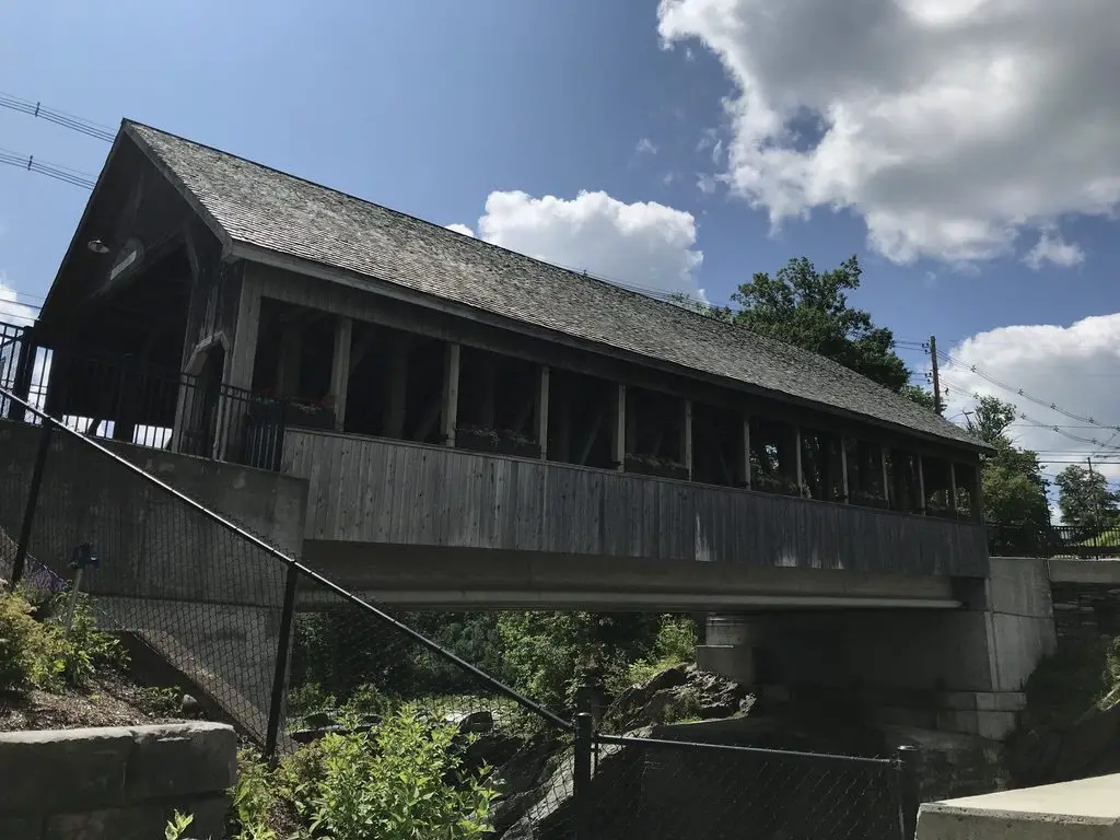
Covered bridge over the Quechee River
Ben and Jerry’s Flagship Store, Waterbury Vermont:
We decided we didn’t have time to actually do the factory tour where you can watch how the ice cream is made (though that would have been REALLY cool). However, we did get ice cream from the official store, and I’ve got a tie-dyed t-shirt to prove it! We did take the time to check out a portion of the grounds called the “flavor graveyard”. It was a little weird 🙃 but it was interesting seeing the various flavor options that have come and gone throughout the years. Check out the website for the factory here.
Cold Hollow Cider Mill, Waterbury, VT:
Just up the road from Ben and Jerry’s is a cool cider mill. It specializes in fresh-baked, cider donuts. I thought they tasted more like spice cake, but either way, they were good! Click here to check out the website for the mill!
The Vermont Country Store, Weston, VT:
This place was nice. It kind of reminded me of Wall Drug, in Wall, SD, but was far less immense. It was definitely a cute place to pick up some local delicacies and check out some cool, retro toys and games from the ’80s, that brought back memories of our childhoods. 😁
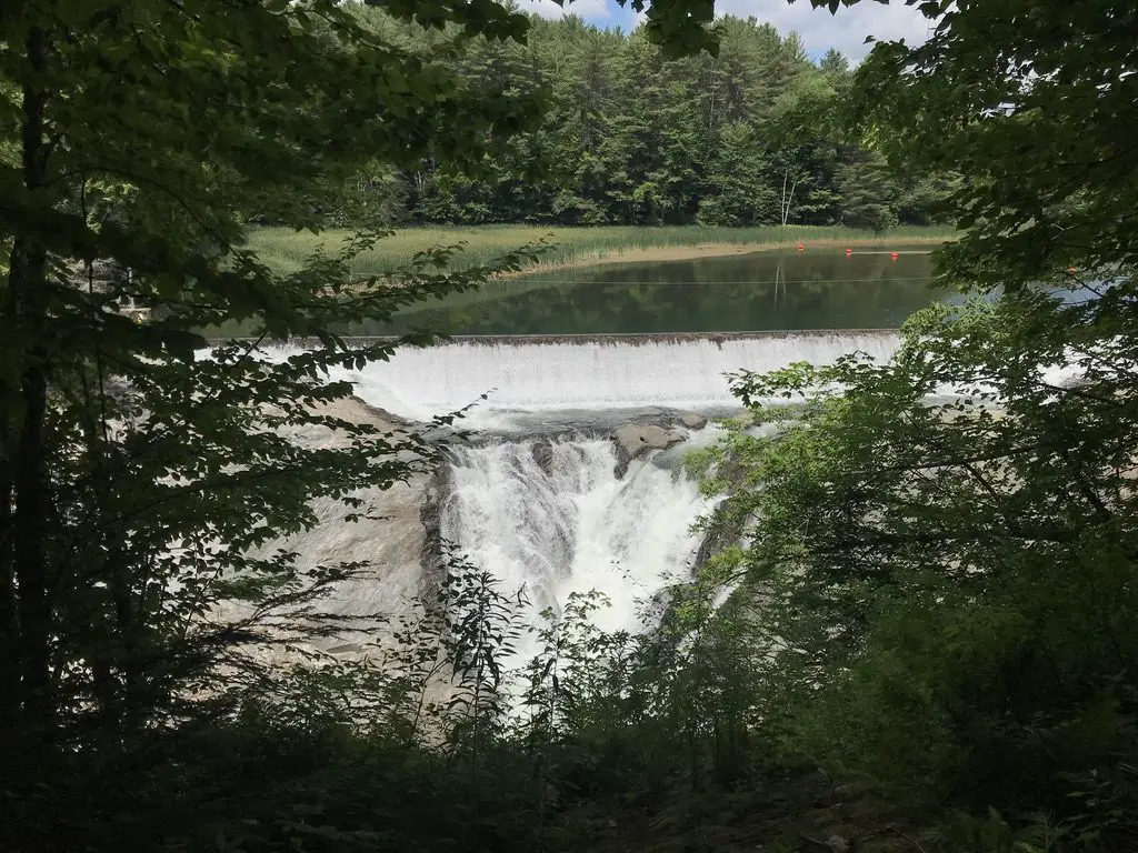
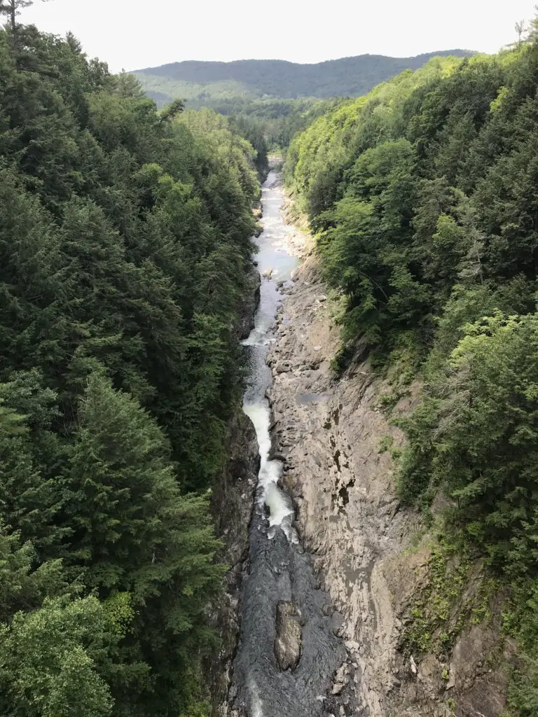
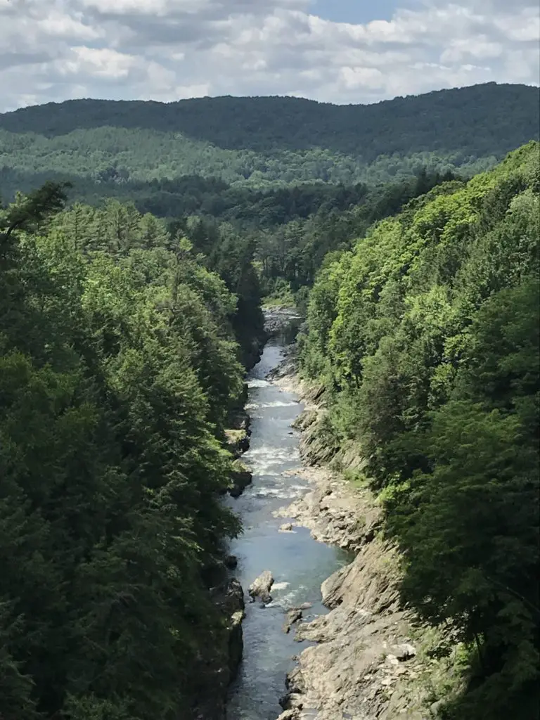
Quechee Gorge, Hartford, VT:
This place was really cool! The Ottauquechee River cuts through over 100 feet of rock in this area, the result is a GORGEOUS, scenic view. A hiking trail nearby takes you on an easy hike of less than one mile, to the head of the gorge, where the river is dammed. This provides a unique view down the length of the canyon.
The trail also traverses about a mile downhill, the length of the gorge, to where the river emerges from the rock again. This is a popular swimming area. Be aware though, as it’s downhill from the main parking lot all the way to the swimming site, you know what that means for the return trip! 😛
The dam at the head of the Quechee GorgeThis pic gives you an idea of how deep the gorge isA view of the gorge from the bridge
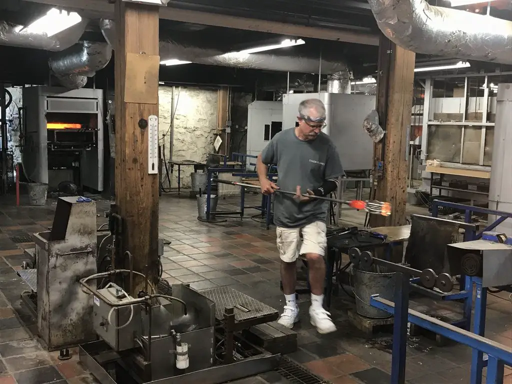
Simon Pearce Glass Mill and Store, Quechee, VT:
Ran using hydroelectric power from the same river that formed the Quechee Gorge, this place was AWESOME! We were able to watch the artisans blow and shape the glass in the mill, in the basement, while the final product is sold in the store upstairs. The shop also features a nice restaurant that overlooks the river.
We decided the creations (even the seconds) were a little too rich for our blood, especially with the risk of breaking them as it was the middle of a lengthy road trip!
A glassblower craftsman at Simon Pearce
Camping at State Parks in Vermont and Maine
Because we enjoy camping, and it helps to keep costs down when on road trips, we spent a few nights at state parks in both Vermont and Maine. The mosquitoes were bad throughout the trip, but that’s to be expected in the middle of the damp woods. 😉
I’m a nature girl, I like critters, even the slithery, skittering, venomous–if we must–kind, as long as we can leave each other alone. What I can’t abide are mosquitoes. Seriously, why, just why? That will be one of the many questions I have for the “Big Guy” someday.
What purpose do they serve? Food for other critters? That’s fine, but why do they have to suck OUR blood, causing welts that itch to high heaven (and are bigger than the critter that left them) that last for days on end, and can even end up infected due to excessive scratching brought on by the extreme itching (I know from experience). A bug that DOESN’T carry potentially deadly disease couldn’t fill that spot? I’m just saying. 😛 They say God doesn’t make mistakes but the presence of mosquitoes makes me wonder a bit. 🤔
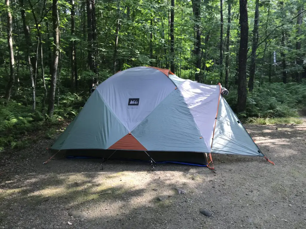
The campsites throughout the campgrounds were largely gravel and flat. They have large stone hearths to use for fires, we aren’t used to that in the Black Hills. It made me think of the Flintstones. 😂 Most of the sites were large enough they could fit a small trailer/pop-up camper (we just brought the old, trusty, ground tent for this trip). There were also flush toilets, electricity, and showers (oh my! 😱) I can’t remember the last time we had those types of “fancy” amenities when camping! 😉
This may be because it’s been a while since we stayed at a state park. We’ve gotten used to national forest sites, with their vault toilets (and that’s it). 😋 Other than their more rustic accommodations though, national forestsare still my favorite places to camp.
Below are some of the parks we visited:
Coolidge State Park, Plymouth, VT:
This is a newer park, and it includes buildings from the historical homestead of the 30th President of the United States, Calvin Coolidge. This was the first place we camped, and the quietest. Sites were shaded and well-separated from each other.
Our campsite at Coolidge State Park
New Discovery State Park, Marshfield, VT:
This place was cute. It rained that night, but not till we were nearing the end of our fire logs, so it was a nice sound to lull us to sleep. There was a weird bird that kept attacking its reflection in the side mirror of my car, and a garter snake got my heart racing when it crawled out of a hole in our fire hearth! 😱 Other than these visitors, though, it was a decent little campground.
Sebago Lake State Park, Naples, ME:
Funnily enough, I actually completed a writeup about this park, just a few weeks before we visited, for an online job I had at the time! This was the busiest park we stayed at, with sites that were placed the closest together. They were nice, and shaded, and allowed you close contact with all your New Yorker neighbors 😋 (we definitely don’t hear the Brooklyn accent much out in Western South Dakota! 😂) One unique aspect of this area was all the sycamore trees, with their LARGE, scalloped leaves.
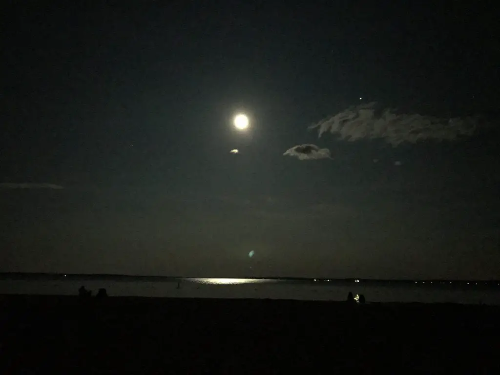
This park sits on the northern shores of the VERY large, Sebago Lake. It was cold, but refreshing to swim in. We enjoyed our almost-lakeside campsite. It was cool watching the full moon rise over the flat, mirrored waters of the lake after dark.
The full moon over Sebago LakeThe cool, rock, fire hearth
Camping in Vermont
I love camping! I love the random, natural experiences you have that you don’t notice cooped up in a house…the sun that dapples through the treetops as water droplets dribble and drip from the still-wet leaves after the rainstorm from the night before…you can see blue sky and stars peeking through the crowns of the trees…the sunbeams filter through the crown of tree leaves and slice through the morning mists that rise from the damp ground…you wake up in the morning to the granddaddy-long-leg who waves at you from his perch on the outside of your tent…
Vermont state parks are pretty nice. They have lean-to’s that can be rented out, which we’ve never seen at developed campgrounds before. They don’t seem like they would provide the most privacy or protection from the weather–or any critters–as it appeared people just set their hammocks/sleeping gear up in the shelter that has a roof, but only three walls. We did see several people putting up tarps as a fourth wall.
They’re big on their “ponds” in New England, except many of them are bigger than the “lakes”. Many are as big as some of the largest reservoirs in the Black Hills. They may need to work on their wording a bit. 😋
Scenic Drives in New Hampshire
As we’ve already driven several of the main scenic routes through the White Mountains in New Hampshire, this time we chose to try out the northern route (US 2 to Route 16). As it turns out, this isn’t nearly as pretty as the scenic byways that are comprised of Route 112 and US 302, that traverse areas such as Franconia Notch. Those areas are GORGEOUS!
We then ventured into North Conway for lunch. This was our second time visiting this little town. We realized we had been there almost exactly 10 years ago, shortly before we got married!
We had attempted to hike the infamous Mount Washington on that trip, but we didn’t make it to the summit thanks to several factors (including a certain blogger leaving breakfast on the side of the mountain 🤮). I want to come back and try it again though, Tuckerman Ravine looks SO beautiful! Now that we hike more regularly and are FAR more used to higher altitudes, I’m hoping we’ll be able to handle it a bit better.
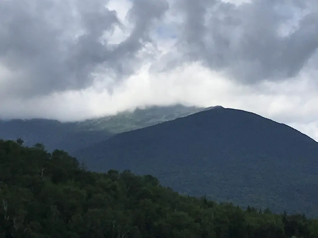
Mount Washington, lost in the clouds (it’s the peak you can’t see)
Both of the Trekkers visited New Hampshire several times throughout our childhoods and we always really enjoyed it. We were surprised to note that, on this trip, we both found the woods of southern Vermont to be more welcoming than the rugged forests of northern Vermont and New Hampshire/Maine. (The northern mountains reminded us of the Black Hills so they didn’t seem as much like a vacation. 😋) They also reminded us of other northern forests that we’ve been to, such as those in Michigan’s Upper Peninsula, those in Glacier National Park/northwestern Montana, those in the Big Horns, and those in northern Colorado (such as in State Forest State Park).
Looking for more amazing pictures of the New England mountains? Check out the Rusch to the Outdoors blog!
It got us to thinking about how much has happened in 10 years: we got married; we moved to South Dakota; there were new jobs for both of us; we bought a house…what will the next 10 years bring? Good things hopefully!
Have you ever been to these parts of New Hampshire or Vermont? Tell me about your experiences in the comments!
Did you enjoy this post? Pin it!
Like what you read here today? Please feel free to leave a comment, like or share this post! Add your email at the bottom of the page, or the sidebar to the right, to be notified when a new post is published. By signing up for the email list, you will also receive a free copy of the Tranquil Trekker’s Top 10 Tips of Trekking Do’s and Don’ts!
You can also follow the blog on social media by clicking the links below!
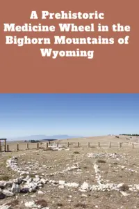
In this post, I discuss an ancient medicine wheel in the Bighorns!
**Author’s note: Just a word of warning, as this is a protect cultural, spiritual and historical area, no dogs are allowed on any trails (exceptions for Service Animals). They are only permitted in the parking lot.**
There is a prehistoric Medicine Wheel hidden in the northern, Bighorn mountains of eastern Wyoming. It was built by the ancient ancestors of today’s American Indian tribes. More than 80 tribes claim the wheel in their oral traditions so it can’t be attributed to any one group or culture, though it’s, obviously, a very sacred site.
What does the Bighorn Medicine Wheel look like?
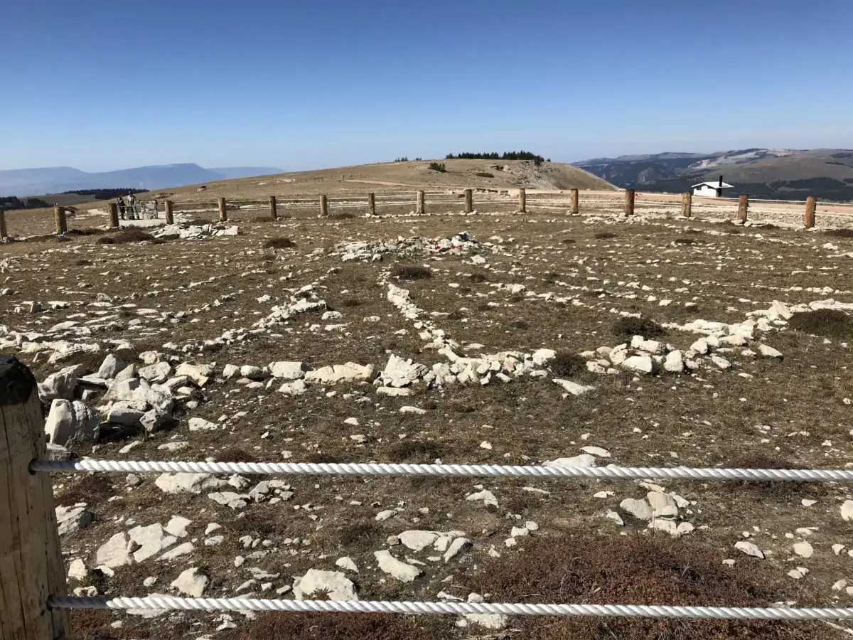
This is one of the largest, stone medicine wheels in North America (there are at least 150 spread throughout the continent). It’s constructed with a center cairn with spokes emanating from it to an outer circle that connects six, smaller cairns that appear to be strategically placed.
Archeologists aren’t sure of the wheel’s exact age, most estimates date it back at least 800 years, but it could be far older. Archaeological evidence shows human habitation as far back as 12,000 years in this area!
The ranger we spoke with stated the six rock cairns that dot the outer portion of the circle are believed to have a celestial purpose, but the exact function remains a mystery–it is thought that they may have been used during vision quests. The last time the six cairns matched up with celestial markers was at least as far back as the 1700s!
Medicine Wheels are Sacred Sites
Religious ceremonies are still held at the wheel on a regular basis as many tribal members make religious pilgrimages to the site. Some of the ceremonies involve large groups, while others include only a few individuals–two, small, private ceremonies occurred while we were there. Anyone with American Indian heritage can participate in a ceremony.
It’s always enthralling for me to observe religious practices that I’m not familiar with. I’m fascinated by the emotions you see play out on the faces of the participants, and how descriptive their movements can be. I find their actions evoke emotions within me as well. You can actually feel the peace and tranquility emanating from them as they dance, pray, or worship in their own way.
A tour of the wheel may be delayed if a ceremony is occurring, though they usually don’t last longer than 30 minutes, so please be patient and respectful during this time of worship. Numerous religious offerings are tied to the fence that rings the site (or are placed within the wheel itself). Please do not touch or photograph these items directly as they are sacred. It is also requested that people not take photos or videos of the ceremonies, as they are occurring, to respect the privacy of the participants.
Where is the Bighorn Medicine Wheel?
The wheel is located on Forest Road 12, off of US 14A, in the northern part of the Bighorns. It’s about 20 miles from Burgess Junction (where 14A branches off from US 14 to the east) and about 30 miles from Lovell, Wyoming, to the west.
The parking lot is a mile-and-a-half walk from the wheel on a graded, dirt road. The hike isn’t bad, though it is uphill both ways (seriously 😝) and the altitude is over 9,000 feet, so take your time. The site is also above tree line so bring a hat, water, and sunscreen, and be prepared for the ever-present, Wyoming wind. It usually takes an hour or so to complete the entire route. The site is free to visit, though donations are appreciated. Because this is a sacred site, pets are not permitted and must be left in the parking area.
The only thing that marred the experience was the large, FAA radar placed on the adjoining peak (because none of the numerous, other peaks in the surrounding area, that were a little farther away, wouldn’t have worked? REALLY?!) Federal Government, do better! 😤
The incredible view of the Bighorns from the Medicine Wheel site (to the right is the road you hike to reach the wheel)The Medicine Wheel (you can see one of the rock cairns in the foreground to the left)
The Backroads of Wyoming
I’ve suggested before, to always take the scenic route, when time permits. We enjoyed a good bit of that on this trip! We started by taking Route 24, west, from where it branches off near the Island Park campground. We then took Forest Road 408, to BLM Road 1117, on to Hyattville.
This route is listed in the gazetteer as being Hyattville Road, but we saw NO signs reflecting this. Similar to what we’ve found in Colorado, even though a road may be listed as a “major connector”, especially in the gazetteer, this could easily mean the road is actually dirt (sometimes wide and graded, other times little more than a narrow, two-track, high-clearance road that I wouldn’t be comfortable taking an Outback on). 😝
We used three separate maps–the gazetteer, a Bighorns map we picked up at a local, outdoor store, and a road atlas–to gather a–somewhat accurate–estimate of the roads’ actual conditions. Part of the difficulty was the roads traversed National Forest and BLM land in this area, and each department names and maintains their roads differently.
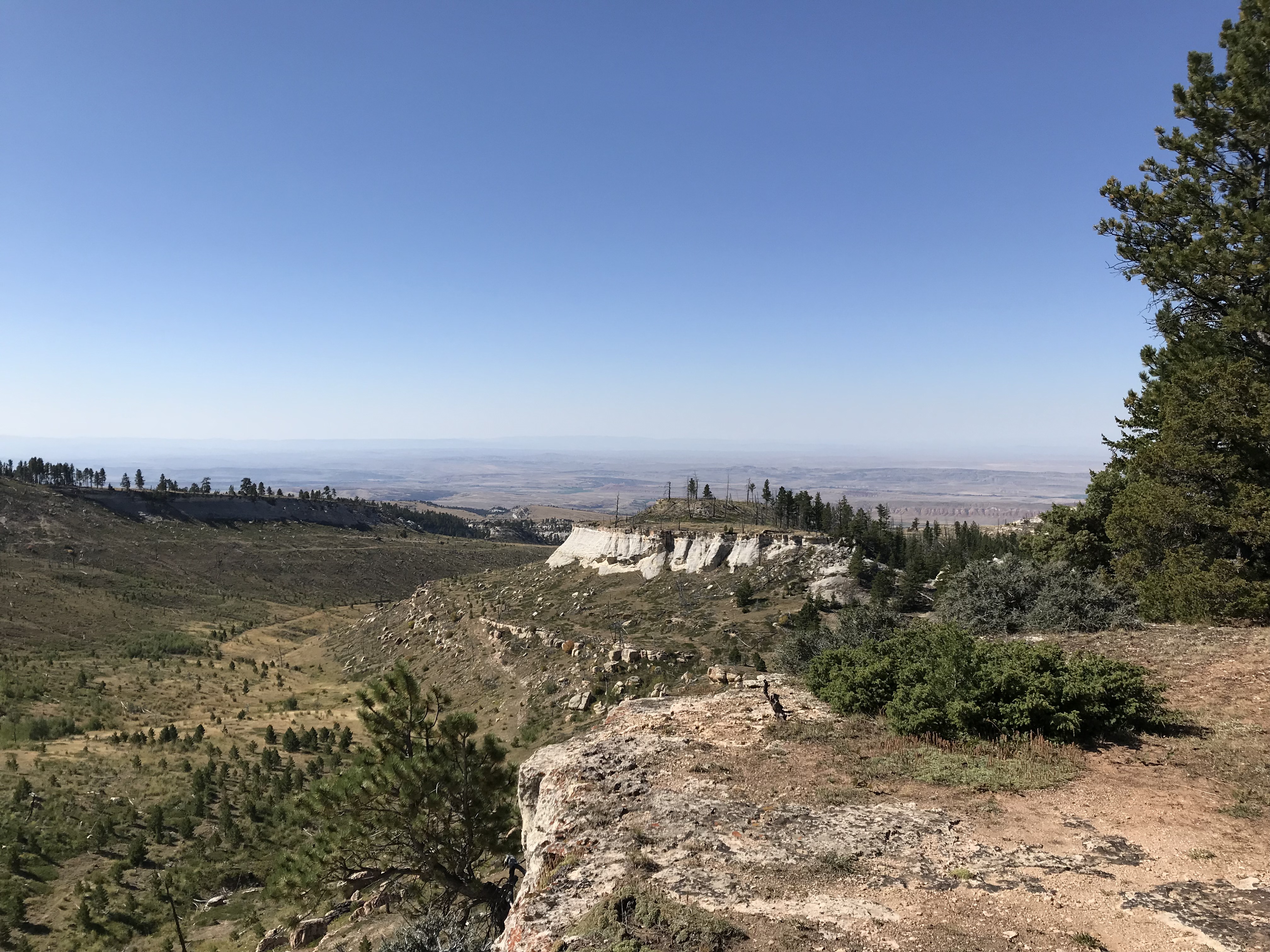
A view from our backroad trip
The drive was very manageable with Mr. Trekker’s Tacoma (any high-clearance, 4WD vehicle could handle it in good conditions). There were no steep drop-offs and no, real, technical obstacles like what we’ve encountered on some of the roads in Colorado. It was also beautiful, ranging from alpine, spruce forests and aspen groves, to dun-colored high prairies dotted with tan and red clay mounds, adorned with the varying greens of the diverse foliage. Rock-rimmed canyons with their gaping mouths open onto prairie grasses far below, while rocky cliffs of various colors traverse throughout, all with the imposing Bighorns as a backdrop.
Here is a video I made that showcases the beauty that is eastern Wyoming.
After leaving the Medicine Wheel, we decided we were game to try a few more back roads. We took another scenic trip, east, on US 14A to Burgess Junction, where we picked up US 14 and took it west. We took that road to Route 17, another “major connector”, that we then took to Alkali Road/BLM Road 1111/Route 228, back to Hyattville (this is a back way to reach the Medicine Wheel from the south).
Again, these road numbers and names were listed on the gazetteer and one of the maps–some of these roads didn’t even appear on the Atlas–but were NOT shown on the actual road. We just trusted the signs that directed us back to Hyattville. You always need to be flexible when taking back roads, as you never know what kind of obstacles or conditions may cross your path. I should also note, there was NO cell coverage in this remote location (and GPS can often be inaccurate), so maps are often times your only option–time to go “old school” folks!
Another road we could have driven was labeled in the Gazetteer as the “Red Gulch, Alkali National Back Country Byway”. We didn’t actually drive it this time–though we returned at a later date to check out the fossilized dinosaur footprintsit leads to! 😯
The Back Country Byway is more of a two-track, high-clearance path, at least in spots. I certainly wouldn’t call it a “main road”. Funnily enough, the roads we took back to Hyattville ended up being in better shape than the back road we brought out from the campground. They were graded, gravel roads that one could expect to travel 30 – 40 mph on (if the rancher in front of us hadn’t decided a slower speed was better. Unfortunately, on those roads, that are only about 1.5 lanes wide, passing really isn’t an option unless the person in front of you is feeling charitable and pulls over. This man didn’t. 😜) So, we enjoyed a leisurely, scenic stroll through the beautiful Wyoming countryside. 😁
After reaching Hyattville we took Route R54 (another graded, well-maintained, gravel road) to Ten Sleep and then got to enjoy the, INCREDIBLY beautiful, US 16 east through Ten Sleep Canyon, back to our campground. (Did I mention, almost all of these roads, despite their varying conditions–with the exception of the highways–had the EXACT SAME indicators on the map? 😜)
The topography of Wyoming is very unique. It’s characterized by the towering Bighorns in the northeast, to the Grand Tetons that criss-cross Yellowstone and the Rockies, in the west. A drier, large, bluff-filled basin sits between Yellowstone and the Bighorns.
Some parts of the state are prettier than others–while the dry, scrubland that surrounds the mountains can be pretty and green in spring, it usually turns rather drab in the later months. The basin area is dotted with oil fields and sketchy-looking, government sites with warning signs plastered on the fences, which can be rather intimidating. 😳
Below are some more pics of our scenic drive:
MOOSE in the Bighorn Mountains!
Earlier that summer, we spent ten days in the Colorado high country during peak season and we didn’t see one moose. Later that fall, we spent ten seconds in the Bighorn mountains of Wyoming (literally), and TWO moose were waiting to greet us when we arrived at our campsite! Bighorns for the win!
Our ungulate friends (this year it was Maggie and Megan)
As I’ve mentioned previously, I’m always surprised at how much this part of Wyoming reminds me of the Colorado mountains. The scenery and critters are very similar, with the added benefit of being half as long a distance from the Black Hills and FAR less crowded than Colorado. 😉
If you’re looking for an amazing, historical site to visit in the Bighorn Mountains of Wyoming, check out the Bighorn Medicine Wheel!
Have you ever visited the prehistoric Medicine Wheel in the Bighorns? Tell me about it in the comments!
Did you enjoy reading this post? Pin it!
Like what you read here today? Please feel free to leave a comment, like or share this post! Add your email at the bottom of the page, or the sidebar to the right, to be notified when a new post is published. By signing up for the email list, you will also receive a free copy of the Tranquil Trekker’s Top 10 Tips of Trekking Do’s and Don’ts!
You can also follow the blog on social media by clicking the links below!
I review several ghost towns we toured around the Colorado High Country as well as our drive up Independence Pass.
The Trekkers LOVE visiting ghost towns! We try to include them whenever possible on our trips. During our 2018 road trip, we got to check out several awesome ghost towns in Colorado.
Ghost towns give you a true, visual understanding of how people lived “back in the day”. I’m a very visual person so this helps me fully appreciate what the lives of the inhabitants of these towns must have been like. I prefer the towns that are restored, with at least several buildings remaining that you can view. Sometimes, however, the places that are comprised mostly of ruins allow you to use your own imagination of how they must have appeared in their heyday.
Click here for a list of ALL the ghost towns the Trekker’s have visited around the country!
Below is a list of seven ghost towns we visited in central and western Colorado…
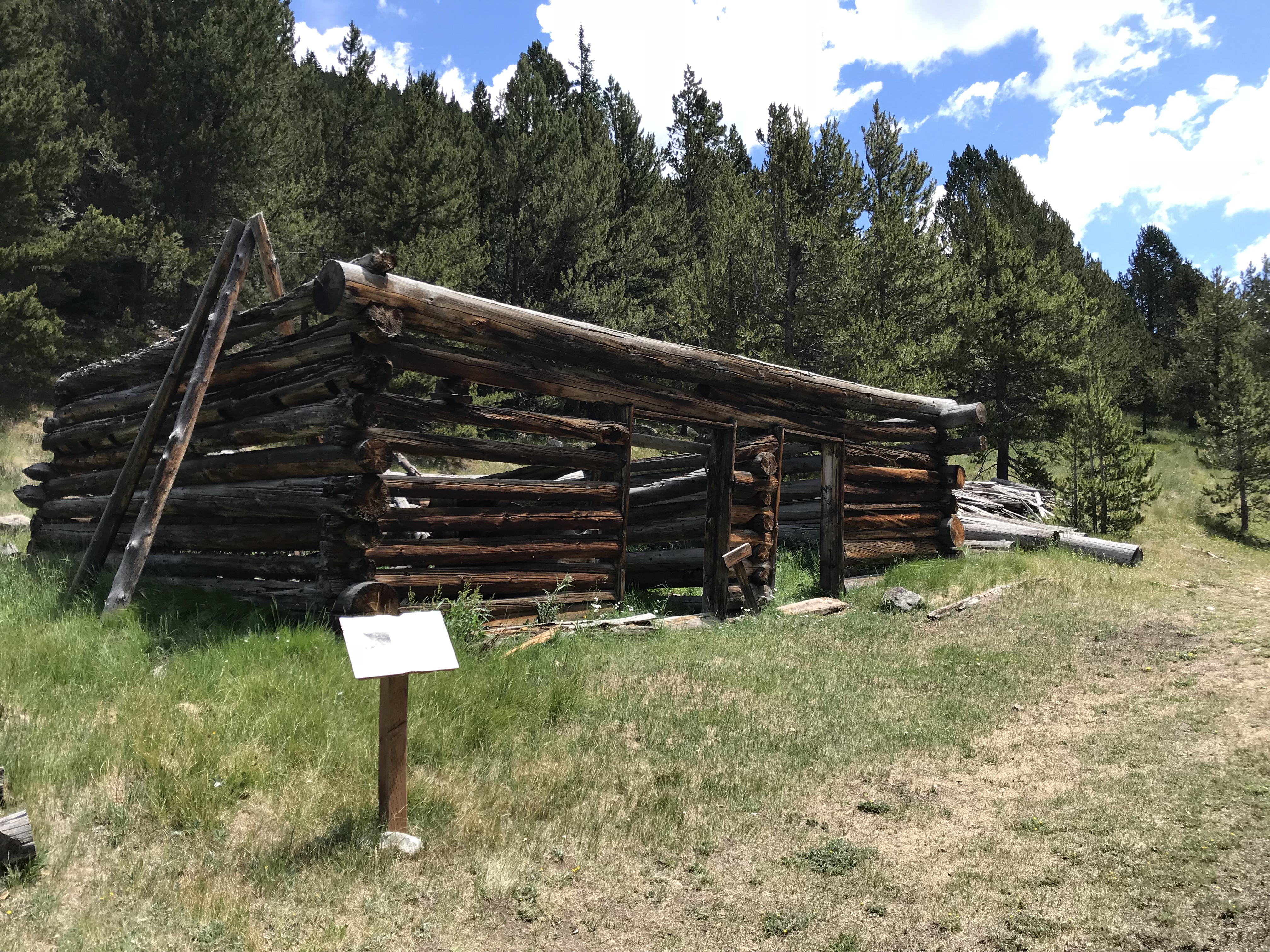
Teller City Ghost Town:
This was the first ghost town we visited and the one that required the most effort to access. The townsite is near State Forest State Park, in far northern Colorado, around nine miles south of Gould, on Route 740 (Baker Pass Road). You reach it by driving on a, somewhat rough, 4WD shelf road. (TheGuide to Colorado Backroads† book that I mentioned in a previous post, rates this road as “easy”. I would rate it as “moderate”. A high clearance, 4WD vehicle should be all you’d need to access this site in good conditions).
We didn’t actually complete the 4×4 road all the way to Baker Pass, though we spoke with a local who said it was worth the drive. Alas, daylight was waning (and the mosquitoes were starting to bite!) 😝
The way was fairly well-marked and obvious, but be watchful. The road branched off several times and the correct route was only marked with orange, snowmobile trail markers (this is a snowmachine trail in the winter months).
One plus with this site is that there’s a designated parking area and then you hike a Nature Trail loop to view the remains of the town. Not much is left, but you could almost hear the voices of the patrons visiting the busy shops, and smell the dust kicked up by the wagons as they rolled along–what used to be–a bustling Main Street.
At various places along the trail, markers describe the history of that home or business. At one of the stops, the words of a young girl who came into town one winter night, via the pass, were noted. Her description of the twinkling town lights flickering through the evening shadows was incredible.
Below are a few more pics of the ruins at Teller City (as usual, thanks to Mr. Trekker for several of these):
An old well pit
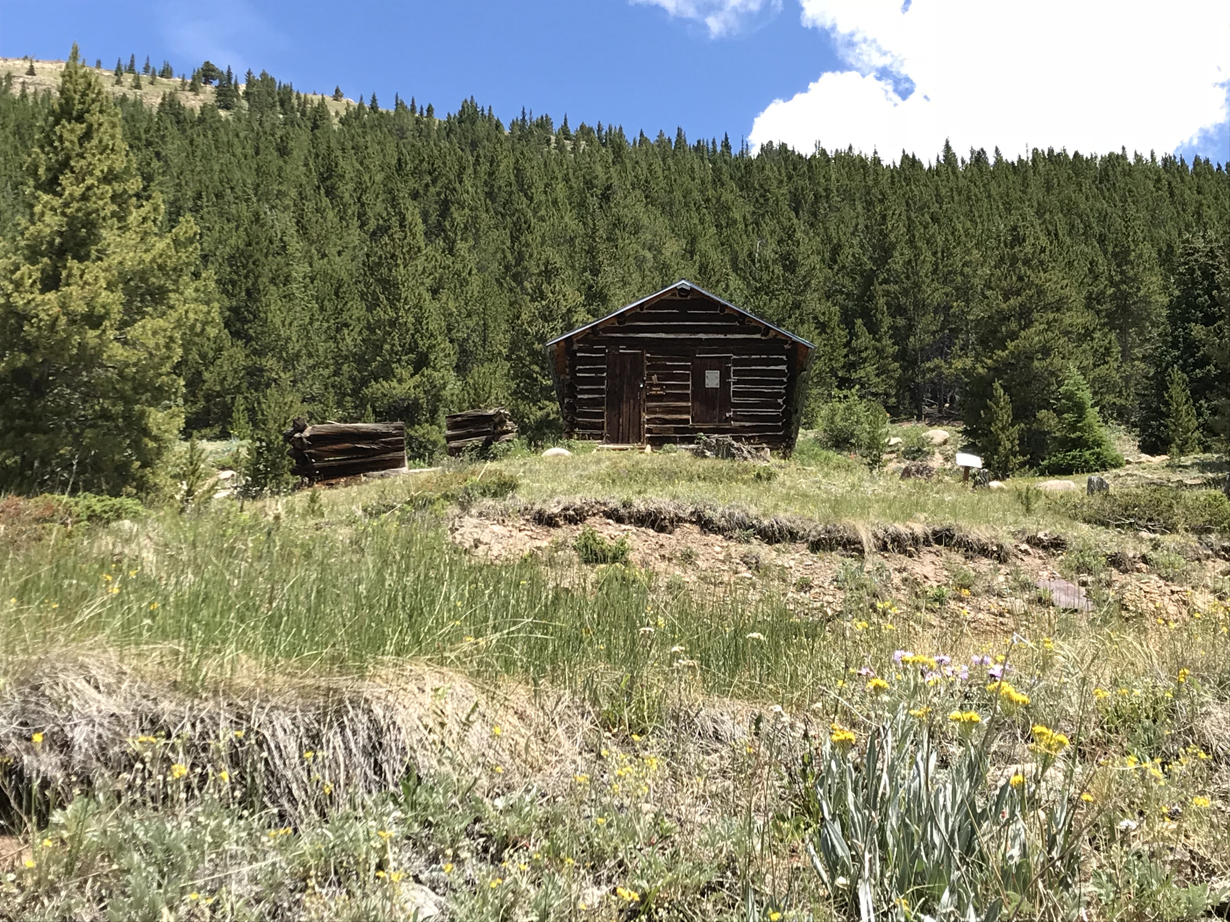
Coalmont, Colorado:
After leaving State Forest State Park, we visited Coalmont on our way to the Flattop Wilderness area. Only the schoolhouse remains of this dusty hamlet, but from what we could see through the grime-spattered window, it appears to have been restored inside. It would have been neat to be able to view it in more detail!
The townsite is located off of Route 14, southwest of Walden, Colorado and can be reached via either Route 24 or Route 26 (they form a half-moon-shaped loop here). The site is directly off of Route 26.
Remains of an old ranch at Grand Mesa National Forest:
This site is located on top of the mesa, off the Land’s End Road. It is the remains of a ranch that operated in this area long ago. Several cabins, one of which you can walk inside, and an old livestock corral, have been restored. They can be viewed on a Nature Trail loop (it is part of a cross-country ski trail in the snowy months).
The old corral
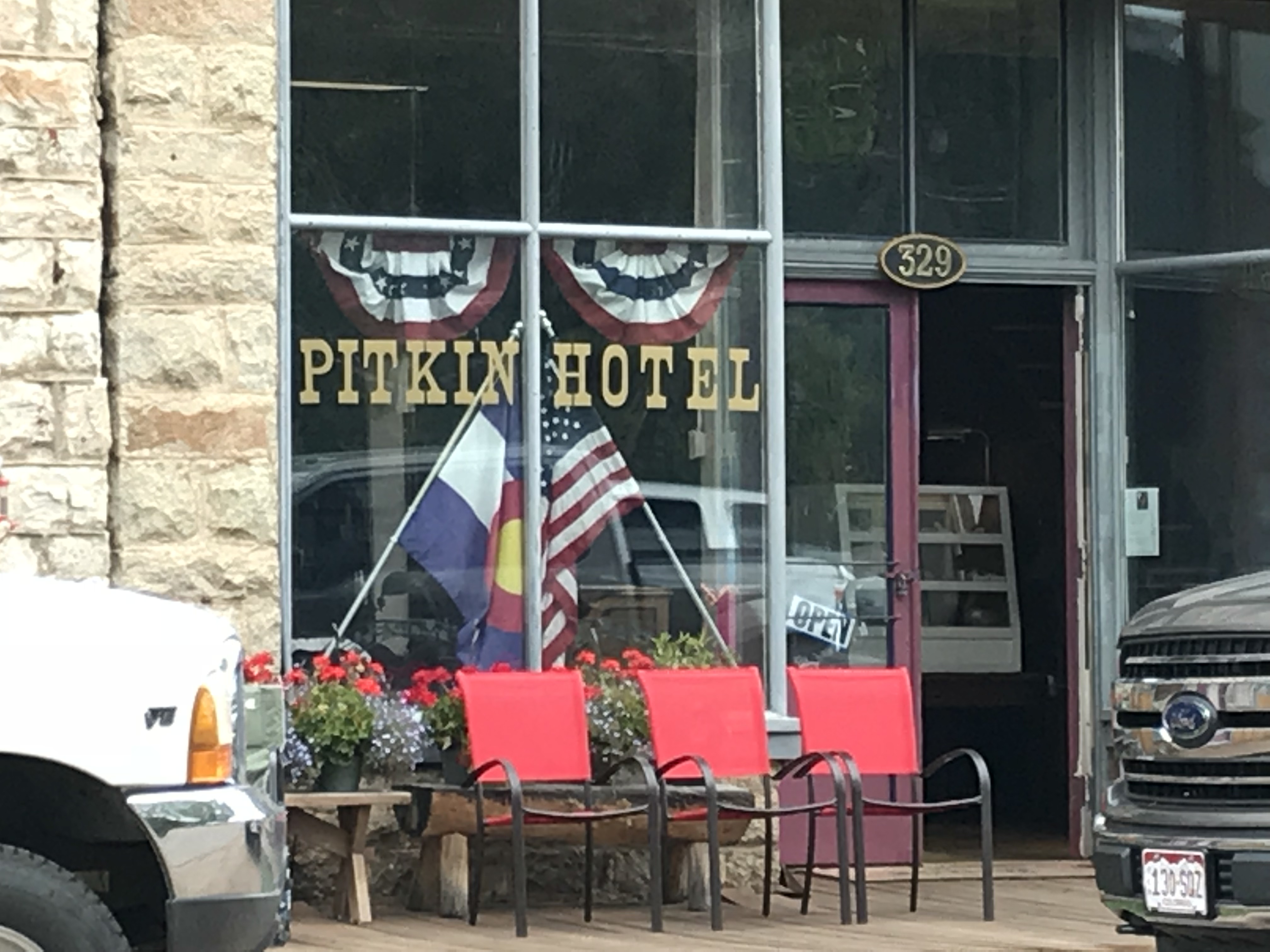
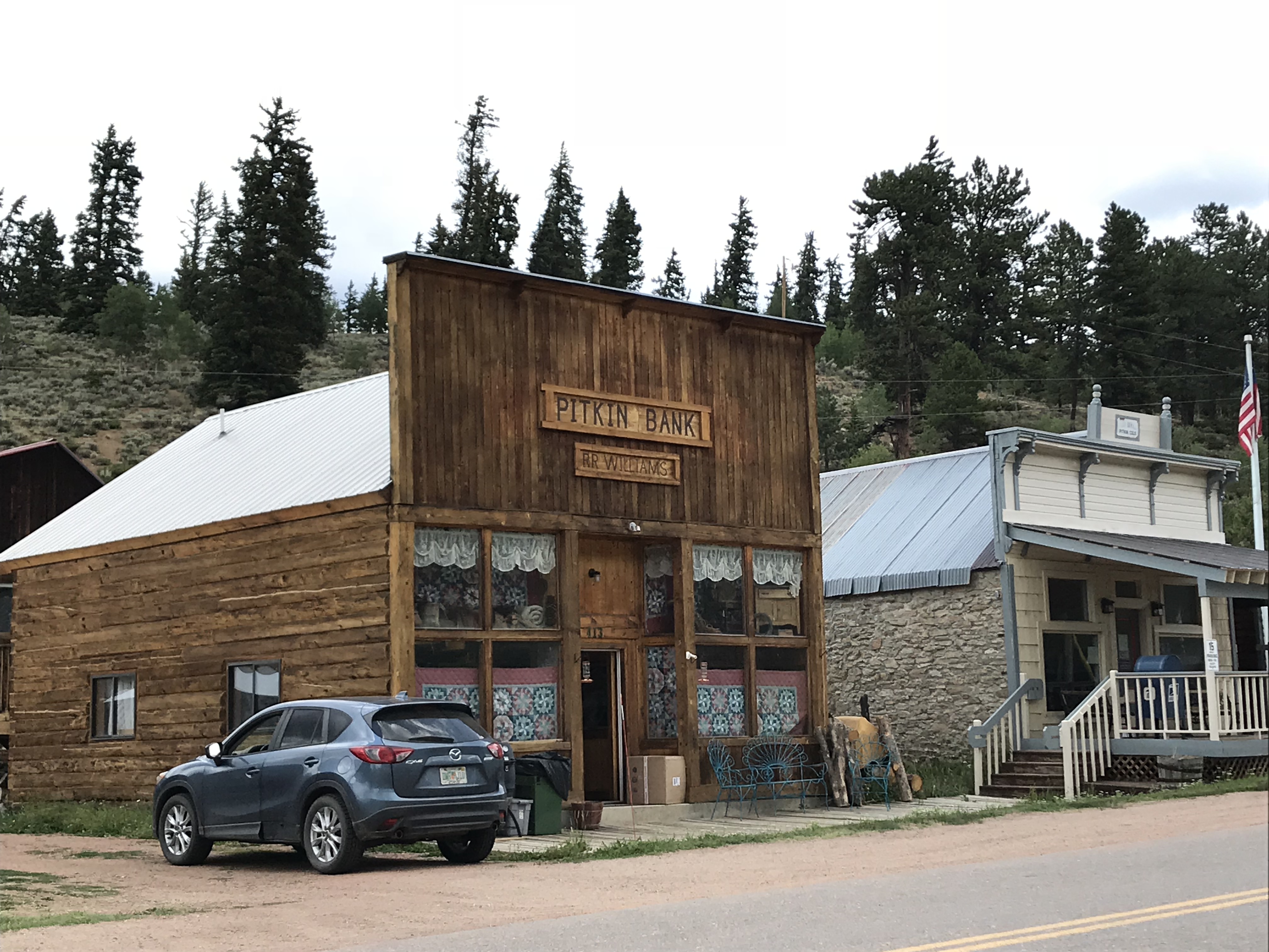
Pitkin Ghost Town:
This “living” ghost town is located about 27 miles east of Gunnison Colorado. Take US 50, east, from Gunnison, then turn left onto Route 76 in Parlin.
As an aside, we enjoyed several good meals in Gunnison. We had a wonderful breakfast at the W. Café, and, I can attest that the High Alpine Brewing Company makes great pizza!
At about the halfway point on Route 76, you will pass the “living” ghost town of Ohio City. (I call them “living” because some hearty souls are still living in both of these locations!)
The rain was falling fairly heavily as we passed through Ohio City, so we chose not to stop, but Pitkin should definitely be on your list of places to visit! It was one of the more “real-feel” ghost towns we toured as it wasn’t crowded with visitors, and enough of the old buildings have been restored that you felt as though you were actually walking down the town’s Main Street.
The Silver Plume General Store, located on the east side of town at the corner of 9th and State Streets, is a great place to stop for lunch. We certainly enjoyed our burgers from the outdoor grille! Note: Pitkin is the last chance at civilization if you’re venturing onward to Tincup, Cottonwood Pass, the Alpine Tunnel, or St. Elmo ghost town via Tincup Pass.
We didn’t make it to Tincup on this trip, being that Cottonwood Pass was closed for paving. We are hoping to, one day, try the Tincup Pass between Tincup and St. Elmo and hike to the Alpine Tunnel. Another journey for another time, I don’t worry that we’ll be back in Colorado soon! 😁
Below is a short video I took of the hummingbirds near the Pitkin Hotel. I’ve always liked hummingbirds, but I’ve never heard them make this noise outside of Colorado…
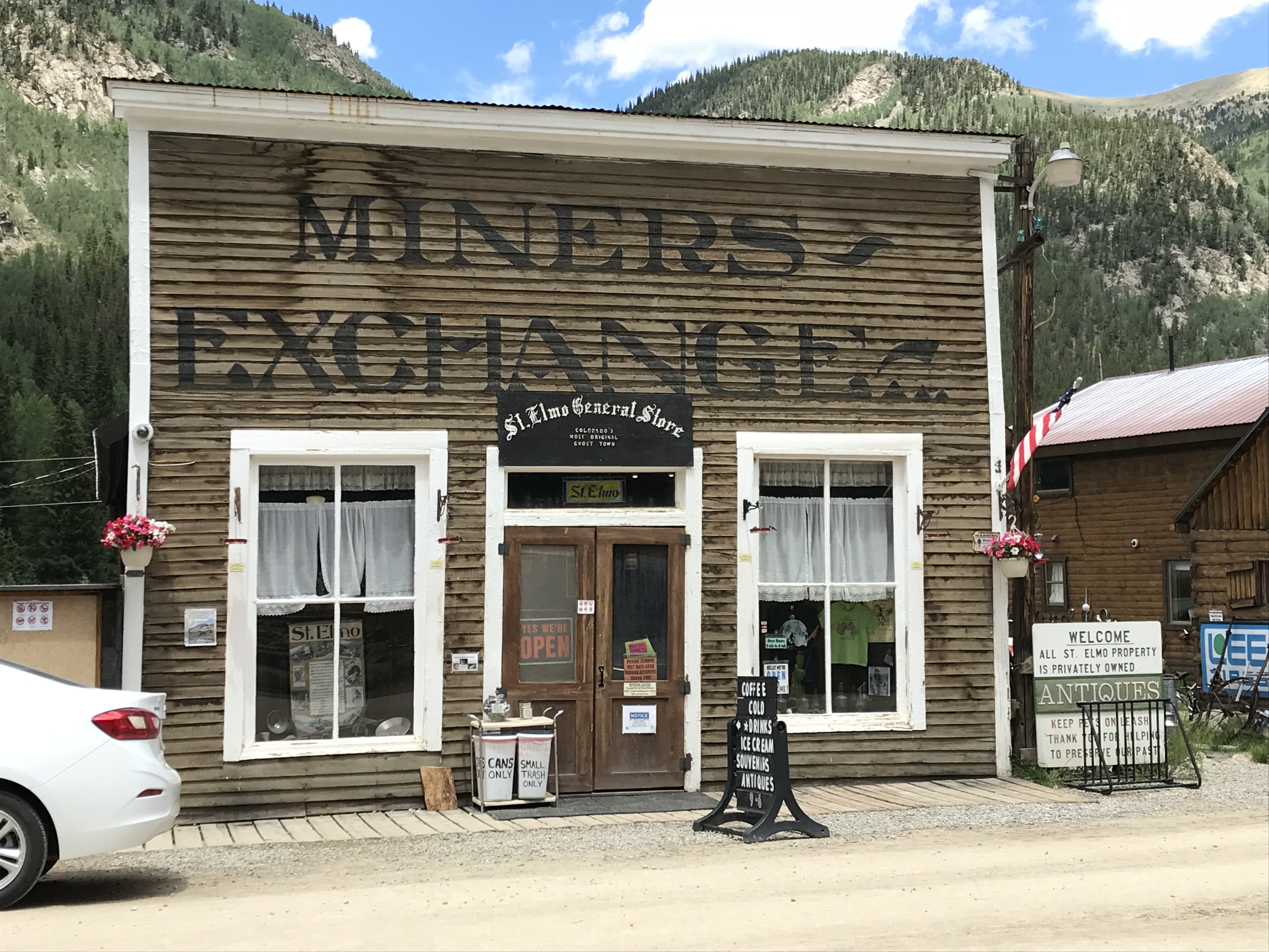
St. Elmo Ghost Town:
Everyone we talked to (and all the guide books we read) told us we HAD to visit St. Elmo, and it was, definitely, worth the visit!
The only disappointment I had with this site is that vehicles are allowed to park in the town itself. Its spirit seems to be somewhat ruined when there’s a modern Audi parked in front of Town Hall. 😝 Also, they were restoring several buildings while we were there—which I’m sure is necessary and will be wonderful when it’s completed—but it meant that construction equipment was parked along Main Street. *sigh* Guess we’ll have to visit another time! 😉
As I mentioned previously, if you’re daring, you can reach St. Elmo via Tincup Pass. If you’re looking for a tamer route, you can do what we did and take the long way. For this trek take Route 50 east of Gunnison through Monarch Pass (another great view) and turn north onto US 285 at Poncha Springs. Then take Route 162 west–an out-and-back road (for the less daring among us)–toward the Mt. Princeton Hot Springs resort and on to St. Elmo.
Near this area, there’s also a turnoff for Hagerman Pass Road to the site of another ghost town, Hancock. From there, you can hike to the Alpine Tunnel from the east, though it sounded as though the hike is longer and the view isn’t quite as good as hiking from the west side–we chose not to complete the hike at this time due to time constraints and the monsoon-fueled thunderheads that were threatening.
As I stated previously, since we missed a few ghostly spots this time around, we’ll be putting this area on our “must-visit” list for the future. It’s always a shame when you visit a location and find out you HAVE to come back to explore further (that happens to us regularly on trips, especially in Colorado…have I mentioned that I enjoy vacationing in this state? 😉)
Much to the Tranquil Trekker’s dismay (we DON’T feed wildlife) one unique feature of St. Elmo is that visitors are encouraged to feed the WAY-overly-friendly and almost-aggressive local chipmunks. You can buy food for them at the General Store. 😝
The Cascades Waterfall near Buena Vista, Colorado:
After leaving Saint Elmo, on our way east, back to US 285, we stopped at The Cascades. This is a lovely waterfall that’s just off the side of the road. It’s a beautiful, peaceful location where you can walk right up to the base of the river that creates a picturesque waterfall in this area as it cascades across boulders–hence the name. 😉
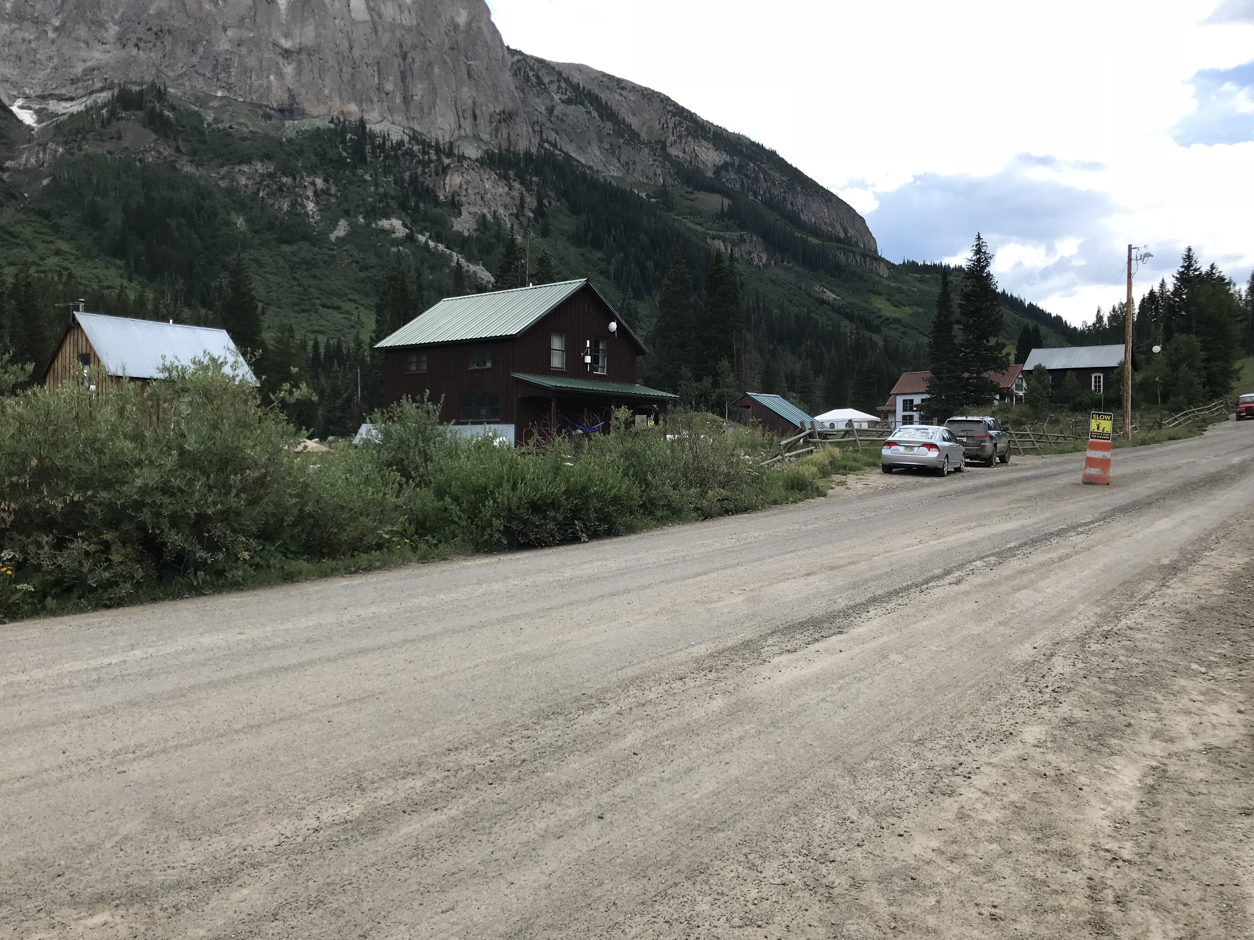
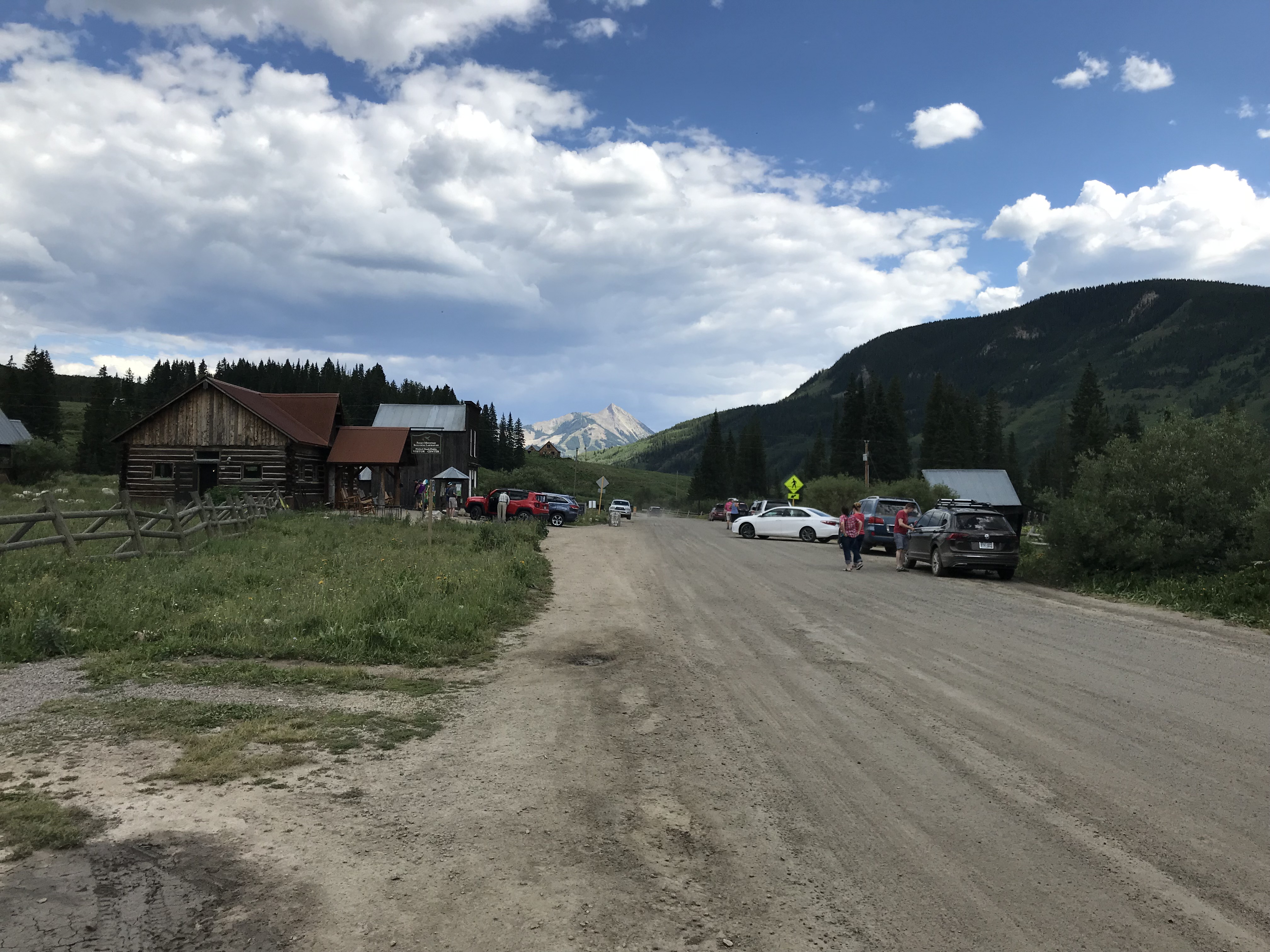
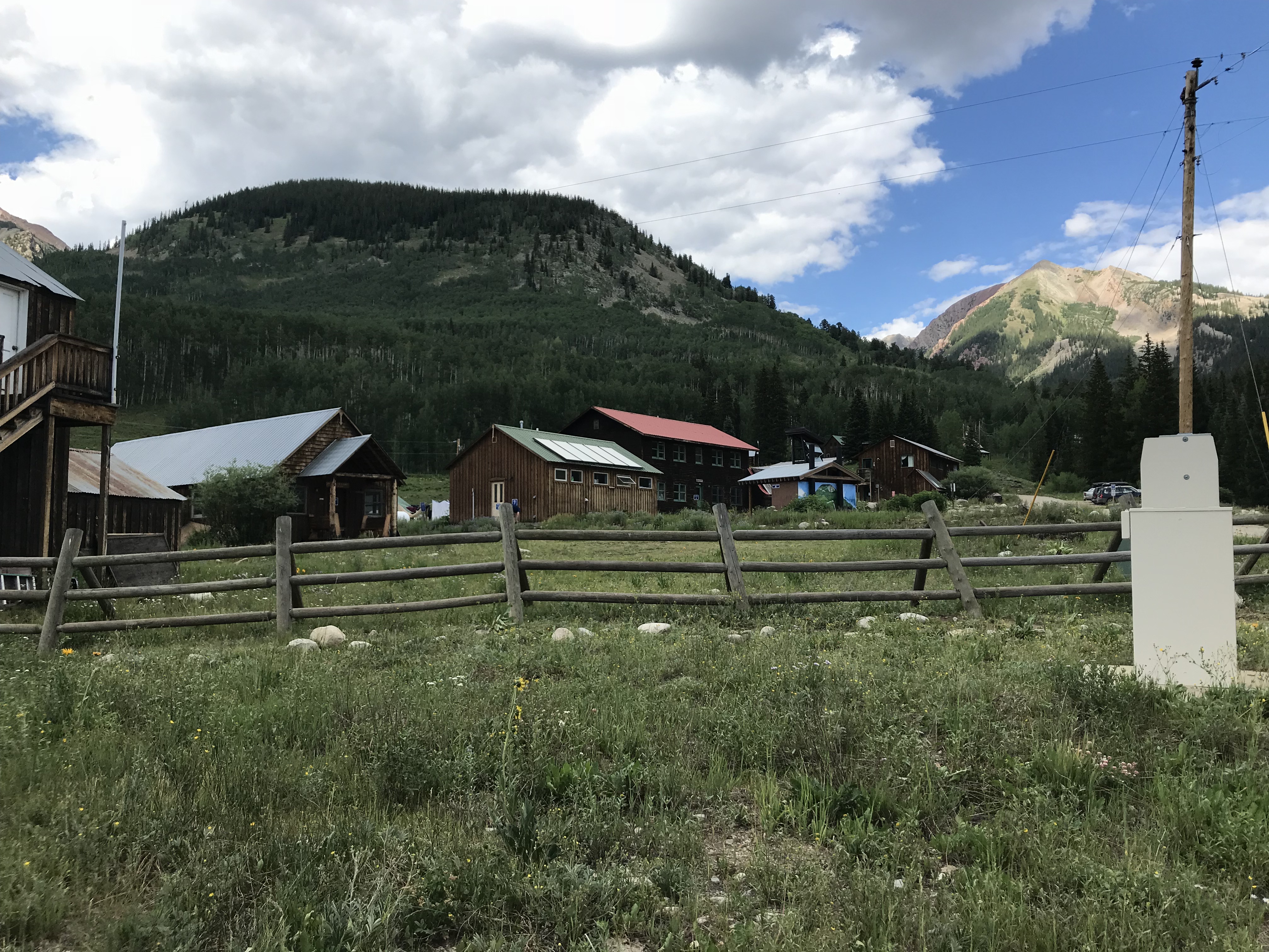
Gothic Ghost Town, Crested Butte, Colorado:
I was a bit disappointed by this town. The Rocky Mountain Biological Laboratory bought the town and did an exceptional job of restoring many of the old buildings which the lab uses for its work. This we knew going in… what I hadn’t realized is that the lab has taken over almost the entirety of the townsite. As it’s now, mostly, all private property, it’s almost impossible to tour around and browse the various buildings. 😒
I’m glad the town is being used for something, and I’m thankful to the lab for helping to save its structures, I just wish the historical features were easier to access. And a note to the general store in town: you close by four? In the middle of summer?? On a Saturday??? REALLY?! Afternoons are a good time for people to eat ice cream you know! 😝😳😉
Signs regarding the lab dotted the entire town 😕
You can reach Gothic by taking Gothic Road, Route 317, north of Crested Butte and the ski village. You can’t miss it, this is, literally, the only main road going north of town! 😉 This will also lead you to Schofield Pass that I discussed in this post.
Main Street in Gothic
The General Store with its questionable hours of operation 😝
Independence Ghost Town and Independence Pass:
Independence ghost town is located on Independence Pass (Route 82), around 16 miles east of Aspen, and around 21 miles west of Twin Lakes.
It’s just east of the peak of the Pass itself, and is, actually, easy to miss. It’s below the grade of the road and the two parking pullouts are small and not well-marked. There are, blue, “Places of Interest” signs, but you have to be watching for them. We actually saw the ruins of the mill, on the other side of the road, first.
The townsite is located in a valley, along the Roaring Fork River, framed by the towering Sawatch Range on both sides.
Independence Ghost Town:
This was my favorite ghost town of the entire trip! It’s easy to access as the site is located directly on Independence Pass. You actually park at a pullout on the Pass road and then hike out to the site, so no vehicles marred the view.
The walk into the town site is about one-mile in each direction, on an old, two-track, dirt road. (The hike is pretty easy as there is almost no elevation gain. Beware though, the town site still sits at about 10,000 feet in elevation.) You can see the town from quite a ways off, which helps you to imagine what it must have felt like riding a horse or wagon along that route during the height of the town’s life.
This would have been an incredibly beautiful place to live! (Had it not been so isolated and suffered such extreme weather.)
Colorado is one of my favorite places to visit. Click here for more posts on this awesome state!
The old mill in Independence, Colorado. (This is the first building we saw to clue us in that we were “there”.)
I don’t imagine this view was much different when the town was thriving
Independence Pass:
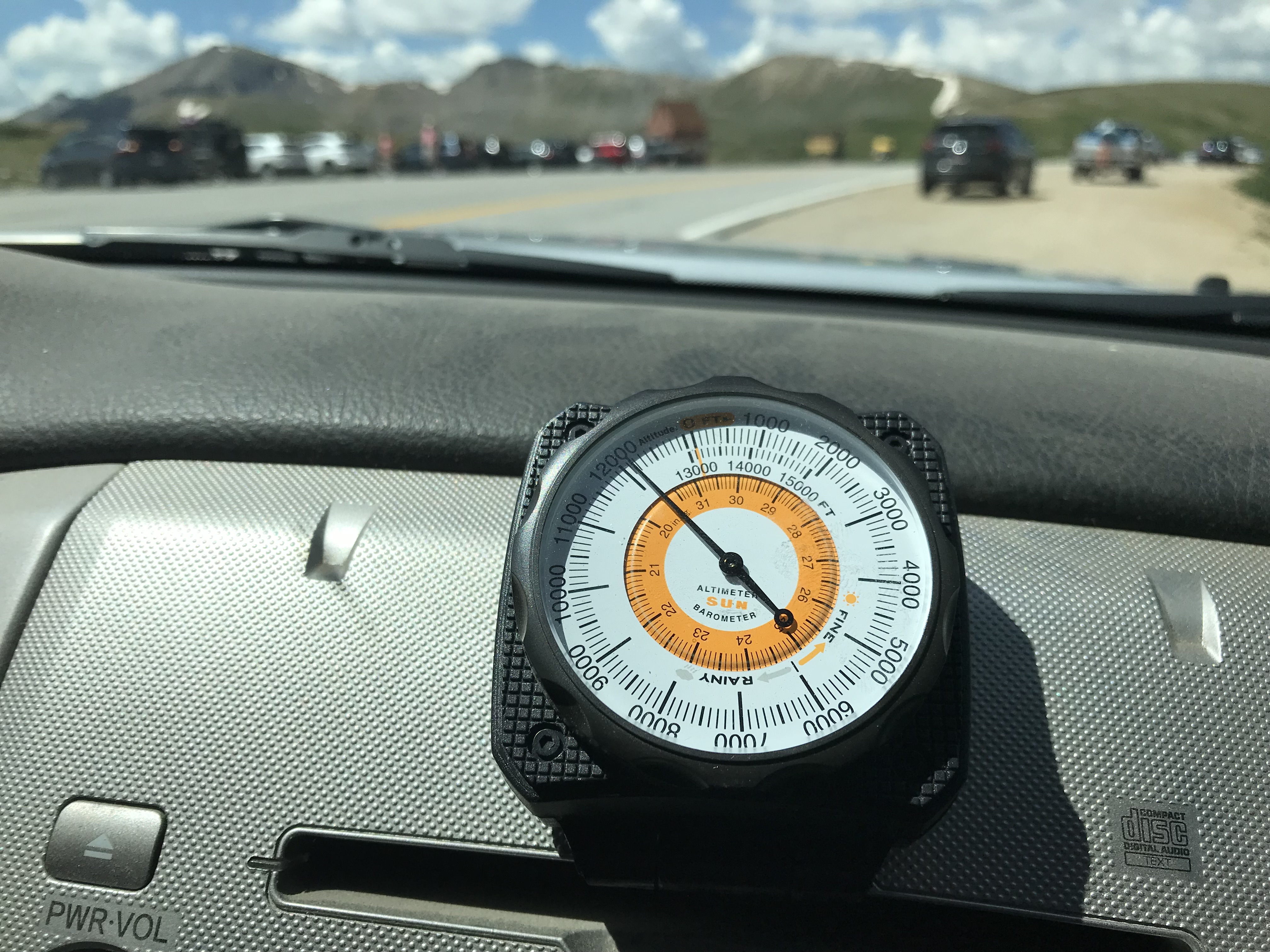
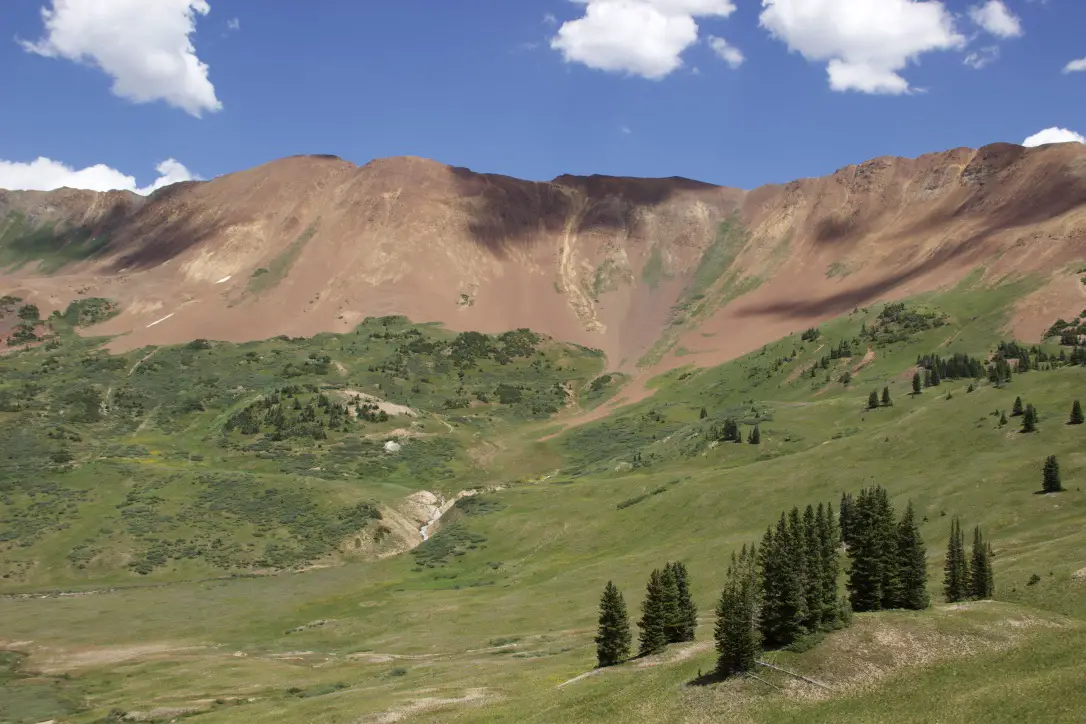
Independence Pass was incredibly beautiful, as well. This one has been on my Colorado Bucket List for some time and it did not disappoint! (It was also the highest altitude we reached on this trip, maxing out at, just over, 12,000 feet!) The scenic overlook and hiking area at the top of the Pass offer, almost, 360-degree views of the Continental Divide, which the Pass spans.
We finally topped 12,000 feet!
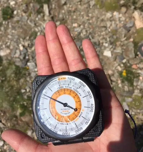
You may have noticed I’ve been enjoying using a Sun Company altimeter† in many of these posts. It responds to changes in barometric pressure caused by weather as well as air pressure at-elevation, so you may have to recalibrate it a little each day to maintain the most accurate readings. But, for amateur interest, it’s a fun, portable, way to keep track of changes in altitude–it connects to the vehicle using velcro so it can be easily removed and taken on a hike if you’re so inclined.
I made another videoof our drive up Independence Pass. I think my videographer skills got a “little” better with this one! 🤔
If you’re looking for something fun to do this summer, definitely check out the ghost towns of the Colorado High Country!
Have you visited any of these amazing places? Tell me about it in the comments!
Did you enjoy this post? Pin it!
†As an Amazon Associate I earn from qualifying purchases
Like what you read here today? Please feel free to leave a comment, like or share this post! Add your email at the bottom of the page, or the sidebar to the right, to be notified when a new post is published. By signing up for the email list, you will also receive a free copy of the Tranquil Trekker’s Top 10 Tips of Trekking Do’s and Don’ts!
You can also follow the blog on social media by clicking the links below!
This post outlines our adventures on several Colorado backroads, including some at State Forest State Park and around the Crested Butte area.
On our 2018 road trip in the Colorado High Country, we really wanted to improve our 4×4 driving (and navigation) skills. Fortunately, there are a number of backroads in Colorado that are perfect for this!
One series of books we found to be incredibly helpful isA Guide to Colorado Backroads†. It’s actually a series of books covering the northern, central, and southern regions of the state. These provide helpful information on the roads and trails including their difficulty level, equipment needed to successfully complete them, and details on each of the routes’ conditions.
Below is a listing of the new roads we enjoyed:
Montgomery Pass Road, State Forest State Park
The first road we mastered, the Montgomery Pass Road at State Forest State Park, ended up being the most technical route we attempted on the entire trip. This out-and-back trek is listed as “moderate” in the guidebook. It was fun, though, definitely, challenging. A high clearance, 4WD vehicle is required and skid plates are an added benefit–we were VERY glad for them as we scraped across one particular rock. Several spots even required me to exit the vehicle and play “spotter” for Mr. Trekker to assist him in navigating the obstacles…it was fun! 😁 The road was wide, with room to pass in most spots, and mostly traversed the forest, so, it lacked the stomach-churning shelf roads we experienced on much of the rest of the trip.
The road ends before it reaches the top of Montgomery Pass, and the final half-mile or so must be completed on foot. It’s an easy hike (minus the altitude) as the trail is an abandoned forest road. It was windy at over 11,000 feet, but the incredible views of the Never Summer Mountains and the promise of the 360-degree vista at the top provide motivation despite beleaguered lungs.
Made it to the top of Montgomery Pass!
The wildflowers had begun to carpet the surrounding meadows while snow still blanketed portions of the nearby peaks (in early July!) Another quality of this wilderness area is that we felt like we had the entire mountain to ourselves on a Monday morning, seeing only two other groups for the duration of the excursion. You can also hike the entire way to the peak from the other side of the mountain. The trailhead is found off Route 14 on the eastern edge of the park.
The view from the summit
Bockman Road, State Forest State Park
We supplemented the adventure above with a side trip down Bockman Road which intersects the Montgomery Pass Road farther down the mountain. This road was easy, I think my CRV may have been able to handle it if you were careful on a few of the bumpy sections. It was dirt, but wide enough for two vehicles and mostly graded. It made for a fun, relaxing afternoon as a bubbling creek accompanied us for much of the trip, as well as countless more wildflowers (have I mentioned the wildflowers are beautiful in Colorado this time of year?) 😉
Gothic Road near Crested Butte
Probably the most nerve-wracking drive we completed was Gothic Road, from Gothic ghost town to Schofield Pass–I discuss Gothic in this post.
The road is in good condition–a sedan could probably negotiate it. The problem we ran into was that it is a 1 1/2-lane shelf road with a significant drop-off at one side and no barrier–a frequent condition we encountered on Colorado back roads.
When we were there it was also INCREDIBLY busy; filled with 2-way traffic in addition to hikers and mountain bikers. Part of the trouble was that we were there on a weekend in July (our fault, it was just the way the trip itinerary worked out). But the horde of visitors combined with people who are unaccustomed to driving in those white-knuckle conditions made for what felt like a genuinely unsafe situation from time to time.
From the top of the pass, a dangerous 4×4 road continues on through the acclaimed “Devil’s Punchbowl” to Crystal Mill–one of the worst 4×4 accidents in Colorado history occurred on this road. We chose NOT to take that route, 😝 but check out this post for the 4×4 adventure we had on Forest Road 314 from Marble to Crystal Mill!
Schofield Pass and Slate River Road
Once we reached Schofield Pass, we completed the loop via Slate River Road (Forest Road 734) through Paradise Divide. This section was not only FAR quieter and more relaxing, but it was also one of the most scenic drives I’ve ever been on (it made the other half of the loop worth the gray hairs). 😉
Paradise Divide
Showcasing towering mountains donning green meadows, grass-covered avalanche chutes, and streaming rivers fueled by snowmelt, this drive is incredible!We were fortunate enough to grab one of the last remaining dispersed campsites in this area that was nestled right next to a small canyon. We fell asleep listening to the water coursing through it that night!
Waterfall along Paradise DivideOur campsite
Below is a video I took of the Divide. Be patient with me, my videographer experience is minimal, the road was bumpy, and this was taken on an iPhone. But…this valley was so INCREDIBLY beautiful, I had to share this with you! You can see why they gave it the name they did! 😎
The drive from Rifle to Grand Mesa Colorado
Even when not looking for a 4×4 adventure, we learned that travel on Colorado back roads can be an interesting experience. We drove the back route from Rifle to Grand Mesa National Forest, taking Dry Hollow Road from Silt. Then we continued, via Route 270, into Colbran and then took Route 121 to enter Grand Mesa the back way.
The drive was lovely! The eclectic scenery transitioned from desert-like scrubland in the Rifle area to aspen forest in the higher elevations, then to rolling farmland in the valleys (that reminded us of Pennsylvania) before ending in the spruce forests that comprise the Grand Mesa area.
Colorado is one of my favorite places to visit. Click here for more posts on this awesome state!
I mentioned earlier that the gazetteer didn’t always differentiate road surfaces well. We found the regular road atlas (and the 4×4 book mentioned above) gave far better indications of what to expect for the actual conditions of the roads…
…In this situation, these routes were indicated to be “major connectors” (and I’m sure they were for that, extremely rural, area). However, this indication included roads that varied from paved and painted to those that are dirt/gravel, with some being extremely rough due to a washboard surface. They were, often, also, narrow and winding (where two, full-size vehicles may struggle to pass). Many also hugged the sides of cliffs on shelf roads. They offered incredible views but may be alarming to people who aren’t accustomed to those conditions.
We had a great time, but I note this so people are aware these conditions can make travel more difficult and may require you to budget additional time to complete the drive.
Viewpoint on the road to Grand Mesa from Silt
These portions of our trip were thrilling, nerve-wracking, and challenging. However you manage to do it, whether it be machine-powered by a 4×4 vehicle or using your own two feet, I’d encourage you to venture out onto these lesser-traveled routes (as you are comfortable, of course). You’ll see sites and experience adventures that the average person misses on the more well-traveled highways. It will give you a whole different appreciation for the nature that surrounds us.
Have you ever tried out any of these Colorado backroads? Tell me about your experience in the comments!
Did you enjoy this post? Pin it!
†As an Amazon Associate I earn from qualifying purchases
Like what you read here today? Please feel free to leave a comment, like or share this post! Add your email at the bottom of the page, or the sidebar to the right, to be notified when a new post is published. By signing up for the email list, you will also receive a free copy of the Tranquil Trekker’s Top 10 Tips of Trekking Do’s and Don’ts!
You can also follow the blog on social media by clicking the links below!
The Big Horn National Forest, in Wyoming, is a wonderful place to enjoy some secluded time in the woods.
The Trekkers LOVE to visit the Bighorn Mountains, in northeastern Wyoming. Each time we go to this area I re-discover my love for them all over again! I enjoy that mountain range almost as much as the Rockies. This is probably because they are very similar with a few wonderful exceptions: there are fewer people in the Bighorns and the Wyoming wilderness is only a few hours from the Black Hills–rather than the 6 to 8-hour drive to the Rockies. Traffic is much better too! 😉
The weather in this area (during the warmer months, at least) is usually comprised of blue skies, warm temps, and clear, crisp evenings. Conditions can change fast though! The Trekkers have a tradition of camping in the Bighorns over Labor Day Weekend and it isn’t unusual for this area to receive its first significant snowstorm of the year a scant week or so later.
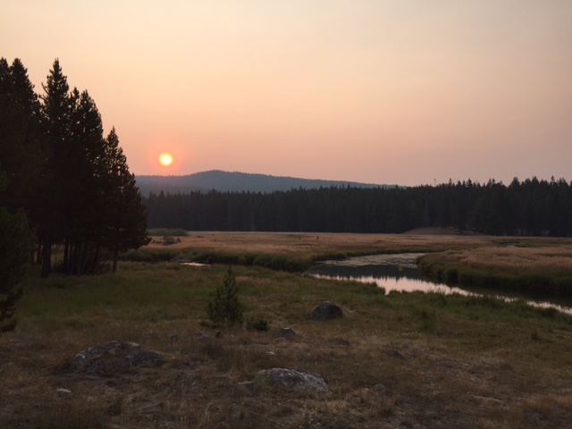
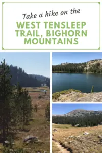
On this particular visit, we came to hike the West Ten Sleep trail to Mirror Lake. The only downside for this trip was lingering smoke from wildfires in Montana. When we arrived in Buffalo, Wyoming, on Friday evening, you could barely make out the mountains through the smoky haze.
If you’ve never been there, Buffalo is basically nestled into the eastern base of the Bighorns, similar to how Rapid City is nestled into the eastern base of the Black Hills. If you’ve never been to either locale, well, let’s just say you normally can’t miss the mountains, they’re like, right there! 😜 Also, you need to plan a visit!!!
Where is the West Tensleep Trailhead?
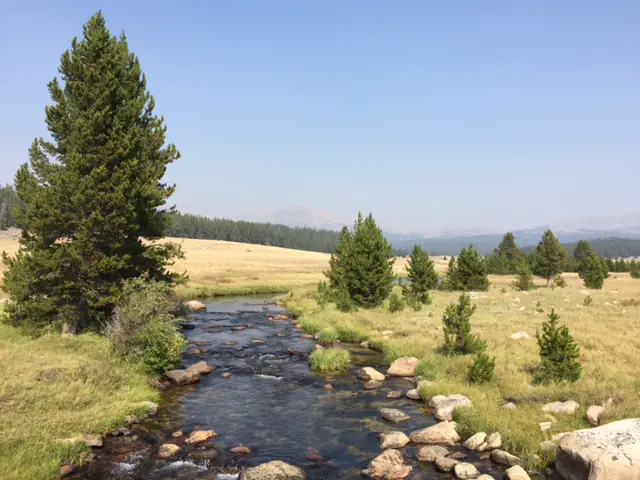
You will find the trailhead at the end of Route 27 North. The road basically ends at West Tensleep Lake and the trail continues along the Tensleep Creek from there. Route 27 branches off of US 16 just east of the B-E-A-Utiful Tensleep Canyon and just west of Meadowlark Lake and the Meadowlark Ski Lodge.
You should note that Route 27 is often closed to regular vehicles during the snowy season, which is lengthy in this part of the country, as it becomes a snowmobile trail. Other times of the year this dirt road can become rugged (in snowy or muddy conditions, even if it’s open) and a 4WD or high-clearance AWD vehicle may be able to handle it better.
Hiking the West Tensleep Trail to Mirror Lake
That Saturday dawned clear and beautiful–we were thankful for a reprieve from the smoke that day–so we hiked West Tensleep Trail (Trail #65) to Mirror Lake. This trail can go as far as Twin Lakes, though that is a 12-mile hike in each direction. We opted to stop at Mirror Lake (at about the halfway point), but the full trail would be ideal for an overnight backpacking trip. This moderate trek is beautiful and accented with stream crossings, sprawling meadows, and a few waterfall views. It is well-marked and wide in most places and not overly difficult. What makes it strenuous at times is the altitude (it reaches close to 10,000 feet in places) though the views of the surrounding summits are worth it!
The gurgling creek accompanies you most of the way creating an iconic, mountain experience. The neighboring stream and the craggy peaks towering nearby especially reminded me of hiking in Rocky Mountain National Park.
West Tensleep Trail
Mirror Lake!
Mirror Lake is a beautiful, alpine lake that mirrors the sky and adjacent cliffs when calm (likely where it gets its name!) and makes a prime lunch spot before turning back or continuing on to Twin Lakes. Usually, we enjoy peaceful solitude in this region, but this time it was quite “crowded” (we saw 5 – 10 other groups on the same trail–that’s crowded in the Bighorns!) Apparently, we weren’t the only ones looking to escape the 90-degree heat of the lower elevations that weekend!
Mirror LakeJust a man and his mountains
Island Park Campground, Bighorn Mountains
We stayed at the Island Park campground and our campsite was located on the fringe of the national forest, overlooking a marshy, grassy valley.
Don’t be afraid of the lesser-developed national forest campgrounds. They are spectacular, though you do need a tolerance for “roughing it” a bit if you’re tent camping (while potable water is often available in the “on” season, pit toilets are regularly all that is offered). If you’ve got an RV this may not be an issue (and the “developed” campgrounds can often accommodate RVs). These sites are usually more off the beaten path so they tend to be quieter, more enjoyable, and may provide more wildlife viewing opportunities.
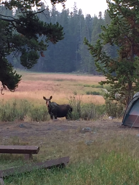
Moose in the Bighorns!
An added bonus that made this weekend laudable was the “visitors” we received each evening (and most mornings). If you’ll recall, in a previous post, I mentioned State Forest State Park in north-central Colorado had the best moose-viewing opportunities we’d ever seen…until this trip! 😁 A single cow and another momma and her baby visited us at least once a day the whole weekend. One evening a large bull also graced us with his presence.
This campground was the perfect place to view moose as they happily gorged on the willow branches that dotted the boundary. We named them Maggie, Molly, Matilda, and Marvin (they’re moose, obviously all their names have to start with “m”! 😉) Marvin kept his distance but the three ladies ventured right up near the campsites if people were quiet enough and gave them their space. It was an incredibly beautiful, (dare I say tranquil?) site to behold.
Maggie and Molly
I’ve always been fascinated by moose, perhaps because they’re one of the only critters that aren’t native to the various regions I’ve lived in. They’re slightly odd-looking creatures (though cute too), and while they seem like they would be awkward clodhoppers 😂, with their large bodies –especially the males–they’re actually quite graceful when they run through wetlands or swim across streams. They seem like big cows but be warned, they ARE wild animals that can be quite dangerous and aggressive if provoked (especially the mothers protecting their babies or the males during the rutting season). Usually, if you leave them alone and give them the respect they deserve, they’ll offer you the same consideration.
Note: Moose are NOT afraid of dogs and they have been known to kill dogs. PLEASE, keep your dogs leashed and fully under control in Moose Country. (Also, the Forest Service can and will ticket you for “harassing wildlife” if they feel you’re allowing your dogs to bother the moose. Always remember, this is at the ranger’s discretion, it doesn’t matter if you agree that harassment was occurring or not…
Oh, hello! (you can see how close she got to the campground!)
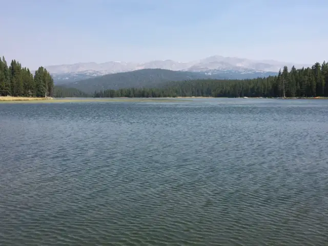
West Tensleep Lake
Sunday we canoed West Tensleep Lake surrounded by the imposing peaks of the Cloud Peak Wilderness (and only slightly marred by lingering smoke). This is a small lake but it’s no-wake so it’s ideal for canoeing, kayaking, and wake-boarding (just give your fellow fishermen space to enjoy their activities, as well.)
West Tensleep Lake, you can see the Cloud Peak Wilderness area looming through the smoky haze
We also attempted to reach East Tensleep Lake via Forest Road 430. While Mr. Trekker had fun practicing his 4×4-ing skills we decided the road was a little more than we wanted to tackle that day so we only traveled about halfway. We enjoyed beautiful views throughout, however. (Check out this post for info on our return trip to that lake!)
Off Forest Road 430
The road parallels Tensleep Creek which offers countless fishing opportunities. It also crosses several expansive meadows providing prime disperse-camping opportunities (this is national forestland so dispersed camping is allowed, just follow all local regulations pertaining to the use of fires). There are also ample opportunities for on and off-trail hiking.
Busy Bee Cafe, Buffalo, Wyoming
Monday morning dawned smoky once again as we packed up to head for home. We ended our trip by enjoying a well-earned breakfast at one of our favorite local haunts, the Busy Bee Cafe in Buffalo! This small diner was thrust into the spotlight thanks to Craig Johnson’s Longmire series that is based in this general area (and its reputation is warranted).
Below are some more pictures from our wonderful weekend (as always thanks to Mr. Trekker for a few of these):
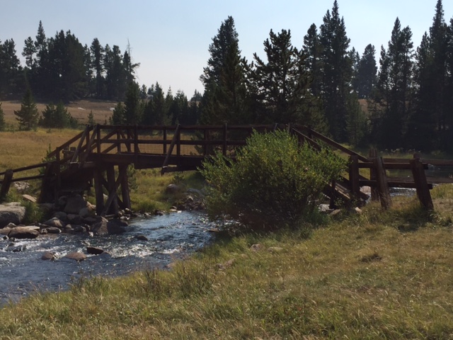
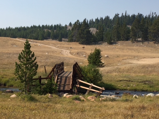
Smoky sunriseBridge over Tensleep Creek
Have you hiked the West Tensleep Trail, or visited Mirror or West Tensleep Lakes? Tell me about your experiences in the comments!
Did you enjoy reading this post? Pin it!
Like what you read here today? Please feel free to leave a comment, like or share this post! Add your email at the bottom of the page, or the sidebar to the right, to be notified when a new post is published. By signing up for the email list, you will also receive a free copy of the Tranquil Trekker’s Top 10 Tips of Trekking Do’s and Don’ts!
You can also follow the blog on social media by clicking the links below!
In case you haven’t figured it out by now, I LOVE to travel and I LOVE road trips. The freedom of the open road; the excitement of not knowing what you’ll find around the next corner; the varying beauty of the ever-changing landscape; the unique individuals you encounter along the way. For my final “2017 Summer Trip” post, I thought I’d offer a compilation of the various thoughts/observations I had, and lessons learned while trekking across the country this summer.
Road Trip across The Great Plains:
I’m always pleasantly surprised at how lovely I find western Nebraska to be with its rugged badlands and rolling prairies. As I always assumed all of Nebraska to be flat, I didn’t expect to enjoy it more than Kansas. Although its seas of green and brown crops (and cows!) has a beauty in its own right, I actually found western Kansas to be boring as it was “flat-as-a-pancake” flat–perhaps the beauty of the corn belt is lost on me having grown up surrounded by it. 😇 Both states showcased “horizon-to-horizon” blue skies and incredibly friendly people. The country roads lined with upside-down boots planted on fence posts accentuated the iconic scene.
The moose observation point at State Forest State Park
Unfortunately, the Plains aren’t comprised solely of simplistic beauty. Many of the small towns we encountered were incredibly run-down with boarded up store windows on their main streets and lack of development. They just felt depressed. Many of these places appeared as though they’ve been languishing for decades. They’re either too remote, too small or they lack much impact on the greater country so they are forgotten and left behind. One can imagine the people living there may start to feel the same way.
Traveling through these areas helped me to understand an often misunderstood portion of our population. In recent months, some people have asked, “how did we get here?” (politically speaking). For me, spending time in these downtrodden areas offered an explanation. It’s understandable that distressed people flock to anything that appears to promise relief from what has become the unfortunate norm.
Similar to politics that smell to high heaven, let’s talk about feedlots! 😉 The smell…the sheer size—thousands of head of cattle corralled in pens as far as the eye can see–the smell. 🤥 I’ve had minor experiences with these while traveling around the country in the past but never to the extent that we encountered on this trip. Wow…did I mention the smell? Not only are they immense, but the odor emanating off a feedlot on a 90-degree day is something to behold! I thought the pit toilet we encountered at State Forest State Park was bad! 😝 I almost felt bad for the poor bovines, being fattened for slaughter…and then I’d catch a whiff trailing on the breeze of someone grilling in their backyard and think, “mmmmm…steak…” 🤤
My memory of this state will always be of heading off into an endless expanse of desert punctuated by scrub brush and beautiful mountain mesas; under the watchful gaze of a buzzard poised on an electrical pole; as old telegraph wires frame the railroad that accompanies you on your journey. I expected the state to be desolate, but it felt even more rural than South Dakota, and that’s saying something! I also fell in love with a pink, blooming, cactus bush we encountered along the roadside that Google informs me is a “cane cholla cactus”.
I’ve mentioned this in a previous post, but I never expected to see so much rain in this state. Isn’t it supposed to be a desert? 🤔 We saw rain each of the five days we spent there and regularly experienced “sunshowers”—when a cloud would darken the sky and then rain would pelt your windshield as the sun returned. I certainly didn’t expect to see temps in the 50s (in rainstorms) in New Mexico that time of year!
The Rockies!
The drastic change in ecosystems between the northern and southern portions of the state was stark. I found the south to be depressing with the hot, dry, desert that was permeated by cracked earth. As you traveled north you quickly returned to almost a prairie-like scrubland. This area reminded me of northeastern Wyoming. The grass was such a verdant spring green color that it felt like going back in time to early spring, even though it was the first week of June.
Lessons Learned on the Road:
As we drove past a rockslide on I-25 that had closed both westbound lanes, I couldn’t help but be amazed by the power of Nature and the fact that, even in 2017, we don’t really control it, we just react to what it throws at us. It was encouraging to see how it carries on. As an example, when the pines die from disease or fire, the aspen/birch trees shoot up to replace them. It may take a couple of decades, and it may never be “the same” again, but Nature can’t truly be contained. As can be seen in the beautiful aspen groves, this change doesn’t have to be a bad thing!
New Mexico has a unique landscape, Colorado has unique people
–We met some very interesting characters on our jaunt around the Rocky Mountain state, but everyone was friendly and seemed to be good-hearted. Sitting in a parking lot at a state park, a lady walked up to my window and accosted me with, “so…what do you think?” No “hello” or pleasantries. I was like, “uh, about the park?” She started laughing. As it turns out, she wanted my personal opinion of my Outback, which I then happily gave her!
–As we were talking with the kindly elderly volunteers at a southern Colorado Welcome Center, another verbose local engaged us in conversation regarding made-up cowboy names for our dog–who wasn’t there. (Another patron had brought a friendly dog into the store which initiated the whole conversation.)
–There was the wisened cowboy who closely resembled a certain “Jolly Old Elf” (on holiday?) who was playing the fiddle at a rest stop (he was quite good!)
More of the beautiful Rocky Mountains!
–We also spotted a VW van full of twenty-something “Hippies” at a gas station (it was a very iconic site).
–Then there was the man who “followed” us from Mesa Verde to Ridgeway State Park. He was recognizable because he used no tent, choosing only to sleep in a bivvy bag out in the open, under the stars. This made him memorable and was probably the only reason I noticed him (I’m not sure he noticed us). He also just happened to be at campsites near ours at both parks.
Random Musings:
–I was heartened by all the solar panels we saw that appeared to be used privately as well a commercially. We also saw countless stretches of land accented by wind turbines. Regardless of any official policies that may or may not be put in place by local/state/federal governments, these sights encouraged me that the country as a whole has turned a corner and is “going green”.
An exception to this would be the farming of cattle in arid areas. We saw quite a bit of watering of pastureland to provide food for the cows. I couldn’t help but marvel at what appeared to be the absurdity of it. Driving through land that is naturally arid and seeing water being used to keep grass green when it naturally wouldn’t be. I couldn’t help but think, “what’s the point?” I grew up on a small farm and I, in no way, wish to shirk people the joy of that lifestyle or to run them out of their livelihood, but I do believe in the principle of “Work Smarter, Not Harder”. It just seems that we should stop fighting Nature. As we feel more effects from climate change these struggles could become even more pronounced. Let’s make the land productive by working with it and letting it work for us. If there’s not enough water naturally to keep grazing land for cows in a given location, perhaps it’s time to initiate a new crop there that thrives in (and is preferably native to) a dry climate.
–The regular appearance of “roadside tables” accompanied us along our route, and we enjoyed them very much! They make very convenient lunch stops, offering space for humans and our 4-legged companions to stretch our legs. We have also found picnic lunches to be more relaxing for the ease of stopping they afford. They offer more healthy food opportunities, they allow you to enjoy the outdoors more, and they’re cheaper than stopping at restaurants (fast food or otherwise!)
Lovely view of a stream flowing through Telluride, CO
–One fun activity I’ve found as you start racking unique road trips under your belt is to compare how similar various areas of the country feel. Many of the mountain vistas we encountered in the Colorado Rockies reminded us of views we saw on previous trips to Glacier or Yellowstone National Parks.
As we descended out of the Sacramento Mountains westward, heading into Alamagordo, New Mexico, I was reminded of the Black Hills. The low mountains sporting the drier, ponderosa pine forest made me feel like we had returned home. Western Colorado reminds me of Southern California with the desert/scrubland. I had no idea how dry it is. I knew the southern portion would be dry but I assumed the northern portion (east and west) would be wet and foresty, like Rocky Mountain National Park. Out near Grand Junction, it was pure desert, which reminded me of nearby Utah and the Moab area.
–One unique aspect we had not seen before was several miles-long trains, just sitting on the tracks that paralleled the highway. I got the impression their stay was intended to be long-term as there was a break in the line at EVERY SINGLE crossing we came across to allow vehicles to pass. I can’t imagine how much work it took to get that in place!
–This trip helped us to really appreciate how spoiled we are living in the Black Hills. Beautiful campgrounds are plentiful that cater to RV’s and “tenters” alike; fires are usually allowed in campgrounds (unless the fire danger is high); firewood is easily available; the weather is frequently lovely (any time of the year); and, smoky days notwithstanding, we’re regularly blessed with truly blue skies (air pollution is low here as is the haze you find in numerous other areas of the county). Although somewhat isolated, we have access to many opportunities usually found in larger cities while still being able to enjoy a small-town air. We’re also blessed to have areas that are thriving and changing, rather than falling victim to the passage of time. (All that being said, while it’s a nice place to visit, this is an AWFUL place to live and NO ONE should move here). 😉 😇
To conclude, I truly feel a road trip is one of the best ways to experience the diverse cultures that make up the “melting-pot” population of our great country. There are things to learn from every region of this great land and the only way to truly appreciate it or understand it is to experience it! So get out there!
What lessons have you learned from road-tripping around the country? Tell me about them in the comments!
Did you enjoy what you read here today? Pin it!
Like what you read here today? Please feel free to leave a comment, like or share this post! Add your email at the bottom of the page, or the sidebar to the right, to be notified when a new post is published. By signing up for the email list, you will also receive a free copy of the Tranquil Trekker’s Top 10 Tips of Trekking Do’s and Don’ts!
You can also follow the blog on social media by clicking the links below!
We spent the second week of our 2017 Road Trip enjoying 11 Don’t Miss Sites in Colorado. That state is, by far, one of my favorite locations in the entire country to visit (and we’ve seen the 48 Continental US States!) Its beauty is indescribable and pictures don’t truly do it justice.
The following is a rundown of the highlights of our tour around the state. Thanks again to Mr. Trekker for some of the pictures!
Trinidad, Colorado
Trinidad is an old-school, Western town in far Southwestern Colorado, only about 15 miles from the New Mexico border. It’s a cute little community that’s been well-maintained and has seen some modern updates in recent years.
I’m still adjusting to the whole “pot legalization thing” in Colorado. 😂 It’s not my fault, I was a DARE child of the ’90s, I grew up being taught that it was bad (of course this was by the same people who also taught us that Pluto was a planet–and people wonder why I have a skeptical nature!) Then there’s the issue where it’s legal in the state but not in National Parks within that state because that’s Federal land and it’s still illegal Federally. Like every good Libertarian, I’m willing to tolerate it but *sigh*, does this make anyone else’s brain hurt?
The next day, we headed West from Trinidad on Route 160, bound for Mesa Verde National Park! 12 years ago we visited the park and parts of Western Colorado on our very first road trip, so it was cool going back. Some of it we remembered, but it had been so long that there was plenty that we were seeing again “for the first time”.
Colorado is one of my favorite places to visit. Click here for more posts on this awesome state!
Having just recently survived a bout with an aggressive flu, I was still not my best self at this point, though, as we were entering some beautiful country we wanted to do a little sightseeing. The first pass we arrived at (and the first overlook) we stopped to take some pictures. I stepped out of the car, took one step on the unsteady gravel in my flip-flops, and skidded to my knees. The fall left a lovely road rash in its wake (because this trip just hadn’t been adventurous enough!)
At first, I figured it was nothing, till I looked down and saw red rivulets running down my leg *sigh*. So, back to the car, we went, with Mr. Trekker coming at me with the first aid kit. Unfortunately, it only had alcohol swabs in it and we were FAR from any modern bathroom with water and soap. Needless to say, Mr. Trekker was NOT my favorite person that day! But, kudos to him, he bandaged me up well (albeit painfully) and I now only have a minor scar to show for my misfortune. 😝
Mesa Verde National Park:
**Author’s note: Just a word of warning, as this is a National Park, no dogs are allowed on any trails (exceptions for Service Animals). They are only permitted in the campgrounds and parking lots.**
This unique park showcases cliff dwellings from the civilizations who lived there thousands of years ago. Some you can view from overlooks, and some you can actually tour (self-guided and ranger-led). They’ve also got a great campground with spectacular star-gazing opportunities.
Our first trip to the park was one of my first camping experiences out West where there’s far less light pollution. I remember being astounded at the light show the night sky put on (and that’s coming from a girl who grew up on an Indiana farm). It was on my first visit to this park that I fell in love with Colorado and “the West”. I didn’t know then that in six years I’d become a “Westerner” myself!
Unlike many of the national parks (such as Rocky), the campgrounds have modern bathrooms—read, flush toilets, and showers. I’d recommend at minimum a 2-day stay to really get the most out of the park.
Cliff dwellingNavajo Canyon
Route 550, the Million Dollar Highway:
On our first trip to this area, we stumbled upon this highway accidentally, completely unprepared for what we were about to experience (it was just the most accessible option to get us where we wanted to go). The second time around we knew what we were in for…and were still awed.
Route 550, in western Colorado, runs north to south between Grand Junction and Durango. It is called the Million Dollar Highway because it is so beautiful it offers million-dollar views as it traverses many mountain passes.
If you’ve never traveled this route, I STRONGLY recommend it, though I’d suggest navigating the road from south to north starting in Durango. This ensures your car is on the inside of the sharp turns the majority of the time. If you’re coming from the north you will find yourself frequently perched along cliff edges with nothing between you and the gaping maw of the canyon below than some thin oxygen (there are no guardrails the majority of the drive as the snowplow drivers need space to push the snow off the cliffs in the winter months).
If you can handle the drop-offs, this drive is a must! This area is referred to as the “Switzerland of America” because its incredible mountain vistas rival those found in the immensely beautiful, European country.
I can testify the views here rival those we saw in Glacier National Park on the Going to the Sun Road (though these are more accessible, depending on your location). Also, this road is open all year, weather permitting.
The most popular portion of the drive (between Durango and Ouray) is less than 70 miles in length, but plan for it to take several hours (that was our big mistake the first go-around). It’s a slow drive, in some areas the suggested speed limit on the curves is only 10 – 15 mph (and trust me, they aren’t joking). It can be slower if you find yourself traveling behind larger, slower-moving vehicles.
The most intense (and most beautiful) portion of the route runs the 25 miles between Silverton and Ouray. Stops are frequently caused by construction in the summer months as workers are constantly fighting the ongoing battle with natural erosion. Rockslides are also common (as well as avalanches in the winter).
This drive can be frightening for us acrophobes with its steep drop offs but the immensely beautiful views are worth it! There’s plenty of skiing, 4×4 trails, hiking, camping, rafting, and a slew of other activities available in this corner of Colorado, so be sure to put it on your “must-see” list.
Telluride, Colorado:
Telluride was about what I would expect from a ski town (the Trekkers are uncoordinated and therefore not downhill skiers). It was lovely, though we were a little early for the summer season so the upper roads weren’t clear of snow or open yet. We walked down the road to view a staple of the town, Bridal Veil Falls. The road up to it was open for hiking, but as I still wasn’t at my best we decided to skip that option this trip. Instead, we opted for lunch at Brown Dog Pizza, a local joint where I can honestly say I had the best cheese calzone I have ever eaten, hands down.
The ricotta cheese seemed as though it had been whipped into an airy froth. I’m no food connoisseur, but it was incredible.
Bridal Veil Falls
Ouray, Colorado (pronounced U-Ray):
The drive into town from the south is one of the most beautiful views I’ve ever seen. THIS I remembered from 12 years ago. You descend from the harrowing Million Dollar Highway and this small oasis of civilization opens up before you in the valley, beckoning you down from the peaks. (If you’ve seen the show “The Ranch” on Netflix, this town is the one used in the opening credits).
Ridgeway State Park:
Ridgeway State Park has one of my favorite campgrounds we visited on the entire trip (part of the reason we spent three days there!) It’s located just north of Ridgeway on Route 550 (north of Ouray, so out of the peaks). They have a lovely, shaded, tent-camping area that’s back off the road, complete with level, graded tent sites, modern restrooms (and showers!), all surrounded by cedar trees.
This brings me to another point. Apparently, it’s perfectly legal to smoke pot in Colorado State Parks, but don’t you dare hang a hammock from a cedar tree! I’m sure there is a good reason for this due to the risk of damage to the trees, and I’m all about protecting nature, but this just seemed to be a bit of a misalignment of priorities to me! 😝
The park surrounds a picturesque reservoir set against a backdrop of snow-capped Rockies to the east. Its location makes it an ideal base camp for numerous day trips and activities.
Ridgeway State ParkIt was so strange to look to the east and see the Rockies
True Grit Film Sites
The park also happens to be near the filming location of the original western, True Grit (the one from 1969 with John Wayne, not the new version). If you’re a good enough detective there are numerous filming sites you can locate in this area (though please be aware, many of these areas are located on private land and you are trespassing if you travel on them without the owner’s permission. Please be respectful of private property!) Click here for some help finding the sites!
We were able to view Mattie Ross’ Ranch, Courthouse Mountain, Chimney Peak, and the meadow where the shootout scene was filmed, without difficulty. The last three can be found off of Route 8 (to reach this travel east from Route 550). You’ll reach The Meadow about ½ mile before the summit of Owl Creek Pass. Courthouse Mountain and Chimney Peak are visible from The Meadow and Sleeping Rock is located at the summit of the pass.
Sleeping Rock (the rock Mattie Ross slept on in the 1969 version of True Grit)Courthouse Mountain and Chimney Peak
Mattie Ross’ Ranch is located off of Last Dollar Road which is found off of Highway 62 (the road from Ridgeway to Telluride).
Mattie Ross’ ranchDeb’s Meadow (where the final shootout scene was filmed)
Grand Mesa National Forest:
Grand Mesa National Forest is another “must-see” location in the mountains east of Grand Junction. It’s primarily used for cross-country skiing and snowmobiling in the winter months. It’s got some great campground/fishing/hiking opportunities as well, but we were, unfortunately, too early in the season to really take advantage of these options. The hiking trails weren’t yet open as there were still feet of snow drifted on them in some places. Click here for more info on our return trip to Grand Mesa!
During the peak of summer, this would be a prime place to escape the heat though, the day we were there it was near 90 in the closest town on the valley floor and it was in the ’40s, and raining/snowing large glops on us at the summit.
Snow on the summit, this was June 6th ya’ll!
Rifle/Rifle Falls, Colorado:
We spent our final hotel stay of the trip in the small town of Rifle, Colorado. This is an adorable, little town with an awesome state park!
Rifle Falls State Park was absolutely beautiful. It was the only place I’ve ever been where you can traverse walkways that stick out over the TOP of the falls! The caves at the bottom were picturesque as well (and provided a cool respite from the summer heat).
Rifle FallsA different view of the falls
State Forest State Park:
$20/night for a campsite; going several days with no indoor plumbing (or showering); a DISGUSTING pit toilet (seriously, it was an upside-down pail sitting over a stinky hole in the ground); BUT…eating dinner while a cow moose and two calves eat theirs, in a field, a few thousand yards away with the Rockies as a backdrop…PRICELESS!!!
We spent the last three nights of our trip at State Forest State Park which is renowned for its moose sightings (many were re-introduced here back in the 90s.). The park actually claims to be the “Moose Viewing Capital of the World!”
It definitely offered the best moose sightings we had ever experienced…until our Labor Day camping trip in the Big Horns later that year…you can read about that here!
This view reminded us of the Garden Wall at Glacier NP.Alpenglow over the Western Rockies (Rocky Mountain National Park and the Never Summer Mountains are basically due east from here, right over those mountains.)Ranger LakesMoose from the campsite
CLOSE ENCOUNTER of the Mountain Lion Kind!!!
The final night of our trip I had a true close encounter (at least I think I did, it was dark and it was over fast!) It was late and we were the only people still up in the half-full campground. Our campsite was perched on a hill backed by the forest and fronted by a lake.
The first night, we spied a moose family skirting the campground using a gully to get to the lake for their evening drink, so we knew it was a popular thoroughfare for the local wildlife. We were waiting for the fire to burn down and out of the corner of my eye, I spotted movement in the empty campsite across the road (maybe 30 yards away and downhill from our site). At first, I thought it was a deer I had seen meandering around earlier that evening…and then I realized the “deer” had a long tail…
Interesting side note, many stories I’ve heard of people spotting mountain lions start with, “I thought it was a deer till I realized it had a long tail…” 😮
…then I thought it was a dog from one of the neighboring campsites, but I was pretty sure he was in the tent with his family…and the creature I spotted didn’t move like a dog…
Its movements were stealthy, fluid, and sleek; beautiful actually. I couldn’t tear my eyes away. It almost glided across the ground. It reminded me of watching a cat jumping onto a high shelf when you’re sure any minute it will send objects flailing into space but instead it glides gracefully around them.
It was visible for only a few seconds, once it saw me it hightailed it out of there (which is exactly what we WANT wild animals to do!), and I wasn’t able to get Mr. Trekker’s attention quickly enough for him to see it. We looked for tracks the next morning and didn’t find any but the ground was very dry and hard so this wasn’t a surprise. I can’t prove it but…I think I saw my first mountain lion that night (that’s my story and I’m sticking to it! 😉)
Oregon Trail Ruts, Guernsey, Wyoming:
On the last day of our trek, we stopped for lunch in Guernsey, Wyoming at the Oregon Trail Ruts State Historic Site. There we viewed wagon wheel ruts left forever engraved on the landscape by the pioneers traveling the Oregon Trail.
You could almost hear the lowing of oxen, the clanking of household items, and the creaking of the wagons as they slowly made their way across the prairie. You could almost smell the rank odor of animal and human sweat mixed with the constant cling of dust stirred up by the plodding of the animals’ hooves.
It was humbling to think that we traveled almost 3500 miles on our two-week road trip, crisscrossing across eight states and visiting countless places in our air-conditioned, all-wheel-drive car, with a suspension that gently glides across any bumps in our path (on the paved or graded gravel roads we drove on). Whereas these people traveled thousands of miles in a wagon train, a trip that took MONTHS as they slowly crept their way across the bumpy, muddy, rutted, rock-strewn ground, and lived under constant threat of death by exposure, disease, or attack.
When I got sick we drove five minutes to the local Urgent Care, it took maybe an hour to get seen, then we went to the Walgreens across the street for medicine and I was back in the hotel room on the road to recovery 20 minutes later. Back in the days of the wagon trains the same ailment likely would have meant DAYS of misery as the best of potential outcomes.
The Oregon Trail Wheel Ruts
A few final pictures from our jaunt around Colorado. If you haven’t been there, I STRONGLY encourage you to put it on your bucket list. You won’t regret it!
The RockiesRifle Gap ReservoirOdometer reading as we pulled into the driveway (No! We didn’t drive around the block an extra time to get it to 3500, I don’t know what you’re talking about!) 🙂
Have you visited any of these places? Tell me about your adventure in the comments!
Did you enjoy this post? Pin it!
Like what you read here today? Please feel free to leave a comment, like or share this post! Add your email at the bottom of the page, or the sidebar to the right, to be notified when a new post is published. By signing up for the email list, you will also receive a free copy of the Tranquil Trekker’s Top 10 Tips of Trekking Do’s and Don’ts!
You can also follow the blog on social media by clicking the links below!
We use cookies on our website to give you the most relevant experience by remembering your preferences and repeat visits. By clicking “Accept”, you consent to the use of ALL the cookies.
This website uses cookies to improve your experience while you navigate through the website. Out of these cookies, the cookies that are categorized as necessary are stored on your browser as they are as essential for the working of basic functionalities of the website. We also use third-party cookies that help us analyze and understand how you use this website. These cookies will be stored in your browser only with your consent. You also have the option to opt-out of these cookies. But opting out of some of these cookies may have an effect on your browsing experience.
Necessary cookies are absolutely essential for the website to function properly. This category only includes cookies that ensures basic functionalities and security features of the website. These cookies do not store any personal information.
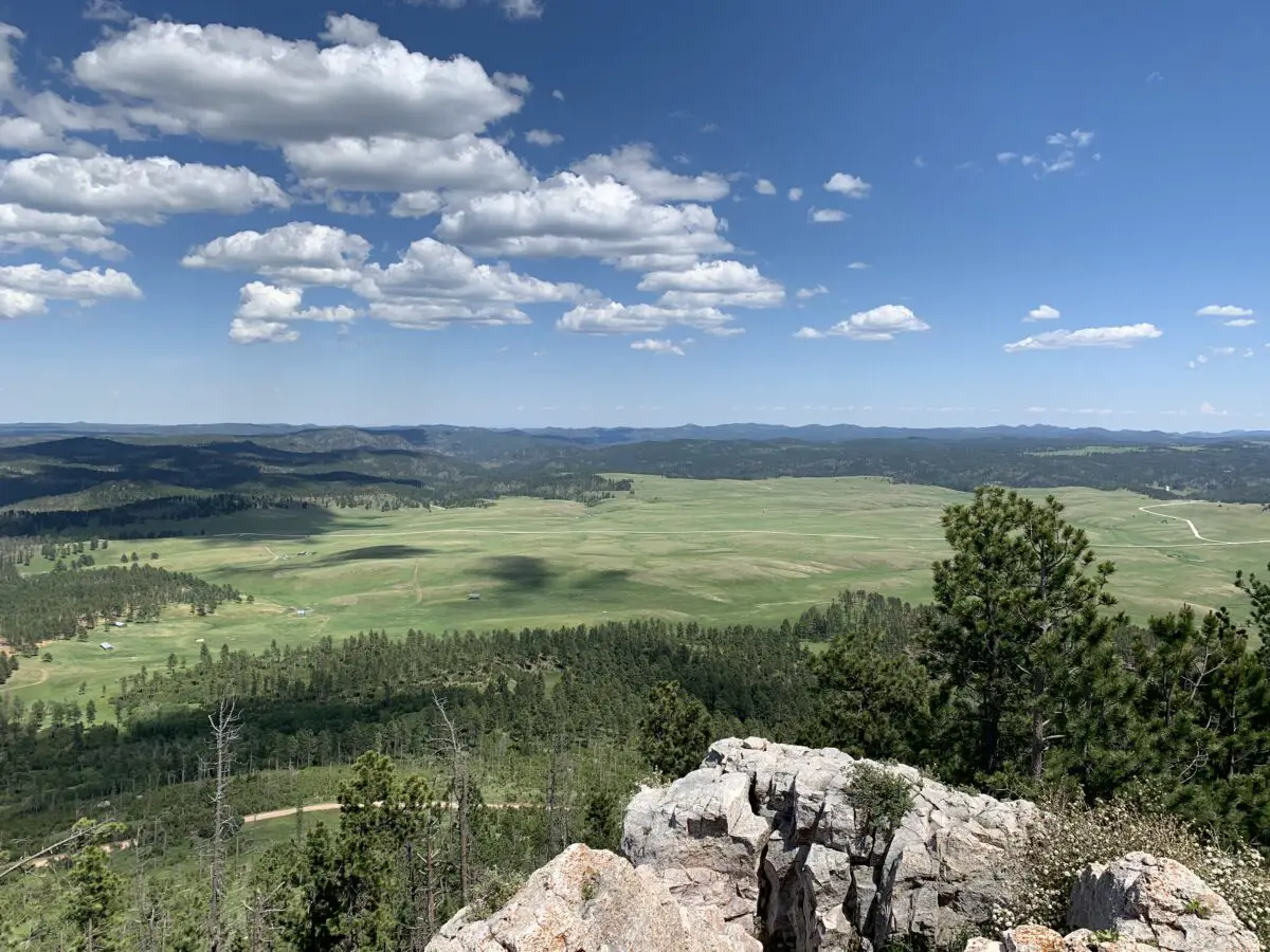
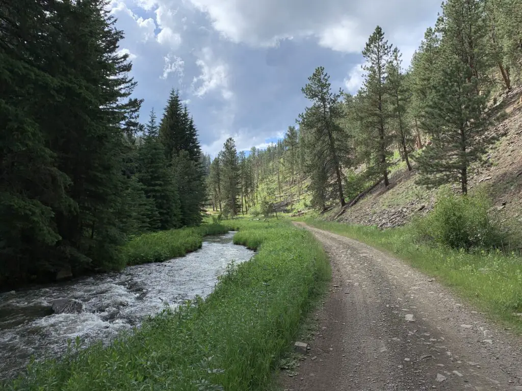
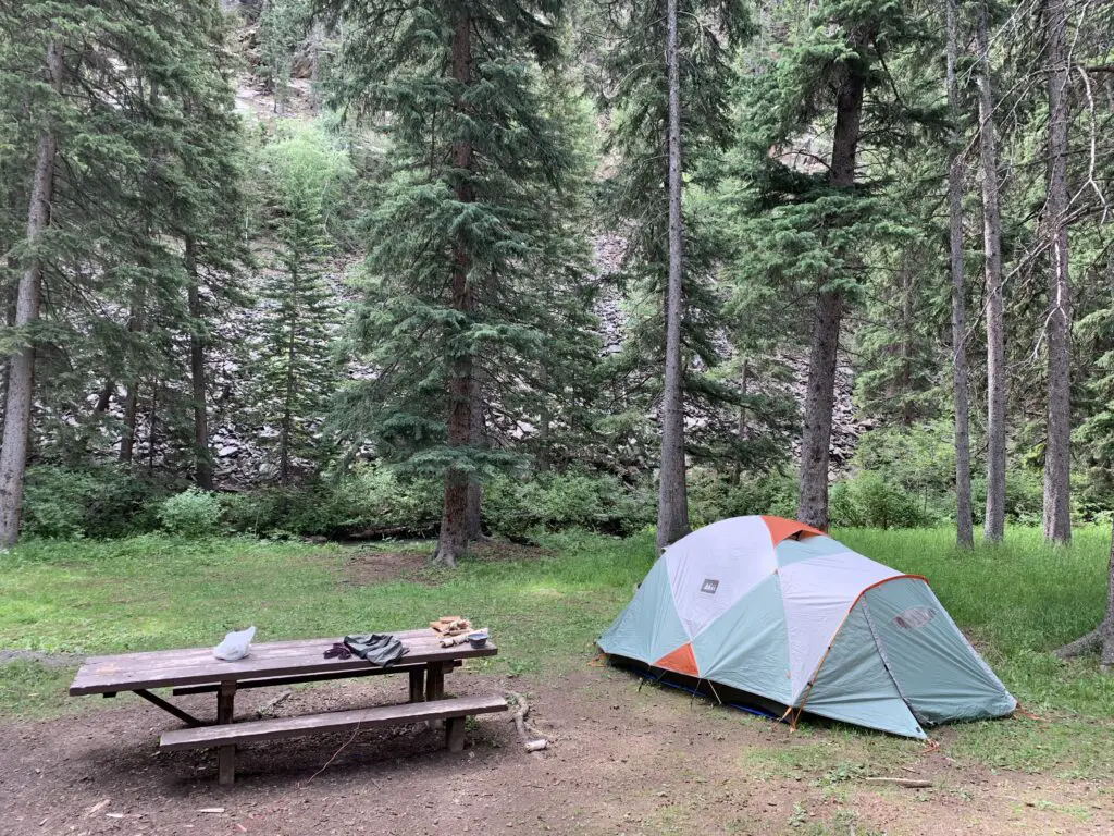
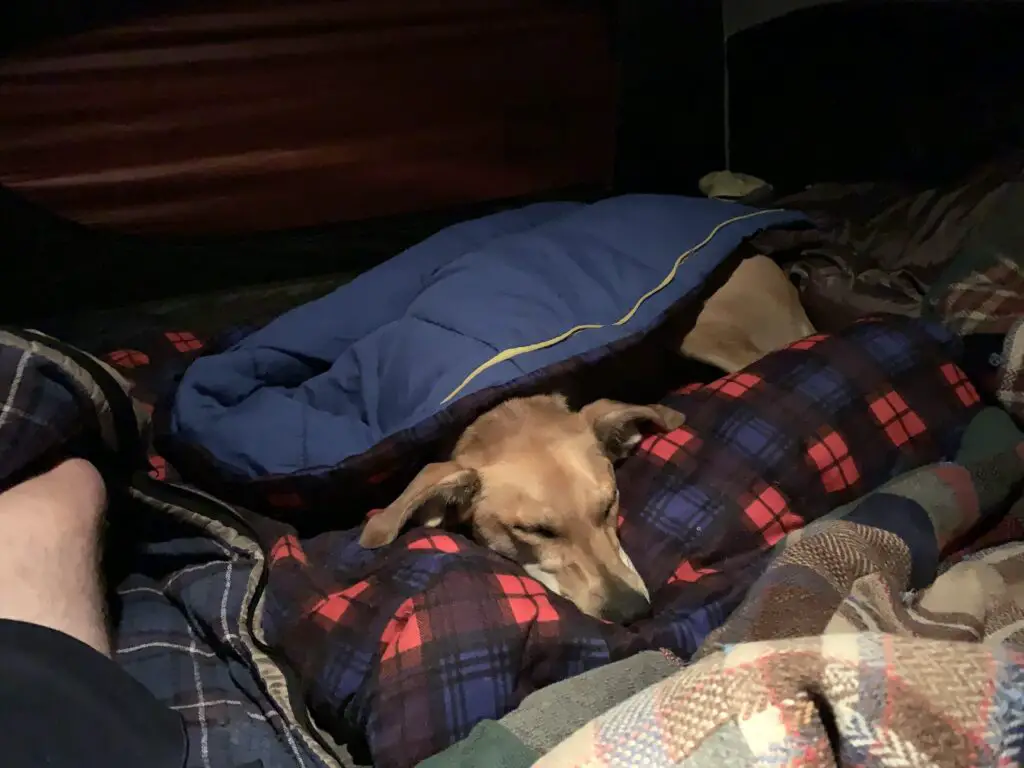
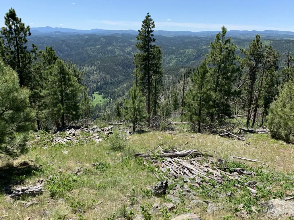
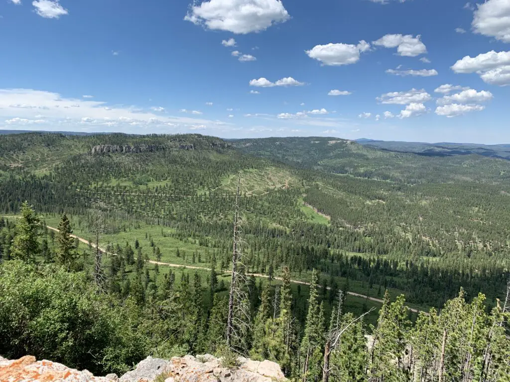
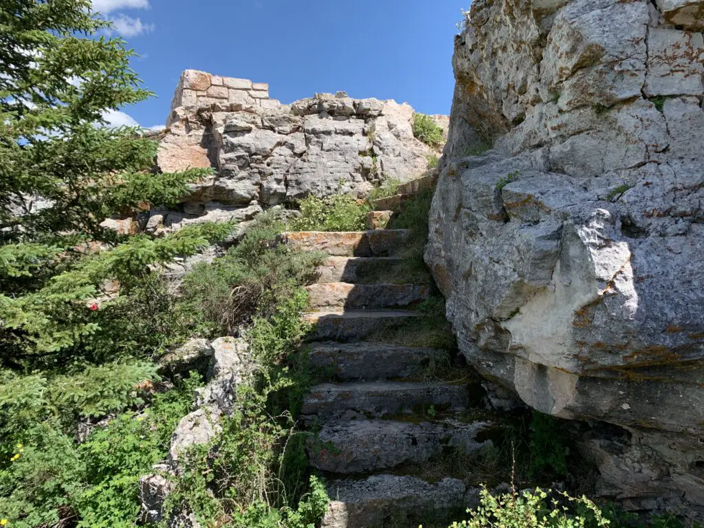
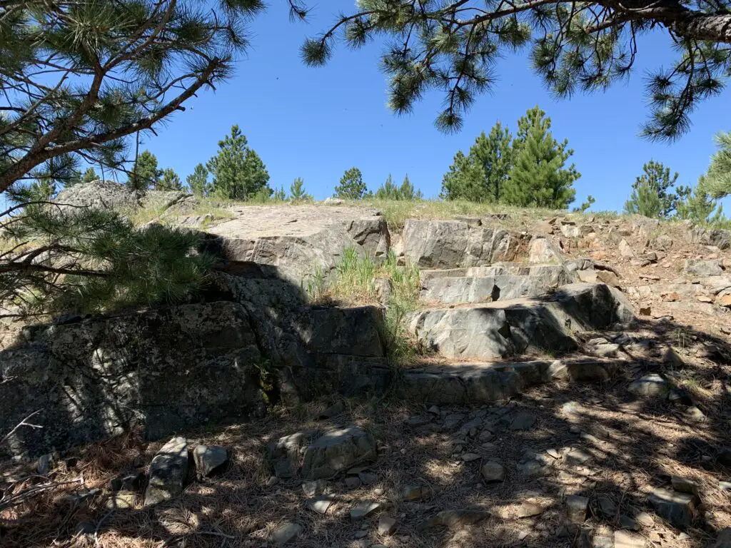
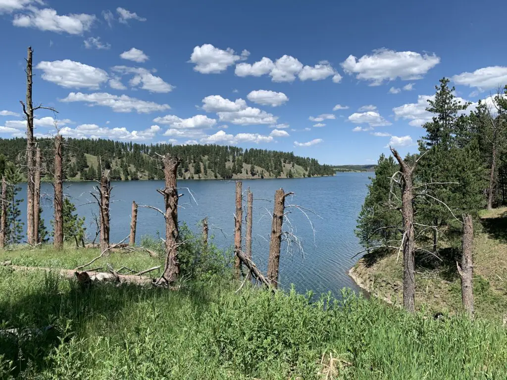
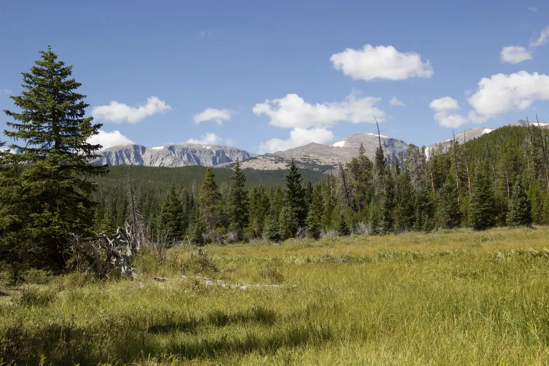
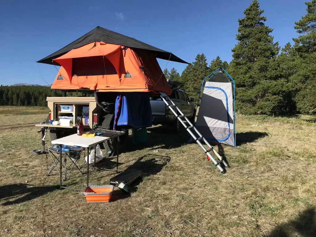
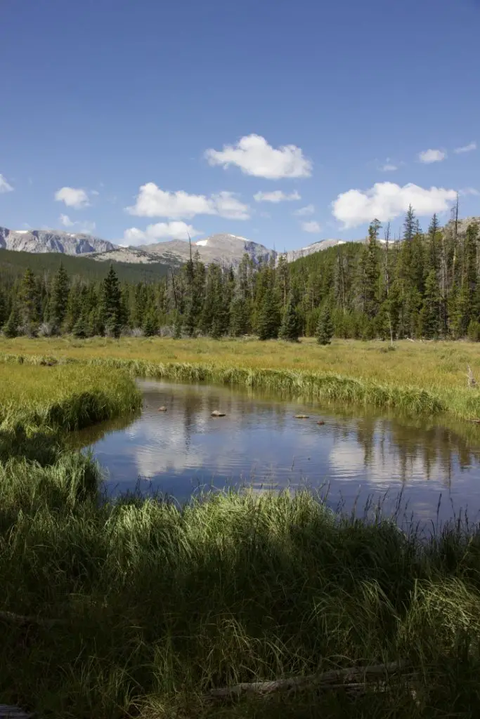 Though this area is just as beautiful as the Rockies, it is FAR less crowded, which makes it so much more pleasant to visit. 😋 There are no lines of people hiking in the Bighorns like we’ve experienced in various places around Colorado. Also, oftentimes, the lower-elevation plains may be baking in 90-degree weather, while it’s in the 60s-70s, and breezy, in the mountains!
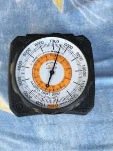 Our campsite was at about 7500 feet on this visit (oftentimes we stay much higher, closer to 9000-10,000 feet). We’ve noticed something odd at these high altitudes that we have also experienced in
 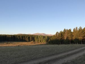 Sometimes when we head out we Disperse Camp. This is also known as “dry camping”, where you just set up your camp somewhere in the national forest, outside of an established campground. We tried this for the first time in Colorado, at both State Forest State Park and near Crested Butte. On both occasions, we did stay at an actual, numbered campsite, it was just away from any campground and we weren’t able to see our neighbors.
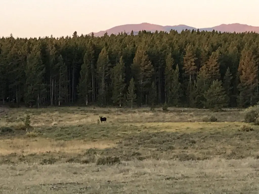
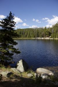
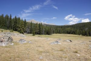 This hike was deceptively tough. It’s only about three miles in total length, but it’s overgrown in many spots, very rocky and there are lots of downed trees. We actually lost the trail several times and had to root around to locate it again. Other parts of it are PERFECT though. They feature a flat, graded path through a moist, pine forest, that is surrounded on both sides by a green carpet of ferns, moss, and soft undergrowth. It almost felt like hiking in the cool rainforests of the Pacific Northwest. It was such an idyllic sight!
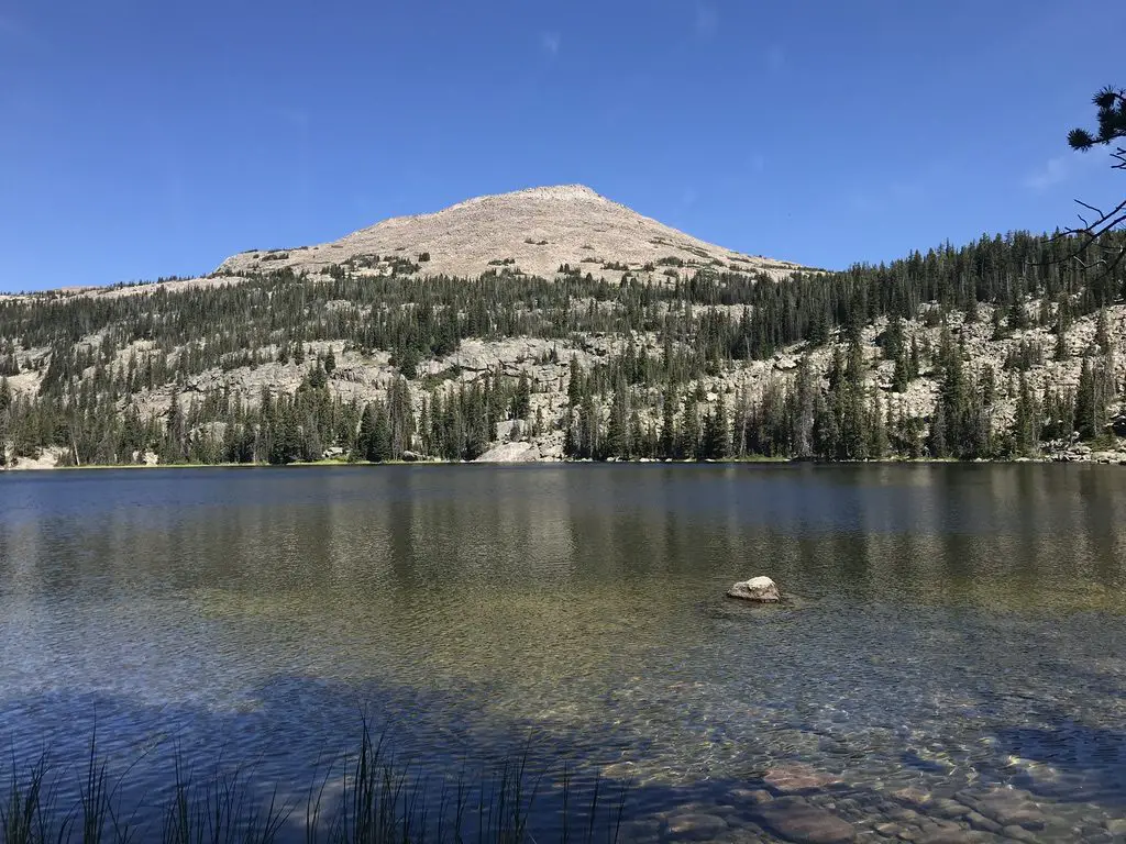
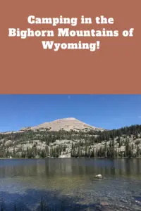
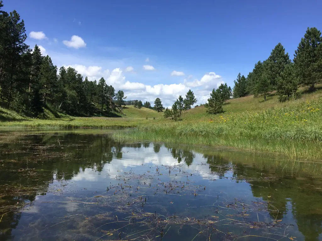
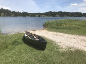 Deerfield Lake is one of the Trekkers’ favorite spots for canoeing in the Black Hills (another is
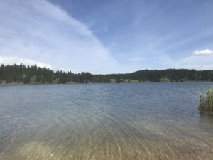
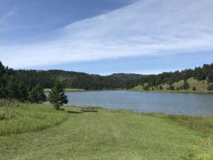 There is a hiking trail, that circumvents the lake, which is also good for cross-country skiing and snowshoeing in the colder months. There are several campgrounds available around the lake, as well. You should be aware these are National Forest campgrounds,