This post outlines our adventures on several Colorado backroads, including some at State Forest State Park and around the Crested Butte area.
On our 2018 road trip in the Colorado High Country, we really wanted to improve our 4×4 driving (and navigation) skills. Fortunately, there are a number of backroads in Colorado that are perfect for this!
One series of books we found to be incredibly helpful isA Guide to Colorado Backroads†. It’s actually a series of books covering the northern, central, and southern regions of the state. These provide helpful information on the roads and trails including their difficulty level, equipment needed to successfully complete them, and details on each of the routes’ conditions.
Below is a listing of the new roads we enjoyed:
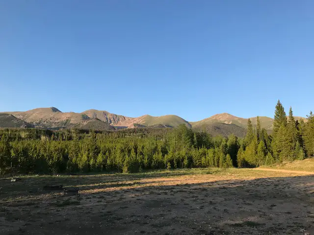
Montgomery Pass Road, State Forest State Park
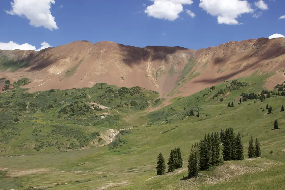
The first road we mastered, the Montgomery Pass Road at State Forest State Park, ended up being the most technical route we attempted on the entire trip. This out-and-back trek is listed as “moderate” in the guidebook. It was fun, though, definitely, challenging. A high clearance, 4WD vehicle is required and skid plates are an added benefit–we were VERY glad for them as we scraped across one particular rock. Several spots even required me to exit the vehicle and play “spotter” for Mr. Trekker to assist him in navigating the obstacles…it was fun! 😁 The road was wide, with room to pass in most spots, and mostly traversed the forest, so, it lacked the stomach-churning shelf roads we experienced on much of the rest of the trip.
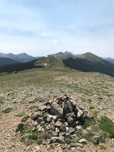
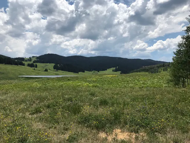
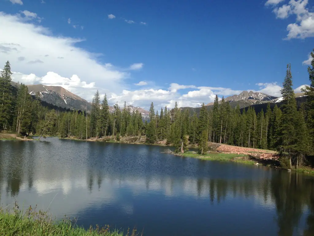
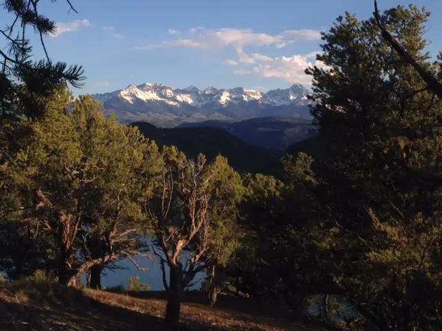
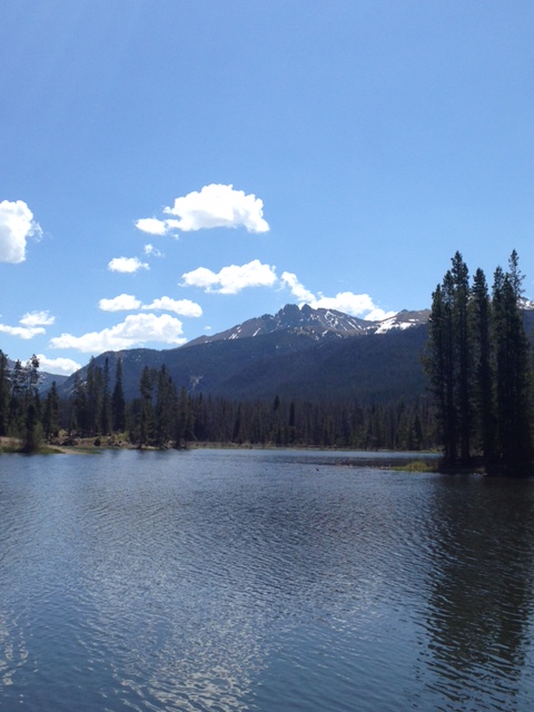
The road ends before it reaches the top of Montgomery Pass, and the final half-mile or so must be completed on foot. It’s an easy hike (minus the altitude) as the trail is an abandoned forest road. It was windy at over 11,000 feet, but the incredible views of the Never Summer Mountains and the promise of the 360-degree vista at the top provide motivation despite beleaguered lungs.
Made it to the top of Montgomery Pass!
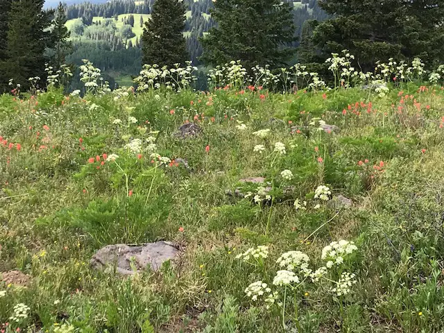
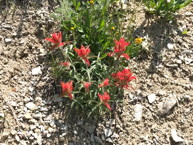
The wildflowers had begun to carpet the surrounding meadows while snow still blanketed portions of the nearby peaks (in early July!) Another quality of this wilderness area is that we felt like we had the entire mountain to ourselves on a Monday morning, seeing only two other groups for the duration of the excursion. You can also hike the entire way to the peak from the other side of the mountain. The trailhead is found off Route 14 on the eastern edge of the park.
The view from the summit
Bockman Road, State Forest State Park
We supplemented the adventure above with a side trip down Bockman Road which intersects the Montgomery Pass Road farther down the mountain. This road was easy, I think my CRV may have been able to handle it if you were careful on a few of the bumpy sections. It was dirt, but wide enough for two vehicles and mostly graded. It made for a fun, relaxing afternoon as a bubbling creek accompanied us for much of the trip, as well as countless more wildflowers (have I mentioned the wildflowers are beautiful in Colorado this time of year?) 😉
Gothic Road near Crested Butte
Probably the most nerve-wracking drive we completed was Gothic Road, from Gothic ghost town to Schofield Pass–I discuss Gothic in this post.
The road is in good condition–a sedan could probably negotiate it. The problem we ran into was that it is a 1 1/2-lane shelf road with a significant drop-off at one side and no barrier–a frequent condition we encountered on Colorado back roads.
When we were there it was also INCREDIBLY busy; filled with 2-way traffic in addition to hikers and mountain bikers. Part of the trouble was that we were there on a weekend in July (our fault, it was just the way the trip itinerary worked out). But the horde of visitors combined with people who are unaccustomed to driving in those white-knuckle conditions made for what felt like a genuinely unsafe situation from time to time.
From the top of the pass, a dangerous 4×4 road continues on through the acclaimed “Devil’s Punchbowl” to Crystal Mill–one of the worst 4×4 accidents in Colorado history occurred on this road. We chose NOT to take that route, 😝 but check out this post for the 4×4 adventure we had on Forest Road 314 from Marble to Crystal Mill!
Schofield Pass and Slate River Road
Once we reached Schofield Pass, we completed the loop via Slate River Road (Forest Road 734) through Paradise Divide. This section was not only FAR quieter and more relaxing, but it was also one of the most scenic drives I’ve ever been on (it made the other half of the loop worth the gray hairs). 😉
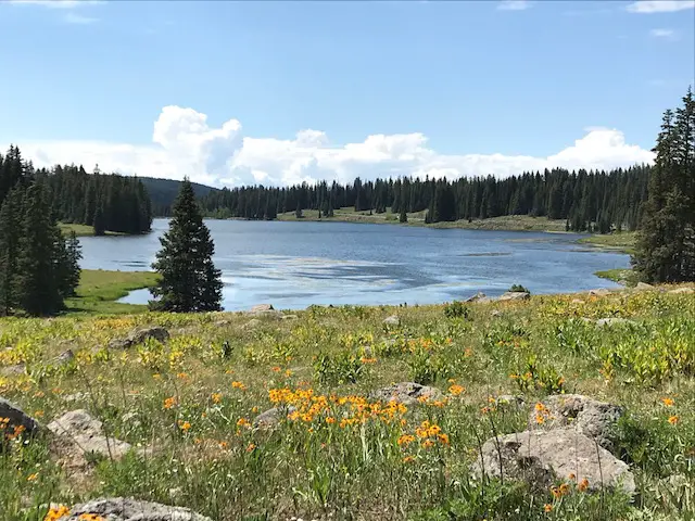
Paradise Divide
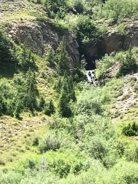
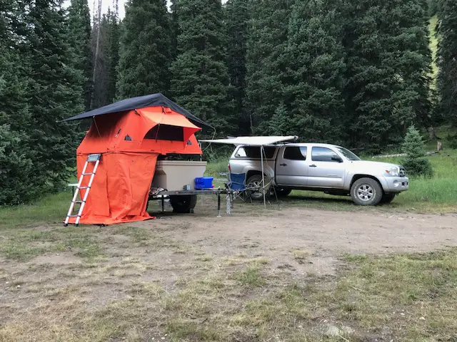
Showcasing towering mountains donning green meadows, grass-covered avalanche chutes, and streaming rivers fueled by snowmelt, this drive is incredible!We were fortunate enough to grab one of the last remaining dispersed campsites in this area that was nestled right next to a small canyon. We fell asleep listening to the water coursing through it that night!
Waterfall along Paradise DivideOur campsite
Below is a video I took of the Divide. Be patient with me, my videographer experience is minimal, the road was bumpy, and this was taken on an iPhone. But…this valley was so INCREDIBLY beautiful, I had to share this with you! You can see why they gave it the name they did! 😎
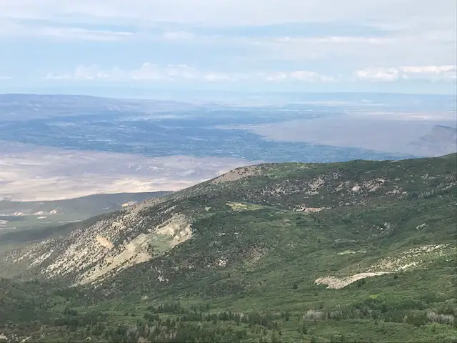
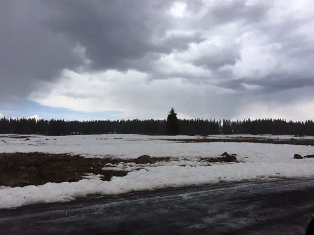
The drive from Rifle to Grand Mesa Colorado
Even when not looking for a 4×4 adventure, we learned that travel on Colorado back roads can be an interesting experience. We drove the back route from Rifle to Grand Mesa National Forest, taking Dry Hollow Road from Silt. Then we continued, via Route 270, into Colbran and then took Route 121 to enter Grand Mesa the back way.
The drive was lovely! The eclectic scenery transitioned from desert-like scrubland in the Rifle area to aspen forest in the higher elevations, then to rolling farmland in the valleys (that reminded us of Pennsylvania) before ending in the spruce forests that comprise the Grand Mesa area.
Colorado is one of my favorite places to visit. Click here for more posts on this awesome state!
I mentioned earlier that the gazetteer didn’t always differentiate road surfaces well. We found the regular road atlas (and the 4×4 book mentioned above) gave far better indications of what to expect for the actual conditions of the roads…
…In this situation, these routes were indicated to be “major connectors” (and I’m sure they were for that, extremely rural, area). However, this indication included roads that varied from paved and painted to those that are dirt/gravel, with some being extremely rough due to a washboard surface. They were, often, also, narrow and winding (where two, full-size vehicles may struggle to pass). Many also hugged the sides of cliffs on shelf roads. They offered incredible views but may be alarming to people who aren’t accustomed to those conditions.
We had a great time, but I note this so people are aware these conditions can make travel more difficult and may require you to budget additional time to complete the drive.
Viewpoint on the road to Grand Mesa from Silt
These portions of our trip were thrilling, nerve-wracking, and challenging. However you manage to do it, whether it be machine-powered by a 4×4 vehicle or using your own two feet, I’d encourage you to venture out onto these lesser-traveled routes (as you are comfortable, of course). You’ll see sites and experience adventures that the average person misses on the more well-traveled highways. It will give you a whole different appreciation for the nature that surrounds us.
Have you ever tried out any of these Colorado backroads? Tell me about your experience in the comments!
Did you enjoy this post? Pin it!
†As an Amazon Associate I earn from qualifying purchases
Like what you read here today? Please feel free to leave a comment, like or share this post! Add your email at the bottom of the page, or the sidebar to the right, to be notified when a new post is published. By signing up for the email list, you will also receive a free copy of the Tranquil Trekker’s Top 10 Tips of Trekking Do’s and Don’ts!
You can also follow the blog on social media by clicking the links below!
This post outlines our 2018 road trip adventure around the Colorado high country.
We enjoyed the northern Colorado portion of our 2017 road trip so much, we thought we’d return there for our 2018 summer vacation! This trip turned out far better. No projectile vomiting, no rivulets of blood running down a certain blogger’s leg, almost no injuries at all actually…just many, MANY, mosquito bites. 😜
For six months, we’d planned to complete a grand loop of Colorado’s Hidden Gems; visiting ghost towns, furthering our 4×4 skills, and enjoying the awesome scenery that is, Colorado. Unfortunately, a winter with unusually low snowfall, and a dry spring, yielded a predictable result, wildfires. One entire National Forest was placed under a Stage 3 fire ban and closed to all visitors for a time, while many others were under Stage 2 bans (no fires of any kind with the exception of gas cooking stoves).
Our home for the week!
At first, we considered changing the trip entirely as it seemed likely that the beautiful vistas we were anticipating would be marred with heavy smoke, we also didn’t want to be an additional burden to those dealing with the fires on a daily basis. After briefly considering the Montana backcountry, and deciding we’d like to leave grizzly encounters for another trip, 😳 we decided to stick with Colorado. Fortunately, about that time the monsoon season kicked in and the fires began to slacken. We were SO glad we made the choice we did!
Colorado is one of my favorite places to visit. Click here for more posts on this awesome state!
In an effort to avoid the worst-hit areas, we altered our trip a bit and returned to the northern portion of the state to both State Forest State Park and Grand Mesa National Forest, two locations we had enjoyed so much last year.We again had a great time at both locations!
We experienced dispersed camping for the first time at State Forest, and at Grand Mesa, we enjoyed a lovely campsite within sight of the–albeit low–lake. We got to explore new places like Montgomery Pass (discussed in this post), as well as Lake Agnes, the Crags, the Flattop Wilderness area, and the Land’s End Road at Grand Mesa.
View from our first dispersed campsite, near the Never Summer Mountains
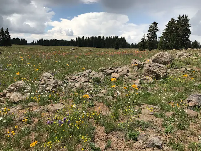
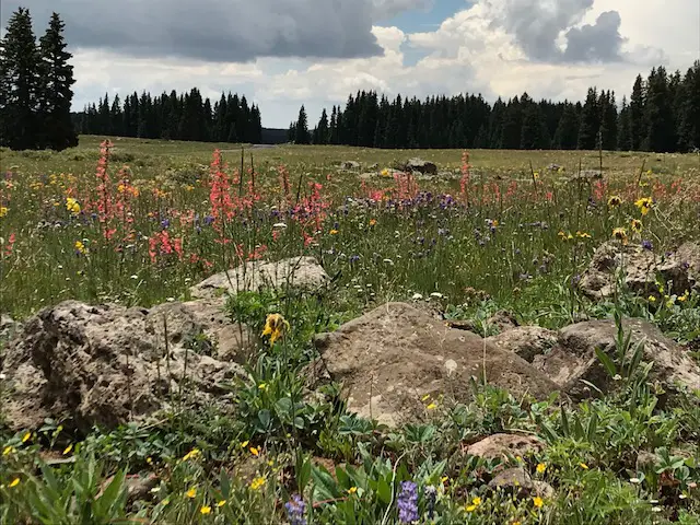
Wildflowers in the Colorado High Country!
We enjoyed COUNTLESS wildflowers throughout the trip. We’d heard stories about the beautiful flora that carpets the Colorado mountains during summertime but had never been there late enough in the year to experience it. Their colors consisted primarily of red, yellow, purple, and white variations. Their beauty was worth the mosquitoes!
This brings me to another point…if you visit these areas in the summer…buy stock in mosquito repellant first! We’d experienced the little buggers (no pun intended 😇) a little in the past but not during prime season. Those things can, almost, carry you away! And they’re tenacious! They latch on until physically removed and are undeterred by vigorous hand-shaking or other, less forceful methods (which is problematic when you’re using both hands to complete other tasks). I’m all about respecting Nature, but mosquitoes may be the one critter where I draw the line. I just don’t see where they have ANY redeeming value. They’re annoying, they spread–potentially deadly–disease, they do act as a food source for other animals, but aren’t there enough other creepy crawlies for those critters to live on? I mean, COME ON! Is it possible Mother Nature made a mistake with this one? 🤔
Public Service Announcement: While I don’t enjoy smearing poison laden with Deet across my body, as someone who reacts STRONGLY to bug bites–to the point of being woken up by the itching in the middle of the night–I’ll defer to the poison on this one. 😝 There are more natural bug repellants available, but I’d encourage you to be VERY careful with your choices in bear country (especially grizzly country). Anything, with any smell, should be avoided. They claim bears can even be attracted to hand lotion or chapstick that’s been left in someone’s pocket inside a tent. 😮 One perk to the drier areas we ventured through later in the trip was the lack of mosquitoes! 🤭
Colorado Crowds
This trip did reiterate for us, again, how spoiled we are living in the Black Hills. In South Dakota, even during high-traffic times, you can enjoy a weekend in the backcountry without encountering nary another human (unless you bring them along 😉).
In Colorado, we were–somewhat unpleasantly–surprised by the number of human companions we encountered. It wasn’t just busy weekends either. While we were in a heavy-use area, I was shocked that we had trouble finding a National Forest campsite on a Monday. I was rather disappointed by the lack of wildlife we encountered on this trip and I wondered if it was at all due to the higher percentage of people in the vicinity? We spent 2.5 days in the “moose capital of Colorado” and didn’t see one moose (actually, we didn’t see any the entire trip!) 😫 We saw LOTS of marmots, but I was hoping, with intentionally spending time in the backcountry, we would have a higher likelihood of encountering more wildlife. I don’t think the heat was a problem as it wasn’t that hot, and we spent the majority of our trip at-or-above 9000 feet. There weren’t THAT many higher locations for the critters to roam!
We DID see countless bovine–which I dubbed “Colorado Bears” by the end of the trip. 🙄 I’m all about everyone having equal access to our National Forest land; however, the cows got a little annoying. They smell, you have to avoid getting their “remnants” on your shoes, and when you’re looking for exciting wildlife–like actual bears, or moose–and all you see are cows, you get a little discouraged. Maybe some “city folk” find our steak-producing cohabiters interesting, but this farm girl from Indiana was not impressed. 😜
We also learned on this trip that no matter where you go in Colorado, and no matter how remote you think your location may be, you will likely always be in the flight path of some airport. You’d settle down in your tent at night, being lulled to sleep by the, surprisingly, deafening silence of the forest (apparently it’s too cold for crickets at 10,000 feet, even in the summer?), and your reverie is suddenly disrupted by the roar of jet engines flying overhead!* 🤫
*I really don’t mean to complain, we honestly had a SPECTACULAR time on this trip and we’re already looking forward to and planning our next excursion to the Rocky Mountain State (I’ve mentioned before my unbounded love for vacationing there). These are just the things you contemplate after 10 days of suffering from altitude-induced hypoxia and the venom of countless insect bites. 😳😉
National Forest Campgrounds are the Best!
We were also, again, reminded of our love of National Forests on this trip. I’ve mentioned this before, but if you can make do with more primitive facilities at their campgrounds (which usually means no flush toilets, though potable water is often available in the summer months), National Forests are a must-see. They are at least as scenic as National Parks, with far cheaper fees and FAR fewer people. We’ve enjoyed campsites where we fall asleep to the sound of the nearby babbling river, and ones where the moose almost walk through your campsite multiple times per day!
A new “device” we acquired for this trip was a Luggable Loo and Double Doodie Bags (seriously, one of the greatest inventions EVER) and **sun shower, which made the dispersed camping experience far more tolerable.
**A sun shower is simply a reusable, robust, vinyl bag and tube with a spout, with black backing that you fill with water and leave out in the sun. When you return to camp later in the day, you have warm water (it also works well to make sure your fire is out at the end of the evening 😁).
I am SO PROUD of this picture. This was an “end-of-the-day-I-was-tired-so-I-jumped-out-of-the-car-and-snapped-a-quick-pic-that-ended-up-being-awesome” picture. 😁
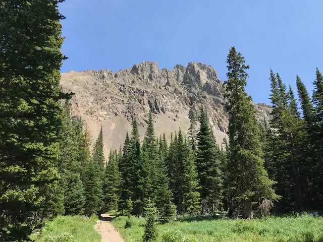
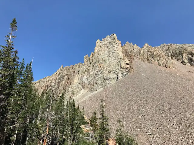
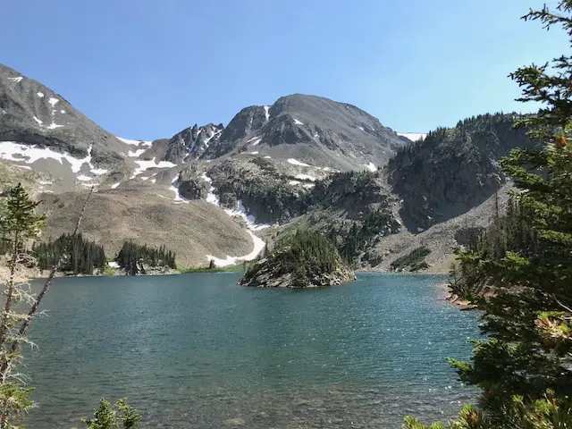
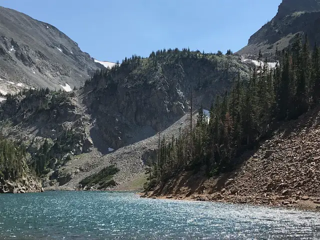
State Forest State Park, the Crags and Lake Agnes:
On this visit to State Forest State Park, we were able to complete the Lake Agnes trail and enjoy the Crags. It’s a fairly short trail, well-graded and not-overly-strenuous. I should caution you though, through many switchbacks you are carried up a fairly decent elevation gain, at 10,000+ feet mind you. 😓
The Crags
The entire trail is only about two miles round-trip and the lovely wildflowers that accompany you on your hike, as well as the SPECTACULAR view at the trail’s midpoint, are absolutely worth the effort required to complete the trek.
While it’s still on our list to visit, it reminded me of pictures I’ve seen of Avalanche Lake at Glacier National Park, complete with the turquoise-colored water. This was comforting to me as I was under the impression this color of water is mostly seen near glaciers, and if glaciers continue to recede, it would be a shame if future generations are unable to enjoy this spectacular view.
Lake Agnes
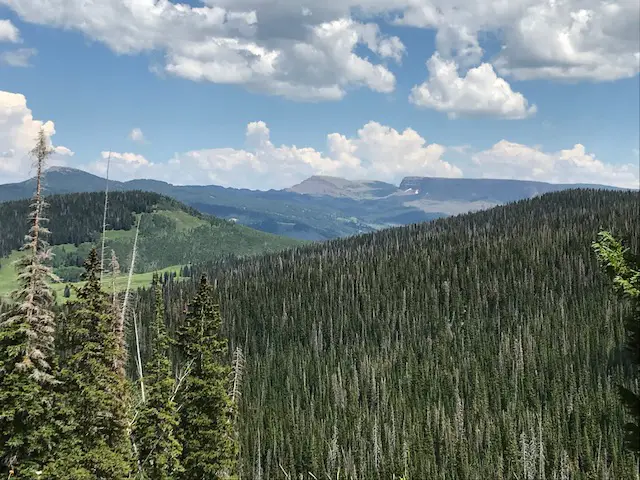
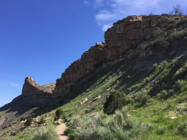
Flat Tops Wilderness:
We also traversed the Flattop Wilderness Area. It was gorgeous as well! The best way to see this area is to take the Flat Tops Trail Scenic Byway which meanders through the countryside. It Follows Routes 13, and 317, and some county roads (two of them are also called North Fork Road and East Williams Fork Road). The Byway connects the small towns of Meeker and Yampa, in far, northern Colorado. The road system was a little confusing out here. There were some intermittent signs for the Byway but I’d recommend a good map before venturing out this way. (Don’t rely on your phone, it’s easy to lose signal in these rural areas.)
People who take this route should be away, the majority of the “highway” that traverses the wilderness area was a dirt road comprised of a rutted, washboard surface. It wasn’t a difficult drive, we saw plenty of sedans traveling it. The surface choice is understandable as the road is completely closed throughout the winter months, so maintenance during the rest of the year is probably more easily completed on a gravel road. I just want people to be aware if you’re expecting a typical “scenic byway” experience consisting of a two-lane, blacktop road, that isn’t exactly what you’re going to get!
The area was spectacular though, full of sweeping vistas of far-off peaks and valley floors dotted with lakes perfect for fishing and picnicking.
You can see where the area got its name
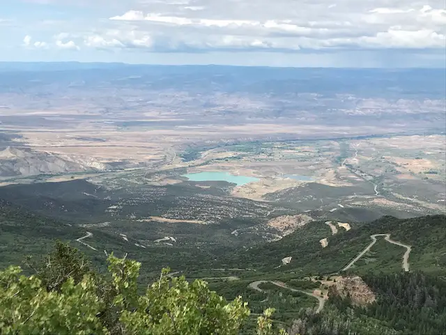
Grand Mesa National Forest:
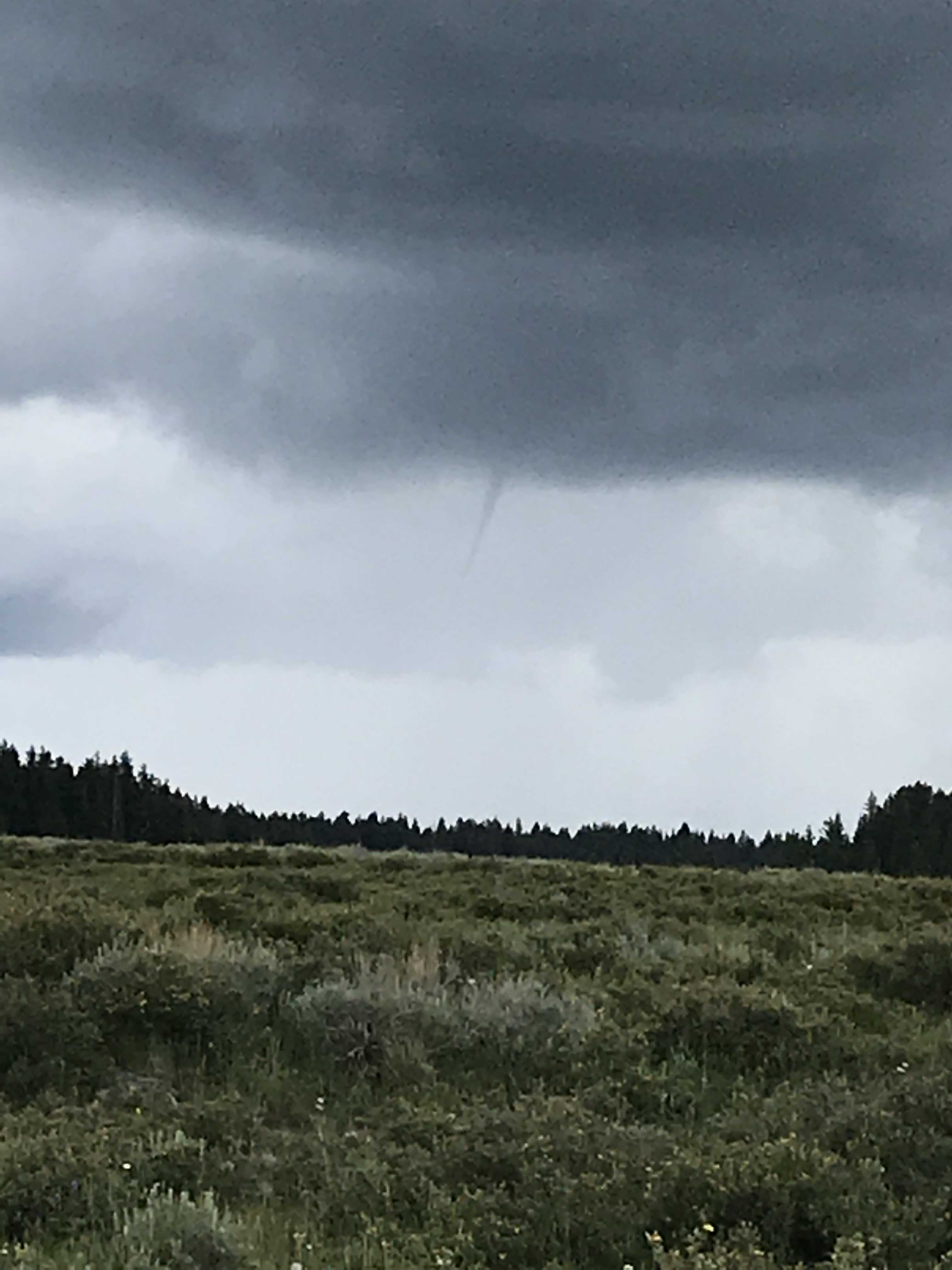
At Grand Mesa, we had hoped to hike more, but the impending thunderstorms and extreme exposure on our intended trail encouraged us to seek out other recreational options.
Those storms actually produced a small, short-lived, funnel cloud! Accidental storm chasing, on a mesa, with only two escape routes (one a potentially muddy, dirt road), what could possibly go wrong? 😳😉 Fortunately, I had a meteorologist with me who determined the risk to us was slight.
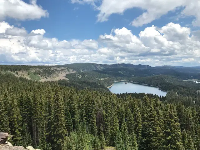
Island Lake with the Crags Crest off to the left (note: these are different crags than those at State Forest State Park)The San Juan mountains provide a lovely backdrop to the views at Grand Mesa
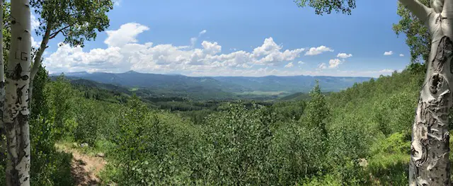
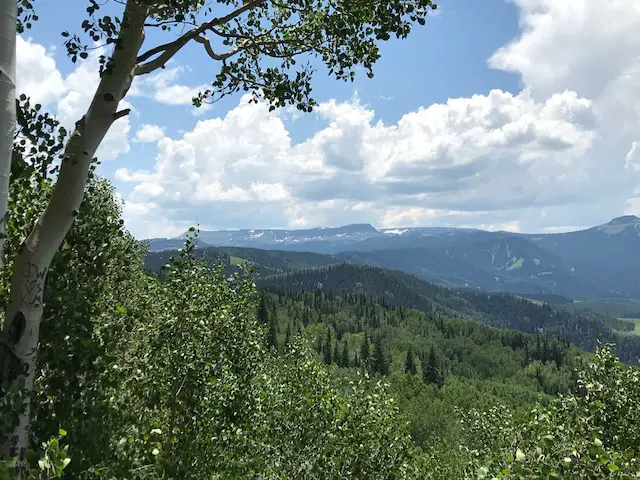
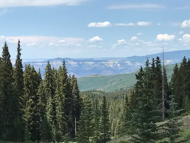
We were able to complete the Land’s End Road–also, primarily, gravel, but in much better condition than the previously mentioned Byway. This route takes you to a, now-closed, Observatory. It also proffered an incredible vista of the valley far below and granted a birds-eye view of the interchanging ecosystems that encompass so much of western Colorado. Here, lush forests in the highest elevations transition into scrubland and nearly-desert as the altitude decreases.
For some views of Grand Mesa in fall, check out this post from when we visited several years later!
We saw some of the friendliest (pushiest?) chipmunks we’d ever encountered on top of the Mesa. The Trekkers believe in keeping wildlife wild so we did NOT feed them. But, evidenced by the mounds of sunflower shells we saw scattered about (and that we watched the critters literally take food from other peoples’ hands), they have been habituated to human contact. The greedy little buggers come at your with cheeks full, begging for more!
The view from the top of the Mesa at the terminus of Land’s End Road
The overly-friendly (and difficult to photograph) chipmunks at the top of the Mesa
Funnel cloud at 10,500 feet!
If you’re looking for some hidden gems to visit in Northern Colorado, make sure you check out State Forest State Park, Grand Mesa National Forest, and the Flattop Wilderness!
Have you enjoyed any of these hidden gems of Colorado? Tell me about your experience in the comments!
Did you enjoy this post? Pin it!
Like what you read here today? Please feel free to leave a comment, like or share this post! Add your email at the bottom of the page, or the sidebar to the right, to be notified when a new post is published. By signing up for the email list, you will also receive a free copy of the Tranquil Trekker’s Top 10 Tips of Trekking Do’s and Don’ts!
You can also follow the blog on social media by clicking the links below!
We spent the second week of our 2017 Road Trip enjoying 11 Don’t Miss Sites in Colorado. That state is, by far, one of my favorite locations in the entire country to visit (and we’ve seen the 48 Continental US States!) Its beauty is indescribable and pictures don’t truly do it justice.
The following is a rundown of the highlights of our tour around the state. Thanks again to Mr. Trekker for some of the pictures!
Trinidad, Colorado
Trinidad is an old-school, Western town in far Southwestern Colorado, only about 15 miles from the New Mexico border. It’s a cute little community that’s been well-maintained and has seen some modern updates in recent years.
I’m still adjusting to the whole “pot legalization thing” in Colorado. 😂 It’s not my fault, I was a DARE child of the ’90s, I grew up being taught that it was bad (of course this was by the same people who also taught us that Pluto was a planet–and people wonder why I have a skeptical nature!) Then there’s the issue where it’s legal in the state but not in National Parks within that state because that’s Federal land and it’s still illegal Federally. Like every good Libertarian, I’m willing to tolerate it but *sigh*, does this make anyone else’s brain hurt?
The next day, we headed West from Trinidad on Route 160, bound for Mesa Verde National Park! 12 years ago we visited the park and parts of Western Colorado on our very first road trip, so it was cool going back. Some of it we remembered, but it had been so long that there was plenty that we were seeing again “for the first time”.
Colorado is one of my favorite places to visit. Click here for more posts on this awesome state!
Having just recently survived a bout with an aggressive flu, I was still not my best self at this point, though, as we were entering some beautiful country we wanted to do a little sightseeing. The first pass we arrived at (and the first overlook) we stopped to take some pictures. I stepped out of the car, took one step on the unsteady gravel in my flip-flops, and skidded to my knees. The fall left a lovely road rash in its wake (because this trip just hadn’t been adventurous enough!)
At first, I figured it was nothing, till I looked down and saw red rivulets running down my leg *sigh*. So, back to the car, we went, with Mr. Trekker coming at me with the first aid kit. Unfortunately, it only had alcohol swabs in it and we were FAR from any modern bathroom with water and soap. Needless to say, Mr. Trekker was NOT my favorite person that day! But, kudos to him, he bandaged me up well (albeit painfully) and I now only have a minor scar to show for my misfortune. 😝
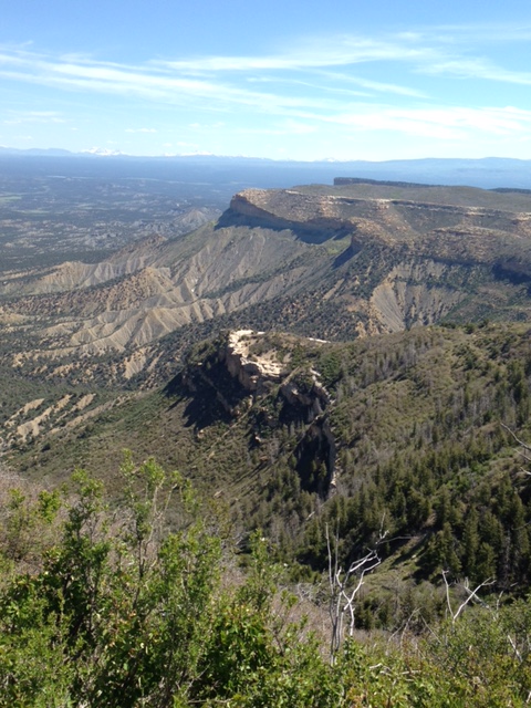
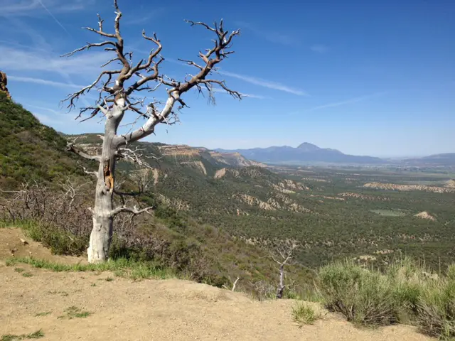
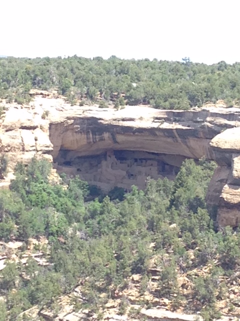
Mesa Verde National Park:
**Author’s note: Just a word of warning, as this is a National Park, no dogs are allowed on any trails (exceptions for Service Animals). They are only permitted in the campgrounds and parking lots.**
This unique park showcases cliff dwellings from the civilizations who lived there thousands of years ago. Some you can view from overlooks, and some you can actually tour (self-guided and ranger-led). They’ve also got a great campground with spectacular star-gazing opportunities.
Our first trip to the park was one of my first camping experiences out West where there’s far less light pollution. I remember being astounded at the light show the night sky put on (and that’s coming from a girl who grew up on an Indiana farm). It was on my first visit to this park that I fell in love with Colorado and “the West”. I didn’t know then that in six years I’d become a “Westerner” myself!
Unlike many of the national parks (such as Rocky), the campgrounds have modern bathrooms—read, flush toilets, and showers. I’d recommend at minimum a 2-day stay to really get the most out of the park.
Cliff dwellingNavajo Canyon
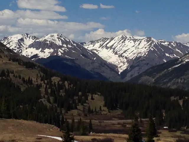
Route 550, the Million Dollar Highway:
On our first trip to this area, we stumbled upon this highway accidentally, completely unprepared for what we were about to experience (it was just the most accessible option to get us where we wanted to go). The second time around we knew what we were in for…and were still awed.
Route 550, in western Colorado, runs north to south between Grand Junction and Durango. It is called the Million Dollar Highway because it is so beautiful it offers million-dollar views as it traverses many mountain passes.
If you’ve never traveled this route, I STRONGLY recommend it, though I’d suggest navigating the road from south to north starting in Durango. This ensures your car is on the inside of the sharp turns the majority of the time. If you’re coming from the north you will find yourself frequently perched along cliff edges with nothing between you and the gaping maw of the canyon below than some thin oxygen (there are no guardrails the majority of the drive as the snowplow drivers need space to push the snow off the cliffs in the winter months).
If you can handle the drop-offs, this drive is a must! This area is referred to as the “Switzerland of America” because its incredible mountain vistas rival those found in the immensely beautiful, European country.
I can testify the views here rival those we saw in Glacier National Park on the Going to the Sun Road (though these are more accessible, depending on your location). Also, this road is open all year, weather permitting.
The most popular portion of the drive (between Durango and Ouray) is less than 70 miles in length, but plan for it to take several hours (that was our big mistake the first go-around). It’s a slow drive, in some areas the suggested speed limit on the curves is only 10 – 15 mph (and trust me, they aren’t joking). It can be slower if you find yourself traveling behind larger, slower-moving vehicles.
The most intense (and most beautiful) portion of the route runs the 25 miles between Silverton and Ouray. Stops are frequently caused by construction in the summer months as workers are constantly fighting the ongoing battle with natural erosion. Rockslides are also common (as well as avalanches in the winter).
This drive can be frightening for us acrophobes with its steep drop offs but the immensely beautiful views are worth it! There’s plenty of skiing, 4×4 trails, hiking, camping, rafting, and a slew of other activities available in this corner of Colorado, so be sure to put it on your “must-see” list.
Telluride, Colorado:
Telluride was about what I would expect from a ski town (the Trekkers are uncoordinated and therefore not downhill skiers). It was lovely, though we were a little early for the summer season so the upper roads weren’t clear of snow or open yet. We walked down the road to view a staple of the town, Bridal Veil Falls. The road up to it was open for hiking, but as I still wasn’t at my best we decided to skip that option this trip. Instead, we opted for lunch at Brown Dog Pizza, a local joint where I can honestly say I had the best cheese calzone I have ever eaten, hands down.
The ricotta cheese seemed as though it had been whipped into an airy froth. I’m no food connoisseur, but it was incredible.
Bridal Veil Falls
Ouray, Colorado (pronounced U-Ray):
The drive into town from the south is one of the most beautiful views I’ve ever seen. THIS I remembered from 12 years ago. You descend from the harrowing Million Dollar Highway and this small oasis of civilization opens up before you in the valley, beckoning you down from the peaks. (If you’ve seen the show “The Ranch” on Netflix, this town is the one used in the opening credits).
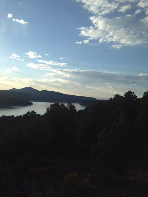
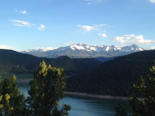
Ridgeway State Park:
Ridgeway State Park has one of my favorite campgrounds we visited on the entire trip (part of the reason we spent three days there!) It’s located just north of Ridgeway on Route 550 (north of Ouray, so out of the peaks). They have a lovely, shaded, tent-camping area that’s back off the road, complete with level, graded tent sites, modern restrooms (and showers!), all surrounded by cedar trees.
This brings me to another point. Apparently, it’s perfectly legal to smoke pot in Colorado State Parks, but don’t you dare hang a hammock from a cedar tree! I’m sure there is a good reason for this due to the risk of damage to the trees, and I’m all about protecting nature, but this just seemed to be a bit of a misalignment of priorities to me! 😝
The park surrounds a picturesque reservoir set against a backdrop of snow-capped Rockies to the east. Its location makes it an ideal base camp for numerous day trips and activities.
Ridgeway State ParkIt was so strange to look to the east and see the Rockies
True Grit Film Sites
The park also happens to be near the filming location of the original western, True Grit (the one from 1969 with John Wayne, not the new version). If you’re a good enough detective there are numerous filming sites you can locate in this area (though please be aware, many of these areas are located on private land and you are trespassing if you travel on them without the owner’s permission. Please be respectful of private property!) Click here for some help finding the sites!
We were able to view Mattie Ross’ Ranch, Courthouse Mountain, Chimney Peak, and the meadow where the shootout scene was filmed, without difficulty. The last three can be found off of Route 8 (to reach this travel east from Route 550). You’ll reach The Meadow about ½ mile before the summit of Owl Creek Pass. Courthouse Mountain and Chimney Peak are visible from The Meadow and Sleeping Rock is located at the summit of the pass.
Sleeping Rock (the rock Mattie Ross slept on in the 1969 version of True Grit)Courthouse Mountain and Chimney Peak
Mattie Ross’ Ranch is located off of Last Dollar Road which is found off of Highway 62 (the road from Ridgeway to Telluride).
Mattie Ross’ ranchDeb’s Meadow (where the final shootout scene was filmed)
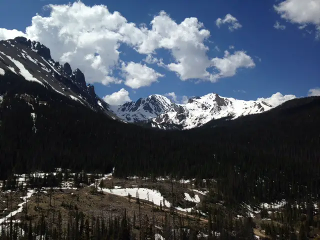
Grand Mesa National Forest:
Grand Mesa National Forest is another “must-see” location in the mountains east of Grand Junction. It’s primarily used for cross-country skiing and snowmobiling in the winter months. It’s got some great campground/fishing/hiking opportunities as well, but we were, unfortunately, too early in the season to really take advantage of these options. The hiking trails weren’t yet open as there were still feet of snow drifted on them in some places. Click here for more info on our return trip to Grand Mesa!
During the peak of summer, this would be a prime place to escape the heat though, the day we were there it was near 90 in the closest town on the valley floor and it was in the ’40s, and raining/snowing large glops on us at the summit.
Snow on the summit, this was June 6th ya’ll!
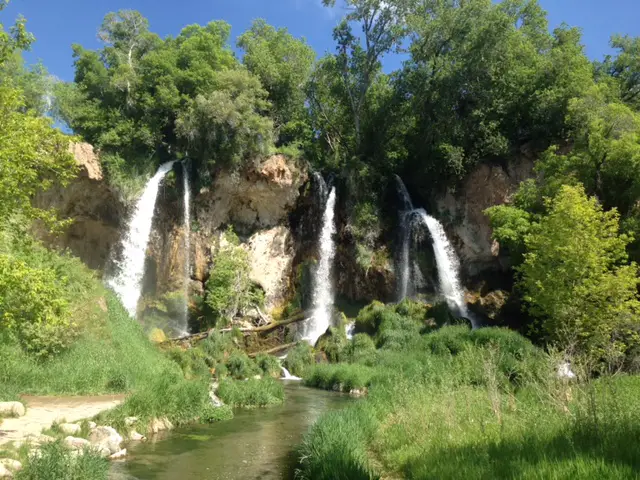
Rifle/Rifle Falls, Colorado:
We spent our final hotel stay of the trip in the small town of Rifle, Colorado. This is an adorable, little town with an awesome state park!
Rifle Falls State Park was absolutely beautiful. It was the only place I’ve ever been where you can traverse walkways that stick out over the TOP of the falls! The caves at the bottom were picturesque as well (and provided a cool respite from the summer heat).
Rifle FallsA different view of the falls
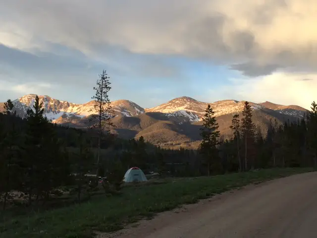
State Forest State Park:
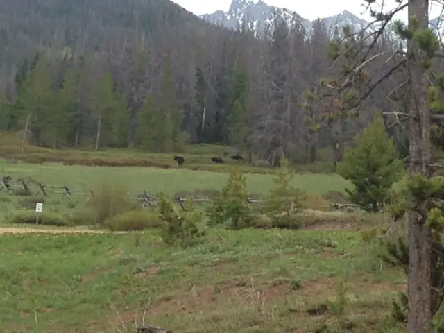
$20/night for a campsite; going several days with no indoor plumbing (or showering); a DISGUSTING pit toilet (seriously, it was an upside-down pail sitting over a stinky hole in the ground); BUT…eating dinner while a cow moose and two calves eat theirs, in a field, a few thousand yards away with the Rockies as a backdrop…PRICELESS!!!
We spent the last three nights of our trip at State Forest State Park which is renowned for its moose sightings (many were re-introduced here back in the 90s.). The park actually claims to be the “Moose Viewing Capital of the World!”
It definitely offered the best moose sightings we had ever experienced…until our Labor Day camping trip in the Big Horns later that year…you can read about that here!
This view reminded us of the Garden Wall at Glacier NP.Alpenglow over the Western Rockies (Rocky Mountain National Park and the Never Summer Mountains are basically due east from here, right over those mountains.)Ranger LakesMoose from the campsite
CLOSE ENCOUNTER of the Mountain Lion Kind!!!
The final night of our trip I had a true close encounter (at least I think I did, it was dark and it was over fast!) It was late and we were the only people still up in the half-full campground. Our campsite was perched on a hill backed by the forest and fronted by a lake.
The first night, we spied a moose family skirting the campground using a gully to get to the lake for their evening drink, so we knew it was a popular thoroughfare for the local wildlife. We were waiting for the fire to burn down and out of the corner of my eye, I spotted movement in the empty campsite across the road (maybe 30 yards away and downhill from our site). At first, I thought it was a deer I had seen meandering around earlier that evening…and then I realized the “deer” had a long tail…
Interesting side note, many stories I’ve heard of people spotting mountain lions start with, “I thought it was a deer till I realized it had a long tail…” 😮
…then I thought it was a dog from one of the neighboring campsites, but I was pretty sure he was in the tent with his family…and the creature I spotted didn’t move like a dog…
Its movements were stealthy, fluid, and sleek; beautiful actually. I couldn’t tear my eyes away. It almost glided across the ground. It reminded me of watching a cat jumping onto a high shelf when you’re sure any minute it will send objects flailing into space but instead it glides gracefully around them.
It was visible for only a few seconds, once it saw me it hightailed it out of there (which is exactly what we WANT wild animals to do!), and I wasn’t able to get Mr. Trekker’s attention quickly enough for him to see it. We looked for tracks the next morning and didn’t find any but the ground was very dry and hard so this wasn’t a surprise. I can’t prove it but…I think I saw my first mountain lion that night (that’s my story and I’m sticking to it! 😉)
Oregon Trail Ruts, Guernsey, Wyoming:
On the last day of our trek, we stopped for lunch in Guernsey, Wyoming at the Oregon Trail Ruts State Historic Site. There we viewed wagon wheel ruts left forever engraved on the landscape by the pioneers traveling the Oregon Trail.
You could almost hear the lowing of oxen, the clanking of household items, and the creaking of the wagons as they slowly made their way across the prairie. You could almost smell the rank odor of animal and human sweat mixed with the constant cling of dust stirred up by the plodding of the animals’ hooves.
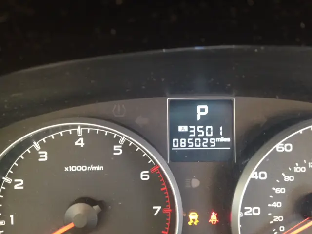
It was humbling to think that we traveled almost 3500 miles on our two-week road trip, crisscrossing across eight states and visiting countless places in our air-conditioned, all-wheel-drive car, with a suspension that gently glides across any bumps in our path (on the paved or graded gravel roads we drove on). Whereas these people traveled thousands of miles in a wagon train, a trip that took MONTHS as they slowly crept their way across the bumpy, muddy, rutted, rock-strewn ground, and lived under constant threat of death by exposure, disease, or attack.
When I got sick we drove five minutes to the local Urgent Care, it took maybe an hour to get seen, then we went to the Walgreens across the street for medicine and I was back in the hotel room on the road to recovery 20 minutes later. Back in the days of the wagon trains the same ailment likely would have meant DAYS of misery as the best of potential outcomes.
The Oregon Trail Wheel Ruts
A few final pictures from our jaunt around Colorado. If you haven’t been there, I STRONGLY encourage you to put it on your bucket list. You won’t regret it!
The RockiesRifle Gap ReservoirOdometer reading as we pulled into the driveway (No! We didn’t drive around the block an extra time to get it to 3500, I don’t know what you’re talking about!) 🙂
Have you visited any of these places? Tell me about your adventure in the comments!
Did you enjoy this post? Pin it!
Like what you read here today? Please feel free to leave a comment, like or share this post! Add your email at the bottom of the page, or the sidebar to the right, to be notified when a new post is published. By signing up for the email list, you will also receive a free copy of the Tranquil Trekker’s Top 10 Tips of Trekking Do’s and Don’ts!
You can also follow the blog on social media by clicking the links below!
We use cookies on our website to give you the most relevant experience by remembering your preferences and repeat visits. By clicking “Accept”, you consent to the use of ALL the cookies.
This website uses cookies to improve your experience while you navigate through the website. Out of these cookies, the cookies that are categorized as necessary are stored on your browser as they are as essential for the working of basic functionalities of the website. We also use third-party cookies that help us analyze and understand how you use this website. These cookies will be stored in your browser only with your consent. You also have the option to opt-out of these cookies. But opting out of some of these cookies may have an effect on your browsing experience.
Necessary cookies are absolutely essential for the website to function properly. This category only includes cookies that ensures basic functionalities and security features of the website. These cookies do not store any personal information.