Hiking Medicine Bow Peak

In this post I detail our climb up Medicine Bow peak in the Snowy Range of Wyoming!


The Trekkers did it! We finally hiked a 12-er (a mountain taller than 12,000 feet!)

We enjoyed Medicine Bow Peak (or MedBow Peak) in the Snowy Range (also called the Snowys), in far, southeastern Wyoming. To date this is probably one of the hardest hikes we’ve ever done. With the high steps over large rocks and boulder field I would say it’s comparable to Mt. Monadnock in New Hampshire–my legs were sore enough to say so, anyway!
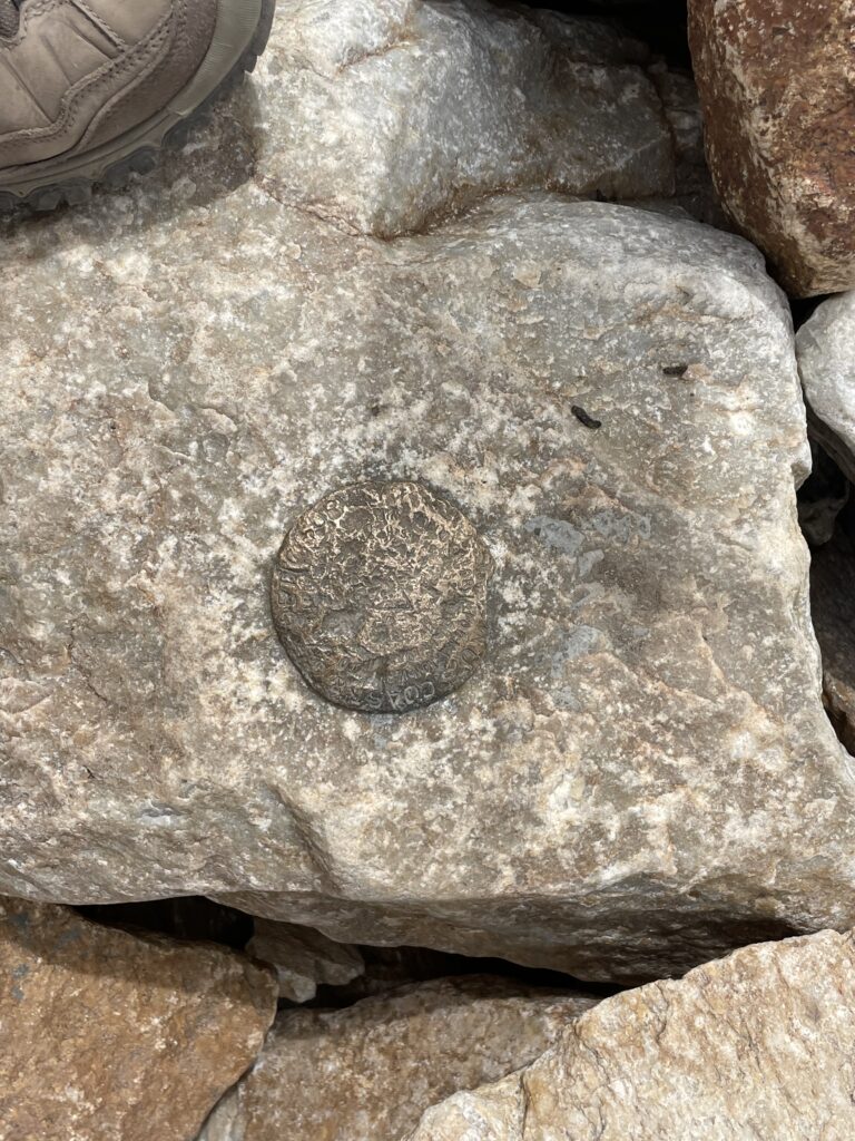
A close-up of a US geological survey benchmark set in a large rock.
US Geological Survey Medallion at the top of MedBow Peak! (Proof we made it!)

Why hike a 12-er?

After hitting our 40s and still dealing with long-COVID brain-fog after multiple rounds of that lovely disease, and then after my various health issues and surgeries in my early 40s,  I kinda felt like I had to prove to myself I’m not completely old and decrepit…YET!

I wanted to prove to myself (and my bionic ankle) that I was still capable of tough stuff. So, two-and-a-half years after major, abdominal surgery (vertical hysterectomy) and 18 months after a nasty fall on the ice and breaking my ankle in two places (as well as dislocating it and tearing a tendon…which resulted in major ankle surgery and permanent hardware–a plate , pins, etc.)  I set the personal goal to hike a 14-er in Colorado (a mountain taller than 14,000 feet).

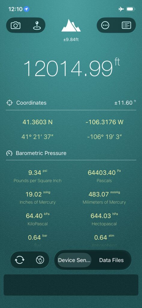
However, to get there, we figured we should do some practice hikes to see if we think we could really make it that high up (and what we’re getting ourselves into). Enter, Medicine Bow Peak which is actually a 12-er and clocks in at around 12,020 feet in elevation!
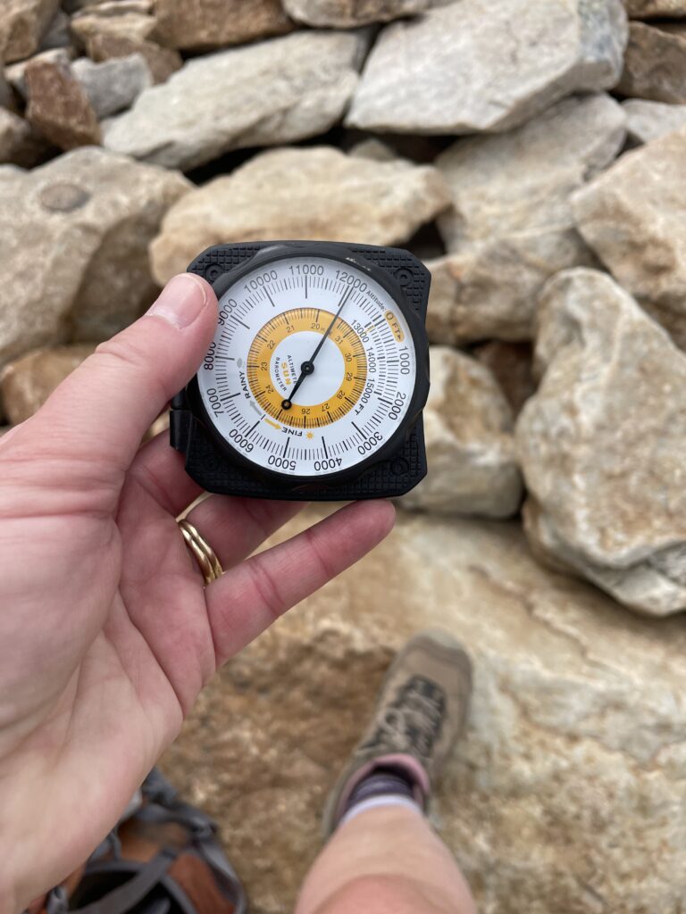
A hand holds an analog altimeter reading about 12,100 feet, with rocky boulders and a hiking boot visible in the background.

A smartphone app screen displays an altitude of 12,014.99 ft, GPS coordinates, and various barometric pressure readings in multiple units.


What is the trail to the summit of Medicine Bow Peak like?

The summit trail to MedBow Peak gains more than 1000 feet in elevation during the hike up (and most of this is gained AFTER the saddle! You can read about the MUCH easier hike to the saddle here.)  It’s also INCREDIBLY rocky and exposed, not to mention HIGH. (You start at over 10,000 feet  at Lewis Lake/the Sugarloaf Trailhead and end up at a little over 12,000 feet!)
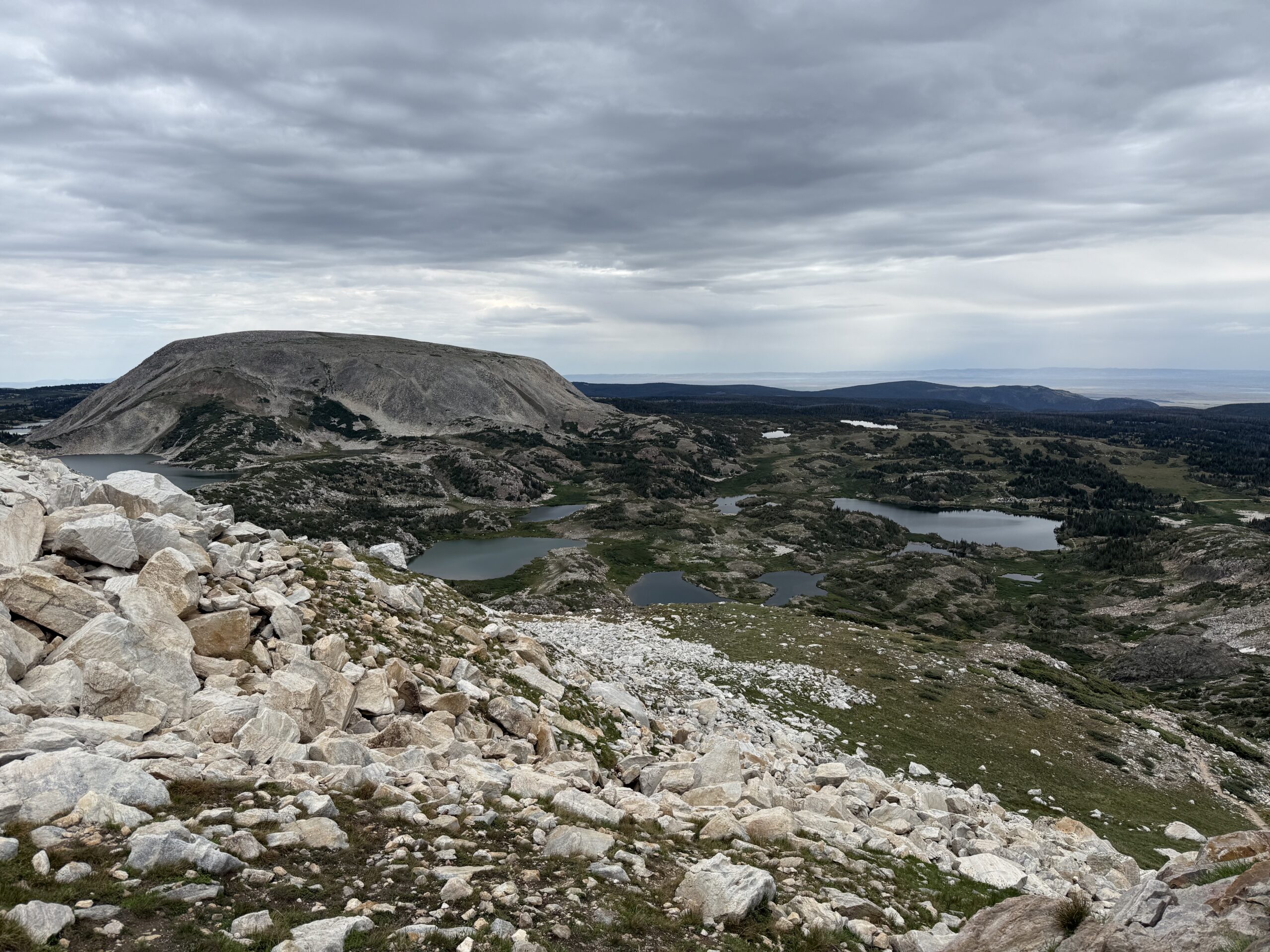
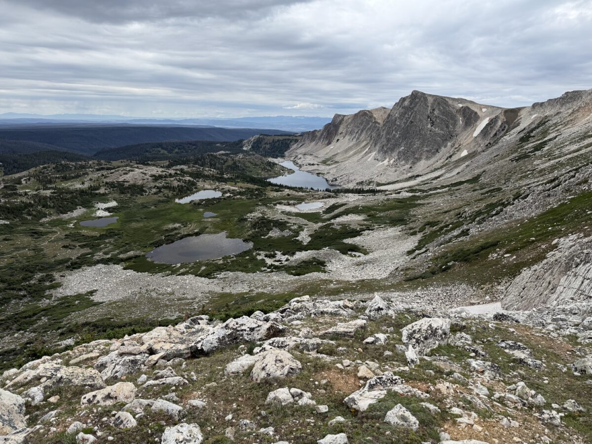
Rocky mountain slope overlooking several small, scattered, apline lakes. A large, rounded mountain sits behind, all under a cloudy sky, with distant forest-covered hills and open plains visible in the background.

Also, due to how high you are you’re above the tree line for the entire route so there is NO SHADE!  The trail can also become INCREDIBLY slick in the rain, mist or snow–and note, snow and ice lasts late into the season and comes early, in the High Country.  It can snow at any time of the year and thanks to monsoonal moisture that is normal in late summer, it has rained on us every single trip we’ve taken to the Snowys!  Also, there is absolutely NO PROTECTION from lightning up here during the violent summer thunderstorms that frequently occur.

We weren’t expecting the boulder field at the top of this mountain either! I thought it was going to be more of a scree field as that’s how all the surrounding mountains look from below. The last 100 feet or so of the climb up MedBow Peak is all boulder field and it SUCKED (if you aren’t into that kind of thing). We definitely determined with this trip that I do NOT like boulder fields (that may play into which 14-ers I choose to challenge myself on in the future…!)

**As I was carefully traversing these large rocks I was especially cognizant of how easy it would be to slip and get your foot/ankle caught…or to slip and roll it and/or twist it some strange way–this would not be good. While anyone can logically imagine the inherent risk in this, when you’ve fallen and literally heard (and felt) you ankle bone *crack!* this is especially triggering! 😮 **
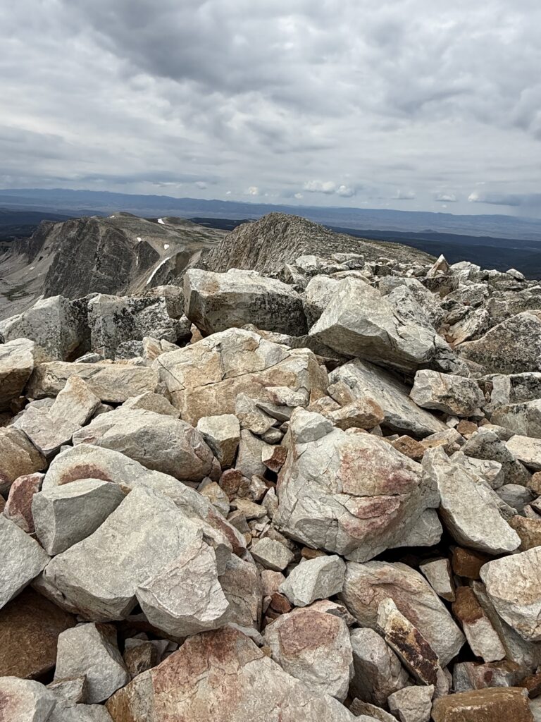
The rocky field on a mountain summit under a cloudy sky, with large boulders in the foreground and distant peaks visible on the horizon. The landscape appears rugged and remote.
The boulder field that makes up the summit of Medicine Bow Peak

For as high and mountain-y as it is, the MedBow trail is surprisingly not scary.

I am terrified of heights ya’ll. So much so that I’ve frozen up in vertigo-inducing situations in the past. (That’s right, I’m afraid of heights and I hike tall mountains–yes, I see the irony there. 😝 🙄)

But with MedBow, even though you’re basically, literally hiking up the side of a mountain and it’s steep, there are no real looming drop-offs.  I can honestly say there are a number of hikes we’ve done in the Black Hills (and elsewhere) that are considered to be much “easier”–even moderate in difficulty, that actually have far worse drop-off/vertigo/”possibilty-of-falling-to-your-death” potential than this mountain! (One example I could think of, for sure, is Lovers Leap trail, in Custer State Park, in the Black Hills of South Dakota.) 
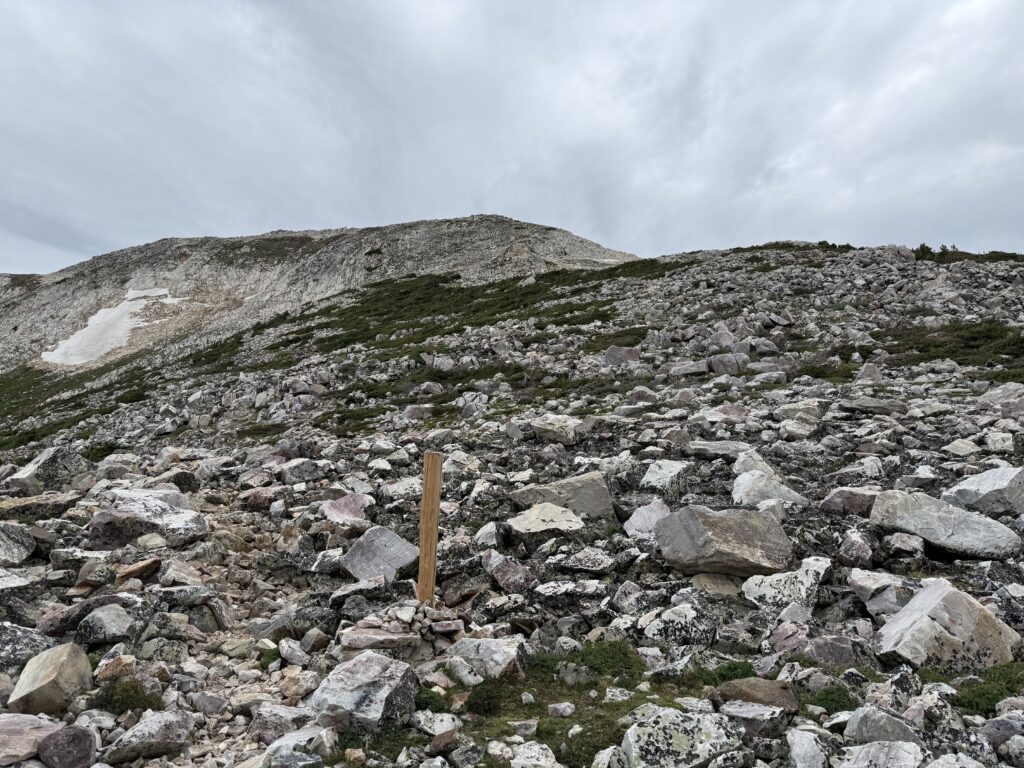
A bald, mountain slope covered in rocks of varying sizes and scattered with sparse grass under a cloudy sky. A wooden trail marker stands near the center of the image near a barely discernible, rocky footpath.
A portion of the MedBow Peak trail

What was also kind of weird is that you can’t actually see the peak of the mountain from the trail, basically until you are there (you can’t really see the peak from further down or from the road either). The mountain is just steep enough and there are enough lower peaks/false summits that you don’t really realize where you’re going until you reach the peak. Even if you can see people standing on the peak from further down the trail you don’t really realize they’re on the actual peak (as opposed to just being above you, further along on the trail).

Who/What you may see on the MedBow Peak Trail

There were quite a few people on the trail with us that day but Mr. Trekker and I determined we were some of the best equipped. There was one guy (an older gentleman who seemed far more in touch with nature than us–VERY nice guy!) who did the trail BAREFOOT!

You do you dude but I do NOT recommend this!–While it may be good for “grounding” I did notice he was bleeding some by the time he finished the hike.

Also, we met up with a group of about 25 teenagers coming up from a different route. Most of them were wearing either chaco-style sandals or converse-type shoes–some even had jeans on! And of course, ALL of them seemed to be having an easier time than us because we are OLD! 😝 It made me feel a bit like a dork with our “fancy”, Keen hiking boots! 🙃

This is definitely a you-do-you situation but I can ONLY recommend hiking boots (or possibly trail runners) on a strenuous hike, especially in a boulder-field-type setup. Some people prefer shoes to boots but only boots provide any real protection against severely rolling/spraining your ankle (and you can still roll your ankle in hiking boots, ask me how I know! 😝 ) Beyond the possibility of turning/breaking an ankle anything else also leaves your foot open to nasty scrapes/cuts, puncture wounds and/or ripped off toenails!

Dogs on Medicine Bow Peak Trail

Dogs are fine for the hike up from Lake Marie or from Lewis Lake to the saddle. These are largely just general, easy-to-moderate hikes. (We’ve taken Puppers on the trail from Lewis Lake several times!) After that I would NOT recommend dogs at MedBow Peak. They are allowed and some can make it up (one beat us to the top of the Peak!) but others we saw seemed to be struggling. We had another owner report they had to carry their dog through the boulder section as she was getting pretty anxious.

So this one is largely up to you as the dog owner. If you’ve got a small dog they may not handle the large boulders well (though if you can easily carry them this may not matter). If you’ve got a larger, agile dog with experience on bigger mountains and boulders they may do fine. The boulders weren’t horribly sharp and the overall trail is fairly short but you may still want to consider doggie booties, just in case.

The ultimate consideration should be, can you carry your dog down the mountain (at least until you reach the easy part) if they get stuck, get tired, get sore feet, etc.? If not, SERIOUSLY consider NOT bringing them to summit Medicine Bow Peak. We chose NOT to bring Puppers for the hard hike. She probably could have handled the boulders in her younger years (though her young hips still got sore on the Lake Helen trail, in the Bighorn Mountains, several years earlier) but I don’t think her “getting-older” joints would have appreciated this hike much. 
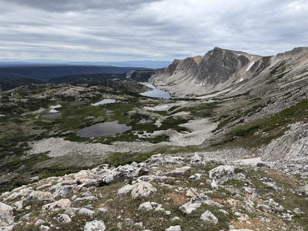
Rocky mountain landscape with several small, alpine lakes and scattered, grassy green, all under a cloudy sky. Rugged peaks rise in the background. The scene is remote and natural.

The downclimb from Medicine Bow Peak

Always remember when you reach the mountain peak…the hike is only HALF DONE! MANY people are injured on the downhill/return portion of hikes. This is due to fatigue but also loss of concentration. It’s easy to become complacent on the return trip. Also there is this little thing called gravity that comes into play far more on the downclimb. Many people don’t realize that climbing up can often be safer (if not easier) then trying to descend down.

This is definitely true for MedBow Peak. There are several sections with large, rock “steps” as well as some pretty short, steep sections that are more easily navigated by scrambling. This trail is largely considered to be a high Class 1 or low Class 2 jaunt, and I would agreed with that (I’m learning all this mountaineering lingo as I study up for hiking a 14-er! 😉) You “can” walk up the whole thing (and Mr. Trekker did, though he’s got a foot of height on me and MUCH longer legs! 😝) I found on the way down these few areas were more easily navigated with a “butt slide” but that’s just my suggestion, you do you! 👍
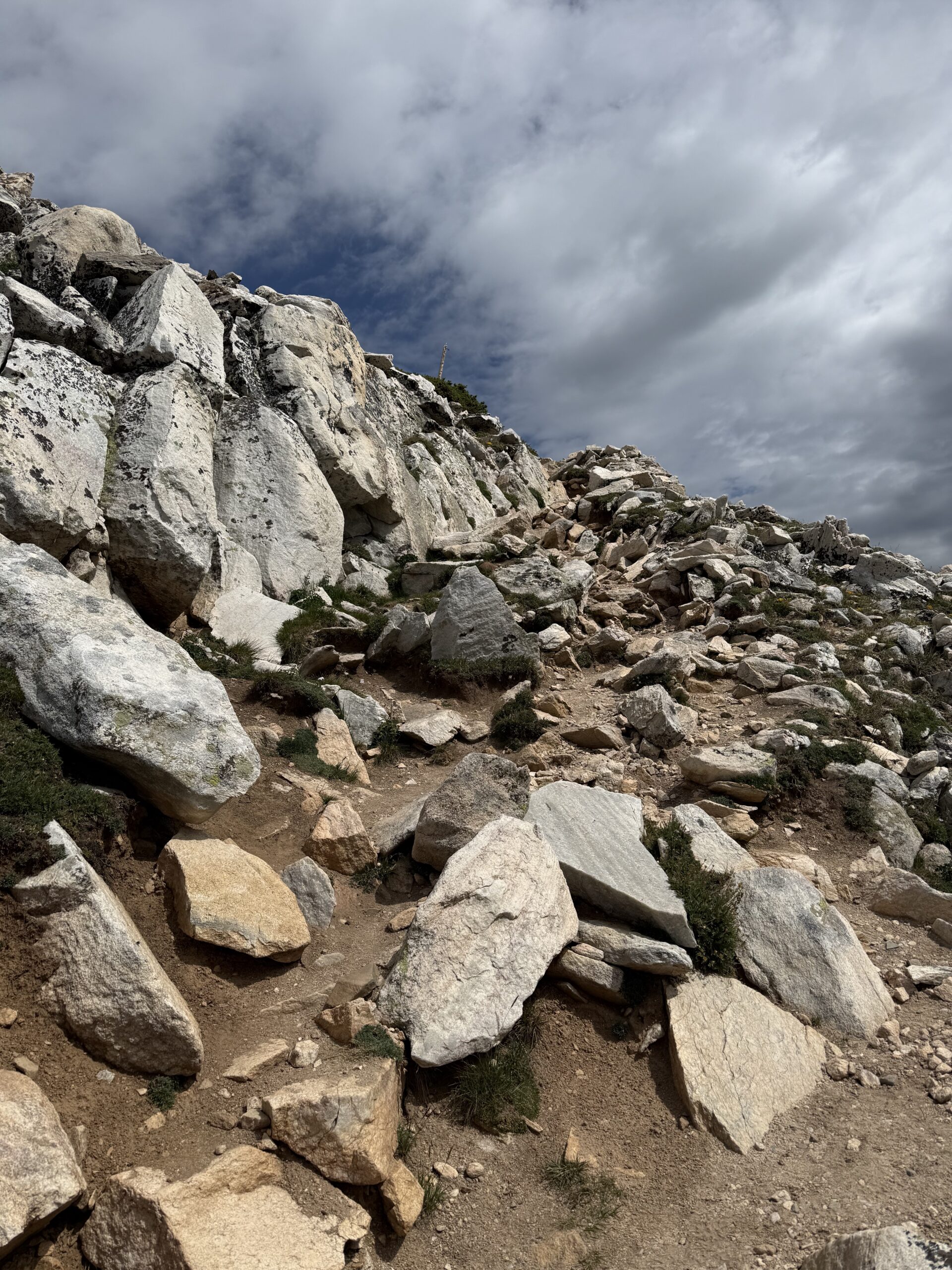
A very steep, mountain slope covered in large rocks with what appears to be a barely discernible foot path.
This IS a portion of the trail to the summit of MedBow Peak! It looks a bit steeper in this picture than it is but it’s definitely strenuous!

I will say this, if the rocks were wet or snowy/icy at all this trail could be downright TREACHEROUS, especially on the return/”down” trip. There are definitely parts where the rock could get slick QUICK. Fortunately when we hiked it was largely dry with just a slight drizzle so we didn’t find the difficulty to be any worse than hiking the hard way up Black Elk Peak in the Black Hills.

Recreating at high altitudes

We were VERY excited and pleased the altitude didn’t really affect us at all on this trip. Once you get to 12,000 feet you start getting to the point where some people can start to feel symptoms of altitude sickness. (We had been up this high a few times in the past–like on Independence Pass in Colorado).

The only time we’d ever done any hiking at this altitude was 10 years prior at Rocky Mountain National Park. We did a quick, short hike near the top of Trail Ridge Road and Mr. Trekker found he was really feeling the altitude. Fortunately, since then, we’ve spent A LOT more time hiking and hanging out “at altitude” so I think our bodies are learning to adjust better–I’ll let you know if that’s really true or not once we try a true 14-er! {We were at the top of Pikes Peak a few years ago (which is a 14-er) though we drove to the top that time, and we didn’t feel too bad walking around, so hopefully that’s a good sign. 🤞}

So why hike “at-altitude”?

After all the physical challenges I had been through the last few years this was just such an incredible accomplishment for me! It was probably one of the hardest trails the Trekkers have ever done to-date (if not THE hardest!) I think the last time I was this proud of myself for a personal accomplishment was when I helped one of the agencies I worked with earn a large grant!

I have also talked with several people who have knowledge of hiking 14-ers and they told me, “if you can do MedBow you can do some of the easier 14-ers for sure!” So, this is incredible motivation for our attempt at an even higher challenge in the future!


Like what you read here today?  Please feel free to leave a comment, like or share this post!  You can also follow the blog on social media by clicking the links below!
Facebook

Twitter

Instagram

Blue Sky

Medicine Bow Mountains (the Snowy Range)

In this post, I detail some great places to hike and camp in the Snowys!


The Medicine Bow mountains (also called “the Snowy Range”) are found in the far, southeastern corner of Wyoming. They are beautiful and unique! This is an area that is pretty secluded and not very commercialized. It also isn’t as well-known as many of it’s Rocky Mountain brothers to the south and west so it isn’t as crowded! This is kind of a hidden gem in the region if you’re looking for beautiful sights, great hiking and fewer crowds! (For fewer crowds I also recommend numerous trails in the Bighorn mountains. Click here for info on those or see more of the links below!)

Where are the Medicine Bows?

The Medicine Bows are a small area of mountains that run from north-central Colorado (near Rocky Mountain National Park) into south-central Wyoming (near Laramie).

These mountains are also called “the Snowys”. Why? Well, because they are usually VERY snowy! 😉  But seriously, every time we have visited this area in late July or early August there was still always at least some snow on some of the peaks.

The Wyoming portion of the range is what most people think of as the Medicine Bows. Here they are divided into three main areas: the Sierra Madres to the west, the Snowy Range (the Snowys) in the middle, and the Laramie Peak area to the east. We have always focused on the Snowys…

The Snowy Range reminded us of Colorado! This area felt a lot like the around Walden, Colorado, and State Forest State Park which makes sense as it’s the same National Forest. Also, less than 100 miles separates the two…we also enjoy the “singing” hummingbirds in the Snowys that we’ve noticed in Colorado before…

Ryan Park Campground

There are multiple Forest Service campgrounds in the Snowy Range.  We usually choose Ryan Park as it is lower than many of the other campgrounds in the Snowys (at “only” around 8,000 feet rather than 10,000 feet.)  This proves an obvious benefit as it is usually slightly warmer (especially at night) and may have less rain (but it’s still FAR cooler than the lower elevations of the surrounding plains!)

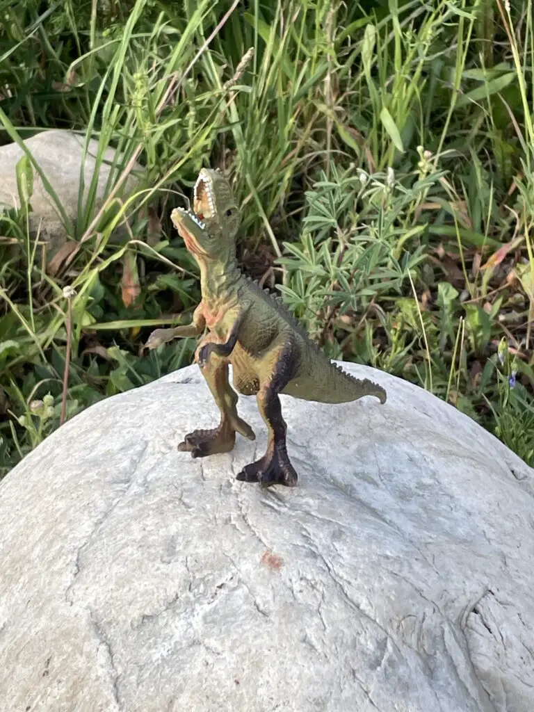
A toy dinosaur with it's head back roaring sits on top of a rock with tall grass surrounding it
Our camp protector! (One year he was at our campsite when we arrived and we left him for whoever came next!)

To be clear, Ryan Park is still a Forest Service campground so it is rustic…

I’ve mentioned before that we REALLY enjoy US Forest Service campgrounds as they usually offer more secluded campsites and more rustic locations. Forest Services campgrounds are perfect for tent camping though most can accommodate RVs, as well (at least in some sites). Just be aware of what you’re getting into as most Forest Service campgrounds only offer:

      • potable water–at least in-season
      • decent campsites with fire grates and picnic tables (Always check local regulations to see if there are any current fire bans in place!)
      • …and that’s about it! 😀  Forest Service campgrounds also usually only offer vault toilets. (And,  let’s be honest, a vault toilet is still just a hole in the ground that you pee in 😉 but, the bathrooms at Ryan Park Campground have always been some of the cleanest and nicest-smelling outhouses we’ve ever been to! 😉)

**I should do a post sometime about decent vault toilets we’ve visited around the country.  Note: Yellowstone National Park and State Forest State Park, in Colorado, sport some of the NASTIEST! 🤥**

Another thing to note is that unfortunately, there isn’t much shade at any of the Snowy Range campgrounds. Sadly, this area has been hit BADLY by beetle kill in recent years. The Forest Service has done a good job of cleaning up all the dead trees near campgrounds, which is incredibly important for safety, it just means most of them are fairly bare of trees now. 😕  This does equate to lovely views of the night sky and sunsets/sunrises though!

Hiking in the Snowy Range

We found some great hiking trails in the Snowys!

Medicine Bow Peak Trail (to the saddle) 

We hiked from the Sugarloaf trailhead near Lewis Lake.  This is one of the shortest routes to Medicine Bow Peak. This portion of the trail is largely family-friendly and doesn’t get too difficult (until after you reach a saddle that is less than a mile from the peak.)

If you’re thinking about trying that last mile, just know that it is incredibly steep and rocky with loose, potentially slippy rock and it is exposed on a shelf-like trail. You can read more about it here

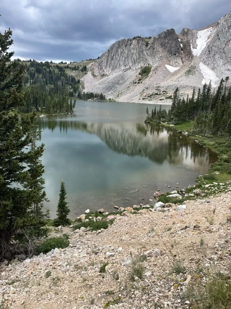
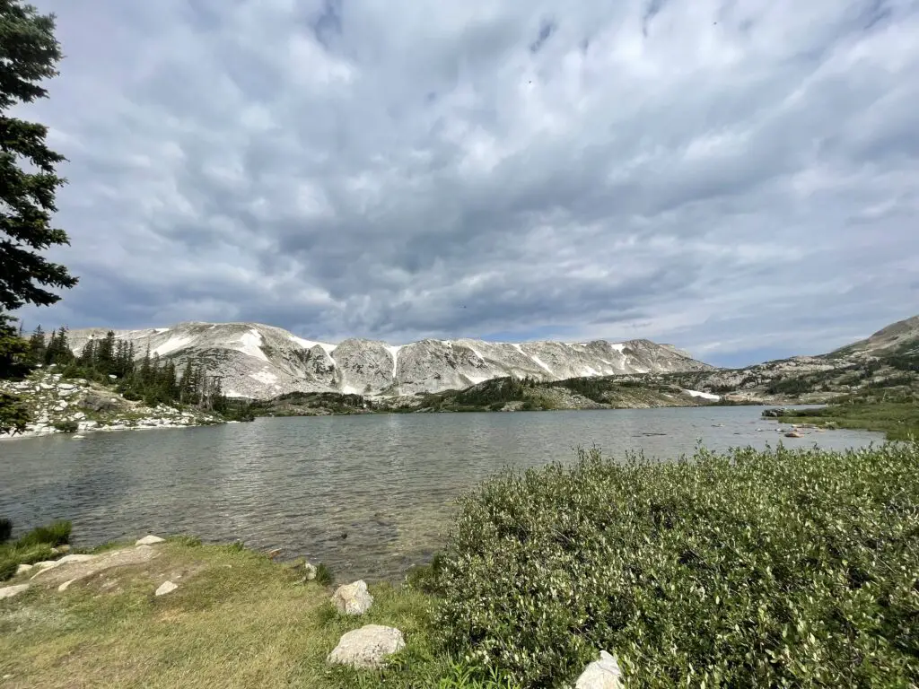
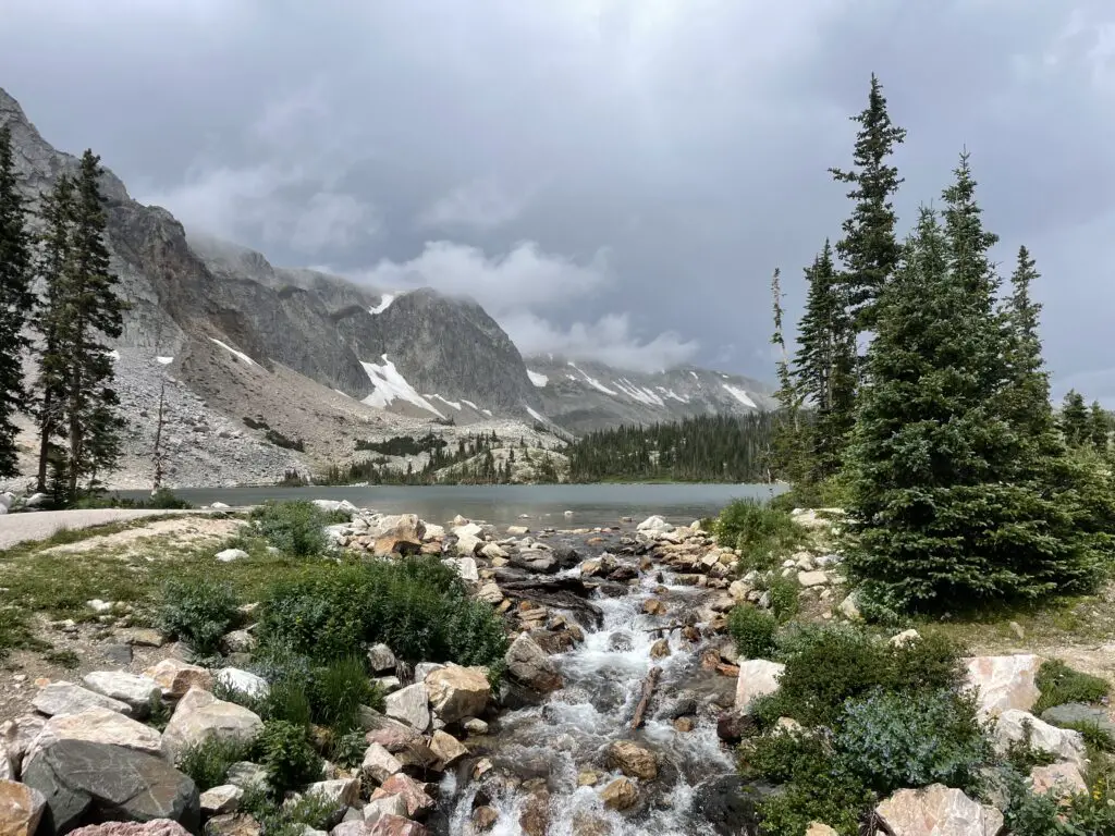
Grey mountains with bits of snow loom over and are reflected in the still waters of a small lake surrounded by pine trees.
Lewis Lake

In addition to the Sugarloaf Trailhead, there are multiple trailheads you can use to access Medicine Bow Peak.  The longest (but relatively easiest) is from Lake Marie.  You can also access the trail from Mirror Lake and Brooklyn Lake, though these routes require a longer trek and combining multiple trails.

Is Medicine Bow Peak Trail (to the saddle) Hard?

The trail from Lewis Lake is only about three miles long. It also only gains about 300 feet in elevation to the saddle. (The remainder of the hike to the Peak it gains more than 1000 feet in elevation in less than a mile!)  The biggest challenge with the hike to the saddle is the altitude. You’re above 10,000 feet for the entire hike!

Be aware that due to how high you are you’re above tree line for the entire route so there is NO SHADE!  This can also cause the trail to become INCREDIBLY slick in the rain, mist or snow–and note, snow and ice lasts LATE into the season and comes EARLY in the High Country.  It can snow at any time of the year up here and thanks to monsoonal moisture, it has rained on us every single trip we’ve taken to the Snowys!  Also, there is absolutely NO PROTECTION from lightning up here during the violent summer thunderstorms that frequently occur. (Thunderstorms are common in the afternoons in late summer, during Monsoon season. You do NOT want to get caught exposed, above treeline during a lightning storm!)

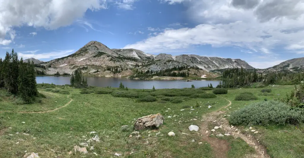
A lake with rocky mountains rising in the background and a green meadow with trails running through it in the foreground.
Libby Lake

At the saddle the trail from Lewis Lake also meets up with the other end of the Medicine Bow trail that comes up from Lake Marie.

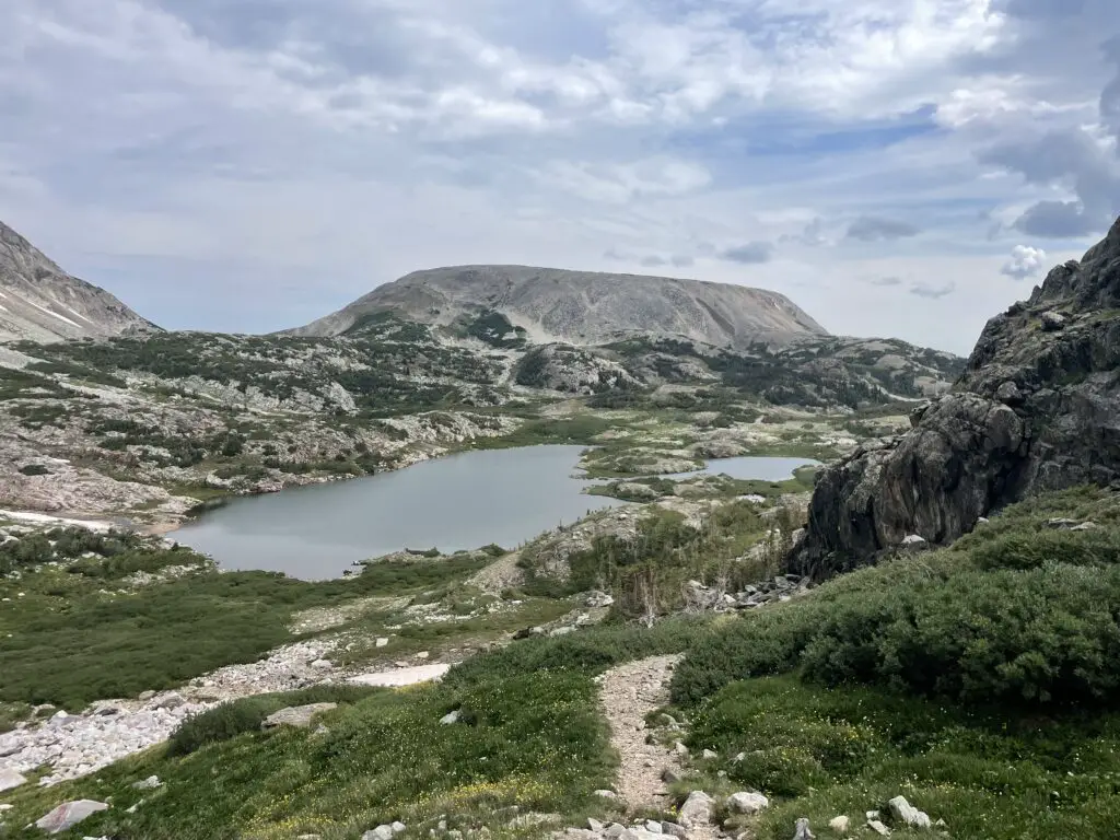
This trail is LOVELY! You hike along the spine of the Snowy Range getting amazing views of the local lakes, the nearby mountains, and the surrounding landscape. At one point we could make out eight separate, small lakes spreading out behind us!

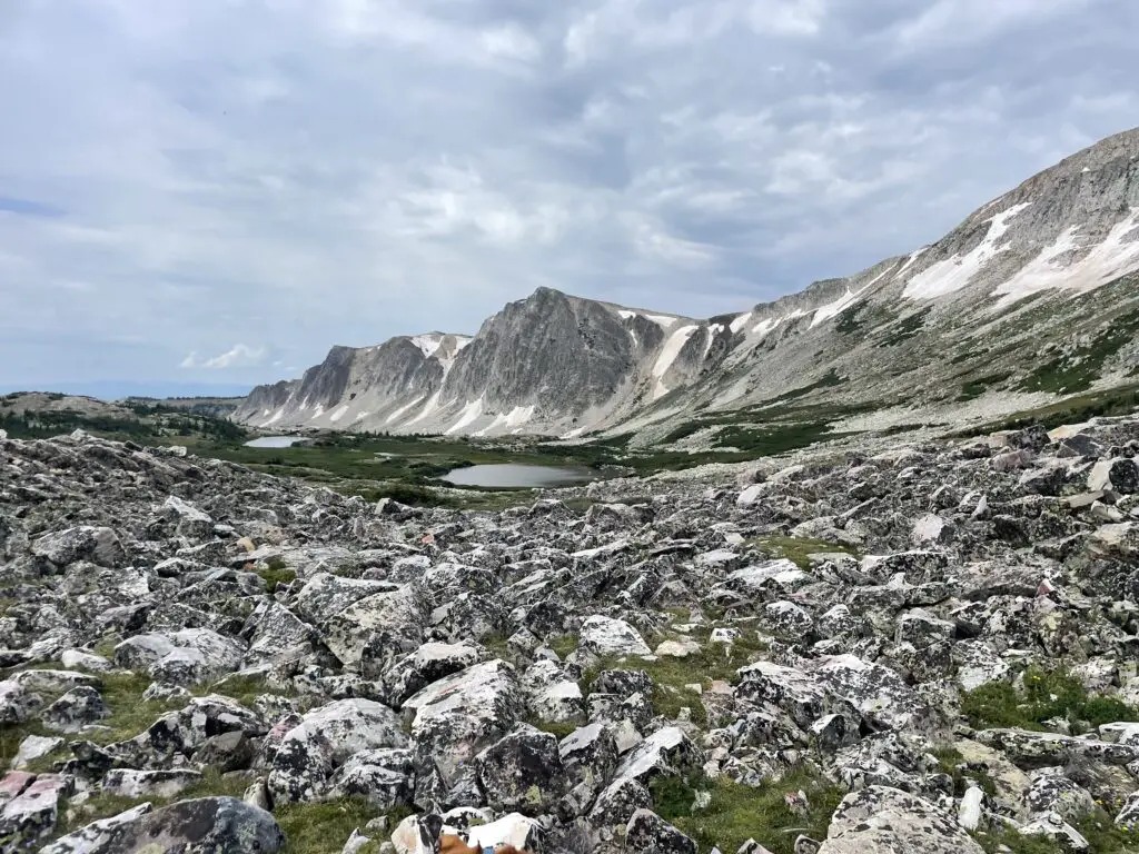
A gray, rocky, mountain wall spotted with snow looms over two small lakes with a small rock-field in the foreground.
This is the amazing view from the saddle. Medicine Bow Peak is to the right and the trail gets considerably more difficult from here…

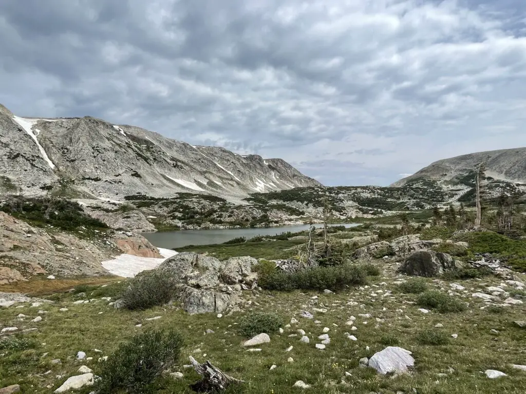
Grey, rocky mountains rise behind a small lake and flat scrubland, all covered in bits of snow.

I would rate the early portion of the trail (to the saddle) as moderate for sure.  It isn’t overly difficult or long–we saw several families with young children. It is a bit rocky and there is some scrambling required in a few, short areas.

The most difficult part about this trail is just that it’s incredibly exposed and high (as I said before, entirely over 10,000 feet).  There are no steep drop-offs directly from the trail though, so as long as you are a fairly capable hiker, you take it slow and you respect the conditions, you should do okay.

Though we’ve never had to navigate any actual snow in late July/early August, there were always still some snowfields along the trail.

Grey, rocky mountains rise behind two small lakes and flat scrubland. A rocky trail rises up a grassy hill in the foreground.

Dogs on Medicine Bow Peak Trail

Dogs are fine for the hike up from Lake Marie or from Lewis Lake to the saddle (also on the trails mentioned below). These are all largely just general, easy-to-moderate hikes. We’ve taken Puppers on most of these trails! After the saddle though I would NOT recommend dogs at MedBow Peak. They are allowed and some can make it up (one beat us to the top!) but others we saw seemed to be anxious and one owner reported needing to carry her dog part of the way (and she was a younger pup).

Lost Glacier Lakes Trail to Lost Lake

Lost Glacier Lakes trailhead is found on the east side of the Snowys. It starts from Brooklyn Lake and heads west. The route to Lost Lake is about six miles in total length (out and back).

From Lost Lake, the trail continues on to where it meets up with the Medicine Bow Peak trail at Lewis Lake and the Sugarloaf Trailhead (see above). The entire Lost Glacier Lakes Trail from Brooklyn Lake to Lewis Lake is a little over eight miles (in one direction).  

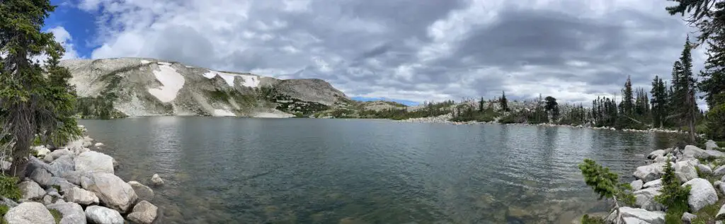
A panoramic of a large, alpine lake with gray, stony mountains spotted with snow looming in the background.
Lost Lake

Lost Lake was SO BEAUTIFUL! It reminded me of Lake Helen in the Bighorns!

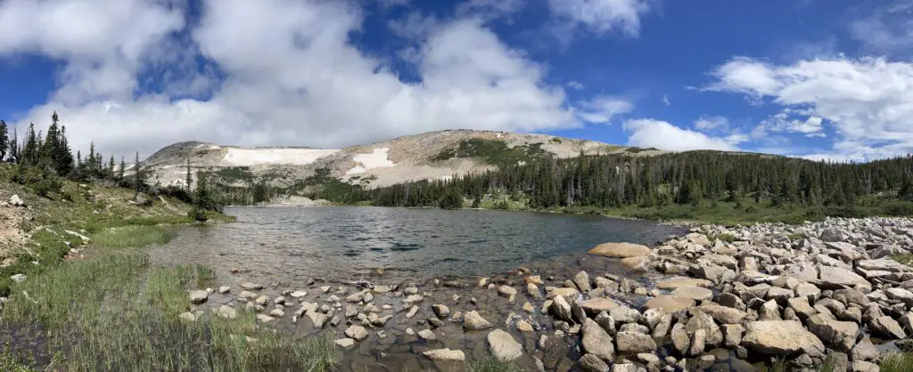
A high, alpine lake surrounded by rocky shores, pine trees and gray, stony mountains spotted with snow.
One of the two Glacier Lakes

Gray, rocky mountains dotted with snow loom over a mountain lake with green grass and bushes in the foreground.

Is Lost Lakes Trail Hard?

The Lost Glacier Lake Trail is a lot of fun! It offers very little elevation gain and is mostly a wide, dirt path throughout. Be watchful for the occasional tree root and rock, but there is very little scrambling required. This is a kid (and dog)-friendly trail! (Just remember the entire trail is still above 8,000 feet!) This trail is also below tree line so there is a lot more shade (and it’s much less exposed) than what you’ll find on the Medicine Bow Peak Trail.

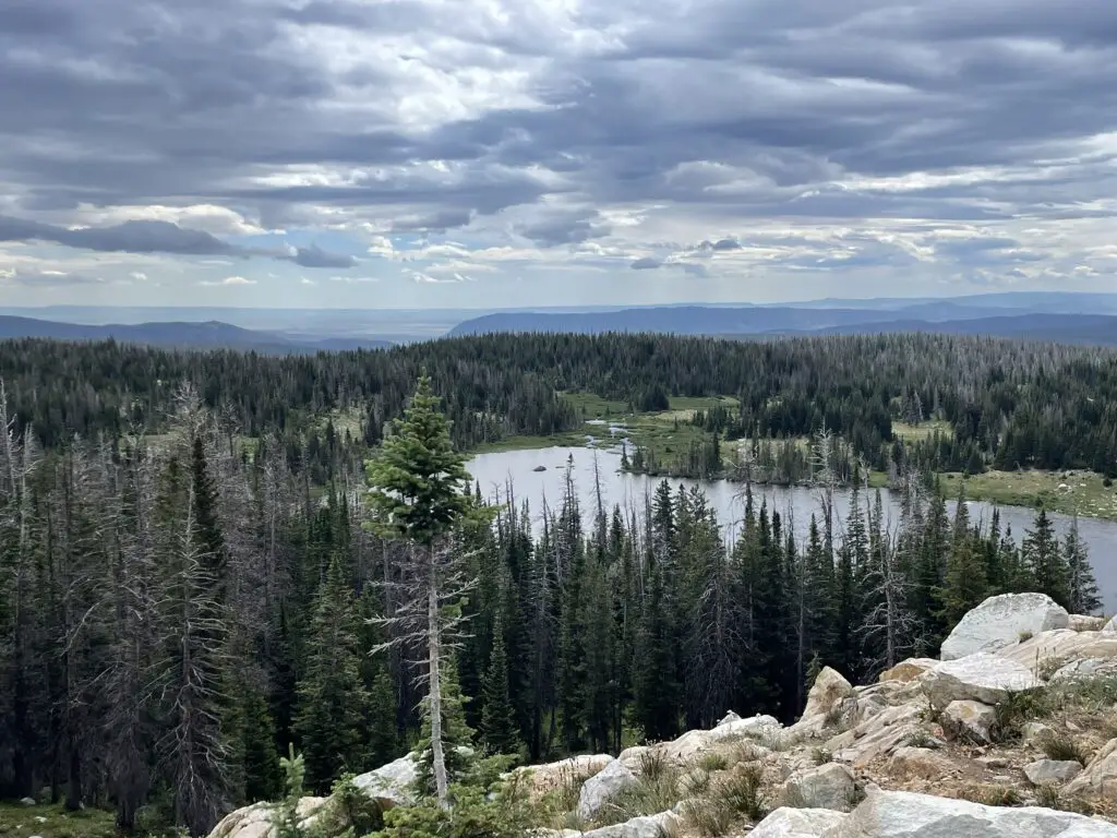
A long lake surrounded by a pine-tree forest. Tree covered mountains rise in the far distance. There is a stony cliff in the foreground.
Telephone Lakes as seen from the Lost Lake Trail

We really enjoyed this trail! It offered nice views of the lower lakes and plains of eastern Wyoming. On clear days you can also spot some of the high peaks of the Rockies down in Colorado.

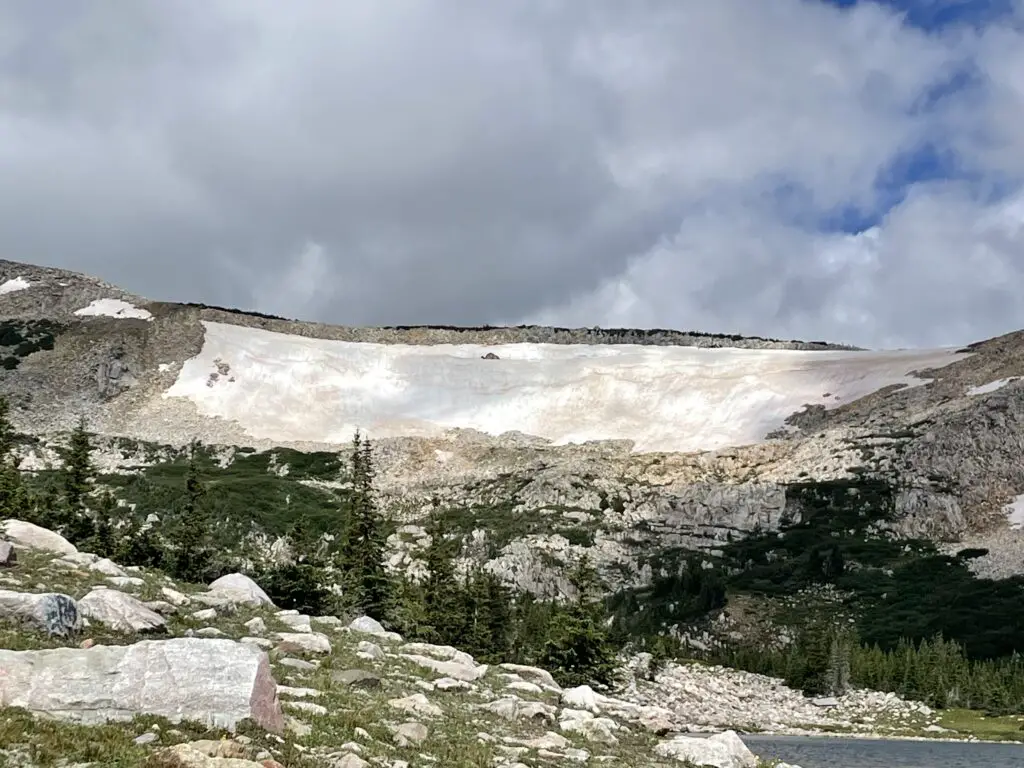
Gray, rock mountain mostly covered in a snowfield in the background. Pine trees and a rocky meadow in the foreground.
You can see why they are called The Snowys! (This was in early August!)

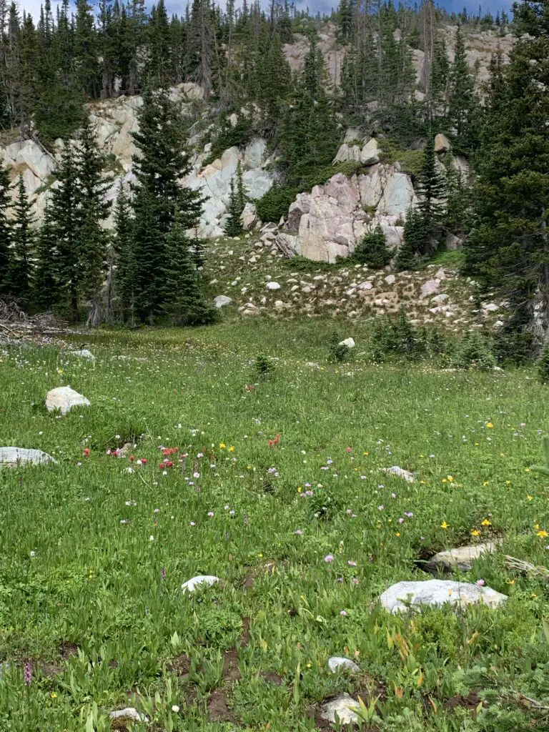
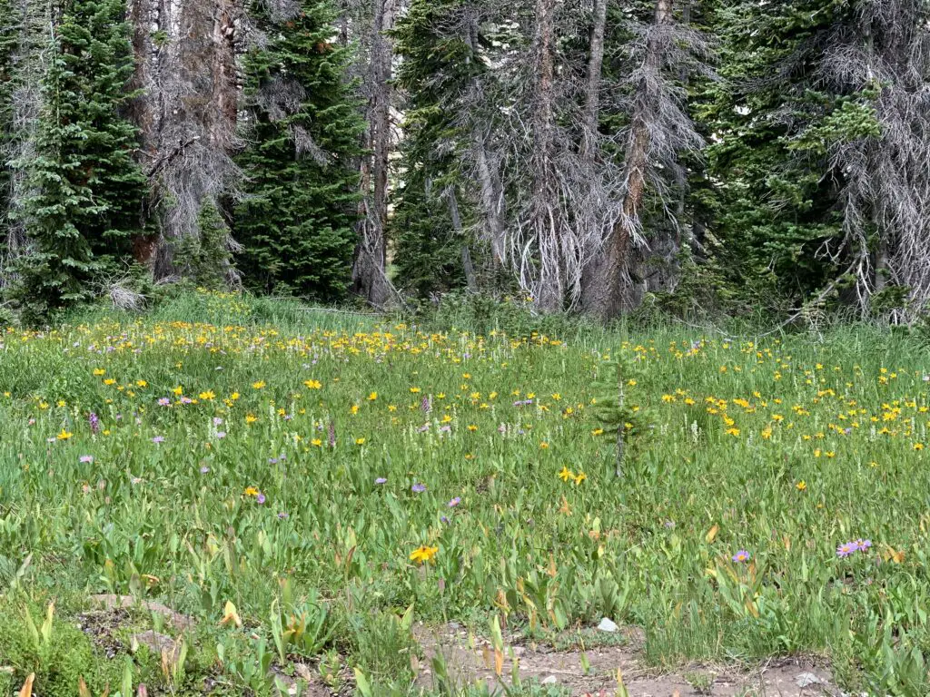
Below are some pictures of the wildflowers we saw on the Lost Glacier Lakes Trail. The pictures don’t do the colors justice, of course. The flowers were absolutely BEAU-tiful!

A grassy meadow full or yellow and red wildflowers backs up to a pine tree-covered rock wall.

A green meadow full of yellow, wild flowers back up to a pine forest

Camping in the rain!

As I mentioned earlier, we always seem to travel to the Snowys during Monsoon Season and we’ve been rained on EVERY time we visit there. That’s okay though, part of “roughing it” in the wild is dealing with whatever weather Mother Nature decides to throw at you! A few tips on tent camping in the rain…

If you’re camping with your spouse, marry someone who you can belly-laugh with rather than yell at! 😍

–Spend money on a NICE tent (I recommend the REI brand) with a rainfly that covers the entire tent and reaches almost to the ground. Our tent stayed completely dry inside!

—-Along with that, make sure nothing important is touching the walls of the tent (clothes, bedding, etc.) I can’t explain it but there is this phenomenon where if the tent is wet outside the water stays outside as long as nothing touches it from the inside. If something does touch it, that thing gets wet and the water seems to start seeping inside the tent.

This is probably some weird phenomenon of physics, but since I’ve never taken a physics class I can’t tell you any more about it. 😇 Ask Mr. Trekker, he used to teach a physics class! 😂

Scenic Byways!

We also drove several scenic byways in the Snowy Range! (Note: both of these routes are closed in the winter–they’re really only open May through November–and this is weather-dependent).

Snowy Range Scenic Byway

The Snowy Range Scenic Byway is Wyoming Route 130 that travels east-to-west through the Snowys portion of the Medicine Bow mountains.  It runs from the Encampment/Saratoga areas in the west to Centennial, Wyoming in the east.

There are several nice pullouts along the Byway. Some of our favorites were:

Libby Flats: an open, meadow area in the higher elevations of the Snowys. It offers an observation tower and spectacular views of the surrounding countryside. We also saw a bunch of marmots here!

Lake Marie: a VERY pretty stop on the western side of the Byway. It offers a nice boardwalk and paved walking path that connects to the Mirror Lake picnic area just to the east. Other hiking trails break off from here, as well (from this lake starts the easiest–though not the shortest or fastest) trail to Medicine Bow Peak.

An alpine lake back by a rocky wall in the background feeds into a small, stony, waterfall-creek in the foreground.
Lake Marie–this is one of my favorite spots in the Snowys!
The Continental Divide! –Battle Pass Byway

Battle Pass Byway is Wyoming Route 70 that travels east-to-west through the Sierra Madre portion of the Medicine Bow mountains.  It runs from Baggs, Wyoming in the west to Encampment in the east and it crosses the Continental Divide.

A narrow spine of grassy ground with pine trees on both sides
The Continental Divide! From this point, water either flows West to the Pacific or East to the Gulf of Mexico/the Atlantic.
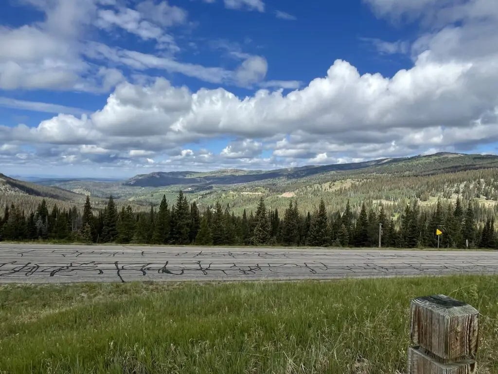
Overlooking a paved road and pine trees in the foreground. A green mountain vista stretches to more mountains on the horizon,
View to the west!
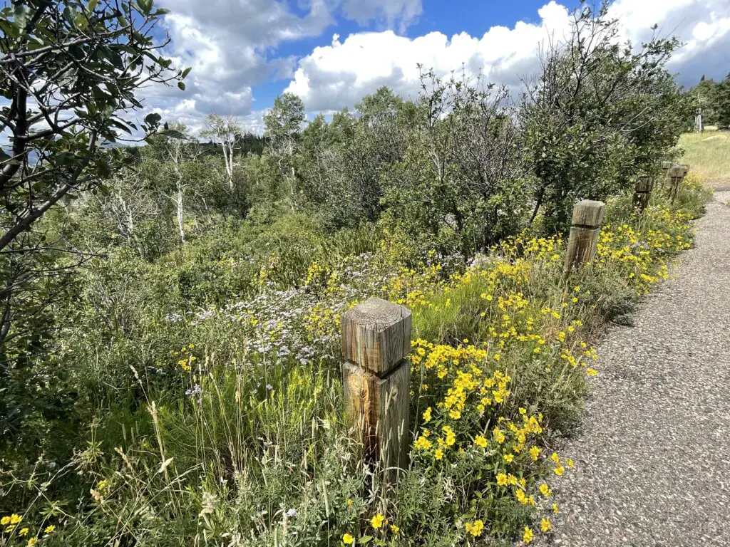
Yellow wildflowers interspersed with overgrown grass and shrubs on the side of a paved trail
Even more wildflowers!
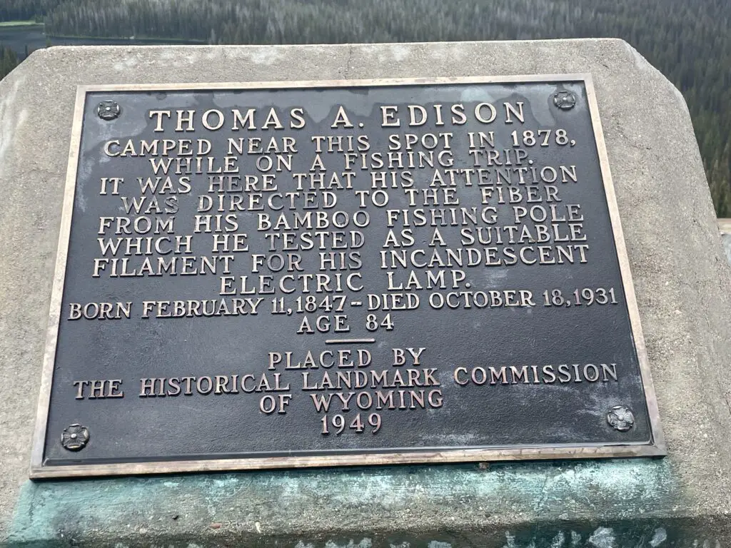
Monument that reads: "Thomas A. Edison camped near this spot in 1878 while on a fishing trip. It was here that his attention was directed to the fiber from his bamboo fishing pole which he tested as a suitable filament for his incandescent electric lamp.--Born February 11, 1847 - Died October 18, 1931 Age 84
History happened here!

So, if you’re looking for a great place to hike and camp that’s just across the border from the crowded trails in Colorado, check out the Snowys!

Have you spent time in the Snowy Range?  Tell me about your experience in the comments! 


Like what you read here today?  Please feel free to leave a comment, like or share this post!  You can also follow the blog on social media by clicking the links below!
Facebook

Twitter

Instagram

Blue Sky