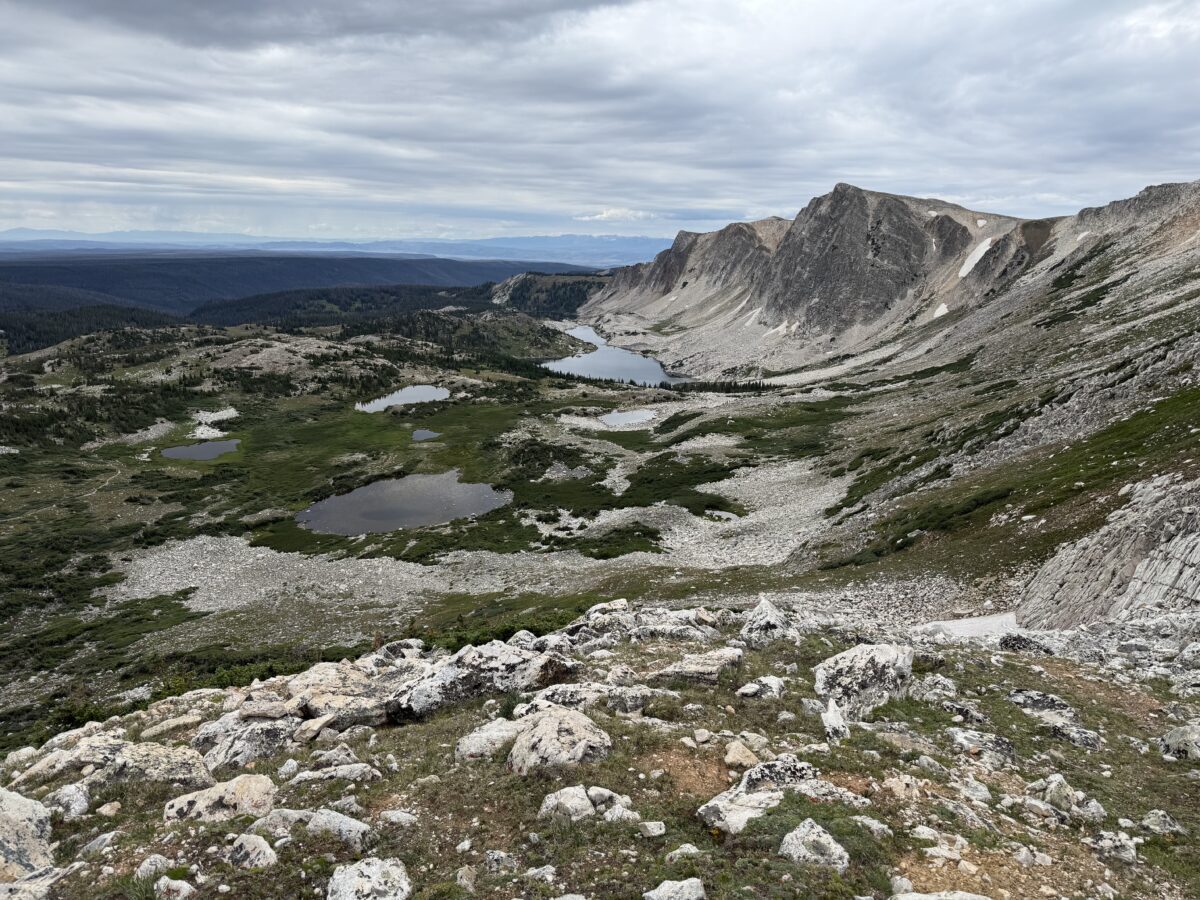
The Trekkers did it! We finally hiked a 12-er (a mountain taller than 12,000 feet!)
We enjoyed Medicine Bow Peak (or MedBow Peak) in the Snowy Range (also called the Snowys), in far, southeastern Wyoming. To date this is probably one of the hardest hikes we’ve ever done. With the high steps over large rocks and boulder field I would say it’s comparable to Mt. Monadnock in New Hampshire–my legs were sore enough to say so, anyway!
Why hike a 12-er?
After hitting our 40s and still dealing with long-COVID brain-fog after multiple rounds of that lovely disease, and then after my various health issues and surgeries in my early 40s, I kinda felt like I had to prove to myself I’m not completely old and decrepit…YET!
I wanted to prove to myself (and my bionic ankle) that I was still capable of tough stuff. So, two-and-a-half years after major, abdominal surgery (vertical hysterectomy) and 18 months after a nasty fall on the ice and breaking my ankle in two places (as well as dislocating it and tearing a tendon…which resulted in major ankle surgery and permanent hardware–a plate , pins, etc.) I set the personal goal to hike a 14-er in Colorado (a mountain taller than 14,000 feet).
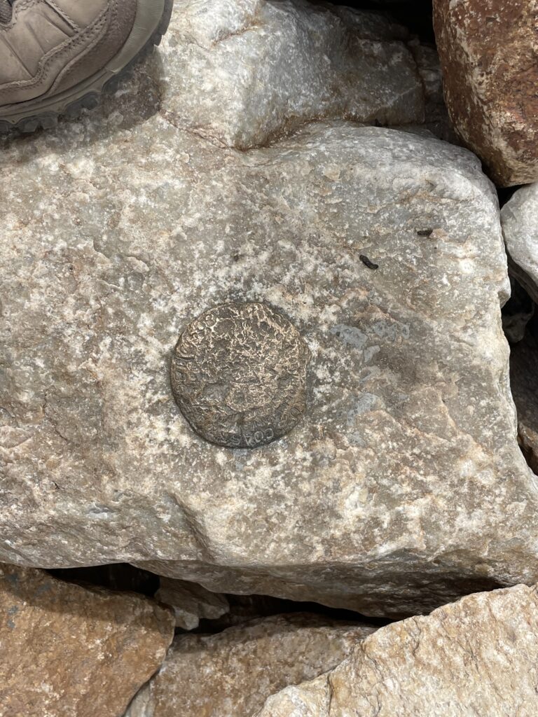
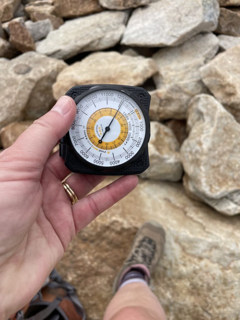
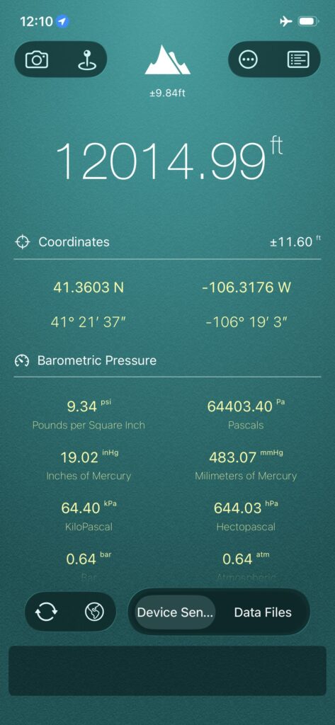
However, to get there, we figured we should do some practice hikes to see if we think we could really make it that high up (and what we’re getting ourselves into). Enter, Medicine Bow Peak which is actually a 12-er and clocks in at around 12,020 feet in elevation!
What is the trail to the summit of Medicine Bow Peak like?
The summit trail to MedBow Peak gains more than 1000 feet in elevation during the hike up (and most of this is gained AFTER the saddle! You can read about the MUCH easier hike to the saddle here.) It’s also INCREDIBLY rocky and exposed, not to mention HIGH. (You start at over 10,000 feet at Lewis Lake/the Sugarloaf Trailhead and end up at a little over 12,000 feet!)
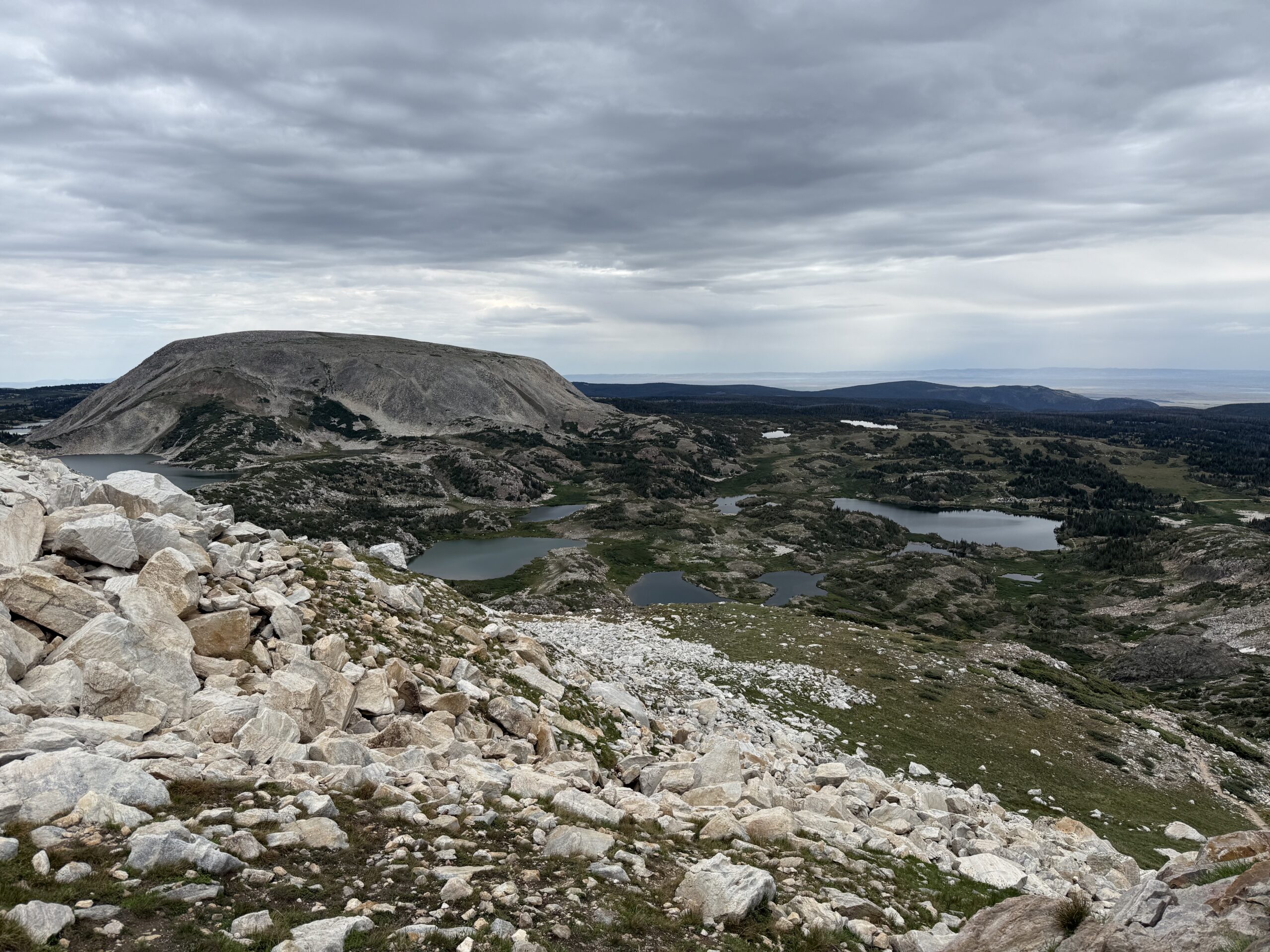
Also, due to how high you are you’re above the tree line for the entire route so there is NO SHADE! The trail can also become INCREDIBLY slick in the rain, mist or snow–and note, snow and ice lasts late into the season and comes early, in the High Country. It can snow at any time of the year and thanks to monsoonal moisture that is normal in late summer, it has rained on us every single trip we’ve taken to the Snowys! Also, there is absolutely NO PROTECTION from lightning up here during the violent summer thunderstorms that frequently occur.
We weren’t expecting the boulder field at the top of this mountain either! I thought it was going to be more of a scree field as that’s how all the surrounding mountains look from below. The last 100 feet or so of the climb up MedBow Peak is all boulder field and it SUCKED (if you aren’t into that kind of thing). We definitely determined with this trip that I do NOT like boulder fields (that may play into which 14-ers I choose to challenge myself on in the future…!)
**As I was carefully traversing these large rocks I was especially cognizant of how easy it would be to slip and get your foot/ankle caught…or to slip and roll it and/or twist it some strange way–this would not be good. While anyone can logically imagine the inherent risk in this, when you’ve fallen and literally heard (and felt) you ankle bone *crack!* this is especially triggering! 😮 **
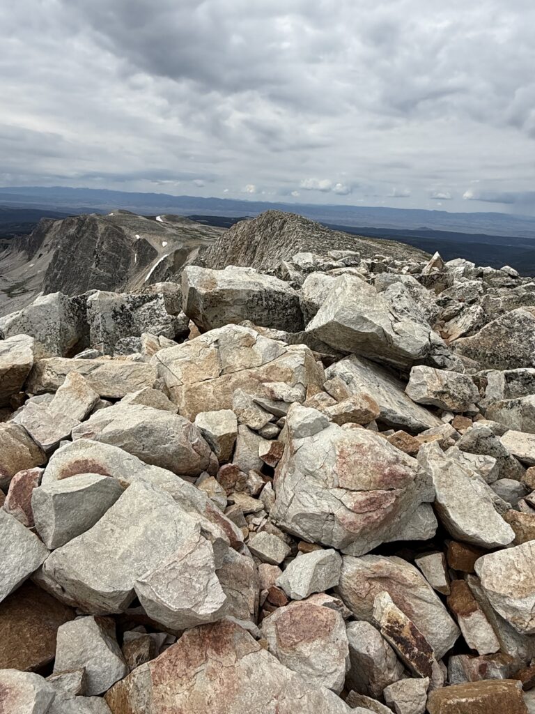
For as high and mountain-y as it is, the MedBow trail is surprisingly not scary.
I am terrified of heights ya’ll. So much so that I’ve frozen up in vertigo-inducing situations in the past. (That’s right, I’m afraid of heights and I hike tall mountains–yes, I see the irony there. 😝 🙄)
But with MedBow, even though you’re basically, literally hiking up the side of a mountain and it’s steep, there are no real looming drop-offs. I can honestly say there are a number of hikes we’ve done in the Black Hills (and elsewhere) that are considered to be much “easier”–even moderate in difficulty, that actually have far worse drop-off/vertigo/”possibilty-of-falling-to-your-death” potential than this mountain! (One example I could think of, for sure, is Lovers Leap trail, in Custer State Park, in the Black Hills of South Dakota.)
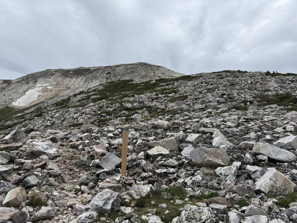
What was also kind of weird is that you can’t actually see the peak of the mountain from the trail, basically until you are there (you can’t really see the peak from further down or from the road either). The mountain is just steep enough and there are enough lower peaks/false summits that you don’t really realize where you’re going until you reach the peak. Even if you can see people standing on the peak from further down the trail you don’t really realize they’re on the actual peak (as opposed to just being above you, further along on the trail).
Who/What you may see on the MedBow Peak Trail
There were quite a few people on the trail with us that day but Mr. Trekker and I determined we were some of the best equipped. There was one guy (an older gentleman who seemed far more in touch with nature than us–VERY nice guy!) who did the trail BAREFOOT!
You do you dude but I do NOT recommend this!–While it may be good for “grounding” I did notice he was bleeding some by the time he finished the hike.
Also, we met up with a group of about 25 teenagers coming up from a different route. Most of them were wearing either chaco-style sandals or converse-type shoes–some even had jeans on! And of course, ALL of them seemed to be having an easier time than us because we are OLD! 😝 It made me feel a bit like a dork with our “fancy”, Keen hiking boots! 🙃
This is definitely a you-do-you situation but I can ONLY recommend hiking boots (or possibly trail runners) on a strenuous hike, especially in a boulder-field-type setup. Some people prefer shoes to boots but only boots provide any real protection against severely rolling/spraining your ankle (and you can still roll your ankle in hiking boots, ask me how I know! 😝 ) Beyond the possibility of turning/breaking an ankle anything else also leaves your foot open to nasty scrapes/cuts, puncture wounds and/or ripped off toenails!
Dogs on Medicine Bow Peak Trail
Dogs are fine for the hike up from Lake Marie or from Lewis Lake to the saddle. These are largely just general, easy-to-moderate hikes. (We’ve taken Puppers on the trail from Lewis Lake several times!) After that I would NOT recommend dogs at MedBow Peak. They are allowed and some can make it up (one beat us to the top of the Peak!) but others we saw seemed to be struggling. We had another owner report they had to carry their dog through the boulder section as she was getting pretty anxious.
So this one is largely up to you as the dog owner. If you’ve got a small dog they may not handle the large boulders well (though if you can easily carry them this may not matter). If you’ve got a larger, agile dog with experience on bigger mountains and boulders they may do fine. The boulders weren’t horribly sharp and the overall trail is fairly short but you may still want to consider doggie booties, just in case.
The ultimate consideration should be, can you carry your dog down the mountain (at least until you reach the easy part) if they get stuck, get tired, get sore feet, etc.? If not, SERIOUSLY consider NOT bringing them to summit Medicine Bow Peak. We chose NOT to bring Puppers for the hard hike. She probably could have handled the boulders in her younger years (though her young hips still got sore on the Lake Helen trail, in the Bighorn Mountains, several years earlier) but I don’t think her “getting-older” joints would have appreciated this hike much.
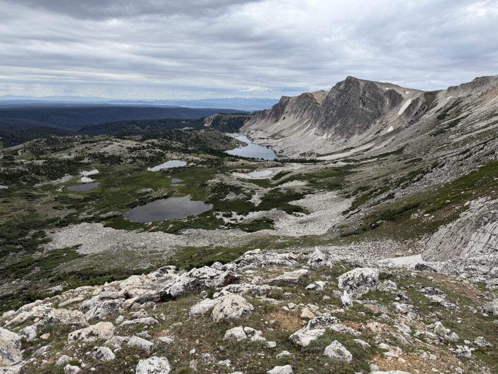
The downclimb from Medicine Bow Peak
Always remember when you reach the mountain peak…the hike is only HALF DONE! MANY people are injured on the downhill/return portion of hikes. This is due to fatigue but also loss of concentration. It’s easy to become complacent on the return trip. Also there is this little thing called gravity that comes into play far more on the downclimb. Many people don’t realize that climbing up can often be safer (if not easier) then trying to descend down.
This is definitely true for MedBow Peak. There are several sections with large, rock “steps” as well as some pretty short, steep sections that are more easily navigated by scrambling. This trail is largely considered to be a high Class 1 or low Class 2 jaunt, and I would agreed with that (I’m learning all this mountaineering lingo as I study up for hiking a 14-er! 😉) You “can” walk up the whole thing (and Mr. Trekker did, though he’s got a foot of height on me and MUCH longer legs! 😝) I found on the way down these few areas were more easily navigated with a “butt slide” but that’s just my suggestion, you do you! 👍
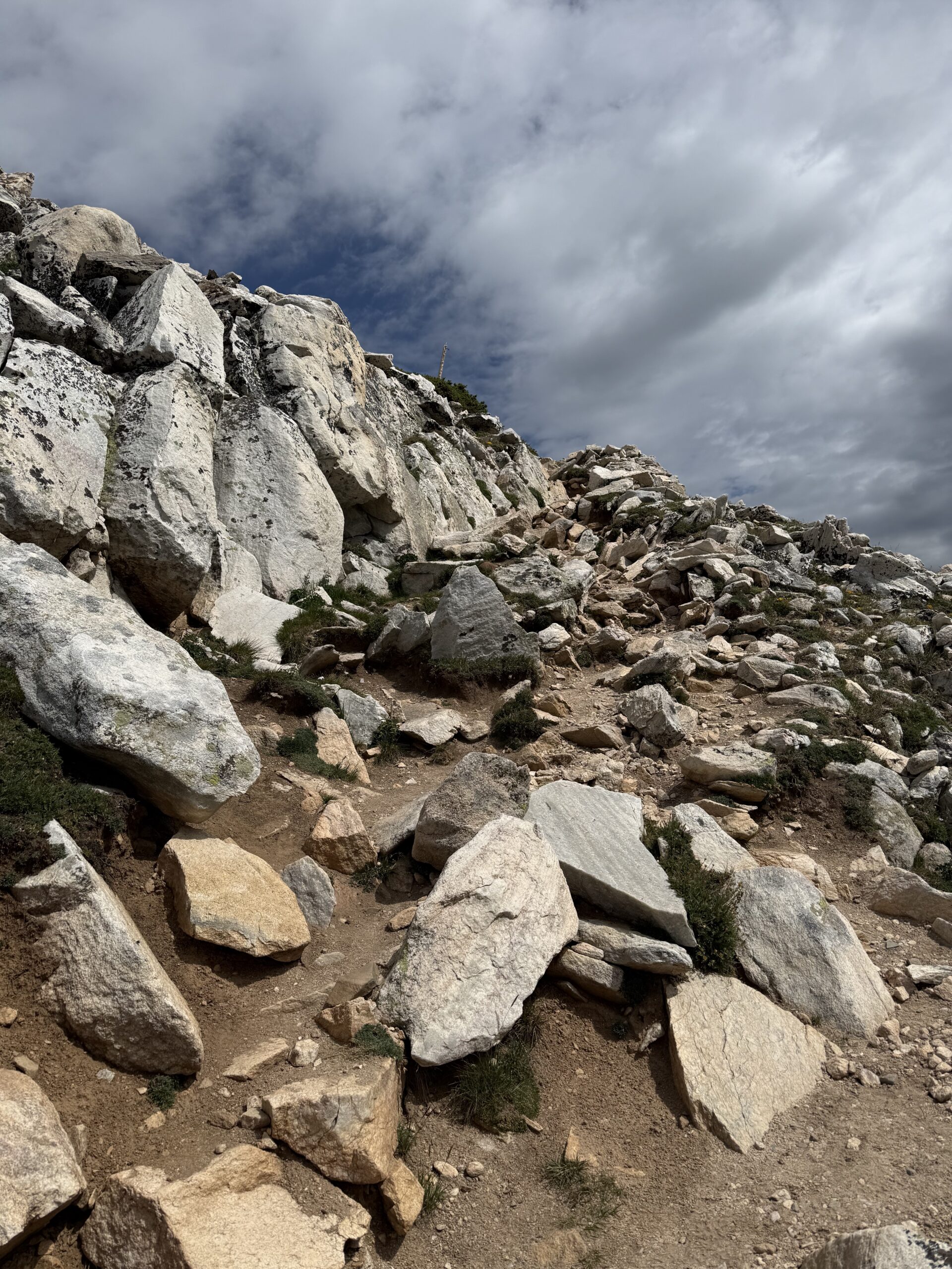
I will say this, if the rocks were wet or snowy/icy at all this trail could be downright TREACHEROUS, especially on the return/”down” trip. There are definitely parts where the rock could get slick QUICK. Fortunately when we hiked it was largely dry with just a slight drizzle so we didn’t find the difficulty to be any worse than hiking the hard way up Black Elk Peak in the Black Hills.
Recreating at high altitudes
We were VERY excited and pleased the altitude didn’t really affect us at all on this trip. Once you get to 12,000 feet you start getting to the point where some people can start to feel symptoms of altitude sickness. (We had been up this high a few times in the past–like on Independence Pass in Colorado).
The only time we’d ever done any hiking at this altitude was 10 years prior at Rocky Mountain National Park. We did a quick, short hike near the top of Trail Ridge Road and Mr. Trekker found he was really feeling the altitude. Fortunately, since then, we’ve spent A LOT more time hiking and hanging out “at altitude” so I think our bodies are learning to adjust better–I’ll let you know if that’s really true or not once we try a true 14-er! {We were at the top of Pikes Peak a few years ago (which is a 14-er) though we drove to the top that time, and we didn’t feel too bad walking around, so hopefully that’s a good sign. 🤞}
So why hike “at-altitude”?
After all the physical challenges I had been through the last few years this was just such an incredible accomplishment for me! It was probably one of the hardest trails the Trekkers have ever done to-date (if not THE hardest!) I think the last time I was this proud of myself for a personal accomplishment was when I helped one of the agencies I worked with earn a large grant!
I have also talked with several people who have knowledge of hiking 14-ers and they told me, “if you can do MedBow you can do some of the easier 14-ers for sure!” So, this is incredible motivation for our attempt at an even higher challenge in the future!
Like what you read here today? Please feel free to leave a comment, like or share this post! You can also follow the blog on social media by clicking the links below!