Dinosaur National Monument: the Colorado Side

In this post, I discuss the Colorado side of Dinosaur National Monument.


In this post, I reviewed the Trekkers’ visit to the Utah side of Dinosaur National Monument.  In this post, I’ll be discussing the Colorado side (as the park spans both states).

Scenic Drives on the Colorado Side of Dinosaur National Monument 

One of the main things we enjoyed on the Colorado side of the monument was the scenic drives.  There are several found throughout this portion of the park, though all but Harper’s Corner Road are suggested for high-clearance vehicles only.

As I mentioned in Part 1, under good conditions most of these roads are great to drive (honestly several of them were less bumpy than some of the paved, county roads we drove on).  I would have felt comfortable taking any vehicle with a higher wheelbase on these (such as an Outback), and we saw several SUVs.

I cannot stress enough though, that we were there in the most ideal weather possible.  According to the park, several of the roads are completely impassable when wet.  This seemed likely as we crossed many dry stream beds that could easily fill with stormwater runoff.  It also makes sense that the powdery dirt that covers the surface of many of these routes could quickly turn into slippery ooze when wet.  Many of the roads also only have one way in or out, so, if you reach the end, and then a rainstorm comes…you may not be able to get back out again.  Several also lead through low-lying canyons which are likely to flood quickly in a heavy rain event.  So please, be wary before attempting these roads if any bad weather conditions are present or expected.

Click here for the NPS website for the park which will have up-to-date info on current road conditions.

Harper’s Corner Road

This is the main road through the Colorado section of Dinosaur National Monument.  You access it near Dinosaur, Colorado.  This is also one of the only paved roads in the park.  At the end of it is the Harper’s Corner Trail which offers INCREDIBLE views.

Hiking on Harper’s Corner Trail

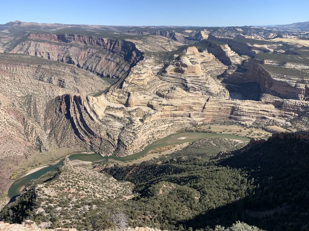
This trail is beautiful! At times you are hiking on an almost knife-edge of rock, with the Green River winding along beside you on one side, and the Yampa River on the other.  Did I mention you are up to 2500 feet ABOVE these waterways throughout the hike? 😮  It got my acrophobic-heart pumping a bit! (It really wasn’t too bad.  I only felt nervous in one spot where you get a healthy view of a chute, down a cliffside. 😋)

I would rate this trail as “easy”.  It’s about three miles in total length (out and back) and it doesn’t have much elevation gain.  Just about anyone wearing tennis shoes should be able to handle it (though I should note the park is at an altitude of over 5000 feet, so “flatlanders” may want to take it slow. 😉)  At the end of the trek you are treated to an AMAZING view down the canyon, and of Steamboat Rock from above, behind which the Yampa and Green Rivers meet.
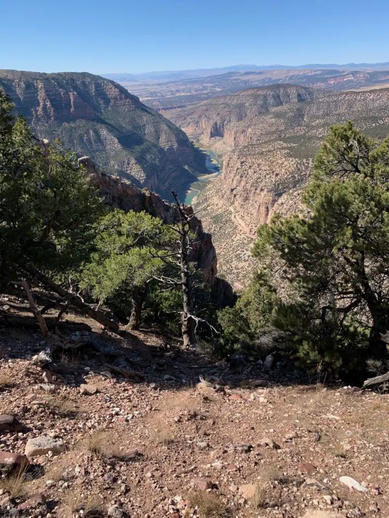
A narrow river valley in a desert landscape as seen from above. Short trees are in the foreground while a thin, green river can be seen far below.
One of the incredible lookout points from the Harper’s Corner Trail. That’s the Green River far below, you can maybe see how it got its name.
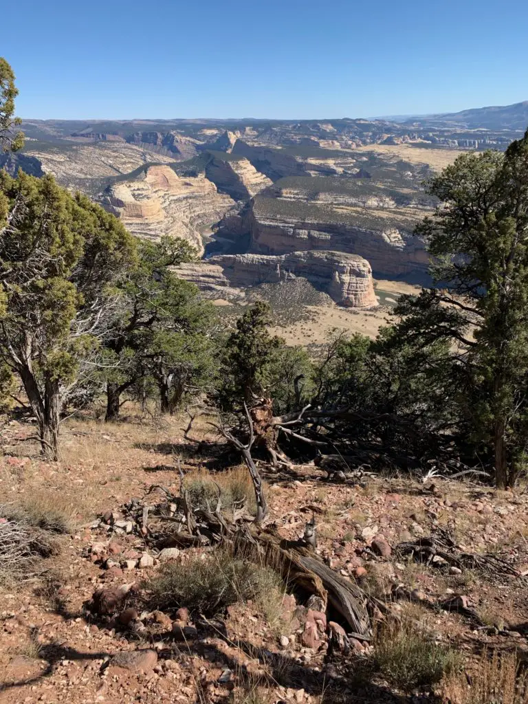
Looking out over a desert, badlands landscape from above. Short trees are in the foreground with a large, rock formation in the background.
Steamboat Rock, from above…

Echo Park Road

This route takes you from Harper’s Corner Road, east, to Echo Park and its campground.  This area is called a “park”, like several other locations in Colorado.  It is really just a flat, meadow-like area.  It was cool!  (Hint, it’s called “Echo Park” for a reason, I encourage you to experiment with this 😁.)

This route traverses the lower “benches” of land that can be seen from above when traversing the Harper’s Corner trail.  They are called this as they are wide sections of terrain.  They literally look like benches, or steps, that rim the lower, river canyons. 

The road winds through an incredible canyon where sheer rock towers over you on both sides.  From here you can see Steamboat Rock from the bottom, where it’s much more impressive.

There is a short hike along the river’s edge that is around two miles long (out-and-back).  It takes you to the confluence of the Yampa and Green Rivers.  There is also a place on this road called Whispering Cave.  It appeared fairly unassuming, at first, as it’s just a vertical slit in the rock wall of the canyon, that you can stand in.  This was until we figured out its secret (and how it got its name).  If people stand at either end of this long slit and whisper REALLY quietly…you can hear each other VERY well (thanks to the unique acoustics of the rock structure).  And it’s far more effective than if you try the same thing outside (we checked! 😉)

Click here for a short video of the drive!
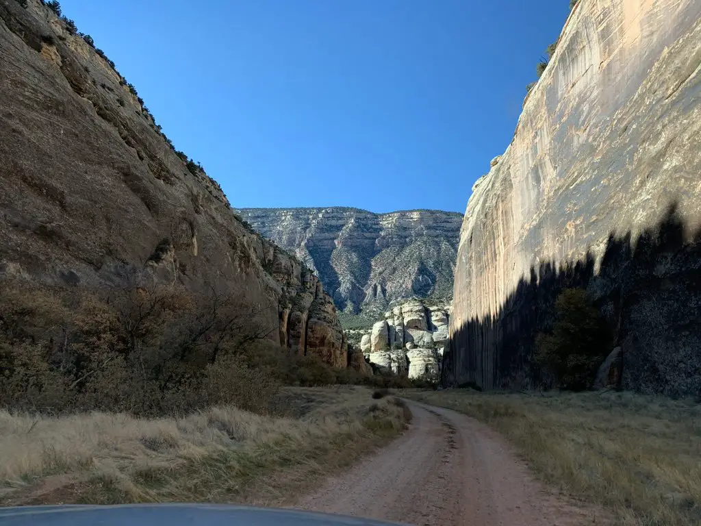
A dirt road snakes through a narrow canyon, rock towers on three sides.
The canyon on Echo Park Road.

A river with a desert landscape and rock rising in the background

A dry, yellowed meadow in a desert landscape and rock rising in the background
Echo Park!
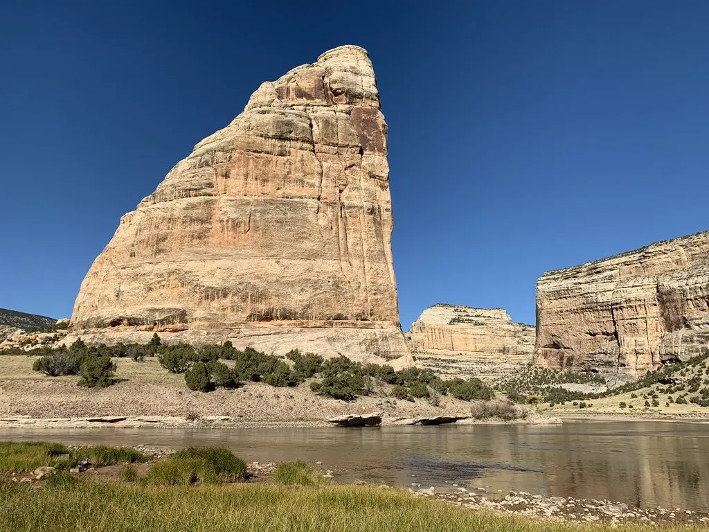
A river with a large rock that resembles a shark's fin rising behind it, all in a desert landscape.
Another view of Steamboat Rock!

Yampa Bench Road

This route takes you from Echo Park Road, east, all the way to US 40 in Elk Springs (though there are a few places you can bug out before you get that far, dependent on road conditions).  This was the most difficult route we encountered.  The drive was beautiful though, with yellow grassland and scrub brush spread before you, all the way to the rock walls that rise above you on two sides.

Even this road wasn’t bad at this time of year, though I could see it being difficult if it was wet.  It was the steepest drive we took and it had the sharpest turns.  This was also the longest route we attempted, by far.  It was fun, but we covered less than half of it (around 20 miles) and that took almost two hours.  This did appear to be the most difficult part of the trek.  According to the map, the rest of it looked flatter and easier (and some parts may have been roughly paved).  We did finally escape, through a blessed hole in the rock wall called Thanksgiving Gorge (I think I know why they give it that name!) just as daylight was waning.  We were rewarded with a herd of elk…and LOTS of cows! 😋
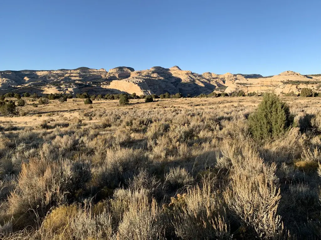
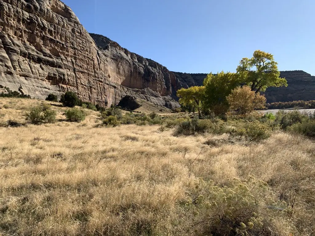
A dry, yellowed grass meadow with rock formations in the background. The sun angle is low and shadows are long.
Sunlight is waning on the Yampa Bench Road

Beautiful Canyons in the Colorado section of Dinosaur National Monument

Flaming Gorge Reservoir

On Sunday we took US 191 north of Vernal, Utah, to the Flaming Gorge Reservoir.  It was named for its vibrant, red cliffs that were cut by the Green River.  The gorge spans both northeastern Utah, and southeastern Wyoming, just to the north.  It is absolutely beautiful, and the dam that created the reservoir is pretty stunning, as well.
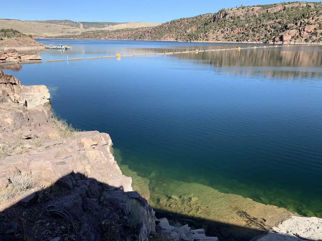
A lake sits between two rocky hillsides in a desert landscape
Flaming Gorge Reservoir
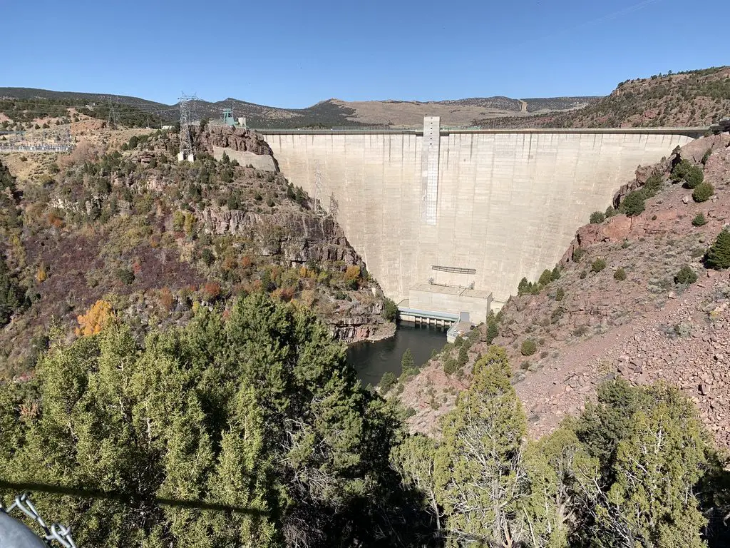
A large, concrete dam in a desert landscape
The Flaming Gorge Dam

Gates of Lodore

From the dam, we then continued north on Route 191, just across the Wyoming line, and picked up Brown’s Park Road.  This we took east, back into Colorado.  From here we followed signs to the Gates of Lodore, another INCREDIBLE canyon that was cut by the Green River.  It sits on the northern tip of the monument.  This route was a mixture of well-graded dirt and rough pavement, though any passenger car should be able to handle it, at least in good weather.

I was pronouncing this location like “Gates of Mordor”, from Lord of the Rings, but was quickly corrected by a local.  Apparently, it’s supposed to sound more like “Gates of la-DOOR”. 😂 

There’s an easy, and fairly short, hiking trail that leads to the mouth of the canyon, from the parking area.  Due to its sheer, rock walls, there is no access through this rocky cleft, except by watercraft on the river itself.
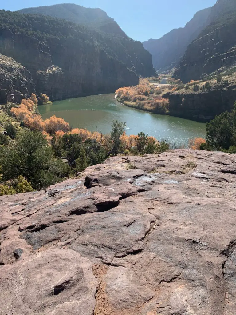
A river winds through a desert canyon. Tree-covered, steep, rocky walls line both sides of the canyon.
Gates of Ladore!

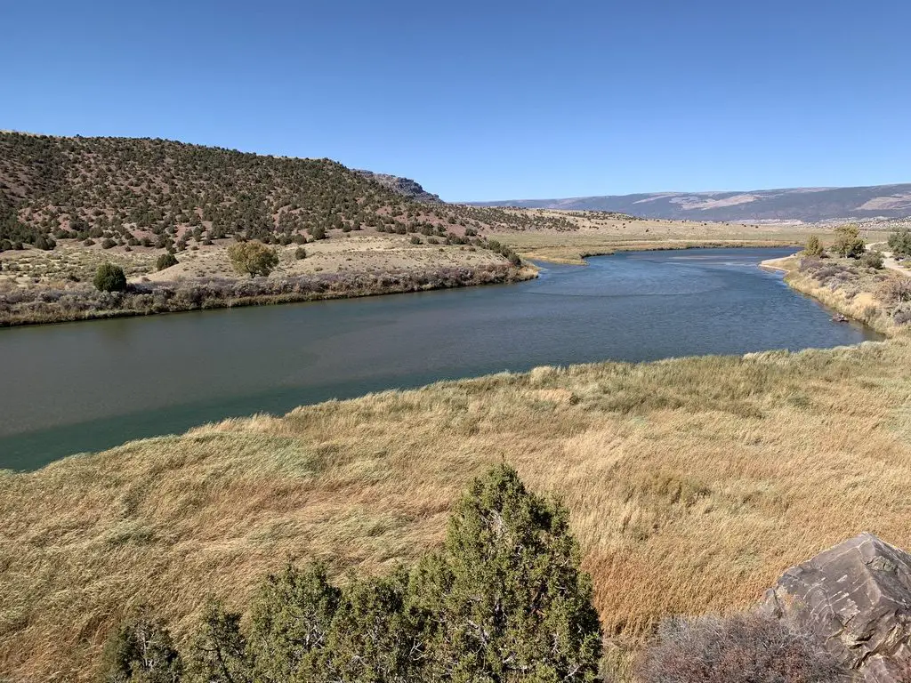
A river snakes through a desert landscape with yellow-grass meadows and scrub brush-covered hillsides

Crouse Canyon/Brown’s Park Scenic Backway

We returned back to Vernal by way of the Crouse Canyon/Brown’s Park Scenic Backway.  This is another route that cuts through a beautiful canyon, and then a meadowy area.

This road was one of the rougher routes we traveled on and was basically only one lane wide.  This was unexpected as it was listed as a scenic drive in one of the local tour brochures, and wasn’t suggested to be high-clearance.  Our truck handled it easily but had we known how rough it would be we would have aired the tires down, just for a smoother ride.  In good conditions, any SUV with a higher wheelbase should be able to handle it (we passed a CRV or two) but I wouldn’t suggest attempting it in a typical passenger car (just because there were some rocks and ruts that had to be navigated).  An Outback probably could have managed it, but we would have been extra cautious. 

The drive was BEAUTIFUL though, with the yellow and orange leaf colors set against the red rock of the canyon walls, which contrasted with the blue of the sky above.  Click here for a short video of it!

We returned home via US 40 east, through Craig, Steamboat Springs, and Rabbit Ears Pass.  This is the one portion of northern Colorado we hadn’t been to yet.

Related posts: Conquer Lengthy Trails in Small Portions; The Best Hidden Gems of Northern Colorado

From there we took Route 14 north to Walden, then headed north to Laramie, Wyoming, and back to the Black Hills.  FYI, this is a great way to avoid the traffic in the Denver area, and much of I-25, if you’re heading north from northern Colorado!  It offers some great views too!

You won’t find a better time to visit this park than Fall.  Tree colors are bright, crowds are light and temperatures are cool.  So the next time you’re looking for a good autumn vacation spot, think of the out-of-the-way Dinosaur National Monument!

Have you visited this incredible place?  Tell me about your favorite parts of it in the comments!


Did you enjoy this post? Pin it!

A narrow river valley in a desert landscape as seen from above. Short trees are in the foreground while a thin, green river can be seen far below. Pin reads, "Dinosaur National Monument: the Colorado Side"


Like what you read here today?  Please feel free to leave a comment, like or share this post!  You can also follow the blog on social media by clicking the links below!
Facebook

Twitter

Instagram

Pinterest

Dinosaur National Monument: the Utah Side

In this post, I give a review of the Utah side of Dinosaur National Monument.


To celebrate our 10-year anniversary, the Trekkers headed to Colorado!  We started our trip in Boulder, as Mr. Trekker had some work-related meetings for a few days.  Thanks to my flexible job I was able to work out on the balcony of our hotel room. 😋

We spent the remainder of our week at the Dinosaur National Monument, that spans the northern border between Utah and Colorado.  This is a cool place that we hadn’t heard of until recently (you can learn more about it at the NPS website here.)  It is in a very remote area.  In fact, we think we may have finally found a place in Colorado where planes don’t constantly fly over!

Boulder, Colorado

Boulder is nice, for being a larger city.  It reminds me A LOT of the place we used to live when we were in North Carolina.  I don’t like all the bike lanes, especially when driving Mr. Trekker’s truck, these give me serious anxiety!

I felt like it was just an added stimulus I had to keep track of while trying to navigate the busy traffic and figure out where in the world I was going 😛.  There were also A LOT of boulevards.  While this is certainly aesthetically pleasing, I find it makes getting around town (or just simply turning around, or getting to a business that’s on the other side of the block) difficult.

I will say this, for a larger city and busier place, I have been pleased with how friendly people are here, especially when driving.  I rarely ever get honked at and people are usually willing to let you into a lane quite regularly, even when traffic is heavy.

I hadn’t expected to miss seeing the mountains…being in a town that sits RIGHT NEXT TO the Rockies! 😛  Boulder might actually be closer to these peaks than we are to the Black Hills…and I can see those from our house!  There were just so many taller buildings and trees that blocked the view.  It seemed kind of sad to me, that people live in such a cool place and you don’t get to enjoy its natural beauty every day…

I can definitely understand why people live in Boulder.  It’s very pretty and there’s a lot of culture, nice restaurants, etc.  It seemed to cater more to those who ride bikes or walk, which is fine, I’m all about a green lifestyle that’s full of outdoor time and exercise.

It doesn’t help that Boulderites–whether on bikes or walking–don’t seem to understand the laws of physics.  They barely watch for vehicles!  Yes, I understand you may have the right of way in many situations. However, you should still navigate defensively. If someone in a half-ton vehicle hits you, your “Right Of Way” doesn’t offer any protection whatsoever! 🙄

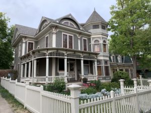
Boulder seems to be in an odd transition phase.  Some parts of it are “old school” and charming, with Victorian-style homes (such as the one used in the tv show, Mork and Mindy, seen here!)  There is also A LOT of new construction occurring, of very modern, industrial-looking, apartment, condo, and office buildings.  While this type of architecture is cool too, I’m not sure about the mix of the two, especially when they’re squished together like sardines.  It kind of felt like a smorgasbord of building design, and I’m not sure how I felt about it…🤔

Parking was definitely a problem though.  I’m not sure if this may be due to the fact that the area has grown so quickly?  Unfortunately, there were multiple times when I couldn’t get to a business or park that I wanted to visit due to there being no parking available nearby.

As I said, if locals mostly walk or ride a bike, maybe this isn’t a big deal.  It doesn’t make a visitor feel very welcome though.  I find it INCREDIBLY frustrating when I want to go to a place and all I see are “no parking” signs. 😡  Do people just “Uber” everywhere these days?  Yeah, I’m a child of the 80s folks, this old dog likes her car and likes to drive herself, thanks! 😉😜

The only real complaint I had about the town (other than the traffic 😇) was when Target charged me 10¢ per plastic bag (and Safeway charged 20¢!)  I understand that the overuse of plastic is a problem, but don’t just start charging me for bags without any warning.  I don’t even mind using reusable bags that I bring from home, but I wasn’t at home, was I?  It just felt, unwelcoming, frankly.

As an example of why, after paying, I realized one of my bags was a little heavy and I would have preferred to double-bag it.  So then I was faced with a dilemma…do I “steal” an extra bag?  Do I go through the hassle of trying to pay an additional 20¢ for ONE MORE BAG?  Or do I just risk there being a hole in my single-layer bag and dumping my glass bottles all over the parking lot? *sigh*

I had an interesting encounter with a Tesla…we were in a tight parking lot and I was getting back in our truck.  I was being VERY careful to not bump the fancy, shiny car next to me, when all of a sudden, the computer screen on its dash “woke up” and started scrolling something about “security” (there was no one in the car, mind you).

I’m assuming the machine was “sensing” my presence?  It was a little creepy!  I felt like I was dealing with Kitt from Knight Rider! 😜 (Yes, that was a 1980s TV reference, I just dated myself again didn’t I? 😋)  I may not be cut out for this “brave new world” ya’ll! 😋

Things to do in Boulder, including the Mork and Mindy House!

A grey, Victorian-style house sits behind a white, picket fence in town

For those who don’t know, Mork and Mindy was a comedy show starring Robin Willaims as an alien that was on in the late 70s (Note: BEFORE my time folks! 😝)

The show was based in Boulder and the house Mork lived in is still standing. It is located at 1619 Pine St. (I’m telling you this because the info is LITERALLY available on Google. 😇)

And, because we apparently can’t ever go to Colorado for our anniversary without it snowing, this is the–admittedly beautiful–sight we woke up to one morning… 😋 (it was 80 the day before mind you! 😮)…

Dinosaur National Monument

On our route west, toward the monument from Boulder, we drove on I-70 through Glenwood Canyon.  That route through the Colorado Rockies has to be one of the prettiest sections of interstate I’ve ever been on.  Click here for a video of our trip through the canyon…

As long as you aren’t intending to go on a rafting trip on the river, fall is known as one of the BEST times to visit this park.  For one thing, it’s in the desert-scrubland that comprises northeast Utah/northwest Colorado, so it gets HOT in the summer (and you all know how much I “love” the heat 😜).  Also, it’s far less busy this time of year and the tree colors are lovely.  We, actually, intentionally held off visiting here, until we could go in the Fall.

We spent our first day on the west (or Utah) side of the monument.  Here you will find the larger–and in my opinion better–Visitor’s Center.  Also, if you’re there for dinosaur bones (and why else would you be visiting?! 😉) this is the side to start on!

The Quarry Exhibit Hall at Dinosaur National Monument

This place was COOL!  Just an FYI, there’s only a few established places where you can actually see dino bones at Dinosaur National Monument.  The town that holds the name “Dinosaur” is on the Colorado side of the park…but there aren’t many bones actually viewable there. 😋  You have to go to the main entrance, which is found in Jensen, Utah (just a little east of Dinosaur, on US 40).  If you’re there when its busy, there’s a free shuttle that takes you to the quarry from the Visitor’s Center.  If you’re there on slower days (which we were) you can drive yourself.

We stayed at a lovely Air B&B in Vernal, Utah, which is about a 30-minute drive west of Dinosaur, Colorado.  This is the largest town in the local area and we were glad we chose it.  It offers easy access to any of the attractions in or around the monument, and also provides the most options for food and lodging.  If you’re wanting to camp, there are several campgrounds within the monument itself, and there is said to be a nice RV park in Dinosaur (though I don’t have any personal experience with that). 

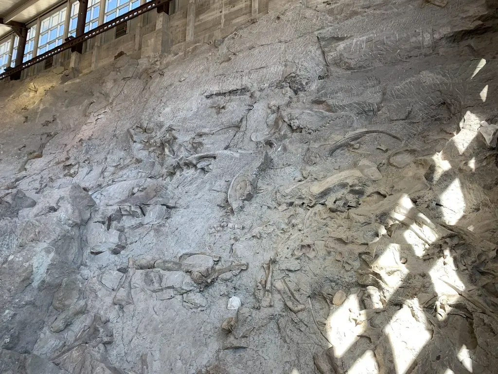
The Quarry is AMAZING!  It’s an enclosed building that was constructed over the site of a former paleontological dig, that contains massive amounts of dinosaur bones.  They were discovered in the early 1900’s.  After much excavation it was finally decided to preserve the remaining bones as-is, and allow people to view them in their natural state.  It’s thought that this was a place where large, flash floods occurred, helping to explain why so many bones ended up in such close proximity to each other.  I could have stayed there all day!

A wall of rock in a building with white, animal bones sticking out of it
At the Quarry. Those are all dinosaur bones from different species that were fossilized in the mud!

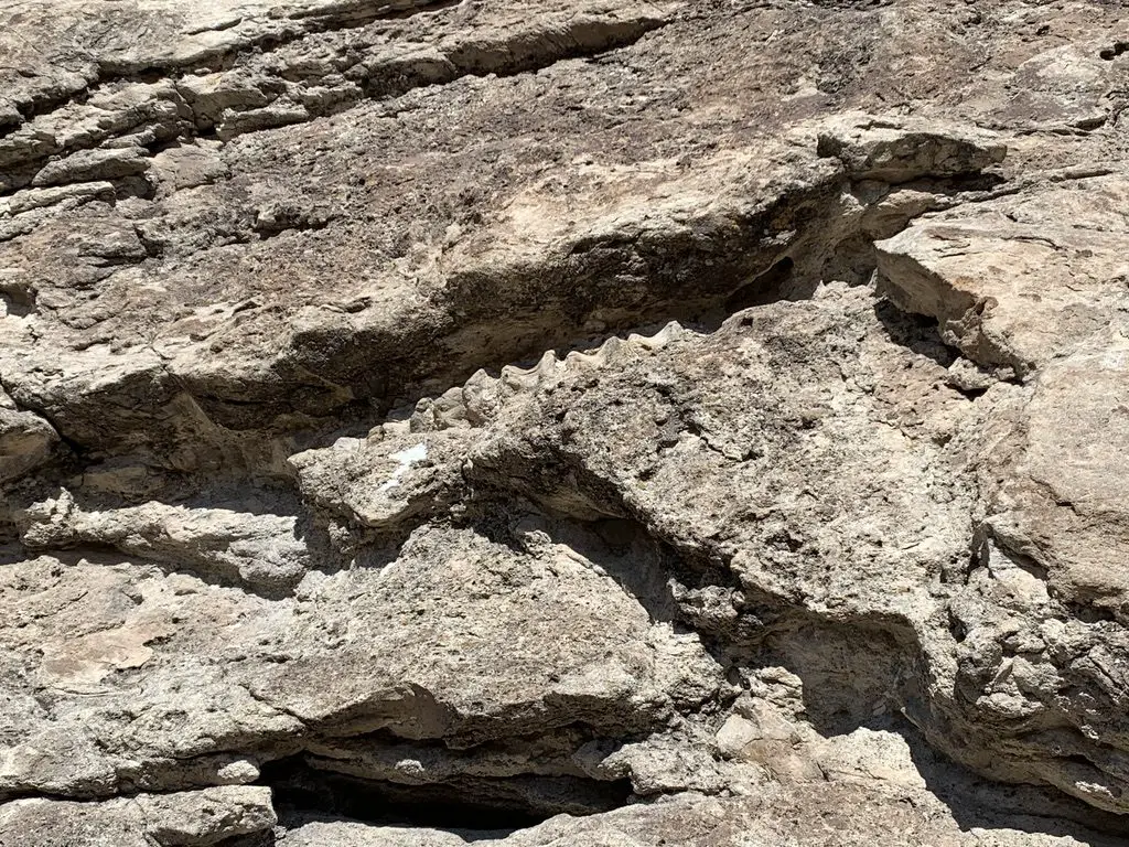
From here, you can also hike the Fossil Discovery Trail which shows some fossils that are still embedded in the rocks …

A rock wall with white arrows painted on it pointing to a specific section
If you look closely, the white arrow is pointing to the fossilized spinal column of a dinosaur!

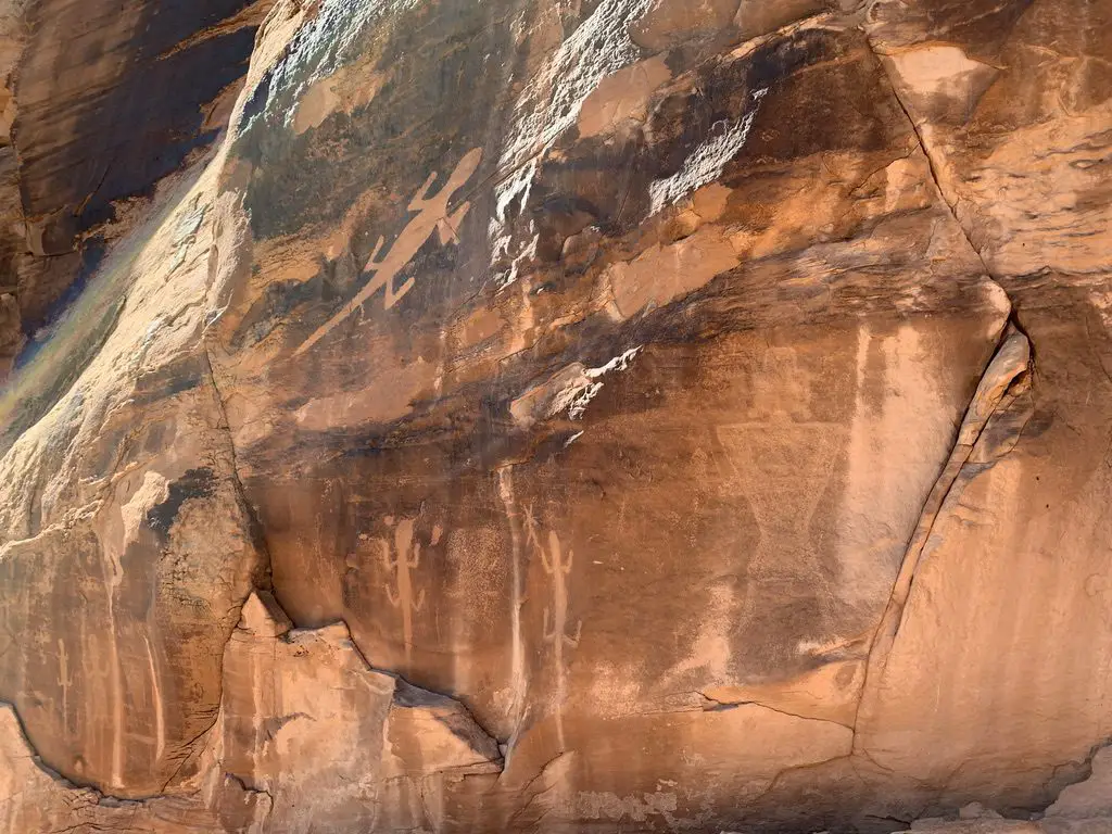
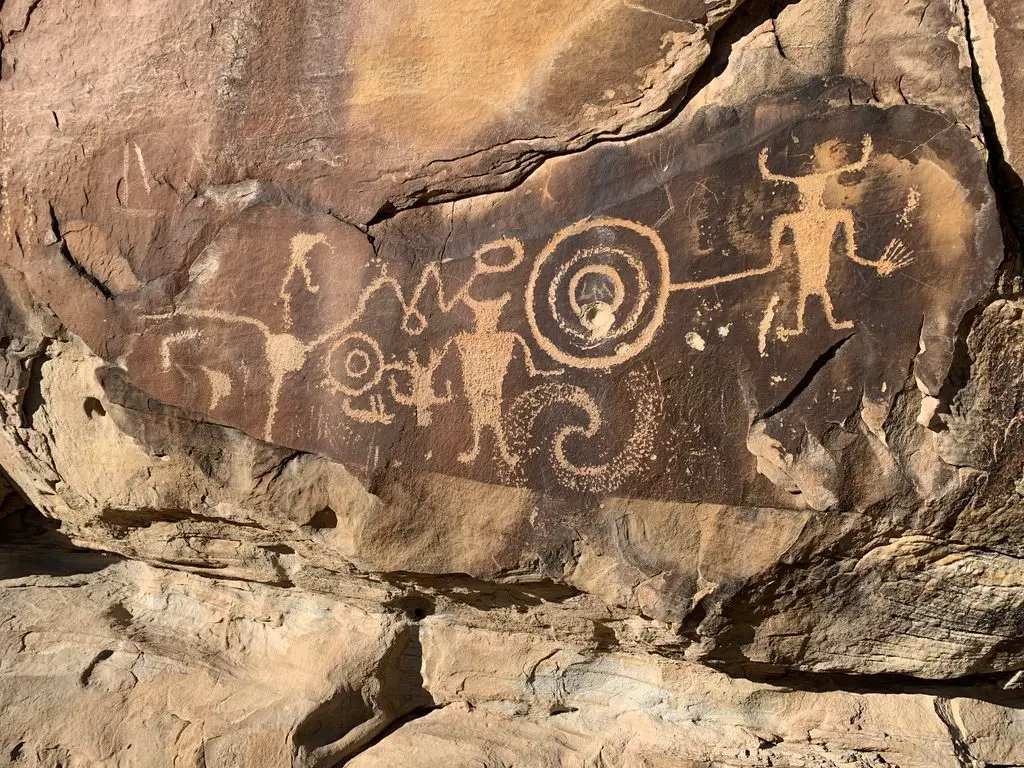
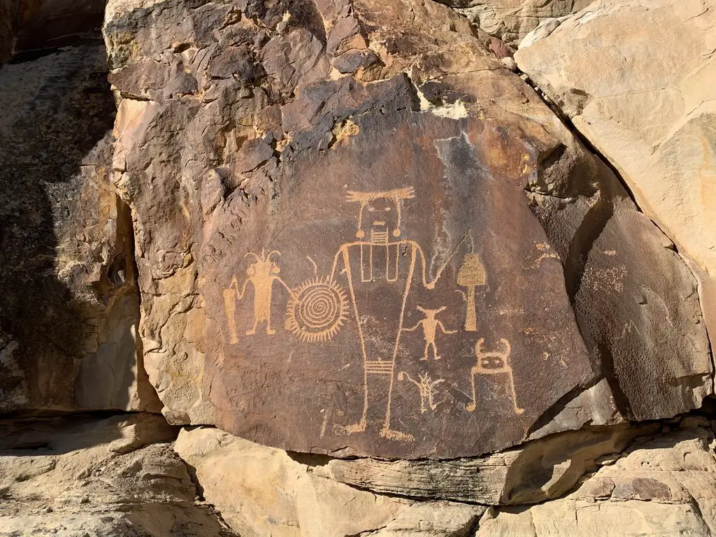
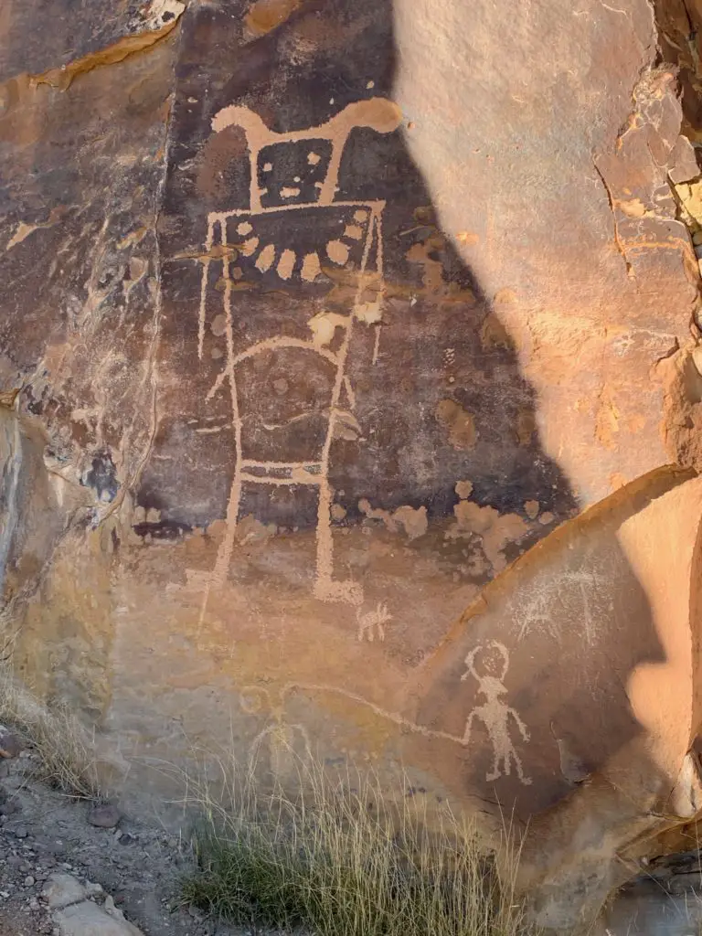
After leaving the Visitor’s Center, we took Cub Creek Road through the park.  This is one of the only paved roads throughout the monument, and even it turns to dirt the final few miles. (This section is well-graded, though, and passable with any passenger vehicle under good conditions.)  It offers several opportunities to view petroglyphs and pictographs (these are the drawings and etchings that were left on the rock by the ancient people who first tamed this wild land).  I had seen pictures of these creations before, but had never viewed them in person.  Some were absolutely AMAZING! 

Aren’t these incredible?!

A sandstone, rock wall with etchings of animals
This is the only place in the park where you can see the lizards.

A sandstone, rock wall with etchings of animals and other figuresA sandstone, rock wall with etchings of figures

A sandstone, rock wall with an etching of a large figure

I’m sure they all had perfectly logical explanations (some of them can be found here) but some looked pretty “unique”…(I’m not saying it’s aliens but…😲😉👽🖖

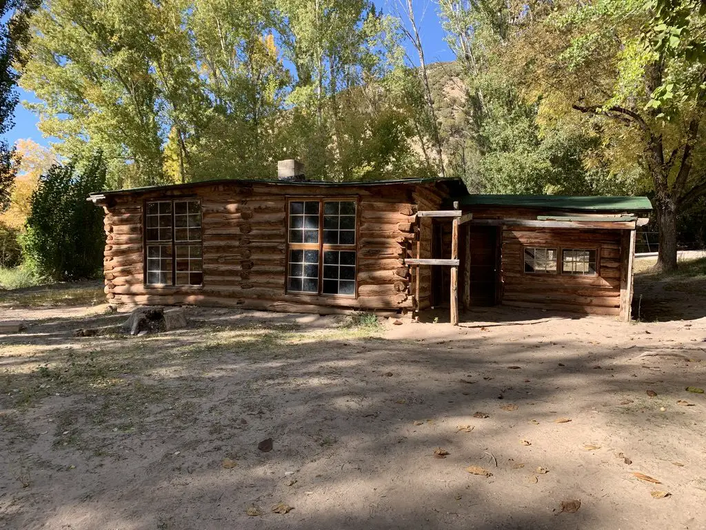
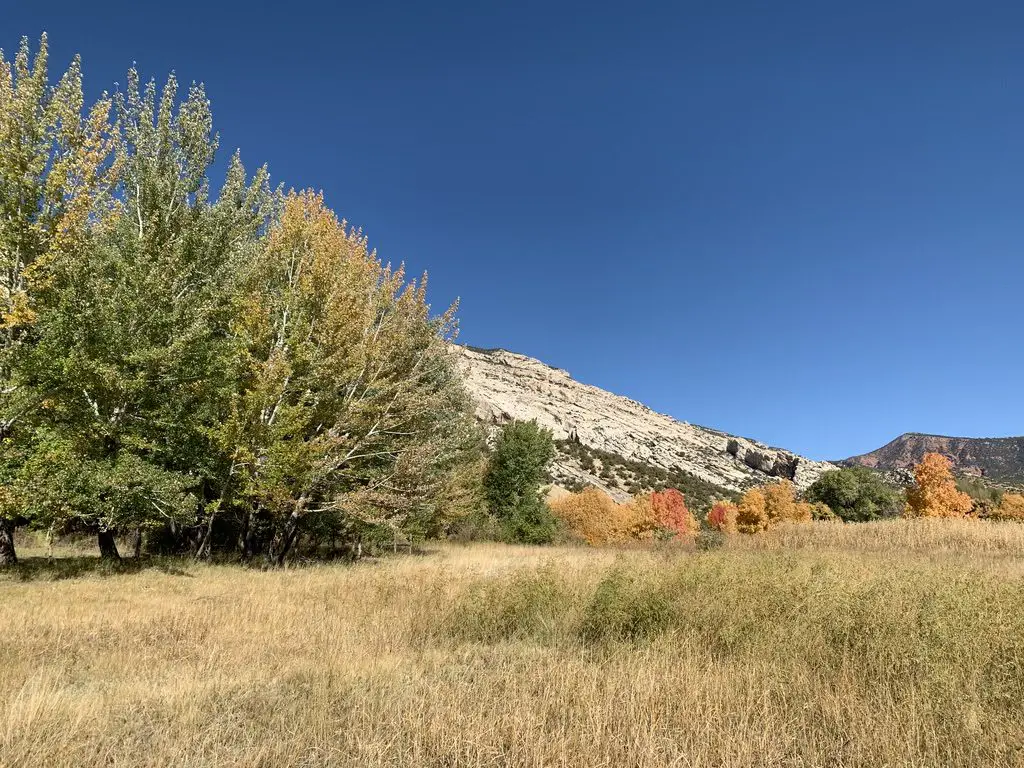
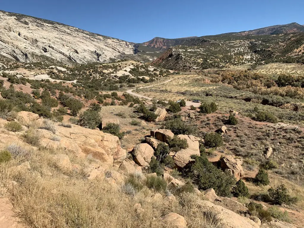
This road eventually takes you to Josie’s Cabin, where up until the 1960’s, a woman lived, by herself, until she was well into her 80’s.  This was without electricity or running water, mind you!  We saw a lot of lovely tree colors in this area.  There were several easy hikes that ventured into box canyons that are known for being good for fall colors (they run right along rivers and streams and the cottonwoods that grow there are very pretty).

An old, wooden cabin sits amongst trees
Josie’s Cabin
A brows-grass meadow with green trees in the foreground and fall-colored trees and a rocky mountain in the background, all under a clear, blue sky
Some of the fall colors along the creekbed
Island Park Road

This was another beautiful drive that is located on the Utah side of the park.  I thought this area had the BEST petroglyphs that we saw throughout the entire monument.

Island Park Road was dirt, and, according to the park office, is said to be “impassable” when wet. (It is suggested to only take high-clearance vehicles on this route, but, when we were there, any vehicle could have handled the drive).

We got lucky, as conditions were absolutely perfect throughout the duration of our trip, with clear skies.  So we were visiting under the most opportune conditions.  There were several areas we drove through that appeared to be dry creek beds, and looked like they could flood easily during wet conditions.  This is also an area that only has one way in or out, so if you drive in under dry conditions, and then a summer thunderstorm pops up…you could find yourself trapped!

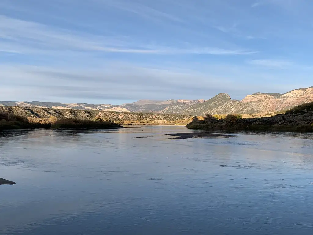
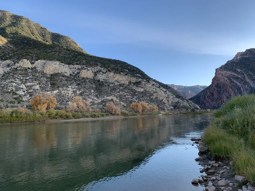
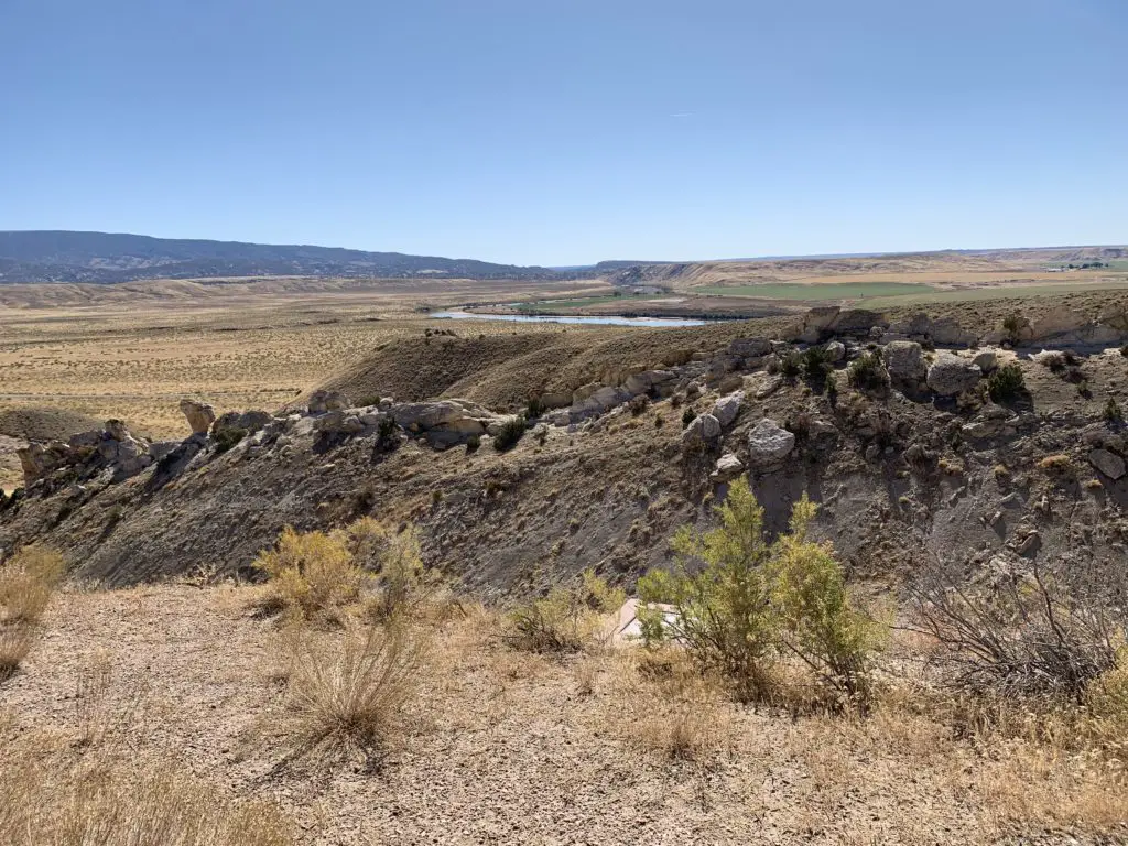
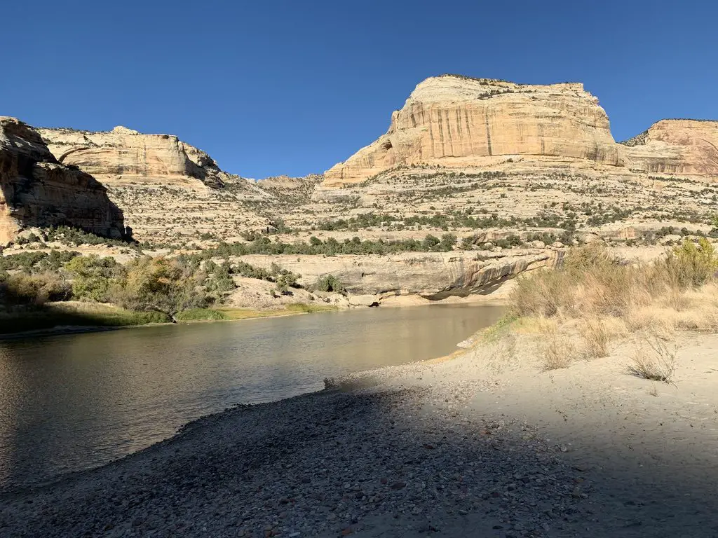
Below are a couple of pictures of the Green River as seen from this road…

Lake with trees and rock mountains surrounding it and in the backgroundCalm creek runs through scrubbrush-covered canyon walls on both sides

…and some of the scrubland around the monument (and thanks go out, as usual, to Mr. Trekker for most of these pics!)…

View over a desert landscape. Scrubbrush flatland with a creek in the far background leads to mountainsView over a desert landscape. Scrubbrush flatland leads to dry mountains in the background

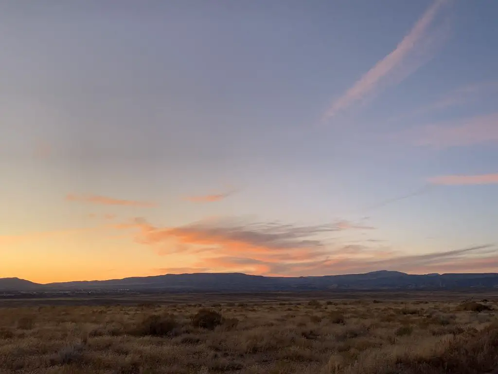
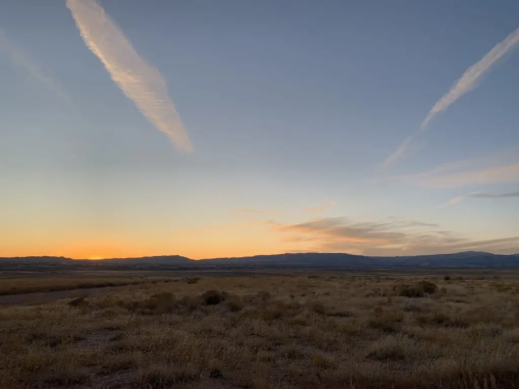
Sunset over the monument!

Sunset over a desert landscape with the silhouette of dark mountains in the backgroundSunset over a desert landscape with the silhouette of dark mountains in the background


Have you visited this incredible place?  Tell me about your favorite parts of it in the comments!


Like this post? Pin it!

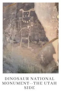
A sandstone, rock wall with an etching of a large figure. Pin reads, "Dinosaur National Monument--the Utah Side"


Like what you read here today?  Please feel free to leave a comment, like or share this post!  You can also follow the blog on social media by clicking the links below!
Facebook

Twitter

Instagram