My palms are damp, my heart is racing, my stomach is churning as I grab the truck’s “Jesus handle” and see my life flash before my eyes!…Mr. Trekker slowly inches the vehicle ever closer to the drop-off….
Let’s back up and start this story at the beginning…
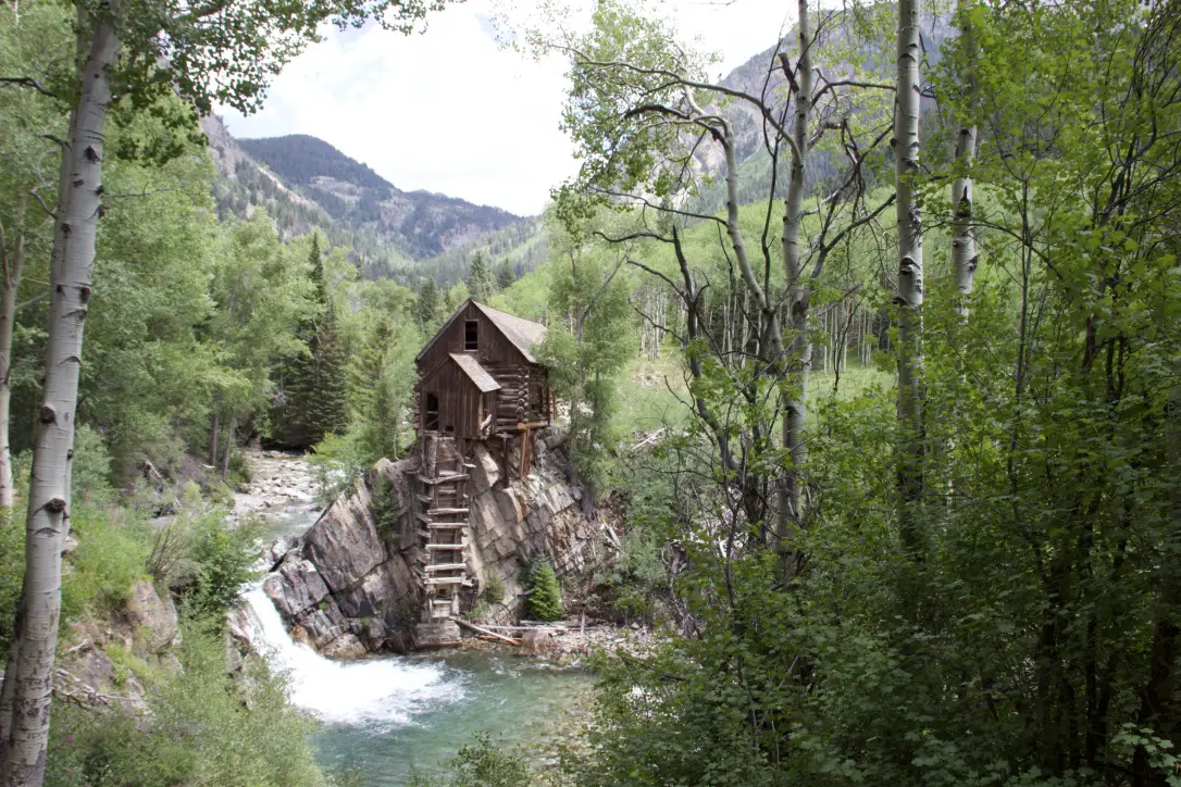
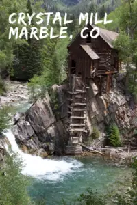
Crystal Mill
The Crystal Mill is one of the most photographed sites in all of Colorado (and a key reason we embarked on this road trip to begin with.)
First off, let’s just get the technicalities out of the way. The well-known structure that everyone takes pictures of and calls Crystal Mill…isn’t actually the mill (even though that’s the common name for it). It’s actually the powerhouse for the mill. This is all that remains of the abandoned site. The actual mill lost its battle with nature many years ago. I just wanted to get that out of the way for all the “sticklers-for-detail” out there, now for the fun stuff! 😁
After spending several days in the Grand Mesa National Forest, and enjoying a wonderful breakfast at Connie’s in Cedaredge, we were off on our long-anticipated adventure to Crystal Mill!
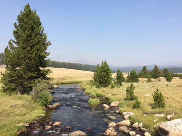
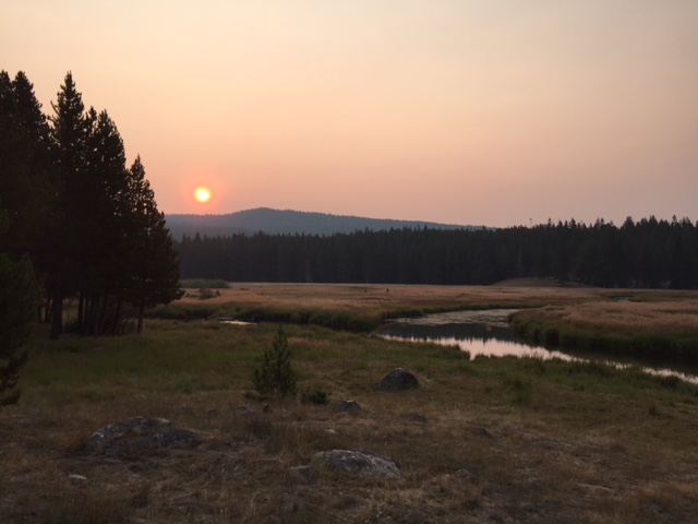
We traversed a beautiful gorge dotted with coal mines and then a spectacular canyon on Route 133. The drive into Marble, Colorado (the departure point for our adventure) was a sight to behold in itself! This was the first real alpine view we’d had on that road trip in 2018, and the drive over McClure Pass and down the switchbacks into town was incredible.
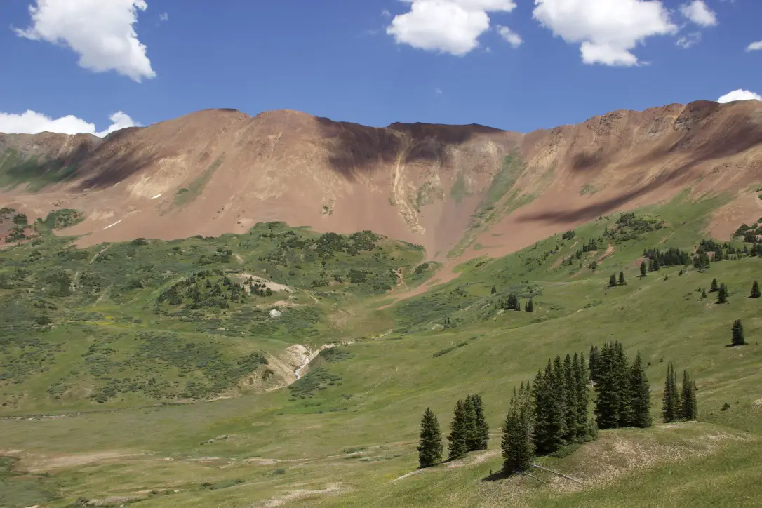
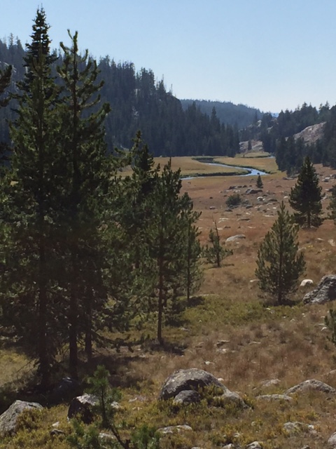
Before reaching the pass we could already see the dichotomy between opposing ecosystems; the drier scrubland on the western slopes and the wetter, alpine peaks on the eastern slopes of the pass. As we rounded the first curves and began our descent down the eastern side of the pass, the yawning chasm of the valley opened up in front of us, edged by the towering peaks of the nearby mountains…
Colorado’s Alpine Beauty
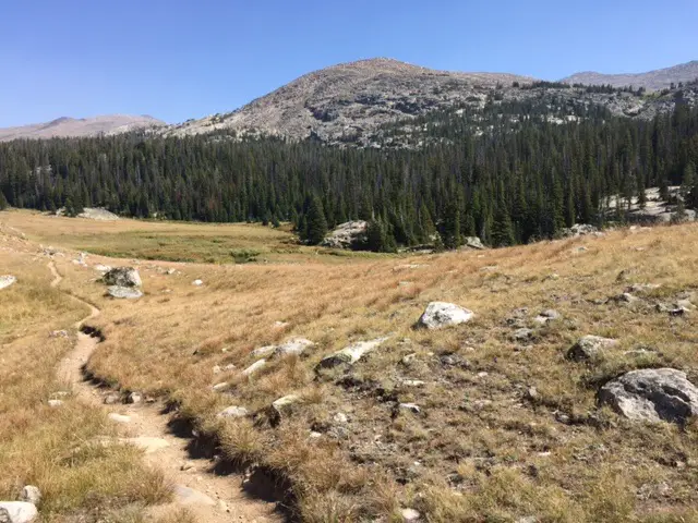
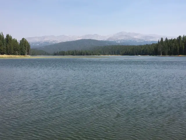
THIS is why I love the mountains so much! That first glimpse of the majestic, alpine peaks is what keeps me coming back time and again, never tiring of their pristine beauty. It’s a humbling experience, feeling so small next to those gigantic monoliths that continue on, one after another, for miles on end, standing the test of time eternal. How many eons has the rock that forms them been in existence? How many more years will it continue existing, affected only by the passage of time? It makes our puny, maybe-a-century-long, human existence on the planet seem paltry in comparison.
Colorado is one of my favorite places to visit. Click here for more posts on this awesome state!
Viewing vast expanses like this, for me, is a transcendent experience. My spirit is refreshed more by a day in the mountains than a week in a church pew. Being allowed the privilege of experiencing creation on this visceral level; as you breathe in the damp loam of the forest floor, and feel the competing elements of heat from the sun and the cool, mountain breeze that simultaneously caress your skin. For me, these experiences leave no doubt of the presence of a Creator. What better way to appreciate said Creator than by encountering its creation?
The tiny village of Marble, Colorado
Marble, Colorado is the nearest town to the Crystal Mill. A tiny hamlet with a permanent population of little more than 100 people, it is nestled into the Rocky Mountains along the Crystal River. Its claim to fame is the marble–hence the name–in its quarries that has been used for a few well-known places. These include portions of the Lincoln Memorial and Tomb of the Unknown Soldier in Washington DC!
Where is Crystal Mill?
The Crystal Mill is located approximately five miles east of the tiny town of Marble. You can drive to the mill when the road is open and conditions are good. This is a fairly technical, 4×4 road. You should NOT attempt this road unless your vehicle has 4-wheel drive, is high clearance, and you are experienced driving off-road. There are places this road can be quite dangerous if you don’t know what you’re doing!
Have no fear though! If you don’t feel your vehicle (or your nerves) are up to the challenge to drive this road, you can hike it! The road doesn’t offer much by way of elevation change but beware you are at an altitude of almost 8000 feet in this area.
The mill is also only about 6.5 miles to the west of Gothic, Colorado. You can drive this route from Gothic via Schofield Pass on Forest Route 317…however, this is an EXTREMELY dangerous and technical 4×4 road that should ONLY be attempted by EXPERIENCED off-road drivers!
This is NOT an exaggeration! This route is extremely narrow, exposed, and difficult. In many places, it only allows room for one vehicle and there are no turn-around options. So, if two vehicles meet, one will be forced to back up for a potentially lengthy distance on a dangerous route. (The Devil’s Punchbowl is found on this route.) I do NOT suggest anyone take this road unless they know what they are getting themselves into. This is known as one of the state’s most dangerous 4×4 trails. People have died while attempting this road!
The Road to Crystal Mill
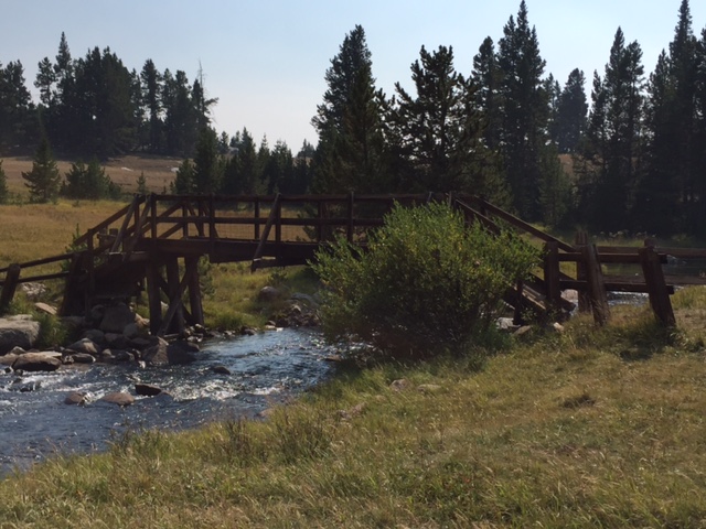
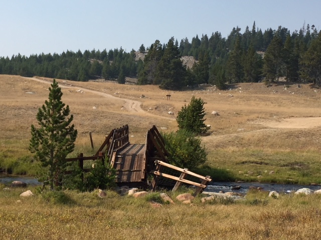
The main road to Crystal Mill, Forest Road 314, is listed as “moderate” in the 4×4 book I mentioned in this post. It’s about a 10-mile, round-trip excursion from Marble to the mill, and then the ghost town of Crystal, beyond. So, be prepared for a several-hour adventure, especially depending on your mode of transportation. The road is open for hiking, biking, and vehicles, so all should proceed cautiously and be ready to encounter others along the way.
I approached this route with a bit of trepidation. We knew this would be one of our more challenging 4×4 adventures to date, so, with sweaty palms and a pounding heart, we passed Beaver Lake and headed toward the unknown.
As it turned out, the technical difficulty of the road was completely manageable, our earlier drive on Montgomery Pass Road, as outlined here, actually proved more challenging. The road was rocky, for sure, with a water crossing or two in places, but any high-clearance, 4WD vehicle could manage it in good conditions.
The difficulty arose when you met people coming the other way on this one-lane, two-way, shelf road! 😳 The smashed cab of the ancient truck I saw lying at the bottom of one of the ravines didn’t help to quell my nerves any! 😕

There was only one, truly nerve-wracking moment when we were forced to hug the edge of a cliff as we waited for an ATV to pass us. (This is the moment described in the opening lines of this post!) Fortunately, this was an area with a bit of a turn-off where the road “widened” to about 1 1/2-lane width, so it was actually the perfect place to meet an oncoming vehicle.
As we hovered on the rim of the canyon, several hundred feet in the air, my acrophobic tendencies spiked as Mr. Trekker had to inch towards the drop-off to make room for the other car. These conditions are a normal part of driving back roads in the mountains so, while manageable, these roads are not for the faint of heart! (Did I mention this was the “safe” and “easy” portion of this road?)
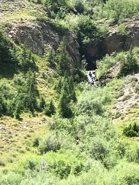
We did arrive safely at Crystal Mill, and it is, truly, all it’s lauded to be. There’s a reason why this is one of the most photographed sites in all of Colorado. The mountains provide a picturesque backdrop and aspens frame the Crystal River as it courses down a small waterfall and edges the side of the mill before continuing on to Marble, farther down the valley. The water roars as it rushes past, caring naught for anyone or anything that gets in its path. It presses on with one purpose, to obey the demand of its master–Nature–to continue on to where the call of gravity slackens.

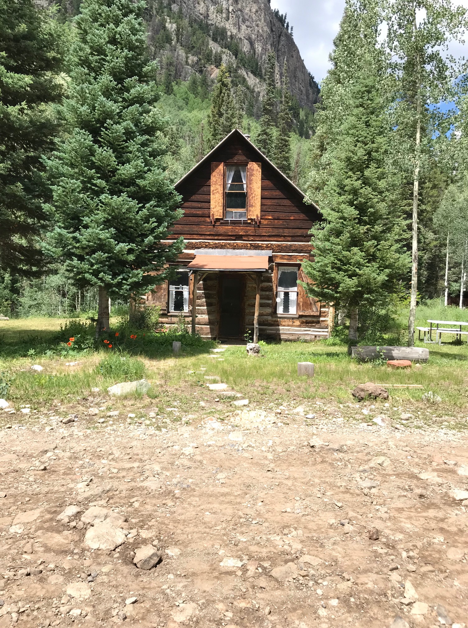
Crystal “Ghost Town”
The ghost town of Crystal is located only a few hundred feet beyond the site of the mill and is not, truly, abandoned–at least in the summer months. Many of the old buildings have been restored and are now privately owned as small, mountain getaways.
The town itself makes for a good turn-around point on the road for those of us who are less brave (wiser?) and are not willing to take on the Devil’s Punchbowl. We returned to Marble, the way we had come, without further incident.

“Just Groovin”!
After that adventure, we decided we had earned a celebratory meal (also, we were hungry!) There is a cool BBQ restaurant, in Marble, called Slow Groovin BBQ. The food was wonderful and was just what our appetites had ordered! (You can visit their website
I liked the message they had printed on the bottom of their menu (
Now that we’ve returned home, this is something I’m trying to implement into my everyday life as well. (I always try to garner insight from our trips, and I always come away inspired when we visit Colorado–have I mentioned I LOVE this state?

To Conclude:
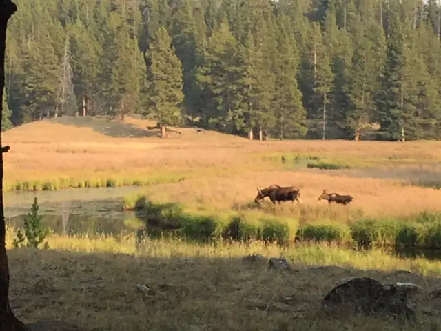
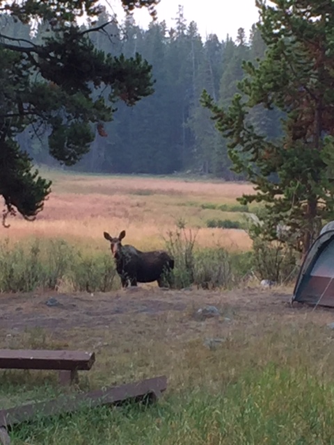
We had planned to camp at an RV park we located on the map in town. Unfortunately, it was full for the night. Since there is no cell service to speak of in the valley, and we were fresh off our life lesson to “just groove”, we decided to press on to see what camping options awaited us in the Gunnison National Forest. We were SO glad we did!
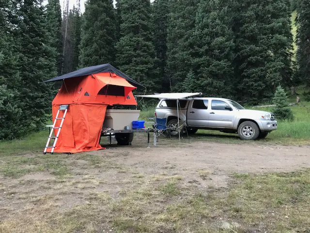
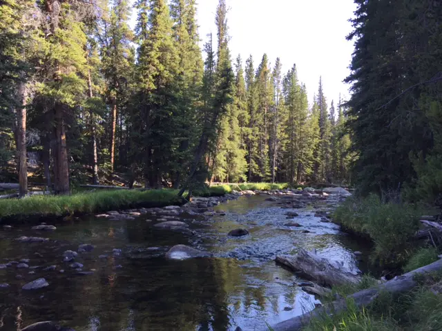
It turned out, merely 20 minutes down the road, we came upon a National Forest campground that was nestled against the Crystal River. There we found, what ended up being, one of our favorite campsites of the entire trip (have I mentioned National Forest campgrounds are AWESOME?) 😉
We happened to arrive shortly after the most scenic campsite in the entire campground became available, early. So, we snatched it up! Sometimes, “winging it” works out for the best! It was located mere feet from the river itself! Due to the Stage 2 fire ban, no campfires were allowed, so we enjoyed a relaxing evening riverside, dangling our feet into the cool water, and reading the books we brought along while enjoying the sounds of the bubbling river.
This trek to the Crystal Mill was definitely one for the Bucket List. If you’re even in the central Colorado High Country, I’d encourage you to visit it as well. You’ll be glad you did!
Have you visited this incredible, Colorado landmark? Tell me about your experience getting there in the comments!
Did you enjoy this post? Pin it!
Like what you read here today? Please feel free to leave a comment, like or share this post! Add your email at the bottom of the page, or the sidebar to the right, to be notified when a new post is published. By signing up for the email list, you will also receive a free copy of the Tranquil Trekker’s Top 10 Tips of Trekking Do’s and Don’ts!
You can also follow the blog on social media by clicking the links below!