Ghost Towns in Southwestern Montana

In this post, I review several, cool ghost towns in southwestern Montana.


Montana IS the Old West!  It’s full of small, dusty, cowpoke towns where you can just imagine characters like Buffalo Bill Cody and Wyatt Earp walking its streets.  What better way to enjoy that experience than visiting an authentic ghost town?  We’ve enjoyed a few of these unique locales (though there are still plenty more on our list!)  See below for details!

Elkhorn State Park (Ghost Town)

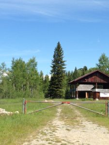
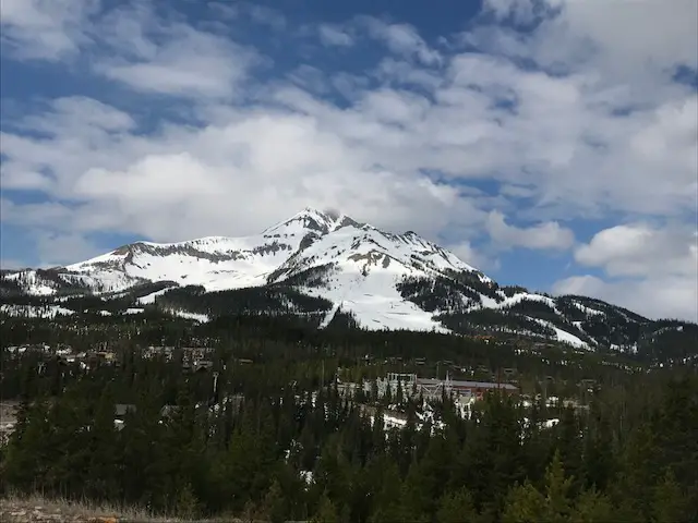
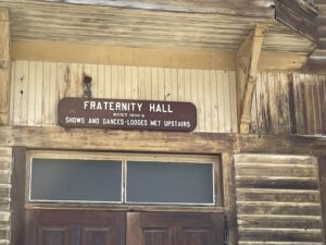
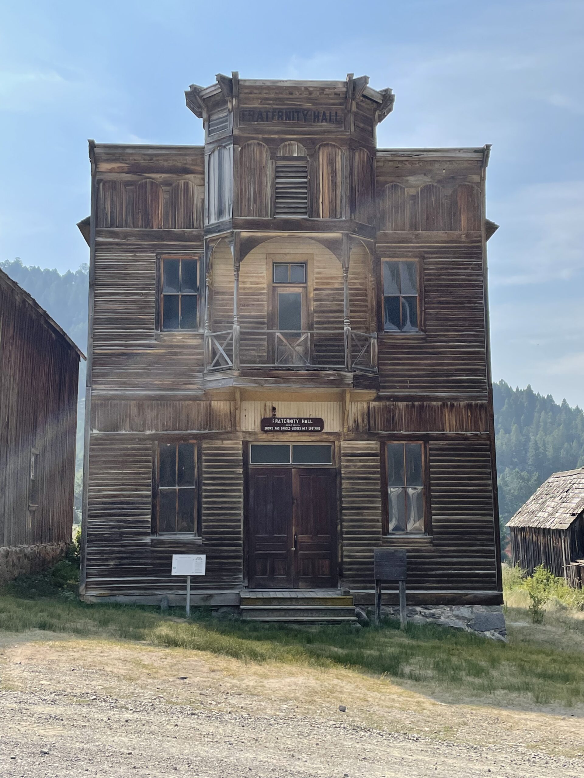
Elkhorn is a tiny town located in the high mountains of southwestern Montana.  It is situated in a lovely valley with a mountain expanse that spreads out before you.  Technically this is a state park but the park portion only encompasses two buildings and a picnic area, the rest of the town is privately owned.  Feel free to walk the local roads though.  There are a number of signs that show where buildings used to be, what they were used for, etc.  

Front of old, wooden building. Sign says, "Gillian Hall: Built 1880's, Bottom a store or saloon, dances upstairs."

You can reach Elkhorn from the south by taking Exit 256, off of I-90, near Cardwell, Montana.  From here you will take Route 69 north.  After about 25 miles you will turn right on White Bridge Road (it’s literally just a short road that crosses the river on a small bridge.)  Once you cross the river turn right at the T-intersection onto Lower Valley Road.  You then take this road to the town.

There are a few signs for the Elkhorn mountains and Elkhorn state park but don’t rely on these to guide you.  It will be about 40 miles until you reach the town going this route.  As long as you stay on the main gravel road once you reach Lower Valley Road, you should be fine.  These roads are almost all dirt but they’re in good shape for basically any vehicle in good weather conditions. 

Old wooden building

You can also reach the town from the north from I-15.  From Exit 164 on I-15 at Boulder, MT, take Route 69 south and then take a left onto White Bridge Road.  The town is about 20 miles from the I-15 exit going this route.

Front of old, wooden building. Sign says, "Fraternity Hall, shows were upstairs"
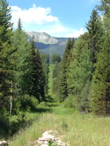
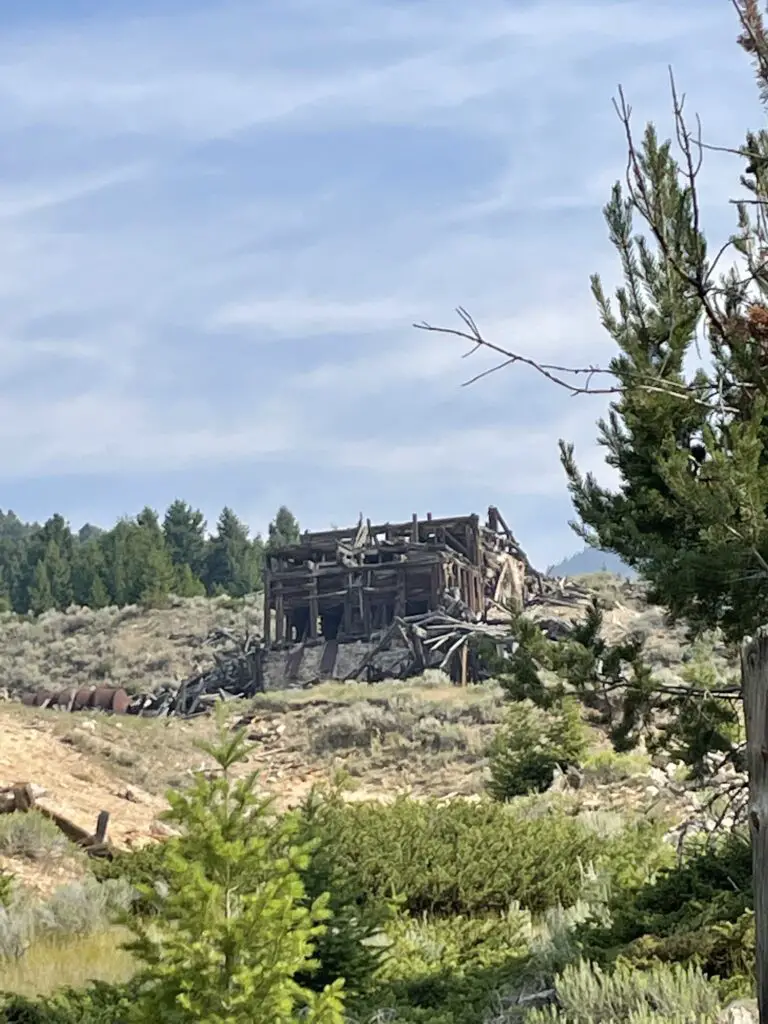
If you continue up the dirt road past town and follow the signs, you will end up at the old cemetery in the woods. (The road is in pretty decent shape in good weather conditions–though we admittedly had a 4×4 truck.  We did see a sedan up there but I’d be careful with any car other than a Subaru or something else with higher clearance.  There were a few ruts and rocks in the road that could damage a lower-clearance vehicle.).

The cemetery was really neat but also very sad.  There were SO MANY graves of babies and children (apparently there was a diphtheria epidemic in the town that killed many children).  You’d see families where multiple children died within just a few days of each other.  I love visiting old cemeteries.  It’s always very sad to see how frequently young people died, but the histories of the area that you can gather are so interesting. 

Old, wooden building

Old, decrepit, wooden mine stands on a mountainside
The mine in Elkhorn

Nevada City and Virginia City Ghost Towns

These two towns are also located in southwest Montana.  They are only about two miles apart.  The easiest way to reach them is probably from Three Forks, Montana.  Take Exit 274 off of I-90 for US 287 south.  Then take this road to the town of Ennis and turn right onto State Route 287 (yes, the roads are the same number. 😉)  This road runs right to the towns.  It is around 60 miles to the towns from I-90.

Related Info:  Activities in Nevada and Virginia Cities, Virginia City history, Nevada City history, Bannack HistoryHistory of Elkhorn; 6 Don’t Miss Places for your Western Montana Road Trip

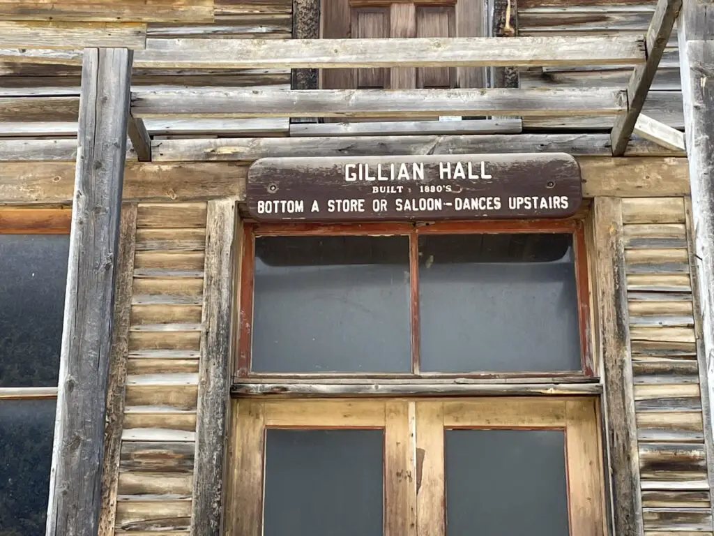
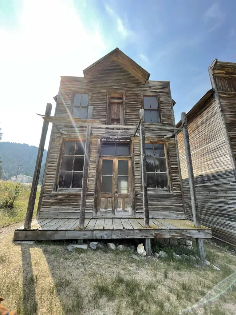
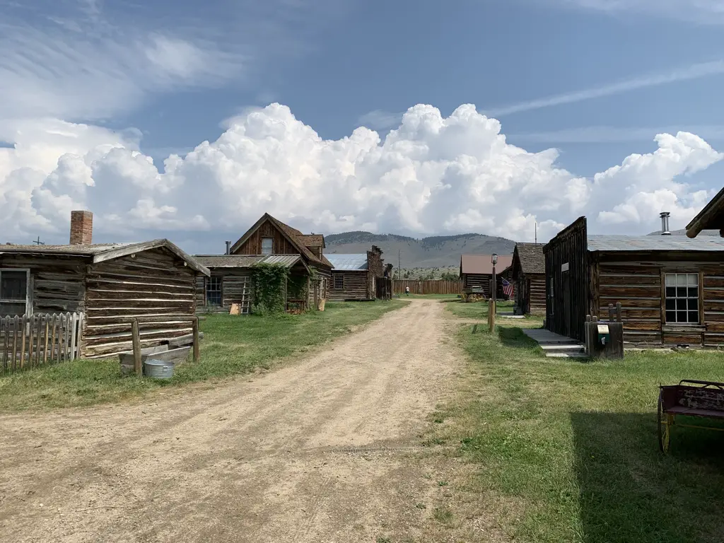
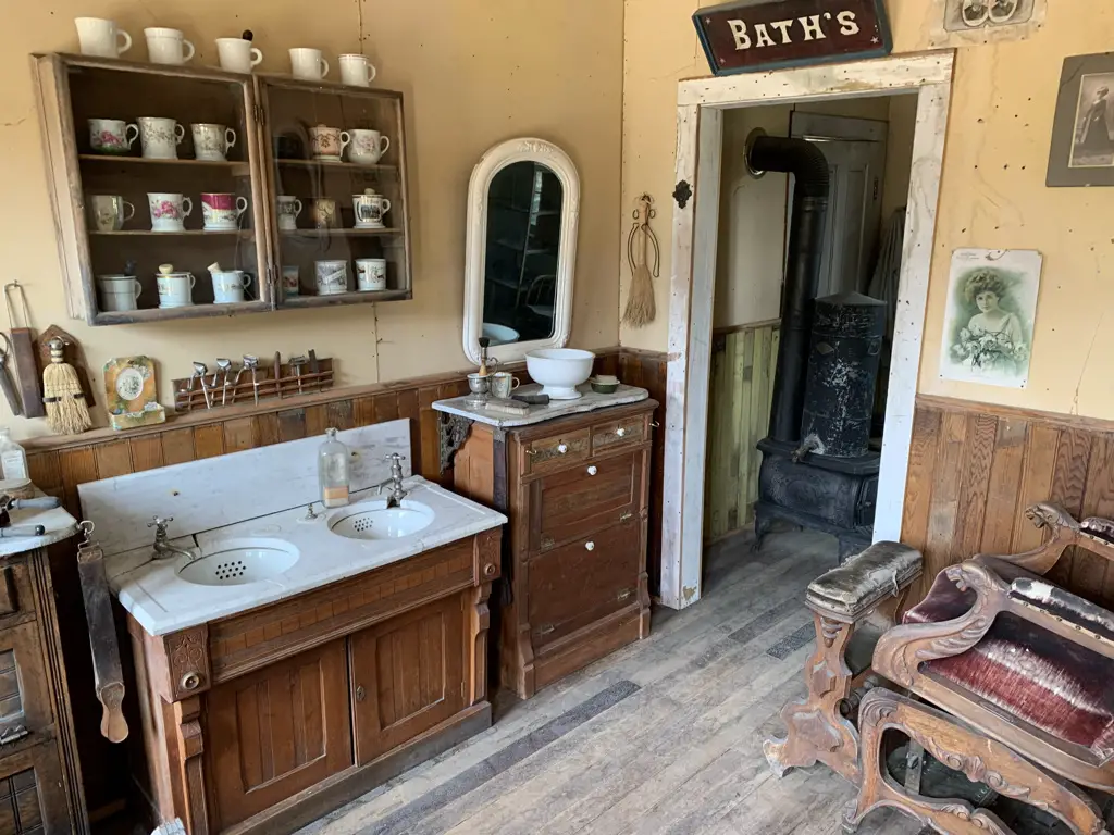
Nevada City was our favorite site of the two.  It is an outdoor museum of sorts.  Once you enter you can then walk around the entire town.  There are many buildings that you can actually go inside that are modeled to look as they would have in their heyday (such as a barbershop, the blacksmith shop, the general store, etc.).  Many of the structures are not native to this exact location, rather they were saved by historical foundations and brought here from around the state to be preserved. (It reminded me a little of the 1880 town in South Dakota.)

View down dirt, main street of Nevada City ghost town. Old, wooden buildings on each side.
Main Street Nevada City

View down dirt street of a ghost town. Old, wooden buildings on each side. Blue sky with clouds

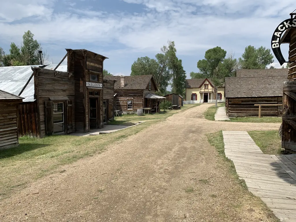
Barber Shop, Nevada City:

Interior of building. Sinks, mirror and wash basin in foreground, antique chair to the side, antique wood stove through doorway. Sign above door says, "Bath's"

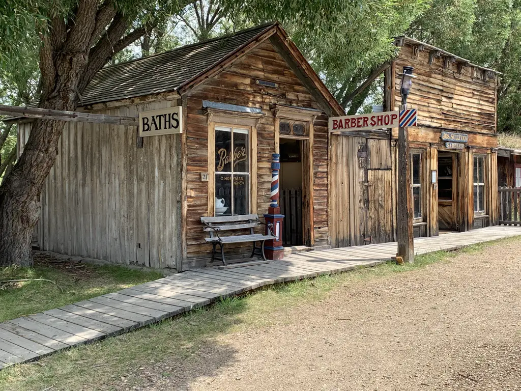
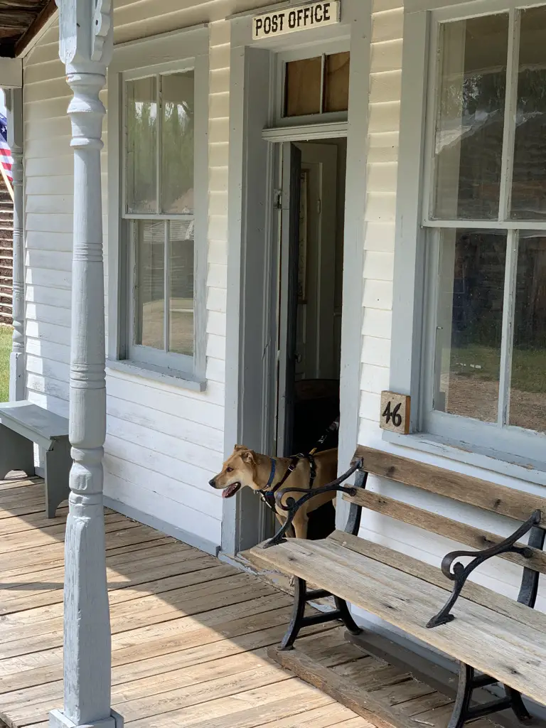
One great part about this museum, it was Puppers friendly!

Front porch of old Post Office, dog walking through front door.
Puppers enjoyed the post office!

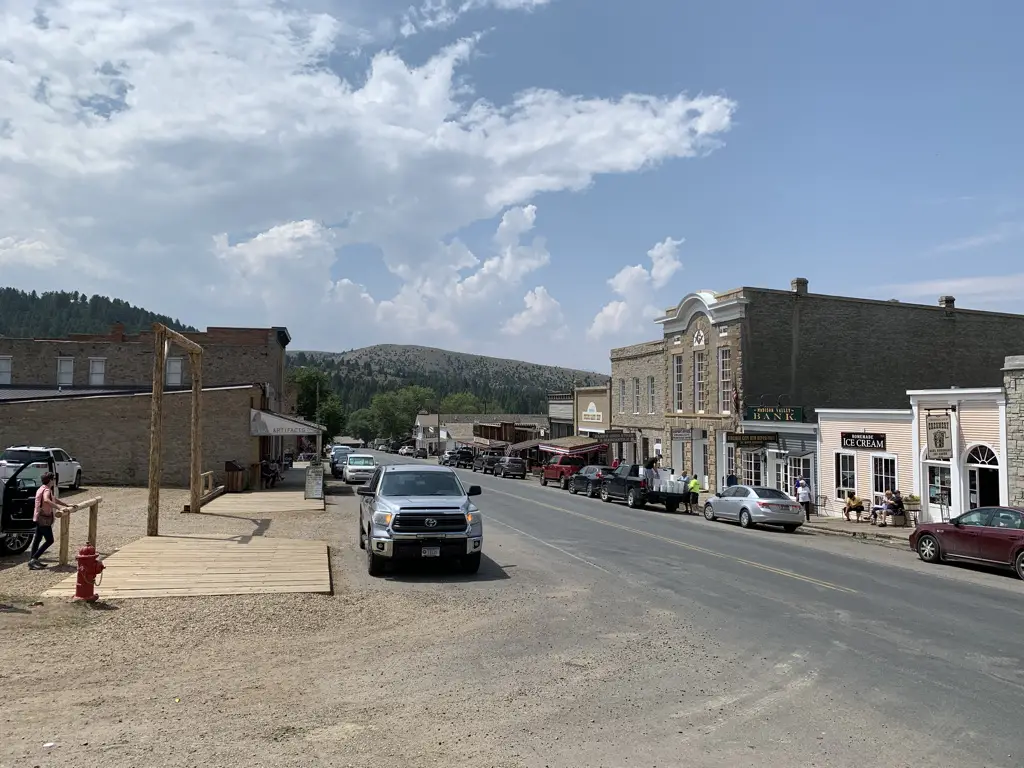
Virginia City was ok.  There were some decent sites to see but mostly it was a busy, commercialized town filled with shops, restaurants, and saloons.  Some people enjoy that atmosphere and that’s fine, but the Trekkers (and Puppers) prefer the quiet and solitude of the real ghost town. 😁  The town did offer some historical tours in horse-drawn stagecoaches that looked kind of cool, though we didn’t partake.

View down modern, paved, main street of Virginia City ghost town. Cars line both sides.
Main Street Virginia City (it isn’t quite so ghostly)

Bannack State Park (Ghost Town)

The easiest way to get to Bannack would be to take I-15 to Exit 59, near Dillon, Montana.  From here you will take Route 278 west.  After about 17 miles, Bannack Bench Road will break off to the south (left).  That takes you right to the state park.

Some of the roads to get to the park are gravel, but they were in great shape!  As long as you take it easy and don’t mind getting your car dirty, any sedan should be able to handle the drive in good weather conditions.

View down dirt, main street of Bannack ghost town, Bannack State Park. Old, wooden buildings on each side, blue, cloud-covered sky, dusty mountains in background..
Main Street Bannack

Old, wooden buildings line one side of dirt, street.

Old, wooden buildings line one side of dirt, street.

Old, wooden jails. Dusty mountains in background.
The jails in Bannack
Interior of old, wooden jail. Shackle points in floor.
You can see where the prisoners were chained

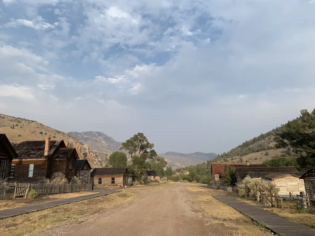
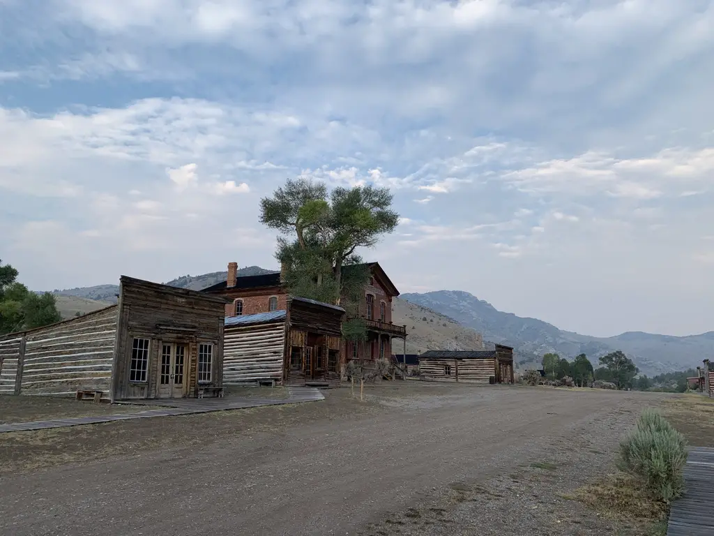
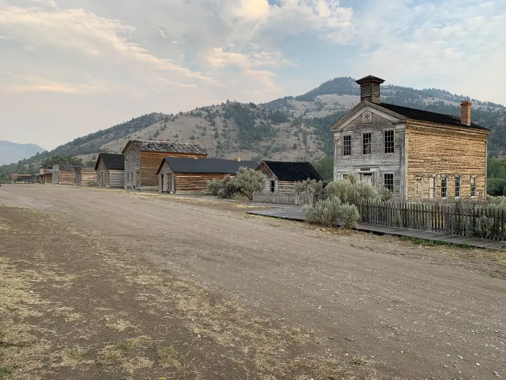
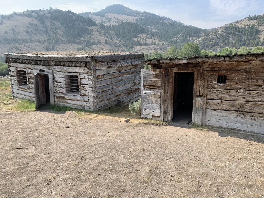
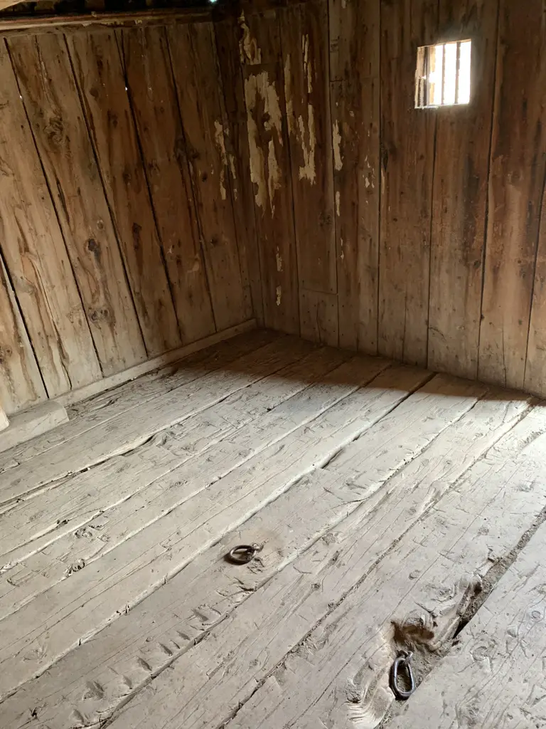
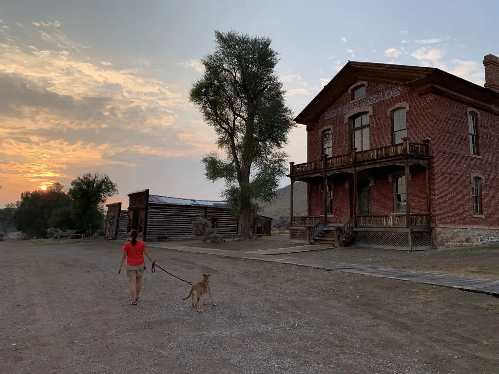
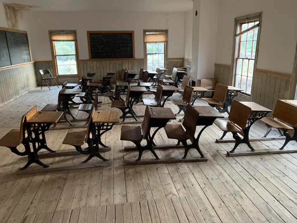
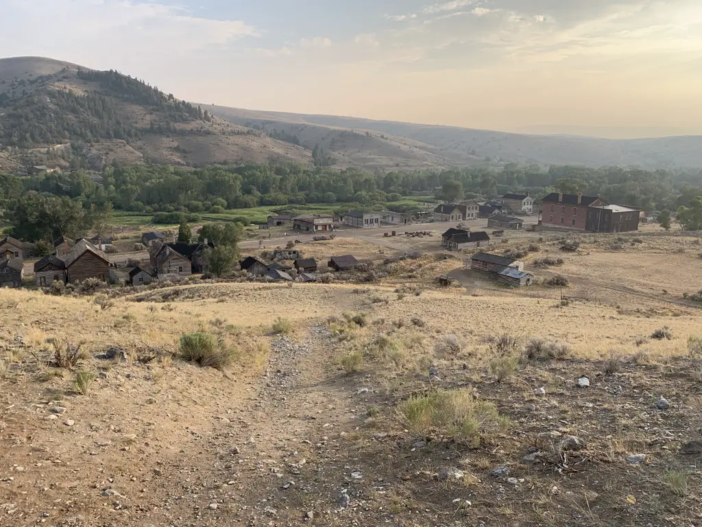
Bannack is AWESOME!  It’s one of the better preserved, true ghost towns I’ve ever seen (meaning it’s still in its original location and the buildings are in fairly good shape.)  They let you just wander around the town on your own, you can go in the buildings (that aren’t locked) AND you can bring dogs!

Smoky sunset over scrub-brush covered pastureland.
A smoky sunset over wild Montana
Woman and dog walking away from camera on dirt street of ghost town, sun setting into the clouds in background.
Puppers and I searching for ghosts at sunset
Interior of old, one room schoolhouse. Antique desks fill the room.
Inside the schoolhouse

Rules for teachers written on the schoolhouse chalkboard:

Rules for teachers at the schoolhouse in 1915 written on a chalkboard. These include, "you may no loiter downtown."

Rules for teachers at the schoolhouse in 1915 written on a chalkboard, including, "you may not dress in bright colors."

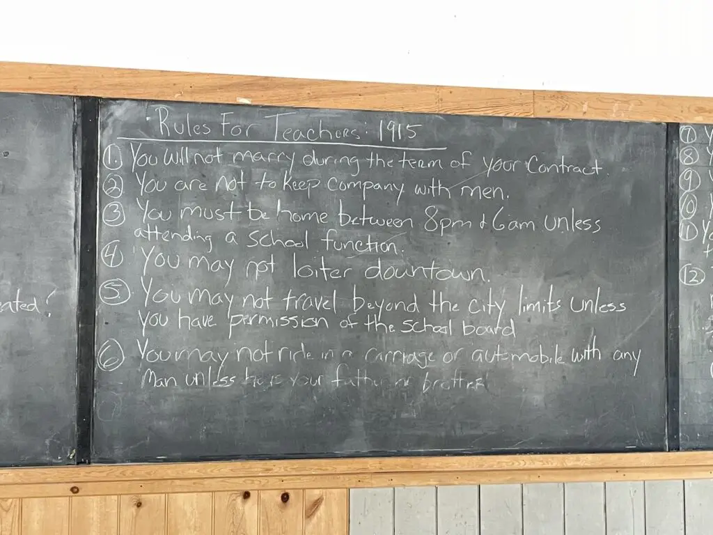
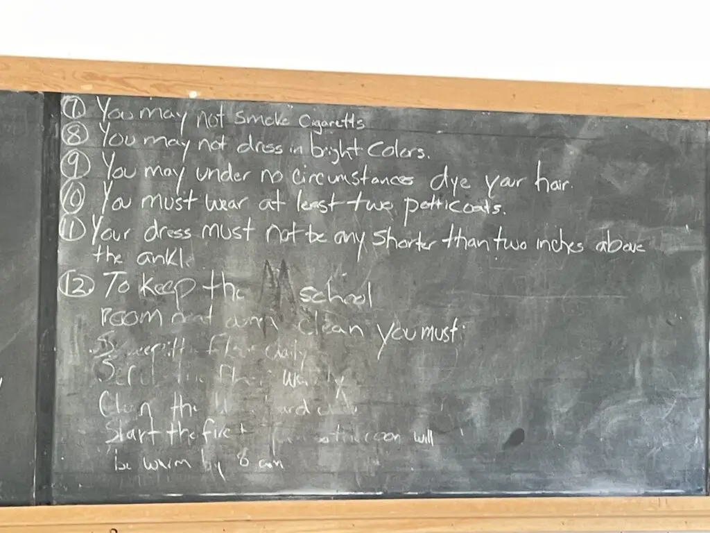
My favorite are no wearing bright colors over that scandalous one petticoat! 🤣 

View down spiral, front staircase of old hotel.
Not gonna lie, I couldn’t help imagining myself descending these stairs in a hoop skirt!

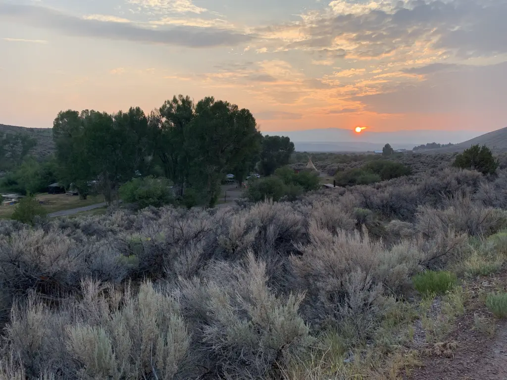
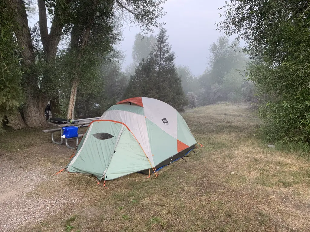
If you can make it work I STRONGLY recommend camping in the park, it’s about a half-mile walk from the campgrounds to the ghost town, and being there in the evening as the light wanes is AMAZING! (If you choose not to camp the park is open till 9 at night, in the summer).  The campgrounds are rustic (read vault toilets) but they were cute, well-maintained, and quiet.  This was our favorite stop of the trip and Mr. Trekker’s favorite campground (mostly because of the access to the ghost town.)

Foggy campsite surrounded by trees, tent in middle.
Our cute little campsite at the Bannack State Park campground
View from top of hill overlooking the ghost town of Bannack, Montana. Smoky mountains in background.
View of Bannack from the hill above the town
Dog asleep in back of vehicle, strapped into harness and seat belt.
Sleepy puppy after chasing ghosts! (BTW that seatbelt harness she’s wearing is AWESOME!)

Though they weren’t nearly as good as the ones we found for Colorado, I did find a series of books that is helpful when visiting Montana ghost towns:  

Book, "a pocket guide to ghost towns of Montana, volume 1."

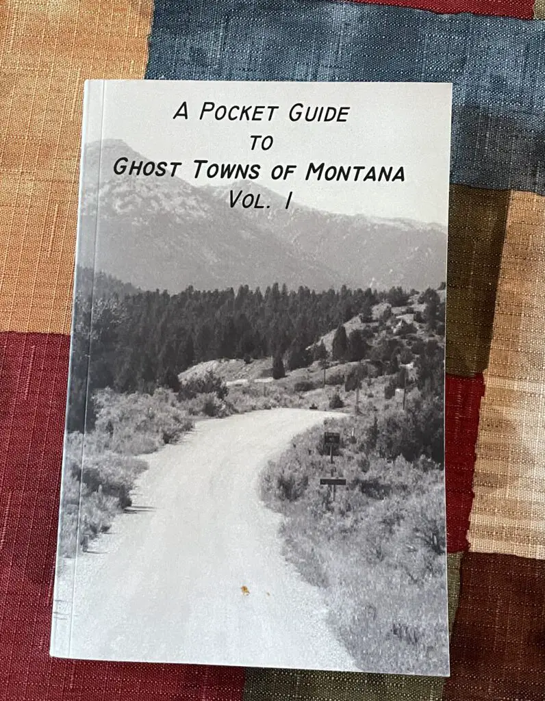
This volume didn’t cover EVERY town we’d like to see but it did review many of them.  I’ll look into getting one of the other volumes when we go out for our next trip.  The book focused mostly on the histories of the towns (which is always interesting) but it did give a quick synopsis of how to find the town at the end of each section.  It even made helpful suggestions such as, “it is not advisable for any vehicles towing trailers to approach using the southern route.”

Bannack and Nevada/Virginia Cities are only about 80 miles apart.  While you can certainly enjoy Nevada City and Virginia City on the same day, I would encourage you to save one whole day for Bannack.  This will allow you to fully enjoy that park and give it the time it deserves.   

Ghost towns are such a great way to experience history and gain an appreciation of the “cushier” lives we lead today.  So if you find yourself in southwestern Montana, check out some of these cool destinations!

Have you been to any of these awesome ghost towns?  Are there others we should put on our list?  Let me know in the comments!

Did you enjoy this post?   Pin it!

Three pictures: 1) Old, wooden buildings line one side of dirt, street; 2) View down dirt, main street of Bannack ghost town, Bannack State Park. Old, wooden buildings on each side, blue, cloud-covered sky, dusty mountains in background; 3) View down modern, paved, main street of Virginia City ghost town. Cars line both sides. Pin reads, Ghost Town in Southwestern Montana

Like what you read here today?  Please feel free to leave a comment, like or share this post!  Add your email at the bottom of the page, or the sidebar to the right, to be notified when a new post is published.  By signing up for the email list, you will also receive a free copy of the Tranquil Trekker’s Top 10 Tips of Trekking Do’s and Don’ts!

You can also follow the blog on social media by clicking the links below!

Facebook

Twitter

Instagram

Pinterest

Going to the Sun Road at Glacier National Park

In this post, I review Going to the Sun Road at Glacier National Park.


Author’s Note: Since we visited Glacier in 2016, the Park Service has implemented a complex, ticket system for visiting the park in the summer. To be honest, I can’t make much sense of it as it involves multiple tickets being required to enjoy various activities around the park. For more information on this system, visit the park website and/or contact the park office. 

While on our visit to Glacier National Park, we drove the famed Going to the Sun Road.  We also learned some tips to keep in mind when traversing rural Montana.

Montana

If you’ve never been there, Montana is a HUGE state.  It takes 8+ hours to cross it when traveling 80 mph (the posted speed limit) and that’s on the Interstate!  It’s absolutely beautiful though!  I never realized how many mountains crisscross their way through the rolling prairies of that state. 
Montana DOT could do with some better signage.  Several times we had to turn around and retrace our steps to find the correct turn–either due to a complete lack of, or unclear, signage.  Frequently there would be large signs pointing the way when coming from one direction; and little to no signage when coming from the other.

It was also, often difficult to decipher which “turn ahead” was the right one–one time it would be the turn DIRECTLY after the sign, while others it would be three turns later after passing numerous side streets. 😛 

Information on local services was also lacking.  We limped the car into Missoula the first night, as we failed to realize how far the distance would be on the interstate between reliable gas opportunities–fortunately, gravity was on our side as a steep grade downhill ushers you into town and the CRV gets good gas mileage!

At least South Dakota provides some warning in these situations with billboards containing messages such as “gas now or gas can later”. 

Montana also has a habit of closing rest stops with little or no warning which is especially problematic when each rest stop can be more than 50 miles apart!

Glacier National Park

Glacier National Park is absolutely BEAU-tiful, as is the surrounding area!  It wasn’t nearly as crowded with visitors as Yellowstone–though as we learned later, being there at the end of June put us at just the beginning of the very short, summer season.  Several hiking trails in the higher elevations were still closed due to snow hazards (and this is normal!) 

Part of the reason it isn’t nearly as crowded as other national parks is that it is, quite literally, in the middle of nowhere.  West Glacier (the western terminus) is almost 140 miles from I-90.  It took us over three hours to drive that distance on winding, mountain roads, sometimes traveling 15 mph lower than the posted speed limit while following large RVs.  Likewise, the other side of the park, St. Mary (the eastern terminus) is almost 90 miles from I-15. 

We didn’t camp on this trip.  However, if you’re looking for some great info on camping at Glacier National Park, click here!

The scenery found on all of these drives is incredible though.  I actually recommend arriving at the park from the east side (driving up through the prairie) as you’ll have a commanding view of the Rockies for a much larger portion of the drive.  If you come into the park from the west, the overall drive is prettier–complete with mountain lakes and twisting curves–but the mountain views are largely obscured by trees and other, smaller hills. 

Large tree-covered mountainsides with bits of snow on their rocky tops, all under a clear blue sky. A river runs through the valley below.
Isn’t this gorgeous?!

Limited Services in Northwest Montana

We were also surprised at the limited access to everyday services of this high-tourist area.  Both West Glacier and St. Mary’s appeared to be reasonably sized towns based on the map (and their proximity to the park)–and they are decently-sized as towns in Northwest Montana are concerned–but they lack many basic services.

I personally required some OTC medication thanks to the side effects of antibiotics, and we had to travel an hour out of our way to finally locate a pharmacy to acquire it (a feat that would have been accomplished in about five minutes in most other rural parts of the country).  So something that should have been nothing more than a temporary annoyance ended up causing a real hindrance to the enjoyment of the trip. 

Having never been to the area before, my early online research made St. Mary appear to be far more commercialized than West Glacier; the map indicated this as well…it wasn’t.  St. Mary consisted mainly of one gas station/small supermarket/restaurant/gift shop and a smattering of campgrounds and roadside cafes.

We returned to this area several years later. Below are the posts relating to that trip!:

Ghost Towns in Southwestern Montana
6 Don’t Miss Places for your Western Montana Road Trip


West Glacier at least had two separate gas stations and several restaurants/shops within walking–or a short driving–distance.  I don’t say these things to complain, you are in the wilderness after all, but more as a caution for preparedness.

Going to the Sun Road

Glacier National Park consists largely of the east and west termini, and a road connecting the two, through the mountain passes (Going to the Sun Road) that’s only open about four months of the year.  The rest of the year it’s buried under up to 30 feet of snow (near Logan Pass) and is frequently plagued by avalanches.

While the two towns are only 50 miles apart it can easily take three hours or more to cross the divide (due to other drivers, the slow speed limit forced by sharp turns and steep inclines, and frequent stops at the many lookouts along the way.) 

It’s an absolutely awe-inspiring view though, and I highly recommend taking your time to fully enjoy your surroundings…and possibly stop for a picnic lunch!

Stop at the turnouts and enjoy the roar of the water filtering up through the canyon, as well as the smell of the sweet, clear mountain breezes.  Notice the contrasts in color of the deep grey or brown/red rock and the blindingly white snowfields of the higher elevations, that all stand out against the vibrant green foliage of the lower altitudes.  To top it off the dome of the sapphire blue sky crowns it all (this area is called the Crown of the Continent!)

A green meadow with a snow field in the foreground. Large, rocky mountains in the background.
The view from Logan Pass

Large, rocky mountain looming over shorter, grass and tree-covered mountains, all under a blue sky dotted with white, puffy clouds.
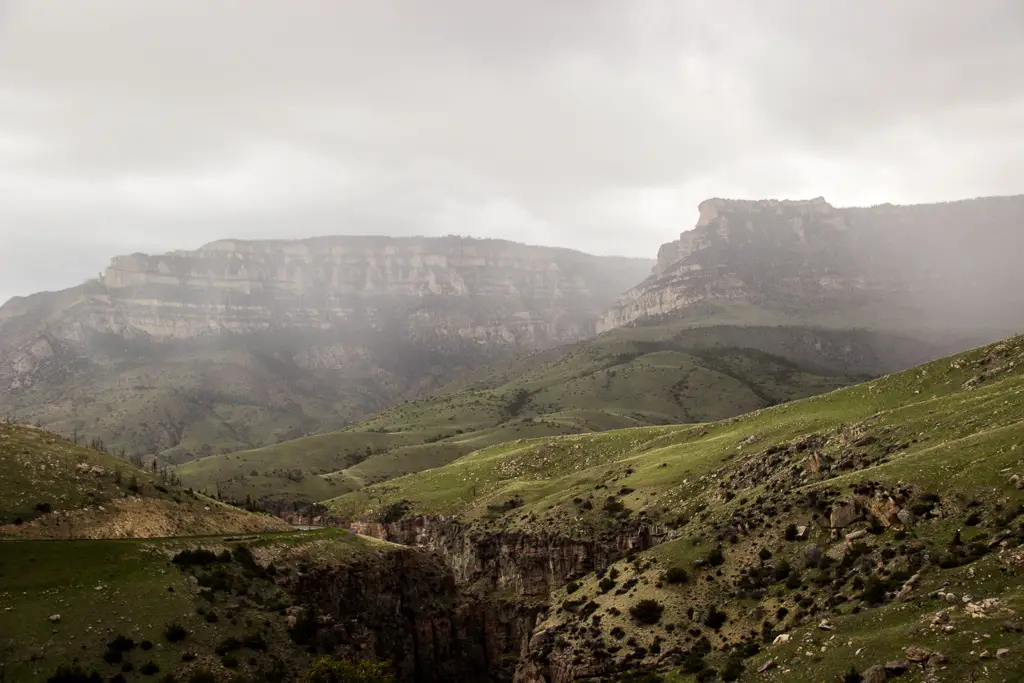
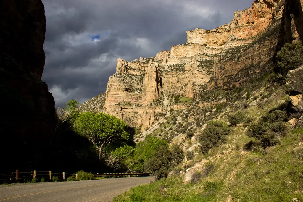
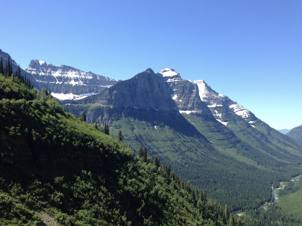
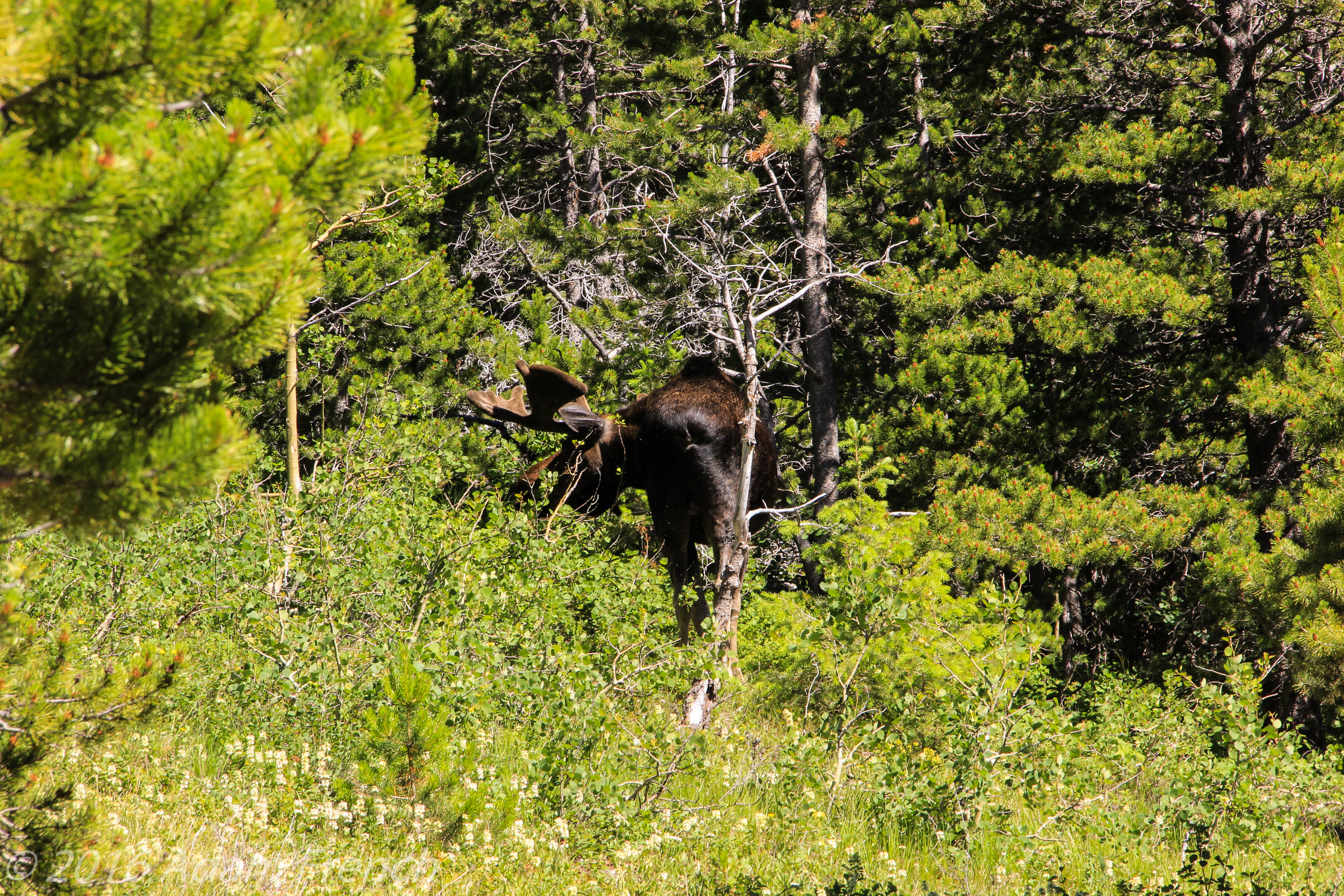
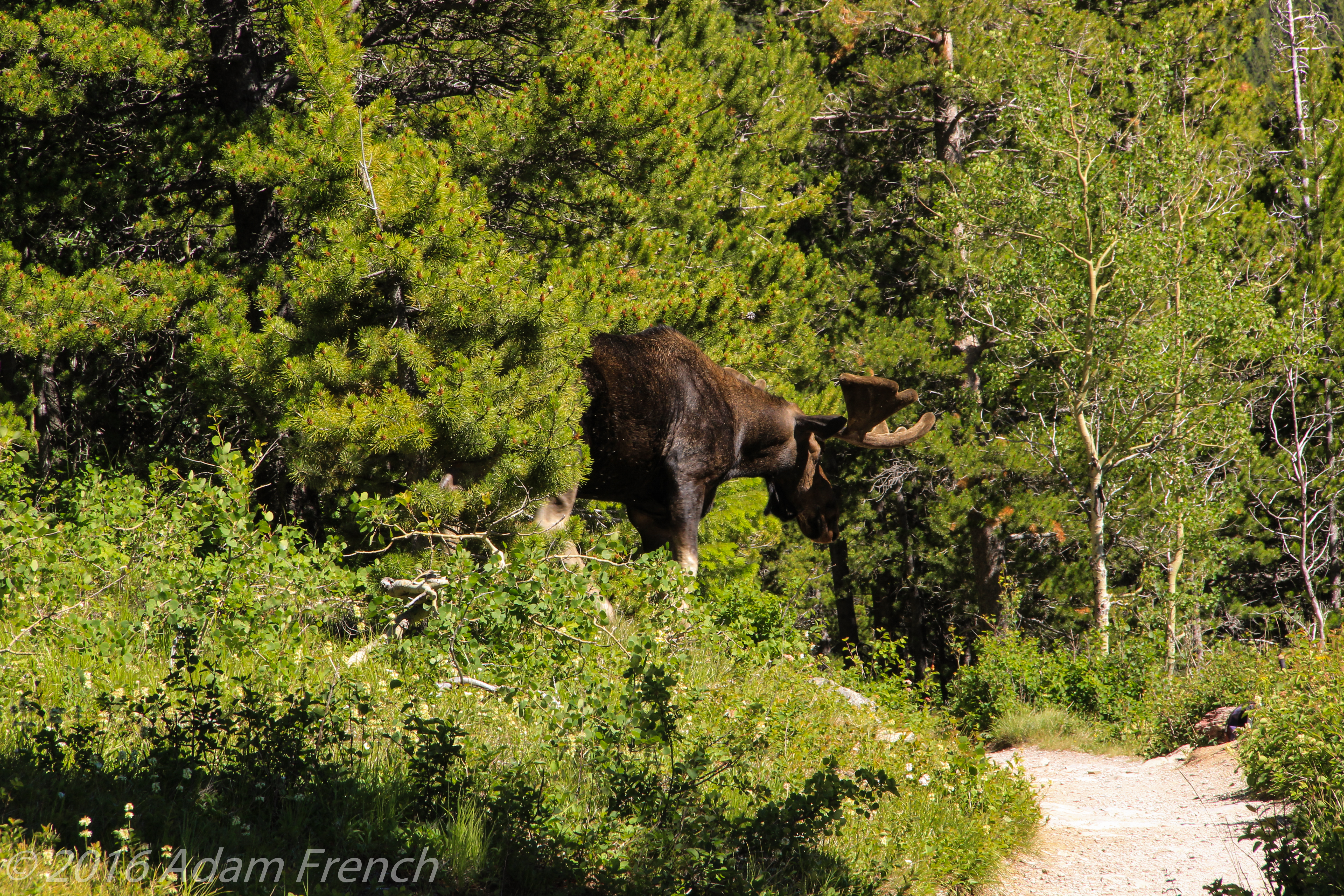
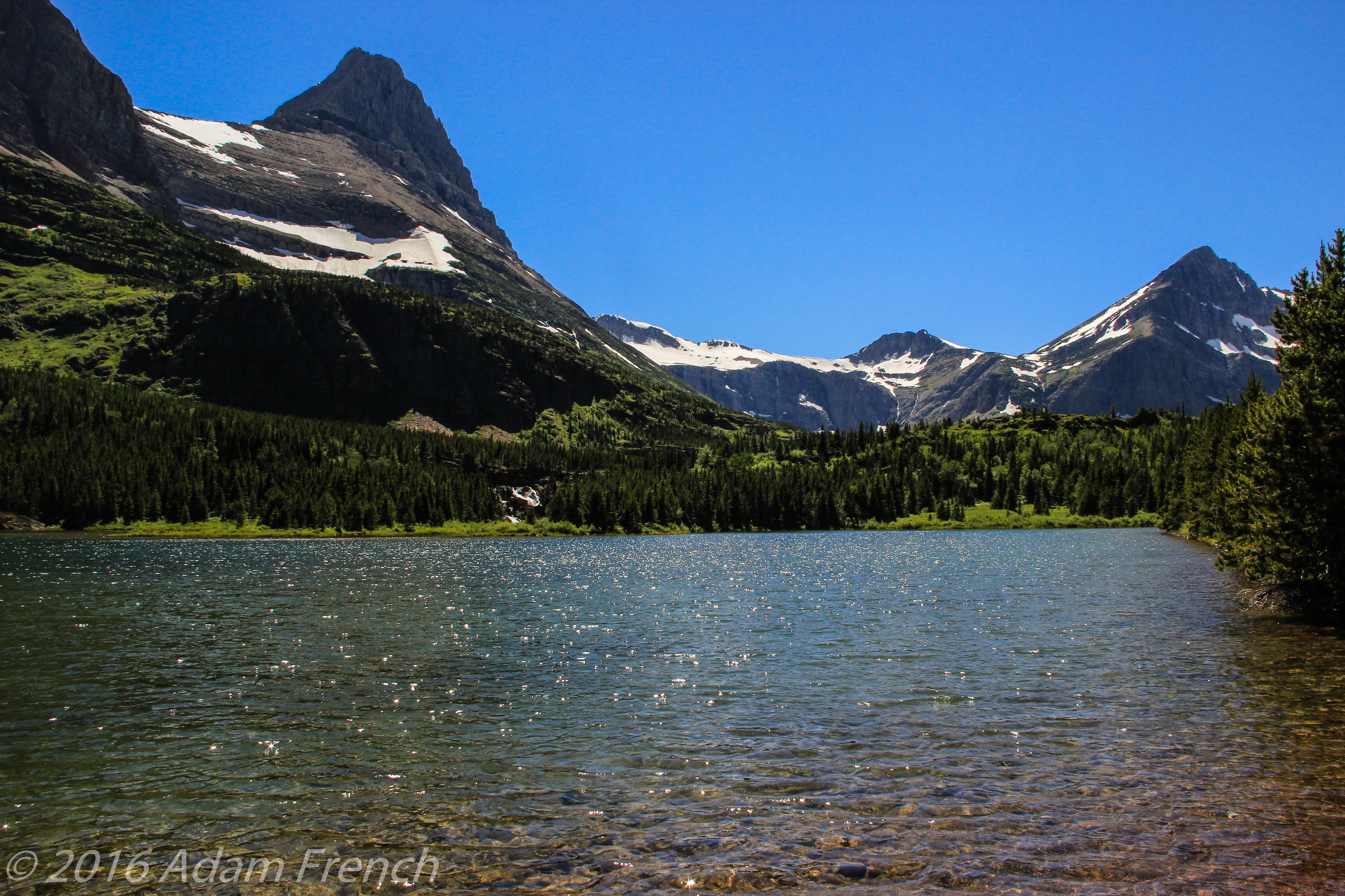
While not as crowded as other parks we’ve been to, there were still plenty of visitors milling about.  Be sure to be watchful for people (and wildlife) that may appear before you around a sharp turn with little or no warning.  There are also many road bikers who must be carefully passed in addition to negotiating the sharp curves.

For someone who is afraid of heights, the trip can be quite anxiety-provoking, especially if traveling west to east (on the outside lane) and if you’re the passenger.  Frequently along the route, the only thing separating you from precipitous drops of 1000 feet or more is a low stone wall! (This also reminded us of Route 550 in Colorado, the Million Dollar Highway!)

I also recommend traveling the road several times, at different times of day, as the light changes the views greatly.  The second time we drove the road was in the evening with the sun at a lower angle, and not only were the colors more vibrant, but subtler details (such as smaller waterfalls) stood out in greater contrast.  I mentioned earlier that we unintentionally arrived early in the busy season.  While this assisted us in beating the crowds, it also had the unintended effect of potentially providing more beautiful views.  We were told by locals that it had been unusually rainy as of late and this, along with late-season snow/glacier melt, contributed to some incredible waterfalls cascading down the steep mountain walls into the canyon.  As the season wanes these falls tend to dry up and become merely trickles.

Related posts:  5 Things you Don’t Want to Miss at Glacier National ParkSwiftcurrent Trail at Glacier National Park and 5 Other “Don’t Miss” Sites!; Gunsight Pass Trail, Glacier National ParkGlacier National Park: Hiking the Apgar Lookout Trail

Are the glaciers melting in Glacier National Park?

Many scientists believe the park will be completely glacier-free within the next 50 years due to warming temperatures.  I hope they are wrong about this as it will have profound effects on the various ecosystems that comprise the park.

You’ll notice as you traverse the road that these systems vary from arid, high plains on the eastern side…to alpine tundra at Logan Pass…to the temperate rainforest at the lower elevations on the western side of the park.  Many of the lakes are fed by glacial springs and/or snowmelt from the long winters.  If these glaciers dry up and/or less snow accumulates in the winter months to feed the lakes, it’s possible they may dry up (or their water levels will significantly lessen) as well.  This will hinder the survivability of the vast array of flora and fauna that make up these ecosystems.

There is already evidence that the warmer temperatures are causing an increase in foliage and subsequent treeline which impedes on the tundra.  Many alpine plants grow only in tundra regions and could become endangered/extinct if these consequences are borne out to their fullest extent.  This could have far-reaching effects that can’t even be fully calculated at this time.

Below is a picture from the Going to the Sun Road.  This was taken near Logan Pass, the highest point on the road, at around 9,000 feet.  Notice the narrow brick wall at the bottom separating the car from the dropoff!

 View from a rocky wall overlooking a vista of a mountain valley with tall tree and snow-covered mountains on both sides, all under a clear, blue sky.

Save

This is one of the most beautiful drives I have ever enjoyed.  Everyone should have Glacier National Park on their Bucket List!

Have you ridden on the Going to the Sun Road?  How was your experience?  Tell me about it in the comments!


Did you enjoy this post?  Pin it!

Large, rocky mountain looming over shorter, grass and tree-covered mountains, all under a blue sky dotted with white, puffy clouds. Pin reads, "Going to the Sun Road: Glacier National Park."


Like what you read here today?  Please feel free to leave a comment, like or share this post!  Add your email at the bottom of the page, or the sidebar to the right, to be notified when a new post is published.  By signing up for the email list, you will also receive a free copy of the Tranquil Trekker’s Top 10 Tips of Trekking Do’s and Don’ts!

You can also follow the blog on social media by clicking the links below!

Facebook

Twitter

Instagram

Pinterest

5 Things you Don’t Want to Miss at Glacier National Park

In this post I describe some of the highlights of our trip to Glacier National Park, in 2016!


Author’s Note: Since we visited Glacier in 2016, the Park Service has implemented a complex, ticket system for visiting the park in the summer. To be honest, I can’t make much sense of it as it involves multiple tickets being required to enjoy various activities around the park. For more information on this system, visit the park website and/or contact the park office. 

Glacier National Park is one of the most beautiful places I have ever visited. The views there are comparable to the ones I saw in the Andes Mountains of Peru when I visited there in 2001.  The Trekkers had an incredible time visiting Glacier (and hope to return someday).  Most people are aware of the park’s acclaimed, Going to the Sun Road, but there are other fun things to do, as well!  In this post, I have outlined 5 not-to-miss sights to see on your trip to the park.

Not-to-Miss Things to See at Glacier National Park

Polebridge, Montana

The tiny town of Polebridge sits about 25 miles north of the park, and only around 15 miles south of the Canadian border.  It is located on North Fork Road.

When I say “tiny”, that is not an exaggeration!   Its main draw is the Mercantile (a historic, general store that is known for its DELICIOUS homemade pastries, the Trekkers especially recommend the huckleberry bear claws!).  The tiny community also consists of a saloon where we had lunch (I highly recommend the homemade potato wedges and ranch dressing) and a few cabins available for rent…and that’s it! 😮 

This little village is the starting point for several hiking trails in the area and there are numerous lakes nearby.

An old storefront with "Polebridge Mercantile" on the front and cars sitting out front
Polebridge Mercantile

Bowman Lake

We visited Bowman Lake and hiked a portion of the Bowman Lake Trail there.

The trail was a simple walk through the woods, on a smooth trail, with little to no elevation gain.  It wasn’t crowded, though we did see several other hikers.  Be watchful for bears in this area–as well as throughout the entire park.  We did not see any but did see evidence that they had been nearby in the past.

The Bowman Lake Trail could be made into a full-day excursion to the end of the lake and back (the lake is six miles long) or enjoyed as a multi-day backpacking trip if one wished to take advantage of all the trails that connect to it.

With the gorgeous views afforded here of the mountains and their reflections on the aquamarine water, this is one of the most picturesque places I have ever seen.

Mountain vista across a flat lake with tree-covered, rocky and snow-speckled mountains towering on both sides.
Bowman Lake, the picture does not do the color of the water justice

The Canadian Border

Being that we were so close to the Canadian border we decided we HAD to drive up and say “hello” to our friendly neighbors to the north.  We knew there used to be a border crossing in this area but that it had been closed for many years.  We were expecting some sort of obvious signage indicating the divide between the two countries, a fence preventing entry, something…we were in for a bit of a surprise…

You reach the border by traveling north from Polebridge on a narrow dirt road.  Drive carefully and be watchful as there are sharp turns.  Wildlife–and the few human inhabitants of that desolate region–may be seen on the road, as well.

We encountered a very friendly couple biking with their three dogs.  They encouraged us to check out the border though we thought they were “pulling the tourists’ leg” when they described what we’d find…they weren’t. 

You will know you’ve reached the border when…the road ends…at a gate that looks like something that will close a city park for the winter! 😮  There is also a SMALL sign that reads “no admittance to Canada” and a trench about two feet wide and a foot deep–that you can walk across–that spans the border as far as the eye can see in both directions.  You see a clear line cut through the forest that stretches for miles and continues up the mountains to the east and to the west.

There is also an obelisk that marks both countries and commemorates one of the longest international borders that has been held peacefully, for one of the longest time spans in history.  There is no fence (don’t tell Trump! 😮), though there are security cameras.  We also saw border agents patrolling the area, so I would strongly encourage you to be respectful of the laws of both countries.  Pictures are allowed, but even if you have a passport, this is not an open border crossing.

*I had a bit of a philosophical epiphany while observing the border.  Humans are not allowed to cross freely, but as there is no fence, the animals cross back and forth completely unhindered.  The same forests and mountains reside on both sides of the border and were it not artificially maintained by human hands, one would not know when it had been crossed.  It gives you pause regarding man’s futile attempts to divide humanity based on imaginary lines.  If the animals and trees don’t care which side of a line drawn on a map that they (and their fellow forest inhabitants) reside…should we?

A simple, metal gate over a dirt lane in front of an old barn and trees
The Canadian Border…seriously, that was it.
A wide path through the woods runs to tall mountains on the horizon
The Canadian Border

The pillar shown below marks both countries:

Metal pillar with "United States" written on it Metal pillar with "United States" written on it

Goat Lick Overlook

This is a very neat area located directly off of US 2, on the southern edge of the park, about halfway between West Glacier and East Glacier (this is one of those areas of lousy signage I mentioned in a previous post).  There is a large sign announcing the overlook from the west, and nothing from the east, so be watchful if coming from that direction. 

The Overlook is exactly as the name suggests–it is a canyon where the wild, mountain goats come to lick minerals that seep from the rocks.  We saw a herd of close to 20 goats, complete with adults and babies, scampering with carefree vigor–you could hear them calling to each other from quite a distance. 

Most of the goats stayed on the other side of the canyon, but one mother and baby were camped out very near our location.  These animals are usually fairly harmless, but please, always remember they are wild.  They should be treated with respect and given space.  If they act in any way uncomfortable by your presence, you are too close!  MOVE BACK!  It should always be assumed that any animal (especially a parent protecting a baby) may attack with force, at any time, if they feel threatened.

Related posts: Swiftcurrent Trail at Glacier National Park and 5 Other “Don’t Miss” Sites!; Gunsight Pass Trail, Glacier National ParkGlacier National Park: Hiking the Apgar Lookout Trail

Sunset on Lake McDonald

Our hotel was only a five-minute drive outside the border of the park and only about 10 minutes from the largest lake at Glacier National Park, Lake McDonald.  Every night we enjoyed the sunset on the shores of the lake, in the tiny community of Apgar.

The view faces northeast so you won’t see the actual sun drop below the western mountains.  However, you will see the play of shadows and alpenglow on the mountains to the east and can see their reflection in the lake water (if it’s calm.)  One night we were lucky enough to be able to watch lightning from far-off storms, in the clouds towering over the mountains, in addition to the beautiful sunset.  In addition to the picturesque sunsets, I highly recommend stopping for ice cream at one of Apgar’s several shops before heading to the lake!

Another important note, none of the lodges or motels inside the park or near its entrances have TVs.  This is done intentionally to help preserve the surroundings in a rustic manner.  It was a bit like taking a step back in time and we found it incredibly enjoyable!  People left their rooms at night and gathered in parks and along the lakeside; eating ice cream, skipping rocks, and conversing with each other.  There isn’t much cell service in this area either, so you’re forced to disconnect a bit and commune with nature (or *gasp!*, actually talk to the person next to you! 😮😉)  It catered to a relaxed, communal atmosphere.

Every night a family of ducks would swim by.  They were unique in that they would dive under the water, and remain submerged for tens of seconds, before popping back to the surface quite a distance from where they went under.  The ducklings were especially entertaining to watch.  They would build up speed by quickly skimming the water with their wings–almost to the point of taking flight–before diving below the surface. 

Sunset photo of a flat-water lake with the dark silhouettes of the surrounding mountains and sunset colors in the clouds reflecting in the water
Sunset on Lake McDonald

Aqua-colored Water

The waters in the park (the rivers and lakes) are crystal clear (and COLD!) and tinged with an aqua hue.  This comes from the glaciers that feed them.  I’ve seen pictures of this phenomenon before but had never seen it in person.  It’s one of the most beautiful, difficult-to-describe colors I have ever seen!  One wonders if the glaciers melt, how it will affect this unique quality of the park?

Panoramic view of a flat-water lake reflecting the tree-covered and rocky mountains surrounding it, all under a clear, blue sky.

Save

Save

Glacier National Park truly offers some of the most incredible scenery I have ever seen.  I strongly encourage you to put it on your bucket list.

If you have been to Glacier, what were your favorite parts?  Let me know in the comments!

Did you enjoy this post?  Pin it!

4 pictures: 1) Mountain vista of towering tree-covered, rocky and snow-speckled mountains; 2) An old storefront with "Polebridge Mercantile" on the front and cars sitting out front; 3) Sunset picture of a low river with a sand bar; 4) A wide path through the woods runs to tall mountains on the horizon. Pin reads, "Glacier National Park, 5 Things Not To Miss"


Like what you read here today?  Please feel free to leave a comment, like or share this post!  Add your email at the bottom of the page, or the sidebar to the right, to be notified when a new post is published.  By signing up for the email list, you will also receive a free copy of the Tranquil Trekker’s Top 10 Tips of Trekking Do’s and Don’ts!

You can also follow the blog on social media by clicking the links below!

Facebook

Twitter

Instagram

Pinterest

NOLS Wilderness First Aid

The Trekker’s learned some Wilderness First Aid skills on a trip to Bozeman, Montana!


Since the Trekkers spend so much time in the wilderness, we thought it would be wise to take a Wilderness First Aid class. 

The one we attended was in Bozeman, Montana, and was hosted by NOLS (National Outdoor Leadership School) and Crossing Latitudes. Together.  They offer events and trainings all over the US, and the world, that range from weekend-long First Aid classes to semester-long Wilderness EMT and Rescue courses.  They also offer leadership and wilderness skills training expeditions. 

Most of the First Aid classes are offered at YMCAs, church camps, or local parks, though your local REI may host one, as well.  For more information on what they have available, you can visit their websites here and here.

Visit Bozeman, Montana

Since there are no REIs in South Dakota and we wanted a more authentic experience, we opted for one of the park/camp locations.  We had several options to choose from in both Colorado and Montana (all similar distances from us).  

We had visited Bozeman briefly in 2014, on our way to Yellowstone, and had been wanting to return to explore it more in-depth so we thought this would be the perfect opportunity.  We were surprised at how much Bozeman had grown in just the few years since we had last been there.  We were also surprised at how crowded and busy the area felt, especially seeing as how our city is almost twice the size of this small hamlet.  The new construction, busy streets, and “mountain feel” reminded both of us of Colorado’s Front Range towns.  Bozeman has a fantastic downtown that is well-maintained with lots of dining and recreational opportunities throughout the year.  It has an “old West” feel to it, and with many of the small boutiques, it reminded me of our foray into Telluride, Colorado from several years ago

What are the NOLS Wilderness First Aid classes like?

The company was great to work with.  They were quickly responsive to questions and the training offered was fun, comprehensive, and professional. 

The course was a little pricey, but you get what you pay for!  It was INTENSE!  We completed 20 hours of First Aid training in two days (10 hours each day).  We’ll have to revisit our notes from time to time to keep what we learned fresh in our minds but it was incredibly useful!

The weekend was absolutely exhausting and incredibly educational.  Much of what we learned was common sense but was often things you may not think about unless specifically told.  

The courses encompassed both classroom as well as “real world”, outdoor, training scenarios.  We even got to practice the skills we were learning on “patients” covered in fake blood! 😳  For those who easily become queasy, this course may challenge you (though you’d have to face this issue in a real-world situation so this is good practice).  

A person sits on concrete. This hand is covered with fake blood with a simulated spike through the hand.
You take a First Aid class and they stick a spike through your hand!  😳 *Note, no bloggers were injured in the simulation of this injury, and yes, I volunteered for this part.*  😁

Ousel Falls near Big Sky, Montana

We chose to take the scenic route back home.  We had hoped to work our way back through the northern loop of Yellowstone, into Cook City, Montana, and down the Beartooth Highway to Cody, Wyoming.  Alas, there was still several feet of snow blocking some of the passes on that route.  

Instead, we traversed the southern Montana plains that border the mountains before winding through the Bighorns in northeastern Wyoming that evening.  

We also took a side trip to Big Sky, Montana, and hiked out to see Ousel Falls.  It was a beautiful hike, down and through a canyon formed by the “South Fork of the West Fork of the Gallatin River”–yes, the sign actually says that! ☺️  It was a bit more “touristy” than Rocky Mountain National Park’s version of a similarly named falls, but it offered both a hiking and a separate mountain bike trail.  

The hike is incredibly scenic, paralleling the river much of the way.  At only about 1.5 miles round trip, the trek is not overly difficult as the trail is graded, but it is rather steep in places.  At that altitude (over 7000 feet), some may find it a challenge.  We almost had the place to ourselves on a Monday morning in mid-May, though I would expect more company during the summer season and on weekends.

A snow-covered mountain in the background with pine trees covering its lower sides, all under a blue sky with white clouds.
Montana Countryside
A white, frothing river runs between a pine tree-covered riverbank and tall, rock walls with pine trees on their rim.
The Gallatin River

A white, frothing river runs between pine tree-covered riverbanks and tall, rock walls with pine trees on their rim.

A white, frothing river runs between pine tree-covered riverbanks

A white, frothing waterfall cascades between pine tree-covered riverbanks
Ousel Falls, Big Sky, Montana

We made several new, large, ungulate friends (of the moose variety) in the Big Horns.   A word of advice, while evenings and mornings are a bad time for hiking in bear country, if you’re specifically interested in scouting for wildlife, this is an exceptional time to be out! We saw four moose over the course of several miles (and just a few hours) while traversing Route 14 through the northern half of the Bighorns.  

We were also able to enjoy the beautiful views and felt like we had the entire National Forest to ourselves (I’m sure it, again, helped that it was a Monday night during the shoulder season).  We ended our trip with a stay in one of our favorite towns, Buffalo, Wyoming, and breakfast at one of our favorite haunts, the Busy Bee Cafe.  I lauded its attributes in a previous post.

Rocky mountains shrowded in misty rain in the background with green hills in the foreground
Bighorns, Wyoming

A paved road meanders through rocky, canyon walls with green grass and trees interspersed throughout

A cow moose stands in the grass with a fence and trees behind her
Moose!


Lessons Learned from the NOLS Wilderness First Aid class

To close, I’m gonna get a little pensive for a minute (you’ve been warned!) 😋  In some ways this First Aid class was a negative for me.  It made me acutely aware of all the various potential hazards that are present for us when we venture out into Nature.  This is difficult for someone who struggles with anxiety (especially, health anxiety). 

Risk is an inherent part of life though (especially for someone who is a self-described klutz).  Instead of trying to remove it from our presence completely, which is impossible, we should, instead, seek to minimize it as much as is reasonably possible  (a criterion which, in itself, is a personal choice for each person). 

For me, First Aid training was a step to minimize that risk.  It made me better aware of how to treat injuries/illnesses should they occur, and what signs to look for that indicate a situation has become severe. It also armed me with the knowledge that will help me remain calm if injuries/illnesses do occur (whether in the backcountry or in our daily lives).  Knowledge is power, so I would encourage anyone who regularly ventures into the wilderness to take a class like this.

This class did strengthen my resolve that recreating in the backcountry, alone, is never advisable (and your 4-legged friend doesn’t count as a partner. 😇) 

I know that’s a bit of a controversial position to take, and, to each his own, ultimately.  This is just my personal opinion, we all have to decide what is best for us.  

But, there are numerous situations where any of us could quickly become incapacitated in the wilderness to the point where we can’t escape without assistance from others.  This could be a traumatic injury, severe dehydration/hypothermia, heat or water-borne illness, animal attack, etc.  We always need to remember that cell phones are frequently without service in the wild, and devices like GPS can be rendered unreliable in certain terrains (such as canyons).  

So, I just ask that before you venture out alone, take an extra few seconds to consider if you’ll be able to save yourself if the situation requires?  If not, perhaps think twice before embarking solo.  Besides, partnering up with people is an opportunity to make new friends!

Have you taken any Wilderness First Aid Courses?  Tell me about your experience in the comments!


Did you enjoy reading this post?  Pin it!

A  person sits on concrete. This hand is covered with fake blood with a simulated spike through the hand. Pin reads, "NOLS Wilderness First Aid"


Like what you read here today?  Please feel free to leave a comment, like or share this post!  Add your email at the bottom of the page, or the sidebar to the right, to be notified when a new post is published.  By signing up for the email list, you will also receive a free copy of the Tranquil Trekker’s Top 10 Tips of Trekking Do’s and Don’ts!

You can also follow the blog on social media by clicking the links below!

Facebook

Twitter

Instagram

Pinterest

Swiftcurrent Trail at Glacier National Park and 5 Other “Don’t Miss” Sites!

In this post, I review the early portion of the Swiftcurrent Trail (before the Pass) at Glacier National Park.


Author’s Note: Since we visited Glacier in 2016, the Park Service has implemented a complex, ticket system for visiting the park in the summer. To be honest, I can’t make much sense of it as it involves multiple tickets being required to enjoy various activities around the park. For more information on this system, visit the park website and/or contact the park office.

Our trip to Glacier National Park was an incredible experience and we barely scratched the surface of the adventures available.  We’re already making a list of the new things we want to try on our next visit (that’s the problem when we go on vacation, we don’t cross places off our list, we just find more stuff we want to do!)  I’d encourage everyone to make it a priority to visit the park if you’ve never been there.  Its beauty is awe-inspiring, and no one knows how greatly it may be changed in the next few decades.

The last few days of our trip we hiked the early portion of the Swiftcurrent Trail (before the Pass) and then headed home via the Beartooth and Chief Joseph Highways.  It’s always fun to include a little adventure on your way home.  It helps to make the return trip something to look forward to, as well!

Swiftcurrent Trail at Glacier National Park

The Swiftcurrent Trailhead is found off the parking lot for the Swiftcurrent Lodge near Many Glacier, on the east side of the park, north of St. Mary’s.

It’s an interesting trail and it varies in difficulty depending on how you choose to navigate it.  It traverses as far as the Granite Park Chalet, which is a seven-mile hike to the top of Swiftcurrent Pass.  There it meets up with the Highline Trail coming from Logan Pass to the south, and The Loop trail coming from Going to the Sun Road to the east.

Related posts:  Going to the Sun Road at Glacier National Park; 5 Things you Don’t Want to Miss at Glacier National Park; Gunsight Pass Trail, Glacier National ParkGlacier National Park: Hiking the Apgar Lookout Trail

This is a beautiful trail that starts as a relatively flat, easy path. It then progresses into a strenuous hike on a narrow trail with sweeping dropoffs, if you choose to go that far.  I wasn’t feeling well that day so we chose not to attempt the entire route this time, choosing only to go as far as Red Rock Falls.

The section of the trail we hiked was well-maintained, smooth, and not too overgrown; it’s also shaded in many parts, depending on the time of day.  This was actually my favorite trail of all the ones we did throughout the week, even though it was the least challenging.  Similar to other trails at this park, always be watchful for bears (can you guess if we saw any?)

We did have a close encounter with a bull moose!  They are frequent visitors to this area as there are several lakes and numerous streams and they like the willows growing nearby.  We were made aware of the moose further up the trail by other hikers so we had fair warning–a fellow hiker almost had a head-on collision with the ungulate though as neither he nor the moose was paying close attention!

As we came over a rise we saw a small cluster of people and then spotted the full-grown bull moose just a few steps off the trail.  He appeared completely oblivious to the commotion he was causing as he calmly munched on nearby scrub.  When he grew tired of the attention he sauntered down the trail and off into the woods.

Fortunately, he was mild-mannered as several hikers inadvertently had closer encounters than would be recommended.   Moose are not predators but they are very large and can be very dangerous if they feel threatened (especially during the fall rut or if they’re protecting young).  As with any wild animals always admire them from afar and remember the general rule of thumb, if the animal is reacting to you, you’re too close.

A bull moose amongst trees
Our friend, the moose
A bull moose stands right next to a hiking trail in the woods
He was CLOSE to the trail

Don’t Miss Red Rock Lake and Red Rock Falls!

Both Red Rock Lake and Red Rock Falls are stunning.  After about 1 1/2 miles down the trail you reach your first view of the lake.  It expands outward toward the west with Mt. Grinnell and its surrounding range as a backdrop.  Then you skirt the lake for about another half a mile and will reach an unmarked side trail breaking off to the left towards the lake/waterfall.  You can’t really see the waterfall at this point but you will hear it.  Follow the unmarked trail a short distance and you’ll arrive at the base of the falls!

Lakewater ripples surrounded by rocky, towering mountains spotted with snow, all under a clear, blue sky
Red Rock Lake
A short waterfall surrounded by pine tree-covered mountainsides
Red Rock Falls

If you’re looking for some more challenging hikes in the St. Mary’s area, check out these:  Siyeh Pass Trail; Iceberg Lake Trail

Montana’s Scenic Roads

On our return trip from Glacier, we spent several days driving across the Montana plains on two-lane, state roads.  I’ve talked before about my love of back roads, and I strongly encourage people to get off the interstate and check out these state highways.

It can sometimes be a shortcut and it’s almost always a welcome change from the drudgery of the highway.  Search for alternate routes to mix the journey up a bit so you aren’t crossing the same areas on the return trip as you traversed on your outbound route.  Enjoy the drive that gets you to that vacation spot as part of your vacation.

This eases boredom but it also helps you to better appreciate the local culture and people in the areas you visit.  You may be surprised at what you might learn–just pay attention to your fuel gauge and the availability of gas when venturing onto backroads.  Also, be aware, that cell signal may be weak-to-nonexistent in many of these areas so be prepared to go old-school when searching for travel info.  You may need to resurrect long-forgotten methods of acquiring information: travel books, hard copies of maps, and even phone books can be good resources in these areas. 

We saw several missile sites leftover from the Cold War and learned about a sapphire mine from a Local (apparently these types of sapphires are only found in this area).  I also had no idea Central and Eastern Montana had so many mountains!  This was a pleasant surprise as I thought it was all rolling prairie.

Beartooth Pass and the Chief Joseph Highway

On our scenic trip home we knocked other points off our Vacation Bucket List by enjoying Beartooth Pass and the Chief Joseph Highway; two connecting Scenic Byways in southern Montana and northern Wyoming.  Be warned, much of this area is tundra with few trees.  This means there is little shelter to be found, so if a thunderstorm blows up (which one did while we were there–complete with small hail!) exercise extreme caution as lightning strikes are an especially dangerous risk in these highly exposed areas.  This is also a very, high-altitude region. The Beartooth Highway usually does not open until Memorial Day Weekend (at the earliest).

Click here for a post I wrote on our attempt to navigate the route that time of year.  

Red Lodge, Montana

I also highly recommend a visit to the town of Red Lodge, Montana.  It was absolutely adorable with its friendly, small-town charm.  It caters to summer and winter outdoor sports and is located off of US 212, about an hour south of Billings, at the base of the Rockies.  The area is perfectly situated to be used as a “base camp” for whatever adventures you are seeking.

A dark, mountain lake surrounded by rocky and snow-speckled mountains
Beartooth Pass

View down a mountain valley with towering, rocky mountains on both sides

Save

Have you hiked Swiftcurrent Trail, or driven the Beartooth or Chief Joseph Highways?  Tell me about it in the comments!


Did you enjoy this post?  Pin it!

A large, rocky mountain towers into the sky. Pin reads, "Swiftcurrent Trail at Glacier National Park"


Like what you read here today?  Please feel free to leave a comment, like or share this post!  Add your email at the bottom of the page, or the sidebar to the right, to be notified when a new post is published.  By signing up for the email list, you will also receive a free copy of the Tranquil Trekker’s Top 10 Tips of Trekking Do’s and Don’ts!

You can also follow the blog on social media by clicking the links below!

Facebook

Twitter

Instagram

Pinterest

Gunsight Pass Trail, Glacier National Park

In this post, I review a portion of the Gunsight Pass Trail (starting from the Jackson Glacier Overlook) at Glacier National Park.


Author’s Note: Since we visited Glacier in 2016, the Park Service has implemented a complex, ticket system for visiting the park in the summer. To be honest, I can’t make much sense of it as it involves multiple tickets being required to enjoy various activities around the park. For more information on this system, visit the park website and/or contact the park office. 

The Gunsight Pass Trail at Glacier National Park is a great hike that offers scenic views.

Similar to the Swiftcurrent Trail, this is a fairly long route that connects with several others throughout the park. It runs for almost 20 miles, from the Lake McDonald Lodge, past the Sperry Chalet, Gunsight Lake, and Lake Ellen Wilson, to the Jackson Glacier Overlook.  The trail offers prime views of several waterfalls along its length. (Both trailheads can be reached from the Going to the Sun Road.)  Because of its length, most thru-hikers do it in two days with an overnight stop at one of several backcountry campgrounds or the Sperry Chalet.

The Trekkers aren’t much for overnight camping in the backcountry, so we chose to only attempt the portion that runs from the Jackson Glacier Overlook, on the Going to the Sun Road, to Florence Falls.  Both of us entered this hike with a bit of trepidation as it was our first real foray into Grizzly Country.  Our goal was to make it to the Florence Falls trail junction (four miles in, making it a total hike of eight miles, round trip).

We had hopes of reaching the falls but wanted to wait to see how we were feeling when we got there.  We knew going in that the final mile of the return trip would be a strenuous uphill climb, so we planned to reserve some energy for that (and it was good we did).

Related posts: 5 Things you Don’t Want to Miss at Glacier National ParkGlacier National Park: Hiking the Apgar Lookout Trail

Hiking on the Gunsight Pass Trail

This is a beautiful trail!  As it runs largely through the forest, in a lower-lying area, along the St. Mary River, it was a cooler option on that 85-degree day.  It is fairly evenly-graded with some beautiful views and was the least crowded trail we experienced in late June (we saw several groups of hikers though none of the “lines” we encountered on a few other trails).  The section we chose was the least strenuous portion of the route–it runs along the valley floor as opposed to climbing the peaks as it does in other segments. 

Despite being in the forest, portions of this trail do allow for breaks in the foliage that overlook a marshy area (look for moose!) with incredible views of the soaring mountain peaks and Jackson Glacier as a backdrop.  Upon completing the initial steep descent the trail levels off at the picturesque Deadwood Falls. 

On your return trip, this is a good place for a break before attempting the final climb to the top.  There’s plenty of space to sit on the rocks in the sun or shade (depending on your preference and the time of day) and let the mist from the falling water cool you.  The creek below the falls is also an opportunity to dip your feet in the chilly water; just use caution, the current is strong and the rocks may be slippery. 

The coursing creek continues to accompany you along the trail.  Shortly after passing the falls and the first back-country campsites, you’ll encounter an interesting suspension bridge that crosses the creek.

A wooden bridge with wires on the sides hangs over a river
The suspension bridge over the creek
A short, turquoise waterfall flows over red rocks
The beautiful Deadwood Falls

Grizzly Bears at Glacier National Park

The only unpleasant factor on this trail was the huckleberry bushes; they were many and accompanied us for a large portion of the four-mile journey.  That time of year they were calf to knee height, though later in the summer they can reach chest to head height.

This causes an especially sensitive situation as the berries are a favorite for grizzly bears in late summer.  There are several places where the trail encounters blind corners and hills so be sure to follow standard safety guidelines when hiking in bear country:  never hike alone, don’t hike around dusk or dawn, carry bear spray, and make plenty of noise (one of our favorite methods is singing and hand-clapping–this also helps to alleviate trail fatigue). 

Also, be aware, that the water rushing in the nearby creek may mask your sounds and could increase the likelihood of surprising one of the large Ursines.  We did not see a bear on our hike (have you noticed a trend in our hikes in Bear Country?) though we saw evidence of a very recent pass-through. 

Another hazard of the thick bushes was they almost completely obscured the trail in some cases making it somewhat hard to follow.  They also hid a less menacing annoyance, bees–as I, unfortunately, found out when one flew inside my hiking boot and stung me for my intrusion.

A large pile of animal poop on a dirt path
This is gross but it’s shown to make a point. This is the closest we got (and that I ever want to get) to a grizzly.  I kid you not, it looked like something that came from an animal the size of a horse!

Wolverines on the Gunsight Pass Trail

We encountered another first on this trail…a wolverine! (It looked nothing like Hugh Jackman! 😝)  They are commonly known in this part of the park.

We were traversing one of the clearer portions of the trail, I was in the lead.  As I looked down the trail a wolverine came trotting towards us around a bend about 25 feet down the trail.  We all stopped…he looked at us…we looked at him…he looked especially cranky as he panted in the heat…then he kept coming!

We’ve never encountered a wolverine in the wild before but I’ve heard stories of their nastiness (apparently they’ve been known to kill moose that have gotten mired in snowdrifts, as well as a polar bear on at least one occasion–seriously!)  At this point, I was scanning the huckleberry-covered hillside for an escape route as I did NOT want to have to deal with this critter that is 1/10th my size but can kill creatures many times larger than me!  Fortunately, at about that moment, he decided it was too hot for a confrontation and sprinted off into the bushes.

The view overlooks a green, marshy area with a large, snow-covered mountain in the distance.
This is the view from one of the lookout points on the trail.  Moose are frequently seen in this area (none were there the day we hiked).  Jackson Glacier is just out of sight on the other side of this mountain.
The view overlooks a green, marshy area with large, snow-covered mountains in the distance.
Another view from the trail lookout

We did reach our four-mile goal but did not make it to Florence Falls.  We had the energy to continue on but knew it would have added over a mile to our trek and we still had a hefty climb ahead of us on the return trip.  We were also running low on water so we again made the safe choice to turn back–this turned out to be wise as our water barely held out the remainder of the hike.  Having faced our fears and successfully trekked eight full miles in the middle of Grizzly Country, we counted this hike as a success!

Have you hiked the Gunsight Pass Trail?  What was your experience?  Tell me in the comments!


Did you enjoy this post?  Pin it!

The view overlooks a green, marshy area with a large, snow-covered mountain in the distance. Pin reads, "Gunsight Pass Trail, Glacier National Park"

Save


Like what you read here today?  Please feel free to leave a comment, like or share this post!  Add your email at the bottom of the page, or the sidebar to the right, to be notified when a new post is published.  By signing up for the email list, you will also receive a free copy of the Tranquil Trekker’s Top 10 Tips of Trekking Do’s and Don’ts!

You can also follow the blog on social media by clicking the links below!

Facebook

Twitter

Instagram

Pinterest

Glacier National Park: Hiking the Apgar Lookout Trail

In this post, I review the Apgar Lookout Trail at Glacier National Park, and discuss our failure to reach the summit.


Author’s Note: Since we visited Glacier in 2016, the Park Service has implemented a complex, ticket system for visiting the park in the summer. To be honest, I can’t make much sense of it as it involves multiple tickets being required to enjoy various activities around the park. For more information on this system, visit the park website and/or contact the park office. 

Otherwise known as the “Soul-Crushing Switchbacks Trail” 😮–thank you Mr. Trekker, for that!–the Apgar Lookout Trail traverses Apgar Mountain to the fire tower near the peak, and offers views of Lake McDonald, in Glacier National Park.  

Where is the Apgar Lookout Trail?

The easiest way to reach the trailhead is from the West Glacier entrance on the west side of the park.  Shortly after passing through the West Glacier entrance gate a road branches off to the left with signs for the Glacier Institute, a horse corral, and the Apgar Lookout Trail.  At the next intersection, you’ll turn right towards the horse corral, then continue following the signs to the left which take you to an unpaved dirt road and the trailhead.

Hiking on the Apgar Lookout Trail

This trek was rough!  The trail is interesting because it isn’t that long (only about seven miles round trip); it’s also fairly wide (enough so that two people can walk side-by-side in some cases), and it’s smooth (there aren’t many roots/rocks to trip you up).  The first 3/4 of a mile is fairly flat but then the elevation gain begins.  You gain almost 2000 feet of elevation in about three miles over a series of three, LONG switchbacks. 

Related posts:  Going to the Sun Road at Glacier National Park; Swiftcurrent Trail at Glacier National Park and 5 Other “Don’t Miss” Sites!5 Things you Don’t Want to Miss at Glacier National ParkGunsight Pass Trail, Glacier National Park

We didn’t fully appreciate just how steep it was on the way up, it was the difficulty in keeping our balance on the way down that clued us in.   Part of what makes it so difficult is that almost the entire trail runs through a burn scar left by a forest fire from several years ago; so it is completely exposed to the sun. 

We got a late start (about 2 pm as we made the attempt shortly after arriving at the park) and it was hot and fairly humid that day (about 85 degrees).  I should also note my body does not tolerate heat well.  There’s a reason why I rejoiced in our move to the cool Northern Plains after living in the steamy South!

The lack of shade-producing foliage does offer one advantage…this trail allows for incredible views of the surrounding Flathead River Valley! 

If you make it to the top, we were told the views of Lake McDonald bordered by the park’s mountains to the north are beautiful. (click here for the webcam view from the summit of Apgar Mountain.) 

In my semi-delirious state, I half-heartedly named this “the Butterfly Trail” for the numerous (and lovely) flying insects we stirred up on our trek. 

As I’ve mentioned in other posts for this park, beware of bears on this trail.  We did not see any but some hikers that were exiting the trail as we were starting out did.  Also, three days later, a mountain biker (and park ranger) was tragically killed when he surprised a grizzly on a bike path about six miles from this very trail (outside the boundaries of the park).

A dirt path through knee-high, pine trees with green hills in the background.
The trail–the view is looking upward near the beginning of the LONG climb, this is essentially what the entire trail looks like.

Know How Hard to Push Yourself When Hiking

I’m going to get on my soapbox a bit regarding an important safety tip:  KNOW YOUR LIMITS in the outdoors!  There is a fine line between pushing yourself to extend your stamina and increase your strength…and putting yourself into a dangerous/potentially deadly situation. 

There are some well-known symptoms of exhaustion, dehydration, and heat stress but it also helps to know your body.  This takes time and experience to learn what signals your body gives when it’s being stressed and what those signals mean.

As much as it pains my pride to admit it…we didn’t make it to the top of this trail.  We decided to turn around about a quarter of the way through the 3rd switchback when the “bent-double” stomach cramps and nausea hit me.  I’ve learned from past experience that this is a major sign of dehydration for myself and I didn’t want to push things too far.

Always remember, just because you get to the top, that’s only halfway, you still have to get back down and sometimes going downhill can be more difficult.  Exhaustion combined with the pull of gravity on the return trip can prove disastrous–I’ve worn scrapes and bruises resulting from stumbles caused by this dastardly combination on more than one occasion.

So don’t spend all your energy on only half the trail or you may find you’re unable to complete the most important half…getting home!

It’s also important to note, for the benefit of your wallet, that some parks/states require you to pay for at least a portion of the cost involved in a Search and Rescue operation if one is deemed necessary.  They’ll come to get you, but the financial toll may remain long after the physical injuries have long since healed.  If concern for your own body isn’t enough to convince you to turn back, perhaps concern for your wallet will be.

View down a mountain from above. Green grass and tree-covered mountains in the distance.
The view–the Flathead River Valley from near the middle of one of the switchbacks, you can see how far we’d come from the trail below us

Don’t be Afraid to Turn Back when Hiking

It’s difficult to admit we failed on this attempt, but I firmly believe we made the right decision in turning back.  It’s easy to get “Summit Fever”, especially when you go into a situation expecting to succeed.  The length of this trail was well within our average hiking range and it was fairly easy, technically speaking, so turning back definitely caused some wounded pride.

Don’t be afraid to admit you’ve bitten off more than you can chew though.  A report from the years 2003 – 2006 found that 23% of Search and Rescue incidents included people in their 20’s and 66.3% of the victims were male.  So the takeaway lesson is, that young males–the ones usually thought of as being the most healthy, strong, and capable–are also the ones most likely to run into trouble.  If they struggle, the rest of us shouldn’t feel bad admitting we struggle too!

So guys, take note…find a hiking partner who wimps out before you do so you can turn back and still save face. 😉  I should note, that the cramps relented within minutes once I stopped climbing, found some shade, got some sustenance in me (food and drink), and cooled down.

If you’re looking for a challenging hike on your next trip to Glacier National Park, check out the Apgar Lookout Trail!

Have you attempted these infamous switchbacks?  What was your experience like? Let me know in the comments!


Did you enjoy this post? Pin it!

View down a mountain from above. Green grass and tree-covered mountains in the distance. Pin reads, "Glacier National Park, Hike the Apgar Lookout Trail"

Like what you read here today?  Please feel free to leave a comment, like or share this post!  Add your email at the bottom of the page, or the sidebar to the right, to be notified when a new post is published.  By signing up for the email list, you will also receive a free copy of the Tranquil Trekker’s Top 10 Tips of Trekking Do’s and Don’ts!

You can also follow the blog on social media by clicking the links below!

Facebook

Twitter

Instagram

Pinterest


Save