Empire Mine, Black Hills of South Dakota

In this post, I review a trip to the “secret” site of the Empire Mine, found in the central Black Hills.


Author’s Note:  I struggled with whether or not to write this post.  I wanted to blog about this location because it is a cool place and I love sharing the history and beauty of our Black Hills with others.  However, it is a bit of a secret spot and I didn’t want to be “that guy” who gives away closely-held, local secrets.  My personal policy is to not offer more directions to these types of sites than are already available on Google.  Unfortunately, there isn’t much to be found regarding the Empire Mine…

My main goal with this policy is to protect the site from vandalism and/or destruction.  We have unfortunately had these types of issues in some local places such as the Spokane ghost town and the iconic Poet’s Table, as of late.  For this reason, my directions below are intentionally vague.  If you want clearer instructions on how to reach the site, you may contact me via social media as indicated below, or by using my contact form, and I may be able to help you a little more. (I got some helpful directions from a friendly and helpful local so I am willing to pay their goodwill forward and do you the same favor. 😀)


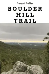
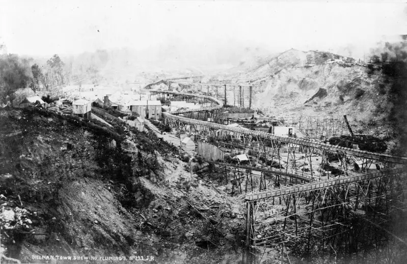
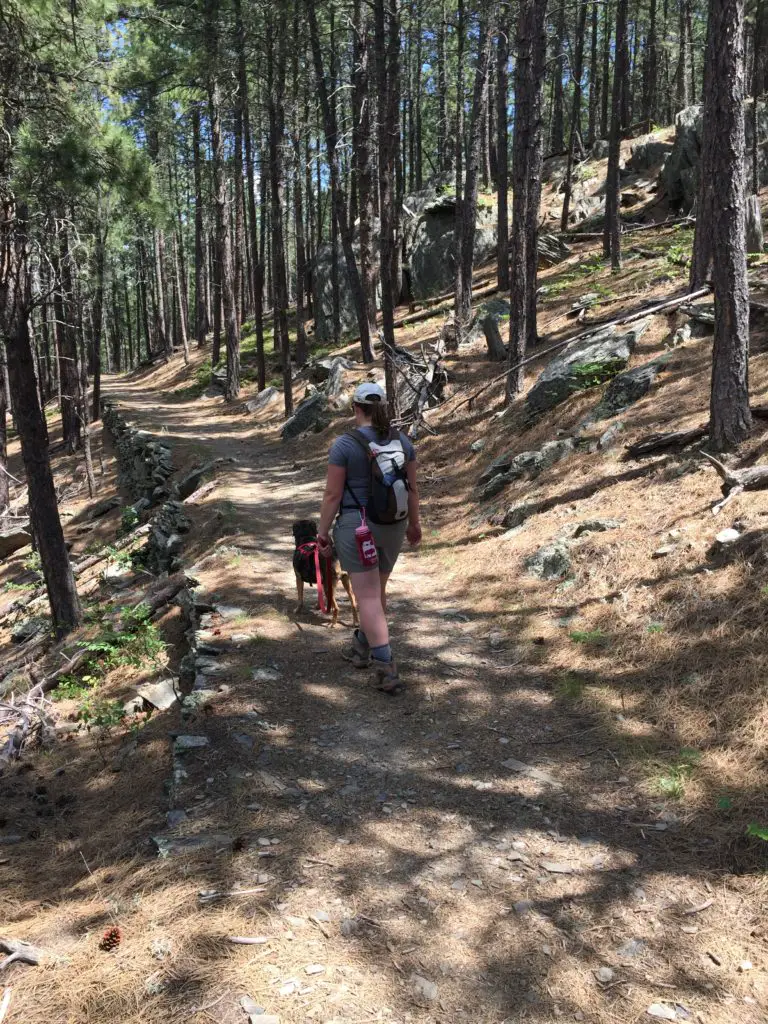
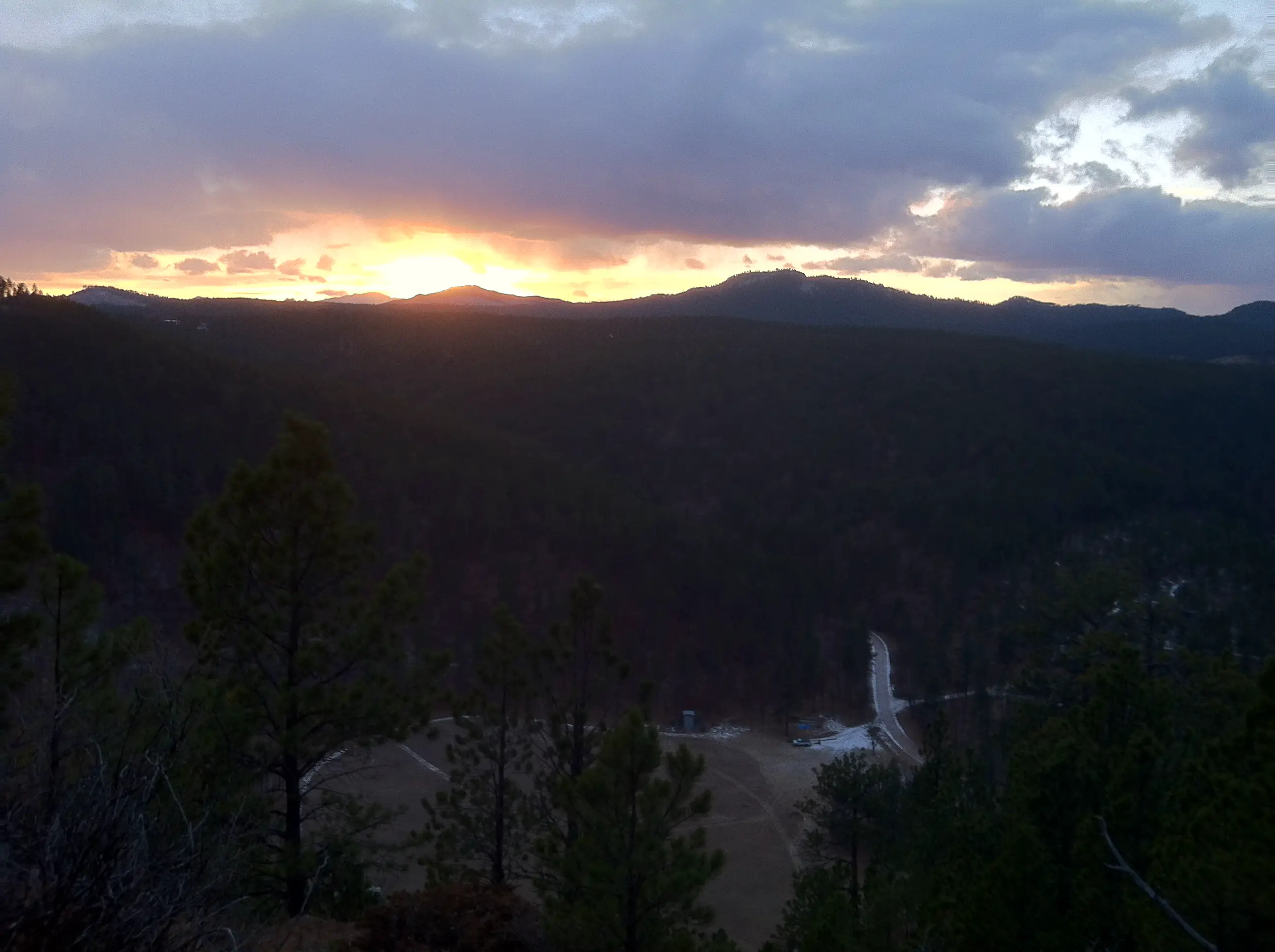
There is a somewhat well-known, secret location many people enjoy hiking to in the central Black Hills.  It is the site of the now-defunct Empire Gold Mine!  You can reach the ruins of this mine via the Samelius trailhead, which is part of the Black Hills Centennial Trail.

That’s it.  Those are my directions. 😇  I told you they would be vague! 😉  I don’t feel like these approximate instructions are giving anything away as this much is available on the AllTrails site.  That page also offers a little more information as to the whereabouts of the mine, including a vague map.  Also, I knew the mine could be reached from this trailhead for quite some time and that didn’t aid me in finding this secret locale (maybe I’m just not that bright? 😂)

Brick ruins sit amongst trees in the woods
The storehouse at Empire Mine.  At one point in time, trucks could drive here.

What is the trail to the Empire Mine like?

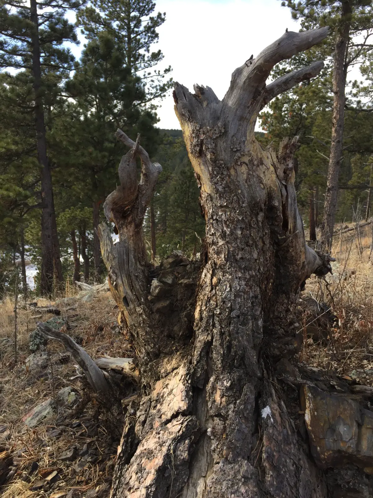
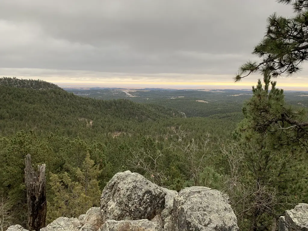
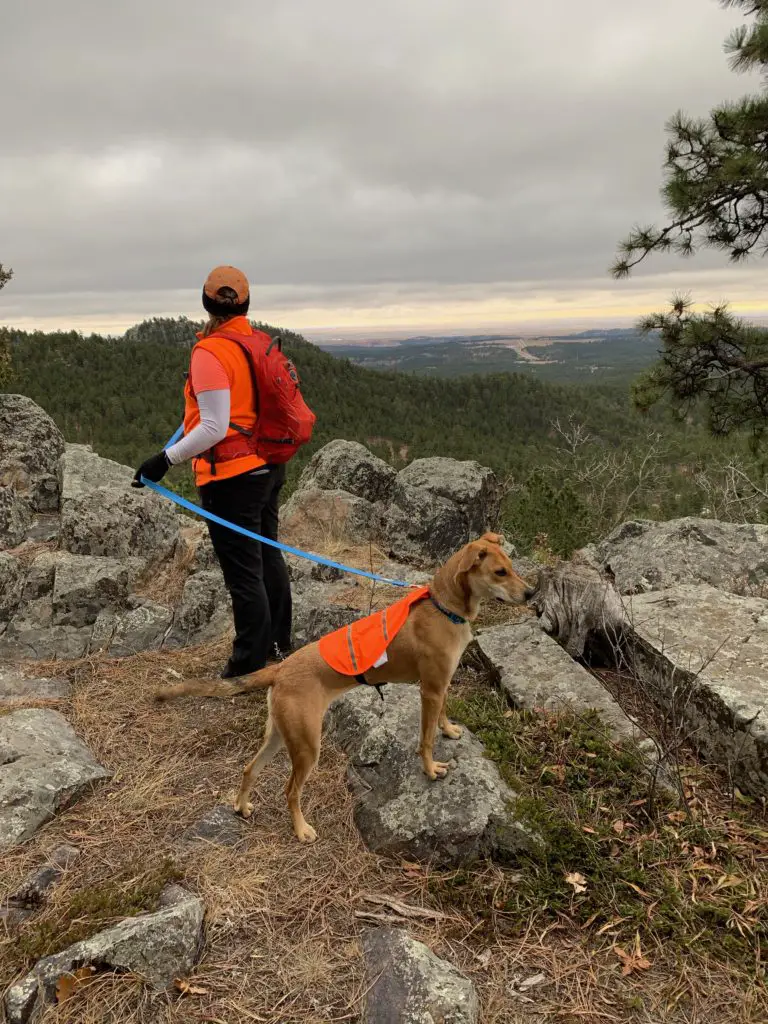
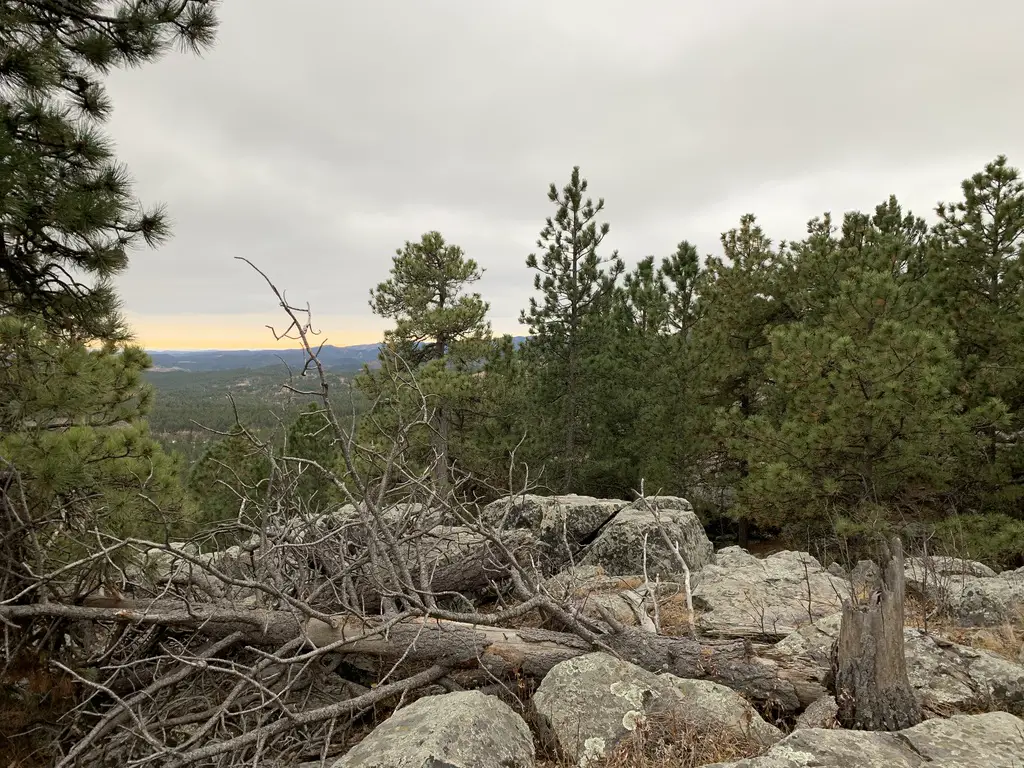
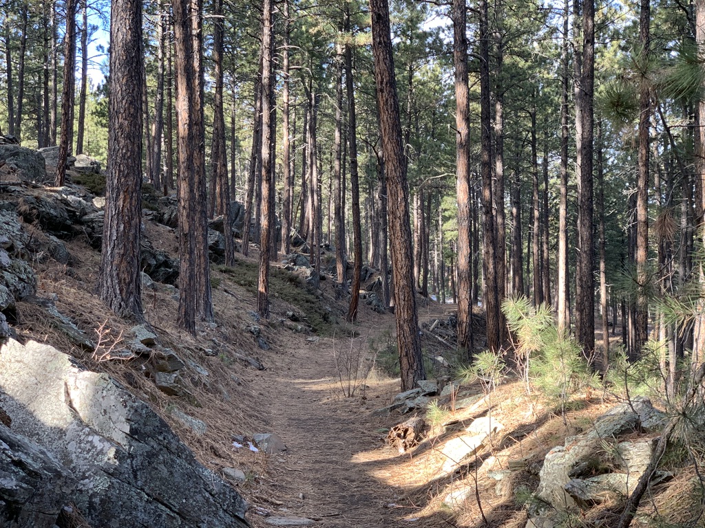
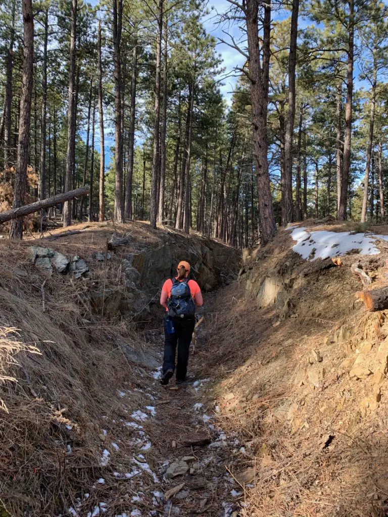
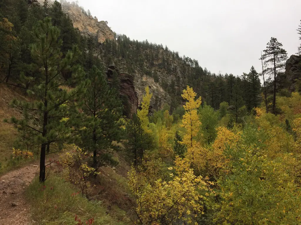
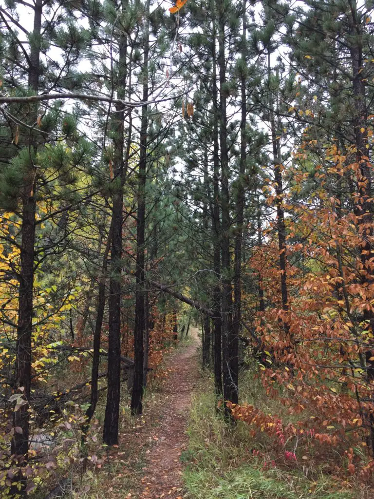
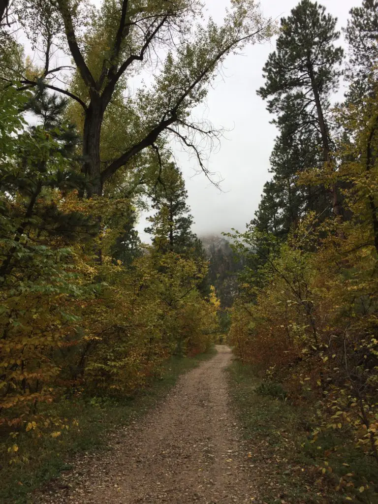
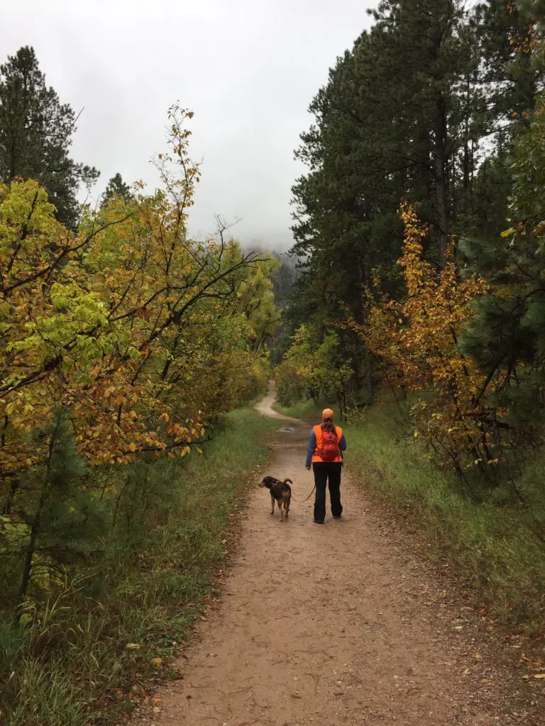
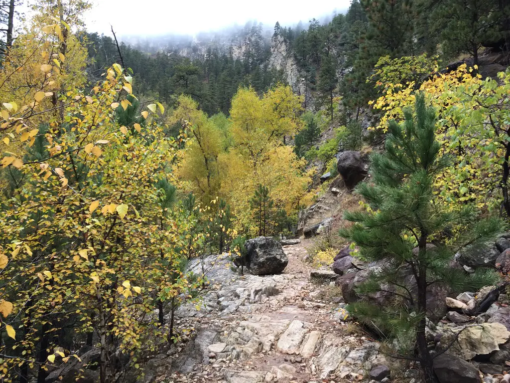
The trail to the Empire Mine is about 4.2 miles in total length, out-and-back.   You should be aware, a goodly portion of the route going out is downhill…you know what that means for a goodly portion of the path coming back?! 😝  The trail is also fairly obvious the entire way.  Much of it follows old forest roads and the portions that don’t are heavily used so they are well-trodden.

When is the best time of year to visit the Empire Mine?

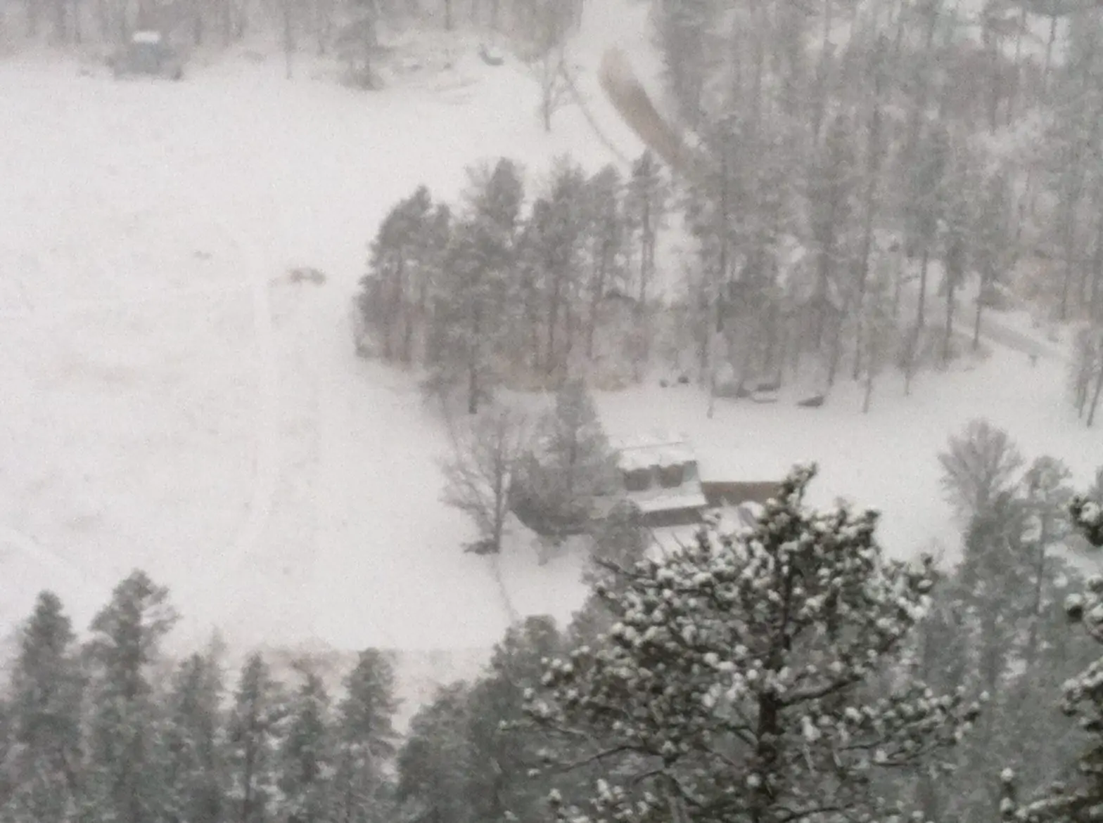
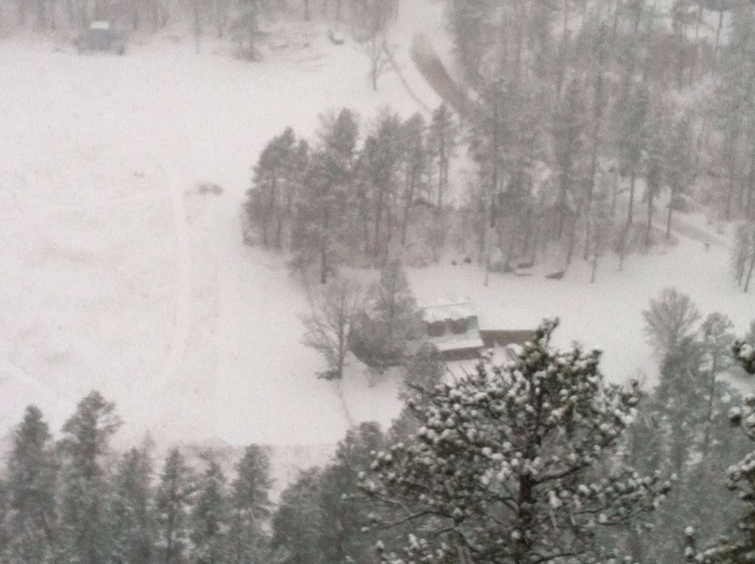
The hike is a bit lengthy but it isn’t overly difficult.  Some of the trail sections could become quite icy during the colder months, especially as this route sees a lot of traffic that can pack the snow into hard ice.  If the weather has been particularly wet recently, or during the spring thaw when snow is melting, mud could also make this trail slippery.

Wooden remains of a mine building in the woods
Another ruin from the site’s mining days. You can see how dilapidated the buildings are becoming.

These factors could make the downhill portions of the route troublesome, so please use caution.  The hike is especially lovely in fall when the trees change color!  This is because along the way you walk near several aspen groves that turn a brilliant, golden hue (hey look, another clue as to the location of the mine! 😉)

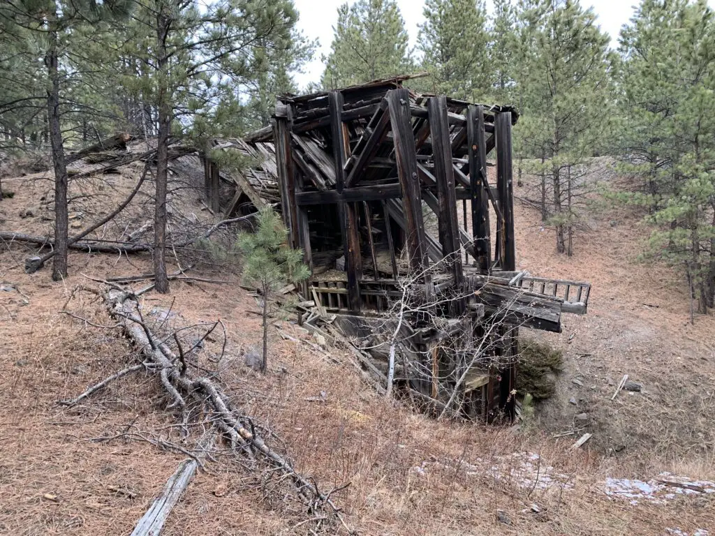
What is there to see at the Empire Mine?

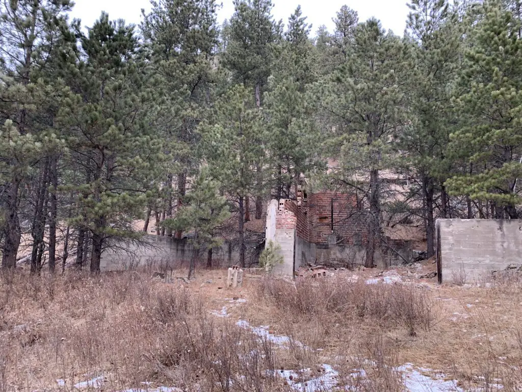
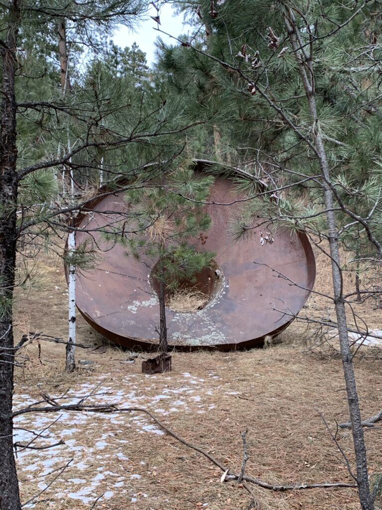
Some of the main ruins that remain of the mine are the brick loading area and a VERY large copper funnel.  Those are found at the bottom of the hill.  As you work your way up the hill you will encounter a number of buildings and mine equipment that still remain in the forest.

A WORD OF WARNING!  The mine was built in the late 1930s so these buildings are OLD!  They are made of wood that has weathered and has not been maintained in many years.  PLEASE do NOT enter them.  Also, watch your step throughout this area as portions of the ground (especially near some of the buildings) are degrading into sinkholes.

A very large, rusty, metal funnel sits in the woods
A large funnel that was used at the mine

This is a pretty neat site to visit.  It is also not that far from several nearby, Black Hills’ towns and it isn’t really that hard to reach IF you know where to look.  If you’re interested in some of the mining history of the Black Hills I encourage you to look into this secret locale.  Just please, treat it with the historical respect it deserves, and don’t ruin the site for those who come after you.  *stepping off my soapbox now* 😇 

Have you visited the site of the Empire Mine in the central Black Hills?  Share your experience with me in the comments!


Did you enjoy this post?  Pin it!

Wooden remains of a mine building in the woods. Pin reads, "Empire Mine, Black Hills of South Dakota".


Like what you read here today?  Please feel free to leave a comment, like or share this post!  Add your email at the bottom of the page, or the sidebar to the right, to be notified when a new post is published.  By signing up for the email list, you will also receive a free copy of the Tranquil Trekker’s Top 10 Tips of Trekking Do’s and Don’ts!

You can also follow the blog on social media by clicking the links below!

Facebook

Twitter

Instagram

Pinterest


“Secret” Hiking Trails off Sheridan Lake Road

In this post, I review several “secret” hiking trails that are found off of Sheridan Lake Road, not far from Rapid City.


If you regularly drive along Sheridan Lake Road, west of Rapid City you may have noticed what look like several random parking areas. You would be right!  These are the starting points for several “secret” hiking trails. (They aren’t really a “secret”, they just aren’t as well-known as other local trails).

It is a bit harder to describe how to reach these, as they don’t have signed trailheads (though they do sit right near the road and their parking lots are obvious).  I will do my best to give accurate descriptions.  All of these routes can be used by hikers, bikers, or horses, and are appropriate for winter sports.

“The Stratobowl, the Quiet Side”

The parking lot for this trail is found just south of the Victoria Lake Road/Sheridan Lake Road intersection, where the road makes a sharp turn.  It’s really just a dirt turnoff with room for only a few cars.  Just past the parking area, there is a gate that blocks the old forest road, but you are permitted to walk through it.

This is an easy hike as it just follows an old, fire road on an out-and-back route.  It takes you to the cliffs on the northern rim of the Stratobowl, which I’ve discussed before.  Be aware, this route has very little shade.  As it is so exposed to the sun, it can be a very hot hike when the weather is warm.  Also, we have seen herds of big-horn sheep near the cliffs, so if you hike with dogs off-leash, make sure to watch for them.

In my opinion, of the several routes I will be discussing today, this trail offers the best views of both the Stratobowl area as well as the canyon that Spring Creek flows through.

“The Sheep Place”

We call it this because there is a sign near the trail that labels it as a “Big Horn Sheep Study Habitat” (funnily enough, we have never seen a sheep here 😝).

The Trailhead

This trail is located almost exactly seven miles from the Catron Boulevard /Sheridan Lake Road intersection.  The parking area is on your left before you round a curve and see a sign for the Peace Ranch.  Right before you reach this parking area you will pass another small, parking lane on the other side of the road.  There are trails here, as well, that are mainly used by mountain bikers (though hikers can also use them).  They eventually meet up with the Coon Hollow Trail system.

The Hike

This is a great, local trail.  We have always enjoyed it as a quick place to take the dog for a walk on a Sunday afternoon or when you just want a quick jaunt on a cold, windy day.  It’s also a good place to sneak in a short hike before a summer thunderstorm (we have raced the thunder back from here on several occasions!)

A series of old, fire, and forest roads offer several different out-and-back options in this area.  Be warned, there are no real maps that cover these trails and the roads aren’t reliably signed.  On one hand, if you pay careful attention, you shouldn’t lose your way.  On the other, if you aren’t paying attention, it is easy to get turned around.  Also, the area is surrounded by private ranch land, so it is important to stick to the roads and be respectful of any “private property” signs you may see.

Three Options

The first old road that breaks off to your left is the shortest of the routes.  It will take you to the edge of a cliff on the northwestern edge of the Stratobowl.

If you continue past that fork, the next road you come to is longer.  It will also, eventually, wind you to the edge of the Stratobowl, but the views aren’t as good as those from the first fork as they are obscured by trees.  I have heard a rumor that there may be a way to loop these trails together, but if it exists we haven’t found that route yet.

There is another unnamed trail that continues straight after the second road forks to the left.  It eventually works its way all the way down to Spring Creek.

You can’t always access this option as there is a gate that is sometimes closed.  I’m not actually sure who controls it (if it is private landowners or the Forest Service).  Either way though, if the gate is closed, please respect it and don’t use that route. 

This trail is the longest of the three options, and the steepest, as it works its way down the cliff face to the creek, far below.  We have yet to complete this entire route but it is on our “to-do” list.

I would rate the first two options as “easy” as they stick to the forest roads and have very little elevation gain.  The third is more “moderate” because it wanders into the woods and requires more strenuous hiking when ascending and descending the cliff face. The easier routes are more exposed to the sun, so they can be quite warm in the summer.

The above trails are fairly well known, so expect to have some company on your trek.

I hope you’ve enjoyed my reviews of these many routes found near town.  If you’d like to read about other trails that are located close to Rapid City, you can click the links below:

Boulder Hill Trail
Flume Loop Trail
Coon Hollow Trail
Little Elk Creek Trail
Stratobowl near Rapid City
Willow Creek Trail Black Hills

Have you enjoyed any of these trails?  If so, let me know in the comments!


Like what you read here today?  Please feel free to leave a comment, like or share this post!  Add your email at the bottom of the page, or the sidebar to the right, to be notified when a new post is published.  By signing up for the email list, you will also receive a free copy of the Tranquil Trekker’s Top 10 Tips of Trekking Do’s and Don’ts!

You can also follow the blog on social media by clicking the links below!

Facebook

Twitter

Instagram

Pinterest

Hiking the Boulder Hill Trail, Black Hills

In this post, I review another trail found not far from Rapid City, the Boulder Hill trail.


This post is another in my series of local, easy-to-reach hikes that are not far from Rapid City, the Boulder Hill Trail.  One thing I like about this route is that it mostly meanders through the forest, so it’s fairly well-protected from the wind, rain, or snow (until you get to the top).  This makes it a good choice for times when the weather is less-than-great.  It’s also eerily beautiful in the fog.

Where is the trailhead for the Boulder Hill Trail?

You will find the trailhead on Boulder Hill Road, about halfway between Sheridan Lake Road (west of Rapid City) and Highway 16 (south of town.)  You can get there from either route.

The road is dirt but it is wide and well-graded, so it is suitable for any passenger car in good conditions.

If the weather is very wet or snowy it could become impassable.  Usually though, a four-wheel drive, high-clearance vehicle can be manage it. 

There is a sign at the trailhead, but you won’t see it until after you enter the parking lot, as it sits right near the woods. This is the same parking area that is used for the Flume Loop Trail that I discussed in a previous post.

The back view of a woman wearing hiking gear, standing on an overlook surrounded by rocks and boulders. She is looking over the overlook at trees and prairie far in the distance. A dog wearing an orange vest stands on a rock near her, all under a cloudy sky.
The Pup and I enjoying the trail.

One unique aspect of this hill is that you can actually drive to the summit.  There is an old forest road that makes a spur off of Boulder Hill Road.  It isn’t marked, so you may miss it if you don’t know where you are going.

We’ve seen passenger cars use the road, but I wouldn’t recommend it.  Even during good conditions it is rutted and washed out in places, and it can sport deep mud holes when it’s been wet.  We were glad we had Mr. Trekker’s 4WD truck the one time we drove up. It’s not a long route or overly technical, but I find the hike to be far more enjoyable.

A rocky overlook with large boulders and a downed, dead tree, all surrounded by pine trees.
With all the rocks at the summit, you can see how the hill got its name.

The Hike

This hike is a bit more challenging than others in this series.  I would rate it as “moderate”.  It is not difficult, but it is an uphill climb to the summit of the mountain almost the entire way (at least on the way up 😉).  About half-way along, it joins with an old, forest road for a short time.  It quickly exits back onto a narrow trail into the woods again, though.

Where it meets the road is also where it joins with the other section of the Flume Trail (the Coon Hollow Trail) that I discussed in this post.

Don’t be surprised if the scolding of squirrels and scurrying chipmunks accompany you on this hike.  This is also a great place for rock scrambling over the large boulders (hence how this hill got its name).

From the summit, you will be treated to views of Highway 16 as you look to the northeast, towards town.  Like many of the trails that traverse the eastern edge of the Black Hills, on clear days you can also see the plains that spread east of town.  On REALLY clear days, you can see portions of the Badlands that sit many miles to the east.

A rocky overlook with a view over trees and prairie far in the distance, all under a cloudy sky.
From the summit, you can see Route 16 heading toward town. You can also see the prairies that extend far to the east.

If you’re looking for a challenging hike that’s easy to reach from Rapid City, check out the Boulder Hill Trail!

Is this a trail you’ve hiked in the past?  Tell me about it in the comments!

If you’d like to read about the other trails in this series, you can click the links below:

Flume Loop Trail
Coon Hollow Trail
Little Elk Creek Trail
“Secret” Hiking Trails off Sheridan Lake Road
Stratobowl near Rapid City
Willow Creek Trail Black Hills


Did you enjoy this post? Pin it!

A rocky overlook with a view over trees and prairie far in the distance, all under a cloudy sky. Pin reads, "Boulder Hill Trail"


Like what you read here today?  Please feel free to leave a comment, like or share this post!  Want to be notified when a new post is published?  Add your email and click the “Follow” button at the bottom of the page or the sidebar to the right.  By signing up for the email list, you will also receive a free copy of the Tranquil Trekker’s Top 10 Tips of Trekking Do’s and Don’ts!

 You can also follow the blog on social media by clicking the links below!

Facebook

Twitter

Instagram

Pinterest

Coon Hollow Trail, Black Hills

In this post, I review the Coon Hollow Trail, located in the central Black Hills.


Another great spot in my series of trails close to Rapid City is the Coon Hollow trail in the Black Hills!

Where is the Coon Hollow Trailhead?

The Coon Hollow trailhead is located just off of US 16, around eight miles south of Rapid City (from the Catron Boulevard/16 Bypass intersection).

Just past the Rockerville exit, turn right onto Silver Mountain Road.  Then, take the first right and turn onto a forest road that runs into the woods.  Immediately to your left, you will see a large dirt area where you can park.  To reach the trail, cross the forest road and look for the footpath that is clearly marked by “Trail 50” placards.

What is the Coon Hollow Trail like?

This trail is actually another branch of the Black Hills Flume Trail that I discussed in a previous post.  The first 1/4 – 1/2 mile of it is quite steep (and can be downright treacherous in wet or icy conditions).  However, once you reach the flume bed, it’s largely flat and wide and is an easy hike.

This portion of the trail is around three miles long, each way.  It ends at an old forest road where it meets up with the the Boulder Hill Trail.  Usually we walk out and back, though you can make loops if you include some of the local forest roads.

It’s important to always carry updated maps of the local trails and forest roads (like the ones shown below) when you’re out in the woods.  This is especially important if you want to combine various routes to make your own loops.  The paths are pretty clear in this area, but you can still get turned around if you aren’t familiar with where they all go.

Two trail maps called "Black Hills South" and "Motor Vehicle Use Map Black Hills National Forest" sit against a black background
These are the types of maps we frequently use

This is a great trail!  I would rank it as “moderate”, mostly due to the initial, steep section. (There are also a few portions of it that traverse low-lying areas which can get slippery in the snow or mud.)  However, the majority of it is easy as it just follows the flat, flume bed.  Once you reach that part, all members of the family should be able to handle the trail easily (including the four-legged ones.  Puppers highly recommends this path, as do several of her friends that we met along the way! 🐶)

Back view of a woman walking through a narrow gulley. Patchy snow on dirt hillsides loom just over her head on both sides. A tall, pine tree forest rises from the gulley.
Me traversing a portion of the Flume Trail. Isn’t it beautiful, the way the sun dapples through the trees? (And yes, it was early January and I was wearing shirt sleeves; part of the reason why I love living in the Black Hills!)

There are many great views of the surrounding forestland available from this trail.  In a few places, you can see all the way to Rapid City, and even to the prairies that lie farther to the east.

Coon Hollow Offers a Variety of Ways to Enjoy the Outdoors

One thing I really like about this area is that it contains a variety of trails that are good for both hiking and mountain biking.  I also like that there are different trails for bikers and hikers, so the two are kept largely separated.

The actual bike trails are mostly one-track, though none of the areas we’ve encountered are terribly steep or technical. The Trekkers (especially me) are novice mountain bikers, and we’ve been able to manage these routes fairly well.  There are also old forest (and fire) roads spread around the area which make for easier biking and hiking options.

If you’re looking for another family-friendly trail to hike in the Black Hills, that is close to Rapid City, check out the Coon Hollow Trail!

Is this a trail you’ve tried for hiking or on your mountain bike?  Let me know your favorite parts of it in the comments!

If you’d like to read about the other trails in this series, you can click the links below:

Boulder Hill Trail
Flume Loop Trail
Little Elk Creek Trail
“Secret” Hiking Trails off Sheridan Lake Road
Stratobowl near Rapid City
Willow Creek Trail Black Hills


Did you enjoy this post? Pin it!

Rear view of a woman walking through a narrow gulley. Patchy snow on dirt hillsides loom just over her head on both sides. A tall, pine tree forest rises from the gulley. Pin reads, Coon Hollow Trail Black Hills"

Like what you read here today?  Please feel free to leave a comment, like or share this post!  Want to be notified when a new post is published?  Add your email and click the “Follow” button at the bottom of the page or the sidebar to the right.  By signing up for the email list, you will also receive a free copy of the Tranquil Trekker’s Top 10 Tips of Trekking Do’s and Don’ts!

You can also follow the blog on social media by clicking the links below!

Facebook

Twitter

Instagram

Pinterest


Little Elk Creek Trail

In this post, I review this great, fairly easy trail that’s found not far from Rapid City.


Little Elk Creek Trail is another great, local trail that is near Rapid City.

Where is the Little Elk Creek Trail?

You can reach the trailhead from Exit 44, off of I-90, for Deerview Road.  Take this road to where it crosses Sturgis Road (which runs parallel to I-90  in this area) and then head north on Sturgis Road.  After about 1/2 mile take a left at Little Elk Creek Road.  You will find a parking lot at the trailhead, where the road ends.

What you will see on the Little Elk Creek Trail

The trail is around five miles long, one-way, though we’ve never actually hiked the whole thing.  If you follow it far enough, it eventually joins up with a Forest Service road that will take you to Dalton Lake.

A hiking trail runs through a "tunnel" of pine tress mixed with other trees and their colorful, fall foilage.
You will see cool, “tree tunnels” like these, along the path.

A hiking trail surrounded by trees of various sizes and colors

At one point, the trail splits into two routes.  They both go to the same place, and after about a mile they end up joining back together again.  One of the trails stays “low”, and I think it is actually a bit more challenging, as it runs right along the creek bed.  With this option, you will need to scramble over a few boulders along the way, and it can be made more difficult if the creek level is high, or if conditions are icy.

There are also a few scrambles up a short, steep hill or two if you choose the “high” route. However, to me, the most challenging part of this option is that it runs right along a ridge.  The drop-off isn’t quite steep, or high, enough to consider it as being a “shelf”, but it has gotten my acrophobic heart pumping a time or two. (This is especially true when you’re walking with a rambunctious pup who is not apprehensive about heights in the least. 😝)

Back view of a woman walking on a hiking trail with a dog. Pine trees and others with colorful leaves surround them.
Doggo #1 and I on the trail several years ago

This route is pretty any time of the year, but especially in the fall, which is when we usually go.  The aspen trees that edge the trail turn a vibrant orangish-gold, and contrast well with the ever-green pines that make up much of the rest of the surrounding forest.  As it is much closer to Rapid City, this is one of the better places to see leaf colors without having to drive all the way to Spearfish Canyon or deal with the fall traffic that is common there.

Yellow-leafed and pine tress surround a boulder between pine tree-covered canyon walls.

During the summer this area can get pretty crowded. It runs right along the creek, which can be accessed many places throughout the route.  It is also fairly shaded, so it makes for a cooler option when the weather is warm.  During the winter months, this canyon doesn’t receive much sunlight, so be prepared for icy conditions (especially in the areas where the creek runs very near the trail).  Yaktrax are highly recommended when attempting this trek during that time of year.

Bare trees in a forest scene. A creek runs through the middle with a bit of snow on fallen logs.
Little Elk Creek in the snow!

If you’re looking for a good, family hike, that’s easy to reach and close to Rapid City, check out Little Elk Creek Trail, near Piedmont!

Have you hiked the Little Elk Creek Trail? Tell me about your experience in the comments! 


If you’d like to read about the other trails in this series, you can click the links below:

Flume Loop Trail
Coon Hollow Trail
“Secret” Hiking Trails off Sheridan Lake Road
Hiking the Boulder Hill Trail
Willow Creek Trail Black Hills
Stratobowl near Rapid City

Did you enjoy this post? Pin it!

A hiking trail runs through a "tunnel" of pine tress mixed with other trees and their colorful, fall foilage. Pin reads, "Tranquil Trekker Little Elk Creek Crail, Black Hills"

Like what you read here today?  Please feel free to leave a comment, like or share this post!  You can also follow the blog on social media by clicking the links below!

Facebook

Twitter

Instagram

Pinterest

Flume Loop Trail, Black Hills

In this post, I discuss the Flume Loop Trail, found in the central Black Hills.


The Flume Loop Trail is another in my series of trails that are found close to Rapid City.

Where is the Flume Loop Trail?

This trail is found off Boulder Hill Road west of Rapid City.  You can reach that road from both US 16 (a little way south of the Rockerville area) as well as off of Sheridan Lake Road.  Either direction works, though the Sheridan Lake Road entrance is closer to the trailhead.

This is a dirt road, though it is usually in very good condition and can be managed by any 2WD car. (The exceptions to this would be in snow, or occasionally, due to heavy rain.)  The parking lot where the trailhead is found is the same one you use for the Boulder Hill Trail

What is a flume?

A flume is a chute, generally built out of wood, used to transport materials (such as logs or gold) using water.  This trail in the Black Hills travels along a former flume route from more than 100 years ago, during the gold rush.  Today, it is mostly comprised of a wide, grassy, leveled grade along the hillside, where the original structure once stood.  In a few areas, the rotting ruins of the original flume can still be spotted. (On other portions of the trail, you can actually travel through old tunnels in the rock that were created for use by the flume.)

The picture at the top of the post is an example of what a flume would have looked like, NOT specifically of the one in the Black Hills.

The rear view of a woman and dog walking along a flat, wide trail in the forest.
This is actually another part of the Flume Trail, but it shows the flume bed well. You can see how flat and wide much of it is.

The entire flume trail runs for more than 15 miles throughout the Black Hills from Rockerville, south of Rapid City, to Sheridan Lake, west of town.  Near Boulder Hill, the path forms a loop, and it connects to other portions of the trail.

What is the flume loop trail like?

This is a great trek!  It can be completed in either direction, though we usually travel it counterclockwise. (My following description of it will follow that route.)

The Flume Loop Trail starts by traversing some lower-lying meadows through the oak and cottonwood trees that grow along the nearby creek .  Watch out for cows in this area during the summer months (or more importantly, what they leave behind. 🤥  This is national forestland, and open grazing is allowed here.)  Also, during hunting season, I strongly encourage people to wear bright colors when enjoying this area as you’ll be sharing it with hunters.

As you continue down the trail you’ll pass a small, dank-smelling pond that is often covered in green scum during the warmer months. 😝   There are some logs you can use to cross the small stream that feeds from it.  Be aware, this area can get VERY mucky in wet times of the year.

After crossing Boulder Hill Road, you then make a short climb up a nearby hillside.  You are now on the flume bed itself.  From here on out, the trail is fairly level, with a few short climbs and descents, and the occasional clamber up some boulders.  The remainder of the trail traverses the pine forest that is more common in the Black Hills.

Sometimes, as you leave the brighter, open spaces behind, walking into these darker, pine tunnels,  can seem almost spooky.   Not to worry though, the scariest sites we’ve seen here are the local mule deer and rabbits who frequent the area.

This trail is nice because much of it is shaded and in the trees, regardless of the time of day you visit.  We have often used it for a quick, evening escape after work, or when it’s too hot to attempt more difficult, or more exposed routes.  The early portion of the trek is great in the fall, as this is a more leaf-prone part of the forest.  The dusty smells of dried leaves underfoot, mixed with the sounds from the ones still clinging to the trees, that rattle in the wind, with the gurgle of the small creek nearby, make for quite the bucolic, autumn setting.

Is the Flume Loop Trail hard?

I would rate this trail as “easy” as it encompasses very little elevation gain.  It can be completed in 1 – 2 hours, depending on your speed and ability level, how many stops you make, etc.  It is appropriate for children of almost any age, and dogs.

Our previous dog enjoyed it, arthritis, bad hips, and all, well into the final year of her long life.  Puppers has put her stamp of approval on it as well.

So the next time you’re looking for a family-friendly trail near Rapid City, consider the Flume Loop Trail!

Have you hiked the Flume Trail? What did you think? Tell me about it in the comments! 

If you’d like to read about the other trails in this series, you can click the links below:

Coon Hollow Trail
“Secret” Hiking Trails off Sheridan Lake Road
Hiking the Boulder Hill Trail
Little Elk Creek Trail
Stratobowl near Rapid City
Willow Creek Trail Black Hills


Did you enjoy this post? Pin it!

Wide, flat, hiking trail through the forest. Pin reads, "Black Hills Flume Loop Trail"

Like what you read here today?  Please feel free to leave a comment, like or share this post!  You can also follow the blog on social media by clicking the links below!

Facebook

Twitter

Instagram

Pinterest

Stratobowl near Rapid City

In this post, I review the Stratobowl trail near Rapid City, SD.


The Stratobowl Rim Trail is a simple hike near Rapid City that offers spectacular views of the Black Hills and a local, historical site.  The Stratobowl is a great trail for a short hike.  It’s only around one mile each way, so it’s amenable to almost any skill level.  

Where is the Stratobowl?

The Stratobowl is located off Route 16, about a half-mile south of Old McDonald’s Farm.  There is no roadside sign highlighting the trail, but there is an obvious parking area just off of Highway 16.  If you’re there during daylight hours, it’s likely you’ll see other vehicles.

Hiking the Stratobowl

The path is comprised of simple, rolling hills on an old access road that traverses through pines and offers a prime opportunity for spotting deer and wild turkeys.  A substantial logging operation was recently completed there (necessitated by pine beetle damage) so chances of viewing wildlife are now even more likely. 

At the trail’s terminus, the road opens onto the rim and the yawning chasm that is the actual Stratobowl.  From here, a valley formed by Spring Creek spreads out before you with homes dotting the canyon floor. You’ll also often see vultures soaring the thermals…below you! 

Related posts:  Willow Creek Trail Black Hills; Hiking the Boulder Hill Trail; Secret Spots in the Black Hills!; Coon Hollow TrailLittle Elk Creek Trail; Flume Loop Trail

The Stratobowl is also a prime place to watch the sun setting over the expanse of the Black Hills (and being so close to town it’s convenient for an evening hike).  The name stems from the bowl-like shape of the valley created by the surrounding terrain.  The north side of the rim can be reached from several other trails/old logging roads off of Sheridan Lake Road to the north (I discuss these options in this post.)

This setting was the site of high-altitude, manned balloon flights that took place in the ’30s (there are several monoliths on-site detailing these); it also currently hosts an annual hot air balloon launch.  Be aware, you may hear the haunting sound of howling wolves when hiking.  Do not be alarmed though, wolves are not usually found in the Hills and those you hear are safely contained at Bear County, just a few miles away.

Sunset shot from above over a valley floor. There is a meadow and pine trees at the bottom. The dark silhouette of mountains is in the distance with the sun setting behind them.
Thank you Mr. Trekker for this sunset shot of the Stratobowl
View from above of a snowy valley floor with the tops of pine trees covered in snow. A house sits in the middle of a meadow, The whole picture is obscured with flying snow.
The Stratobowl in the snow!

This trail is perfect for an afternoon or after-work hike, or if you’re just looking for an easier place to take the kids or the dog that’s close to home.  It’s gorgeous in almost any kind of weather and the trail is family-friendly.  This is another great one to add to your list of fun hikes found near Rapid City!

Do you enjoy hiking the Stratobowl?  Tell me about it in the comments! 

Did you enjoy this post?  Pin it!

View from above of a snowy valley floor with the tops of pine trees covered in snow. A house sits in the middle of a meadow, The whole picture is obscured with flying snow. Pin reads, "For a quick hike near Rapid City check out the Stratobowl Trail"


Like what you read here today?  Please feel free to leave a comment, like or share this post!  Add your email at the bottom of the page, or the sidebar to the right, to be notified when a new post is published.  By signing up for the email list, you will also receive a free copy of the Tranquil Trekker’s Top 10 Tips of Trekking Do’s and Don’ts!

You can also follow the blog on social media by clicking the links below!

Facebook

Twitter

Instagram

Pinterest