Coon Hollow Trail, Black Hills

In this post, I review the Coon Hollow Trail, located in the central Black Hills.


Another great spot in my series of trails close to Rapid City is the Coon Hollow trail in the Black Hills!

Where is the Coon Hollow Trailhead?

The Coon Hollow trailhead is located just off of US 16, around eight miles south of Rapid City (from the Catron Boulevard/16 Bypass intersection).

Just past the Rockerville exit, turn right onto Silver Mountain Road.  Then, take the first right and turn onto a forest road that runs into the woods.  Immediately to your left, you will see a large dirt area where you can park.  To reach the trail, cross the forest road and look for the footpath that is clearly marked by “Trail 50” placards.

What is the Coon Hollow Trail like?

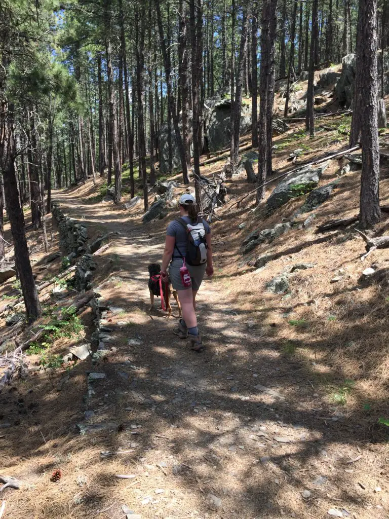
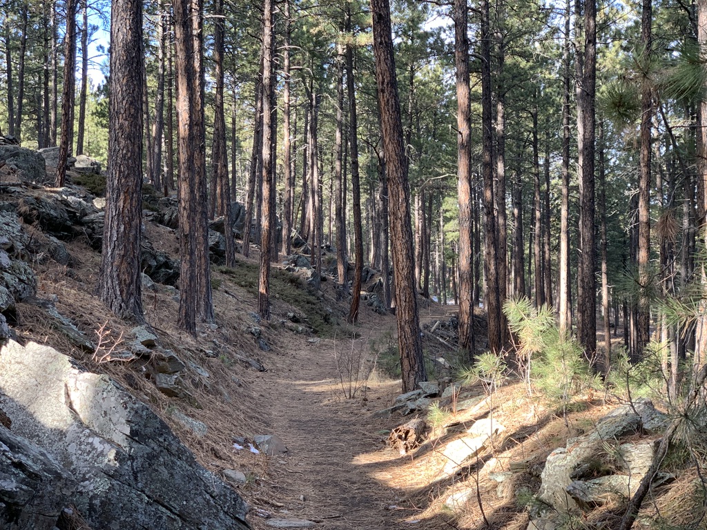
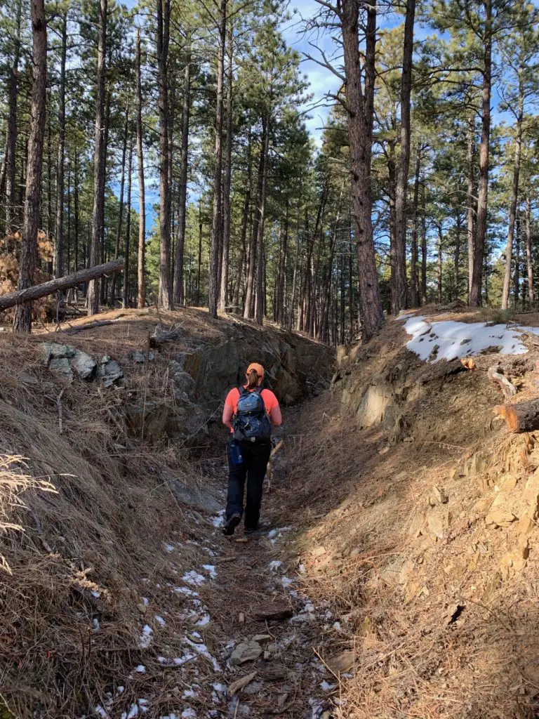
This trail is actually another branch of the Black Hills Flume Trail that I discussed in a previous post.  The first 1/4 – 1/2 mile of it is quite steep (and can be downright treacherous in wet or icy conditions).  However, once you reach the flume bed, it’s largely flat and wide and is an easy hike.

This portion of the trail is around three miles long, each way.  It ends at an old forest road where it meets up with the the Boulder Hill Trail.  Usually we walk out and back, though you can make loops if you include some of the local forest roads.

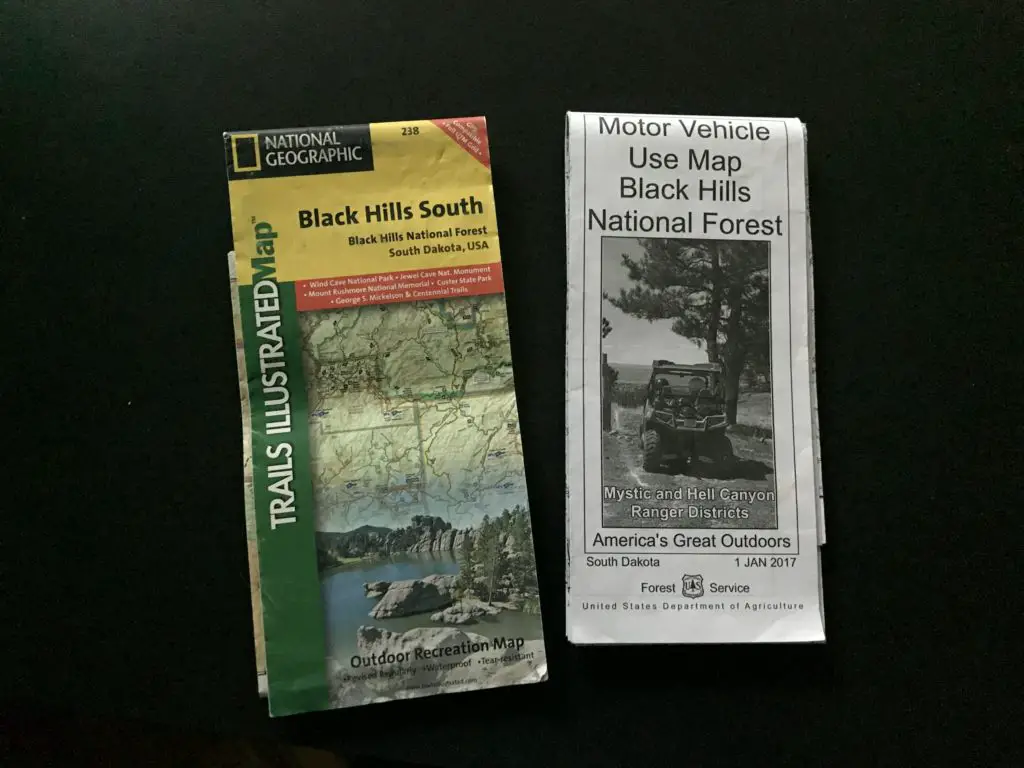
It’s important to always carry updated maps of the local trails and forest roads (like the ones shown below) when you’re out in the woods.  This is especially important if you want to combine various routes to make your own loops.  The paths are pretty clear in this area, but you can still get turned around if you aren’t familiar with where they all go.

Two trail maps called "Black Hills South" and "Motor Vehicle Use Map Black Hills National Forest" sit against a black background
These are the types of maps we frequently use

This is a great trail!  I would rank it as “moderate”, mostly due to the initial, steep section. (There are also a few portions of it that traverse low-lying areas which can get slippery in the snow or mud.)  However, the majority of it is easy as it just follows the flat, flume bed.  Once you reach that part, all members of the family should be able to handle the trail easily (including the four-legged ones.  Puppers highly recommends this path, as do several of her friends that we met along the way! 🐶)

Back view of a woman walking through a narrow gulley. Patchy snow on dirt hillsides loom just over her head on both sides. A tall, pine tree forest rises from the gulley.
Me traversing a portion of the Flume Trail. Isn’t it beautiful, the way the sun dapples through the trees? (And yes, it was early January and I was wearing shirt sleeves; part of the reason why I love living in the Black Hills!)

There are many great views of the surrounding forestland available from this trail.  In a few places, you can see all the way to Rapid City, and even to the prairies that lie farther to the east.

Coon Hollow Offers a Variety of Ways to Enjoy the Outdoors

One thing I really like about this area is that it contains a variety of trails that are good for both hiking and mountain biking.  I also like that there are different trails for bikers and hikers, so the two are kept largely separated.

The actual bike trails are mostly one-track, though none of the areas we’ve encountered are terribly steep or technical. The Trekkers (especially me) are novice mountain bikers, and we’ve been able to manage these routes fairly well.  There are also old forest (and fire) roads spread around the area which make for easier biking and hiking options.

If you’re looking for another family-friendly trail to hike in the Black Hills, that is close to Rapid City, check out the Coon Hollow Trail!

Is this a trail you’ve tried for hiking or on your mountain bike?  Let me know your favorite parts of it in the comments!

If you’d like to read about the other trails in this series, you can click the links below:

Boulder Hill Trail
Flume Loop Trail
Little Elk Creek Trail
“Secret” Hiking Trails off Sheridan Lake Road
Stratobowl near Rapid City
Willow Creek Trail Black Hills


Did you enjoy this post? Pin it!

Rear view of a woman walking through a narrow gulley. Patchy snow on dirt hillsides loom just over her head on both sides. A tall, pine tree forest rises from the gulley. Pin reads, Coon Hollow Trail Black Hills"

Like what you read here today?  Please feel free to leave a comment, like or share this post!  Want to be notified when a new post is published?  Add your email and click the “Follow” button at the bottom of the page or the sidebar to the right.  By signing up for the email list, you will also receive a free copy of the Tranquil Trekker’s Top 10 Tips of Trekking Do’s and Don’ts!

You can also follow the blog on social media by clicking the links below!

Facebook

Twitter

Instagram

Pinterest


Flume Loop Trail, Black Hills

In this post, I discuss the Flume Loop Trail, found in the central Black Hills.


The Flume Loop Trail is another in my series of trails that are found close to Rapid City.

Where is the Flume Loop Trail?

This trail is found off Boulder Hill Road west of Rapid City.  You can reach that road from both US 16 (a little way south of the Rockerville area) as well as off of Sheridan Lake Road.  Either direction works, though the Sheridan Lake Road entrance is closer to the trailhead.

This is a dirt road, though it is usually in very good condition and can be managed by any 2WD car. (The exceptions to this would be in snow, or occasionally, due to heavy rain.)  The parking lot where the trailhead is found is the same one you use for the Boulder Hill Trail

What is a flume?

A flume is a chute, generally built out of wood, used to transport materials (such as logs or gold) using water.  This trail in the Black Hills travels along a former flume route from more than 100 years ago, during the gold rush.  Today, it is mostly comprised of a wide, grassy, leveled grade along the hillside, where the original structure once stood.  In a few areas, the rotting ruins of the original flume can still be spotted. (On other portions of the trail, you can actually travel through old tunnels in the rock that were created for use by the flume.)

The picture at the top of the post is an example of what a flume would have looked like, NOT specifically of the one in the Black Hills.

The rear view of a woman and dog walking along a flat, wide trail in the forest.
This is actually another part of the Flume Trail, but it shows the flume bed well. You can see how flat and wide much of it is.

The entire flume trail runs for more than 15 miles throughout the Black Hills from Rockerville, south of Rapid City, to Sheridan Lake, west of town.  Near Boulder Hill, the path forms a loop, and it connects to other portions of the trail.

What is the flume loop trail like?

This is a great trek!  It can be completed in either direction, though we usually travel it counterclockwise. (My following description of it will follow that route.)

The Flume Loop Trail starts by traversing some lower-lying meadows through the oak and cottonwood trees that grow along the nearby creek .  Watch out for cows in this area during the summer months (or more importantly, what they leave behind. 🤥  This is national forestland, and open grazing is allowed here.)  Also, during hunting season, I strongly encourage people to wear bright colors when enjoying this area as you’ll be sharing it with hunters.

As you continue down the trail you’ll pass a small, dank-smelling pond that is often covered in green scum during the warmer months. 😝   There are some logs you can use to cross the small stream that feeds from it.  Be aware, this area can get VERY mucky in wet times of the year.

After crossing Boulder Hill Road, you then make a short climb up a nearby hillside.  You are now on the flume bed itself.  From here on out, the trail is fairly level, with a few short climbs and descents, and the occasional clamber up some boulders.  The remainder of the trail traverses the pine forest that is more common in the Black Hills.

Sometimes, as you leave the brighter, open spaces behind, walking into these darker, pine tunnels,  can seem almost spooky.   Not to worry though, the scariest sites we’ve seen here are the local mule deer and rabbits who frequent the area.

This trail is nice because much of it is shaded and in the trees, regardless of the time of day you visit.  We have often used it for a quick, evening escape after work, or when it’s too hot to attempt more difficult, or more exposed routes.  The early portion of the trek is great in the fall, as this is a more leaf-prone part of the forest.  The dusty smells of dried leaves underfoot, mixed with the sounds from the ones still clinging to the trees, that rattle in the wind, with the gurgle of the small creek nearby, make for quite the bucolic, autumn setting.

Is the Flume Loop Trail hard?

I would rate this trail as “easy” as it encompasses very little elevation gain.  It can be completed in 1 – 2 hours, depending on your speed and ability level, how many stops you make, etc.  It is appropriate for children of almost any age, and dogs.

Our previous dog enjoyed it, arthritis, bad hips, and all, well into the final year of her long life.  Puppers has put her stamp of approval on it as well.

So the next time you’re looking for a family-friendly trail near Rapid City, consider the Flume Loop Trail!

Have you hiked the Flume Trail? What did you think? Tell me about it in the comments! 

If you’d like to read about the other trails in this series, you can click the links below:

Coon Hollow Trail
“Secret” Hiking Trails off Sheridan Lake Road
Hiking the Boulder Hill Trail
Little Elk Creek Trail
Stratobowl near Rapid City
Willow Creek Trail Black Hills


Did you enjoy this post? Pin it!

Wide, flat, hiking trail through the forest. Pin reads, "Black Hills Flume Loop Trail"

Like what you read here today?  Please feel free to leave a comment, like or share this post!  You can also follow the blog on social media by clicking the links below!

Facebook

Twitter

Instagram

Pinterest