Author’s Note: Since we visited Glacier in 2016, the Park Service has implemented a complex, ticket system for visiting the park in the summer. To be honest, I can’t make much sense of it as it involves multiple tickets being required to enjoy various activities around the park. For more information on this system, visit the park website and/or contact the park office.
Also, just a word of warning, as this is a National Park, no dogs are allowed on any trails within the park (exceptions for Service Animals). They are only permitted in the campgrounds and parking lots.**
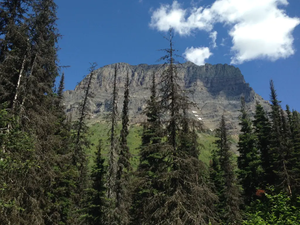
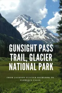
The Gunsight Pass Trail at Glacier National Park is a great hike that offers scenic views.
Similar to the Swiftcurrent Trail, this is a fairly long route that connects with several others throughout the park. It runs for almost 20 miles, from the Lake McDonald Lodge, past the Sperry Chalet, Gunsight Lake, and Lake Ellen Wilson, to the Jackson Glacier Overlook. The trail offers prime views of several waterfalls along its length. (Both trailheads can be reached from the Going to the Sun Road.) Because of its length, most thru-hikers do it in two days with an overnight stop at one of several backcountry campgrounds or the Sperry Chalet.
The Trekkers aren’t much for overnight camping in the backcountry, so we chose to only attempt the portion that runs from the Jackson Glacier Overlook, on the Going to the Sun Road, to Florence Falls. Both of us entered this hike with a bit of trepidation as it was our first real foray into Grizzly Country. Our goal was to make it to the Florence Falls trail junction (four miles in, making it a total hike of eight miles, round trip).
We had hopes of reaching the falls but wanted to wait to see how we were feeling when we got there. We knew going in that the final mile of the return trip would be a strenuous uphill climb, so we planned to reserve some energy for that (and it was good we did).
Related posts: 5 Things you Don’t Want to Miss at Glacier National Park; Glacier National Park: Hiking the Apgar Lookout Trail
Hiking on the Gunsight Pass Trail
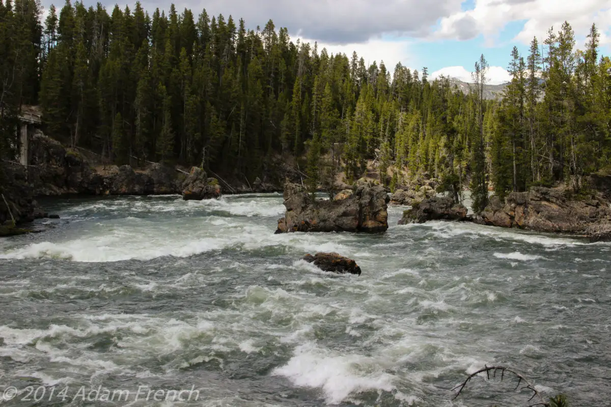
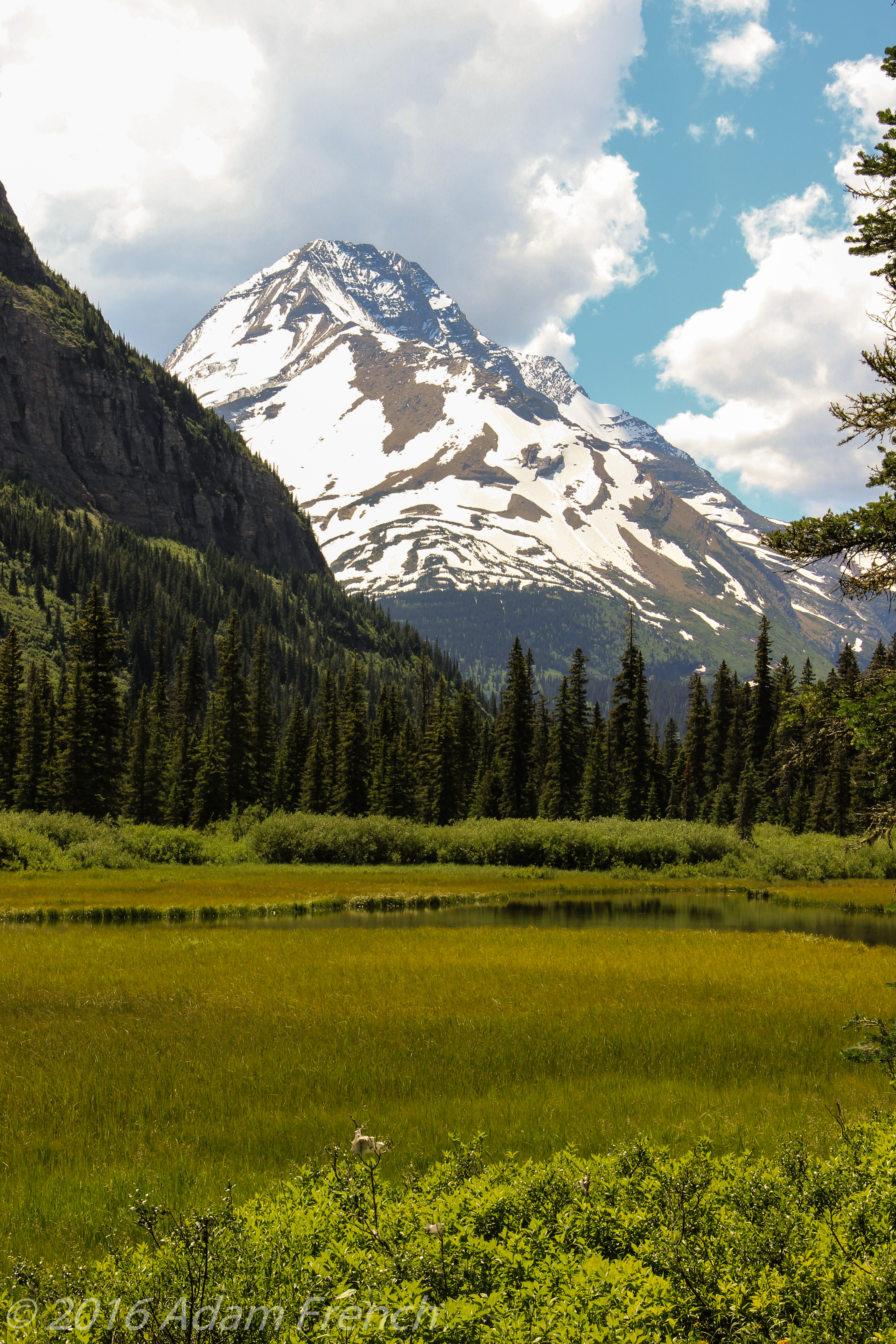
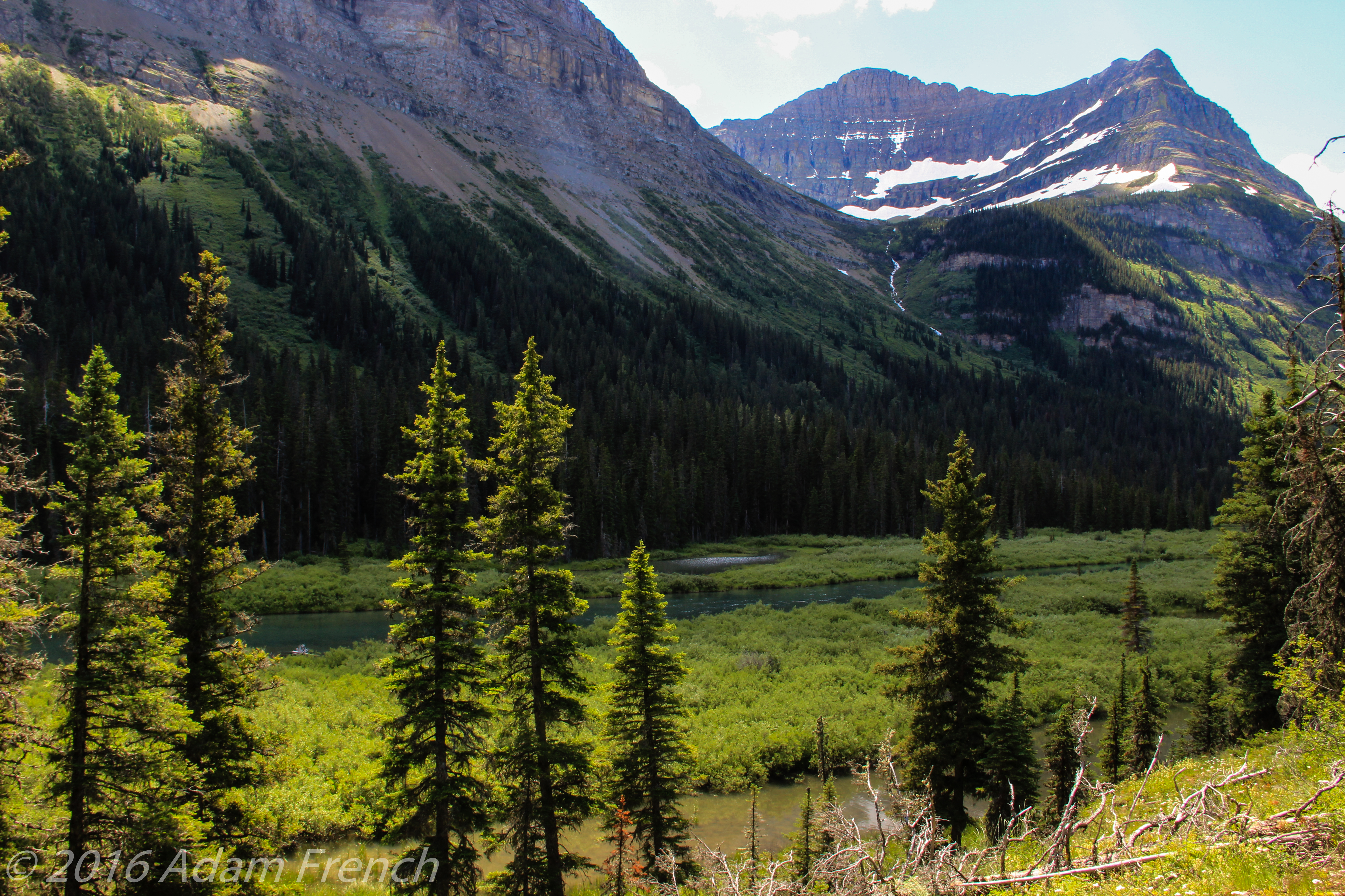
This is a beautiful trail! As it runs largely through the forest, in a lower-lying area, along the St. Mary River, it was a cooler option on that 85-degree day. It is fairly evenly-graded with some beautiful views and was the least crowded trail we experienced in late June (we saw several groups of hikers though none of the “lines” we encountered on a few other trails). The section we chose was the least strenuous portion of the route–it runs along the valley floor as opposed to climbing the peaks as it does in other segments.
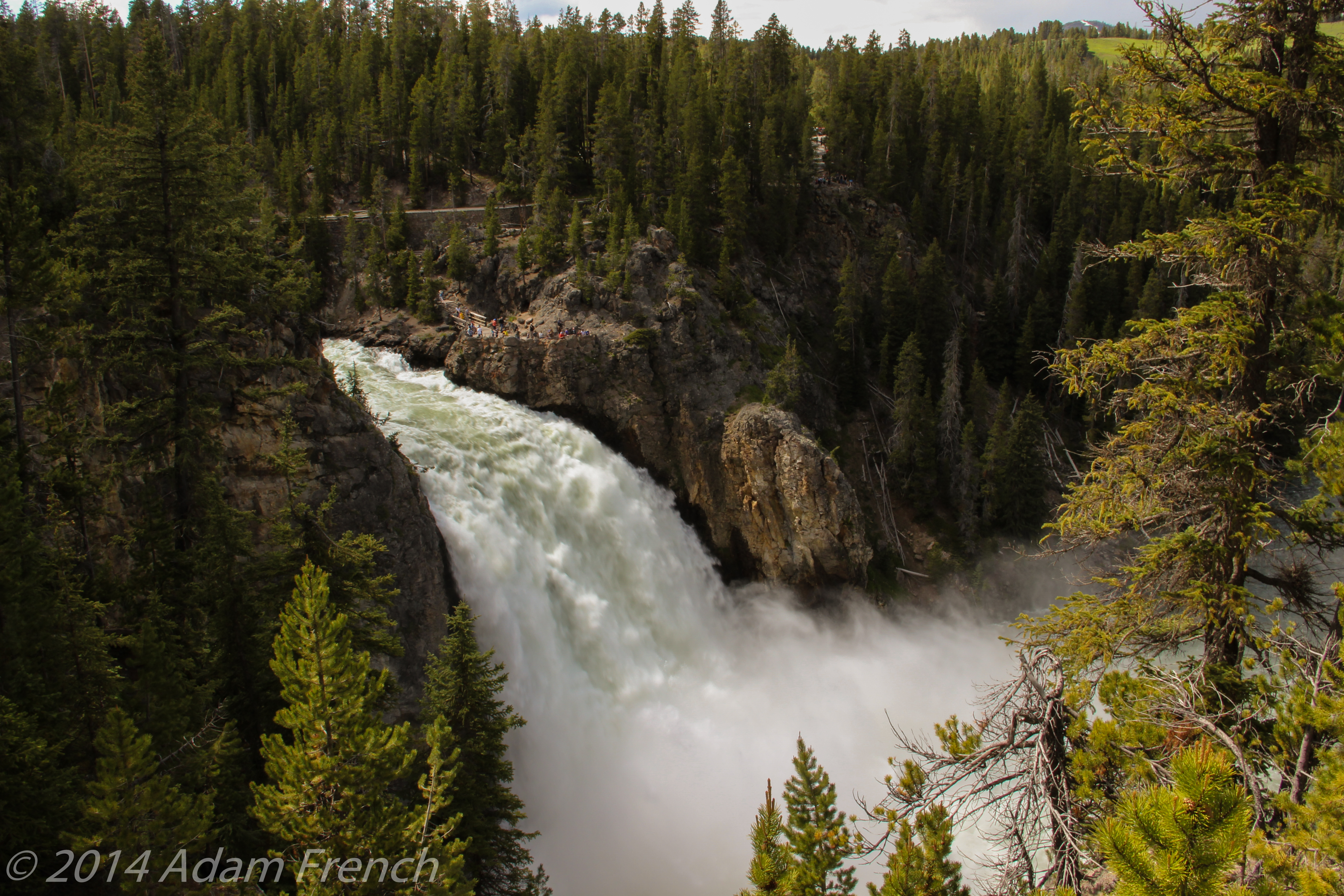
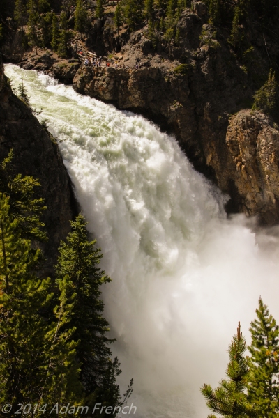
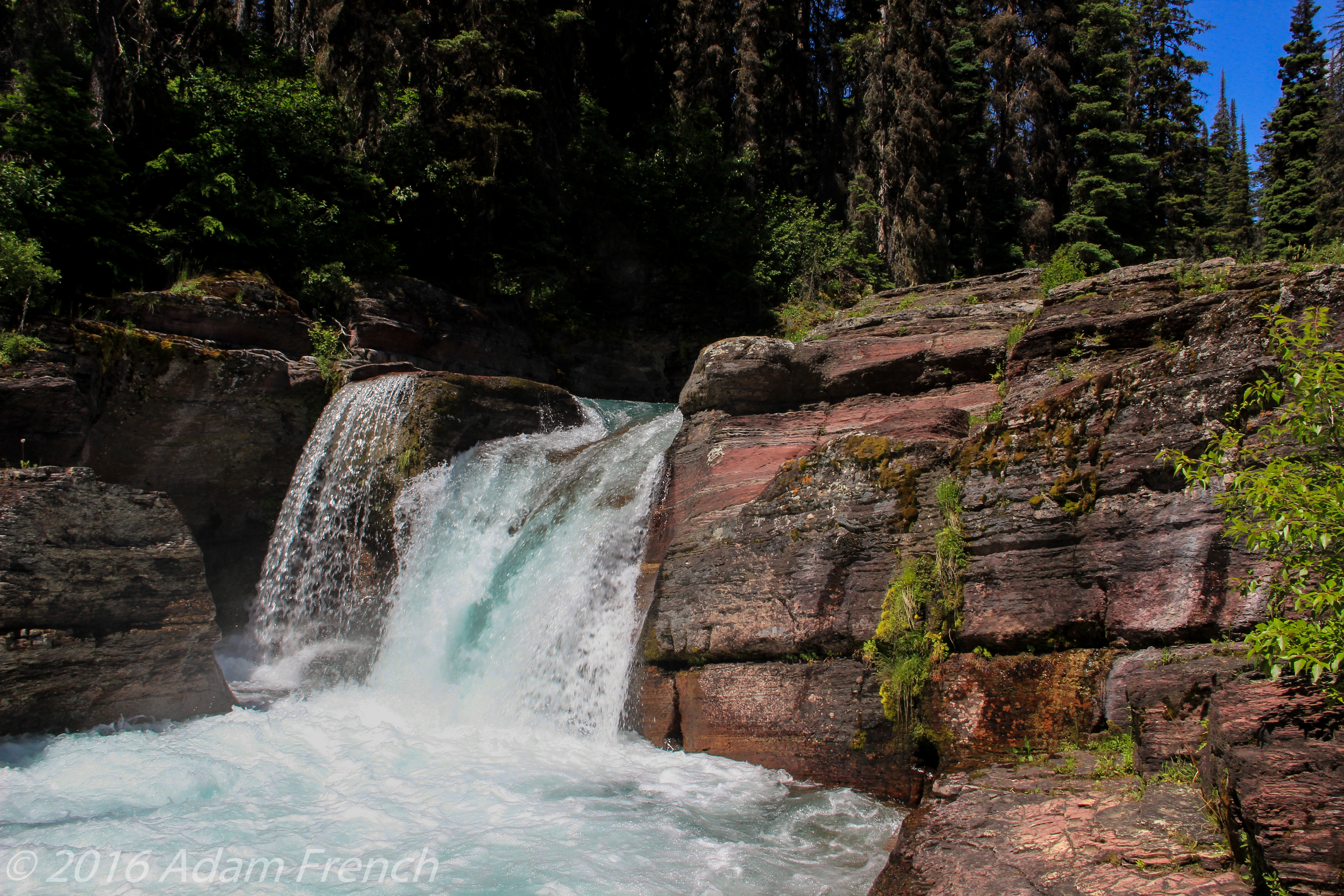
Despite being in the forest, portions of this trail do allow for breaks in the foliage that overlook a marshy area (look for moose!) with incredible views of the soaring mountain peaks and Jackson Glacier as a backdrop. Upon completing the initial steep descent the trail levels off at the picturesque Deadwood Falls.
On your return trip, this is a good place for a break before attempting the final climb to the top. There’s plenty of space to sit on the rocks in the sun or shade (depending on your preference and the time of day) and let the mist from the falling water cool you. The creek below the falls is also an opportunity to dip your feet in the chilly water; just use caution, the current is strong and the rocks may be slippery.
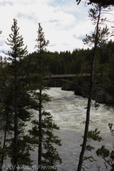
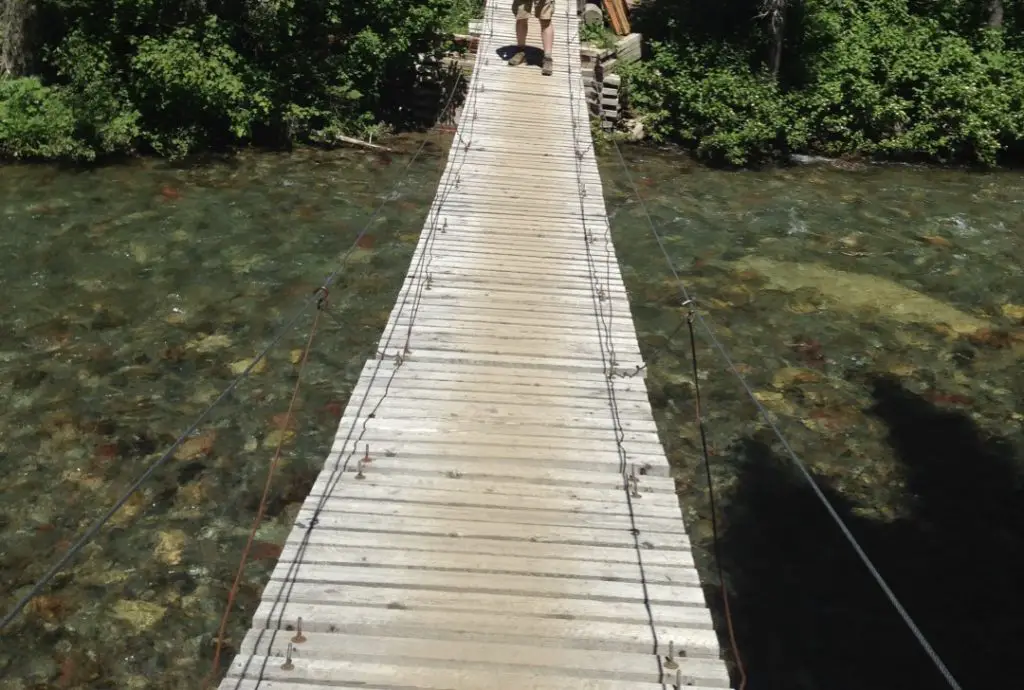
The coursing creek continues to accompany you along the trail. Shortly after passing the falls and the first back-country campsites, you’ll encounter an interesting suspension bridge that crosses the creek.
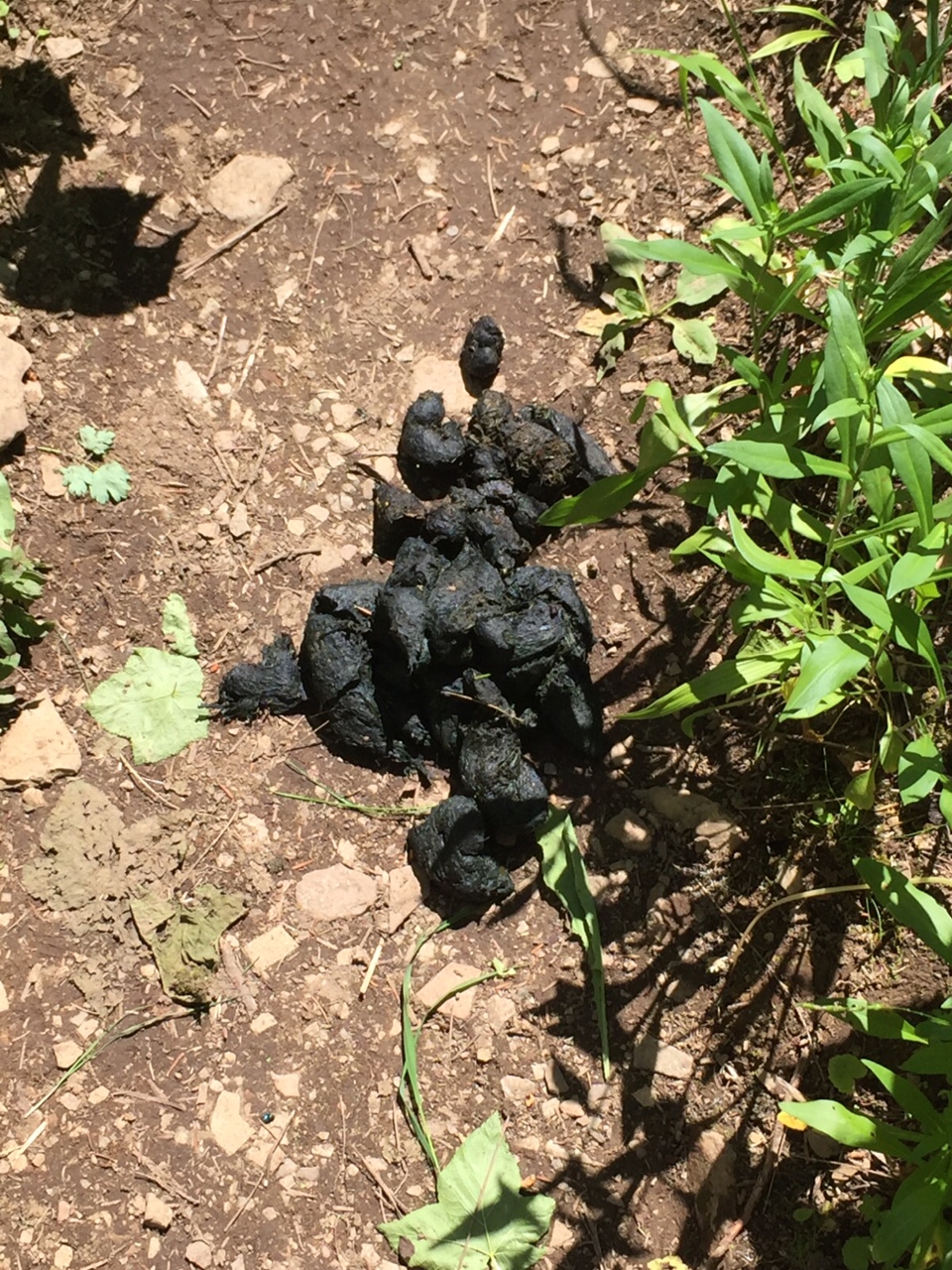
Grizzly Bears at Glacier National Park
The only unpleasant factor on this trail was the huckleberry bushes; they were many and accompanied us for a large portion of the four-mile journey. That time of year they were calf to knee height, though later in the summer they can reach chest to head height.
This causes an especially sensitive situation as the berries are a favorite for grizzly bears in late summer. There are several places where the trail encounters blind corners and hills so be sure to follow standard safety guidelines when hiking in bear country: never hike alone, don’t hike around dusk or dawn, carry bear spray, and make plenty of noise (one of our favorite methods is singing and hand-clapping–this also helps to alleviate trail fatigue).
Also, be aware, that the water rushing in the nearby creek may mask your sounds and could increase the likelihood of surprising one of the large Ursines. We did not see a bear on our hike (have you noticed a trend in our hikes in Bear Country?) though we saw evidence of a very recent pass-through.
Another hazard of the thick bushes was they almost completely obscured the trail in some cases making it somewhat hard to follow. They also hid a less menacing annoyance, bees–as I, unfortunately, found out when one flew inside my hiking boot and stung me for my intrusion.
Wolverines on the Gunsight Pass Trail
We encountered another first on this trail…a wolverine! (It looked nothing like Hugh Jackman! 😝) They are commonly known in this part of the park.
We were traversing one of the clearer portions of the trail, I was in the lead. As I looked down the trail a wolverine came trotting towards us around a bend about 25 feet down the trail. We all stopped…he looked at us…we looked at him…he looked especially cranky as he panted in the heat…then he kept coming!
We’ve never encountered a wolverine in the wild before but I’ve heard stories of their nastiness (apparently they’ve been known to kill moose that have gotten mired in snowdrifts, as well as a polar bear on at least one occasion–seriously!) At this point, I was scanning the huckleberry-covered hillside for an escape route as I did NOT want to have to deal with this critter that is 1/10th my size but can kill creatures many times larger than me! Fortunately, at about that moment, he decided it was too hot for a confrontation and sprinted off into the bushes.
We did reach our four-mile goal but did not make it to Florence Falls. We had the energy to continue on but knew it would have added over a mile to our trek and we still had a hefty climb ahead of us on the return trip. We were also running low on water so we again made the safe choice to turn back–this turned out to be wise as our water barely held out the remainder of the hike. Having faced our fears and successfully trekked eight full miles in the middle of Grizzly Country, we counted this hike as a success!
Have you hiked the Gunsight Pass Trail? What was your experience? Tell me in the comments!
Did you enjoy this post? Pin it!
Like what you read here today? Please feel free to leave a comment, like or share this post! Add your email at the bottom of the page, or the sidebar to the right, to be notified when a new post is published. By signing up for the email list, you will also receive a free copy of the Tranquil Trekker’s Top 10 Tips of Trekking Do’s and Don’ts!
You can also follow the blog on social media by clicking the links below!