Deerfield Trail (Trail #40) in the Black Hills

In this post, I review the Deerfield Trail (Trail #40) that traverses a portion of the central Black Hills.


At 23 total miles long, the Deerfield Trail (Trail #40) can be accessed from several trailheads throughout the Black Hills.  It begins at Deerfield Reservoir (there’s a spur trail that actually circumvents the entire lake), crosses the Mickelson Trail at about the halfway point, and eventually, spans all the way to the Centennial Trail near Pactola Reservoir.  

The Deerfield Trail is adorable!  It traverses canyons, meadows, valleys, and ridges.  Sites that housed old mining camps (and some that are still operating) and the occasional remnants of an abandoned homestead dot its course.  This includes one squatter’s paradise that was built directly into the rock!  Tailings from old mining sites, remnants of ramshackle cabins, and numerous stream crossings–often with charming, simple, log bridges–are scattered throughout the trail’s length.  

A dirt path runs along a wide, dirt road through a forest of pine trees
This is one of the forest roads the trail traverses.  It was such an iconic site I kept half-expecting to see a horse and cart saunter by!  😂
A small log sits on a narrow, dirt path through the grass that is sprinkled in yellow leaves
I LOVE the golden leaves contrasted against the still-green grass and the various brown hues of the log and dirt…

Things to See on the Deerfield Trail

An old dirt road, grassed-over with yellow-leafed and green, pine trees on both sides. 
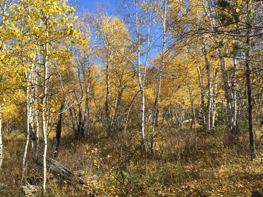
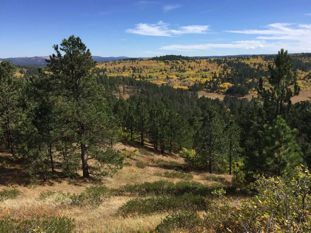
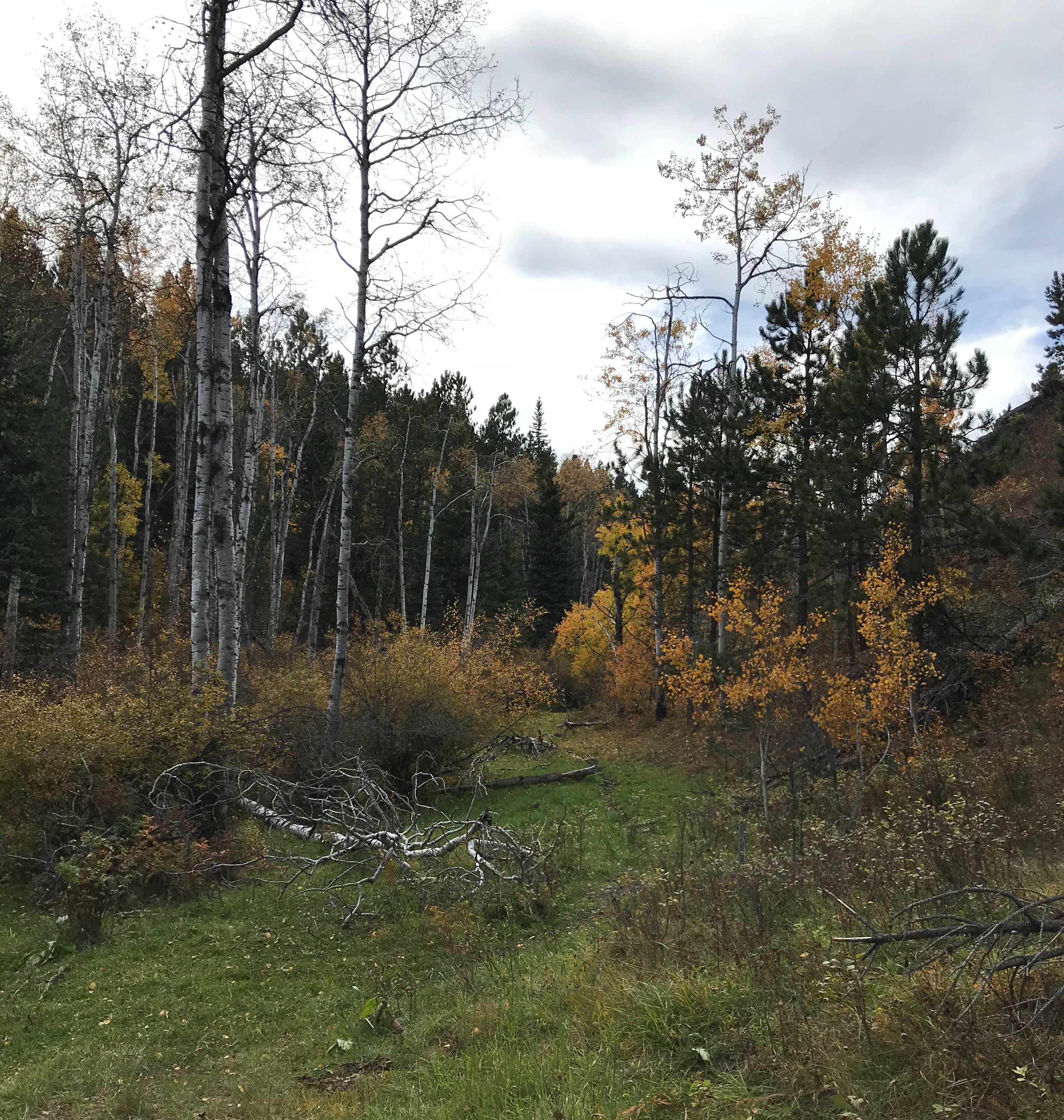
The Deerfield Trail runs through several canyons that are similar to those found on Rimrock Trail, that traverses the rim of Spearfish Canyon and others that you see on the Little Elk Creek Trail, near Sturgis.  The canyons are especially gorgeous in fall as the never-ending green of the spruces, that blanket the canyon walls, contrasts with the yellow and orange of the aspens and red of the plants that frame the creek.

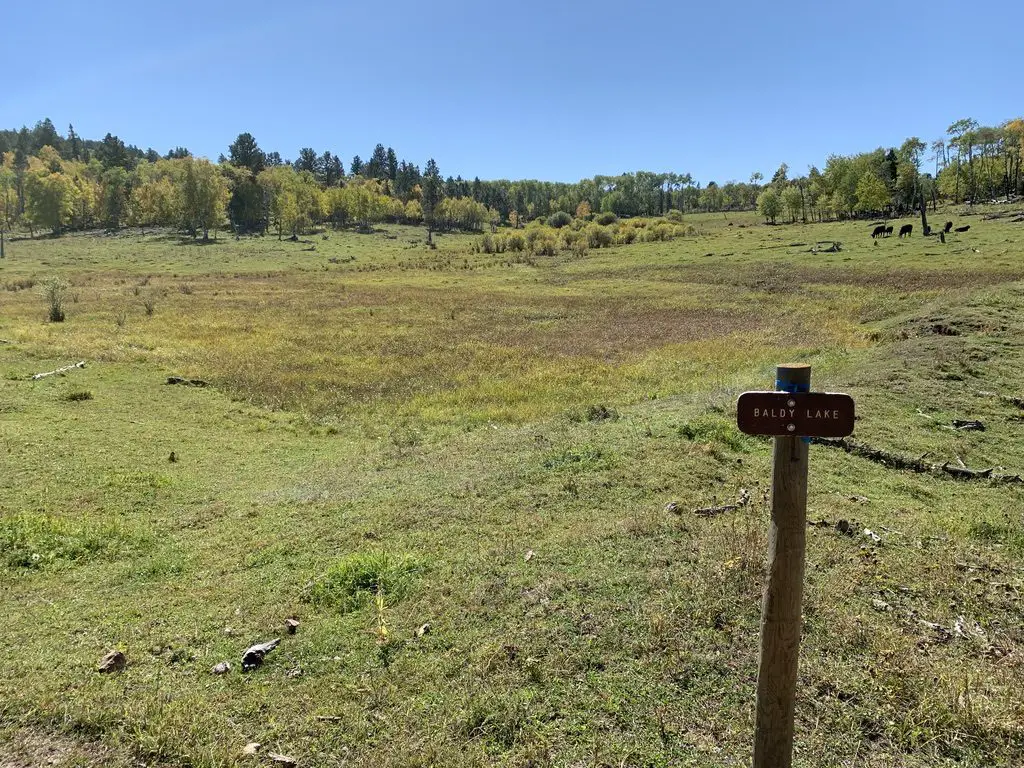
Several sections of this trail run along ridges that are reminiscent of those found in the Eagle Cliff and Big Hill areas in the Northern Hills.

This is another trail system that crosses multiple ecosystems, similar to the trails that traverse the rim of Spearfish Canyon.  The canyon sections are lush and green, while the ridge sections are comprised more of a drier, arid prairie.

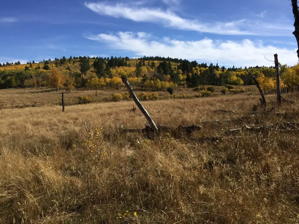
Treks on the Deerfield Trail can even include a variety of weather depending on which side of the mountain you find yourself.  You may start off your hike in sunny, blue skies, veiled with wisps of cirrus clouds.  By the time you reach the ridgeline, a cold breeze can be blowing darker, heavier clouds in.  Then, after a quick lunch, you can retrace your steps to the other side of the hill and return to a warmer, sunlit forest.

An old dirt road, grassed-over with yellow-leafed and green, pine trees on both sides.

A snowy footpath between the trees

Things To Do on the Deerfield Trail

A snowy footpath between the trees
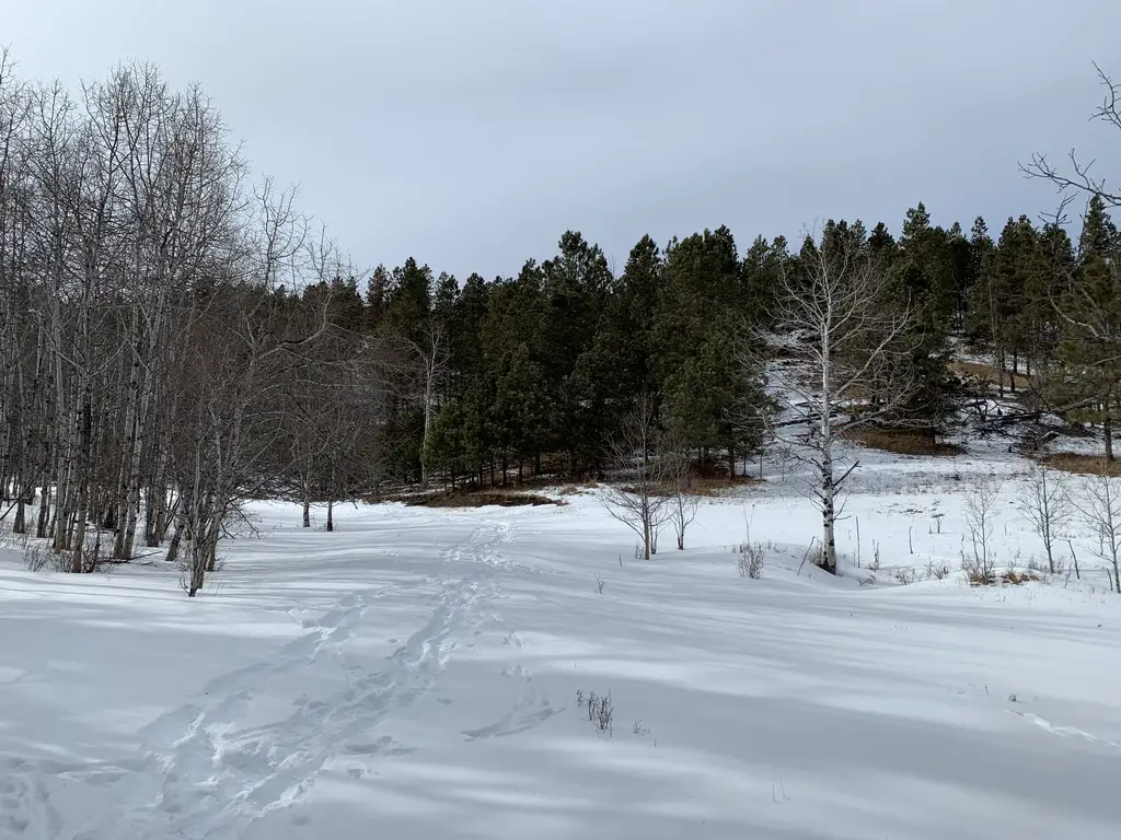
The Deerfield Trail is open year-round, for various activities, including horseback riding, hiking, mountain biking, and snowshoeing/cross-country skiing, depending on the time of year.

Large portions of the route follow old logging and forest roads that are wide and well-graded, so travel is often smooth. (Some of these are still in use so keep your ears and eyes open as you may have company on the trail).

While the entire route could be completed in one attempt with an overnight trip–or a VERY long day trip (if you had a car at each end)–it is usually conquered in sections (as the Trekkers are attempting).  It should also be noted that some of the trailheads may be difficult–or impossible–to reach in the snowy months (at least with a typical, road-worthy vehicle).

The elevation for this trail is moderate compared to many of the other, longer ones in the Black Hills.  While some sections will get your heart pumping, many consist of scenic, tranquil afternoon hikes in the woods.

One of the best features of this hike, for me, is its solitude.  Some portions are more heavily traveled than others–namely the canyon sections–but often you’ll find you have the trail to yourself (especially in the colder months).  It’s not unusual for the only evidence of others having used the route to be the deer, elk, coyote, and often, mountain lion tracks–usually following the deer tracks! 😳–that remain in the mud or snow.  Don’t be surprised if you see the flags of some white-tail deer tails flying high as they dash out of your way as you traverse the trail!

Cloven hoof print from a large animal in the mud, between tire prints
Elk print!

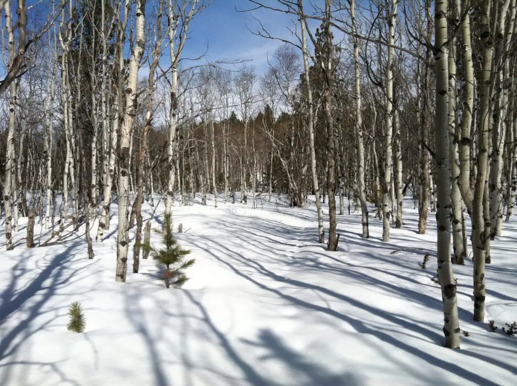
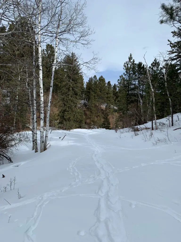
Below is a picture from the same area on the trail, but at different seasons (fall and winter).

An old, dirt road, through the woods, sprinkled with yellow leaves, with yellow-leafed and green, pine trees on both sides

A snow-covered road through the woods with a snowy footpath

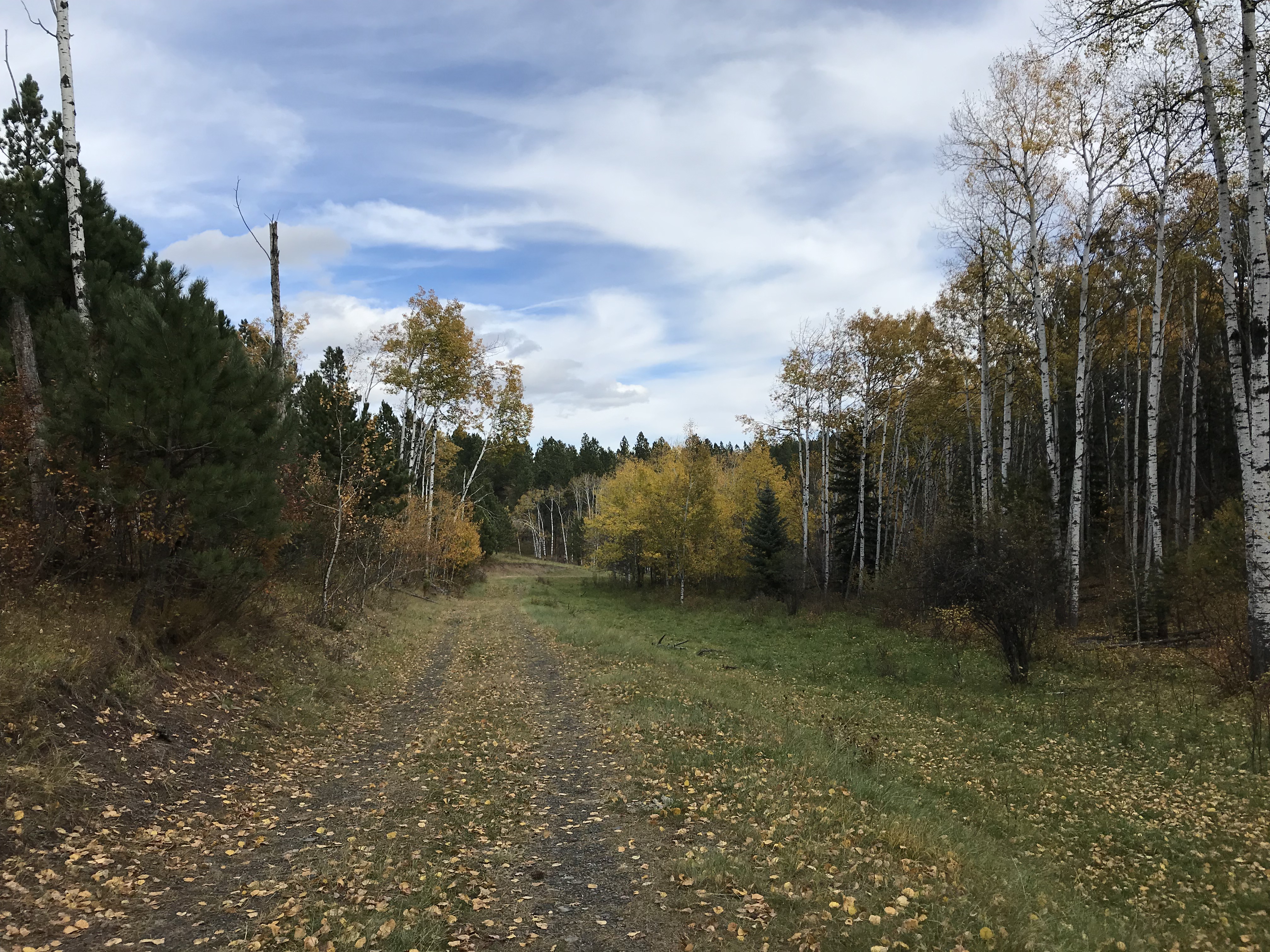
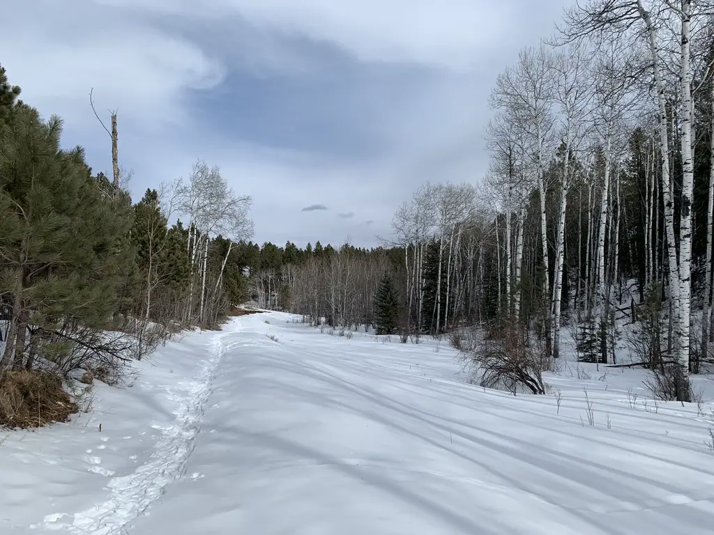
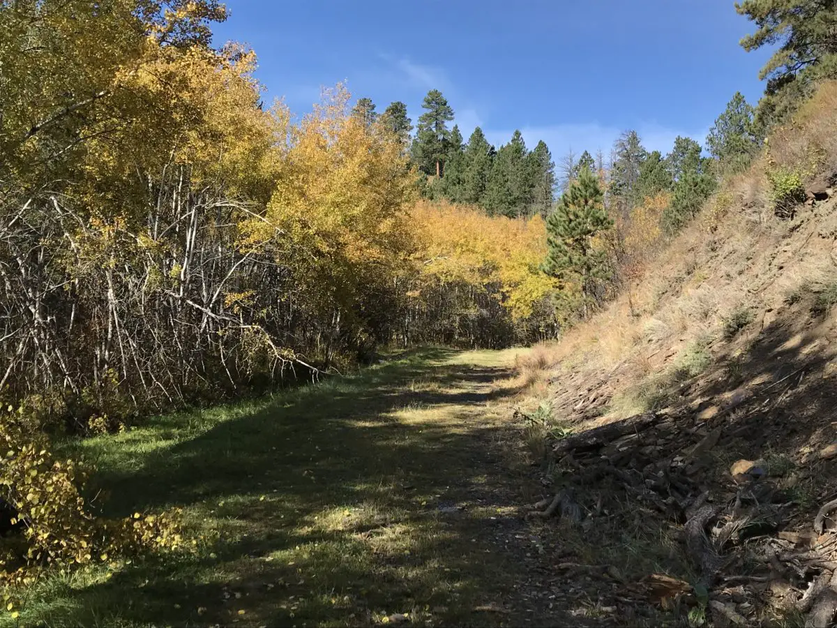
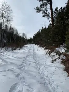
A few more pictures from this scenic trail!

Green grass area surrounded by yellow-leafed and green pine trees

Snowy, open area surrounded by leafless trees and pine trees
If you’re looking for a peaceful, casual hike through some beautiful countryside, consider giving the Deerfield Trail a try!

Have you hiked portions of this trail?  What were your favorite parts?  Tell me about them in the comments!

Did you enjoy this post?  Pin it!

A snowy footpath between the trees. Pin reads, "Deerfield Trail (Trail #40) in the Black Hills"


Like what you read here today?  Please feel free to leave a comment, like or share this post!  Add your email at the bottom of the page, or the sidebar to the right, to be notified when a new post is published.  By signing up for the email list, you will also receive a free copy of the Tranquil Trekker’s Top 10 Tips of Trekking Do’s and Don’ts!

You can also follow the blog on social media by clicking the links below!

Facebook

Twitter

Instagram

Pinterest

Old Baldy: a Great Place for Fall Colors in the Black Hills

In this post, I review Old Baldy, a trail loop near Spearfish, South Dakota that the Trekkers frequent.


There is a great, under-appreciated place to view fall colors in the Black Hills, Old Baldy, near Spearfish, South Dakota!  While it’s beautiful in the fall, the Trekkers enjoy it throughout the year as it’s never crowded.

Where is the Old Baldy Trailhead?

The Old Baldy trailhead is on Tinton Road, about halfway between Spearfish and Lead.  You can get there from either town.

From Spearfish, the easiest way is to take Exit 8 off of I-90, for McGuigan Road.  Take this south to the T-intersection with Tinton Road, and then turn right towards the forest.  Take Tinton Road about 10 miles to the trailhead.

If you’re coming from Lead, take US 85 west (towards Wyoming) for about 18 miles out of Lead, until you reach the turnoff for Tinton Road.  Take Tinton Road about 18 miles to the trailhead.

The road is gravel, however, it is well-graded.  As long as you don’t mind your car getting dusty, any passenger vehicle can handle it under good conditions.  In the winter, though, it is rarely plowed past the Iron Creek Lake turnoff when coming from Spearfish.  A high-clearance, 4WD vehicle is often needed to drive this road under those conditions, and even then it is often impassable unless you’re on foot, skis, or are powered by a snowmobile.

I’m not sure if this area has been getting more snow in recent years (this part of the Hills receives some of the largest amounts of snow during the winter); or if the Forest Service just isn’t maintaining Tinton Road past the Iron Creek Lake turnoff; or if they’re intending it more for snowmobile usage.  But whatever the reason, the road has been almost impassible for much of the winter, lately.  One time, we got pretty stuck attempting to reach the trailhead (we were VERY fortunate we carry recovery gear).

What you will see on the Old Baldy Trail

This loop trail is around six miles in total length, with an additional spur to the Mt. Baldy summit that adds a little over 1.5 miles to the total hike.  There is a “lake” that is signed, though I use that term VERY loosely.  We’ve never actually seen any water in it.  It should be called “Green Lake” because it looks like a meadow!  There is a small stream that runs through the “lakebed”, but mostly you only see grass and cows near here. 😋

A word of warning, beware of the cows, as well as their “leavings”. 🤥   The National Forest leases this area to local ranchers, so you can find cows anywhere and everywhere near here during the summer.

A green meadow with trees in the background with a wooden sign that reads, "Baldy Lake"
The “lake” (yes, really!)
A muddy creek runs through a green meadow with trees in the background
Hey look, we found some water!

The trail winds through pine forests with aspen glens dispersed amongst them.  It also traverses the edges of a few meadows and offers spectacular views of the surrounding landscape.  This area is especially pretty in fall when the yellow of the aspen and green of the pine complement each other beautifully, especially as contrasted against the clear blue, Black Hills sky!

Besides the main loop, there is a spur of the Rimrock Trail that can be accessed from here, as well.  This side trail will take you to the rim of Spearfish Canyon.  These are all prime places to enjoy the fall colors the Northern Hills are known for, without having to deal with the crowds you’ll find in the Canyon below.

A brown-grass meadow and fence with hills covered in pine trees and yellow, fall-colored trees in the background
The trail options here are really just one loop (other than the spur to the Rimrock Trail).  If you go right at the fork, heading counterclockwise, you’ll hit the GORGEOUS aspen glen first,  traversing the only real switchbacks found on the trail on the downhill.

If you do choose this route, the return trip is a little steeper, but I think it’s easier.  There is more open space, so there is also more breeze if you’re warm.  The open areas also provide you with INCREDIBLE views of the surrounding mountains and prairie.  However, if it’s sunny in the summer, this area could be hotter as there is less shade…

Regardless of which fork you choose, the “lake” and the turnoff to the summit of the mountain are at the bottom of the hill.  You know what this means!  No matter which fork you pick, you have to climb back up the WHOLE return trip! 😛  

If you start off on the left branch of the trail, going clockwise, you’ll hit the more open area of the loop on your descent.  Facing this direction, you’ll actually be provided with more expansive views of the surrounding countryside.

Unfortunately, this will mean you have to face the “spirit-crushing switchbacks” (I HATE switchbacks!) through the aspen glen, on the way back up the hill.  Because the trees in this area are thicker, it is also more shaded during the summer months.  HOWEVER, the denser foliage also means there is less of a breeze…phew!  Decisions, decisions!

Either way the aspen glen, especially, is INCREDIBLY beautiful in the fall months, not to mention the surrounding hillsides that are ablaze with yellow from all the aspen trees.  The aspen glen is my favorite of the whole trail in the fall.

Author’s note:  the American Indians who originally gave the Black Hills their name called them this because the pine forests made the Hills look dark from afar.  In recent years, the pine trees have been decimated by pine beetles and some wildfires. Aspen trees grow EXTREMELY WELL in their wake.  One wonders if a few hundred years from now, a more appropriate name for these hills may be the Aspen Hills, or the Yellow Hills–the color all the aspens turn in the fall…

A view across hills covered in green, pine trees and yellow, fall-colored trees in the background
This view is from one of the lookout points on the western edge of the loop

These days, if you visit this location, you will see some extensive storm damage.  Multiple tornadoes actually went through here in recent summers!  That’s a rare occurrence in the Black Hills!

One of the storms was especially nerve-racking for me, as the Trekker Parental Units (and Extended Family) were staying at a rental house near Lead at the time. They were outside the tornado’s track–thankfully–but only by about a mile. 😮  Fortunately, the baseball-sized hail that the storm dropped missed them as well!  Helplessly watching that tempest on the radar, while I was sitting in the sunshine over an hour away, was enough to give me a few gray hairs!

When is the best time of year to visit the Old Baldy trail?

The trails are perfect for both summer and winter recreation IF you can reach them in the winter.  If Tinton Road is passable as far as the trailhead when there is snow on the ground, the actual site can be hard to find as the sign is often buried by snow.  Also, there is usually very little parking as the lane to the parking lot is not plowed.

So, you must make do with parking along the side of the road.  In the past, we have come here multiple times to snowshoe or ski. Unfortunately, we haven’t been able to reach the site the last several years.

The difficulty in accessing the trailhead during the winter months is really a shame because it is GORGEOUS under the cover of snow.  The sunbeams shine through the bare branches of the aspen trees while the pristine, white snow, and dark-brown bark, contrast perfectly with the dark green pine trees and blue sky.  Make sure to wear layers, as it can get pretty windy up here since it’s near the top of the mountain.

View through a snowy forest with leafless trees
This is a fun trail for mountain biking as well, heading downhill. 😋  Going back up can be a bit of a pain, especially if you ascend via the eastern leg of the loop, through the switchbacks.  Both hikers and bikers need to be watchful for each other as there are several blind curves and collisions can happen if the bikes round them too quickly.

Horses are also allowed on this trail.  It is imperative that bikers watch for these equines, who could shy and throw a rider, or hurt themselves (or the biker) if a bike came racing around a corner and startled them.

If you’re looking for a fine place to view fall colors in the Black Hills, and you’d like to avoid the usual crowds, check out Old Baldy!  You’ll be glad you did!

Have you ever tried this trail in any season?  Tell me about your experience in the comments!


Did you enjoy reading this post?  Pin it!

4 pictures: 1) Yellow-leafed and green trees cover a hillside; 2)A brown-grass meadow with fall-colored trees dotting it, all under a clear, blue sky; 3) A view across hills covered in green, pine trees and yellow, fall-colored trees in the background; 4) A green meadow with trees in the background with a wooden sign that reads, "Baldy Lake". Pin reads, "Old Baldy: A Great Place for Fall Colors in the Black Hills"


Like what you read here today?  Please feel free to leave a comment, like or share this post!  Add your email at the bottom of the page, or the sidebar to the right, to be notified when a new post is published.  By signing up for the email list, you will also receive a free copy of the Tranquil Trekker’s Top 10 Tips of Trekking Do’s and Don’ts!

You can also follow the blog on social media by clicking the links below!

Facebook

Twitter

Instagram

Pinterest