Old Baldy: a Great Place for Fall Colors in the Black Hills

In this post, I review Old Baldy, a trail loop near Spearfish, South Dakota that the Trekkers frequent.


There is a great, under-appreciated place to view fall colors in the Black Hills, Old Baldy, near Spearfish, South Dakota!  While it’s beautiful in the fall, the Trekkers enjoy it throughout the year as it’s never crowded.

Where is the Old Baldy Trailhead?

The Old Baldy trailhead is on Tinton Road, about halfway between Spearfish and Lead.  You can get there from either town.

From Spearfish, the easiest way is to take Exit 8 off of I-90, for McGuigan Road.  Take this south to the T-intersection with Tinton Road, and then turn right towards the forest.  Take Tinton Road about 10 miles to the trailhead.

If you’re coming from Lead, take US 85 west (towards Wyoming) for about 18 miles out of Lead, until you reach the turnoff for Tinton Road.  Take Tinton Road about 18 miles to the trailhead.

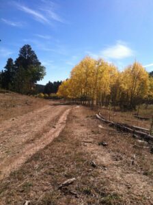
The road is gravel, however, it is well-graded.  As long as you don’t mind your car getting dusty, any passenger vehicle can handle it under good conditions.  In the winter, though, it is rarely plowed past the Iron Creek Lake turnoff when coming from Spearfish.  A high-clearance, 4WD vehicle is often needed to drive this road under those conditions, and even then it is often impassable unless you’re on foot, skis, or are powered by a snowmobile.

I’m not sure if this area has been getting more snow in recent years (this part of the Hills receives some of the largest amounts of snow during the winter); or if the Forest Service just isn’t maintaining Tinton Road past the Iron Creek Lake turnoff; or if they’re intending it more for snowmobile usage.  But whatever the reason, the road has been almost impassible for much of the winter, lately.  One time, we got pretty stuck attempting to reach the trailhead (we were VERY fortunate we carry recovery gear).

What you will see on the Old Baldy Trail

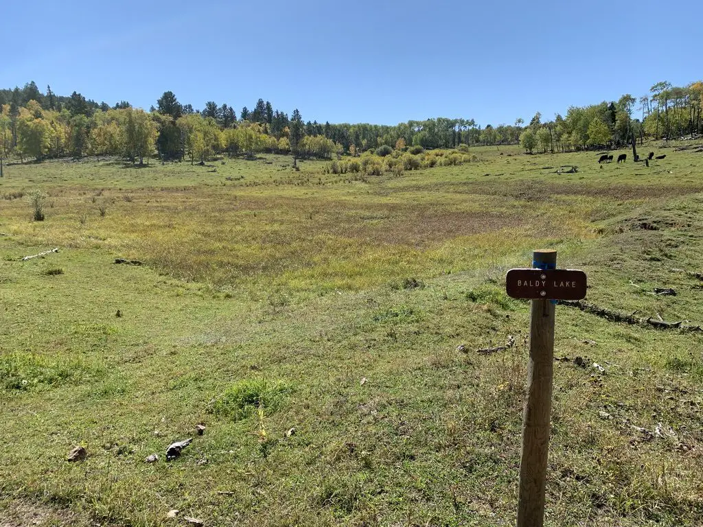
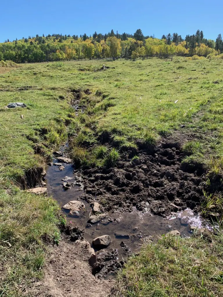
This loop trail is around six miles in total length, with an additional spur to the Mt. Baldy summit that adds a little over 1.5 miles to the total hike.  There is a “lake” that is signed, though I use that term VERY loosely.  We’ve never actually seen any water in it.  It should be called “Green Lake” because it looks like a meadow!  There is a small stream that runs through the “lakebed”, but mostly you only see grass and cows near here. 😋

A word of warning, beware of the cows, as well as their “leavings”. 🤥   The National Forest leases this area to local ranchers, so you can find cows anywhere and everywhere near here during the summer.

A green meadow with trees in the background with a wooden sign that reads, "Baldy Lake"
The “lake” (yes, really!)
A muddy creek runs through a green meadow with trees in the background
Hey look, we found some water!

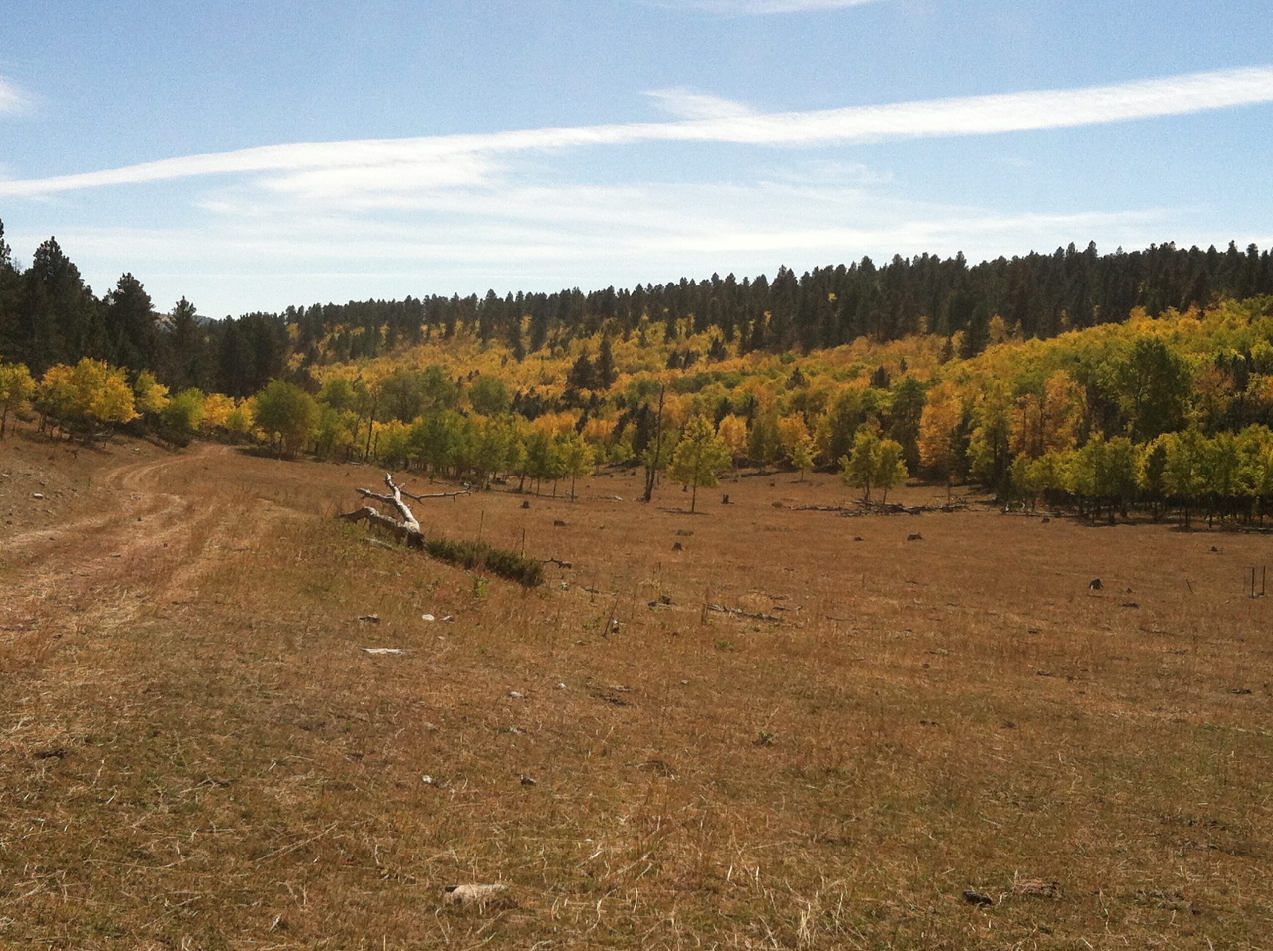
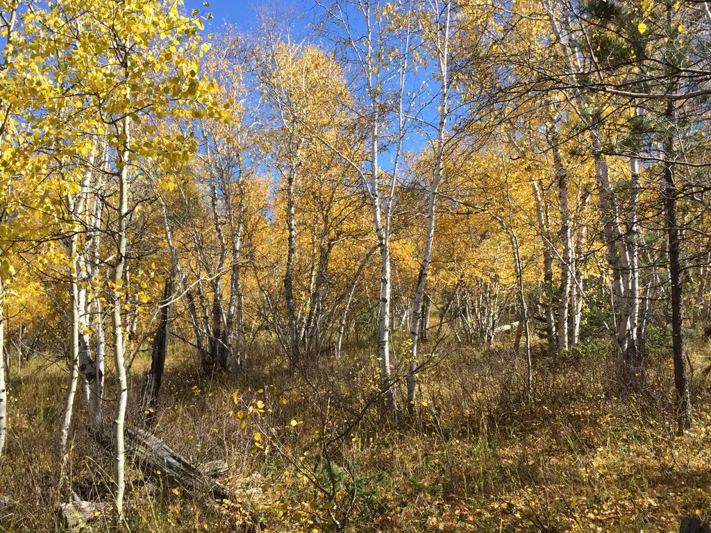
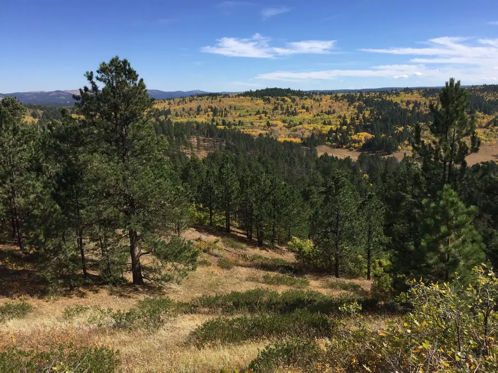
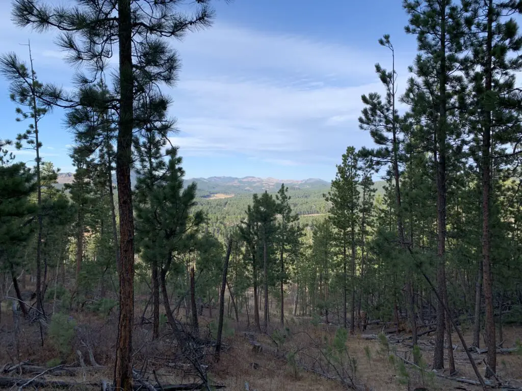
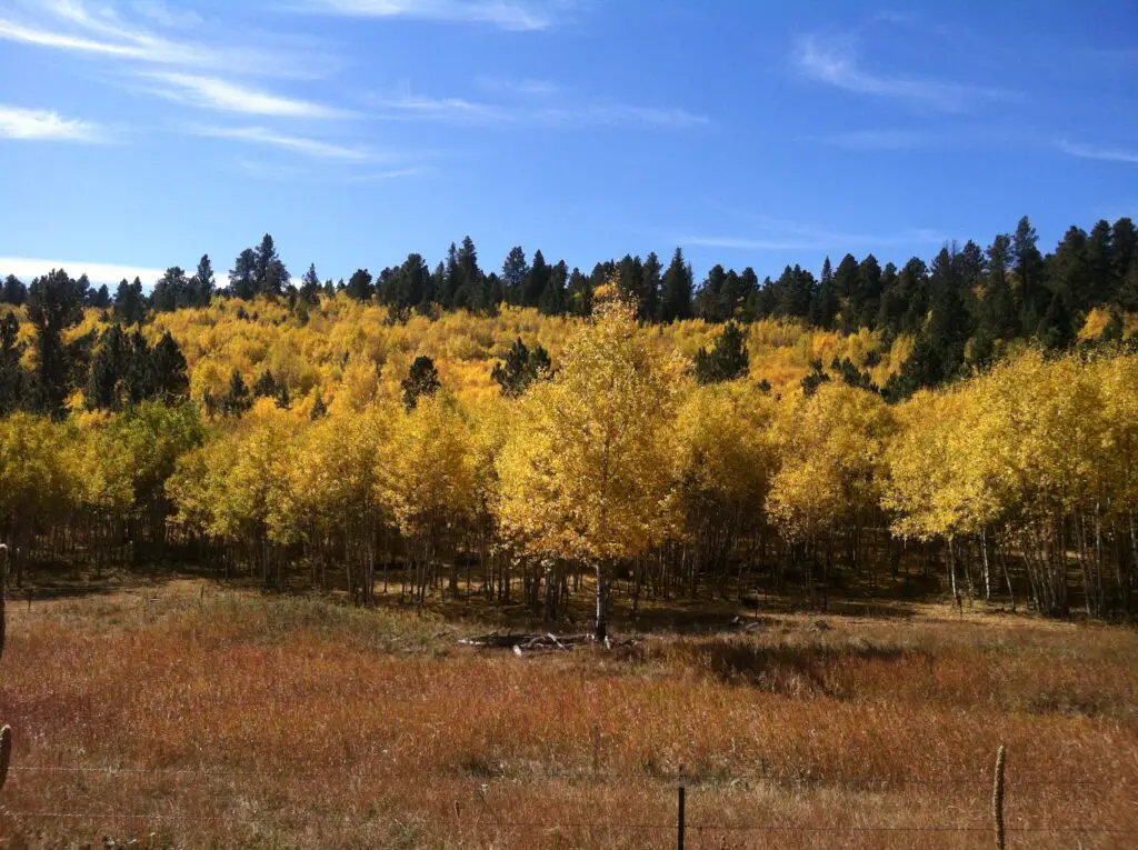
The trail winds through pine forests with aspen glens dispersed amongst them.  It also traverses the edges of a few meadows and offers spectacular views of the surrounding landscape.  This area is especially pretty in fall when the yellow of the aspen and green of the pine complement each other beautifully, especially as contrasted against the clear blue, Black Hills sky!

Besides the main loop, there is a spur of the Rimrock Trail that can be accessed from here, as well.  This side trail will take you to the rim of Spearfish Canyon.  These are all prime places to enjoy the fall colors the Northern Hills are known for, without having to deal with the crowds you’ll find in the Canyon below.

A brown-grass meadow and fence with hills covered in pine trees and yellow, fall-colored trees in the background
The trail options here are really just one loop (other than the spur to the Rimrock Trail).  If you go right at the fork, heading counterclockwise, you’ll hit the GORGEOUS aspen glen first,  traversing the only real switchbacks found on the trail on the downhill.

If you do choose this route, the return trip is a little steeper, but I think it’s easier.  There is more open space, so there is also more breeze if you’re warm.  The open areas also provide you with INCREDIBLE views of the surrounding mountains and prairie.  However, if it’s sunny in the summer, this area could be hotter as there is less shade…

Regardless of which fork you choose, the “lake” and the turnoff to the summit of the mountain are at the bottom of the hill.  You know what this means!  No matter which fork you pick, you have to climb back up the WHOLE return trip! 😛  

If you start off on the left branch of the trail, going clockwise, you’ll hit the more open area of the loop on your descent.  Facing this direction, you’ll actually be provided with more expansive views of the surrounding countryside.

Unfortunately, this will mean you have to face the “spirit-crushing switchbacks” (I HATE switchbacks!) through the aspen glen, on the way back up the hill.  Because the trees in this area are thicker, it is also more shaded during the summer months.  HOWEVER, the denser foliage also means there is less of a breeze…phew!  Decisions, decisions!

Either way the aspen glen, especially, is INCREDIBLY beautiful in the fall months, not to mention the surrounding hillsides that are ablaze with yellow from all the aspen trees.  The aspen glen is my favorite of the whole trail in the fall.

Author’s note:  the American Indians who originally gave the Black Hills their name called them this because the pine forests made the Hills look dark from afar.  In recent years, the pine trees have been decimated by pine beetles and some wildfires. Aspen trees grow EXTREMELY WELL in their wake.  One wonders if a few hundred years from now, a more appropriate name for these hills may be the Aspen Hills, or the Yellow Hills–the color all the aspens turn in the fall…

A view across hills covered in green, pine trees and yellow, fall-colored trees in the background
This view is from one of the lookout points on the western edge of the loop

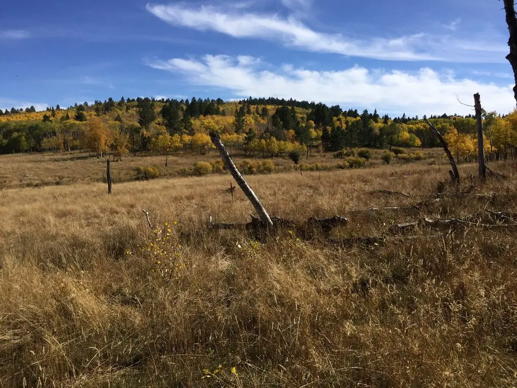
These days, if you visit this location, you will see some extensive storm damage.  Multiple tornadoes actually went through here in recent summers!  That’s a rare occurrence in the Black Hills!

One of the storms was especially nerve-racking for me, as the Trekker Parental Units (and Extended Family) were staying at a rental house near Lead at the time. They were outside the tornado’s track–thankfully–but only by about a mile. 😮  Fortunately, the baseball-sized hail that the storm dropped missed them as well!  Helplessly watching that tempest on the radar, while I was sitting in the sunshine over an hour away, was enough to give me a few gray hairs!

When is the best time of year to visit the Old Baldy trail?

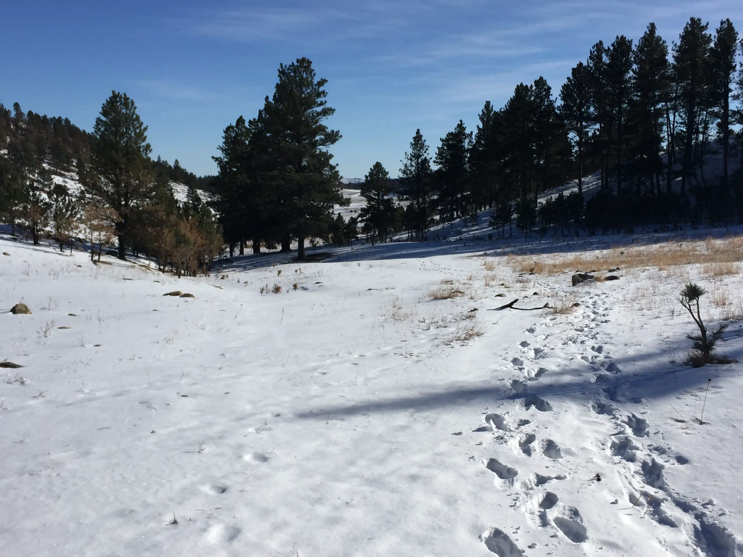
The trails are perfect for both summer and winter recreation IF you can reach them in the winter.  If Tinton Road is passable as far as the trailhead when there is snow on the ground, the actual site can be hard to find as the sign is often buried by snow.  Also, there is usually very little parking as the lane to the parking lot is not plowed.

So, you must make do with parking along the side of the road.  In the past, we have come here multiple times to snowshoe or ski. Unfortunately, we haven’t been able to reach the site the last several years.

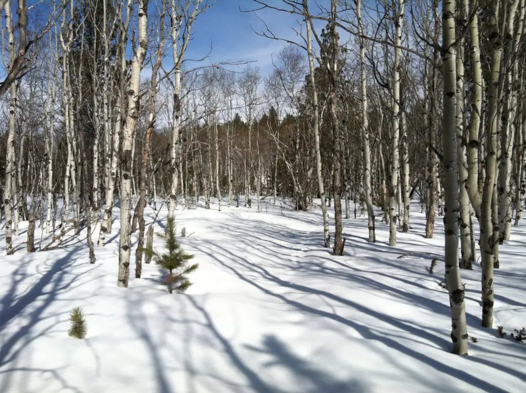
The difficulty in accessing the trailhead during the winter months is really a shame because it is GORGEOUS under the cover of snow.  The sunbeams shine through the bare branches of the aspen trees while the pristine, white snow, and dark-brown bark, contrast perfectly with the dark green pine trees and blue sky.  Make sure to wear layers, as it can get pretty windy up here since it’s near the top of the mountain.

View through a snowy forest with leafless trees
This is a fun trail for mountain biking as well, heading downhill. 😋  Going back up can be a bit of a pain, especially if you ascend via the eastern leg of the loop, through the switchbacks.  Both hikers and bikers need to be watchful for each other as there are several blind curves and collisions can happen if the bikes round them too quickly.

Horses are also allowed on this trail.  It is imperative that bikers watch for these equines, who could shy and throw a rider, or hurt themselves (or the biker) if a bike came racing around a corner and startled them.

If you’re looking for a fine place to view fall colors in the Black Hills, and you’d like to avoid the usual crowds, check out Old Baldy!  You’ll be glad you did!

Have you ever tried this trail in any season?  Tell me about your experience in the comments!


Did you enjoy reading this post?  Pin it!

4 pictures: 1) Yellow-leafed and green trees cover a hillside; 2)A brown-grass meadow with fall-colored trees dotting it, all under a clear, blue sky; 3) A view across hills covered in green, pine trees and yellow, fall-colored trees in the background; 4) A green meadow with trees in the background with a wooden sign that reads, "Baldy Lake". Pin reads, "Old Baldy: A Great Place for Fall Colors in the Black Hills"


Like what you read here today?  Please feel free to leave a comment, like or share this post!  Add your email at the bottom of the page, or the sidebar to the right, to be notified when a new post is published.  By signing up for the email list, you will also receive a free copy of the Tranquil Trekker’s Top 10 Tips of Trekking Do’s and Don’ts!

You can also follow the blog on social media by clicking the links below!

Facebook

Twitter

Instagram

Pinterest

Conquer Lengthy Trails in Small Portions

In this post, I discuss how to build your self-confidence by “connecting the dots” and finishing portions of trails you haven’t conquered in the past.


Today I’m going to discuss the incredible feeling of accomplishment that comes from completing a lengthy trail in small, manageable portions, regardless of how many tries, trips, or years it takes to achieve that goal. 😁  Below I outline several different trails we’ve done sections of in the past and have finally “connected-the-dots” on.

Willow Creek/Rushmore Trail (Trail #5)

View through the woods of pine trees and tree-covered mountains in the background

 We completed the Willow Creek/Rushmore trail (Trail #5,) all the way to where it meets up with the Harney Trail {Trail #9, the hard way up Black Elk (formerly Harney) Peak}.  

This is really just a connector trail and not that big of a deal (though it’s a nice trek with lovely views).  It’s just such an accomplishment when you complete these various routes.  

The Willow Creek/Rushmore Trail was one I’ve been wanting to do for years.  Every time we’ve hiked the difficult Harney Trail (Trail #9), we’ve always used the Willow Creek turn-off as a bit of a landmark to watch for.  So, to finally connect the two was such a delight! 

This accomplishment was especially exhilarating as it was already getting snowy up that way and some of the knee-deep snow was a challenge to hike through–we hadn’t taken snowshoes that day as the lower elevations didn’t have any snow and we didn’t know how much we’d be encountering.

Eagle Cliff Trails in the Black Hills

After numerous tries throughout multiple seasons, we finally completed several sections of various trails in the Eagle Cliff area. 

We’ve enjoyed parts of these trails in previous years–sometimes skiing, sometimes snowshoeing, sometimes mountain biking–but we’ve never fully connected them all.  In the past, we failed to complete the entire loop as we’ve always turned around due to being tired, being cold, or losing the trail.**

This time, however, we started with the Hamburger Snowshoe Route (who comes up with these names?! 😝); took that to Lily Park Trailhead; then continued on to the Holey Rock Trail.  We then looped back to the Bratwurst Ski Trail and brought that all the way back to our starting point–not to worry, we stayed off the ski trails. 😇 (Another group had, kindly, already blazed a snowshoe trail alongside the main road that we were able to follow. 😁)

**As much as we love the Eagle Cliff area, we’ve frequently lost our trail up there.  This has occurred both in the summer and the winter months and has actually been worse in the summer (the tall grasses don’t do much to suggest a trail.  At least in the winter, there are, oftentimes, other tracks to follow!)  Fortunately, we’ve never gotten lost to the point of being in trouble, we were always able to retrace our steps and find our way back.  Sometimes too, we’ve been able to spot the valley we were seeking from a ways off and reach it via off-trail routes.  

I do believe some of this was due to poor signage, the old maps were difficult to read and often sun-faded, or they were an inaccurate match with the current trails that year.  The new ones seem far more clear.  The trail blazes on the trees also seem to be closer together and better-marked now.  It could also be that we’re finally getting comfortable with the area as we’ve completed so many of the trails.  

Related posts:  Cross-Country Skiing at Big Hill, Spearfish, SDWinter Activities at Eagle Cliff

To Conclude

The point to discussing all this is that, if there is a difficult or lengthy trail (or set of trails) you’re interested in, but they seem too challenging or long for you to accomplish in one sitting, complete them in sections!  It still counts as mastering the entire monster, even if you don’t do it all in one try!
Start from one end and try to make it halfway.  Then, on another occasion, start from the other end and make it halfway again.  You just finished the entire thing, even if you only ever did half a section at a time!  

I have a few other, personal examples of this in relation to local trails.  The Trekkers are aiming to hike the entire, 111-mile-long, Centennial Trail that traverses the length of the Black Hills.  We also want to bike the entirety of the Mikelson Trail, the 109-mile-long, graded, gravel path that spans the Hills, from north to south.  It follows an old railroad grade, leftover from the Gold Rush days of yesteryear.   It’s taken us more than a decade, but so far we’ve completed over half of the Centennial Trail and almost the same amount for the Mikelson.  

With routes that are quite lengthy, numerous trailheads often split them up into more manageable sections.  Completing one several-mile section every few months is far simpler than attempting an entire 25-mile trail all at once.  

We’ve even split up single sections before.  There is a 14-mile portion of the Mikelson trail that we’ve just never been able to finish all at once.  We HAVE completed it using the “halfway method” mentioned above, starting from each direction, though.  

This technique is also a good way to keep your spirits and enthusiasm up.  It’s much easier to stay motivated if you’re not trying to psych yourself up for a crazy excursion, but instead, a fun, shorter, one-day outing.  

With this post, I want to stress that you don’t have to be a marathon recreator.  It’s perfectly reasonable to be more of a “sprinter”, who feels a five-mile outing is a perfectly acceptable definition of a “full day”.  When you’re out on the trail you aren’t competing with anyone or anything else (with the exception of Mother Nature, of course).  Your only rival is yourself. So, don’t compare yourself to others.  The only thing that matters is that you’re improving your skills, your strength, and your health–both mental and physical–along with it.  

The other caveat is, of course, that you’re having fun!  As long as you’re getting out, connecting with the natural world, working off the steam of any built-up, negative energy, and you’re accomplishing the goals you have set for yourself, that’s the only thing that’s really important.  

You’ll find achieving goals is also quite the confidence booster, as you’re pushing yourself and meeting challenges. (If you are the marathoner-type person who can go out and accomplish 20 miles in one sitting, mad points to you too! 😉)

So, what are you waiting for?  Get out there and accomplish some goals and in the process, boost your confidence by finishing​ what you start!   

Have you conquered lengthy trails in small sections?  Tell me about it in the comments!


Did you enjoy reading this post?  Pin it!

A wooden sign on a wooden signpost along a dirt path in the woods. Pin reads, "Conquer Lengthy Trails in Small Portions"


Like what you read here today?  Please feel free to leave a comment, like or share this post!  Add your email at the bottom of the page, or the sidebar to the right, to be notified when a new post is published.  By signing up for the email list, you will also receive a free copy of the Tranquil Trekker’s Top 10 Tips of Trekking Do’s and Don’ts!

You can also follow the blog on social media by clicking the links below!

Facebook

Twitter

Instagram

Pinterest


Winter Activities at Big Hill, Spearfish, South Dakota

In this post, I discuss winter activities available at the Big Hill recreation area, in the northern Black Hills.


Big Hill is a recreation area located in the Black Hills National Forest that offers outdoor, leisure opportunities year-round.  The prime activities enjoyed here are cross-country skiing, snowshoeing, and fat-biking in the winter, though people regularly hike and mountain bike here during the summer months, as well. 

Where is Big Hill?

The Big Hill recreation area is located southwest of Spearfish, in the northern Black Hills.  The easiest way to reach the main trailhead is to take Exit 8, off of I-90, for McGuigan Road.  Take this south until you reach the T-intersection with Tinton Road.  Turn right at the intersection to drive up the hill. 

After about 8 miles, watch for a VERY tiny brown sign on the right-hand side of the road showing a hiker.  Shortly after this sign, at the top of the hill, you’ll see a large parking area on your right. (The trailhead is directly across the road from the parking area).  It is difficult to miss as there are usually numerous other cars there (especially in the winter). 

There are other routes you can take to reach this trailhead–coming from downtown Spearfish–as well as a scenic route coming up the other direction on Tinton Road from the south (from Roughlock Falls Road).  While this is a beautiful, scenic drive that I highly recommend in the summer, it should be approached with extreme caution in the winter.  This portion of the road is barely maintained for winter driving and is usually at least somewhat snow-covered.  We have successfully taken this route in the 4×4 truck in the winter, but it’s not for the faint of heart (though it is necessary if you want to reach the Old Baldy trailhead to enjoy winter activities in that area). 

The route from McGuigan Road to the trailhead is usually maintained quite well and can often be reached using a typical, 2-wheel drive vehicle (we made our first trip there in an old Civic).  It should also be noted that whether Summer or Winter, all of these dirt/gravel forest roads are dependent on the current weather and their condition can vary greatly (and QUICKLY) as the weather changes.

What is the Big Hill Recreation Area like?

Big Hill offers over 15 miles of trails formed by several different loops/routes (many follow old forest roads) that can be combined in a variety of ways.  Trail maps are usually available at the trailhead.

The trails at Big Hill are very well-signed but it’s still best to have a map to help determine the best route for you (the map also indicates the difficulty levels of the various trails).  The managers of this recreation area also do a marvelous job of keeping the ski trails and the snowshoe/fat bike/dog-friendly trails separate while ensuring everyone can still enjoy this beautiful area! 

Big Hill tends to be one of the snowier places in the Black Hills so you can potentially participate in winter activities here anywhere from October – May (dependent on current snow conditions, of course).  We’ve enjoyed snowshoeing here, as well, though there are times the snow isn’t quite deep enough so we tend to favor the Eagle Cliff area for our snowshoeing adventures. 

Today, I am focusing on the winter sports available here.  I will say though, this area is a must-see in the fall when the yellow Aspens are in full color.

Brown meadowgrass in the foreground with a hillside of yellow aspen trees (intermixed with evergreens) in the background, all under a blue sky.

**I mentioned the Eagle Cliff area above.  It only has one groomed trail, the rest are just trails cut by outdoor enthusiasts.  Big Hill offers machine-groomed ski trails that are better for practicing the fundamental drills of skiing as they are smoother. 

Machine-groomed trails require FAR less effort, but I find I enjoy them less.  They are more crowded and while faster, I find it’s harder to control my skis.  The person-groomed trails require more effort and you’ll move less quickly, but I find the resistance the snow provides aides in control of the skis and balance.  So, while the groomed trails are usually recommended for beginners, I’d say you have to decide what is most important to you; ease of effort or less fear of hurtling down a hill uncontrollably…possibly towards a tree. 😳

Warmer the higher up you go?

This area is another example of the complicated, frequently-contrasting weather you can have in the Black Hills.  On several occasions we’ve experienced temps in the single digits to low teens in the lower elevations–but it can feel almost balmy with temps in the mid-twenties at Big Hill (that equates to perfectly comfortable conditions when skiing, in the sun, with little wind.)  This contrasting weather is due to a temperature inversion.  Put in simple terms this basically means warmer air is lighter and floats over cooler air.  This makes it warmer the higher you go in elevation. (If you want a more scientific explanation you’ll have to track down Mr. Trekker. 😃)

Snowshoeing vs. Cross-Country Skiing

Snowshoeing is great fun, but it’s HARD work depending on snow conditions (this activity and mountain biking are literally the hardest workouts I’ve ever done). 

Cross-country skiing, in contrast, requires far less exertion (and I’ve found that working out with an elliptical during the week is perfect training for this sport as the body motions required for both are very similar). 

Anyone who can walk can snowshoe.  It takes a little skill to keep from stepping on your own shoes, but once you master that, you’re golden.  Cross-country skiing, on the other hand, is FAR more difficult.  It requires balance, finesse, and the ability to relax and just “go with the flow”–all characteristics I SORELY lack (“sore” being the keyword as that’s often the result of my endeavors 😝). 

I would also argue skiing is more dangerous as you’re moving faster and are more likely to slip/twist something when you fall (and you WILL fall).  If you fall while snowshoeing, you pretty much just end up on your rump or fall to the side into a cushioning snowbank.  It may be cold, but not really injury-inducing (although your snowshoe could become stuck under a buried log, as I found out at Big Hill one early, spring day…😮 )  

We’ve gotten pretty good at most outdoor sports we enjoy, but with skiing, we’re still very much beginners.  Standing on a thin object that’s meant to glide quickly and effortlessly does not lend itself to keeping one’s balance.  Neither do skis that are as long as I am tall and stick out several feet both in front of and behind you.  Not only do you have to learn how to move around without stepping on yourself (similar to snowshoes) but you have to do it while each leg is trying to slide in an opposite direction. 😝

So, if you’re enjoying a snowy weekend at Big Hill, and you see a bumbling idiot barely able to stay upright on their skis..it just might be me! 😇

The best trails at Big Hill

Dirt trail crossing a brown-grass meadow with yellow apens and evergreens in the background, all under a blue sky.For beginners, I strongly recommend starting with the initial Loop A.  It’s a short, groomed trail that just goes in a small circle around a meadow/forested area near the front of the Big Hill trail network.  It’s fairly flat with only a few short rises and dips and doesn’t offer much opportunity for falls (though, full disclosure, I have fallen here 😝). 

There is another Loop A that goes farther out.  This option is also usually groomed. It’s also good for beginners once you get a little more confidence as it’s solely a “green” route–meaning it’s considered “easy”.  There are a few steeper slopes, one especially on the right-hand (western) side of the loop as you’re heading out.  I’ve had my worst spills in this area and though they were frightening, I’ve left without injury–so far–and haven’t even felt very sore the next day. (A surprise as I was sure my ankles were being ripped from my body when I fell. 😮 )

What will you see at Big Hill?

Big Hill is absolutely BEAUTIFUL no matter the time of year.  It offers a mixture of forested and meadowy areas that contain leafless deciduous and evergreen trees, all covered in a soft blanket of snow during the winter.  On sunny days you’ll frequently hear birds chirping in the trees, and the ever-present, South Dakota breeze rustling through the pines provides a respite from the deafening, snowy silence.  In the fall, this area offers a warm glow with the bronze meadowgrass, and glowing, yellow aspens all standing in contrast to the evergreen trees.

Brown meadowgrass in the foreground with a hillside of yellow aspen trees (intermixed with evergreens) in the background.

This recreation area is far enough from civilization that it offers an incredibly peaceful environment.  It is sullied in the winter only by the occasional roar of snowmobiles that also enjoy nearby trails–though not these exact trails. (Fortunately, they focus on the region on the other side of the road so they are usually only really heard when you are near the parking lot.)

If you’re looking for a great place to enjoy some snow sports that is both beautiful, easy to reach, and that offers fun options for everyone, check out Big Hill!

Have you tried the Big Hill Recreation Area?  Tell me about your experience in the comments! 


Did you enjoy reading this post?  Pin it!

Snow-covered meadow in the foreground; green, pine trees in the background. Pin reads, "Winter Activities at Big Hill in South Dakota."


Like what you read here today?  Please feel free to leave a comment, like or share this post!  Add your email at the bottom of the page, or the sidebar to the right, to be notified when a new post is published.  By signing up for the email list, you will also receive a free copy of the Tranquil Trekker’s Top 10 Tips of Trekking Do’s and Don’ts!

You can also follow the blog on social media by clicking the links below!

Facebook

Twitter

Instagram

Pinterest