Hiking Black Elk Peak, Trail #9: the Easy Way!

In this post, I detail the main route up Black Elk Peak in the Black Hills.


Black Elk Peak trail (Trail #9) is one of the most popular hikes in the entire Black Hills.  It summits Black Elk Peak, which is the tallest peak in the Hills (at over 7000 feet in elevation) and it is also the tallest mountain in the entire country east of the Rockies!

In this post, I am reviewing the route that traverses the south side of the mountain.  This is the easiest way up Black Elk Peak.  You can also attempt Trail #9 from the north.  For a review of that trail, which is only lightly traveled and is FAR more strenuous than the southern route (in my opinion it is one of the hardest trails in the entire Black Hills) click here.  

Where is the Black Elk Peak Trailhead?

The trailhead is located within Custer State Park.  It is adjacent to the picturesque Sylvan Lake.  You can reach it from the east side of the main parking lot at the lake, which is found just off of Route 87.

When is the best time of year to hike the Black Elk Peak Trail?

You can hike this trail any time of the year (weather-permitting that Route 87 is open so you can get to the trailhead).  Always remember that because this is the highest portion of the Black Hills, it tends to get more snow than the surrounding areas and that snow tends to stick around longer.

Also, this trail is VERY popular, even in the winter months, so the snow on it gets packed into very slippery ice.  At a bare minimum, traction devices such as Yaktrax are a MUST during the snowy months.

As with the majority of Custer State Park, you can take dogs on this trail.  Please keep them leashed though.  Unlike many other trails in the Black Hills, you should expect to have A LOT of company on your hike, at least during the busy season. 

Black Elk Peak is the new name for Harney Peak

Black Elk Peak is located within the Harney range.   The name of the mountain was changed from Harney Peak just a few years ago so many signs and maps still carry the old name.  The new name honors Black Elk, a Lakota, Holy Man who died in 1950.  The wilderness area that the peak is located within was named after him, as well.

*If you’re interested in learning more about this great man and the rich, Lakota culture, check out the book Black Elk Speaks by John Neihardt.  Neihardt wrote this biography after interviewing Black Elk near the end of his life. 

The Holy Man had an incredibly rich life filled with diverse experiences.  These ranged from growing up in a nomadic tribe on the South Dakota Plains to traveling the world with the Wild Bill Hickok Wild West show!  Black Elk was even at the Battle of Little Bighorn where General Custer was killed.  In the book, he discusses how everything changed when “the yellow metal that makes white men crazy”–-his name for gold–was found in the Black Hills.

What is the Black Elk Peak trail like?

The trail is quite wide and graded, with very little rock-scrambling required (until you get to the summit).  Due to this, I would give it a rating of Moderate.

The only things that make this trail difficult are the length (it’s over seven miles long, out-and-back, and can easily take 4 – 5 hours to complete) and it sits at a high altitude.  Throughout the entire hike you never drop below 6000 feet, so expect to feel the lower oxygen levels present at this higher elevation.  You will get out of breath and tired more quickly and you may feel dizzy (or like your head is “swimming”.)

The summit can be a little daunting.  As with much of the rest of the Black Hills this area is left primarily to nature.  There are very few fences or barriers between you and the cliff edges that surround the summit of the mountain.  If you are responsible you can very safely enjoy this site.  Just be watchful with small children and pets.

All that being said, this trail is family-friendly as long as you know your limits and take your time.  I would recommend hiking boots (or at least sturdy shoes) for this hike but I’ve seen people do it in simple sneakers and even flip-flops or sandals. 😮
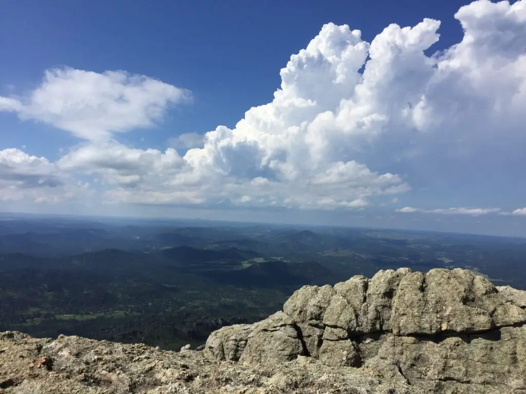
A grey, rocky cliff in the foreground overlooking tree-covered mountains and plains stretching to the horizon far below, all under puffy, white clouds in a blue sky.
It’s a long way down!

The other concern here is the weather.  It can change incredibly quickly.  It can also be drastically different here than the lower elevations in the rest of the park or the surrounding countryside.  The peak is solely made of granite rock, there are no trees for shade or protection.

While the hike does meander through the Black Hills National Forest, this portion of it was decimated by the pine beetle epidemic just a few years ago so there are many areas that were left bare of trees. So don’t expect a lot of shade to hide you from the sun in the summer. 

There is also little protection from the wind.  If a thunderstorm pops up while you’re on the mountain (which can frequently be expected during the afternoon in the summer months) you should immediately trek back down the trail and get to an area with more trees and protection!

What will you see on the Black Elk Peak Trail?

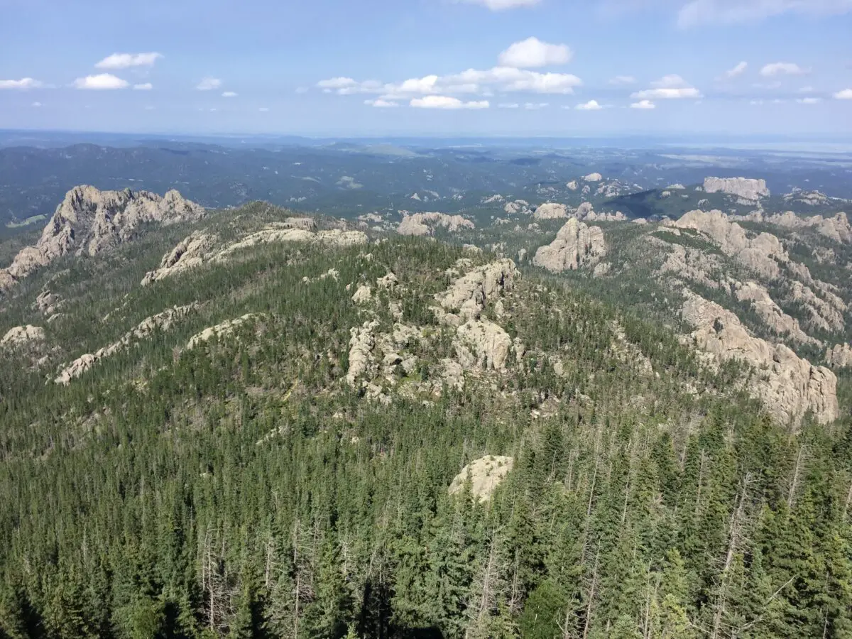
The panorama that greets you at the summit is unrivaled anywhere in the Black Hills (you’re taller than everything else so there is nothing to block your view! )  We are talking a 360-degree vista of the entirety of Custer State Park, the town of Custer to the south, Rapid City to the north, and the plains that spread to the east of town!  On clear days you may also be able to spot the Badlands, which is almost 100 miles to the east (bring your binoculars!)
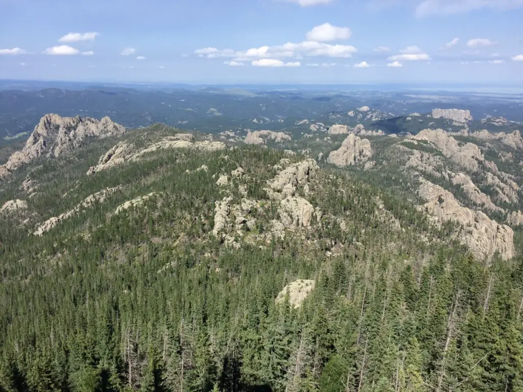
View from above overlooking an expanse of grey, rocky mountains covered in green pine trees. Lower mountains covered in trees and plains stretch to the horizon, all under a blue sky with puffy, white clouds.
The view from 7000+ feet high!

Much like the rest of the park, this route is the perfect place to see the wide variety of flora (plants) and fauna (critters) that call Custer State Park home.  These include mountain goats, bighorn sheep, deer (both whitetail and mule), elk, chipmunks, and the squirrels who will chatter at you along the way.  There are also coyotes, mountain lions, and bobcats, though you are less likely to see these shy animals. 

Harney Fire Tower

There is an incredibly picturesque fire tower at the top of the peak and to my knowledge, it still bears Harney’s name.  It was built in the 1930s and rumor has it the infamous burrows that can be spotted in other portions of the park are descendants of the pack animals who were used when the fire tower was in service.  The tower is no longer in operation, but it is still maintained and can be climbed!  For more info on the tower, click here!
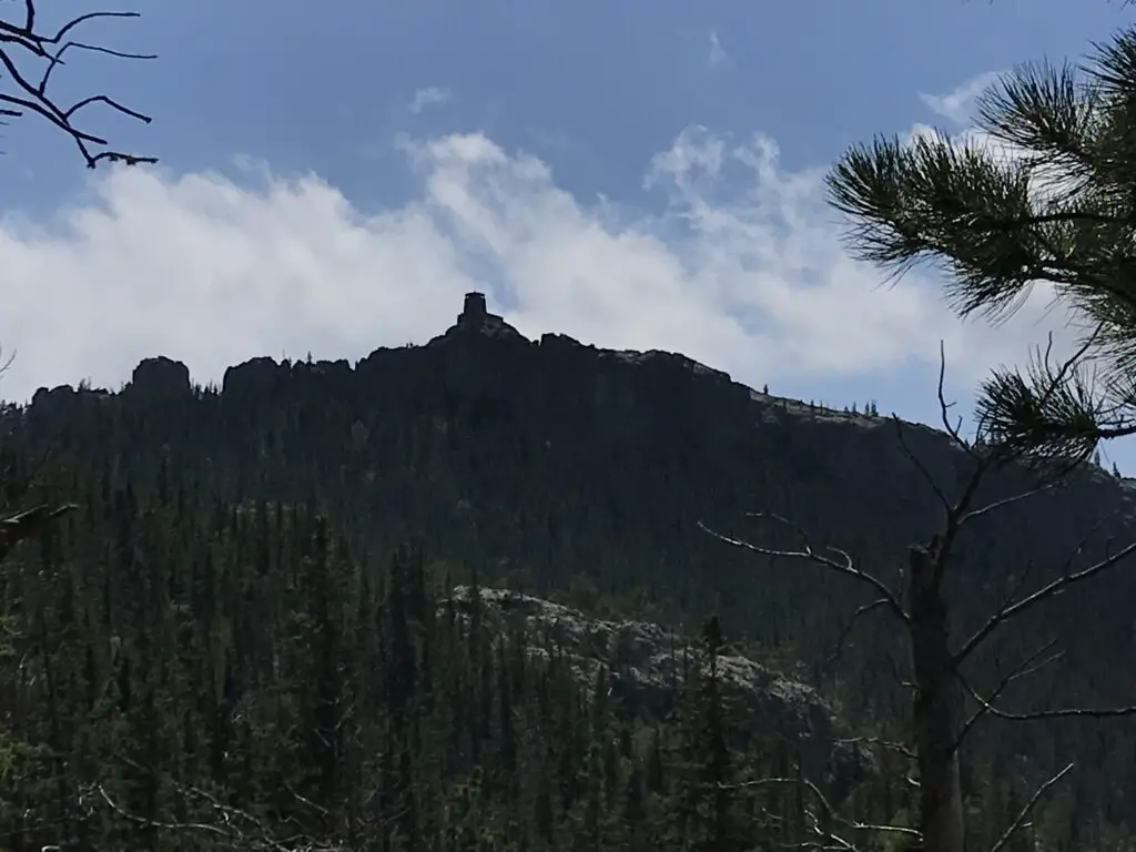
View from below: dark silhouette of a rocky, castle-like fire tower on top of a rocky, tree-covered mountain.
First glimpse of the Harney Fire Tower!

This trail is not “easy” but it is quite doable for almost any able-bodied hiker.  Plan to spend an entire day at Sylvan Lake and hiking the Black Elk Peak trail, it is most definitely worth that much time!  Enjoy the trail, appreciate the summit and the splendid beauty of the Black Hills that surround you.  This is a fun trek with incredible views and I would encourage anyone who has even the slightest interest in hiking to try it out!  You’ll be glad you did!

Have you enjoyed the “easy” hike up Black Elk Peak? Tell me about your experience in the comments! 


Did you enjoy this post?  Pin it!

View from above overlooking an expanse of grey, rocky mountains covered in green pine trees. Lower mountains covered in trees and plains stretch to the horizon, all under a blue sky with puffy, white clouds. Pin reads, "Hiking Black Elk Peak Trail #9: the Easy Way."


Like what you read here today?  Please feel free to leave a comment, like or share this post!  Add your email at the bottom of the page, or the sidebar to the right, to be notified when a new post is published.  By signing up for the email list, you will also receive a free copy of the Tranquil Trekker’s Top 10 Tips of Trekking Do’s and Don’ts!

You can also follow the blog on social media by clicking the links below!
Facebook

Twitter

Instagram

Pinterest

Grizzly Bear Creek Trail in the Black Hills

In this post, I review the Grizzly Bear Creek Trail which is located in the Black Elk Wilderness near Custer State Park!


I’ve mentioned before how much I enjoy hiking in the Harney Range and the Black Elk Wilderness area of the Black Hills.  Well, the Grizzly Bear Creek Trail is one of my favorite routes in that locale.

Because this trail is located in the wilderness area, it isn’t maintained as much as the surrounding national forest.  There isn’t a lot of logging here and ranchers aren’t able to use this land to graze their herds, so you don’t have to worry about the “leavings” of cows.  There also aren’t any people living nearby.  Therefore, it’s really just left to Mother Nature.  It’s natural, beautiful, and rugged.

What will you see on the Grizzly Bear Creek Trail?

This path is interesting because it doesn’t really “go” anywhere, per se.  It’s really just a connector trail that meanders through the lower-lying areas of the Black Elk Wilderness.

This trail isn’t one of the more popular ones in the Black Hills so it’s rarely busy, no matter the time of year.  It also tends to be VERY pretty, as it traverses canyons and valleys.  A bubbling creek also accompanies you along much of the route’s length, which makes a pleasant accompaniment to your hike.  It usually has water in it which can be rare in this part of the country (many local waterways dry up at certain times of the year).

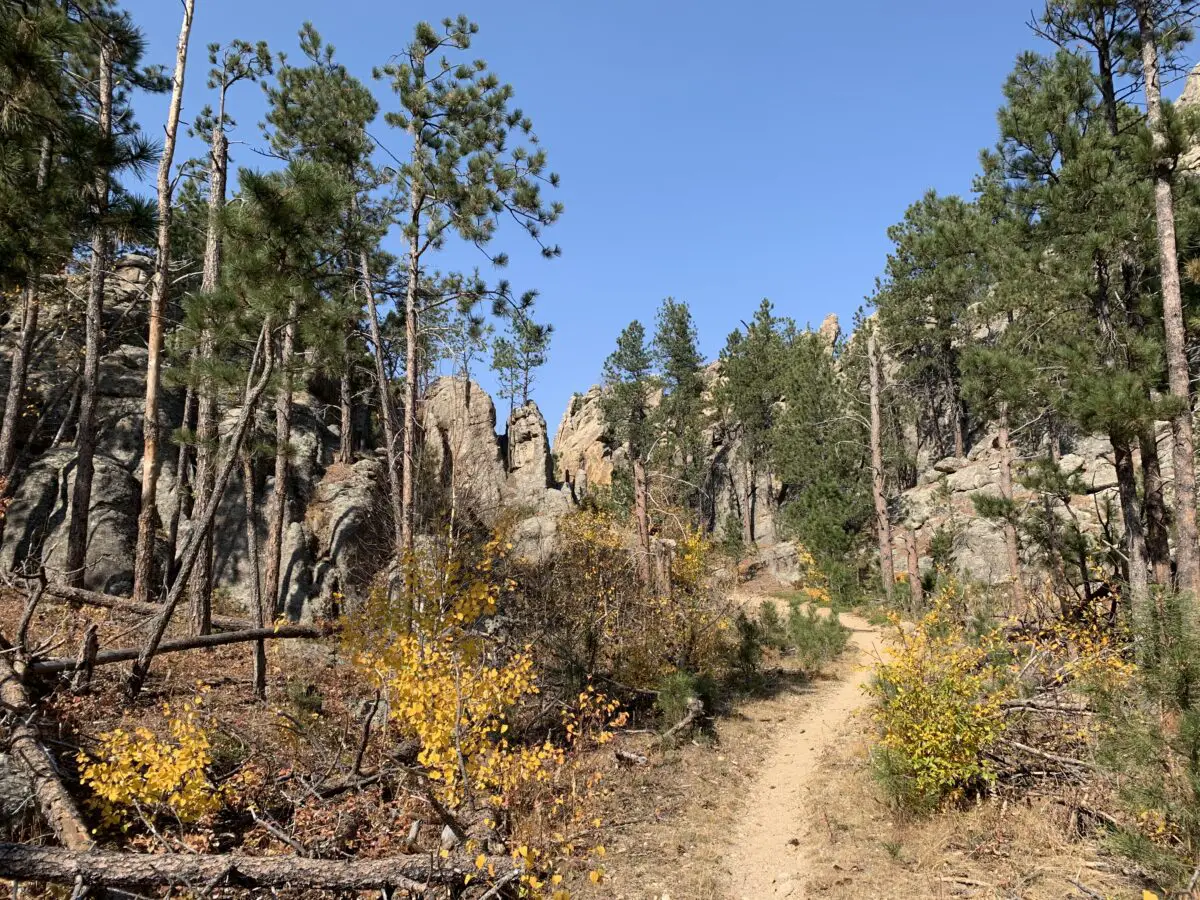
The constant presence of water means this is a more verdant part of the Hills in regards to foliage and it’s a beautiful and colorful area to visit during the fall.  This is also one of the easier trails found locally, with just simple, rolling hills to challenge you.  In addition to the lovely foliage, you will also be treated to views of the towering spires and imposing rock walls created by the granite the Black Hills is known for.

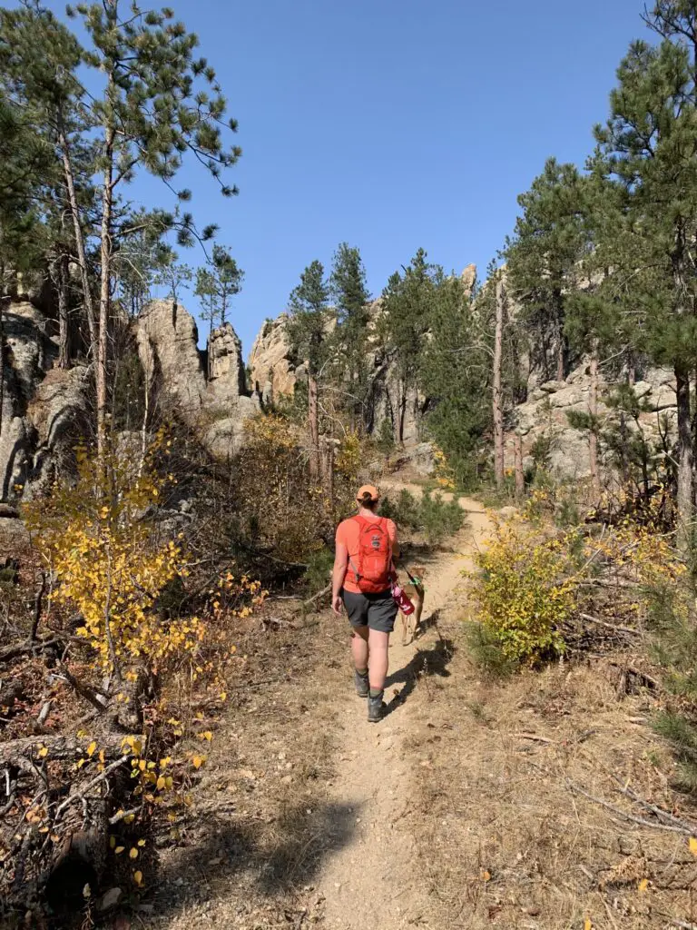
Rear view of a woman and dog walking on a dirt path that meanders through green, pine trees, yellow-leafed plants and rock towers, all under a clear, blue sky.
Puppers and I enjoying the trail!
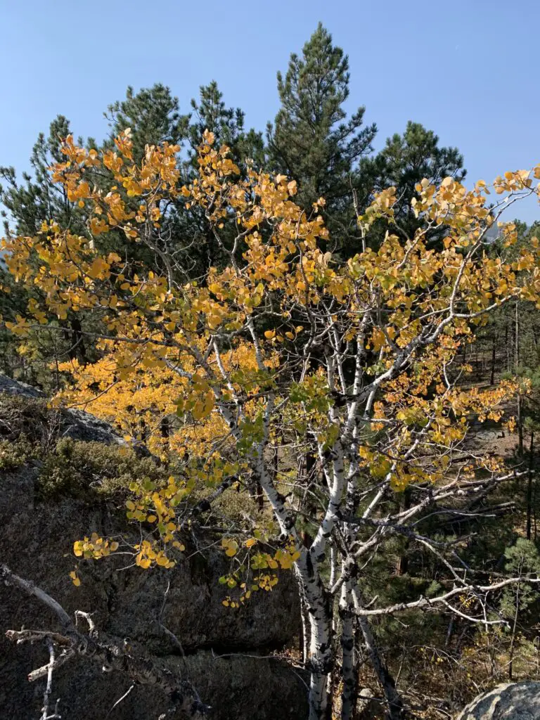
Yellow leaves on a tree with green, pine trees behind it
The aspen trees were lovely!

Where is the Grizzly Bear Creek Trail?

The Grizzly Bear Creek Trail does have a trailhead of its own.  You will find it off of Forest Road 345 after it branches off of State Route 87 (also called the Needles Highway) in the northern portion of Custer State Park.  As it is a connector trail you can also access it from a number of other routes in the Black Elk Wilderness, including the Black Elk Peak Trail (formerly the Harney Trail), the Centennial, the Horsethief Lake, and the Norbeck Trails.

How long is the Grizzly Bear Creek Trail?

The trail is about 13 miles in total length.  If you just want to hike portions of the route, you can do out-and-back treks, or you can connect this path with several other trails in the local area to make a variety of loops.  These can be shorter, day hikes or longer, multi-day backpacking trips.  All of them make for a great way to see the rugged beauty of the higher elevations of the central Black Hills.

Related posts:  Great Hikes in the Black Elk Wilderness; Black Hills Blackberry Trail, near Mt. Rushmore

When is the best time of year to hike the Grizzly Bear Creek Trail?

While the Grizzly Bear Creek trail can be enjoyed at any time of the year, the warmer months are a better time to access it.  It would be beautiful in the winter, though it would be difficult to get to the trailhead as neither the forest road nor the Needles Highway is maintained during the snowy season.  As this is one of the highest elevation areas in the Black Hills, you should also expect to encounter, potentially, feet of snow throughout much of the winter.

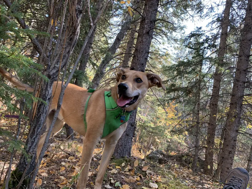
A dog pants while standing in the forest on dirt and downed, brown leaves.
This trail is Puppers approved!

Because you are so close to the creek for much of the trail’s route, there are also a number of water crossings along its length.  You should be prepared for this and have either waterproof shoes or footwear you don’t mind getting wet.

Some of the crossings have rocks you can hop across, though the availability of these will depend on the depth of the water, which can vary greatly throughout the year.  These stones can also become mossy and slippery so you should use them with caution.

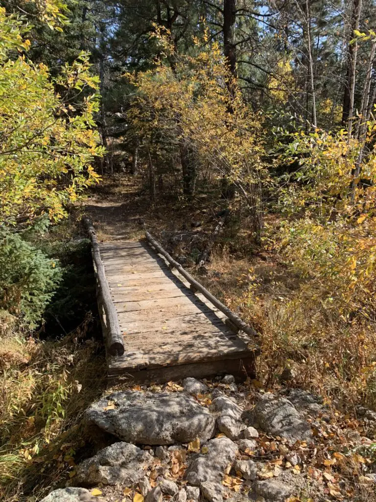
A wooden footbridge crosses a small, dry creek, surrounded by fall-colored trees and leaves in the woods.
A bridge across the creek!

If you’re looking for a less-traveled but beautiful hike in the Black Hills, check out the Grizzly Bear Creek Trail!

Have you ever hiked this trail?  What did you think?  Tell me about it in the comments!


Did you enjoy reading this post?  Pin it!

3 pictures: 1) A wooden footbridge crosses a small, dry creek, surrounded by fall-colored trees and leaves in the woods; 2) Yellow leaves on a tree with green, pine trees behind it; 3) A dirt path that meanders through green, pine trees, yellow-leafed plants and rock towers, all under a clear, blue sky. Pin reads, "Black Hills Grizzly Bear Creek Trail"


Like what you read here today?  Please feel free to leave a comment, like or share this post!  Add your email at the bottom of the page, or the sidebar to the right, to be notified when a new post is published.  By signing up for the email list, you will also receive a free copy of the Tranquil Trekker’s Top 10 Tips of Trekking Do’s and Don’ts!

You can also follow the blog on social media by clicking the links below!
Facebook

Twitter

Instagram

Pinterest

Black Hills Blackberry Trail, near Mt. Rushmore

In this post, I review the Blackberry Trail in the Black Elk Wilderness!


The Blackberry Trail is a great hike into the Black Elk Wilderness.  This trail is fairly unknown, which is ironic because it sits directly across from one of the biggest tourist spots in the Black Hills, Mount Rushmore!

Where is the Blackberry Trail in the Black Hills?

The Blackberry trailhead is found in an old gravel parking area (that is sometimes roped off) directly across the road from Mt. Rushmore.

If the gravel parking area is roped off, you can actually park in the Mt. Rushmore parking deck. (This means you will have to pay the parking fee at the site. It used to be that once you bought a pass it was good for a year.  Now it’s only good for the day. 😛–Insert rant here, from Mr. Trekker, about the evil, automated kiosks they installed to replace humans 😂.)

We had interesting weather the day we trekked this trail, typical of spring in the Black Hills.  It was windy, with precipitation varying between light rain, heavy snow showers, and pelting mini-ice balls!  This was all mixed in with blue sky and warm sun, and we experienced all of these conditions within about 30 minutes of each other! 😛

Bring Extra Clothes when Hiking

As we were navigating the route, Mr. Trekker proved why you always bring extra supplies along, especially a change of socks!  You never know when you’re going to slip off a mossy rock and fall knee-deep into a swollen creek!

(I can’t make fun of him too much, he was actually trying to find an easy way across so he could then help me across. 😳  Of course, if he had listened to his wife and taken the route I suggested in the first place…😉.)

The water level seemed much higher than usual, as many of these creeks are just suggestions in drier times.  With the recent snowmelt and wet conditions of spring, the local waters were definitely running higher than normal.

What you’ll see on the Blackberry Trail

This is an absolutely GORGEOUS trail!  While it does climb the majority of the way, the route undulates through the hills and beautiful canyons that are common in the Black Hills National Forest.  There were a few lengthy, steep spots, but for the most part, they didn’t become overbearing.  The first half mile or so of the trail actually runs downhill. (You know what that means for the return trip!  Everyone loves a good, uphill climb to finish! 😛)

We did an out-and-back trek, taking the Blackberry Trail south to where it meets up with the Centennial Trail (just in the last few years, this portion of the route earned the classification of a National Recreation Trail.)  Then we took the Centennial Trail south, to its junction with the Grizzly Bear Creek Trail, which I discuss in this post.

I’m not sure why it’s called Grizzly Bear Creek. There may be been grizzlies in this area at one time, but that was MANY years ago (we’re talking centuries. 😛)

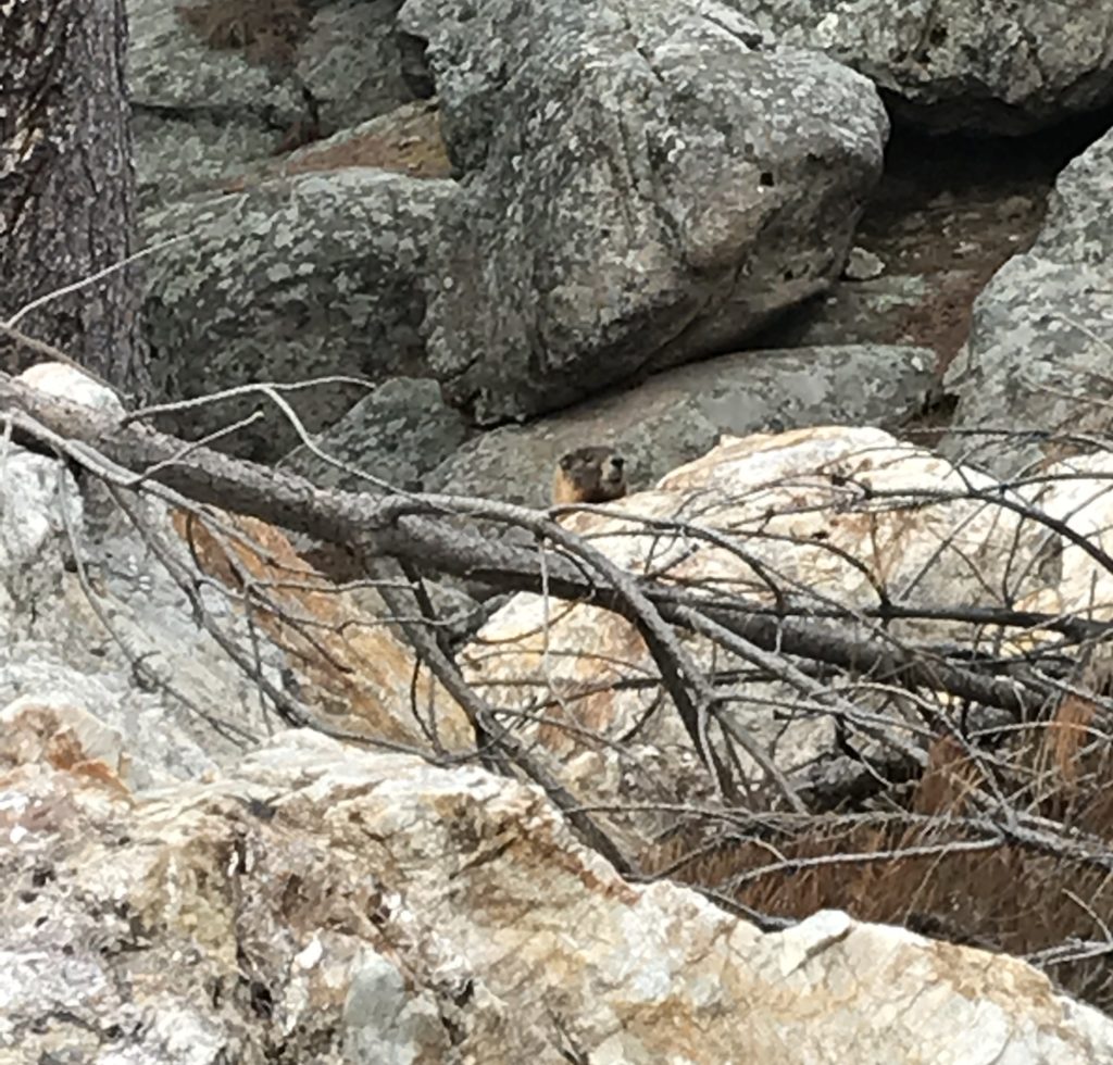
A portion of the way, the path runs along with Grizzly Bear Creek, which helps to make it so picturesque.  There were numerous water crossings and very few bridges throughout the trek.  Again, in drier times of the year, this may not be an issue, but I would recommend wearing either waterproof hiking boots or sandals you don’t mind getting wet if you’re planning to tackle this hike.  Also, be on the lookout for mountain goats and marmots, as they tend to frequent this area!

A marmot peaks it's head over some boulders
Marmot!
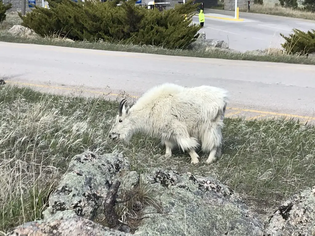
Mountain goal eating grass on the side of the road
You see these guys A LOT at Mt. Rushmore!
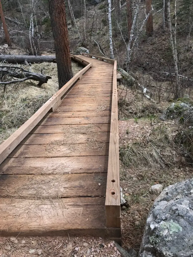
A boardwalk traverses the forest floor
One of the only bridges we encountered. It was quite picturesque!

How Long is the Blackberry Trail?

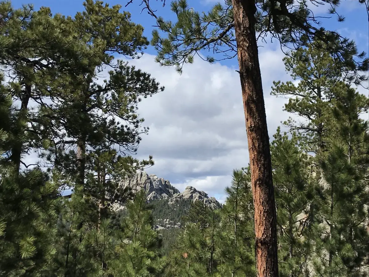
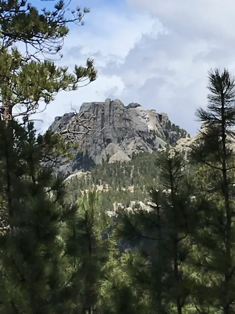
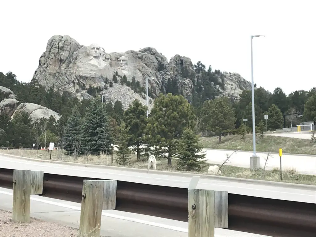
This route was about eight miles, out-and-back.  Not a bad day’s hike for us, though you could easily make it shorter or longer, to suit your tastes. Depending on how adventurous you are, this is a great area for backpacking, as it would allow you more time to fully explore the various trails that wander through the Black Elk Wilderness Area.  One other unique thing about this trail is that it offers cool views of Mt. Rushmore along the way!

Mt. Rushmore as seen through a break in the trees

Harney Range in the Black Hills National Forest

I know I’ve mentioned it in the past, but I LOVE hiking in the Harney Range.  The granite mounds and spires that are frequently found throughout the area give the region its own, unique flair.  The Ponderosa Pines that grow here allow a lot of light through their branches.  Also, the drier conditions (usually) found in the Hills lend themselves to little or no undergrowth on the forest floor. This means, even in the midst of the forest, you can actually see for quite a distance.

This is pretty unique compared to many forests we’ve visited.  Some areas of Colorado and Wyoming are similar, but these definitely contrast with forests that you find in many other parts of the country.  Most of those are comprised of dark, foreboding woods with trees so thick it’s hard to see between them.  Even in North Carolina, with the almost-tropical plants and ferns that covered the forest floor, it was easy to lose the trail.

There are all sorts of trails winding around the Black Elk Wilderness.  These aren’t the big trails that all the tourists hear about throughout the Wilderness Area and Custer State Park, though many of these do connect with the better-known trails, such as Black Elk Peak Trail, Trail #9 (formerly the Harney Trail) or the Cathedral Spires/Little Devil’s Tower Trails.

But if you’re looking for a nice, afternoon jaunt through the woods on a warm day, these are perfect.  Because they aren’t as well known, they tend to be far less crowded.  They aren’t overly difficult either.  I would give the majority of these side trails a moderate rating, with some strenuous spots.  They are sometimes single-track, rather than wide and graded, and you do have to watch for roots and rocks that you may need to clamber over or around.  But there aren’t any large, rocky areas that need to be navigated.

More pics from our day on the Blackberry Trail!

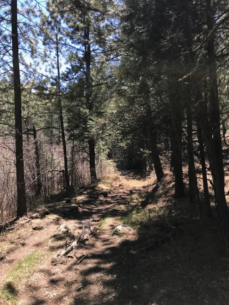
A dirt hiking trail forms a tunnel between the trees
I LOVE “tunnels”!
Mountain goats on the side of the road with Mt. Rushmore in the background
Our “Greeter” at Mt. Rushmore!

So the next time you’re looking for an interesting hike in the Black Hills, consider one of the lesser-known trails in the Black Elk Wilderness like the Blackberry Trail.  You may be surprised how much you enjoy these hidden gems!

Have you enjoyed this trail or do you have any questions on how to reach it?  Feel free to leave your experiences or any questions in the comments!


Did you enjoy this post?  Pin it!

A boardwalk in the woods with the title "Blackberry Trail"

Like what you read here today?  Please feel free to leave a comment, like or share this post!  Add your email at the bottom of the page, or the sidebar to the right, to be notified when a new post is published.  By signing up for the email list, you will also receive a free copy of the Tranquil Trekker’s Top 10 Tips of Trekking Do’s and Don’ts!

You can also follow the blog on social media by clicking the links below!
Facebook

Twitter

Instagram

Pinterest


Hike the Norbeck Trail in Custer State Park

I review the Norbeck Trail, a low-use trail in the higher elevations of the Black Hills, near Custer State Park.


The Norbeck Trail is a beautiful, lesser-traveled hiking route situated within the Black Elk Wilderness.  This is found within the boundaries of Custer State Park in the Black Hills of South Dakota. 

How do you get to the Norbeck Trail in Custer State Park?

There are actually two trailheads to access the Norbeck Trail:

If you want a shorter hike and want to hit the more difficult, steeper sections sooner (while you have more energy) the Upper Norbeck trailhead comes first. It is located about .3 miles east of Sylvan Lake and about .1 miles east of the trailhead for the Cathedral Spires (all on the Needles Highway, Route 87.)

It’s kind of hard to find the trailhead because you can’t see it from the road and there isn’t any sign. Basically, once you pass the trailhead for the Cathedral Spires, start watching for a paved lane going off to the left. That’s the trailhead. (Sorry, that’s about the best description I can give. 😝)

To reach the main Norbeck trailhead, take Route 87 to Forest Road 345 (Camp Remington Road).  Then take Iron Creek Horse Camp Road (which will be on your left).  Watch for signs for the Iron Creek Horse Camp and the Iron Creek Centennial Trailhead as they’re both, also, found on this road.  You will actually park at the horse camp, or just outside of it if the gates are closed (when we were there in mid-April the campground was still closed for the winter.)

Note: the Needles Highway is closed to vehicle traffic during the winter months. You can hike, snowshoe or ski it though (which can be a lot of fun!) 

What you will see on the Norbeck Trail, in the Black Hills

The trail is comprised of picturesque, rolling terrain.  It’s well-marked and wide enough for two people to walk side-by-side in some places.  There are several water crossings that are small enough that they’re easy to cross but big enough to offer relief and respite on a hot day. 

The ecology found along the length of the trail varies greatly from moist, almost temperate rainforest near the base, to dry, alpine forest near the top. 

As you trek through these various ecosystems take note of the abundance of spruce trees in certain areas–usually on the northern slopes–that denote a wetter climate (you usually only see this variety in wetter locations in the Hills.)  

What is the difficulty level of the Norbeck Trail?

The route is steep in parts, but the elevation changes are fairly moderate until you near the terminus of the trail where it joins with the Little Devils Tower trail.  These last 2.5 miles of the trail gain 1000 feet in elevation! (To compare, we gained the same elevation amount on the Misty Moon trail in the Bighorn mountains of Wyoming over the course of five miles!) 

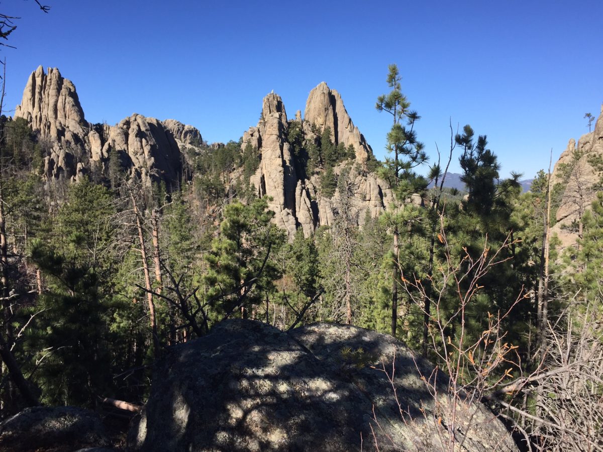
This more difficult area is beautiful, though, as it snakes through a canyon complete with rocky, craggy overhangs and caves.  You’ll see the backside of the Cathedral Spires towering over you to your left, and if you turn around you will be treated to beautiful views of the Southern Hills and plains to the south.

A word of advice: never let your focus on completing a trail keep you from looking around–and behind you!  You never know what incredible views you may be missing if you’re solely focusing on the trail in front of you.

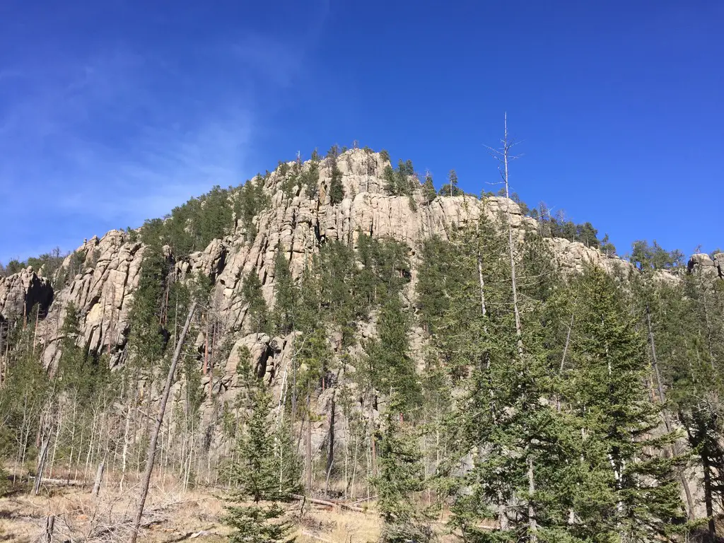
Pine trees and tree-covered mountains. Spindly rock on top of a mountain are in the far background
The rear view of the Cathedral Spires.

This trail doesn’t really “go” anywhere, per se, it’s more of a connector to other notable trails.   It can be combined with different routes to form various loops depending on how long you wish to spend in the Wilderness Area.  From the trailhead to the junction with the Little Devil’s Tower Trail, the route is a little over five miles (one way)–and as mentioned above it gets steep–so plan for a full day’s hike when considering this option. 

We really enjoyed the hike and the ever-changing scenery was beautiful.  There were some gorgeous vantage points and numerous opportunities for wildlife sightings.  This trail is less well-known and, therefore, more secluded. 

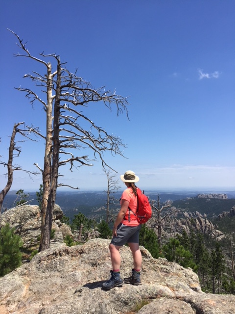
A portion of the trek does run near Route 87, for a time, so the summer months may be busier.  Certain areas of the trail also traverse old burn scars so, if traveling in the summer, be prepared for lack of shade and a hot hike in some parts.

Person stands in an open space amongst deadfall of trees. A few scraggly pine trees remain standing. Rock mountains are in the far background
You can see the sparseness of the shade in some areas.

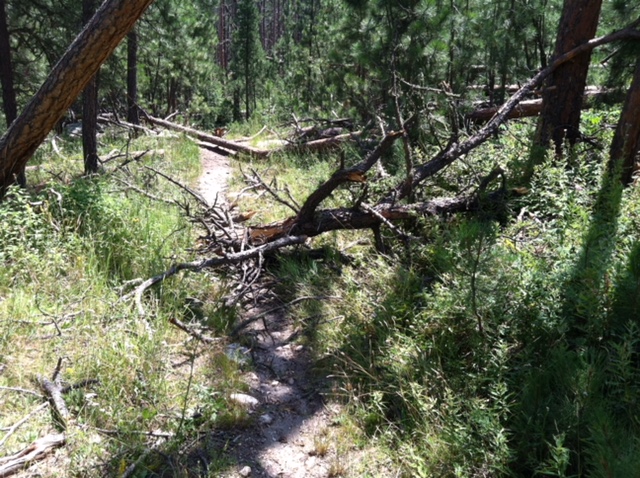
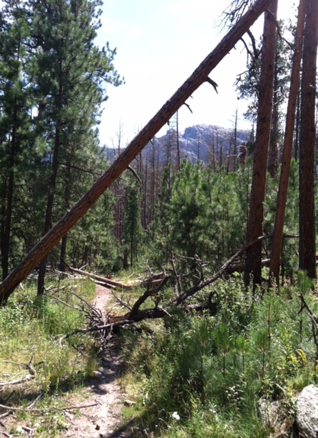
As with many other areas in the Black Hills, be watchful for deadfall as well as dead trees that remain, precipitously, standing (and their hanging, broken branches).  These are remnants of the recent pine beetle infestation, and they can fall at any time, even on not-so-windy days.    

A few scraggly pine trees standing amonst deadfall. Rock mountains are in the far background
Damage from the recent pine beetle infestation

If you’re looking for a fairly easy day hike, with nice views and few people, consider the Norbeck Trail!  

Have you ever hiked this lighter-use trail?  If so, tell me about your experience in the comments!


Did you enjoy this post?  Pin it!

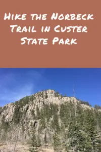
Picture of a rocky mountain sparsely covered by trees and a blue sky overhead. Pin reads, "Hike the Norbeck Trail in Custer State Park."


Like what you read here today?  Please feel free to leave a comment, like or share this post!  Add your email at the bottom of the page, or the sidebar to the right, to be notified when a new post is published.  By signing up for the email list, you will also receive a free copy of the Tranquil Trekker’s Top 10 Tips of Trekking Do’s and Don’ts!

You can also follow the blog on social media by clicking the links below!
Facebook

Twitter

Instagram

Pinterest

Black Elk Peak, Trail #9 (the Difficult, Northern Route)

In this post, I detail our attempts to conquer Trail #9, the difficult/northern route up Black Elk Peak.


Black Elk Peak, formerly Harney Peak, is the highest point in the Black Hills and one of the most sought-after hikes in this area. 

In case you aren’t aware of it (and as I outlined in this post), the name of this mountain changed just a few years ago and they’re still working on updating all the signs and maps.  

There are multiple trail options for getting to the summit.  The most popular route is the southern portion of Trail #9, the Black Elk Peak Trail, that starts at Sylvan Lake.  However, in this post, I’m going to talk about the far less-traveled (and far more difficult) northern portion of this same trail.

It is a little confusing because the names are the same.  Be watchful for this (there are signs!)}  This portion of the trail is actually shorter than the southern route, but it is far steeper, which is why it is more difficult.  

Accessing the Black Elk Peak Northern Route Trailhead

There are a number of ways to access this portion of the trail.  One of the easiest is from the Willow Creek Horse Camp off of Route 244.  You will find it directly across the road from the Mount Rushmore KOA campground (and around six miles west of Mount Rushmore. 

The Willow Creek Trail is an easy and fairly short loop that makes for a great, quick hike.  It is only around two miles in length and you can enjoy it in either direction.  You will need to start on the Willow Creek Trail to reach the Black Elk Peak Trail which branches off about halfway through the Willow Creek loop.   

1st Attempt to Conquer Black Elk Peak, the Hard Way

We’re standing at Black Elk Peak, we’ve been on the trail for five hours, the guidebook we’d consulted said the trail options we chose were only around eight, total miles long.  We now KNOW that can’t be right as our GPS says we’re well over five miles into the hike and we’ve only reached the summit.  It’s 5 p.m. and…it’s starting to drizzle…  

We had used the Lost Cabin trailhead off Palmer Creek Road to ascend the mountain on this attempt.  We weren’t sure if we’d make it the whole way or just turn back at some point, but at lunchtime, we were nearly four miles in and the book had said it was only an eight-mile trek so…this is a lesson in listening to your gut.  When your guidebook (and/or GPS) say one thing, but while looking at the map and using human logic your gut says another…ALWAYS listen to your gut!  😝

Fortunately, it was Memorial Day weekend so we had guaranteed daylight until 8:30 pm or so, and we had headlamps with us. (This was one of the only, true, “uh oh” moments I’ve ever had on a trail.  The thought crossed my mind that we could be facing a long, cold night.).   

We did, eventually, make it down safely, and with daylight remaining.  We even managed to save one set of dry pants, each, to change into when we got back to the car!

After descending this trail in drier conditions, I’m somewhat impressed we made it down as safely and easily as we did.  Water trickles over the large, boulder steps on sunny days, so, on rainy days, it can turn into a veritable river in spots! 

The path is steep and technical enough on its own, in the rain and growing darkness, it can get muddy and slippery very quickly–portions of it literally turn into mini-waterfalls from water running down the slope!  I thank Mr. Trekker for suppressing my tendency to rush…I hate this trail.  😝  

This trail system is a beast!  Mr. Trekker and I almost had a dead limb fall on us on another, nearby trail during a hike a few years ago, on a day that wasn’t particularly windy. 😳

A large tree limb lies across a dirt path that meanders through the woods
This big guy is the one that almost fell on us!
IMG_0397
See the limb?  See the trail?  About five minutes before this fell we walked through this area.  We then stopped for some lunch and were startled by the “CRASH!” when it fell!

2nd Attempt to Conquer Black Elk Peak’s North Route

It’s a beautiful, sunny day.  We began hiking fairly early in the morning.  One problem with Trail #9 is its exposure.  It used to be fairly shaded…until the pine beetles had their way.  That and the resultant logging to lessen the danger of falling, dead trees has culminated in A LOT of sun exposure.  Fortunately, a breeze is often present…but not always…  

The heat got the Trekkers on this day (especially me).  I’ve mentioned before that I don’t do well with heat. We made it about halfway to the summit, to the point where it really starts to get difficult.

I call this “the Boulder Section” because you have to clamber across a long length of boulders while negotiating a rather steep incline–this is the section that becomes mini-waterfalls in wetter conditions.

After this section comes the first phase of mind-numbing switchbacks (that’s right, I said FIRST! 😝)  You then proceed to a flatter section, before the final phase of switchbacks, which takes you to the junction with the Black Elk Peak Summit Trail (a short, spur trail).  

About the time we reached the “Boulder Section”, I started suffering from stomach cramps and nausea, similar to what I experienced when I became overheated hiking in Glacier National Park several years ago.  Due to this, we made the wise decision to turn back…have I mentioned that I HATE THIS TRAIL?! 😩  

3rd Attempt…SUCCESS!!!

It’s a, fairly cool, July day (lower 80’s).  Earlier that week we had returned from a 10-day trip to the Colorado High Country that I outlined in these four posts.  Due to hanging out at 8000 – 10,000 feet throughout that trip, we were especially acclimated to the altitude. (Black Elk Peak, at a little over 7000 feet, is not only the highest peak in the Black Hills, but it is also the highest peak in the country east of the Rockies).  I honestly felt in my gut that if I ever hoped to vanquish this monster, this was the time to do it.  All conditions were perfect, we were both feeling great and it was a beautiful day!  

We made it through the easy, early section with no difficulty.  We happily said “hello” to others on the trail, and avoided the occasional “remnant” from horses that had gone before us. 🤥  We reached “the Boulder Section”…my first nemesis.  We conquered that fairly easily as well!  

Then, we reached the first section of switchbacks.  Fortunately, the shade was on our side at that time of the day.  It was starting to hurt…but we made it through.

The next section traverses a ridge that parallels Black Elk Peak, so it is fairly flat.  This is beneficial as it’s also fairly exposed.  

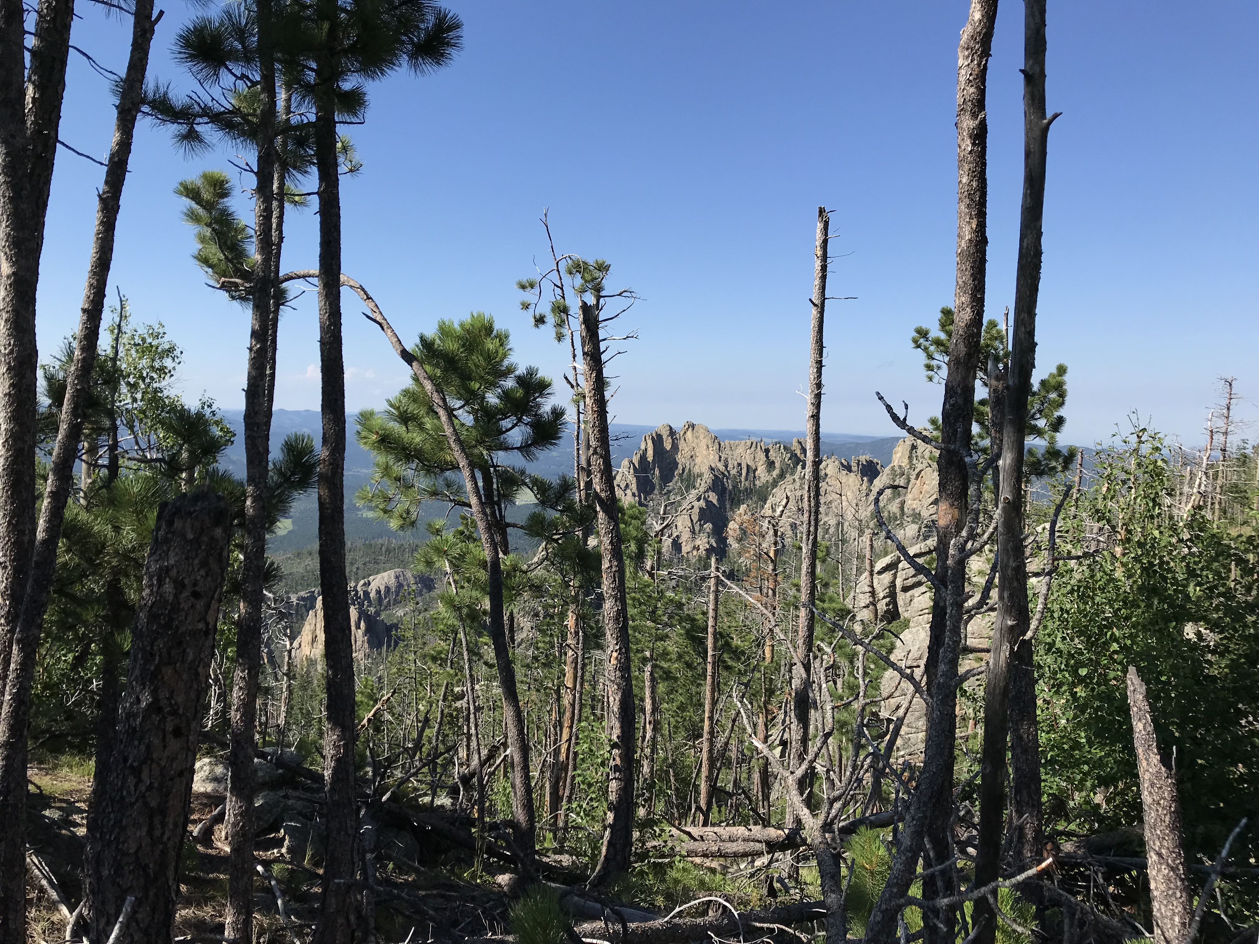
This area affords lovely views of the crags that lord over you from nearby peaks, and the panoramic vistas of the plains to the east (on clear days).  Buzzards soar on the thermals high above your head (waiting for beleaguered hikers to falter? 🤔) There are also several, lovely, lookout points along the way that make for a great break/lunch spot.  We stopped at a couple, both on the trek up and down the mountain.

Rear view of a woman in hiking gear, standing on a large rock, looking out over a mountainous vista, all under a blue sky.

Then…we hit the final section of switchbacks.  Both of us had just started feeling the altitude a bit (we were pushing 7000 feet at that point).  This was the only spot where I started feeling ill.  Fortunately, it was still early afternoon and we were in a shaded, quiet area, so we were able to take some time to rest and recover.  

And then…

…we began our final push…

…as we rounded one, final switchback…

…and crested one, final rise in the trail…

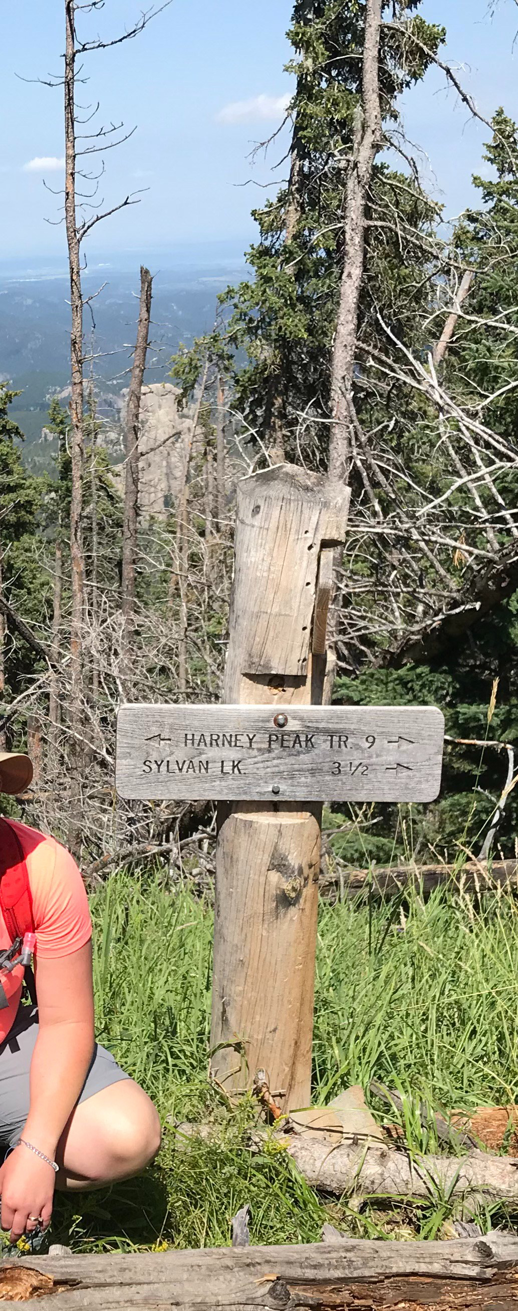
…we saw a brown sign appear in the distance, indicating our destination was just ahead…

…WE HAD MADE IT!!! 😁  

A wooden sign on a wooden post in the woods that reads, "Harney Peak, Tr. 9" and "Sylvan Lake 3.5", both with arrows pointing to the correct direction
My ray of hope, the sign at the top of the trail!

Seriously ya’ll, I almost broke down in tears!  I get emotional now, just thinking about it.  It had taken us three attempts to conquer this beast!

I maintain this is the toughest trail I’ve ever completed in the entire Black Hills.  It has a reputation for being “a doozy”.  It’s long, it’s difficult, it’s exposed, and the weather can change at a moment’s notice.  Fog and rain can seep in, which is an experience unto itself. (You won’t have the grand vistas that you’ll see on clearer days, but the granite columns materializing through the mist create a spooky gloom that is definitely worth experiencing, just watch your footing!)    

Descending the Northern Route of Black Elk Peak

On the way down…we ran out of water (seriously).  With the exception of another difficult trek in Glacier National Park, this almost NEVER happens!  We usually return with a liter or so left in each of our water bladders.  

It was projected to be a fairly cool day and we wanted to limit weight as much as possible– due to the strenuous hike–so we didn’t fill them quite to their max, fill line.  I will NEVER make that mistake, in July, again!  

Fortunately, by the time we ran out, we were only about 1.5 miles from the trailhead, it was all downhill from there and we had reached the easier portion of the trek. (Also, fortunately, a gas station in Hill City, the nearest town, had LARGE Gatorades for sale! 😜


Have I mentioned that I HATE this trail?!  I don’t think I’ve ever said that about a hike before.  I am SO GLAD that we finally beat this brute, but seriously, I don’t know that I’d do it again.  

I may consider it with two cars, one parked at Sylvan Lake so you can take the easy route up, and the other parked at Willow Creek trailhead as descending the hard route isn’t too bad…as long as it isn’t raining. 😝  (Or, find a nice friend who will shuttle you between the two points).  Or I would try ascending the Lost Cabin trail and descending this one again.  

Below are some pics from our day of achievement! 😁 (Thanks, as usual, to Mr. Trekker for some of these!)

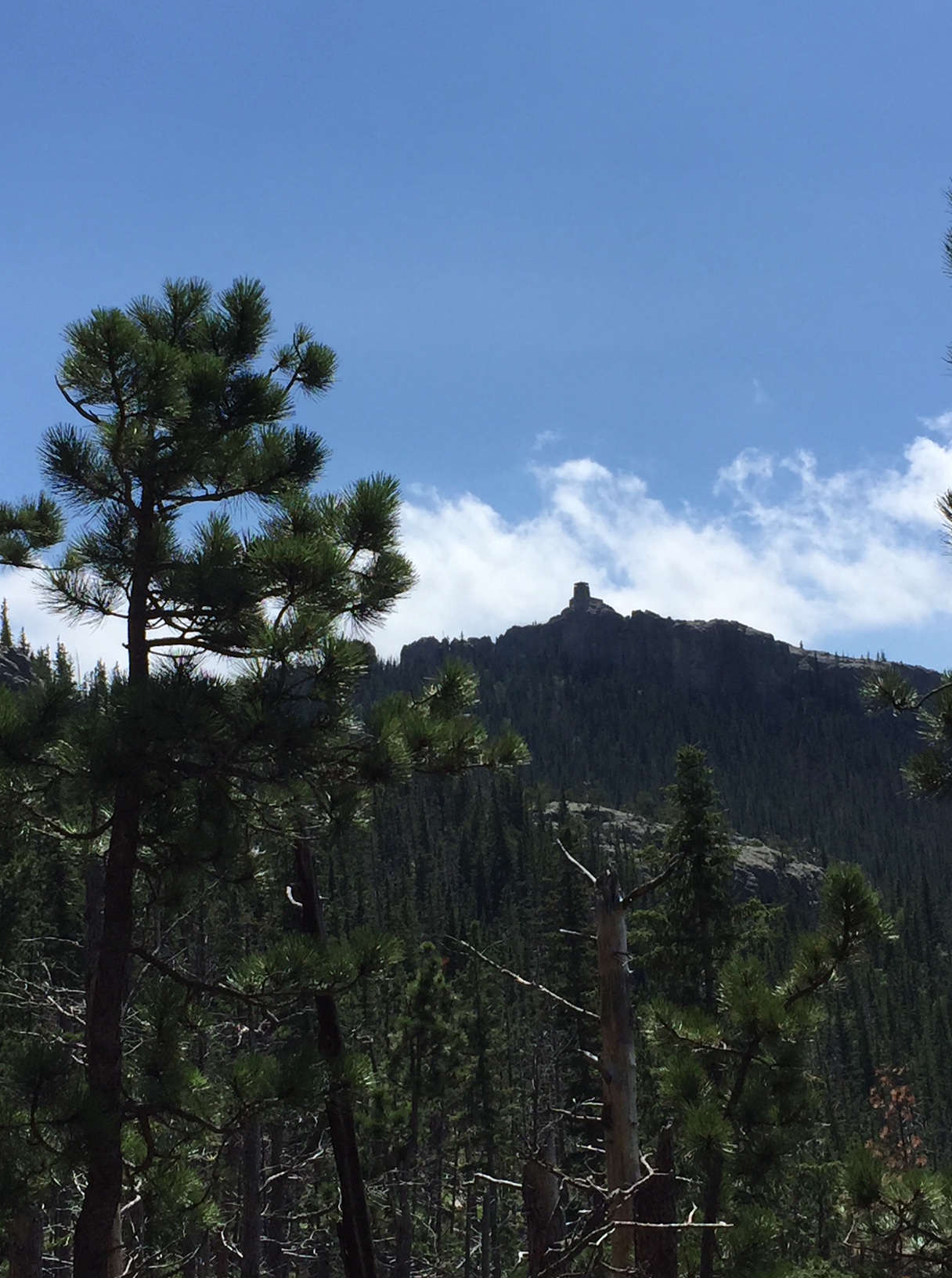
View over a forested mountainside with lots of dead trees. At the top of the mountain sits a silhouette of a stone building.
Our first glimpse of the fire tower on the summit!
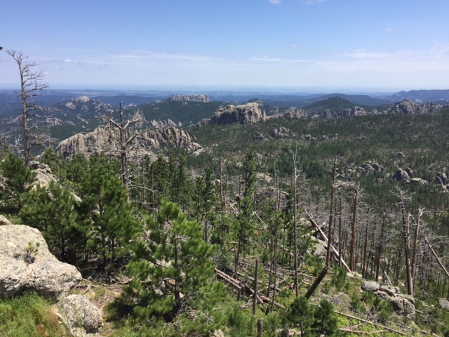
View over a forested, mountainside vista with lots of dead trees.
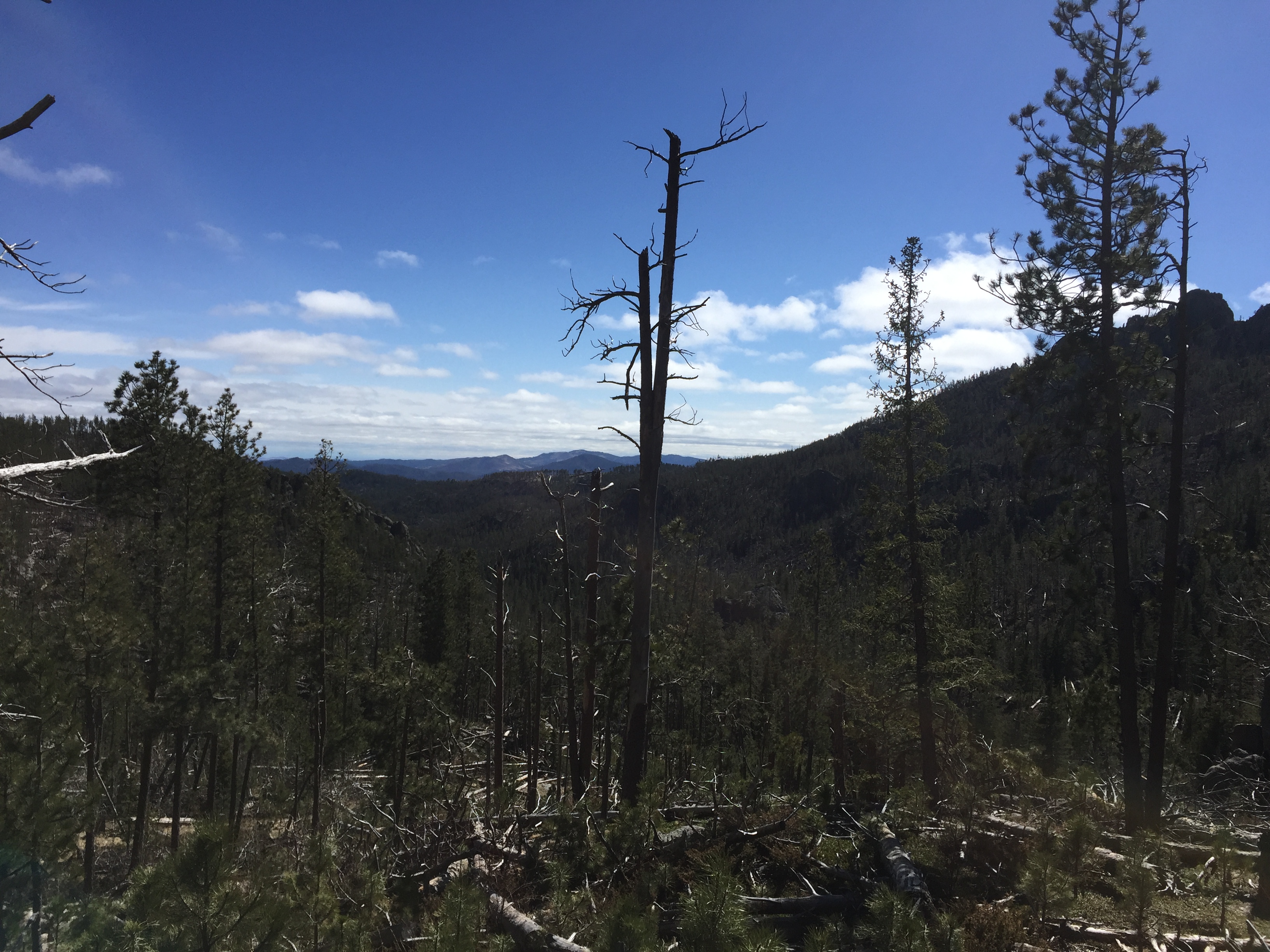
My Hills!  You can see the sparseness of the foliage in the foreground.
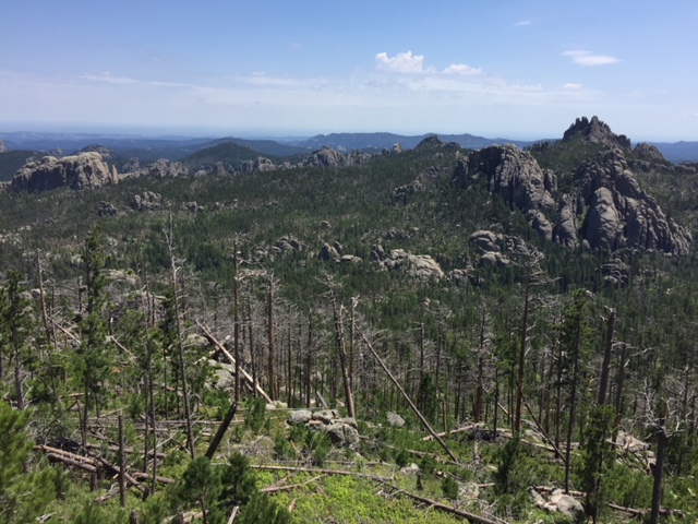
View over a forested, mountainside vista with lots of dead trees. Flatter plains are in the far background through the haze. Random, rock mountains rise from the surrounding forest.
If you look closely, you can see the plains, far in the distance.  I “think” one of those rock faces is the backside of Mt. Rushmore! 🤔
View through sparse pine trees of large, craggy rocks, all under a clear, blue sky
This view of the nearby crags is on the first set of switchbacks
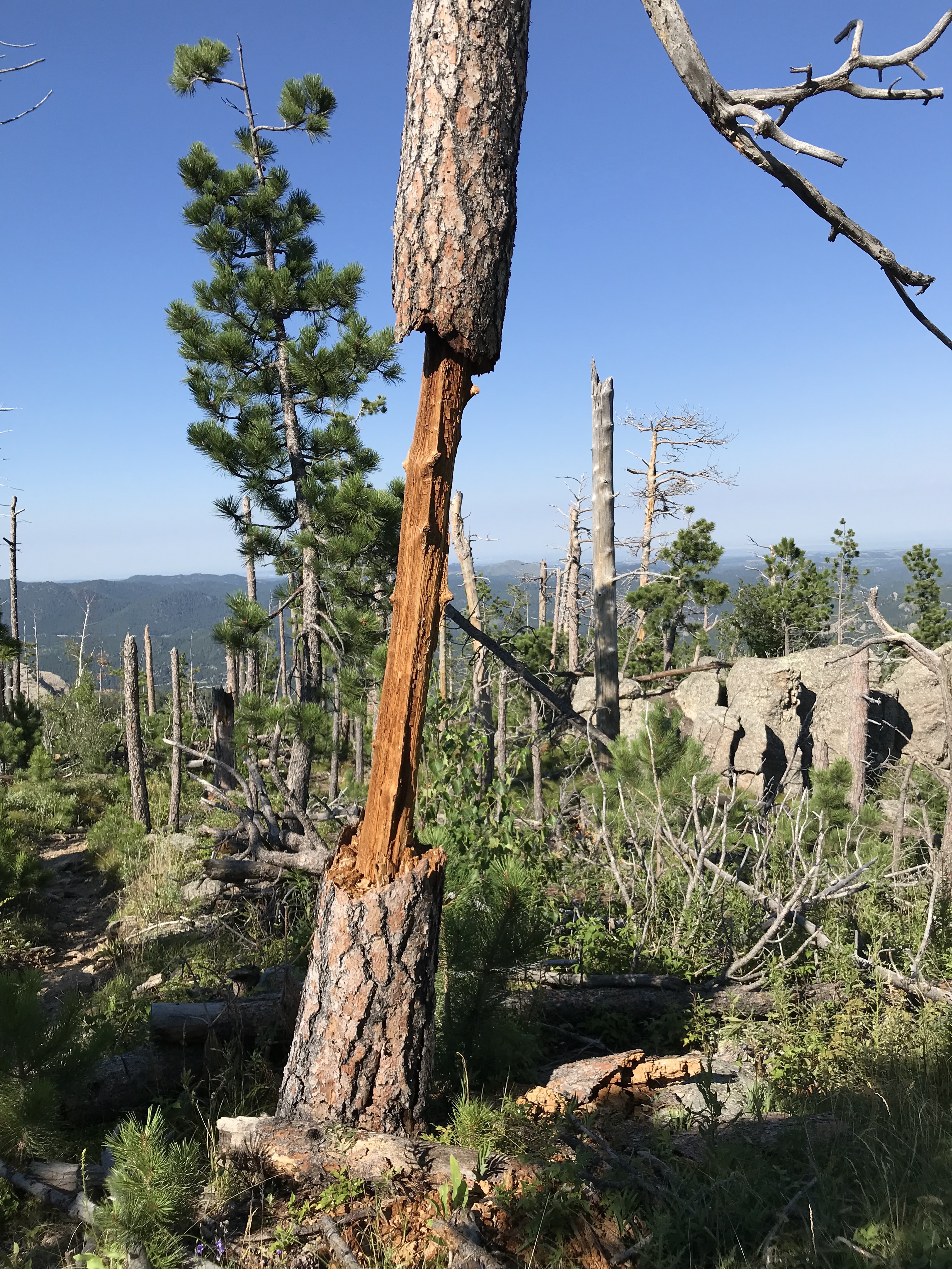
A standing, dead, tree trunk that has had the bark and most of the trunk chewed/whittled away in the middle, stands in the sparse forest, all under a clear, blue sky
Not really sure what happened here?!  Deer or elk perhaps?  Looks like somebody has been gnawing on it!

Conquer Fear by Reaching your Goals

This trail had beaten us twice before, but we had finally defeated it!  If we hadn’t already been acclimated to the altitude, it may have won again.  This was a personal goal of mine that I had wanted to achieve for years! 

This trail had made me sick, it left me with (several) blisters, it hurt me, it caused lingering anxiety to even think of attempting it again, and it pushed the limits of my endurance.  But…I beat it!  

Reaching this goal was an incredibly empowering, inspiring experience.  This was, truly, my “white whale”.  It’s hard to express my sense of accomplishment for finally completing this hike.  I know others have done it and claim it “isn’t that bad”.  I know it’s not a “14-er”, but so what?  I don’t hike “14-ers”! 😉  This was a personal goal and desire I had set for myself and I had achieved it!  What could be more empowering than that!

I don’t mean to sound like I’m bragging.  My point is just that, each person has their own, personal goals, whether they be to learn a new skill, to conquer a specific challenge, etc.  

Don’t compare yourself to others.  Only be concerned that you push yourself to expand your comfort zone.  It doesn’t matter what the goal is, as long as you strive to achieve it and, perhaps, find a way to trounce a few personal demons along the way.  👊

Have you attempted this trail?  What other difficult goals have you set for yourself and achieved?  Tell me about your experiences in the comments! 


Did you enjoy this post?  Pin it!

Rear view of a woman in hiking gear, standing on a large rock, looking out over a mountainous vista, all under a blue sky. Pin reads, "Hiking Black Elk Peak, the Difficult, Northern Route"


Like what you read here today?  Please feel free to leave a comment, like or share this post!  Add your email at the bottom of the page, or the sidebar to the right, to be notified when a new post is published.  By signing up for the email list, you will also receive a free copy of the Tranquil Trekker’s Top 10 Tips of Trekking Do’s and Don’ts!

You can also follow the blog on social media by clicking the links below!
Facebook

Twitter

Instagram

Pinterest

Great Hikes in the Black Elk Wilderness

In this post, I review some hiking trails found in the Black Elk Wilderness, in the Black Hills of South Dakota.


The Black Elk Wilderness covers a portion of the central Black Hills, in the Mount Rushmore/Horsethief Lake portion of the Harney range (now the Black Elk range) of South Dakota.  There are some great hiking trails that traverse this area!

Hike the Horsethief Lake Trail to Grizzly Bear Creek Trail in the Black Hills

One great option is to begin at the Horsethief Lake Trail.  The trailhead can be found at the Horsethief Lake Fishing/Rec area which is located off of Hwy 244, west of Mt. Rushmore.

Note: this is one turnoff east of the drive for the Horsethief Lake Campground. 

There is a larger parking area right at the lake. The trailhead is located at a small parking area just to the east of here–there is a sign. 

We took the Horsethief Lake Trail (Trail #14) to the Grizzly Bear Creek Trail (Trail #7) which traverses a lovely canyon area and parallels Grizzly Bear Creek for a time. 

This portion of the Black Hills is particularly vulnerable to storm damage as it was decimated by the Pine Beetle plague in recent years.  Due to this, there are several hazards to watch out for in this area, including blow-down sections of trees and falling limbs/trees if windy conditions are occurring. 

What you’ll see hiking through the Black Elk Wilderness

The hike was lovely.  Much of it traverses canyons, surrounded on all sides by towers of granite.  There are several beautiful, lookout points with views of the surrounding Hills and the prairie stretching far to the east.  The trail is in a largely wooded area so it would be fairly shaded in the warmer months, and as you climb there is usually at least a moderate, cooling breeze (that can be downright chilling in the cooler months). 

Portions of this trail are open to horses as well so be watchful for the equines (and be careful not to step in what they leave behind). 

The portion of the trail we completed was of moderate difficulty, was well-developed, and was fairly wide.  There weren’t many rocks/large steps to negotiate and while there were few trail markers, they weren’t needed as the path was evident. 

It should be noted that the lower part of the Horsethief Trail is frequently wet and muddy so waterproof shoes/boots are suggested.   In the winter/early spring, thanks to snow-melt and the nearby creek it is often extremely icy and slick.  This portion of the trail is located in a canyon under a canopy of trees so it doesn’t get much sunlight to melt the ice.   We have seen several inches of thick, hazardous ice on this trail in the early spring that required our Yaktrax to navigate safely.

Other trail loops in the Black Elk Wilderness

If you’re up to the challenge, a loop can be made of this trail using the Horsethief Lake Trail to the Grizzly Bear Creek Trail to the Centennial Trail (Trail # 89). This will then eventually take you back to the Horsethief Lake trail almost at the Trailhead (the loop can be completed in either direction).  This entire loop would be around 10 – 12 miles.  While this is within our ability level, we weren’t sure about the steepness/difficulty of the remainder of the trail, and daylight was growing short so we chose to stop at about the halfway point, have some lunch along the creekside, and return the way we had come. 

Numerous trails connect throughout the Harney (Black Elk) range. Depending on your skill level and how long you are willing to commit to being out in the wild you can hike any combination of these, ranging from a simple hike of a few hours to a backpacking trek of several days.

For those non-locals who may be wondering why I keep referring to this area as the Harney (Black Elk) range, I’ll explain.  Harney Peak is the highest mountain in the Black Hills (and the tallest east of the Rockies).  It stands out among the surrounding peaks of the Harney Range.  The Black Elk Wilderness area comprises much of this range. 

Black Elk was a Lakota, Holy Man who lived around the turn of the century, the Wilderness area is named after him.*  A few years ago, it was decided that Harney Peak would be renamed Black Elk Peak in honor of this great man and as a tribute to the local, Lakota culture.  As it has been such a short duration of time since the change, many of the books/maps regarding this local area (and the signs currently posted) will still carry the former name of the mountain/range.

*If you’re a history buff or just interested in American Indian culture, I highly recommend the book Black Elk Speaks by John Neihardt.  It’s a biography of the Holy Man’s life based on interviews Neihardt completed with him in his final years. It is a very interesting, fairly objective account of a man growing up in a changing world.  It discusses Black Elk’s nomadic life before General Custer and his soldiers arrived and the way this life changed after gold–or as Black Elk called it, “the yellow metal that makes white men crazy”–was found in the Black Hills.

Below are two pics that Mr. Trekker took of our hike:

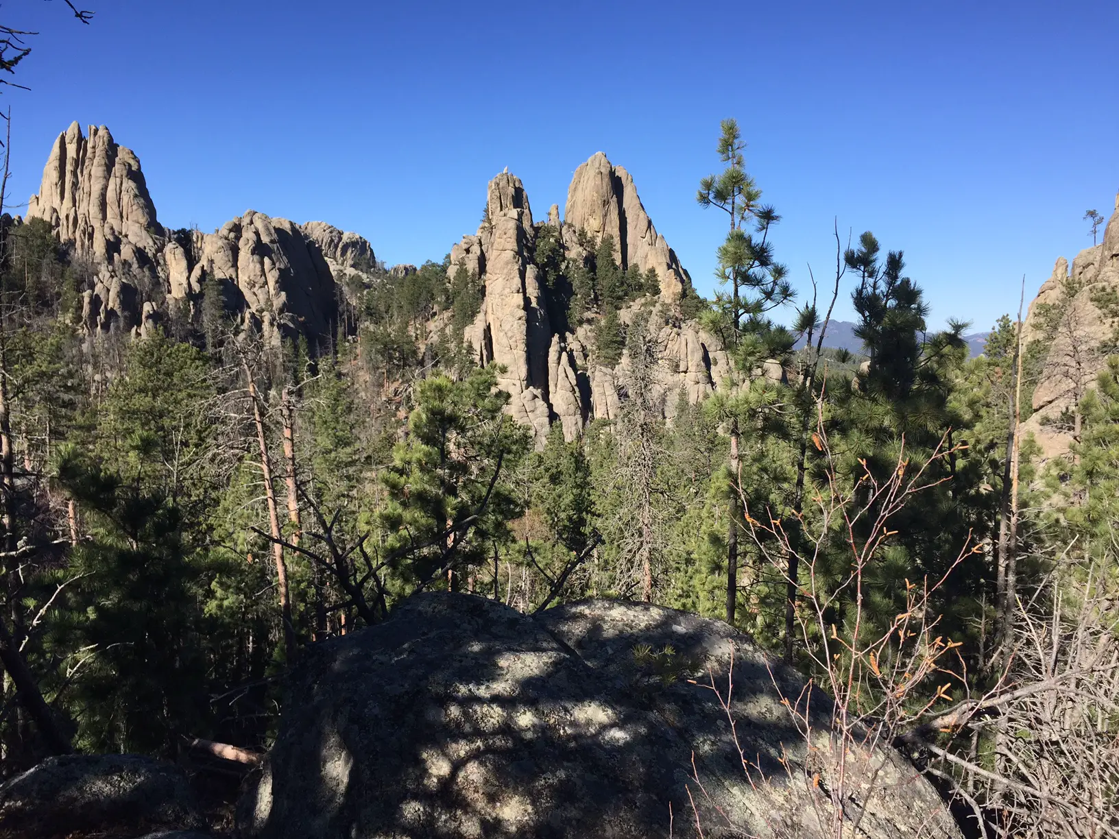
Rock spires rise above the green, pine forest, all under a clear, blue sky
The granite spires surrounding the canyon we were hiking in
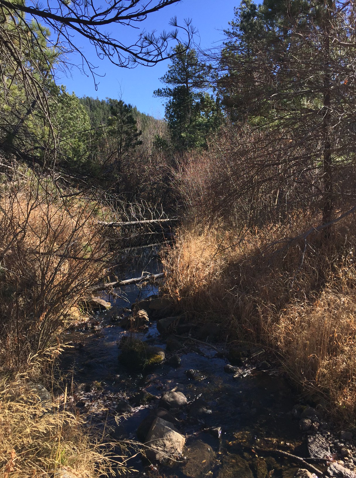
A fall scene. A small creek running through dry grass and bare trees, with green pine trees in the background, all under a clear, blue sky.
Grizzly Creek

Save/span</

For more information on other trails available in the Black Elk Wilderness, click here.

Have you hiked this portion of the Black Elk Wilderness? Tell me what you thought of the beauty here in the comments! 


Did you enjoy this post?  Pin it!

A fall scene. A small creek running through dry grass and bare trees, with green pine trees in the background, all under a clear, blue sky. 

Pin reads, "Great Hikes in the Black Elk Wilderness. Several hikes not to miss on your next trip to the Black Hills of South Dakota."


Like what you read here today? Please feel free to leave a comment, like or share this post! Add your email at the bottom of the page, or the sidebar to the right, to be notified when a new post is published. By signing up for the email list, you will also receive a free copy of the Tranquil Trekker’s Top 10 Tips of Trekking Do’s and Don’ts!

You can also follow the blog on social media by clicking the links below!
Facebook

Twitter

Instagram

Pinterest