Lake Helen, Bighorn Mountains, Wyoming

In this post, I review the Misty Moon trail starting at the trailhead at West Ten Sleep Lake and continuing to Lake Helen.


Are you looking for a moderate hiking trail that really lets you enjoy the wilderness of the Bighorn Mountains in Wyoming? Check out the Misty Moon trail from West Ten Sleep Lake to Lake Helen in the Cloud Peak Wilderness!

Where is the Misty Moon trail?

Trail #63, the Misty Moon trail, is one of the most accessible, main trails to access Cloud Peak and Bomber Mountain.  It starts at the trailhead behind West Ten Sleep Lake (this is also where the trail for Mirror Lake/Lost Twin Lakes begins.

To reach the trailhead take Forest Route 27 to where it terminates.  FR 27 is located off of US 16 in the southern Bighorn mountains.  You will turn at the sign for (and location of) the Deerhaven Lodge.  Boulder Campground, Island Park Campground, and West Ten Sleep Campground are also all located off of this road.
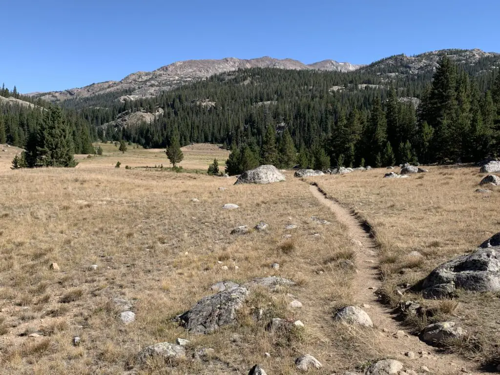
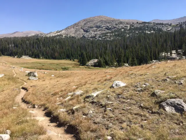
Hiking trail crossing a grassy meadow leads to trees with a rocky mountain behind

What is the trail to Lake Helen like?

The first few miles of the trail are LOVELY. You start by meandering on a flat trail through the woods around West Ten Sleep Lake.

We saw a momma moose and baby bedded down in the tall grass near the lake!  Be sure to give these animals PLENTY of space, especially with dogs. Most momma animals can be INCREDIBLY aggressive when they’re protecting babies, and moose have been known to kill dogs–we kept Puppers on a leash and she was too distracted by smells to be aware of our new friends. 
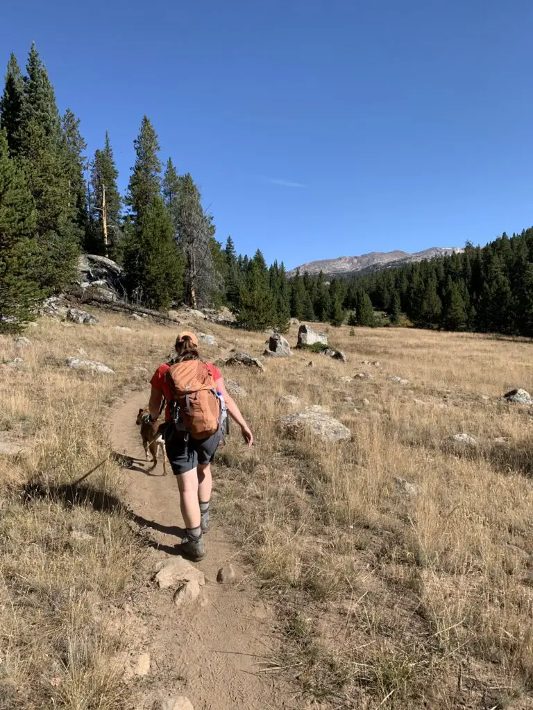
(As viewed from the back.) A woman and dog ascend a hiking trail through a grassy field. Trees and a rocky mountain can be seen in the background
Puppers and I on the Misty Moon Trail

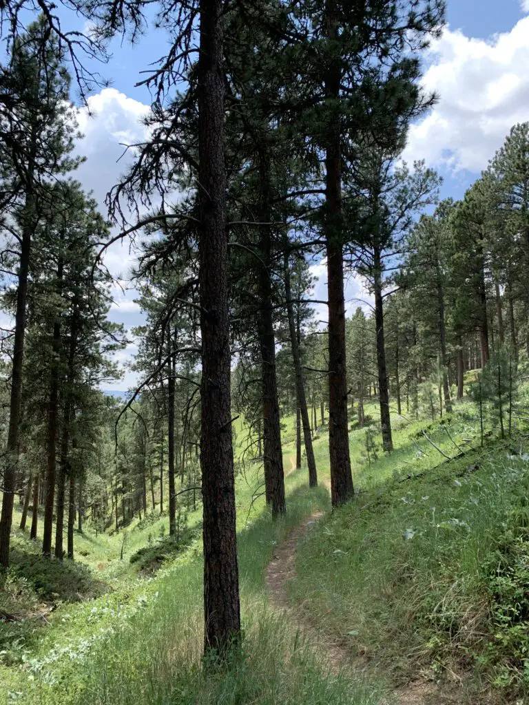
Once past the lake, you start a gradual climb through several grassy meadows and forested areas, with great views of the mountains beckoning you along the way.

The trail undulates the whole way so while there are a few short, steep spots, there are no lengthy, spirit-crushing climbs–I think this contributed to the trail feeling easier than it actually was.
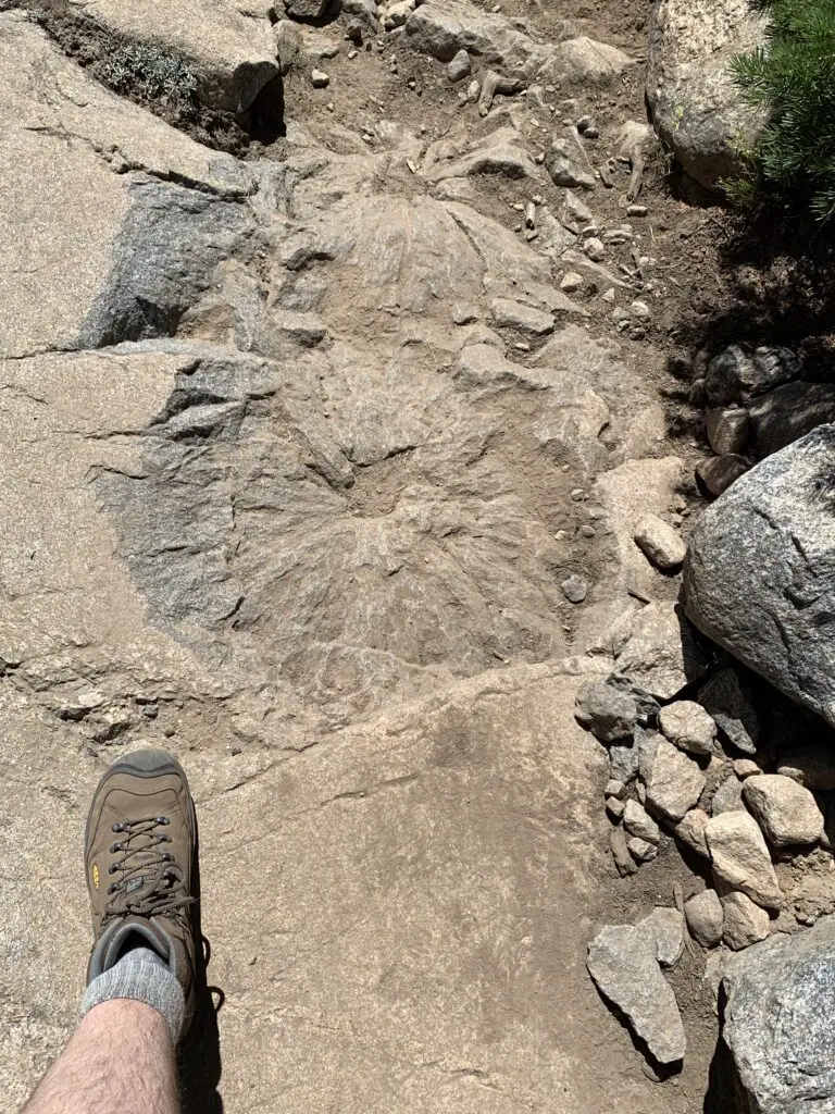
Circular, rough indentation in the rock
We saw a bunch of these indentations on the rocks, not sure if it’s some kind of fossil? Looks like a plant left them…🤔

About halfway to Lake Helen, the trail becomes steeper.  This is where you hit the rocky sections.  There are no large boulder fields to cross and no scree slopes to navigate (on this portion of the trail) but the rocks are big enough that they cause a lot of uneven terrain that you’ll need to manage.  Hiking boots are definitely recommended for this trek!

I think older kids could do this trail. It’s a longer one and they may need some help in the rocky areas, but overall I would say it is moderately difficult.

The hike didn’t actually seem that bad while we were doing it. Both Mr. Trekker and I were pleased at how good we felt throughout.  Especially considering we carried heavier packs than usual (we brought A LOT of water) and we hadn’t hiked much this summer as it’s been so warm.  Also, the trail STARTS at around 9000 feet (you gain around 1000 feet in elevation over its five-mile length.  Lake Helen sits at almost exactly 10,000 feet.)

Mr. Trekker and I were both pleased that we didn’t feel the altitude too much (it probably helped that we camped at 9000 feet the night before).  If you aren’t used to these altitudes though, you’ll definitely want to take it easy.

The Trekkers seem to be doing better with altitude in recent years. It used to be that just driving to Estes Park in Colorado (which sits at around 8000 feet) was enough to make me feel funny.  Now we’ve camped and hiked higher than that on multiple excursions in Colorado, Wyoming, and Montana and done quite well.  They claim your body “learns” how to adjust to the altitude better the more you experience it and I think that may be true. (Living at 3000+ feet for the last decade probably hasn’t hurt either. 😉)

Related posts:  A drive through Ten Sleep Canyon!Bighorn Medicine Wheel in Wyoming; 4 Don’t Miss Sites in the Bighorn Mountains of Wyoming; Camping in the Bighorns

We considered going all the way to Misty Moon Lake but that would have added several miles to our already 10-mile hike.  All three of us were feeling good when we arrived at Lake Helen so we figured we’d just spend a relaxing lunch at the lake and head back.

As it turned out it was good we did decide to turn back.  Even though she was raring to keep going when we reached the lake, by the time we got back to camp Puppers was hurting.  This was the first time she’s ever really had issues on the trail.  This is one of the longer trails we’ve ever done with her (though she’s done 10 miles with us before).  This trail is REALLY rocky, in parts, which means it’s probably also one of the toughest trails we’ve ever done with her.  We did LOTS of rock hopping on the way down and she was obviously aching by the time we got back.  She seemed to make a full recovery within a few days though! (In her defense, my hips were sore for several days afterward, as well.) 
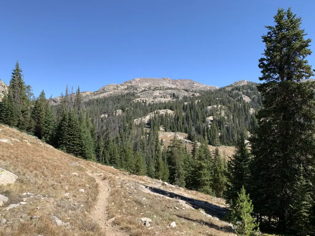
Hiking trail crossing a grassy meadow leads to trees with a rocky mountain behind

Obviously, I can’t speak to the trail past Lake Helen (since we didn’t do it. 😉 I do know that Misty Moon Lake is only about 300 feet higher than Lake Helen but it takes two more miles of hiking (each way) to get there.

Also, my understanding is once you get past Misty Moon Lake the trail gets much tougher.  There are some scree slopes and boulder fields (namely on the way to the wreckage site at Bomber Mountain and to reach the actual Cloud Peak).  Also, once you get past Lake Helen you are basically above treeline the entire way.  This means there is NO SHADE at all so make sure you bring sun hats, LOTS of water, and sunscreen if you’re planning to go this route.  There is also NO PROTECTION if you’re caught out in a storm.

I cannot stress this enough:  if storms appear imminent PLEASE get below treeline as safely and quickly as possible.  It is INCREDIBLY dangerous to be above treeline during a lightning storm.  Safety should ALWAYS be your first priority!  
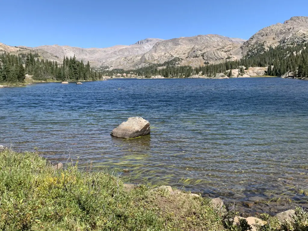
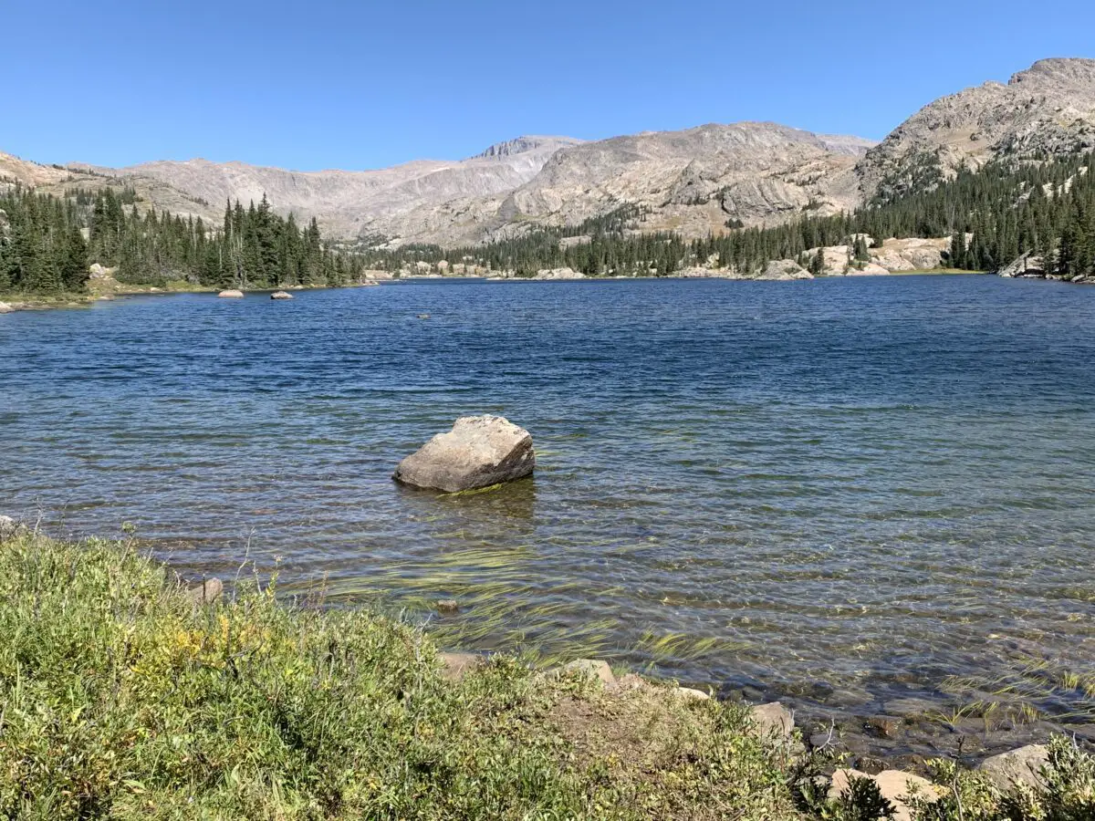
Small lake with a large rock in the middle, ringed by trees. Rocky mountains rise in the background.
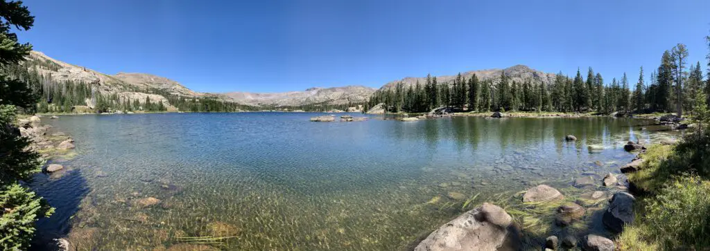
Lake Helen! (Bomber Mountain is near the tall peak straight up from the rock in the water. Florence Pass is through the saddle even further to the right.)

Panoramic view of a blue, peaceful lake with rocky mountains and trees in the background

From Lake Helen you can see Bomber Mountain and the high-altitude, Florence Pass to the right.  What you cannot see is Cloud Peak (as often as we have visited the Bighorns we have yet to see that site. It’s VERY isolated. 😝)  From what I have heard from other hikers though, you CAN get views of Cloud Peak from Misty Moon Lake.

Let’s talk about Bomber Mountain and Cloud Peak

Cloud Peak and Bomber Mountain reach altitudes higher than 12,000 feet so altitude sickness starts to be a concern when you spend lengthy amounts of time at these altitudes.  Potential hikers should also be aware the snow can be quite deep on these trails through July!  Also, mosquitoes are said to be HORRIBLE in the summer (we had no problems at all on Labor Day weekend and we didn’t use any bug spray. 😁)

Bomber Mountain:  This used to be an unnamed mountain in the Bighorns.  That is until a World War II-era bomber crashed here while on a training mission in the early 1940s.  If you know where to look you can still view the wreckage. (Don’t ask me how to get there, I don’t know. 😉. For more info on this hike you can click here)

You can check with local forest offices for information on how to get to the site.  From what I’ve heard there are also rock cairns that help direct the way but you need an idea of where to look. 

Please be respectful if you visit this site as several soldiers did lose their lives in the crash.
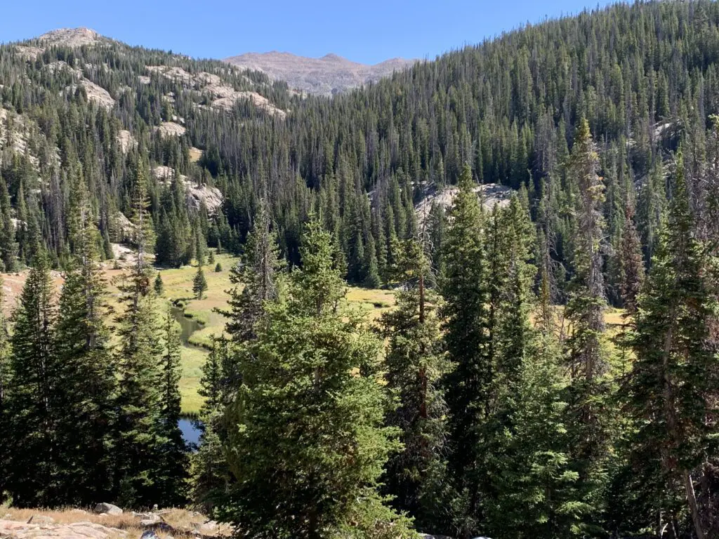
Pine trees in a grassy valley with a spring running through it and mountains on all sides

There are no actual trails that go to Bomber Mountain or Cloud Peak. (This seems a little odd to me as Cloud Peak is the highest point in the Bighorns and is what the wilderness area is named for, but I digress. 😝)  There are some rock cairns to guide your way to Cloud Peak.  My understanding is for Bomber Mountain, you pretty much just have to know where you are going.

This being said, PLEASE be sure you have a good, topographical map and a compass with you if you are attempting these hikes.  Also, be aware there will likely be some bushwacking involved and you could easily become lost. These routes should only be attempted by EXPERIENCED, backcountry hikers! (Cell phone service is spotty at best in this area. DO NOT rely on it!)

Cloud Peak: “can” be done in one day but it would be a VERY long and VERY hard day (it’s around 24 miles total).  People have done it but most suggest doing a 2 – 3 day backpacking trip. (Lake Helen and Misty Moon Lake are popular places to camp for these.)  The last three miles to the summit are said to be a boulder field with “house-sized” boulders (per the reviews).  The “trail” isn’t super clear either.  Some people suggested this is actually a more difficult hike than the notorious Longs Peak in Rocky Mountain National Park 😮 so PLEASE think hard and use incredible caution if you’re considering this trek.

West Ten Sleep Lake Campground

On other trips, we’ve stayed at the Island Park campground but since we were leaving from the trailhead at the lake we stayed at the West Ten Sleep campground on this trip.
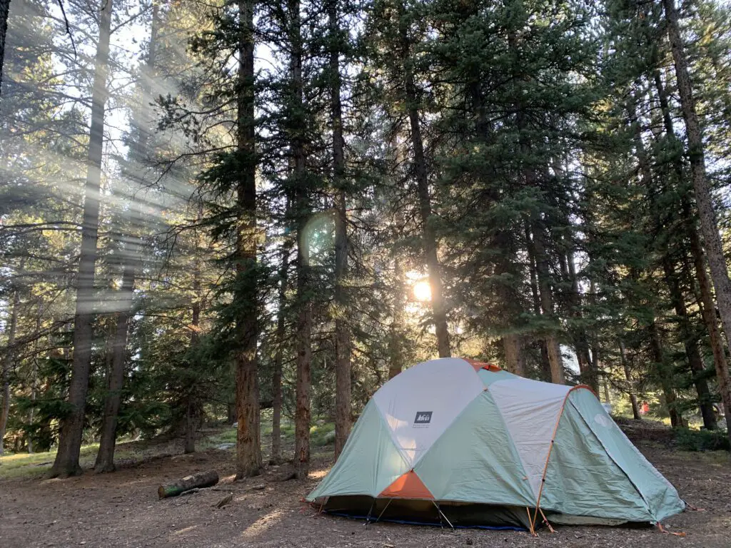
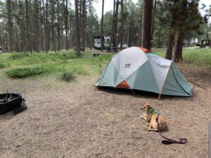
A tent sits in the forest, sunlight streams through the trees and creates beams in the smoky air

It was LOVELY! Some sites had views of the lake, ours had forest views. But the sites were nicely shaded with lots of soft, pine fluff.  The campground was also relatively quiet and quite pretty.  It was also only a couple of hundred yards to the beauty of West Ten Sleep Lake!
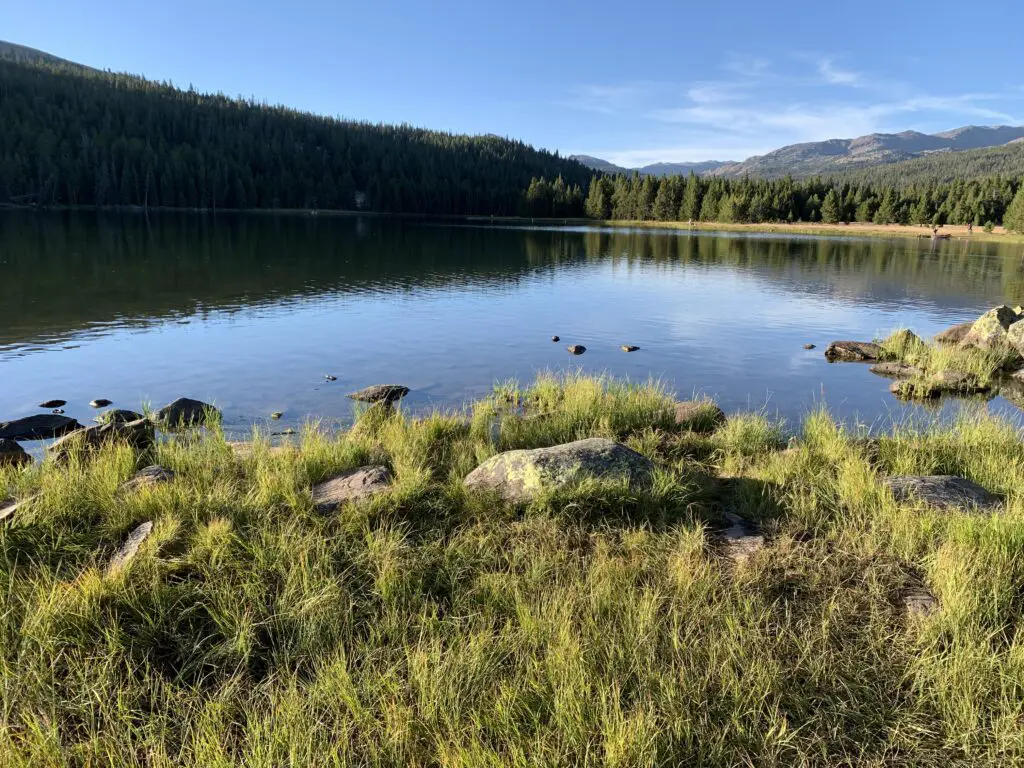
Serene lake reflecting the trees and mountains that surround it
West Ten Sleep Lake!

James T. Saban Fire Lookout

The Trekkers have passed this lookout on every trip we’ve made to the Bighorns and we always say, “we should check that out!”…so, we did!

The trailhead for the James T. Saban Fire lookout is found off Route 16 in the Bighorn Mountains, around five miles east of Meadowlark Lake.  The turnoff is on the south side of the road.  I can’t remember if there are signs telling you to turn but you can see the lookout at the top of the hill from the road.  This is also the turnoff for the St. Christopher’s Chapel and there are signs for that site.
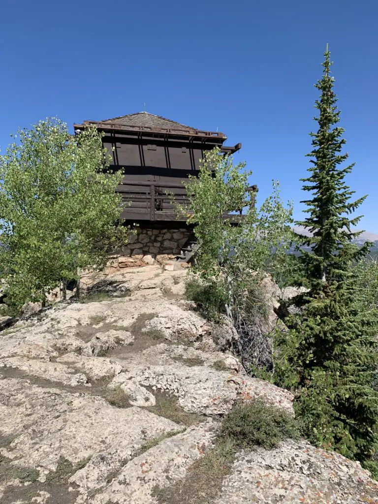
A wooden and shuttered fire tower sits on top of rocks. Trees grow out of the rocks.
The James T. Saban Fire Lookout!
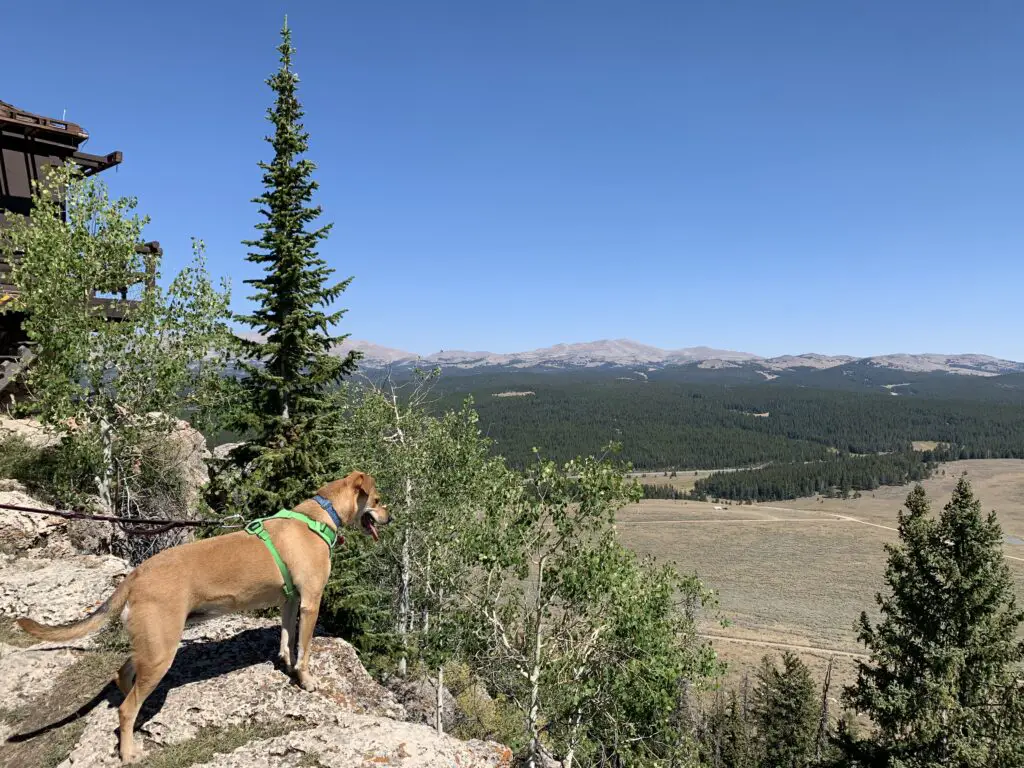
Dog stands on a rocky ledge overlooking trees and a dropoff. A grassy field and mountains are in the background.
Puppers enjoying the view from the fire lookout!

This fire lookout is easy to reach and offers some amazing views of the surrounding area.  It requires a short drive on a narrow, dirt road to reach the trailhead.  You’ll want to take it slow and watch where you are driving. In good conditions, I would be comfortable taking almost any higher clearance car, SUV, or truck there.  In poor conditions (mud or snow) the road may be impassable.

Once you reach the trailhead, it is about a 15-minute walk (in each direction) to the tower at the top of the hill.  It isn’t a bad hike. It gets a little steep in spots but the trek is short enough almost anyone in good health should be able to handle it. (Note: you are at an altitude of around 8000 – 9000 feet in this area so take your time as you may feel short of breath.)
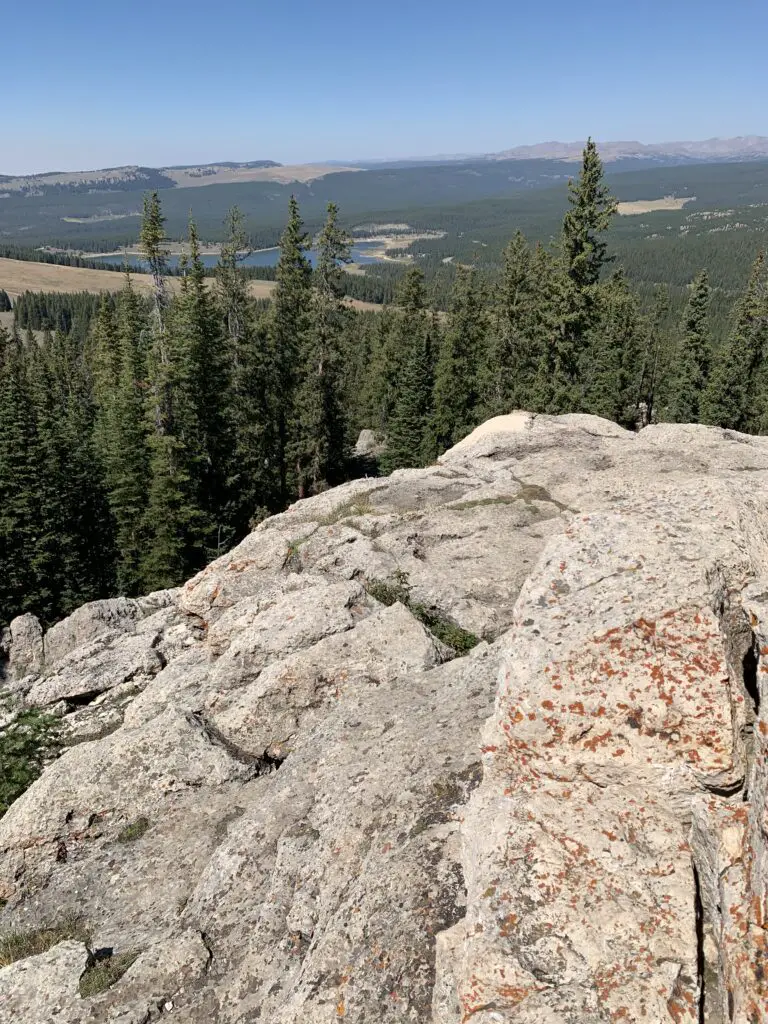
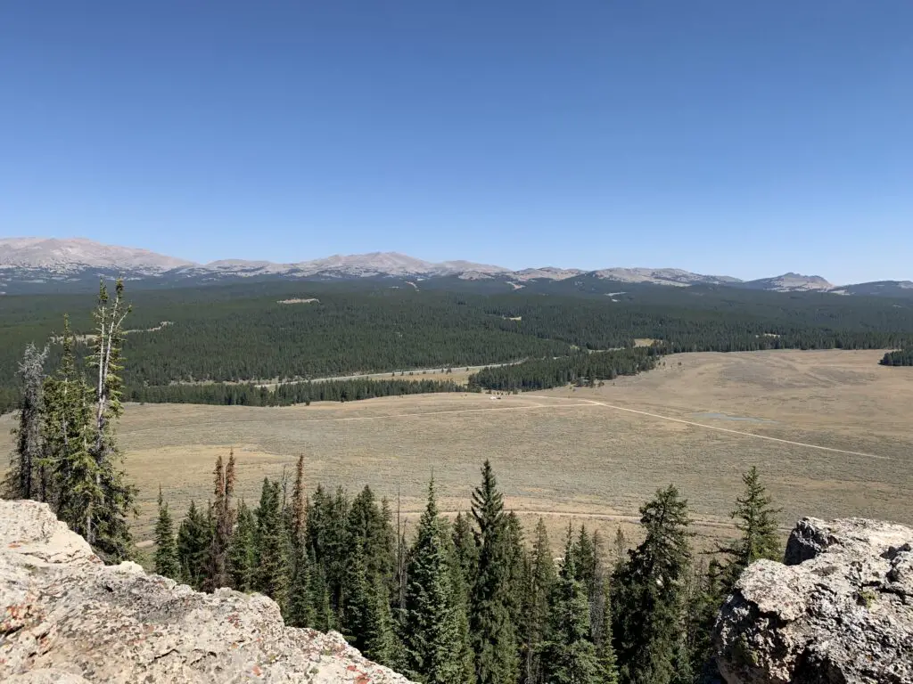
Mountain overlook, trees in the foreground, then a grassy field with mountains in the background

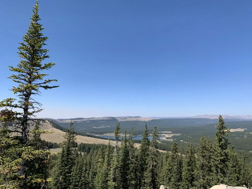
Mountain overlook, rock and trees in the foreground, then a lake and mountains in the background
That is Meadowlark Lake in the background

Mountain overlook, trees in the foreground, then a grassy field with a lake and mountains in the background

Though it is a bit long and strenuous, the Misty Moon Trail to Lake Helen is a great hike if you want to really get a taste of the Cloud Peak Wilderness area in the Bighorn Mountains!

Have you hiked to Lake Helen, Bomber Mountain, Cloud Peak, the James T. Saban Lookout Tower, or Misty Moon Lake? If so, tell me about your adventures in the comments!


Did you enjoy this post? Pin it!

3 pictures show a trail with mountains behind it, a lake with forest surrounding it and a lake with rocky mountains in the background. Pin reads, "Wyoming, Lake Helen, Bighorn Mountains"


Like what you read here today?  Please feel free to leave a comment, like or share this post!  You can also follow the blog on social media by clicking the links below!
Facebook

Twitter

Instagram

Pinterest

Wyoming’s Bear Lodge Mountains

In this post, I review a weekend we spent in the Bear Lodge Mountains of Wyoming.


A dog lays on the gravel, in front of a tent, in a wooded campsite.There is a less-frequently visited portion of the Black Hills in far-eastern Wyoming called the Bear Lodge Mountains.  When the Trekkers visited we stayed at the Reuter Campground.  It is easy to reach, as it is less than two hours from Rapid City.  It is also just a short drive north of Sundance, WY (and I-90).

This was a typical, rustic, National Forest campground.  Potable water is available in-season, there are campfire rings and picnic tables at each campsite, and the campground offers vault toilets.

The campsites were decent, this was one of the first times we had an “inner” site so it was closer to other campers.  Usually, we go for “outer” sites but there were none available by the time we made reservations.  This meant we had to deal with more noise from other campers which is something we are usually able to avoid.

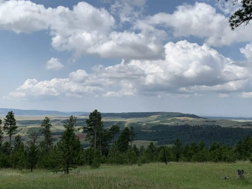
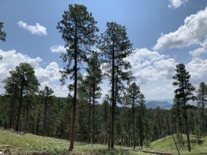
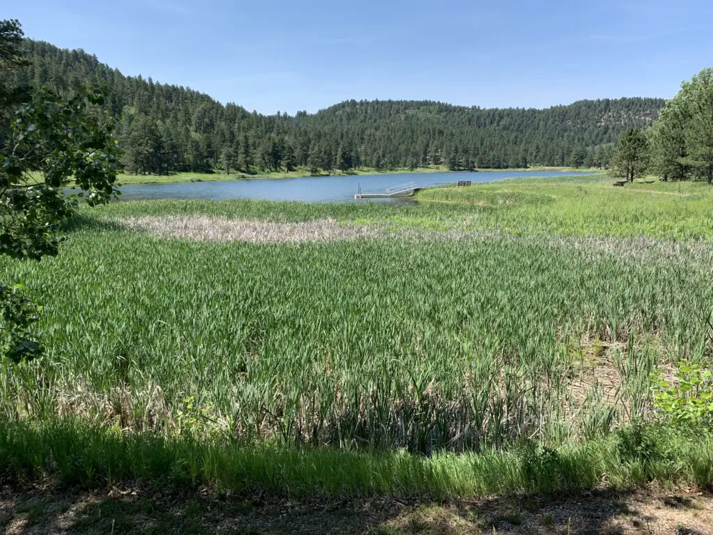
View from a lookout point over pine trees and a grassy meadow with green grass and tree-covered hills rising in the background, all under a blue sky and puffy clouds.

This campground wasn’t my favorite.  It was fine, the were plenty of large and shaded sites, but the host wasn’t as available or on top of things as we usually experience. (As an example, the trash DEARLY needed to be changed when we arrived.  It’s usually not a good idea to have full trash cans at a campground, at the START of the weekend, in the height of summer. 😝  She also seemed to have a hard time remembering who she had and hadn’t checked in already. 🙄)

We noted another campground in this local area was actually closed and was looking for a host.  It seems that campgrounds may be experiencing the same lack of available employees that so many other businesses around the country are right now.

Hiking in the Bear Lodge Mountains of Wyoming

We enjoyed several different hiking trails in the area.  Though many were overgrown, they were very well marked with signs and markers.  Just watch out for ticks, snakes, and thistles in the tall grass. 😯

Carson Draw Trail including the Carson Draw Spur #1, the Carson Cut Across, and the Reuter Springs Trails

We made a loop out of a portion of the Carson Draw Trail, which we then took to the Carson Draw Spur #1, then went on to the Carson Cut Across, and then the Reuter Springs Trail…

The Carson Draw Trail offers a lengthy and groomed cross-country ski trail in the winter months that is around five miles long.  I think this would be a lovely area for skiing.  We may also return for a day trip in the fall to check out the leaf colors.  We saw several aspen groves that would likely be lovely.

View down a trail that traverses a grassy, pine tree-filled canyon.
Looking down Reuter Canyon on the Reuter Springs Trail

Unfortunately, going in this direction means that the Carson Draw Spur #1 trail is almost completely an uphill hike.  It isn’t overly steep, it’s just a long hill.  It was a former forest road so it is plenty wide and graded though it was rather overgrown.

The Carson Cut Across was much nicer.  It was short (less than a mile) with only a small amount of elevation gain.  It was also nicely shaded and more like a typical, single-track, hiking trail.

View down a grassy hill covered in pine trees. Green, pine-covered hills rise in the background.

Even though it meant a long uphill slog on the Carson Cut Across, I would recommend taking this loop counterclockwise as we did.  It means prettier views of the Wyoming prairie and grasslands opening up before you, on your way down the hill, as you exit Reuter canyon on the Reuter Springs Trail.  Also, portions of the Carson Draw Spur #1 trail were VERY STEEP as you went downhill shortly before it reached the Carson Cut Across.  I was happy we didn’t have to hike UP that!

Warren Peak Fire Lookout Tower

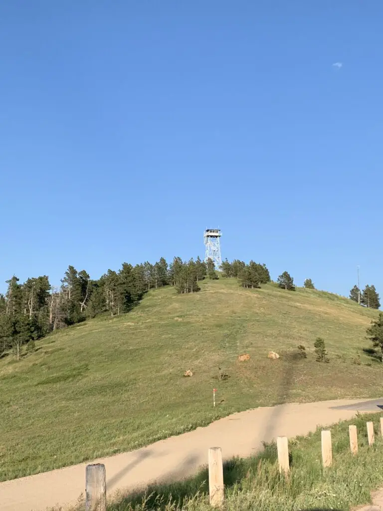
View from a dirt road, looking up to a fire tower, sitting atop a grassy, tree-covered hill all under a clear, blue sky.
Warren Peak Fire Lookout

The Warren Peak Fire Lookout Tower works in conjunction with the Cement Ridge Tower, which sits to the southeast, on the border of South Dakota and Wyoming. (I discuss that lookout here).  It offers 360-degree views of the surrounding mountains and prairie.  On a clear day, you can see portions of Montana, Wyoming, the mountain Crow Peak in South Dakota, Devils Tower just a scant 20 miles away, all the way to the Bighorn Mountains much farther to the west!

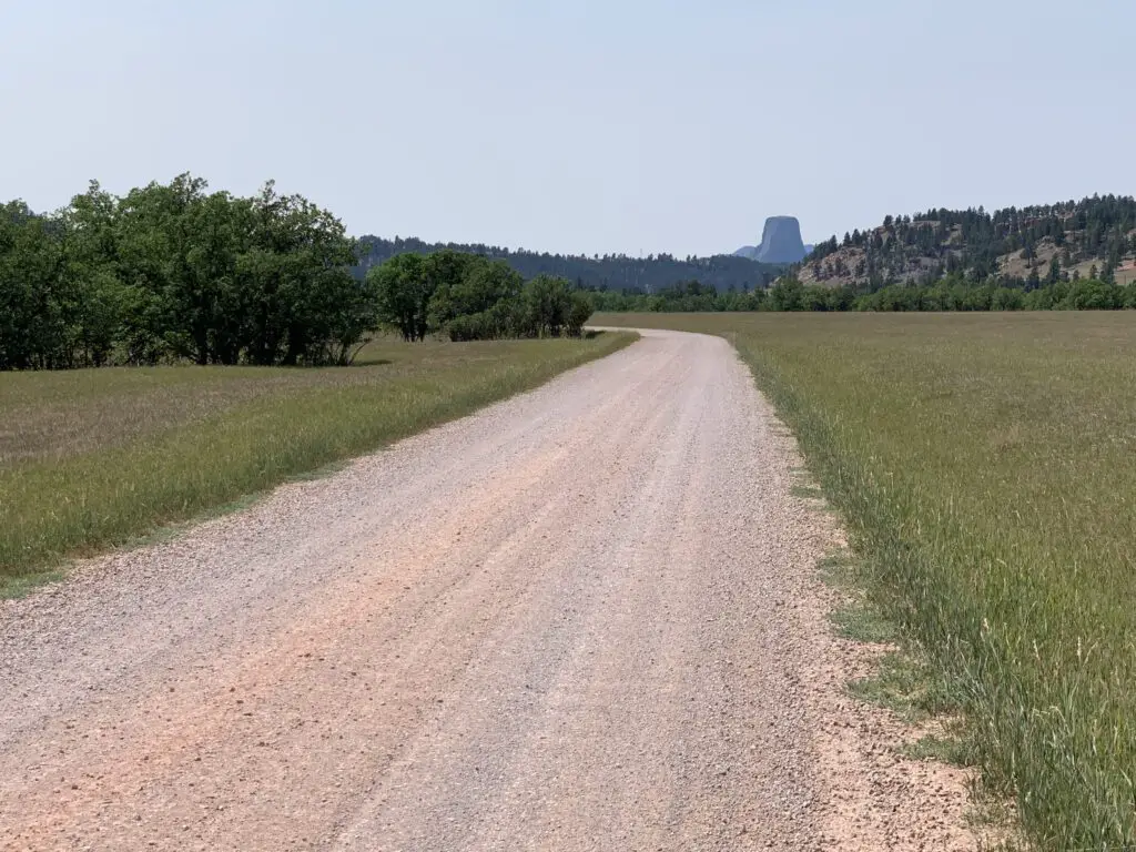
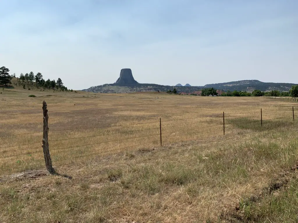
Devils Tower as seen from the Bear Lodge Mountains:

View down a dirt road that crosses a meadow. A rock obelisk (Devils Tower) materializes through the haze in the distance, behind tree-covered hills.

Cliff Swallow Trail

So, I am NOT trying to be a Negative Nellie here but we did NOT see ANY swallows OR their nests on this trail (and I’ve talked to other people who said the same thing!😝)  The only place we could have possibly seen them was one overlook fairly early into the hike where we saw some cliffs across the canyon.  They were probably a good half-mile away though and we couldn’t see any birds using the binoculars.  We’ve definitely seen more of these cool featherlings on other trails that don’t even advertise themselves as “Cliff Swallow” trails. 😝  So I’m gonna have to give this trail a rating of…FAKE NEWS! 😂

This trail can also be done in a loop.  I would again recommend taking it counterclockwise.  Going this route you start at the bottom of the canyon and travel along the bubbling, Beaver Creek.  The trail went through some very lush greenery, with lots of deciduous trees and ferns (this also meant it was VERY green…and humid. 🥵)  There was also little breeze down in the canyon and there were TONS of cobwebs strung amongst the greenery that spanned the trail (thanks to Mr. Trekker for taking one for the team on this one and going first, to knock them all out of the way.  See guys, THIS is how you woo a lady. 😉)

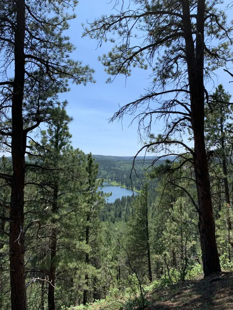
View down a tree-covered hill to a long, blue lake, surrounded by more trees, in the distance.
Cook Lake as seen from the Cliff Swallow Trail

As you continue down the trail you ascend some mild switchbacks that take you up the hill.  Here you will notice a transition to a drier, ponderosa-pine-forest-environment that is more typical of the Black Hills.  There was also a blessed breeze at the top and it was less humid (though there could be more sun depending on the time of day as you’re traversing the canyon rim at this point).  Our experience was the entire trail was a mix of sun and shade and we were there around the middle of the day.

Again, I strongly suggest you take this loop counterclockwise.  The ascent of the hill is more gradual and you’ll have nice views of the lake as you emerge from the canyon.  If you go clockwise the trail goes straight up the hill! 

This isn’t a bad trail at all, older kids could certainly handle it. It was definitely shorter and easier than the Carson Draw/Carson Draw Spur/Carson Cut Across/Reuter Springs loop (thankfully because it was also HOTTER that day! 🥵)  That trail wasn’t bad either, though.  I would probably give both a rating of “moderate”, just on opposing ends of the spectrum.

Green cattails lead to a small lake, surrounded by tree-covered hills.
Cook Lake

To finish the second day of hiking, we took a back road out to Devils Tower, just because it was close and we could. 😉  Also, the Devils Tower General Store sells ICE CREAM! 🍦😀😀  

A brown-grass meadow leads to a rocky monolith (Devils Tower) in the distance.
That monolith points to ice cream! 😁
A dog sleeps on a mat on the grass
Sleepy puppy after hiking!

In general, these Hills seem to be more lush and overgrown than is typical in the South Dakota Black Hills.  They reminded us more of the lusher ecosystem you find in the northern portions of our Hills.

Not sure if this may indicate they are wetter and may mean they have fewer wildfires here on average (as you don’t hear about them much.)  This could also explain why we found there were fewer good lookout/viewpoints here, many of our open spaces in the Black Hills come from burn scars. 😝

I found I didn’t like the Bear Lodge Mountains quite as much as the Black Hills we know and love.  They were more rustic and less developed.  They actually reminded me a bit of State Forest State Park in Colorado (you can read about that little-known location here and here!)  It seemed less organized, you were kind of left more on your own to figure things out.

It wasn’t nearly as busy and touristy as the South Dakota Black Hills though this also meant it was far less crowded. (Admittedly we only experienced a small corner of this area.)  It made me think of a green island rising from the sea of brown that is the dry grassland of eastern Wyoming. 😇

Have you ever been to the Bear Lodge Mountains of Wyoming?  Tell me about your experience in the comments!

Did you enjoy this post?  Pin it!

View down a tree-covered hill to a long, blue lake, surrounded by more trees, in the distance. Pin reads, "Wyoming's Bear Lodge Mountains Hiking the Carson Draw and Cliff Swallow Trails"


Like what you read here today?  Please feel free to leave a comment, like or share this post!  Add your email at the bottom of the page, or the sidebar to the right, to be notified when a new post is published.  By signing up for the email list, you will also receive a free copy of the Tranquil Trekker’s Top 10 Tips of Trekking Do’s and Don’ts!

You can also follow the blog on social media by clicking the links below!
Facebook

Twitter

Instagram

Pinterest

Cement Ridge Lookout Tower

In this post, I review the Cement Ridge Lookout Tower in extreme, eastern Wyoming.


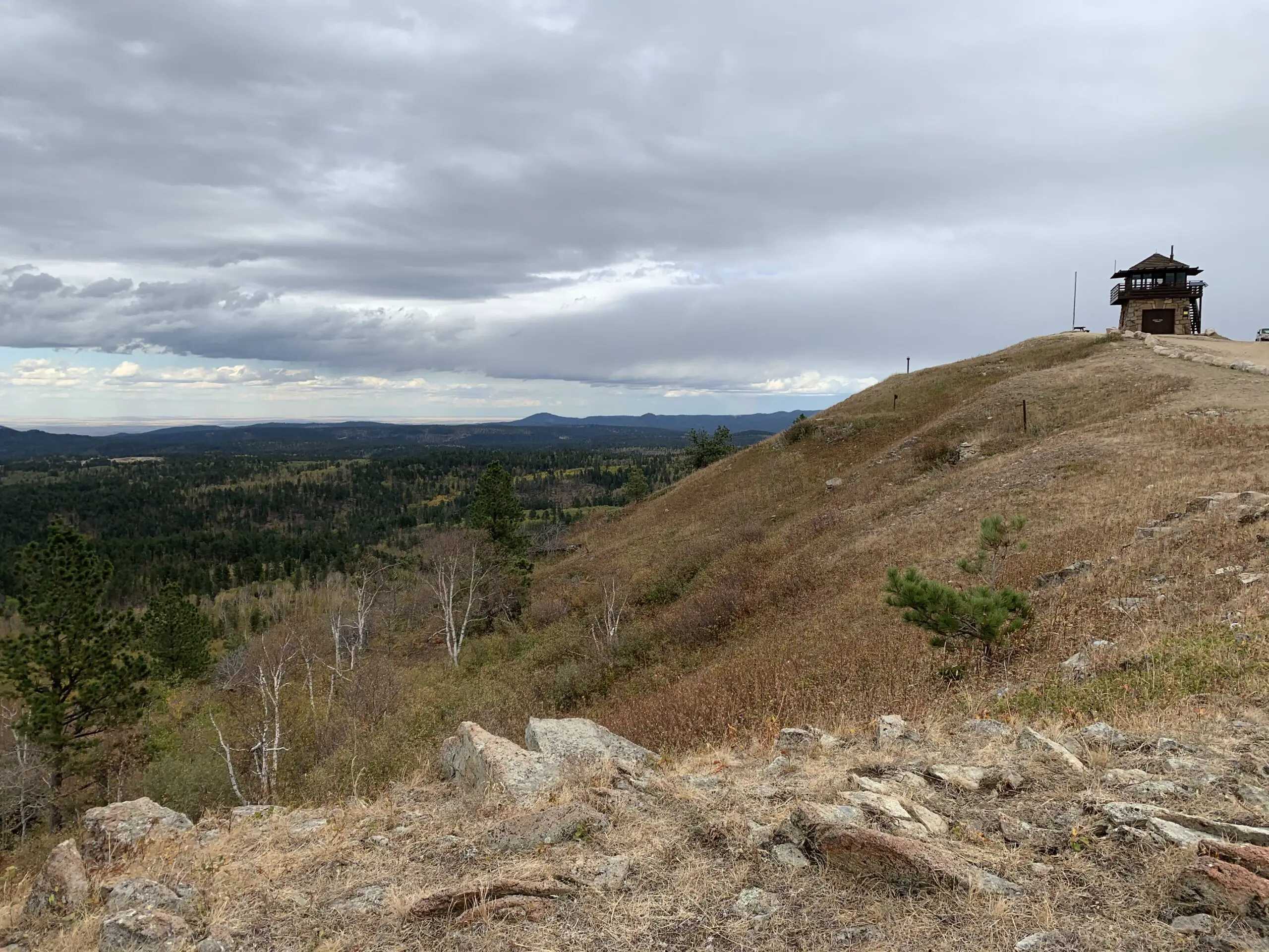
The Cement Ridge Lookout Tower is located in extreme eastern Wyoming, almost on the border with neighboring South Dakota.  It is a National Forest Service fire lookout that is still in active use today.  This is a prime place for 360-degree views of the surrounding countryside and is especially picturesque during the fall.

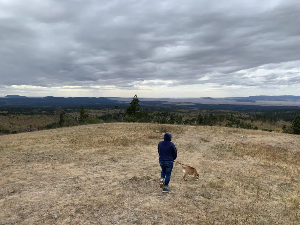
The back view of a person wearing a hoodie and a dog walking across a brown-grass meadow. Pine trees, mountains and plains stretch to the horizon beyond, all under a gray, cloudy sky.
Puppers and I enjoying the lookout!

From the lookout point, you can see portions of four states, South Dakota, Wyoming, North Dakota, and Montana.  Expect the weather to be different here than in much of the rest of the Black Hills as this is one of the higher elevations you will find in the Hills.  It is frequently windy here and is usually cooler than the surrounding region due to its altitude.  It can also be cloudy/foggy, even when the surrounding areas are not.

Mr. Trekler and I once attempted to take Momma and Poppa Trekker here to view leaf colors.  It was a lovely day and we were raving about the view the entire way.  When we reached the tower, however, it was sacked in with fog. 😕 

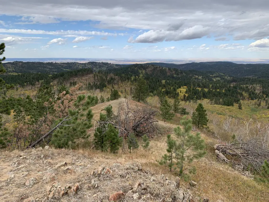
Brown grass and green, pine trees cover ridges in the foreground. A sunny plain is in the far background near the horizon.
The view from the lookout tower! This is looking north towards Montana/North Dakota.

How do you get to the Cement Ridge Lookout Tower?

There are a number of different routes you can take to the lookout tower.  Some of them require driving on high-clearance, 4WD roads so I won’t be discussing those here.  The easiest way to reach the tower is via Forest Route 222 (also called Roughlock Falls Road) that traverses Little Spearfish Canyon. (You can reach the “little” canyon via the main Spearfish Canyon and Route 14A.)  In recent years, the Forest Service has actually put up signs directing you to the lookout, so it is much easier to locate than it used to be.

You will take Roughlock Falls Road west, towards Wyoming, past the turnoff for Roughlock Falls.  Continue until this road meets a T-intersection with Tinton Road.  You will then take a right onto Tinton Road and, a short time later, make a left onto Schoolhouse Gulch Road.  Take that route to the intersection with Cement Ridge Road and then follow the signs.

Drivers should be aware that after leaving the main road through Spearfish Canyon, ALL of these roads are dirt.  They are graded, however, and are in quite good condition.  As long as you don’t mind your car getting dirty, any sedan should be able to handle them in good weather.

It should also be noted that in the winter, most of these dirt roads become impassable to all vehicles other than snowmobiles as they are usually not maintained. 

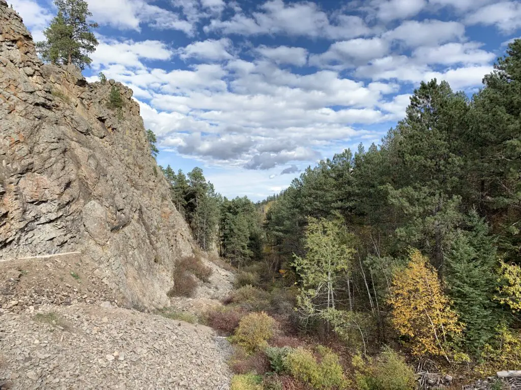
A rocky wall on the left, green and yellow trees on the right, all under a blue sky with puffy, white clouds.
Another pretty fall picture from the Black Hills!

If you’d like to skip the busyness of Spearfish Canyon, you can access Tinton road from the north from Spearfish (take I-90 to Exit 8 for McGuigan Road.  Then take that route to the south until you reach the T-intersection with Tinton Road.)  You can also access it from the south.  Take US 85 west out of Lead (towards Wyoming) for about 18 miles.  Tinton Road will be on your right.

This is a fun place to visit almost any time of the year, which also offers amazing views.  Why not check it out?

Have you been to the Cement Ridge Lookout Tower?  What did you think?  Tell me about it in the comments!


Did you enjoy reading this post?  Pin it!

Dunn-colored rocks, dry grass and bare trees cover this mountainside. Pin reads, "Cement Ridge Lookout Tower"


Like what you read here today?  Please feel free to leave a comment, like or share this post!  Add your email at the bottom of the page, or the sidebar to the right, to be notified when a new post is published.  By signing up for the email list, you will also receive a free copy of the Tranquil Trekker’s Top 10 Tips of Trekking Do’s and Don’ts!

You can also follow the blog on social media by clicking the links below!
Facebook

Twitter

Instagram

Pinterest

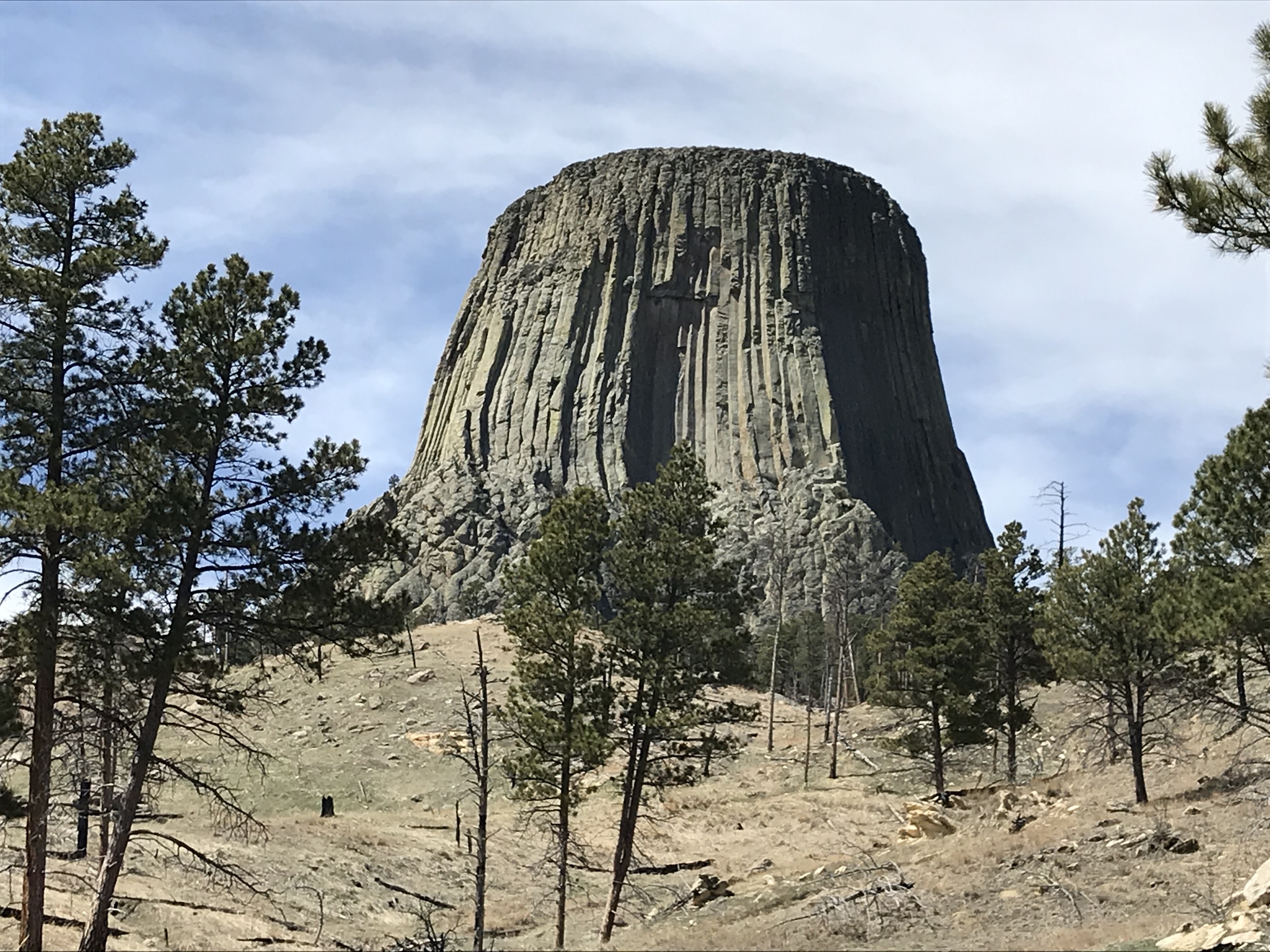
Hiking Devils Tower

Devils Tower, in nearby Wyoming, is worth the time it takes to visit. In this post, I review the hiking trails that help you enjoy the site, as well as its history and some unusual legends that surround this other-worldly monolith.


As it holds the title of the nation’s First National Monument (thank you Teddy Roosevelt!), Devils Tower should be on your bucket list!  Several different hiking trails offer beautiful views as the site rises over the surrounding valley floor.  You’ll find yourself surrounded by yellow rock layers that stand out in contrast to the red layers of the Spearfish Formation, while the gorgeous Wyoming countryside spreads out before you like a mottled quilt.

As it holds the title of the nation’s first National Monument (thank you Teddy Roosevelt!), Devil’s Tower should be on your bucket list!  You’ll find several different hiking trails throughout the park, of varying lengths and difficulties.  Beautiful views are available from all the trails as the tower rises above the surrounding valley floor.  Below you, the gorgeous Wyoming countryside spreads out before you like a mottled quilt. The yellowed rock layers that surround you stand out in contrast to the red cliffs of the Spearfish Formatio

Watch out for rattlesnakes in this area during the warmer months. You won’t usually find them on the well-traveled paths–though they will, occasionally, seek out the warmer blacktop in the mornings or evenings.  However, you may come upon them in the grass if you wander off-trail, or if you are hiking some of the more rugged, grassier routes.

If you visit the Visitor’s Center, you can see views of the top of the Tower. Interestingly enough, there is actually grass up there!  It offers a nice place for the climbers to relax and take a break before they trek back down.

Snakes have even been found on the summit, though naturalists aren’t quite sure how they got there.  It has been theorized that they may have been dropped by birds that were planning to make a meal of them.  While this meant good fortune for the snake, it also meant an empty tummy for the bird. 😳

Devils Tower Hikes:

All of the hiking trails at Devils Tower are worth checking out and can be enjoyed by those with a variety of hiking expertise.  You should be aware, there isn’t a lot of shade available on any of the routes.  While this makes for a hot trek in the warmer months, the good news is you’re in Wyoming, so there is almost ALWAYS at least a slight breeze! 😉

The Tower Trail:

This is the main trail that traverses the base of the tower.  At a little over a mile in length, it is paved or graded the entire way and offers benches for resting.  This route should be accessible for most people, just watch out for the occasional root.  Bring binoculars and watch for climbers on the monolith!

South Side and Valley View Trails:

Both of these are side trails that connect to the Red Beds Trail and add an additional half mile to that route.  They are shorter and take you into the valley that skirts the south side of the tower (imagine that!) 😝  They wind through a prairie dog town that is also accessible from the road.  The furry little critters are cute, but stay back!  DO NOT FEED THEM!  Their fleas carry Plague (yes, THAT plague). 😝

The Joyner Trail:

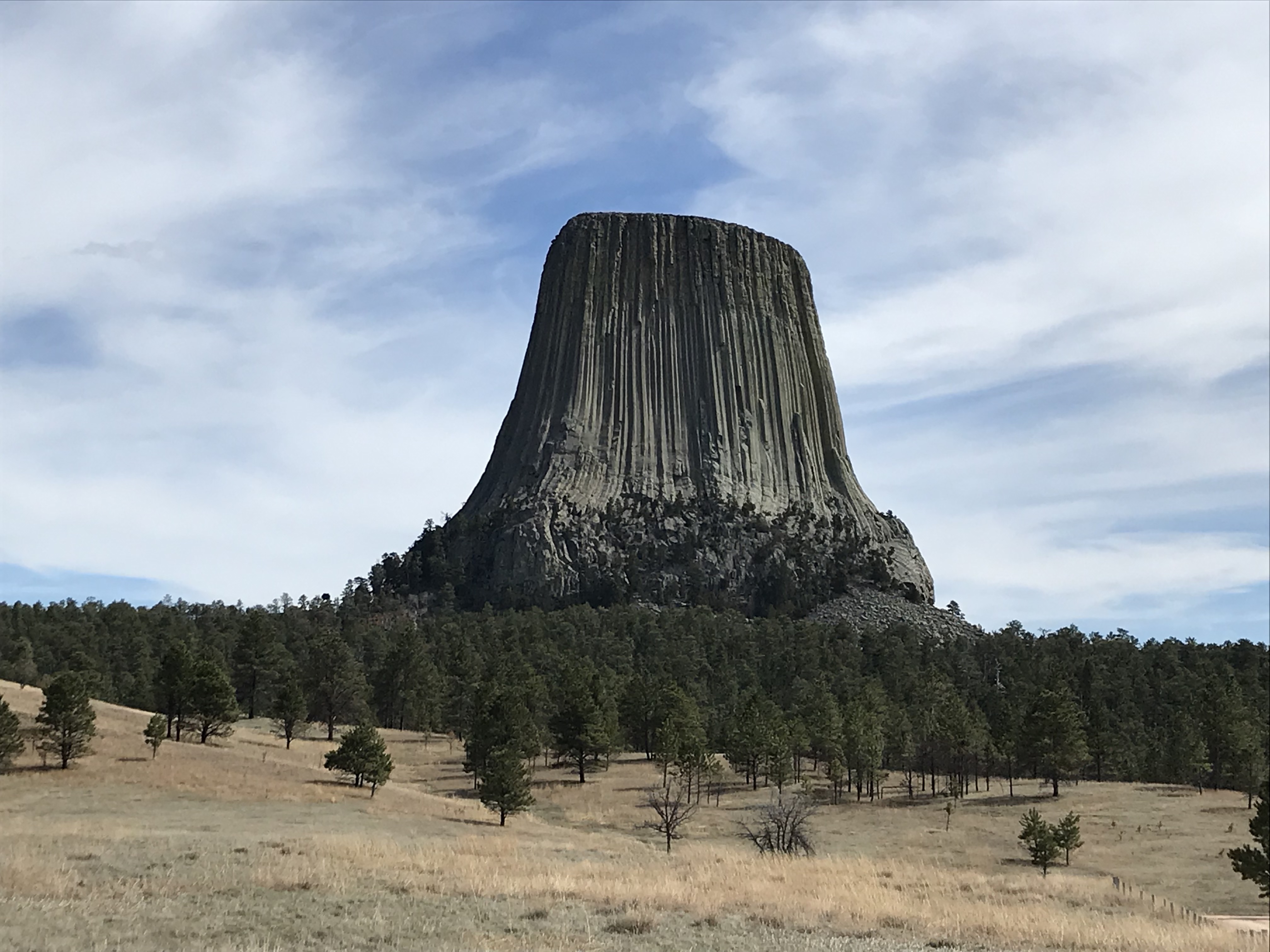
This trek is a 1.5-mile loop that covers mostly the grassland north of the tower.  It also includes a connector to the Red Beds Trail if you choose to use it.  Its trailhead is found in a different location on the north side of the park, which also makes a prime lunch spot as it offers one of the most dramatic shots of the monolith (see below):

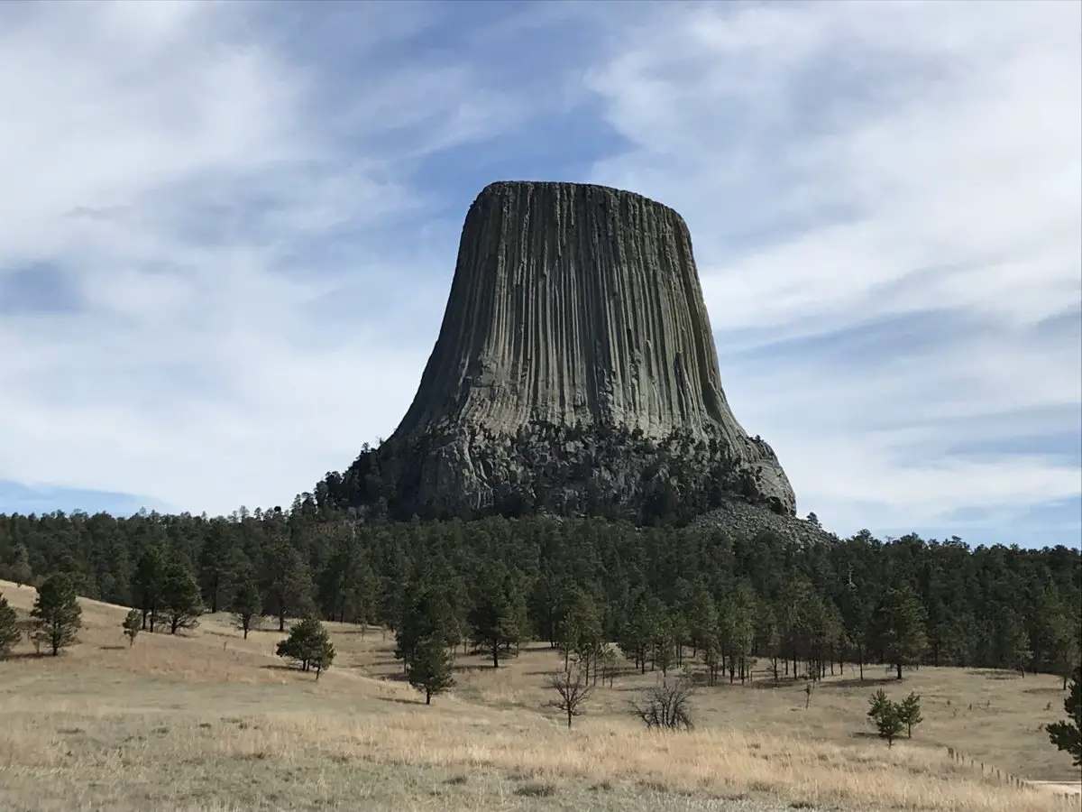
A large, rock monolith rises above the trees and brown, prairie grass into the cloudy, blue sky.

Red Beds Trail:

This is our favorite hike at Devils Tower!  At almost three total miles in length, this loop is the longest and most strenuous of all the trails.  You can take it either direction, though both will start by heading downhill to about the halfway point and then will return uphill.  So, while you think it’s easy at first, remember, it’s uphill ALL the way back! 😉 

While you won’t have as good of views of the tower from this route, it tends to be far less busy and it offers more views of the surrounding landscape.  It also takes you through different ecosystems including the nearby grassland and the dry, red rock bed–hence the name–of the Spearfish Formation.

Below are some of the scenic views available from the Red Beds Trail:

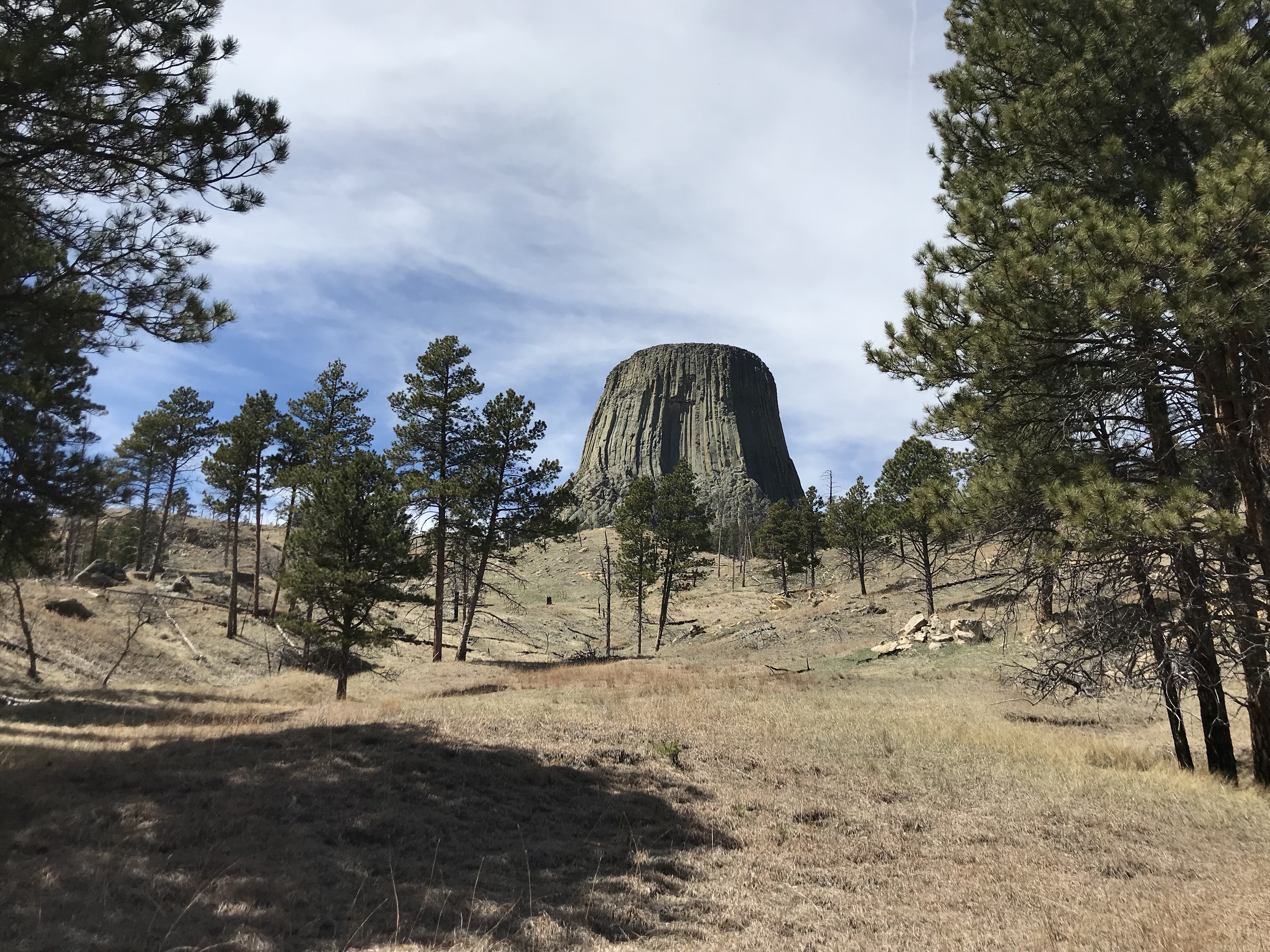
View up a hill covered in brown grass and sparse, pine trees. A tall, rock monolith rises from behind the crest of the hill.

View from the bottom of a brown-grass and sparse, pine tree-covered hill. A tall, rock monolith rises from behind the crest of the hill.
This route does offer a few nice views of the tower!

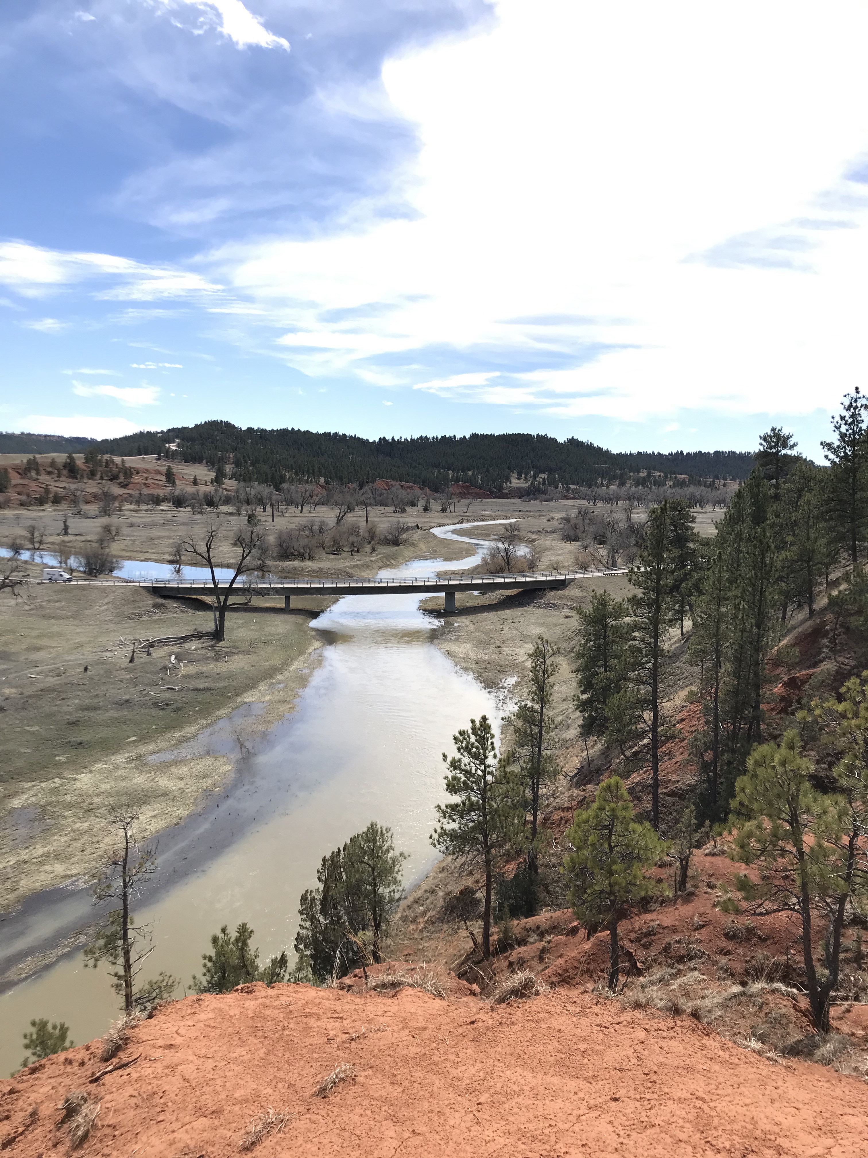
A muddy river snakes through brown-grass and pine tree-covered banks.
The Cheyenne River

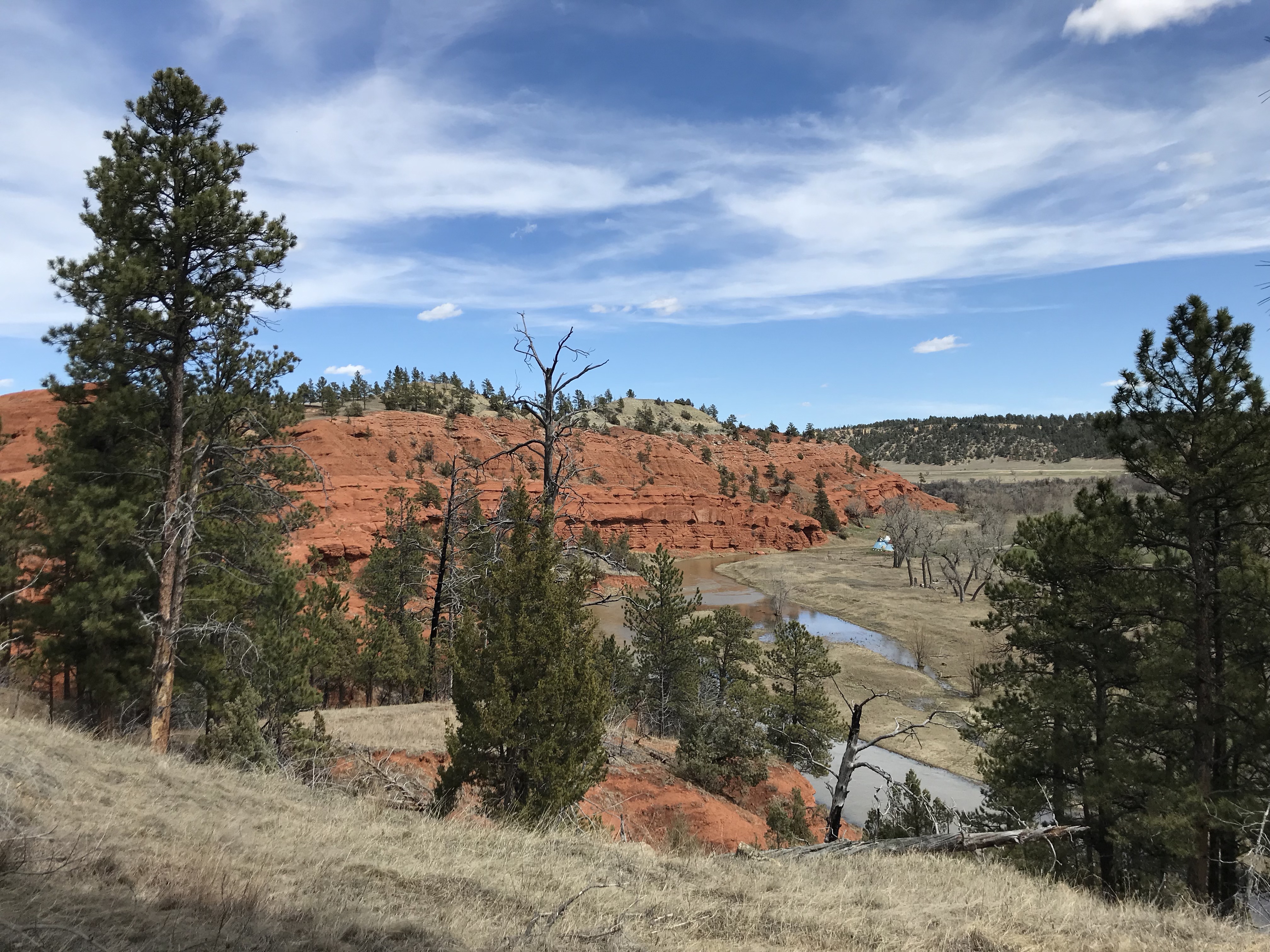
A red rock wall spreads to the distance. Pine and brown-grass-covered hills are in the foreground.
You can see why they call it the Red Beds Trail!

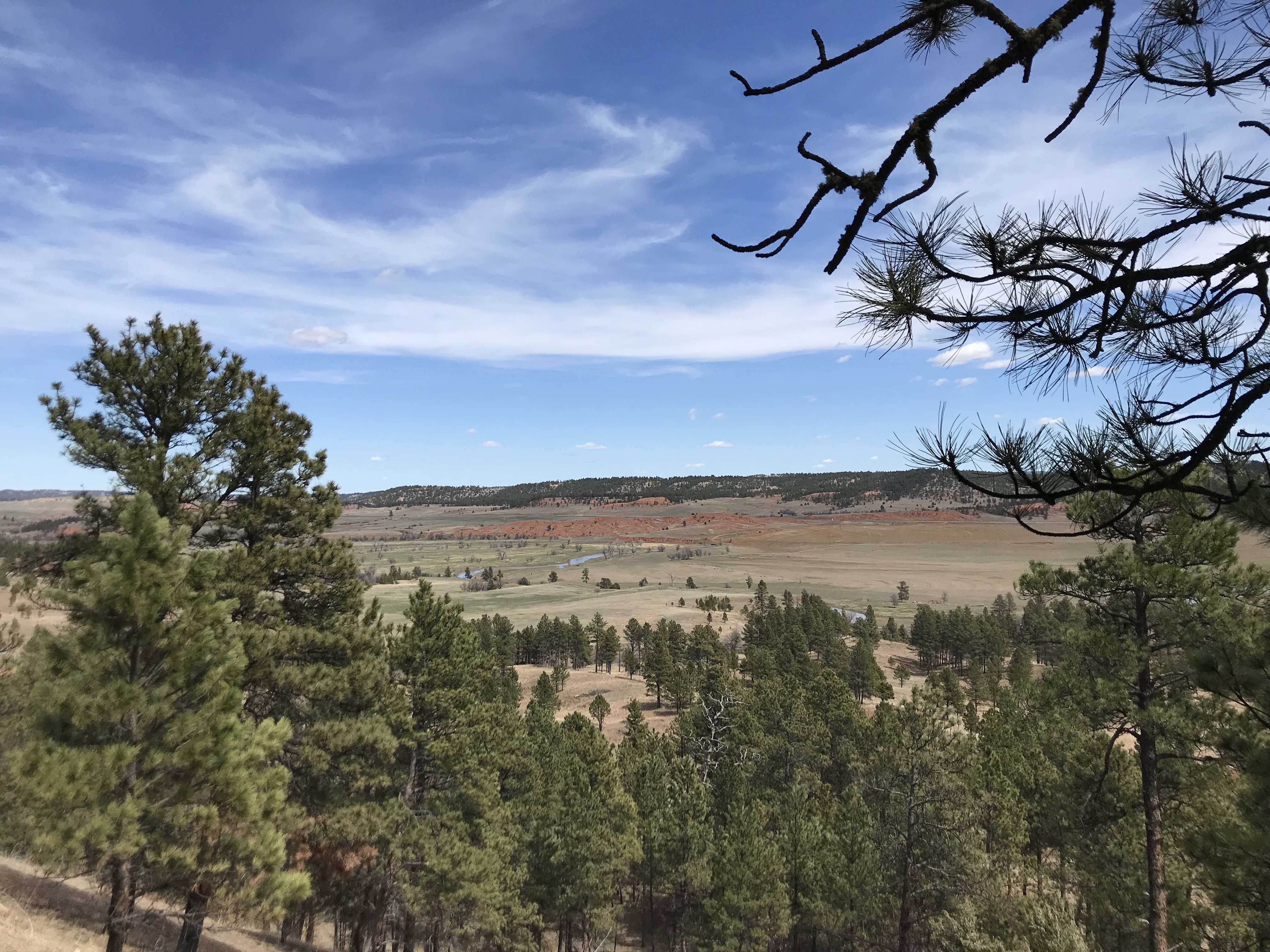
Pine tree-covered hills in the fore and far background. A brown grass valley sits in between them.
The surrounding valley
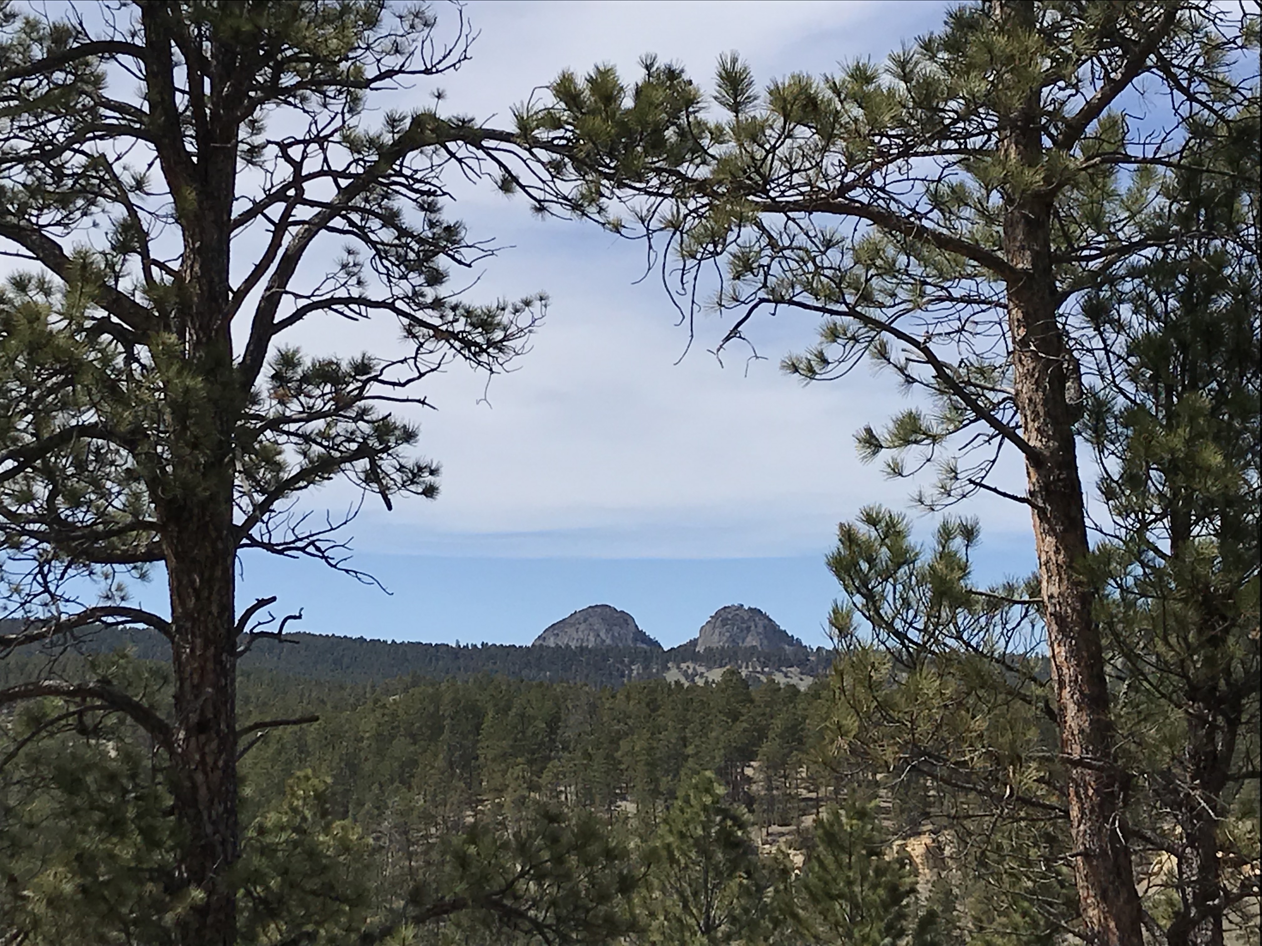
View from between two pine trees of pine tree-covered hills with two rocky mountains rising above them in the far background.

How was Devils Tower Formed?

There are several explanations for how the tower came to be:

The “boring” scientific explanation 😉:

There are various theories that explain the creation of the Tower, but the most accepted one is that, back when the Earth was young, this was once a volcanic plug that allowed lava to escape to the surface.  The rock that formed around the plug was harder and of a different type than the surrounding rock.  In later years, this softer rock eroded, leaving the plug behind.  

But enough with “provable facts”, let’s move on to the far more interesting legends. 😁

American Indian legends:

The legends vary by tribe, but most feature young children being chased by a large bear.  The children usually climb on a rock to escape the bear and pray for help.  The Great Spirit causes the rock to grow so the children are transported out of the bear’s reach.  As the bear tries to climb the rock and falls, his claws leave large gashes in the rock (this explains the igneous columns).

Several of the legends state the children are girls who eventually turned into the Seven Sisters star constellation.  One Lakota Sioux legend states the bear grows tired, wanders away to the land that is now South Dakota, and eventually falls asleep.  He then turns into Bear Butte, a sister volcanic plug found in the northern Black Hills.  

Both of these sites are considered sacred by numerous American Indian tribes.  It is common to see prayer bundles at either location and sometimes, people can be observed practicing ceremonies there. These locales are occasionally closed to visitors when certain tribal events are occurring.  Please respect any religious observances you note and refrain from touching or moving them.  We are truly visitors to these sacred areas and should respect them as such. 

“I’m not saying it’s aliens…”

Then there’s the “other” explanation…when in doubt, always assume it’s the aliens! 👽  

Some people may have never heard of one of Steven Spielberg’s classics from the 1970’s–and one of Richard Dreyfuss’ first big movies–Close Encounters of the Third Kind.  This film was old when I watched it as a kid (and we don’t need to discuss how long ago THAT was! 😝).  It’s always been one of my favorites, though I may be a little biased as a large portion of the movie takes place in my home state of Indiana. 😉 

Devils Tower features heavily into the plot of the film, so you can imagine how excited I was to learn it was nearby when we moved to the Black Hills.  The movie is relatively kid-friendly, aside from one (in my opinion) unnecessarily, frightening scene.  The aliens are more akin to those found in ET than Independence Day. 😉  

I STRONGLY recommend you check out the movie after visiting the tower, especially the Director’s Cut with all the deleted scenes.  The Special Edition version is actually my favorite, as it is the only one to include the fabled “Mothership Scene” at the end.  While Spielberg later regretted bowing to the film studio’s pressure and adding this scene in, it was always one of my favorites.  Think about the special effects that were required to make this scene and how few of them would have been available to Spielberg in the ’70s.  This was well before computer effects kiddos! 😳  And yes, once you hear it, that theme music will be an earworm that will drive you INSANE! 😝

Where is Devils Tower?

 The tower is pretty easy to reach from the Black Hills.  The directions are simple: drive west on I-90; follow the signs. 😉 

Driving through beautiful Wyoming

Though it does take a couple of hours, part of the reason we enjoy this trip so much is the drive (I’ve mentioned before how much I enjoy long drives through the countryside).  There are a couple of different routes you can take…

We like to form a loop where we take I-90 out (the quick way) to Sundance, get off on US 14 North, and take that to Route 24 North.  When we leave the site, we continue on Route 24 to the north (the scenic route) and take that all the way back to Belle Fourche, SD where you can pick up I-90 again.  The drive takes around 1.5 – 2 hours or so each direction, but boy is it worth it!  

This part of the country is, truly, God’s Country.  I love South Dakota, but the Wyoming countryside brings with it a new definition of wild and wonderful.  It’s so incredibly rugged (as is the weather!) and you’ll notice the change immediately after crossing the state line.  The red rocks form a distinct backdrop as they stand out in direct contrast to the dun-colored prairie.

Take the time to visit the Wyoming Black Hills, you’ll be glad you did! 

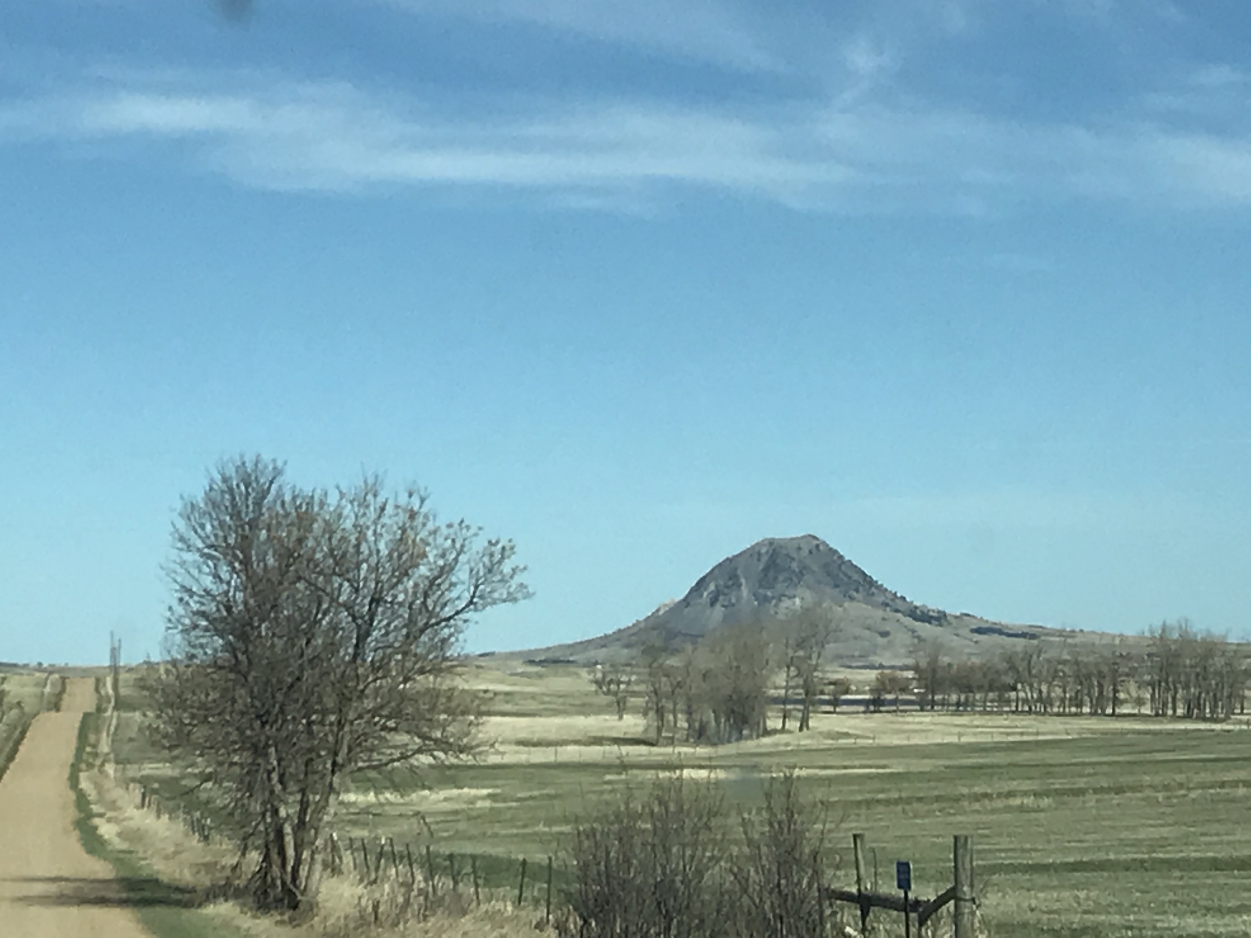
A dirt road skirts a brown-grass meadow. A bare, rocky mountain rises from the prairie in the far background.
We even got a nice view of Bear Butte on the way home!
What is your favorite legend for the creation of this unique monolith?  Let me know in the comments! 

Did you enjoy reading this post?  Pin it!

A large, rock monolith rises above the trees and brown, prairie grass into the cloudy, blue sky. Pin reads, "hiking trails at Devils Tower".

Like what you read here today?  Please feel free to leave a comment, like or share this post!  Add your email at the bottom of the page, or the sidebar to the right, to be notified when a new post is published.  By signing up for the email list, you will also receive a free copy of the Tranquil Trekker’s Top 10 Tips of Trekking Do’s and Don’ts!

You can also follow the blog on social media by clicking the links below!
Facebook
TwitterInstagram

Pinterest

Bighorn Medicine Wheel in Wyoming

In this post, I discuss an ancient medicine wheel in the Bighorns!


There is a prehistoric Medicine Wheel hidden in the northern, Bighorn mountains of eastern Wyoming.  It was built by the ancient ancestors of today’s American Indian tribes.  More than 80 tribes claim the wheel in their oral traditions so it can’t be attributed to any one group or culture, though it’s, obviously, a very sacred site.  

What does the Bighorn Medicine Wheel look like?

This is one of the largest, stone medicine wheels in North America (there are at least 150 spread throughout the continent).  It’s constructed with a center cairn with spokes emanating from it to an outer circle that connects six, smaller cairns that appear to be strategically placed.  

Archeologists aren’t sure of the wheel’s exact age, most estimates date it back at least 800 years, but it could be far older.  Archaeological evidence shows human habitation as far back as 12,000 years in this area!  

The ranger we spoke with stated the six rock cairns that dot the outer portion of the circle are believed to have a celestial purpose, but the exact function remains a mystery–it is thought that they may have been used during vision quests.  The last time the six cairns matched up with celestial markers was at least as far back as the 1700s!

Medicine Wheels are Sacred Sites

Religious ceremonies are still held at the wheel on a regular basis as many tribal members make religious pilgrimages to the site.  Some of the ceremonies involve large groups, while others include only a few individuals–two, small, private ceremonies occurred while we were there.  Anyone with American Indian heritage can participate in a ceremony.  

It’s always enthralling for me to observe religious practices that I’m not familiar with.  I’m fascinated by the emotions you see play out on the faces of the participants, and how descriptive their movements can be.  I find their actions evoke emotions within me as well.  You can actually feel the peace and tranquility emanating from them as they dance, pray, or worship in their own way.  

A tour of the wheel may be delayed if a ceremony is occurring, though they usually don’t last longer than 30 minutes, so please be patient and respectful during this time of worship.  Numerous religious offerings are tied to the fence that rings the site (or are placed within the wheel itself).  Please do not touch or photograph these items directly as they are sacred.  It is also requested that people not take photos or videos of the ceremonies, as they are occurring, to respect the privacy of the participants.  

Where is the Bighorn Medicine Wheel?

The wheel is located on Forest Road 12, off of US 14A, in the northern part of the Bighorns.  It’s about 20 miles from Burgess Junction (where 14A branches off from US 14 to the east) and about 30 miles from Lovell, Wyoming, to the west.

Related posts: Lake Helen, Bighorn Mountains, Wyoming; 4 Don’t Miss Sites in the Bighorn Mountains of WyomingWest Tensleep Trail, Bighorn Mountains, WyomingCamping in the Bighorns

The parking lot is a mile-and-a-half walk from the wheel on a graded, dirt road.  The hike isn’t bad, though it is uphill both ways (seriously 😝) and the altitude is over 9,000 feet, so take your time.  The site is also above tree line so bring a hat, water, and sunscreen, and be prepared for the ever-present, Wyoming wind.  It usually takes an hour or so to complete the entire route.  The site is free to visit, though donations are appreciated.  Because this is a sacred site, pets are not permitted and must be left in the parking area.

The only thing that marred the experience was the large, FAA radar placed on the adjoining peak (because none of the numerous, other peaks in the surrounding area, that were a little farther away, wouldn’t have worked?  REALLY?!)  Federal Government, do better! 😤      

Panoramic view of a rocky mountainside. Tree-covered mountains spread in the distance under a crystal clear, blue sky
The incredible view of the Bighorns from the Medicine Wheel site (to the right is the road you hike to reach the wheel)
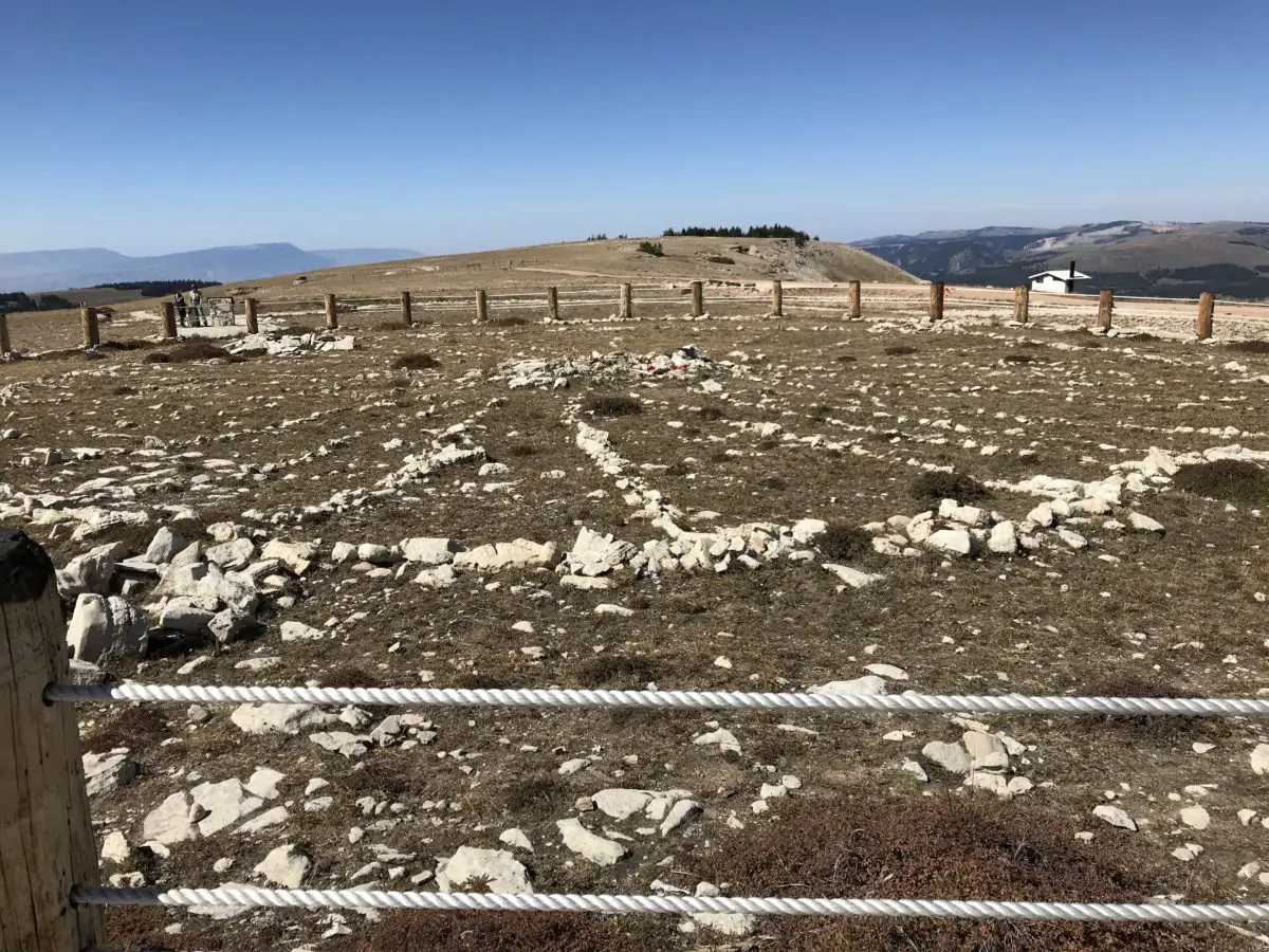
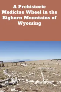
Small stones on the ground form the center and outer portions of a wheel with stone spokes connecting them
The Medicine Wheel (you can see one of the rock cairns in the foreground to the left)

The Backroads of Wyoming

I’ve suggested before, to always take the scenic route, when time permits.  We enjoyed a good bit of that on this trip!  We started by taking Route 24, west, from where it branches off near the Island Park campground.  We then took Forest Road 408, to BLM Road 1117, on to Hyattville.  

This route is listed in the gazetteer as being Hyattville Road, but we saw NO signs reflecting this.  Similar to what we’ve found in Colorado, even though a road may be listed as a “major connector”, especially in the gazetteer, this could easily mean the road is actually dirt (sometimes wide and graded, other times little more than a narrow, two-track, high-clearance road that I wouldn’t be comfortable taking an Outback on). 😝 

We used three separate maps–the gazetteer, a Bighorns map we picked up at a local, outdoor store, and a road atlas–to gather a–somewhat accurate–estimate of the roads’ actual conditions.  Part of the difficulty was the roads traversed National Forest and BLM land in this area, and each department names and maintains their roads differently.  

Overlooking a rocky cliff with pine trees growing up from below
A view from our backroad trip

The drive was very manageable with Mr. Trekker’s Tacoma (any high-clearance, 4WD vehicle could handle it in good conditions).  There were no steep drop-offs and no, real, technical obstacles like what we’ve encountered on some of the roads in Colorado.  It was also beautiful, ranging from alpine, spruce forests and aspen groves, to dun-colored high prairies dotted with tan and red clay mounds, adorned with the varying greens of the diverse foliage.  Rock-rimmed canyons with their gaping mouths open onto prairie grasses far below, while rocky cliffs of various colors traverse throughout, all with the imposing Bighorns as a backdrop.  

Here is a video I made that showcases the beauty that is eastern Wyoming.

After leaving the Medicine Wheel, we decided we were game to try a few more back roads.  We took another scenic trip, east, on US 14A to Burgess Junction, where we picked up US 14 and took it west.  We took that road to Route 17, another “major connector”, that we then took to Alkali Road/BLM Road 1111/Route 228, back to Hyattville (this is a back way to reach the Medicine Wheel from the south).  

Again, these road numbers and names were listed on the gazetteer and one of the maps–some of these roads didn’t even appear on the Atlas–but were NOT shown on the actual road.  We just trusted the signs that directed us back to Hyattville.  You always need to be flexible when taking back roads, as you never know what kind of obstacles or conditions may cross your path.  I should also note, there was NO cell coverage in this remote location (and GPS can often be inaccurate), so maps are often times your only option–time to go “old school” folks!  

Another road we could have driven was labeled in the Gazetteer as the “Red Gulch, Alkali National Back Country Byway”.  We didn’t actually drive it this time–though we returned at a later date to check out the fossilized dinosaur footprints it leads to! 😯  

The Back Country Byway is more of a two-track, high-clearance path, at least in spots.  I certainly wouldn’t call it a “main road”.  Funnily enough, the roads we took back to Hyattville ended up being in better shape than the back road we brought out from the campground.  They were graded, gravel roads that one could expect to travel 30 – 40 mph on (if the rancher in front of us hadn’t decided a slower speed was better.  Unfortunately, on those roads, that are only about 1.5 lanes wide, passing really isn’t an option unless the person in front of you is feeling charitable and pulls over.  This man didn’t. 😜)  So, we enjoyed a leisurely, scenic stroll through the beautiful Wyoming countryside.  😁  

After reaching Hyattville we took Route R54 (another graded, well-maintained, gravel road) to Ten Sleep and then got to enjoy the, INCREDIBLY beautiful, US 16 east through Ten Sleep Canyon, back to our campground. (Did I mention, almost all of these roads, despite their varying conditions–with the exception of the highways–had the EXACT SAME indicators on the map? 😜)

Peering through the trees across tree-covered mountains out to the dry, high prairie far in the distance

The topography of Wyoming is very unique.  It’s characterized by the towering Bighorns in the northeast, to the Grand Tetons that criss-cross Yellowstone and the Rockies, in the west.  A drier, large, bluff-filled basin sits between Yellowstone and the Bighorns.  

Some parts of the state are prettier than others–while the dry, scrubland that surrounds the mountains can be pretty and green in spring, it usually turns rather drab in the later months.  The basin area is dotted with oil fields and sketchy-looking, government sites with warning signs plastered on the fences, which can be rather intimidating. 😳

Below are some more pics of our scenic drive:

Dry, green meadow with trees and rocky mountains far in the background, under a clear, blue skyWhite, rocky cliffs rise high aboveA dry, scrubland canyon with a dry, high plain in the far distanceDry, grassy meadow with dry, high plains and bluffs in the distanceDry, grassy meadow with dry, high plains and red-rock bluffs in the distanceDry, grassy meadow with tree-covered, white cliffs and dry, high plains and mountains in the backgroundDry, grassy high plains with pine-covered mountains in the background

MOOSE in the Bighorn Mountains!

Earlier that summer, we spent ten days in the Colorado high country during peak season and we didn’t see one moose.  Later that fall, we spent ten seconds in the Bighorn mountains of Wyoming (literally), and TWO moose were waiting to greet us when we arrived at our campsite!  Bighorns for the win!   

Two moose in a field as seen through the trees
Our ungulate friends (this year it was Maggie and Megan)

As I’ve mentioned previously, I’m always surprised at how much this part of Wyoming reminds me of the Colorado mountains.  The scenery and critters are very similar, with the added benefit of being half as long a distance from the Black Hills and FAR less crowded than Colorado. 😉  

If you’re looking for an amazing, historical site to visit in the Bighorn Mountains of Wyoming, check out the Bighorn Medicine Wheel!

Have you ever visited the prehistoric Medicine Wheel in the Bighorns?  Tell me about it in the comments! 

Did you enjoy reading this post?  Pin it!

Small stones on the ground form the center and outer portions of a wheel with stone spokes connecting them. Pin reads, "A Prehistoric Medicine Wheel in the Bighorn Mountains of Wyoming"

Like what you read here today?  Please feel free to leave a comment, like or share this post!  Add your email at the bottom of the page, or the sidebar to the right, to be notified when a new post is published.  By signing up for the email list, you will also receive a free copy of the Tranquil Trekker’s Top 10 Tips of Trekking Do’s and Don’ts!

You can also follow the blog on social media by clicking the links below!
Facebook

Twitter

Instagram

Pinterest

West Tensleep Trail, Bighorn Mountains, Wyoming

The Big Horn National Forest, in Wyoming, is a wonderful place to enjoy some secluded time in the woods.


The Trekkers LOVE to visit the Bighorn Mountains, in northeastern Wyoming.  Each time we go to this area I re-discover my love for them all over again!  I enjoy that mountain range almost as much as the Rockies.  This is probably because they are very similar with a few wonderful exceptions:  there are fewer people in the Bighorns and the Wyoming wilderness is only a few hours from the Black Hills–rather than the 6 to 8-hour drive to the Rockies.  Traffic is much better too!  😉

The weather in this area (during the warmer months, at least) is usually comprised of blue skies, warm temps, and clear, crisp evenings.  Conditions can change fast though!  The Trekkers have a tradition of camping in the Bighorns over Labor Day Weekend and it isn’t unusual for this area to receive its first significant snowstorm of the year a scant week or so later. 

On this particular visit, we came to hike the West Ten Sleep trail to Mirror Lake. The only downside for this trip was lingering smoke from wildfires in Montana.  When we arrived in Buffalo, Wyoming, on Friday evening, you could barely make out the mountains through the smoky haze. 

If you’ve never been there, Buffalo is basically nestled into the eastern base of the Bighorns, similar to how Rapid City is nestled into the eastern base of the Black Hills.  If you’ve never been to either locale, well, let’s just say you normally can’t miss the mountains, they’re like, right there!  😜  Also, you need to plan a visit!!!

Where is the West Tensleep Trailhead?

You will find the trailhead at the end of Route 27 North.  The road basically ends at West Tensleep Lake and the trail continues along the Tensleep Creek from there.  Route 27 branches off of US 16 just east of the B-E-A-Utiful Tensleep Canyon and just west of Meadowlark Lake and the Meadowlark Ski Lodge.

You should note that Route 27 is often closed to regular vehicles during the snowy season, which is lengthy in this part of the country, as it becomes a snowmobile trail.  Other times of the year this dirt road can become rugged (in snowy or muddy conditions, even if it’s open) and a 4WD or high-clearance AWD vehicle may be able to handle it better.

Hiking the West Tensleep Trail to Mirror Lake

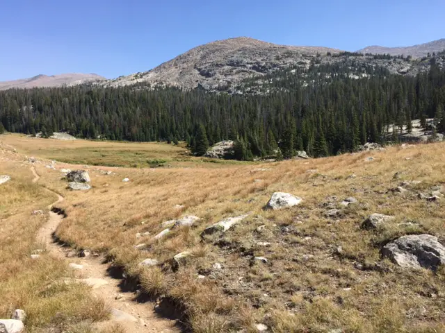
That Saturday dawned clear and beautiful–we were thankful for a reprieve from the smoke that day–so we hiked West Tensleep Trail (Trail #65) to Mirror Lake.  This trail can go as far as Twin Lakes, though that is a 12-mile hike in each direction.  We opted to stop at Mirror Lake (at about the halfway point), but the full trail would be ideal for an overnight backpacking trip.  This moderate trek is beautiful and accented with stream crossings, sprawling meadows, and a few waterfall views.  It is well-marked and wide in most places and not overly difficult.  What makes it strenuous at times is the altitude (it reaches close to 10,000 feet in places) though the views of the surrounding summits are worth it!

Related posts: Lake Helen, Bighorn Mountains, Wyoming; Camping in the Bighorns; Bighorn Medicine Wheel in Wyoming; 4 Don’t Miss Sites in the Bighorn Mountains of Wyoming

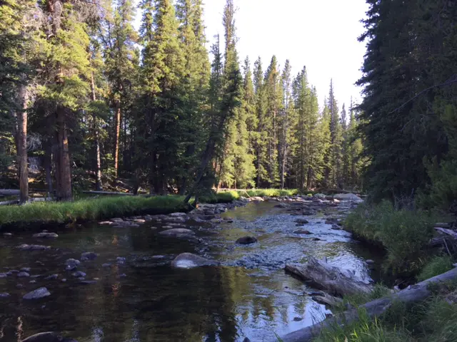
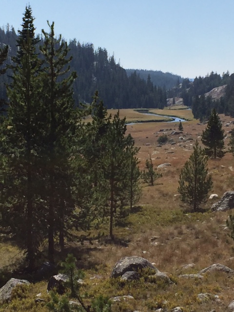
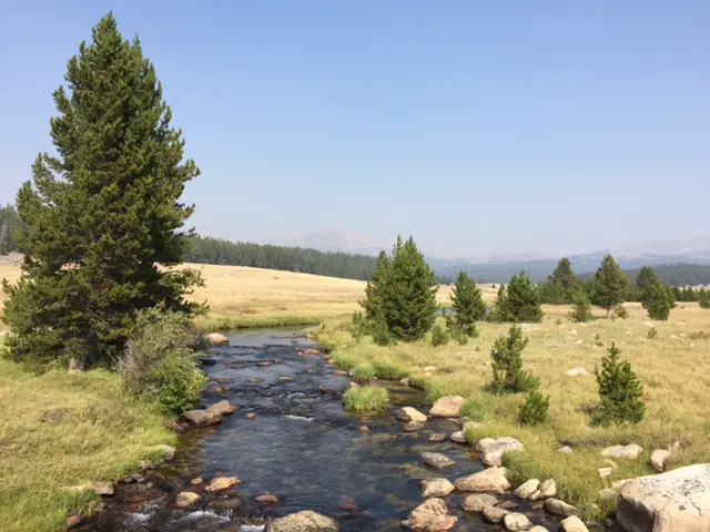
The gurgling creek accompanies you most of the way creating an iconic, mountain experience.  The neighboring stream and the craggy peaks towering nearby especially reminded me of hiking in Rocky Mountain National Park. 

A stream runs through a forest
West Tensleep Trail

A creek meanders through a narrow meadow with pine trees lining both sides

A trail meanders through a rocky meadow. A large, rocky mountain can be seen in the background.

Mirror Lake!

Mirror Lake is a beautiful, alpine lake that mirrors the sky and adjacent cliffs when calm (likely where it gets its name!) and makes a prime lunch spot before turning back or continuing on to Twin Lakes.  Usually, we enjoy peaceful solitude in this region, but this time it was quite “crowded” (we saw 5 – 10 other groups on the same trail–that’s crowded in the Bighorns!)  Apparently, we weren’t the only ones looking to escape the 90-degree heat of the lower elevations that weekend!

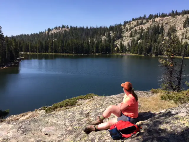
A woman sits looking out over the dark, smooth water of Mirror Lake surrounded by forest. A tree-covered mountainside is in the background.
Mirror Lake
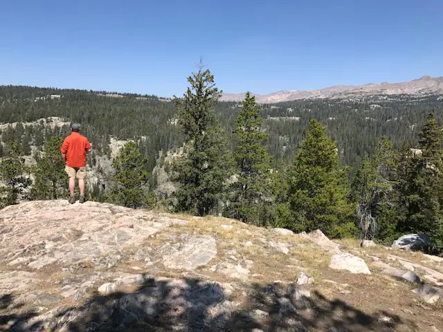
Mr. Trekker stands on a cliff edge with his back to us, looking out over the mountain vista. Tree-covered mountain slopes are in the background.
Just a man and his mountains

Island Park Campground, Bighorn Mountains

We stayed at the Island Park campground and our campsite was located on the fringe of the national forest, overlooking a marshy, grassy valley.

Don’t be afraid of the lesser-developed national forest campgrounds.  They are spectacular, though you do need a tolerance for “roughing it” a bit if you’re tent camping (while potable water is often available in the “on” season, pit toilets are regularly all that is offered).  If you’ve got an RV this may not be an issue (and the “developed” campgrounds can often accommodate RVs).  These sites are usually more off the beaten path so they tend to be quieter, more enjoyable, and may provide more wildlife viewing opportunities.

Moose in the Bighorns!

An added bonus that made this weekend laudable was the “visitors” we received each evening (and most mornings).  If you’ll recall, in a previous post, I mentioned State Forest State Park in north-central Colorado had the best moose-viewing opportunities we’d ever seen…until this trip! 😁  A single cow and another momma and her baby visited us at least once a day the whole weekend.  One evening a large bull also graced us with his presence. 

This campground was the perfect place to view moose as they happily gorged on the willow branches that dotted the boundary.  We named them Maggie, Molly, Matilda, and Marvin (they’re moose, obviously all their names have to start with “m”! 😉)  Marvin kept his distance but the three ladies ventured right up near the campsites if people were quiet enough and gave them their space.  It was an incredibly beautiful, (dare I say tranquil?) site to behold.

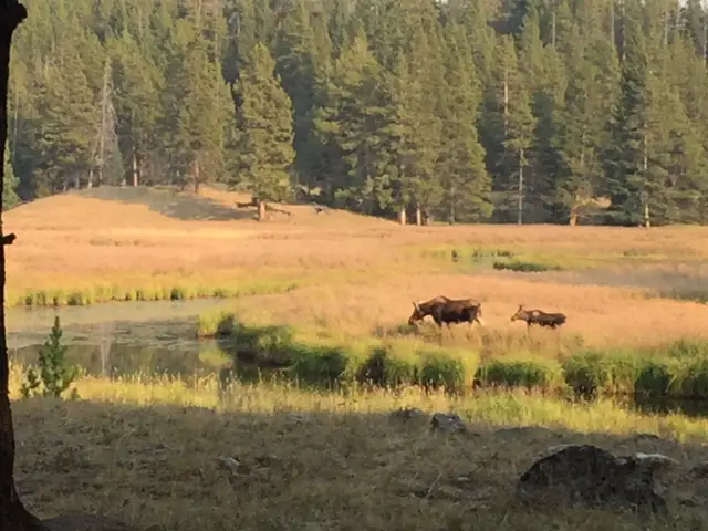
A cow and baby moose walk through a meadow with a stream running through it. The forest creates a backdrop.
Maggie and Molly

I’ve always been fascinated by moose, perhaps because they’re one of the only critters that aren’t native to the various regions I’ve lived in.  They’re slightly odd-looking creatures (though cute too), and while they seem like they would be awkward clodhoppers 😂, with their large bodies –especially the males–they’re actually quite graceful when they run through wetlands or swim across streams.  They seem like big cows but be warned, they ARE wild animals that can be quite dangerous and aggressive if provoked (especially the mothers protecting their babies or the males during the rutting season).  Usually, if you leave them alone and give them the respect they deserve, they’ll offer you the same consideration.

Note: Moose are NOT afraid of dogs and they have been known to kill dogs. PLEASE, keep your dogs leashed and fully under control in Moose Country. (Also, the Forest Service can and will ticket you for “harassing wildlife” if they feel you’re allowing your dogs to bother the moose.  Always remember, this is at the ranger’s discretion, it doesn’t matter if you agree that harassment was occurring or not… 

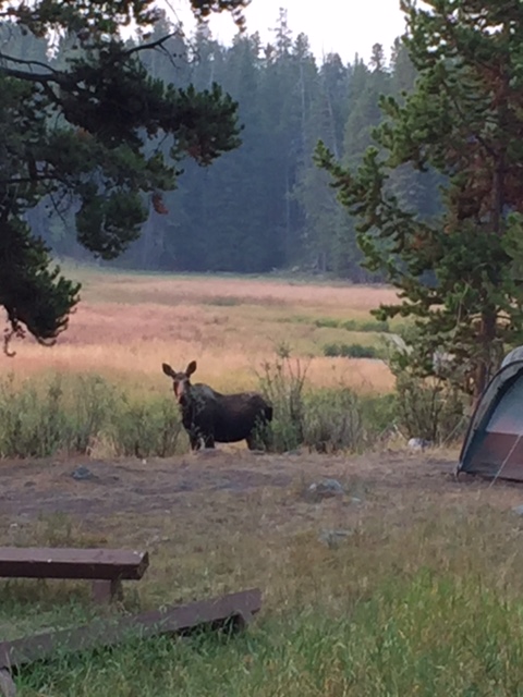
A cow moose is seen eating willows just a few feet from a tent!
Oh, hello! (you can see how close she got to the campground!)

West Tensleep Lake

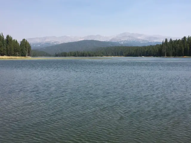
Sunday we canoed West Tensleep Lake surrounded by the imposing peaks of the Cloud Peak Wilderness (and only slightly marred by lingering smoke).  This is a small lake but it’s no-wake so it’s ideal for canoeing, kayaking, and wake-boarding (just give your fellow fishermen space to enjoy their activities, as well.) 

The dark, rippling waters of West Tensleep Lake with rocky mountains looming through the haze in the background
West Tensleep Lake, you can see the Cloud Peak Wilderness area looming through the smoky haze

We also attempted to reach East Tensleep Lake via Forest Road 430.  While Mr. Trekker had fun practicing his 4×4-ing skills we decided the road was a little more than we wanted to tackle that day so we only traveled about halfway.  We enjoyed beautiful views throughout, however. (Check out this post for info on our return trip to that lake!) 

A creek runs through a meadow scattered with trees. Mountains can be seen looming through the haze in the background.
Off Forest Road 430

The road parallels Tensleep Creek which offers countless fishing opportunities.  It also crosses several expansive meadows providing prime disperse-camping opportunities (this is national forestland so dispersed camping is allowed, just follow all local regulations pertaining to the use of fires).  There are also ample opportunities for on and off-trail hiking.

Busy Bee Cafe, Buffalo, Wyoming

Monday morning dawned smoky once again as we packed up to head for home.  We ended our trip by enjoying a well-earned breakfast at one of our favorite local haunts, the Busy Bee Cafe in Buffalo!  This small diner was thrust into the spotlight thanks to Craig Johnson’s Longmire series that is based in this general area (and its reputation is warranted).

Below are some more pictures from our wonderful weekend (as always thanks to Mr. Trekker for a few of these):

IMG_2512
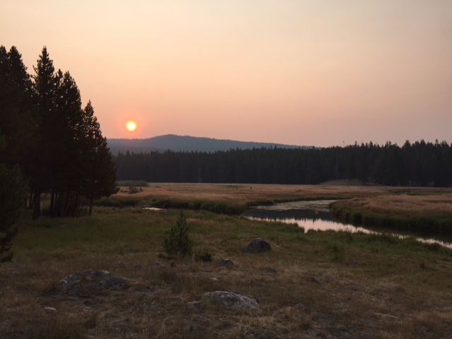
Smoky sunrise
IMG_2494
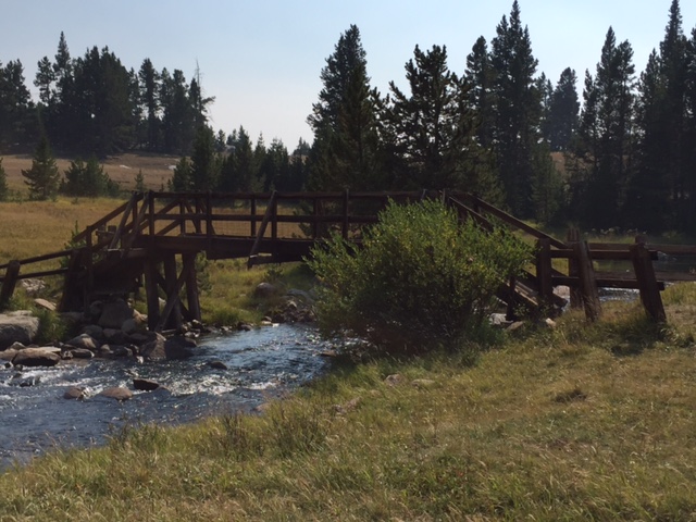
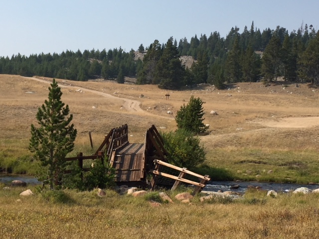
Bridge over Tensleep Creek

IMG_2493

Have you hiked the West Tensleep Trail, or visited Mirror or West Tensleep Lakes?  Tell me about your experiences in the comments!

Did you enjoy reading this post?  Pin it!

3 pictures: 1) A creek meanders through a narrow meadow with pine trees lining both sides; 2) The dark waters of West Tensleep Lake with rocky mountains speckled with pine trees in the background; 3) A trail meanders through a rocky meadow. A large, rocky mountain can be seen in the background. Pin reads, Take a Hike on the West Tensleep Trail, Bighorn Mountains"


Like what you read here today?  Please feel free to leave a comment, like or share this post!  Add your email at the bottom of the page, or the sidebar to the right, to be notified when a new post is published.  By signing up for the email list, you will also receive a free copy of the Tranquil Trekker’s Top 10 Tips of Trekking Do’s and Don’ts!

You can also follow the blog on social media by clicking the links below!
Facebook

Twitter

Instagram

Pinterest

South Rim and Uncle Tom’s Trails, Yellowstone National Park

In this post I review Uncle Tom’s and the South Rim Trails, and their views of the Upper and Lower Falls, at Yellowstone National Park.


Several years ago, in June, we visited Yellowstone National Park with the Trekker In-Laws.  As it was the first time there for all of us we didn’t get much hiking in, we just went full-blown tourist and hit all the “must-see” sights.  But Mr. Trekker and I did get to do two very cool, very accessible hikes, the South Rim and Uncle Tom’s trails, which allow amazing views of Yellowstone’s Upper and Lower Falls.

The Trekkers visited during a time of snowmelt so some of the waterfalls were running especially high at the time. 

Author’s Note: Not long after writing this post the Uncle Tom’s Trail was permanently closed due to safety concerns and maintenance costs. Unfortunately, future visitors to the park will not have the opportunity to enjoy these cool sites, so I will leave info on this trail up to allow others to experience what we saw. I feel very fortunate that we were able to see these views before they were forever altered. 

The Yellowstone River:

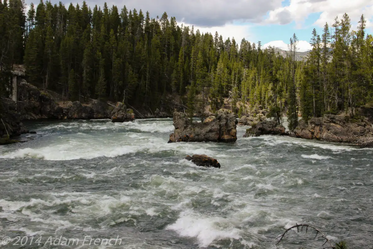
A wide, raging river with white-capped rapids flows between rocky, pine tree-covered banks. Large boulders sit in the middle of the river.

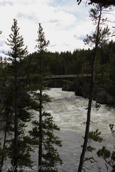
A wide, raging river with white-capped rapids flows between rocky, pine tree-covered banks. A large, cement, road bridge croses the river with pine trees in the foreground.

Where are the South Rim and Uncle Tom’s Trails?

The trails are located in the Grand Canyon of Yellowstone on the South Rim.  You access the South Rim Trail from the Wapiti Lake Trailhead, which then joins the Uncle Tom Trail.  The trails encompass gorgeous views of both the Upper and Lower Falls of the Yellowstone River. (Only the Lower Falls was visible from the Uncle Tom Trail).  The terminus of both of these routes is Point Sublime near Artist Point.
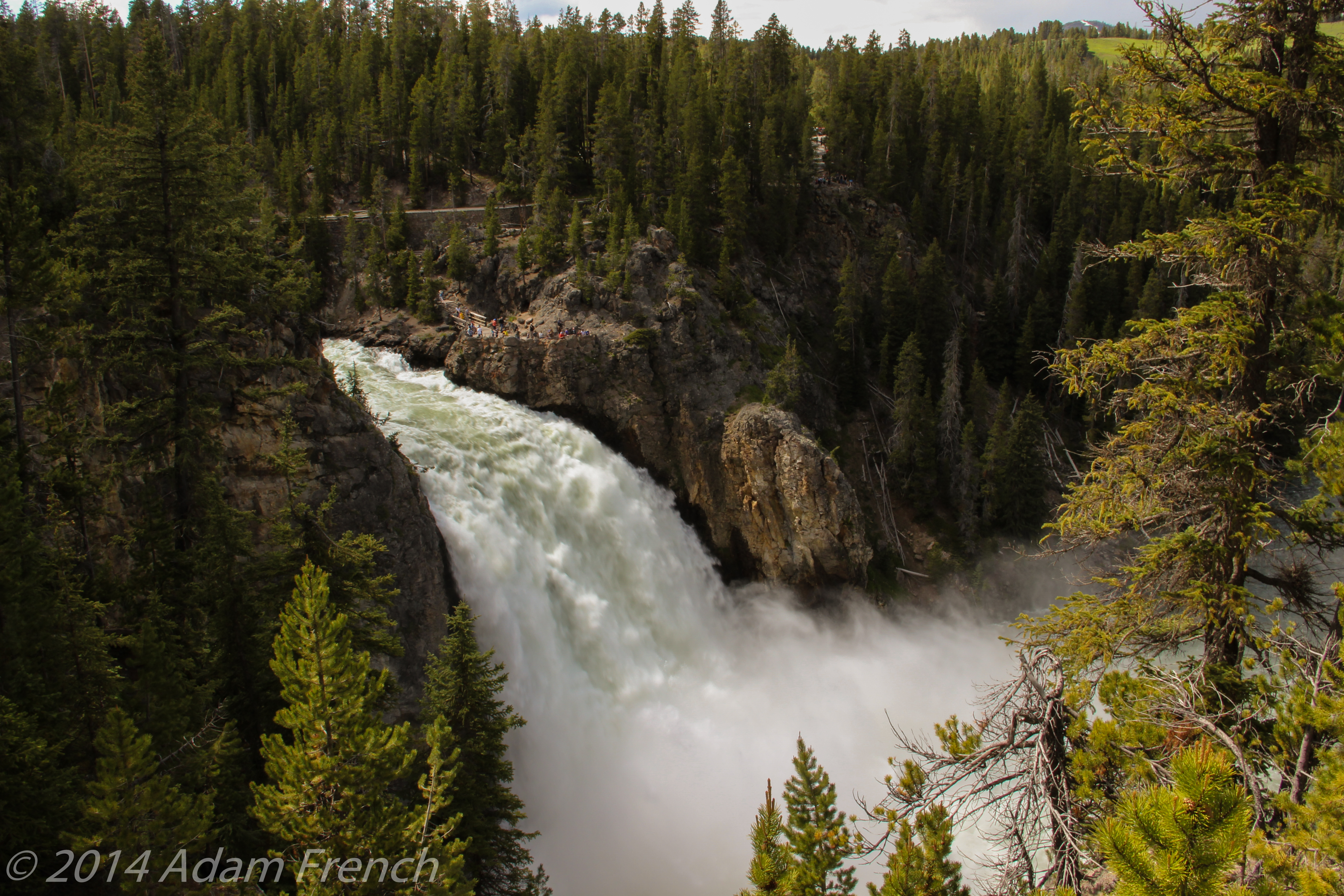
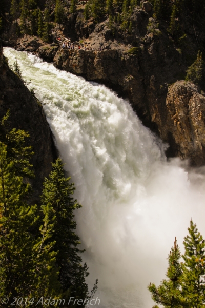
Yellowstone’s Upper Falls

A large, white-capped waterfall pours down a rock face into the mist below. It is surrounded by rocky, pine tree-covered walls.

View from above of a large, white-capped waterfall pours down a rock face into the mist below. It is surrounded by rocky, pine tree-covered walls.

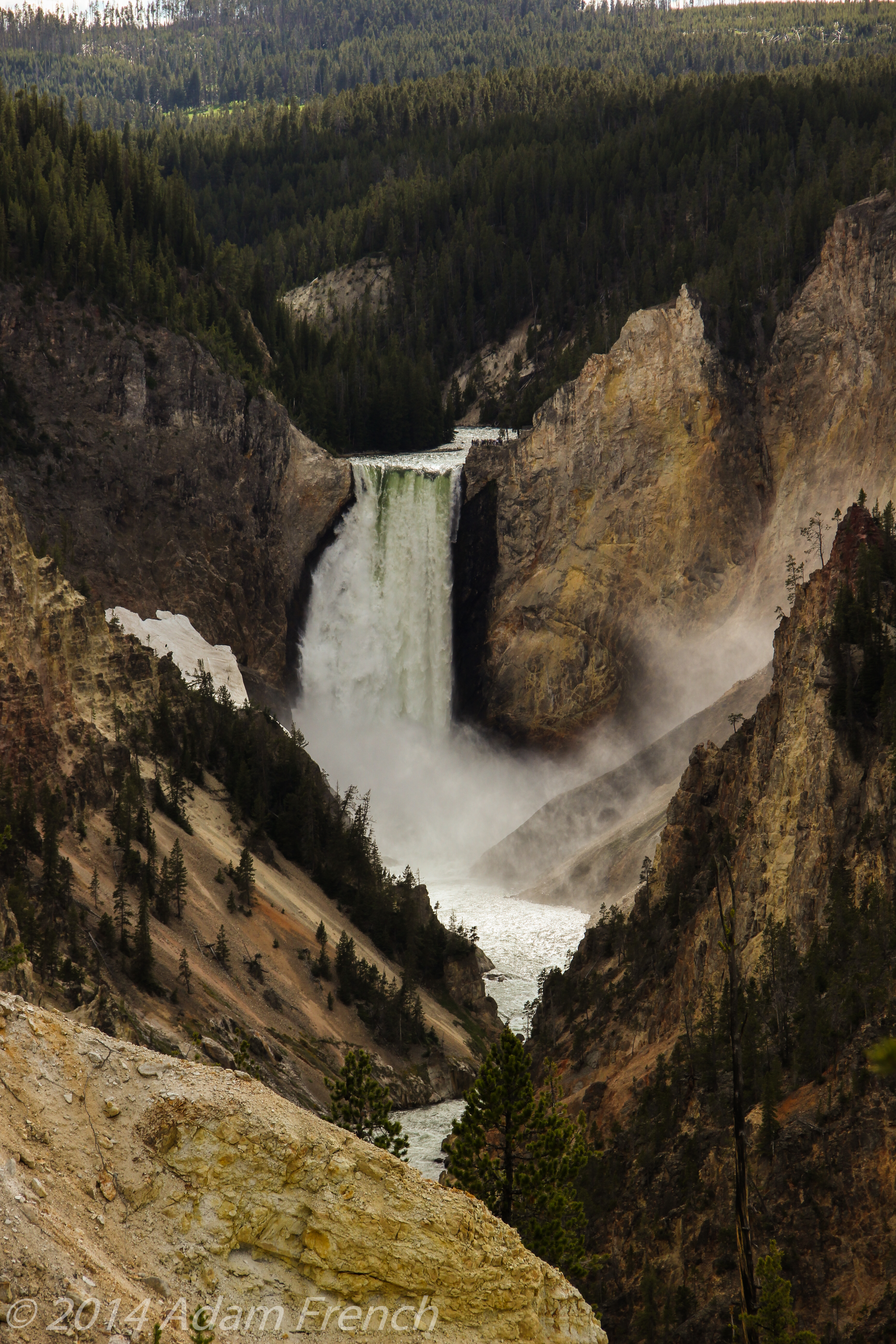
Yellowstone’s Lower Falls

In the background, a large, white-capped waterfall pours down a rock face into the mist and river below. It is surrounded by rocky, pine tree-covered walls. The river then flows through a rocky canyon into the foreground.

A white-capped waterfall flows down a rock face. Dirty snowpack clings to rock in the foreground.

What are the hikes to view Yellowstone’s Upper and Lower Falls like?

Our hike began on the South Rim Trail.  In a welcome contrast to the rest of the park, we saw relatively few fellow hikers even though this portion of the trail is easily accessed and has little elevation gain.  I highly recommend this peaceful hike with its many beautiful views of the two falls; though as is good practice when hiking throughout the park, always be aware of the wildlife that may be sharing the trail with you (we had no bear encounters on our hike but heard stories of hikers who did). 

We had more company on the Uncle Tom Trail as it was more popular.  It was named for H.F. Richardson, or Uncle Tom, as was his nickname.  In the late 19th Century he began guiding tourists into the Canyon to view the waterfalls and cross the river.  At that time the trail consisted of numerous ropes and rope ladders that visitors had to negotiate.  Fortunately on our hike, one only had to manage a hefty climb (300+ steps!) on a metal staircase bolted into the rock on the side of the canyon.

As I’ve mentioned plenty of times on this blog, I harbor a hefty case of acrophobia, or fear of heights.  I tend to get vertigo and “freeze” when confronted with a lack of earth in front of me–an interesting condition for someone who enjoys hiking in high places regularly. 😝 

Due to this, I was a little nervous upon venturing onto the Uncle Tom Trail as I knew the steps bolted into the side of the canyon were composed of perforated steel.  That’s right, not only were you hanging off the side of a cliff but as you descended you were awarded with a view of the gaping chasm yawning below you!…or so I thought.  In truth, the canyon wall was very rocky and the steps lingered over rock ledges the entire way.  Though the steps did hang off the side of the wall and span a chasm, the rock floor you saw was never more than 20 or 30 feet below your feet.  To my surprise, I found the descent surprisingly bearable.

The Stairs that made up Uncle Tom’s Trail:

A lengthy span of metal stairs descend a rocky, pine tree-covered canyon wall. A river is traversing the bottom of the canyon.

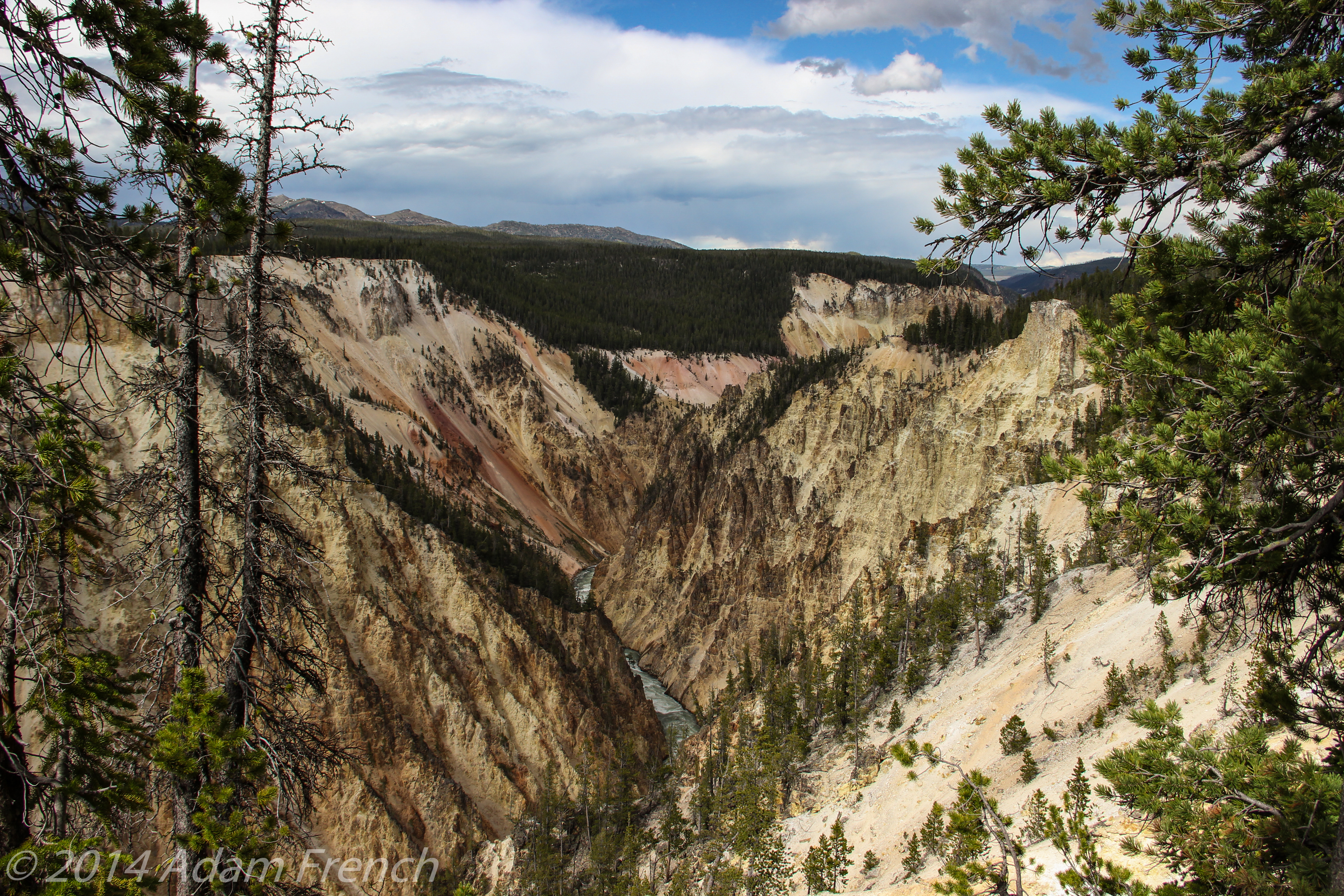
Grand Canyon of the Yellowstone

I’ve been to the “real” Grand Canyon, and while it’s got an exquisite beauty all its own, I think the Grand Canyon of Yellowstone surpasses that splendor in some ways and truly lives up to its name.  This canyon is far smaller and more narrow than its big brother to the south, with rock colors that vary between yellows and reds contrasted with the deep greens of the pine trees on the rim.  There were also numerous patches of snow still remaining in late June.

Rocky, yellow and red-colored canyon walls with a river at the bottom and pine trees covering the rim. A dirty snowfield is in the foreground. Rocky, yellow and red-colored canyon walls with a river at the bottom and pine trees covering the rim. Rocky, yellow and red-colored canyon walls with a river at the bottom and pine trees covering the rim. A dirty snowfield is in the foreground.

So, if you’re looking to stretch your legs a little on your next trip to Yellowstone and want amazing views of the Upper and Lower Falls, check out the South Rim Trail!

Have you hiked these trails?  Let me know what you thought of them in the comments!


Did you enjoy this post?  Pin it!

Steam rises from rock under a cloudy sky. Pin reads, "South Rim and Uncle Tom's Trails with the Upper and Lower Falls. 2 of the Best Hikes in Yellowstone."


Like what you read here today?  Please feel free to leave a comment, like or share this post!  Add your email at the bottom of the page, or the sidebar to the right, to be notified when a new post is published.  By signing up for the email list, you will also receive a free copy of the Tranquil Trekker’s Top 10 Tips of Trekking Do’s and Don’ts!

You can also follow the blog on social media by clicking the links below!

Facebook

Twitter

Instagram

Pinterest 

Save

Save


Dugout Gulch Botanical Trail (#77)

In this post, I review the Dugout Gulch Botanical trail south of Beulah, WY.


The Dugout Gulch Botanical Trail is a nine-mile loop (4.6 mi out to the loop and back, then 4.4 for the actual loop).  It is located in the Wyoming Black Hills. 

We didn’t complete the entire route as it started thundering–when your hiking partner is a meteorologist, you defer to his expertise on these things. 😇  

Where is the Dugout Gulch Botanical Trail?

The trail is situated near Ranch A, south of Beulah, Wyoming.  Take exit 205 off of I-90 (it is the first exit as you come into Wyoming).  Then take Forest Road 863, south, for about six miles to the trailhead. (This is an easy, one-hour trip from Rapid City.)  As you near the end of the drive you’re rewarded with a gorgeous expanse of red sandstone on the western side of the Black Hills.

What is the Dugout Gulch Botanical Trail like?

 The trail was secluded and free of road noise.  It has a gentle ascent the entire way to the loop but the slope is gradual.  The path is fairly root/rock-free so overall it’s not strenuous.  It’s well-marked and very visible as it fluctuates between a single track and a path that’s large enough for several people to walk side-by-side; much of it follows old forest roads.

The Dugout Gulch Botanical Trail begins in lush undergrowth surrounded by leafy trees (it was warm and humid on Memorial Day Weekend) and eventually gives way to more open pine forest as you increase in elevation.  This contrast equates to a unique change in ecosystems as you travel up the gulch. 

The path is fairly narrow to start so be watchful for others sharing the trail.  This also goes for the flora/fauna you may encounter–specifically snakes and poison ivy. 

I won’t comment on the GIANT spider we saw sunbathing on the rocks but we did enjoy a close encounter with a friendly bull snake on this particular hike. 

As the thunder started before we reached the top I can’t speak for the full sights the trail offers but the views of the canyon walls are gorgeous (especially on the return trip).  The variance in rock color from slate gray to reddish-orange, as your eyes travel up the rock face, is incredible.  On much of the trail, you’re accompanied by a bubbling brook, and this along with constant bird chatter, add aesthetic delight to the hike. 

 We chose to hike this particular day but the trail could be amenable for other activities as well.  Once you reach the loop the wide, gradual slope would make for an enjoyable bike ride and the lack of obstacles on the path would present great snowshoeing or cross-country skiing opportunities in the winter months.

My verdict: it’s not the most beautiful trail I’ve ever seen but the views of the canyon walls, the peaceful solitude, and the ease of the path make for an enjoyable afternoon. 

A picture of our new friend is below:  😊

A large, yellow and black snake blends in with the brown and green grass and brown pine needles on the forest floor.

Save

Have you tried out this trail?  What did you think?  Tell me about it in the comments!


Did you enjoy this post?  Pin it! 

A large, yellow and black snake blends in with the brown and green grass and brown pine needles on the forest floor. Pin reads, "Dugout Gulch Botanical Trail."


Like what you read here today?  Please feel free to leave a comment, like or share this post!  Add your email at the bottom of the page, or the sidebar to the right, to be notified when a new post is published.  By signing up for the email list, you will also receive a free copy of the Tranquil Trekker’s Top 10 Tips of Trekking Do’s and Don’ts!

You can also follow the blog on social media by clicking the links below!

Facebook

Twitter

Instagram

Pinterest