In this post, I discuss a summer adventure to this great, state park in western Nebraska
Nebraska isn’t all flat cornfields! Looking for some hidden gems for recreation? Check out Fort Robinson State Park and Toadstool Geologic Park, both located in the far, northwestern corner of the state!
Fort Robinson State Park
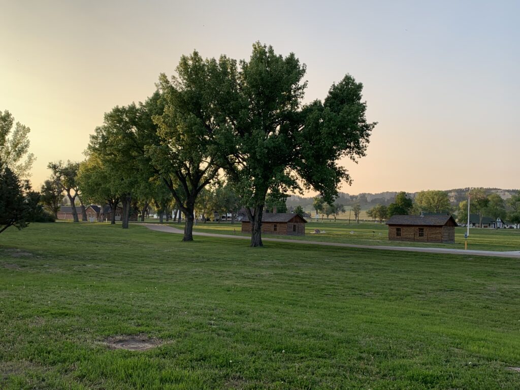
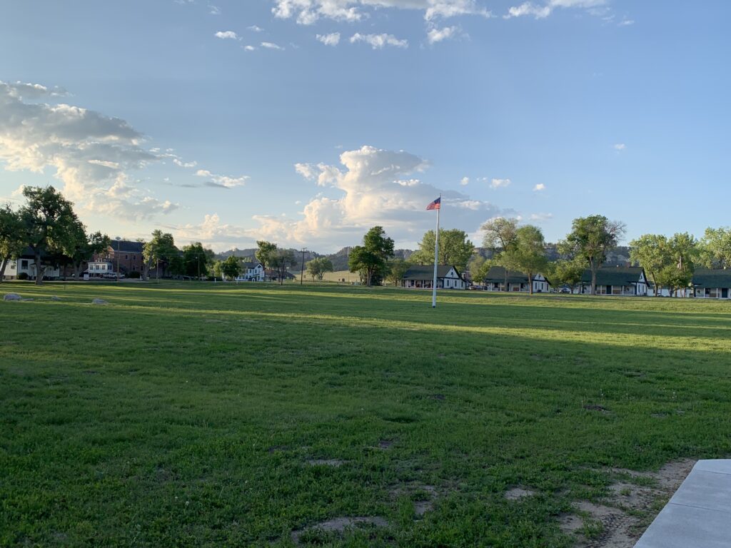
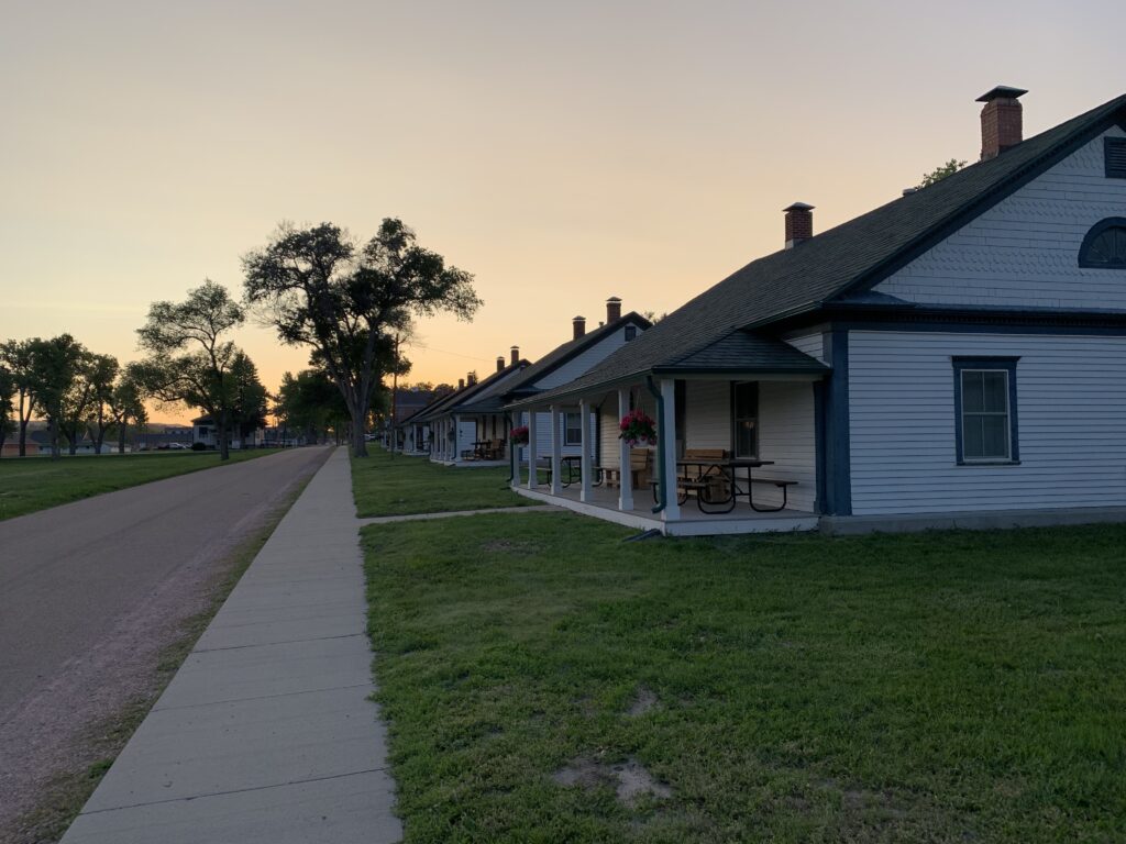
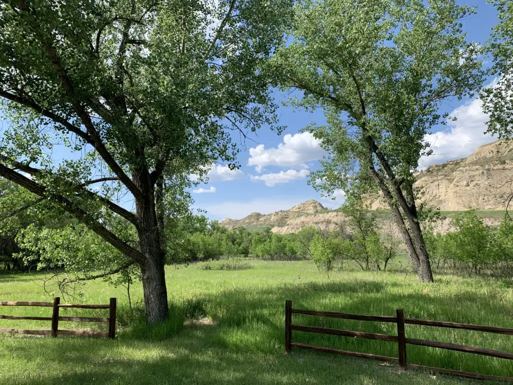
Fort Robinson State Park is a great place to visit! It is a former fort (hence the name 🙃) that has been transformed into a family-friendly rec area! It offers hiking paths, history, and many of the old soldiers’ Quarters were refurbished and are now available for vacation rentals. This is unique and allows Fort Robinson to actually be known as a great, family reunion destination.
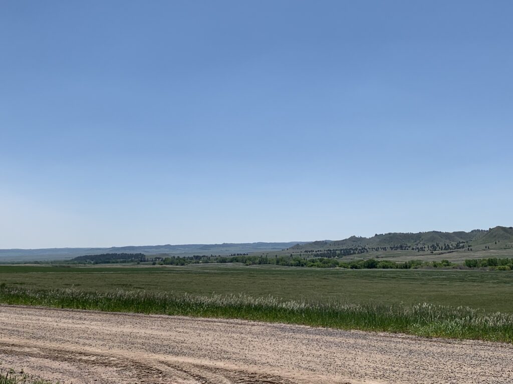
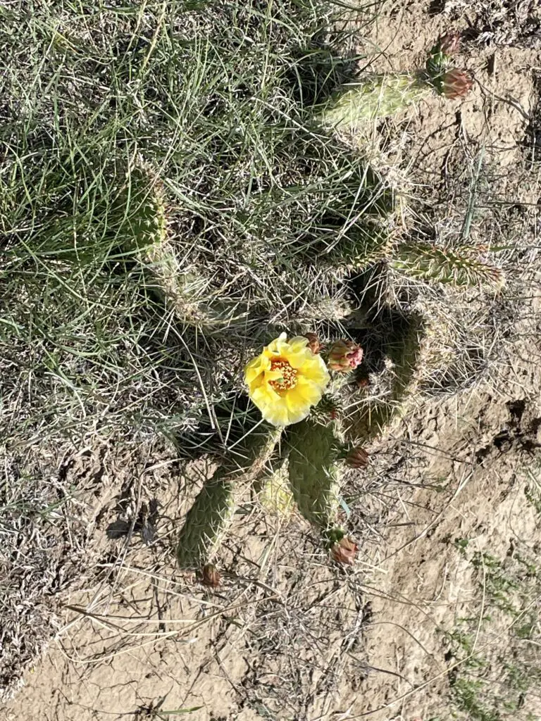
Sometimes called a “gem of Nebraska State Parks”, Fort Robinson was quite nice! (It’s a little-known fact that western Nebraska is actually very pretty! I recommend it over the rest of the state!) The park features LOTS of shade trees!
We did struggle with some ticks and bugs though at least it was quite green when we were there in late May. The mosquitoes weren’t bad though I’m sure they could be at times (and the tent-camping section was all grass, under trees, near the creek. It seemed fairly dark and damp–it looked like a great place to snag a few-hundred mosquito bites! 😝)
To be fair, we’ve only been to two of them, but this has been our experience with Nebraska state parks. We’ve never been impressed with their tent-camping areas (we had another disappointing, tent-camping experience at another Nebraska state park, on a Great Plains road trip, several years ago–though it did result in some Northern Lights viewing!)
For this trip, we actually chose to stay in the RV camping area. Though the sites were pretty tightly packed we were quite happy with this option.
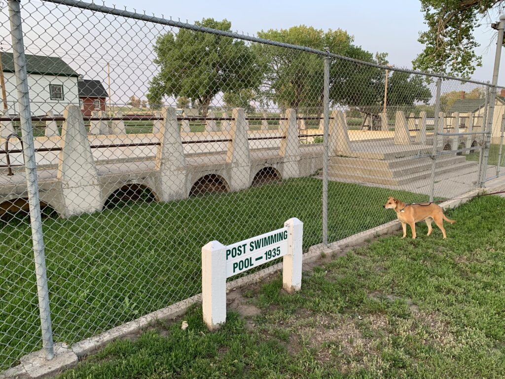
Puppers checking out the old, fort poolThese were Officers’ Quarters that are now available for rent!Western Nebraska is quite beautiful!
Where is Fort Robinson Located?
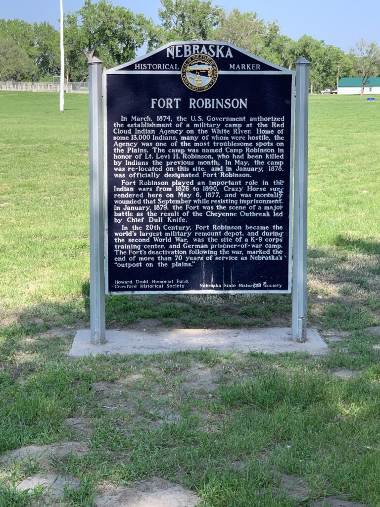
Fort Robinson sits right on US Hwy 20 in far, northwest Nebraska, less than five miles southwest of the small town of Crawford.
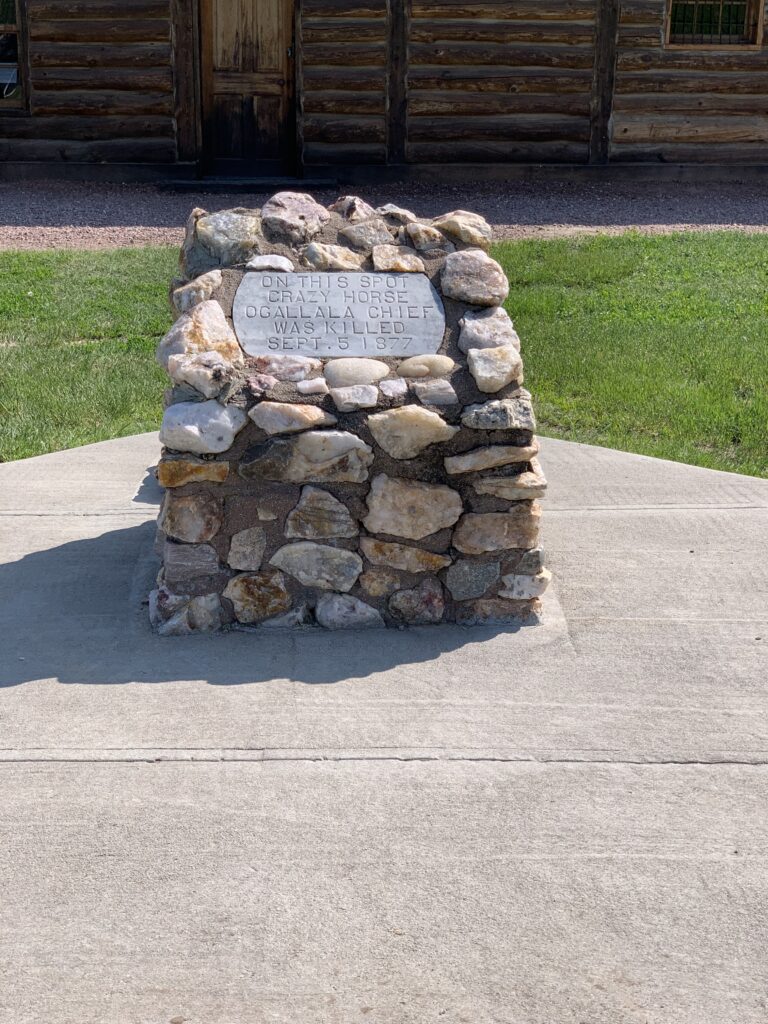
The park has quite a storied past. It started as a fort during the Indian Wars in the 1880s–this was actually the sad location of the death of Crazyhorse, the great Lakota warrior.
The actual site where Crazyhorse died
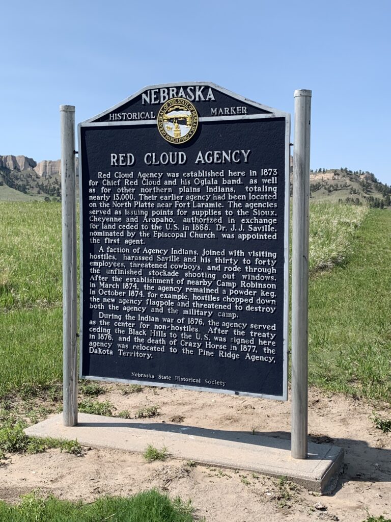
Fort Robinson also served as a large reservation for many American Indians including Red Cloud and his people.
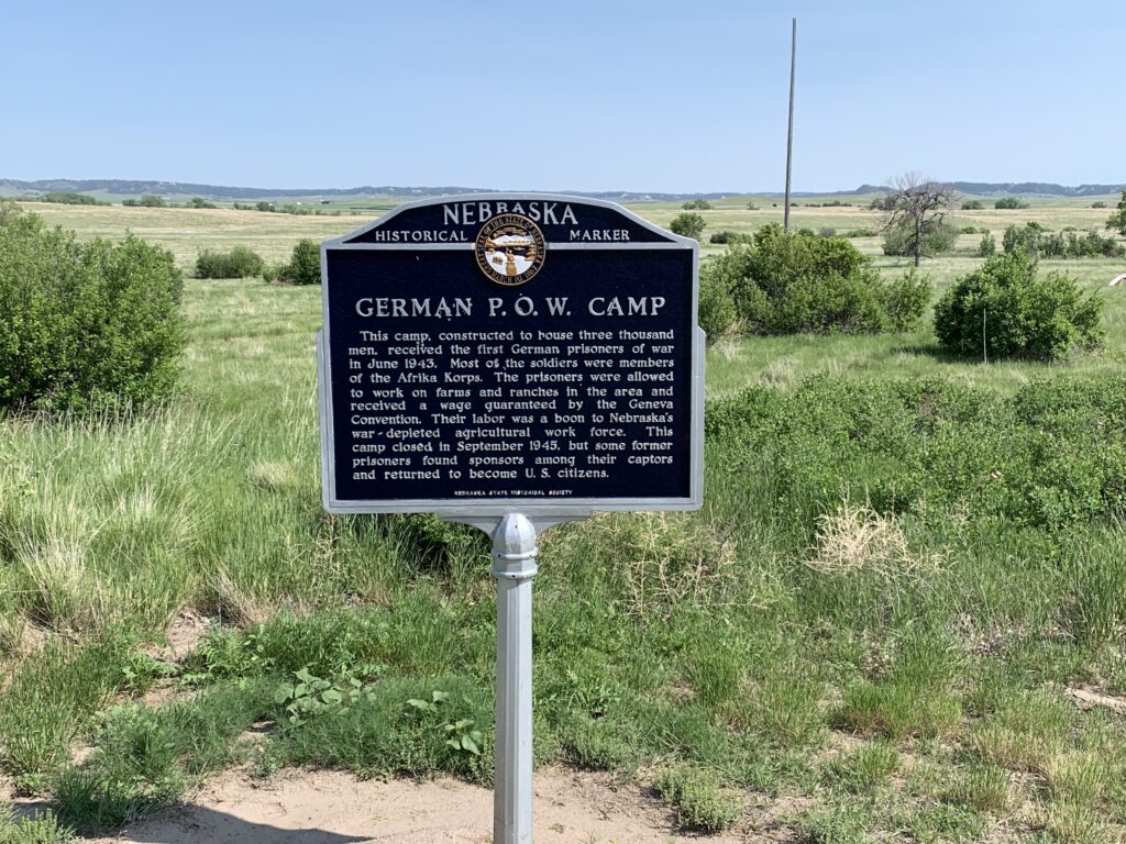
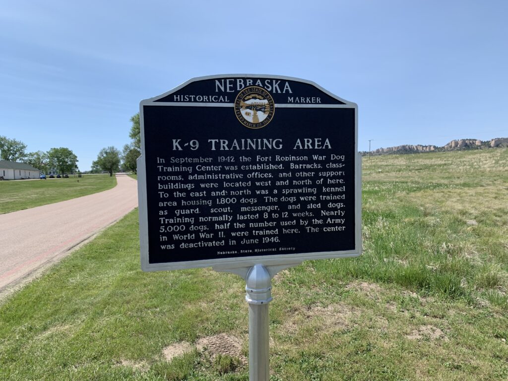
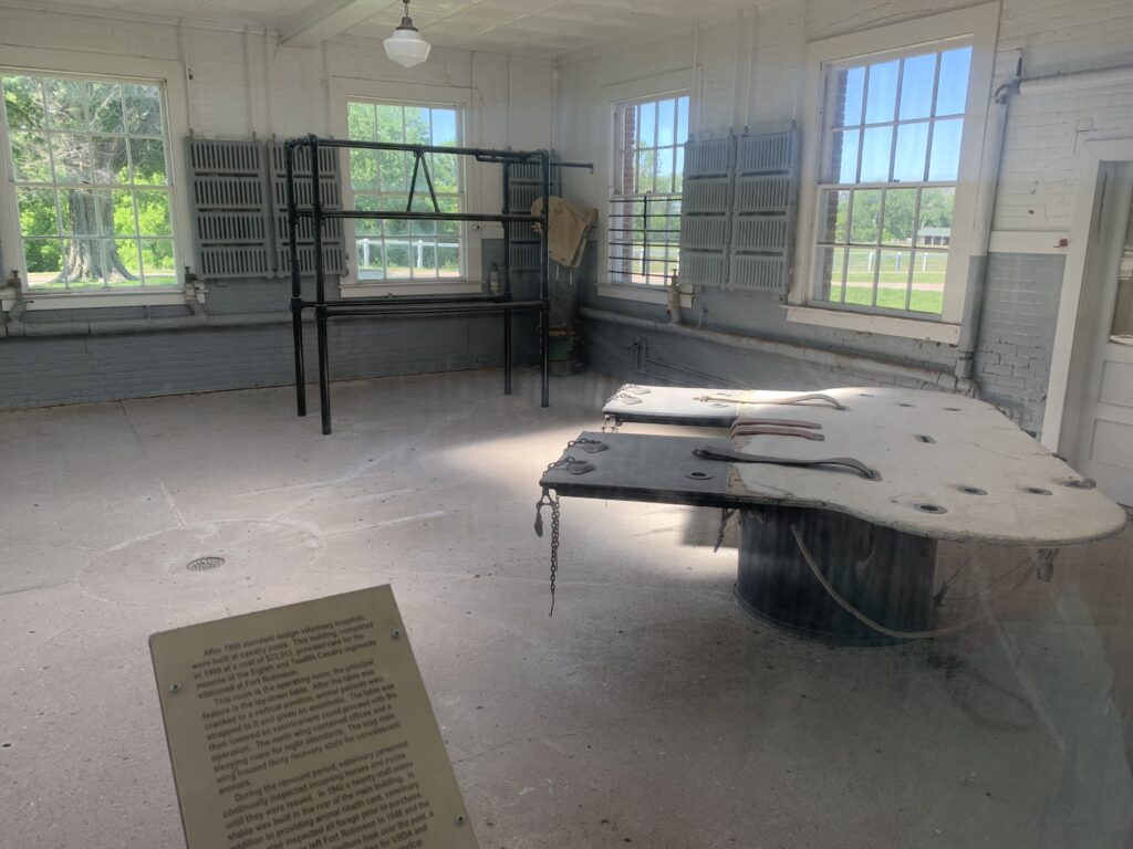
The fort was also a “remount” location for Calvary horses (meaning the battle horses and their wounds were treated here and new mounts were provided). Fort Robinson was also a war-dog training camp and a German, Prisoner of War camp during World War II.
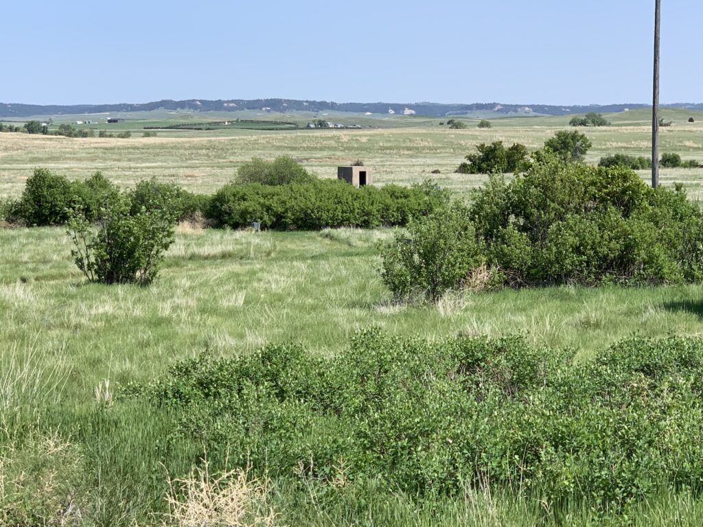
This is about all that remains of the former, German, POW camp
Horse vet center! That table moves to the vertical. They would strap a standing horse to it, sedate the animal and then move the table–with the horse strapped to it–back to the horizontal to perform procedures–not bad for 1940s technology!
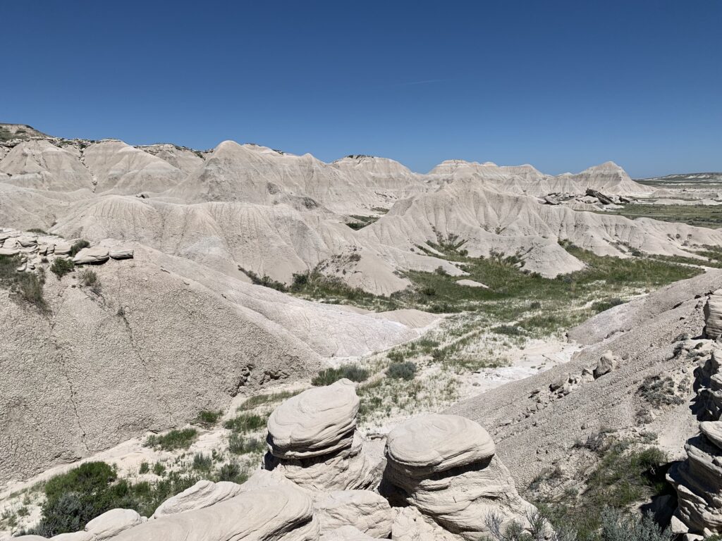
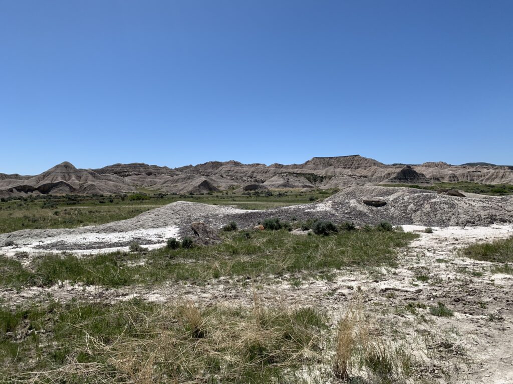
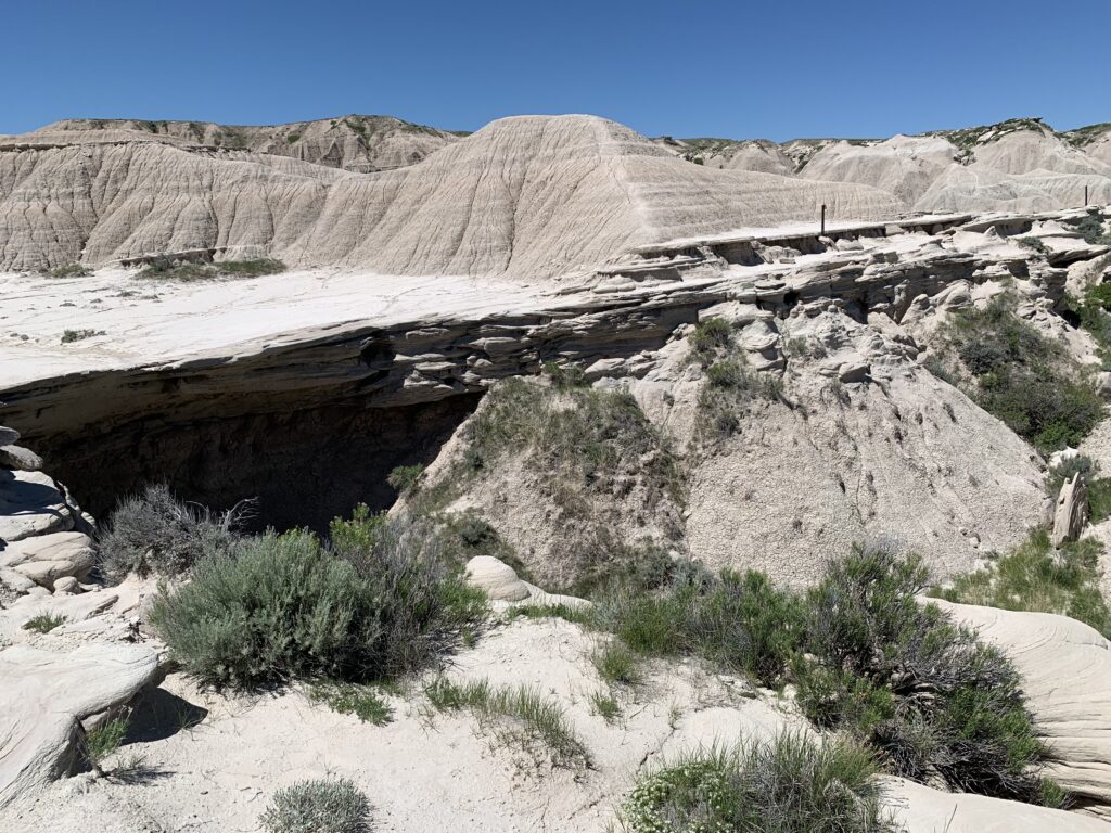
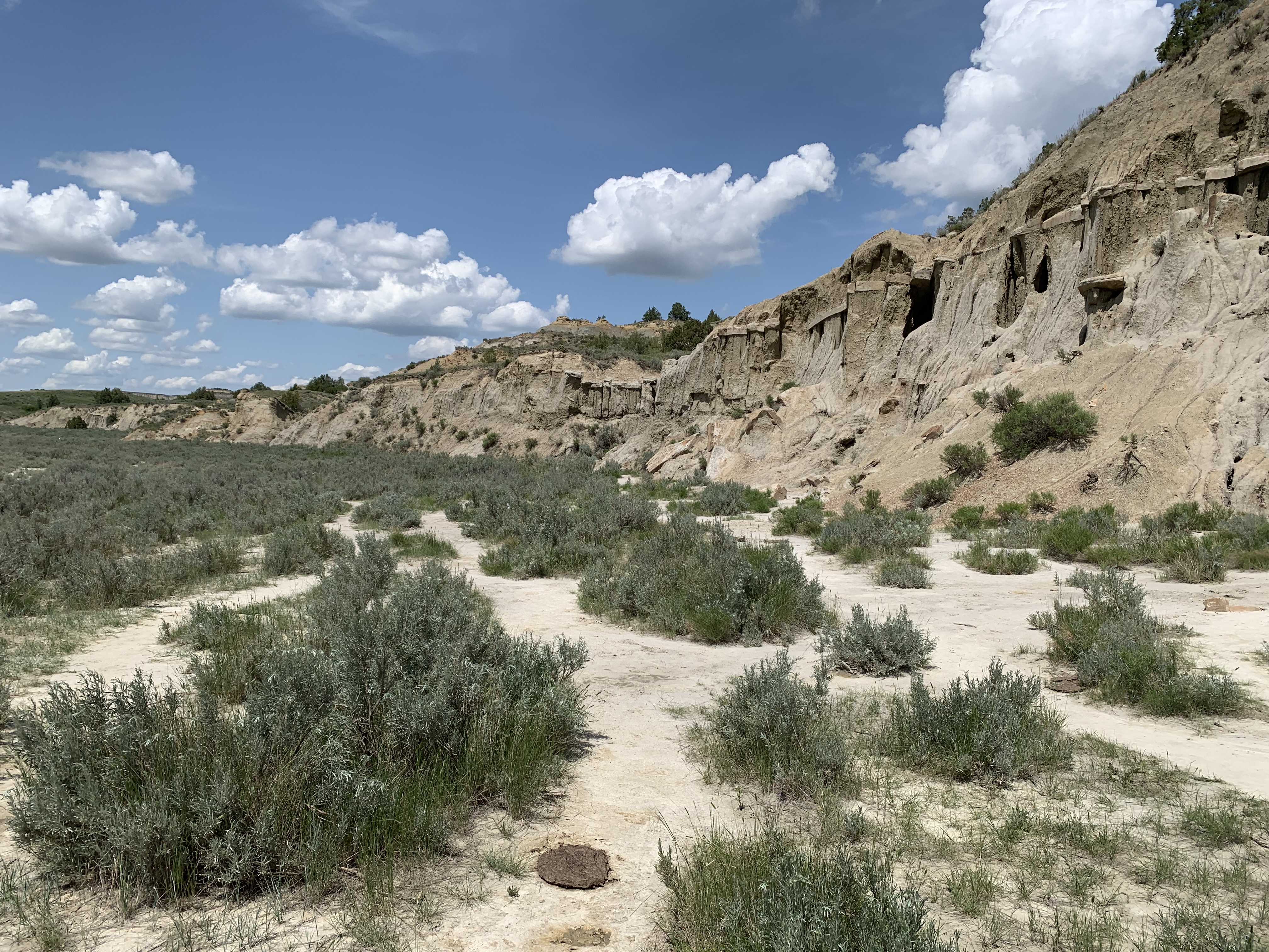
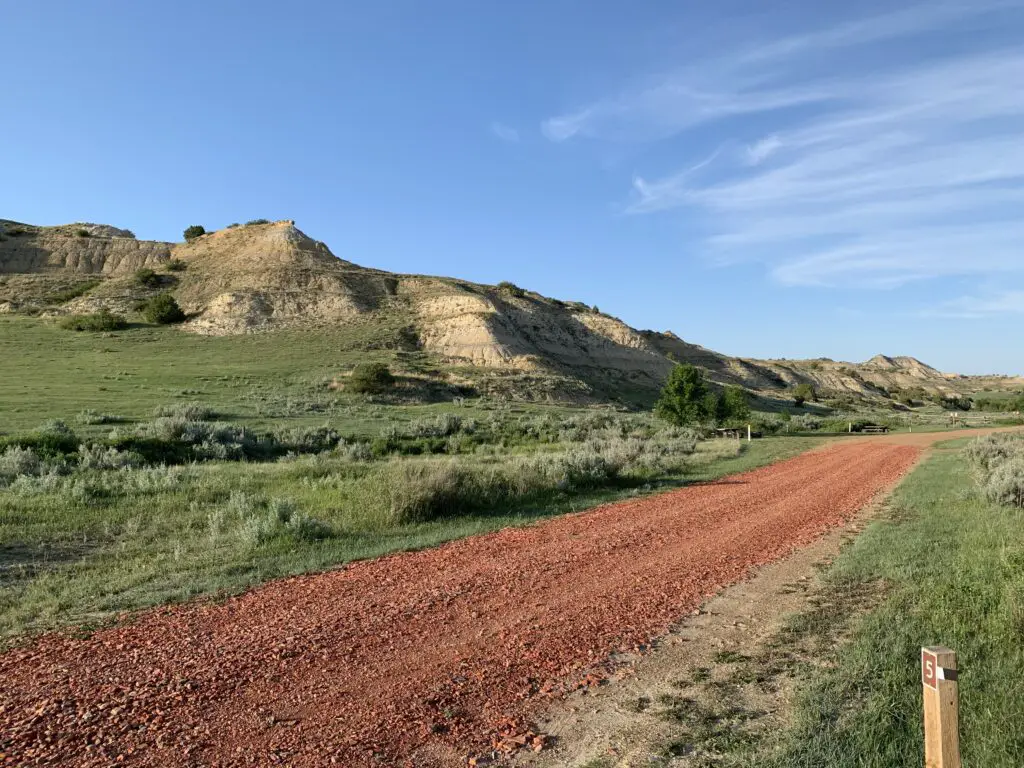
Toadstool Geologic Park
Toadstool Geologic Park is literally in the middle of nowhere! It is situated in the far, northwest corner of Nebraska, about 30 miles north of Fort Robinson, 20 miles northwest of the small town of Crawford and 40 miles west of Chadron, Nebraska.
The park looks a lot like Badlands National Park in South Dakota or the North Dakota Badlands at Teddy Roosevelt National Park–you can read more on that hidden gem here!
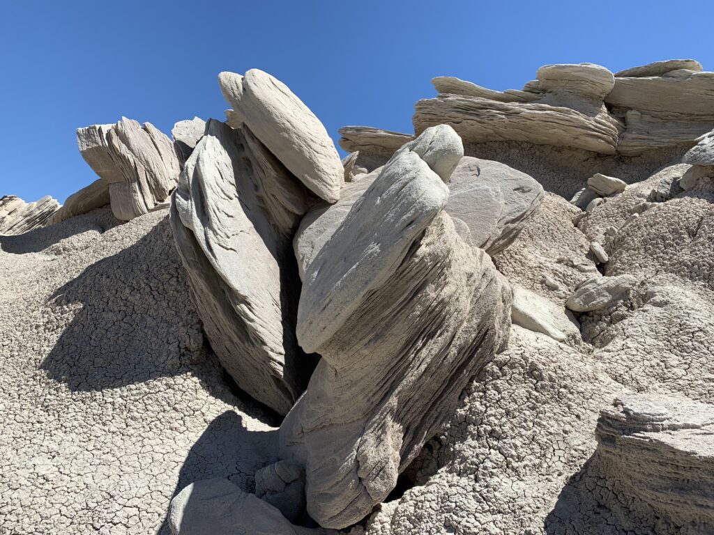
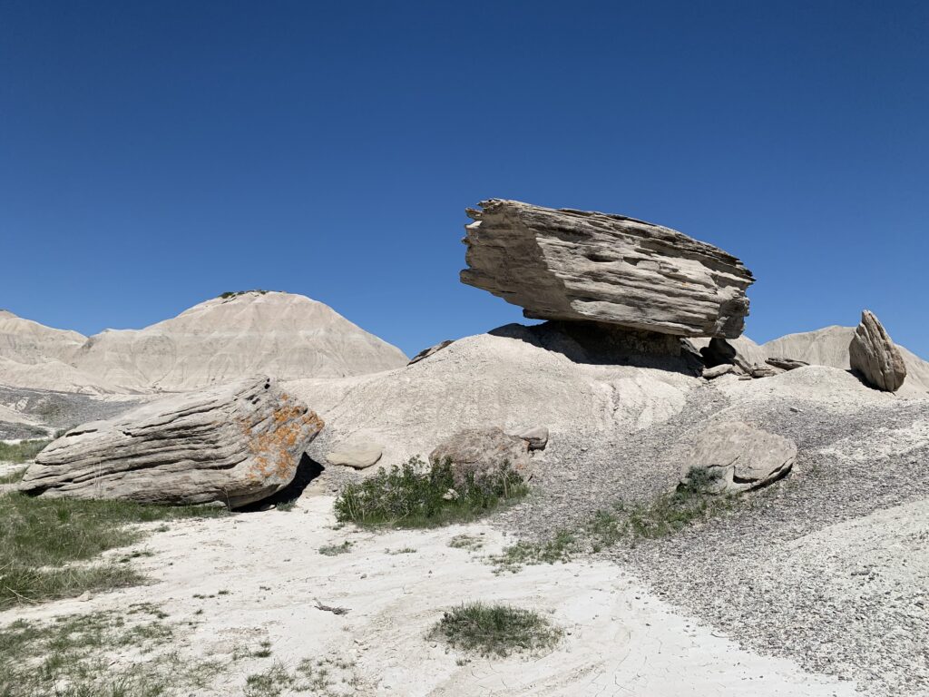
Toadstool Geological Park is mostly a place for hiking though it does offer some camping options…
This was my first big hike after severely breaking my ankle a few months prior. It was a little tougher than we were first expecting for a “nature trail” but I finished the route thanks to my awesome trekking poles and help from Mr. Trekker!
The trail said it was a one-mile “nature trail” which are usually fairly easy. This hike wasn’t “difficult” but there was plenty of uneven ground and some scrambling on loose gravel as well as a few steeper ups and downs…
We learned later that I “may” have gotten a little too aggressive with twisting my ankle around on the uneven ground on this hike. A few weeks later, at my next ankle-surgeon checkup, we found out I broke one of my titanium pins! 😅 The doctor was like, “How did you manage that?!”–she had planned to take it out anyway 😇
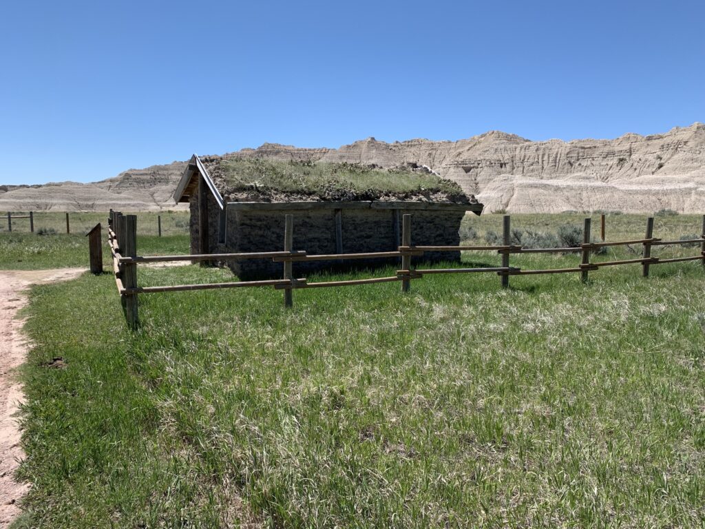
This is a mockup of a sod house–these were common in this part of the country in the past
If you’re looking for some great, family-friendly outdoor and camping options in western Nebraska, check out Fort Robinson State Park and Toadstool Geologic Park!
Like what you read here today? Please feel free to leave a comment, like, or share this post! Add your email at the bottom of the page, or the sidebar to the right, to be notified when a new post is published.
In this post, I discuss what you’re missing from this national park you may not know exists!
**Author’s note: Just a word of warning, as this is a National Park, no dogs are allowed on any trails (exceptions for Service Animals). They are only permitted in the campgrounds and parking lots.**
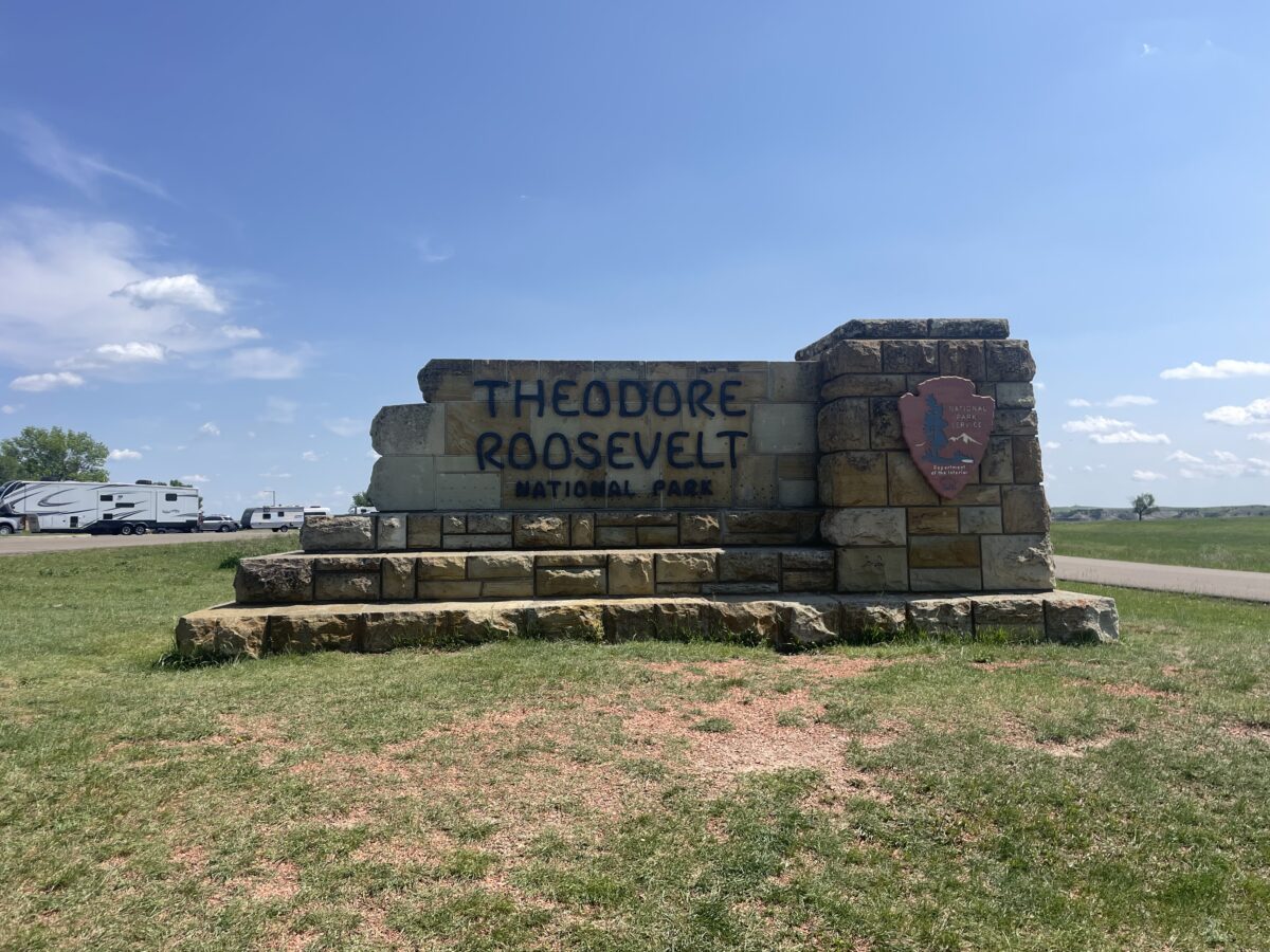
The Trekkers have had Theodore Roosevelt National Park, in southwestern North Dakota, on our bucket list for quiet a while. We wanted to go fairly early in the season, so it would still be green, and in mid-June it was BEAU-tiful!
This was one of the first trips we took once I could start hiking again after I had been laid up for MONTHS thanks to surgery for an ankle that was broken in two places (along with being dislocated and a torn tendon) after a NASTY fall on the ice. 😝 I was finally able to start getting back out there!
Teddy Roosevelt National Park is named after the 26th President of the United States as he lived in this area for a while (before becoming President). He credits his time there as inspiring him to the Presidency.
I’ve come to decide “Teddy” may be my favorite President. They did call him the “Conservation President” after all! He originally came west to help him escape the pain of several serious, personal losses (one of the “loves of his life”, his first wife, died from complications after childbirth THE SAME DAY his mother died of typhoid fever! 😪)
Teddy helped create the US Forest Service and was a champion of protecting countless acres of land in the western US, as well as creating a number of national parks and monuments (many of which the Trekkers’ enjoy regularly.) He was also friends with John Muir (another of my favorites!) He was the OG #natureaddict/#natureboy!
A note on this park: the irony is the National Park named after the “Conservation President” sits on the edge of the Baaken Oil Fields!–For those who don’t know these are some of the largest oil fields in the US.
This really won’t affect your experience at Teddy Roosevelt National Park too much. You can see the flames burning off waste-natural gas from some of the overlooks and hiking trails in the North Unit. This is especially troublesome at night when they can affect the Dark Sky status of the park.
I don’t think Teddy would have liked to see his beautiful land in this state but who can stand in the way of progress? 🙃 “Black Gold, Texas Tea baby!” 😡
Where is Teddy Roosevelt National Park?
The park is situated in far, southwestern North Dakota about 130-ish miles west of Bismarck!
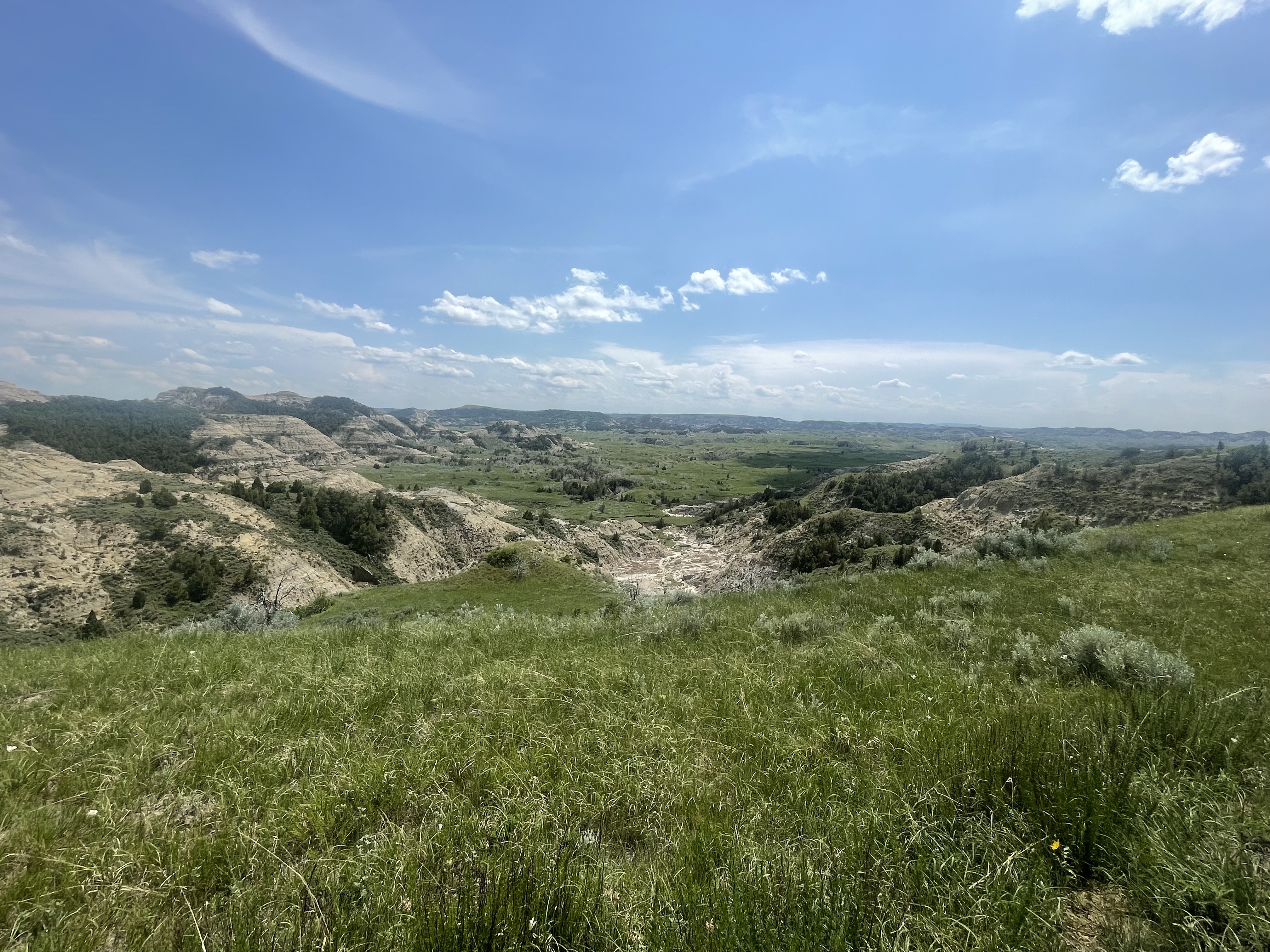
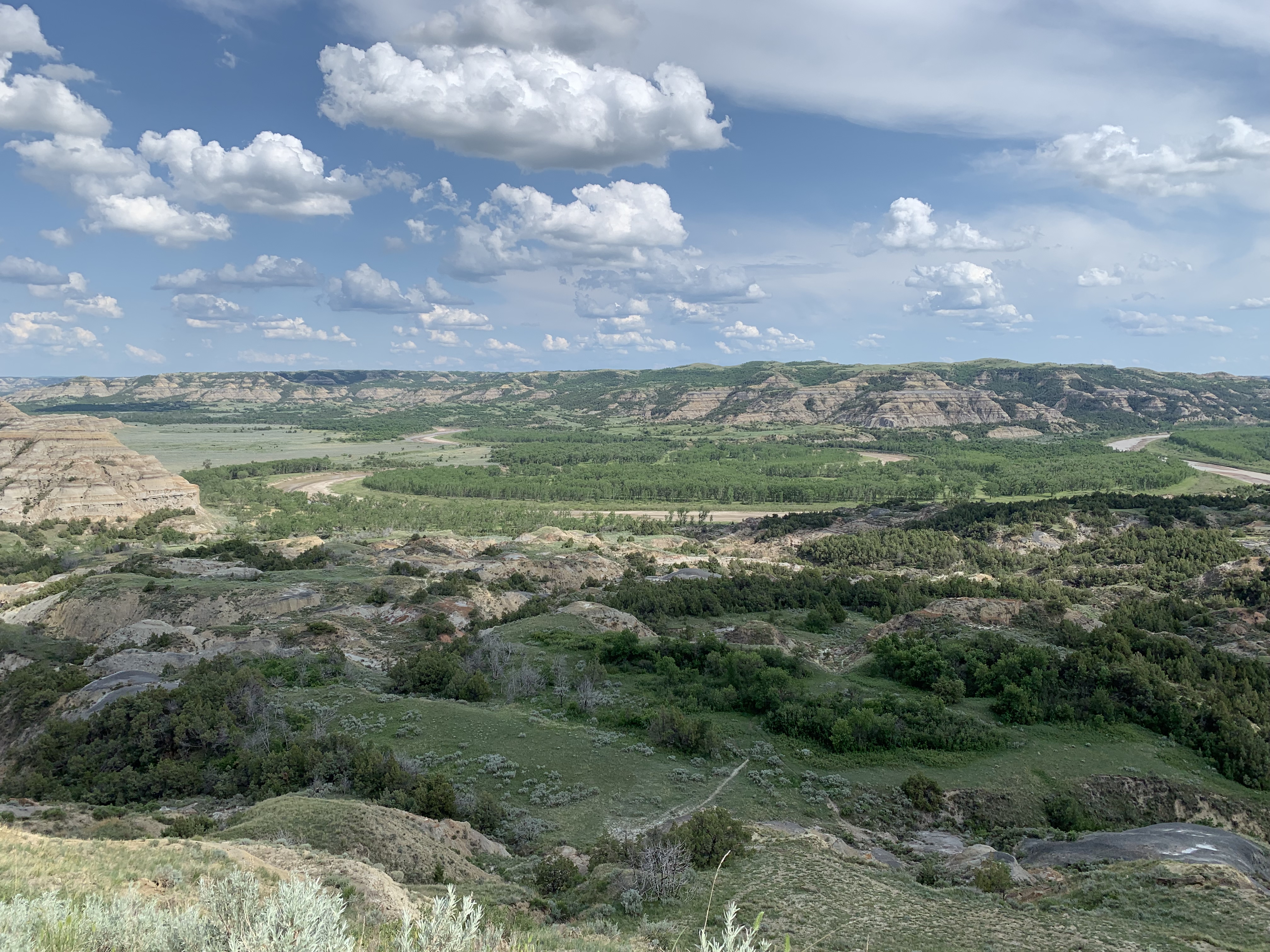
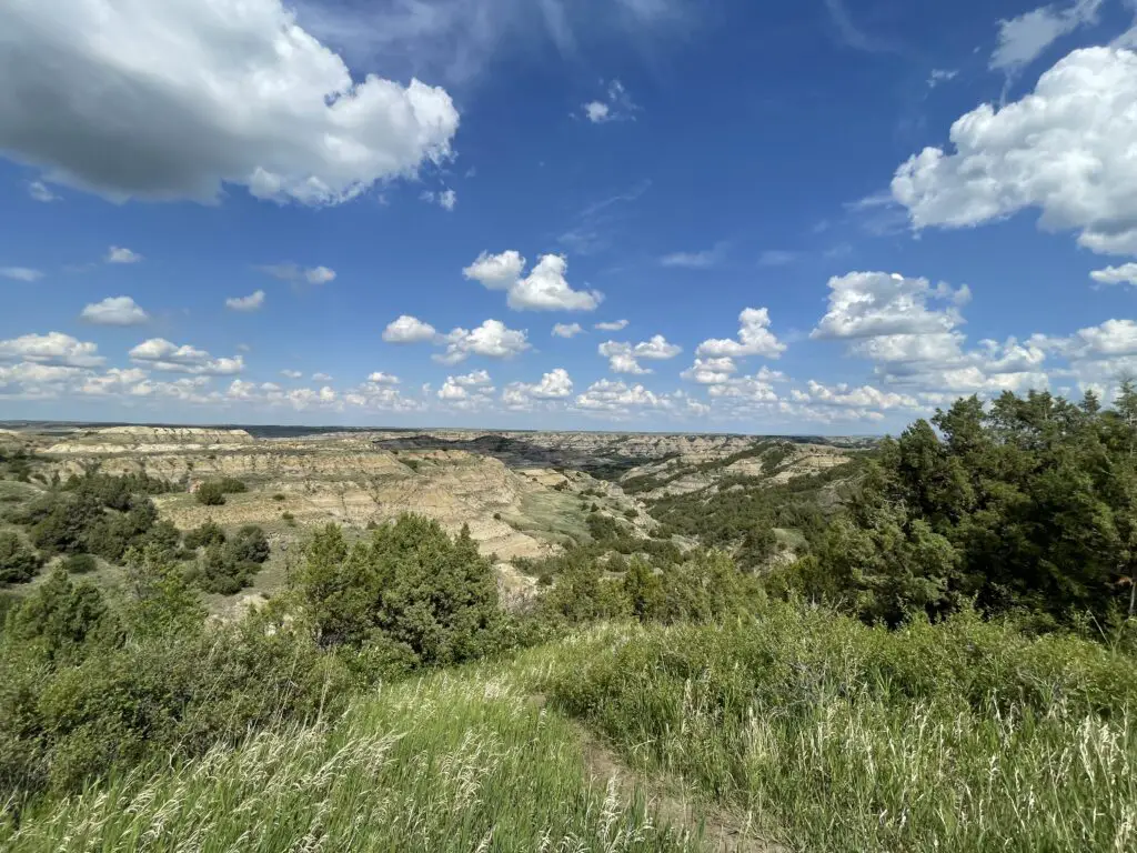
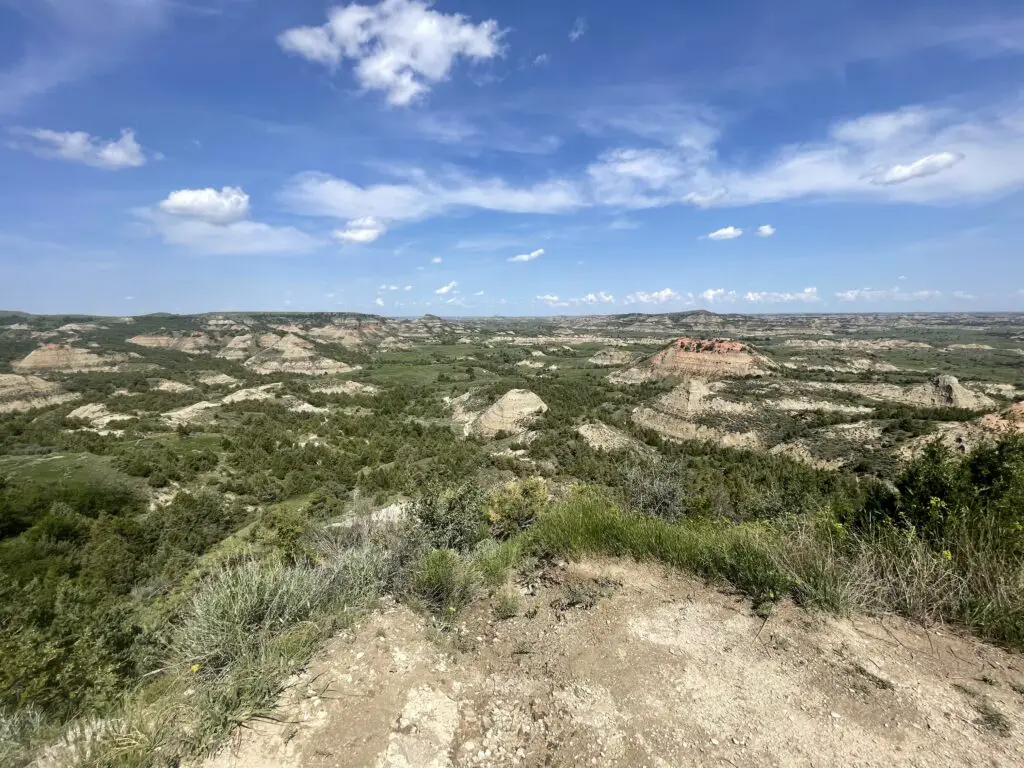
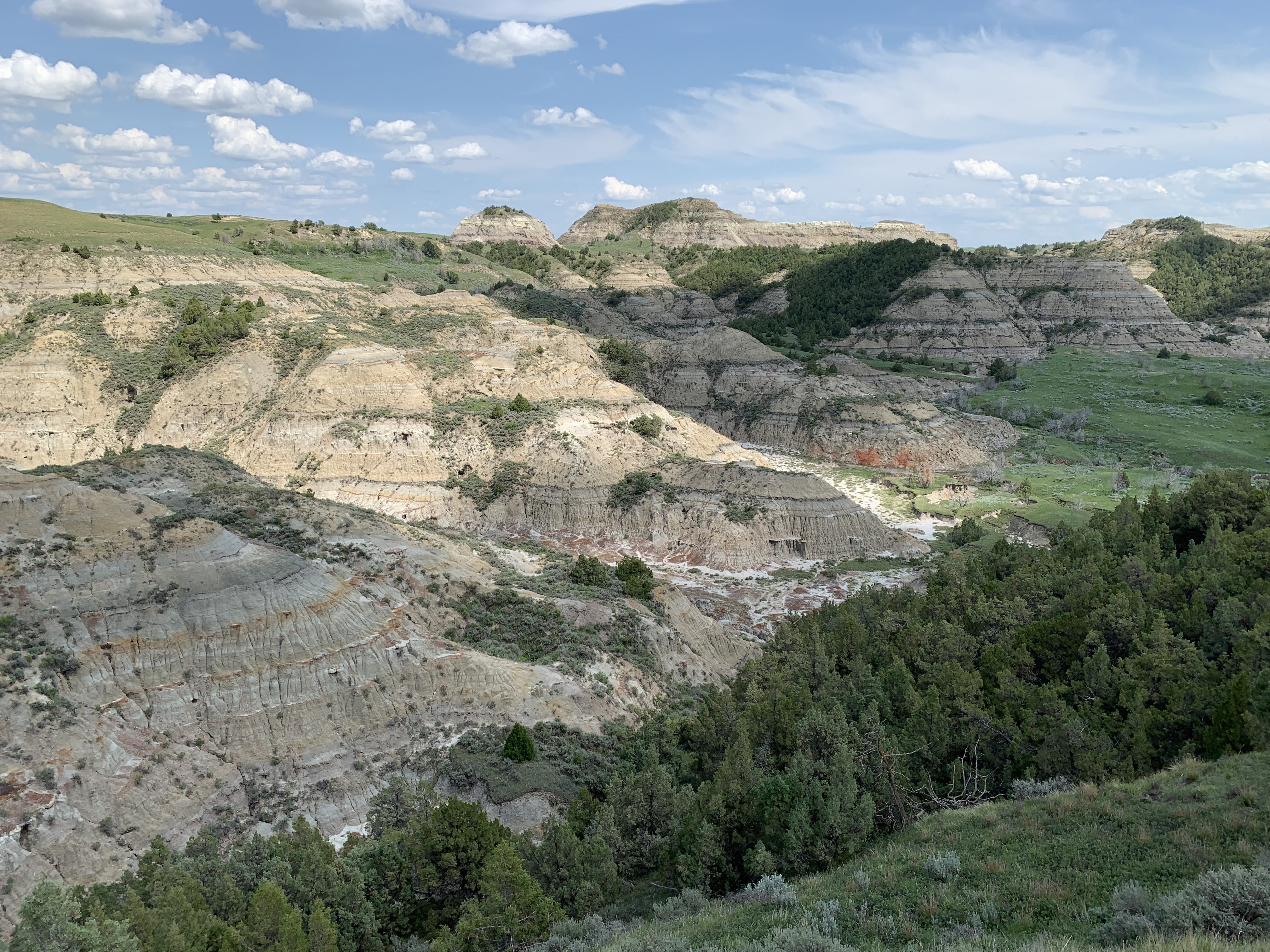
This park is also called the “North Dakota Badlands”. While somewhat similar to Badlands National Park in South Dakota, this area is wetter and greener…
Teddy Roosevelt National Park is divided into three separate units. The North Unit was our favorite. It is known for being less developed but also prettier, offers more wildlife and is less busy. The South Unit is more developed and busier but offers more hiking options. (The two units are about a one-hour drive apart–around 70 miles).
There is also a bit of a “satellite” unit centrally-located to the west of the other two, main units. It is called Elkhorn Ranch. This is where Teddy literally lived when he was in North Dakota and it is LITERALLY in the Middle of Nowhere! This one is pretty far out there–about a one-hour drive (around 54 miles) northwest of Medora…
The park basically isn’t near anything except the tiny town of Medora. The town is cute but small. It wasn’t too busy when we were there in mid-June but it can get MUCH busier later in the season.
Driving around North Dakota was kind of weird. 😅 All of their traffic light poles are bright yellow. Not sure if this is to highlight them against the snow they get all winter? Also, they don’t hardly have any good gas stations/Convenience-stores. All throughout Wyoming, rural South Dakota and Montana you have plenty of good, big, gas station stores (some are literally in the middle of nowhere with no other buildings in sight and double as catch-all grocery stores)–in western North Dakota these are HARD to find!
They have plenty of gas stations but they all look like they’re from about 1995–several we stopped at, while small, did at least have clean bathrooms! This was surprising to me because there aren’t a lot of gas stations up there, you’d think the ones they do have would be fairly good-sized and decent–even near major highways, like I-94, the stations were largely disappointing…
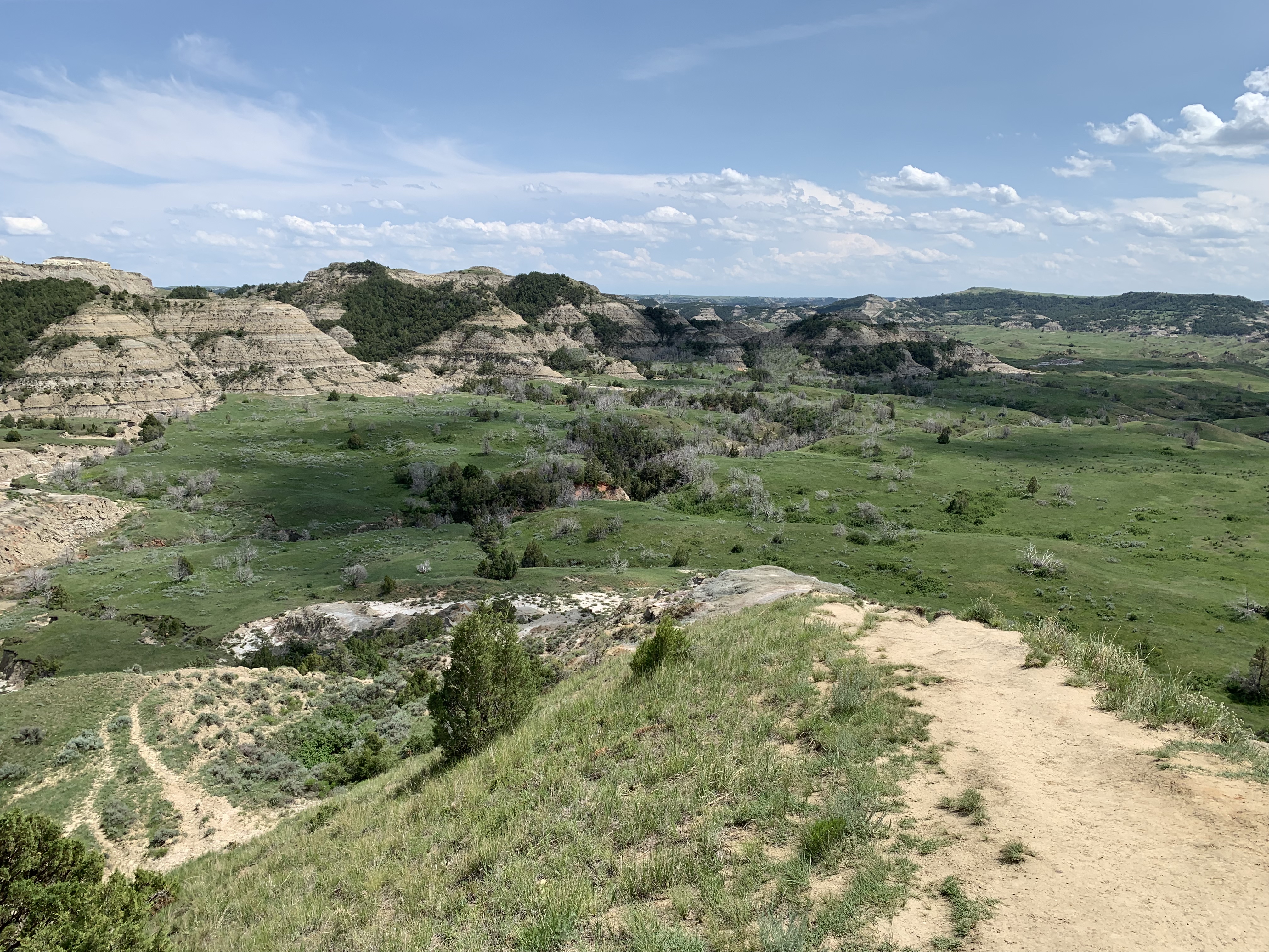
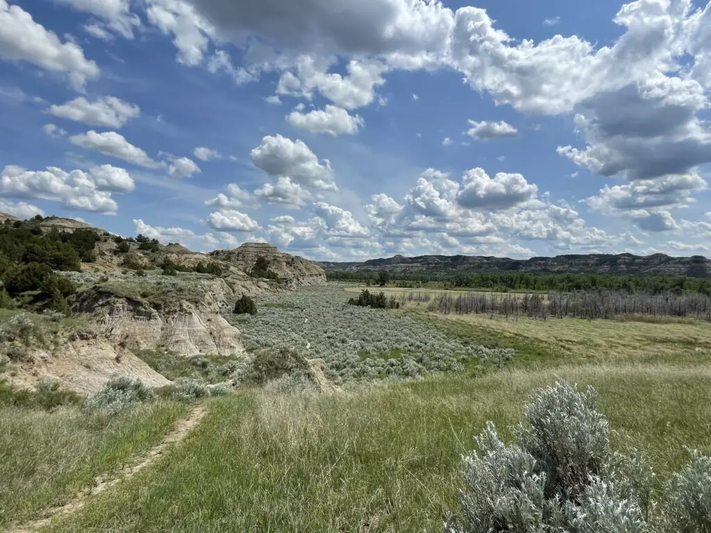
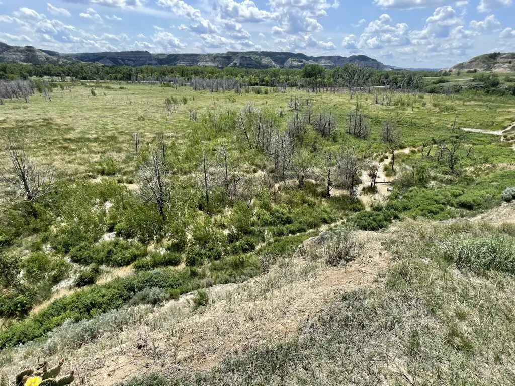
Teddy Roosevelt National Park North Unit
We enjoyed camping and hiking around the North Unit more. It was definitely quieter, and it offers a 14-mile scenic drive (each way). Just realize this is NOT a loop, you have to drive out and back!
Camping at Juniper Campground
Juniper Campground, on the North Unit of Teddy Roosevelt National Park, is MUCH easier to get sites at than the Cottonwood Campground on the South Unit. We got into a First-Come-First-Serve site at Juniper, in the middle of the week, in mid-June, with no problem!
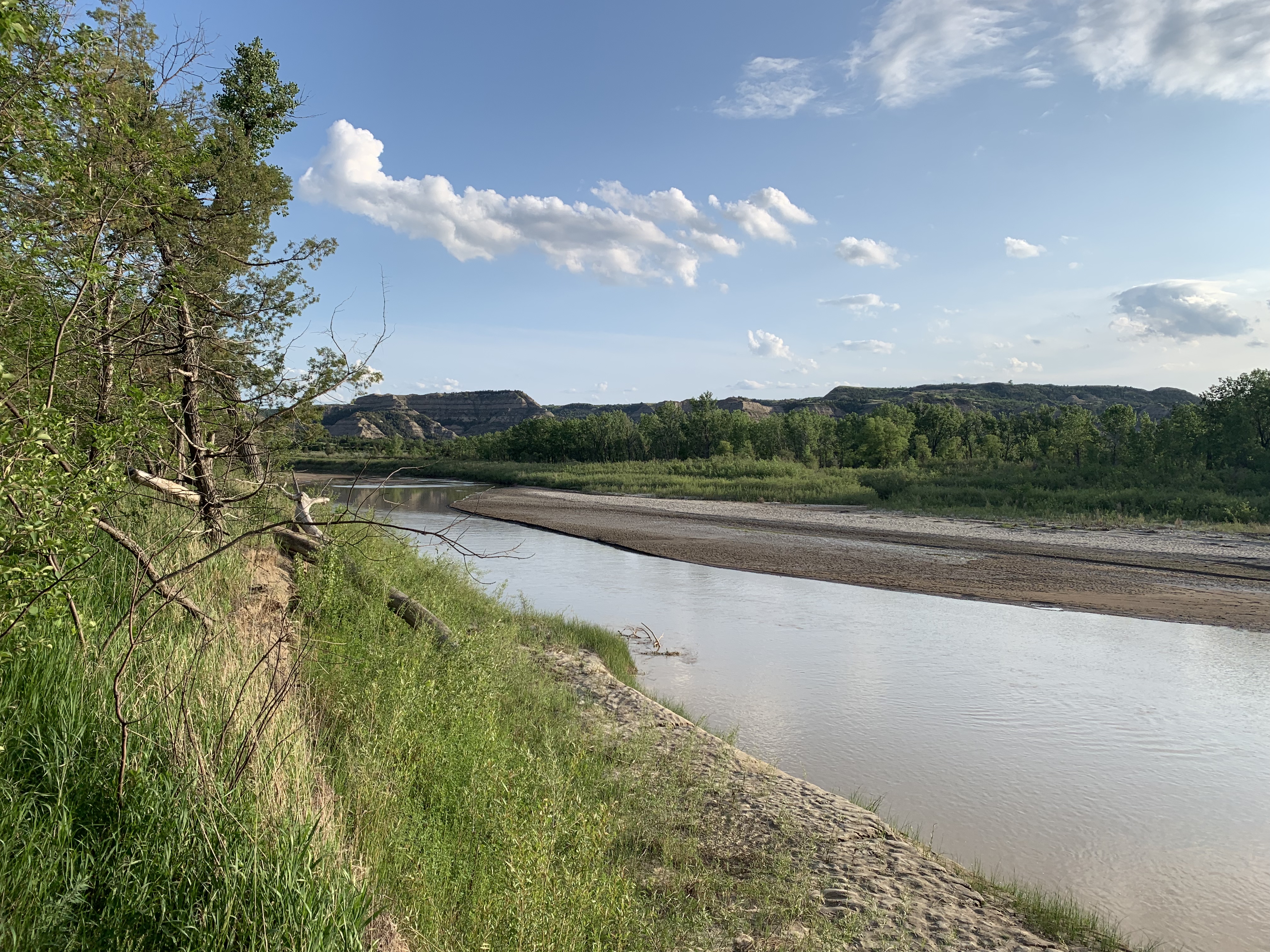
The Little Missouri River ran JUST on the north side of Juniper Campground–basically barely across the road from our campsite!
I would not want to be standing there in a flash flood!
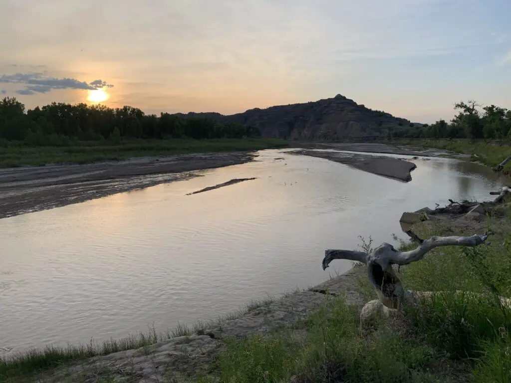
I LOVE this pic Mr. Trekker took, it’s SO moody!
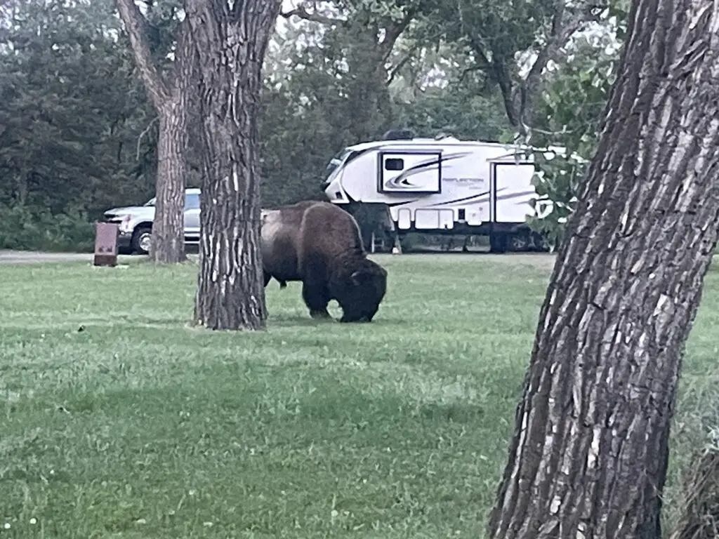
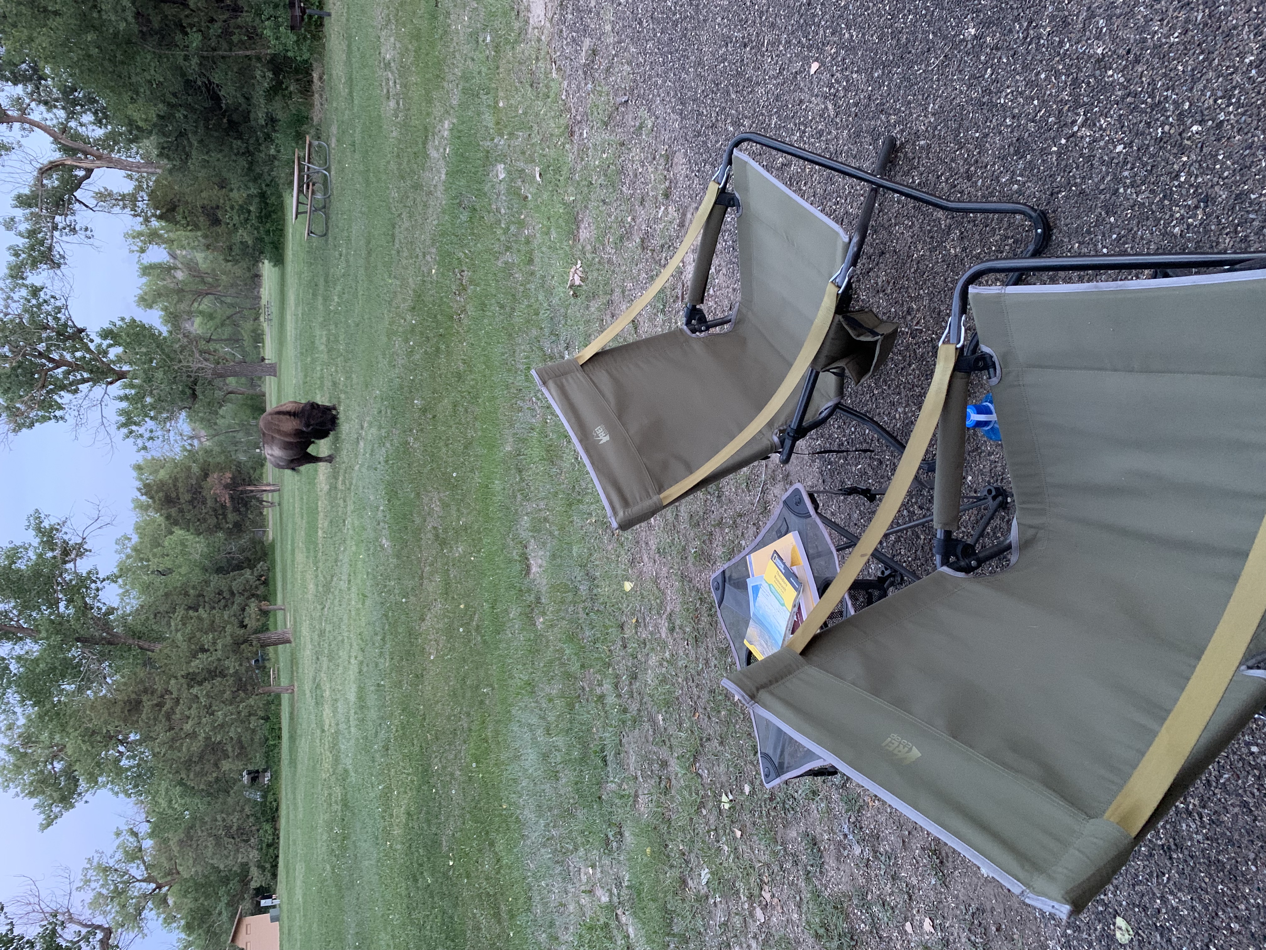
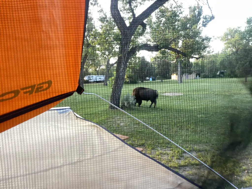
There was even a buffalo that hung out with us IN THE CAMPGROUND–watch out for these! #dontpetthefluffycows!
Big boy! Imagine running into him walking to the bathroom in the middle of the night!
A note about buffalo: it is NOT ADVISABLE to get as close to a buffalo as we were in the picture above. However, in this case, we were literally sitting on the truck bed and he came up to us so this was a bit of an exception. He seemed calm and other campers said he’d been there before. As he was showing no signs of agitation we stayed still till he wandered off to a safer distance.
To be clear though, buffalo are known to be completely unpredictable and they can be DANGEROUS if they get irritated. So even in situations like this, DO NOT approach them, give them space, be calm and quiet and try to back off slowly but calmly if possible. DO NOT let dogs get near them (dogs can agitate them and they can easily kill a dog). ESPECIALLY, DO NOT APPROACHif they have babies!!! They may look oafish but these brutes can run at 30 mph–you CANNOT outrun them–and they’re equipped with sharp horns and a VERY hard head!
View from our GoFast Camper the next morning!
For more info on camping at Teddy Roosevelt National Park, click here!
Since the North Unit was so quiet we noted there was SO MUCH birdsong! Teddy actually mentions this in his book about being at his ranch, Ranch Life and the Hunting Trail. He describes the birdsong as:
“…the rider on the plains will hear bird songs unknown in the East…many are characteristic of this region. Throughout June the thickets and groves around the ranch house are loud with bird music from before dawn till well after sunrise.”
Your Moment of Zen: enjoy some birdsong from Teddy Roosevelt National Park (it was breezy too!)–turn UP the volume!:
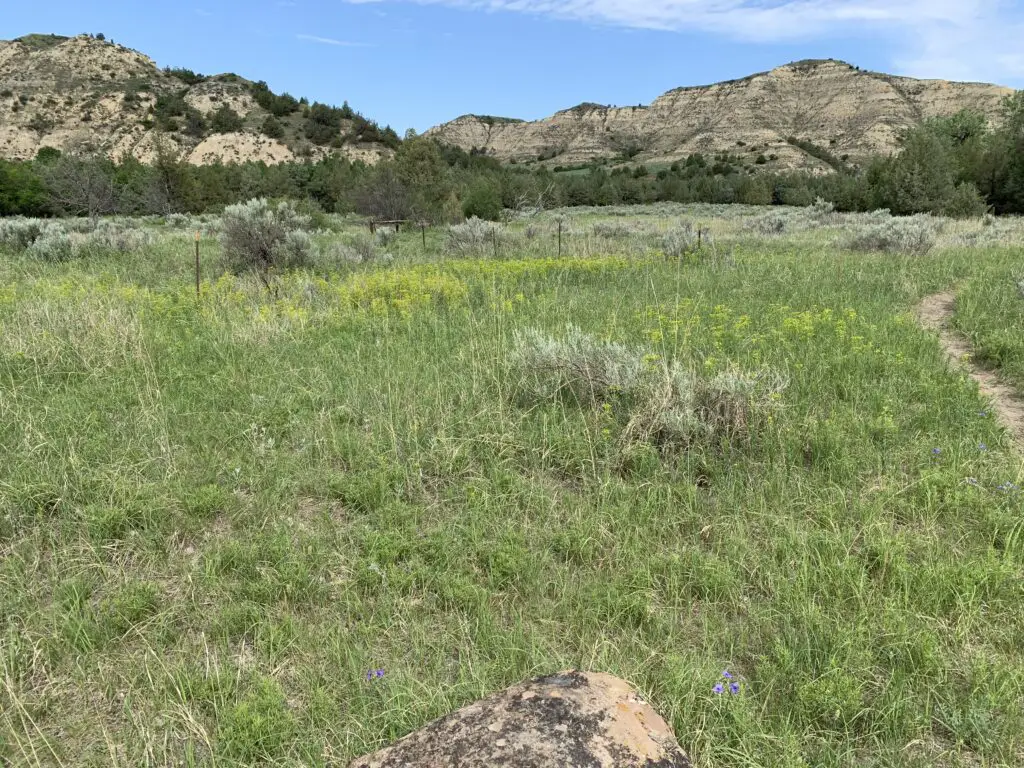
Some hiking trails and good stops at the North Unit of Teddy Roosevelt Park:
We enjoyed several fun pull-offs and short hiking trails in the North Unit:
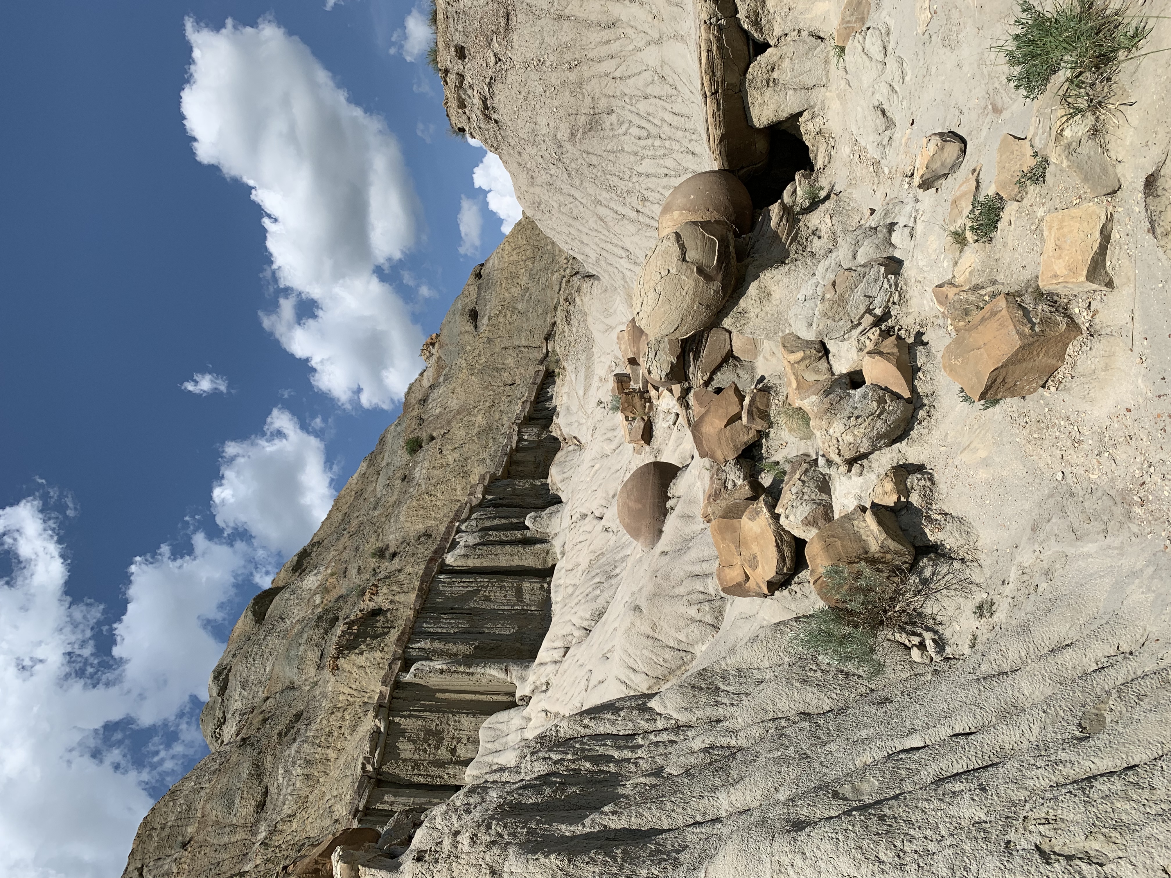
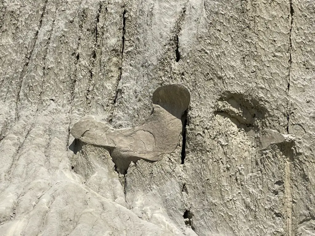
The Cannonball Concretions Pullout was the first one we came to and is just across the road from the entrance to Juniper Campground:
The Cannonball Concretions!Whaddya think…a bird or Mickey Mouse?
Buckhorn Trail starts from the Cannonball Concretions pullout. We only did a small portion of this trail, basically just up the hill from the pullout. It’s full length is more than 10 miles long and wanders throughout the North Unit of the park!
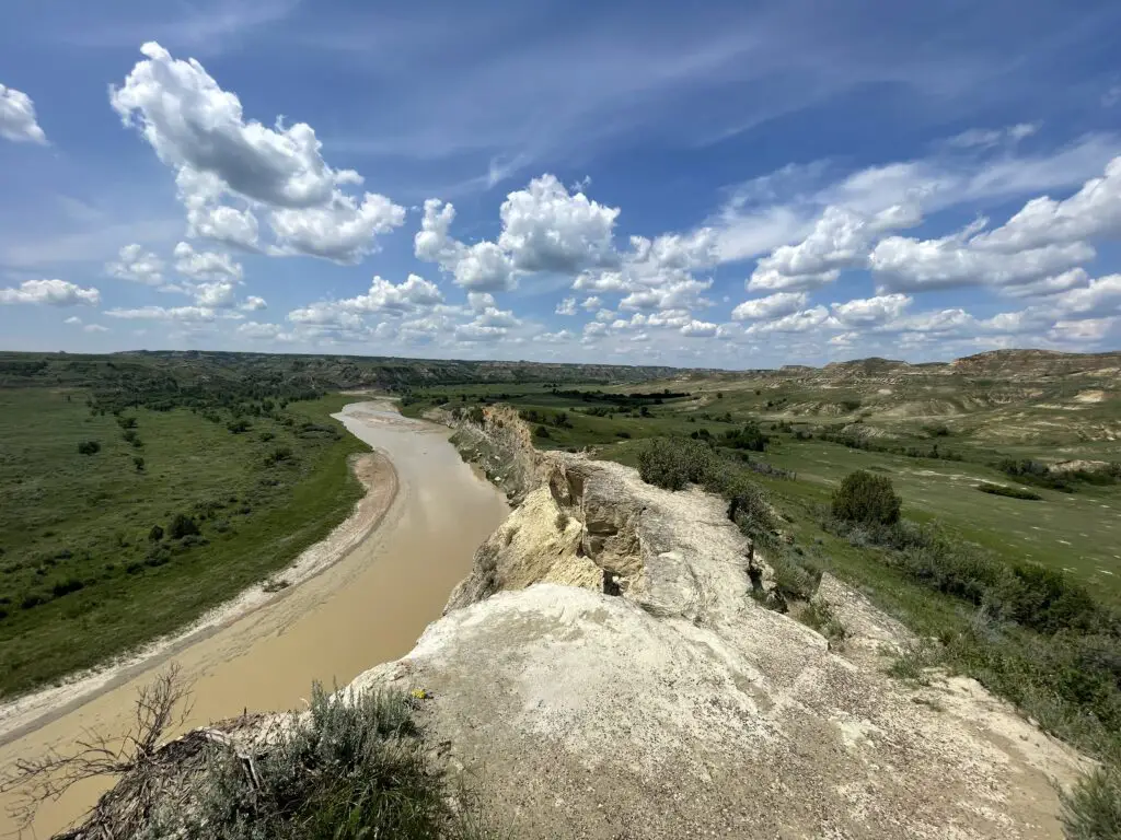
Riverbend Overlook was just a quick (but pretty!) jump out of the car:
Oxbow Overlook was an easy, pretty and short hike to and around the overlook–the shelter also makes a great place for a picnic or snack:
Teddy Roosevelt National Park South Unit
The Scenic Loop Drive circumvents the majority of the South Unit of the park. It is about 36 miles round trip though we couldn’t do the whole loop as the southern half was closed for construction…
Note: The time zone change between Central and Mountain time runs along the Little Missouri River. This results in the main, two units of the park being in separate time zones (the North Unit is on Central Time while the South Unit is on Mountain Time.) So the North Unit is one hour ahead of the South Unit–life is weird out West! 😀
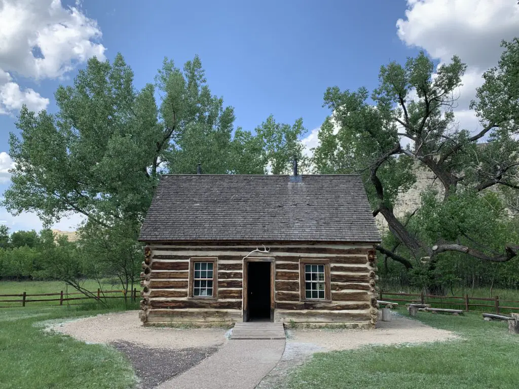
This was one of the actual cabins Teddy lived in when he was in North Dakota!
You literally drive through the South Unit on I-94 which is kinda cool. One of the rest stops is literally part of the park and you can hike a bit from here!
This pic was taken from the rest stop on I-94. This is a portion of the Painted Canyon Trail. You can hike around down there and access it from the rest stop!
Painted Canyon trails: These trailheads are locate at the I-94 rest stop that sits in Teddy Roosevelt National Park.
The Painted Canyon Nature Trail is an easy trail, only about 1/2 mile long and it runs along the rim of the canyon, just behind and around the rest stop building. Pets can be on this portion of the trail!
The Painted Canyon Trail departs from this same area. It’s fairly steep to get down into the canyon. It’s about four miles in total length and be aware there is NO SHADE on this trail. It also connects to other backcountry trails throughout the northern portion of the park.
Moment of Zen 2: Buffalo at Teddy Roosevelt National Park!:
Some hiking trails and good stops at the South Unit of Teddy Roosevelt Park:
Boicourt Overlook/trail: The park website says this trail is only .3 miles and handicap accessible–this is “kind of” true. This description is true for the main trail but you can keep going further along the ridge for probably close to another 1/2 mile (that portion is not accessible).
Buck Hill: The entire trail is less than 1/2 mile but it’s quite steep! The steepest portion is paved (though I wouldn’t call it “accessible” as it’s so steep) while the rest of the route is a good, packed-dirt trail.
Wind Canyon Trail: This trail is about 1/2 mile in length. It has a few steep sections but overall this one isn’t too bad. It was a nice overlook of the river!
View of the Little Missouri River from the Wind Canyon Trail
For more info about hiking at the South Unit of Teddy Roosevelt National Park click here!
Teddy Roosevelt National Park Elkhorn Ranch Unit
There are a few ways to get to the Elkhorn Ranch unit:
The easiest (though it is longer) is to take Exit 1, on I-94 at Beach, and go north on Route 16. Then take Black Tail Road to the east until it becomes Belle Lake Road. Then take a left turn at Elkhorn Ranch Road. We went to the Unit this route and found it pretty easy to follow…
The actual location of Teddy Roosevelt’s ranch in western North Dakota
You can also take I-94 west from Medora, to Exit 10 for Belle Lake Road. Google will get you there going this way though it is out in the middle of NOWHERE with a lot of twists and jogs. We brought this route back to the highway and found it fairly easy to follow.
Note: while they were in great condition when we were there, be aware most of these roads are dirt!–Your car may get a little dusty!
View from our campground near Elkhorn Ranch
It’s all dirt roads to get there but they’re in pretty good shape and your sedan can make it, at least in good conditions. 🌞(In mud or snow, you’re on your own! 😇)
Enchanted Highway
On the way back to the Black Hills we checked out the Enchanted Highway!
Most people can only take so much Interstate driving (and that only gets you so far in North Dakota) and the straight, flat, state routes can get a little dull too. So spice things up with this interesting little stretch of highway that runs 32-miles north and south between Exit 72 on I-94 and the tiny town of Regent, ND and Route 21 (that’s right, western North Dakota is so rural they just identify places based on their corresponding exits on the highway!)
An enterprising, local sculptor put a series of large, metal critters (ants, grasshoppers and kinda freaky-looking fairy tale creatures) all along the highway. It’s worth a looksie if you’re heading that way anyway! (There are even signs on the highway to help you find this!)
We had a good time in NoDak! I’m not “dying” to go back again but Teddy Roosevelt National Park is definitely worth a drive to this random state that is often one of the last on everybody’s 50-state list! 😀
Like what you read here today? Please feel free to leave a comment, like, or share this post! Add your email at the bottom of the page, or the sidebar to the right, to be notified when a new post is published.
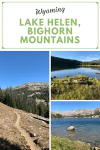
In this post, I review the Misty Moon trail starting at the trailhead at West Ten Sleep Lake and continuing to Lake Helen.
Are you looking for a moderate hiking trail that really lets you enjoy the wilderness of the Bighorn Mountains in Wyoming? Check out the Misty Moon trail from West Ten Sleep Lake to Lake Helen in the Cloud Peak Wilderness!
Where is the Misty Moon trail?
Trail #63, the Misty Moon trail, is one of the most accessible, main trails to access Cloud Peak and Bomber Mountain. It starts at the trailhead behind West Ten Sleep Lake (this is also where the trail for Mirror Lake/Lost Twin Lakes begins.
To reach the trailhead take Forest Route 27 to where it terminates. FR 27 is located off of US 16 in the southern Bighorn mountains. You will turn at the sign for (and location of) the Deerhaven Lodge. Boulder Campground, Island Park Campground, and West Ten Sleep Campground are also all located off of this road.
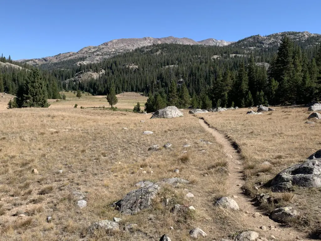
What is the trail to Lake Helen like?
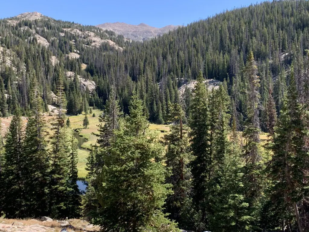
The first few miles of the trail are LOVELY. You start by meandering on a flat trail through the woods around West Ten Sleep Lake.
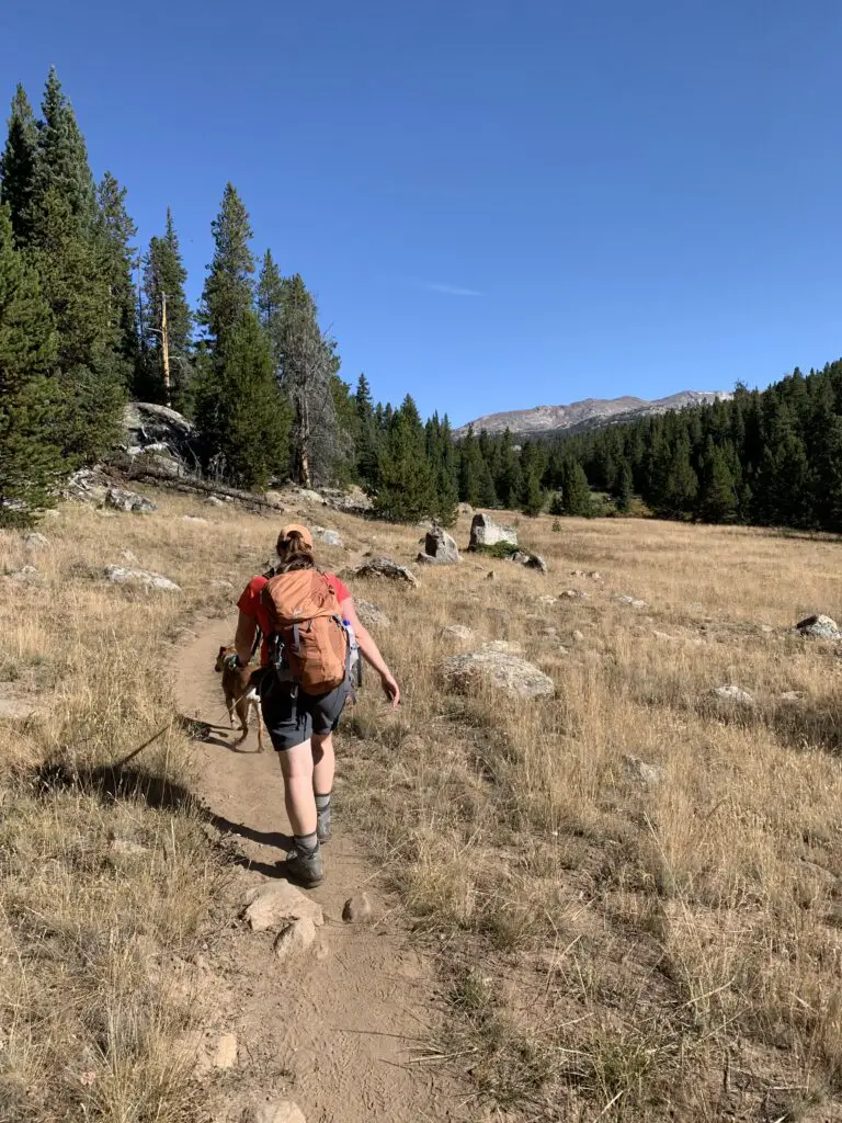
We saw a momma moose and baby bedded down in the tall grass near the lake! Be sure to give these animals PLENTY of space, especially with dogs. Most momma animals can be INCREDIBLY aggressive when they’re protecting babies, and moose have been known to kill dogs–we kept Puppers on a leash and she was too distracted by smells to be aware of our new friends.
Puppers and I on the Misty Moon Trail
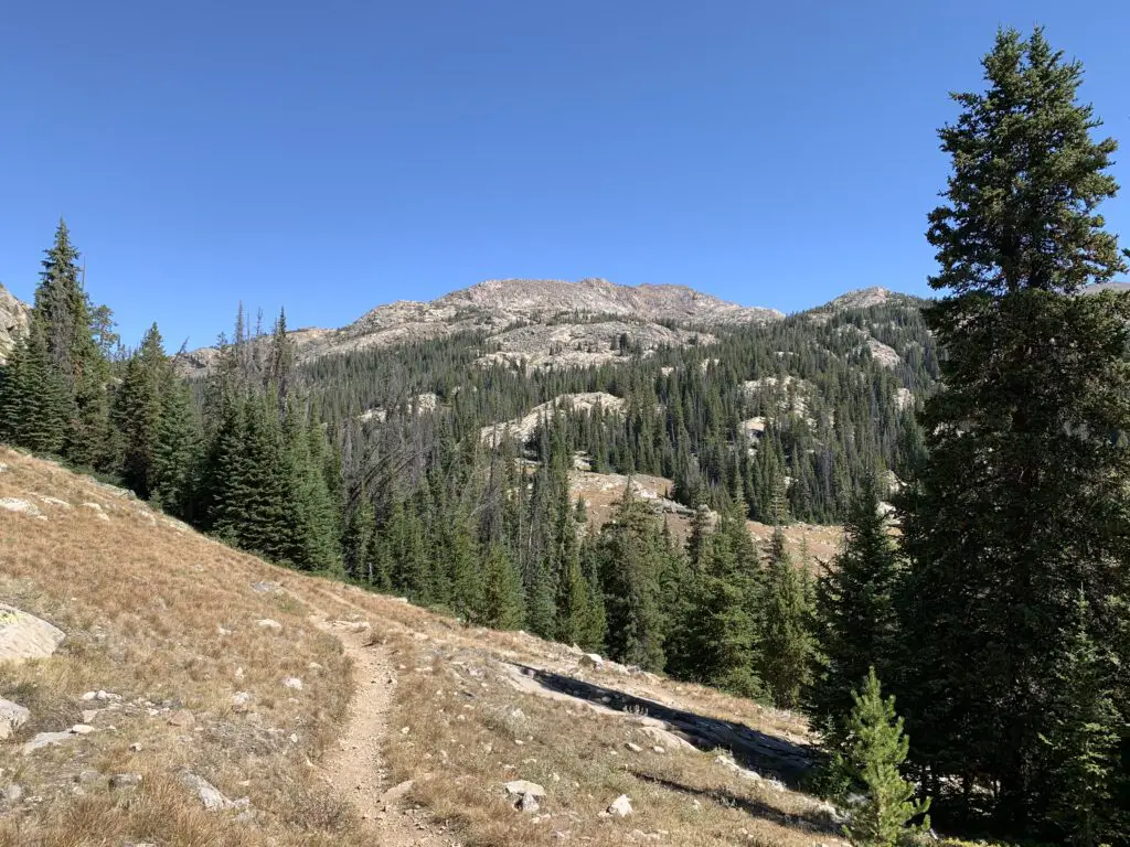
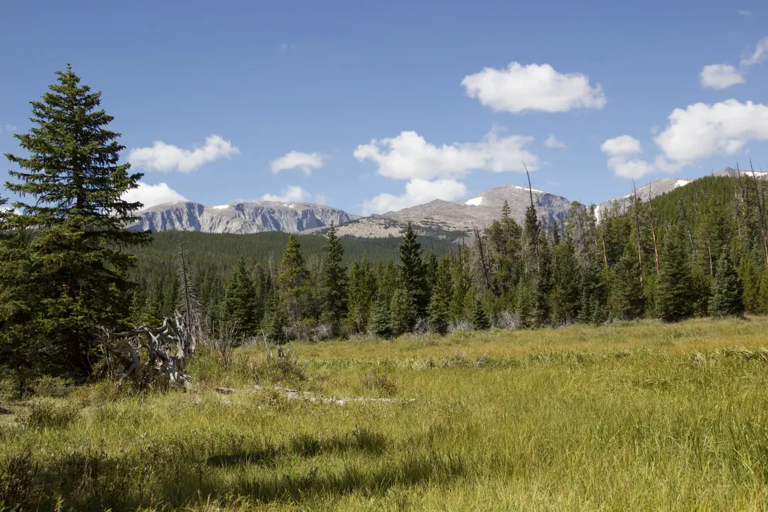
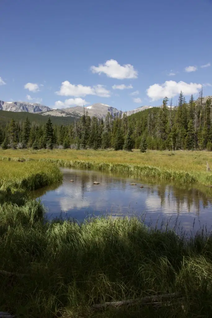
Once past the lake, you start a gradual climb through several grassy meadows and forested areas, with great views of the mountains beckoning you along the way.
The trail undulates the whole way so while there are a few short, steep spots, there are no lengthy, spirit-crushing climbs–I think this contributed to the trail feeling easier than it actually was.
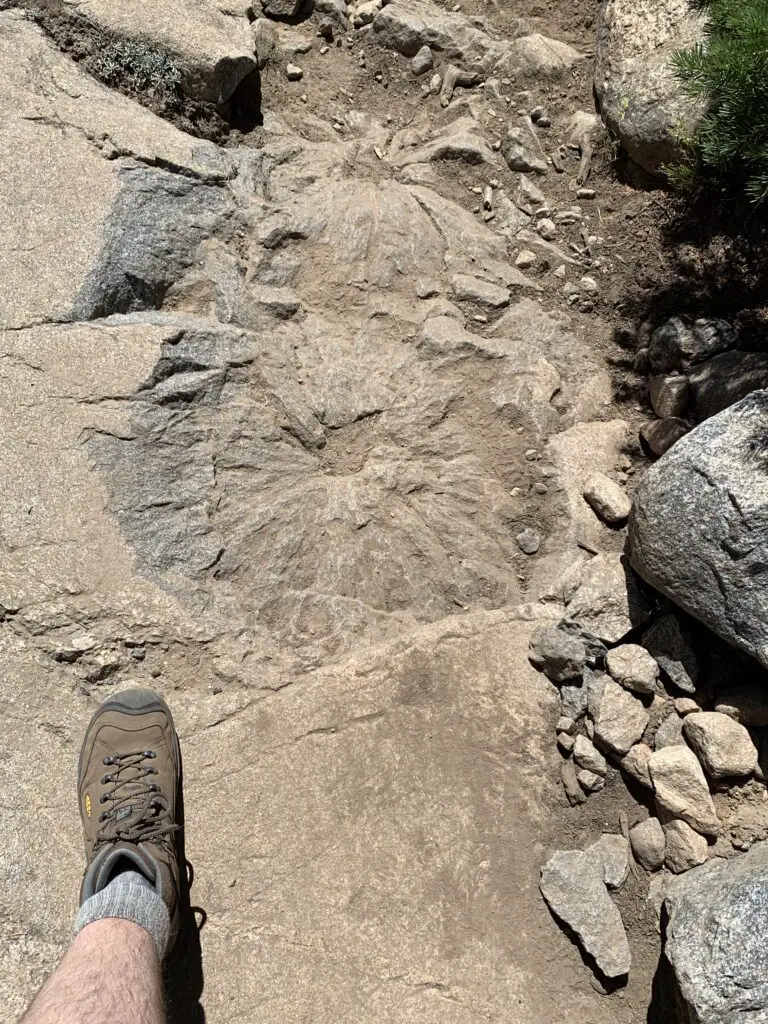
We saw a bunch of these indentations on the rocks, not sure if it’s some kind of fossil? Looks like a plant left them…🤔
About halfway to Lake Helen, the trail becomes steeper. This is where you hit the rocky sections. There are no large boulder fields to cross and no scree slopes to navigate (on this portion of the trail) but the rocks are big enough that they cause a lot of uneven terrain that you’ll need to manage. Hiking boots are definitely recommended for this trek!
I think older kids could do this trail. It’s a longer one and they may need some help in the rocky areas, but overall I would say it is moderately difficult.
The hike didn’t actually seem that bad while we were doing it. Both Mr. Trekker and I were pleased at how good we felt throughout. Especially considering we carried heavier packs than usual (we brought A LOT of water) and we hadn’t hiked much this summer as it’s been so warm. Also, the trail STARTS at around 9000 feet (you gain around 1000 feet in elevation over its five-mile length. Lake Helen sits at almost exactly 10,000 feet.)
Mr. Trekker and I were both pleased that we didn’t feel the altitude too much (it probably helped that we camped at 9000 feet the night before). If you aren’t used to these altitudes though, you’ll definitely want to take it easy.
The Trekkers seem to be doing better with altitude in recent years. It used to be that just driving to Estes Park in Colorado (which sits at around 8000 feet) was enough to make me feel funny. Now we’ve camped and hiked higher than that on multiple excursions in Colorado, Wyoming, and Montana and done quite well. They claim your body “learns” how to adjust to the altitude better the more you experience it and I think that may be true. (Living at 3000+ feet for the last decade probably hasn’t hurt either. 😉)
We considered going all the way to Misty Moon Lake but that would have added several miles to our already 10-mile hike. All three of us were feeling good when we arrived at Lake Helen so we figured we’d just spend a relaxing lunch at the lake and head back.
As it turned out it was good we did decide to turn back. Even though she was raring to keep going when we reached the lake, by the time we got back to camp Puppers was hurting. This was the first time she’s ever really had issues on the trail. This is one of the longer trails we’ve ever done with her (though she’s done 10 miles with us before). This trail is REALLY rocky, in parts, which means it’s probably also one of the toughest trails we’ve ever done with her. We did LOTS of rock hopping on the way down and she was obviously aching by the time we got back. She seemed to make a full recovery within a few days though! (In her defense, my hips were sore for several days afterward, as well.)
Obviously, I can’t speak to the trail past Lake Helen (since we didn’t do it. 😉 I do know that Misty Moon Lake is only about 300 feet higher than Lake Helen but it takes two more miles of hiking (each way) to get there.
Also, my understanding is once you get past Misty Moon Lake the trail gets much tougher. There are some scree slopes and boulder fields (namely on the way to the wreckage site at Bomber Mountain and to reach the actual Cloud Peak). Also, once you get past Lake Helen you are basically above treeline the entire way. This means there is NO SHADE at all so make sure you bring sun hats, LOTS of water, and sunscreen if you’re planning to go this route. There is also NO PROTECTION if you’re caught out in a storm.
I cannot stress this enough: if storms appear imminent PLEASE get below treeline as safely and quickly as possible. It is INCREDIBLY dangerous to be above treeline during a lightning storm. Safety should ALWAYS be your first priority!
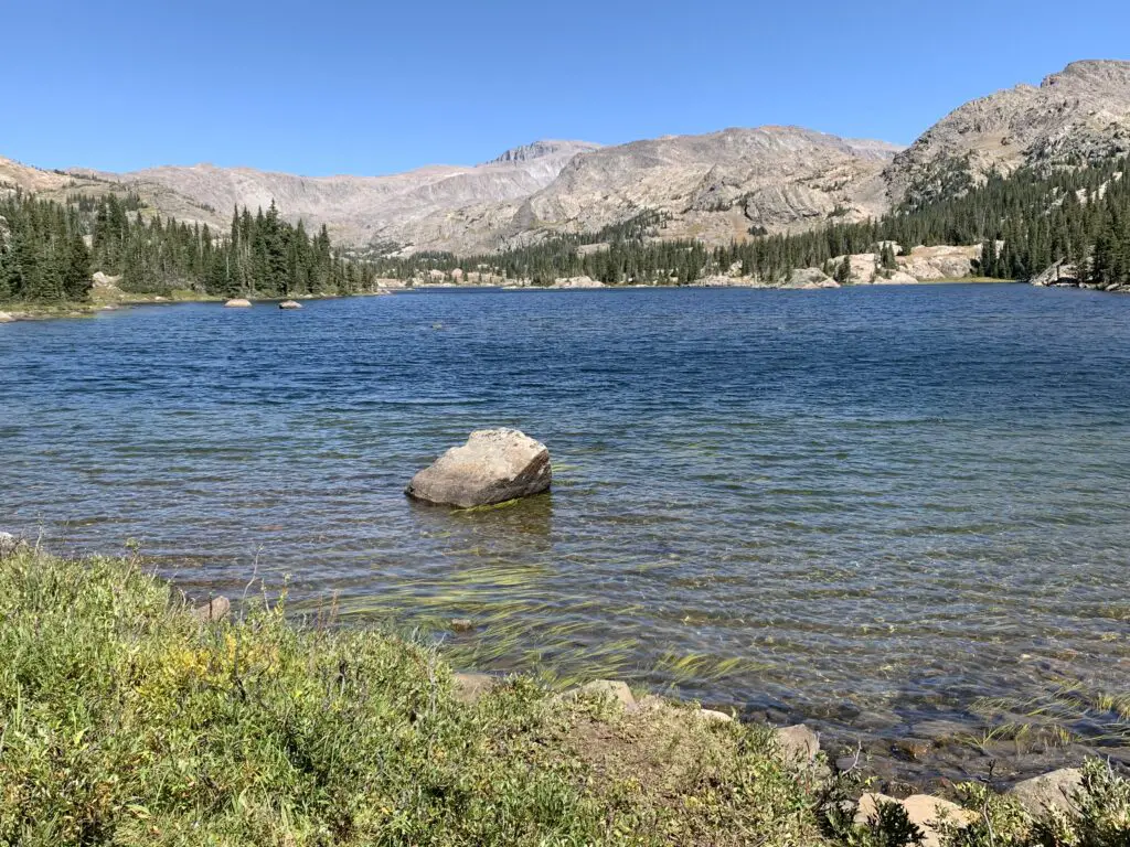
Lake Helen! (Bomber Mountain is near the tall peak straight up from the rock in the water. Florence Pass is through the saddle even further to the right.)
From Lake Helen you can see Bomber Mountain and the high-altitude, Florence Pass to the right. What you cannot see is Cloud Peak (as often as we have visited the Bighorns we have yet to see that site. It’s VERY isolated. 😝) From what I have heard from other hikers though, you CAN get views of Cloud Peak from Misty Moon Lake.
Let’s talk about Bomber Mountain and Cloud Peak
Cloud Peak and Bomber Mountain reach altitudes higher than 12,000 feet so altitude sickness starts to be a concern when you spend lengthy amounts of time at these altitudes. Potential hikers should also be aware the snow can be quite deep on these trails through July! Also, mosquitoes are said to be HORRIBLE in the summer (we had no problems at all on Labor Day weekend and we didn’t use any bug spray. 😁)
Bomber Mountain: This used to be an unnamed mountain in the Bighorns. That is until a World War II-era bomber crashed here while on a training mission in the early 1940s. If you know where to look you can still view the wreckage. (Don’t ask me how to get there, I don’t know. 😉. For more info on this hike you can click here)
You can check with local forest offices for information on how to get to the site. From what I’ve heard there are also rock cairns that help direct the way but you need an idea of where to look.
Please be respectful if you visit this site as several soldiers did lose their lives in the crash.
There are no actual trails that go to Bomber Mountain or Cloud Peak. (This seems a little odd to me as Cloud Peak is the highest point in the Bighorns and is what the wilderness area is named for, but I digress. 😝) There are some rock cairns to guide your way to Cloud Peak. My understanding is for Bomber Mountain, you pretty much just have to know where you are going.
This being said, PLEASE be sure you have a good, topographical map and a compass with you if you are attempting these hikes. Also, be aware there will likely be some bushwacking involved and you could easily become lost. These routes should only be attempted by EXPERIENCED, backcountry hikers! (Cell phone service is spotty at best in this area. DO NOT rely on it!)
Cloud Peak: “can” be done in one day but it would be a VERY long and VERY hard day (it’s around 24 miles total). People have done it but most suggest doing a 2 – 3 day backpacking trip. (Lake Helen and Misty Moon Lake are popular places to camp for these.) The last three miles to the summit are said to be a boulder field with “house-sized” boulders (per the reviews). The “trail” isn’t super clear either. Some people suggested this is actually a more difficult hike than the notorious Longs Peak in Rocky Mountain National Park 😮 so PLEASE think hard and use incredible caution if you’re considering this trek.
West Ten Sleep Lake Campground
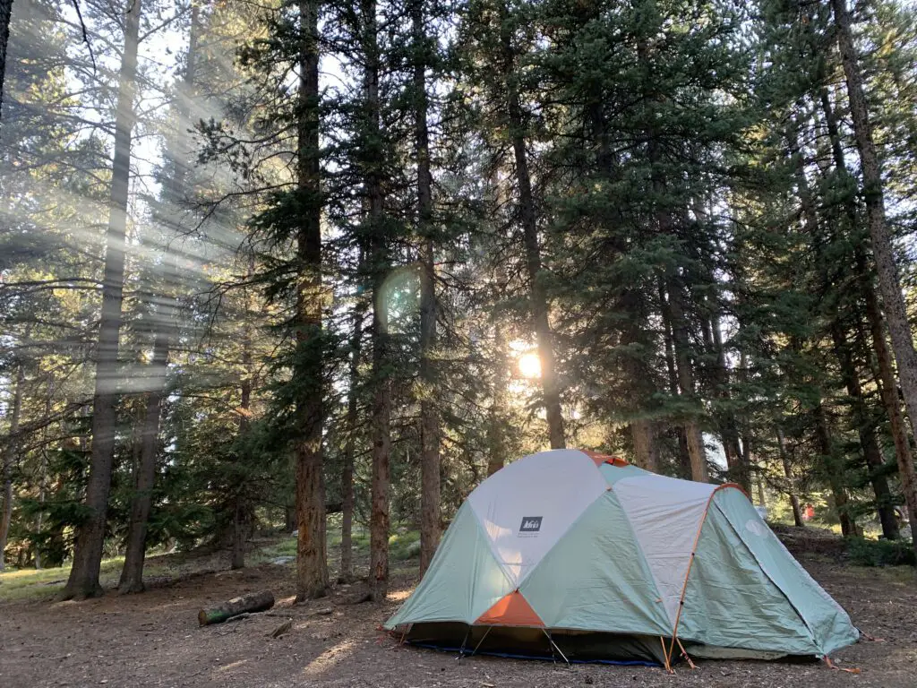
On other trips, we’ve stayed at the Island Park campground but since we were leaving from the trailhead at the lake we stayed at the West Ten Sleep campground on this trip.
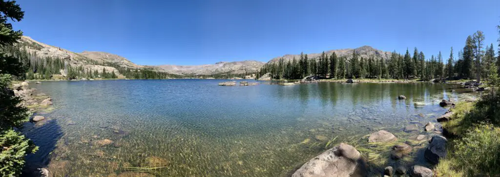
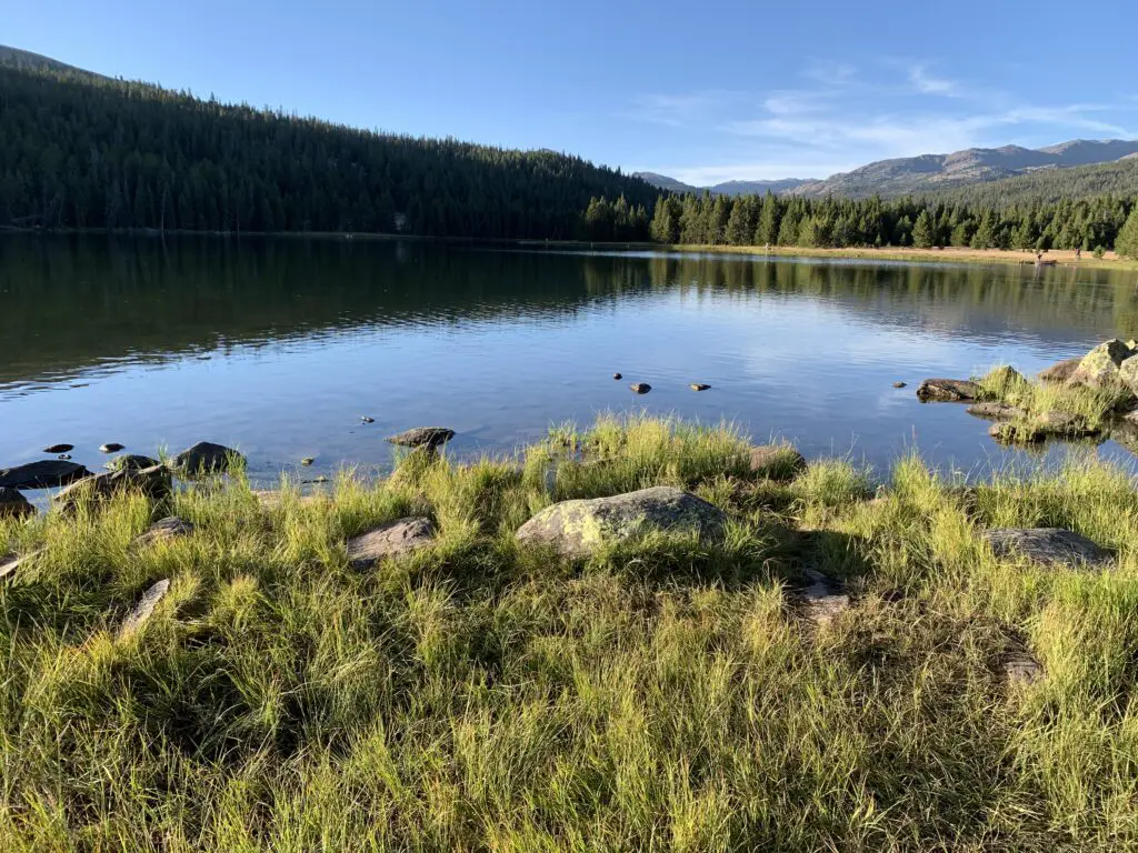
It was LOVELY! Some sites had views of the lake, ours had forest views. But the sites were nicely shaded with lots of soft, pine fluff. The campground was also relatively quiet and quite pretty. It was also only a couple of hundred yards to the beauty of West Ten Sleep Lake!
West Ten Sleep Lake!
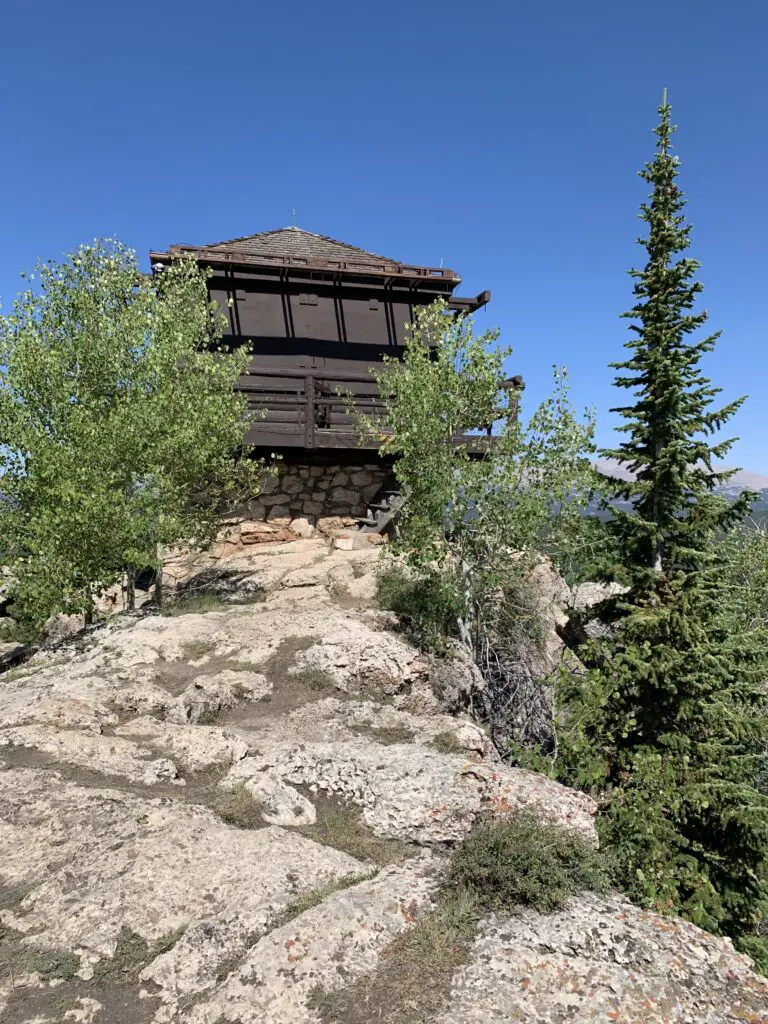
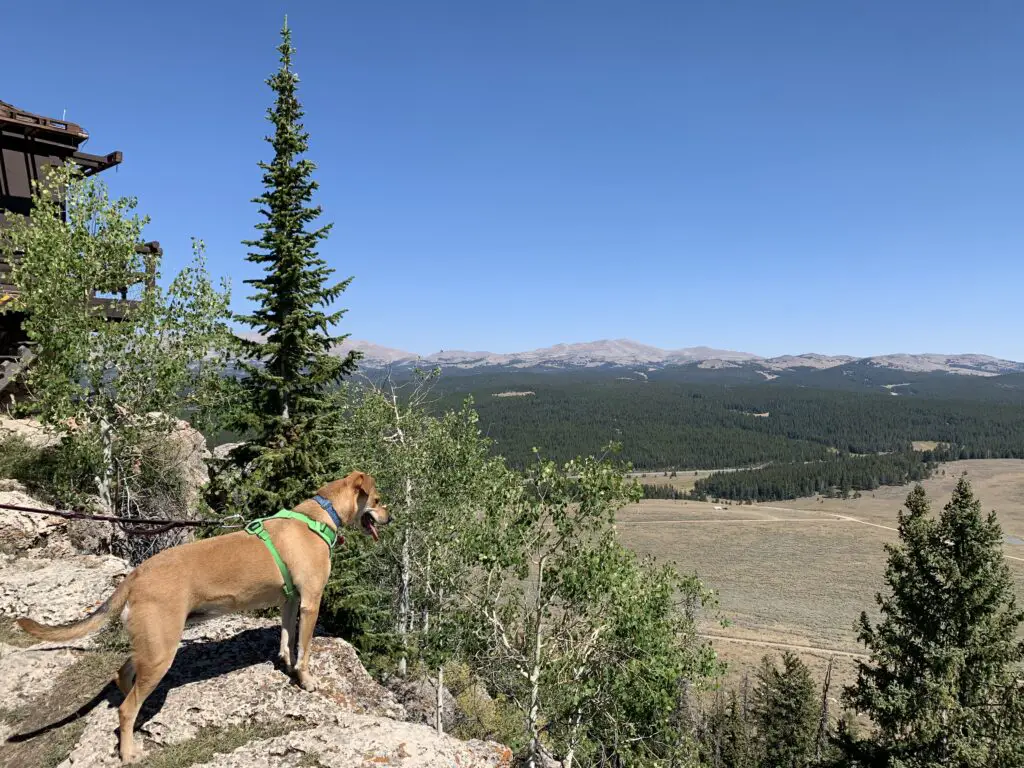
James T. Saban Fire Lookout
The Trekkers have passed this lookout on every trip we’ve made to the Bighorns and we always say, “we should check that out!”…so, we did!
The trailhead for the James T. Saban Fire lookout is found off Route 16 in the Bighorn Mountains, around five miles east of Meadowlark Lake. The turnoff is on the south side of the road. I can’t remember if there are signs telling you to turn but you can see the lookout at the top of the hill from the road. This is also the turnoff for the St. Christopher’s Chapel and there are signs for that site.
The James T. Saban Fire Lookout!Puppers enjoying the view from the fire lookout!
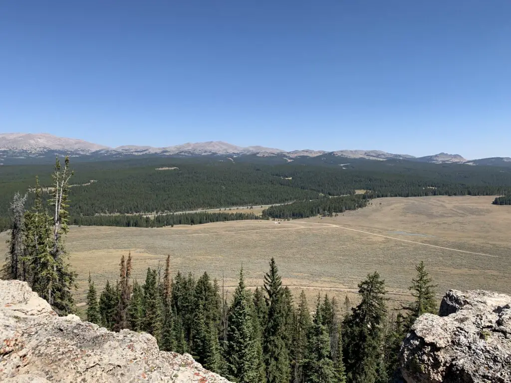
This fire lookout is easy to reach and offers some amazing views of the surrounding area. It requires a short drive on a narrow, dirt road to reach the trailhead. You’ll want to take it slow and watch where you are driving. In good conditions, I would be comfortable taking almost any higher clearance car, SUV, or truck there. In poor conditions (mud or snow) the road may be impassable.
Once you reach the trailhead, it is about a 15-minute walk (in each direction) to the tower at the top of the hill. It isn’t a bad hike. It gets a little steep in spots but the trek is short enough almost anyone in good health should be able to handle it. (Note: you are at an altitude of around 8000 – 9000 feet in this area so take your time as you may feel short of breath.)
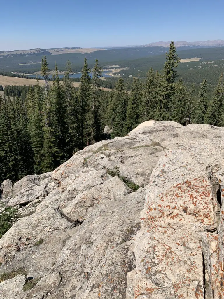
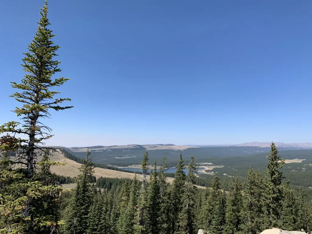
That is Meadowlark Lake in the background
Though it is a bit long and strenuous, the Misty Moon Trail to Lake Helen is a great hike if you want to really get a taste of the Cloud Peak Wilderness area in the Bighorn Mountains!
Have you hiked to Lake Helen, Bomber Mountain, Cloud Peak, the James T. Saban Lookout Tower, or Misty Moon Lake? If so, tell me about your adventures in the comments!
Did you enjoy this post? Pin it!
Like what you read here today? Please feel free to leave a comment, like or share this post! You can also follow the blog on social media by clicking the links below!
We try to camp in the Bighorns, in northeastern Wyoming, at least once a year!
The Trekkers have a tradition of camping in the Bighorns each Labor Day Weekend! Puppers has been a trooper on our camping trips. She enjoys riding in the truck (she doesn’t even mind the BUMPY, jarring journeys we’ve taken her down a few 4×4 roads…too much! 😉) She can keep up with us on the hiking trails and she even handles the tents like a champ (though she needs a little assistance getting in and out of the rooftop tent).
You do have to wonder about people who drive 3+ hours to the wilderness, where they proceed to pee in a bucket and not shower for three days…and call that fun! 🤔😉😎
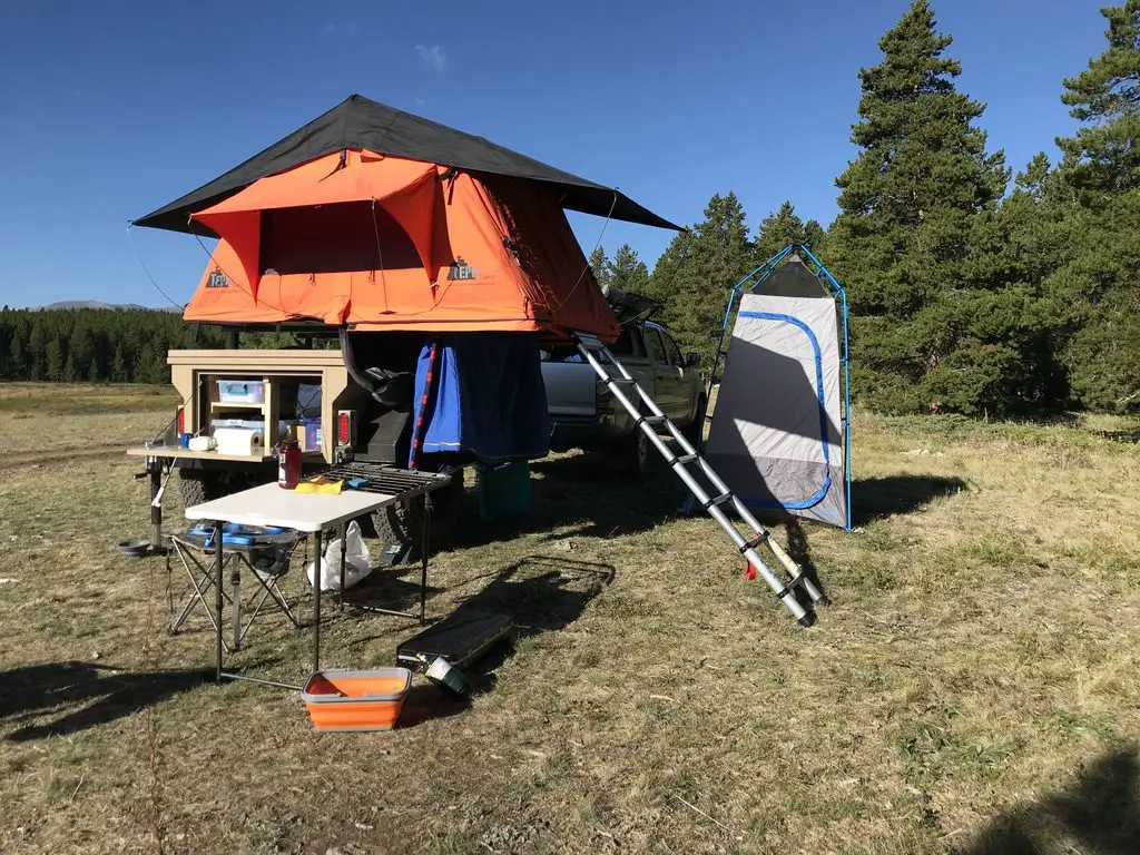
One of our camp setups
We finally caved and bought a privacy shelter for this trip, and we were SO glad we did. It made life SO MUCH easier. In the past we’ve used the vestibule that came with the rooftop tent, this worked ok, but even I couldn’t stand up straight in it (not to mention Mr. Trekker’s 6’4 frame). This could be because we have the tent on the trailer rather than on top of the truck, the vestibule likely works better in that situation. But the shelter worked great for changing, for a bathroom along with our Luggable Loo†, and for a shower using the solar shower. It was so cool to look up at night and see the Milky Way shining over you while you were changing or “taking care of business”. 😇
The Bighorn Mountains
I know I’ve said this before, and I hate to sound like a broken record, 😇 but I LOVE the Bighorns. I always forget we aren’t in the depths of the Colorado High Country when we visit there. I love their stony summits, some still sporting spots of white leftovers from last winter’s snowpack, just above the treeline far below.
I always think of them as their own tiny island of mountains that rises out of the high prairie of northeastern Wyoming, but according to Wikipedia, they’re actually a spur of the Rockies separated from the main mountain chain by the Bighorn Basin.
Though this area is just as beautiful as the Rockies, it is FAR less crowded, which makes it so much more pleasant to visit. 😋 There are no lines of people hiking in the Bighorns like we’ve experienced in various places around Colorado. Also, oftentimes, the lower-elevation plains may be baking in 90-degree weather, while it’s in the 60s-70s, and breezy, in the mountains!
It doesn’t hurt that, depending on which area you are heading to, the Bighorns are a shorter, 3 – 4-hour drive from the Black Hills, rather than the 6 – 8+ hours required to reach the mountains in Colorado ( and that’s just the Front Range, in the east-central portion of the state). You will still have to drive through rural Wyoming whether you’re going to Colorado or the Bighorns. However, to reach the mountains in Wyoming, you drive on I-90 the whole way. It’s a little easier if weather is bad, and you don’t have as much trouble with the Wyoming drivers who like to pass on two-lane roads leaving little room for oncoming cars…(ahem!🤬🤯) ( Of course, all that being said, no one should visit here, ever, it’s just a terrible place to be. 😮😇🙃)
The Bighorns aren’t to be trifled with though. These mountains are rugged, with little accommodations by way of gas, food, and supplies. Small towns, such as Buffalo, Ten Sleep, Greybull, and Sheridan dot the area. But these are few and far between (not to mention pretty tiny, by the standards of “normal” people who aren’t used to the small settlements that are common in the West). 😉 This is a national forest area, not a national park, so even camping accommodations are rustic, rarely offering more than potable water and a pit toilet (and those are the fancy ones)! 😮 So, if you’re looking to visit this area, be prepared to be self-sufficient. The views will make it worth the trial, though!
The night sky in the Bighorns
There isn’t a lot of light pollution in the Bighorns, so on clear nights, you are treated to an INCREDIBLE light show! Once the sun sets, the stars and planets come out in abundance. My whole life, I’ve never seen a night sky that is comparable to what you find in the crisp coolness of the high mountains. The sky actually looks like it has the measles, as there is almost a rash of stars that covers it. The cloudy ribbon of the Milky Way is often clearly visible as it stretches across the expanse of darkness. You can almost sense it glowing from within. It is truly an incredible sight.
Silent Night in the high mountains
Our campsite was at about 7500 feet on this visit (oftentimes we stay much higher, closer to 9000-10,000 feet). We’ve noticed something odd at these high altitudes that we have also experienced in Colorado’s High Country. There is a distinct lack of “night sounds”. You don’t hear the chirping of crickets or croaking of frogs in that thinner air, even on warmer nights, and I don’t know why. Nights tend to be pretty cool in those places, so it may be due to this, or just that there is a very short season where the night air would even be warm enough for the creatures to survive. But whatever the reason, when we’re up so high I do miss the “chirping” sounds of a summer night.
Dispersed camping in the Bighorn National Forest
Sometimes when we head out we Disperse Camp. This is also known as “dry camping”, where you just set up your camp somewhere in the national forest, outside of an established campground. We tried this for the first time in Colorado, at both State Forest State Park and near Crested Butte. On both occasions, we did stay at an actual, numbered campsite, it was just away from any campground and we weren’t able to see our neighbors.
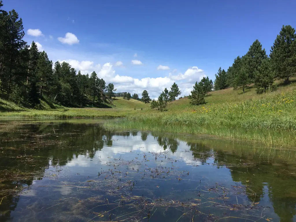
On this trip, there were no numbered sites, but they did request that you stay at an already established campsite (designated by fire rings). I have never experienced such a busy weekend in the Bighorns! We stayed near Circle Park (there are a lot of “parks” in this region, they are basically just large, meadowy areas amongst the forests). It was a lovely site with views of the surrounding mountains, but we could see three other campsites from ours (one had a large group in it). We could hear even more campers, just on the other side of the copse of trees we were camped near. Next time, we’ll have to try going even farther out if we hope to have more privacy! 😉
Moose in the Bighorns!
Ladies and gentlemen, Martin the Moose!
I wasn’t sure if we’d see any moose on this trip since we were sticking mainly to the southern portion of the Bighorns and I wasn’t aware of any waterways running near our campsite (which moose favor). We lucked out though. It only happened one time, but at about 6:30 one morning, as the Pup and I were enjoying her “morning constitutional”, I spotted Martin the Bull Moose sauntering through the “park”, down the hill from our campsite! SUCCESS!!! Puppers wasn’t sure what to make of that LARGE, funny-looking thing!
Hiking Trails
Circle Park Trail:
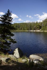
Sherd Lake
We did this same trail on our first trip to the Bighorns, several years ago, in October. It’s a nice hike, fairly wide and graded, and not terribly steep (though it is quite rocky in several places). We walked to Sherd Lake, which is absolutely GORGEOUS! There are views of several nearby mountains, such as Bighorn and Darton Peaks, from here. This trail is around four miles total, so it’s perfect for a day hike (especially with a not-quite-full-stamina, juvenile, canine friend). 🐶
The trail continues on to several other lakes from there. It also connects with an 8-mile loop that snakes around the nearby mountain peaks, if you’re looking for a lengthy hike (or a good backpacking trip).
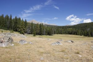
Maybelle Lake Trail (off Forest Road 430):
This hike was deceptively tough. It’s only about three miles in total length, but it’s overgrown in many spots, very rocky and there are lots of downed trees. We actually lost the trail several times and had to root around to locate it again. Other parts of it are PERFECT though. They feature a flat, graded path through a moist, pine forest, that is surrounded on both sides by a green carpet of ferns, moss, and soft undergrowth. It almost felt like hiking in the cool rainforests of the Pacific Northwest. It was such an idyllic sight!
The other difficulty is in reaching this trail. You have to drive about 45 minutes (one way) on a rugged, 4×4 road to get to the trailhead. We had done this route several years ago, so we knew what to expect, but this would NOT be appropriate for a normal car, or even just a high clearance vehicle. If you don’t have a 4×4, with gear intended for off-road purposes, you should NOT attempt this road. (As an example, after trying this route a few years ago, we decided skid plates would be an important addition to the truck.) After completing the road on this adventure, there is some paint hanging from the skid plates in a few spots (we sure were glad they were there!) 😋
Maybelle Lake
Tensleep Canyon
I’ve mentioned this canyon before, but this is one of the most beautiful places in the Bighorns. If you are anywhere near this national forest and you have the chance to drive the canyon, you absolutely MUST put it on your list. It is NOT to be missed. This is one of our favorite areas in this national forest, and we try to enjoy it whenever we’re nearby.
The canyon is surrounded by arid, rocky cliffs on both sides, and is located on the southwest side of the Bighorn mountains. One great thing about it is that EVERYONE can experience it. US 16 is the main road that runs through the middle of the canyon. It’s an easy-to-drive, paved byway.
For the best views, I would travel down the canyon, from east to west, on Route 435. This is actually a dirt road that runs parallel to US 16 on the canyon’s southern side. It’s a very well-graded route though, so as long as you don’t mind your car getting a little dusty, any 2WD vehicle can handle it in good weather (beware, the road may be impassable during snowy or muddy conditions. The road is also closed to vehicles November – June).
It’s a two-way road, but it’s fairly narrow, so take your time and be cautious. There is room to pass a vehicle coming the other way but both drivers need to be aware as the lane gets tight.
This route provides better views down the length of the canyon into the dry expanse of Bighorn Basin, that opens up between the western slopes of the Bighorns and the eastern slopes of the Absarokas (near Yellowstone National Park). While the Bighorns provide cooler conditions, even on the hottest days of the summer, the Basin sits on a high prairie that lies in the rain shadow of the larger mountains, to the west, and bakes under the heat waves of the summer sun.
On your return trip up the canyon, take the paved, US 16 for incredible views of the dun-colored rock and sparse, short, green trees and bushes that comprise the canyon walls. They stand out in contrast to the deep blue of the sky above. These views are SO beautiful!
You aren’t very likely to see moose in this area, it’s too dry and hot for the vittles they enjoy dining on. The northern side of the Bighorns, near routes like US 14 and 14A, are prime spots for spotting these ungulates.
For the best light, it’s best to drive up the canyon, west to east, in the afternoon when the sun is at your back! Here is a link to a video I made of our drive up the canyon.
We were glad to enjoy another successful, Labor Day, camping trip to the Bighorns. We really enjoy returning to this area year after year. There are so many things to see here, it can’t all be done in one weekend!
Have you hiked to Sherd or Maybelle Lakes? What did you think of the trails? Tell me about your experiences in the comments!
Did you enjoy reading this post? Pin it!
Like what you read here today? Please feel free to leave a comment, like or share this post! Add your email at the bottom of the page, or the sidebar to the right, to be notified when a new post is published. By signing up for the email list, you will also receive a free copy of the Tranquil Trekker’s Top 10 Tips of Trekking Do’s and Don’ts!
You can also follow the blog on social media by clicking the links below!
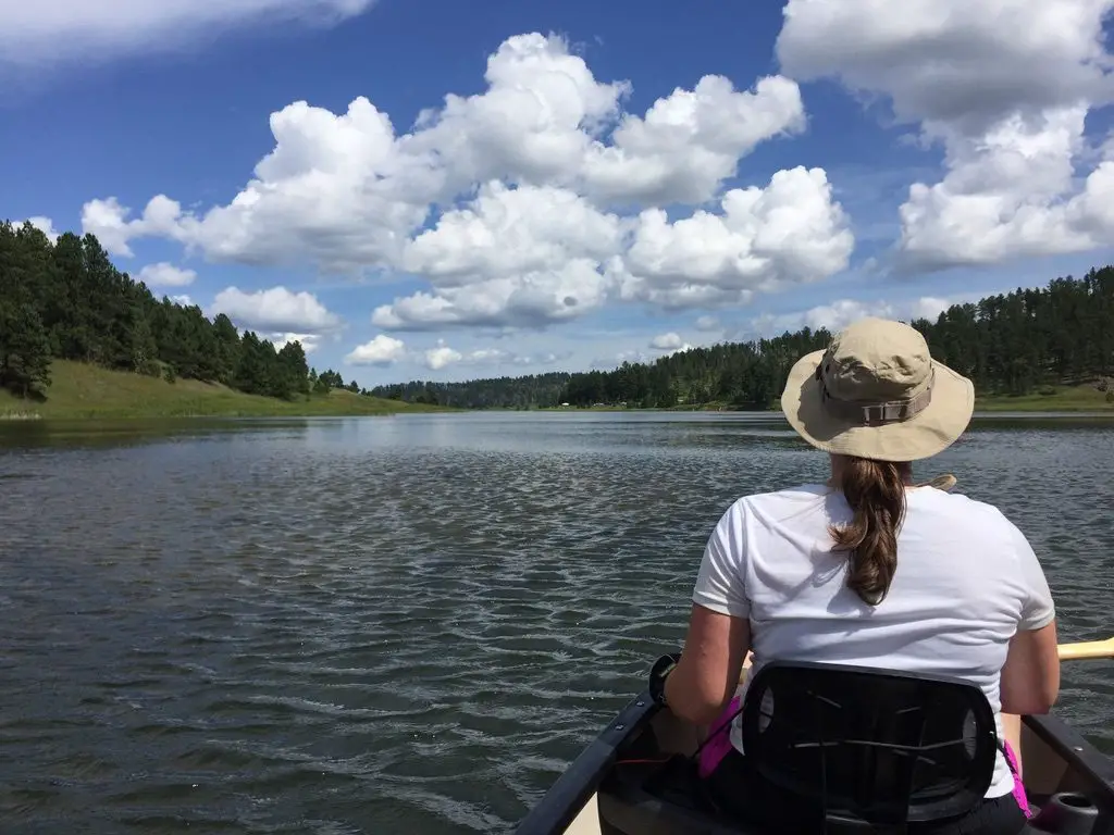
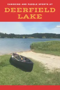
In this post, I review one of our favorite canoeing sites, Deerfield Lake, in the Black Hills of South Dakota.
Deerfield Lake is one of the Trekkers’ favorite spots for canoeing in the Black Hills (another is Jenney Gulch, on Pactola Lake.) This site is the terminus for the lengthy Deerfield Trail, that I’ve mentioned in another post. There are many things to enjoy about this part of the Black Hills. It’s a little more remote, so it does take a little longer to reach, but it’s also higher in elevation so it tends to be cooler. In the winter, this may not be as pleasant, but in the summer, when you are roasting in Rapid City, you can head to the Deerfield area for a less oppressively warm, far more enjoyable day.
Where in the Black Hills is Deerfield Reservoir?
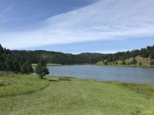
This body of water is easy to reach, just take Deerfield Road west, from Hill City, for about 15 miles. You drive right past it so you can’t miss it! 🙃
What fun things can you do at Deerfield Lake?
There is a hiking trail, that circumvents the lake, which is also good for cross-country skiing and snowshoeing in the colder months. There are several campgrounds available around the lake, as well. You should be aware these are National Forest campgrounds, which we always love,but they usually have very sparse accommodations. Potable water and vault toilets are about all you can expect at these campsites (though they are usually quiet and some spots have WONDERFUL views). This is also one of our favorite areas for acquiring Christmas trees in the Black Hillsif you know where to look…
What makes Deerfield Reservoir so great?
One of the best things about this lake is that it is fairly large in size (comparable to Sheridan Lake farther to the east) but it has a no-wake rule. So, while people can bring motorized boats if they wish (and some do, to fish) they aren’t allowed to go very fast. This regulation makes Deerfield Reservoir an opportune site for the slower, water sports such as canoeing, kayaking, and paddle-boarding.
We are especially thankful for the peacefulness of this place as there was a measure put forth to the State Legislature to drop the no-wake rule. This would have allowed boats to travel at wake-speed which would likely have increased the frequency and amount of larger boats using the lake. Fortunately, after a STRONG public outcry from locals, it was defeated. We were SO glad! This is truly one of the best places to canoe or kayak in the Black Hills (in my opinion). There are other nice lakes around Custer State Park, but they aren’t nearly as large. They don’t offer as nice of views of the surrounding mountains either. (With all that being said, this is a horrible place to visit and everyone should stay away! 😮😉)
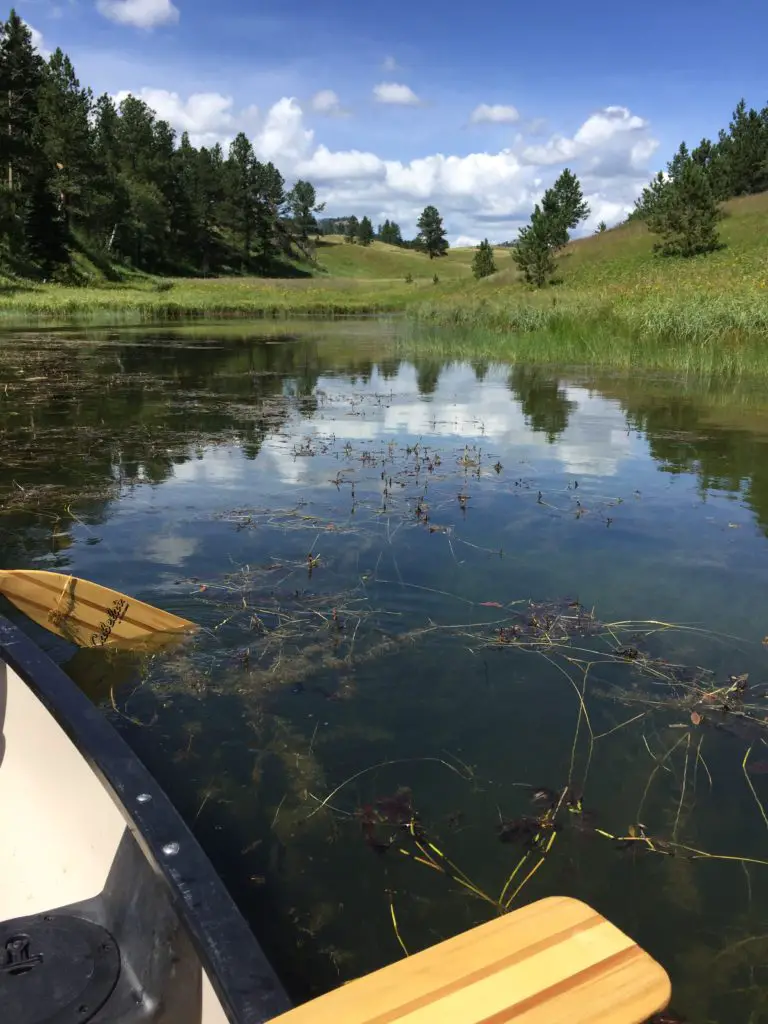
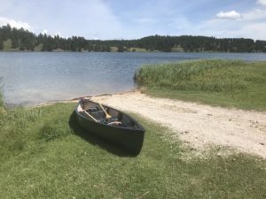
More pictures of our canoe day are below, courtesy of Mr. Trekker!
Just two canoe paddles, in love! 😉
With all this talk of canoeing, I would be remiss not to mention the rack system that we use to safely transport our mighty vessel. 😉 We really like the Yakima KeelOver Rooftop Canoe Rack†. It installs INCREDIBLY easily–and quickly–on the luggage rack on top of your vehicle. It also both protects the canoe from damage and holds it in place very well. Basically, the way it is designed, there are four separate, cushioned feet that attach to the already-installed luggage rack. If the canoe starts to slide to the left or the right, it is held in place by the feet on the opposite side. The kit also comes with tie-down straps that are used side-to-side and front-to-back to strap the canoe to the vehicle. It should be noted that this system is specifically intended for canoes only.
The next time you’re looking to escape the heat of a summer day in Rapid City, check out Deerfield Lake. It makes for a quiet retreat from the hustle and bustle of the busier, tourist towns, and offers scenic views as well. Go out and enjoy it!
Have you canoed at Deerfield Lake? Tell me about your experience in the comments!
Did you enjoy this post? Pin it!
Like what you read here today? Please feel free to leave a comment or share this post! You can also follow the blog on social media by clicking the links below!
†As an Amazon Associate I earn from qualifying purchases
This website uses cookies to improve your experience. We'll assume you're ok with this, but you can opt-out if you wish. Cookie settingsACCEPT
Privacy & Cookies Policy
Privacy Overview
This website uses cookies to improve your experience while you navigate through the website. Out of these cookies, the cookies that are categorized as necessary are stored on your browser as they are as essential for the working of basic functionalities of the website. We also use third-party cookies that help us analyze and understand how you use this website. These cookies will be stored in your browser only with your consent. You also have the option to opt-out of these cookies. But opting out of some of these cookies may have an effect on your browsing experience.
Necessary cookies are absolutely essential for the website to function properly. This category only includes cookies that ensures basic functionalities and security features of the website. These cookies do not store any personal information.

 Though this area is just as beautiful as the Rockies, it is FAR less crowded, which makes it so much more pleasant to visit. 😋 There are no lines of people hiking in the Bighorns like we’ve experienced in various places around Colorado. Also, oftentimes, the lower-elevation plains may be baking in 90-degree weather, while it’s in the 60s-70s, and breezy, in the mountains!
 Our campsite was at about 7500 feet on this visit (oftentimes we stay much higher, closer to 9000-10,000 feet). We’ve noticed something odd at these high altitudes that we have also experienced in
 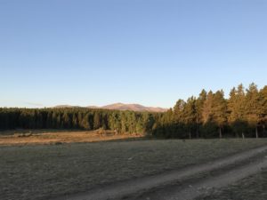 Sometimes when we head out we Disperse Camp. This is also known as “dry camping”, where you just set up your camp somewhere in the national forest, outside of an established campground. We tried this for the first time in Colorado, at both State Forest State Park and near Crested Butte. On both occasions, we did stay at an actual, numbered campsite, it was just away from any campground and we weren’t able to see our neighbors.
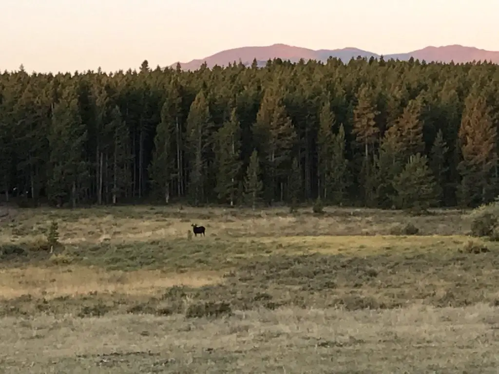
 This hike was deceptively tough. It’s only about three miles in total length, but it’s overgrown in many spots, very rocky and there are lots of downed trees. We actually lost the trail several times and had to root around to locate it again. Other parts of it are PERFECT though. They feature a flat, graded path through a moist, pine forest, that is surrounded on both sides by a green carpet of ferns, moss, and soft undergrowth. It almost felt like hiking in the cool rainforests of the Pacific Northwest. It was such an idyllic sight!
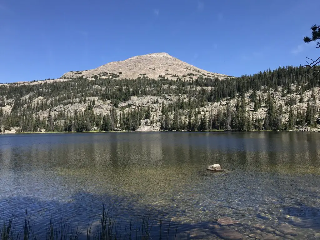
 Deerfield Lake is one of the Trekkers’ favorite spots for canoeing in the Black Hills (another is
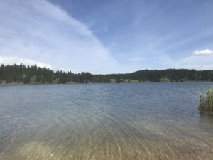
 There is a hiking trail, that circumvents the lake, which is also good for cross-country skiing and snowshoeing in the colder months. There are several campgrounds available around the lake, as well. You should be aware these are National Forest campgrounds,