I discuss my feelings on the longest day of the year
The Summer Solstice, also called “Midsummer”, is the longest day of the year. Despite the name, most people don’t think of this date as the middle of summer (especially in parts of the country like the Black Hills where it isn’t unusual to see snowfall well into May! 😮) The calendar says today is the first, official day of the warm season, though that doesn’t feel quite right either since many of us have been enjoying warm weather for a while now…
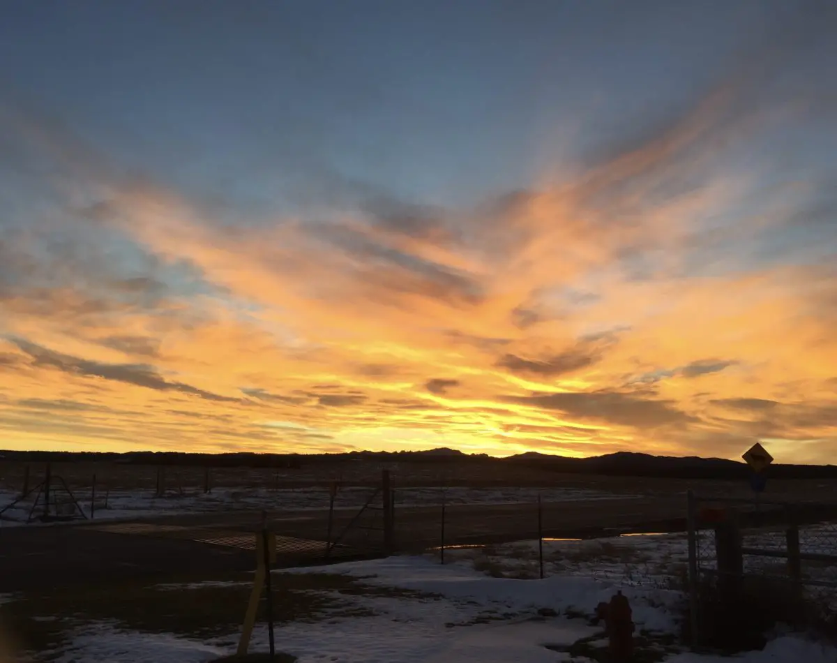
Reflecting on the Summer Solstice
Today is always a day of reflection for me…
I’ve written extensively about my struggle with SAD (Seasonal Affective Disorder) during the winter months. I’ve also discussed how I look forward to the Winter Solstice because our waning daylight finally begins its triumphant return after the shortest day of the year. Ironically the opposite extreme, the Summer Solstice, always makes me a little sad.
While I don’t struggle with SAD symptoms this time of the year, today is always a bit of a “downer” for me. Don’t get me wrong, I FULLY appreciate the more than 15 hours of sunshine we enjoy in the Northern Plains this time of year. 😎 But I will miss the sun, that bright companion that makes even the most difficult of days just a bit more cheerful.
Now that our daylight will be slowly decreasing, I won’t miss getting woken up at 4:00 every morning. My body is VERY sensitive to daylight so, if it’s light out, I’m awake. 😛 (This is especially troublesome when you have a bedroom that faces east). It got so troublesome I had to start wearing a sleeping mask to block out the daylight. 😝 It can also be a struggle to go to bed at a decent time when it stays light and warm out till almost 10 pm, and I need to get to sleep because my body is gonna wake me up again at 4! 😛
On this, the day of the year with the longest amount of daylight, I enjoy sitting on the back deck in the early morning, watching the sunrise, before the sounds of children playing outside and neighbors mowing their lawns takes over. The combination of the leafy and pine-needled greens that surround our backyard, combined with the cacophony of birds tweeting, complete with the dampness that starts the day, makes it almost feel like you’re in the middle of a rainforest. It’s a great time for reflecting, meditating, and/or journaling. We can’t hold on to daylight any more than we can hold the waves in place on the sand. So, we have to be fully present in each moment we are blessed with and embrace the joy to be found there.
Origins of the Summer Solstice
People who practice the Pagan religion call this day “Litha”, special ceremonies are even held at Stonehenge to commemorate the many hours of sunlight. In recent years I have developed my own little celebration. I try to get up early so that I can enjoy both the sunrise and sunset on this day. I try to spend as much time as possible experiencing every moment of today’s daylight. I want to soak up as much Vitamin D as I can, to start storing it up for the shorter days to come. 🌞
To our friends in the Southern Hemisphere, you can enjoy your “season in the sun” for a while now. Don’t get too comfortable with it though, we’re going to take it back in six months! 😎
Do you have any traditions to celebrate the longest day of the year? Tell me about them in the comments!
Did you enjoy this post? Pin it!
Like what you read here today? Please feel free to leave a comment, like or share this post! Add your email at the bottom of the page, or the sidebar to the right, to be notified when a new post is published. By signing up for the email list, you will also receive a free copy of the Tranquil Trekker’s Top 10 Tips of Trekking Do’s and Don’ts!
You can also follow the blog on social media by clicking the links below!
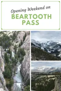
In this post, I review a Memorial Day road trip on Opening Weekend of the Beartooth Highway in Montana.
One item you should definitely have on your Road Trip Bucket List is to drive the Beartooth Highway on Opening Weekend. This route connects Red Lodge, Montana, on the north side; Yellowstone National Park, to the west; and Cody, Wyoming, to the south. The route usually opens by the Saturday of Memorial Day Weekend, though this is always weather-dependent. Also, temporary closures may occur after the opening date, also due to weather.
Click hereto watch videos of snowplows clearing the route on YouTube (be warned, they are addictive! 😉) The Montana DOT often has to clear snowdrifts that are over 20 feet deep in some areas!
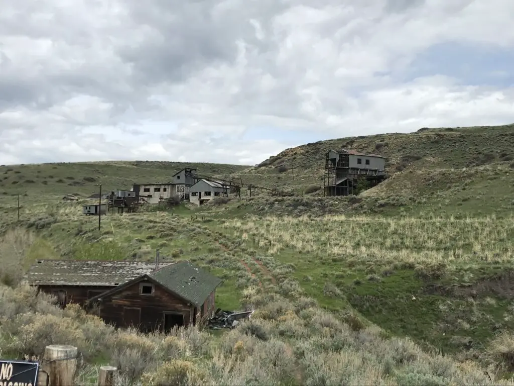
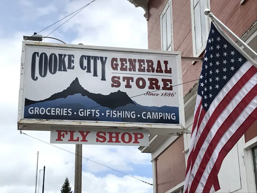
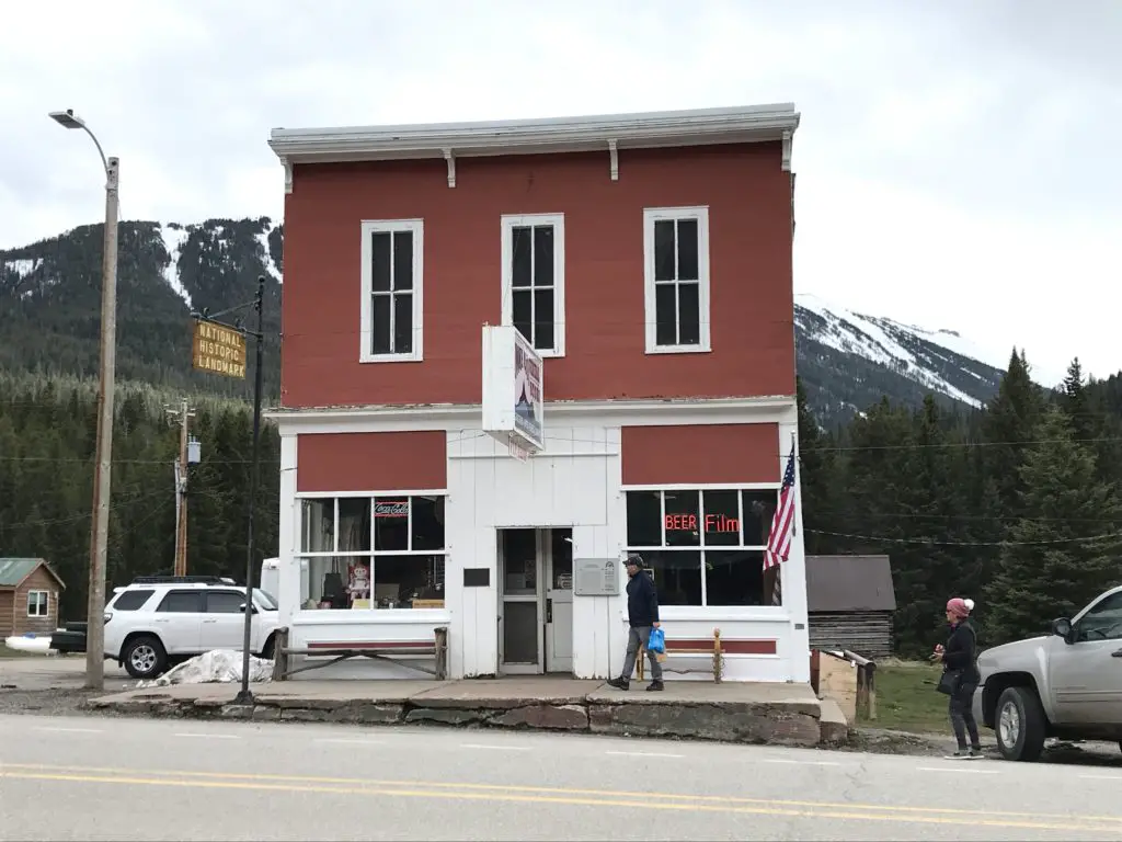
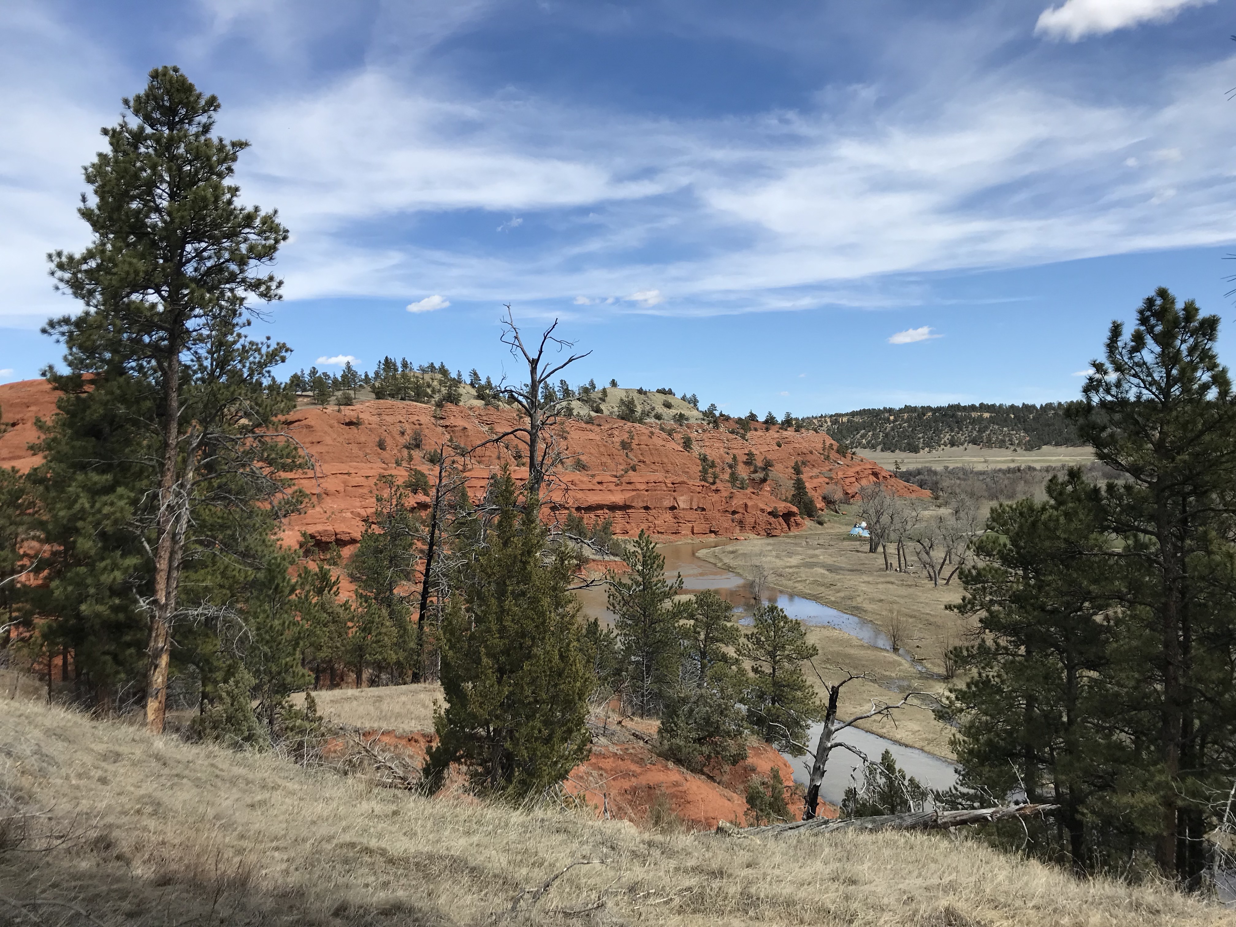
Washoe Ghost Town near Red Lodge, Montana
You can travel the road from either direction. We started in Red Lodge, Montana. We noted on the map that there was a ghost town not far from our hotel. The Washoe Ghost Town and mine site is located on Route 308, between Red Lodge and the tiny town of Bearcreek, on the way to Belfry. The actual site is situated on private land, so you can’t tour it, but it is easily visible from the side of the road.
We’ve been learning the joy of simple motels on recent trips. Air B&B’s have become our “lodging of choice”, though we’ve been finding, if we MUST stay in a hotel, the simpler, local options appeal to us the most.
They have to be clean, and well-maintained, of course, but they often have so much more character than the stale, chain hotels people usually think of. We also, frequently, stay in smaller towns, where the larger chains don’t often have a large presence. So, being willing to expand our horizons a bit makes lodging much easier to locate.
We had incredible luck with finding places to stay on this trip. In Red Lodge, we chose theRed Lodge Inn, which was absolutely ADORABLE.
It was a simple motel, but it appeared that the rooms had been refurbished recently, and they were quite nice. We were also impressed by how large they were! The motel is owned by a young family, and the hosts were incredibly friendly and helpful when we needed information regarding local attractions.
In Cody, Wyoming, we stayed at theCody Cowboy Village, and it was equally as cute. This one had more of a “Western” theme, while the room in Red Lodge felt more like a mountain cabin, but both were equally enjoyable.
At the motel in Cody, large wooden beams made up the small cabins and reminded me of the ADORABLEGrandma’s Cabinthat we stayed in, with Mr. Trekker’s family, in Island Park, Idaho, during our Yellowstone trip in 2014!
Places to eat along the Beartooth Highway
We’re also learning that simplicity is our friend when it comes to finding meals out on the road. We love little cafes and diners, and again, when you stay in small towns, it’s good to enjoy these. 😁
When in Red Lodge we had dinner at one of our favorite places, Red Lodge Pizza. The restaurant is housed in the old post office and features creations along that theme such as, the Cliff Claven! We’ve never had a bad meal there!
In Cody, we ate breakfast at Our Place, a charming little dive (to be clear, I use that term affectionately) just across the street from our hotel.
Some of the best meals I’ve eaten at a restaurant were cooked in “dives”. These places are usually locally-owned by regular, small-town folks. The owners are often a joy to talk with, and any time the place is crowded with locals, you know you’re in for a treat!
We enjoyed dinner at the Occidental Saloon in Buffalo, Wyoming the final night. We’ve visited there before and have always been happy with the meals. This site is attached to a historic hotel in town, where the likes of Teddy Roosevelt, Butch Cassidy, and Calamity Jane once rested their weary feet. As usual, we ate the final meal of our trip, breakfast on Memorial Day morning, at the Busy Bee Cafe, also in Buffalo. I’ve waxed lyrical about how much we like this cute little restaurantbefore.
The drive on Beartooth Pass!
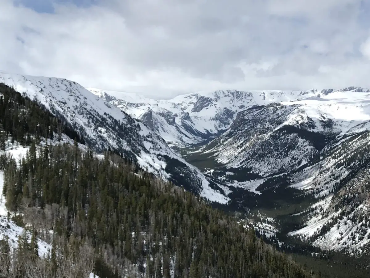
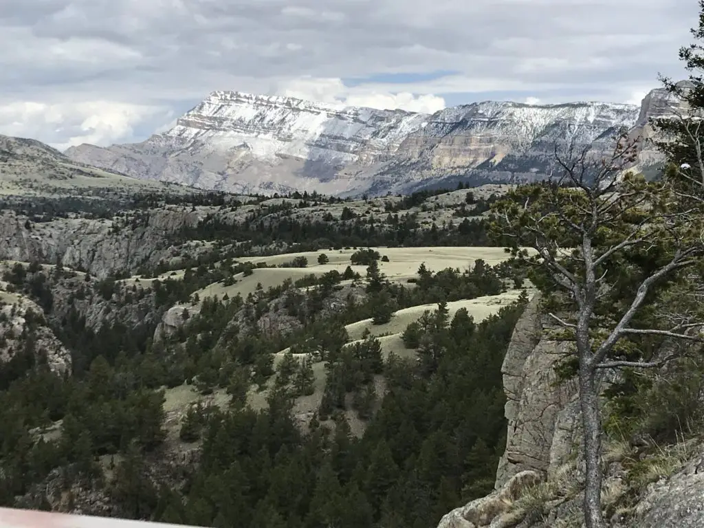
Although weather forecasts made it appear doubtful, we did get to drive the full extent of the road…on the Montana side. We had to wait 1.5 hours for it to open up but got to enjoy views from one of the main lookout points while we waited. When we heard whoops of delight from the skiers and snowboarders that were parked near us and saw the snowplows drive by, we knew we were headed to the summit!
Weather had been pretty wild in this part of the country that spring, and this area had received close to a foot of snow just a few days before the road opened.
The Forest Service had gotten the Wyoming side of the route mostly open, save for the last few miles at the summit. With the recent lousy weather though, this portion had drifted shut again. Fortunately, we have driven the entire route before(just not on Opening Weekend).
The weather didn’t seem much different from when we were there in July of 2016, there was just–a little–less snow in the summer. There were still plenty of gloomy gray clouds, and the temperature was, maybe, only 1o degrees warmer. 😛
We found it to be almost disorienting near the summit. The way the white snowfields melded with the pale, gray sky, it was hard to tell where the land ended and the sky began!
Because the road was closed, we had to embrace our motto from a previous road trip, and “Just Groove“, and boy, were we glad we did!
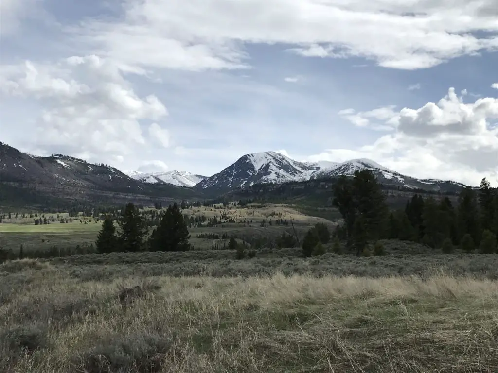
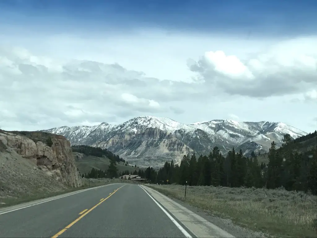
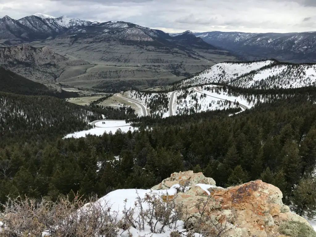
The alternate route we chose was Route 72, south of Belfry, Montana, into Wyoming, and may I say it is absolutely GORGEOUS! It offers incredible views of the Absaroka Mountains as you drive along their length.
Click here for a video I made of our drive. We definitely saw large piles of snow but didn’t quite get to experience the “snow tunnels” I was hoping for. I guess we’ll just have to go back and do this route again on another Opening Weekend!
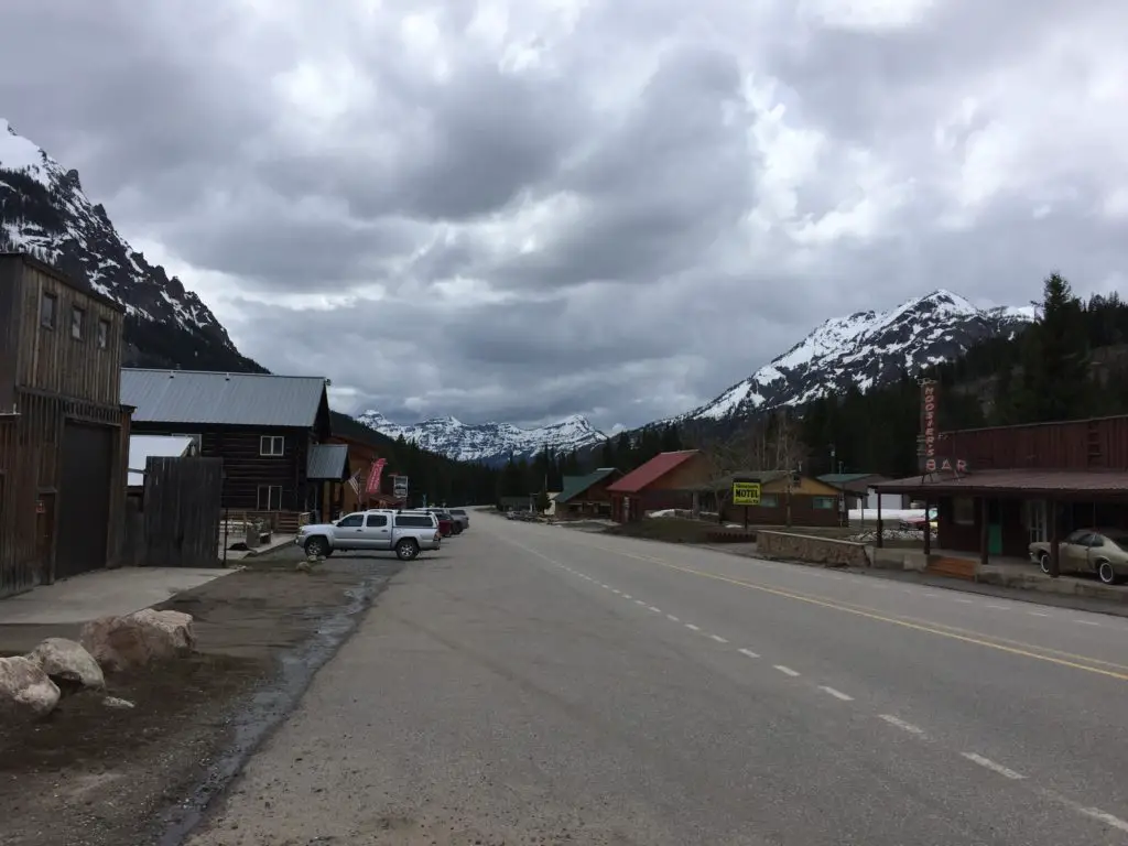
Cooke City, Montana
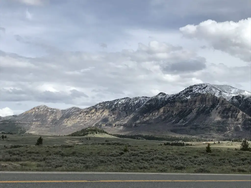
When we reached Route 296, in Wyoming, we took that road (the Chief Joseph Highway) back to US 212 (the Beartooth Highway) on the Wyoming side, as that portion was open. This takes you all the way to Cooke City/Silver Gate back in Montana, and eventually on to Yellowstone National Park.
These two, tiny towns had been on our “must visit” list since ourYellowstone Trip. The towns were teensy but enjoyable. They definitely felt like the type of places you’d visit in the high mountains. For those who may be interested, I should note that there are several campgrounds in this vicinity. HOWEVER, they only allow hard-sided campers (no tents) due to regular bear activity. Just something to be aware of. 😳
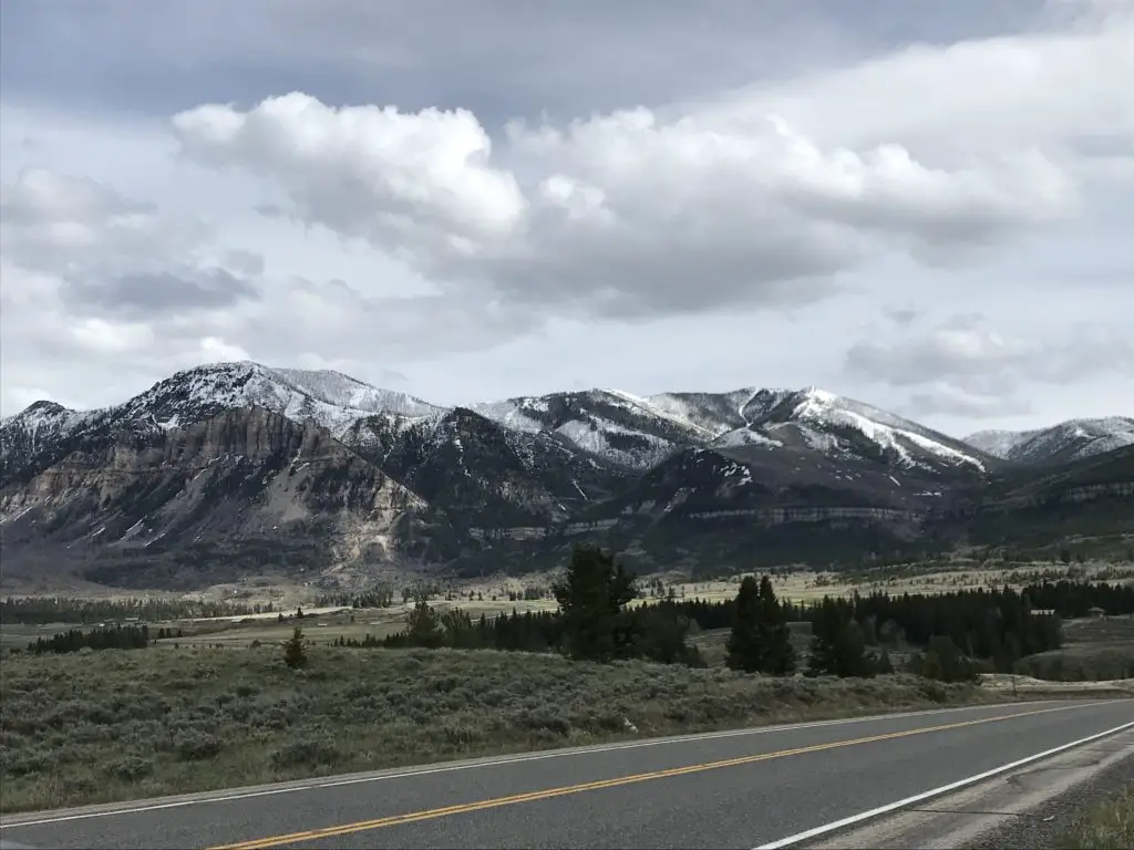
Drive the Chief Joseph Highway in Wyoming
I can never get over how beautiful northeastern Wyoming is. On our trip, everything was so uncharacteristically green! This is an unusual sight for this normally dry area, but the early season and recent rain had the grass growing well!
There were some gray clouds (though we enjoyed more sun than expected) and these, contrasted with the vibrant green of the new grass and the steely, dark gray mountains, with snow still capping their summits, made for quite the scenic view! The somewhat dreary–yet picturesque–image made both of us think of Scotland (or what we imagine Scotland to look like, having never been there…YET!) 😮😉
There’s a story that goes with this picture. Mr. Trekker had to take it from the bridge because I was too chicken to stand near the edge!
See below for more pictures of our drive. As you can see, there was still some snow on the upper peaks:
Buffalo Bill Center of the West in Cody, Wyoming
We eventually made our way back down the Beartooth Highway and stayed in Cody, Wyoming Saturday night. We’ve stayed there several times as a stopover, and each time we thought we should take the time to visit theBuffalo Bill Center of the West(but never got the chance). Since this was a weekend of “checking things off the list”, we decided now was as good a time as any!
The museum is actually made up of five different areas. We both enjoyed the Natural History portion the most. This section comprises multiple levels, as though you were traversing down a mountain, from the tundra ecosystem near the summit to the prairie/grassland found far below.
We also enjoyed the firearms museum, that showcased items from around the globe and from a wide range of battles throughout history. There was also a section regarding the life of Buffalo Bill Cody and his Wild West Show that was quite interesting.
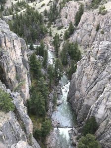
Ten Sleep Canyon, Bighorn Mountains
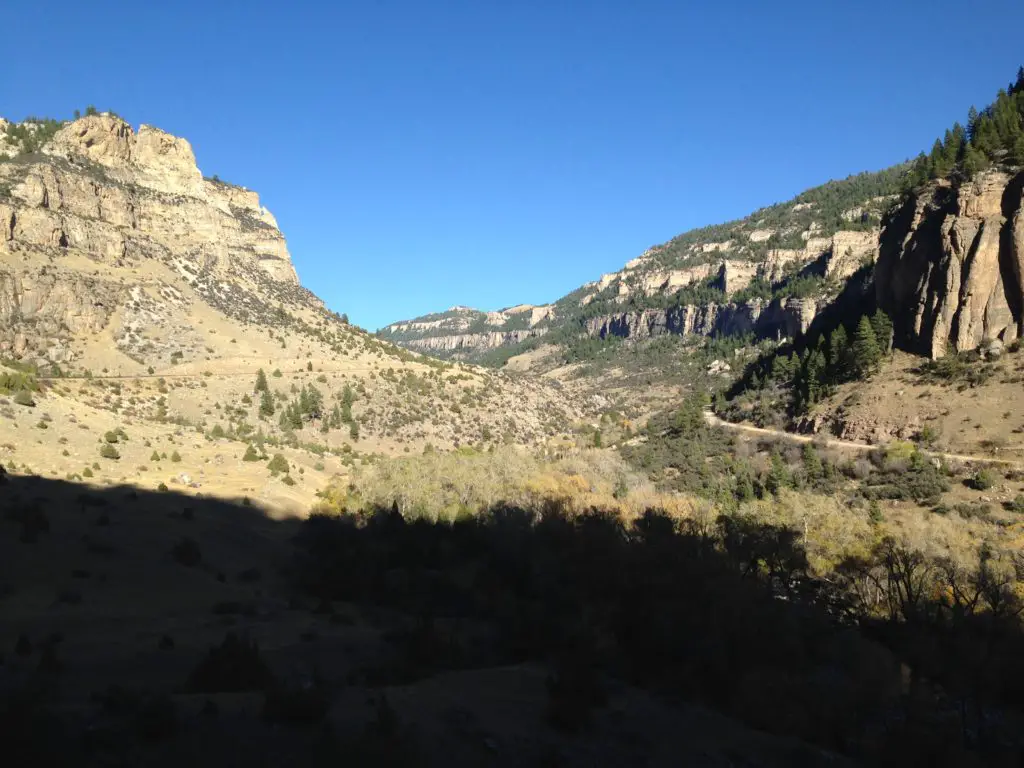
We took one of our favorite routes home through the Big Horns, US 16 through Ten Sleep Canyon, in Wyoming. This is, absolutely, one of the most beautiful canyons I have ever seen!
They call this the most scenic route through the Big Horns and I believe it! Route 14 and 14a are pretty in their own right (and you’re much more likely to see moose on one of these roads) but the southern route through the canyon is one that shouldn’t be missed!
As you’re driving into the canyon from the west, you have the Absaroka Range in your rearview mirror while the Big Horns loom ever larger in front of you. This area is quite dry and barren, as it’s in the rain shadow of the Absarokas, adding to its rugged beauty.
I know I’vementioned it before, but I can’t get enough of the ruggedness that makes up the Wyoming countryside. The drab yellow of the badlands that contrasts–this time of year–against the almost florescent, green grass of Spring in the foreground, and the imposing, dark mountains in the background (with their bright white caps). This area is pretty all the time, but especially so this time of year before the hot summer conditions have baked it dry.
This route is also called the Cloud Peak Skyway Scenic Byway, as it is the main road that runs nearest to Cloud Peak, the tallest summit in the Big Horns (though you can’t actually see the summit from the road as it’s in the middle of a Wilderness Area).
Clickherefor a video I made of a Labor Day Weekend drive through the canyon.
This route is also a beautiful drive down the east side of the Big Horns into Buffalo, WY. If you’re there at the right time, you may see yaks grazing on the steep hillside near the side of the road! 😮
I recommend everyone check out these drives if they have a chance, as they are all quite beautiful. There are LOTS of tiny lakes that make for great pictures (not to mention plenty of marmots posing for photos in the higher elevations!) Be prepared though, winter conditions can occur at any time in that area (we had thunder and slushy snow falling on us in July!) 😮
Go tour these highways, you’ll be glad you did!
Longmire Store, Buffalo, Wyoming
Finally, we were able to cap off our weekend in the best way! Each time we visit Buffalo, I have hoped to stop at the Longmire store, named after the well-known book and Netflix series. As we learned, it used to ONLY be open during Longmire Days each year in July, as it was just a satellite store. Well, it is now open all season and we FINALLY got to partake of its wares! See, persistence pays off. 😁
Have you visited the Beartooth Highway on Opening Weekend? Tell me about it in the comments!
Did you enjoy this post? Pin it!
Like what you read here today? Please feel free to leave a comment, like or share this post! Add your email at the bottom of the page, or the sidebar to the right, to be notified when a new post is published. By signing up for the email list, you will also receive a free copy of the Tranquil Trekker’s Top 10 Tips of Trekking Do’s and Don’ts!
You can also follow the blog on social media by clicking the links below!
In this post, I detail what I learned from my experience working as a freelancer.
Author’s Note: I wrote this article several years ago when I was working as a Freelancer, writing grants, online articles, and doing some consulting. Unfortunately, COVID brought that opportunity to a grinding halt (though I now have a more typical “9 to 5 job” I’m still blessed that it’s very flexible and it allows me to frequently work from home.) I thought people may still find my Freelance experience interesting though and I do hope to return to this type of work someday.
I cannot express how thankful I was that I was able to seize this opportunity. My thanks especially go out to my amazing hubby, as without him this wouldn’t have been possible (both emotionally and financially). A word of warning, this type of work is not all roses and sunshine. It’s hard work, there isn’t a lot of job security and it requires a large amount of personal discipline. But the freedom it gave me to live my life as I chose made it all worth it!
Can you freelance in most professions?
Freelance work covers a wide range of industries. It can be anything from online writing, web design, or consulting to an artist who is contracted for work or a person selling beauty products or supplements on the side.
A freelancer could be a stay-at-home parent who babysits other people’s children in addition to their own, jobs like Uber, or a dog walker. Basically, it is any service contracted between you and another party, for any type of payment.
Payment may not even be financial in nature. While I firmly believe no one should work for “free”, it isn’t unusual to do at least some freelance work for no financial compensation. Instead, “payment” could include experience earned, connections made, or even just the hope of future dividends paid. I got started as a volunteer and this eventually morphed into a paid opportunity.
Freelancing can be a physical job based on a hand-shake with a real human, or a gig in the new, online workforce where you may never meet or even see your client face-to-face. Literally ANYONE can do this!
Is freelancing a “real” job?
The answer is a resounding YES! (and it can be TOUGH!) Freelancing often gets a bad rap. It’s become more and more accepted and normal in the past few years (especially during COVID), and trends suggest this will only continue into the future.
But many people (and even some businesses and potential employers) treat it with condescension. They think all we freelancers do is sit on the porch all day, sipping on lemonade while we type on our laptops.
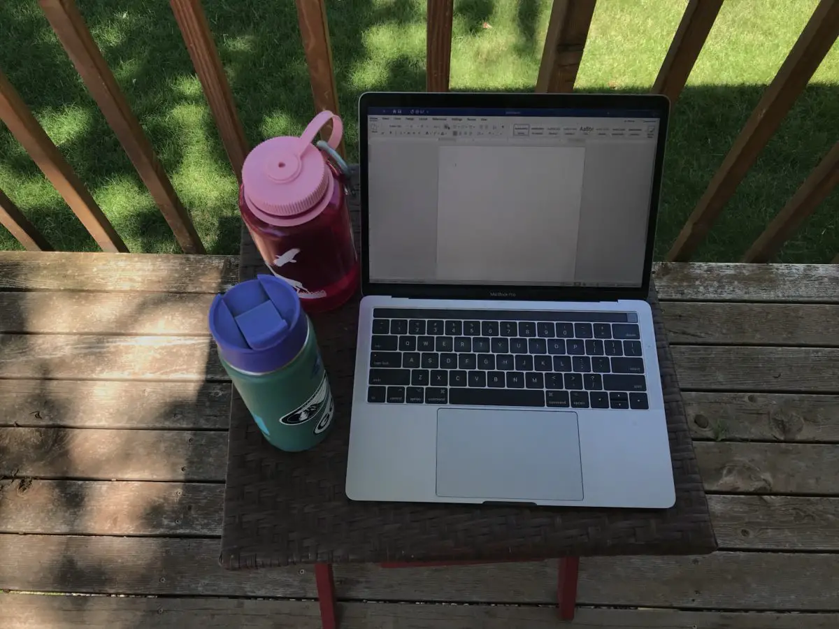
To be fair, there is a little truth to this idea (says the woman who is currently typing on her laptop while sitting on the porch. 😇)
But many don’t realize the effort that goes into freelancing…
A freelance job is stressful
I didn’t fully appreciate just how stressful freelancing would be when I first started. There are things they don’t tell you about this “dream job”. For one, you literally don’t get paid unless you’re actively working. That may seem silly to say, but you don’t realize just how tiring a day of work can be until you don’t make a dime unless the project is delivered and completed, to the client’s liking. Whether it takes you two hours or two days to complete the project, the payment is the same. Even if you bill a client on an hourly basis, you have to justify every minute of that hour.
At a typical hourly (or even salaried) job, you get paid for those breaks you take to run to the coffee machine, or the bathroom, or to stop by a coworker’s desk to discuss a project (and end up shooting the breeze for the next 20 minutes). As a freelancer, you don’t, you literally have to work for every…single…cent you make. It’s a wonderful, flexible, exhilarating, rewarding experience, but it’s also tiring. I can honestly say I felt more tired at the end of the day, working part-time from home as a freelancer, than I almost ever have working a normal, 9 – 5, hourly job.
There is a lack of job security with freelance work
There is also the financial strain of fluctuating, irregular income, and extreme job uncertainty with freelance work. While no job is “guaranteed”, people with long-term employment are usually pretty comfortable that their job will still be there next week or next month. With freelancing, there is virtually no job security. There are some contracted positions, but those are usually only “guaranteed” until the current project is complete (and as we all learned with COVID you can be laid off at any time, with little to no warning.) Most freelancers are continuously seeking out new work.
Freelancers work an irregular schedule
You can spend days or weeks with almost no work, and then a big project will crop up with little notice (which is wonderful, for the money and experience, but it can cause a lot of sudden stress and really throw off a family routine).
Please understand I don’t intend any of these statements as complaints. I LOVED working as a freelancer and hope to return to it someday. I am VERY aware of just how fortunate I was to even be allowed this opportunity. I just want people to understand that just like any job, working for yourself has its challenges, as well.
Freelancer pearls of wisdom
I learned a lot through my freelancer experience, and I know a lot of freelancers who are striving to make their “side-hustles” work, so I thought I’d pass on a few pearls of wisdom:
–Freelance work is INCREDIBLY rewarding. This was one of the only jobs where I actually felt like I EARNED every single dime I made (don’t tell any of my “real” bosses I said that! 😛) That felt REALLY GOOD!
It was ironic, I made less working as a freelancer than I had in more than a decade, but I felt more proud of the work I did and the income I received. It reminded me of when I first started working in high school. Even though the checks weren’t large, I knew I busted my butt for every single dime I received (of course, then Uncle Sam comes in and takes his share…😤)
–I find online freelance work can be surreal. It IS work, it takes time, planning, and mental energy. But it doesn’t FEEL “real”. Depending on the type of work you do, tt may not be unusual to only communicate with clients via email or online messaging. You may never hear their actual voice, or even know what they look like! Then there’s also the fact that your work is magically sent into the ether that is the World Wide Web, and then, a while later, if the client is pleased, money magically appears in your bank account. 😮
I’ve gotten several jobs through Upwork, a freelance matching service. There are several platforms like this out there that allow freelancers to connect with potential clients around the world. I’ve worked with companies as far away as Seattle. Living in western South Dakota, just a few, short years ago it would have been hard to even connect with a place like this.
–I am still somewhat amazed that you can actually make a decent income, literally working from your backyard. I have learned that there are actually legitimate companies out there that will pay you a decent wage to work from home. It takes a little luck to get established and to find some of the connections, but once you get over that hurdle, depending on the time you have available, your internet connectivity, your skillset, and your determination, you can make a decent career for yourself as a freelancer.
–I liked being able to pick and choose what companies I wanted to work with and what projects I wanted to work on. Obviously, if I was picky, that meant less money in my pocket. But it enriches your work life when you don’t have a boss forcing you to work on a project you aren’t interested in or being forced to work with a company you don’t respect.
–I had to learn about things like quarterly tax payments to the state, and “estimated tax” to the Federal government. Ugh, every time I had to deal with the bureaucracy involved with these my Libertarian heart grew a little larger (and I say that as a former State employee living in a business-tax-friendly state! 🤑)
–Then there’s the constant bane of my existence, the one act of blogging that makes me want to rip my hair out and throw the–not inexpensive–laptop across the room…the dreaded coding. 🤮 I HATE coding! I’m learning to do it, though I’m still an extreme novice, but I HATE it. I know, this is an unpopular opinion, and I probably just made a bunch of “Women-in-STEM” advocates cringe, 😉 but I can’t help it. I HATE it! 😋
I find coding is a tedious process. The more I understand, the more I can use it, but it just doesn’t spark my interest. A lot of people really enjoy it, and I can kind of understand why. It is like a puzzle that needs to be solved (kind of like math, which I also HATE! 😉)
But for me, the time spent trying to figure out why that stupid heading INSISTS on remaining in the middle of the page just feels like a waste of time. It’s probably mostly that the blog isn’t making much income at this time. That’s ok, that’s how these things work and I understand that. The hope is that it will pay dividends in the future. But I think the stress of spending hours fighting the code would be much easier to handle if a hefty salary came along with it. 😛
Goals I was able to achieve in my attempt at freelancing:
I’ve was able to develop a decent portfolio of online travel writing that served me well in long-standing jobs
My grant writing career didn’t progress like I hoped it would. COVID, and the resulting economic decline saw to that. I did find I could only focus on a few projects at once, so having one or two clients I could place all my focus on was much better than having to divide that focus out among numerous agencies.I originally started by providing volunteer services. I learned A LOT during those years, and am happy to say that knowledge paid off as several grants I submitted were approved for funding. It’s incredibly satisfying to be able to help local, non-profit agencies that I care about and can see literally helping people in my own community, to be able to continue to provide those necessary services.
For a short time, I was able to work as a consultant for a local agency and was able to pull from several previous jobs to succeed in that position.
Regarding the blog, I have learned SO MUCH regarding marketing, social media, and coding and I’ve even begun to master the much-dreaded SEO. 😮 Don’t let anybody kid you, maintaining a blog can be a full-time job in itself. But I’m excited to say I’m finally starting to see some success and growth!
You won’t find a more flexible, family-friendly work environment than that of a freelancer. But, there’s also the stress that comes from uncertain job security and the financial strain that’s caused when you move away from a steady, full-time income (and benefits). This is made far easier for anyone who can lean on a partner or spouse for financial support or things like health insurance, but not everyone is in that position, which makes freelancing even more difficult.
To Conclude
Many people pursue freelancing on a part-time basis as the ever-popular “side hustle“. This is a GREAT way to get started, it’s also far smarter and more secure financially. But it poses problems of its own…
We’re all busy, trying to carve out time in our days around work, house chores, dealing with kids and/or elderly parents, or working around busy family schedules. Finding time to fit in an additional job, especially one where you may not make much money for the first several years, can feel like an insurmountable obstacle.
I pursued this endeavor under the best of circumstances (I was financially able to lean on a partner for support and we don’t have kids), and I STILL felt the stress and eventually failed at my endeavor (at least for now. 😉) I can’t imagine how people who deal with additional stressors manage. So to all the other freelancers out there, trying to make it as a pioneer in this new, gig economy, my hats off to you!
Have you done freelance work? What have you learned? Are you interested in becoming a freelancer? What additional questions do you have? Let me know in the comments!
Did you enjoy reading this post? Pin it!
Like what you read here today? Please feel free to leave a comment, like or share this post! Add your email at the bottom of the page, or the sidebar to the right, to be notified when a new post is published. By signing up for the email list, you will also receive a free copy of the Tranquil Trekker’s Top 10 Tips of Trekking Do’s and Don’ts!
You can also follow the blog on social media by clicking the links below!
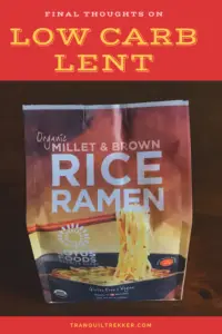
In this post, I review how I’m continuing to implement some low-carb recipes into my everyday diet.
Several years ago I tried to go low-carb as part of my Lenten fast. I’ve been able to maintain some of the low-carb practices and recipes I learned during that experiment and make them a sustainable part of my everyday life. I’ve had some interesting results.
The low-carb diet killed my sweet tooth!
It appears that my sweet tooth took a bit of a hit during my low-carb experiment. (I suppose some may consider this a good thing. 😛) I still enjoy sweets, I just find that my tolerance for them is lower. Or, at least, that my “palate fatigue” is stronger in regards to sweet treats. (This mechanism was discussed in the Paleo and Keto Diet bookI reviewed in a previous post.) This seems to mean that while I still have a desire for sweet foods, and still enjoy them, my craving for them ends more quickly and it is easier to put them aside.
I also find I no longer have any interest in something that is “just sweet”. This would be treats such as milk chocolate or plain Rice Krispy squares. If I’m going to stimulate my sweet tooth these days, I need something with real flavor. Dark chocolate and/or treats that include peanut butter now seem to be the most appealing.
Better low-carb food choices…
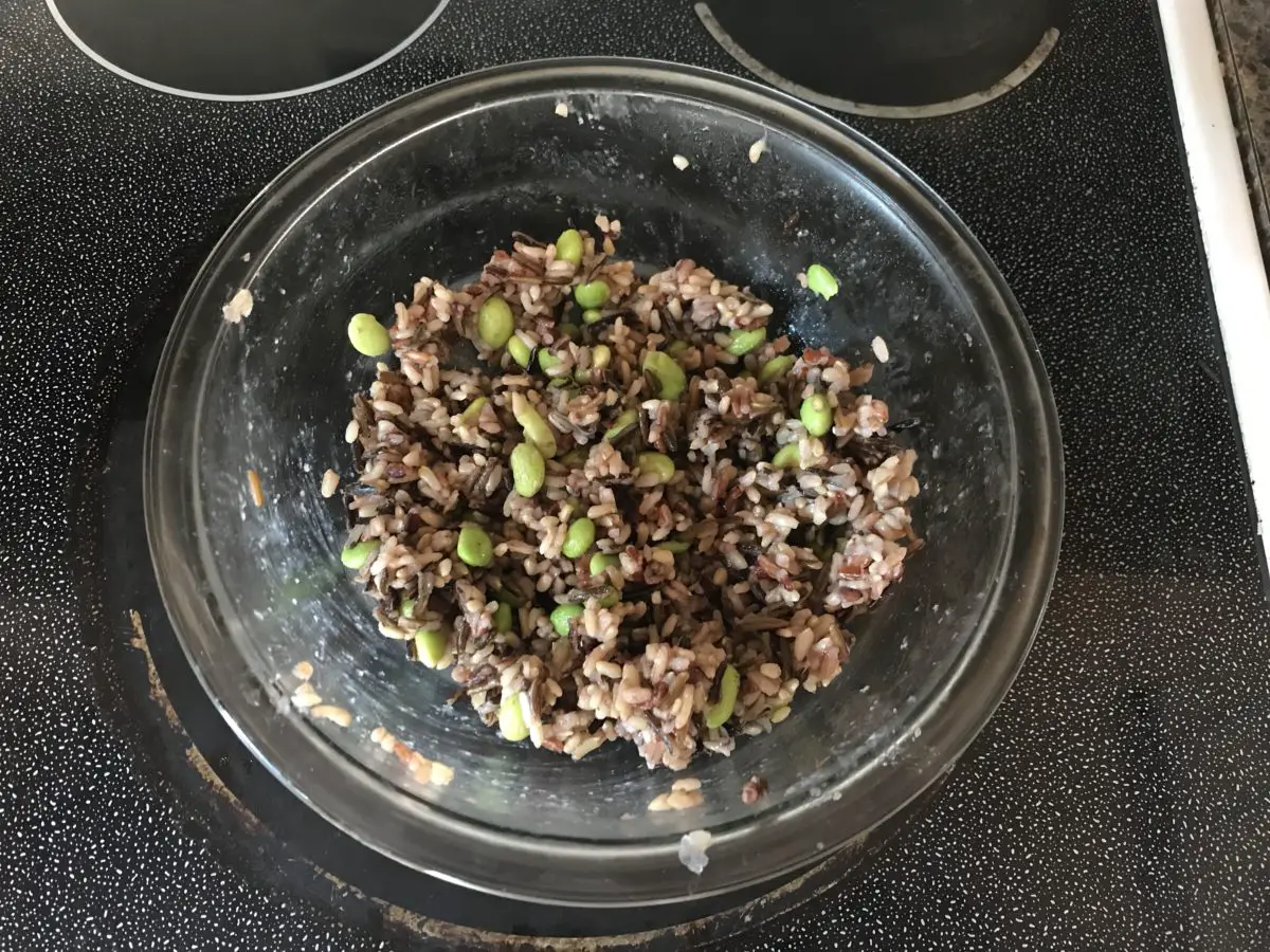
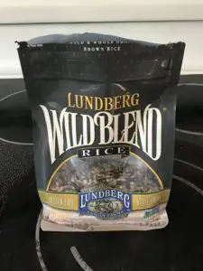
I’m also striving to continue to snack more healthily, and have been attempting to stick with nuts, trail mix, and granola bars, rather than chips or sweet snacks. I’ve still been trying to keep more whole grains, brown and wild rice, whole-wheat flour, and more “breads with seeds” (as Mr. Trekker calls them 😉) in my diet as well. One of our new favorites is a rice medley of brown and wild rice that I add edamame to. Sprinkle a little soy sauce on for added flavor and it is divine! It’s also filling and really sticks with you! (See the pic above for the finished product!)
I have been rather proud of myself. In addition to having less of a sweet tooth, I’m still finding I don’t crave processed foods as much as I used to. I allow myself to eat these occasionally, but now I seem to be able to make a single bag of Cheetos last SEVERAL weeks when I used to only be able to contain my impulses on these favorite snacks for a few days. I am also finding that certain “naughty” foods, such as sweets, or fast food items, just don’t taste all that good anymore. This makes them far easier to say “no” to! 😁
Every now and then I continue to get the occasional, lightly-queasy feeling I mentioned previously, which I’m hoping means I’m still eating fewer carbs than I used to since this seems to be a normal side effect of a low-carb diet. It usually only occurs when I’m getting hungry, and I’m still finding that a handful of peanuts seems to take care of it rather effectively.
Fasting as part of a healthy diet
I’m also still trying to implement 12:12 fasting as well, where I try to eat mostly between the hours of 7:30 am – 7:30 pm. This is harder in the summer as it remains light so late. We tend to be outside in the evening, adventuring, or even just doing yard work, so sometimes dinner hasn’t even occurred yet by 7:30. This is especially true on weekends, though I tend to be more lenient with myself on those days.
Nausea from too many carbs…
I had an unexpected experience regarding white-pasta. We had spaghetti one night as well as some breadsticks. My body had a few things to say about this…
A short time after we finished dinner, the feeling came on fast. It was kind of like an odd mix of heartburn and an IBS episode, but without any pain. I just felt very strange. It felt like there was a giant brick in my stomach, weighing me down. Then I started to feel a bit shaky. I was also sweating profusely (with IBS episodes I break out into a cold sweat, get chills, and shake, but I also have intense stomach cramps). With the help of Tums, some ginger ale, and a little rest, I quickly got to feeling much better.
This was a one-time occurrence and I haven’t had a relapse. I’m assuming my body just didn’t know how to handle that large brick of carbs anymore. I ate white-flour noodles and white-flour garlic breadsticks, and really nothing else. I had no cheese or protein, and even the sauce I used was a light, Italian sauce. On the other occasions that I’ve eaten large amounts of carbs, it was always mixed with other proteins or cheeses, such as in pizza.
I will say, I’m used to my stomach doing strange things, but that was a whole new experience. 🤢
Conclusion
My body seems to function best with a higher carb intake (healthier carbs at least) rather than what a typical, low-carb diet allows for. Overall, I think this crazy diet had a beneficial effect on me. I’m happy to see that while I’m in no way maintaining a strict, low-carb diet any longer, the experience seems to continue to encourage my appetite to lean toward healthier foods.
What steps do you take to maintain a lower carb intake? Tell me about them in the comments!
Did you enjoy this post? Pin it!
Like what you read here today? Please feel free to leave a comment, like or share this post! Add your email at the bottom of the page, or the sidebar to the right, to be notified when a new post is published. By signing up for the email list, you will also receive a free copy of the Tranquil Trekker’s Top 10 Tips of Trekking Do’s and Don’ts!
You can also follow the blog on social media by clicking the links below!
In this post, I review the Blackberry Trail in the Black Elk Wilderness!
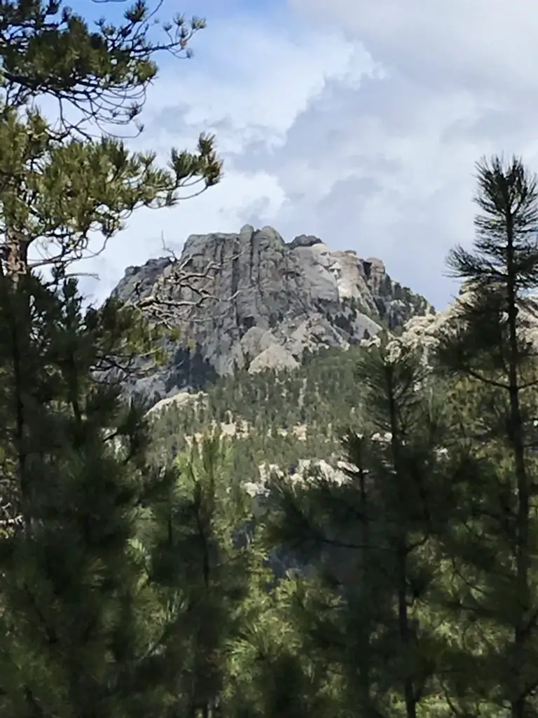
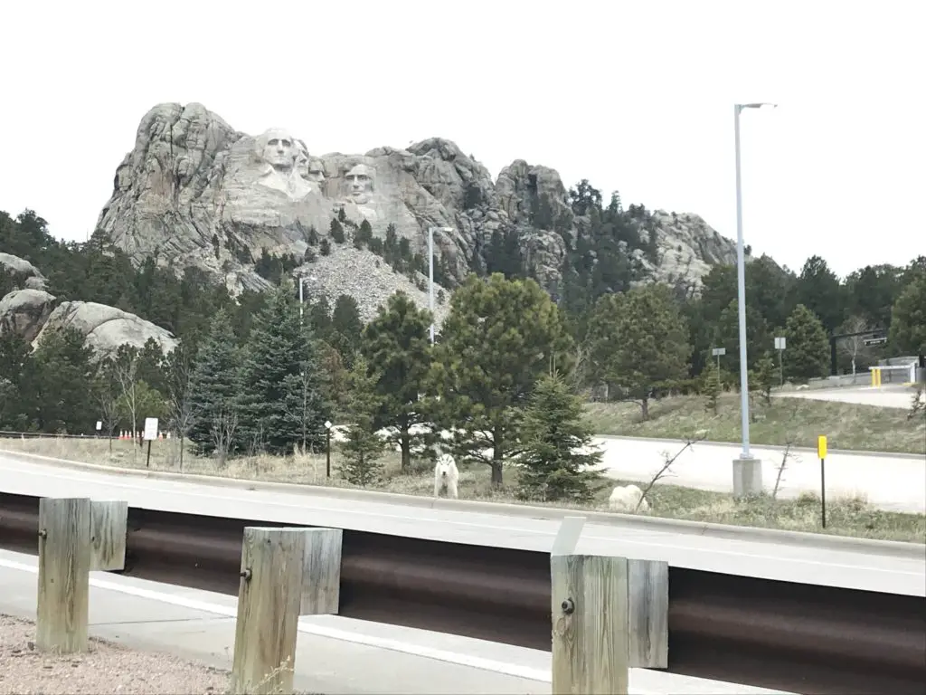
The Blackberry Trail is a great hike into the Black Elk Wilderness. This trail is fairly unknown, which is ironic because it sits directly across from one of the biggest tourist spots in the Black Hills, Mount Rushmore!
Where is the Blackberry Trail in the Black Hills?
The Blackberry trailhead is found in an old gravel parking area (that is sometimes roped off) directly across the road from Mt. Rushmore.
If the gravel parking area is roped off, you can actually park in the Mt. Rushmore parking deck. (This means you will have to pay the parking fee at the site. It used to be that once you bought a pass it was good for a year. Now it’s only good for the day. 😛–Insert rant here, from Mr. Trekker, about the evil, automated kiosks they installed to replace humans 😂.)
We had interesting weather the day we trekked this trail, typical of spring in the Black Hills. It was windy, with precipitation varying between light rain, heavy snow showers, and pelting mini-ice balls! This was all mixed in with blue sky and warm sun, and we experienced all of these conditions within about 30 minutes of each other! 😛
Bring Extra Clothes when Hiking
As we were navigating the route, Mr. Trekker proved why you always bring extra supplies along, especially a change of socks! You never know when you’re going to slip off a mossy rock and fall knee-deep into a swollen creek!
(I can’t make fun of him too much, he was actually trying to find an easy way across so he could then help me across. 😳 Of course, if he had listened to his wife and taken the route I suggested in the first place…😉.)
The water level seemed much higher than usual, as many of these creeks are just suggestions in drier times. With the recent snowmelt and wet conditions of spring, the local waters were definitely running higher than normal.
What you’ll see on the Blackberry Trail
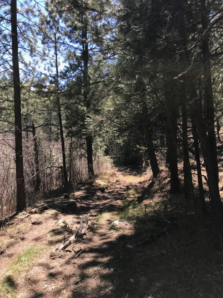
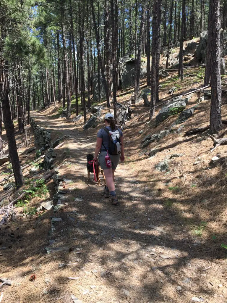
This is an absolutely GORGEOUS trail! While it does climb the majority of the way, the route undulates through the hills and beautiful canyons that are common in the Black Hills National Forest. There were a few lengthy, steep spots, but for the most part, they didn’t become overbearing. The first half mile or so of the trail actually runs downhill. (You know what that means for the return trip! Everyone loves a good, uphill climb to finish! 😛)
We did an out-and-back trek, taking the Blackberry Trail south to where it meets up with the Centennial Trail (just in the last few years, this portion of the route earned the classification of a National Recreation Trail.) Then we took the Centennial Trail south, to its junction with the Grizzly Bear Creek Trail, which I discuss in this post.
I’m not sure why it’s called Grizzly Bear Creek. There may be been grizzlies in this area at one time, but that was MANY years ago (we’re talking centuries. 😛)
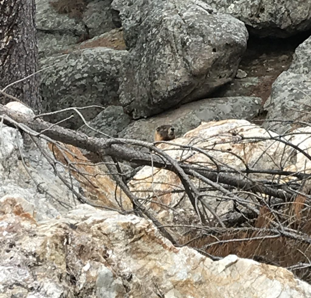
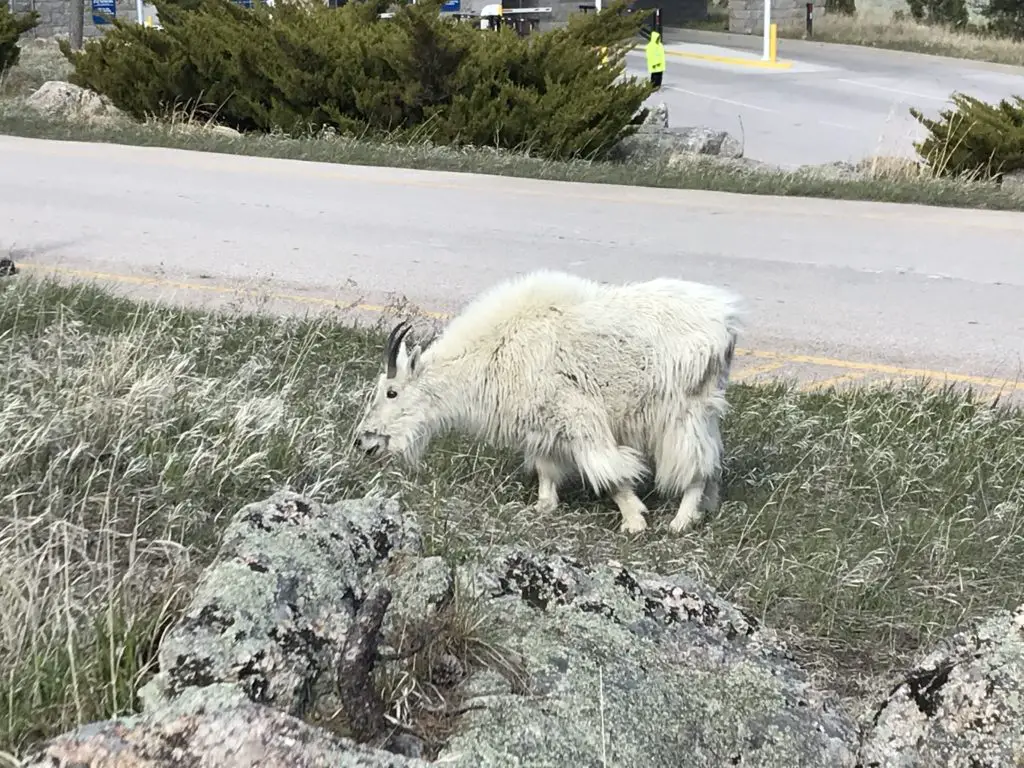
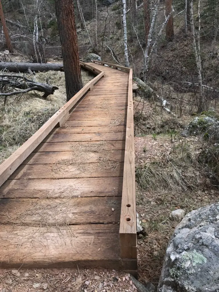
A portion of the way, the path runs along with Grizzly Bear Creek, which helps to make it so picturesque. There were numerous water crossings and very few bridges throughout the trek. Again, in drier times of the year, this may not be an issue, but I would recommend wearing either waterproof hiking boots or sandals you don’t mind getting wet if you’re planning to tackle this hike. Also, be on the lookout for mountain goats and marmots, as they tend to frequent this area!
Marmot!You see these guys A LOT at Mt. Rushmore!One of the only bridges we encountered. It was quite picturesque!
How Long is the Blackberry Trail?
This route was about eight miles, out-and-back. Not a bad day’s hike for us, though you could easily make it shorter or longer, to suit your tastes. Depending on how adventurous you are, this is a great area for backpacking, as it would allow you more time to fully explore the various trails that wander through the Black Elk Wilderness Area. One other unique thing about this trail is that it offers cool views of Mt. Rushmore along the way!
Harney Range in the Black Hills National Forest
I know I’ve mentioned it in the past, but I LOVE hiking in the Harney Range. The granite mounds and spires that are frequently found throughout the area give the region its own, unique flair. The Ponderosa Pines that grow here allow a lot of light through their branches. Also, the drier conditions (usually) found in the Hills lend themselves to little or no undergrowth on the forest floor. This means, even in the midst of the forest, you can actually see for quite a distance.
This is pretty unique compared to many forests we’ve visited. Some areas of Colorado and Wyoming are similar, but these definitely contrast with forests that you find in many other parts of the country. Most of those are comprised of dark, foreboding woods with trees so thick it’s hard to see between them. Even in North Carolina, with the almost-tropical plants and ferns that covered the forest floor, it was easy to lose the trail.
There are all sorts of trails winding around the Black Elk Wilderness. These aren’t the big trails that all the tourists hear about throughout the Wilderness Area and Custer State Park, though many of these do connect with the better-known trails, such as Black Elk Peak Trail, Trail #9 (formerly the Harney Trail) or the Cathedral Spires/Little Devil’s Tower Trails.
But if you’re looking for a nice, afternoon jaunt through the woods on a warm day, these are perfect. Because they aren’t as well known, they tend to be far less crowded. They aren’t overly difficult either. I would give the majority of these side trails a moderate rating, with some strenuous spots. They are sometimes single-track, rather than wide and graded, and you do have to watch for roots and rocks that you may need to clamber over or around. But there aren’t any large, rocky areas that need to be navigated.
More pics from our day on the Blackberry Trail!
I LOVE “tunnels”!Our “Greeter” at Mt. Rushmore!
So the next time you’re looking for an interesting hike in the Black Hills, consider one of the lesser-known trails in the Black Elk Wilderness like the Blackberry Trail. You may be surprised how much you enjoy these hidden gems!
Have you enjoyed this trail or do you have any questions on how to reach it? Feel free to leave your experiences or any questions in the comments!
Did you enjoy this post? Pin it!
Like what you read here today? Please feel free to leave a comment, like or share this post! Add your email at the bottom of the page, or the sidebar to the right, to be notified when a new post is published. By signing up for the email list, you will also receive a free copy of the Tranquil Trekker’s Top 10 Tips of Trekking Do’s and Don’ts!
You can also follow the blog on social media by clicking the links below!
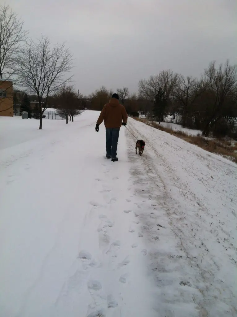
In this post, I remember the life of a wonderful dog!
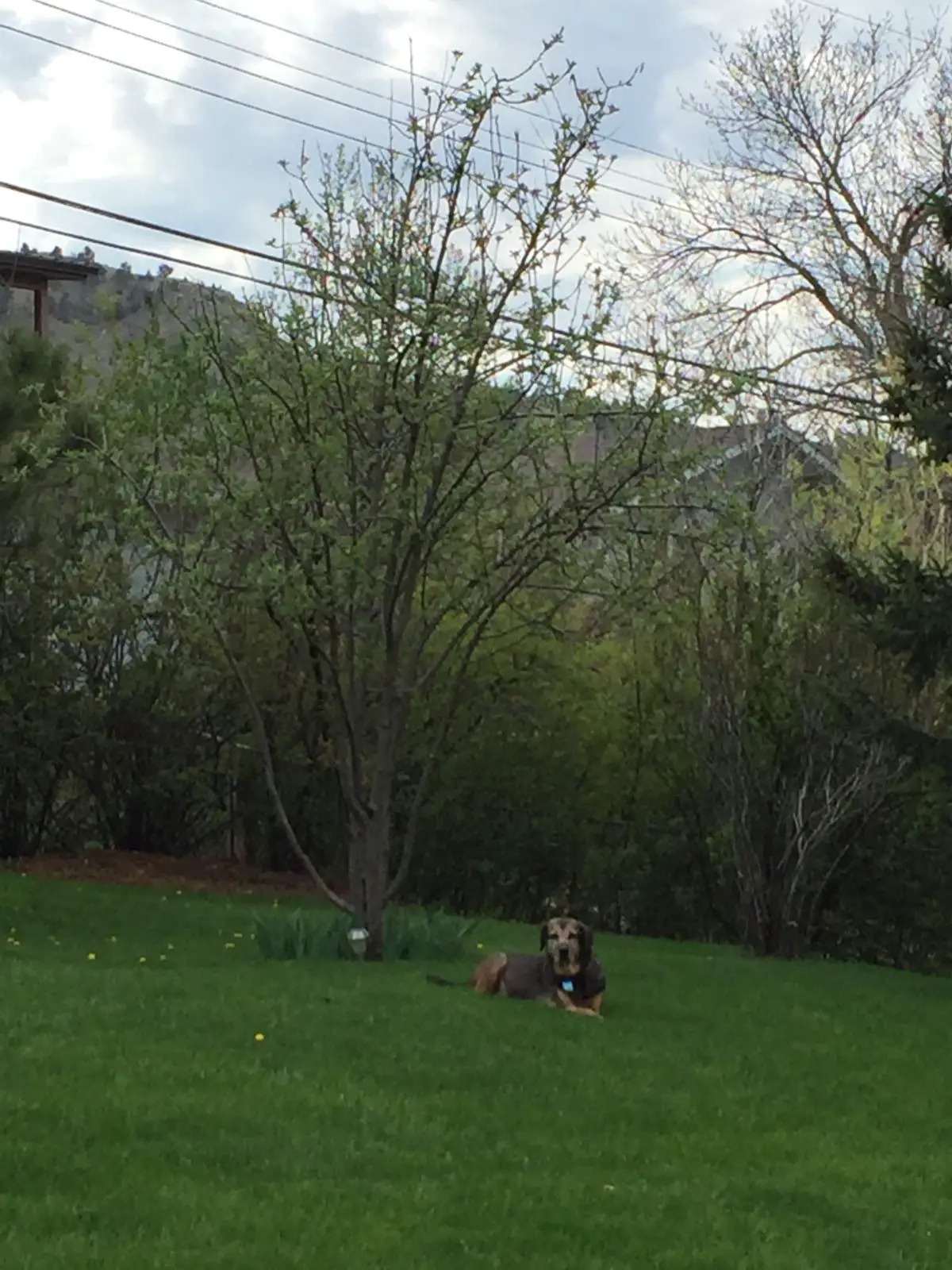
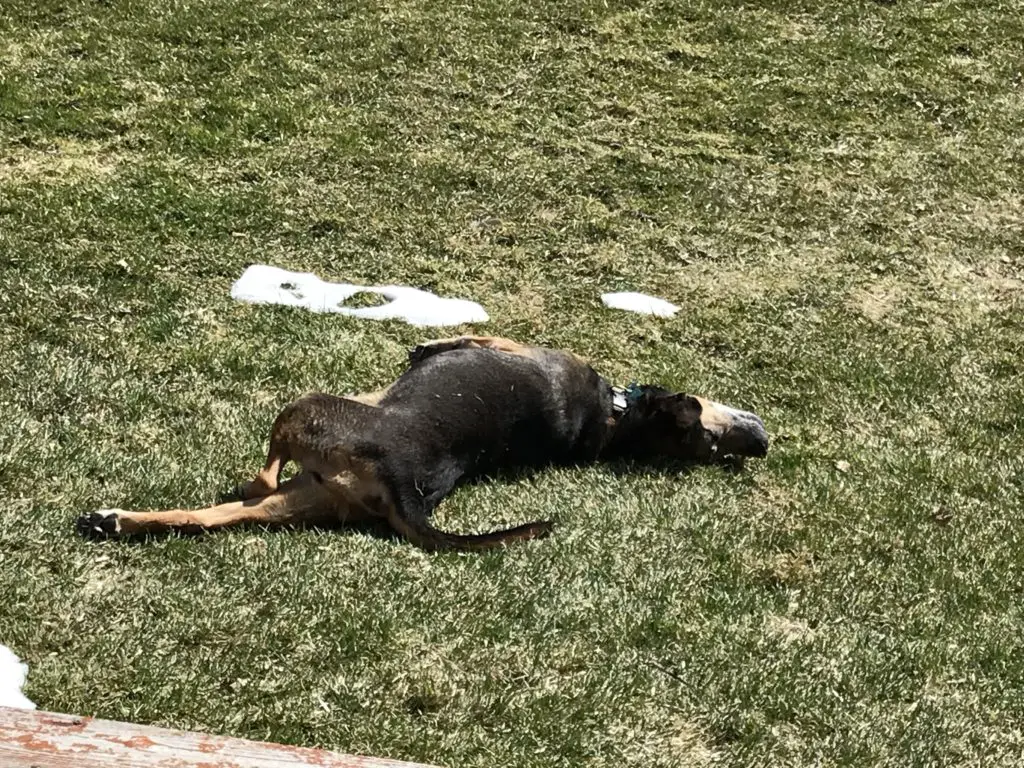
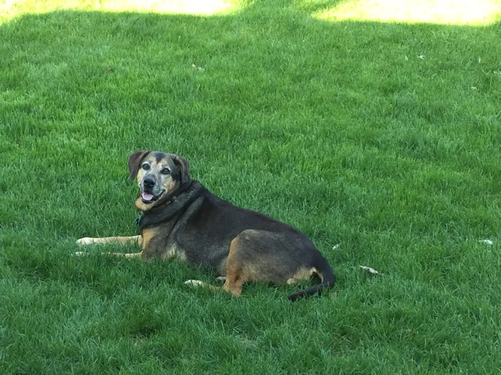
After 12 wonderful years, we finally had to say goodbye to our family dog. We aren’t sure exactly how old she was. We adopted her as a young adult in 2007 so…she was at least 13 and could have been closer to 15, just based on the information we were given at the time of adoption. This sweet, spoiled canine led a good, long life!
Allow yourself to feel grief
Sometimes “adulting” is hard. I’ve spoken before about how we don’t like to experience any pain in the modern world if we can avoid it (and frequently we can). There’s usually a pill that will at least help to dull the ache. Pain is never completely avoidable in life, though. One of those unavoidable heartaches is the loss of close friends (be they human or animal). Grief sucks…and it HURTS!
We must keep in mind though, that this feeling of loss we are forced to experience from time to time is actually a sign of a good life. That pain means you had something to love, something that added joy to your life, to begin with. We should consider ourselves blessed if we have things in our lives that hurt so much to lose.
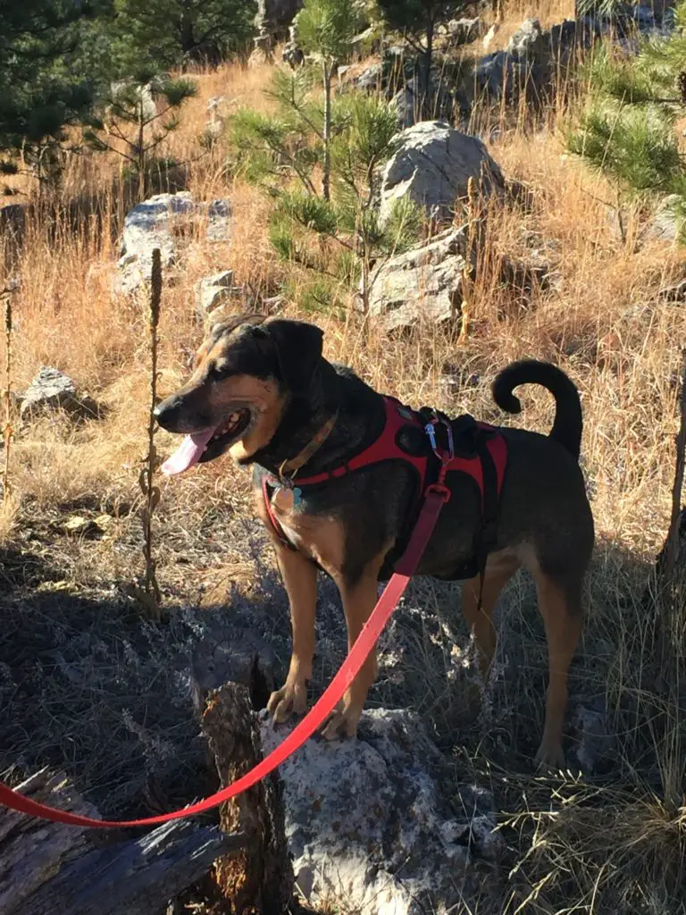
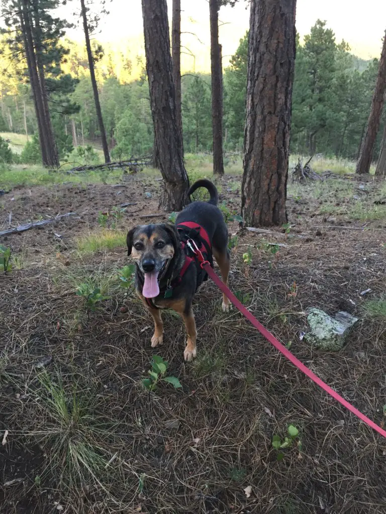
The Trekkers have been preparing for this eventuality for quite a while. For the last several years, we’ve watched our dear friend, slow, lose her hearing, and the ability to fully enjoy many activities she used to delight in. The dog who once–with enthusiasm–drug our butts all the way up and down the 6,683-foot Mt. Mitchell, in North Carolina, became a greying friend who could barely make it around the block.
Our furry friend led an enjoyable life. Since 2007 she’s accompanied us on countless hiking and camping adventures, traveled with us to both Indiana and New England to spend holidays with our families, and relocated more than 1700 miles across the country with us when we moved from North Carolina to the Black Hills of South Dakota. (She glared at me from the back seat of my Civic through every mile of that trip 😂! This is a dog who used to get carsick after less than 15 minutes in a car, which made things interesting those first few years. 😛)
We adopted her from theWake County Humane Societyin Raleigh, North Carolina. For anyone living in the area, this is an amazing place. They provide an incredibly comprehensive survey to help match you with your ideal pet, and they provide support services after adoption (such as behavior counseling) if needed.
Happier memories of times past:
She LOVED to sleep on the back of that couch (it did not survive her)! 😂Dragging Mommy down the trail…Dragging Daddy through the snow…She loved getting outdoors!
In case it isn’t obvious from the pictures, this pup was spoiled rotten. 😉
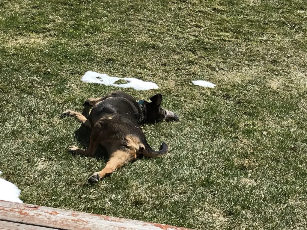
We received her terminal diagnosis several months before she died, so we were very blessed to get to spend so much extra time with her. She ended up outliving the vet’s prognosis by several months! We were so happy that she hung on long enough to be able to enjoy laying in the sun and rolling in the soft, green grass of spring again.
I have to say a huge, “thank you!” to the staff at Dakota Hills Veterinary Clinic as well. They took such good care of our friend for the last eight years, she actually enjoyed going there. On her last day on earth, she happily walked in the front doors, excited to see the friends she had made there. The staff made a difficult and painful experience as easy as possible to bear.
We were fortunate to have more than 12 long years with our friend, and I like to think she was pretty happy with her human pack members as well.
We should all strive to live life like a hound dog!
Goodbye old friend, you are missed but you will never be forgotten…
Like what you read here today? Please feel free to leave a comment, like or share this post! Add your email at the bottom of the page, or the sidebar to the right, to be notified when a new post is published. By signing up for the email list, you will also receive a free copy of the Tranquil Trekker’s Top 10 Tips of Trekking Do’s and Don’ts!
You can also follow the blog on social media by clicking the links below!
I hate that feeling when your mind seems to be racing out of control. When you’re so hyped up, your whole body feels like it’s trembling. It’s like you’ve ingested too much caffeine…you feel like life and your brain is careening out of control and you just can’t seem to relax. The more you try to focus on something the more it seems to slip through your mental fingers.
Yet you notice, perplexedly, when you take a breath and are able to relax, that thoughts come easier. You can remember and focus when, just a few hours ago, you couldn’t hang onto a thought for more than a few seconds…read on for tips on how to lessen stress using Mindful Minimalism.
Signs Your Body is Stressed
Tight stomach muscles…taught shoulders…you feel the dull ache of a tension headache at the back of your neck…then your eyelid or cheek starts to twitch…your lower back and shoulder blades are tense…there’s the occasional, weird twinge in your chest or abdomen…sometimes a lightheadedness kicks in, complete with difficulty focusing and a dazed sense of, what could almost be described as, disorientation…you may have trouble sleeping, or experience sleep disturbances or strange dreams…
These are all signs that our body is telling us, “YOU ARE STRESSED AND NEED A BREAK!” You know the stress is building when you notice these signs.
My understanding is some of the stranger symptoms, such as the lightheadedness and disorientation, occur because we have a tendency to unconsciously hold our breath– or at least breathe shallowly–when we are tense and stressed. This leads to lower oxygen levels and the disconnected, lightheaded feeling (it doesn’t help that I have chronic sinus and inner-ear problems that mess with my equilibrium 😋).
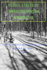
How to Use Mindfulness and Minimalism Practices to Reduce Stress
I’ve learned to take heed when these symptoms show themselves. At the first sign of them, I immediately try to kick my mindfulness, simplicity and minimalism practices into high gear. I focus on meditation, physical exercise and taking slow, deep breaths. I also try to focus on only one task at a time while keeping the distractions as minimal as possible.
In the age of our always-on, always-connected lives, many people are starting to feel that our brains are being overwhelmed, present company included.Below are some of the procedures I employ when I notice these symptoms and realize I need to take a little “me time”:
Digital Minimalism:
This may seem odd for a blogger, and full disclosure, I do use multiple social media platforms for the blog. However, I try to focus on them ONLY for the blog.
I do use them to stay up-to-date on certain subjects, mostly travel-related, and to keep in touch with long-distance family and friends. I also peruse the occasional political site to keep up with the news, as well. But I consider it a good sign when the platform is “nudging” me that I haven’t been posting much.
Prioritize Minimalism in All Areas of Your Life:
I try to minimize the distractions caused by music and television (unless I’m focusing on them as a means of relaxation).
I try to focus on other relaxation practices such as coloring or writing in a journal.
I’m big on simplicity. I don’t wear much jewelry, and what I do wear tends to be small. I find one of my biggest irritations in the morning is how much time I waste “getting ready” (and the fact that Mr. Trekker can do it in half the time it takes me 😋). So, to counteract that, I keep that process as simple as possible. I don’t mess with my hair much, most days I don’t even dry it. I wear very little makeup, I don’t even own a bottle of hairspray anymore. 😋
I’ve never been a very showy person (says the woman with a nose ring and tattoo, but hey, they’re both small! I suppose “showy” is in the eye of the beholder. 🙃) My tattoo is simple, consisting of only one color and a little shading. Both can be hidden if I choose.I prefer these methods of beautification because they are simple and constant. They’re there but are blessedly low maintenance. Often times I completely forget about them. They allow me to show off my own personal flair but in a subtle and simple way.
(To be clear, this isn’t intended as any sort of judgment on people who do prioritize beautification more. These methods are just part of the way I keep life simple. I was also always way too lazy to take the time to learn how to do much regarding my hair or makeup anyway. 😛)
Make Lists (LOTS of Lists!):
I’ve always been a fan of list-making, but I find during times of higher stress it’s even more helpful. It relieves stress because, when you write things down that you need to keep track of, you don’t have to “stress” 😉 about remembering them anymore.
This also helps with maintaining focus as you have fewer thoughts bouncing around in your head. I always carry a pen and a small notebook with me so, at a moment’s notice, I can write things down I don’t want to forget. You can also use the “notes” or “reminder” function on your phone, but I’m partial to the “old school” method.
Stress Makes Everyday Life Harder
High levels of everyday, mental stress make it more difficult to handle real problems when they actually occur. As an example, a “low-tire” light on a car, while not usually more than a nuisance, can feel like an insurmountable obstacle that you don’t feel like you can handle when your mental energy supply is already depleted.
One of my biggest struggles is feeling like IhavetorushandgetmytodolistdoneasfastasIpossiblycan!!! (That’s difficult to read, right? Yeah, that’s just a glimmer into the everyday workings of my foul little mind. 🙃)
Inevitably I find I allow myself to get stressed about all the things I need to do throughout the day or week. Sometimes they are legitimately urgent (in which case they go to the top of the Mental Energy Priority Pile). But more often than not, they’re just everyday tasks that need to be completed. Things like errands, groceries, chores around the house and various work tasks. These issues are by no means life and death, they’re just part of normal living. Inevitably I find I ALWAYS manage to complete them (quite often, faster and more easily than I thought I would). And if they take a little extra time to finish, guess what, the world somehow still continues on. The sun still rises each morning and sets each night, the birds still sing in the trees…
The trouble with all that stress I bring on myself is that when I complete the task and realize all is well…I still have all that negative energy built up…and then I start stressing about how to relieve THAT! 😛🙄
To Conclude:
Ultimately, it’s not healthy for us to maintain all the strain that we hold on a daily basis. The rates of anxiety and stress-related illnesses keep increasing in modern society. The saddest part of this is, that most of our lives aren’t even that difficult. We are literally making ourselves sick with illnesses that harbor potentially lethal consequences…over “First World Problems”. We all really need to CHILL OUT! 😉
More and more I’m finding that implementing mindful, minimalism practices helps with controlling my anxiety and stress-related symptoms. I hope this list helps you (and I) work toward a more serene life.
How do you implement Mindfulness and Minimalism practices to help reduce everyday stress? Let me know in the comments!
Did you enjoy this post? Pin it!
Like what you read here today? Please feel free to leave a comment, like or share this post! Add your email at the bottom of the page, or the sidebar to the right, to be notified when a new post is published. By signing up for the email list, you will also receive a free copy of the Tranquil Trekker’s Top 10 Tips of Trekking Do’s and Don’ts!
You can also follow the blog on social media by clicking the links below!
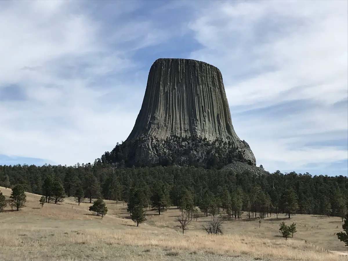
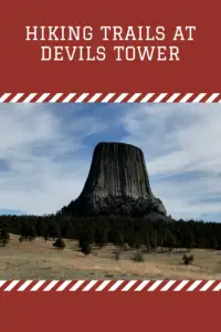
Devils Tower, in nearby Wyoming, is worth the time it takes to visit. In this post, I review the hiking trails that help you enjoy the site, as well as its history and some unusual legends that surround this other-worldly monolith.
**Author’s note: Just a word of warning, as this is a federal, National Monument, no dogs are allowed on any trails (exceptions for Service Animals). They are only permitted in the campgrounds and parking lots.**
As it holds the title of the nation’s First National Monument (thank you Teddy Roosevelt!), Devils Tower should be on your bucket list! Several different hiking trails offer beautiful views as the site rises over the surrounding valley floor. You’ll find yourself surrounded by yellow rock layers that stand out in contrast to the red layers of the Spearfish Formation, while the gorgeous Wyoming countryside spreads out before you like a mottled quilt.
As it holds the title of the nation’s first National Monument (thank you Teddy Roosevelt!), Devil’s Tower should be on your bucket list! You’ll find several different hiking trails throughout the park, of varying lengths and difficulties. Beautiful views are available from all the trails as the tower rises above the surrounding valley floor. Below you, the gorgeous Wyoming countryside spreads out before you like a mottled quilt. The yellowed rock layers that surround you stand out in contrast to the red cliffs of the Spearfish Formatio
Watch out for rattlesnakes in this area during the warmer months. You won’t usually find them on the well-traveled paths–though they will, occasionally, seek out the warmer blacktop in the mornings or evenings. However, you may come upon them in the grass if you wander off-trail, or if you are hiking some of the more rugged, grassier routes.
If you visit the Visitor’s Center, you can see views of the top of the Tower. Interestingly enough, there is actually grass up there! It offers a nice place for the climbers to relax and take a break before they trek back down.
Snakes have even been found on the summit, though naturalists aren’t quite sure how they got there. It has been theorized that they may have been dropped by birds that were planning to make a meal of them. While this meant good fortune for the snake, it also meant an empty tummy for the bird. 😳
Devils Tower Hikes:
All of the hiking trails at Devils Tower are worth checking out and can be enjoyed by those with a variety of hiking expertise. You should be aware, there isn’t a lot of shade available on any of the routes. While this makes for a hot trek in the warmer months, the good news is you’re in Wyoming, so there is almost ALWAYS at least a slight breeze! 😉
The Tower Trail:
This is the main trail that traverses the base of the tower. At a little over a mile in length, it is paved or graded the entire way and offers benches for resting. This route should be accessible for most people, just watch out for the occasional root.Bring binoculars and watch for climbers on the monolith!
South Side and Valley View Trails:
Both of these are side trails that connect to the Red Beds Trail and add an additional half mile to that route. They are shorter and take you into the valley that skirts the south side of the tower (imagine that!) 😝 They wind through a prairie dog town that is also accessible from the road. The furry little critters are cute, but stay back! DO NOT FEED THEM! Their fleas carry Plague (yes, THAT plague). 😝
The Joyner Trail:
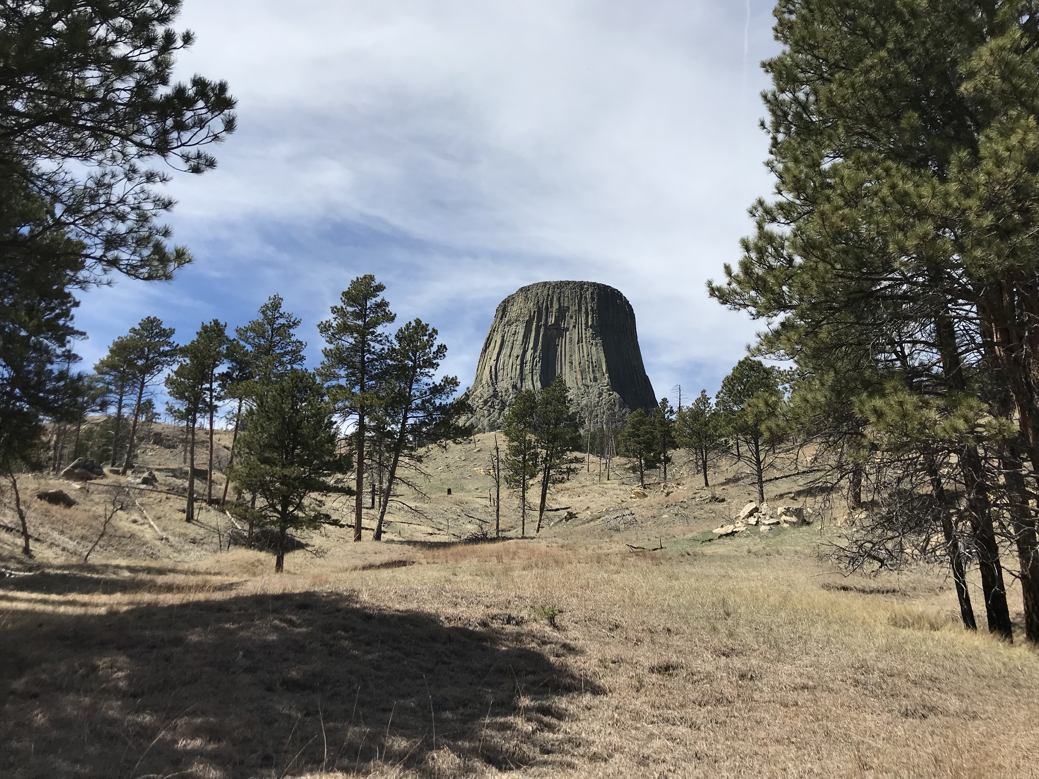
This trek is a 1.5-mile loop that covers mostly the grassland north of the tower. It also includes a connector to the Red Beds Trail if you choose to use it. Its trailhead is found in a different location on the north side of the park, which also makes a prime lunch spot as it offers one of the most dramatic shots of the monolith (see below):
Red Beds Trail:
This is our favorite hike at Devils Tower! At almost three total miles in length, this loop is the longest and most strenuous of all the trails. You can take it either direction, though both will start by heading downhill to about the halfway point and then will return uphill. So, while you think it’s easy at first, remember, it’s uphill ALL the way back! 😉
While you won’t have as good of views of the tower from this route, it tends to be far less busy and it offers more views of the surrounding landscape. It also takes you through different ecosystems including the nearby grassland and the dry, red rock bed–hence the name–of the Spearfish Formation.
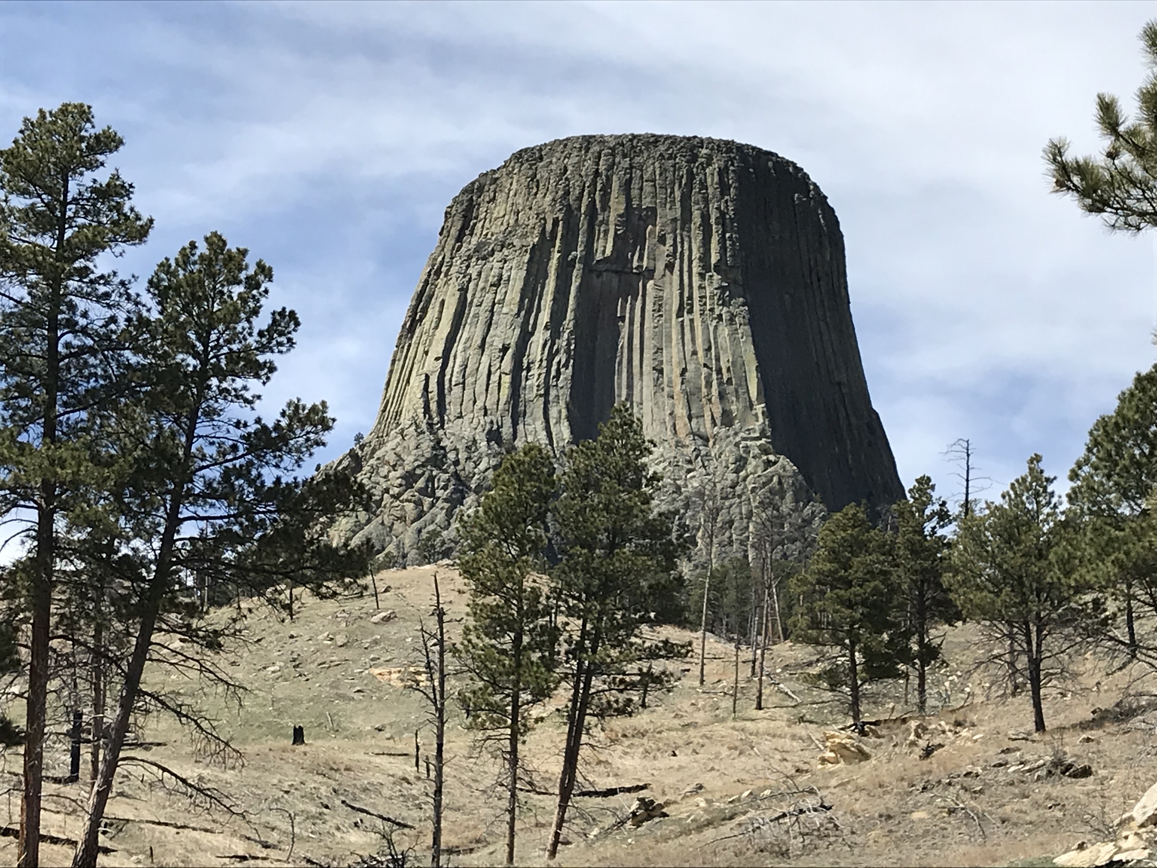
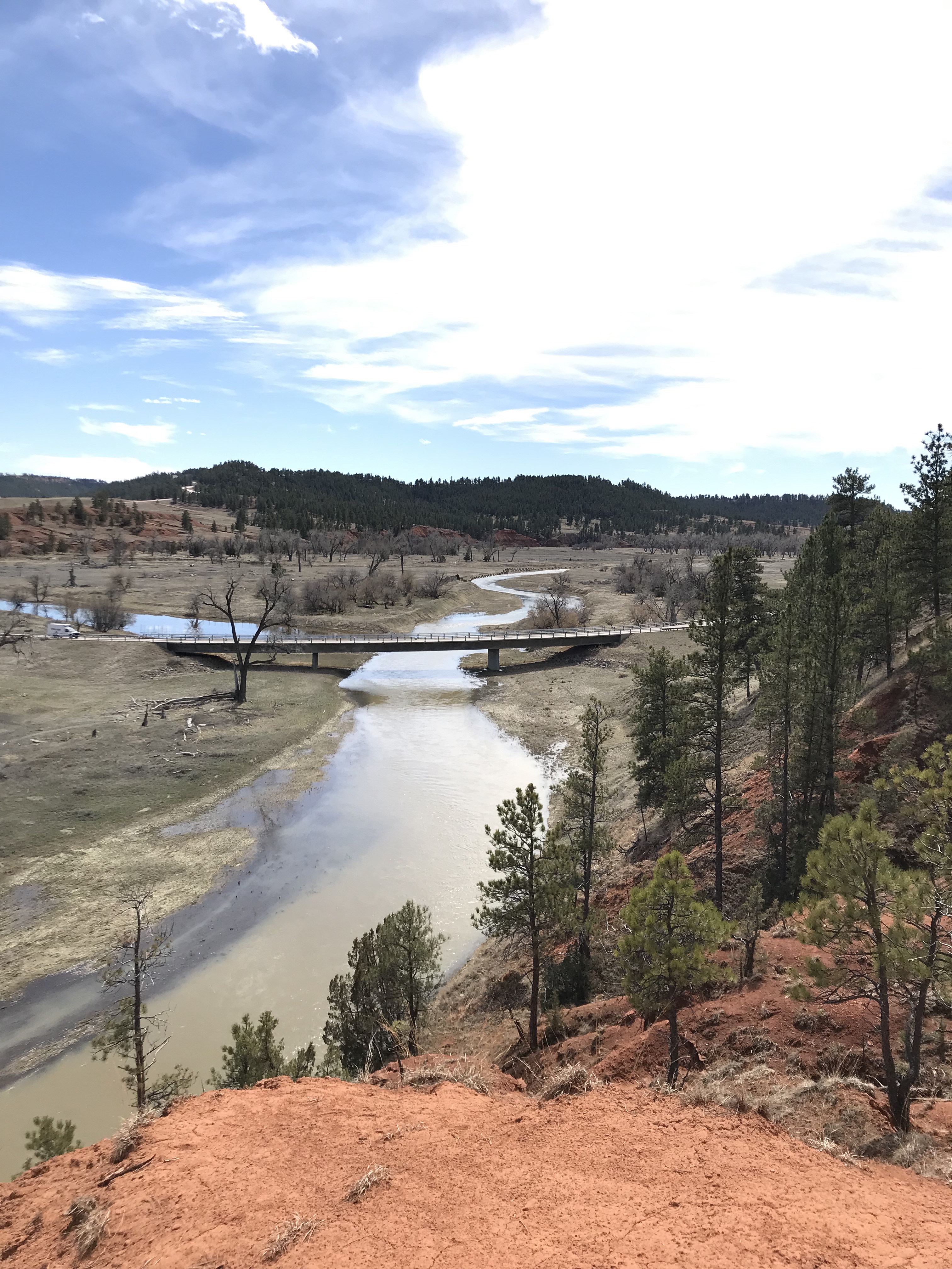
Below are some of the scenic views available from the Red Beds Trail:
This route does offer a few nice views of the tower!
The Cheyenne River
You can see why they call it the Red Beds Trail!The surrounding valley
How was Devils Tower Formed?
There are several explanations for how the tower came to be:
The “boring” scientific explanation 😉:
There are various theories that explain the creation of the Tower, but the most accepted one is that, back when the Earth was young, this was once a volcanic plug that allowed lava to escape to the surface. The rock that formed around the plug was harder and of a different type than the surrounding rock. In later years, this softer rock eroded, leaving the plug behind.
But enough with “provable facts”, let’s move on to the far more interesting legends. 😁
American Indian legends:
The legends vary by tribe, but most feature young children being chased by a large bear. The children usually climb on a rock to escape the bear and pray for help. The Great Spirit causes the rock to grow so the children are transported out of the bear’s reach. As the bear tries to climb the rock and falls, his claws leave large gashes in the rock (this explains the igneous columns).
Several of the legends state the children are girls who eventually turned into the Seven Sisters star constellation. One Lakota Sioux legend states the bear grows tired, wanders away to the land that is now South Dakota, and eventually falls asleep. He then turns into Bear Butte, a sister volcanic plug found in the northern Black Hills.
Both of these sites are considered sacred by numerous American Indian tribes. It is common to see prayer bundles at either location and sometimes, people can be observed practicing ceremonies there. These locales are occasionally closed to visitors when certain tribal events are occurring. Please respect any religious observances you note and refrain from touching or moving them. We are truly visitors to these sacred areas and should respect them as such.
“I’m not saying it’s aliens…”
Then there’s the “other” explanation…when in doubt, always assume it’s the aliens! 👽
Some people may have never heard of one of Steven Spielberg’s classics from the 1970’s–and one of Richard Dreyfuss’ first big movies–Close Encounters of the Third Kind. This film was old when I watched it as a kid (and we don’t need to discuss how long ago THAT was! 😝). It’s always been one of my favorites, though I may be a little biased as a large portion of the movie takes place in my home state of Indiana. 😉
Devils Tower features heavily into the plot of the film, so you can imagine how excited I was to learn it was nearby when we moved to the Black Hills. The movie is relatively kid-friendly, aside from one (in my opinion) unnecessarily, frightening scene. The aliens are more akin to those found in ET than Independence Day. 😉
I STRONGLY recommend you check out the movie after visiting the tower, especially the Director’s Cut with all the deleted scenes. The Special Edition version is actually my favorite, as it is the only one to include the fabled “Mothership Scene” at the end. While Spielberg later regretted bowing to the film studio’s pressure and adding this scene in, it was always one of my favorites. Think about the special effects that were required to make this scene and how few of them would have been available to Spielberg in the ’70s. This was well before computer effects kiddos! 😳 And yes, once you hear it, that theme music will be an earworm that will drive you INSANE! 😝
Where is Devils Tower?
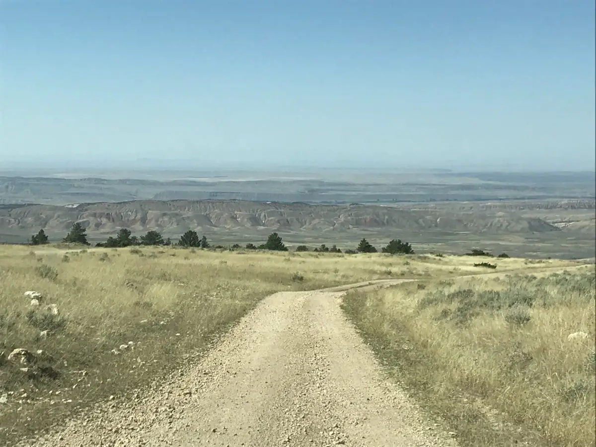
The tower is pretty easy to reach from the Black Hills. The directions are simple: drive west on I-90; follow the signs. 😉
Driving through beautiful Wyoming
Though it does take a couple of hours, part of the reason we enjoy this trip so much is the drive (I’ve mentioned before how much I enjoy long drives through the countryside). There are a couple of different routes you can take…
We like to form a loop where we take I-90 out (the quick way) to Sundance, get off on US 14 North, and take that to Route 24 North. When we leave the site, we continue on Route 24 to the north (the scenic route) and take that all the way back to Belle Fourche, SD where you can pick up I-90 again. The drive takes around 1.5 – 2 hours or so each direction, but boy is it worth it!
This part of the country is, truly, God’s Country. I love South Dakota, but the Wyoming countryside brings with it a new definition of wild and wonderful. It’s so incredibly rugged (as is the weather!) and you’ll notice the change immediately after crossing the state line. The red rocks form a distinct backdrop as they stand out in direct contrast to the dun-colored prairie.
Take the time to visit the Wyoming Black Hills, you’ll be glad you did!
We even got a nice view of Bear Butte on the way home!What is your favorite legend for the creation of this unique monolith? Let me know in the comments!Did you enjoy reading this post? Pin it!
Like what you read here today? Please feel free to leave a comment, like or share this post! Add your email at the bottom of the page, or the sidebar to the right, to be notified when a new post is published. By signing up for the email list, you will also receive a free copy of the Tranquil Trekker’s Top 10 Tips of Trekking Do’s and Don’ts!
Several years ago I tried going low-carb for my Lenten Fast. Honestly, it didn’t go very well…
I did a pretty good job of staying away from grains (my primary goal) but I ate potatoes…and fruit…and drank soda. I ate a hard-core, hearty, wild rice medley on a few occasions, as well as bread ONE TIME (that was more out of necessity and it had actual seeds in it!) 😉😝
It still floors me that foods of this heartiness can somehow be “bad” for you (assuming you don’t have outstanding medical conditions). These types of seemingly counterintuitive ideas still make me a little dubious that this low-carb craze is really best for every body type. 🤔
Going Low Carb is Hard!
I think I mentioned it before, but in case I didn’t make my feelings perfectly clear then…this diet is a PAIN IN THE A**! I wasn’t expecting it to be as hard as it was, and I wasn’t expecting to come to LOATHE it as much as I did.
Cravings weren’t the problem, those actually weren’t too bad and I have experience dealing with those. What I wasn’t expecting is how INCREDIBLY inconvenient this diet is. That is what I found to be the most difficult part. People never talk about that factor.
As an example, you may have to go to multiple stores to find what you need as it’s not easy to make substitutions. I can’t imagine trying to work the diet around the palate of a picky child (this picky adult struggled 😝).
Perhaps for people in more metropolitan areas, this isn’t as much of a problem. But for those of us where the nearest Trader Joe’s or Whole Foods is 400 miles away, it can be a bit of a hindrance. 😝
The main takeaways from my low-carb experiment:
This diet is EXPENSIVE (compare a bag of almond flour to a bag of regular flour sometime)! 😝
This diet is difficult if the entire household doesn’t commit to it. You either have to end up making multiple dishes to keep everyone happy, or the special food ends up posing a HUGE inconvenience to anyone not committed to it. (This seems unfair to them, in my mind, if you’re pursuing the diet for non-health-related reasons.)
Unless you live in a warm climate where you have regular, easy access to fresh fruit and veggies all year round–or you have your own large orchard/garden to get these goodies from and can easily preserve them for later–you can end up needing to go to the store multiple times per week to keep getting fresh foods. The stuff that’s good for you spoils quickly, especially during the warmer months. (Oh, and have I mentioned that fruit has carbs in it). 🙄
I was hungry quite a bit. That probably means I wasn’t eating enough protein, but dear God, how much meat can one person stuff their face with? 😝
I probably should have chowed down more on the vegetables too, but as I’ve said before, I have a sensitive gag reflex regarding veggies, I can’t explain why. Ever since I was a child, a certain texture or “green” flavor hits the back of my tongue and it’s like my stomach lurches and my throat closes up. At that moment, any appetite is instantly gone (of course it comes back later, with a VENGENCE).
I found that I thought about food ALL THE TIME. I was CONSTANTLY thinking about what I was going to make for the next meal (or the next several meals)…and whether or not I needed to stop at the store while I was out running errands (or make a special trip out just to go to the grocery store)…and if I DID need to go out which store, specifically, did I need to go too? It was EXHAUSTING! 😝
I also noted more instances of heartburn when I went low-carb. This seems odd, as most of the research I’ve done makes it seem that low-carb diets should help with heartburn occurrences. Maybe this is further evidence that my body doesn’t really need a low-carb diet? Or, maybe I’m just suffering the effects of getting old. 😝
In a previous post,I talked about feeling like carb-heavy meals made me feel full of air, whereas protein-heavy meals left a more substantial, full feeling. I will say, when I eat mostly protein and vegetables, I feel like there are still a few holes missing. Like a piece of bread or some crackers could just perfectly cap off the satisfying meal. I found it interesting that this desire did not slacken AT ALL across the six-week fast. (I’m also taking it to mean it’s ok if I eat some carbs since it seems like that’s what my body wants. 😁)
The most surprising thing of all, I found this diet to be depressing, and I mean that in the most literal way. For me, it kind of sucked the joy out of eating. It required so much thought and planning and was so limiting of foods I truly enjoy, that it made me not even want to bother. I couldn’t help feeling like, “what’s the point”?
Going low carb made me miss out on some of my favorite foods
I’ve said this before but I’m sorry, I can’t give up things like pizza, or noodles, or brownies. Not entirely at least. I may be able to reduce my consumption of them, but as long as these things aren’t making people in our household sick (and at this point in our lives they aren’t), I can’t give them up entirely.
At some point, giving up these things starts to make life less fulfilling. I’m not sure if that’s emotionally unhealthy, to put that much emphasis on food, but I think it’s how a lot of us are. Food reflects our cultures, in both a macro and micro sense, so I don’t think I’m the only one who feels this way. It brings us comfort and happiness, it’s called “comfort food” for a reason for heaven’s sake! 😉
I’ve said it plenty of times before, but I’ll say it again, I’m a Midwest girl at heart. We show love through food (this includes some of the most fattening, most DELICIOUS meals you can think of). 😝 I enjoy eating, plus, I was fortunate to grow up in a family of good cooks who passed their recipes on to me (Mr. Trekker doesn’t complain). 😉
I enjoy foods that bring back memories of family dinners and happy times. This diet takes A LOT of those emotions away. If I don’t require it for health reasons, why would I want to limit myself like that? So, lessening, yes, substitutions, sure, but complete exclusion of certain foods, I don’t think so. 😝
There were a few good takeaways from my low-carb experience:
I found it interesting how much I became aware of my eating practices (such as how many “white” carbs I generally consume that aren’t good for you. Also, how frequently I eat them). I do hope to continue better practices in the future regarding snacks (trail mix and peanuts rather than chips, for example).
Another thing I found is you can usually “eat-paleo” at just about any location, you just may need to get creative. (I say “usually” because I actually found that I could not find ONE low-carb dish at one of my favorite restaurants. Hey “Pizza Joint”, they have invented this stuff called “salad”.) 😝As an example, take McDonald’s. You can eat a burger (or two) and salad, just hold the bun. Technically, you should also hold the cheese and ketchup, but I wouldn’t. 😝 (This hearkens back to my point about, “why bother eating, at some point?”) Obviously, McD’s isn’t the healthiest choice, but in a pinch, you can make places like this work.
Going low carb is a complete lifestyle change
I LOVE to eat, so it has to be exciting, it has to be a treat. If it isn’t, I’ll never be able to maintain a lifestyle change such as this. As long as my household remains healthy, where the foods we eat aren’t making us sick (such as with Type 2 Diabetes, Gluten Intolerance, etc.) I’m going to stick with what enhances my life. After all, if we aren’t enjoying it, what’s the point?
If Mr. Trekker or I needed a diet like this for health-related reasons, that would be one thing. I can commit to a lifestyle change with that kind of motivation. But that’s really what this diet is, it’s a full-scale, lifestyle change. If you aren’t willing to commit to it fully, I would dissuade you from it.
In the end, I’m glad I tried the experiment. I learned that my body does seem to respond better to a higher protein and fat diet (with whole-grain carbs included). As an example, if I have a sandwich for lunch, white pasta for dinner, or cereal for breakfast, my stomach is growling LOUDLY (and I am STARVING) just a few hours later.
In contrast, if I eat something higher in protein (a thick piece of steak, pork, or chicken) mixed with veggies, or breakfast with bacon, eggs, and potatoes, I can usually make it 3 – 4 hours without feeling hungry. This makes sense, as basically, fats and proteins burn more slowly than carbs (though I do notice that “non-white” carbs, such as brown rice, millet, and items with whole grains, stick with me better).
So, based on this, in the future, I’m going to pursue more of a “slow-carb” diet rather than a “low-carb” diet. This allows for whole-grain carbs and, I think, will fit far better with the Trekkers’ current lifestyle (and my patience level).
So my take-away after six weeks of going low-carb…I won’t be “going Keto” (or Paleo) anytime soon!
Now, if you’ll excuse me, I have a date with some soft, Easter Dinner rolls!
HAPPY EASTER EVERYONE!!!
Have you tried a low-carb diet? Tell me about your experiences in the comments!
Did you enjoy this post? Pin it!
Like what you read here today? Please feel free to leave a comment, like or share this post! Add your email at the bottom of the page, or the sidebar to the right, to be notified when a new post is published. By signing up for the email list, you will also receive a free copy of the Tranquil Trekker’s Top 10 Tips of Trekking Do’s and Don’ts!
You can also follow the blog on social media by clicking the links below!
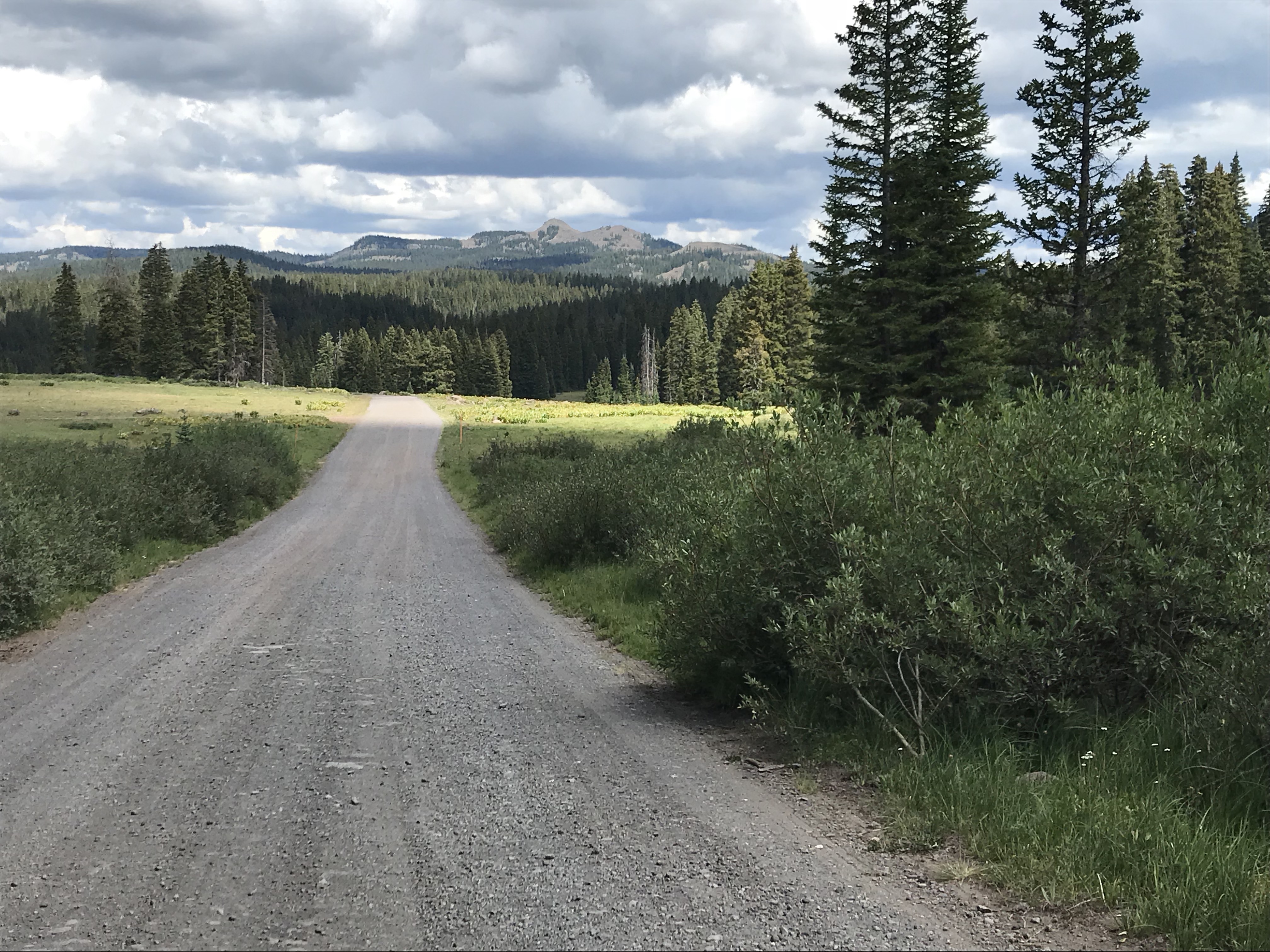
I love going for drives, I absolutely LOVE them. I love lengthy road trips too (as anyone that’s followed this blog for a while should know) but I also love just simple drives around the countryside. It’s hard to describe the feeling of peace and freedom that comes from the open road.
I enjoy drives by myself on winding roads (just me and my Honda, dancing through turns). I also enjoy them with Mr. Trekker, my trusty side-kick, and usually, the primary driver. He’s probably one of the only people I can stand being stuck in a car with for days on end. 😁 (This is another good sign to watch for if you’re considering marrying someone. The question isn’t just can you tolerate, but do you actually enjoy lengthy car rides with your significant other? 😁 )
Can you inherit wanderlust?
I maintain it’s not my fault that I have this crazy obsession with the open road, it’s in my genes. I seem to have inherited my maternal grandfather’s wanderlust. He used to love to “go for a drive”. Oftentimes, he’d invite us grandkids along (it didn’t hurt that this usually meant there was a Wendy’s frosty in your future if you went 😉). I can remember my grandma asking him, “why are you going this way?” His response was always, “I already went the other way!” (Duh! 😉) I firmly endorse this statement!
Mr. Trekker even knows if he’s driving us somewhere, we can’t go the same way twice. Why would we go home the way we came, we already saw that stuff today?! 😝
Can wanderlust be taught?
I don’t think this desire is all Nature though, I blame Nurture, as well. I went on numerous road trips throughout my childhood, with both my parents and grandparents. I rode along with my paternal grandparents, one year when they returned to their home in Kansas after a visit to Indiana. I also rode to Florida for family vacations several times as a child. I even helped my maternal grandparents drive there on a few occasions, as I got older and they started wintering in the warmer climate. My parents and I also took numerous trips to New England over the years, to visit family.
As it turns out, there were times Mr. Trekker and I may have been quite near each other, throughout our childhood, as he grew up near where the family we were visiting lived–we didn’t actually meet until college though. He also shares my love of road trips, probably due, in no small part, to the highway adventures he enjoyed while growing up. His parents took him throughout New England, as well as to countless Civil War battlefields up and down the Eastern Seaboard.
Songs about the Open Road
There are a few songs that well relate my love of the open road (click on the link on each title to hear the full song):
…Gotta get outta here, get it all off my mind And it makes me wanna take a back road Makes me wanna take the long way home Put a little gravel in my travel…
These lyrics speak to me because there are times when I feel like I need to escape from the stress of daily life.
…Tear down some two-lane country who knows? Get lost and get right with my soul…
We shouldn’t be afraid to go the long way through the countryside, things seem to fall back into balance after spending a little time on the open road.
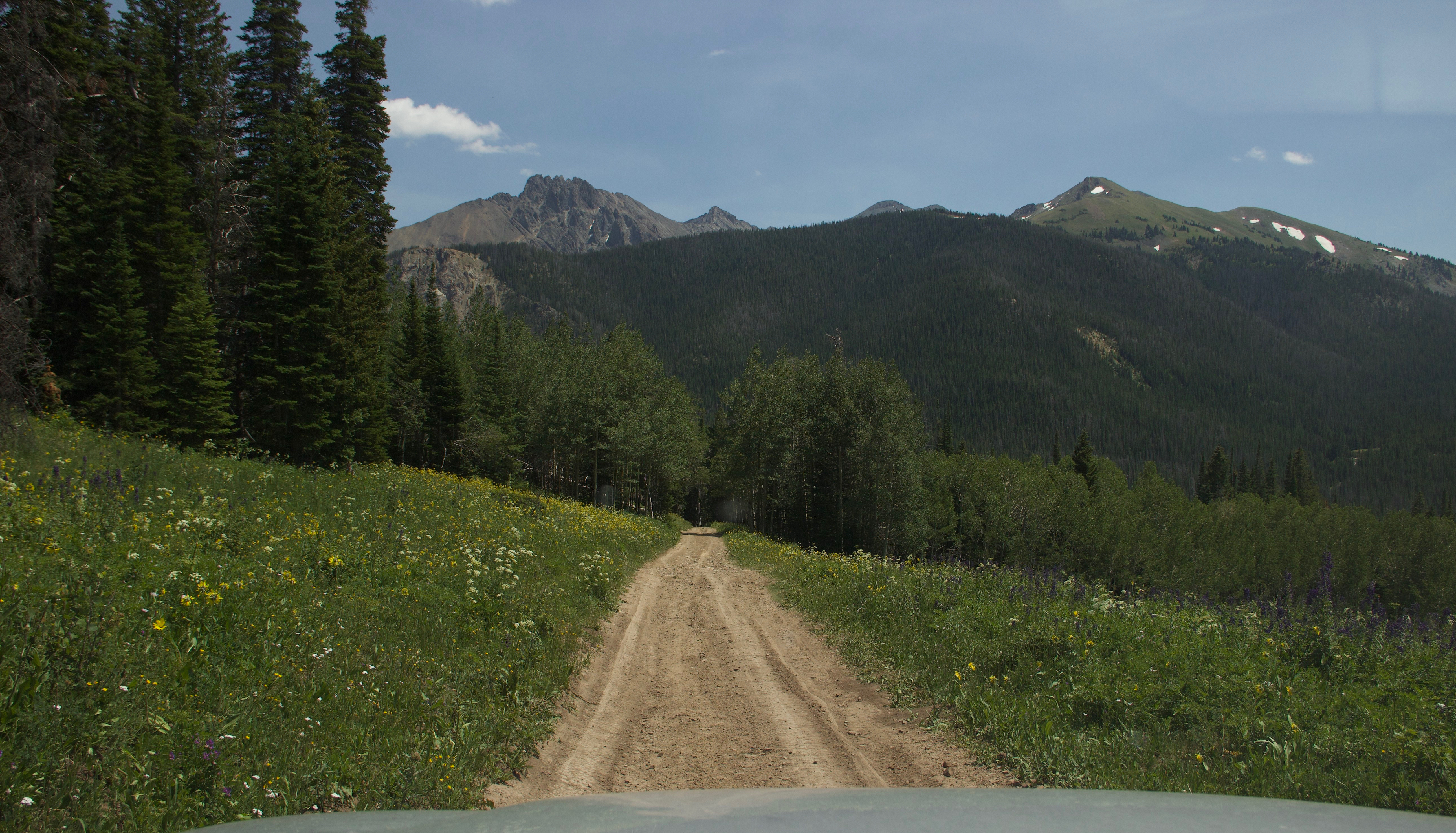
I’ve been cooped up, tied down ‘bout forgotten What a field looks like full of corn and cotton… …I need the curvin’, windin’, twistin’ dusty path to nowhere…
I, personally, could never forget the sight of a field. I grew up surrounded by them (and still live by the prairie). But that isn’t the case for everyone. A lot of people are constantly surrounded by a concrete jungle. I think this separation between us and our evolutionary roots with the natural world causes angst for people. Getting out on the open road helps us get back in touch with those roots.
In “Backroad”, by Granger Smith, the lyrics state:
Barbed wire fence carving out a hillside, cutting holes in the midday sun Like a postcard framed in a windshield covered in dust I love the rhythm of an old grey blacktop Steer the wheel, one-handed on a two-lane, hugging that line I got the windows down, no one else around singin’…
I used to be incredibly outgoing and extroverted. I would get re-energized just by being around other people. These days, I’m still outgoing, but more and more, I prefer quiet and solitude. Mr. Trekker and I can spend several days in the wilderness, with just each other, the pup, birds, deer, moose, and maybe a bear for company. We head into “town”–that can mean very different things in different parts of the country–to restock on supplies and get a shower, and within a day we’re both ready to get back to the solitude again. These days, I get exhausted being around people all the time.
**Working from home the last several years probably doesn’t help my newfound introverted side much. I spend more time alone (or with just the dog) now than I ever used to, which I am PERFECTLY happy about, mind you. I have actually found, now that I’m not around people as much, my patience for them (in parking lots, while driving, in stores) has actually increased. It’s like less exposure to people increases my tolerance level for them! 😂
We hope to someday get property in the Hills. Maybe we’ll live close enough to our neighbors so that we can actually see their house from ours…maybe. 😝 We currently live in town, but at least in the summer, our backyard is walled in by green trees, shrubs, and bushes. I can at least pretend I’m alone. I see pictures of other neighborhoods where the houses are closer together, or the properties aren’t separated by barriers. Or I see pictures in large cities where big buildings block out the sky unless you’re looking straight up. These images just make me cringe! They get my anxious heart pumping! I need room to breathe, ya’ll! (Again, not really my fault. I grew up as a farm girl in Indiana, it only makes sense that I love wide open spaces.) 😁
Granger Smith goes on to say:
Freedom is the miles I’m rollin’ on… …I feel the wheel like a melody, like a radio dialing in strong The breeze smells like a summertime hay field’s just been cut I got the windows down, way out of town singing…
There is freedom on the open road (and the smell of fresh-cut hay is DEVINE!) Don’t just take my word for it. There have been some famous people who have shared my love of it too. John Steinbeck, for example, in his book “Travels with Charlie” (his poodle) comes to mind. In that account, he and Charley enjoy a country-spanning road trip, sleeping out of his truck camper.
Another song that reflects my love for the open road is “My Church”, by Maren Morris. The lyrics of that song state:
…I find holy redemption When I put this car in drive Roll the windows down and turn up the dial Can I get a hallelujah Can I get an amen Feels like the Holy Ghost running through ya…
…I find my soul revival… …Yeah, I guess that’s my church…
…When this wonderful world gets heavy And I need to find my escape I just keep the wheel rolling, radio scrolling ‘Til my sins wash away
I get this sentiment. I feel the same way about the open road. I feel refreshed and stimulated when I’m out there. It’s almost a spiritual experience or a spiritual renewal of sorts. I feel so much more relaxed after a good, long drive. It’s like I can breathe again, like I’ve been rejuvenated.
**This is partially why I love being out in nature so much. It’s quiet, it’s natural, it’s solitude, it’s peaceful. You gotta respect it because it can kill you, 😳 but it can also refresh you in a way nothing artificial can. Nature and wide-open vistas are my Xanax!
Oddly enough, I don’t love the Plains because they are too wide open. It’s a bit overwhelming. I love the mountains, but I couldn’t live in them, either. For one thing, the weather can be too extreme. For another, they block the view! I prefer to live in the foothills, they are an almost “Goldilocks”-type region. You get to experience the best of both worlds. The flatter land that leads up to the base of the mountains is open, so you feel like you can breathe, but it doesn’t continue on endlessly. It is reigned in by the rocks (and you can also enjoy mountain views, as well). You also benefit from the protection the monoliths provide from the worst of the weather, and lower altitudes usually also offer more mild weather.
I love taking my car on the winding back roads. It’s fun to drive and it makes you feel like you’re one with the land, it’s like you can finally relax. I LOVE the smells of the country, yes, even “those” smells. Manure is natural too kids! 😉
Below are some more pictures of our travels on the open road. Don’t they just make you feel like you can breathe?:
So, the next time you get the chance, don’t be afraid to get out there and enjoy your own back roads a little!
Do you enjoy long drives in the country? Tell me about it in the comments!
Did you enjoy this post? Pin it!
Like what you read here today? Please feel free to leave a comment, like or share this post! Add your email at the bottom of the page, or the sidebar to the right, to be notified when a new post is published. By signing up for the email list, you will also receive a free copy of the Tranquil Trekker’s Top 10 Tips of Trekking Do’s and Don’ts!
You can also follow the blog on social media by clicking the links below!
This website uses cookies to improve your experience. We'll assume you're ok with this, but you can opt-out if you wish. Cookie settingsACCEPT
Privacy & Cookies Policy
Privacy Overview
This website uses cookies to improve your experience while you navigate through the website. Out of these cookies, the cookies that are categorized as necessary are stored on your browser as they are as essential for the working of basic functionalities of the website. We also use third-party cookies that help us analyze and understand how you use this website. These cookies will be stored in your browser only with your consent. You also have the option to opt-out of these cookies. But opting out of some of these cookies may have an effect on your browsing experience.
Necessary cookies are absolutely essential for the website to function properly. This category only includes cookies that ensures basic functionalities and security features of the website. These cookies do not store any personal information.