Hot Air Balloons at the Stratobowl!

In this post, I review a hot air balloon launch that occurs every year at the historic Stratobowl, in the Black Hills.


The alarm wails and wakes you from a deep slumber, it’s 4:30 am…

…you stumble out of bed and feel for your clothes through sleep-blurred eyes…the dog wonders if you’re crazy for being up before the sun…

…a short drive later and you park along the roadside in an ever-growing line of vehicles, strap a headlamp to your brow, and set off for the mile-or-so-walk to the Stratobowl as, ever so slowly, the darkness perceptibly lessens…  

The Stratobowl Historic Hot Air Balloon Launch

This is a really cool annual event that occurs one weekend each year in early September.  It is VERY weather-dependent and can be canceled due to the frequent, South Dakota wind.  On the days the flight is canceled, some of the balloons are often at least inflated and fly, tethered, several hundred feet above the ground.  

I discussed the Stratobowl in a previous post.  If, however, you’re unfamiliar with this location, the hike takes you along the Stratobowl rim with a valley that spreads far below you. (The balloons take off from the meadow in this valley.)  One of the meadow’s unique aspects is that one of the residents who lives there mows a peace sign in the same field that is the site of the launch.  It fits the tranquility of the site–and the Black Hills in general–well.  It also compliments the kaleidoscope of bright colors that adorn the balloons.

Top view of four colorful, hot air balloons floating near a grassy, valley floor surrounded by pine trees. A peace sign has been mowed into the grass. Cars and trucks also dot the valley floor.
Our view from the Stratobowl rim.  If you look closely enough, you can see the “peace sign” mowed into the grass.
View from a cliff above with rocks and gravel in the foreground. In the background, four colorful, hot air balloons floating near a grassy, valley floor surrounded by pine trees. Cars and trucks also dot the valley floor.
This gives you an idea of how far below you the valley floor is

The rainbow of colors from the balloons make for a spectacular contrast against the dark green backdrop of the Black Hills National Forest, where the aspen trees are usually just beginning to take on their autumnal, yellow hue.  As the sun rises, it slowly unfurls its light over the tree-covered Hills to the west.  The *whoosh!* of the flame-heated air rushing in to fill the balloons then reaches your ears from the basin far below.  

If you’ve never seen a hot-air balloon, a large propane tank is attached to a basket.  At regular intervals (as controlled by the pilot) the tank springs to life, spurts out a flame, and rushes hot air into the balloon. (A fan also helps with the initial inflating process.)  

Hot air rises, so, once it’s full enough, the balloon does as well–yay science! 😝  The pilots can control the altitude of the balloon using this device, allowing for a safe landing, but they can’t control where the wind blows the craft (Someone Else is still in charge of that department 😉).  A “chase vehicle” follows the balloon to collect it from whatever field it finally lands in.   

I have fond memories of hot-air balloons from my childhood in Indiana.  There were several pilots around the local area where I grew up, so these craft were a regular sight in the sky.  We also enjoyed several mass-launches at the county fair in the summer.  I have one, specific, memory of a balloon flying over my grandparents’ pool so low to the ground that we were able to talk with the pilot (he ended up landing in the field across the road).  

Embrace Life’s Simple Pleasures

This is another opportunity to enjoy the simple things in life, not to mention a micro-adventure close to home.  It is a family-friendly, free activity, less than a half-hour drive from Rapid City, which requires only the small sacrifice of missing some sleep.  But it allows us to enjoy the natural beauty that surrounds us in a unique and easy way.  

So again, strive to seek out these simple, everyday opportunities that are present in your local neighborhood (farmer’s markets, county fairs, free events downtown or in local parks, etc.)  You’ll be surprised how much fun you can have (and it’s frugal too!) 🤑

Top view of four colorful, hot air balloons floating near a grassy, valley floor surrounded by pine trees. A few tethers string down from the balloons. Cars and trucks also dot the valley floor.
You can see the tethers on the dark blue balloon, anchoring it to the ground

Have you ever watched balloons take off from the Stratobowl?  What did you think?  Tell me about your experience in the comments!

Did you enjoy reading this post?  Pin it! 

Top view of four colorful, hot air balloons floating near a grassy, valley floor surrounded by pine trees. Cars and trucks also dot the valley floor. Pin reads, "Hot Air Balloons at the Stratobowl!"


Like what you read here today?  Please feel free to leave a comment, like or share this post!  Add your email at the bottom of the page, or the sidebar to the right, to be notified when a new post is published.  By signing up for the email list, you will also receive a free copy of the Tranquil Trekker’s Top 10 Tips of Trekking Do’s and Don’ts!

You can also follow the blog on social media by clicking the links below!

Facebook

Twitter

Instagram

Pinterest

The Terry Peak Lookout Tower

The Terry Peak summit road and lookout near Lead, SD.


Several years ago, I had family visiting the Black Hills from the great (albeit flat) state of Indiana. 😊   They rented a cabin up near Terry Peak (and were almost blown out of it by the, incredibly unusual, tornado that went within a short distance of where they were staying!) 😳

My aunt and uncle brought their ATV along and were seeking an interesting destination to drive it to, so, we checked out the Terry Peak Lookout Tower. Mr. Trekker and I had visited there once before but it was cold and windy and we weren’t able to locate the trail to the actual tower.  This time, thanks to my aunt’s keen eye, we found it!

Where is the Terry Peak Lookout Tower?

The turnoff for the summit road can be found about four miles west of Nevada Gulch Road (the road you turn on to reach the Terry Peak Lodge).  Once you turn onto that road it’s about a three-mile drive to the summit.  The summit road is a dead-end, dirt road, but it is fairly well graded.  

I completed the drive in my Subaru Outback with no problem, so, any passenger vehicle–and certainly any truck or ATV with higher clearance–should be able to manage it (at least in good conditions).  There were a few rocks to negotiate, so, a typical, stock, sedan should take it easy.  The driver should gauge for themselves if the vehicle can clear the obstacles.  The road becomes a bit of a shelf road in a few spots (with no guardrail), so, while it can be easily managed, drive with caution.  

The road is wide enough for vehicles to pass, throughout, and while you aren’t likely to see many others on your drive, be watchful for those coming the other way (especially in areas where the hill you’re cresting is steep and/or the curve you’re negotiating is sharp).  The panoramic vistas of the surrounding hillsides, blanketed in aspen and pine, are spectacular though!

The sign for the trailhead is small and almost at ground level right next to the trail.  As you pull into the parking turnaround, the trail is to the right and almost behind you (depending on where you park).  If there are any snowdrifts around, the sign could easily be buried (which may be why Mr. Trekker and I missed it on our first attempt).

The Lookout itself can be achieved via a short hike up the hill using the charming cobblestone path that was intended for the purpose (there is a gravel road that can be driven–or traversed on foot–though it’s rather steep and narrow).  

Once you reach the tower, there is a short flight of metal stairs that must be climbed to reach the platform on top (though there are some lovely views from the base of the tower, as well).  Even speaking as an acrophobe, I didn’t find the height to be alarming.  The Lookout is placed in the middle of the hill with no steep drop-offs in the vicinity.  

Be aware, this is one of the higher points in the Black Hills and it tops out at just a little over 7000 feet (so flatlanders may find themselves huffing and puffing to excess). 😉  Full disclosure:  Mr. Trekker and I live at around 3000 feet and we find ourselves breathing a little extra hard hiking at that altitude. 😜

Cobblestone steps ascend a hill through the trees
The cobblestone path leading to the Lookout

What you’ll see from the Terry Peak Lookout Tower

The lookout provides a spectacular, 360-degree view of the Black Hills.  On clear days you should even be able to see parts of Montana, Wyoming, and North Dakota, as well.  You can search out the various peaks in the local area (Crow Peak, Big Hill, etc.) and you get a unique view of the back side of the Terry Peak ski lift.  

The scenery would be more attractive without the large communication towers and their guide wires that populate the summit.  I wouldn’t recommend being up there during a lightning storm! 😱

Panoramic view of the flat lookout platform with many radio antennas in the background.
Did I mention the towers?  😩

We also had a commanding view of the Wharf Mine as well as several others scattered around the local area, and their “leavings” on our beautiful Black Hills (if you’re noting derision in my tone, you would be noting correctly). 😡   

But, this blog is all about tranquility and focusing on the positives, so, I’ll end my critique of the mines there.  My momma always taught me to look for the good things in life, so, I’ll offer one positive critique.  At least the mines provide good-paying jobs to local residents (though I slept better before phrases like “large vat of cyanide” ever entered my lexicon). 😒

Ski lift and building on a grassy hill with mountains in the background.
The Terry Peak ski lift

The three of us enjoyed the lookout so much, I took the rest of my relatives back there later in the day.  On the first trip, the colors of the surrounding Hills were muted by clouds.  However, by that afternoon, the sun had returned and its light, along with the shadows it created with the remaining clouds, made for spectacular viewing.

More pics from the top!

A hazy view from the top of the mountain
Lead as seen from the summit.  If you look really carefully in the distance you can see Bear Butte materializing through the haze.
An ATV drives down a steep, gravel road through the trees
My aunt and uncle driving down from the Lookout (I make no claims, pro or con, regarding the license plate on the front).  😇

If you’re looking for a unique place to visit in the northern Black Hills, check out the Terry Peak Lookout Tower! 

Have you visited the lookout?   What did you think?  Tell me about it in the comments! 

Did you enjoy reading this post?  Pin it!

Two pictures of cobblestone stairs, one of a vista overlooking mountains. Pin reads, "The Terry Peak Lookout Tower."


Like what you read here today?  Please feel free to leave a comment, like or share this post!  Add your email at the bottom of the page, or the sidebar to the right, to be notified when a new post is published.  By signing up for the email list, you will also receive a free copy of the Tranquil Trekker’s Top 10 Tips of Trekking Do’s and Don’ts!

You can also follow the blog on social media by clicking the links below!

Facebook

Twitter

Instagram

Pinterest

They Vandalized Poet’s Table!

I explore my frustration over the vandalization of an iconic, Black Hills landmark.


“You didn’t tell me you were gonna kill it!”  This line, spoken by the astute Linus in the cherished cartoon It’s The Great Pumpkin Charlie Brown, well summed up my feelings regarding the vandalization of a beloved Black Hills landmark…

Poet’s Table Vandalized

I am, of course, talking about the two misguided souls who took it upon themselves to remove decades-old mementos from this “secret” Black Hills landmark a few years ago.  For decades, Poet’s Table has been a sanctuary for those who are entranced by our beautiful surroundings.  As the story goes, these individuals committed this crime because they thought Poet’s Table was an eyesore on the pristine, natural beauty of the Black Hills.  Whether this is true or if they were really just seeking their 15 minutes of fame could be debated lengthily.  For the sake of decency, I am willing to give them the benefit of the doubt. 

To be fair, they are (technically) correct.  Many years ago, another misguided (albeit strong and tenacious) soul drug a table, some chairs, and a cabinet into the wilderness and left them in a beautiful, hidden, place in our beloved Black Hills.  Today, we would call that littering.  But, because he meant well, and because others have found such enjoyment from the site in the decades since, we choose to view it as a positive.  The site has become such a popular urban legend of sorts that nearby Custer State Park uses it as a marketing ploy.

Anger over Poet’s Table Vandalism

My first instinct, when I found out this treasured site had been ravaged, was all-out rage.  Fortunately, the foolish individuals quickly came forward and returned the items and Custer State Park quickly began repairing the damage.  Due to this quick recovery, my fervor ceded a bit.

One has to wonder, though…with the power of social media these days, and the fact that these two were foolish enough to get their pictures and names all over Facebook–not to mention the local news–if Karma saw to it that they garnered less positive attention than they originally bargained for?

I really hope their idea was just ill-advised and that they weren’t actually trying to be unfeeling and hurtful to others–even if that was the end result.  It was encouraging to see the reaction of the local community in their desire to fix the error as quickly as possible to preserve this awesome site.  Hopefully, due to this, Poet’s Table will remain a hidden gem and refuge for those who seek it out for many more generations to come!

Don’t wait, embrace today’s opportunities NOW!

After learning what had occurred, Mr. Trekker and I felt very fortunate that we had sought out Poet’s Table, when we did, the summer before the vandalism occurred (you can read about that here).  For me, this was a real-world situation where the sage advice of not putting off till tomorrow what you could be doing today, applies. 

We’ve all heard the admonition that we could die at any moment so live each day like it’s your last (which is true, albeit depressing–I think this was driven home to all of us during COVID 😋).   But, this also fits in with the broader picture of being present in the current moment and living life to the fullest. 

Obviously, we all have responsibilities that we need to take care of.  We can’t play all the time, we have to work so that we can afford to play. 😁  But, let’s try not to make life too busy.  Let’s make the most of the free time available to us to spend time with family/friends, enjoy our hobbies, volunteer, learn a new skill, whatever. 

If we fill every waking moment with things we think we “should” be doing, we miss out on all the joys we COULD be enjoying.  As a former therapist once said, “Don’t SHOULD all over yourself!”

This was also a partial motivation for our visit to Glacier National Park a few years ago, to see it before the glaciers were all gone.  You can view that post here.

There have been a few instances in life where I regret not taking a day off of work to enjoy what may have been an opportunity that doesn’t come around often, or taking an extra few hours on a road trip to drive out of the way a bit to see an awesome site.  These are the moments that make life worth living!  While they vary from person to person they exist for everyone in some form, and we should learn to take advantage of them!  These are what make life rich! 

It doesn’t have to be something big.  It could just be stopping on the commute home to enjoy a beautiful sunset, even if that means you don’t get the bathroom cleaned tonight. 😇  We need to embrace the little joys in every day, that’s what living is all about!

And some of us need to learn a lesson they should have been taught in Kindergarten…to keep their hands off of that which does not belong to them.  😜

Have you had any moments in life you wish you hadn’t missed (or are glad you didn’t miss?)  Tell me about them in the comments!


Like what you read here today?  Please feel free to leave a comment, like or share this post!  Add your email at the bottom of the page, or the sidebar to the right, to be notified when a new post is published.  By signing up for the email list, you will also receive a free copy of the Tranquil Trekker’s Top 10 Tips of Trekking Do’s and Don’ts!

You can also follow the blog on social media by clicking the links below!

Facebook

Twitter

Instagram

Pinterest

Poet’s Table, Black Hills of South Dakota

I discuss our various attempts to discover this “secret” Black Hills landmark.


After only two tries, the Trekkers were finally able to locate Poet’s Table!  (As it turned out, we almost reached it the first time, and probably would have, had it not been for the mist blanketing everything and the fog hiding the site from view).  

If you’re looking for specific instructions on finding this awesome spot…keep looking.  I won’t give any details that can’t already be found on Google.  Part of the fun is in the search! (I will say this much if you think you’re close…make sure you look up!)

But if you’re looking for hints to help with your search…keep scrolling! 😁

Where is Poet’s Table

Poet’s Table is in the Black Hills, of course! 😉

Our first attempt to find Poet’s Table was in early June on a particularly foggy day–which can be a really cool time to hike in this area.  It’s eerily beautiful to see the rock outcrops and spires looming out of the mist. 

Our second attempt was a few years later, also in June, and we were actually able to help some visitors from Illinois locate the spot.  They were grateful for our assistance as they were eager to ferret out this iconic, Black Hills location.

The only major clue I’ll give you is that this “secret” spot is within Custer State Park.  There are no signs or trail markers so you’re going to have to put your sleuthing hat on to find Poet’s Table.  The trail is unmarked and is located about a half-mile from the Little Devil’s Tower trailhead, which is about half a mile from Sylvan Lake, on Route 87.  It is also not far from the scenic Cathedral Spires Trail.  

After about a 1/2 mile hike down the Little Devil’s Tower trail and crossing a footbridge, you will see a fallen log on your right.  On your left is a rather large, well-trodden path going off to your left, heading uphill, traversing a bit of a canyon.  Take this path.  

As you trek this new, unmarked trail, within a few minutes you’ll see another, smaller, also well-trodden trail heading off to the left, toward more towering granite summits.  Take this left…

…this is where my directions end, the rest is up to you!

A mountain landscape with trees and rocks in the foreground. A meadow and more mountains are in the background
The view from Poet’s Table

Poet’s Table Can be Hard to Find

Don’t get discouraged if you don’t find the site on your first attempt (or even your 3rd!)  Just enjoy the hike, the views, and the beauty of the natural world that surrounds you.  We found some pretty nifty spots in the area even when we failed to find the actual Poet’s Table.  Good luck, have fun, and happy hunting!

Note:  There are several other unmarked trails traversing gulleys and canyons in this area.  They don’t “go anywhere” per se, but I encourage you to investigate them.  This is a pretty amazing area that you’ll have largely to yourself most any time of year (though summer is the busiest time).  There are lovely canyons, picturesque granite outcroppings, and the occasional small waterfall to hunt if you’re there during a wetter period of the year.  

Trails in this area aren’t overly long but they can get rather steep so watch your footing, especially in wet, muddy, snowy, or icy conditions.  The trail is in the Harney Range, which is also one of the higher elevations in the Black Hills (over 6000 ft), so flat-landers should take heed. 😉  Another nice thing about the trails being relatively short, most are half-day hikes or less (though you can, obviously, spend as much time in this area as your heart desires.)  You won’t get bored!

Thanks, as usual, to Mr. Trekker for this great shot of Poet’s Table!

Green table, chairs and cabinet sitting on a rock slab backed by tall rock. Some people are taking pictures.
Poet’s Table! (and our new friends from Illinois. 😉)

**A few months after our trip, this iconic landmark was vandalized. Fortunately, it has been reset. You can read my feelings about that event here.

Have you ever been to Poet’s Table (or got lost trying to find it? Tell me about your experience in the comments!)


Did you enjoy this post?  Pin it!

A mountain landscape with trees and rocks in the foreground. A meadow and more mountains are in the background. Pin reads, "Poet's Table, Black Hills of South Dakota"


Like what you read here today?  Please feel free to leave a comment, like or share this post!  Add your email at the bottom of the page, or the sidebar to the right, to be notified when a new post is published.  By signing up for the email list, you will also receive a free copy of the Tranquil Trekker’s Top 10 Tips of Trekking Do’s and Don’ts!

You can also follow the blog on social media by clicking the links below!

Facebook

Twitter

Instagram

Pinterest

Stratobowl near Rapid City

In this post, I review the Stratobowl trail near Rapid City, SD.


The Stratobowl Rim Trail is a simple hike near Rapid City that offers spectacular views of the Black Hills and a local, historical site.  The Stratobowl is a great trail for a short hike.  It’s only around one mile each way, so it’s amenable to almost any skill level.  

Where is the Stratobowl?

The Stratobowl is located off Route 16, about a half-mile south of Old McDonald’s Farm.  There is no roadside sign highlighting the trail, but there is an obvious parking area just off of Highway 16.  If you’re there during daylight hours, it’s likely you’ll see other vehicles.

Hiking the Stratobowl

The path is comprised of simple, rolling hills on an old access road that traverses through pines and offers a prime opportunity for spotting deer and wild turkeys.  A substantial logging operation was recently completed there (necessitated by pine beetle damage) so chances of viewing wildlife are now even more likely. 

At the trail’s terminus, the road opens onto the rim and the yawning chasm that is the actual Stratobowl.  From here, a valley formed by Spring Creek spreads out before you with homes dotting the canyon floor. You’ll also often see vultures soaring the thermals…below you! 

Related posts:  Willow Creek Trail Black Hills; Hiking the Boulder Hill Trail; Secret Spots in the Black Hills!; Coon Hollow TrailLittle Elk Creek Trail; Flume Loop Trail

The Stratobowl is also a prime place to watch the sun setting over the expanse of the Black Hills (and being so close to town it’s convenient for an evening hike).  The name stems from the bowl-like shape of the valley created by the surrounding terrain.  The north side of the rim can be reached from several other trails/old logging roads off of Sheridan Lake Road to the north (I discuss these options in this post.)

This setting was the site of high-altitude, manned balloon flights that took place in the ’30s (there are several monoliths on-site detailing these); it also currently hosts an annual hot air balloon launch.  Be aware, you may hear the haunting sound of howling wolves when hiking.  Do not be alarmed though, wolves are not usually found in the Hills and those you hear are safely contained at Bear County, just a few miles away.

Sunset shot from above over a valley floor. There is a meadow and pine trees at the bottom. The dark silhouette of mountains is in the distance with the sun setting behind them.
Thank you Mr. Trekker for this sunset shot of the Stratobowl
View from above of a snowy valley floor with the tops of pine trees covered in snow. A house sits in the middle of a meadow, The whole picture is obscured with flying snow.
The Stratobowl in the snow!

This trail is perfect for an afternoon or after-work hike, or if you’re just looking for an easier place to take the kids or the dog that’s close to home.  It’s gorgeous in almost any kind of weather and the trail is family-friendly.  This is another great one to add to your list of fun hikes found near Rapid City!

Do you enjoy hiking the Stratobowl?  Tell me about it in the comments! 

Did you enjoy this post?  Pin it!

View from above of a snowy valley floor with the tops of pine trees covered in snow. A house sits in the middle of a meadow, The whole picture is obscured with flying snow. Pin reads, "For a quick hike near Rapid City check out the Stratobowl Trail"


Like what you read here today?  Please feel free to leave a comment, like or share this post!  Add your email at the bottom of the page, or the sidebar to the right, to be notified when a new post is published.  By signing up for the email list, you will also receive a free copy of the Tranquil Trekker’s Top 10 Tips of Trekking Do’s and Don’ts!

You can also follow the blog on social media by clicking the links below!

Facebook

Twitter

Instagram

Pinterest

Jenny Gulch Road in the Black Hills

In this post, I review the drive on Jenny Gulch Road, in the central Black Hills.


In a  previous post, I gave a brief mention to Jenny Gulch Road.  It is found off Silver City Road, on the way to the Jenney Gulch boat ramp of Pactola Lake and the tiny community of Silver City. 

This gets a little confusing.  There are several roads in the Rapid City and the central Black Hills area that go by this name so Google Maps (and possibly other mapping programs) may send you to the wrong place.  To be clear, for this post I am referencing the Jenny Gulch Road that follows along Forest Road 261 and runs through a central portion of the Black Hills National Forest, outside of town.  It meets up with Broad Gulch Road and runs as far as Rochford Road, both of which eventually lead you to Highway 385, one of the main routes through the Hills. 

In the earlier post, I mentioned a large section of the road heads off to the north (and consequently not near Jenney Gulch at all) but we’d never taken that route.  I am happy to report we have rectified that issue and I can now give you details of that road, as well! 

Jenny Gulch Road offers a nice drive through national forestland.  It doesn’t really provide any exciting activity options, but several dead-end forest roads branch off from it which present prime “set-up-your-hammock-and-enjoy-the-quiet of-the forest” opportunities.  These would also be some good spots for dispersed camping. 

We did learn these are off-limits to vehicle travel and are barred by gates in the off-season (though they’re still available for foot travel). 

The road is recommended for high clearance vehicles only and near the northern terminus, I was glad we had the 4×4 with the higher ground clearance.  A regular AWD vehicle could probably make it but some of the ruts could cause the situation to become a little dodgy.

This back road is something to think about if you’re looking for a secluded place in the forest to collect your thoughts, and another item checked off of our Black Hills Bucket List!

Like what you read here today?  Please feel free to leave a comment, like or share this post!  Add your email at the bottom of the page, or the sidebar to the right, to be notified when a new post is published.  By signing up for the email list, you will also receive a free copy of the Tranquil Trekker’s Top 10 Tips of Trekking Do’s and Don’ts!

You can also follow the blog on social media by clicking the links below!

Facebook

Twitter

Instagram

Pinterest

Winter Fun at Eagle Cliff Ski Area

In this post, I discuss winter activities available at the Eagle Cliff recreation area, near Lead, South Dakota.


The Eagle Cliff ski area is located on national forestland just outside of Lead, South Dakota.  Much like Big Hill, it is a great place for winter recreation (though it provides outdoor leisure opportunities year-round.) 

Where is Eagle Cliff?

The Eagle Cliff ski area is located around 10 miles west of Lead, South Dakota on Highway 85, just west of Cheyenne Crossing and the southern mouth of Spearfish Canyon. 

Snow-covered hill covered in both pine and leafless trees on a cloudy day
The Winter Wonderland at Eagle Cliff

What are the Eagle Cliff trails like?

Eagle Cliff is comprised of a series of 21 trails with multiple trailheads and over 27 miles of possible trail combinations.  While this area is open year-round it is primarily used for winter recreation. 

Eagle Cliff is available for mountain biking and hiking in the summer but is not maintained at all and tends to become extremely overgrown.  When we’ve biked there in the past the grass has reached my knees or higher (while on the bike) in some locations. 

You can make a multitude of loops connecting various trails in this area.  Watch for the signs the many forest inhabitants that live here leave behind in the snow, including mountain lion tracks/scat.  Once we were able to surmise where a big cat had traveled through the fringes of the trees to stalk a herd of deer in the meadow below.

Mountain lion tracks in the snow
“Here kitty kitty”!

The Eagle Cliff trailheads are Dead Ox, Raddick, Bratwurst, Lily Park, and Sunny Meadow.  My personal favorites are Raddick and Sunny Meadow.  I especially like a loop made by taking the Raddick Gulch Trail to the Roller Coaster Trail loop.  This route is less than four miles in total length and it incorporates undulating hills and a beautiful landscape. 

This area is fully forested and doesn’t offer much by way of views, but as it’s protected from the wind, it is usually warmer here and the snow blankets the trees providing an iconic, winter landscape. 

View down a hill over a snow-covered open area surrounded by tall pine trees
This is near Raddick Gulch looking down into the valley where we saw evidence of a mountain lion stalking a herd of deer

Sunny Meadow is–as its name suggests–an open meadow, perfect for skiing or snowshoeing in the winter and biking in the summer (just watch out for the cows and their “leavings” in the warmer months 🤥).  This is an absolutely beautiful area with open, rolling hills surrounded by national forestland.  Because it is so open, this expanse can be rather windy and chilly in the winter, and due to lack of shade the sun beats down unmercifully here in the summer, so plan accordingly.  The only complaint I have regarding this beautiful space is that it is near snowmobile trails (though fortunately they aren’t allowed in the ski/snowshoe area) because their noise tends to shatter the serenity of this snowy landscape.

These are, literally, my favorite places in the Hills for winter sports.  Unfortunately, a few years ago, they closed these areas for snowshoeing (my favorite winter sport).  They are now only open for cross-country skiing and Raddick Gulch is a bit too steep for my menial XX-skiing skills.  This was because there were issues with snowshoers messing up the ski trails.  This is why we can’t have nice things! 😒 (FYI snowshoeing is only allowed off of the main, Eagle Cliff trailhead.  There is a large parking lot and a sign for it. 😀)

What activities can you enjoy at Eagle Cliff?

Although both snowshoeing and cross-country skiing are available in this area in the winter, there is only one groomed ski trail.  Similar to the Big Hill trails near Spearfish, this portion of the Black Hills usually receives some of the largest amounts of snow each winter.  This means that even if the ground is bare in Spearfish, Rapid City, or other lower elevations, it’s a good bet that there will be snow at these higher altitudes (oftentimes, A LOT of it)–It’s not unusual to step over the top of gates in the winter that you walk through in the summer or to see the trail signs that are at eye level in summer at boot level in winter. 😮

Ski tracks down a snow-covered forest road. Pine trees line both sides
One of the old forest roads available for snowshoeing or cross-country skiing

So, if you’re looking for a great place to enjoy winter sports that is both beautiful and quiet, check out the Eagle Cliff ski area! 

Have you enjoyed winter Sports at Eagle Cliff?  Tell me about your experience in the comments!


Did you enjoy reading this post?  Pin it!

Ski tracks down a snow-covered forest road. Pine trees line both sides. Pin reads, "Eagle Cliff Winter fun in the Black Hills!"

Like what you read here today?  Please feel free to leave a comment, like or share this post!  Add your email at the bottom of the page, or the sidebar to the right, to be notified when a new post is published.  By signing up for the email list, you will also receive a free copy of the Tranquil Trekker’s Top 10 Tips of Trekking Do’s and Don’ts!

You can also follow the blog on social media by clicking the links below!

Facebook

Twitter

Instagram

Pinterest

Winter Activities at Big Hill, Spearfish, South Dakota

In this post, I discuss winter activities available at the Big Hill recreation area, in the northern Black Hills.


Big Hill is a recreation area located in the Black Hills National Forest that offers outdoor, leisure opportunities year-round.  The prime activities enjoyed here are cross-country skiing, snowshoeing, and fat-biking in the winter, though people regularly hike and mountain bike here during the summer months, as well. 

Where is Big Hill?

The Big Hill recreation area is located southwest of Spearfish, in the northern Black Hills.  The easiest way to reach the main trailhead is to take Exit 8, off of I-90, for McGuigan Road.  Take this south until you reach the T-intersection with Tinton Road.  Turn right at the intersection to drive up the hill. 

After about 8 miles, watch for a VERY tiny brown sign on the right-hand side of the road showing a hiker.  Shortly after this sign, at the top of the hill, you’ll see a large parking area on your right. (The trailhead is directly across the road from the parking area).  It is difficult to miss as there are usually numerous other cars there (especially in the winter). 

There are other routes you can take to reach this trailhead–coming from downtown Spearfish–as well as a scenic route coming up the other direction on Tinton Road from the south (from Roughlock Falls Road).  While this is a beautiful, scenic drive that I highly recommend in the summer, it should be approached with extreme caution in the winter.  This portion of the road is barely maintained for winter driving and is usually at least somewhat snow-covered.  We have successfully taken this route in the 4×4 truck in the winter, but it’s not for the faint of heart (though it is necessary if you want to reach the Old Baldy trailhead to enjoy winter activities in that area). 

The route from McGuigan Road to the trailhead is usually maintained quite well and can often be reached using a typical, 2-wheel drive vehicle (we made our first trip there in an old Civic).  It should also be noted that whether Summer or Winter, all of these dirt/gravel forest roads are dependent on the current weather and their condition can vary greatly (and QUICKLY) as the weather changes.

What is the Big Hill Recreation Area like?

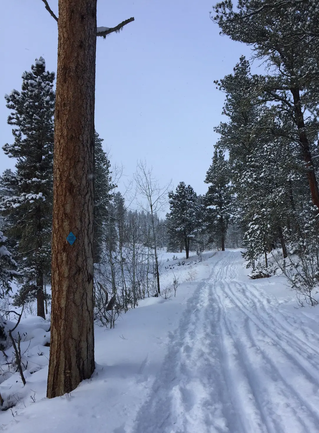
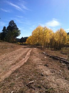
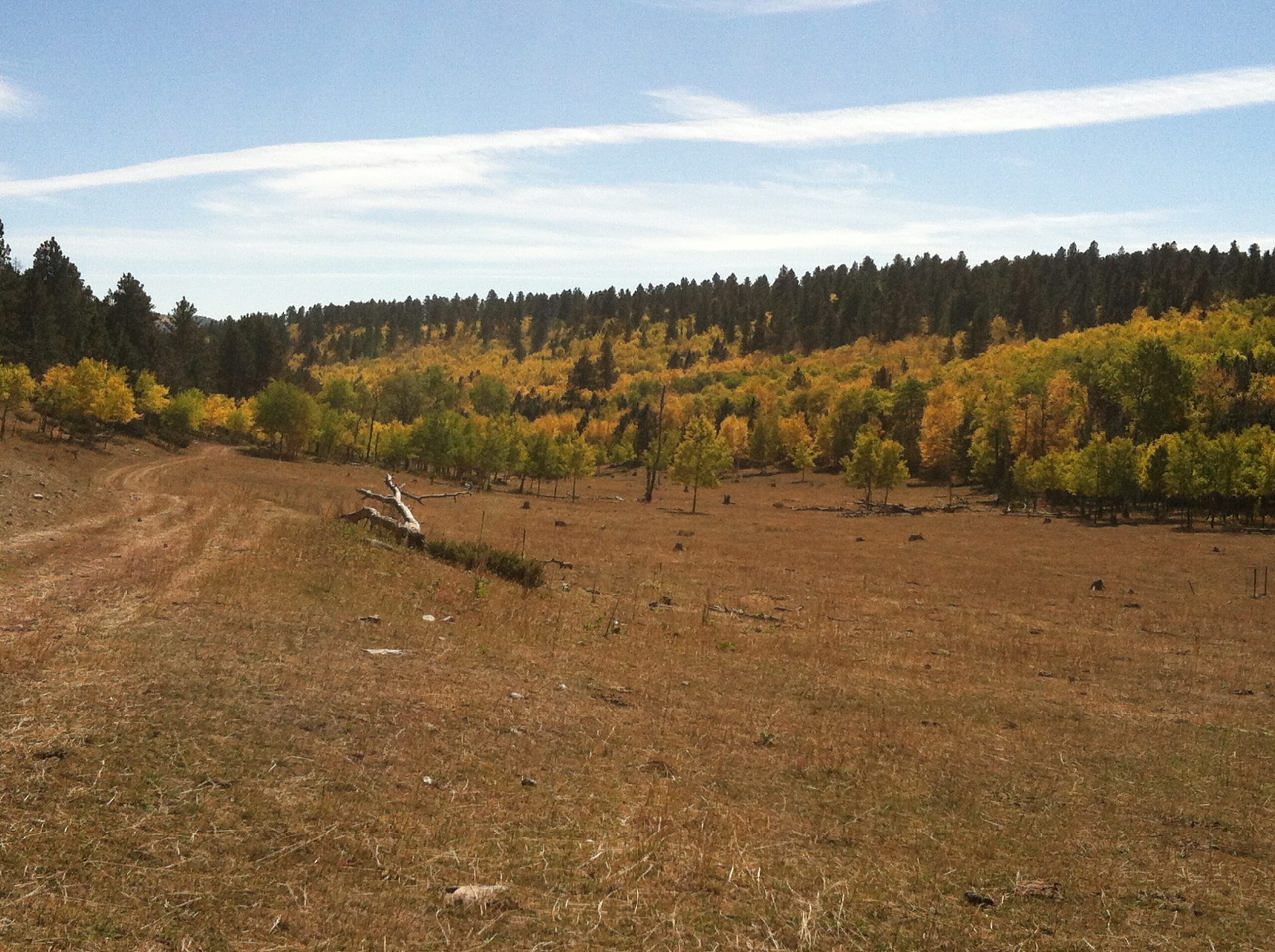
Big Hill offers over 15 miles of trails formed by several different loops/routes (many follow old forest roads) that can be combined in a variety of ways.  Trail maps are usually available at the trailhead.

The trails at Big Hill are very well-signed but it’s still best to have a map to help determine the best route for you (the map also indicates the difficulty levels of the various trails).  The managers of this recreation area also do a marvelous job of keeping the ski trails and the snowshoe/fat bike/dog-friendly trails separate while ensuring everyone can still enjoy this beautiful area! 

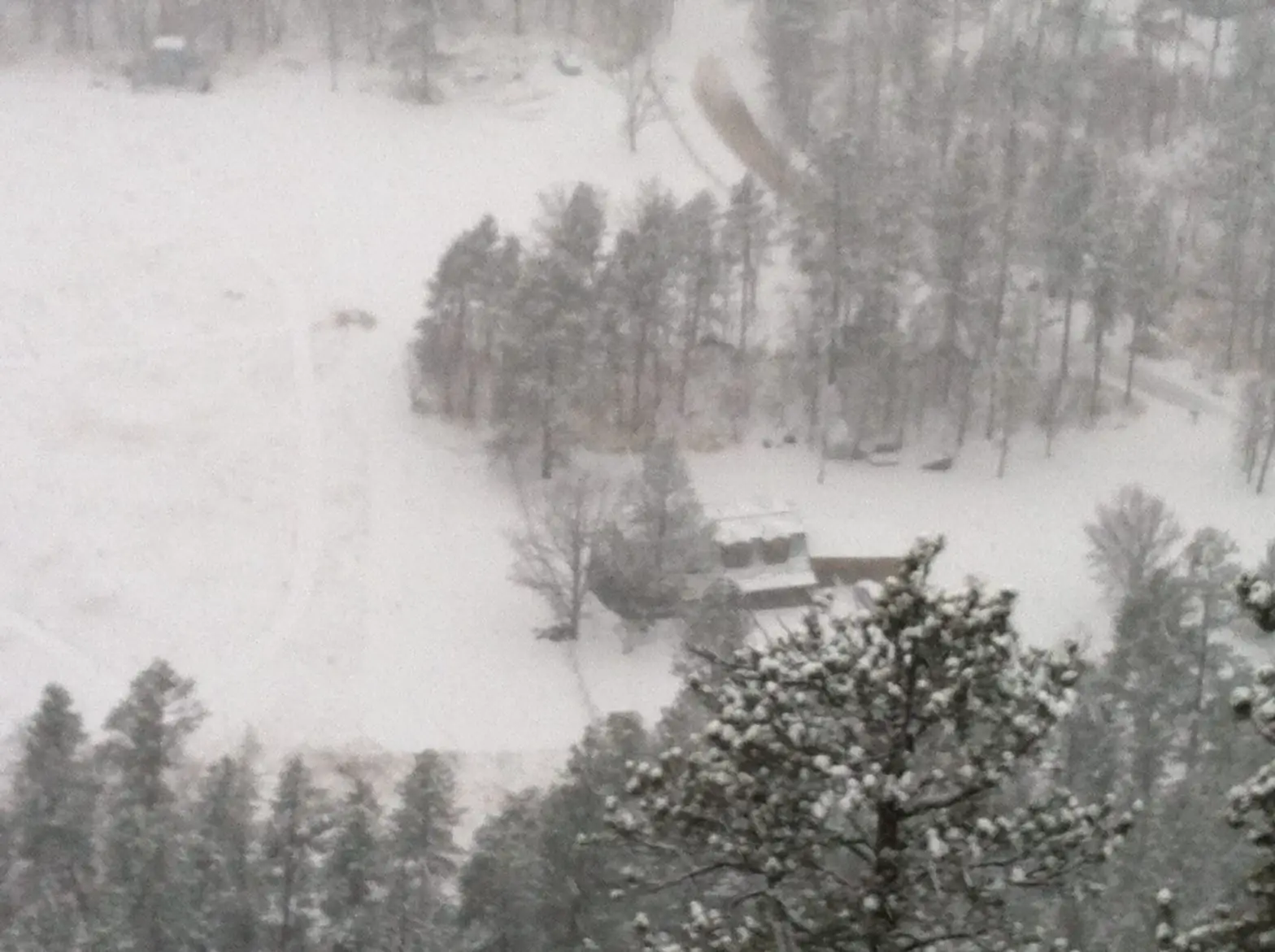
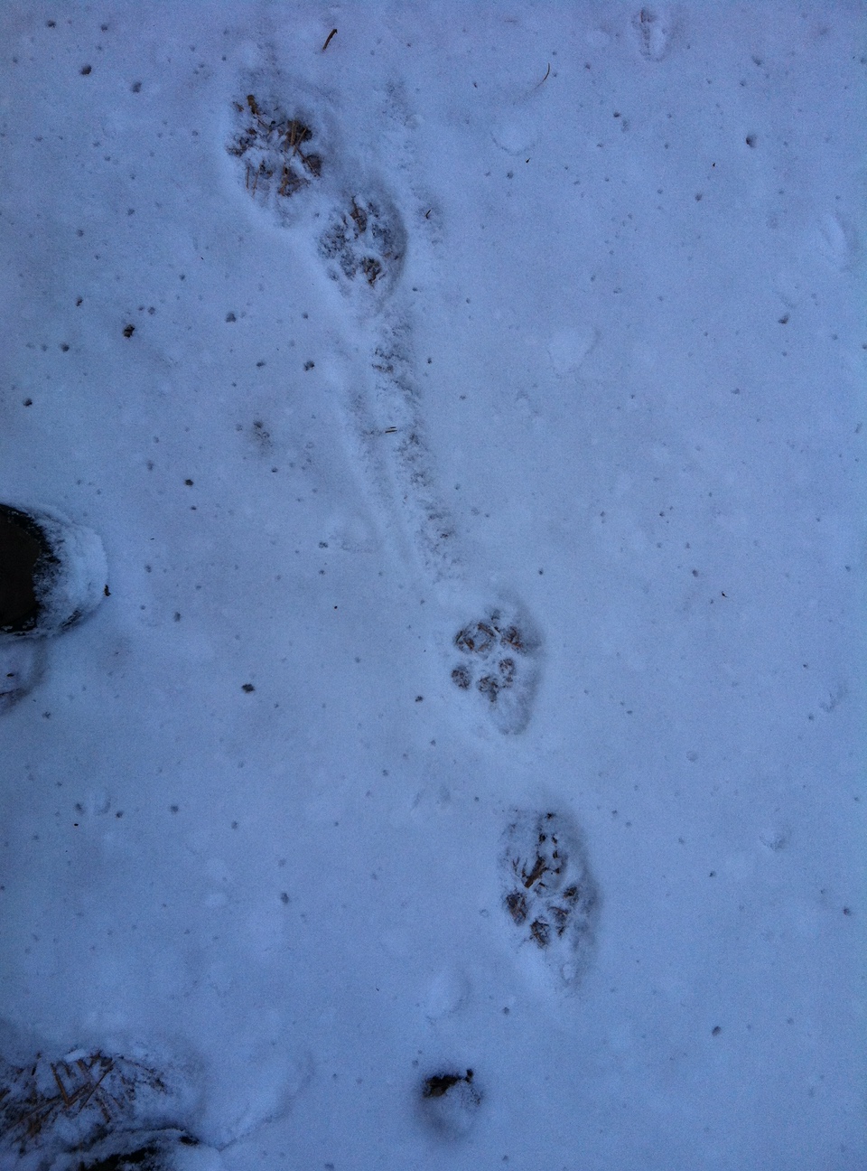
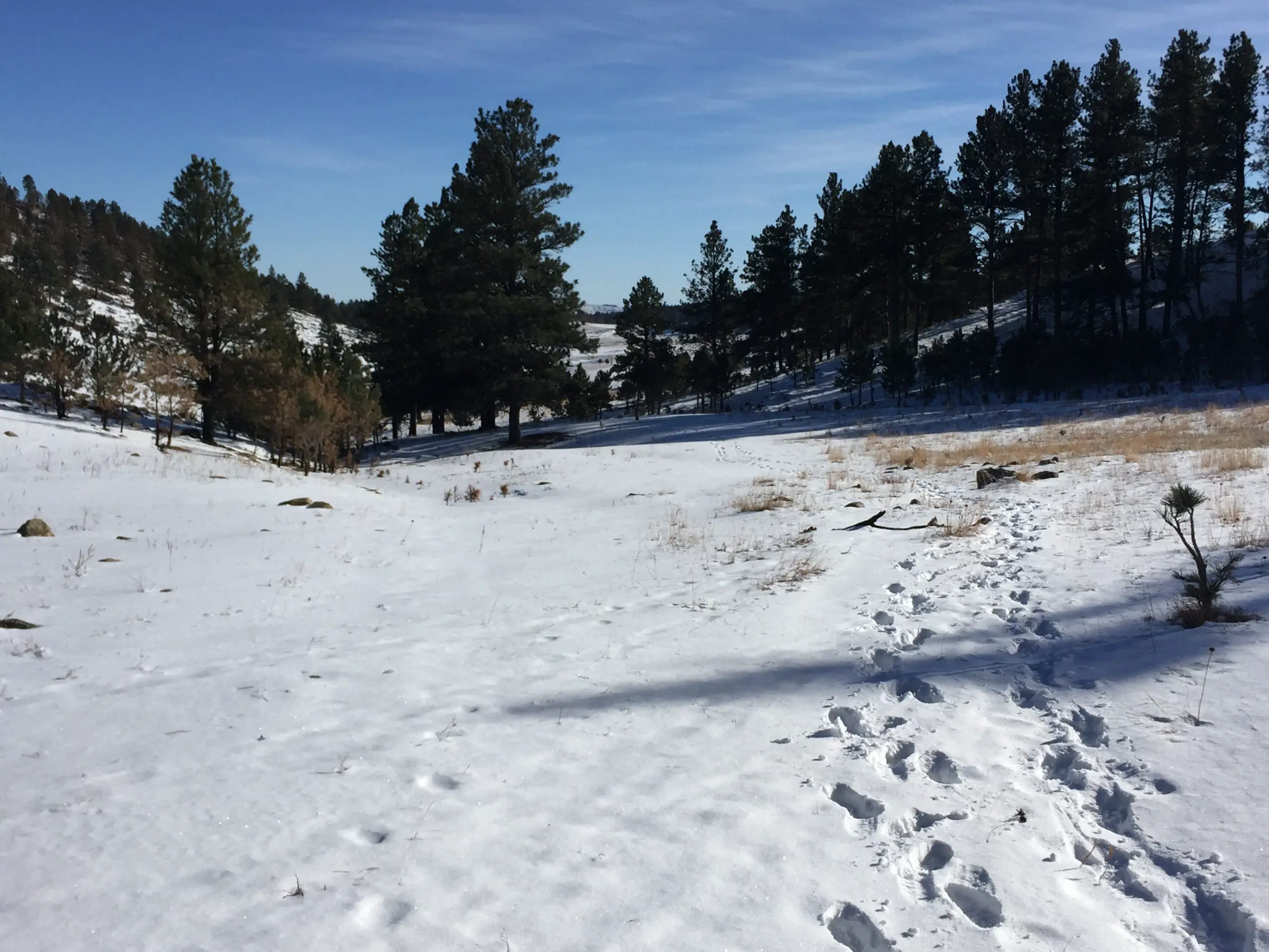
Big Hill tends to be one of the snowier places in the Black Hills so you can potentially participate in winter activities here anywhere from October – May (dependent on current snow conditions, of course).  We’ve enjoyed snowshoeing here, as well, though there are times the snow isn’t quite deep enough so we tend to favor the Eagle Cliff area for our snowshoeing adventures. 

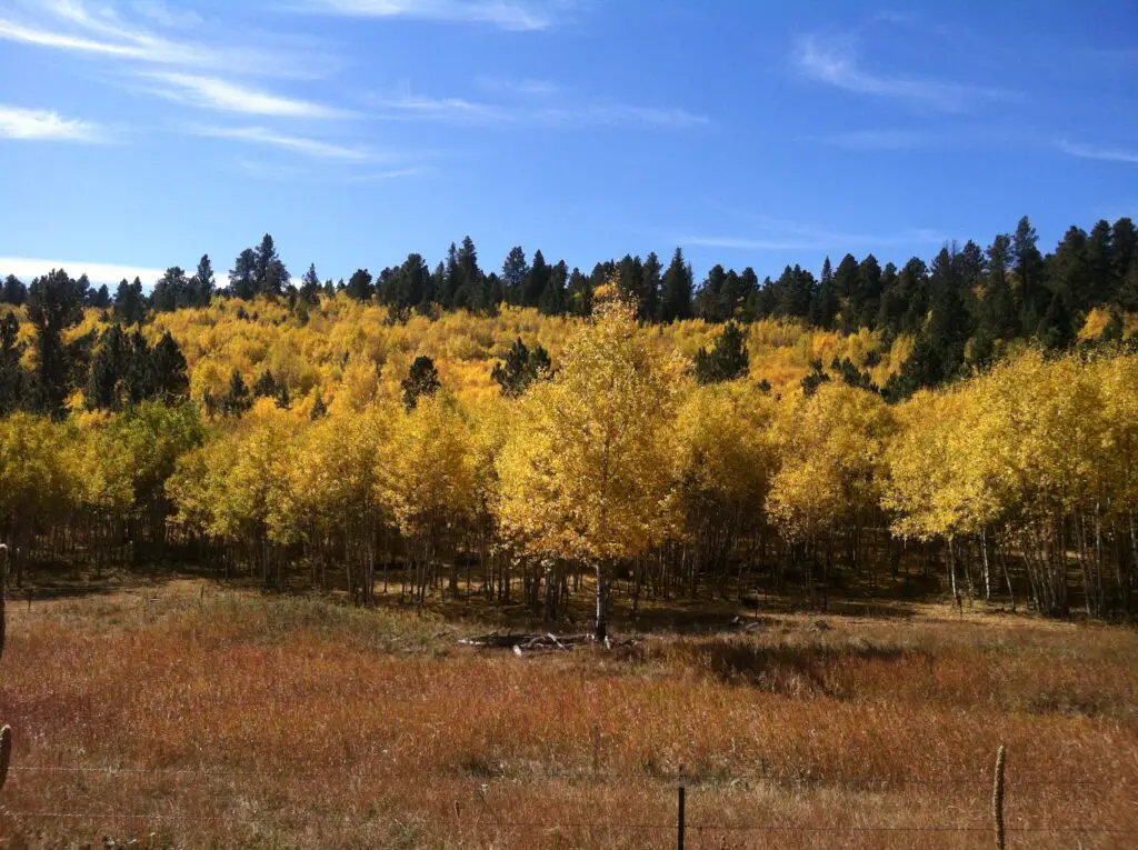
Today, I am focusing on the winter sports available here.  I will say though, this area is a must-see in the fall when the yellow Aspens are in full color.

Brown meadowgrass in the foreground with a hillside of yellow aspen trees (intermixed with evergreens) in the background, all under a blue sky.

**I mentioned the Eagle Cliff area above.  It only has one groomed trail, the rest are just trails cut by outdoor enthusiasts.  Big Hill offers machine-groomed ski trails that are better for practicing the fundamental drills of skiing as they are smoother. 

Machine-groomed trails require FAR less effort, but I find I enjoy them less.  They are more crowded and while faster, I find it’s harder to control my skis.  The person-groomed trails require more effort and you’ll move less quickly, but I find the resistance the snow provides aides in control of the skis and balance.  So, while the groomed trails are usually recommended for beginners, I’d say you have to decide what is most important to you; ease of effort or less fear of hurtling down a hill uncontrollably…possibly towards a tree. 😳

Warmer the higher up you go?

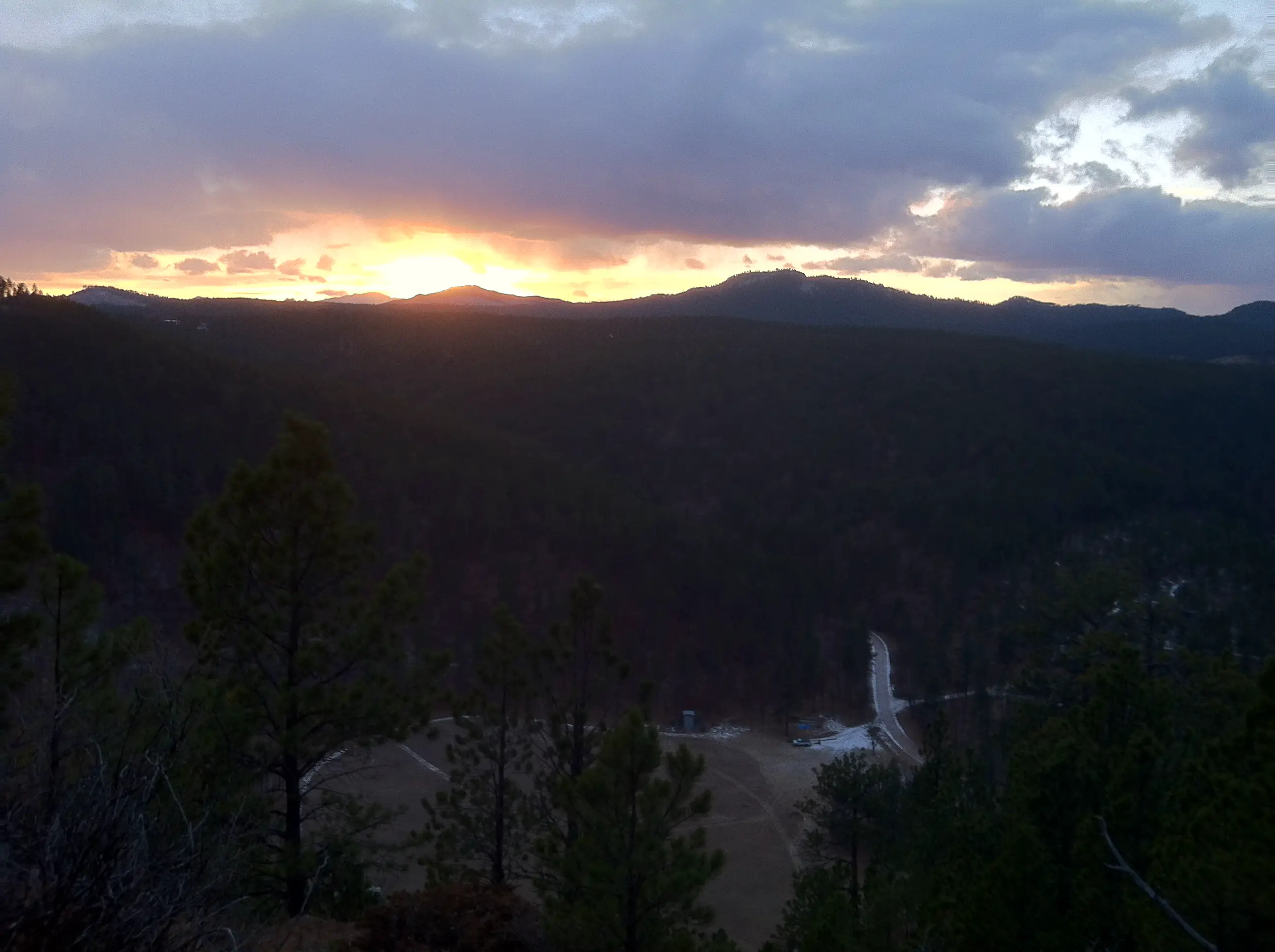
This area is another example of the complicated, frequently-contrasting weather you can have in the Black Hills.  On several occasions we’ve experienced temps in the single digits to low teens in the lower elevations–but it can feel almost balmy with temps in the mid-twenties at Big Hill (that equates to perfectly comfortable conditions when skiing, in the sun, with little wind.)  This contrasting weather is due to a temperature inversion.  Put in simple terms this basically means warmer air is lighter and floats over cooler air.  This makes it warmer the higher you go in elevation. (If you want a more scientific explanation you’ll have to track down Mr. Trekker. 😃)

Snowshoeing vs. Cross-Country Skiing

Snowshoeing is great fun, but it’s HARD work depending on snow conditions (this activity and mountain biking are literally the hardest workouts I’ve ever done). 

Cross-country skiing, in contrast, requires far less exertion (and I’ve found that working out with an elliptical during the week is perfect training for this sport as the body motions required for both are very similar). 

Anyone who can walk can snowshoe.  It takes a little skill to keep from stepping on your own shoes, but once you master that, you’re golden.  Cross-country skiing, on the other hand, is FAR more difficult.  It requires balance, finesse, and the ability to relax and just “go with the flow”–all characteristics I SORELY lack (“sore” being the keyword as that’s often the result of my endeavors 😝). 

I would also argue skiing is more dangerous as you’re moving faster and are more likely to slip/twist something when you fall (and you WILL fall).  If you fall while snowshoeing, you pretty much just end up on your rump or fall to the side into a cushioning snowbank.  It may be cold, but not really injury-inducing (although your snowshoe could become stuck under a buried log, as I found out at Big Hill one early, spring day…😮 )  

We’ve gotten pretty good at most outdoor sports we enjoy, but with skiing, we’re still very much beginners.  Standing on a thin object that’s meant to glide quickly and effortlessly does not lend itself to keeping one’s balance.  Neither do skis that are as long as I am tall and stick out several feet both in front of and behind you.  Not only do you have to learn how to move around without stepping on yourself (similar to snowshoes) but you have to do it while each leg is trying to slide in an opposite direction. 😝

So, if you’re enjoying a snowy weekend at Big Hill, and you see a bumbling idiot barely able to stay upright on their skis..it just might be me! 😇

The best trails at Big Hill

Dirt trail crossing a brown-grass meadow with yellow apens and evergreens in the background, all under a blue sky.For beginners, I strongly recommend starting with the initial Loop A.  It’s a short, groomed trail that just goes in a small circle around a meadow/forested area near the front of the Big Hill trail network.  It’s fairly flat with only a few short rises and dips and doesn’t offer much opportunity for falls (though, full disclosure, I have fallen here 😝). 

There is another Loop A that goes farther out.  This option is also usually groomed. It’s also good for beginners once you get a little more confidence as it’s solely a “green” route–meaning it’s considered “easy”.  There are a few steeper slopes, one especially on the right-hand (western) side of the loop as you’re heading out.  I’ve had my worst spills in this area and though they were frightening, I’ve left without injury–so far–and haven’t even felt very sore the next day. (A surprise as I was sure my ankles were being ripped from my body when I fell. 😮 )

What will you see at Big Hill?

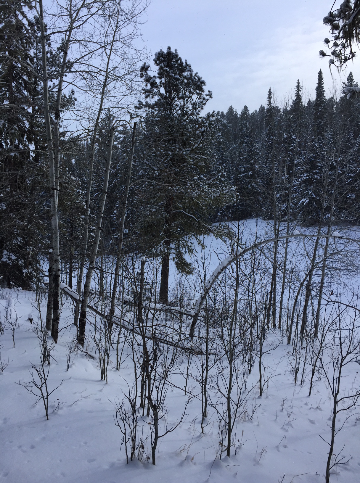
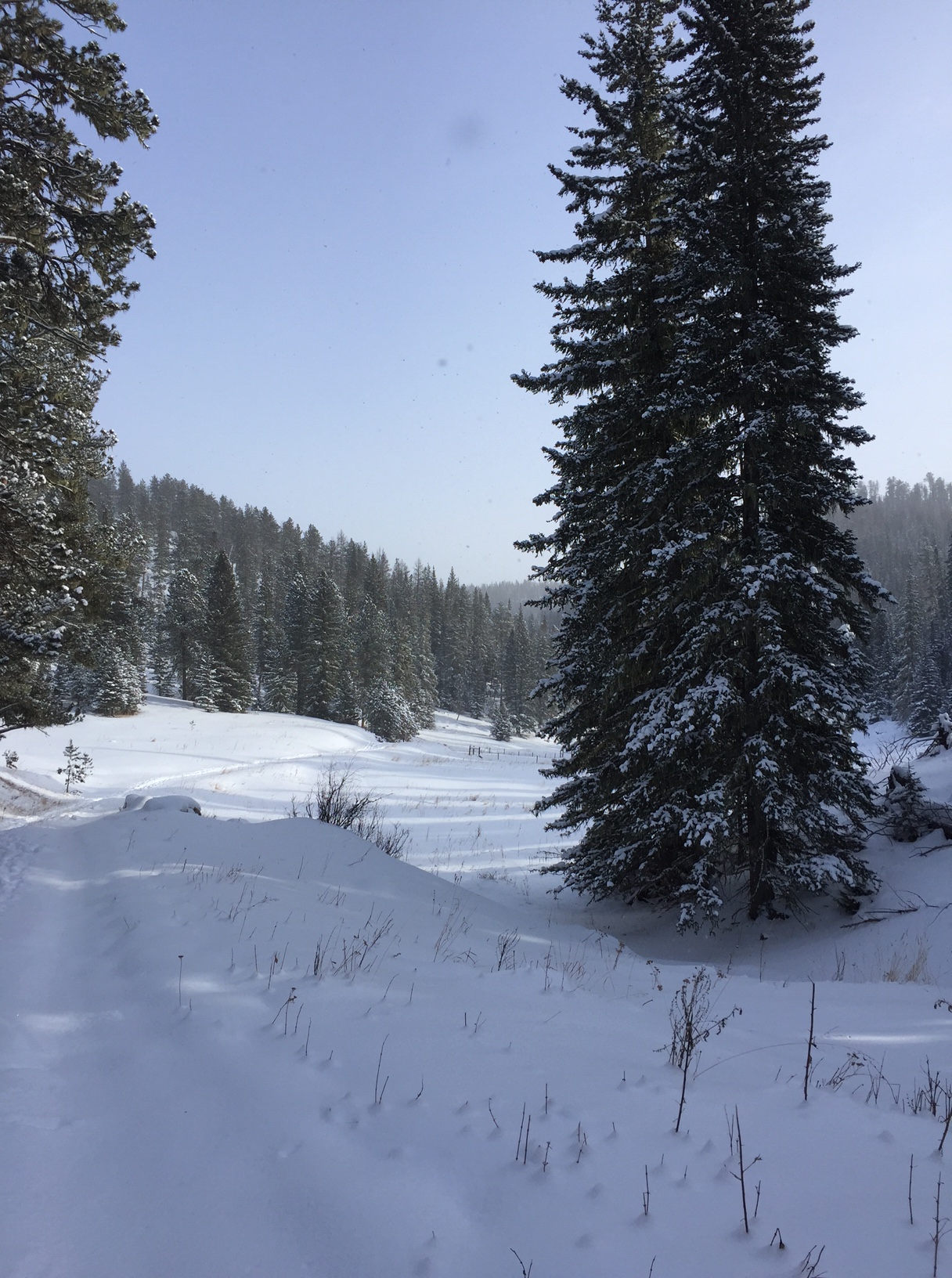
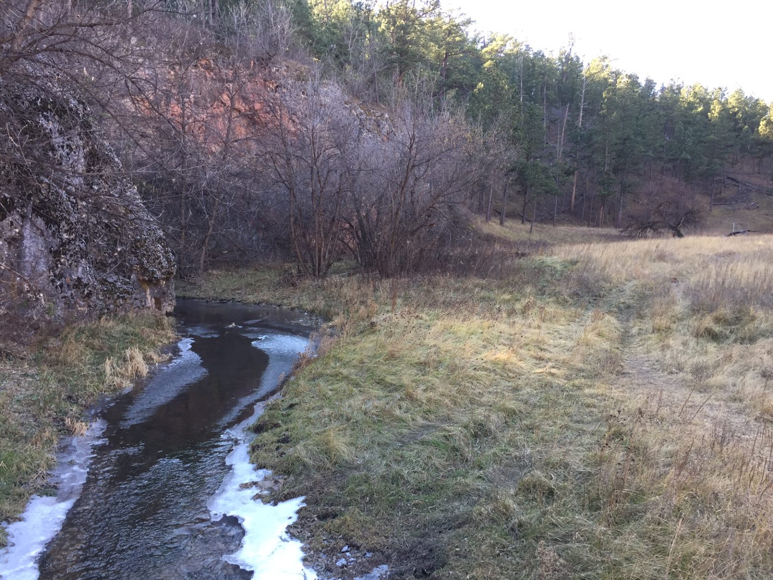
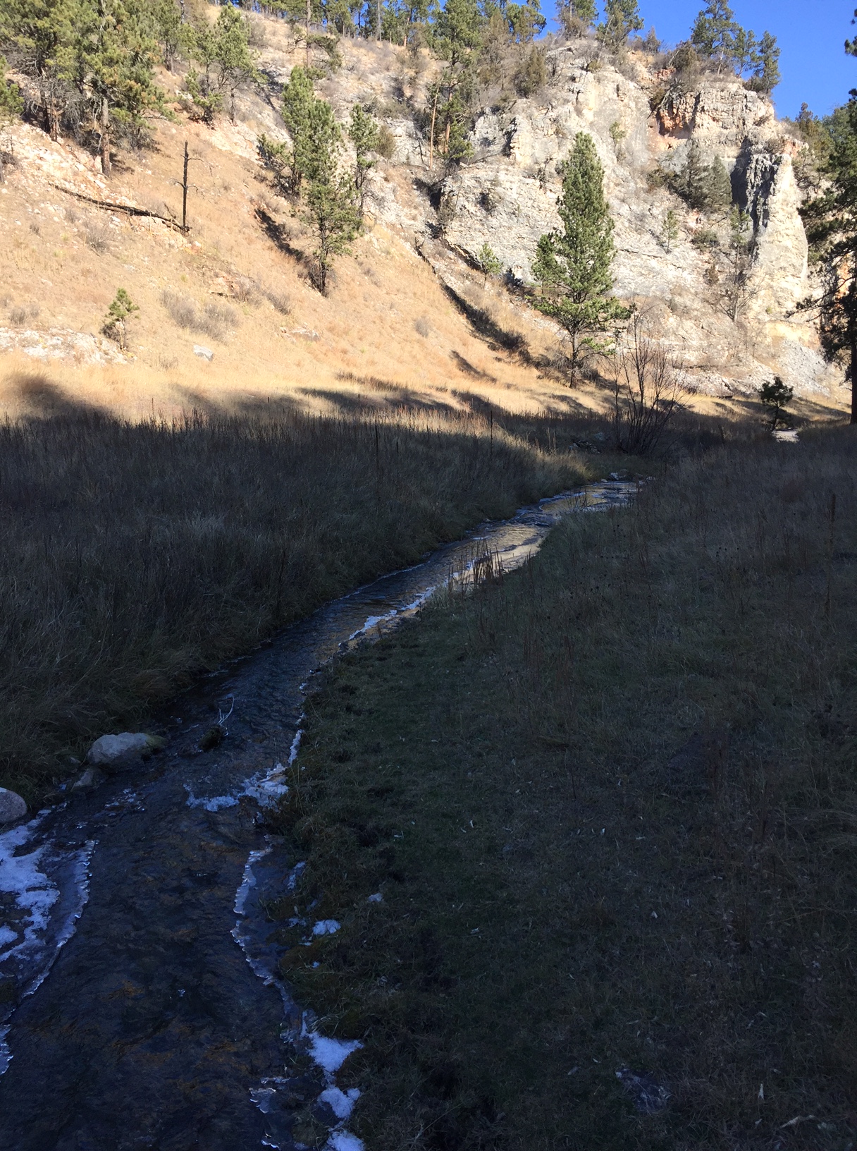
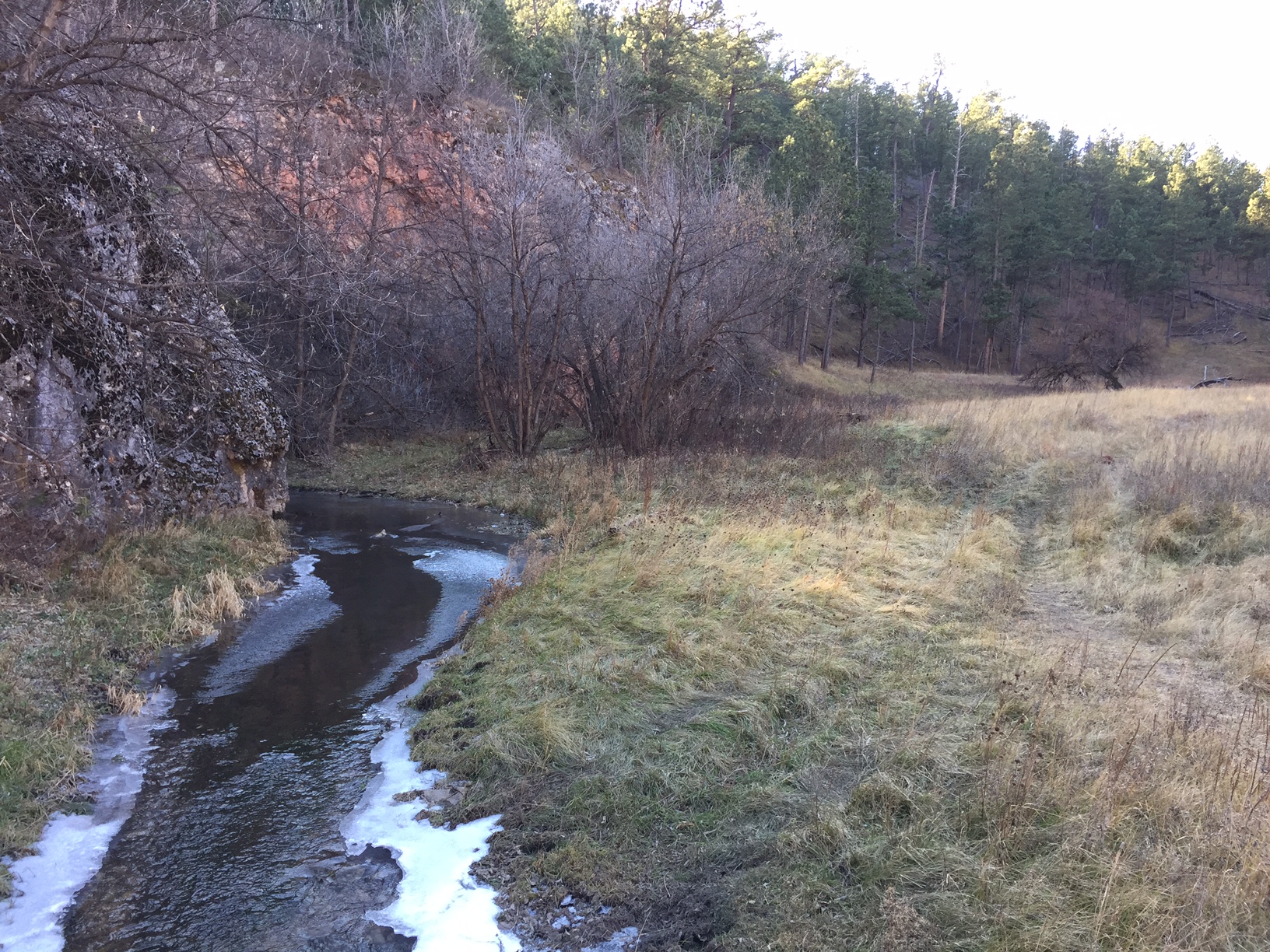
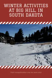
Big Hill is absolutely BEAUTIFUL no matter the time of year.  It offers a mixture of forested and meadowy areas that contain leafless deciduous and evergreen trees, all covered in a soft blanket of snow during the winter.  On sunny days you’ll frequently hear birds chirping in the trees, and the ever-present, South Dakota breeze rustling through the pines provides a respite from the deafening, snowy silence.  In the fall, this area offers a warm glow with the bronze meadowgrass, and glowing, yellow aspens all standing in contrast to the evergreen trees.

Brown meadowgrass in the foreground with a hillside of yellow aspen trees (intermixed with evergreens) in the background.

This recreation area is far enough from civilization that it offers an incredibly peaceful environment.  It is sullied in the winter only by the occasional roar of snowmobiles that also enjoy nearby trails–though not these exact trails. (Fortunately, they focus on the region on the other side of the road so they are usually only really heard when you are near the parking lot.)

If you’re looking for a great place to enjoy some snow sports that is both beautiful, easy to reach, and that offers fun options for everyone, check out Big Hill!

Have you tried the Big Hill Recreation Area?  Tell me about your experience in the comments! 


Did you enjoy reading this post?  Pin it!

Snow-covered meadow in the foreground; green, pine trees in the background. Pin reads, "Winter Activities at Big Hill in South Dakota."


Like what you read here today?  Please feel free to leave a comment, like or share this post!  Add your email at the bottom of the page, or the sidebar to the right, to be notified when a new post is published.  By signing up for the email list, you will also receive a free copy of the Tranquil Trekker’s Top 10 Tips of Trekking Do’s and Don’ts!

You can also follow the blog on social media by clicking the links below!

Facebook

Twitter

Instagram

Pinterest

Lookout Point Trail at Wind Cave National Park

In this post, I discuss activities available above-ground at Wind Cave National Park.


Wind Cave National Park, located near Hot Springs, South Dakota, is best known for the sites it offers below-ground.  However, it also provides plenty of opportunities for hiking above-ground, as well!

Hiking trails at Wind Cave National Park

There are several trails found throughout Wind Cave National Park and countless route combinations and loops can be made depending on how long of a hike you are interested in.  These include the Rankin Ridge Trail, and one of our favorites, a loop formed by the Lookout Point Trail. 

It includes a short skirt where the Sanctuary/Centennial Trails run together and then continues on to the final portion of the hike which is solely comprised of the Centennial Trail.  This is all located in the southern portion of the park. 

Where is the trailhead for the Lookout Point Trail?

The trailhead we use for this hike (the Norbeck Trailhead) also marks the southern terminus of the 111-mile Centennial Trail.  This route traverses the spine of the Black Hills.

The Lookout Point trailhead can be found off Route 87 in Wind Cave National Park.  There are numerous ways to reach it but we usually take SD 79 south out of Rapid City, to US 18 west heading to Hot Springs.  We then take US 385 north out of Hot Springs until it connects with Route 87 north. 

To return to Rapid City you can retrace your steps, or if you’re interested in a longer, more scenic route, you can choose from a variety of options north through Wind Cave, Custer State Park, and the Black Hills.  Have I mentioned a map is helpful when adventuring in the Hills? 😉

What You Will See on the Lookout Point Trail

The Lookout Point loop can be completed in either direction though we prefer starting on the Lookout Point Trail (the climbs going this direction are less steep).  The hike starts off along a small creek and then almost immediately takes you up a steep hill (fortunately the climb is of relatively short duration and once you reach the ridge above, the terrain is fairly flat for some time).  

The correct route through this area isn’t always clear due to  NUMEROUS game trails left by the many four-legged critters traveling to the creek for water, so be very watchful so as not to lose the path.  The signage on the trail is decent but (even with previous experience) we’ve ended up following well-worn buffalo paths instead of the actual trail.  Luckily, we were able to recognize our error early on and quickly correct it.

Once you jump on the Sanctuary Trail portion of the loop (about halfway through), the ecosystem makes a clear change as you descend from the open grassland of the prairie into a forested canyon.  The descent is rather steep so take care not to slip on loose scree (or if ice is present). 

See if you can spot an unusual item in the Black Hills, cedar trees!  They appear to favor this protected, damper area. 

This portion of the trail is also characterized by the rock cliffs towering far overhead. 

An icy creek traverses the bottom of a canyon. Dry, brown grass and green, pine trees speckle the rocky, canyon wall.
The creek through the canyon

The bottom of the canyon consists of a long, narrow meadow.  When you reach the floor of the canyon, be sure to turn left onto the Centennial Trail to keep to the loop (a right turn will put you on the Highland Creek Trail). 

There are several prime lunch spots along the creek and watch for remnants of the ungulates (deer and elk) whose bones are scattered throughout this area (whether they met their demise by flood or they were drug here by fanged animals, we will never know). 

Follow the canyon and its babbling creek for about two miles until you emerge dramatically into an open meadow.  A portion of the Centennial Trail will soon break off on an uphill branch to the right, while you will continue straight along the creek and eventually the trail will curve to the left.  It then ascends one final rise which brings you back to the trailhead.

A winter scene. A small, icy creak meanders through a brown-grass meadow with bare trees on its banks and green pine trees in the background.
The creek through the meadow (notice how it is just beginning to freeze)

Wildlife on the Lookout Point Trail

Be sure to keep VERY ALERT for buffalo in this area.  They are numerous and we see them every time we hike in this park.  It is rare that we don’t have to alter our route to skirt a buffalo (or 30).  They seem to favor the same trails the humans use so be prepared to go off-trail and give them a wide berth. 

Fortunately, this area is highly visible, open prairie so even if you have to go well off-trail you’re usually able to keep at least one trail marker in sight.  It’s always advisable to bring a topographical trail map and compass when hiking these areas (or anywhere, really) to assist you in maintaining your direction if you need to go off-trail. 

Always remember, if the animal is reacting to you (acting agitated in any way, huffing, stomping its feet, etc.) you are TOO CLOSE and should move away (calmly and slowly) as soon as possible.  As long as the animal’s space is respected there are rarely any altercations but it should always be remembered that these are wild (not to mention LARGE) animals and they may react aggressively if they feel threatened (this is especially true in the spring when calves are present). 

A brown-grassy hill dotted with pine trees, with two dark specks resembling buffalo at the top, all under a clear, blue sky.
Buffalo on the ridge, near the end of the hike

On this day’s hike the buffalo we saw didn’t even bother to get up and stop chewing their cud as they watched us wander by.  We have had buffalo turn to follow our every step until we’re out of sight when calves were present (and we were intentionally skirting them at the time).  We’re also often scolded by prairie dogs for “invading” their area when altering our course away from the buffalo. 

This brings up another safety point, give the prairie dogs space too.  According to the Forest Service, their fleas carry plague (yes, as in the Black Plague) which can be passed to you if you get too close and are bitten by said flea.  Also, the animals may bite if they feel threatened, though they aren’t usually aggressive.  In addition, rattlesnakes and black widow spiders favor abandoned prairie dog holes (not to mention these holes offer a prime opportunity to twist an ankle if you aren’t careful) so it’s best to treat these “prairie dog towns” with respect, as well. 

Be sure to keep a sharp eye out for coyote, elk, and deer in this area as this is prime viewing territory for that type of wildlife.  Be careful to also watch trail signs at junctions in these locales as there are several intersections and it is easy to get on the wrong trail.  

To Conclude

 This entire loop can be completed in about three hours (dependent on your skill level, speed, and how many sightseeing breaks you choose to take).  The trail is relatively easy with only short, moderate-difficulty climbs and is around five miles in distance for the entire loop.  This area is also lower in altitude than many areas in the Hills and may be easier for the “Lowlanders” to handle. 😉  In the summer, be prepared for unrelenting heat and little shade on the prairie section (though the ever-present prairie wind will offer some respite).

So, when visiting Wind Cave, don’t let the amazing sights below ground deter you from enjoying the numerous opportunities available above ground as well!

Have you hiked in Wind Cave? Tell me about your experience in the comments! 


Did you enjoy this post?  Pin it!

A winter scene. A small, icy creak meanders through a brown-grass meadow with bare trees on its banks and green pine trees in the background. Pin reads, "Lookout Point Trail at Wind Cave National Park"


Like what you read here today?  Please feel free to leave a comment, like or share this post!  Add your email at the bottom of the page, or the sidebar to the right, to be notified when a new post is published.  By signing up for the email list, you will also receive a free copy of the Tranquil Trekker’s Top 10 Tips of Trekking Do’s and Don’ts!

You can also follow the blog on social media by clicking the links below!

Facebook

Twitter

Instagram

Pinterest

Save

Save

Great Hikes in the Black Elk Wilderness

In this post, I review some hiking trails found in the Black Elk Wilderness, in the Black Hills of South Dakota.


The Black Elk Wilderness covers a portion of the central Black Hills, in the Mount Rushmore/Horsethief Lake portion of the Harney range (now the Black Elk range) of South Dakota.  There are some great hiking trails that traverse this area!

Hike the Horsethief Lake Trail to Grizzly Bear Creek Trail in the Black Hills

One great option is to begin at the Horsethief Lake Trail.  The trailhead can be found at the Horsethief Lake Fishing/Rec area which is located off of Hwy 244, west of Mt. Rushmore.

Note: this is one turnoff east of the drive for the Horsethief Lake Campground. 

There is a larger parking area right at the lake. The trailhead is located at a small parking area just to the east of here–there is a sign. 

We took the Horsethief Lake Trail (Trail #14) to the Grizzly Bear Creek Trail (Trail #7) which traverses a lovely canyon area and parallels Grizzly Bear Creek for a time. 

This portion of the Black Hills is particularly vulnerable to storm damage as it was decimated by the Pine Beetle plague in recent years.  Due to this, there are several hazards to watch out for in this area, including blow-down sections of trees and falling limbs/trees if windy conditions are occurring. 

What you’ll see hiking through the Black Elk Wilderness

The hike was lovely.  Much of it traverses canyons, surrounded on all sides by towers of granite.  There are several beautiful, lookout points with views of the surrounding Hills and the prairie stretching far to the east.  The trail is in a largely wooded area so it would be fairly shaded in the warmer months, and as you climb there is usually at least a moderate, cooling breeze (that can be downright chilling in the cooler months). 

Portions of this trail are open to horses as well so be watchful for the equines (and be careful not to step in what they leave behind). 

The portion of the trail we completed was of moderate difficulty, was well-developed, and was fairly wide.  There weren’t many rocks/large steps to negotiate and while there were few trail markers, they weren’t needed as the path was evident. 

It should be noted that the lower part of the Horsethief Trail is frequently wet and muddy so waterproof shoes/boots are suggested.   In the winter/early spring, thanks to snow-melt and the nearby creek it is often extremely icy and slick.  This portion of the trail is located in a canyon under a canopy of trees so it doesn’t get much sunlight to melt the ice.   We have seen several inches of thick, hazardous ice on this trail in the early spring that required our Yaktrax to navigate safely.

Other trail loops in the Black Elk Wilderness

If you’re up to the challenge, a loop can be made of this trail using the Horsethief Lake Trail to the Grizzly Bear Creek Trail to the Centennial Trail (Trail # 89). This will then eventually take you back to the Horsethief Lake trail almost at the Trailhead (the loop can be completed in either direction).  This entire loop would be around 10 – 12 miles.  While this is within our ability level, we weren’t sure about the steepness/difficulty of the remainder of the trail, and daylight was growing short so we chose to stop at about the halfway point, have some lunch along the creekside, and return the way we had come. 

Numerous trails connect throughout the Harney (Black Elk) range. Depending on your skill level and how long you are willing to commit to being out in the wild you can hike any combination of these, ranging from a simple hike of a few hours to a backpacking trek of several days.

For those non-locals who may be wondering why I keep referring to this area as the Harney (Black Elk) range, I’ll explain.  Harney Peak is the highest mountain in the Black Hills (and the tallest east of the Rockies).  It stands out among the surrounding peaks of the Harney Range.  The Black Elk Wilderness area comprises much of this range. 

Black Elk was a Lakota, Holy Man who lived around the turn of the century, the Wilderness area is named after him.*  A few years ago, it was decided that Harney Peak would be renamed Black Elk Peak in honor of this great man and as a tribute to the local, Lakota culture.  As it has been such a short duration of time since the change, many of the books/maps regarding this local area (and the signs currently posted) will still carry the former name of the mountain/range.

*If you’re a history buff or just interested in American Indian culture, I highly recommend the book Black Elk Speaks by John Neihardt.  It’s a biography of the Holy Man’s life based on interviews Neihardt completed with him in his final years. It is a very interesting, fairly objective account of a man growing up in a changing world.  It discusses Black Elk’s nomadic life before General Custer and his soldiers arrived and the way this life changed after gold–or as Black Elk called it, “the yellow metal that makes white men crazy”–was found in the Black Hills.

Below are two pics that Mr. Trekker took of our hike:

Rock spires rise above the green, pine forest, all under a clear, blue sky
The granite spires surrounding the canyon we were hiking in
A fall scene. A small creek running through dry grass and bare trees, with green pine trees in the background, all under a clear, blue sky.
Grizzly Creek

Save/span</

For more information on other trails available in the Black Elk Wilderness, click here.

Have you hiked this portion of the Black Elk Wilderness? Tell me what you thought of the beauty here in the comments! 


Did you enjoy this post?  Pin it!

A fall scene. A small creek running through dry grass and bare trees, with green pine trees in the background, all under a clear, blue sky. 

Pin reads, "Great Hikes in the Black Elk Wilderness. Several hikes not to miss on your next trip to the Black Hills of South Dakota."


Like what you read here today? Please feel free to leave a comment, like or share this post! Add your email at the bottom of the page, or the sidebar to the right, to be notified when a new post is published. By signing up for the email list, you will also receive a free copy of the Tranquil Trekker’s Top 10 Tips of Trekking Do’s and Don’ts!

You can also follow the blog on social media by clicking the links below!

Facebook

Twitter

Instagram

Pinterest