My posts!

Conquer Lengthy Trails in Small Portions

In this post, I discuss how to build your self-confidence by “connecting the dots” and finishing portions of trails you haven’t conquered in the past.


Today I’m going to discuss the incredible feeling of accomplishment that comes from completing a lengthy trail in small, manageable portions, regardless of how many tries, trips, or years it takes to achieve that goal. 😁  Below I outline several different trails we’ve done sections of in the past and have finally “connected-the-dots” on.

Willow Creek/Rushmore Trail (Trail #5)

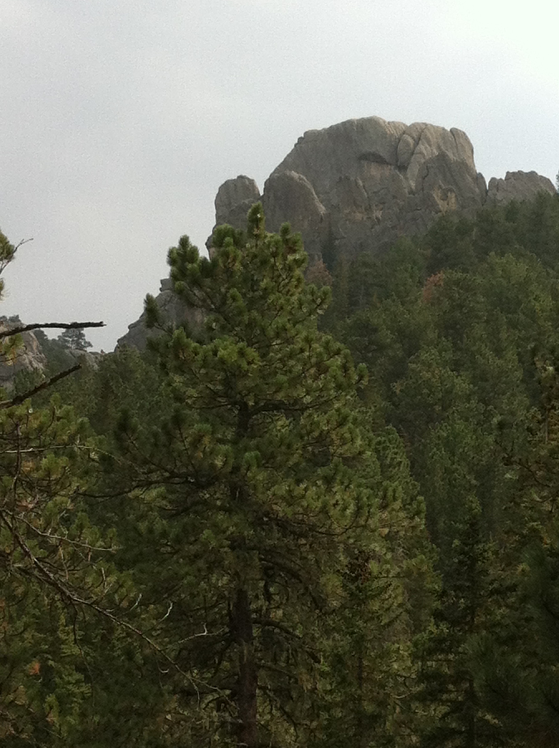
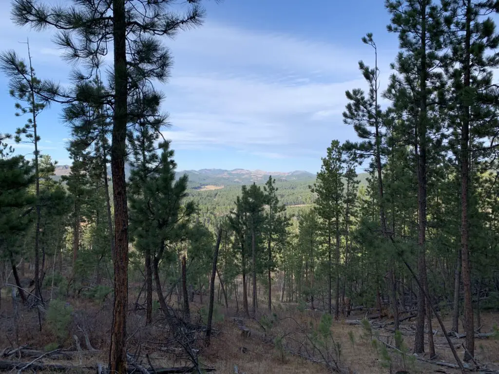
View through the woods of pine trees and tree-covered mountains in the background

 We completed the Willow Creek/Rushmore trail (Trail #5,) all the way to where it meets up with the Harney Trail {Trail #9, the hard way up Black Elk (formerly Harney) Peak}.  

This is really just a connector trail and not that big of a deal (though it’s a nice trek with lovely views).  It’s just such an accomplishment when you complete these various routes.  

The Willow Creek/Rushmore Trail was one I’ve been wanting to do for years.  Every time we’ve hiked the difficult Harney Trail (Trail #9), we’ve always used the Willow Creek turn-off as a bit of a landmark to watch for.  So, to finally connect the two was such a delight! 

This accomplishment was especially exhilarating as it was already getting snowy up that way and some of the knee-deep snow was a challenge to hike through–we hadn’t taken snowshoes that day as the lower elevations didn’t have any snow and we didn’t know how much we’d be encountering.

Eagle Cliff Trails in the Black Hills

After numerous tries throughout multiple seasons, we finally completed several sections of various trails in the Eagle Cliff area. 

We’ve enjoyed parts of these trails in previous years–sometimes skiing, sometimes snowshoeing, sometimes mountain biking–but we’ve never fully connected them all.  In the past, we failed to complete the entire loop as we’ve always turned around due to being tired, being cold, or losing the trail.**

This time, however, we started with the Hamburger Snowshoe Route (who comes up with these names?! 😝); took that to Lily Park Trailhead; then continued on to the Holey Rock Trail.  We then looped back to the Bratwurst Ski Trail and brought that all the way back to our starting point–not to worry, we stayed off the ski trails. 😇 (Another group had, kindly, already blazed a snowshoe trail alongside the main road that we were able to follow. 😁)

**As much as we love the Eagle Cliff area, we’ve frequently lost our trail up there.  This has occurred both in the summer and the winter months and has actually been worse in the summer (the tall grasses don’t do much to suggest a trail.  At least in the winter, there are, oftentimes, other tracks to follow!)  Fortunately, we’ve never gotten lost to the point of being in trouble, we were always able to retrace our steps and find our way back.  Sometimes too, we’ve been able to spot the valley we were seeking from a ways off and reach it via off-trail routes.  

I do believe some of this was due to poor signage, the old maps were difficult to read and often sun-faded, or they were an inaccurate match with the current trails that year.  The new ones seem far more clear.  The trail blazes on the trees also seem to be closer together and better-marked now.  It could also be that we’re finally getting comfortable with the area as we’ve completed so many of the trails.  

Related posts:  Cross-Country Skiing at Big Hill, Spearfish, SDWinter Activities at Eagle Cliff

To Conclude

The point to discussing all this is that, if there is a difficult or lengthy trail (or set of trails) you’re interested in, but they seem too challenging or long for you to accomplish in one sitting, complete them in sections!  It still counts as mastering the entire monster, even if you don’t do it all in one try!
Start from one end and try to make it halfway.  Then, on another occasion, start from the other end and make it halfway again.  You just finished the entire thing, even if you only ever did half a section at a time!  

I have a few other, personal examples of this in relation to local trails.  The Trekkers are aiming to hike the entire, 111-mile-long, Centennial Trail that traverses the length of the Black Hills.  We also want to bike the entirety of the Mikelson Trail, the 109-mile-long, graded, gravel path that spans the Hills, from north to south.  It follows an old railroad grade, leftover from the Gold Rush days of yesteryear.   It’s taken us more than a decade, but so far we’ve completed over half of the Centennial Trail and almost the same amount for the Mikelson.  

With routes that are quite lengthy, numerous trailheads often split them up into more manageable sections.  Completing one several-mile section every few months is far simpler than attempting an entire 25-mile trail all at once.  

We’ve even split up single sections before.  There is a 14-mile portion of the Mikelson trail that we’ve just never been able to finish all at once.  We HAVE completed it using the “halfway method” mentioned above, starting from each direction, though.  

This technique is also a good way to keep your spirits and enthusiasm up.  It’s much easier to stay motivated if you’re not trying to psych yourself up for a crazy excursion, but instead, a fun, shorter, one-day outing.  

With this post, I want to stress that you don’t have to be a marathon recreator.  It’s perfectly reasonable to be more of a “sprinter”, who feels a five-mile outing is a perfectly acceptable definition of a “full day”.  When you’re out on the trail you aren’t competing with anyone or anything else (with the exception of Mother Nature, of course).  Your only rival is yourself. So, don’t compare yourself to others.  The only thing that matters is that you’re improving your skills, your strength, and your health–both mental and physical–along with it.  

The other caveat is, of course, that you’re having fun!  As long as you’re getting out, connecting with the natural world, working off the steam of any built-up, negative energy, and you’re accomplishing the goals you have set for yourself, that’s the only thing that’s really important.  

You’ll find achieving goals is also quite the confidence booster, as you’re pushing yourself and meeting challenges. (If you are the marathoner-type person who can go out and accomplish 20 miles in one sitting, mad points to you too! 😉)

So, what are you waiting for?  Get out there and accomplish some goals and in the process, boost your confidence by finishing​ what you start!   

Have you conquered lengthy trails in small sections?  Tell me about it in the comments!


Did you enjoy reading this post?  Pin it!
A wooden sign on a wooden signpost along a dirt path in the woods. Pin reads, "Conquer Lengthy Trails in Small Portions"


Like what you read here today?  Please feel free to leave a comment, like or share this post!  Add your email at the bottom of the page, or the sidebar to the right, to be notified when a new post is published.  By signing up for the email list, you will also receive a free copy of the Tranquil Trekker’s Top 10 Tips of Trekking Do’s and Don’ts!

You can also follow the blog on social media by clicking the links below!

Facebook

Twitter

Instagram

Pinterest


Hiking the Robber’s Roost Trail, Custer State Park

In this post, I review two adventures where we learned the value in seeking out the “boring” locales, even on “less-than-ideal” days.


Author’s Note: The Trekkers originally hiked the Robber’s Roost Trail in Custer State Park on a foggy, mild, January day.  Many of the pictures below are from that trip.  We have since returned in warmer weather and found it to be equally enjoyable so I’ve added a few more pictures! 

Is it cold out, or windy, or really hot, or raining…then it’s not a good day to spend outside, right?…or is it?

The Robber’s Roost Trail, in Custer State Park, can be enjoyed in almost ANY weather!

One thing anyone who lives near mountainous terrain can tell you is the weather can change at a moment’s notice–which can be both good and bad–and it can vary greatly between nearby locations.  The Trekkers have experienced this frequently. 

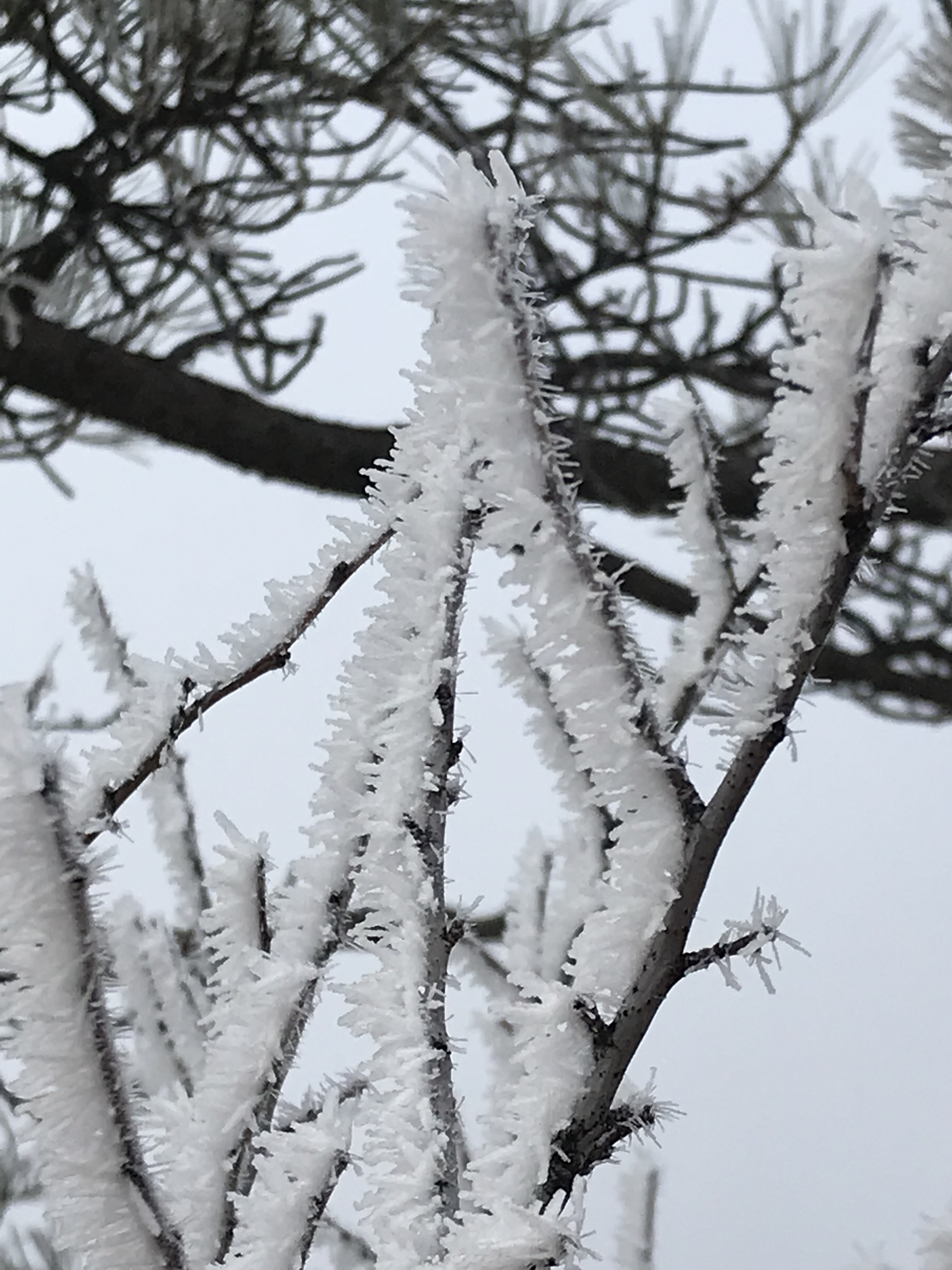
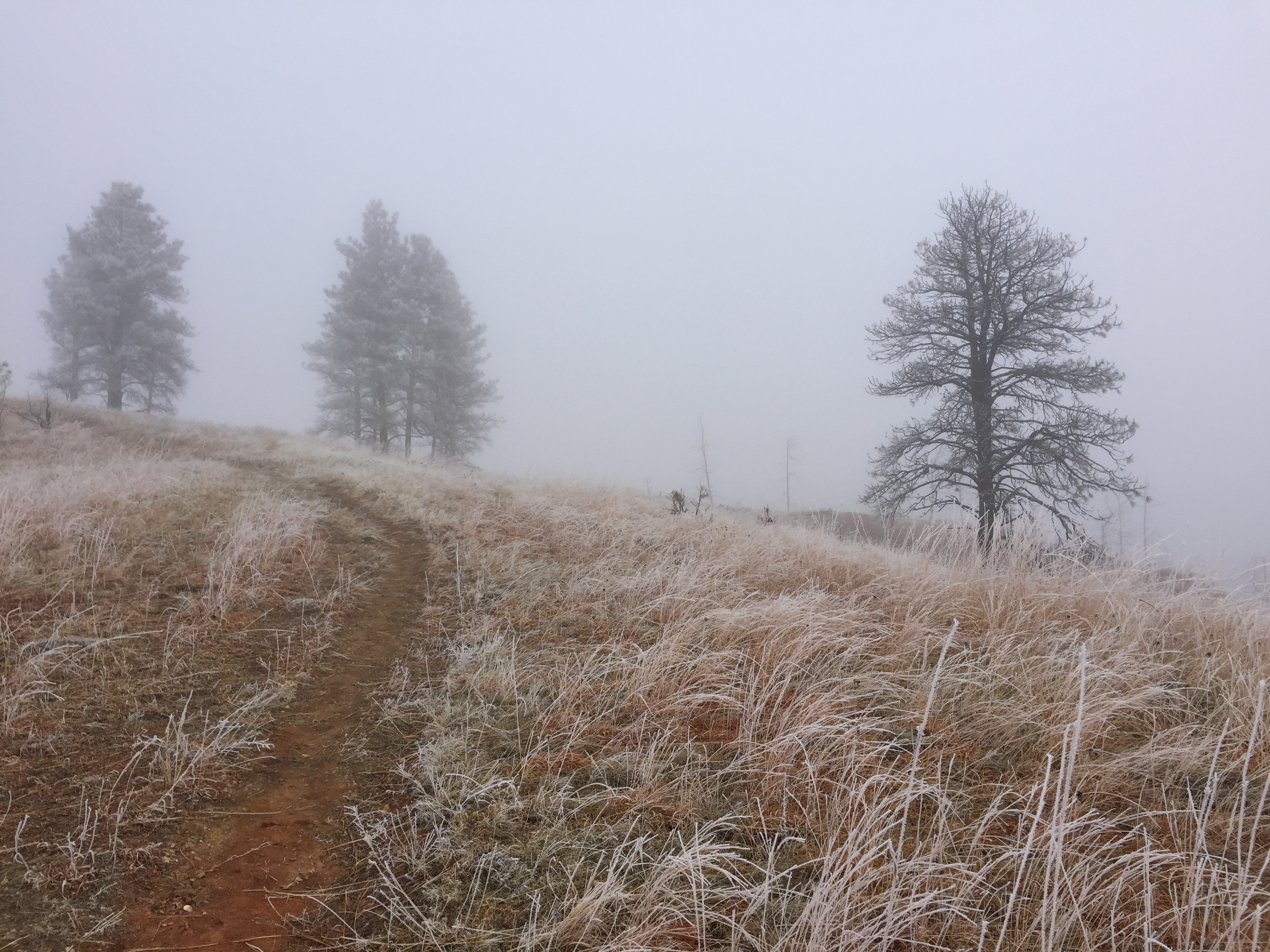
One particular January day our local area was socked in with heavy, freezing fog.  It was a damp, 30ish-degrees so it wasn’t exactly ideal for being out (though the hoarfrost on the trees was beautiful!)  

Previous experience has shown us how variable our local weather can be, dependent on terrain.  Due to this, we knew the weather in the Black Hills could be far different than what we were currently experiencing in town (being married to a meteorologist who can look up conditions in certain areas helps too 😉).  So, we decided to try out the Robber’s Roost Trail in Custer State Park.  We knew, at the worst, we would be able to enjoy a pretty drive and could get some nice hiking in, while at the best the weather could be FAR different as we climbed in elevation.  Boy, was it!

A Foggy Drive through Custer State Park

As we headed for the park, Mr. Trekker made the prediction that we’d emerge from the fog shortly after passing the entrance sign (where the road begins to gain in elevation)…he was right on the money! (I’m gonna channel Johnny Depp from Pirates of the Caribbean and state, “There’ll be no living with him now.” 😝)  

As we headed toward our trailhead, we made several stops for photo opportunities of the gorgeous hoarfrost the freezing fog had left behind.  I can’t quite explain why, but that natural occurrence utterly fascinates me.  The way the frozen crystals cling to the local flora can cause a smooth piece of bark to look almost furry.  It reminds me of the tiny hairs on a spider’s legs.  

Close-up view of bare tree branches that are covered in frosty needles of ice
Isn’t this incredible?

Close-up view of a dirt path that runs through a brown-grass meadow with frost covering the individual grass stems. Pine trees appear through fog in the background.

Close-up view of tiny pine trees in a brown-grass meadow with frost covering the individual grass stems. Pine trees appear through fog in the background.

Hiking the Robber’s Roost Trail

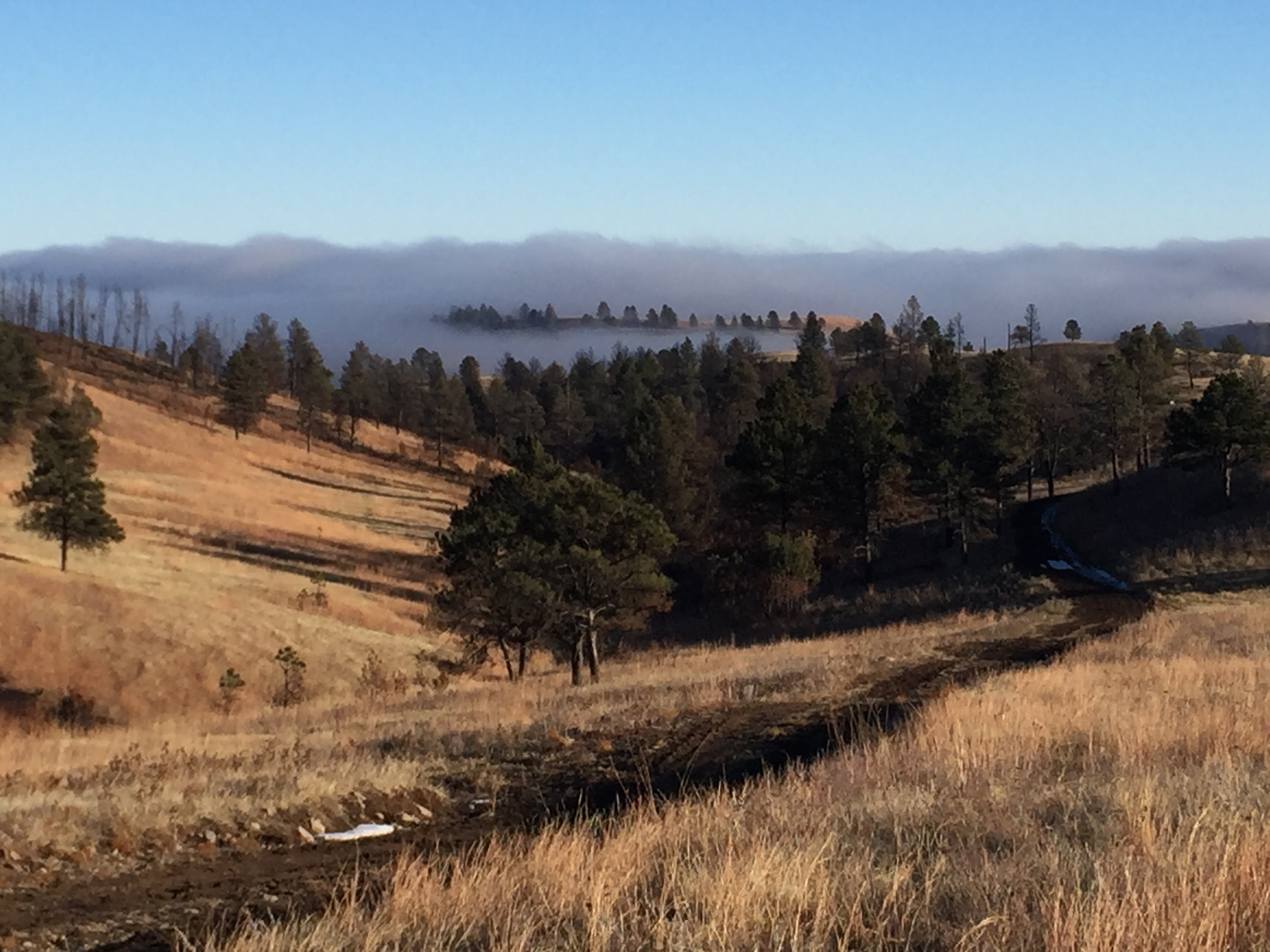
When we arrived at our trailhead, the sun was shining brightly, and continued to do so…for the remainder of the afternoon!  We had many opportunities to view the fog bank below us, in the lower elevations, but it never reached our altitude until the very end of our trek.  By then, we had returned to the car and were wandering about, seeking out prime picture opportunities.  😁

A dirt path runs through a brown-grass meadow with pine tree-covered hillsides in the background. Fog rises over the trees and hills in the far background, all under a clear, blue sky.
The fog is coming!

A brown-grass meadow with pine tree-covered hillsides in the background. Fog rises over the trees and hills in the far background, all under a clear, blue sky.

A single, pine tree sits on a brown-grass hill with smoke rising over the pine trees in the valley behind, all under a clear, blue sky.
It was incredible, watching the fog slowly rise from the lower elevations.

A brown-grass meadow with pine tree-covered hillsides in the background. Fog rises over the trees and hills in the far background, all under a clear, blue sky with a foggy sun shining through.

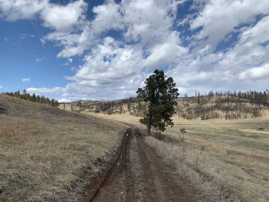
The trail isn’t anything exciting, it’s just an old fire road that winds through prairie land, around and over hills throughout the park, but we had a great time!  

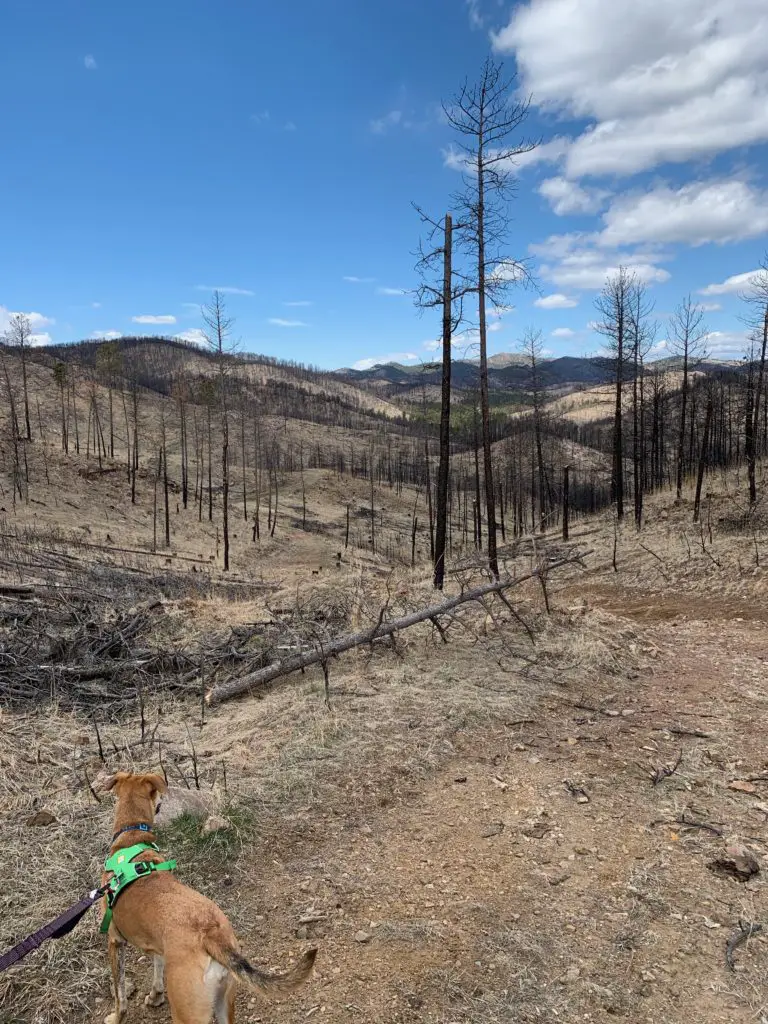
The scenery used to be more picturesque, but after the large, Legion Lake Fire that swept through this area in December 2017, this portion of the park now consists, mainly, of a burn scar.  For this reason, be aware, that in the warmer months, there is very little shade.  You should be prepared for hot conditions.   

If you’re looking for some additional fun activities to check out in Custer State Park, click here!

Where is the Robber’s Roost Trailhead?

The trailhead is located in the southern portion of Custer State Park, off of Oak Draw Road (just to the east of the Prairie Trail trailhead).  You can reach that road from the southern arm of the Wildlife Loop Road (Route 16A).  

The hike just follows an old, forest road, out-and-back, though it can be combined with other old roads, in the local area.  These would make for a great hike, horseback, or mountain bike ride. (We’re planning to try this route on our bikes soon!) 

A dog looks down a brown-grass hillside over an expanse of other hills in the distance, all covered by trees that appear to have been burnt.
Puppers enjoying the hike!
A dirt lane traverses a brown-grass hillside with a lone, pine tree on it's side and tree-covered hills in the background--some of the trees appear burnt.
You can see the burn scar in the distance

Below is a short video I took, at the end of the hike, of the coyotes’ haunting song that seemed to welcome the fog as it silently slipped back up the mountainside…(turn the sound up for this one!):

Below are a few more pictures of our trek.  Thanks, as usual, to Mr. Trekker, for several of the pictures!

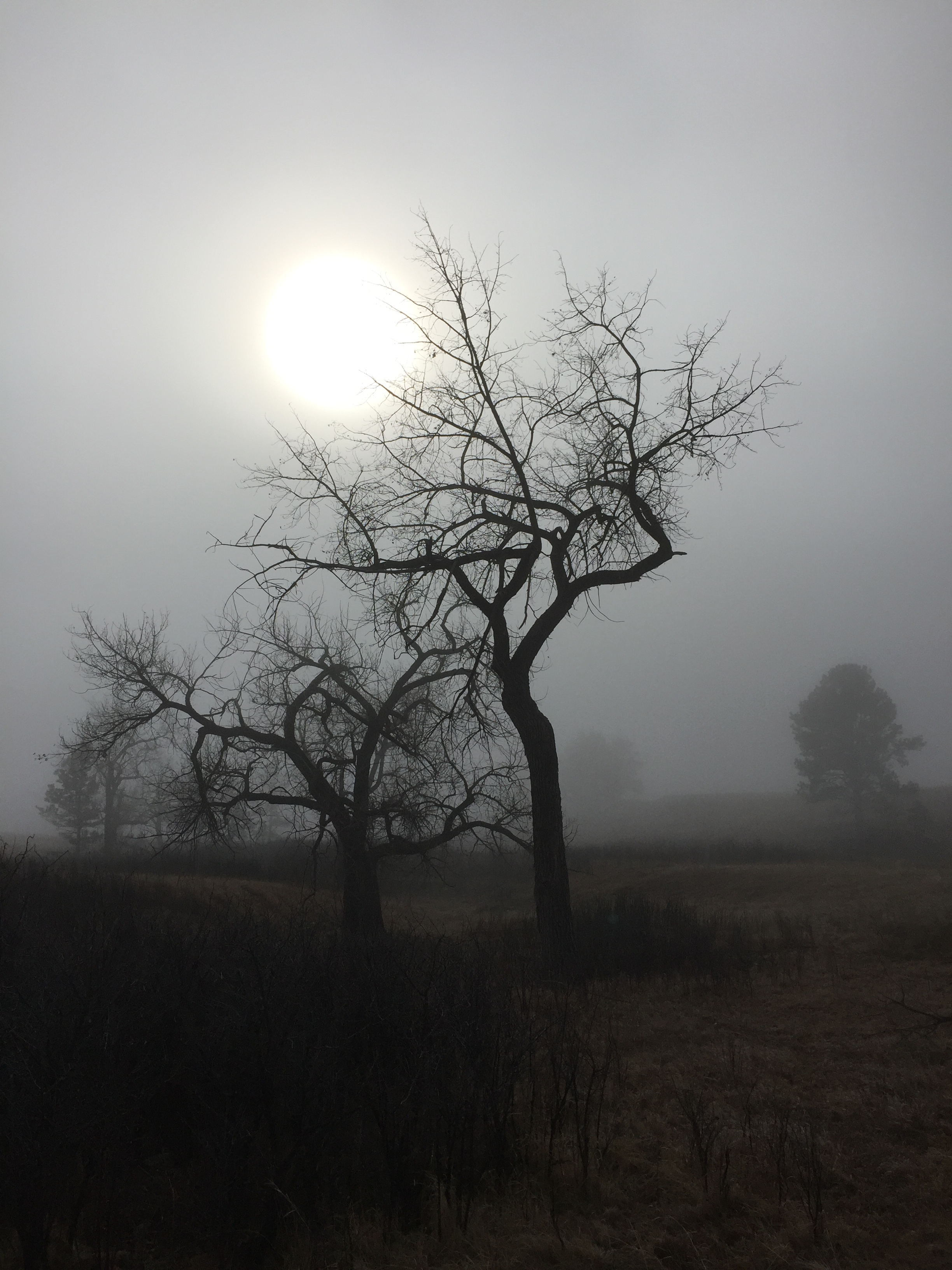
Picture looks black & white. Leafless trees and a milky sun appear through the fog

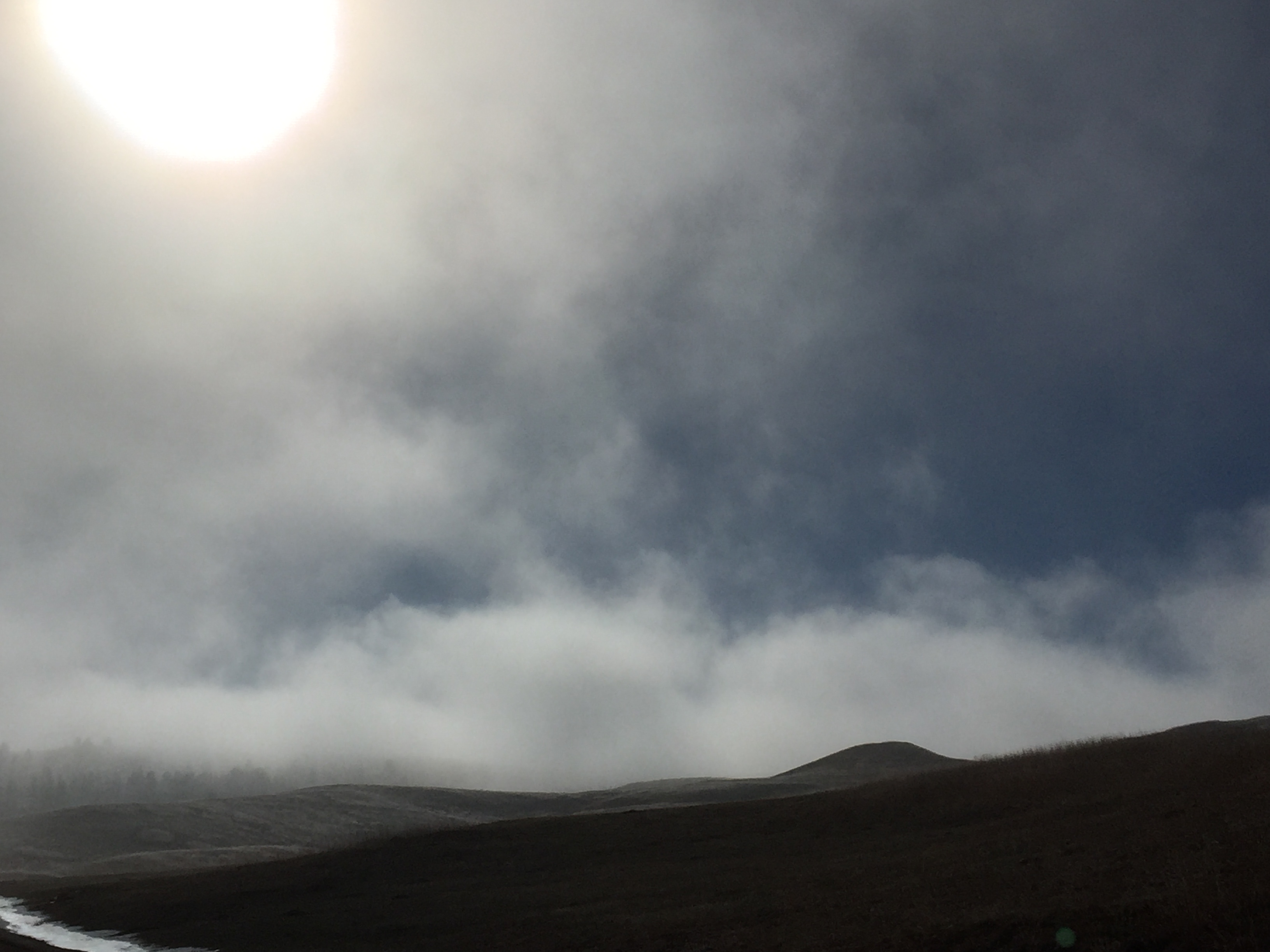
The sun shines through whispy fog as it rises above hills
To me, this picture feels otherworldly, like smoke rising from a scorched landscape (it is just fog).
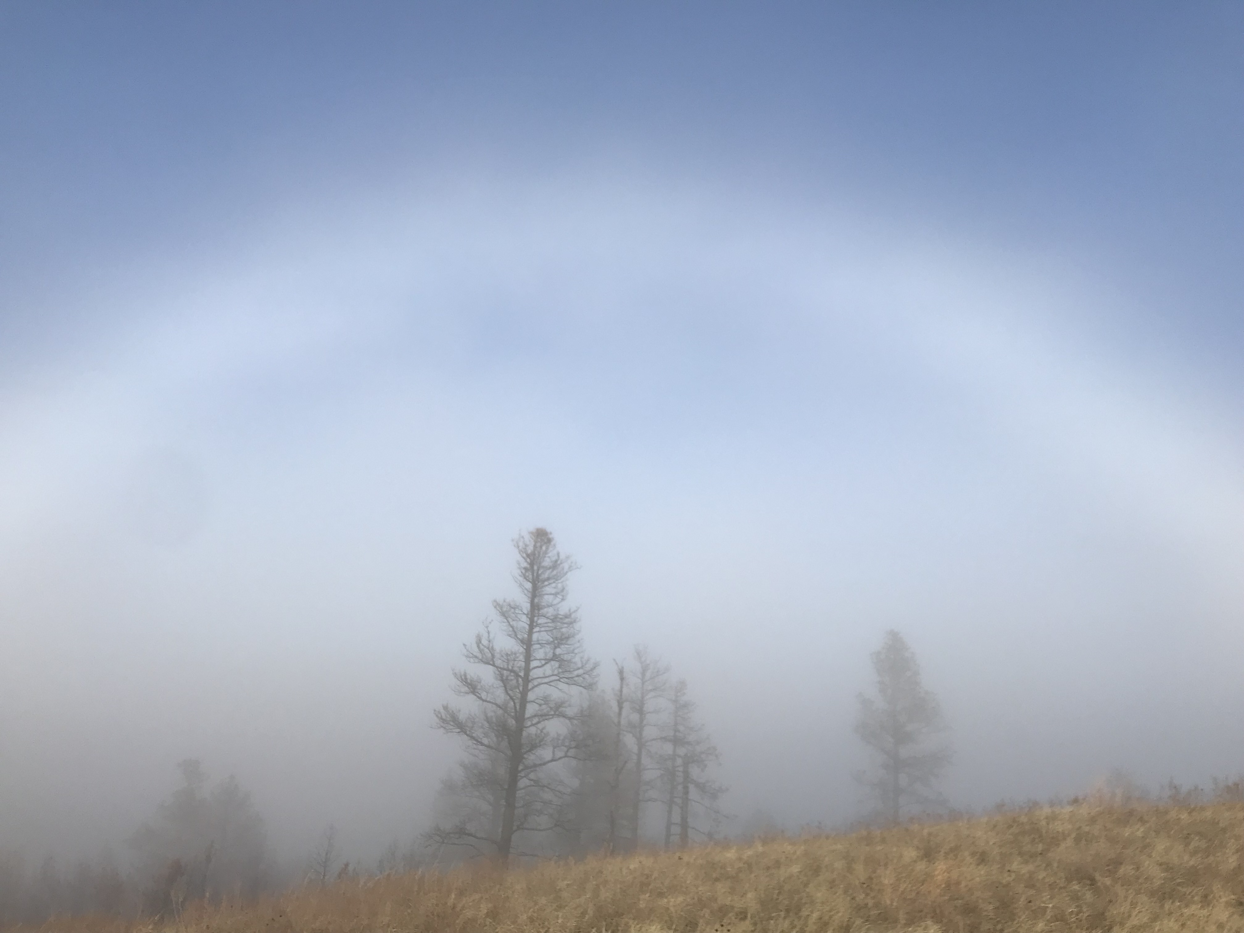
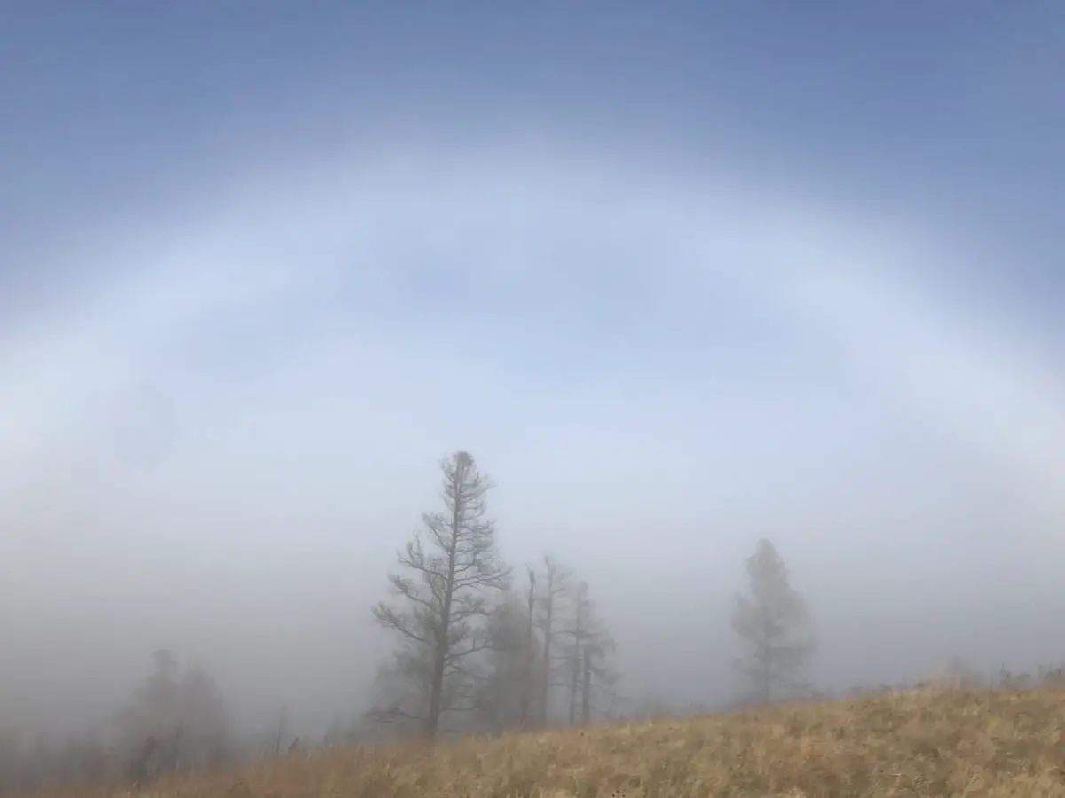
A fog bow forms over a fog-covered trees under a clear, blue sky
Fogbow!
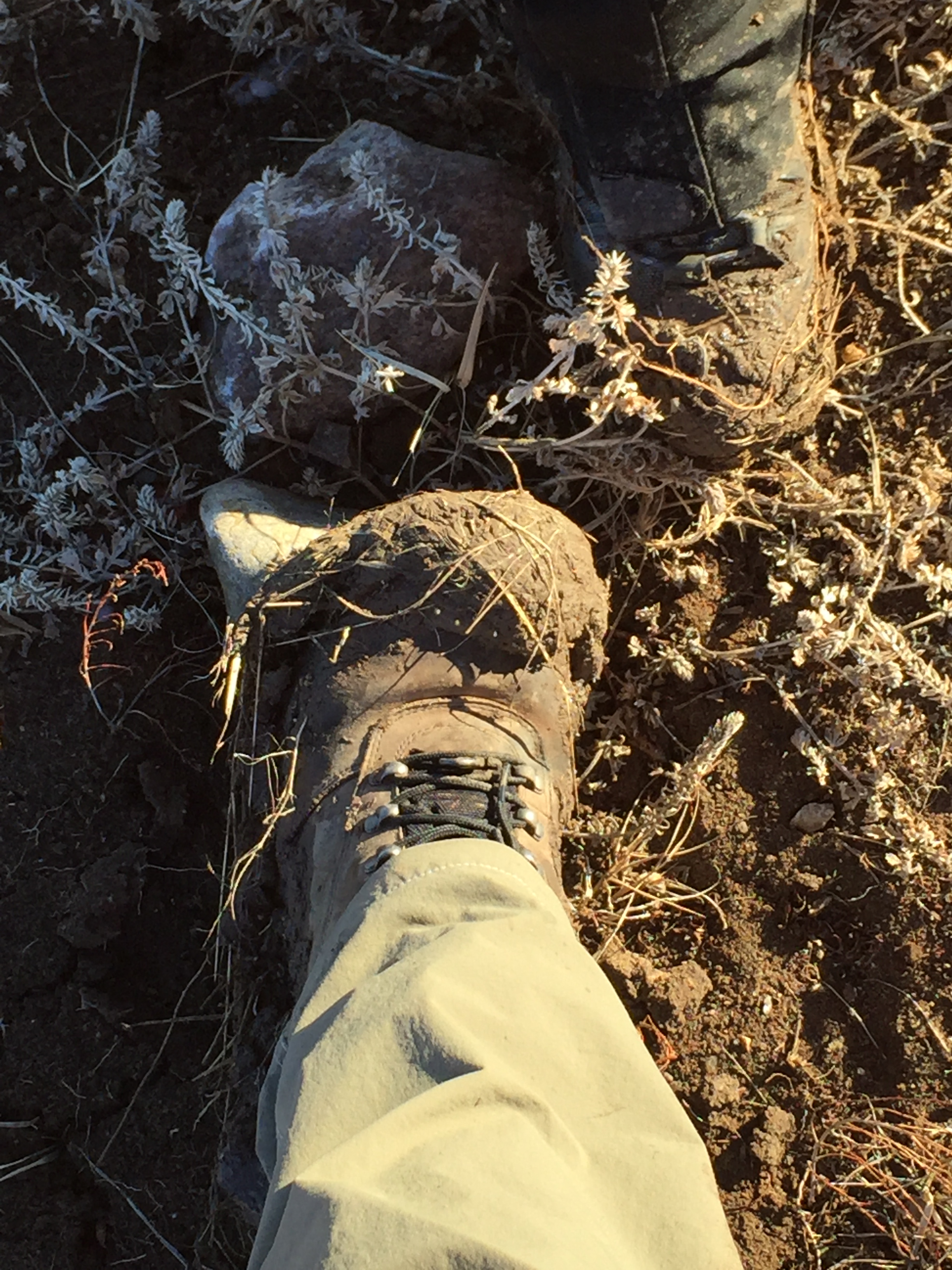
2 hiking boots covered in mud on the ground
Did I mention this trail can get a “bit” muddy? 😳😁

In Conclusion

Don’t be afraid to seek out the “boring” or “go-nowhere” treks, they can sometimes offer some surprises of their own.  We enjoyed a great–albeit INCREDIBLY muddy–hike (basically in shirt sleeves)…in mid-January…in SOUTH DAKOTA!  Whereas, if we had stayed at home, we may have felt depressed by the cold, damp, foggy day.  So don’t be afraid to Get Out While the Gettin’s…Bad!

Have you had a positive experience where you ventured outdoors when the weather was less than perfect?  Tell me about it in the comments!


Did you enjoy this post?  Pin it!

A path leads through brown-grass-covered hills and trees that appear burnt. Pin reads, "Hiking Custer State Park's Robber's Roost Trail"


Like what you read here today?  Please feel free to leave a comment, like or share this post!  Add your email at the bottom of the page, or the sidebar to the right, to be notified when a new post is published.  By signing up for the email list, you will also receive a free copy of the Tranquil Trekker’s Top 10 Tips of Trekking Do’s and Don’ts!

You can also follow the blog on social media by clicking the links below!
Facebook

Twitter

Instagram

Pinterest

Hike the Sunday Gulch Trail in Custer State Park

In this post, I review the Sunday Gulch Trail, in Custer State Park, near Sylvan Lake.


As part of the incredible trail system offered by Custer State Park, the Sunday Gulch Trail is a must-hike!  You will find the trailhead located behind the large rocks at the back of Sylvan Lake,  off the Sylvan Lake Shore Trail.  

Note:  this trail is closed in the winter months due to ice buildup from the nearby creek.  

Hiking the Sunday Gulch Trail

This loop trail is around three miles long and can be completed in either direction. 

I suggest taking the right fork at the trailhead.  This way, you’ll complete the most difficult portion of the hike first, and you’ll be doing it heading downhill.  You will still end your trek with an uphill climb, but it will be far less strenuous than the alternate option. 

Traveling this direction, the early portion of the trail is comprised of steps and large boulders that must be navigated—there is a handrail—as you make your way down the ravine.  Once you reach the bottom, the path is relatively easy and flat while you traverse a canyon; until the final climb back to Sylvan Lake at the top.

In the hotter months, be prepared for a hot hike!  Due to the gulch-like nature of the terrain, cool summer breezes often miss this area. Fortunately, the surrounding foliage provides significant shade opportunities (except when the sun is high, in the middle of the day).  

As you continue down the canyon, your trek will eventually begin to wind uphill when you commence the final, LONG ascent back to the lake.  The path is well-trodden and fairly smooth/free of debris, but it’s a long hill back to Sylvan Lake.  You will hear more road noise on this portion of the trail as it parallels Route 87.  

Pine trees with rock formations rising behind them
A view of the surrounding peaks from the top/end of the trail

Things you will see on the Sunday Gulch Trail

The trail is beautiful.  As you descend into the ravine, granite cliffs tower far above you on both sides, while a bubbling brook accompanies you the entire way.  

Once you reach the bottom of the gully, continue following the creek as it winds its way through the canyon.  This area is very peaceful as there is little road noise–the only main route, nearby, is Route 87, and that snakes along the edge of the ridge far above you.    

Rear view of a woman climbing down rocks while holding onto a metal railing
The Tranquil Trekker, navigating the steep, boulder section of the trail, through the ravine

Use caution when the path is wet, due to rain or snowmelt, as the creek often gushes across it when the water level is high.  Even in late spring, be prepared for the possibility of ice where the route traverses the deep ravine, as it doesn’t get sufficient sunlight throughout much of the day.

Traction devices, such as Yaktrax, are highly recommended unless you are hiking this trail at the height of summer. (Click here for more information on these awesome traction devices!)      

This trek can be managed by smaller children and pets, but they may require assistance with the really, rocky portions of the trail. 

As it combines bouldering with a relaxing jaunt through the forest, this fun hike contains a wide selection of scenery and is a must-see for those wanting a bit more adventure.  If you’re looking for a challenging and fun hiking trail on your visit to Custer State Park, check out the Sunday Gulch Trail near Sylvan Lake!  

Have you hiked this awesome trail?  Tell me about your experience in the comments!


Did you enjoy this post?  Pin it!

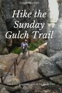
Rear view of a woman climbing down rocks while holding onto a metal railing. Pin reads, "Hike the Sunday Gulch Trail"


Like what you read here today?  Please feel free to leave a comment, like or share this post!  Add your email at the bottom of the page, or the sidebar to the right, to be notified when a new post is published.  By signing up for the email list, you will also receive a free copy of the Tranquil Trekker’s Top 10 Tips of Trekking Do’s and Don’ts!

You can also follow the blog on social media by clicking the links below!
Facebook

Twitter

Instagram

Pinterest


†As an Amazon Associate I earn from qualifying purchases


Wired to Eat (A Book Review)

In this post, I review a book that will factor into one of the Trekkers’ goals for 2019, eating fewer carbs.


This “gear review” is a bit different…  

Thinking of jumping on the Keto or Paleo bandwagons?

Mr. Trekker and I tried out a low-carb diet one year!  I know these fad diets can be controversial, so let me just say upfront, I am not a doctor, a nutritionist, or even a scientist (does being married to one count?)  I don’t play any of these on TV and I didn’t even stay at a Holiday Inn Express last night. 😉 

As I’ve mentioned in previous posts, however, I am a big fan of natural and behavior-based methods to mitigate (or help prevent) health problems, when possible.  So, I’m interested in a diet that doesn’t require any special pills, food, or shakes and isn’t difficult (though it does require some self-control).  

Below is a listing of posts I wrote regarding how I felt throughout this experiment (was I hungry?  Did my energy levels stay high?  Did I feel good?  Did I notice changes–good or bad–to things like my cholesterol levels?  Did I lose weight?)  This won’t interest everyone, and that’s fine.  I’m a curious person and this is something I found intriguing, so I wanted to try it and see what results I noticed if any.  It’s always fun to use your body as a bit of a guinea pig for science, right? 😉  To be clear though, I’m not trying to imply this diet is healthier than other options out there or that it is best for every person.    

“Wired to Eat”

I went more in-depth on the Trekkers’ personal experiences–successes and failures–in the other posts listed below.  For now, if you’re interested in the subject, a book I would suggest is Wired to Eat.†  Mr. Trekker learned of it via a podcast, so we both read it and found it useful.  It’s actually a sequel to another on the Paleo diet (which we haven’t read).  

There are numerous books available regarding these lifestyle choices, but I found this one to be well-written and easy to understand.  It outlines the ideas simply and keeps them interesting to the lay reader.  I especially like that it describes ways to tweak the diet for each, individual person based on their own, body chemistry, and it encourages you to listen to your body regarding what foods are right for your individual makeup.    

Modern diets contain too much glucose

The basic idea behind the Paleo and Keto diets revolves around glucose, namely, that we aren’t evolutionarily designed to process as much of the chemical as the typical Western diet provides.  The resulting effect is inflammation throughout the body; glucose sensitivity leading to diabetes; and a whole host of auto-immune issues, including diseases ranging from rheumatoid arthritis and Crohn’s disease to cancer.

The goal of the Paleo and Keto diets is to get back to eating the way our Paleolithic ancestors did (a diet with little gluten as agriculture hadn’t been invented yet) so our food intake matches what evolution has prepared us for, bringing everything back into balance.  We do this by retraining our body to burn fat and protein rather than carbohydrates (sugar/glucose) as fuel.  

As I mentioned previously, I am aware the factuality of these claims is up for debate, but one thing I do like about these nutritional theories is that they encourage clean eating.  I don’t think anyone can argue with the concept that a diet composed mostly of fruits and vegetables, with –preferably, lean–protein thrown in, that discourages unhealthy fats, sugars, and preservatives, is a bad idea for anyone.  

I also like the idea of personalized nutrition instead of a one-size-fits-all approach.  The book outlines a process for determining which carbs are beneficial for each, individual person.  It also, briefly, discusses fasting–something I dabbled with minimally–and offers recipes that are friendly to the two, specialized diets.     

So if you’re interested, click the link above and check out the book.  Check out the posts listed below to see how the Trekkers’ attempt at a low-carb life went!

Related posts:  Yummy Keto-friendly recipes!Final Thoughts on Low-Carb LentA Sustainable Low-carb LifestyleLow-carb Lent

Have you read this book?  What did you think?  Tell me about it in the comments!


Did you enjoy this post?  Pin it!

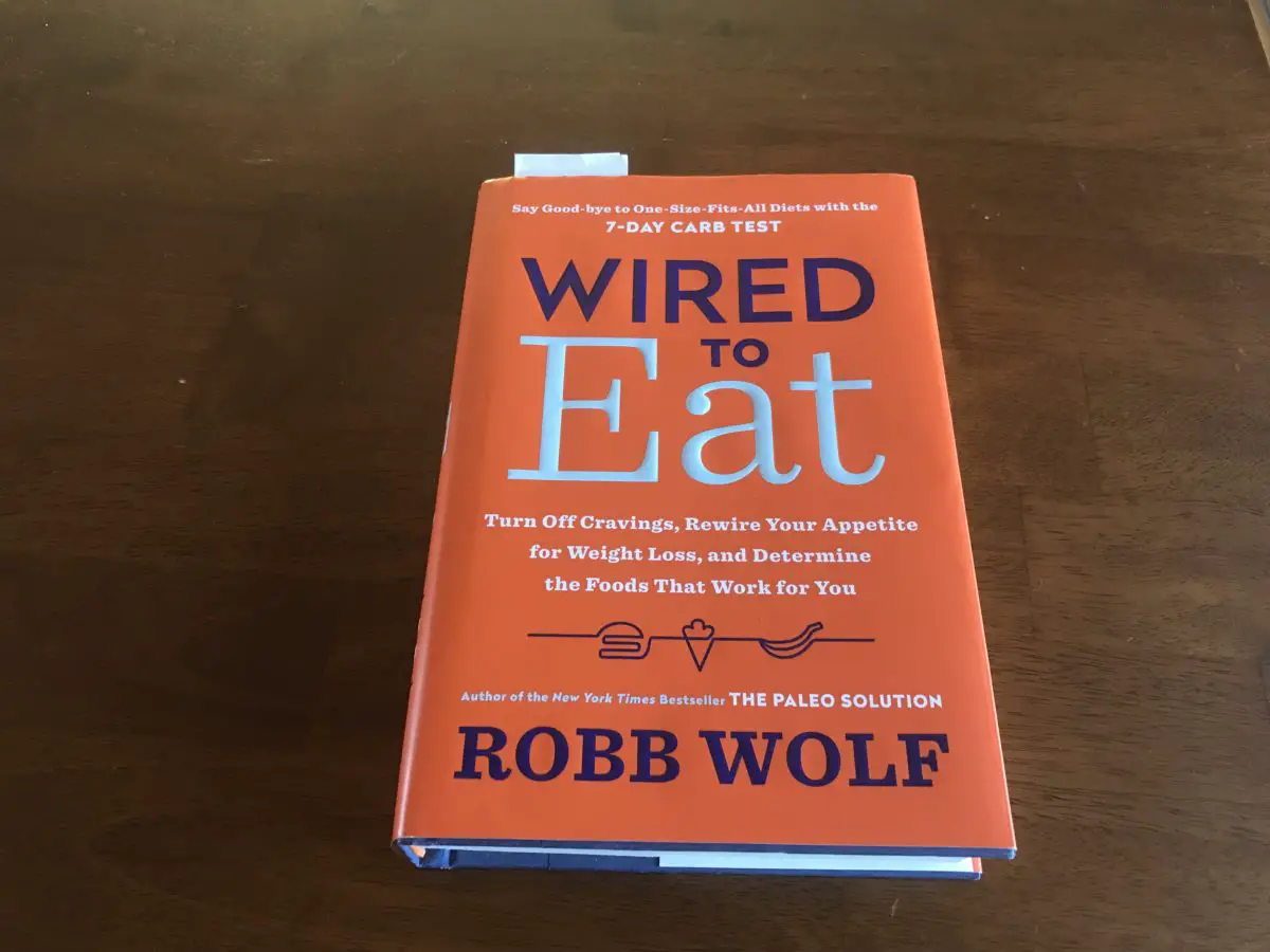
A book titled, "Wired to Eat" sits on a table.


†As an Amazon Associate I earn from qualifying purchases

Like what you read here today?  Please feel free to leave a comment, like or share this post!  Add your email at the bottom of the page, or the sidebar to the right, to be notified when a new post is published.  By signing up for the email list, you will also receive a free copy of the Tranquil Trekker’s Top 10 Tips of Trekking Do’s and Don’ts!

You can also follow the blog on social media by clicking the links below!
Facebook

Twitter

Instagram

Pinterest

An Amazing Southeastern US Road Trip

I review a road trip to Florida, and discuss thoughts I often have on the open road, and why I enjoy lengthy road trips so much!

On an amazing, southeastern road trip one Thanksgiving, the Trekkers experienced 9 days, 13 states, 4,433 miles, 1 snowstorm, 3 seasons and numerous ecosystems.  We were invited to spend the holiday in Florida, with family.  Neither Mr. Trekker, nor I, had been there in at least a decade, and we realized we’d never visited together.  

We also figured out a route that allowed us, both, to check off another item on both of our “bucket lists”…after this trip, both Mr. Trekker and I have visited all 48 of the continental US states!  {Note: the Trekkers are currently accepting donations to fund trips to States #49 and #50… 😉–Based on my above statement, you should be able to guess which two states these are. 😉} 

Oil Refineries, Route 66 and the Ozarks!

We enjoyed some unique experiences on this trip:

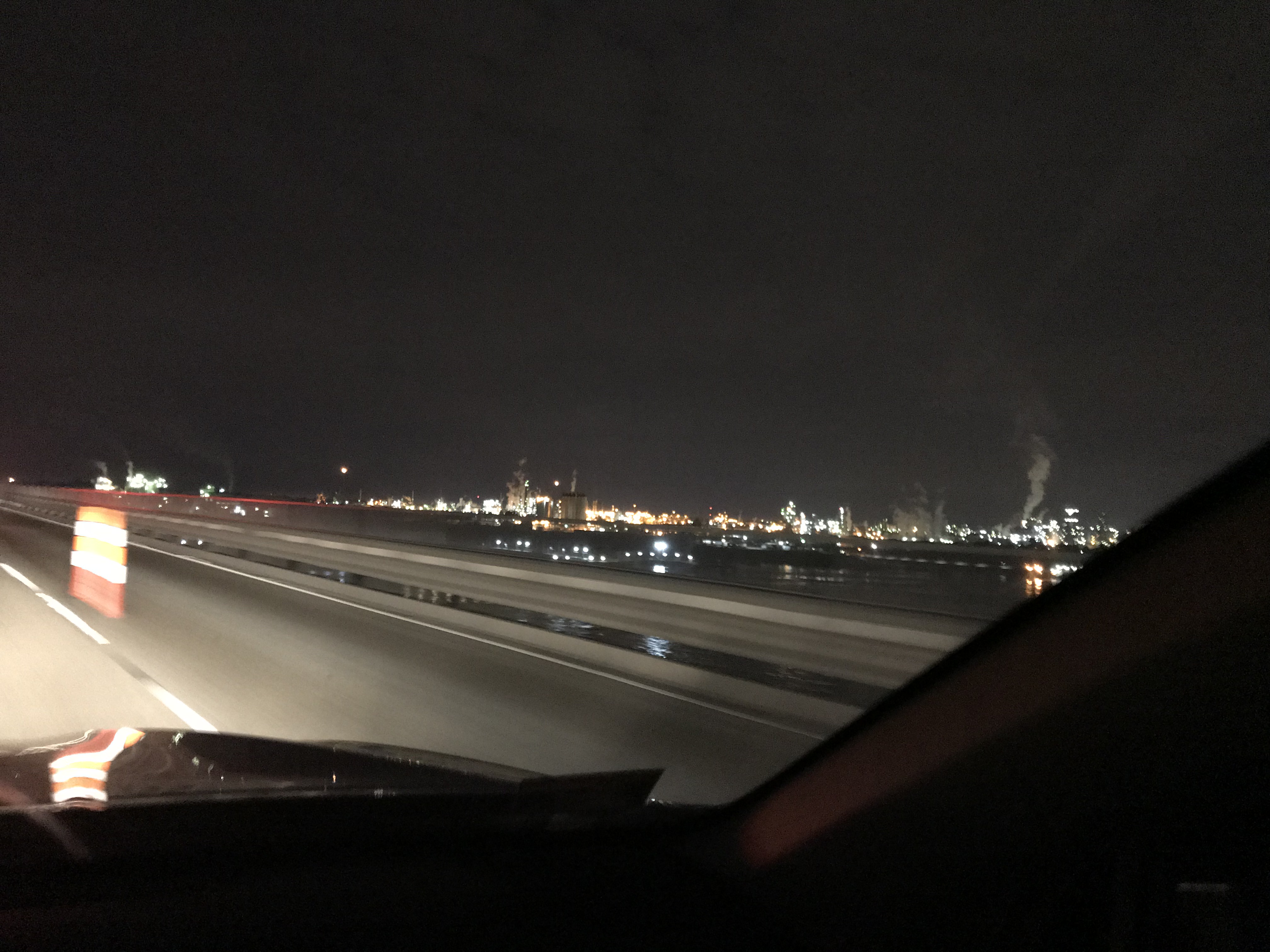
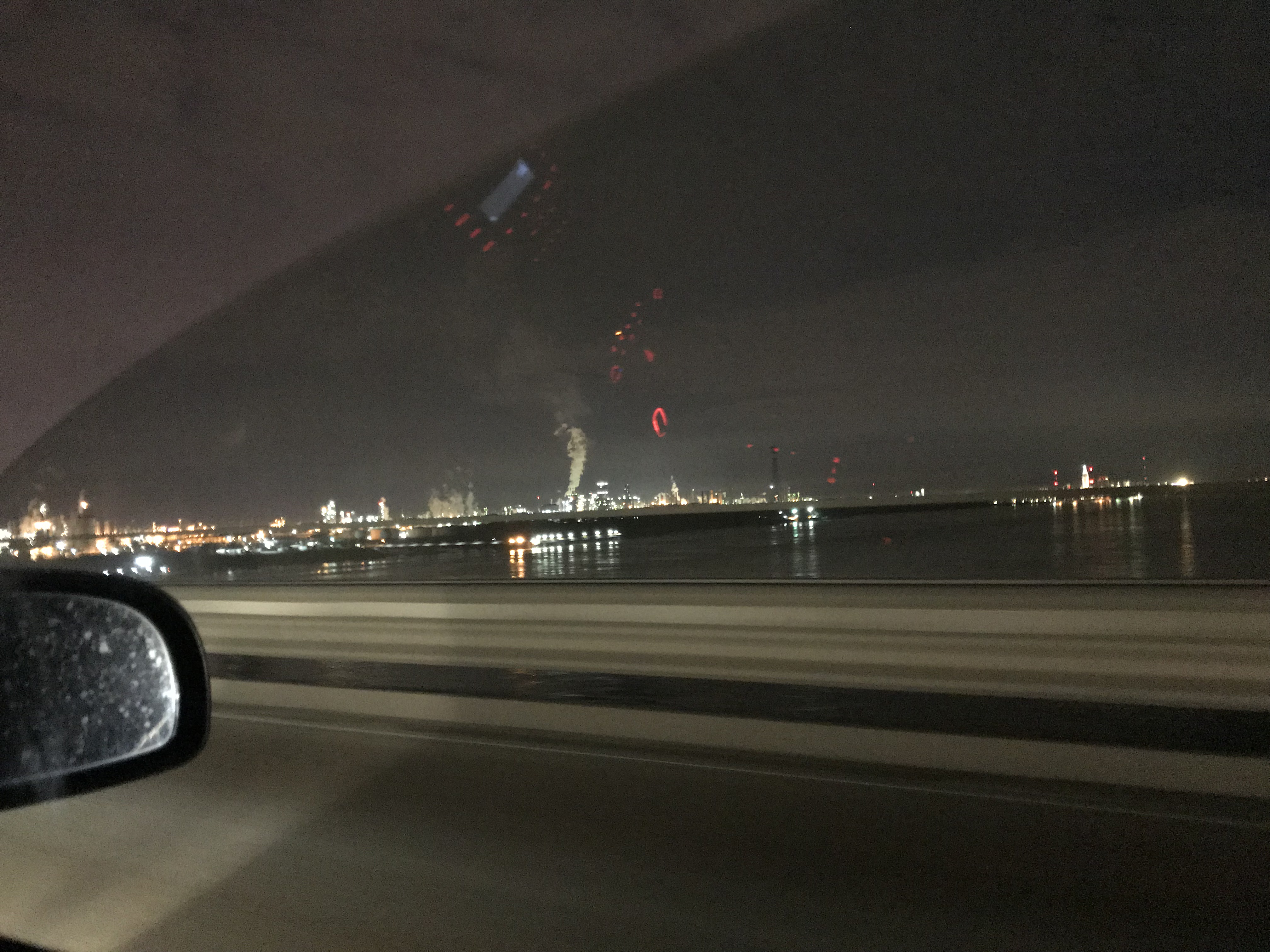
–We saw oil refineries that twinkle across the bays as they hug the coast.  I prefer green energy, but, there’s a certain beauty connected with these structures (at least at night).

They remind me of the old, steel factories you see in Gary, Indiana, near where I grew up.  There, an eerie, orange glow emanates from them and the reflection glitters on nearby Lake Michigan.  In Louisiana, the bays of the Gulf of Mexico proffer a similar effect.

Bright lights shine and are reflected across a bay of water at night.

View from a car on a bridge: bright lights shine and are reflected across a bay of water at night
Some of the refineries are HUGE!

View from a car on a bridge: bright lights shine and are reflected across a bay of water at night


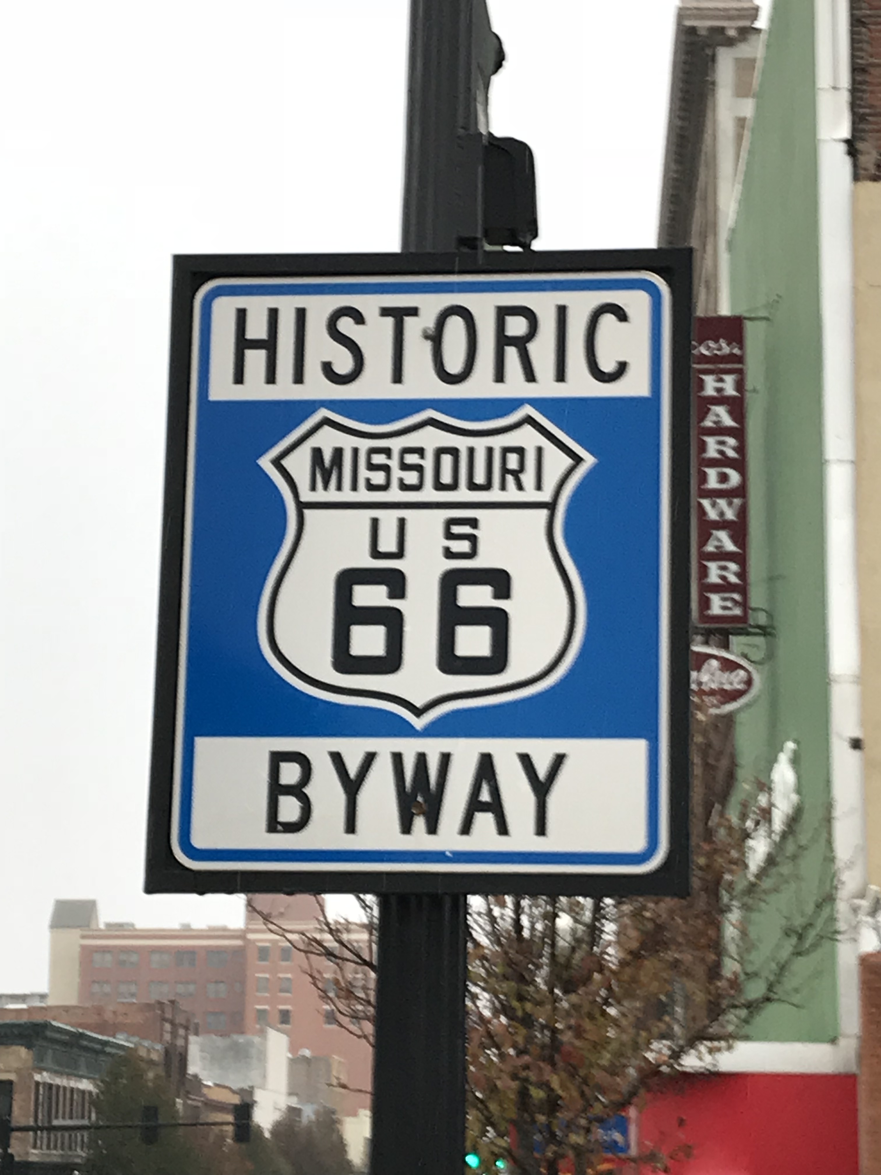
–We drove another portion of Route 66!  I had forgotten it runs through Missouri until we stumbled on it while surveying the map.  We had last seen that route on a trip through New Mexico in 2017.

A blue and white road sign reads, "Historic Byway, Missouri US 66"

A mural on the side of an old, cement building shows a picture of an old car driving past a large road sign which reads, "Joplin Missouri, You're in Historic Route 66"; along with a Route 66 road sign. Below this is painted a road map across the US with Route 66 signs.


–I was also able to experience the beauty of the Ozarks for the first time (Mr. Trekker had been there before.)  I had no idea how lovely the majority of Missouri and western Arkansas are with their rolling farmlands and forested hills.  Fall also runs a little later in those states, so we got to enjoy the late, remaining foliage as well! (Note to the Missouri Department of Transportation, your snow management on your highways could use some work. 😝)

–We experienced multiple seasons on this trip.  When we left South Dakota it was 15 degrees out!  We enjoyed fall colors in the Ozarks and through beautiful, northern Georgia.  Then, at the end of the weekend, we fast-tracked it back to South Dakota to outrun the impending, winter storm that was bearing down on the lower Midwest. 😳

THIS is why we drive rather than fly (this, the TSA and the fact that I hate those cramped machines! 😉)–I’m not afraid of flying, per se, it’s the crashing-to-a-fiery-death-in-a-cramped-metal-tube-from-30,000-feet-up that scares me. 😝

Cross-country travel in a car also allows you to truly experience the varying landscapes and cultures that are present throughout our wonderful country. In addition to the US being a “melting-pot” of various people and religious identities, it showcases a cornucopia of landscapes as well.  On every road trip we take I’m always amazed at the various scenes and inhabitants we encounter.  

Things you’ll notice when you visit the “Lower 48”: 

The South

This region is characterized by cotton fields, salt marshes and flat, coastal plains.  Comprising a portion of the “Bible Belt”, folks here are friendly, though they’re often quick to spot that, “ya’ll ain’t from around here are ya?” 😉

The Northeast/New England

Highlighted by rolling, hilly, farmland, heavily-forested mountains and flat, coastal plain; many think of this region as sporting “city-folk” with fast-paced lifestyles.  There’s plenty of “country folk” outside the urban centers who may disagree with that assessment, though.

The Midwest and Great Plains

This area is comprised mostly of flat farmland.  Many think of it as boring, flyover country.  It may not be as exciting as other regions, but this area has a unique beauty of its own.  Being that I grew up there, its charmingly simple way of life will always hold a piece of my heart.  And you can’t beat their sunsets over the “amber waves of grain” (and cornfields). 😉  The folks who live here, residing fully in the ‘Bible Belt”, are known for their friendliness (and tornadoes!  It’s THE place to be, in the country, for storm chasing! 🌪) 

The West

I would define the borders of this area as the country west of the Missouri River (excluding the West Coast) and north of the Desert Southwest.  In my personal opinion, you can’t beat the beauty of the craggy mountains that are found here.  They don’t call this area “God’s Country” for nothing.  

In my experience, some of the friendliest people I’ve encountered live in the rural West.  This is an interesting contrast to, what can be, a difficult life.  Living in the West is a whole other ballgame.  The land is rugged, the weather is harsh, and its residents have to be tough.  It’s a place that, even in the 21st Century, has to be survived.  Maybe this fosters kinship among those who choose to brave its challenges?  Here, the weather and nature–both flora and fauna, can, quite literally, kill you.  But the people who call this, immensely beautiful and often desolate place, “home”, won’t make you regret a visit.

The West Coast (ie: the western halves of the West Coast states)

It’s amazing how different the various sides of these states can be!  The eastern halves of Washington, Oregon, and California are comprised of more rural, scrub and farmland, and the people trend toward a more conservative ideology. 

**The two halves are split but rugged mountains!**

The western halves of these states are flatter, far wetter, coastal plains; sometimes ranging to a temperate, rainforest climate.  The people who reside there are usually categorized as metropolitan.  I was, pleasantly surprised, though, by the light-hearted lifestyle of the LA area.  

Texas/the Desert Southwest

Texas is one area I can’t speak much to, as we haven’t spent enough time there for me to get a feel of it (a problem we’re hoping to correct). 🤞  I do know it’s hot and dry, though.  😅  The rest of the Desert Southwest shares characteristics with the West! 

The statements above are just generalizations, of course.  As we’ve traveled around the country, I’m always amazed how cultures vary within these local regions, as well.  

As you traverse the states, rural areas are usually more conservative, and the larger cities tend to trend more liberal.  The change from urban to rural can be stark and often occurs quite quickly.  Many living in the rural areas of Illinois, Virginia or New York may not feel they have much in common with their counterparts living in the DC suburbs, Chicago or New York City.

 “Transplants”, people who move from places like NYC to more conservative states, like North Carolina (and others), make those places a melting pot of cultures and ideologies within their own right.  One place we visited several years ago was the small town of Willits, in northern California.  It was one of the first places we’d visited in the state, and I was surprised how charming and “Midwestern” it felt.  

Let’s embrace our similarities!

What am I trying to get at here?  The bottom line is, none of that sh*t really matters.  I think we often forget that we’re all in this together.  We all vary, but we all share similarities as well.  Often times, those similarities aren’t categorized by skin color, religion, politics, etc.  Regardless of where we live, what church–or synagogue, or mosque, or temple–we attend (or don’t); who we vote for, or who our favorite sports team is, we’re all human.

We all live in the same, magnificent country.  I firmly believe, we’re all, for the most part, good people (one generalization we all share).  As our country remains divided on numerous issues politically, religiously, racially, culturally, I think it’s important to keep this fact in mind.   THIS is what makes road trips so enjoyable!  I LOVE traveling the country, and experiencing how much we all have in common!

The late chef and world-traveler, Anthony Bordain, felt food bonded us, that our connection with it could bridge divides between cultures, religions, politics, etc.  I think we need to seek out other “bridges” like this, as well.   Whether that be a common love (or hatred? 😳) for a specific sports team, a love of the outdoors, whatever.  I don’t care who you voted for in the last election (or if you voted at all); if you cheer for the Yankees or Red Sox; if you say “pop” or “soda”.  

I. DON’T. CARE.  

Those things aren’t important in the long run.  What is important, and what we need to focus on, are the commonalities we all share.  We need to seek out the things that unite us, not those that divide us.  We need to realize how blessed we ALL are to live in this incredible, messy, complicated place.  

We’re all stuck on this big, beautiful, blue ball, hurtling through the dark, cold, emptiness of space.  We’re all in this together, so let’s make the most of it, be kind and try to get along, yeah?  🤠  


See below for some more pics from our cross-country adventure! (Thanks, as usual, to Mr. Trekker for some of these):

A drawbridge is raised on a road bridge in the background. The blue water in a bay flows in the foreground and under the bridge.
Drawbridge!
A white bird with black feathers sweeping from its head pecks at the sand on a beach.
Is it just me…
A white bird with black feathers sweeping from its head stands on a beach.
A white bird with black feathers sweeping from its head pecks at the sand on a beach. …or does this bird look like Bernie Sanders?  😳
A large tree (with moss clinging to it) hangs over an old rest stop building
I love the moss!
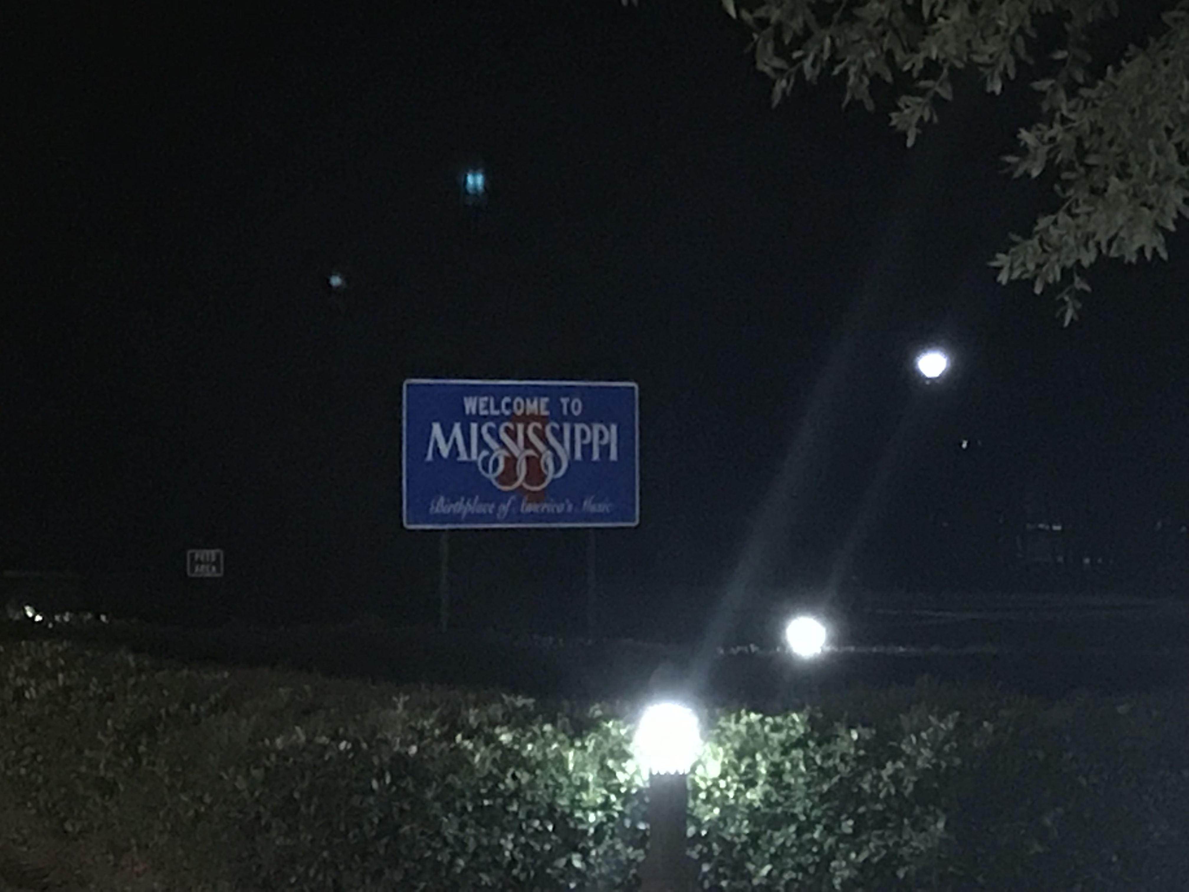
A road sign is lit by lights at night and reads, "Welcome to Mississippi, birthplace of America's music"
State #48 for the Trekkers!
A radial elevation dial held in a person's hand over water--where a foot sits in the water--reads "0 feet" (sea level)
The lowest altitude we reached on the trip. You can see my foot is in the Gulf of Mexico if you look in the lower left corner…
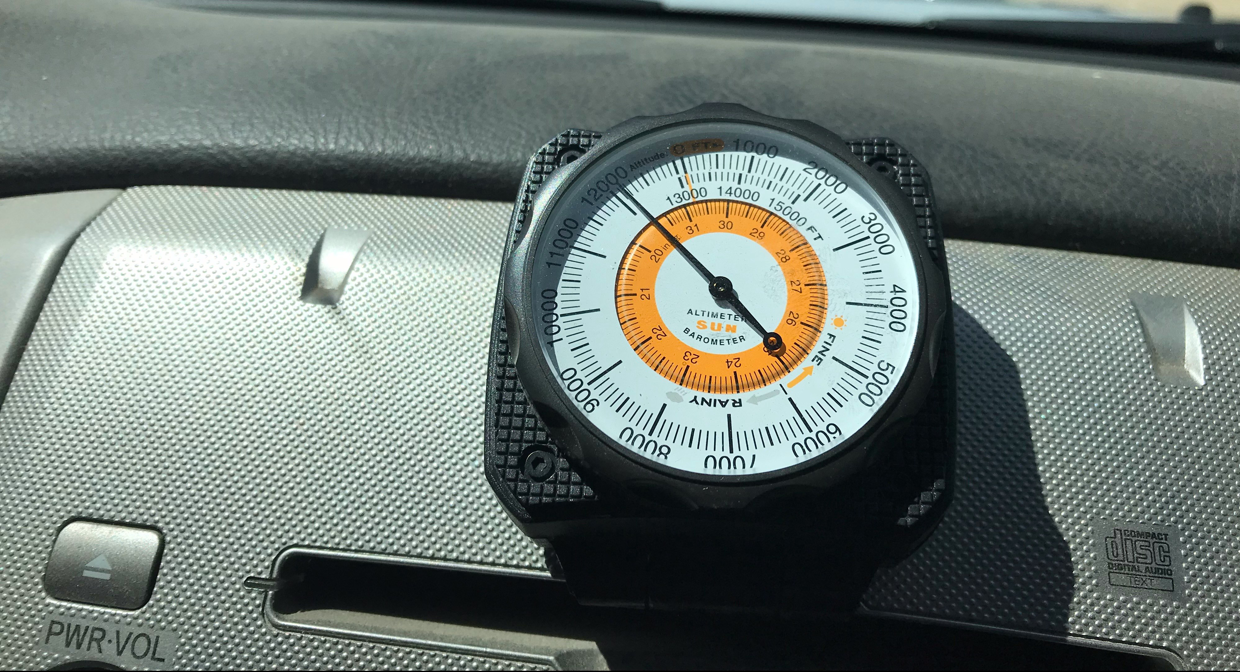
A radial elevation dial sits on a car consul and reads, "12,100 feet"
…contrast that with the highest altitude we reached on our road trip the previous summer, at the top of Independence Pass, in Colorado!
Multi-colored (mostly white) shells sit on the sand as a wave comes into shore
Seashells!
Two peoples bare feet stand in water to their ankles
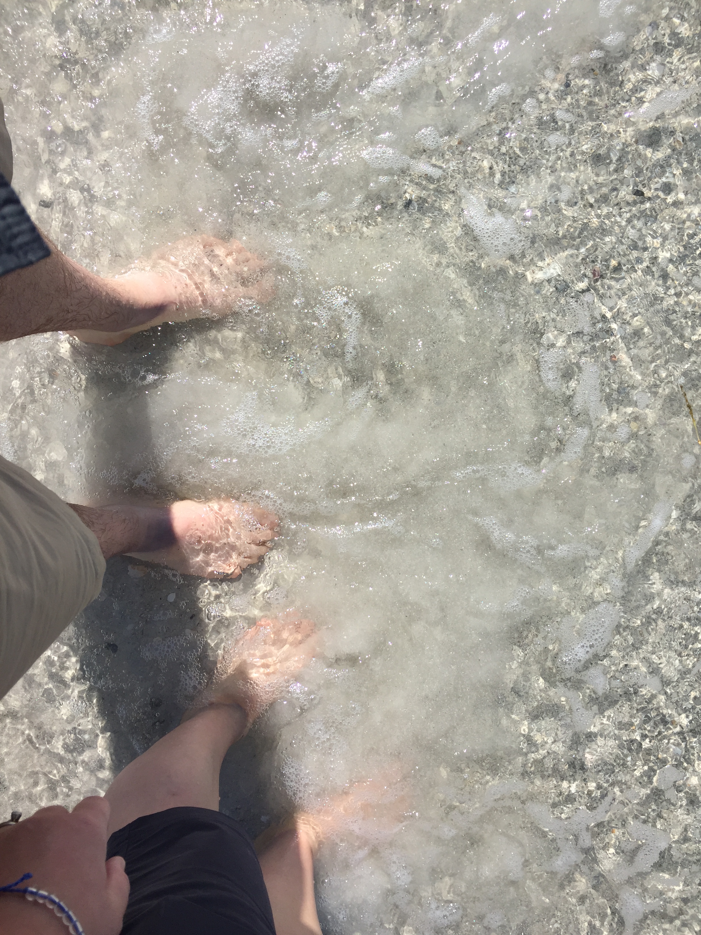
“I got my toes in the water…”


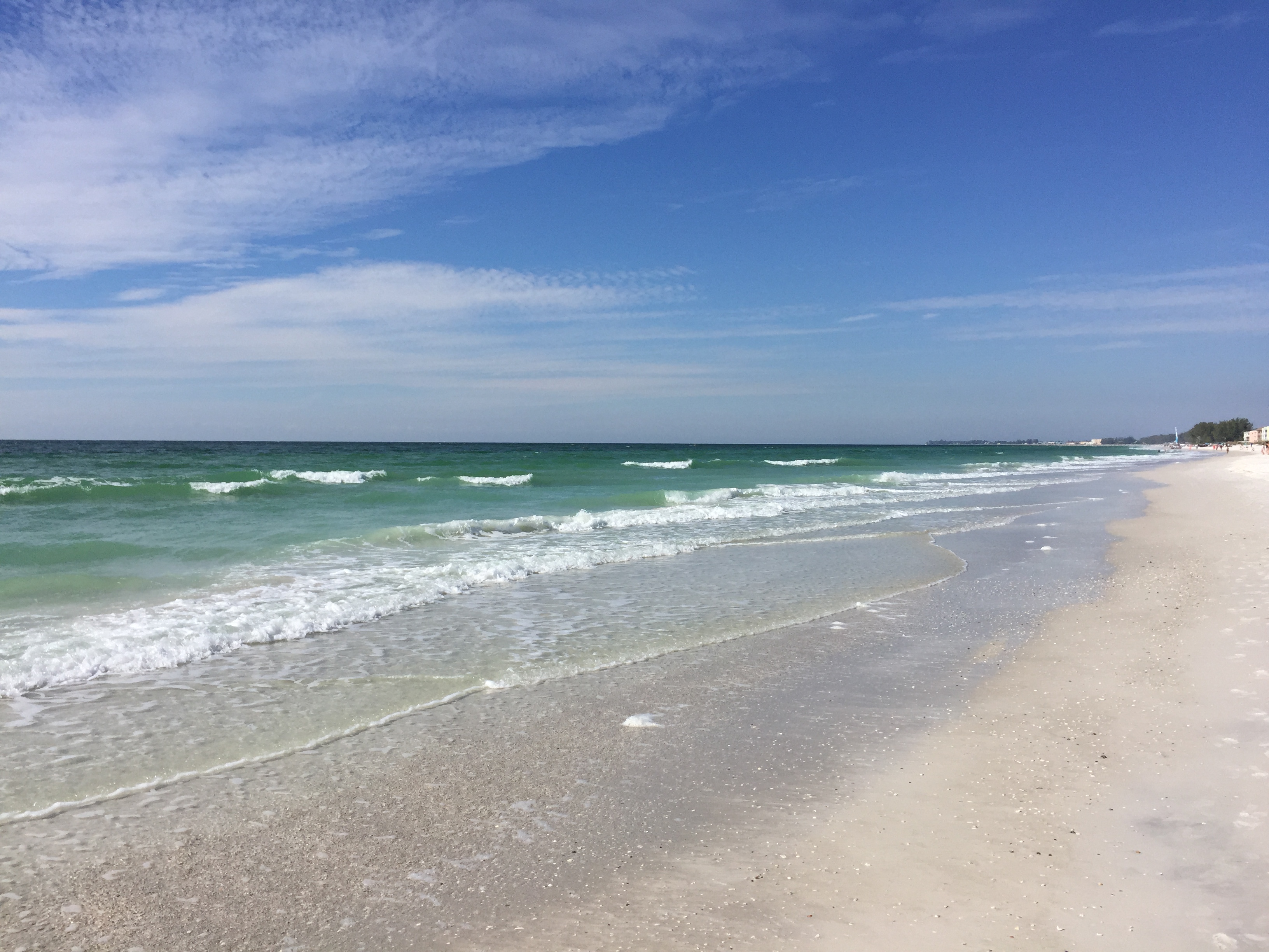
Florida Beaches:

A beach in the foreground with minimal waves and the blue ocean expanding to the horizon, all under a blue sky with white, wispy clouds
A beach in the foreground with minimal, white-capped waves and the blue ocean expanding to the horizon, all under a blue sky with white, wispy clouds. Some green trees are in the far, side-background along the beach.A white beach with tall grass in the foreground, multi-story beach homes are in the background. Dark, minimal waves wash up on a dark beach as the ocean stretches to the horizon. The sun sets into the clouds causing yellow and pink colors in the clouds. Several birds are on the beachSmall gray, ocean waves wash up on the beach. Multi-story buildings stand along the beach in the far background

The shadows of two people stretch across the beach. Multi-story buildings stand along the beach in the far background
Beach Trekkers!

Rear view of a woman walking along the beach, with minimal waves washing on shore. Numerous people stand in the background with multi-story buildings standing along the beach in the far background

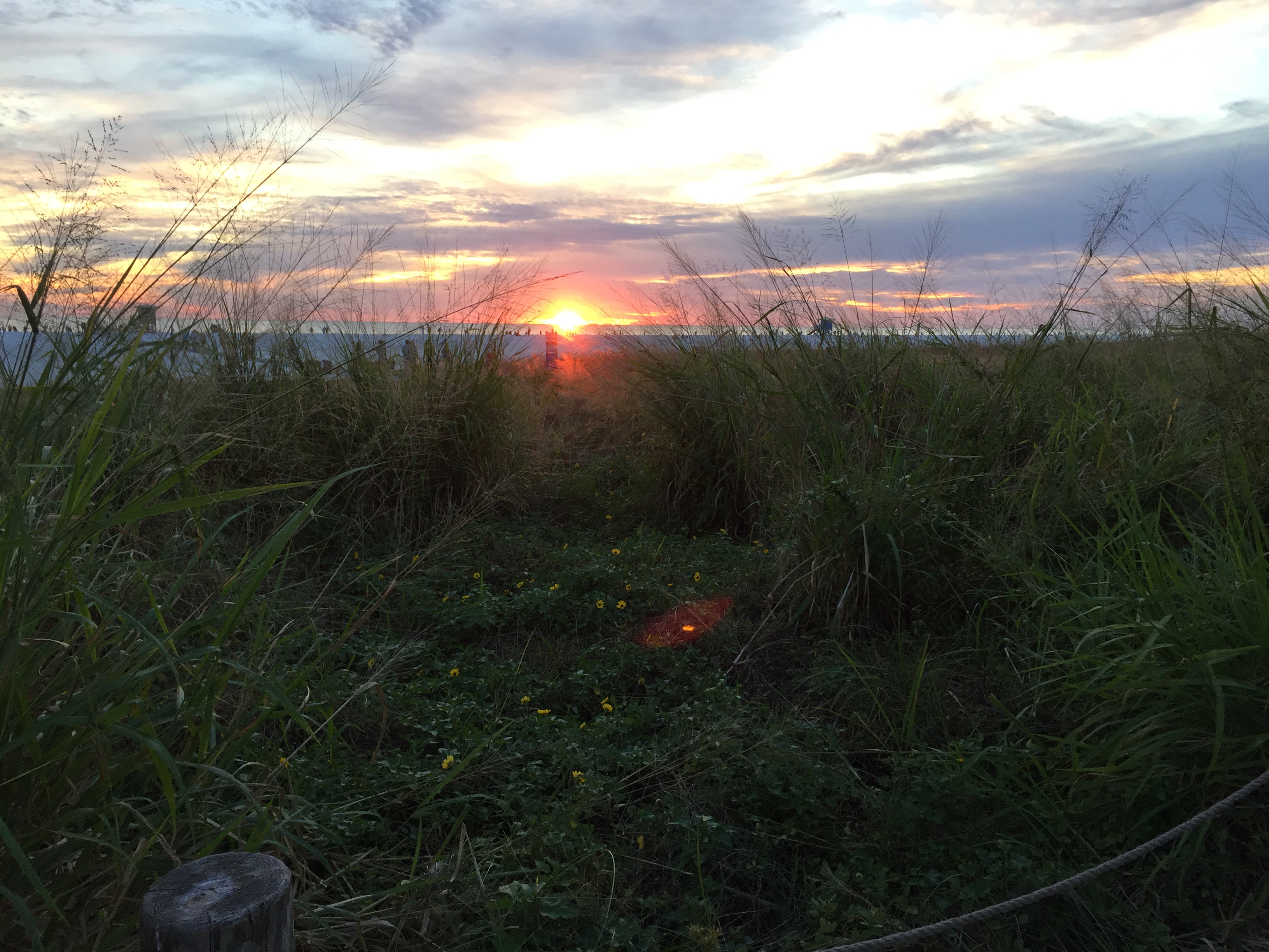
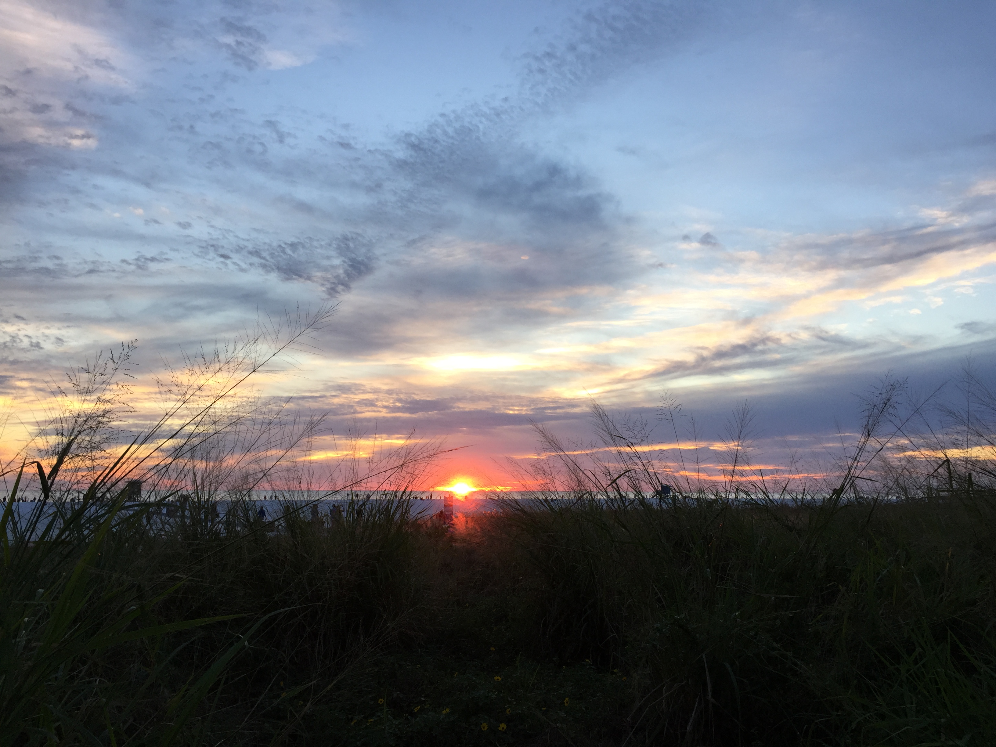
Goodnight Florida!

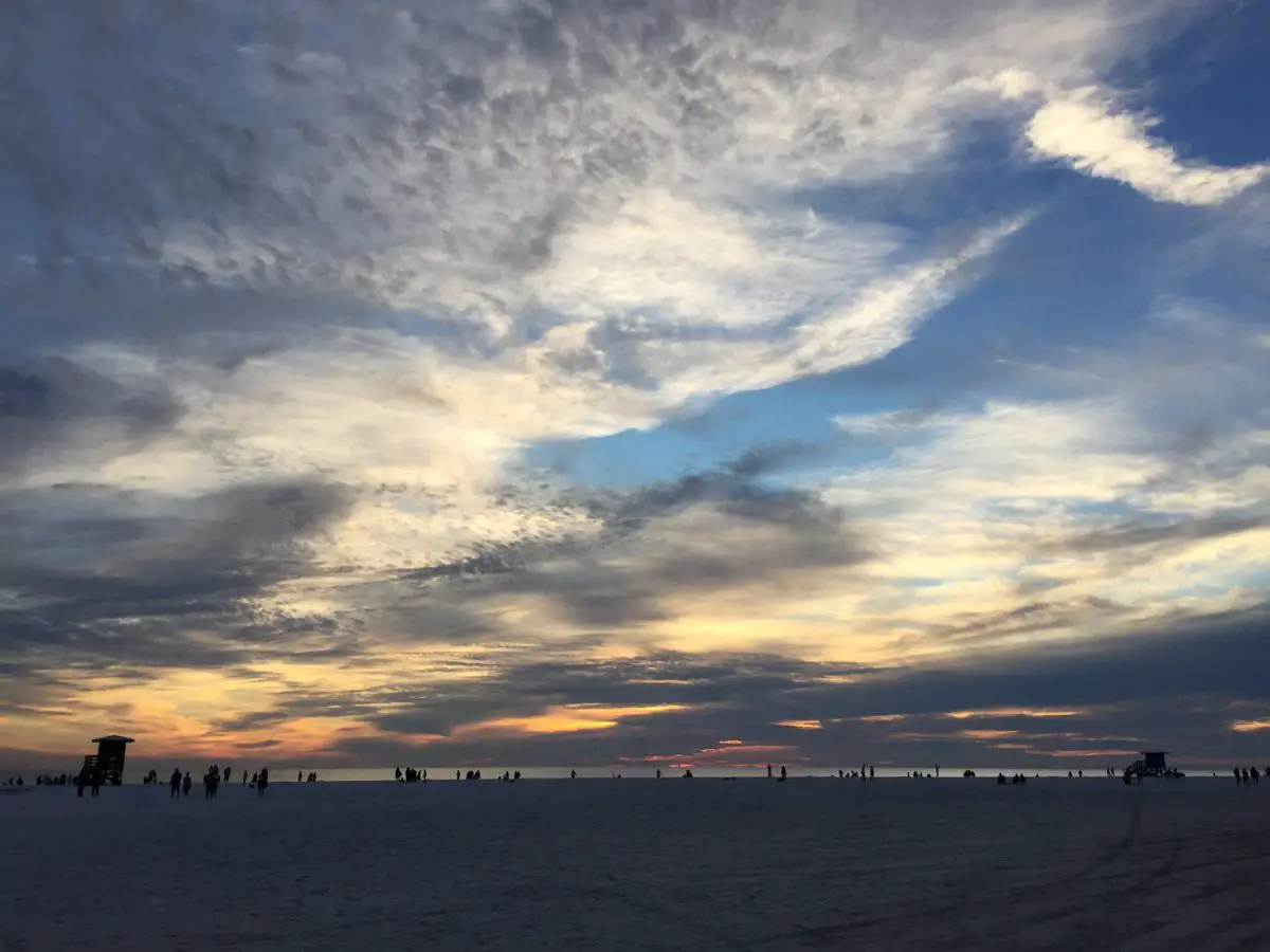
An orange and blue sunset shines in the cloudy sky over a beachDry beach grass in the foreground, a white-sand beach stretches to the horizon dotted with people and a lifeguard stand. The sky is gray-cloudy with peaks of yellow, orange and pink sunset barely shining through. Dry beach grass in the foreground, a white-sand beach stretches to the horizon dotted with people and a lifeguard stand. The sky is gray-cloudy with peaks of yellow, orange and pink sunset barely shining through. The reddish-orange setting sun is peaking through the clouds.Green beach grass in the foreground. The sky is gray-cloudy with peaks of yellow, orange and pink sunset barely shining through. The reddish-orange setting sun is peaking through the clouds in the far background.Dark beach grass in the foreground. The sky is light blue with gray-cloud wisps. The reddish-orange setting sun is peaking through the clouds.Green, palm trees with gray-pink clouds in the blue sky overhead

What have you learned from traveling around the country (or world)?  Let me know in the comments!


Did you enjoy this post?  Pin it!

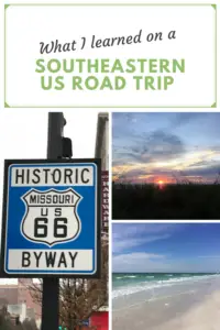
Three pictures: 1) A blue and white road sign reads, "Historic Byway, Missouri US 66"; 2)3) A beach in the foreground with minimal, white-capped waves and the blue ocean expanding to the horizon, all under a blue sky with white, wispy clouds. Pin reads, "What I learned on a Southeastern US Road Trip"

Like what you read here today?  Please feel free to leave a comment, like or share this post!  Add your email at the bottom of the page, or the sidebar to the right, to be notified when a new post is published.  By signing up for the email list, you will also receive a free copy of the Tranquil Trekker’s Top 10 Tips of Trekking Do’s and Don’ts!

You can also follow the blog on social media by clicking the links below!
Facebook

Twitter

Instagram

Pinterest

A Trekker’s Manifesto

In this post I discuss my motivations for writing this blog.


“Thousands of tired, nerve-shaken, over-civilized people are beginning to find out that going to the mountains is going home; that wildness is a necessity.”        

― John Muir

Some may wonder why I write this blog…

One of my favorite songs is “Noise”, by Kenny Chesney.  For me, it’s a rallying cry, of sorts, as it well expresses my growing disillusionment with the rat race that is the modern lifestyle.  I firmly believe one of the central problems with modern society is that we are constantly overstimulated with busy lives, busy minds, and busy spirits.  

The song demonstrates how this “noise” that continuously engulfs us makes us miserable.  It is inescapable and unending.  My personal belief is this overstimulation contributes to the anxiety so many feel.  I know, for myself, the anxious symptoms I experience peak when my life feels the most hectic. 

Some lyrics from the song state:

“…Yeah we scream, yeah we shout ’til we don’t have a voice.  In the streets, in the crowds, it ain’t nothing but noise…”

We’re constantly pulled in multiple directions at once:  relationships, chores, work and school, hobbies, attempting-to-find-some-time-to-just-relax! 

“Twenty-four hour television, gets so loud that no one listens…”

In addition, we’re persistently bombarded by 24-hour news cycles, streaming music, and video, our sources of stimulation continue on ad-nauseum…. I can feel my blood pressure rising just THINKING about all of this! 🤯  

Articles are written about the burnout people feel.  How they are striving to “unplug”, to have a better work-life balance, to take back control of their lives.  But then, they’re told to “lean in” and live “well-rounded” lives…

 “There really ain’t no conversation, ain’t nothing left to the imagination…”

From an early age, we’re exposed to so much technology that our creativity is squashed.  Children used to spend hours playing outside, but now their days are filled with activities structured by others and devices that tell them what a game is and how to play it.  We don’t think for ourselves anymore or take a step back and critically examine situations.  Instead, we allow ourselves to be influenced and pressured by what our friends are “liking” on social media, or what our trusted news source is telling us is a fact. 

“…trapped in our phones and we can’t make it stop…”

We’re all adrenaline junkies running around constantly stimulated by the technology that continuously surrounds us.  This stimulation is so persistent that when we have to go more than 30 minutes without the dopamine hits it provides we get anxious and think we’re bored—even though that’s what life is supposed to normally feel like—we just aren’t used to it.  Our phones chirp mercilessly, constantly giving us the recognition we’ve come to crave as it means that someone “liked” our post or tweet, or is trying to contact us so we don’t feel so small and alone…

*This may seem contradictory for a blogger; whose job is dependent on the use of technology.  To be clear, I’m not anti-technology, I’m pro the purposeful and controlled use of it.  It’s a tool that should be used deliberately and within limits, without allowing it to control our lives.*


I write for my love of the outdoors…

“Sometimes I wonder, how did we get here?  …we didn’t turn it on, but we can’t turn it off…

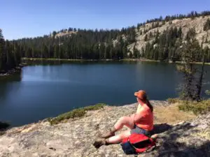
A woman and hiking gear sits on a rocky ledge, overlooking a lake that is surrounded by tree-covered mountains, all under a blue sky.

We’re constantly surrounded by all this “noise” but we haven’t yet evolved to handle it, and I don’t think we are meant to.  We weren’t designed for the modern-day lifestyle.  Evolution didn’t prepare us for this craziness, because it isn’t a natural thing.  We’re meant to be surrounded by the peace and tranquility that nature brings: the perfectly formed snowflake; the sound of chirping birds and the whistling wind; the silent clamor of snow falling in the woods; the pitter-patter of rain against the window and the “CRASH!” of thunder outside.  We’re meant to feel the sun warm our skin as the wind caresses our face and to smell the fresh, earthy aroma of wet dirt that a fresh rain brings. 

I’m an avid Nature Girl.  I enjoy pretty much any activity that gives me an excuse to be outside.  I’m also high energy (in case that isn’t obvious). 😉  I like the outdoors, active hobbies and I find walls induce claustrophobia.  I grew up as a country-girl, playing in the dirt and fresh air, so, outdoor recreation is a perfect hobby for me. 

This love of nature brings me peace by enjoying the beauty and simplicity of the environment that surrounds us.  Many people find comfort in these things and I think there’s a reason for that, it’s our intended habitat.  It’s where we’re supposed to be, so, we connect with it on a basic, transcendent level.  The most instinctual part of our being longs for it.  I feel my spirit is renewed by nature, so I want to use this blog to encourage others to enjoy this incredible experience, as well.  

For me, this peace is also spiritual, in a sense.  Not everyone agrees with this, and that’s ok, religion is a very personal journey, and everyone has to choose what’s best for them.  I feel my life is richer and I find hope in despairing situations when I embrace the spiritual side of life.  Experiencing nature aids my spiritual journey as it helps me to form a tangible connection to the Creator, by communing with the extraordinary creation.

I’ve enjoyed being out in nature since I was a kid, I especially love the mountains.  I still remember the instant I fell in love with them.  Mr. Trekker and I were enjoying our first road trip together, in 2005, shortly after we both graduated college.  We were at Mesa Verde National Park, standing at one of the lookouts on top of the mesa, with the whole of Colorado stretching before us (maybe THAT’s why I love the state so much?!) 😉  

I remember thinking, “I could live here”, and feeling a connection to the mountains, on a visceral level.  At the time, the Trekkers were preparing to move to North Carolina.  Until then, I had only ever lived in Indiana, this was my first time experiencing the Rockies.  I had visited the Appalachians throughout Pennsylvania and New England on numerous family vacations and had always enjoyed the mountain scenery, but this time, something struck a chord within me… 

It would be six years before we returned to the mountain west, this time to stay.  We’d had enough of the big city, and after numerous adventures in the mountains of western North Carolina, we were hooked on our outdoor activities.  The Black Hills aren’t quite the Rockies, but the smaller towns and simpler way of life—not to mention the frequently beautiful weather—suit me just fine.


I write to describe my struggle with anxiety and (hopefully) to help others who are struggling…

When we moved to South Dakota, I started experiencing frequent symptoms of anxiety.  To make matters worse, I also began noticing depressive symptoms due to SAD (Seasonal Affective Disorder), thanks to the minimal hours of sunlight–and the resulting Vitamin D deficiency—present in the Northern Plains during the winter.  I set out on a mission to learn methods to alleviate the symptoms I was experiencing, so I began working with a therapist. 

For some, anti-anxiety medications work wonders.  For myself, I hated the woozy, detached feeling I experienced as a side-effect, so I sought out natural and behavior-based methods as an alternative. I have found that by taking a step back from the continuous “noise” of our modern lifestyle, through pursuing outdoor adventures, and by employing intentional methods such as mindfulness, I am able to effectively manage the condition. 

Besides the obvious benefit of a flood of endorphins brought on by physical exercise, I think experiencing nature helps to decrease anxiety symptoms because it has a tendency to test our resolve.  It’s an incredibly humbling–and somewhat frightening—experience when you find yourself at a different location on the trail than you originally thought, and you realize how far you still have to go as the sun sinks ever lower towards the horizon.  Your concern is heightened as the cold wind intensifies, and dark clouds close in.  You come to the very sobering realization that you are at the mercy of Mother Nature and her elements. 

This is a moment where anxiety is truly warranted!  But, it’s also an incredibly empowering moment.  You realize that you’re reliant on your own devices, that your ability to get home rests squarely on your own shoulders…and you CAN do this!  It’s liberating when you do, eventually, make it home safely.  The feat raises your confidence level as you now know that you are capable, and you can handle the challenges life throws at your feet.  It helps you to realize how powerful your inner strength really is!  

I think we often forget that anxiety can be a useful tool.  It’s a natural, beneficial response to an element in our environment that’s posing a risk to us.  But it should be reserved for situations where our safety is actually at risk. Unfortunately, these aren’t the situations that often cause anxiety in modern times.  

Oftentimes, “modern” stress stems from situations that are, frequently, not threatening at all.  As I had a therapist once explain it, “your body doesn’t know the difference between being called into a meeting in your boss’ office and being chased by a saber-toothed tiger!  It responds the same.”  “Good” stress situations (such as finding yourself lost on a trail) help to keep anxious feelings in perspective.  They help us to realize that some circumstances unnecessarily induce anxiety within us.

Beyond personal empowerment, basking in the awesome power of nature helps to remind us that we aren’t the center of the universe. It’s humbling (and relieving) to experience that power overshadows many of our worries, and it helps us to realize that many of them aren’t as unique or catastrophic as we think they are.  What is an impending root canal in comparison to the immense “ROAR!” created as millions of gallons of water pour over a waterfall every day?  Or when you observe the natural forces required to create locations such as the Grand Canyon?


I write for my quest for a more tranquil lifestyle…

“Every room, every house, every shade of noise.  All the floors, all the walls, they all shake with noise.  We can’t sleep, we can’t think, can’t escape the noise, we can’t take the noise so we just make noise!”  

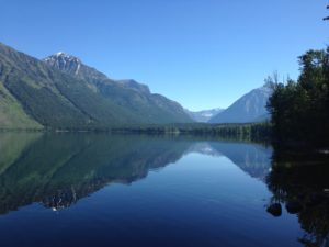
A pristine, mirror-like lake surface reflects the green mountains that surround and tower over it. All under a clear, blue sky.

We were all dropped into this technological soup that we aren’t equipped to handle.  To mitigate the stress brought on by our modern lifestyles, we seek out more stimulation (or noise), when what we really need is rest!  We get worked up from the constant information and news, we worry about our friends and family, about the state of the world.  Then, due to all this, we struggle to sleep at night which just leads to exhaustion, more stress, more anxiety, and depression…WE NEED A BREAK!  We need to be able to take time to just STOP!…relax…take a breath…and enjoy the natural beauty and peace that constantly surround us.

I write this blog because I want to help people find their break.  Through my struggle with anxiety, I’ve found that one of the best ways to control the condition is to actively seek out activities and lengthy amounts of time where I remove the craziness of the modern world from my life and get back to what matters most.  The Bible says, “No man can serve two masters”, and that’s true in life as well.  We seem to know that we need to take control of our lives, but we don’t know how to do so.  This blog is about my search for a more tranquil lifestyle.  I write to help others with a similar desire. 

I find I’m able to mitigate my anxiety symptoms by employing a more tranquil existence.  I strive to maintain a purposeful mindset where I utilize deliberate techniques to control my symptoms, such as mindfulness, meditation, and journaling.  Mindfulness helps us to focus on the present, not an upcoming meeting with the boss or an argument we had with our spouse that morning.  It also helps us to fully enjoy whatever we’re engaging in at that current moment and to make the most of it.  Journaling allows me to relieve the thoughts that are bouncing around in my head in a productive way.  It helps me to view my concerns objectively, and either devise solutions to them or realize they aren’t as concerning as I first thought.   

A peaceful lifestyle helps to lessen anxiety.  This is because the more stressed we become, the lower our tolerance is to handle stressful situations, which increases the likelihood that we’ll feel anxiety regarding them.  In contrast, the calmer we feel, the higher our tolerance to handle stressful situations, and the better adept we’ll be at using coping methods to alleviate any anxiety that results from them.

For myself, tranquility means not constantly feeling hyped up, not constantly dwelling on things to come, or constantly replaying previous conversations in my head.  It means focusing solely on aspects of my life and the world at large that I actually have control over (such as how I respond to circumstances).  For elements of life that we can’t control, worrying about them doesn’t help anyway, so why bother? (To be clear, this is easy to say, but NEVER easy to accomplish in practice.  This is one of those skills I toil with on a daily basis.)

 These practices have led me to a more fulfilling life, a decrease in symptoms of anxiety, and greater control over the disorder.  Writing this blog also helps me return my focus to nature and the things I enjoy.  It helps me focus on positive things and reminds me of the empowering effect of the activities we pursue; how they stretch the bounds of my comfort zone and show me how capable I really am.  I hope by sharing these experiences with others I can be a vehicle to help lead them to a more tranquil, thoughtful, and less anxious experience, as well.


I writ
e the blog as a guidebook of sorts…

Several road maps are piled on top of each other on a table. A "Road Atlas" and maps of "Colorado) and "Wyoming" are prominent.

I also write this blog as a type of guidebook, to share the adventures we’ve had and to assist others who may want to follow in our footsteps (so to speak).  I truly enjoy traveling, the sites we see, and the random hodgepodge of people we meet. 

Since we live in the Black Hills of South Dakota, my posts primarily focus on activities in that area.  However, Mr. Trekker and I are also avid travelers, so I also outline the various journeys we embark on around the country.  The Trekkers engage in an eclectic mix of outdoor activities including hiking, biking, canoeing, exploring 4-wheel-drive roads, car camping, cross-country skiing, snowshoeing, and road trips, among others.  

I want to encourage others to try activities that are outside their comfort zone, while at the same time giving them practical, useful tips to help make that experience as painless as possible. I want to spark their interest in new activities, but also give them an awareness of what hurdles may lie in their path so that they can embark on their adventures well-prepared.  For those who may be unable to partake of some of these sites, I hope to bring the experience to them, in a sense, through my writing.


To Conclude:

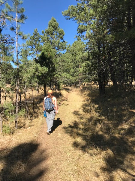
Rear view of a woman walking along a trail through trees in a forest

The techniques listed above have empowered me to take more control of my anxiety.  I don’t put my issues out there to garner pity from others.  Rather, I seek to relate my personal struggles with the disorder, as well as the methods I’ve learned to help control it.  I want this blog to be a place where others can come to acquire these tools for themselves. 

I’ve accepted the fact that my anxiety is a part of me, that it’s something I will, likely, live with for the rest of my life.  But, that doesn’t mean I have to allow it control over my life.  I strive, every day, to reign in those worrisome thoughts and emotions and use them to improve myself.  There will be some tough days.  Sometimes, the anxiety will win.  But that’s just one day.  Life is a marathon, not a sprint!  The sun WILL rise again tomorrow!  So, when we have a bad day, we pick ourselves up, dust ourselves off, and press on!

Part of what I love about the outdoors is that nature cuts out the BS.  It takes away our technology and gets us back to basics.  It humbles us as it forces us to acknowledge there are some things in life we can’t control.  Along with that, though, it helps us to understand that some of the things that cause us anxiety aren’t really as threatening as we might first think.  Nature gets us back to our intrinsic roots.  I find that one of the rare times I can truly put my mind and spirit at peace is when I’m engaging with and appreciating the natural world, in all its glory.  I want to share that with others. 

So, some may ask, “why do I write this blog and spend so much time outside?”  To that I answer, “to escape the noise!”

*Ya’ll, I’m telling you, this song is awesome.  If you aren’t familiar with it, I BEG you, go listen to it.  This is three-and-a-half minutes that IS worth your time (the video is pretty cool, too).  For your convenience, I’ve linked to it here.  Pay careful attention to the last couple of shots near the end, see if you notice a common theme…*

Hike the Norbeck Trail in Custer State Park

I review the Norbeck Trail, a low-use trail in the higher elevations of the Black Hills, near Custer State Park.


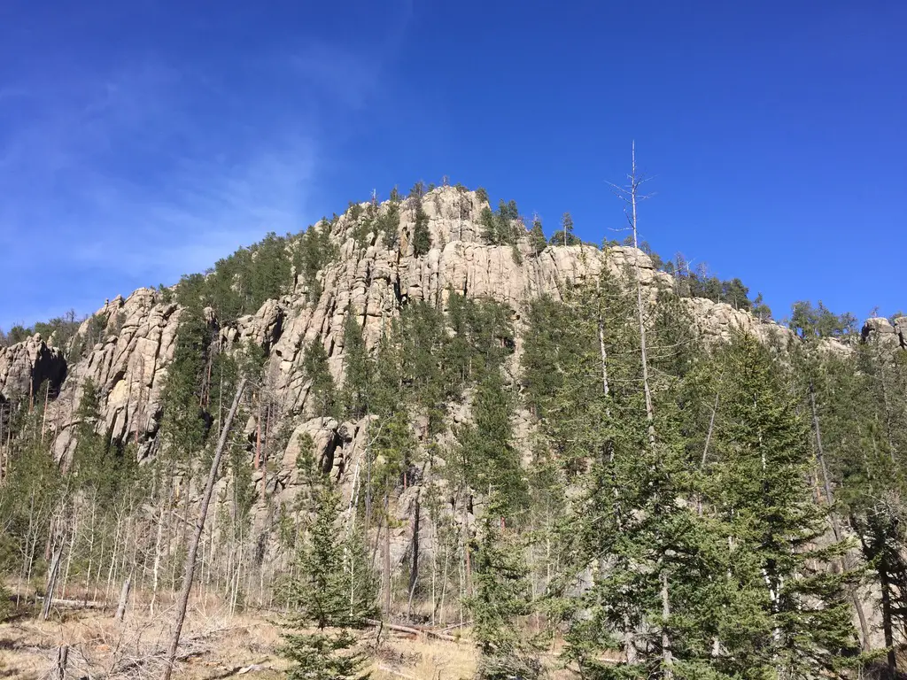
The Norbeck Trail is a beautiful, lesser-traveled hiking route situated within the Black Elk Wilderness.  This is found within the boundaries of Custer State Park in the Black Hills of South Dakota. 

How do you get to the Norbeck Trail in Custer State Park?

There are actually two trailheads to access the Norbeck Trail:

If you want a shorter hike and want to hit the more difficult, steeper sections sooner (while you have more energy) the Upper Norbeck trailhead comes first. It is located about .3 miles east of Sylvan Lake and about .1 miles east of the trailhead for the Cathedral Spires (all on the Needles Highway, Route 87.)

It’s kind of hard to find the trailhead because you can’t see it from the road and there isn’t any sign. Basically, once you pass the trailhead for the Cathedral Spires, start watching for a paved lane going off to the left. That’s the trailhead. (Sorry, that’s about the best description I can give. 😝)

To reach the main Norbeck trailhead, take Route 87 to Forest Road 345 (Camp Remington Road).  Then take Iron Creek Horse Camp Road (which will be on your left).  Watch for signs for the Iron Creek Horse Camp and the Iron Creek Centennial Trailhead as they’re both, also, found on this road.  You will actually park at the horse camp, or just outside of it if the gates are closed (when we were there in mid-April the campground was still closed for the winter.)

Note: the Needles Highway is closed to vehicle traffic during the winter months. You can hike, snowshoe or ski it though (which can be a lot of fun!) 

What you will see on the Norbeck Trail, in the Black Hills

The trail is comprised of picturesque, rolling terrain.  It’s well-marked and wide enough for two people to walk side-by-side in some places.  There are several water crossings that are small enough that they’re easy to cross but big enough to offer relief and respite on a hot day. 

The ecology found along the length of the trail varies greatly from moist, almost temperate rainforest near the base, to dry, alpine forest near the top. 

As you trek through these various ecosystems take note of the abundance of spruce trees in certain areas–usually on the northern slopes–that denote a wetter climate (you usually only see this variety in wetter locations in the Hills.)  

What is the difficulty level of the Norbeck Trail?

The route is steep in parts, but the elevation changes are fairly moderate until you near the terminus of the trail where it joins with the Little Devils Tower trail.  These last 2.5 miles of the trail gain 1000 feet in elevation! (To compare, we gained the same elevation amount on the Misty Moon trail in the Bighorn mountains of Wyoming over the course of five miles!) 

This more difficult area is beautiful, though, as it snakes through a canyon complete with rocky, craggy overhangs and caves.  You’ll see the backside of the Cathedral Spires towering over you to your left, and if you turn around you will be treated to beautiful views of the Southern Hills and plains to the south.

A word of advice: never let your focus on completing a trail keep you from looking around–and behind you!  You never know what incredible views you may be missing if you’re solely focusing on the trail in front of you.

Pine trees and tree-covered mountains. Spindly rock on top of a mountain are in the far background
The rear view of the Cathedral Spires.

This trail doesn’t really “go” anywhere, per se, it’s more of a connector to other notable trails.   It can be combined with different routes to form various loops depending on how long you wish to spend in the Wilderness Area.  From the trailhead to the junction with the Little Devil’s Tower Trail, the route is a little over five miles (one way)–and as mentioned above it gets steep–so plan for a full day’s hike when considering this option. 

We really enjoyed the hike and the ever-changing scenery was beautiful.  There were some gorgeous vantage points and numerous opportunities for wildlife sightings.  This trail is less well-known and, therefore, more secluded. 

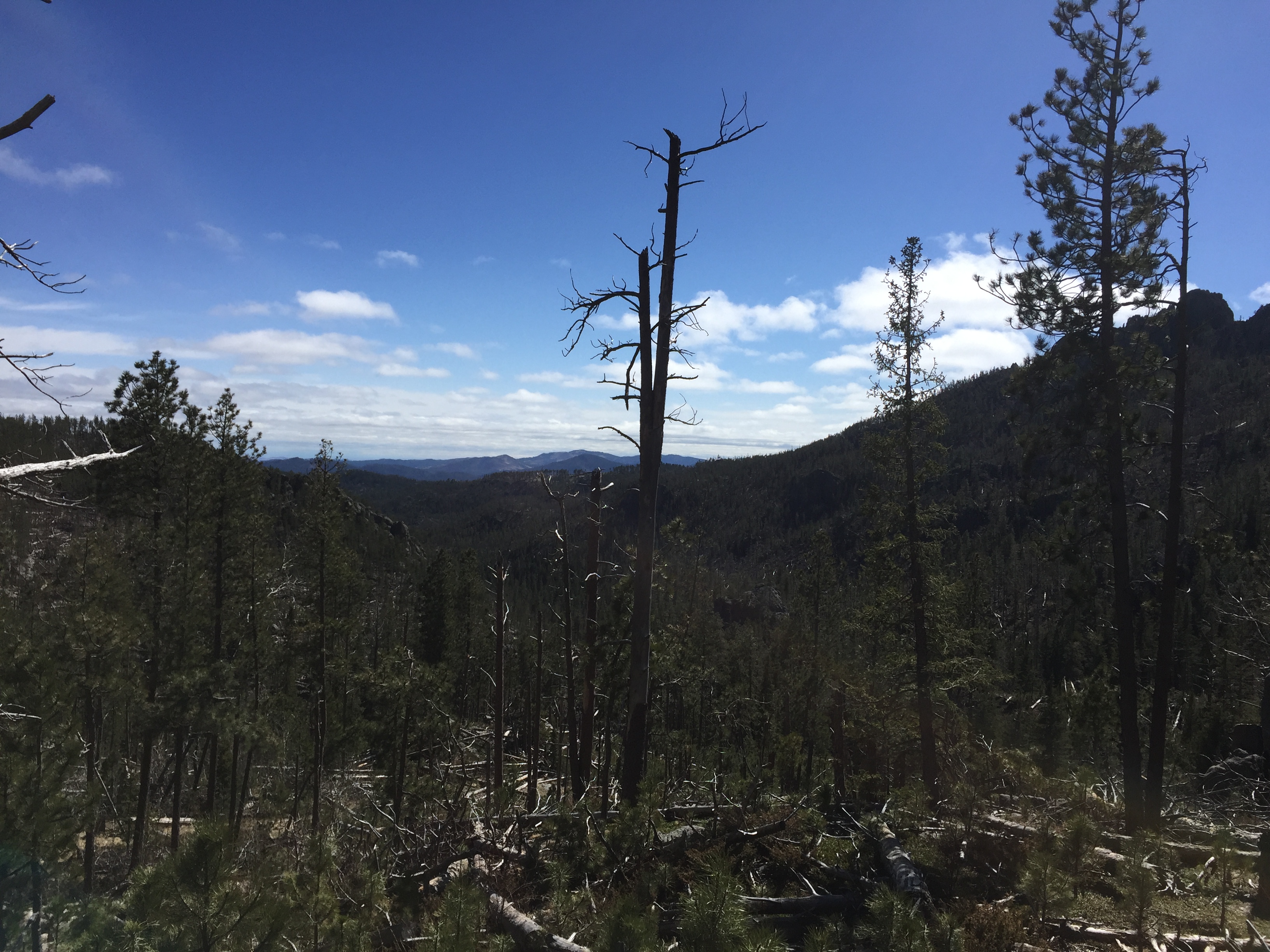
A portion of the trek does run near Route 87, for a time, so the summer months may be busier.  Certain areas of the trail also traverse old burn scars so, if traveling in the summer, be prepared for lack of shade and a hot hike in some parts.

Person stands in an open space amongst deadfall of trees. A few scraggly pine trees remain standing. Rock mountains are in the far background
You can see the sparseness of the shade in some areas.

As with many other areas in the Black Hills, be watchful for deadfall as well as dead trees that remain, precipitously, standing (and their hanging, broken branches).  These are remnants of the recent pine beetle infestation, and they can fall at any time, even on not-so-windy days.    

A few scraggly pine trees standing amonst deadfall. Rock mountains are in the far background
Damage from the recent pine beetle infestation

If you’re looking for a fairly easy day hike, with nice views and few people, consider the Norbeck Trail!  

Have you ever hiked this lighter-use trail?  If so, tell me about your experience in the comments!


Did you enjoy this post?  Pin it!

Picture of a rocky mountain sparsely covered by trees and a blue sky overhead. Pin reads, "Hike the Norbeck Trail in Custer State Park."


Like what you read here today?  Please feel free to leave a comment, like or share this post!  Add your email at the bottom of the page, or the sidebar to the right, to be notified when a new post is published.  By signing up for the email list, you will also receive a free copy of the Tranquil Trekker’s Top 10 Tips of Trekking Do’s and Don’ts!

You can also follow the blog on social media by clicking the links below!
Facebook

Twitter

Instagram

Pinterest

Car Altimeter and Sun Shower Review

In this post, I review one of my favorite gear items (a car altimeter), as well as a piece of gear no long-term camping trip should be without (a sun shower!)


The car altimeter and sun shower are two items the Trekkers use fairly regularly when car camping/traveling.  Neither are must-haves, per se, but they make the trip more comfortable and more fun!

What is a Sun Shower?

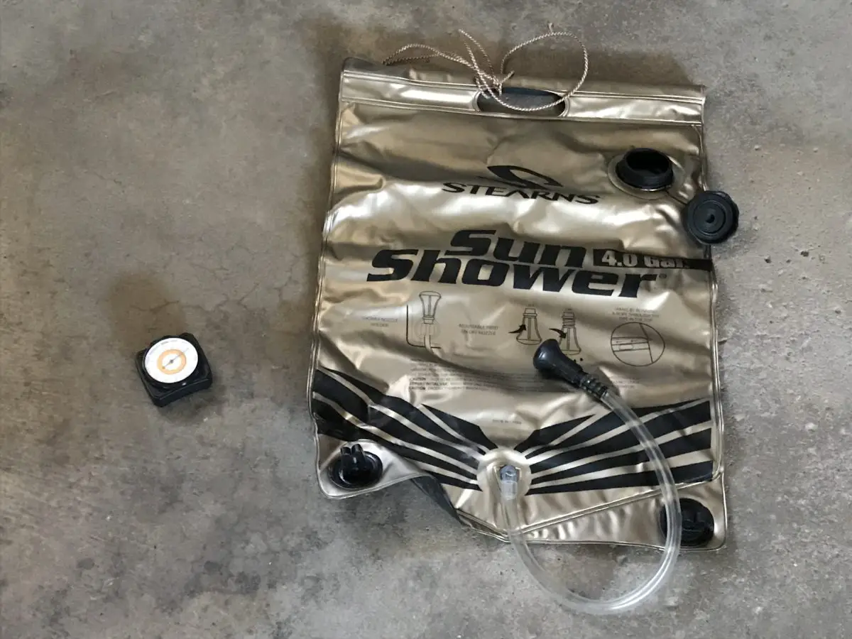
A sun shower is simply a reusable, robust, vinyl bag and tube, with a spout and black backing, that you fill with water and leave out in the sun–it looks like a giant water bladder.  When you return to camp after a day on the trail, you have warm water and a spigot you can wash with.  The device is gravity-powered, so you’ll need to keep this in mind when you’re picking a spot to hang it.  

There are various brands and versions of this apparatus, this specific one holds four gallons of water.  We’ve found this system works well even to just rinse off, or to have hanging around camp to use to help keep hands and feet clean. (We have found this setup also works well to make sure your fire is out at the end of the evening as you can direct the water more easily than using a bucket).

What is a car altimeter?

The car altimeter indicates the elevation you’re currently residing at.  This may not be a necessary piece of gear for the average hiker, but it’s fun on a road trip to see just how high (or low) of an altitude you’ve achieved.  It’s also one of my favorite gear items, even though it isn’t, usually, essential to regular hikers (those venturing to the truly high altitudes–10,000+ feet–may find it more useful.)

The device responds to changes in barometric pressure caused by weather, as well, so you may have to recalibrate it a little, each day, to maintain the most accurate readings.  

Other versions of this instrument are digital, but I like the classic feel of the dial.  For amateur interest, this is a fun, portable, way to keep track of elevation changes.  It also mounts to the vehicle using velcro, so it can be easily removed and taken on a hike if you’re so inclined. 

Below is a close-up picture of the altimeter:

A small dial showing various elevations sits on a table

So, if you’re wanting to maintain a higher level of hygiene on your next camping trip, or you want to know exactly why you’re breathing a little harder on the mountain top you’re currently standing on 😳, check into these devices!

Have you used either of these products?  What were your experiences?  Tell me about them in the comments!


Did you enjoy reading this post?  Pin it!

A plastic container and tub labled, "Sun Shower" and a small dial sit on the floor. Pin reads, Car Altimeter and Sun Shower 2 Reviews of some of my favorite gear items!"


Like what you read here today?  Please feel free to leave a comment, like or share this post!  Add your email at the bottom of the page, or the sidebar to the right, to be notified when a new post is published.  By signing up for the email list, you will also receive a free copy of the Tranquil Trekker’s Top 10 Tips of Trekking Do’s and Don’ts!

You can also follow the blog on social media by clicking the links below!

Facebook

Twitter

Instagram

Pinterest

†As an Amazon Associate I earn from qualifying purchases

Yaktrax Review

In this post, I review Yaktrax, a must-have, gear item for the slippery, winter months.


When the weather turns cold and the ground icy, there is one item the Trekkers can’t live without, Yaktrax!  These gadgets are a GODSEND for anyone who spends a lot of time walking outside in the winter months.  

We use them for hiking (obviously), but also for things like walking the dog, clearing snow, etc.  They are especially effective for people who live in neighborhoods like ours where there is, literally, no flat ground ANYWHERE.  

Imagine this situation…the dog–with her 4-paw-drive–takes off down the hill dragging you with her.  You can:

A) Hang on for dear life, running through the snow-covered grass to maintain a semblance of traction or skid behind her on the slippery pavement…

or…

B) Walk easily behind her, completely in control (even if she’s slipping along), thanks to the Yaktrax–I speak from personal experience. 😇

There are several variations of these nifty devices, as well as a few different versions of the traction implement on the gear.  I strongly recommend the ones with velcro straps that attach over the top of the foot (they aid greatly in holding the device to the shoe). 

If you want to use these with hiking boots, I would suggest you lean toward a larger size–so, if you wear a size 10 shoes, I recommend the Yaktrax that are intended for sizes 10.5 – 12.5, NOT the ones that can only accommodate up to size 10.  My personal experience was, that the size recommended fits shoes just fine, but is almost too small for boots (they fit but they’re difficult to put on and take off and they tear/wear out sooner).  

Some of the product options feature chains, some studs, some springs, and some spikes (depending on the severity of the conditions you intend to encounter).  We’ve always used the “spring” version with great success (on extremely smooth/slippery ice, you may want something a little more hardcore).  Prices range from under $20 to close to $200 (again, based on the intensity of the spike you are interested in).   

Options for YakTrax!

Trekker Favorites

Best for shoes

Diamond Grip

Cleats for Running

Spikes!

Heavy Duty

A word of caution, be careful walking on these for long periods over hard dirt/rocks as they can become damaged.  We regularly carry them with us and then apply/remove them as conditions require (fortunately they’re small and fold up well, so this is easy to do).  

I would also caution against walking on them indoors (especially on hardwood floors or carpet) as they could tear/scratch that material (this risk will rise with the intensity of the traction material chosen). 

As long as they aren’t too tight, the Yaktrax slip on and off quite easily.  I would also recommend caution when using them in muddy conditions (though sometimes this can’t be avoided).  They can be a HUGE pain to clean if the mud dries on them (though if you can wash it off using water or rub it off with snow before it hardens, the difficulty decreases exponentially).

I would also suggest choosing the traction option that covers the most surface area of the boot/shoe (which is why the Trekkers chose the “Pro” version).  The exception to this would be if you really feel that spikes are required for the activity you intend to use the gear for. 

There are multiple brands of this product, these are the ones we use and have had great success with.  My first pair eventually tore, after several years of use, due to being slightly too small for my boots causing them to over-stretch.  Mr. Trekker got the exact, same brand/type, at the same time I did, and his are still going strong (under very similar use).

Below is a “shoe-sole” view of the Yaktrax, this is what bites into the ice:

Two springed, traction devices sit on a table

If you’re looking for a low-cost tool to help you remain upright during the slippery, winter months, I strongly recommend Yaktrax!

Have you used Yaktrax?  Tell me about your experience in the comments! 


Did you enjoy reading this post?  Pin it!

Two springed, traction devices sit on a table. Yaktrax are labled on the velcro. Pin reads, "Yaktrax Review! Use these amazing devices for winter hiking or just taking the dog for a walk on a snowy day."


Like what you read here today?  Please feel free to leave a comment, like or share this post!  Add your email at the bottom of the page, or the sidebar to the right, to be notified when a new post is published.  By signing up for the email list, you will also receive a free copy of the Tranquil Trekker’s Top 10 Tips of Trekking Do’s and Don’ts!

You can also follow the blog on social media by clicking the links below!
Facebook

Twitter

Instagram

Pinterest


†As an Amazon Associate I earn from qualifying purchases

Rimrock Trail Black Hills

In this post, I review Rimrock Trail, that traverses the canyon walls, floor and crest of Spearfish Canyon.


Located along the crest and walls of Spearfish Canyon, in the northern Black Hills of South Dakota, is Rimrock Trail–Trail #79. (This route also now offers access to the recently organized Tinton Trail that traverses this area, as well.)  

Where is Rimrock Trail?

You can access the route via several different trailheads.  The easiest is to use Forest Road 222 from the tiny hamlet of Savoy, at the junction of Spearfish and Little Spearfish Canyons.  

From the Spearfish Canyon Byway turn at the Spearfish Canyon Lodge.  Once you drive past the final pullout for Roughlock Falls, start looking for parking areas–there are several. (If you reach the T-intersection with Tinton Road you’ve gone too far.) 

The parking areas are near the Rod & Gun and Timon Campgrounds, on the right-hand side of the road.  Be watchful as they are VERY small–they only fit about two vehicles each.  Also, some of the trailhead signs are recessed into the woods a bit, so they’re easy to miss.  

Rear view of a woman walking on a trail through a grove of yellow aspen trees and green grass.
The Tranquil Trekker traverses an “Aspen Tunnel”!

There is easy, trail access from the Rod & Gun and Timon Campgrounds, as well, though there are technically no “official” trailheads here.  If you want to avoid the crowds near Savoy, you can also take Tinton Road north from US 85 as it heads west out of Lead (towards Wyoming) and turn right onto Roughlock Falls Road, heading towards the falls (in this case the trailheads will be on your left before you reach the falls).  

There is another access point to this route from a spur trail that begins at the Old Baldy trailhead and parking area, which is found further along Tinton Road.  From here you will actually approach the canyon from the top.  This portion of the trail is relatively flat.

What is the Rimrock Trail like? 

The trail is comprised of two loops, the Upper Loop is 4.7 miles long and the Lower Loop is  3.2 miles.  We enjoyed both, and doing so means you’ll experience around a 700-foot total elevation change (the trail is fairly flat, the entire elevation change is mostly contained within an area of 1/2 mile or so, twice, throughout the hike–once descending and once ascending the canyon wall).  

This area is open for hiking, snowshoeing, horseback riding, and mountain biking.  The trails can be enjoyed year-round with proper equipment, though be aware, Route 222 is closed in the winter to all vehicles other than snowmobiles.

Tinton Road is not usually maintained in this area during the winter either, so, its accessibility varies depending on current conditions.  In addition to the weather, these include the vehicle you’re driving, the recovery gear you’ve got at your disposal, and your experience level with 4×4 driving.  We’ve traversed it successfully, but we’ve also gotten stuck, to the point where we would have had to be rescued had we not had proper recovery gear with us.   

What you will see on the Rimrock Trail

The trail offers GORGEOUS aspen groves that are especially lovely in Fall (take note, this area is one of the higher elevations in the Hills and trees usually change earlier here.)  The trek also features canyons and open meadows that are perfect for a stop for lunch. 

This area used to be fairly well-shaded.  Unfortunately, it has been hit by multiple tornadoes in recent years so now there are several bare spots where the trees once stood. 😕

We started from the eastern, Lower Loop, trailhead (the first one you come to when traveling from Savoy.)  Beginning the hike from here, the climb isn’t as steep, whereas if you start from the western trailhead the trek gets VERY steep almost immediately.  Due to the grade of that climb, that area would be very difficult and potentially risky if it was muddy.  

A dirt path winds through yellow aspen trees and green grass with pine trees in the background, all under a blue sky.

From where we began, it was amazing how quickly the ecosystems changed from a cool, damp, almost rainforest-type environment to the dryer, warmer, ponderosa pine forest and meadows common to the rest of western South Dakota.  The trail also offers expansive views of the canyon and surrounding countryside once you reach the crest. 

Going this direction, the final stretch of the route is easy and almost flat (which is nice when your energy is running low) as it traverses the floor of the canyon.  The babbling Little Spearfish Creek accompanies you the entire way.  Feel free to stop for a spell and soak your tired feet in the cool water, or watch minnows dart in and out of the sun-dappled shallows. 

You’ll pass a filming site from the movie Dances with Wolves (from the final scene in the film).  The origin of the 1997 White House Christmas Tree and the remains of an abandoned ranger station/homestead can be seen in this area, as well.

A grove of yellow, aspen trees with green grass and pine trees in the background all under a blue sky dotted with white, fluffy clouds.

This really is a great trail!  It’s one of the better options to experience the various ecosystems western South Dakota has to offer and it’s also very pretty.  The canyon portions remind me of those I’ve mentioned previously on the Deerfield Trail.  

In the fall, you can enjoy some of the best leaf viewing the Black Hills has to offer without having to negotiate all the traffic and visitors to the main portion of Spearfish Canyon.  During the autumn months, the yellow of the aspen contrasted with the dark ever-green of the pine trees; the brown bark of fallen logs; the incredible South Dakota blue sky, and the white puffy clouds (with red creekside plants speckled throughout the canyon areas) truly creates an iconic scene.  

I would rate the entirety of the trail as moderate (though several of the flatter portions are actually easy).  The climb up and down the canyon wall is relatively short but it’s steep enough for a strenuous rating, especially in less-than-superb conditions.  Because the trail can be divided into shorter sections, it is appropriate for smaller children, though they may need some assistance negotiating the steeper portions.  

A creek runs through yellow, green and red, fall foilage with pine trees in the backgound.
The view as you’re descending to the creek (creekside areas seem to be about the only place to reliably see red color in the Hills in the fall)

If you’re seeking a less well-known hike in the Hills, check out Rimrock Trail!

Have you ever hiked in this area?  What did you think?  Tell me about your experience in the comments!


Did you enjoy reading this post?  Pin it!

A creek runs through yellow, green and red, fall foilage with pine trees in the backgound. Pin reads, "Black Hills Rimrock Trail"


Like what you read here today?  Please feel free to leave a comment, like or share this post!  Add your email at the bottom of the page, or the sidebar to the right, to be notified when a new post is published.  By signing up for the email list, you will also receive a free copy of the Tranquil Trekker’s Top 10 Tips of Trekking Do’s and Don’ts!

You can also follow the blog on social media by clicking the links below!

Facebook

Twitter

Instagram

Pinterest