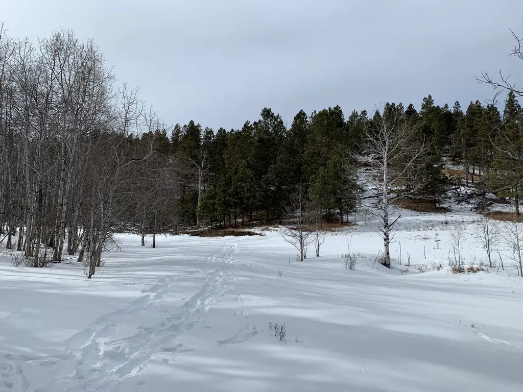
In this post, I review the Deerfield Trail (Trail #40) that traverses a portion of the central Black Hills.
At 23 total miles long, the Deerfield Trail (Trail #40) can be accessed from several trailheads throughout the Black Hills. It begins at Deerfield Reservoir (there’s a spur trail that actually circumvents the entire lake), crosses the Mickelson Trail at about the halfway point, and eventually, spans all the way to the Centennial Trail near Pactola Reservoir.
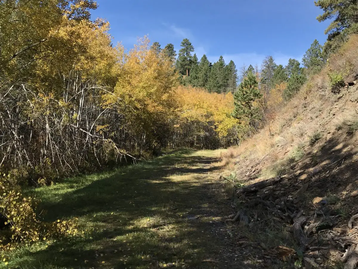
The Deerfield Trail is adorable! It traverses canyons, meadows, valleys, and ridges. Sites that housed old mining camps (and some that are still operating) and the occasional remnants of an abandoned homestead dot its course. This includes one squatter’s paradise that was built directly into the rock! Tailings from old mining sites, remnants of ramshackle cabins, and numerous stream crossings–often with charming, simple, log bridges–are scattered throughout the trail’s length.
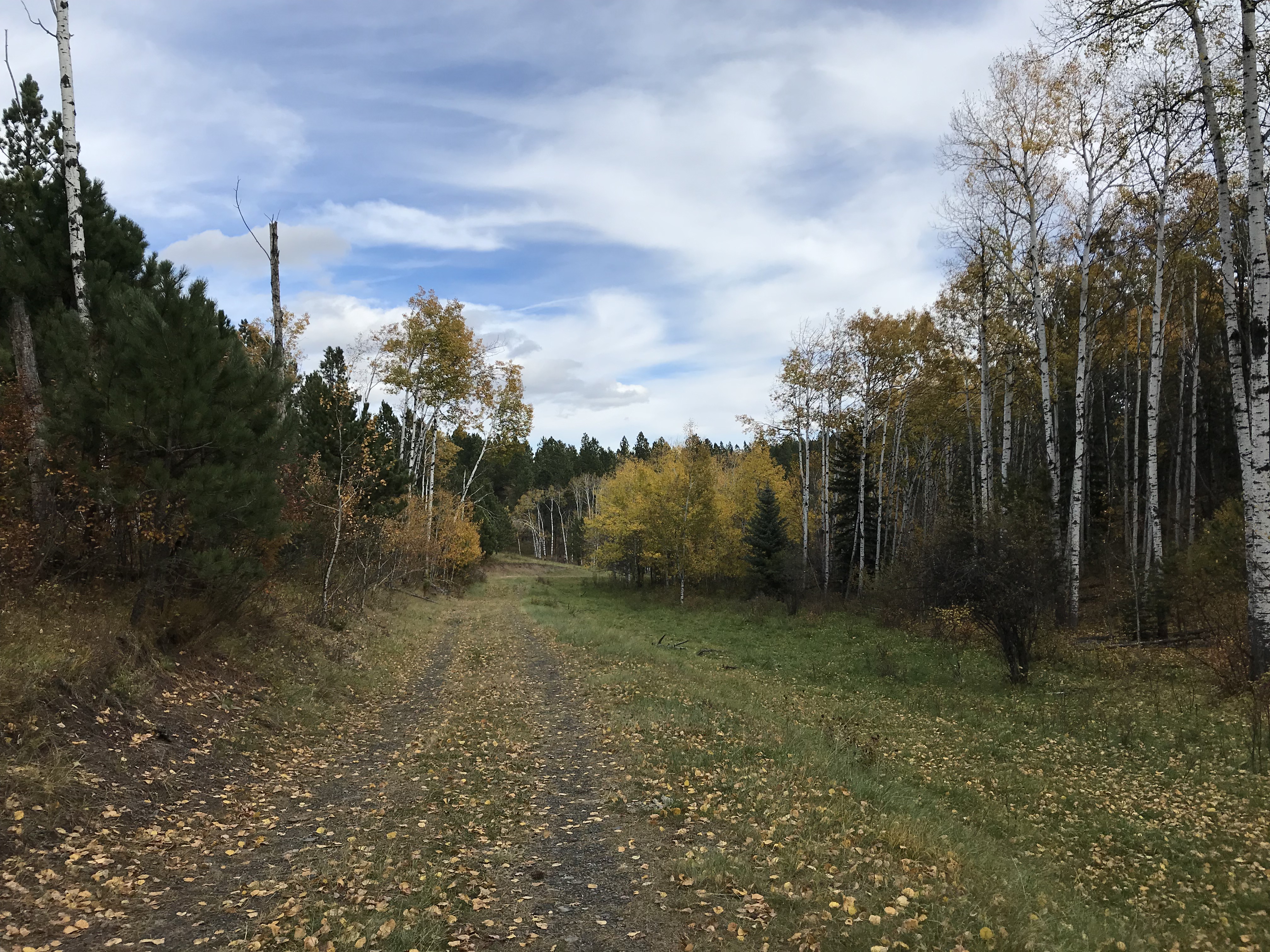
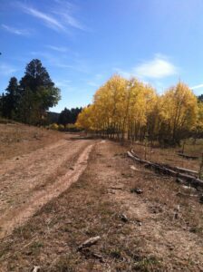
This is one of the forest roads the trail traverses. It was such an iconic site I kept half-expecting to see a horse and cart saunter by! 😂I LOVE the golden leaves contrasted against the still-green grass and the various brown hues of the log and dirt…
Things to See on the Deerfield Trail
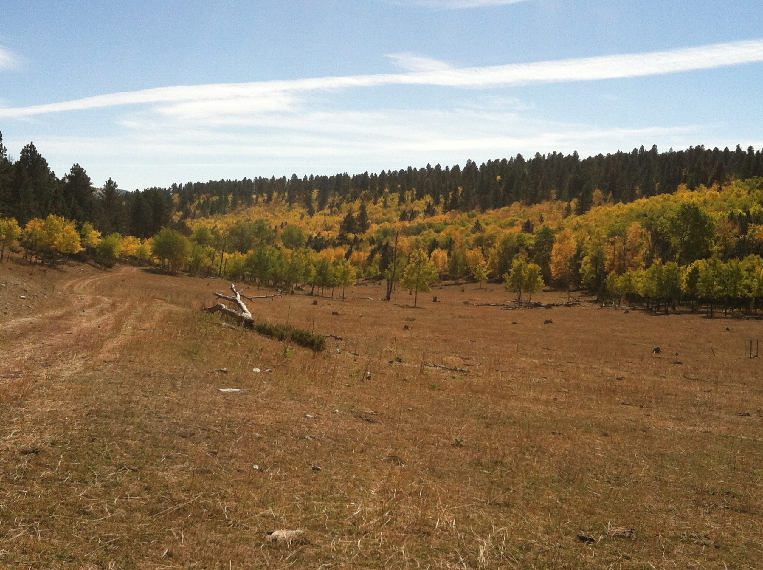
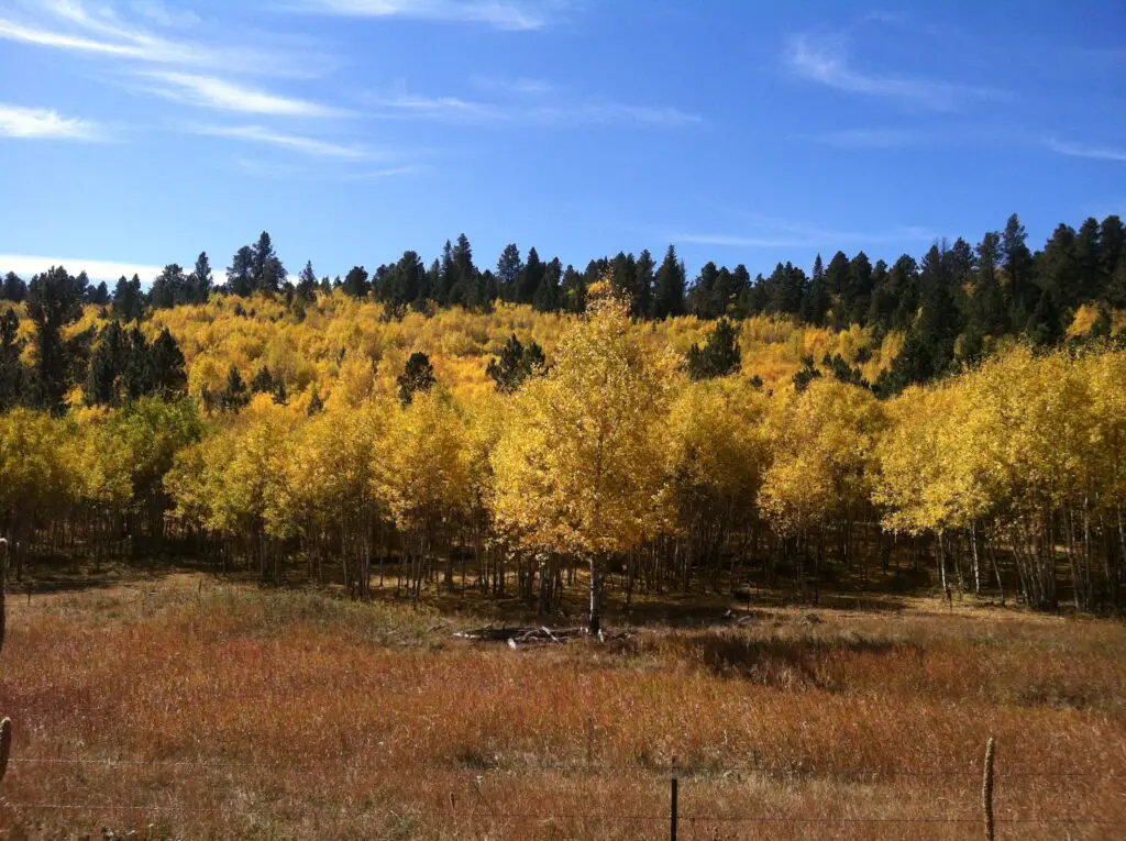
The Deerfield Trail runs through several canyons that are similar to those found on Rimrock Trail, that traverses the rim of Spearfish Canyon and others that you see on the Little Elk Creek Trail, near Sturgis. The canyons are especially gorgeous in fall as the never-ending green of the spruces, that blanket the canyon walls, contrasts with the yellow and orange of the aspens and red of the plants that frame the creek.
Several sections of this trail run along ridges that are reminiscent of those found in the Eagle Cliffand Big Hill areas in the Northern Hills.
This is another trail system that crosses multiple ecosystems, similar to the trails that traverse the rim of Spearfish Canyon. The canyon sections are lush and green, while the ridge sections are comprised more of a drier, arid prairie.
Treks on the Deerfield Trail can even include a variety of weather depending on which side of the mountain you find yourself. You may start off your hike in sunny, blue skies, veiled with wisps of cirrus clouds. By the time you reach the ridgeline, a cold breeze can be blowing darker, heavier clouds in. Then, after a quick lunch, you can retrace your steps to the other side of the hill and return to a warmer, sunlit forest.
Things To Do on the Deerfield Trail
The Deerfield Trail is open year-round, for various activities, including horseback riding, hiking, mountain biking, and snowshoeing/cross-country skiing, depending on the time of year.
Large portions of the route follow old logging and forest roads that are wide and well-graded, so travel is often smooth. (Some of these are still in use so keep your ears and eyes open as you may have company on the trail).
While the entire route could be completed in one attempt with an overnight trip–or a VERY long day trip (if you had a car at each end)–it is usually conquered in sections (as the Trekkers are attempting). It should also be noted that some of the trailheads may be difficult–or impossible–to reach in the snowy months (at least with a typical, road-worthy vehicle).
The elevation for this trail is moderate compared to many of the other, longer ones in the Black Hills. While some sections will get your heart pumping, many consist of scenic, tranquil afternoon hikes in the woods.
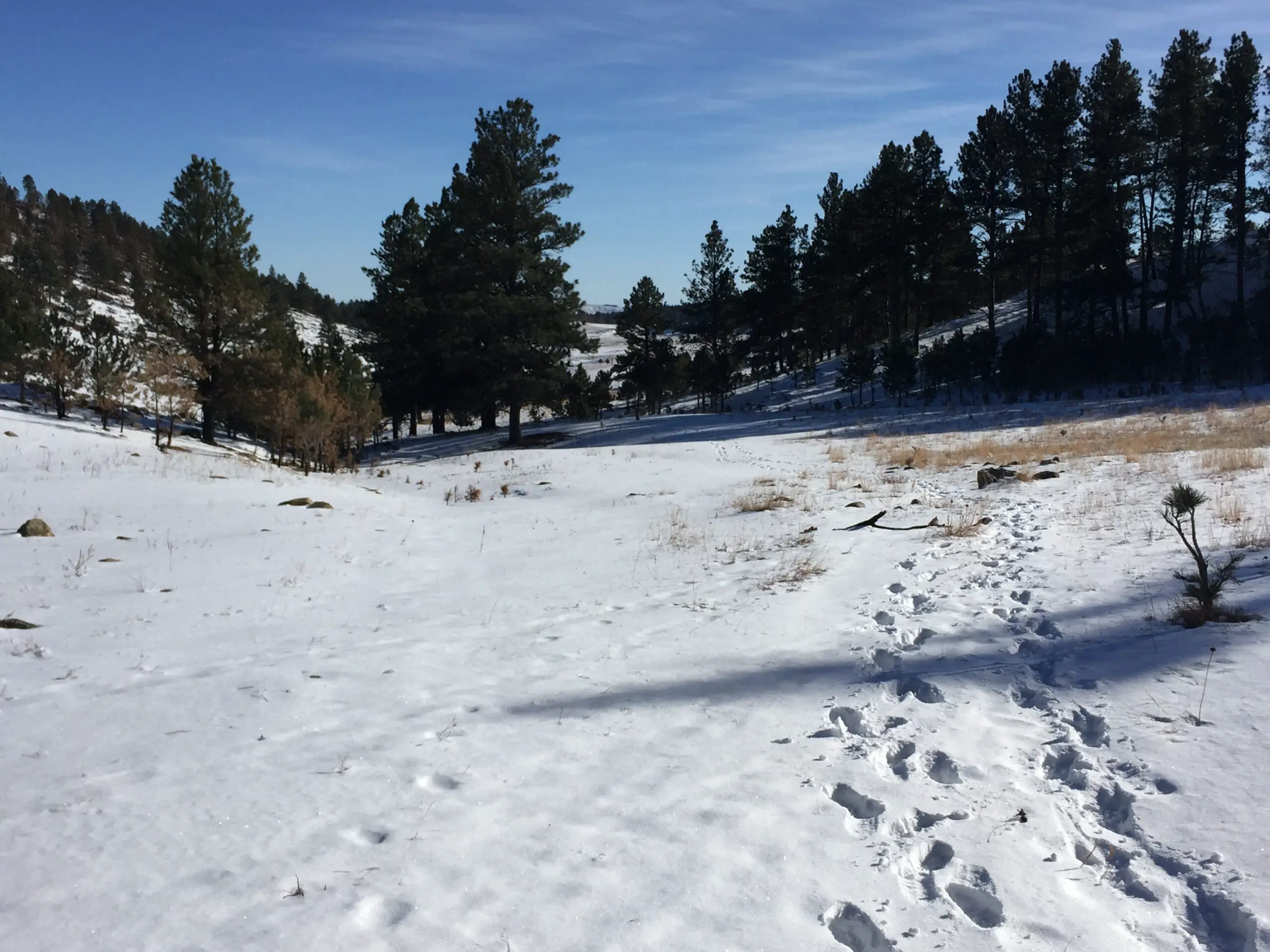
One of the best features of this hike, for me, is its solitude. Some portions are more heavily traveled than others–namely the canyon sections–but often you’ll find you have the trail to yourself (especially in the colder months). It’s not unusual for the only evidence of others having used the route to be the deer, elk, coyote, and often, mountain lion tracks–usually following the deer tracks! 😳–that remain in the mud or snow. Don’t be surprised if you see the flags of some white-tail deer tails flying high as they dash out of your way as you traverse the trail!
Elk print!
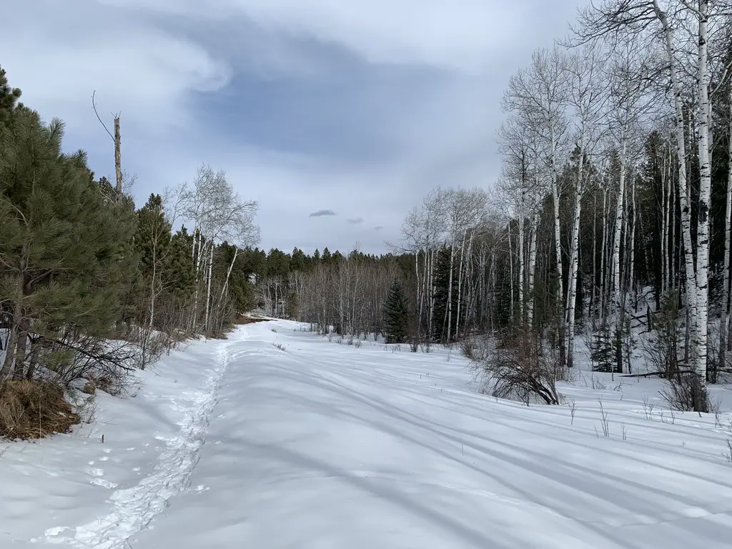
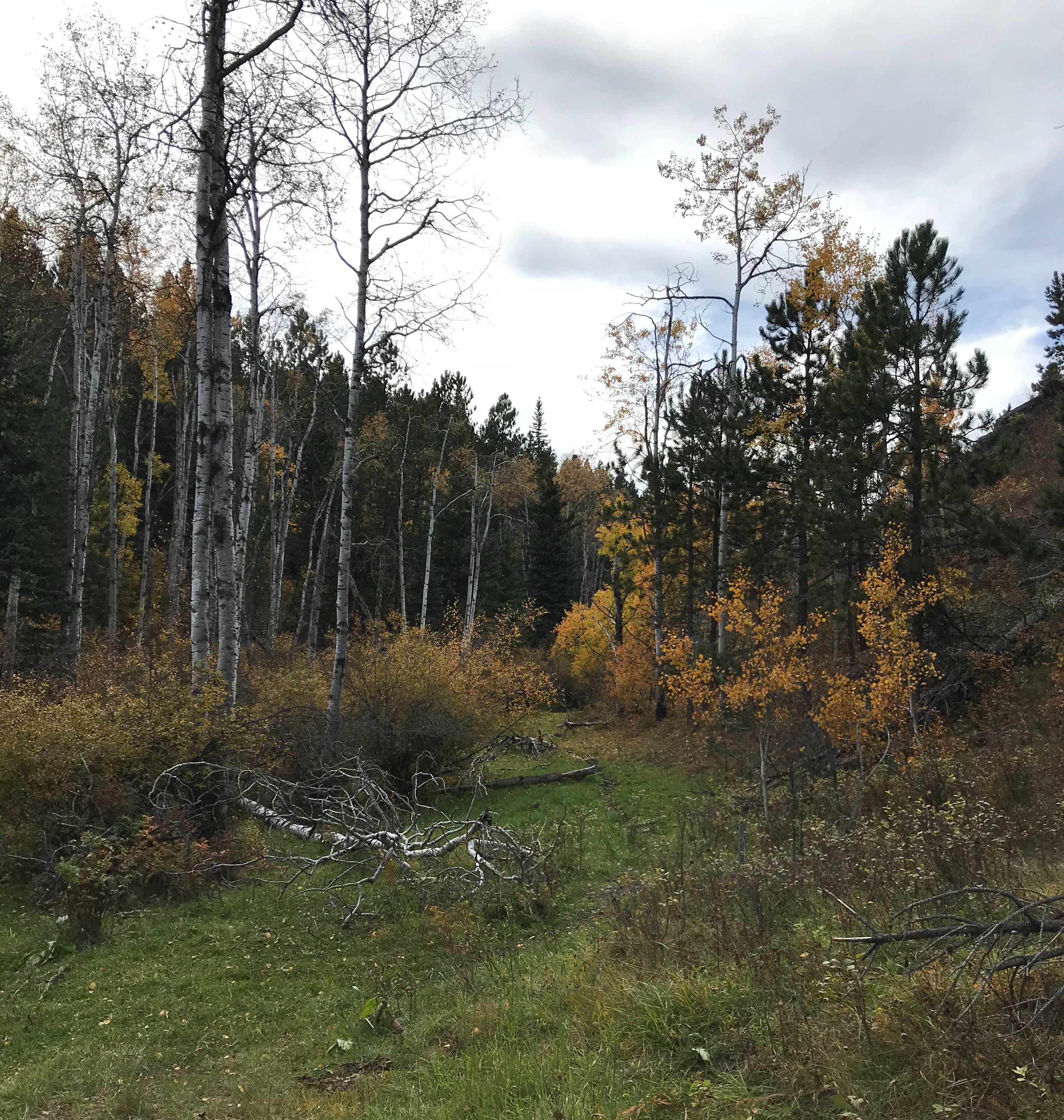
Below is a picture from the same area on the trail, but at different seasons (fall and winter).
A few more pictures from this scenic trail!
If you’re looking for a peaceful, casual hike through some beautiful countryside, consider giving the Deerfield Trail a try!
Have you hiked portions of this trail? What were your favorite parts? Tell me about them in the comments!
Did you enjoy this post? Pin it!
Like what you read here today? Please feel free to leave a comment, like or share this post! Add your email at the bottom of the page, or the sidebar to the right, to be notified when a new post is published. By signing up for the email list, you will also receive a free copy of the Tranquil Trekker’s Top 10 Tips of Trekking Do’s and Don’ts!
You can also follow the blog on social media by clicking the links below!
In this post, I review the hike on the Centennial Trail between the Samelius Trailhead and Sheridan Lake
One interesting hike that is part of the Black Hills Centennial Trail runs between the Samelius trailhead and Sheridan Lake.
This section of the Centennial Trail is about seven miles in total length and ends at the Calumet trailhead at Sheridan Lake–obviously you can hike the trail from either direction, starting at either trailhead.
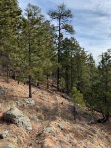
Hiking North from the Samelius Trailhead
The Centennial Trail runs in two directions from this trailhead, northbound towards Sheridan Lake and south, to the vicinity of Mount Rushmore and Horsethief Lake. These are both good hikes. We’ve only completed a small portion of the southbound route, so I’ll leave that review for another day.
The Trekkers have now hiked portions of this route from each direction/trailhead. You’ll notice I said “portions” because…this trail is ROUGH and it kicks our sorry butts every time we try it!
It is a LOVELY route though and definitely worth the effort! I would dub this trail as a fair unknown and hidden gem in the Black Hills! It won’t take you to the summits of any of the major, nearby mountains on its own. (There are several in the local area that you can climb to though, if you’re daring enough to trek off-trail. Mt. Samelius is one of these.) Also, if you know where to look, there is a Black Hills Secret Spot that can be reached somewhere off this portion of the Centennial Trail…😇
We have attempted this route at least four separate times and have never traversed the entirely of the trail between these two trailheads!
Try 1) it started lightning and thundering so we turned back…(I think this actually happened a few times…)
Try 2) I rolled my ankle SEVERELY about halfway up–we continued on to the summit before turning around…but in hindsight I probably should have turned back sooner…
Try 3) We attempted this route starting at the Calumet Trailhead at Sheridan Lake and did ok but never made it to the summit (that we reached on “Try 2”). To be fair, it was a pretty hot day!
Try 4) We attempted from the Samelius trailhead again and got further than we’ve ever reached before but STILL didn’t make it to the point we reached on “Try 3” *sigh*
Did I mention this section of trail kicks our butts EVERY. SINGLE. TIME.?!
What is the hike from the Samelius Trailhead like?
While the route from either trailhead ends up quite steep, we enjoy the hike from Samelius the best. For the first mile or so it follows an old, forest road so the path is wide and not too steep. (It reminded us of some old, carriage roads we’ve been on in parks out East!) After that it ventures back into the woods on a one-track trail that gets more rocky.
This is the begining of the rockier section of the trail
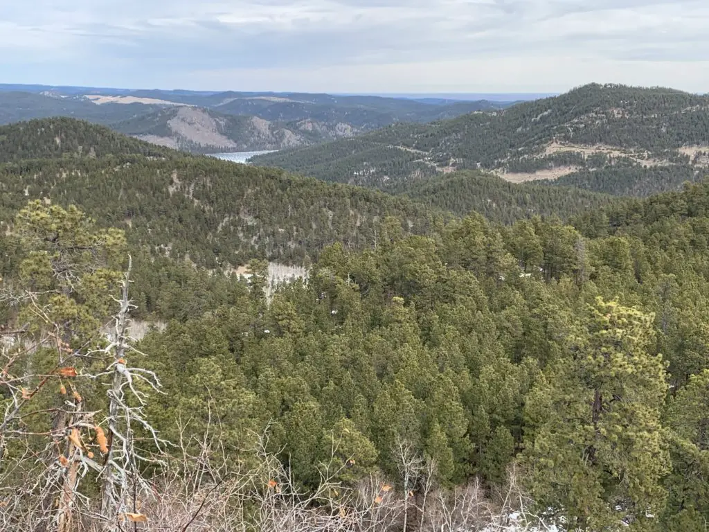
You will be treated to scenic vistas of Black Elk Peak (formerly Harney Peak) and the Cathedral Spires from the trail and there are several places you can spot portions of Sheridan Lake and the prairies that extend east of the Hills!
If you look closely in the background, you can see a portion of Sheridan Lake.
The steepest part of the trail coming from either trailhead is in the middle–though we found the entirety of the route from the Calumet trailhead to be steeper and not quite as pretty–you do get more glimpses of Sheridan Lake on this side.
The Samelius portion of the Centennial Trail is tough!
The path can be challenging, so you need to watch your step (as I found out when I made a misstep on a small rock–this was “Try #2″….)
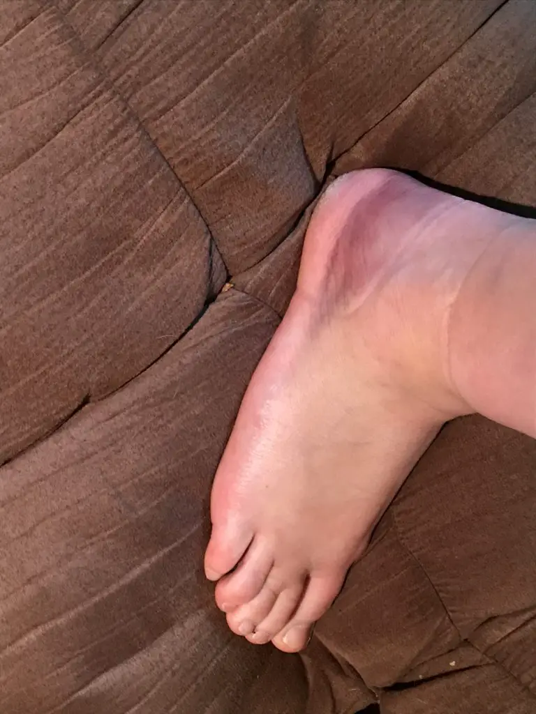
I rolled my ankle the worst I ever have less than a mile into the hike. At first, it didn’t seem that bad. It really didn’t hurt and there wasn’t any real evidence of bruising or swelling, so I decided to continue on. When we stopped for lunch at our turnaround point is when the stiffness and pain really settled in and I realized I may have pushed on too far. (Of course, we were also several miles from the truck at that point. 😝 ) Fortunately, Mr. Trekker fashioned a perfect hiking pole for me, out of a downed tree branch we found nearby. It made the trip back far more bearable for my ankle.–he’s never had to do that before or since. (This was the worse ankle injury I’d ever had…until I broke the other ankle in two places, dislocated it and tore a tendon falling on the ice several years later. 😝 In another hindsight, I probably should have named this blog The Clutzy Trekker. 🙄)
The bruise from rolling my ankle wrapped all the way around the outer ankle!
Don’t Hike Alone!
Ok, time for a little tangent–bear with me, I truly feel this is IMPORTANT!
My ankle injury on “Try #2” is another good example of why I stress that it isn’t safe to hike alone. (And no, your incredibly adorable, four-legged companion does NOT count as a hiking partner. 😐)
I know this opinion isn’t popular but it is a hill I will die on! It is always astounding to me how quickly accidents can happen on the trail, and how silly things can cause them. 😔
On “Try #2” I didn’t fall (for once) or slip on ice, I can’t even blame the dog for pulling on me too much. We were just walking down a dry section of trail that was relatively flat. It happened to be a bit rocky and I stepped on one of the rocks protruding from the ground wrong, which turned my ankle. Unfortunately, my momentum was already carrying me forward so I proceeded to–heavily–put my full weight on that ankle, and felt a *pop!* (not to mention numbing shocks running from my ankle bone up my shin and down my foot. 😝)
Some may argue that my decision to continue hiking was foolish, and they may have a point. The Trekkers have had some First Aid training so we implemented what we learned. The pain subsided fairly quickly, I had full range of motion with my foot and I could put my full weight on it. This suggested I wasn’t hurt too badly and this wasn’t the first time I rolled my ankle on the trail. (I have a tendency to underpronate when I walk so this happens easily and regularly to me.)
We examined the ankle and it showed no signs of visible swelling or bruising. Since it wasn’t really a struggle to continue hiking I decided to press onward. Some of this was also pure stubbornness. As we had already attempted this trail several times before and had never gotten very far due to the “Tries” mentioned above. I really wanted to continue on and keep enjoying the warm weather, so I chose to plod on.
As we slowly made our way back to the car, I couldn’t help thinking how things would have been different if it had been just me on the trail. I probably could have gotten back on my own, we weren’t that far out and I wasn’t hurting that badly. However, if it had been just me and the (barely) one-year-old, rambunctious pup…
I did ok navigating the route on my own with a walking stick, but if I had needed to be tethered to an energetic pup in addition, that feat would have been far more difficult (especially if the injury had occurred further along on the trail where the terrain became more strenuous).
To further belabor my point…
I feel the need to stress my warning is NOT a gendered statement–mens’ ankles twist and snap! just as easily and quickly as women’s!
Several years later when I fell on the ice and actually broke my ankle I WAS alone with the dog–THANKFULLY we were in our local neighborhood, only about a block from the house, and some WONDERFUL strangers stopped to help!
…if you read the post linked below you’ll learn about the time I fell through a snow drift and the foot of my snowshoe got stuck under a buried, fallen log. While I wasn’t injured, if I had been alone it would have been VERY difficult for me to reach to dig out or unhook the snowshoe. I was off trail, stuck in a gulley, with no cell service and would have had to scream for help until someone *hopefully* heard me. And to top it off I was buried up to my waist in wet snow and it was a fairly chilly, windy day…at that point hypothermia would have become a very, real threat…
This incident also further demonstrated to me why it’s important to ALWAYS bring extra gear. I almost didn’t bring a warm coat the day I rolled my ankle just to save weight and space. Even though it was early February the forecast was calling for fairly warm temperatures (not that unusual to have warm days occasionally in the Black Hills in the winter!) I did end up–wisely–including my winter “puffy” coat at the last minute, as it’s super light and packs well. I just couldn’t bare the thought of not bringing it along in the middle of winter, just in case…
As it turned out, I didn’t end up using the coat. HOWEVER, if my injury had been worse to the point where I had needed to wait for rescue, I easily could have become chilled and potentially even hypothermic if I hadn’t had a warm coat with me (I was sweaty and it was a breezy day).
Accidents can happen on the trail in a split-second folks, and it doesn’t have to be in wet, slippery, cold, or even difficult conditions. A fun walk through the woods on a warm day can become a rescue scenario in a matter of seconds. Please, learn from my experience, and ALWAYS BE PREPARED!!!
To Conclude
If you’re looking for a little tougher hike and you want to explore a lesser-known but beautiful trail in the Black Hills, check out the Samelius area of the Centennial Trail!
Have you ever hurt yourself while out hiking? Did you learn anything from the experience? If so, let me know in the comments!
If you enjoyed this post, feel free to Pin it!
Like what you read here today? Please feel free to leave a comment, like or share this post! Add your email at the bottom of the page, or the sidebar to the right, to be notified when a new post is published. By signing up for the email list, you will also receive a free copy of the Tranquil Trekker’s Top 10 Tips of Trekking Do’s and Don’ts!
You can also follow the blog on social media by clicking the links below!
In this post, I review several “secret” hiking trails that are found off of Sheridan Lake Road, not far from Rapid City.
If you regularly drive along Sheridan Lake Road, west of Rapid City you may have noticed what look like several random parking areas. You would be right! These are the starting points for several “secret” hiking trails. (They aren’t really a “secret”, they just aren’t as well-known as other local trails).
It is a bit harder to describe how to reach these, as they don’t have signed trailheads (though they do sit right near the road and their parking lots are obvious). I will do my best to give accurate descriptions. All of these routes can be used by hikers, bikers, or horses, and are appropriate for winter sports.
“The Stratobowl, the Quiet Side”
The parking lot for this trail is found just south of the Victoria Lake Road/Sheridan Lake Road intersection, where the road makes a sharp turn. It’s really just a dirt turnoff with room for only a few cars. Just past the parking area, there is a gate that blocks the old forest road, but you are permitted to walk through it.
This is an easy hike as it just follows an old, fire road on an out-and-back route. It takes you to the cliffs on the northern rim of the Stratobowl, which I’ve discussed before. Be aware, this route has very little shade. As it is so exposed to the sun, it can be a very hot hike when the weather is warm. Also, we have seen herds of big-horn sheep near the cliffs, so if you hike with dogs off-leash, make sure to watch for them.
In my opinion, of the several routes I will be discussing today, this trail offers the best views of both the Stratobowl area as well as the canyon that Spring Creek flows through.
“The Sheep Place”
We call it this because there is a sign near the trail that labels it as a “Big Horn Sheep Study Habitat” (funnily enough, we have never seen a sheep here 😝).
The Trailhead
This trail is located almost exactly seven miles from the Catron Boulevard /Sheridan Lake Road intersection. The parking area is on your left before you round a curve and see a sign for the Peace Ranch. Right before you reach this parking area you will pass another small, parking lane on the other side of the road. There are trails here, as well, that are mainly used by mountain bikers (though hikers can also use them). They eventually meet up with the Coon Hollow Trail system.
The Hike
This is a great, local trail. We have always enjoyed it as a quick place to take the dog for a walk on a Sunday afternoon or when you just want a quick jaunt on a cold, windy day. It’s also a good place to sneak in a short hike before a summer thunderstorm (we have raced the thunder back from here on several occasions!)
A series of old, fire, and forest roads offer several different out-and-back options in this area. Be warned, there are no real maps that cover these trails and the roads aren’t reliably signed. On one hand, if you pay careful attention, you shouldn’t lose your way. On the other, if you aren’t paying attention, it is easy to get turned around. Also, the area is surrounded by private ranch land, so it is important to stick to the roads and be respectful of any “private property” signs you may see.
Three Options
The first old road that breaks off to your left is the shortest of the routes. It will take you to the edge of a cliff on the northwestern edge of the Stratobowl.
If you continue past that fork, the next road you come to is longer. It will also, eventually, wind you to the edge of the Stratobowl, but the views aren’t as good as those from the first fork as they are obscured by trees. I have heard a rumor that there may be a way to loop these trails together, but if it exists we haven’t found that route yet.
There is another unnamed trail that continues straight after the second road forks to the left. It eventually works its way all the way down to Spring Creek.
You can’t always access this option as there is a gate that is sometimes closed. I’m not actually sure who controls it (if it is private landowners or the Forest Service). Either way though, if the gate is closed, please respect it and don’t use that route.
This trail is the longest of the three options, and the steepest, as it works its way down the cliff face to the creek, far below. We have yet to complete this entire route but it is on our “to-do” list.
I would rate the first two options as “easy” as they stick to the forest roads and have very little elevation gain. The third is more “moderate” because it wanders into the woods and requires more strenuous hiking when ascending and descending the cliff face. The easier routes are more exposed to the sun, so they can be quite warm in the summer.
The above trails are fairly well known, so expect to have some company on your trek.
I hope you’ve enjoyed my reviews of these many routes found near town. If you’d like to read about other trails that are located close to Rapid City, you can click the links below:
Have you enjoyed any of these trails? If so, let me know in the comments!
Like what you read here today? Please feel free to leave a comment, like or share this post! Add your email at the bottom of the page, or the sidebar to the right, to be notified when a new post is published. By signing up for the email list, you will also receive a free copy of the Tranquil Trekker’s Top 10 Tips of Trekking Do’s and Don’ts!
You can also follow the blog on social media by clicking the links below!
In this post, I discuss the Flume Loop Trail, found in the central Black Hills.
The Flume Loop Trail is another in my series of trails that are found close to Rapid City.
Where is the Flume Loop Trail?
This trail is found off Boulder Hill Road west of Rapid City. You can reach that road from both US 16 (a little way south of the Rockerville area) as well as off of Sheridan Lake Road. Either direction works, though the Sheridan Lake Road entrance is closer to the trailhead.
This is a dirt road, though it is usually in very good condition and can be managed by any 2WD car. (The exceptions to this would be in snow, or occasionally, due to heavy rain.) The parking lot where the trailhead is found is the same one you use for the Boulder Hill Trail.
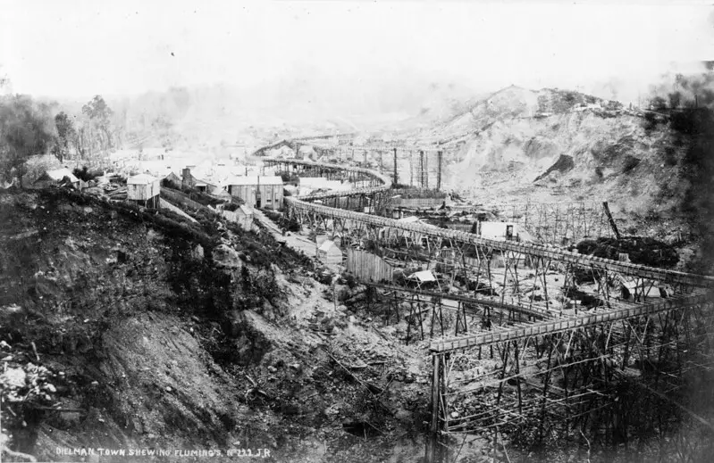
What is a flume?
A flume is a chute, generally built out of wood, used to transport materials (such as logs or gold) using water. This trail in the Black Hills travels along a former flume route from more than 100 years ago, during the gold rush. Today, it is mostly comprised of a wide, grassy, leveled grade along the hillside, where the original structure once stood. In a few areas, the rotting ruins of the original flume can still be spotted. (On other portions of the trail, you can actually travel through old tunnels in the rock that were created for use by the flume.)
The picture at the top of the post is an example of what a flume would have looked like, NOT specifically of the one in the Black Hills.
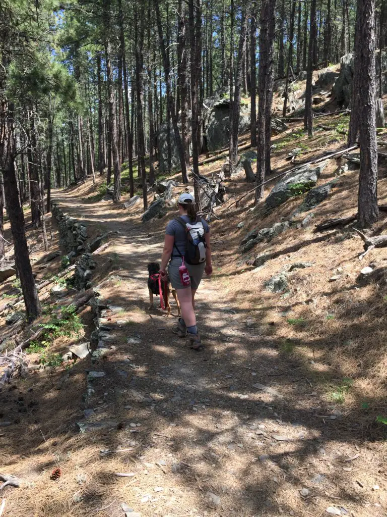
This is actually another part of the Flume Trail, but it shows the flume bed well. You can see how flat and wide much of it is.
The entire flume trail runs for more than 15 miles throughout the Black Hills from Rockerville, south of Rapid City, to Sheridan Lake, west of town. Near Boulder Hill, the path forms a loop, and it connects to other portions of the trail.
What is the flume loop trail like?
This is a great trek! It can be completed in either direction, though we usually travel it counterclockwise. (My following description of it will follow that route.)
The Flume Loop Trail starts by traversing some lower-lying meadows through the oak and cottonwood trees that grow along the nearby creek . Watch out for cows in this area during the summer months (or more importantly, what they leave behind. 🤥 This is national forestland, and open grazing is allowed here.) Also, during hunting season, I strongly encourage people to wear bright colors when enjoying this area as you’ll be sharing it with hunters.
As you continue down the trail you’ll pass a small, dank-smelling pond that is often covered in green scum during the warmer months. 😝 There are some logs you can use to cross the small stream that feeds from it. Be aware, this area can get VERY mucky in wet times of the year.
After crossing Boulder Hill Road, you then make a short climb up a nearby hillside. You are now on the flume bed itself. From here on out, the trail is fairly level, with a few short climbs and descents, and the occasional clamber up some boulders. The remainder of the trail traverses the pine forest that is more common in the Black Hills.
Sometimes, as you leave the brighter, open spaces behind, walking into these darker, pine tunnels, can seem almost spooky. Not to worry though, the scariest sites we’ve seen here are the local mule deer and rabbits who frequent the area.
This trail is nice because much of it is shaded and in the trees, regardless of the time of day you visit. We have often used it for a quick, evening escape after work, or when it’s too hot to attempt more difficult, or more exposed routes. The early portion of the trek is great in the fall, as this is a more leaf-prone part of the forest. The dusty smells of dried leaves underfoot, mixed with the sounds from the ones still clinging to the trees, that rattle in the wind, with the gurgle of the small creek nearby, make for quite the bucolic, autumn setting.
Is the Flume Loop Trail hard?
I would rate this trail as “easy” as it encompasses very little elevation gain. It can be completed in 1 – 2 hours, depending on your speed and ability level, how many stops you make, etc. It is appropriate for children of almost any age, and dogs.
Our previous dog enjoyed it, arthritis, bad hips, and all, well into the final year of her long life. Puppers has put her stamp of approval on it as well.
So the next time you’re looking for a family-friendly trail near Rapid City, consider the Flume Loop Trail!
Have you hiked the Flume Trail? What did you think? Tell me about it in the comments!
If you’d like to read about the other trails in this series, you can click the links below:
Like what you read here today? Please feel free to leave a comment, like or share this post! You can also follow the blog on social media by clicking the links below!
I review the Norbeck Trail, a low-use trail in the higher elevations of the Black Hills, near Custer State Park.
The Norbeck Trail is a beautiful, lesser-traveled hiking route situated within the Black Elk Wilderness. This is found within the boundaries of Custer State Park in the Black Hills of South Dakota.
How do you get to the Norbeck Trail in Custer State Park?
There are actually two trailheads to access the Norbeck Trail:
If you want a shorter hike and want to hit the more difficult, steeper sections sooner (while you have more energy) the Upper Norbeck trailhead comes first. It is located about .3 miles east of Sylvan Lake and about .1 miles east of the trailhead for the Cathedral Spires (all on the Needles Highway, Route 87.)
It’s kind of hard to find the trailhead because you can’t see it from the road and there isn’t any sign. Basically, once you pass the trailhead for the Cathedral Spires, start watching for a paved lane going off to the left. That’s the trailhead. (Sorry, that’s about the best description I can give. 😝)
To reach the main Norbeck trailhead, take Route 87 to Forest Road 345 (Camp Remington Road). Then take Iron Creek Horse Camp Road (which will be on your left). Watch for signs for the Iron Creek Horse Camp and the Iron Creek Centennial Trailhead as they’re both, also, found on this road. You will actually park at the horse camp, or just outside of it if the gates are closed (when we were there in mid-April the campground was still closed for the winter.)
Note: the Needles Highway is closed to vehicle traffic during the winter months. You can hike, snowshoe or ski it though (which can be a lot of fun!)
What you will see on the Norbeck Trail, in the Black Hills
The trail is comprised of picturesque, rolling terrain. It’s well-marked and wide enough for two people to walk side-by-side in some places. There are several water crossings that are small enough that they’re easy to cross but big enough to offer relief and respite on a hot day.
The ecology found along the length of the trail varies greatly from moist, almost temperate rainforest near the base, to dry, alpine forest near the top.
As you trek through these various ecosystems take note of the abundance of spruce trees in certain areas–usually on the northern slopes–that denote a wetter climate (you usually only see this variety in wetter locations in the Hills.)
What is the difficulty level of the Norbeck Trail?
The route is steep in parts, but the elevation changes are fairly moderate until you near the terminus of the trail where it joins with the Little Devils Tower trail. These last 2.5 miles of the trail gain 1000 feet in elevation! (To compare, we gained the same elevation amount on the Misty Moon trail in the Bighorn mountains of Wyoming over the course of five miles!)
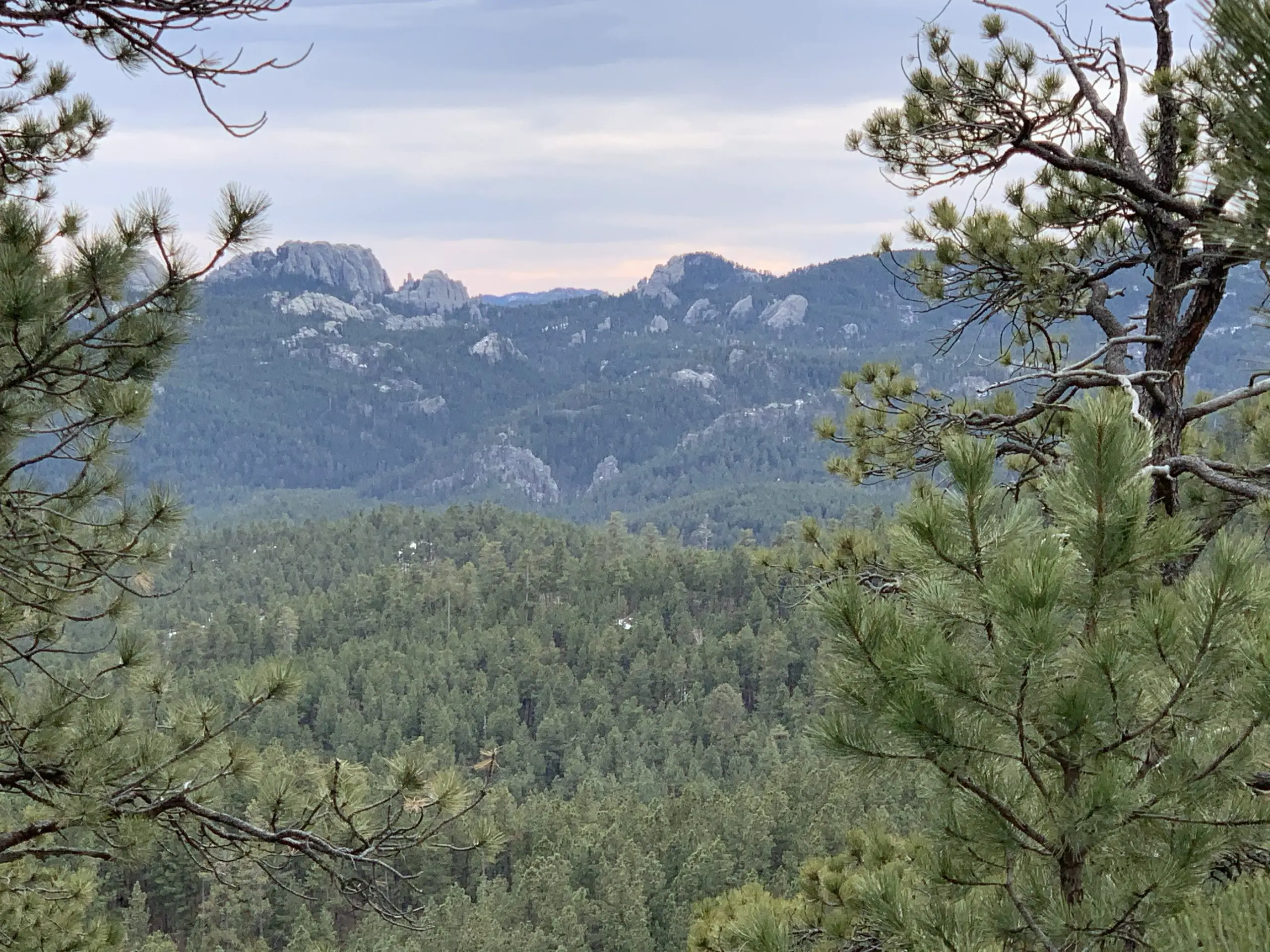
This more difficult area is beautiful, though, as it snakes through a canyon complete with rocky, craggy overhangs and caves. You’ll see the backside of the Cathedral Spires towering over you to your left, and if you turn around you will be treated to beautiful views of the Southern Hills and plains to the south.
A word of advice: never let your focus on completing a trail keep you from looking around–and behind you! You never know what incredible views you may be missing if you’re solely focusing on the trail in front of you.
The rear view of the Cathedral Spires.
This trail doesn’t really “go” anywhere, per se, it’s more of a connector to other notable trails. It can be combined with different routes to form various loops depending on how long you wish to spend in the Wilderness Area. From the trailhead to the junction with the Little Devil’s Tower Trail, the route is a little over five miles (one way)–and as mentioned above it gets steep–so plan for a full day’s hike when considering this option.
We really enjoyed the hike and the ever-changing scenery was beautiful. There were some gorgeous vantage points and numerous opportunities for wildlife sightings. This trail is less well-known and, therefore, more secluded.
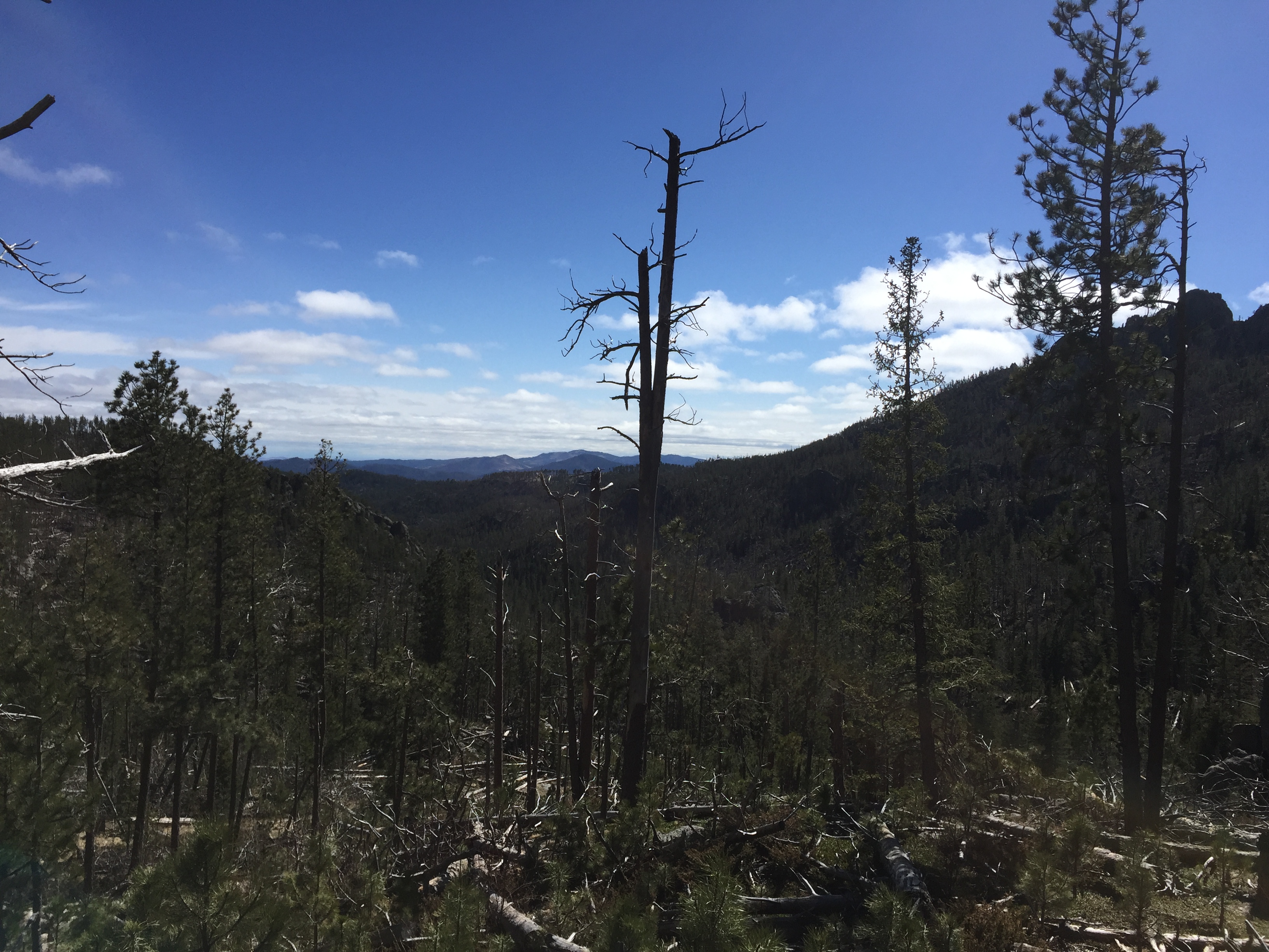
A portion of the trek does run near Route 87, for a time, so the summer months may be busier. Certain areas of the trail also traverse old burn scars so, if traveling in the summer, be prepared for lack of shade and a hot hike in some parts.
You can see the sparseness of the shade in some areas.
As with many other areas in the Black Hills, be watchful for deadfall as well as dead trees that remain, precipitously, standing (and their hanging, broken branches). These are remnants of the recent pine beetle infestation, and they can fall at any time, even on not-so-windy days.
Damage from the recent pine beetle infestation
If you’re looking for a fairly easy day hike, with nice views and few people, consider the Norbeck Trail!
Have you ever hiked this lighter-use trail? If so, tell me about your experience in the comments!
Did you enjoy this post? Pin it!
Like what you read here today? Please feel free to leave a comment, like or share this post! Add your email at the bottom of the page, or the sidebar to the right, to be notified when a new post is published. By signing up for the email list, you will also receive a free copy of the Tranquil Trekker’s Top 10 Tips of Trekking Do’s and Don’ts!
You can also follow the blog on social media by clicking the links below!
In this post, I review the Stratobowl trail near Rapid City, SD.
The Stratobowl Rim Trail is a simple hike near Rapid City that offers spectacular views of the Black Hills and a local, historical site. The Stratobowl is a great trail for a short hike. It’s only around one mile each way, so it’s amenable to almost any skill level.
Where is the Stratobowl?
The Stratobowl is located off Route 16, about a half-mile south of Old McDonald’s Farm. There is no roadside sign highlighting the trail, but there is an obvious parking area just off of Highway 16. If you’re there during daylight hours, it’s likely you’ll see other vehicles.
Hiking the Stratobowl
The path is comprised of simple, rolling hills on an old access road that traverses through pines and offers a prime opportunity for spotting deer and wild turkeys. A substantial logging operation was recently completed there (necessitated by pine beetle damage) so chances of viewing wildlife are now even more likely.
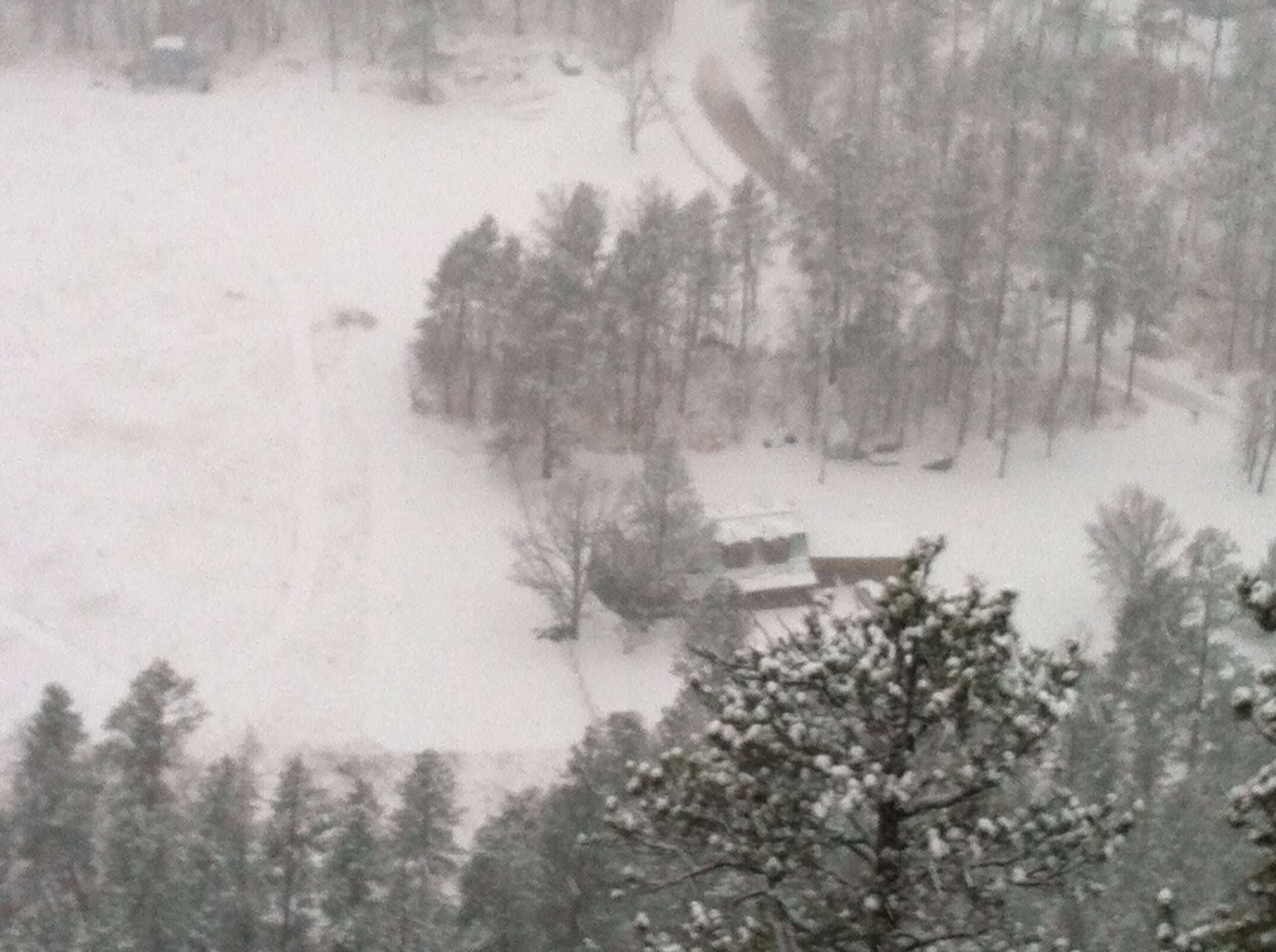
At the trail’s terminus, the road opens onto the rim and the yawning chasm that is the actual Stratobowl. From here, a valley formed by Spring Creek spreads out before you with homes dotting the canyon floor. You’ll also often see vultures soaring the thermals…below you!
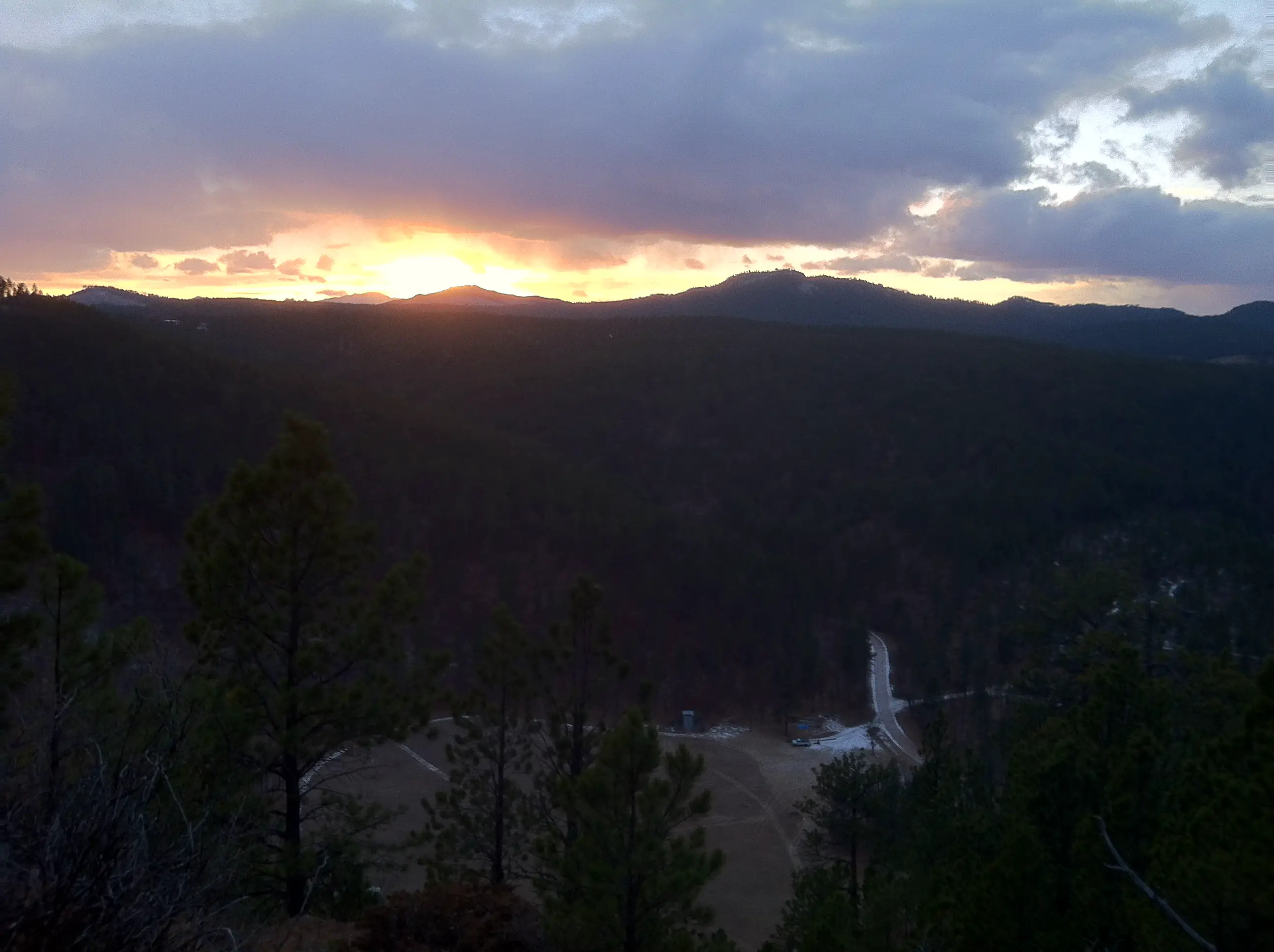
The Stratobowl is also a prime place to watch the sun setting over the expanse of the Black Hills (and being so close to town it’s convenient for an evening hike). The name stems from the bowl-like shape of the valley created by the surrounding terrain. The north side of the rim can be reached from several other trails/old logging roads off of Sheridan Lake Road to the north (I discuss these options in this post.)
This setting was the site of high-altitude, manned balloon flights that took place in the ’30s (there are several monoliths on-site detailing these); it also currently hosts an annual hot air balloon launch. Be aware, you may hear the haunting sound of howling wolves when hiking. Do not be alarmed though, wolves are not usually found in the Hills and those you hear are safely contained at Bear County, just a few miles away.
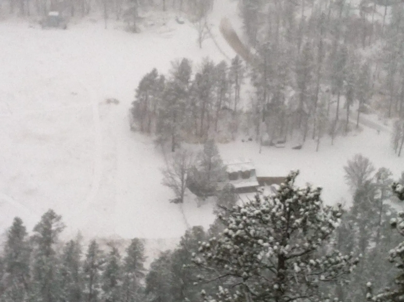
Thank you Mr. Trekker for this sunset shot of the StratobowlThe Stratobowl in the snow!
This trail is perfect for an afternoon or after-work hike, or if you’re just looking for an easier place to take the kids or the dog that’s close to home. It’s gorgeous in almost any kind of weather and the trail is family-friendly. This is another great one to add to your list of fun hikes found near Rapid City!
Do you enjoy hiking the Stratobowl? Tell me about it in the comments!
Did you enjoy this post? Pin it!
Like what you read here today? Please feel free to leave a comment, like or share this post! Add your email at the bottom of the page, or the sidebar to the right, to be notified when a new post is published. By signing up for the email list, you will also receive a free copy of the Tranquil Trekker’s Top 10 Tips of Trekking Do’s and Don’ts!
You can also follow the blog on social media by clicking the links below!
In this post, I review the drive on Jenny Gulch Road, in the central Black Hills.
In a previous post, I gave a brief mention to Jenny Gulch Road. It is found off Silver City Road, on the way to the Jenney Gulch boat ramp of Pactola Lake and the tiny community of Silver City.
This gets a little confusing. There are several roads in the Rapid City and the central Black Hills area that go by this name so Google Maps (and possibly other mapping programs) may send you to the wrong place. To be clear, for this post I am referencing the Jenny Gulch Road that follows along Forest Road 261 and runs through a central portion of the Black Hills National Forest, outside of town. It meets up with Broad Gulch Road and runs as far as Rochford Road, both of which eventually lead you to Highway 385, one of the main routes through the Hills.
In the earlier post, I mentioned a large section of the road heads off to the north (and consequently not near Jenney Gulch at all) but we’d never taken that route. I am happy to report we have rectified that issue and I can now give you details of that road, as well!
Jenny Gulch Road offers a nice drive through national forestland. It doesn’t really provide any exciting activity options, but several dead-end forest roads branch off from it which present prime “set-up-your-hammock-and-enjoy-the-quiet of-the forest” opportunities. These would also be some good spots for dispersed camping.
We did learn these are off-limits to vehicle travel and are barred by gates in the off-season (though they’re still available for foot travel).
The road is recommended for high clearance vehicles only and near the northern terminus, I was glad we had the 4×4 with the higher ground clearance. A regular AWD vehicle could probably make it but some of the ruts could cause the situation to become a little dodgy.
This back road is something to think about if you’re looking for a secluded place in the forest to collect your thoughts, and another item checked off of our Black Hills Bucket List!
Like what you read here today? Please feel free to leave a comment, like or share this post! Add your email at the bottom of the page, or the sidebar to the right, to be notified when a new post is published. By signing up for the email list, you will also receive a free copy of the Tranquil Trekker’s Top 10 Tips of Trekking Do’s and Don’ts!
You can also follow the blog on social media by clicking the links below!
In this post, I discuss winter activities available at the Big Hill recreation area, in the northern Black Hills.
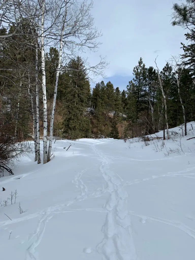
Big Hill is a recreation area located in the Black Hills National Forest that offers outdoor, leisure opportunities year-round. The prime activities enjoyed here are cross-country skiing, snowshoeing, and fat-biking in the winter, though people regularly hike and mountain bike here during the summer months, as well.
Where is Big Hill?
The Big Hill recreation area is located southwest of Spearfish, in the northern Black Hills. The easiest way to reach the main trailhead is to take Exit 8, off of I-90, for McGuigan Road. Take this south until you reach the T-intersection with Tinton Road. Turn right at the intersection to drive up the hill.
After about 8 miles, watch for a VERY tiny brown sign on the right-hand side of the road showing a hiker. Shortly after this sign, at the top of the hill, you’ll see a large parking area on your right. (The trailhead is directly across the road from the parking area). It is difficult to miss as there are usually numerous other cars there (especially in the winter).
There are other routes you can take to reach this trailhead–coming from downtown Spearfish–as well as a scenic route coming up the other direction on Tinton Road from the south (from Roughlock Falls Road). While this is a beautiful, scenic drive that I highly recommend in the summer, it should be approached with extreme caution in the winter. This portion of the road is barely maintained for winter driving and is usually at least somewhat snow-covered. We have successfully taken this route in the 4×4 truck in the winter, but it’s not for the faint of heart (though it is necessary if you want to reach the Old Baldy trailhead to enjoy winter activities in that area).
The route from McGuigan Road to the trailhead is usually maintained quite well and can often be reached using a typical, 2-wheel drive vehicle (we made our first trip there in an old Civic). It should also be noted that whether Summer or Winter, all of these dirt/gravel forest roads are dependent on the current weather and their condition can vary greatly (and QUICKLY) as the weather changes.
What is the Big Hill Recreation Area like?
Big Hill offers over 15 miles of trails formed by several different loops/routes (many follow old forest roads) that can be combined in a variety of ways. Trail maps are usually available at the trailhead.
The trails at Big Hill are very well-signed but it’s still best to have a map to help determine the best route for you (the map also indicates the difficulty levels of the various trails). The managers of this recreation area also do a marvelous job of keeping the ski trails and the snowshoe/fat bike/dog-friendly trails separate while ensuring everyone can still enjoy this beautiful area!
Big Hill tends to be one of the snowier places in the Black Hills so you can potentially participate in winter activities here anywhere from October – May (dependent on current snow conditions, of course). We’ve enjoyed snowshoeing here, as well, though there are times the snow isn’t quite deep enough so we tend to favor the Eagle Cliff area for our snowshoeing adventures.
Today, I am focusing on the winter sports available here. I will say though, this area is a must-see in the fall when the yellow Aspens are in full color.
**I mentioned the Eagle Cliff area above. It only has one groomed trail, the rest are just trails cut by outdoor enthusiasts. Big Hill offers machine-groomed ski trails that are better for practicing the fundamental drills of skiing as they are smoother.
Machine-groomed trails require FAR less effort, but I find I enjoy them less. They are more crowded and while faster, I find it’s harder to control my skis. The person-groomed trails require more effort and you’ll move less quickly, but I find the resistance the snow provides aides in control of the skis and balance. So, while the groomed trails are usually recommended for beginners, I’d say you have to decide what is most important to you; ease of effort or less fear of hurtling down a hill uncontrollably…possibly towards a tree. 😳
Warmer the higher up you go?
This area is another example of the complicated, frequently-contrasting weather you can have in the Black Hills. On several occasions we’ve experienced temps in the single digits to low teens in the lower elevations–but it can feel almost balmy with temps in the mid-twenties at Big Hill (that equates to perfectly comfortable conditions when skiing, in the sun, with little wind.) This contrasting weather is due to a temperature inversion. Put in simple terms this basically means warmer air is lighter and floats over cooler air. This makes it warmer the higher you go in elevation. (If you want a more scientific explanation you’ll have to track down Mr. Trekker. 😃)
Snowshoeing vs. Cross-Country Skiing
Snowshoeing is great fun, but it’s HARD work depending on snow conditions (this activity and mountain biking are literally the hardest workouts I’ve ever done).
Cross-country skiing, in contrast, requires far less exertion (and I’ve found that working out with an elliptical during the week is perfect training for this sport as the body motions required for both are very similar).
Anyone who can walk can snowshoe. It takes a little skill to keep from stepping on your own shoes, but once you master that, you’re golden. Cross-country skiing, on the other hand, is FAR more difficult. It requires balance, finesse, and the ability to relax and just “go with the flow”–all characteristics I SORELY lack (“sore” being the keyword as that’s often the result of my endeavors 😝).
I would also argue skiing is more dangerous as you’re moving faster and are more likely to slip/twist something when you fall (and you WILL fall). If you fall while snowshoeing, you pretty much just end up on your rump or fall to the side into a cushioning snowbank. It may be cold, but not really injury-inducing (although your snowshoe could become stuck under a buried log, as I found out at Big Hill one early, spring day…😮 )
We’ve gotten pretty good at most outdoor sports we enjoy, but with skiing, we’re still very much beginners. Standing on a thin object that’s meant to glide quickly and effortlessly does not lend itself to keeping one’s balance. Neither do skis that are as long as I am tall and stick out several feet both in front of and behind you. Not only do you have to learn how to move around without stepping on yourself (similar to snowshoes) but you have to do it while each leg is trying to slide in an opposite direction. 😝
So, if you’re enjoying a snowy weekend at Big Hill, and you see a bumbling idiot barely able to stay upright on their skis..it just might be me! 😇
The best trails at Big Hill
For beginners, I strongly recommend starting with the initial Loop A. It’s a short, groomed trail that just goes in a small circle around a meadow/forested area near the front of the Big Hill trail network. It’s fairly flat with only a few short rises and dips and doesn’t offer much opportunity for falls (though, full disclosure, I have fallen here 😝).
There is another Loop A that goes farther out. This option is also usually groomed. It’s also good for beginners once you get a little more confidence as it’s solely a “green” route–meaning it’s considered “easy”. There are a few steeper slopes, one especially on the right-hand (western) side of the loop as you’re heading out. I’ve had my worst spills in this area and though they were frightening, I’ve left without injury–so far–and haven’t even felt very sore the next day. (A surprise as I was sure my ankles were being ripped from my body when I fell. 😮 )
What will you see at Big Hill?
Big Hill is absolutely BEAUTIFUL no matter the time of year. It offers a mixture of forested and meadowy areas that contain leafless deciduous and evergreen trees, all covered in a soft blanket of snow during the winter. On sunny days you’ll frequently hear birds chirping in the trees, and the ever-present, South Dakota breeze rustling through the pines provides a respite from the deafening, snowy silence. In the fall, this area offers a warm glow with the bronze meadowgrass, and glowing, yellow aspens all standing in contrast to the evergreen trees.
This recreation area is far enough from civilization that it offers an incredibly peaceful environment. It is sullied in the winter only by the occasional roar of snowmobiles that also enjoy nearby trails–though not these exact trails. (Fortunately, they focus on the region on the other side of the road so they are usually only really heard when you are near the parking lot.)
If you’re looking for a great place to enjoy some snow sports that is both beautiful, easy to reach, and that offers fun options for everyone, check out Big Hill!
Have you tried the Big Hill Recreation Area? Tell me about your experience in the comments!
Did you enjoy reading this post? Pin it!
Like what you read here today? Please feel free to leave a comment, like or share this post! Add your email at the bottom of the page, or the sidebar to the right, to be notified when a new post is published. By signing up for the email list, you will also receive a free copy of the Tranquil Trekker’s Top 10 Tips of Trekking Do’s and Don’ts!
You can also follow the blog on social media by clicking the links below!
We use cookies on our website to give you the most relevant experience by remembering your preferences and repeat visits. By clicking “Accept”, you consent to the use of ALL the cookies.
This website uses cookies to improve your experience while you navigate through the website. Out of these cookies, the cookies that are categorized as necessary are stored on your browser as they are as essential for the working of basic functionalities of the website. We also use third-party cookies that help us analyze and understand how you use this website. These cookies will be stored in your browser only with your consent. You also have the option to opt-out of these cookies. But opting out of some of these cookies may have an effect on your browsing experience.
Necessary cookies are absolutely essential for the website to function properly. This category only includes cookies that ensures basic functionalities and security features of the website. These cookies do not store any personal information.


 The Deerfield Trail runs through several canyons that are similar to those found on Rimrock Trail, that traverses the rim of Spearfish Canyon and others that you see on the Little Elk Creek Trail, near Sturgis. The canyons are especially gorgeous in fall as the never-ending green of the spruces, that blanket the canyon walls, contrasts with the yellow and orange of the aspens and red of the plants that frame the creek.
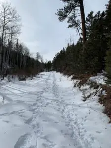 The Deerfield Trail is open year-round, for various activities, including horseback riding, hiking, mountain biking, and snowshoeing/cross-country skiing, depending on the time of year.

 Ok, time for a little tangent–bear with me, I truly feel this is IMPORTANT!


 For beginners, I strongly recommend starting with the initial Loop A. It’s a short, groomed trail that just goes in a small circle around a meadow/forested area near the front of the Big Hill trail network. It’s fairly flat with only a few short rises and dips and doesn’t offer much opportunity for falls (though, full disclosure, I have fallen here 😝).