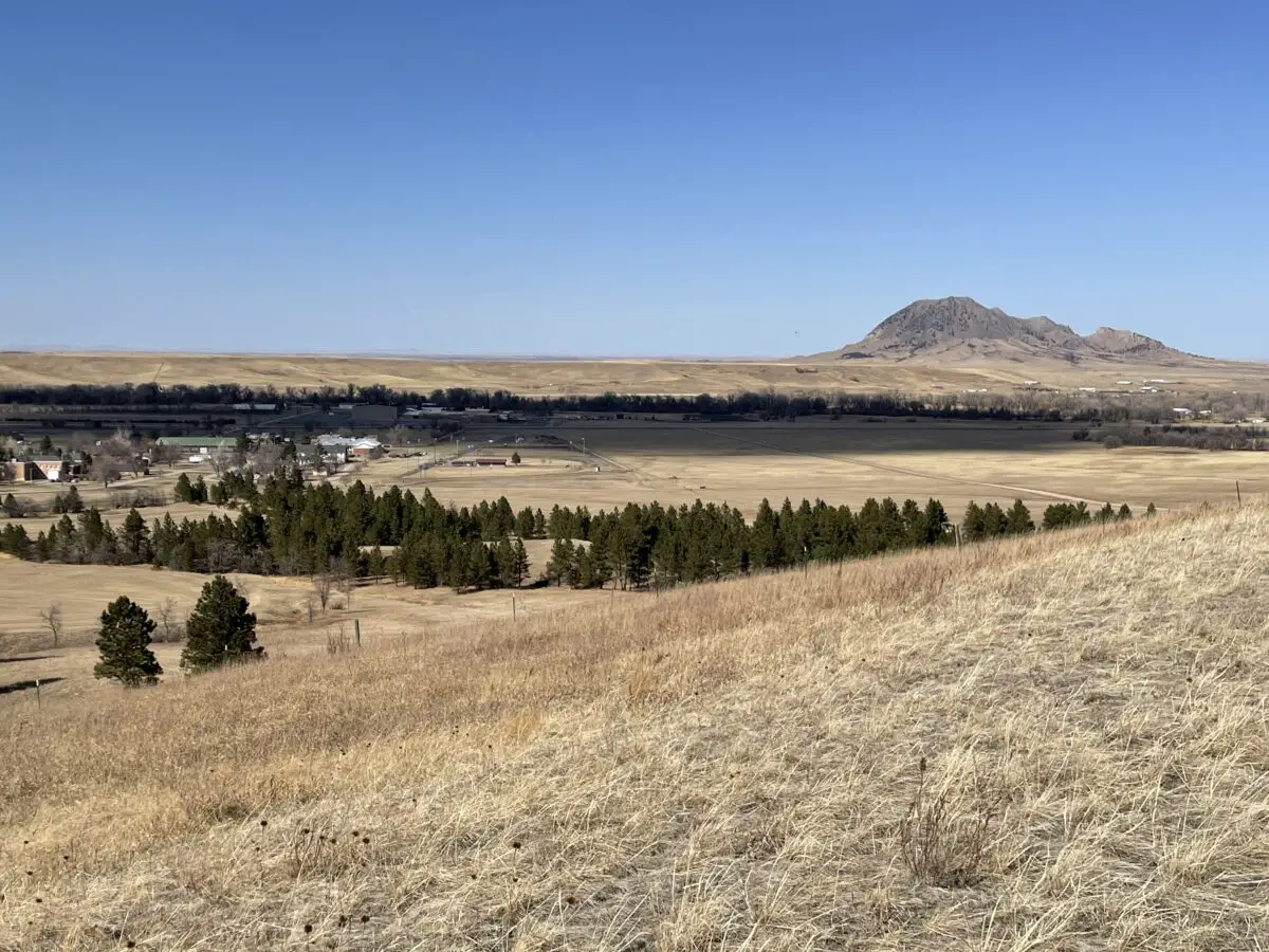
Happy Blogiversary!

In this post, I ruminate on my last five years of blogging and what I hope to achieve in the next five years


The Tranquil Trekker turns 5 this month!  That’s a pretty major Blogiversary milestone!  I can’t believe it’s been that long!  For fun, here’s a link to the first, full-length blog post I ever wrote:  Dugout Gulch Botanical Trail (#77).

How It Started…

I started the blog in 2016 kind of on a whim, not knowing ANYTHING about blogging.  I did it mainly to make it easy to share pictures and stories of our adventures with our family and friends.  At the time we were living more than 900 miles from our closest family members and people were always asking about the random trips we took.  I originally assumed “no one makes money on a blog”, so I didn’t start it with that intent at all.

What’s Changed…

SO MUCH has changed in the last 5 years!!!

–In 2018 I left my full-time job and started social media accounts for the blog.  I also switched from a free-hosted blog (WordPress.com) to a self-hosted blog (WordPress.org).  I can honestly say that I LOVE both Bluehost and WordPress.org!  They make blogging easy for me, the technologically-challenged, “geriatric” millennial. 😝 (I also now know the difference between the two WordPress options. 😉  If any novice bloggers out there want help deciding which option is right for them, let me know!)

–I monetized my blog!  Contrary to popular belief, it is actually possible to make money blogging! 😮   I’m still not making much, but at least it’s something! (And at least now I know what affiliate programs are and how they work!)

–In 2020 I FINALLY learned how to do SEO and started ranking on Page 1 of Google for many posts!

I still hate SEO, it still feels to me like you’re speaking “robot” to make a computer happy–which you kind of are.  It’s hard to make the blog post feel authentic to ME.  But…I understand the need for SEO.  At some point, if you want your blog to be seen by others, you have to make it easy for the Google Bots to “see” you first.

I’ve even had a couple of freelance jobs where I did proofreading and helped with SEO optimization on other blogs.  I definitely NEVER thought THAT would be a job for me! 😮

What I’ve Learned…

You could ask, when did my blog really start?  In 2016 I was lucky if I was publishing one post each month as I was busy with my full-time job and other projects.  In 2018, when I finally got on social media, I really started pushing my blog to the masses.  But it wasn’t until 2020 that I finally started really doing the SEO.  So, did I “start” my blog in 2016 and I’m just a REALLY slow learner, or did it really not “start” still 2018 or 2020?  Whatever the answer you can see I have learned SO MUCH throughout the whole process.

I also learned how to code…barely. 😉.  Really I just learned how to look tips up online to tell the webpage how to do what I want it to do.  Sometimes, Google really is your friend! (If anyone has any suggestions on coding classes I could take, specifically for web development–namely HTML and CSS–let me know!  I’ve been on the lookout but haven’t found anything that really fits just yet.)

Over the last five years, I’ve made a lot of friends in the blogging world, specifically travel/outdoor recreation bloggers.  I’ve done guest posts on other blogs and collaborations with other friendly bloggers (click here to see those!)  There are so many supportive people in the blogging world, I’ve been SO impressed by how many want to help each other.  It’s a really encouraging community to be a part of!

What’s Next?

What will the next five years bring?  Who knows!  Some day I want to attend my first blogging conference.  I’ve also been working on a project for the last several years that I’ve been keeping very hush-hush.  I’m truly hoping to make enough progress on this to reveal it to you soon…🙏 🤞  I do hope to continue the blog, at least in some form, for the next many years!

Thank you for hanging out with me for the last five years.  I have grown to love blogging and I TRULY appreciate the supportive readers I’ve gained along the way.  I hope we have MANY more years of blog enjoyment ahead of us!

What brought you to my blog Dear Reader?  What holds your interest and gets you to keep reading?  Do you have any suggestions of things I could change in the future or topics you’d like to see me cover?  Let me know in the comments!


Did you enjoy reading this post?  Pin it!
4 pineapples (one wearing sunglasses) are surrounded by balloons and party hats! Pin reads, "The Tranquil Trekker turns FIVE!"


Like what you read here today?  Please feel free to leave a comment, like or share this post!  Add your email at the bottom of the page, or the sidebar to the right, to be notified when a new post is published.  By signing up for the email list, you will also receive a free copy of the Tranquil Trekker’s Top 10 Tips of Trekking Do’s and Don’ts!

You can also follow the blog on social media by clicking the links below!
Facebook

Twitter

Instagram

Pinterest

Hiking Black Elk Peak, Trail #9: the Easy Way!

In this post, I detail the main route up Black Elk Peak in the Black Hills.


Black Elk Peak trail (Trail #9) is one of the most popular hikes in the entire Black Hills.  It summits Black Elk Peak, which is the tallest peak in the Hills (at over 7000 feet in elevation) and it is also the tallest mountain in the entire country east of the Rockies!

In this post, I am reviewing the route that traverses the south side of the mountain.  This is the easiest way up Black Elk Peak.  You can also attempt Trail #9 from the north.  For a review of that trail, which is only lightly traveled and is FAR more strenuous than the southern route (in my opinion it is one of the hardest trails in the entire Black Hills) click here.  

Where is the Black Elk Peak Trailhead?

The trailhead is located within Custer State Park.  It is adjacent to the picturesque Sylvan Lake.  You can reach it from the east side of the main parking lot at the lake, which is found just off of Route 87.

When is the best time of year to hike the Black Elk Peak Trail?

You can hike this trail any time of the year (weather-permitting that Route 87 is open so you can get to the trailhead).  Always remember that because this is the highest portion of the Black Hills, it tends to get more snow than the surrounding areas and that snow tends to stick around longer.

Also, this trail is VERY popular, even in the winter months, so the snow on it gets packed into very slippery ice.  At a bare minimum, traction devices such as Yaktrax are a MUST during the snowy months.

As with the majority of Custer State Park, you can take dogs on this trail.  Please keep them leashed though.  Unlike many other trails in the Black Hills, you should expect to have A LOT of company on your hike, at least during the busy season. 

Black Elk Peak is the new name for Harney Peak

Black Elk Peak is located within the Harney range.   The name of the mountain was changed from Harney Peak just a few years ago so many signs and maps still carry the old name.  The new name honors Black Elk, a Lakota, Holy Man who died in 1950.  The wilderness area that the peak is located within was named after him, as well.

*If you’re interested in learning more about this great man and the rich, Lakota culture, check out the book Black Elk Speaks by John Neihardt.  Neihardt wrote this biography after interviewing Black Elk near the end of his life. 

The Holy Man had an incredibly rich life filled with diverse experiences.  These ranged from growing up in a nomadic tribe on the South Dakota Plains to traveling the world with the Wild Bill Hickok Wild West show!  Black Elk was even at the Battle of Little Bighorn where General Custer was killed.  In the book, he discusses how everything changed when “the yellow metal that makes white men crazy”–-his name for gold–was found in the Black Hills.

What is the Black Elk Peak trail like?

The trail is quite wide and graded, with very little rock-scrambling required (until you get to the summit).  Due to this, I would give it a rating of Moderate.

The only things that make this trail difficult are the length (it’s over seven miles long, out-and-back, and can easily take 4 – 5 hours to complete) and it sits at a high altitude.  Throughout the entire hike you never drop below 6000 feet, so expect to feel the lower oxygen levels present at this higher elevation.  You will get out of breath and tired more quickly and you may feel dizzy (or like your head is “swimming”.)

The summit can be a little daunting.  As with much of the rest of the Black Hills this area is left primarily to nature.  There are very few fences or barriers between you and the cliff edges that surround the summit of the mountain.  If you are responsible you can very safely enjoy this site.  Just be watchful with small children and pets.

All that being said, this trail is family-friendly as long as you know your limits and take your time.  I would recommend hiking boots (or at least sturdy shoes) for this hike but I’ve seen people do it in simple sneakers and even flip-flops or sandals. 😮

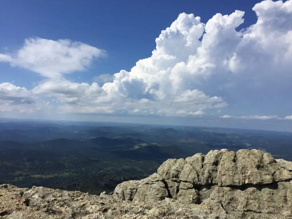
A grey, rocky cliff in the foreground overlooking tree-covered mountains and plains stretching to the horizon far below, all under puffy, white clouds in a blue sky.
It’s a long way down!

The other concern here is the weather.  It can change incredibly quickly.  It can also be drastically different here than the lower elevations in the rest of the park or the surrounding countryside.  The peak is solely made of granite rock, there are no trees for shade or protection.

While the hike does meander through the Black Hills National Forest, this portion of it was decimated by the pine beetle epidemic just a few years ago so there are many areas that were left bare of trees. So don’t expect a lot of shade to hide you from the sun in the summer. 

There is also little protection from the wind.  If a thunderstorm pops up while you’re on the mountain (which can frequently be expected during the afternoon in the summer months) you should immediately trek back down the trail and get to an area with more trees and protection!

What will you see on the Black Elk Peak Trail?

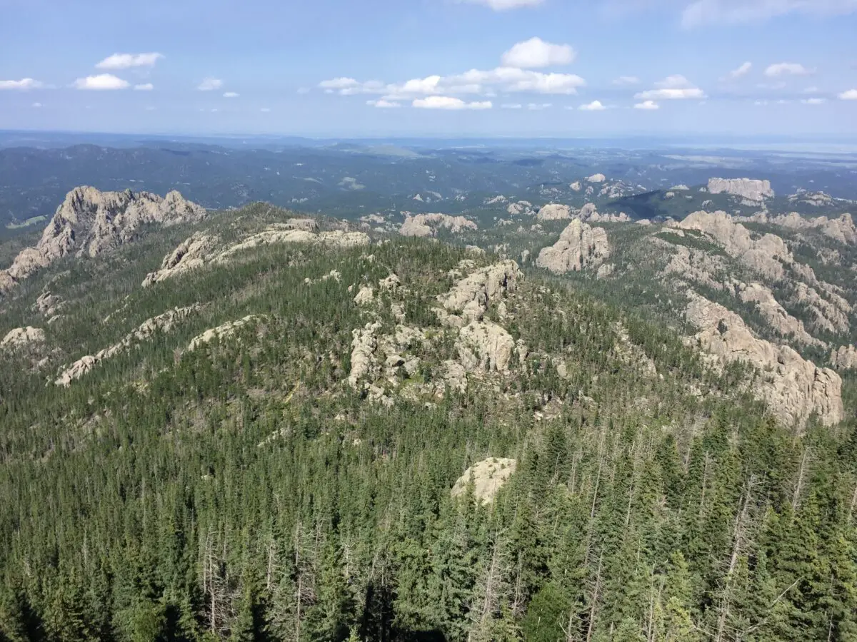
The panorama that greets you at the summit is unrivaled anywhere in the Black Hills (you’re taller than everything else so there is nothing to block your view! )  We are talking a 360-degree vista of the entirety of Custer State Park, the town of Custer to the south, Rapid City to the north, and the plains that spread to the east of town!  On clear days you may also be able to spot the Badlands, which is almost 100 miles to the east (bring your binoculars!)

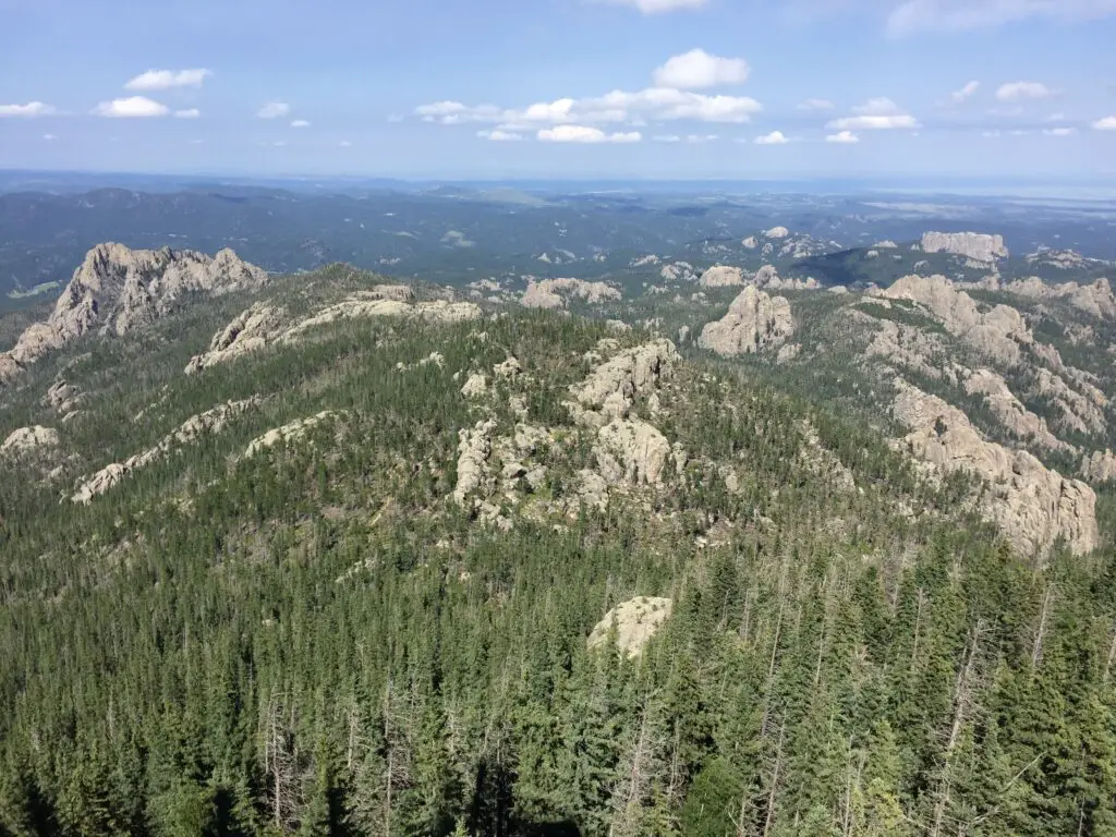
View from above overlooking an expanse of grey, rocky mountains covered in green pine trees. Lower mountains covered in trees and plains stretch to the horizon, all under a blue sky with puffy, white clouds.
The view from 7000+ feet high!

Much like the rest of the park, this route is the perfect place to see the wide variety of flora (plants) and fauna (critters) that call Custer State Park home.  These include mountain goats, bighorn sheep, deer (both whitetail and mule), elk, chipmunks, and the squirrels who will chatter at you along the way.  There are also coyotes, mountain lions, and bobcats, though you are less likely to see these shy animals. 

Harney Fire Tower

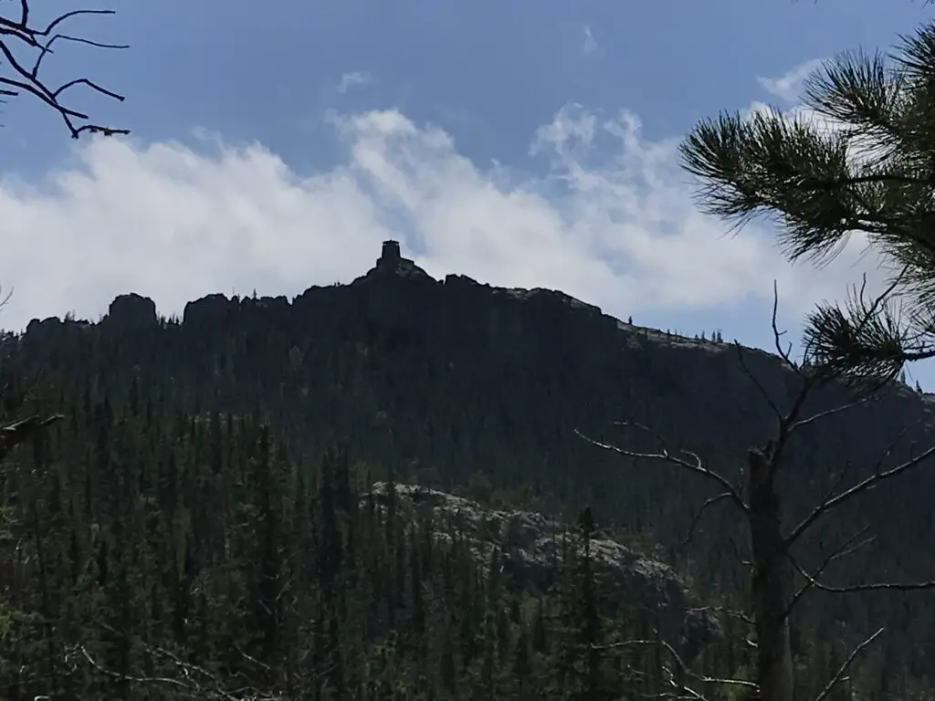
There is an incredibly picturesque fire tower at the top of the peak and to my knowledge, it still bears Harney’s name.  It was built in the 1930s and rumor has it the infamous burrows that can be spotted in other portions of the park are descendants of the pack animals who were used when the fire tower was in service.  The tower is no longer in operation, but it is still maintained and can be climbed!  For more info on the tower, click here!

View from below: dark silhouette of a rocky, castle-like fire tower on top of a rocky, tree-covered mountain.
First glimpse of the Harney Fire Tower!

This trail is not “easy” but it is quite doable for almost any able-bodied hiker.  Plan to spend an entire day at Sylvan Lake and hiking the Black Elk Peak trail, it is most definitely worth that much time!  Enjoy the trail, appreciate the summit and the splendid beauty of the Black Hills that surround you.  This is a fun trek with incredible views and I would encourage anyone who has even the slightest interest in hiking to try it out!  You’ll be glad you did!

Have you enjoyed the “easy” hike up Black Elk Peak? Tell me about your experience in the comments! 


Did you enjoy this post?  Pin it!

View from above overlooking an expanse of grey, rocky mountains covered in green pine trees. Lower mountains covered in trees and plains stretch to the horizon, all under a blue sky with puffy, white clouds. Pin reads, "Hiking Black Elk Peak Trail #9: the Easy Way."


Like what you read here today?  Please feel free to leave a comment, like or share this post!  Add your email at the bottom of the page, or the sidebar to the right, to be notified when a new post is published.  By signing up for the email list, you will also receive a free copy of the Tranquil Trekker’s Top 10 Tips of Trekking Do’s and Don’ts!

You can also follow the blog on social media by clicking the links below!

Facebook

Twitter

Instagram

Pinterest

Hike the Hell Canyon Trail in the Black Hills

In this post, I review the Hell Canyon trail located near Custer, South Dakota


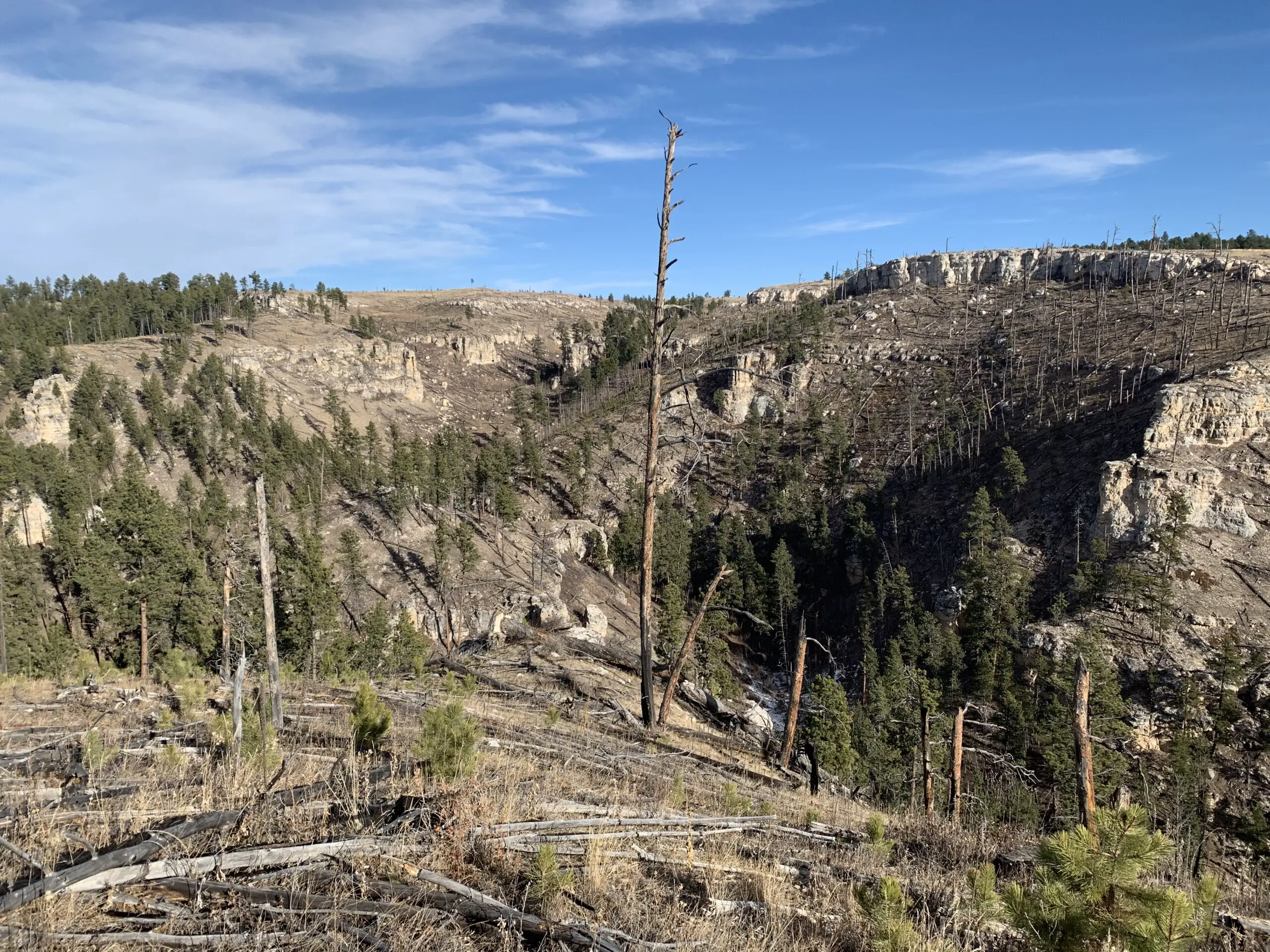
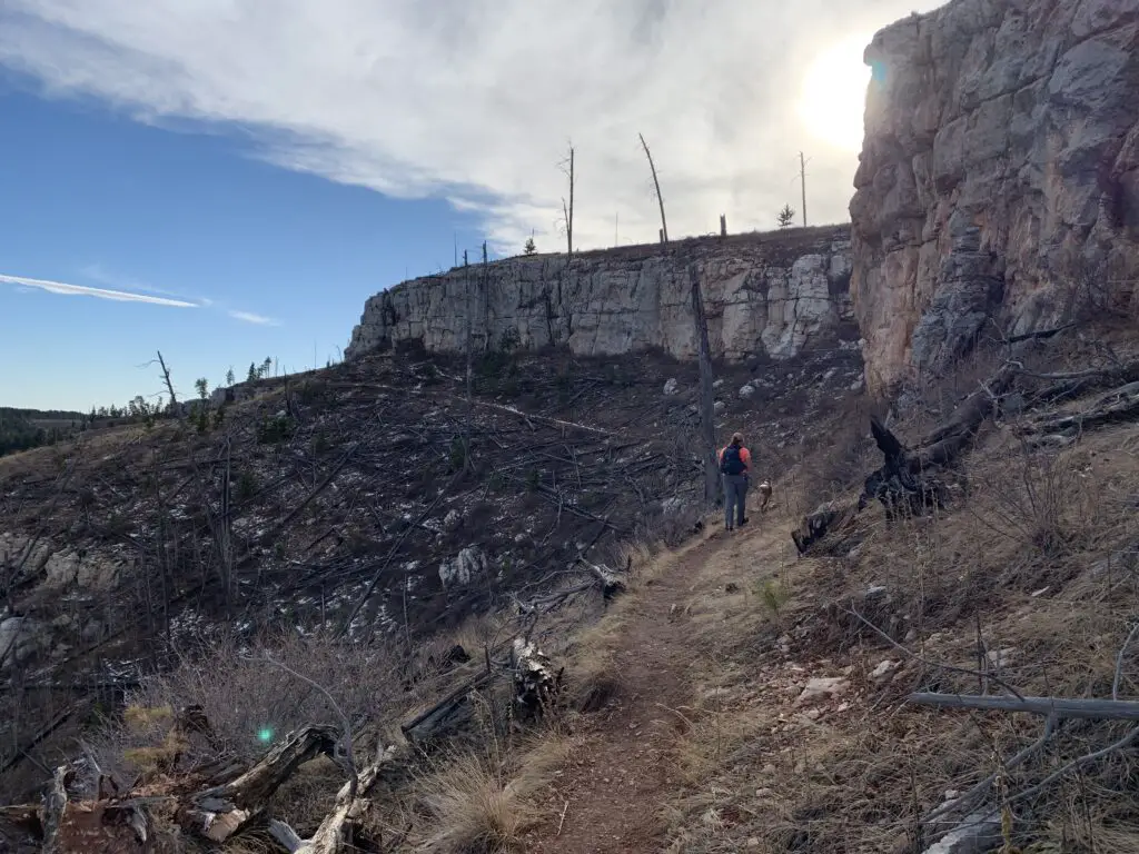
The Hell Canyon Trail is found in a very scenic portion of the southern Black Hills.  It was once quite forested until it was decimated by the Jasper Fire in 2000 which was one of the worst fires on record, in the Black Hills.  You can still see remnants of this damage (though they have begun reseeding this area, so hopefully it will be returned to the forest in a few years).

Funnily enough, the canyon was named BEFORE it was ravaged by the fire.  The ruins of that event do make it look a bit like a hellscape though! 😮

Rear view of a woman and dog traversing a dirt, hiking trail through yellow-grass and brown dirt-covered canyon walls with grey, rock walls rising above.
Puppers and I enjoying the trail along one of the canyon walls that was left bare as a result of the Jasper Fire.

Where is the Hell Canyon Trailhead?

The Hell Canyon trailhead is located in far southwestern South Dakota pretty much in the middle of nowhere. 😉   It is situated 25 miles east of Newcastle, Wyoming, or a little more than 10 miles east of the Wyoming state line.  It is also less than 15 miles west of Custer, South Dakota, basically a mile west of Jewell Cave, on US 16, on the north side of the road.

A word of caution:  if you just put “Hell Canyon” into your GPS it may try to take you to a remote spot south of the highway.  This area is beautiful, but these roads can turn into 4WD roads VERY quickly and easily, especially in snowy or muddy conditions. 

You can certainly enjoy driving in this area but do so with caution and at your own risk.  The actual Hell Canyon trailhead can be reached by any vehicle as it is just off of US 16.  No 4WD required!

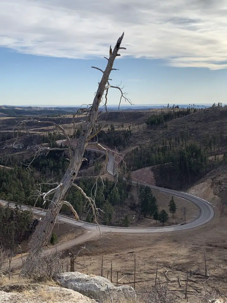
A view from above down a yellow-grass hill. At the bottom of the hill, a paved road snakes through pine-covered hills with a dirt lane breaking off of it. A dead tree is prominent in the foreground on top of the hill.
The paved road at the bottom of the canyon is US 16, you can see how easily accessible the lane to the trailhead is (the dirt road).

What is the Hell Canyon trail like?

Hell Canyon is a loop trail that is about 5.5 miles long and really only covers a small portion of land.  The right side, or eastern branch, of the trail traverses the floor of the actual canyon while the left side, or western branch, is found on the canyon rim.  In many places, you can see the lower portion of the trail from the upper portion.

You can really take the loop in either direction.  During the warmer months, the Trekkers prefer to go counterclockwise, starting with the climb to the top of the canyon wall.  This gets the only moderately-difficult portion of the trail out of the way early.  This area also has little to no shade, due to the Jasper Fire, so depending on what time you set out, it may be best to try to do this section during the coolest portion of your hike.

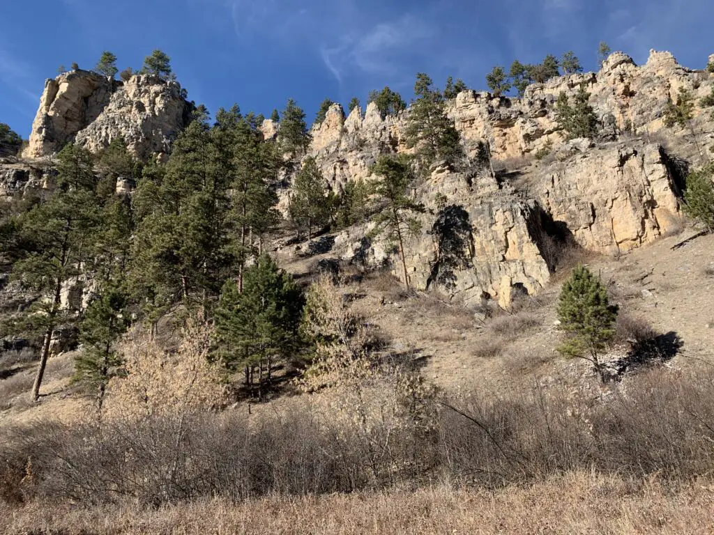
View from below: dry, yellow-grass in the foreground leads to tan, rock and pine spotted canyon walls.
A cool pic of the canyon wall!

The exception to this is if you’re attempting the hike during the colder months and you WANT the sun.  Also, the portion at the back of the canyon that descends the forested part of the canyon wall can become INCREDIBLY icy during the cooler times of the year.  We made the mistake of descending this way once and had to pretty much do the entire thing by crab-crawling and sliding on our backsides to keep from careening over the cliff edge (and this was WITH YakTrax traction devices on! 😮 )

What Will You See on the Hell Canyon Trail?

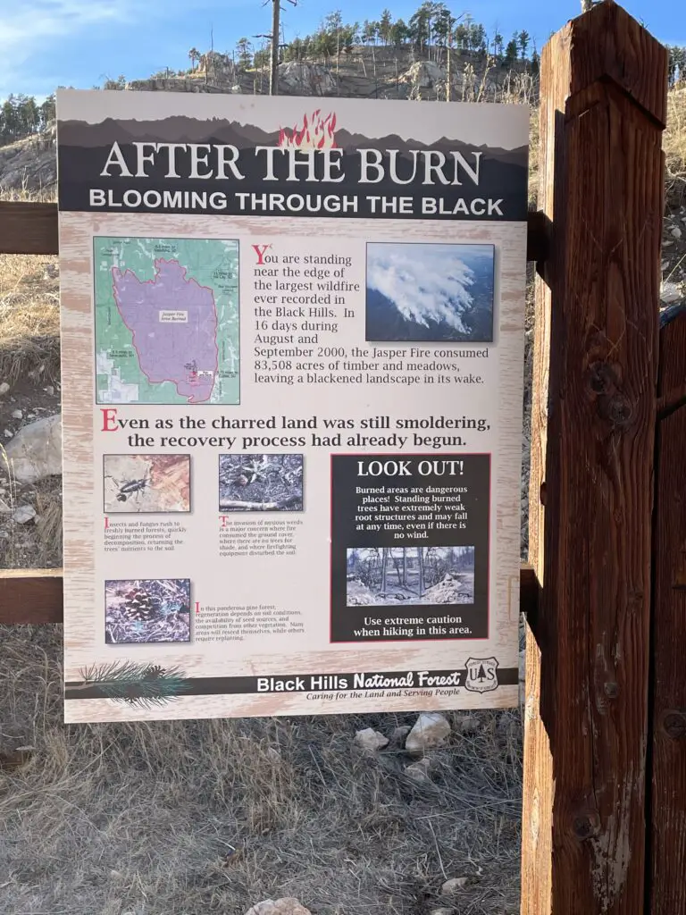
You will see a variety of ecosystems on the hike.  The canyon floor itself is forested and quite green and lush, with a creek running through it.  The upper canyon rim consists of dry, arid grassland.  This is the portion that was hit by the fire.

A trailside sign reads, "After the Burn, Blooming Through the Black". It also contains other pictures and information about the fire and safety warnings.
A placard at the trailhead that gives info on the fire

On the backside of the canyon (the north end), at around the halfway point through the loop, you will see the ruins of an old CCC camp.  There is also evidence of an old, paved road in this area, as well as some root cellars and small, cement foundations leftover from the camp days.

There are a few places along the canyon rim that can feel a little sketchy to people who are afraid of heights.  As long as you are careful there isn’t a lot of danger on this portion of the trail, but it can be disorienting as you’re basically just staring down a scree slope.

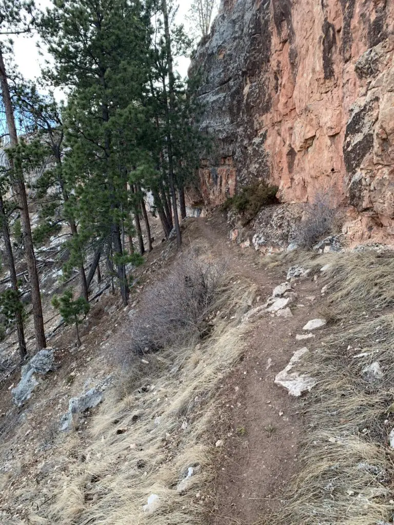
Dirt, walking path traverses the side of a steep, grassy hill. Red, rock walls rise on one side with pine trees on the other.
This is one of my favorite parts of the hike. The red rocks of the canyon rim make a VERY pretty contrast to the dark green trees that sit just below it.

If you’re looking for a fun, moderately challenging hike that isn’t very busy, check out the Hell Canyon trail!

Have you hiked at Hell Canyon? Tell me what you thought of the trail in the comments! 


Did you enjoy this post?  Pin it!

Dirt, walking path traverses the side of a steep, grassy hill. Red, rock walls rise on one side with pine trees on the other. Pin reads, "Hell Canyon Trail--Black Hills"


Like what you read here today?  Please feel free to leave a comment, like or share this post!  Add your email at the bottom of the page, or the sidebar to the right, to be notified when a new post is published.  By signing up for the email list, you will also receive a free copy of the Tranquil Trekker’s Top 10 Tips of Trekking Do’s and Don’ts!

You can also follow the blog on social media by clicking the links below!
Facebook

Twitter

Instagram

Pinterest

Little Devils Tower, Cathedral Spires and Needles Highway Loop

In this post, I review a loop hike made from two popular trails and a scenic road, all amidst the beauty of Custer State Park!


While there are many great hikes in Custer State Park, one of my favorites is an awesome loop trail that connects the Cathedral Spires to the Little Devils Tower Trails and incorporates a portion of the Needles Highway.

You can do this loop any time of the year, but I suggest extreme caution if you try it in the summer.  It includes either a lengthy overlanding stretch which requires scrambling over steep, unmarked terrain, or it means you have to walk along the narrow, CROWDED Needles Highway.

Where are the Little Devils Tower and Cathedral Spires trailheads?

You can reach both of these trails from the Sylvan Lake area, which is found off Route 87 in Custer State Park.  Both are accessible throughout the year (weather permitting) though you can’t drive directly to the trailheads during the winter months. (You can access them via a spur trail from Sylvan Lake or other connector trails in the local area.)  See below for directions to both trailheads:

Little Devils Tower Trailhead

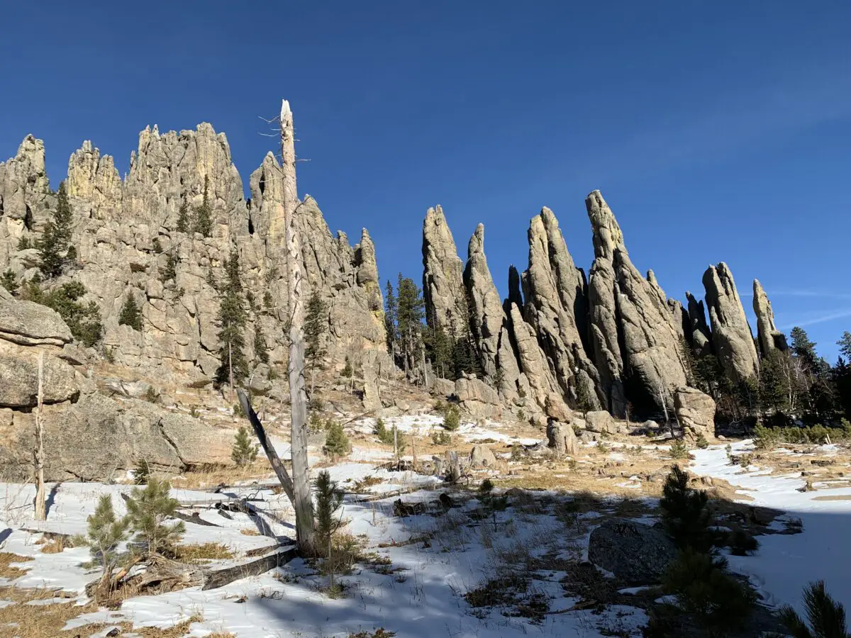
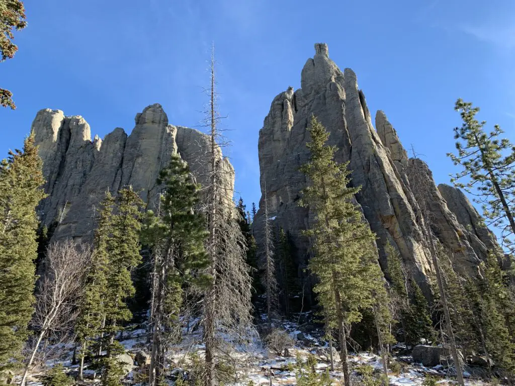
Brown grass with some snow in the foreground. Gray, pointy rock structures in the background, dotted with green, pine trees, all under a clear, blue sky.This is found just past the turnoff for Sylvan Lake. (Continue on Route 87 a little less than a mile south of the turnoff for the lake.  You will see a sign for the trailhead on your left and will make a left-hand turn into the parking lot.)

You can’t reach this trailhead by car in the winter months as the road is closed in that area.  In this case, you can access the Little Devils Tower trail via an easy spur trail that is located on the western corner of the main Sylvan Lake parking area.   

Cathedral Spires Trailhead

This trailhead can be found less than one mile south of the Needle Overlook on the Needles Highway (Route 87). (Note, this is south of the turnoff for Sylvan Lake.)

Extreme caution should be practiced in this area.  The parking lot is small and is located at a bend in an extremely curvy and narrow portion of the Needles Highway.  It is necessary to cross the road to reach the trailhead and in the summer this area is frequently crowded with traffic.  The curves and rock walls can greatly reduce a driver’s visibility and cars are sometimes parked incorrectly, as well, further exacerbating the problem.

As the Needles Highway is closed in the winter, that time of year you can only access this trail by car if you do it via a connector trail (such as the Little Devils Tower trail).

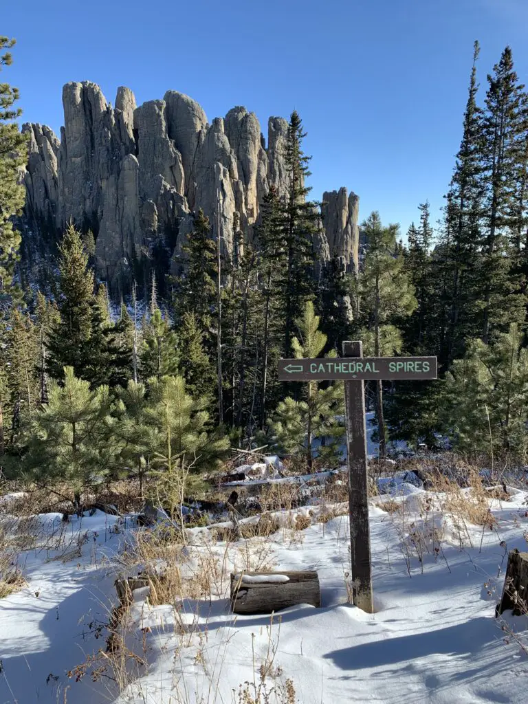
Snow in the foreground, then green, pine trees and gray, rock spires in the background. A brown sign reads, "Cathedral Spires".
This is the junction where the Little Devils Tower trail meets the Cathedral Spires trail

What will you see on the Cathedral Spires/Little Devils Tower/Needles Highway loop?

The loop can be completed in any direction, or you can hike each section individually.  The Trekkers find it easier to start at either Sylvan Lake and take the spur to the Little Devils Tower Trail or to just drive to that trailhead directly.

This route is especially enjoyable during the winter months (roughly November through April depending on the weather) because the Needles Highway is closed to all vehicles during that time.  You can still hike/snowshoe/ski it though!  It’s so cool to be able to slowly and calmly enjoy this route, and all the beautiful views it offers, in peace.

No offense tourists, we love you guys!  It’s just that during the busy, warm months, all the bustling of cars, busses, and motorcycles makes us miss our quiet, peaceful Hills. 😇   

See below for a description of each trail:

Little Devils Tower Trail

This trail is around two miles long, in each direction.  It is fairly wide and smooth and isn’t overly difficult (it does ascend the entire way out but the grade is low).

If you know where to look, the fabled Poet’s Table can also be found in this area.  If you want a few hints on how to find it, click here.  

Near the summit, the last several hundred feet does require scrambling over large, steep boulders.  There are some absolutely gorgeous vistas on this trail, and from the summit, you can get great views of the Cathedral Spires…

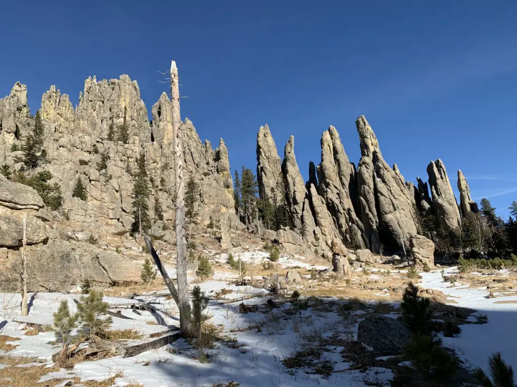
Brown grass with some snow in the foreground, dotted with green, pine trees. Gray, pointy rock structures in the background, , all under a clear, blue sky.

Cathedral Spires Trail

You can reach this trail directly from the Little Devils Tower Trail or from the Cathedral Spires Trailhead on Needles Highway (if it’s open).  At one-and-a-half miles in each direction, the hike is fairly flat, smooth, and well-marked.  At its terminus, you will find yourself in an amphitheater.  It is surrounded on three sides by rock spires that reach to the heavens as they tower overhead.  Sounds reverberate off the rock causing a cacophony of noise.  This is a prime area to stop for a quick lunch break and it is especially haunting in the fog when it creates a spooky, almost fairy-tale-like scene.

Green, pine trees in the snow in the foreground. In the background, gray, rocky spires reach to the clear, blue sky.
The Cathedral Spires!

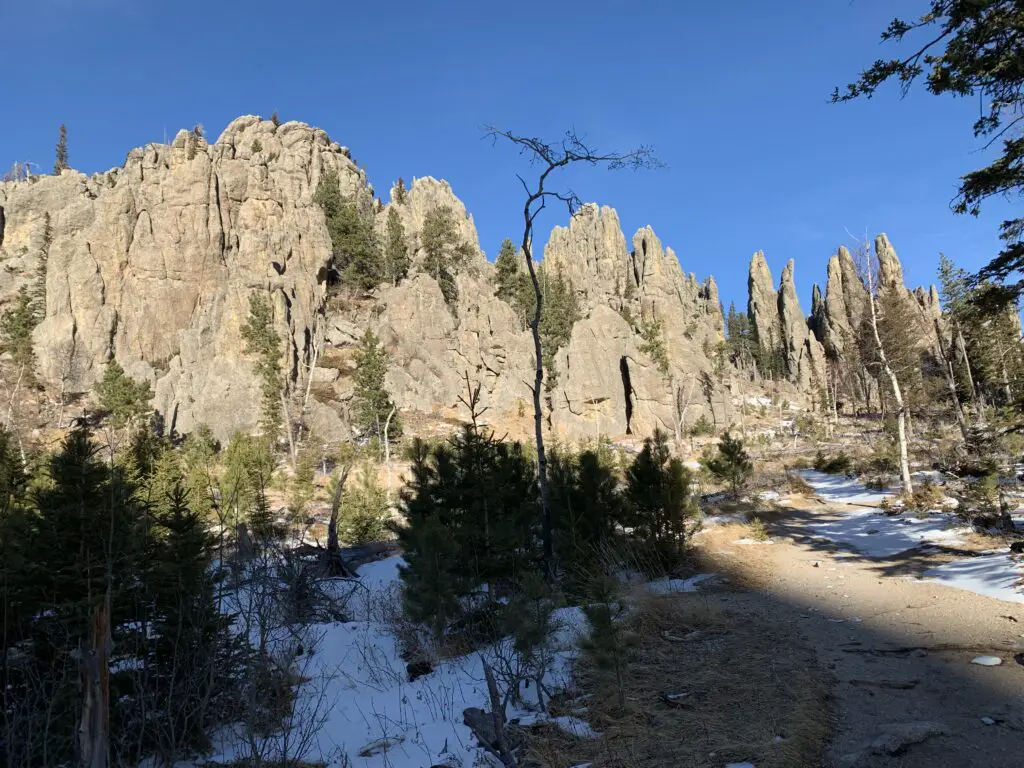
Small, green, pine trees in the snow in the foreground, along with a dirt path. In the background, gray, rocky spires reach to the clear, blue sky. Needles Highway

This connector section of the trail offers incredible views of Custer State Park and the town of Custer that sits directly to the south of the park.  On clear days you can also see the plains that stretch to the east and south.  It is truly a beautiful area!  Watch for mountain goats here too as they favor the rocky, granite crags that this part of the state is known for.

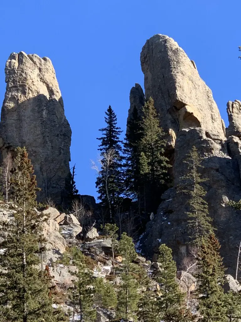
Green, pine trees in the snow in the foreground. In the background, large, gray, pointy boulders under a clear, blue sky.
Can you spot the mountain goat?
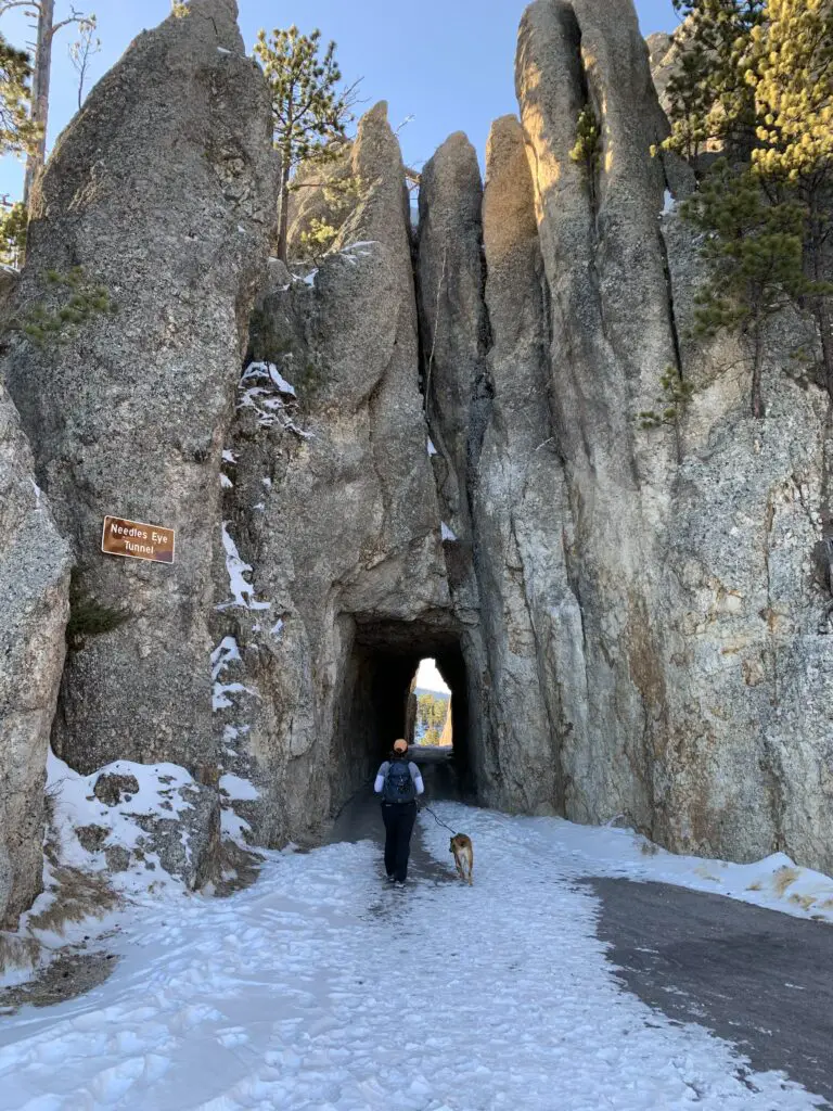
Rear view of a woman and dog walking on a snow-covered path through a tunnel of pointy rocks. A sign on the rocks reads, "Needles Eye Tunnel".
Puppers and I entering the Needles Eye Tunnel! Can you believe full-sized buses fit through here?! True story!
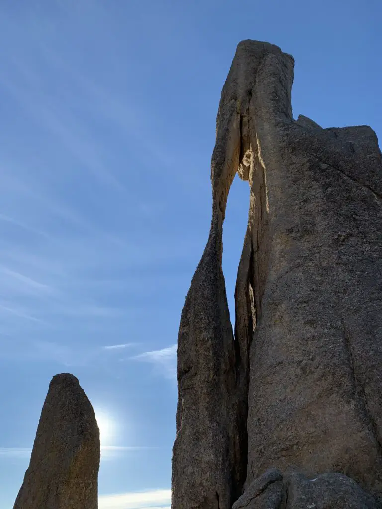
Two large, rock structures, one with a long, narrow hole, all under a blue sky.
The Needles Eye!

The entire loop is around 9ish miles in total length so it’s a little long.  However, there isn’t a lot of elevation gain as you’re already at one of the highest points in the Hills and the routes themselves aren’t difficult.  I would rate this as a moderate hike.

So, if you’re looking for a fun and scenic way to see well-known parts of Custer State Park, check out this loop trail made from the Little Devils Tower and Cathedral Spires trails, and the Needles Highway!

Have you hiked these trails? Tell me about your experience in the comments!


Did you enjoy this post?  Pin it!

Two large, rock structures, one with a long, narrow hole, all under a blue sky. Pin reads, "Hike this loop, off-season in Custer State Park. A loop trail of the Little/Cathedral Spires Trails and the Needles Highway"


Like what you read here today?  Please feel free to leave a comment, like or share this post!  Add your email at the bottom of the page, or the sidebar to the right, to be notified when a new post is published.  By signing up for the email list, you will also receive a free copy of the Tranquil Trekker’s Top 10 Tips of Trekking Do’s and Don’ts!

You can also follow the blog on social media by clicking the links below!
Facebook

Twitter

Instagram

Pinterest


Mindful Thoughts on COVID

In this post, I look back COVID, from my perspective.


In the spring of 2020, the world ended (metaphorically speaking)…it still feels surreal…COVID…I feel like it became a punchline…of the worst joke EVER! 😝  So many people lost income and jobs to the Pandemic (I did), and so many lost their livelihoods.  So many people had their lives abruptly changed and for some things may never fully return to normal…

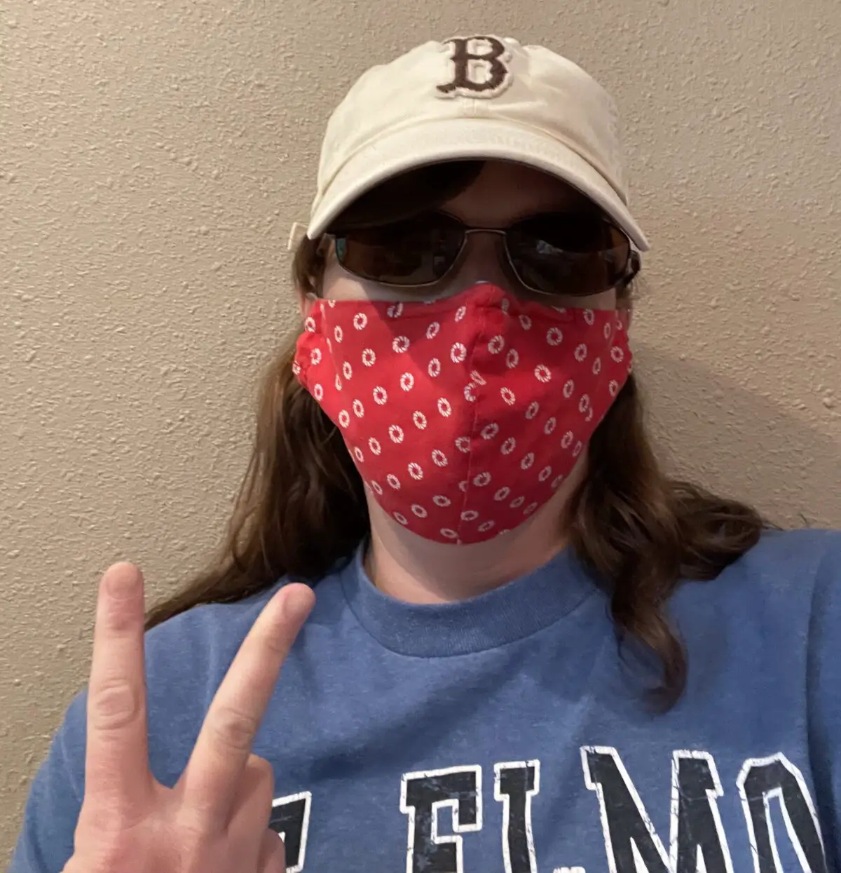
We were lucky out here in South Dakota.  We never had any real, state-wide mandates (masks or otherwise).  Most people were good about wearing masks during the height of the Pandemic.  (You still see people wearing them occasionally.  I still wear them frequently for work but that’s because I work with people who are very high risk who also live and spend time in community settings.)

I am still awed at how a minuscule event in one corner of the world could shut the entire globe down…

The majority of the US population now has COVID antibodies (whether through vaccines, natural immunity, or both)

They say that as much as 95% of Americans now have COVID antibodies, whether that be from the vaccines, natural immunity, or both.  If I NEVER hear the words “herd immunity” again, it will be too soon! 😤 *sigh*

Mr. Trekker and I have both 😝

Mr. Trekker and I stayed healthy for a long time!  We both received our 3rd round of COVID shots in late 2021…and then we both got COVID (probably Omicron) in early January 2022.

I got it from him, we have no idea how he got it. 😝 

We didn’t have it too bad, it mostly felt like a bad sinus infection/cold. Interestingly enough, between the two of us, we were more worried about me getting it because I have mild asthma.  As it turned out, I hardly had a cough at all, while Mr. Trekker ended up with a mild cough for several weeks afterward…this virus is weird!

I also ended up with mild pinkeye as a side effect of my first round with COVID (apparently that isn’t too unusual with viruses.)  Since then, my eyes have become INCREDIBLY sensitive.  They’ve always been that way but now, if they get dry from dust or wind, or if I am near any food that could be considered even the teeniest bit spicey, my eyes will begin to burn and water horribly (like to the point where I can’t see out of them. 😝)  This is especially true in my right eye which is also the one that had the worse pink eye symptoms.

Then in June 2022, we both got it again…

This time, I’m pretty sure I got it from a client (even though we were sitting outside and she wasn’t symptomatic at the time.)

I then proceeded to pass it on to Mr. Trekker and MommaTrekker. 😔

We were really worried about her as she’s over 70 and has several pre-existing conditions. She had just had a booster a few weeks before though and honestly faired better than either of us! 

This time it didn’t last as long and the symptoms weren’t as severe. Unfortunately, we both ended up with a cough that lasted WEEKS and more lasting Long COVID symptoms from this round–mostly brain fog and memory issues.

Again…*sigh*

I HATE this virus! 😡

Mindfulness in the Midst of a Worldwide Pandemic

I try and keep a somewhat positive outlook on the whole experience by being mindful of how the pandemic ACTUALLY played out vs. how the experts feared it might end up.

There were more than one million deaths in the US from COVID-19, and millions more worldwide, and to be clear, EVERY. SINGLE. ONE. of these was awful!  However, when the whole mess started the experts were projecting more than two million deaths in the US alone, before the end of 2020, and that was with social distancing protocols being implemented.

I don’t mean to make light of the tragic losses that did occur, but this FAR lower statistic is a pretty amazing feat!  It is a testament to the scientists, researchers, medical professionals, and technology we have available to us at this point in history!  If this awful virus had come around 100 years ago or more, billions could have died! (Think the Spanish Flu.)

Valid Emotions During Crisis Situations:

We all experience and respond to crises differently but I think it’s important to acknowledge that whatever feelings you had regarding COVID were valid.  We should be mindful of how we express them but don’t run from these emotions (be they positive or negative).  Accept them and acknowledge they exist (because they will whether you fight them or not).  We must allow ourselves to feel whatever it is we need to.  Below are some emotions I experienced throughout COVID:

Anger About the Pandemic:

Hoarding: Many people seemed to think only of themselves and didn’t save enough products for others (some who were seniors or the immune-compromised who really shouldn’t have been going out).  If you aren’t the Duggars, or you aren’t buying toilet paper for multiple families, you don’t need to hoard! 😡 

On the other hand, we were told not to hoard, but then the CDC and other emergency preparedness groups came out and said to have up to a month’s supply of food on hand…what were we supposed to do with those two bits of contradictory information? 🤷

Leave people alone!: I never understood many peoples’ desires to comment on the choices of others.  I’ve said before on several occasions that I lean Libertarian so I’m pretty big on people being left alone to make their own choices.  However, I do understand in crisis situations when at least local governments may need to implement certain restrictions in the interest of Public Health.

More so than that though, I don’t understand peoples’ need to criticize others for wearing a mask or being careful when the general public is no longer being forced to.  You have no idea what a person’s situation is. Just because they wear a mask doesn’t necessarily mean they’re “living in fear” (and if they are, so what, how does that affect you?)  They may be immunocompromised (or be caring/living with someone who is.)

There was a point, several years into the pandemic, where I was preparing for–and recovering from–MAJOR abdominal surgery that required a multi-day hospital stay.  I wore masks for WEEKS in public around that time.  It wasn’t that I was “scared” per se, but I did NOT want to get sick with ANYTHING!  It could have led to my surgery being delayed, my getting horrifically ill, or serious complications after surgery due to violent coughing/sneezing/vomiting. 

So, why not just leave people alone to do what they feel is best for them? (And you can do the same for yourself?)

The Media:  I often felt a sense of rage at the news media.  I’ve distrusted them in the past but after COVID I’ve become completely jaded–regarding the virus and most other news-worthy issues.  They seemed to mislead at every turn if it could cause controversy. (I probably shouldn’t be surprised anymore but I still am at points.)

I’d read a clickbait headline that makes one claim and then goes on to almost disprove itself if you read the actual text of the article, or watch the entirety of the video clip they referenced in the article.  They weren’t openly lying, because there was a semblance of truth in what they said, but their claim was so far from the truth that it may as well have been a lie with the message they were proclaiming to the masses (and for the record, I don’t care which news source is your favorite, I’ve seen ALL of them do this.)

They seemed to take pleasure in reporting bad news and stirring people up.  They didn’t take the time to fully research information, that would apparently have taken too long. 🙄  It seemed to be more important that they were “the first” to break a story.  The really shameful thing was, that I don’t believe they cared.  They just went happily along reporting bad news every chance they got because it may have helped a reporter’s career or a certain company’s reputation.

Depression and Anxiety over COVID:

Anyone who reads this blog regularly knows I already struggle with anxiety (which obviously, COVID caused for many of us.)  One symptom of anxiety is catastrophizing.  This means your mind automatically jumps to worrying about the worst-case scenario and that was SO EASY to do during COVID.

I believe I’m technically an optimist at heart.  I try to focus on the positive (although I worry about the worst-case scenario, of course, especially with my anxiety).  But it just felt like, during the Pandemic, that so many only wanted to focus on the worst thing that could happen and they wanted to scream that to the world.  Why?  Why do we seem to focus on things that make ourselves and others miserable?

We need to rely on Logic, not Emotion during these difficult situations!  I believe we have to be calm and logical when dealing with times like these.  I don’t mean to sound snarky, but why can’t people stay rational when things get difficult without immediately jumping to APOCOLYPSE?!  It feels like they’re pouring salt into an already raw, gaping wound…

COVID may be with us for a while…

The COVID pandemic isn’t over yet, unfortunately.  I’m starting to think it will NEVER be “fully” over, at least not for the next few decades.  I hold out hope that we’ll be able to remain living relatively normal lives, but now I fear that regular vaccines (and perhaps even regular–hopefully mild–infections) are going to remain a part of “normal” life. 😕  

At one time I was hopeful that we were on our way out of this mess.  Now that I’ve done everything right (at least regarding getting my vaccines) and we STILL got COVID (TWICE!)–AND we’ve got Long-COVID symptoms I’m more skeptical…

I believe in science. I believe it’s very possible the reason neither of the Trekkers got all that sick from this potentially deadly disease was due to our vaccines.  I also believe the reason none of our parents have gotten very ill from COVID is due to vaccines.  And I am VERY thankful for these! 

But when we got sick 1 MONTH after getting our boosters I just felt…DONE.  I think, at that moment, I just gave up.  It’s here, it isn’t going away, and we have to learn to live with it….THE END. 😪

I understand the vaccines probably worked as intended and those in our families who have had COVID while vaccinated came through relatively unscathed.  But we still got it, and I’m assuming if another variant (maybe one not related to Omicron) develops, we will likely be at risk of at least mild disease from that.  So, this is our “new normal”. 

We will probably have at least annual vaccines with the threat of at least occasional, mild illness always looming…possibly for the rest of our lives…it sucks but I just feel like that’s what we have to adjust to and accept for the foreseeable future. *sigh*–again!

Searching for Hope and Encouragement in Crisis Situations

I have to end this post on a good note, right?

I can’t help it.  Even with my learned helplessness after years of being beaten down by COVID, I still feel a glimmer of hope.

COVID was a unique time in our lives.  Many of us have never experienced something like this before.  As a (very OLD) Millenial, the only country-wide crisis I’ve really had to deal with was the September 11th terrorist attacks.

I grew up hearing stories about my grandparents’ generation dealing with World War II, the rationing of meat, the transitioning of factories to make equipment for the military, and the various drives people engaged in at home for the “war effort”.  I always wondered what it would be like to be able to do something like that to help your country.  Now I know…

Through all this, I’ve been reminded that there is a lot of good in the world, and times like these are when it really shows.

A lot of good things DID happen!  Vaccines were produced in an unheard-of, record time.  So many people bound together to help each other get through this crisis, from wearing masks and social distancing in public to those who volunteered their time to make masks for local schools and hospitals.  Others ran errands for people who felt they couldn’t go out.  Some small businesses transitioned to help their local communities (like distilleries that stopped producing alcohol and started producing hand sanitizer instead.)

I think a lot of the world’s goodness was shown throughout COVID.  I know I’ve learned a lot, both about myself and also about the reality of country-wide/worldwide crises:  how they proceed, how people react to them, the good and the bad.

So there are things to be hopeful about regarding COVID!

What did the COVID crisis feel like to you?  What POSITIVE things did you see during this time of crisis?  Share your experiences in the comments!


Like what you read here today?  Please feel free to leave a comment, like or share this post!  Add your email at the bottom of the page, or the sidebar to the right, to be notified when a new post is published.  By signing up for the email list, you will also receive a free copy of the Tranquil Trekker’s Top 10 Tips of Trekking Do’s and Don’ts!

You can also follow the blog on social media by clicking the links below!
Facebook

Twitter

Instagram

Pinterest


Empire Mine, Black Hills of South Dakota

In this post, I review a trip to the “secret” site of the Empire Mine, found in the central Black Hills.


Author’s Note:  I struggled with whether or not to write this post.  I wanted to blog about this location because it is a cool place and I love sharing the history and beauty of our Black Hills with others.  However, it is a bit of a secret spot and I didn’t want to be “that guy” who gives away closely-held, local secrets.  My personal policy is to not offer more directions to these types of sites than are already available on Google.  Unfortunately, there isn’t much to be found regarding the Empire Mine…

My main goal with this policy is to protect the site from vandalism and/or destruction.  We have unfortunately had these types of issues in some local places such as the Spokane ghost town and the iconic Poet’s Table, as of late.  For this reason, my directions below are intentionally vague.  If you want clearer instructions on how to reach the site, you may contact me via social media as indicated below, or by using my contact form, and I may be able to help you a little more. (I got some helpful directions from a friendly and helpful local so I am willing to pay their goodwill forward and do you the same favor. 😀)


There is a somewhat well-known, secret location many people enjoy hiking to in the central Black Hills.  It is the site of the now-defunct Empire Gold Mine!  You can reach the ruins of this mine via the Samelius trailhead, which is part of the Black Hills Centennial Trail.

That’s it.  Those are my directions. 😇  I told you they would be vague! 😉  I don’t feel like these approximate instructions are giving anything away as this much is available on the AllTrails site.  That page also offers a little more information as to the whereabouts of the mine, including a vague map.  Also, I knew the mine could be reached from this trailhead for quite some time and that didn’t aid me in finding this secret locale (maybe I’m just not that bright? 😂)

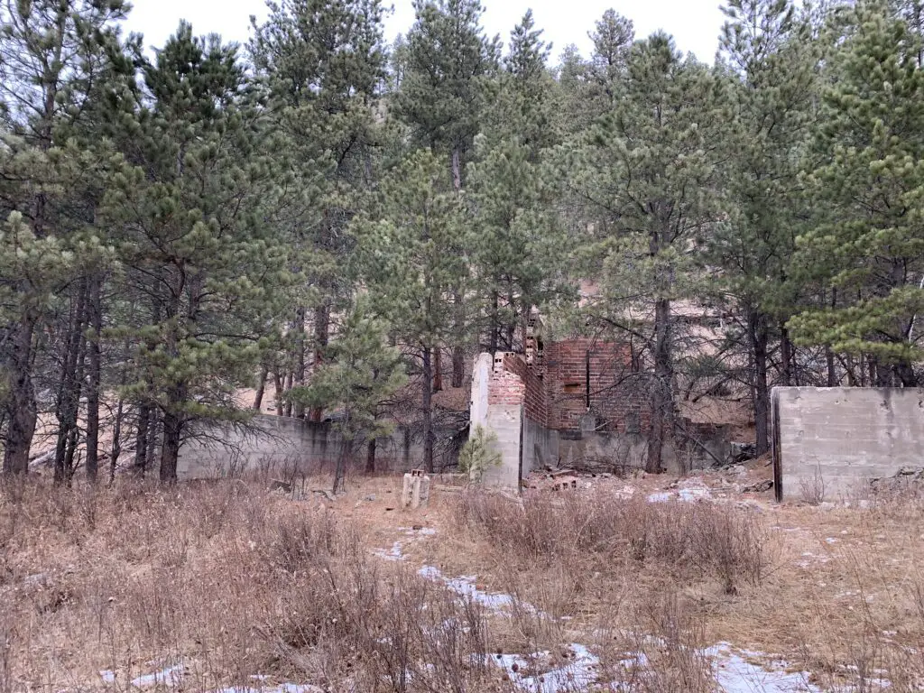
Brick ruins sit amongst trees in the woods
The storehouse at Empire Mine.  At one point in time, trucks could drive here.

What is the trail to the Empire Mine like?

The trail to the Empire Mine is about 4.2 miles in total length, out-and-back.   You should be aware, a goodly portion of the route going out is downhill…you know what that means for a goodly portion of the path coming back?! 😝  The trail is also fairly obvious the entire way.  Much of it follows old forest roads and the portions that don’t are heavily used so they are well-trodden.

When is the best time of year to visit the Empire Mine?

The hike is a bit lengthy but it isn’t overly difficult.  Some of the trail sections could become quite icy during the colder months, especially as this route sees a lot of traffic that can pack the snow into hard ice.  If the weather has been particularly wet recently, or during the spring thaw when snow is melting, mud could also make this trail slippery.

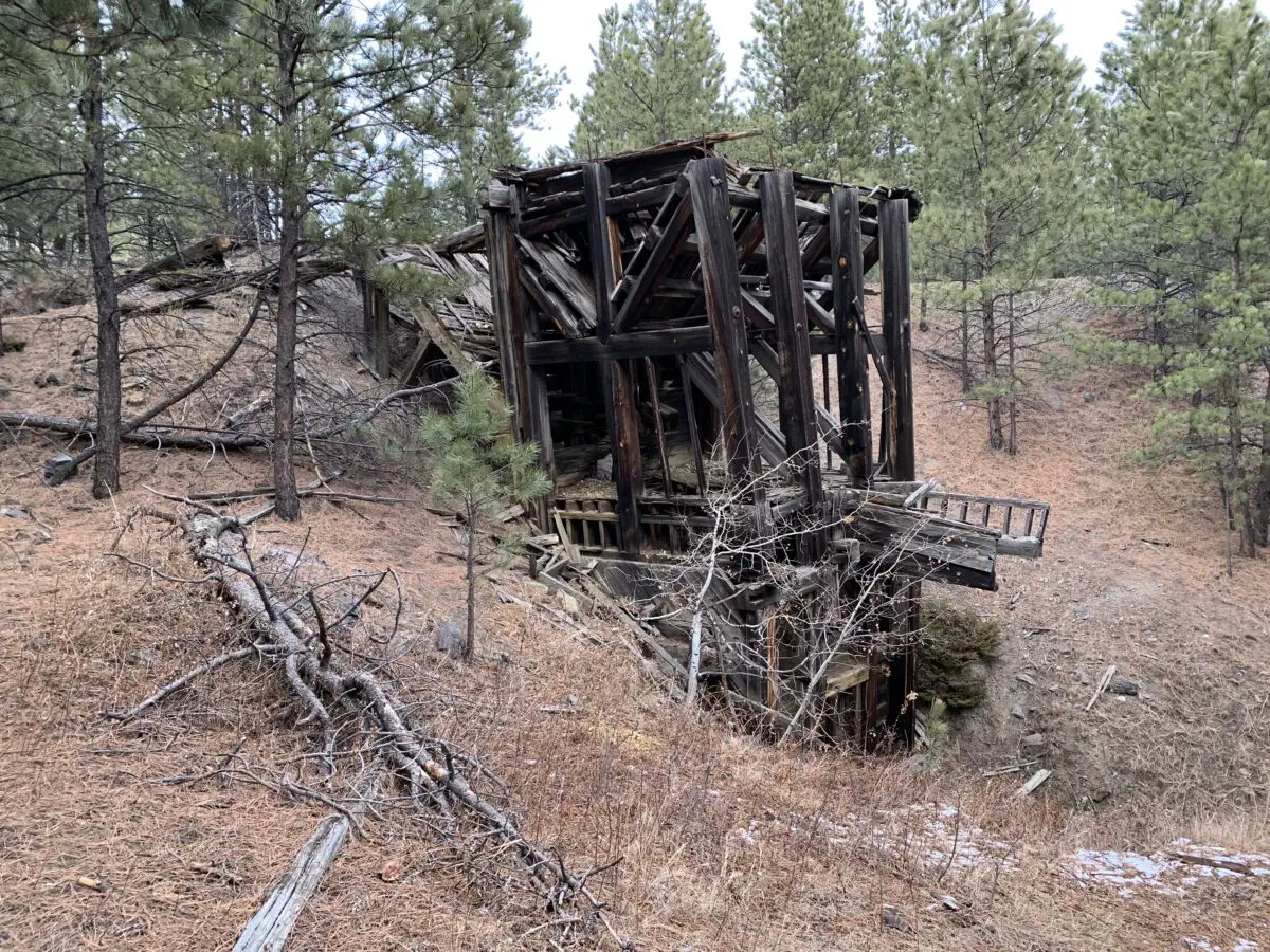
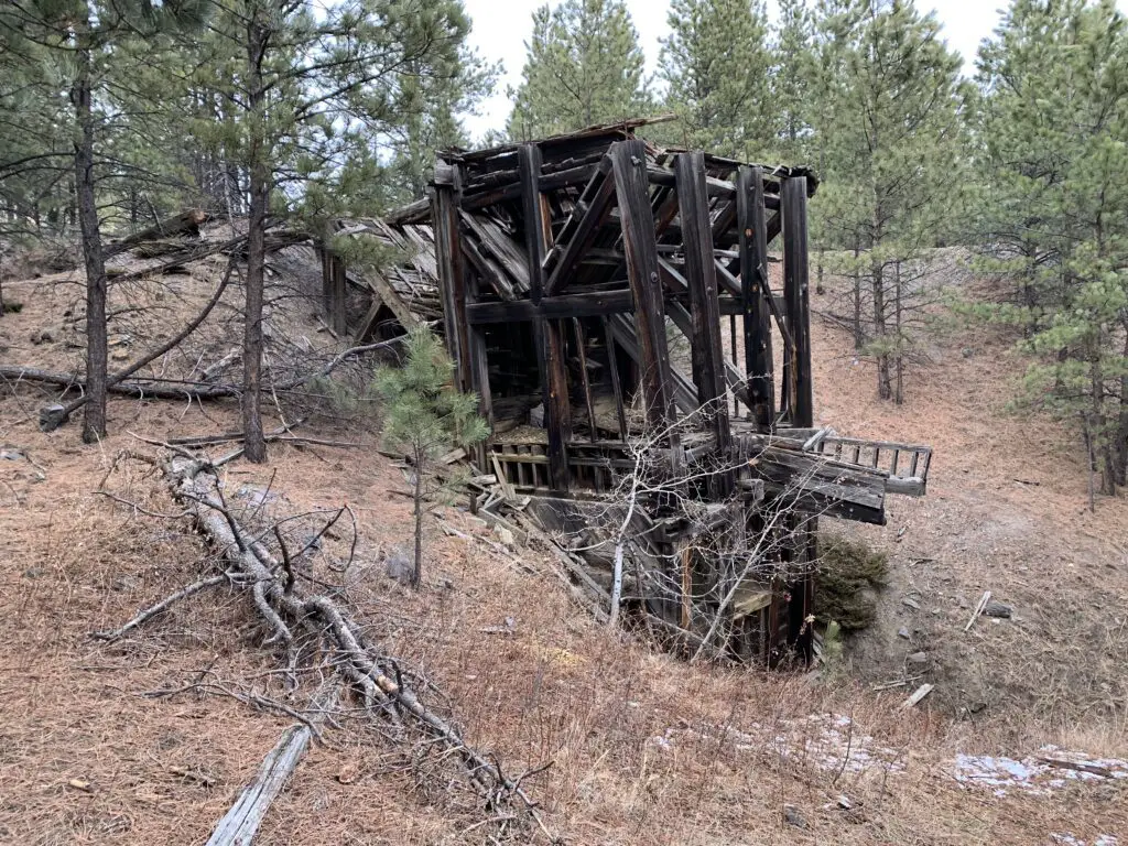
Wooden remains of a mine building in the woods
Another ruin from the site’s mining days. You can see how dilapidated the buildings are becoming.

These factors could make the downhill portions of the route troublesome, so please use caution.  The hike is especially lovely in fall when the trees change color!  This is because along the way you walk near several aspen groves that turn a brilliant, golden hue (hey look, another clue as to the location of the mine! 😉)

What is there to see at the Empire Mine?

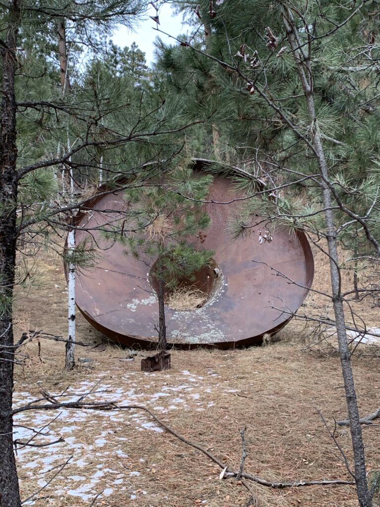
Some of the main ruins that remain of the mine are the brick loading area and a VERY large copper funnel.  Those are found at the bottom of the hill.  As you work your way up the hill you will encounter a number of buildings and mine equipment that still remain in the forest.

A WORD OF WARNING!  The mine was built in the late 1930s so these buildings are OLD!  They are made of wood that has weathered and has not been maintained in many years.  PLEASE do NOT enter them.  Also, watch your step throughout this area as portions of the ground (especially near some of the buildings) are degrading into sinkholes.

A very large, rusty, metal funnel sits in the woods
A large funnel that was used at the mine

This is a pretty neat site to visit.  It is also not that far from several nearby, Black Hills’ towns and it isn’t really that hard to reach IF you know where to look.  If you’re interested in some of the mining history of the Black Hills I encourage you to look into this secret locale.  Just please, treat it with the historical respect it deserves, and don’t ruin the site for those who come after you.  *stepping off my soapbox now* 😇 

Have you visited the site of the Empire Mine in the central Black Hills?  Share your experience with me in the comments!


Did you enjoy this post?  Pin it!

Wooden remains of a mine building in the woods. Pin reads, "Empire Mine, Black Hills of South Dakota".


Like what you read here today?  Please feel free to leave a comment, like or share this post!  Add your email at the bottom of the page, or the sidebar to the right, to be notified when a new post is published.  By signing up for the email list, you will also receive a free copy of the Tranquil Trekker’s Top 10 Tips of Trekking Do’s and Don’ts!

You can also follow the blog on social media by clicking the links below!
Facebook

Twitter

Instagram

Pinterest


Centennial Trail Between Bear Butte and Alkali Creek Trailheads

In this post, I review the northern portion of the Centennial Trail that runs between Bear Butte State Park and the Alkali Creek trailheads (this also includes Fort Meade) in the northern Black Hills.


Mild, winter days make great weather for hiking the northern portions of the Black Hills Centennial Trail.  Today’s post is going to focus specifically on the sections that run between the Alkali Creek trailhead and Bear Butte State Park (Fort Meade is included in this).

Where can you find the Alkali Creek, Fort Meade, and Bear Butte trailheads of the Centennial Trail?

When hiking the Centennial Trail from these trailheads you can choose to start from whichever one you’d like and can travel northbound or southbound from any of them.  All of these are pretty easy to find as they are all close to populated areas (namely I-90 and Sturgis, South Dakota).  See below for specific directions to each:

    • Alkali Creek trailhead:  located adjacent to I-90 across the highway from the Black Hills National Cemetery at Exit 34.
    • Bear Butte trailhead:  found at Bear Butte State Park which is northeast of Sturgis, SD on Route 79.
    • Fort Meade trailhead:  located on the eastern edge of the Fort Meade historical site off of Route 34, just east of Sturgis.

What will you see on the Black Hills Centennial Trail in the Northern Hills?

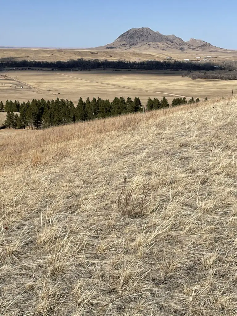
This whole area sits in the shadow of Bear Butte, meaning it offers spectacular views of that unique formation.

Bear Butte is a “sister” volcanic plug to Devils Tower that is located in eastern Wyoming.  The American Indians who named this geological formation gave it this name as they thought it resembled a sleeping bear. (I think it more resembles a sleeping stegosaurus or dragon, but the tribal people probably wouldn’t have been familiar with these critters, so I’ll give it to them. 😀)

The idea of the bear plays into the American Indian legend of the giant bear who scored the sides of the Tower with his claws, leaving the large columns of igneous rock behind.

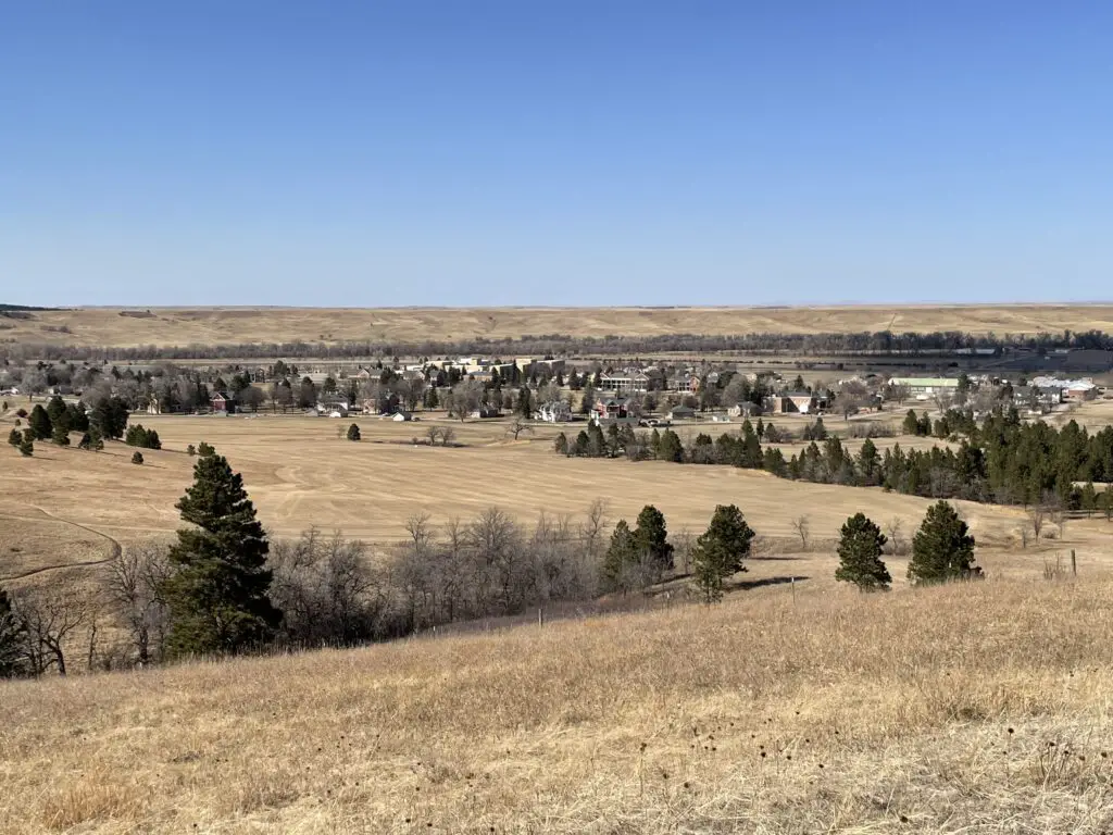
The Centennial Trail between Alkali Creek and Fort Meade trailheads

My favorite of these sections is the portion between Alkali Creek and the Fort Meade historical site in Sturgis.  As its name would imply, Fort Meade was originally built as a fort in the late 1800s.  It now features a museum, multiple historical buildings, and a VA hospital.

As you venture near the fort you start to see many historical buildings popping up along the hiking route.  One was just an old ( but beautiful) stone fireplace and chimney.  Another looked to be old, stone barracks.

Brown-grass plain in the foreground leads to tree covered hills in the background
On the Centennial Trail, looking towards Fort Meade from the north

On the Alkali Creek portion, we made a loop of the Centennial Trail and through the Fort Meade Recreation Area.  This place is awesome!  I had heard about it before but had never been there.  We’d definitely like to go back and do more of the trails.  They would be perfect for mountain biking or horseback riding, in addition to hiking.

We brought roads 11 and 12 back to the Alkali Creek trailhead to complete our loop.  They were much easier and quicker than the way out as they were mostly on old forest roads.  Be aware though, that this section has no shade as it traverses the grassland portion of this trail.

Brown-grass plain, green pines and leafless trees in the foreground, a small grouping of houses and other buildings in the background surrounded by trees
The Fort Meade historical site

This section of the Centennial Trail is VERY pretty.  It is comprised of forested hills (much like the rest of the Black Hills) and prairie sections.  There are lots of different ecosystems and flora represented here, ranging from pine forests to prairie grassland.  It made me wonder if this is what Bear Butte looked like, before the fire in 1996?

Brown-grass plain and green pine trees to the horizon where a mountain stands that looks like an animal laying down, all under a clear, blue sky
Bear Butte, the sleeping bear (or sleeping stegosaurus, if you prefer. 😉 )

This portion of the trail is comprised of a bunch of up-and-down sections, but nothing too terribly steep or long.  It reminded us of some of the Devils Tower hikes in Wyoming where you are hiking through the trees but can still look out over the plains.

While one portion of this hike is VERY close to I-90 (the highway is maybe half a mile away?) it isn’t very noisy because you’re in the forest on the “other” side of the hill!  Yay, science!

The Black Hills Centennial Trail between Fort Meade and Bear Butte trailheads

The rest of this section of trails is comprised mostly of just prairie and prairie dogs. 😊  We did spot a grass fire to the north as we were hiking along.  That was a little disconcerting as were surrounded by highly flammable material. 😮

We weren’t too worried as it was quite a ways off, we could see the authorities were already on the scene, and the wind was blowing the fire away from us.  It did get us thinking about what we would do if a fire was to come racing across the grassland while we were hiking through it. 😝  There was a farmhouse nearby we could have run to or there were some small cow ponds scattered nearby.  These may not have been very clean or nice but they would have sufficed in a pinch! 😂

Take note that these portions of trails could be VERY warm in the summer (which is partially why we enjoyed them in the winter).  Much of the Centennial Trail in this region traverses grassland with no shade to speak of ANYWHERE.  While the brisk, South Dakota breeze usually accompanies you, you won’t be able to escape the unrelenting sun.

Between the hot sun and that breeze–plus the fact that the air is usually quite dry here–you can dehydrate quickly and easily.  Not only do they dry you out, but the constant breeze and dryness can make it so that you don’t even realize how much you are sweating.

That being said, this portion of the Centennial Trail is a great hike!  It offers some amazing views and it is easier than many portions of the trail that are further south.  This is because the altitude is lower here and the elevation changes are far more minimal.  So if you’re looking for something fun to do, check out the Centennial Trail in the Northern Black Hills!

Have you tried out any of these routes?  What did you think?  Tell me about your hike in the comments!


Did you enjoy this post?  Pin it!

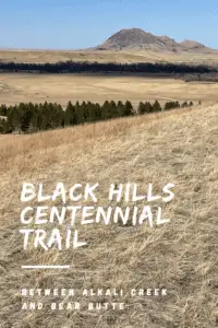
Brown-grass plain and green pine trees to the horizon where a mountain stands that looks like an animal laying down, all under a clear, blue sky. Pin reads, "Black Hills Centennial Trail between Alkali Creek and Bear Butte"


Like what you read here today?  Please feel free to leave a comment, like or share this post!  Add your email at the bottom of the page, or the sidebar to the right, to be notified when a new post is published.  By signing up for the email list, you will also receive a free copy of the Tranquil Trekker’s Top 10 Tips of Trekking Do’s and Don’ts!

You can also follow the blog on social media by clicking the links below!
Facebook

Twitter

Instagram

Pinterest

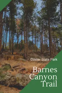
Barnes Canyon Trail in Custer State Park

In this post, I review a newer, lesser-known trail in Custer State Park.


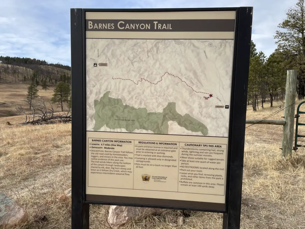
The Barnes Canyon Trail is a relatively new hiking option located within Custer State Park.  It is a great path as it is broad and easy to follow (being that it used to be a road 😉).  Because it is so wide and well-graded it is appropriate for almost everyone in your party.

Where in Custer State Park is the Barnes Canyon Trail?

The trailhead is located on the eastern edge of the park, near Custer State Park Airport.  It also connects through to the Badger Clark Memorial Trail which is located off of Route 16A, found farther west, and deeper within the park. (I discuss this portion of the trail in another post.)

How long is the hike?

The hike is around 10 miles in total length (4.7 miles in each direction).  You only have to traverse as much of it as you want, of course.  The road is out-and-back and was once used for forest and logging access. (It has now been closed to motorized vehicles.)

Many old maps show that the trail makes a loop.  We didn’t see any obvious evidence of this on our hike.  We found on several websites that the loop can be difficult to follow as one of the sections is heavily overgrown, not well-maintained, and not well-marked.  If you want to try the whole loop be my guest, but be sure you have good maps and a compass with you as it may require some bushwhacking of your own trail.

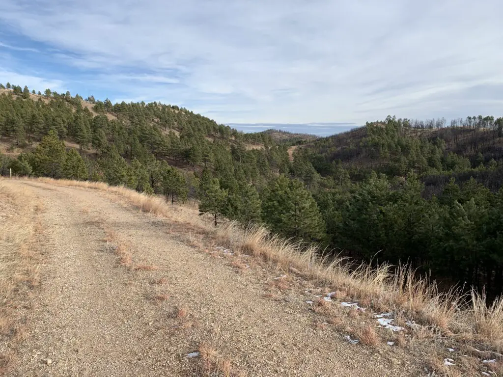
A gravel road with tree-covered hillsides in the distance
This road is basically what the entire tail looks like
 What will you see on the Barnes Canyon Trail?

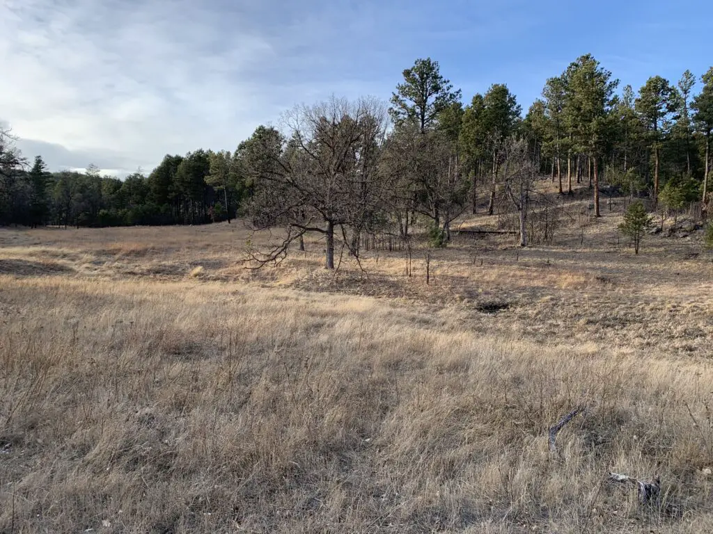
The route includes hills and dips, but traveling east to west it generally traverses uphill. It isn’t a very steep or difficult trek, however, so it should be appropriate for almost anyone.  In several places, it offers nice views of the surrounding prairies and wooded hillsides.  While the majority of the trail mostly runs through forestland, you do cross a few meadowy areas, as well.

A dry, grassy meadow with some leafless trees and a pine forest in the background.

One nice thing about this trail is that it allows you to get out into the middle of Custer State Park.  Here it is quiet and far from the many tourists that are frequently in the area.  You may spot many different wildlife on your trek including deer, buffalo, elk, and bighorn sheep, not to mention a wide variety of birds and other forest critters.  This is also a very quiet hike as the trail does not run near any major roads.  Use your time here to soak up the tranquility, peace, and natural sounds of the forest.

When is the best time of the year to hike this trail?

This trail is appropriate to use at any time of the year, though it could be difficult to reach in deep snow or very muddy conditions.  Also, if you attempt this hike during the colder months, you may want to bring traction devices, such as Yaktrax, to help you manage any icy sections that may form in shaded areas, especially on hills.

If you’re looking for a great trail that isn’t difficult but offers some beautiful views of the flora and fauna that make up the amazing scenery of the Black Hills, check out the Barnes Canyon Trail in Custer State Park!

Have you tried this new-ish trail?  Tell me what you thought of the route in the comments! 


Did you enjoy reading this post?  Pin it!

A tree-covered hillside. Pin reads, "Custer State Park, Barnes Canyon Trail"


Like what you read here today?  Please feel free to leave a comment, like or share this post!  Add your email at the bottom of the page, or the sidebar to the right, to be notified when a new post is published.  By signing up for the email list, you will also receive a free copy of the Tranquil Trekker’s Top 10 Tips of Trekking Do’s and Don’ts!

You can also follow the blog on social media by clicking the links below!
Facebook

Twitter

Instagram

Pinterest

Willow Creek Trail Black Hills

In this post, I review the Willow Creek loop trail!


One shorter trail the Trekkers really enjoy in the Black Hills is the Willow Creek Trail (trail #8)!  I like this route so much because it isn’t super difficult.  Anyone can reach the trailhead with any vehicle (in good conditions).  It’s also fairly short with no lengthy or super-difficult climbs, so anyone in decent condition should be able to manage it.  This trail is appropriate for all ages, children, adults, and four-legged friends! 

Related posts:  Hiking the Boulder Hill Trail; “Secret” Hiking Trails off Sheridan Lake Road; Coon Hollow Trail; Little Elk Creek Trail; Flume Loop TrailStratobowl near Rapid City

The Willow Creek trail also sticks to the lower altitudes in the Black Hills and doesn’t offer any major elevation changes, which makes it easier.  This route allows you to get out into the Hills, to experience their beauty, to view some of the more rugged parts of the Hills, and to really experience getting out into the wilderness, on an easily accessible and hike-able trail.  It’s almost perfect!

Rear view of a dog standing on a snowy, hiking trail in a forest. A low sun shines through the trees.
This trail is Puppers approved!
Where in the Black Hills is the Willow Creek Trailhead?

You will find the trailhead at the Willow Creek Horse Camp which is off of Route 244, almost directly across from the Mt. Rushmore KOA Resort at Palmer Gulch.  It sits about 6 miles to the west of Mount Rushmore and around 3.5 miles east of the junction of US 385 and Route 244.  There is a short lane to reach the trailhead that is dirt, but it is well-graded and appropriate for any type of vehicle (in good conditions.  It may be impassable in deep snow.)  There is also a large parking area with plenty of room for numerous vehicles.

In the foreground, a trail sign that reads, "Black Elk Peak Trail #9" (arrow straight ahead), "Willow Creek Trail # 8" (arrow left and right). Hillside with sparse snow and pine trees in the background.

This trail doesn’t “go anywhere” per se. It does connect to the Black Elk Peak trail (trail #9–the hard way!) which is the northern route up the tallest mountain in the Black Hills.  It also connects to the Lost Cabin Trail which is another fun hike in this local part of the Harney Range.

How long is the Willow Creek Trail?

This trail is a 2.5-mile loop, that you can take in either direction.   I recommend trekking it counterclockwise.  This means you will face the two steepest, uphill climbs earlier on in the hike when you are most fresh.  Also, if conditions are iffy at all–wet, snowy, or icy–it is usually easier to handle these while climbing rather than on the downhill. (It is better to work against gravity in these situations.)  This left (or east branch) of the trail does have a lesser amount of shade.  When the weather is cool this means it’s more likely to be warmer, though in the hotter months, the sun can beat down on you in this section.  

What you will see on the Willow Creek Trail

While the entire trail is fun, the prettiest portion of it is on the right (or western) arm of the loop.  This area is one of the lowest and flattest parts of the trail.  It comprises mostly a riparian habitat (or one that is near a creek).  It’s lush, vibrant, fairly cool, and shaded during the summer months.

A narrow, icy creek flows through a snowy forest.
Willow Creek!

One of the prettiest parts of this section of the trail is a small waterfall that is formed by the creek.  A short side path will lead you to it.  It is especially pretty when it is frozen in the winter, though use care when walking on and around the ice.

A snowy slope with a large boulder towering on one side in a forest. A tiny, iced-over waterfall sits in the snow.

Below is a video Mr. Trekker took of the frozen waterfall:


If you’re looking for a fun trail to hike in the Black Hills that is easy to reach and appropriate for almost anyone, check out the Willow Creek Trail!

Have you hiked the Willow Creek Trail? Did you enjoy it? Tell me about your experience in the comments! 


Did you enjoy reading this post?  Pin it!

Three pictures: 1) A trail sign that reads, "Black Elk Peak Trail #9" (arrow straight ahead), "Willow Creek Trail # 8" (arrow left and right) on a snow-spotted hill; 2) A snowy slope with a large boulder towering on one side in a forest. A tiny, iced-over waterfall sits in the snow; 3) a dirt, hiking trail through a snow-spotted forest. Pin reads, "Black Hills Willow Creek Trail


Like what you read here today?  Please feel free to leave a comment, like or share this post!  Add your email at the bottom of the page, or the sidebar to the right, to be notified when a new post is published.  By signing up for the email list, you will also receive a free copy of the Tranquil Trekker’s Top 10 Tips of Trekking Do’s and Don’ts!

You can also follow the blog on social media by clicking the links below!
Facebook

Twitter

Instagram

Pinterest

Grizzly Bear Creek Trail in the Black Hills

In this post, I review the Grizzly Bear Creek Trail which is located in the Black Elk Wilderness near Custer State Park!


I’ve mentioned before how much I enjoy hiking in the Harney Range and the Black Elk Wilderness area of the Black Hills.  Well, the Grizzly Bear Creek Trail is one of my favorite routes in that locale.

Because this trail is located in the wilderness area, it isn’t maintained as much as the surrounding national forest.  There isn’t a lot of logging here and ranchers aren’t able to use this land to graze their herds, so you don’t have to worry about the “leavings” of cows.  There also aren’t any people living nearby.  Therefore, it’s really just left to Mother Nature.  It’s natural, beautiful, and rugged.

What will you see on the Grizzly Bear Creek Trail?

This path is interesting because it doesn’t really “go” anywhere, per se.  It’s really just a connector trail that meanders through the lower-lying areas of the Black Elk Wilderness.

This trail isn’t one of the more popular ones in the Black Hills so it’s rarely busy, no matter the time of year.  It also tends to be VERY pretty, as it traverses canyons and valleys.  A bubbling creek also accompanies you along much of the route’s length, which makes a pleasant accompaniment to your hike.  It usually has water in it which can be rare in this part of the country (many local waterways dry up at certain times of the year).

The constant presence of water means this is a more verdant part of the Hills in regards to foliage and it’s a beautiful and colorful area to visit during the fall.  This is also one of the easier trails found locally, with just simple, rolling hills to challenge you.  In addition to the lovely foliage, you will also be treated to views of the towering spires and imposing rock walls created by the granite the Black Hills is known for.

Rear view of a woman and dog walking on a dirt path that meanders through green, pine trees, yellow-leafed plants and rock towers, all under a clear, blue sky.
Puppers and I enjoying the trail!
Yellow leaves on a tree with green, pine trees behind it
The aspen trees were lovely!

Where is the Grizzly Bear Creek Trail?

The Grizzly Bear Creek Trail does have a trailhead of its own.  You will find it off of Forest Road 345 after it branches off of State Route 87 (also called the Needles Highway) in the northern portion of Custer State Park.  As it is a connector trail you can also access it from a number of other routes in the Black Elk Wilderness, including the Black Elk Peak Trail (formerly the Harney Trail), the Centennial, the Horsethief Lake, and the Norbeck Trails.

How long is the Grizzly Bear Creek Trail?

The trail is about 13 miles in total length.  If you just want to hike portions of the route, you can do out-and-back treks, or you can connect this path with several other trails in the local area to make a variety of loops.  These can be shorter, day hikes or longer, multi-day backpacking trips.  All of them make for a great way to see the rugged beauty of the higher elevations of the central Black Hills.

Related posts:  Great Hikes in the Black Elk Wilderness; Black Hills Blackberry Trail, near Mt. Rushmore

When is the best time of year to hike the Grizzly Bear Creek Trail?

While the Grizzly Bear Creek trail can be enjoyed at any time of the year, the warmer months are a better time to access it.  It would be beautiful in the winter, though it would be difficult to get to the trailhead as neither the forest road nor the Needles Highway is maintained during the snowy season.  As this is one of the highest elevation areas in the Black Hills, you should also expect to encounter, potentially, feet of snow throughout much of the winter.

A dog pants while standing in the forest on dirt and downed, brown leaves.
This trail is Puppers approved!

Because you are so close to the creek for much of the trail’s route, there are also a number of water crossings along its length.  You should be prepared for this and have either waterproof shoes or footwear you don’t mind getting wet.

Some of the crossings have rocks you can hop across, though the availability of these will depend on the depth of the water, which can vary greatly throughout the year.  These stones can also become mossy and slippery so you should use them with caution.

A wooden footbridge crosses a small, dry creek, surrounded by fall-colored trees and leaves in the woods.
A bridge across the creek!

If you’re looking for a less-traveled but beautiful hike in the Black Hills, check out the Grizzly Bear Creek Trail!

Have you ever hiked this trail?  What did you think?  Tell me about it in the comments!


Did you enjoy reading this post?  Pin it!

3 pictures: 1) A wooden footbridge crosses a small, dry creek, surrounded by fall-colored trees and leaves in the woods; 2) Yellow leaves on a tree with green, pine trees behind it; 3) A dirt path that meanders through green, pine trees, yellow-leafed plants and rock towers, all under a clear, blue sky. Pin reads, "Black Hills Grizzly Bear Creek Trail"


Like what you read here today?  Please feel free to leave a comment, like or share this post!  Add your email at the bottom of the page, or the sidebar to the right, to be notified when a new post is published.  By signing up for the email list, you will also receive a free copy of the Tranquil Trekker’s Top 10 Tips of Trekking Do’s and Don’ts!

You can also follow the blog on social media by clicking the links below!
Facebook

Twitter

Instagram

Pinterest