San Luis Valley: Aliens, Sand Dunes and Sandhill Cranes!

In this post, I detail a recent trip the Trekkers took to the San Luis Valley in south-central Colorado.


One cool event to check out in early March is the Monte Vista Crane Festival in the beautiful, San Luis Valley of south-central Colorado!

The time we visited our trip started with an interesting drive down I-25 in southeast Wyoming near Cheyenne. We got as far as Wheatland, Wyoming on the interstate, and then saw the flashing sign for “I-25 closed to Cheyenne”! (It had snowed the day before, and even though it was bright and sunny strong winds were causing blowing snow and bad enough winter conditions to close I-25 and I-80 for close to 12 hours!)  So, we had to turn around and drive in “a big f-ing circle”–per Mr. Trekker 😂–back to the nearest alternate route through Torrington.

Anyone who’s driven through MANY parts of Wyoming knows, alternate routes (or roads in general) can be hard to come by. 😝 

After navigating some black ice…in the dark…and some sketchy drivers (I’m looking at you reckless semi-truck! 😒) we finally made it safely to Cheyenne.  From there it was an easy trip to the hotel in Lakewood (with a quick stop at Chick-fil-A for dinner!)  This is the price we pay to live in the INCREDIBLE Mountain West and try to travel during the fickle, early spring. 😂

Snowy pastures with snow-covered Rocky Mountains in background

The next day we headed down the GORGEOUS Route 285 southwest of Denver.  I LOVE this drive, it is always SO PRETTY! It sweeps through mountain passes and across alpine valleys.  It was cool because we’ve never been to the Rockies when they had this much snow before! One of my favorite parts of the drive traverses South Park, an incredible valley in central Colorado. Click here for a video!

San Luis Valley, Colorado

Eventually, we arrived in the BEAU-tiful San Luis Valley!

The San Luis Valley, in southern Colorado, is an amazing place! It is the world’s largest high-altitude (alpine) valley that stretches over 100 miles north-to-south and is almost 75 miles in width.  It was once the bottom of a large lake and this is evident as the valley floor is flat as a pancake!  The valley is especially striking as it is lorded over on three sides by the Sangre de Cristo (Blood of Christ) mountains that reach higher than 14,000 feet!  The views here are truly incredible! (Click here for a short video of the drive into the valley.)

Looking down the road at the long San Luis Valley. Snow-covered Sangre de Cristo mountains on the left.
Driving into the incredible San Luis Valley!

Where is the San Luis Valley?

You will find this amazing valley hidden…in the middle of nowhere. 😉  The southern tip of the valley is only about 35 miles north of the state’s southern border with New Mexico.  The valley is also situated almost directly in the center of Colorado (going west-to-east).  It sits around 150 miles west of the mountain town of Durango and 120 miles from I-25 (nearest to the small town of Trinidad and the larger city of Pueblo.)

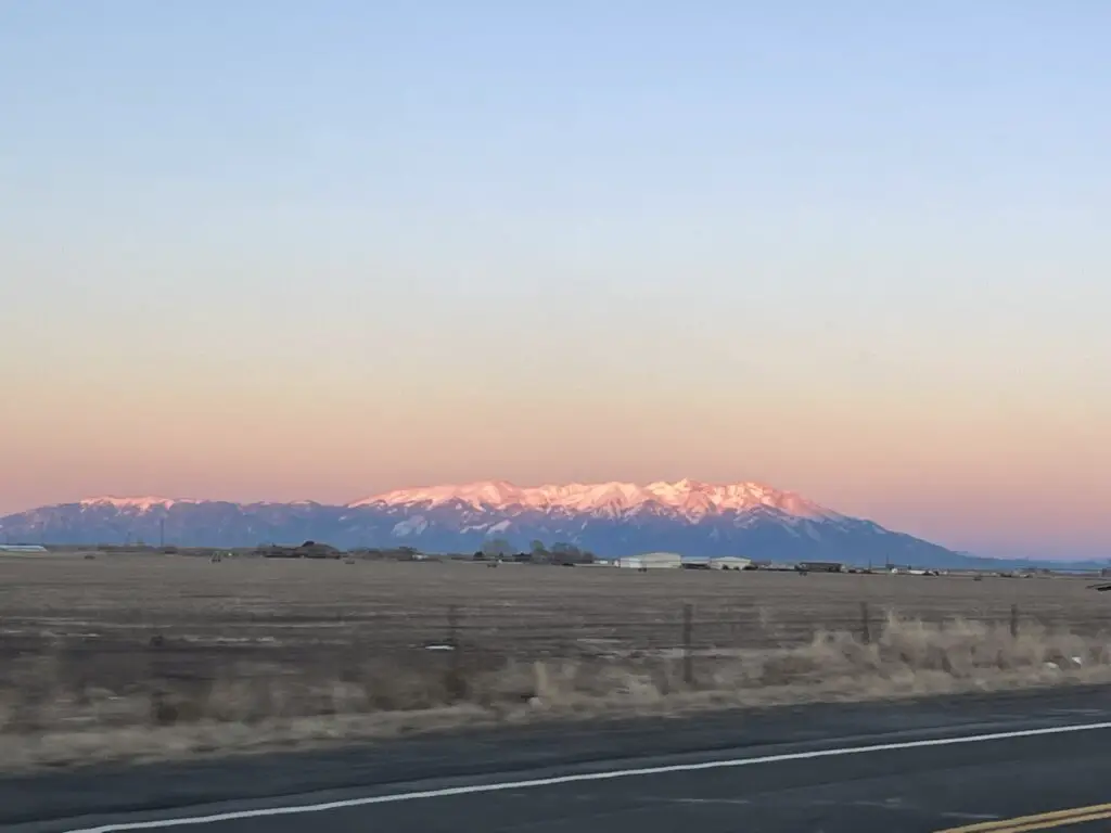
Pastureland backed by snow-covered mountains that are pink as they reflect the setting sun
Sangre de Cristo mountains living up to their name!

Fun Things to do in the San Luis Valley

The San Luis Valley is chock full of fun (and sometimes downright WEIRD) things to do! 

Great Sand Dunes National Park

This is the second time we’ve visited this park.  The first was several years ago in October (another lovely time to visit.)  We were able to hike higher on the dunes this time but we still haven’t made it to the top.  Those things are steep and they’re situated at like 8900 feet of elevation so you’re dealing with thinner air too!  It always seems to be windy at the Dunes (but I suppose that makes sense as wind is what created them. 😉)

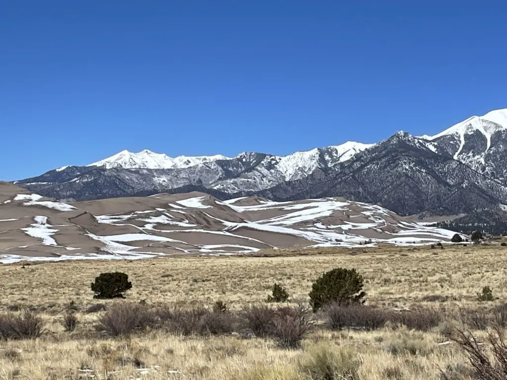
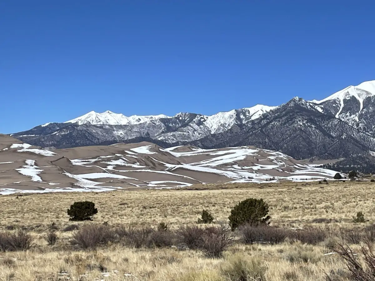
Snow-covered pasture and sand dunes with snow-topped Sangre de Cristo mountains in background
Great Sand Dunes under the watchful eye of the Sangres!
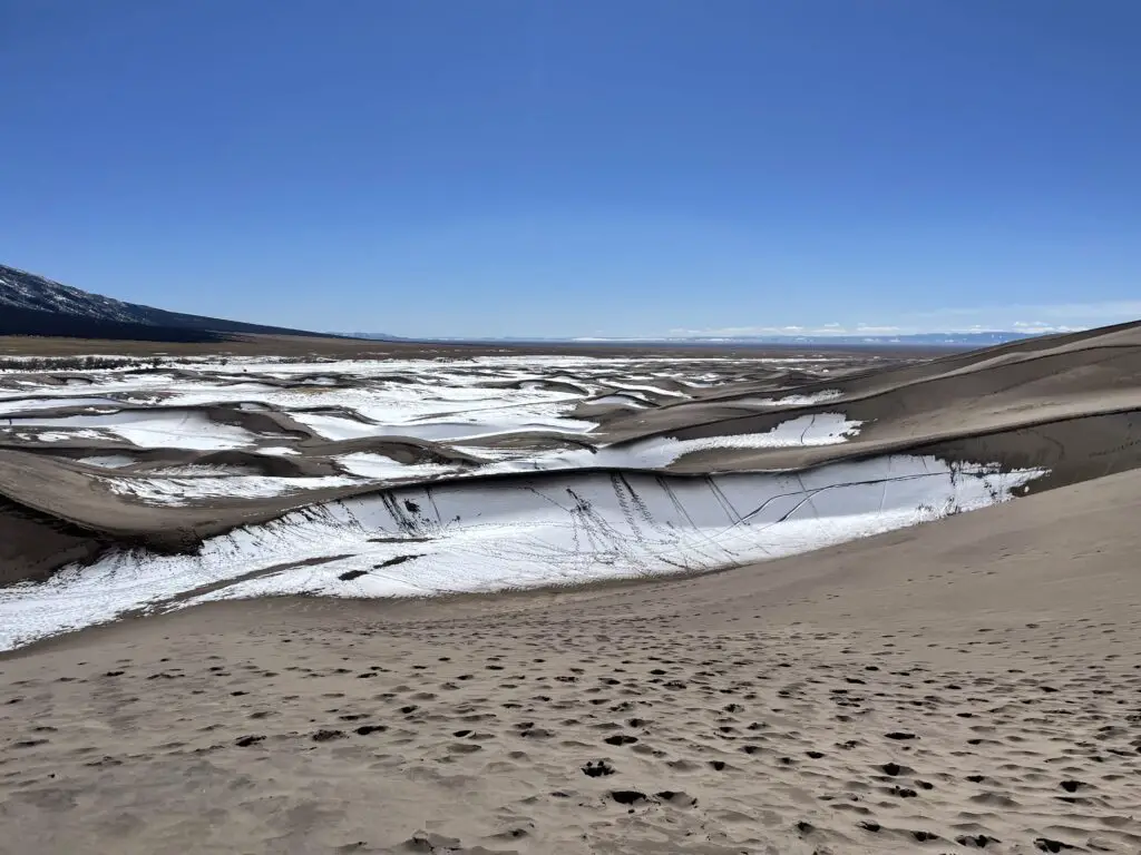
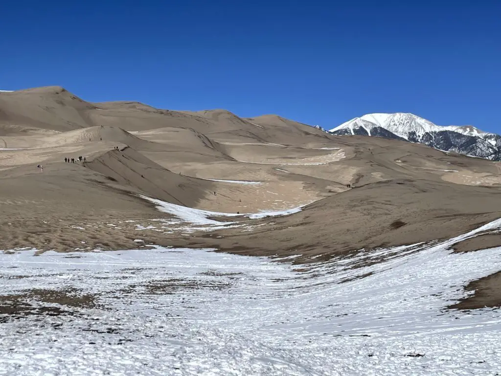
Snow-covered sand dunes with a clear, blue sky
Snow-covered sand dunes
Snow-covered sand dunes with mountains in the background and a clear, blue sky.
Panorama of the Sand Dunes!
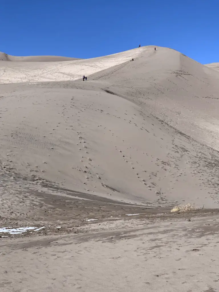
People seem tiny as they climb a sand dune
A view up one of the mid-sized dunes. (We made it to the top of this!)
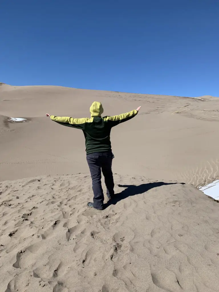
Person with back to camera standing with arms-outstretched atop a sand dune.
Tranquil Trekker, Queen of the Sand Dune!

Snow-covered sand dunes with snow-covered mountains and a clear, blue sky in the background

Crestone, Colorado

The small town of Crestone, Colorado is found in the northeast corner of the valley. The town has a population of only a little over 100 people but at least eight different religions offer sites here.  They range from a co-ed Catholic monastery to Buddhist, Hindu, and New Age offerings.  You can see a Ziggurat–a monument commonly found to honor ancient, Mesopotamian gods.  There are also Buddhist and Hindu centers.  This tiny town even hosts the only open-air funeral pyre (used for open-air cremation) in the country!

Aliens in the San Luis Valley?

This valley is known for one very unique characteristic, a large amount of UFO sightings!  This has helped it earn the title of the “Bermuda Triangle of the West”.  There have been recorded UFO sightings in the valley since the Spanish Conquistadors first came here in the 1500s! (Before that time there are stories of “Star People” found in the ancient legends of the American Indian tribes who were here far earlier.)

No one knows exactly why there are so many UFO sightings here:

      • It could be due to the incredibly dark, night sky that is somewhat unique to this area.  This is provided by the towering mountains that surround the majority of the valley blocking out light pollution from larger towns in the local area.
      • This region is also very rural, some of the largest towns in the valley only boast populations of around 10,000 people.
      • Some also suggest these sightings may be related to covert operations occurring at Cheyenne Mountain, a military base located less than 200 miles to the northeast (not too far as the secret government plane flies. 😮 😉)
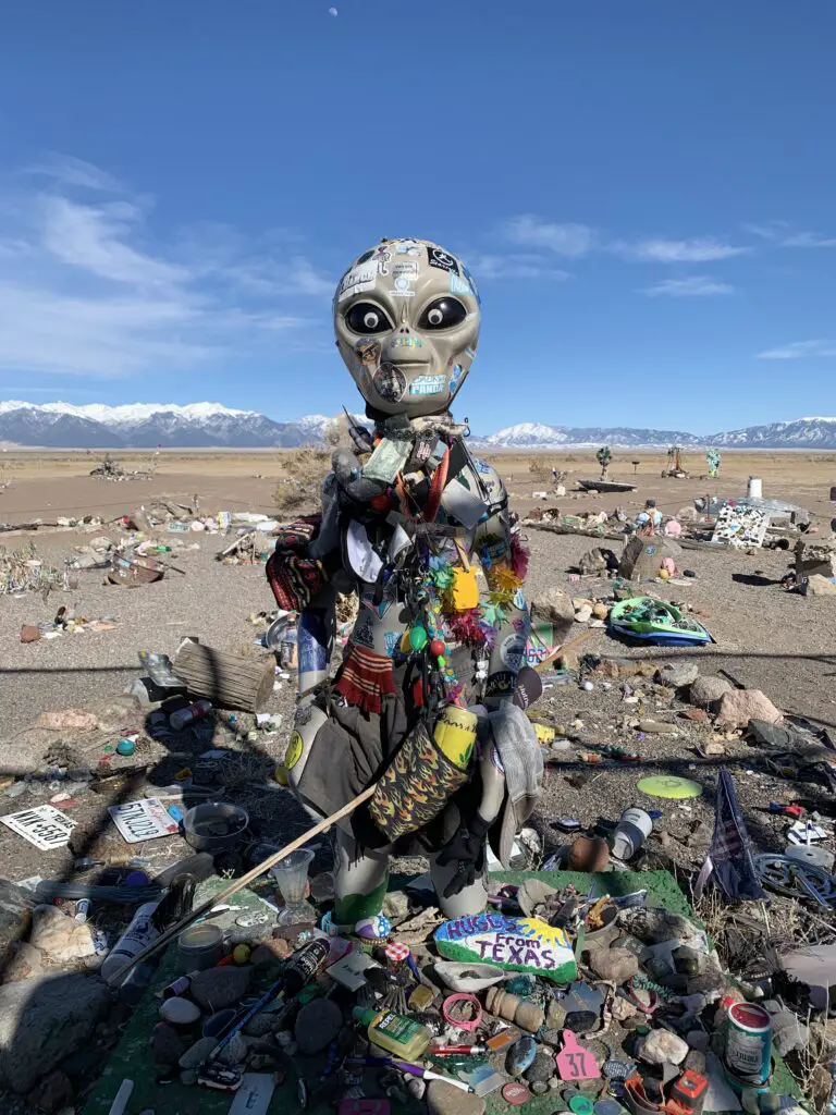
Alien figure surrounded by and covered in trinkets and figurines
Benevolent Guardian of the UFO Watchtower vortices?

Whatever the reason though, there are more UFO sightings here than at the infamous, Roswell, New Mexico.

UFO Watchtower!

Continuing with the “out-of-this-world” tradition of the San Luis Valley is the UFO Watchower!  We discovered this unique locale the first time we visited the valley.  We literally stumbled on it as we were driving down the road. 😂  We didn’t have time to stop then so Mr. Trekker promised we could return on the next trip!

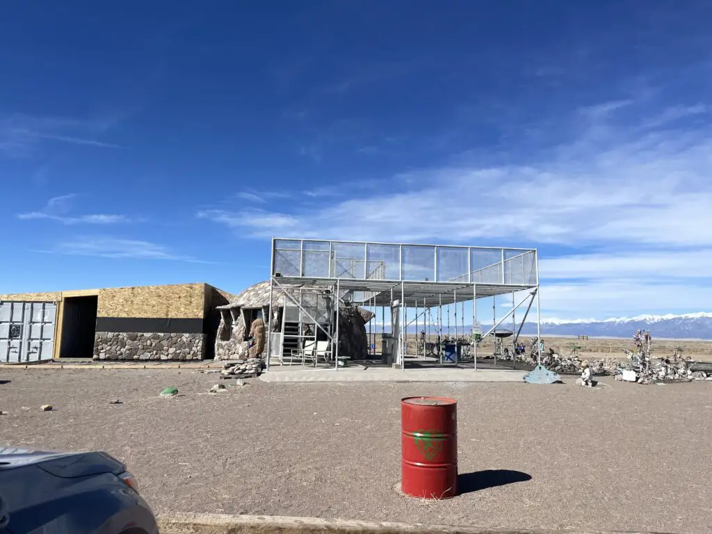
A small, open tower with an uncovered deck on top
The UFO Watchtower!
Desert landscape with tower railings and trinkets in the foreground, snow-covered mountains far in the background
Panorama from the UFO Watchower

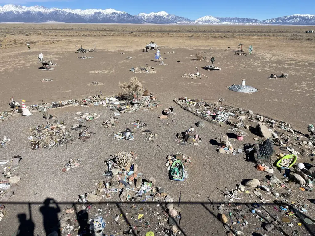
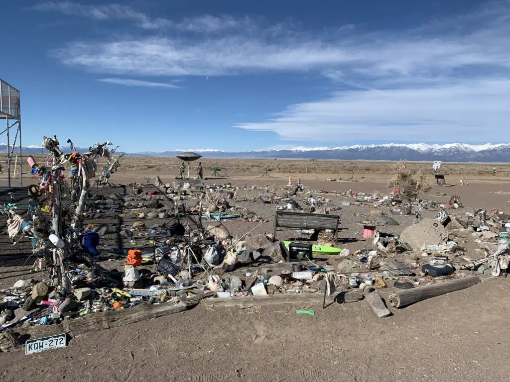
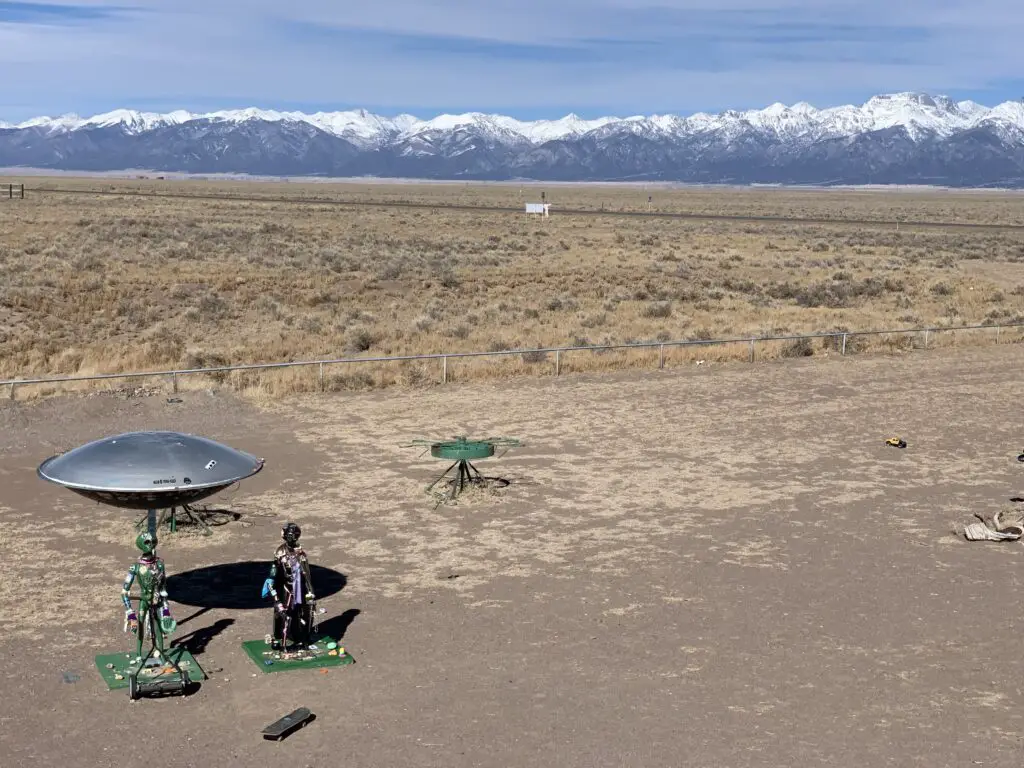
It takes a little imagination and a BIG open mind to fully appreciate the quirkiness of the site.  The story goes that two large, energy vortices are found here.  One spins clockwise, the other counterclockwise. (They are said to be connections to other dimensions/universes.  Supposedly, 25 different psychics have visited the site and have confirmed this.)  Several have also claimed that two large “beings” protect the vortices (they’re supposed to be friendly as long as you are respectful. 😇)

I’m not sure I believe any of this, but science has shown the earth has different magnetic fields, so maybe these could influence the area?  Neither of us sensed anything strange but maybe we’re just skeptics? 😝  

Desert landscape with trinkets in the foreground, snow-covered mountains far in the background
View from the UFO Watchtower

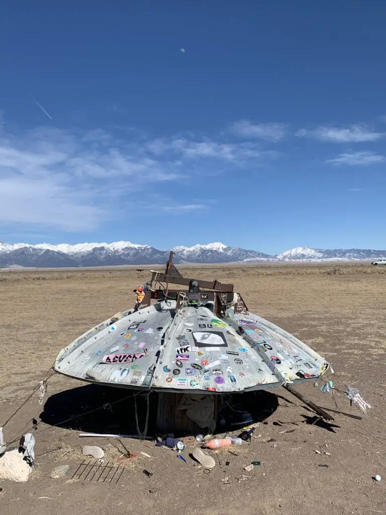
There is “The Garden” where people leave trinkets (I left a bobby pin, it’s all I had in my pocket. 😇)  Some of the psychics also claim there is a mile-long mothership buried in the ground underneath the watchtower. (Could this help explain all the UFO sightings? 👽🖖)

Desert landscape with trinkets in the foreground, snow-covered mountains far in the background
“The Garden”

Old satellite dish covered with stickers and surrounded by trinkets in the foreground, snow-covered mountains far in the background

Where is the UFO Watchtower?

The UFO Watchtower sits around three miles north of the tiny community of Hooper, Colorado.  You will find it on Route 17, a little more than halfway down the San Luis Valley.  It is situated around 25 miles north of one of the largest towns in the valley, Alamosa, and about 60 miles south of the town of Salida.

Desert landscape with space-like robots in the foreground, snow-covered mountains far in the background

The friendly proprietor of the site claims that since the destination opened in May of 2000 around 231 “tourists from outer space” have been spied in the night sky over the valley. (The owner claims she’s seen around 28 “things she can’t explain”.)

Sandhill Cranes!

The main reason we chose this weekend to visit the San Luis Valley is that it was the date of the annual, Sandhill Crane Festival (it occurs every year in early March.)  We always enjoy watching (and hearing!) the cranes fly over our area every fall and spring, their unique song echoing across the Hills as they fly high on the thermals.

We actually learned while we were down there that the Cranes that fly over the Black Hills are NOT the ones we were watching in the San Luis Valley. These are the greater Sandhill Cranes that migrate to the Yellowstone area for the summer.  The ones that fly over our house are the lesser Cranes who summer in Canada. 

You can view the cranes, feeding, flying, and “loafing” about all around Monte Vista.  We especially enjoyed visiting the Monte Vista National Wildlife Refuge where we saw a bunch of geese too!

Click here for a video of the cranes, their incredible song and their “flight ballet”…

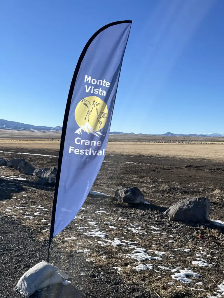
Banner that says, "Monte Vista Crane Festival" in front of pastureland
Monte Vista Sandhill Crane Festival!
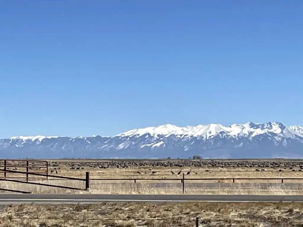
Pastureland covered in flocks of Sandhill Cranes in foreground, snow-covered mountain peaks in background
Feeding and “loafing” cranes

Places to Eat in the San Luis Valley

The Trekkers always find great places to eat on our adventures:

The Cow –a yummy place for breakfast (This locale is not actually in the San Luis Valley. It is located in Morrison, Colorado, not far from the Red Rocks Amphitheater.)
San Luis Valley Brewing Company–Alamosa, Colorado.  A good place for dinner and/or drinks
–Campus Cafe–Alamosa, Colorado.  Another great place for breakfast (and probably the best meal we had all weekend!)
Purple Pig Pizzeria–Another fun place for a post-adventure meal!

If you want to explore a lesser-known part of the incredible state of Colorado, check out all the amazing San Luis Valley has to offer!

Have you checked out any of these sites in the San Luis Valley?  Tell me about them in the comments! 


Did you enjoy this post?  Pin it!

Banner that says, "Monte Vista Crane Festival" in front of pastureland. Pin reads, "San Luis Valley, Aliens, Sand Dunes and Sandhill Cranes"

Like what you read here today?  Please feel free to leave a comment, like or share this post!  Add your email at the bottom of the page, or the sidebar to the right, to be notified when a new post is published.  By signing up for the email list, you will also receive a free copy of the Tranquil Trekker’s Top 10 Tips of Trekking Do’s and Don’ts!

You can also follow the blog on social media by clicking the links below!
Facebook

Twitter

Instagram

Pinterest


Palisades State Park & Good Earth State Park at Blood Run

In this post, I review these two, fun state parks in southeastern South Dakota!


After more than a decade of living in the state, I finally have a park report from the eastern side of South Dakota (otherwise known as “East River”)!  Mr. Trekker had a hankering for orchard-fresh apples and cider one fall (those are hard to come by in the Black Hills) so we decided to explore the eastern half of our state for our anniversary that year.

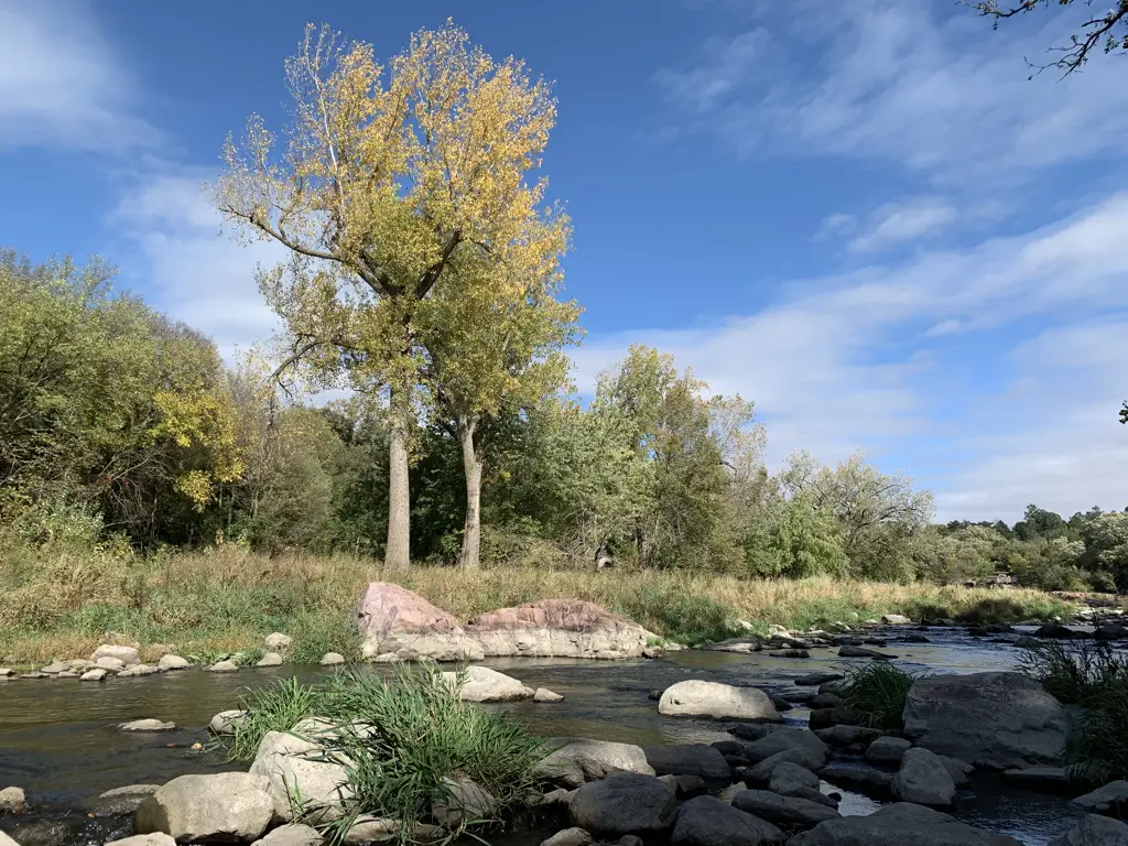
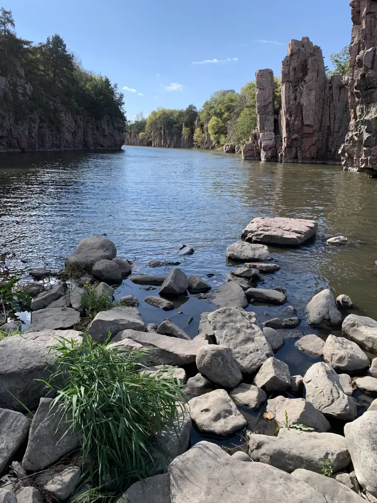
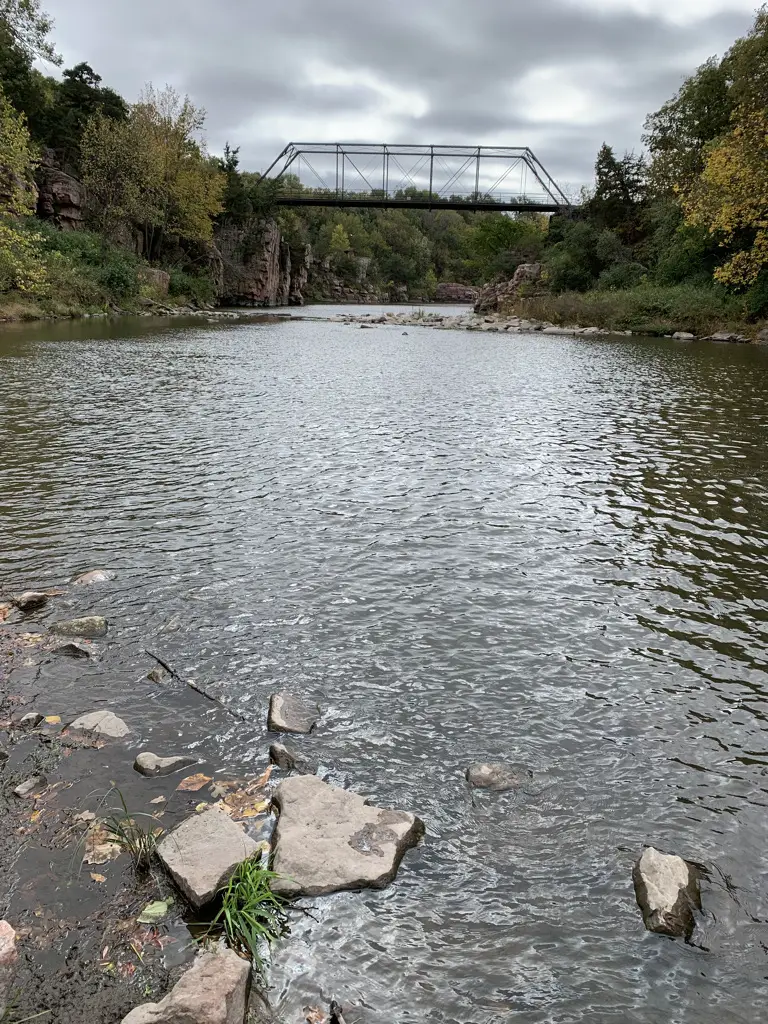
Shallow creek with rocks back by trees, blue sky with clouds

The Trekkers visited Palisades State Park and Good Earth State Park at Blood Run.  Both of these locales were on the smaller side, especially compared to the larger parks that we’re used to on the western side of the state (let’s just be blunt, these are NOT Custer State Park! 😇)  We knew they would be more modest going in though, and we really enjoyed them. They were relaxing and the trails were not very strenuous at all. We also found both parks to be relatively easy to locate!

Palisades State Park

You will find Palisades State Park off of 485th Avenue, about 23 miles to the northeast of Sioux Falls and about 10 miles northeast of Brandon, South Dakota.  You can reach the park from Exit 400, off of I-90, for 476th Avenue, or from Exit 410, for 486th Avenue (you head north from both of these exits.)  Then follow the signs!

You will feel like you’re driving through farm country and there can’t possibly be a state park out there. (It’s kind of hidden in a gulley created by Split Rock Creek.)

This park is quite pretty.  It offers a number of trails, though my favorite was the South Wall trail.  It traverses the south wall (hence the name) of the canyon created by Split Rock Creek.  A portion of it reminded me of Raven Rock State Park that we used to frequent when we lived in North Carolina (I haven’t done a post on this one yet but don’t worry, it’s on my list!)

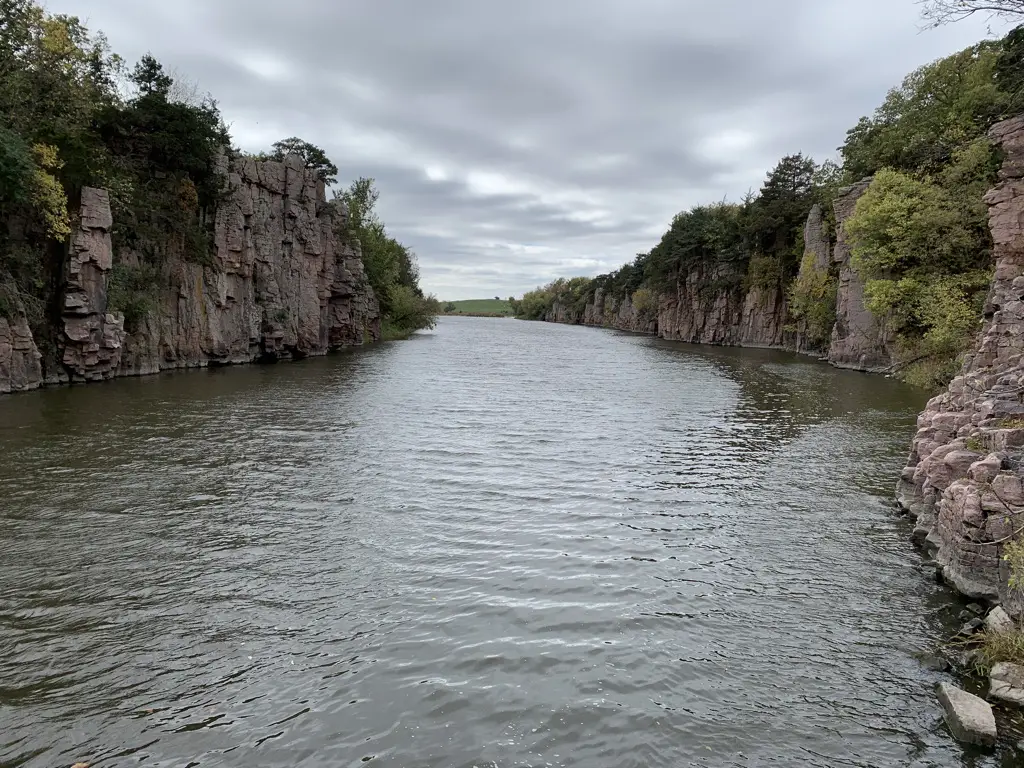
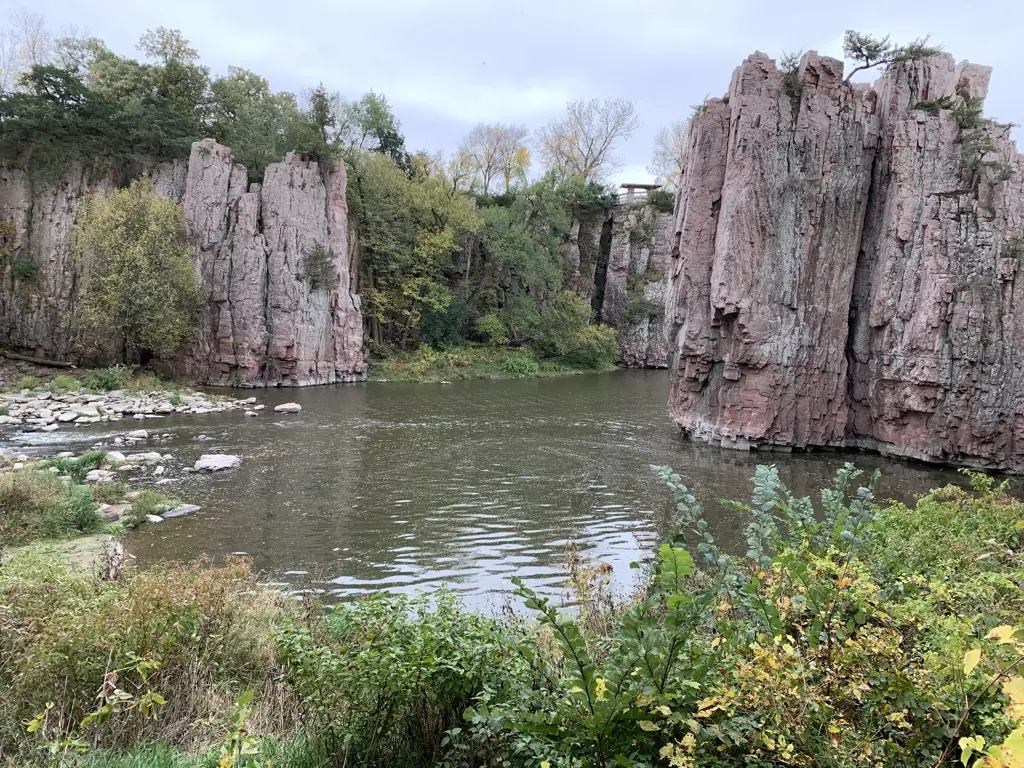
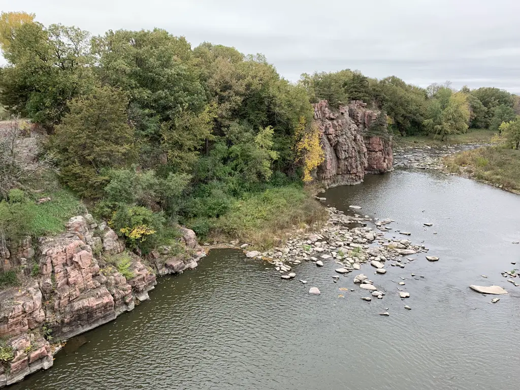
Split Rock Creek:

View down a creek with rocky and vegetation-covered walls on both sides, blue sky

View down a creek with rocky and vegetation-covered walls on both sides; grey, cloudy sky.

Creek running between a large break in a rock wall. Green vegetation tops the rocks and in foreground.

This park had some decent fall color when we were there in early October (though we were actually a little early for this).  It was surprising, in the Black Hills we were already almost done with fall color, and out east, they were just getting started (to be fair there are a couple of thousand feet of elevation change between the two. 😉 )

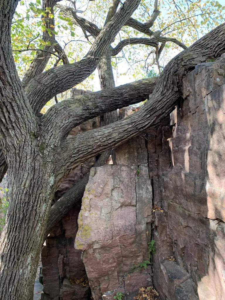
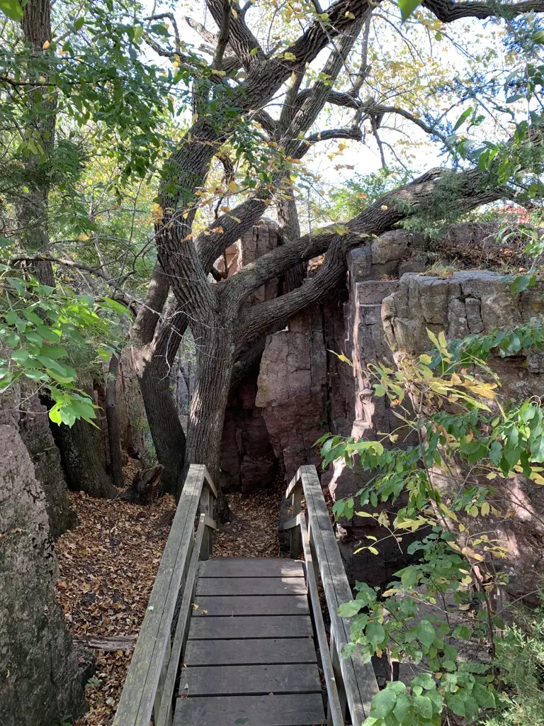
Large tree grows around a rock
Isn’t this tree cool, the way it grew around the rock? Nature is awesome!

Large tree grows around a rock. Boardwalk and hiking track are beneath the tree.

Several of the trails in this park did require a little bit of scrambling on some boulders.  This could be more difficult for smaller children or anyone who may have mobility difficulties.

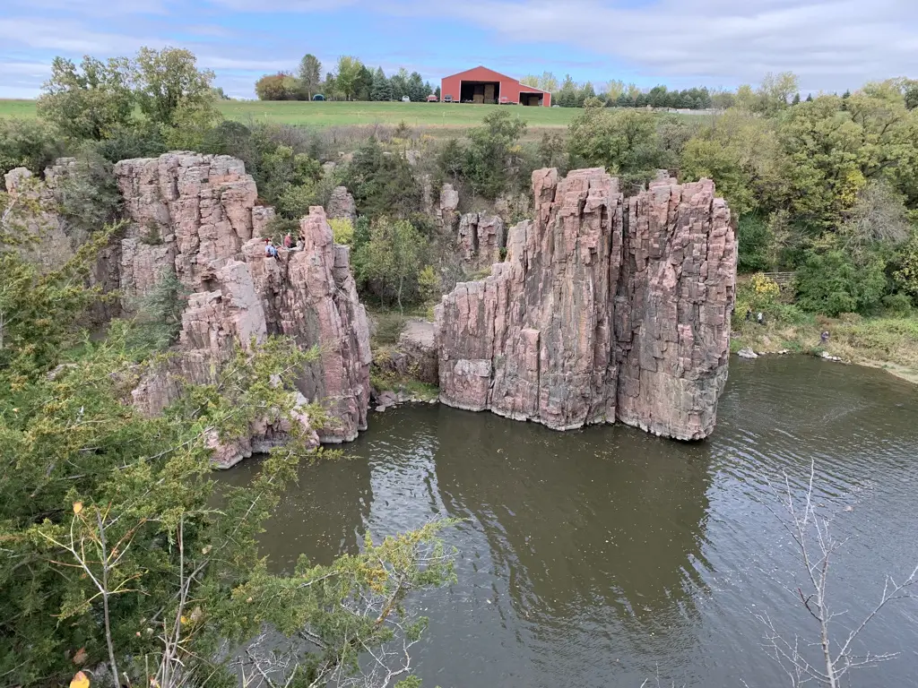
View is from above. Creek is below with rock walls on the far side. Above the rocks sits a red barn on a nearby hill.
King and Queen Rocks (Yes, that is a farm field above the canyon. I told you this park was in a weird place. 😂 )

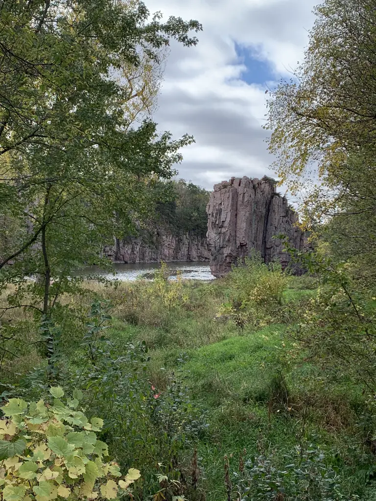
King Rock through the trees:

View through vegetation. Rock walls with creek running through them in background.

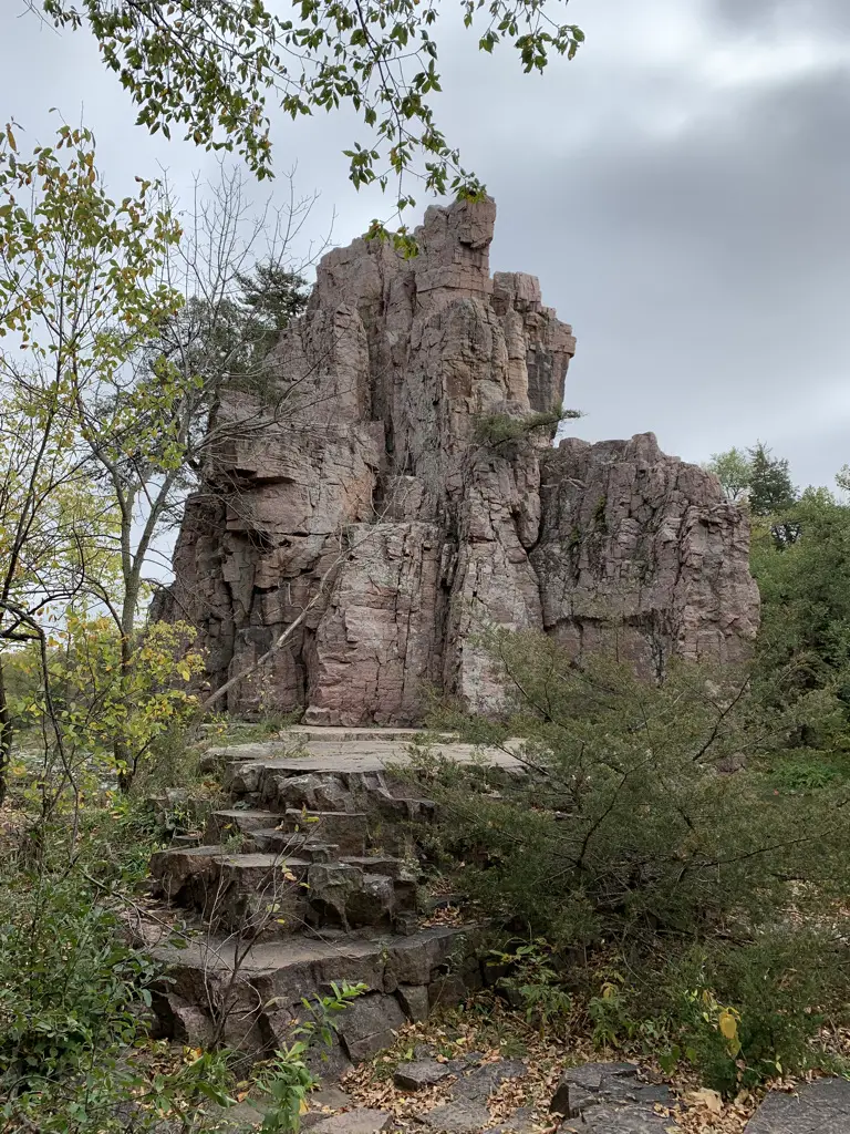
Towering rock formation.

Palisades was definitely the most scenic of the two parks.  Below are a few more pictures Mr. Trekker took:

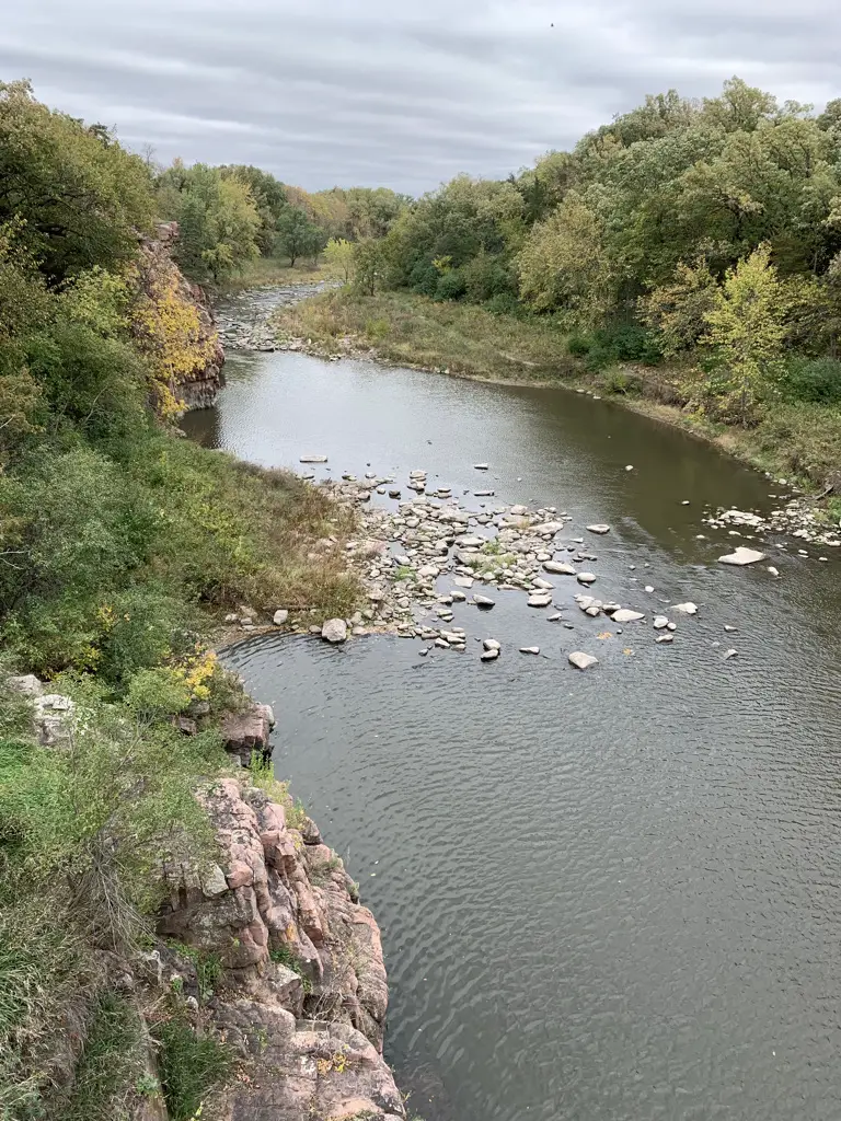
Metal bridge spanning creek, vegetation-covered rock walls on both sides; cloudy, grey sky.
Old railroad bridge over the creek
Creek running under the bridge with vegetation on both sides.
View from the bridge
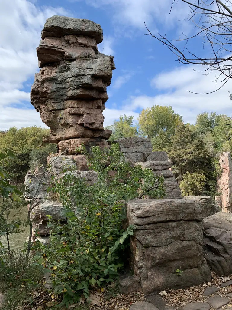
Towering rock formation, green vegetation and cloud-filled, blue sky in background.
Balancing Rock

Good Earth State Park at Blood Run

Good Earth State Park at Blood Run is located about 11 miles to the southeast of Sioux Falls off of 480th Avenue.  From Sioux Falls get on the Veterans Parkway on the east side of town.  Take it south until it meets up with 69th Street (Route 102).  Then take that road to 480th Avenue (follow the signs).

This park consists mostly just of hiking trails (which are really more walking paths).  There were a number of them, many of which connected and formed loops.  This would be a great place for some mild mountain biking, or cross-country skiing in the winter (if the typical South Dakota wind doesn’t scour the paths dry, that is! 😝)  While it was closed when we arrived late on a Sunday afternoon 😝 the park appeared to have a new, large and lovely Visitor’s Center.

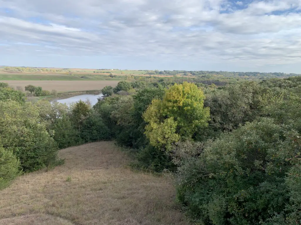
Grass and trees in foreground, creek and farmland behind these in background.
In case you were wondering, that’s Iowa across the river. 😂

The trails had many maps spaced along them.  The only problem was almost all the maps were south-facing and had such terrible sun damage they were difficult to read. 😕  They had paper maps available, which would have been fine, but unfortunately, they didn’t mark the trails with the trail names which made the maps difficult to follow. 😕

The trails were wide, graded gravel, and mostly flat. They should accommodate an off-road stroller/wagon quite well, in dry conditions.  This locale isn’t far from town and would be a great place for a run or to walk the dog after work. It would also be perfect for a nice, Sunday afternoon stroll with the family.

Both of these parks were nice, though Palisades was my for-sure favorite.  I’d definitely consider going to both again.  As both of these have been on my “to-do” list it was fun to visit them and see more of our fair state.

Creek in foreground, vegetation-covered rock walls in background, grey, cloudy sky.

Have you visited either of these parks?  Tell me what you thought of them in the comments!

Did you enjoy this post?  Pin it!

View down a creek with rocky and vegetation-covered walls on both sides, blue sky. Pin reads, "2 Fun State Parks in Eastern South Dakota"

Like what you read here today?  Please feel free to leave a comment, like or share this post!  Add your email at the bottom of the page, or the sidebar to the right, to be notified when a new post is published.  By signing up for the email list, you will also receive a free copy of the Tranquil Trekker’s Top 10 Tips of Trekking Do’s and Don’ts!

You can also follow the blog on social media by clicking the links below!
Facebook

Twitter

Instagram

Pinterest

4 Tips for Digital Mindfulness at Work

In this post, I outline some steps we can all take to be more mindful regarding the use of work laptops, phones, and messaging programs when we’re supposed to be enjoying some “downtime”.


I started a new (more normal) job a few years ago after COVID pretty much killed my freelance career. 😝  I still work from home a lot but I also visit with clients out in the community.  Because of this, I now have two laptops and two phones (one each for work and personal use).  As you may imagine, this does not lend itself to tranquility, peace, or a dearth of technology in my life. 

I’ve felt like the old grandma at work, trying to figure out her grandkids new-fangled technology. 😝  I actually did this same job 10 years ago but back then all I had was a Word document, a flip phone, and a laptop. (It took real effort to locate a WiFi signal anywhere away from the office back then, and there were no hotspots on my flip phones!)  Today, almost everything is web-based.  While this makes things far more convenient (and saves trees, a definite plus!) it also means there are countless more assessments and paperwork items that are screaming for my attention at all times.

All of this runs completely counter to the mindfulness principles so many of us work so hard to maintain in our lives.  We want to be Present in the current moment…we strive to focus our mental energy on one task at a time…and then we’re slammed by multiple devices pinging and dinging with alerts like “you’ve got mail!”, “someone’s calling!”, or “your next meeting starts in 15 minutes!”  It’s EXHAUSTING!

So, how do we use these devices as tools to help make our work-life run efficiently, so we can focus our mental and physical energy on what is most important, thereby leaving LOTS of time to live life?  Read on for the Tranquil Trekker’s tips for digital mindfulness at work! 

Author’s Note:  My intent with this post is NOT to complain about my new job.  Having a work phone and laptop actually makes a lot of sense with the work I do.  My home IS my office.  Also, since my job is fairly mobile, it only makes sense that my work is mobile too.  I also VERY MUCH appreciate that my company has provided me with work devices as I DON’T want to have to use my own. 😝  

And bottom line, SO MANY people are in this same boat.  Having multiple devices is really just becoming the new normal (especially with the popularity of flexible work options and the rise in work-from-home due to COVID.)  My goal with this post is to encourage people to view these devices as necessary evils and to help them figure out how to use them as beneficial tools without allowing them to take over our lives.

Compartmentalize your Work Devices

Compartmentalize with your work laptop, phone, and any messaging apps if at all possible.  You can accomplish this by only having these work-related programs on your work devices.  Also, be sure to turn these off at the end of every day and on your days off if possible (I realize this isn’t always an option if you are on-call).

If you feel this isn’t an option in your case, my question would be, are you actually on-call?  If not, is there truly an expectation that you respond to calls, emails, or messages during off-hours?  To put it bluntly, are you actually jeopardizing your job (or future promotional opportunities) if you don’t respond promptly?  Or, is this a self-imposed prison?  Is it not actually necessary for you to be available at all times but do you feel like you should be?

Many people have their work email come to their personal phone (even though oftentimes this is voluntary, and is NOT required by their job).  I think they’re nuts, personally 😉, but I also can’t help but feel a bit sad for them.  They need (and deserve) a break and I just don’t see how this practice achieves that for them.

So my advice is to talk to your boss.  Get a clear understanding of what the expectations really are.  If the presumption is that you be readily available during off-hours, then you’ll have to decide for yourself if that’s the work environment you want.  Just know that studies show you’ll be a better employee if you have true downtime. (Don’t take my word for it, you can read about some of them below! 😉)  And if you’re the boss, check out the links and please, don’t be an a-hole! 😇)

Harvard Business Review–The Upside of Downtime  
Forbes–Downtime is Important!

Multitasking Makes you Less Productive

In addition to compartmentalizing your work devices, the studies linked below also show that contrary to popular office belief, multitasking DOES NOT work, and it actually DAMAGES your productivity! 😮

Forbes: Multitasking is Bad for You!
Cleveland Clinic:  Multitasking Doesn’t Work
Forbes:  Multitasking Hurts Productivity

Multitasking is almost NEVER a mindful practice, as mindfulness requires you to put your full mental energy and focus into ONE task at a time.  As an example, think about taking a work call while driving (we’re going to assume you’re using hand’s-free devices.)  If you’re paying attention to driving (which you should be) you CAN’T be putting all your mental energy and concentration toward the phone call you’re having.  And if you’re aren’t focusing on the phone call whatever/whomever you’re trying to serve with that call won’t be getting your best effort.  Also, you can’t take notes while driving, or look things up on your computer or phone as you may need to. (I would also ask, how do you pay close attention to driving if you’re distracted by a call?)  So all this multitasking scenario succeeds in is making you less of a safe driver while also providing lousier service to your job task at hand.  It’s a lose-lose situation!

Prioritize Downtime

Now that I’m back to working more like a normal person, there is nothing better than 5:00 on a Friday, when I log out of my work email, turn my work phone off, close my work laptop, and put all of them (screen down) in the office, not to be looked at for the next several days.  I think it’s important that we have that break whenever/wherever we can take it.

That break is important for our mental health and it makes us better workers.  It gives us a chance to recharge mentally and physically so we have more mental energy to face the challenges of the job when the next work week comes.  I worry this appreciation for the benefits of downtime is something that’s gotten lost in recent years, in our always-on society.

Find Unique Places to Work

This one may be difficult for some people.  Depending on the type of work you do you may need to be in front of a video monitor often.  Or you may do highly technical work that requires you to be tied down to some sort of office environment.  But for many of us, one of the joys of flexible work situations is that you can pick where you want to actually work.  So don’t limit yourself to being locked in your home office, the basement, the second bedroom, or wherever you usually work from.  If it’s a nice day and you have the internet access you need, work from the front porch or the back deck.  Go sit at a local park, beach, or other green/blue spaces.  If the Great Outdoors isn’t really your thing, go to a local coffee shop.

Obviously, make certain you are still ensuring all necessary confidentiality your job may require.  Use screen protectors so others can’t read your screen, talk quietly if you’re on the phone or seek out private places to talk, or use headphones if you’re in a meeting or a training session (anyone sitting within earshot will appreciate this anyway!)

To Conclude:

This is somewhat of a complex subject as our jobs all vary so greatly in terms of the circumstances that surround them, what our supervisors may require, the security necessary to protect the information we work with, and the practicality of how our jobs function.  I just want us all to “think outside the box” when it comes to flexible work options. 

One of the best things about these work options is they allow us to get out of the office and better fit our work into the lives we live.  So take advantage of this!  Set boundaries for when and how you use your work devices.  Recognize that while multitasking may make you FEEL more productive, in all likelihood it’s probably, actually hurting your productivity.  This isn’t good for your company or the clients you serve.

Also, remember to prioritize your self-care.  If you aren’t in a good place it will be almost impossible for you to put your best foot forward in terms of the work you do.  Part of this self-care means making your work environment the most pleasurable it can be (while staying within the confines of what is required for your job, of course). 

So, the next time you go to grab your work laptop or phone on your “off” hours ask yourself, “Is this really what’s best for me, my client, or my company?” If the answer is likely “no” go do something enjoyable instead!

Do you have any tips for keeping a healthy balance between work and home when your digital, work devices follow you home?  Tell me about them in the comments!


Did you enjoy this post?  Pin it!

Two laptops and two cell phones, all sitting on a desk. Pin reads, "Tips for Digital Mindfulness at Work"


Like what you read here today?  Please feel free to leave a comment, like or share this post!  Add your email at the bottom of the page, or the sidebar to the right, to be notified when a new post is published.  By signing up for the email list, you will also receive a free copy of the Tranquil Trekker’s Top 10 Tips of Trekking Do’s and Don’ts!

You can also follow the blog on social media by clicking the links below!
Facebook

Twitter

Instagram

Pinterest

Tips for Traveling with a Dog

In this post, I give some simple tips for making traveling with your four-legged family member a breeze!


What’s better than going on vacation with the family?  Going on vacation with the four-legged members of your family, of course!  Read on for the Tranquil Trekker’s tips to make traveling with a dog a relaxing and enjoyable experience!

Frequent Stops when Traveling with a Dog

We find it’s best to stop every couple of hours–and to be clear this means a stop where Doggo can get out and walk around some whenever possible (rest stops are preferable to gas stations, and parks or short hikes are most preferable of all!)  This isn’t as easy if you’re traveling through more urban environments.  But any time you can stop where there is at least a little grass where the pup can get out and run helps (it’s good for us to get out and stretch our legs too!)

Don’t forget the pups need stops to potty and for snacks and water too, just like us!

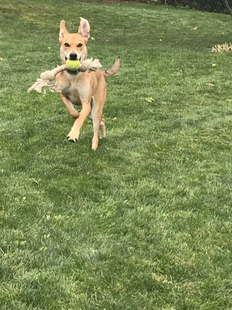
Dog running mid-stride in the grass, tennis ball and rope in mouth, ears flopping.
Puppers encourages you to search for green spaces to play!

We especially enjoy stopping at parks or other green areas to get all of us some exercise.  This also helps you experience the areas you are visiting (or just driving through) better.  This is a great part of road tripping, getting to actually experience the country rather than just flying over it on the way to your final destination.

We’ve had lots of fun stopping at little parks in small towns.  Sometimes they have memorials that help you learn about the local area, occasionally they may even have a small museum on-site.  We also strive to find waterfalls/dams/historical sites to hike out to whenever possible.  Many times this may be a simple walk of less than a mile to see a cool place.

Related post: Rest Areas: A Road Trip Necessity

It’s not only good exercise and relaxation for us, we always need to remember a good puppy is a tired puppy, and exercise is a great way to tucker our furry friends out (this is especially important if they tend to sleep in the car.  You don’t want to get some place and be tired and all your four-legged friend wants to do is run and play because they’ve been sleeping in the car the last several hours.).

When You Travel Pack Treats and Toys for the Dog

Bring chew toys or something the pup can play with on their own (in the back seat, their crate, the hatch, etc.)  Also, bring multiple toys to keep them entertained (a stick to chew on, a ball to chase, a rope.) Bring extra toys in case you lose one in a creek 😮 or you meet a friend who needs one!

Dog asleep on floor of room, tennis ball sits in open mouth.
Puppers recommends you bring SEVERAL balls on the trip!

Have an in-car bag with treats, water, toys for rest stops, poop bags, and an easy-to-pack bowl.  Don’t forget food too, if it’s going to be a long travel day.

Pack Luggage for the Dog When You Travel

Pack luggage for your friend, as well.  This keeps their food, treats, bedding, harnesses, water, jackets, toys, etc. all in one place that is easy to pack and easy to find.

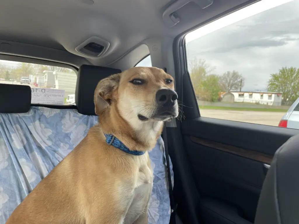
Dog sitting in back seat of vehicle, suspicious look on face.
I’ve been locked in this back seat a long time Human, don’t you think it’s about time for a break?!

Practice PATIENCE when Traveling with a Dog

Have patience!!!  Remember your four-legged friend gets bored, antsy, hungry, cranky, carsick, needs to pee, etc, just like we do!  This can especially be true for younger dogs. (Our former dog got horribly car sick until she was around five years old.  The vet couldn’t even believe it.  He kept asking, “she’s STILL getting sick?!”)

Give Fido His Space in the Car!

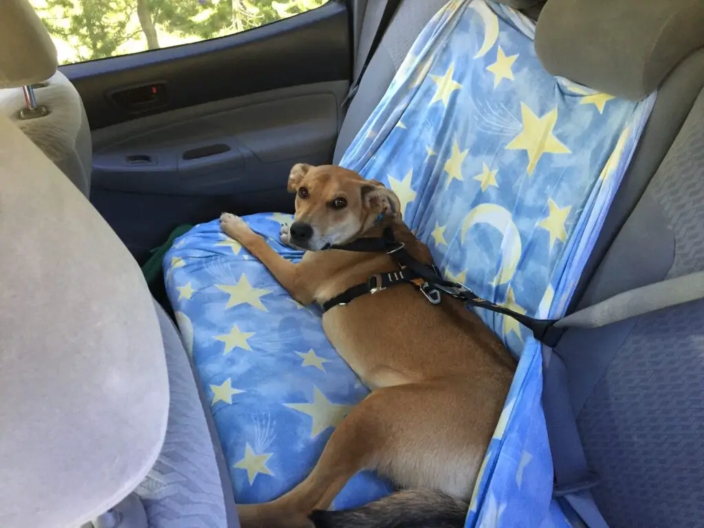
Make sure your friend has their own space in the vehicle.  This could be a chunk of the back seat or hatch or their own crate in the back of the car.  It should be big enough that they can lie down.  Treat your furry friend as a passenger that you have to make room for.  Don’t pack the car to the gills and then expect the dog to just “fit” into a spot.  They are part of the family right?  We need to treat them as such in the car. 😀

Dog laying in back seat of vehicle, strapped in by seatbelt.
Puppers says, “I need my space!”

We enjoy traveling with Puppers!  Use these tips the next time you travel with a dog to help make your trip as memorable and free from difficulty as possible!  Now get out there and enjoy an adventure with both human and canine members of the family!

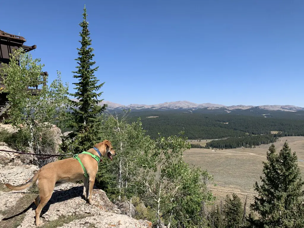
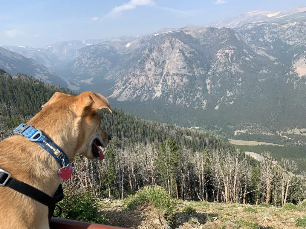
Dog looks out at mountain vista from a viewpoint

Do you travel with your dog?  Have you learned any additional tips or tricks?  Tell me about them in the comments!

Did you enjoy this post?  Pin it!

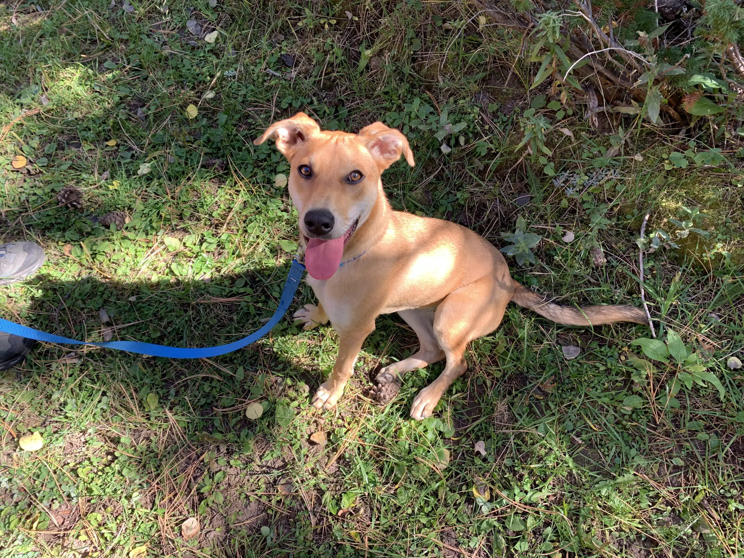
Three pictures: 1) Dog running mid-stride in the grass, tennis ball and rope in mouth, ears flopping; 2) Dog laying in back seat of vehicle, strapped in by seatbelt; 3) Happy-looking dog with perked ears and tongue hanging out sits in the grass. Pin reads, "5 Tips for Traveling With a Dog"


Like what you read here today?  Please feel free to leave a comment, like or share this post!  Add your email at the bottom of the page, or the sidebar to the right, to be notified when a new post is published.  By signing up for the email list, you will also receive a free copy of the Tranquil Trekker’s Top 10 Tips of Trekking Do’s and Don’ts!

You can also follow the blog on social media by clicking the links below!
Facebook

Twitter

Instagram

Pinterest

Ghost Towns in Southwestern Montana

In this post, I review several, cool ghost towns in southwestern Montana.


Montana IS the Old West!  It’s full of small, dusty, cowpoke towns where you can just imagine characters like Buffalo Bill Cody and Wyatt Earp walking its streets.  What better way to enjoy that experience than visiting an authentic ghost town?  We’ve enjoyed a few of these unique locales (though there are still plenty more on our list!)  See below for details!

Elkhorn State Park (Ghost Town)

Elkhorn is a tiny town located in the high mountains of southwestern Montana.  It is situated in a lovely valley with a mountain expanse that spreads out before you.  Technically this is a state park but the park portion only encompasses two buildings and a picnic area, the rest of the town is privately owned.  Feel free to walk the local roads though.  There are a number of signs that show where buildings used to be, what they were used for, etc.  

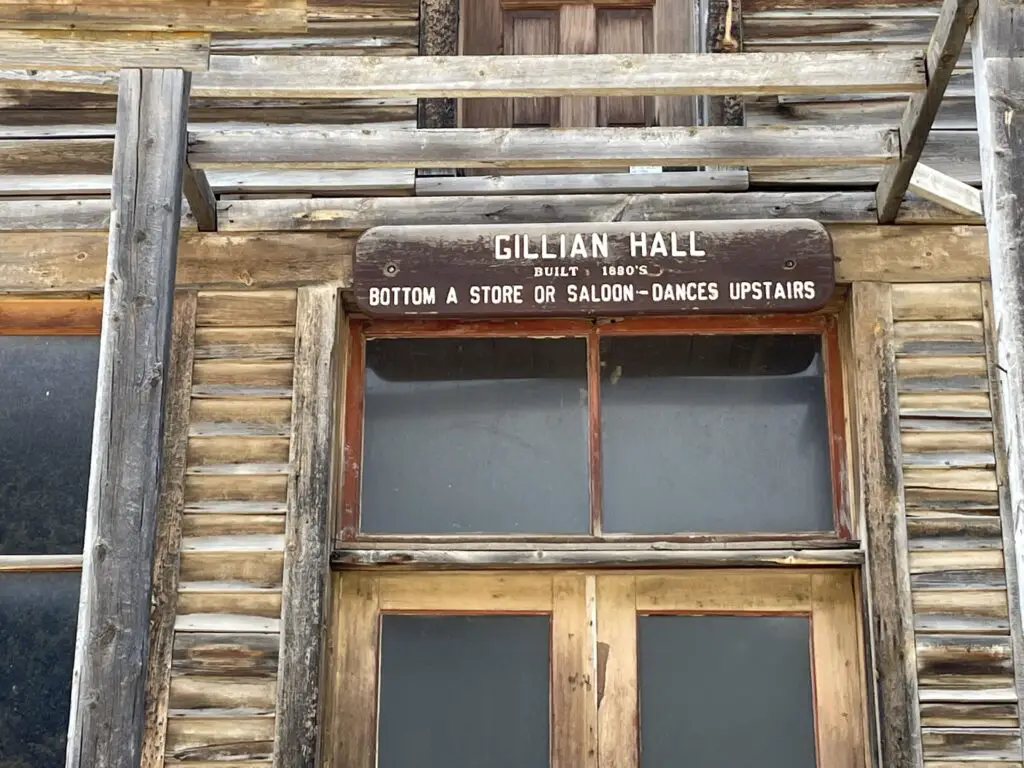
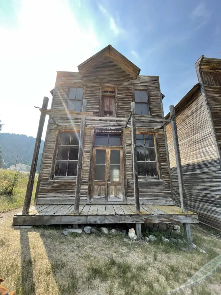
Front of old, wooden building. Sign says, "Gillian Hall: Built 1880's, Bottom a store or saloon, dances upstairs."

You can reach Elkhorn from the south by taking Exit 256, off of I-90, near Cardwell, Montana.  From here you will take Route 69 north.  After about 25 miles you will turn right on White Bridge Road (it’s literally just a short road that crosses the river on a small bridge.)  Once you cross the river turn right at the T-intersection onto Lower Valley Road.  You then take this road to the town.

There are a few signs for the Elkhorn mountains and Elkhorn state park but don’t rely on these to guide you.  It will be about 40 miles until you reach the town going this route.  As long as you stay on the main gravel road once you reach Lower Valley Road, you should be fine.  These roads are almost all dirt but they’re in good shape for basically any vehicle in good weather conditions. 

Old wooden building

You can also reach the town from the north from I-15.  From Exit 164 on I-15 at Boulder, MT, take Route 69 south and then take a left onto White Bridge Road.  The town is about 20 miles from the I-15 exit going this route.

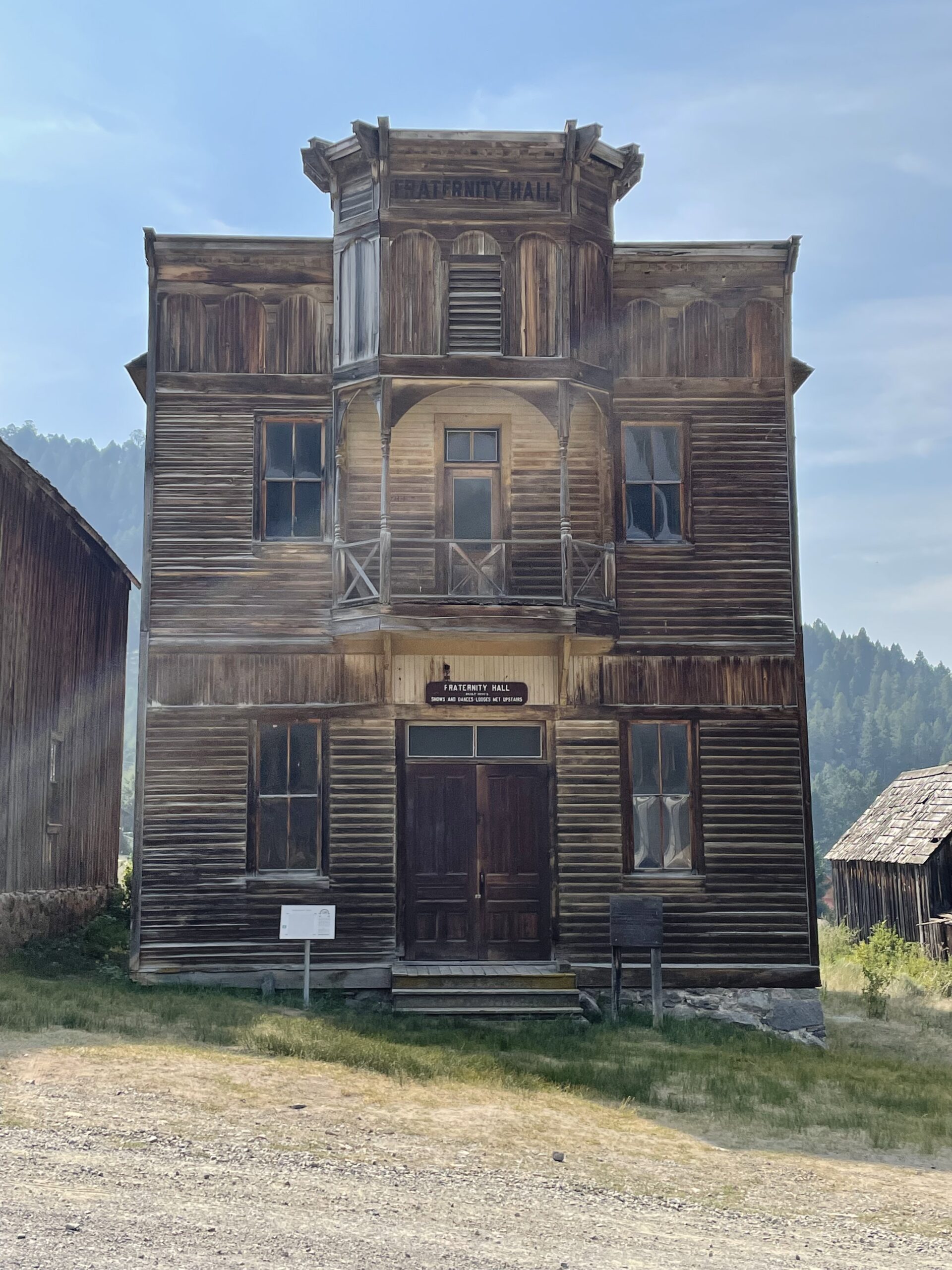
Front of old, wooden building. Sign says, "Fraternity Hall, shows were upstairs"If you continue up the dirt road past town and follow the signs, you will end up at the old cemetery in the woods. (The road is in pretty decent shape in good weather conditions–though we admittedly had a 4×4 truck.  We did see a sedan up there but I’d be careful with any car other than a Subaru or something else with higher clearance.  There were a few ruts and rocks in the road that could damage a lower-clearance vehicle.).

The cemetery was really neat but also very sad.  There were SO MANY graves of babies and children (apparently there was a diphtheria epidemic in the town that killed many children).  You’d see families where multiple children died within just a few days of each other.  I love visiting old cemeteries.  It’s always very sad to see how frequently young people died, but the histories of the area that you can gather are so interesting. 

Old, wooden building

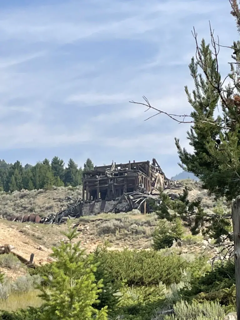
Old, decrepit, wooden mine stands on a mountainside
The mine in Elkhorn

Nevada City and Virginia City Ghost Towns

These two towns are also located in southwest Montana.  They are only about two miles apart.  The easiest way to reach them is probably from Three Forks, Montana.  Take Exit 274 off of I-90 for US 287 south.  Then take this road to the town of Ennis and turn right onto State Route 287 (yes, the roads are the same number. 😉)  This road runs right to the towns.  It is around 60 miles to the towns from I-90.

Related Info:  Activities in Nevada and Virginia Cities, Virginia City history, Nevada City history, Bannack HistoryHistory of Elkhorn; 6 Don’t Miss Places for your Western Montana Road Trip

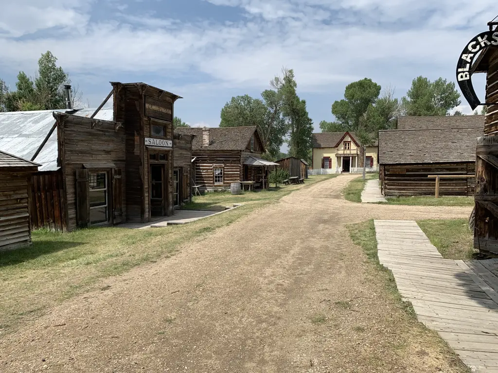
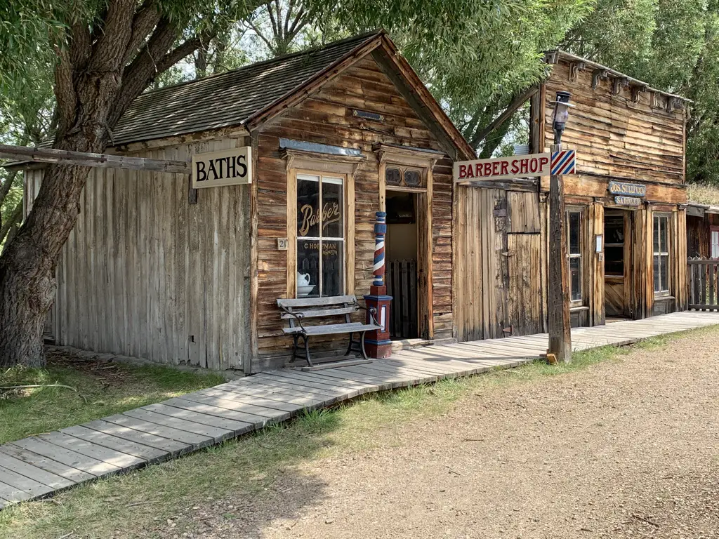
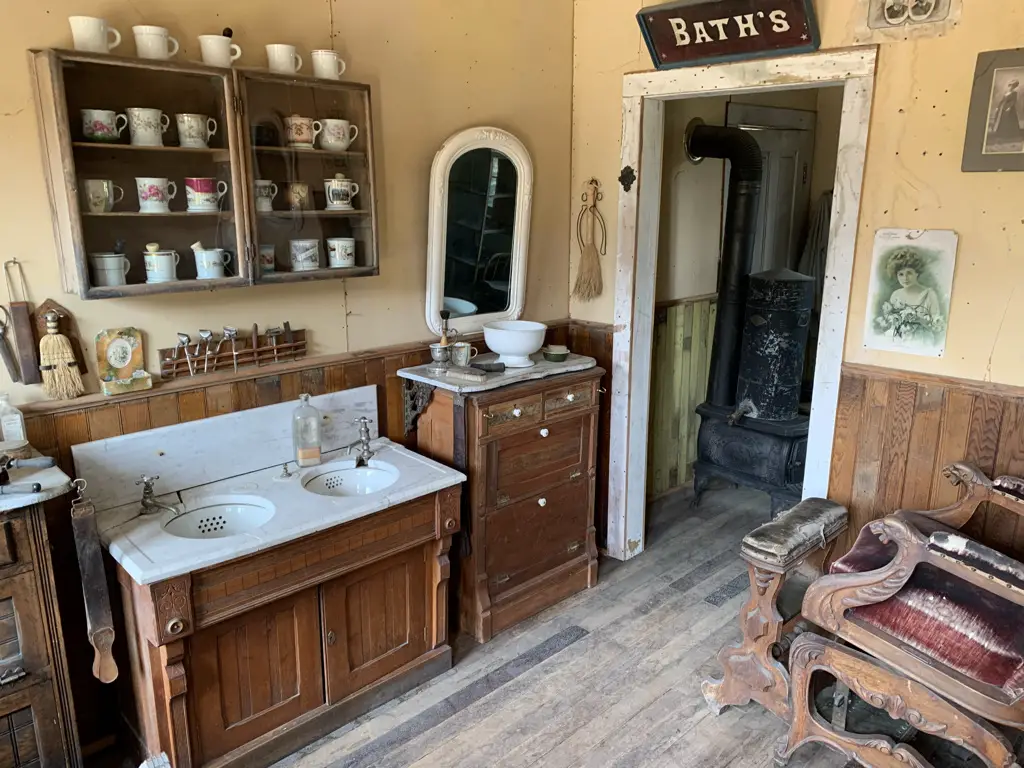
Nevada City was our favorite site of the two.  It is an outdoor museum of sorts.  Once you enter you can then walk around the entire town.  There are many buildings that you can actually go inside that are modeled to look as they would have in their heyday (such as a barbershop, the blacksmith shop, the general store, etc.).  Many of the structures are not native to this exact location, rather they were saved by historical foundations and brought here from around the state to be preserved. (It reminded me a little of the 1880 town in South Dakota.)

View down dirt, main street of Nevada City ghost town. Old, wooden buildings on each side.
Main Street Nevada City

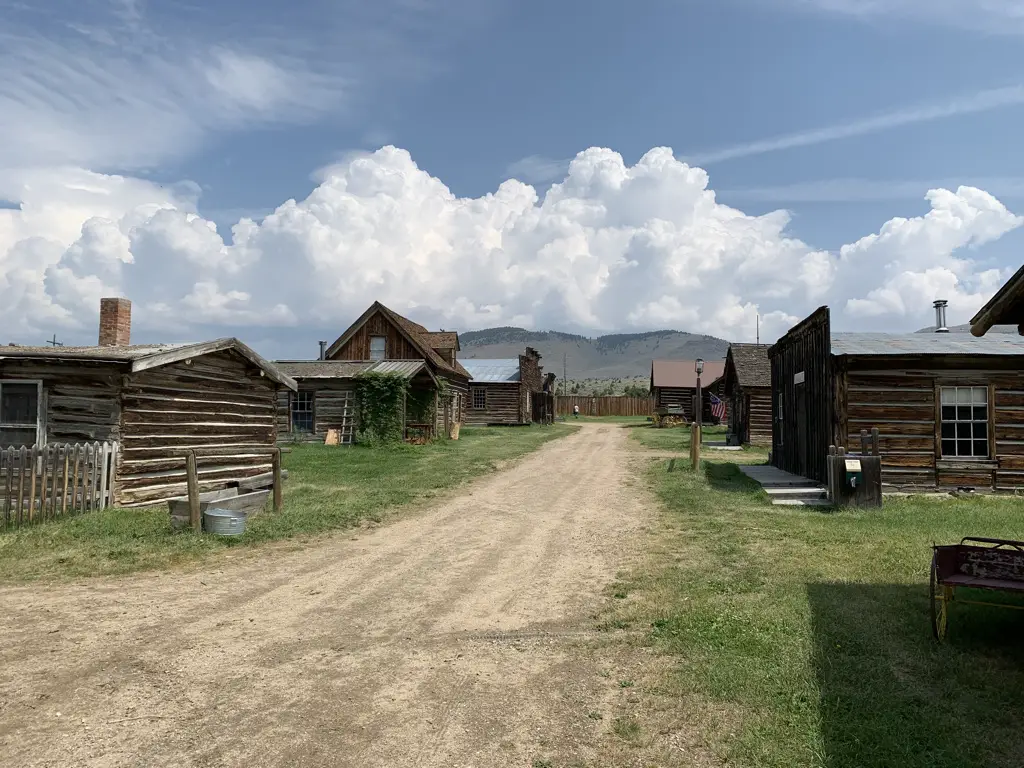
View down dirt street of a ghost town. Old, wooden buildings on each side. Blue sky with clouds

Barber Shop, Nevada City:

Interior of building. Sinks, mirror and wash basin in foreground, antique chair to the side, antique wood stove through doorway. Sign above door says, "Bath's"

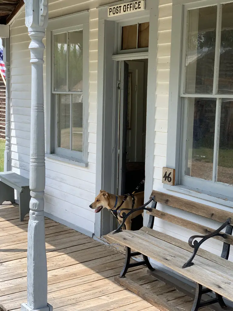
One great part about this museum, it was Puppers friendly!

Front porch of old Post Office, dog walking through front door.
Puppers enjoyed the post office!

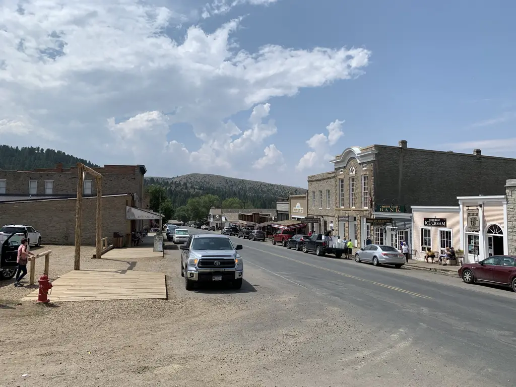
Virginia City was ok.  There were some decent sites to see but mostly it was a busy, commercialized town filled with shops, restaurants, and saloons.  Some people enjoy that atmosphere and that’s fine, but the Trekkers (and Puppers) prefer the quiet and solitude of the real ghost town. 😁  The town did offer some historical tours in horse-drawn stagecoaches that looked kind of cool, though we didn’t partake.

View down modern, paved, main street of Virginia City ghost town. Cars line both sides.
Main Street Virginia City (it isn’t quite so ghostly)

Bannack State Park (Ghost Town)

The easiest way to get to Bannack would be to take I-15 to Exit 59, near Dillon, Montana.  From here you will take Route 278 west.  After about 17 miles, Bannack Bench Road will break off to the south (left).  That takes you right to the state park.

Some of the roads to get to the park are gravel, but they were in great shape!  As long as you take it easy and don’t mind getting your car dirty, any sedan should be able to handle the drive in good weather conditions.

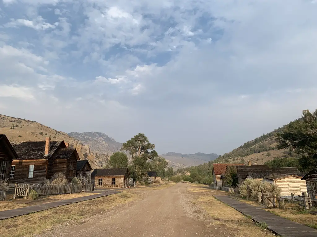
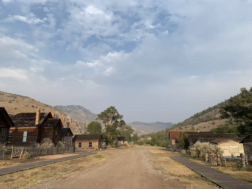
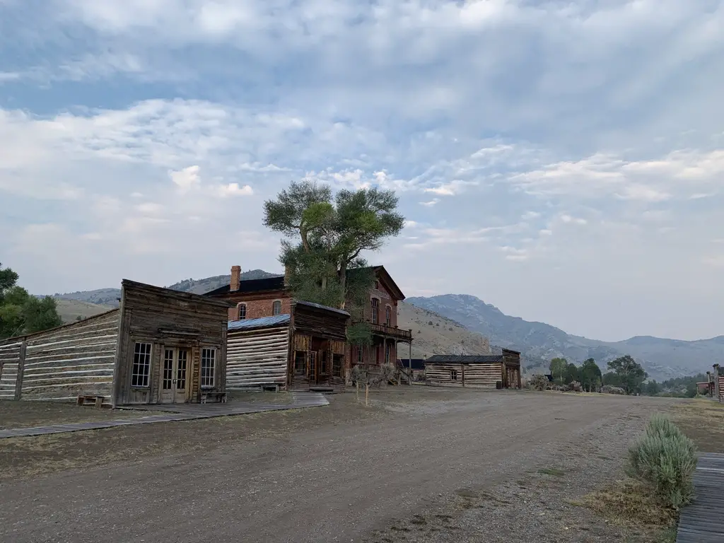
View down dirt, main street of Bannack ghost town, Bannack State Park. Old, wooden buildings on each side, blue, cloud-covered sky, dusty mountains in background..
Main Street Bannack

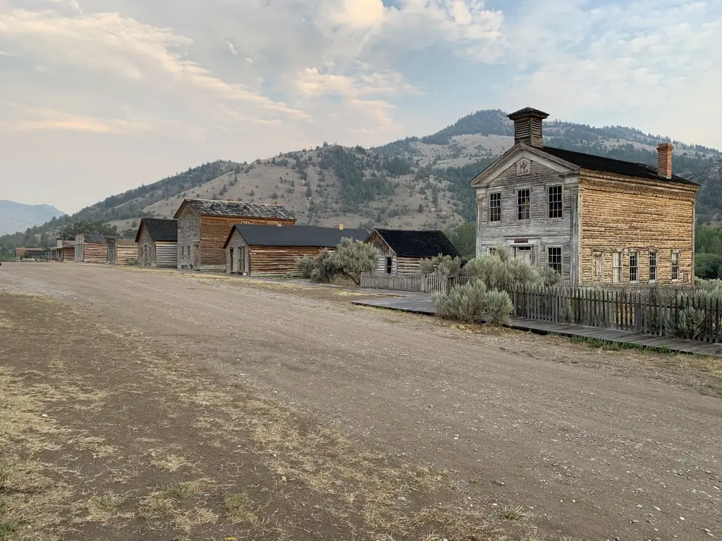
Old, wooden buildings line one side of dirt, street.

Old, wooden buildings line one side of dirt, street.

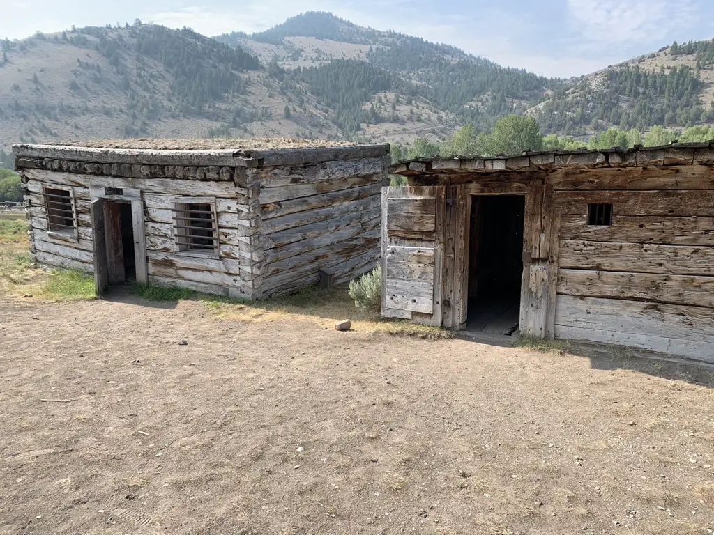
Old, wooden jails. Dusty mountains in background.
The jails in Bannack
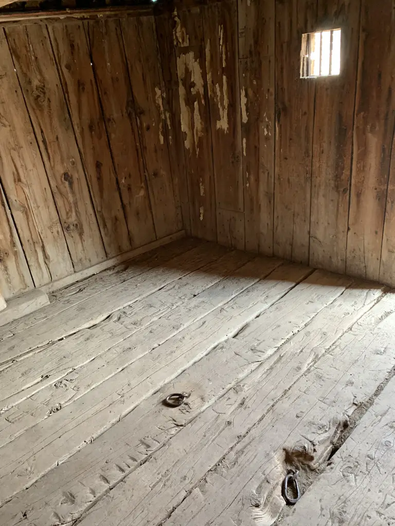
Interior of old, wooden jail. Shackle points in floor.
You can see where the prisoners were chained

Bannack is AWESOME!  It’s one of the better preserved, true ghost towns I’ve ever seen (meaning it’s still in its original location and the buildings are in fairly good shape.)  They let you just wander around the town on your own, you can go in the buildings (that aren’t locked) AND you can bring dogs!

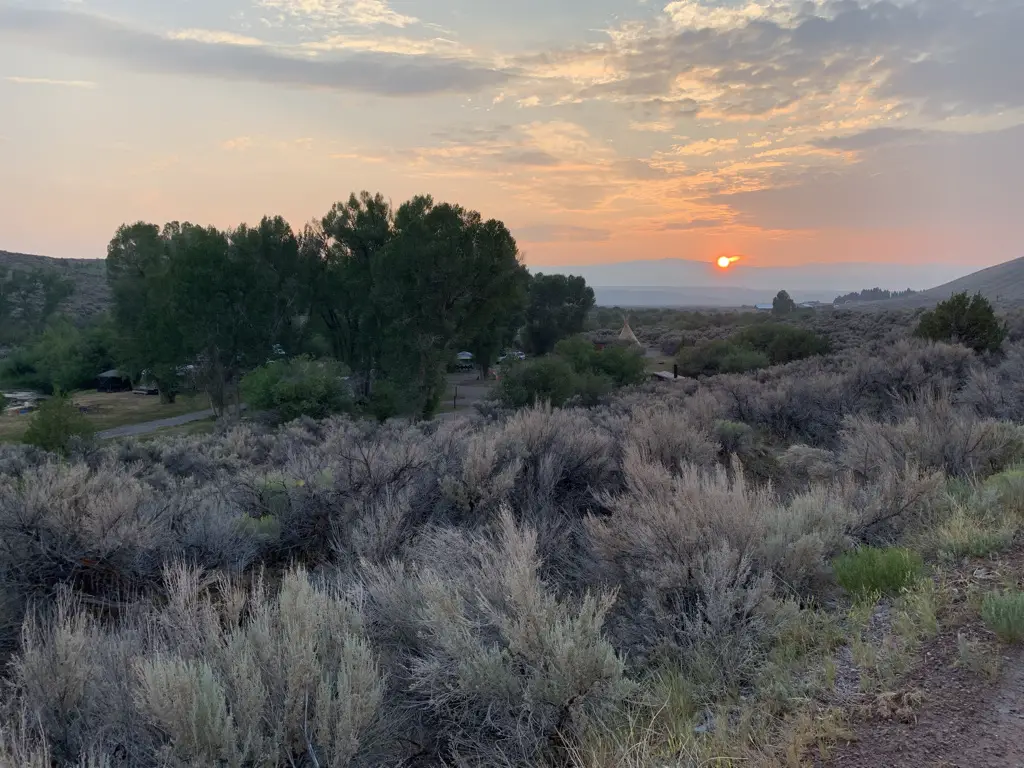
Smoky sunset over scrub-brush covered pastureland.
A smoky sunset over wild Montana
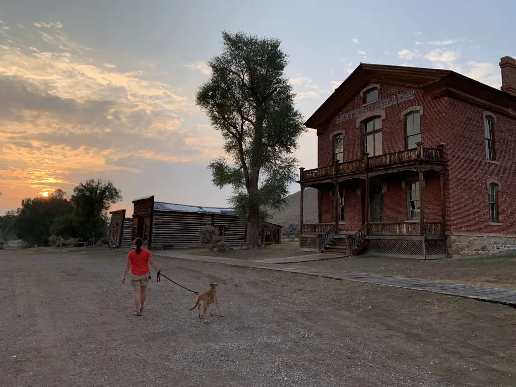
Woman and dog walking away from camera on dirt street of ghost town, sun setting into the clouds in background.
Puppers and I searching for ghosts at sunset
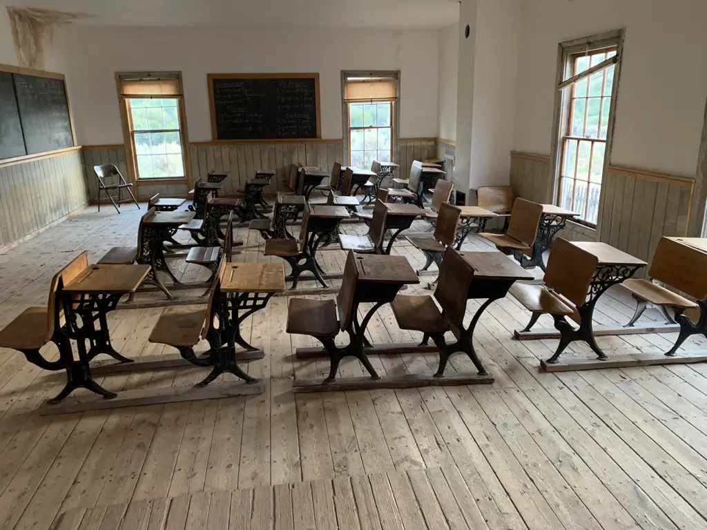
Interior of old, one room schoolhouse. Antique desks fill the room.
Inside the schoolhouse

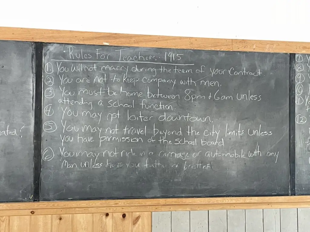
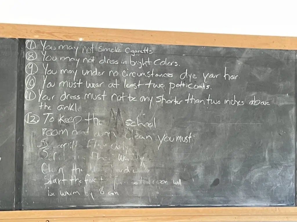
Rules for teachers written on the schoolhouse chalkboard:

Rules for teachers at the schoolhouse in 1915 written on a chalkboard. These include, "you may no loiter downtown."

Rules for teachers at the schoolhouse in 1915 written on a chalkboard, including, "you may not dress in bright colors."

My favorite are no wearing bright colors over that scandalous one petticoat! 🤣 

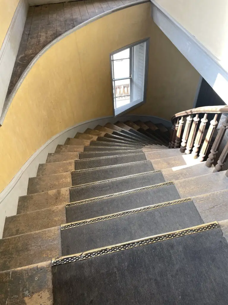
View down spiral, front staircase of old hotel.
Not gonna lie, I couldn’t help imagining myself descending these stairs in a hoop skirt!

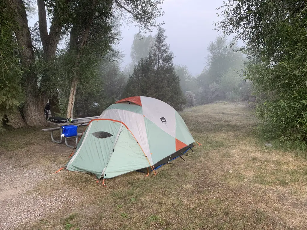
If you can make it work I STRONGLY recommend camping in the park, it’s about a half-mile walk from the campgrounds to the ghost town, and being there in the evening as the light wanes is AMAZING! (If you choose not to camp the park is open till 9 at night, in the summer).  The campgrounds are rustic (read vault toilets) but they were cute, well-maintained, and quiet.  This was our favorite stop of the trip and Mr. Trekker’s favorite campground (mostly because of the access to the ghost town.)

Foggy campsite surrounded by trees, tent in middle.
Our cute little campsite at the Bannack State Park campground
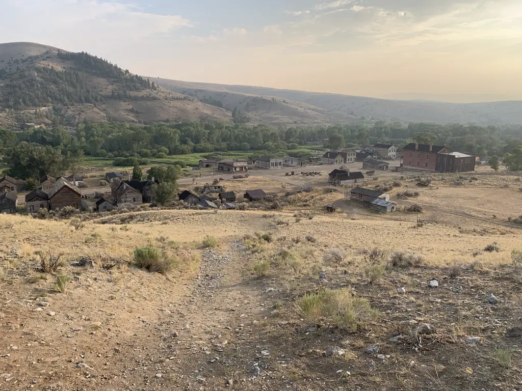
View from top of hill overlooking the ghost town of Bannack, Montana. Smoky mountains in background.
View of Bannack from the hill above the town
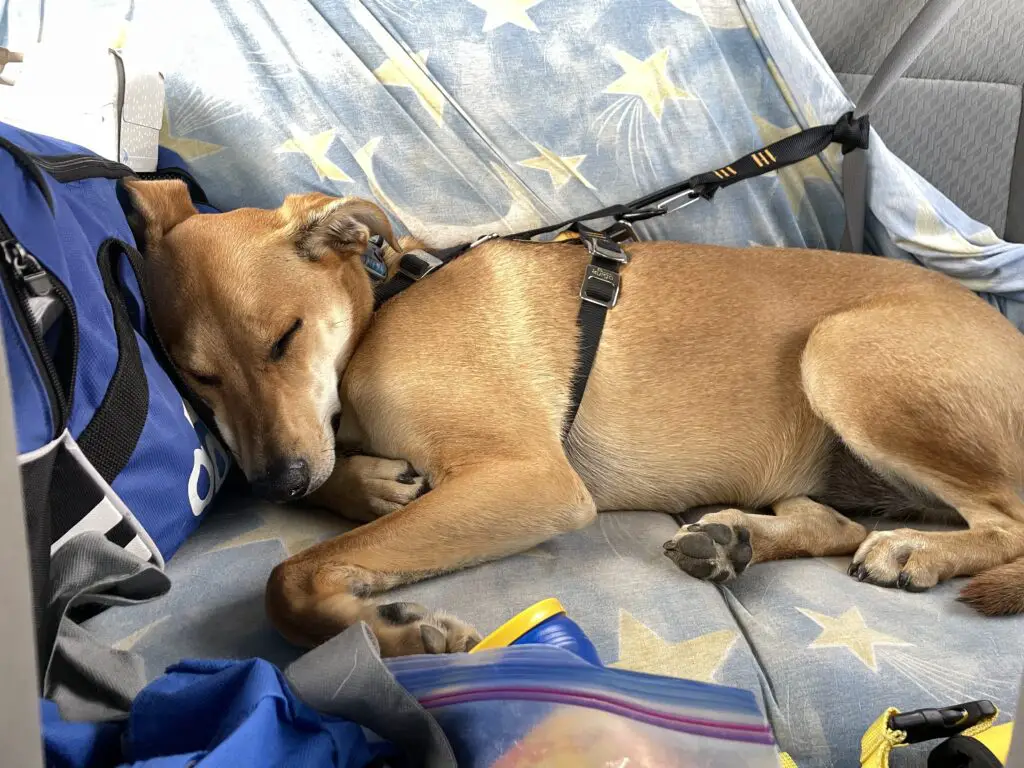
Dog asleep in back of vehicle, strapped into harness and seat belt.
Sleepy puppy after chasing ghosts! (BTW that seatbelt harness she’s wearing is AWESOME!)

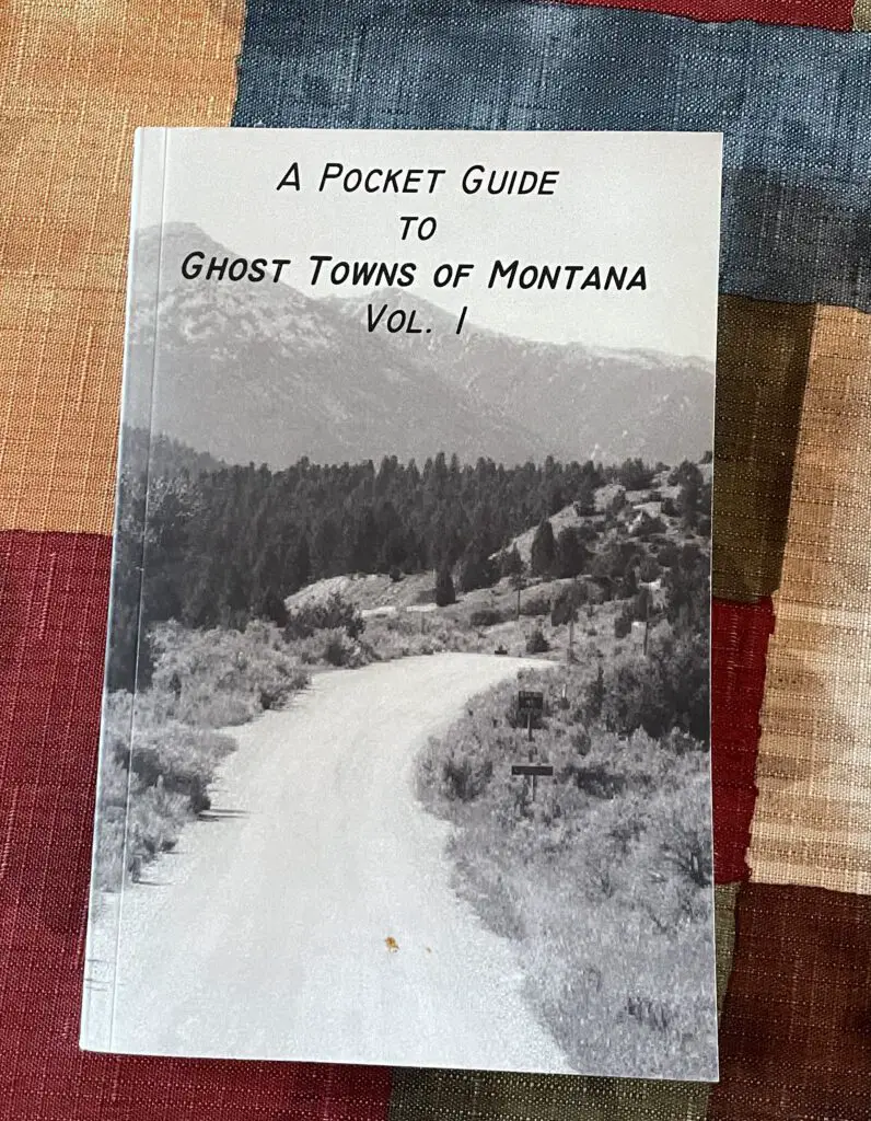
Though they weren’t nearly as good as the ones we found for Colorado, I did find a series of books that is helpful when visiting Montana ghost towns:  

Book, "a pocket guide to ghost towns of Montana, volume 1."

This volume didn’t cover EVERY town we’d like to see but it did review many of them.  I’ll look into getting one of the other volumes when we go out for our next trip.  The book focused mostly on the histories of the towns (which is always interesting) but it did give a quick synopsis of how to find the town at the end of each section.  It even made helpful suggestions such as, “it is not advisable for any vehicles towing trailers to approach using the southern route.”

Bannack and Nevada/Virginia Cities are only about 80 miles apart.  While you can certainly enjoy Nevada City and Virginia City on the same day, I would encourage you to save one whole day for Bannack.  This will allow you to fully enjoy that park and give it the time it deserves.   

Ghost towns are such a great way to experience history and gain an appreciation of the “cushier” lives we lead today.  So if you find yourself in southwestern Montana, check out some of these cool destinations!

Have you been to any of these awesome ghost towns?  Are there others we should put on our list?  Let me know in the comments!

Did you enjoy this post?   Pin it!

Three pictures: 1) Old, wooden buildings line one side of dirt, street; 2) View down dirt, main street of Bannack ghost town, Bannack State Park. Old, wooden buildings on each side, blue, cloud-covered sky, dusty mountains in background; 3) View down modern, paved, main street of Virginia City ghost town. Cars line both sides. Pin reads, Ghost Town in Southwestern Montana

Like what you read here today?  Please feel free to leave a comment, like or share this post!  Add your email at the bottom of the page, or the sidebar to the right, to be notified when a new post is published.  By signing up for the email list, you will also receive a free copy of the Tranquil Trekker’s Top 10 Tips of Trekking Do’s and Don’ts!

You can also follow the blog on social media by clicking the links below!
Facebook

Twitter

Instagram

Pinterest

6 Don’t Miss Places for your Western Montana Road Trip

In this post, I detail sites we saw on a road trip through western Montana.


It all started with some AMAZING huckleberry bear claws… 🤤  

In 2016, on our trip to Glacier National Park, we visited Polebridge, Montana.  They are famous for their homemade, huckleberry bear claws that are baked at their Mercantile. (They are AMAZING and totally worth the drive!)  

Mr. Trekker has had an ongoing craving for these delicious delicacies since that trip. One summer a few years ago, we decided we needed more of these amazing treats, so we crafted an entire road trip around enjoying some! Read on for more info on the bear claws, and several other cool stops to add to your Western Montana Road Trip!

Places to Eat in Western Montana

There are so many great places to eat in Western Montana.  I mention a few we tried  below:

Montana Wheat bakery (throughout the state):  this place has AWESOME cinnamon rolls and pastries that are made locally.

Lake City Bakery and Eatery (Polson, MT):  We acquired yummy pastries from this locale and then enjoyed them at Boettcher Park which sits on the southern shores of Flathead Lake.  It offers prime views of the lake (where we learned that Puppers is afraid of waves, even small ones. 😂)

Burrito Brothers (also in Polson):  We got another AWESOME breakfast from this small shop.  They offer a variety of burrito choices including both breakfast and lunch options, and they’re open throughout the day!

Freestone Ice Cream (Hamilton, MT) and the Virginia City Creamery (found in the Virginia City ghost town!):  check out the yummy huckleberry ice cream at these locales!

Red Lodge Cafe and Lounge:  They make a great breakfast sandwich!

For more fun places to visit in this area, check out my post on Ghost Towns in Southwestern Montana!

Polebridge Mercantile in Polebridge, Montana

We made it to Polebridge and got our huckleberry bear claws…and yes, they were DELICIOUS! (For more info about this little piece of paradise, click here!)  Polebridge is a TINY hamlet that sits only about 20 miles south of the Canadian border. (For those keeping track at home, the Polebridge Mercantile is exactly 923 miles from our house! 😁)  They also make some great sandwiches that we enjoyed by the creek later!

Polson/Flathead Lake KOA Review

I struggled with whether to include this info.  I always try to keep this blog positive, however, this experience was so disappointing I felt like I needed to say something.  The campground was LOVELY.  It was set back from the road so it was fairly quiet, and it offered beautiful views of Flathead Lake and nearby mountains. The RV sites were shaded and lovely, as well.  We were excited when we got there because it seemed SO NICE…then we got to the tent sites…

Anyone who reads this blog regularly knows we prefer to stay in national forest campgrounds.  They’re usually more secluded, quieter, prettier and you’re more likely to see wildlife.  However, western Montana is prime grizzly habitat (and since they scare the CRAP out of me) we decided to opt mostly for KOA’s this trip.  I will be the first to admit, KOA’s are basically the most “vanilla” camping experience you can possibly have (but the showers and flush toilets were LOVELY! 😉)

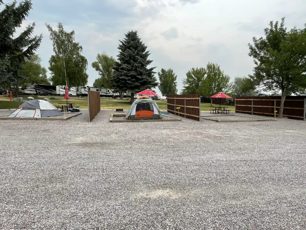
Unfortunately, the tent campsites at the Polson/Flathead Lake KOA were AWFUL!  The facility literally parked the tent sites onto a gravel parking lot.  It felt like whoever designed them had never tent-camped a day in their life. 😔

The tent sites are on pebble tent pads (which are ok) but they are surrounded by gravel…there was only a small amount of lawn that we could reach next to us (and the sprinklers came on for that at midnight and sprayed half our campsite too, getting our chairs and towels wet and hitting the fence and waking us up. 😒)

The sites offered almost no shade so they just BAKED under the sun.  We avoided ours until at least 6 at night as it was so hot.  The first night the hot pebbles radiated heat into our tent all night. 🥵  To top it all off they wanted us to park our car elsewhere (not too far away, but still.)  Um, we are CAR CAMPING, all our stuff is stored in the truck so we go to it, A LOT!  KOA isn’t known for great tent sites but these were the worst we’ve ever had. 😕

Three tent campsites separated by wood fences on gravel and pebble pads
I’m sorry but THIS is not worth $50/night. 🙁

I will say the showers and the Pet Exercise area were nice.  The views of Flathead Lake were also great and the mountains would have been gorgeous…if we had been able to see them through the wildfire smoke. 😝 (This issue was obviously not the fault of the campground.).

Bottom line, if you want to be an RV resort, that’s fine, just tout yourself as such and don’t bother with the tent sites.  Or, if you want to offer options for all types of camping, PLEASE don’t make your tent campers feel like second-class citizens. 😡

Flathead Lake

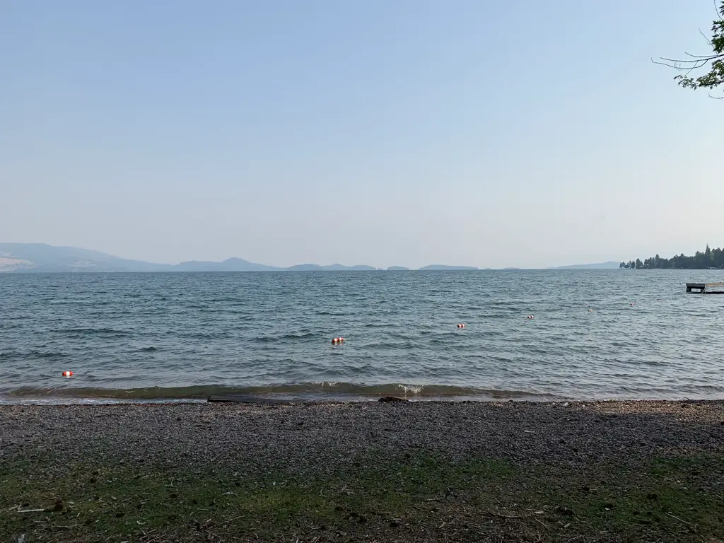
On a much more positive note, Flathead Lake is situated in far, northwestern Montana, less than 50 miles southwest of Glacier National Park.  It’s the largest freshwater lake in the Continental US west of the Mississippi and it is AWESOME!  The view reminded me of Sebago Lake in Maine. (I reviewed a trip we took to that lake, several summers ago, here.)

On a beach looking out over a large lake. Mountains are barely visible in the background through the haze.
Looking north from the southern tip of Flathead Lake
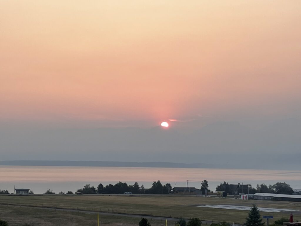
Grassy area with a large lake in the background. The sun rises over some shadows in the far background through the haze of wildfire smoke.
The sun rising over the haze-enshrouded Rockies (those would be the dark blur below the sun that you can barely make out through the wildfire smoke). 😝
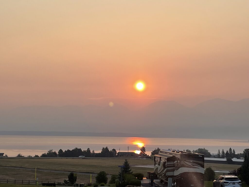
Sun shines through the haze of wildfire smoke and is reflected on the water of a lake
The sun reflecting off Flathead Lake

*You may notice a lack of the beautiful, landscape, vista pictures, that I usually post.  That would be because on this trip, we could hardly see the mountains due to all the smoke and haze. 😩  Sadly, this is becoming more of a norm as the West tends to burn each summer. 😪  PLEASE pray to Whatever/Whoever you pray to, send positive vibes, good wishes, white light, or whatever your spiritual “thing” is, but the West NEEDS rain, snow, or anything else that can fall as precipitation.  It’s crazy seeing some of the flooding in other parts of the country/world while out here the landscape just BAKES under the hot sun. 😭  Climate change SUX!!! 😡  

I’m glad we’ve visited this area before so we know how beautiful the landscape actually is.  A few times on this trip we could barely make out tall, mountain shapes looming through the yellow-brown gloom. 😪 (We did get lucky that even though we drove through some very smoky areas, none of our campsites were inundated with wildfire smoke.)  The morning we woke up to the sound of rain on the tent it took me a while to remember what that sound was! 😯  And then I rejoiced!  It’s a beautiful sound and we didn’t even mind packing up a wet tent in the drizzle. 😁  

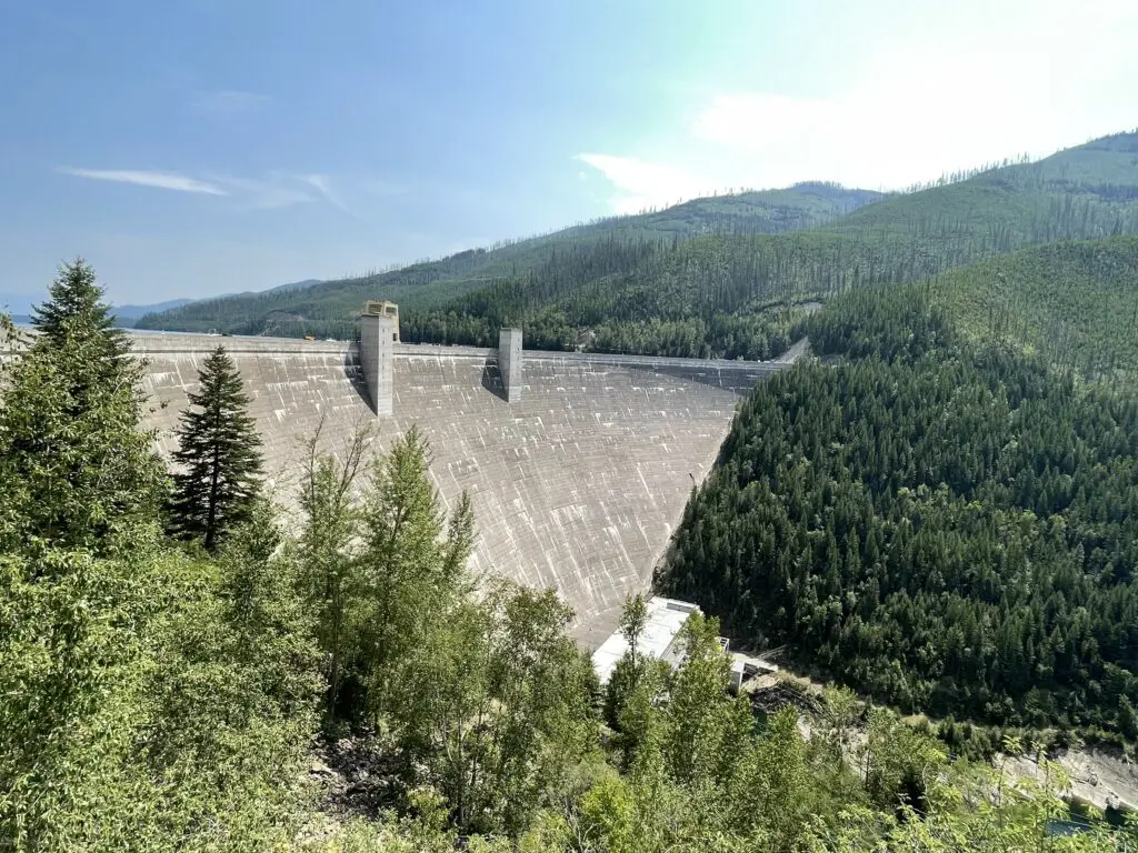
Hungry Horse Dam in Hungry Horse, Montana

We also saw the Hungry Horse and Kerr Dams.  The Hungry Horse Dam is located just south of Route 2 in Hungry Horse, Montana, just west of Glacier National Park.  It dams one of the forks of the Flathead River and creates the very scenic and very LONG Hungry Horse Reservoir.  The dam is over 500 feet tall and is one of the tallest ever built by the CCC (and is one of the largest of its type in the country).  It was cool to see!  If you stop at the Visitor Center there are even some tours available of the dam and its workings.

Large, concrete dam sits in the middle of forested mountains
Hungry Horse Dam
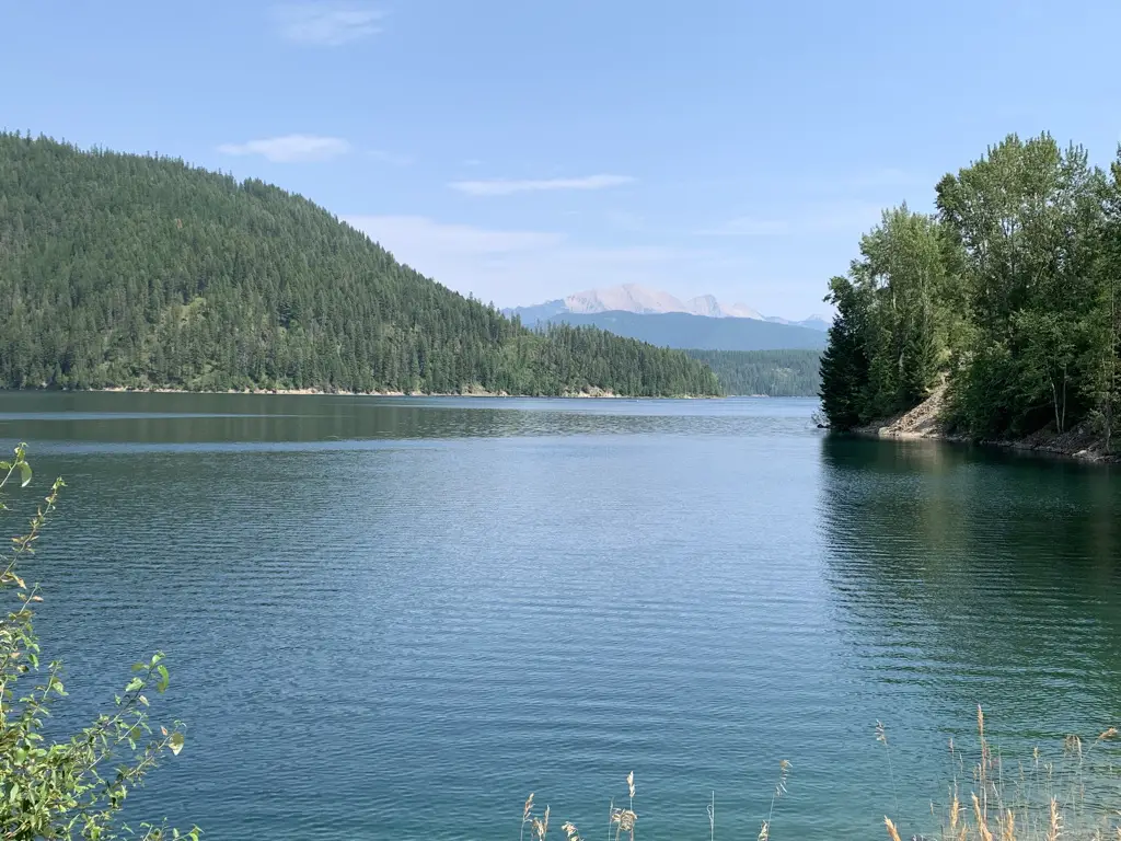
A serene lake surround by forested mountains. A large, rocky mountain looms in the background.
View from Hungry Horse Dam

Word to the Wise:  The view in the picture above is similar to the one we saw from the Gunsight Pass Trail in Glacier National Park–the portion of the trail that starts from the Jackson Glacier Overlook which is found off the Going to the Sun Road. (I reviewed that trek here.).   Often, if you know where to look (and have a little bit of luck), you can see similar sites to those found in national parks just outside the park boundaries where there are fewer crowds.  After all, it’s all the same countryside!   

Kerr Dam in Polson, Montana

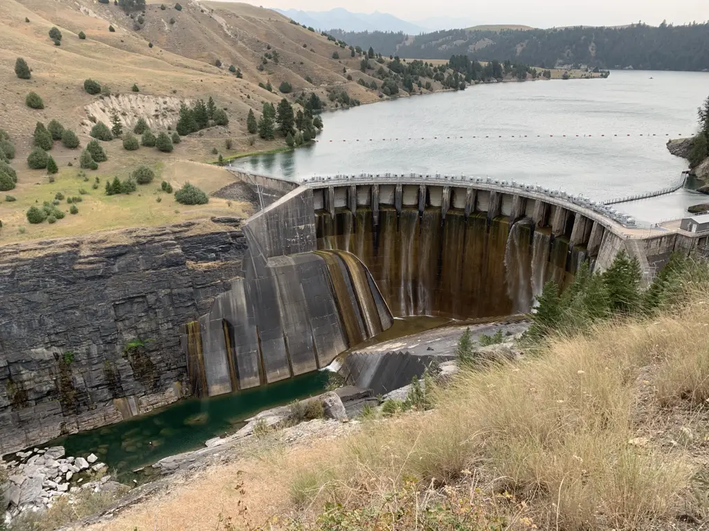
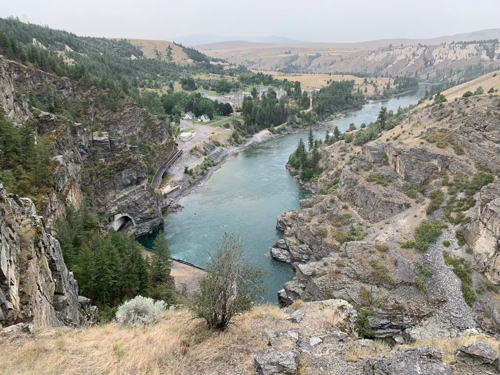
The Kerr Dam was REALLY neat!  They had a great little boardwalk path down the canyon wall that offered prime views of the structure.

Be warned, the path was a little steep and could be HOT in the sun.  It could also be slippery if wet. We had a nice breeze and a rain shower when we were there at 6 pm so it was pretty nice, we also had the place to ourselves at that time of day.  This could also be a bit of an uncomfortable walk if you’re afraid of heights.  It didn’t bother me as there was a nice railing but you’re basically walking along a knife-edge cliff that drops off on both sides.

The dam is on another fork of the Flathead River on land owned by the Flathead, Salish, and Kootenai tribal people.  The US government leases the dam from the tribes which provides them revenue.

Large, concrete dam in a river canyon with a reservoir behind it
Kerr Dam

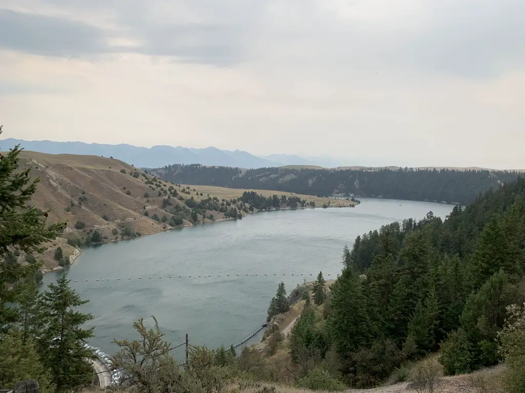
Views from the Kerr Dam Overlook:

A river flows through a valley surrounded by rugged, rocky and tree-covered hillsides

A river flows through a valley surrounded by tree-covered hillsides with dark mountains in the background

Traveler’s Rest State Park

Traveler’s Rest State Park is pretty cool!  It is located near the intersection of Routes 12 and 93 in Lolo, Montana.  This site’s claim to fame is that it is the only confirmed campsite of the intrepid explorers, Louis and Clark.  How do they KNOW this is the case, you may ask?  Well, the answer is kind of gross actually! 😂

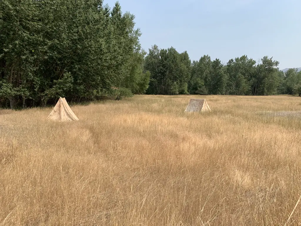
Two small, canvas tents sit in a golden, grassy meadow
A recreation of Louis and Clark’s camp!

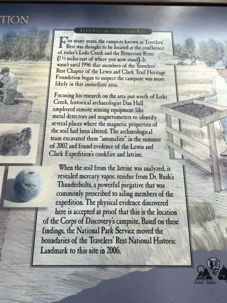
The location of the camp was long suspected to be in this area.  An archeological study eventually found higher-than-normal amounts of mercury in soil samples gathered here.  It was known that the exploration party carried mercury pills to be used to help “expel sickness from the body”.  As it turns out, the soil the archeologists had found was the site of the camp’s latrine! 🤥  Once this spot was confirmed, the scientists were then able to locate other remnants of the camp using previously known camp arrangements.

Informational, trail sign that explains how the site was analyzed and that the mercury they found in the soil indicates it was likely the location of the camp's latrine.
Don’t believe me regarding the story of how they confirmed this was the site of the camp? Read the sign! 😁

Similar to the trees I discussed in my Gettysburg National Battlefield post, Witness Trees have also been identified at the site of the Louis and Clark camp! (These are trees that have been determined to be old enough to have been here when the camp was here.)

The camp’s three Witness Trees:

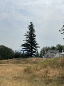
Single tree stands on a grassy hill Lone pine tree standing tall against the blue sky Lone pine tree stands on a grassy hill with a barn in the background

The Salish Tribe

One of the prominent, early tribes in this area was the Salish People.  I loved how many of the local signs are written in both English and Salish.  It is a beautiful language to see written.  It looks almost Cyrillic (Russian) but is actually completely unique to this tribe.  I was also able to purchase a cool book that gives a Salish glossary.

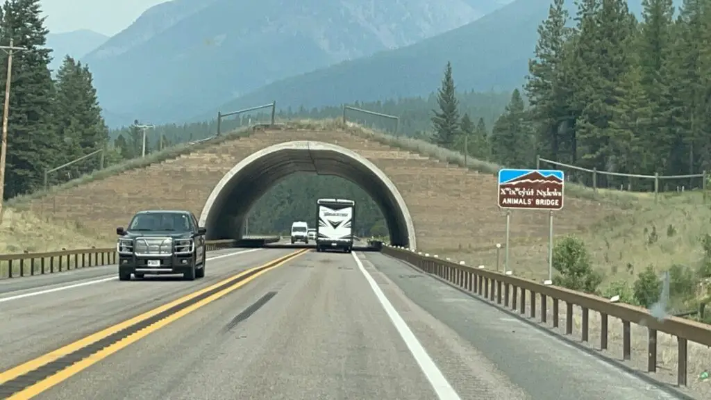
Grassy bridge overpass. Also a road sign written in English and the Salish language.
This is so neat! It’s one of those “wildlife bridges” on Route 93 between Missoula, MT and Polson (on the Flathead Reservation). It allows wildlife to safely cross the highway. Notice the Salish language included on the sign.

Our evening with the Hells Angels 😮

When we arrived in Red Lodge, Montana, one evening, near the end of our trip, we noticed LOTS of bikes (motorcycles).  We’ve always loved Red Lodge but have only been there in the early summer, it’s a bit busier during the prime season. 😝  We should be used to this living so close to Sturgis but we hadn’t anticipated all these bikers may want to ride the Beartooth Highway (duh!)

So, we were like, “oh, ok, no big deal.”  Then we noticed, “Hey, that guy has a Hells Angels cut on…and so does that guy over there…and over there is a cop…and over there is another cop…those guys over there are wearing Hells Angels cuts too….and over there is another cop…”…yeah…the Hells Angels were apparently having their annual gathering in Red Lodge that week. *sigh* 🙄 (For the record we had no problems at all and the few HA’s we talked to were VERY friendly–they liked Puppers. 😉)

Beartooth Highway (Beartooth Pass)

On our final day in Montana, we traveled up the Beartooth Pass a bit to see the view.

We were actually killing time until a local store, Lewis and Barks opened. (You’ll notice it’s a play on words of the two explorers mentioned earlier.)  As you may guess by the name, it’s a pet-based store.  We figured Puppers had done so well on her first real trip with us that she deserved a souvenir too! 

Finally, we took a nice, country drive on several back roads (Route 308 east out of Red Lodge, then picked up Route 72 north to Route 310 southeast.  We took that to Lovell, WY where we picked up Route Alt-14) to our final campsite of the trip in the northern Bighorn Mountains of Wyoming!

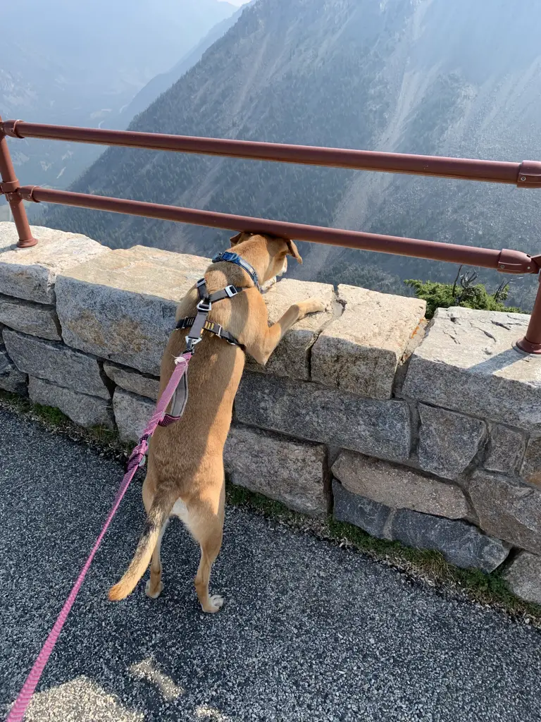
Overlook of a mountain pass. A stone wall and metal railing in the foreground, mountain vista in the background.
Puppers checking out the view on Beartooth Pass!
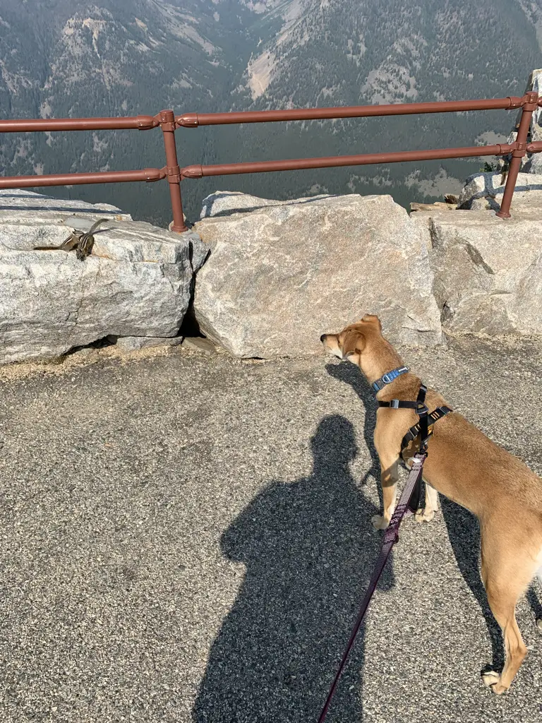
A dog on a leash stares at a chipmunk on a rock, just out of reach.
Puppers enjoyed the OVERLY FRIENDLY chipmunks at the Vista Overlook on the Beartooth Highway.

So there you go, 2000 miles and 7 days later…we saw some great sites, we ate some DELICIOUS huckleberry, bear claws and we had a fun time!  Check out some of these great locales for your next road trip around Western Montana! 

Have you visited any of these places?  Tell me about your experience in the comments!


Like what you read here today?  Please feel free to leave a comment, like or share this post!  Add your email at the bottom of the page, or the sidebar to the right, to be notified when a new post is published.  By signing up for the email list, you will also receive a free copy of the Tranquil Trekker’s Top 10 Tips of Trekking Do’s and Don’ts!

You can also follow the blog on social media by clicking the links below!
Facebook

Twitter

Instagram

Pinterest

Wyoming’s Bear Lodge Mountains

In this post, I review a weekend we spent in the Bear Lodge Mountains of Wyoming.


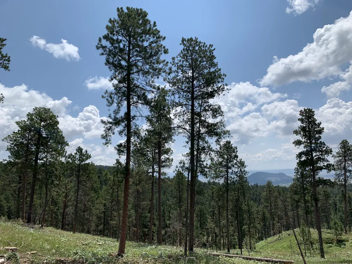
A dog lays on the gravel, in front of a tent, in a wooded campsite.There is a less-frequently visited portion of the Black Hills in far-eastern Wyoming called the Bear Lodge Mountains.  When the Trekkers visited we stayed at the Reuter Campground.  It is easy to reach, as it is less than two hours from Rapid City.  It is also just a short drive north of Sundance, WY (and I-90).

This was a typical, rustic, National Forest campground.  Potable water is available in-season, there are campfire rings and picnic tables at each campsite, and the campground offers vault toilets.

The campsites were decent, this was one of the first times we had an “inner” site so it was closer to other campers.  Usually, we go for “outer” sites but there were none available by the time we made reservations.  This meant we had to deal with more noise from other campers which is something we are usually able to avoid.

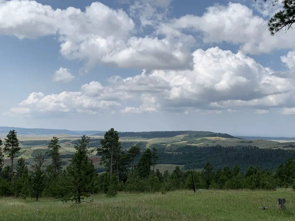
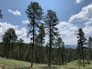
View from a lookout point over pine trees and a grassy meadow with green grass and tree-covered hills rising in the background, all under a blue sky and puffy clouds.

This campground wasn’t my favorite.  It was fine, the were plenty of large and shaded sites, but the host wasn’t as available or on top of things as we usually experience. (As an example, the trash DEARLY needed to be changed when we arrived.  It’s usually not a good idea to have full trash cans at a campground, at the START of the weekend, in the height of summer. 😝  She also seemed to have a hard time remembering who she had and hadn’t checked in already. 🙄)

We noted another campground in this local area was actually closed and was looking for a host.  It seems that campgrounds may be experiencing the same lack of available employees that so many other businesses around the country are right now.

Hiking in the Bear Lodge Mountains of Wyoming

We enjoyed several different hiking trails in the area.  Though many were overgrown, they were very well marked with signs and markers.  Just watch out for ticks, snakes, and thistles in the tall grass. 😯

Carson Draw Trail including the Carson Draw Spur #1, the Carson Cut Across, and the Reuter Springs Trails

We made a loop out of a portion of the Carson Draw Trail, which we then took to the Carson Draw Spur #1, then went on to the Carson Cut Across, and then the Reuter Springs Trail…

The Carson Draw Trail offers a lengthy and groomed cross-country ski trail in the winter months that is around five miles long.  I think this would be a lovely area for skiing.  We may also return for a day trip in the fall to check out the leaf colors.  We saw several aspen groves that would likely be lovely.

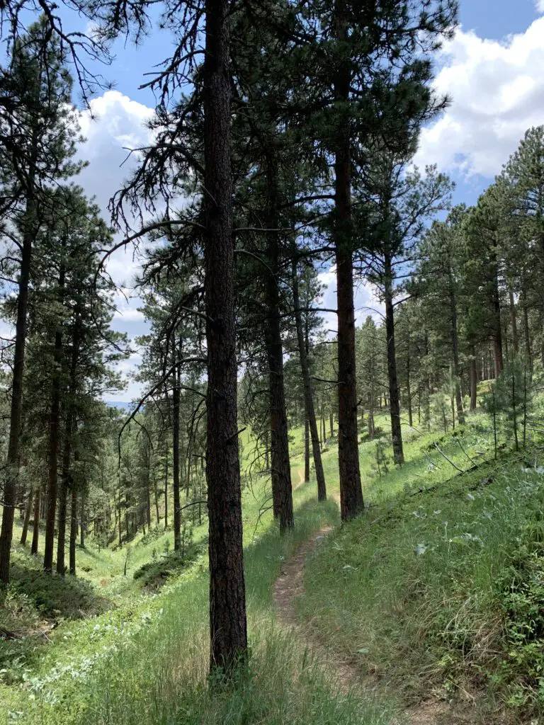
View down a trail that traverses a grassy, pine tree-filled canyon.
Looking down Reuter Canyon on the Reuter Springs Trail

Unfortunately, going in this direction means that the Carson Draw Spur #1 trail is almost completely an uphill hike.  It isn’t overly steep, it’s just a long hill.  It was a former forest road so it is plenty wide and graded though it was rather overgrown.

The Carson Cut Across was much nicer.  It was short (less than a mile) with only a small amount of elevation gain.  It was also nicely shaded and more like a typical, single-track, hiking trail.

View down a grassy hill covered in pine trees. Green, pine-covered hills rise in the background.

Even though it meant a long uphill slog on the Carson Cut Across, I would recommend taking this loop counterclockwise as we did.  It means prettier views of the Wyoming prairie and grasslands opening up before you, on your way down the hill, as you exit Reuter canyon on the Reuter Springs Trail.  Also, portions of the Carson Draw Spur #1 trail were VERY STEEP as you went downhill shortly before it reached the Carson Cut Across.  I was happy we didn’t have to hike UP that!

Warren Peak Fire Lookout Tower

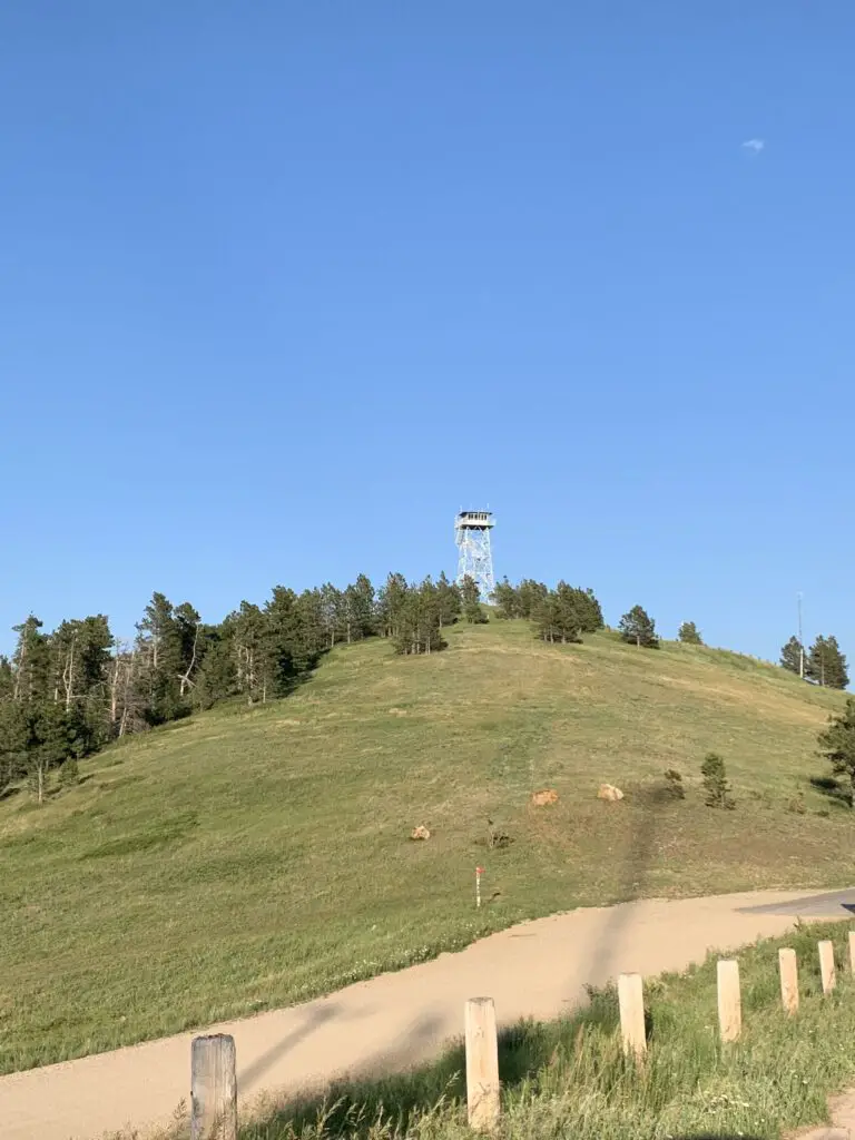
View from a dirt road, looking up to a fire tower, sitting atop a grassy, tree-covered hill all under a clear, blue sky.
Warren Peak Fire Lookout

The Warren Peak Fire Lookout Tower works in conjunction with the Cement Ridge Tower, which sits to the southeast, on the border of South Dakota and Wyoming. (I discuss that lookout here).  It offers 360-degree views of the surrounding mountains and prairie.  On a clear day, you can see portions of Montana, Wyoming, the mountain Crow Peak in South Dakota, Devils Tower just a scant 20 miles away, all the way to the Bighorn Mountains much farther to the west!

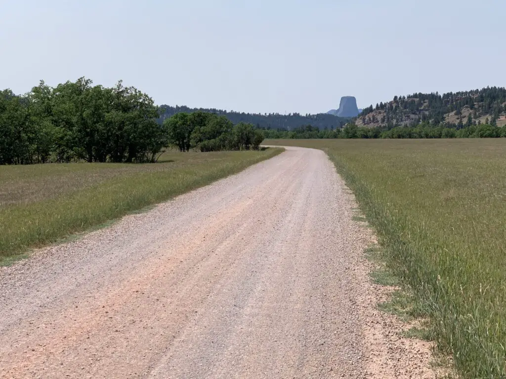
Devils Tower as seen from the Bear Lodge Mountains:

View down a dirt road that crosses a meadow. A rock obelisk (Devils Tower) materializes through the haze in the distance, behind tree-covered hills.

Cliff Swallow Trail

So, I am NOT trying to be a Negative Nellie here but we did NOT see ANY swallows OR their nests on this trail (and I’ve talked to other people who said the same thing!😝)  The only place we could have possibly seen them was one overlook fairly early into the hike where we saw some cliffs across the canyon.  They were probably a good half-mile away though and we couldn’t see any birds using the binoculars.  We’ve definitely seen more of these cool featherlings on other trails that don’t even advertise themselves as “Cliff Swallow” trails. 😝  So I’m gonna have to give this trail a rating of…FAKE NEWS! 😂

This trail can also be done in a loop.  I would again recommend taking it counterclockwise.  Going this route you start at the bottom of the canyon and travel along the bubbling, Beaver Creek.  The trail went through some very lush greenery, with lots of deciduous trees and ferns (this also meant it was VERY green…and humid. 🥵)  There was also little breeze down in the canyon and there were TONS of cobwebs strung amongst the greenery that spanned the trail (thanks to Mr. Trekker for taking one for the team on this one and going first, to knock them all out of the way.  See guys, THIS is how you woo a lady. 😉)

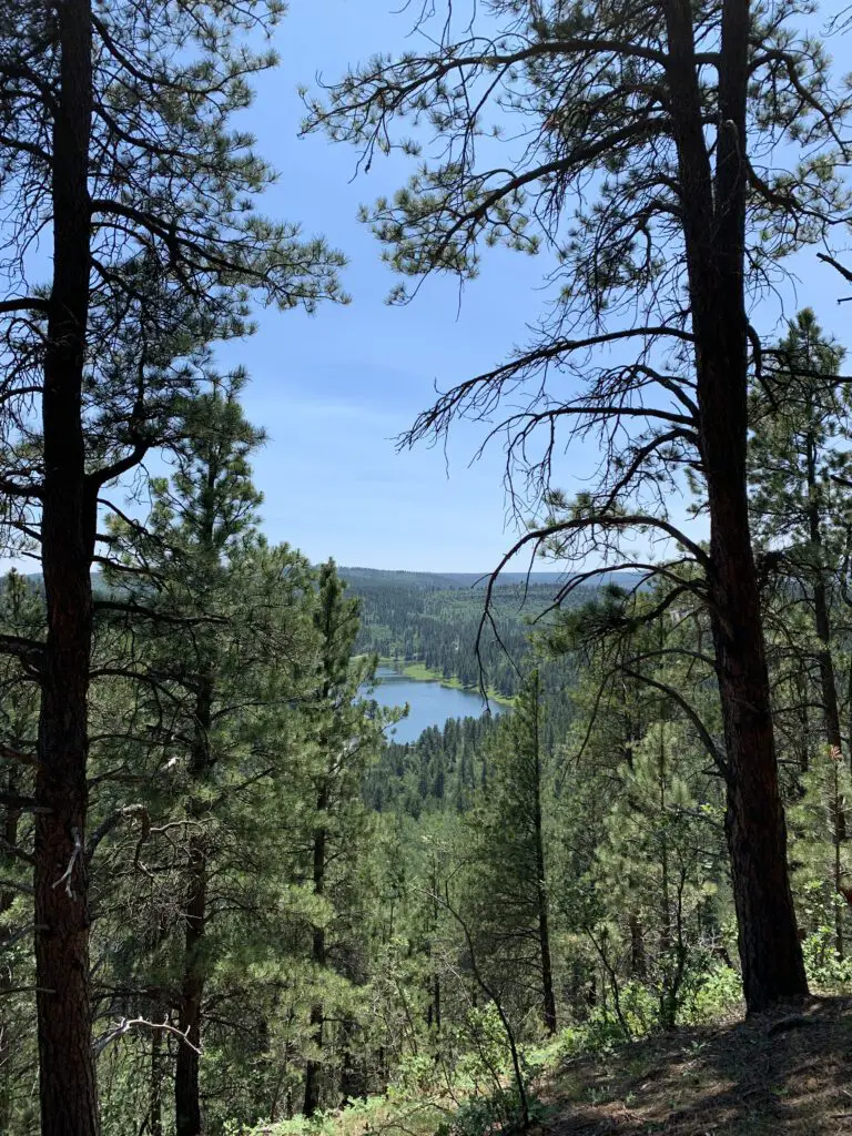
View down a tree-covered hill to a long, blue lake, surrounded by more trees, in the distance.
Cook Lake as seen from the Cliff Swallow Trail

As you continue down the trail you ascend some mild switchbacks that take you up the hill.  Here you will notice a transition to a drier, ponderosa-pine-forest-environment that is more typical of the Black Hills.  There was also a blessed breeze at the top and it was less humid (though there could be more sun depending on the time of day as you’re traversing the canyon rim at this point).  Our experience was the entire trail was a mix of sun and shade and we were there around the middle of the day.

Again, I strongly suggest you take this loop counterclockwise.  The ascent of the hill is more gradual and you’ll have nice views of the lake as you emerge from the canyon.  If you go clockwise the trail goes straight up the hill! 

This isn’t a bad trail at all, older kids could certainly handle it. It was definitely shorter and easier than the Carson Draw/Carson Draw Spur/Carson Cut Across/Reuter Springs loop (thankfully because it was also HOTTER that day! 🥵)  That trail wasn’t bad either, though.  I would probably give both a rating of “moderate”, just on opposing ends of the spectrum.

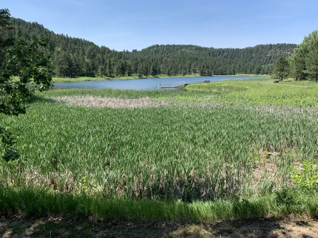
Green cattails lead to a small lake, surrounded by tree-covered hills.
Cook Lake

To finish the second day of hiking, we took a back road out to Devils Tower, just because it was close and we could. 😉  Also, the Devils Tower General Store sells ICE CREAM! 🍦😀😀  

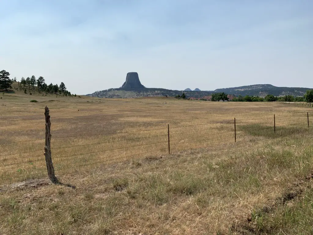
A brown-grass meadow leads to a rocky monolith (Devils Tower) in the distance.
That monolith points to ice cream! 😁
A dog sleeps on a mat on the grass
Sleepy puppy after hiking!

In general, these Hills seem to be more lush and overgrown than is typical in the South Dakota Black Hills.  They reminded us more of the lusher ecosystem you find in the northern portions of our Hills.

Not sure if this may indicate they are wetter and may mean they have fewer wildfires here on average (as you don’t hear about them much.)  This could also explain why we found there were fewer good lookout/viewpoints here, many of our open spaces in the Black Hills come from burn scars. 😝

I found I didn’t like the Bear Lodge Mountains quite as much as the Black Hills we know and love.  They were more rustic and less developed.  They actually reminded me a bit of State Forest State Park in Colorado (you can read about that little-known location here and here!)  It seemed less organized, you were kind of left more on your own to figure things out.

It wasn’t nearly as busy and touristy as the South Dakota Black Hills though this also meant it was far less crowded. (Admittedly we only experienced a small corner of this area.)  It made me think of a green island rising from the sea of brown that is the dry grassland of eastern Wyoming. 😇

Have you ever been to the Bear Lodge Mountains of Wyoming?  Tell me about your experience in the comments!

Did you enjoy this post?  Pin it!

View down a tree-covered hill to a long, blue lake, surrounded by more trees, in the distance. Pin reads, "Wyoming's Bear Lodge Mountains Hiking the Carson Draw and Cliff Swallow Trails"


Like what you read here today?  Please feel free to leave a comment, like or share this post!  Add your email at the bottom of the page, or the sidebar to the right, to be notified when a new post is published.  By signing up for the email list, you will also receive a free copy of the Tranquil Trekker’s Top 10 Tips of Trekking Do’s and Don’ts!

You can also follow the blog on social media by clicking the links below!
Facebook

Twitter

Instagram

Pinterest

Hershey’s Chocolate World!

In this post, I review the Trekkers’ visit to the home of Hershey’s chocolate!


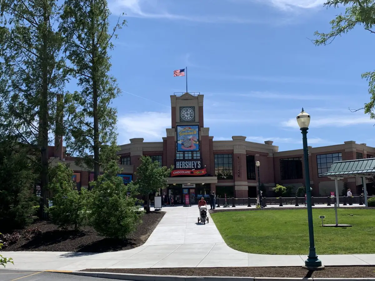
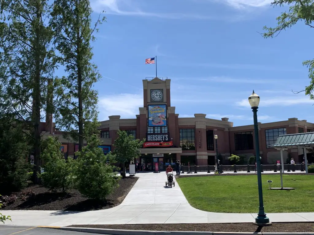
Now that the Trekker In-Laws moved to Pennsylvania, I got to check out a place I’ve been wanting to visit for years since I learned about it while researching one of my online, travel-related, writing jobs…Hershey’s Chocolate World!  

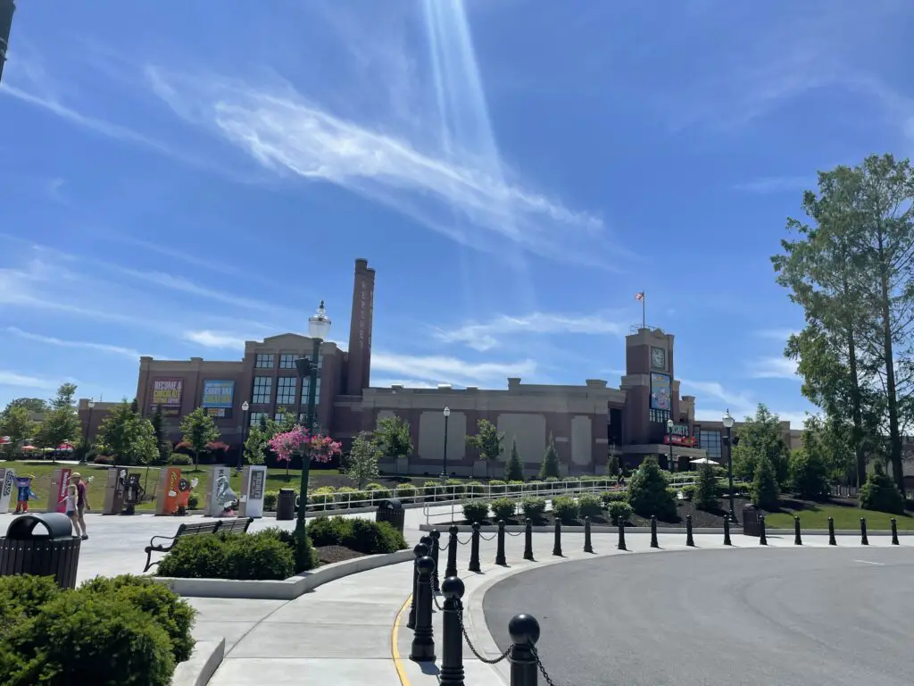
A large sidewalk leads to a building that says "Hershey's Chocolate" and has a picture of candy painted on it
Hershey’s Chocolate World!

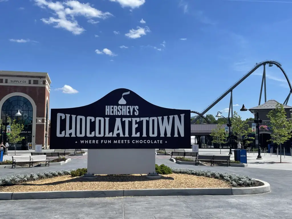
There are SO MANY things to do at Hershey’s Chocolate World.  You can tour the “chocolate factory”, enjoy chocolatey tastings, there is even a place where you can invent your own chocolate bar, and take a trolley tour!  There is also HersheyPark, which is an amusement park that is adjacent to the factory campus and there is a small zoo on-site!

Large, brown sign reads, "Hershey's Chocolatetown where fun meets chocolate". A roller coaster is in the background
Hershey’s Chocolatetown and Amusement Park

Things to do at Hershey’s Chocolate World

We didn’t see every attraction but I’ll highlight the ones we did enjoy (hopefully we can go back later to try out the rides at HersheyPark 😁 ). 

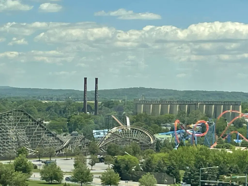
A view of multiple roller coasters amidst many trees. Green hills and smokestacks are in the background.
You can see all the roller coasters at HersheyPark from this shot I took on our Trolley Tour.

Hershey’s Chocolate Tour

This is the “factory tour” that shows you how Hershey makes their chocolate!  Admittedly, it was a little hokey (it was a slow ride through a mock-up of a factory) but it was fun and FREE!  They even give out free candy at the end! (Rumor has it they used to give out full-sized candy bars, now they are fun-sized.  Gotta love inflation! 😝)

I highly recommend the GIANT soft pretzels at the food court.  They are HUGE and delicious (and come with multiple types of dipping sauces).  Plan on sharing these!  

View of a large, brick building from a parking area, under a blue sky
Hershey Trolley Works

This was one of my favorite attractions that we enjoyed.  It was a very cool tour of the town, that also gave historical info on Milton Hershey’s life.   I had no idea he was such a philanthropist!

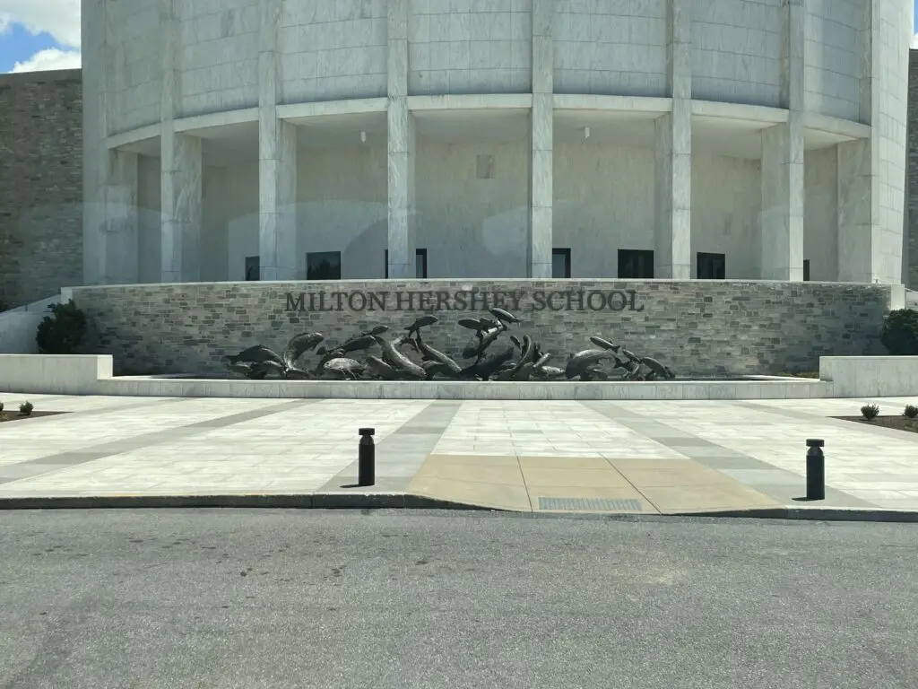
He gave millions to help his employees and the local community.  He donated money and land for schools, theaters, and community centers.  He even started a boarding school for underprivileged children that still runs today (at no cost to the families of the kids who attend!)

Large, brick sign at the front of a multi-story, concrete building reads, "Milton Hershey School"

Hershey, Pennsylvania Street Lights

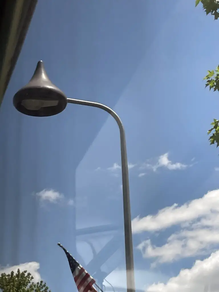
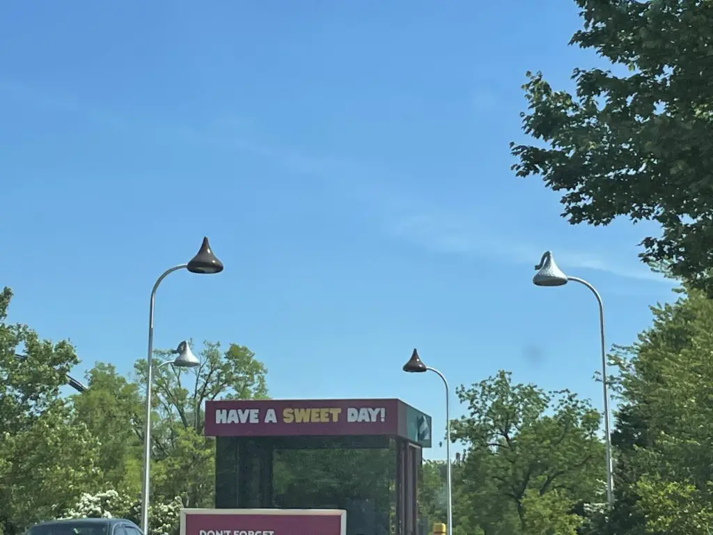
One quirky aspect the town of Hershey is known for is its REALLY unique street lamps!  They look like Hershey’s kisses and they’re found all throughout town!

View through a window of a streetlamp that looks like a Hershey's Chocolate Kiss

View through a window of several streetlamps that look like Hershey's Chocolate Kisses--some are wrapped in foil. A sign on a small building reads, "have a sweet day"

US Route 15!

On this excursion, we enjoyed another drive that was an “old friend” from times past, Route 15 in south-central Pennsylvania.  This road was important to the Trekkers in our earlier years.  We used to take it when we drove from the Trekker In-Laws’ old home in New England back to North Carolina when we lived there.  It was a way to avoid the traffic fiasco known as the Capital Beltway in Washington, D.C. 😝

We hadn’t driven this route in more than 10 years.  I always enjoy going back and seeing places we’ve been in our past.  It is interesting to see how they change and develop over time.

There are Hershey Chocolate Worlds in several other locations in the US and throughout the world but I figure it’s always best to go right to the source, right?  If you’re ever in the area definitely make time to check this place out.  You’ll even get some free chocolate out of the deal!  What could be better than that?! 😁

Related posts:  Gettysburg Battlefield, Flight 93 Memorial

Have you ever been to Hershey’s Chocolate World?  Tell me about your visit in the comments!


Did you enjoy this post?  Pin it!

White sign reads, "Hershey" and has a chocolate kiss on it. Pin reads, "Visit Hershey's Chocolate World!"


Like what you read here today?  Please feel free to leave a comment, like or share this post!  Add your email at the bottom of the page, or the sidebar to the right, to be notified when a new post is published.  By signing up for the email list, you will also receive a free copy of the Tranquil Trekker’s Top 10 Tips of Trekking Do’s and Don’ts!

You can also follow the blog on social media by clicking the links below!
Facebook

Twitter

Instagram

Pinterest

Flight 93 Memorial

In this post, I review the Flight 93, September 11th Memorial in Shanksville, Pennsylvania.


As part of a road trip out East to visit the Trekker In-Laws a few years ago, we visited the Flight 93, September 11th Memorial in Shanksville, Pennsylvania. (For anyone who isn’t aware, United Flight 93 was one of the four planes hijacked by terrorists on September 11, 2001.  They believe this one was headed towards the capital when it was brought down by the INCREDIBLY brave passengers who were trying to take control back from the terrorists.)

Author’s Note:  I usually try to keep this blog light and carefree.  Unfortunately, there is really no way to do that with this post.

I felt like I lost my innocence in a lot of ways on September 11th, 2001.  The metaphorical curtain was removed and I saw the depravity, hate, and evil capable in the human spirit.  I also felt horrible feelings within myself that I didn’t even know were there.  It was the first time in my life I understood how it felt to actually hate another human being, to feel like I wanted to lash out and hurt someone who was responsible for hurting others.  When you see innocent people being harmed, dying in horrific ways, knowing that families are being ripped apart, forever altered, it makes you angry.  You can’t understand why some people would want to hurt others like that. (As someone who has a degree in human psychology, I can understand that these feelings are perfectly normal as a reaction to such a trauma.  It’s still alarming to see those feelings manifested in myself, however.)

The Flight 93 Memorial Visitor’s Center

We started at the Visitor’s Center which was very well done.  It highlights the events of September 11th with various video and audio recordings that actually occurred that day (news reports, recordings from air traffic control, even some of the messages people on the planes left with their families–those were particularly heartwrenching.)

View up a green-grass hill at a large, concrete building
The Visitor’s Center at the Flight 93 National Memorial

It was a very emotional experience to visit this memorial, as I assumed it would be.  Mr. Trekker and I realized this is the only national memorial we’ve been to that commemorates something that happened in our own lifetime. (I’ve also been to the 9/11 Pentagon Memorial which is very beautiful.  We hope to visit Ground Zero at some point in the future, as well.).

I can’t imagine the thoughts and emotions that the people on the plane felt.  They knew what was happening and that they were likely to die, so they were facing their own mortality on top of dealing with this attack on their homeland.  I have always been awed by their bravery and their final act to try to stop the attack and take control back.  I pray I am never in a situation like that.

The memorial brought back memories of that fateful day.  Mr. Trekker and I were (barely) freshmen in college, we had only been there a couple of weeks.  Funnily enough, that was one of the first times we remember actually spending time together.  We went to chapel together with a group of friends that night…

One of the spooky parts of that day for us was our college was located only about an hour from Chicago.  A lot of the kids we were in school with were from the Chicago area and they were all worried that the terrorists might be targeting the Sears Tower (now the Willis Tower).   

Related Posts:  Hershey’s Chocolate World!; Gettysburg Battlefield

This was the first national crisis Mr. Trekker and I had ever lived through, it was definitely a defining moment for our generation. (I realize this is an indication of just how blessed life is for most of us in the US…the fact that we were almost 20 before we had to deal with a crisis like this and that for most Americans, this type of national crisis is a once or twice-in-a-lifetime experience.  We are so blessed not to live in a war-torn country!)

This was our “Pearl Harbor moment”.  I will never forget where I was or what I was doing that morning, what the weather was like, or how we found out “something” was wrong.

While walking through the memorial I just kept thinking, “I know our country and world are divided right now but man, I can’t contemplate one person having so much hate for another, and for seemingly innocuous reasons.  How can you want to kill someone who isn’t posing a risk to you or your family, who is just existing…most if not all of the victims were completely innocent (some were children even!)  

The Wall of Names

The Wall of Names is the actual, granite, memorial stone that looks much like many other memorials around the country.  It also sits at the bottom of the hill, near the final flight line and boulder that marks the crash site.  It features a separate stone for each innocent person killed on the flight with their names engraved in the marble.

View down the length of a long, concrete wall with names written on it
The Wall of Names

Flight 93 Flight Line and Crash Site

The actual crash site sits in a field below and behind the Visitor’s Center.  It was once an old mine that scarred the land.  Now it is a lovely green area filled with wildflowers, surrounded by trees and accentuated with birdsong.  I think it is a perfect memorial to the people who died.  I’m glad this former scar on the land got a new lease on life, so to speak.

A green meadow with trees in the background. A line is mowed into a portion of the grass
Flight 93 flight line. The mowed area is the final path the flight took before it crashed into the field.

According to one of the guides we spoke with, the plane hit the ground at over 500 mph with hundreds of gallons of fuel onboard.  Needless to say, the resulting explosion left very little behind.  So a boulder is used to mark the plane’s final resting place… 

A green field with a large boulder at the rear and trees behind
The boulder is the site of the actual crash of Flight 93. No one but the families of the victims are allowed out near it.

Walking Trails at the Flight 93 Memorial

There are several walking trails that ring the field that marks the plane’s final resting place.  One is the Avenue of Trees that is a paved trail lined on both sides by trees.  It circles one side of the field where the plane crashed and leads from Memorial Plaza, at the bottom of the hill where ceremonies are held, back to the Visitor’s Center.  It leads past the 40 Memorial Groves where more than 1500 trees were planted to commemorate the people who died at this site that day.

The Western Overlook Trail is a dirt and grass path that forms the other side of the loop around the field.  It runs from the Visitor’s Center down to the actual stone memorial and the crash site itself, and then on to Memorial Plaza at the bottom of the hill.

A paved walkway with trees on both sides
The Avenue of Trees

Tower of Voices

The Tower of Voices is located elsewhere on the monument’s property.  It is 93 feet tall (in honor of the flight number) and it features 40 different wind chimes (one for each, innocent person killed on the fateful flight.)  It needs at least a 12 mph wind to chime well.  It wasn’t ringing much the day we were there but what we heard was pretty.  It’s an unusual, haunting, and very subtle sound.

Click here for a video of the chimes in action. (This link takes you to the virtual tour of the site on the Memorial’s main page. Click “Enter” to start the virtual tour, then click on “Tower of Voices” at the upper right corner of the map.  Then click the musical note in the upper right corner. Sorry it’s convoluted, this is the best-sounding video I could find.)

A tall, concrete tower with holes throughout and bells hanging from it sits on a grassy hill
The Tower of Voices
View from the bottom of the metal chimes that hang from the tower
A look at the chimes that make up the Tower, from below.

US 30 through Southern Pennsylvania

We brought the scenic, US 30 back from the memorial.  This road holds a special place in my heart as it was the same route we drove to college (from home, in Indiana) and I took a portion of it from home to North Carolina when we lived there.  It’s funny how certain objects (like roads) can sometimes play a role in our lives.  As another example, US 6 ran right near where I grew up.  It also ran right through Mr. Trekker’s hometown, even though we grew up almost 800 miles apart.  We were connected long before we even knew it! 😀

This is a VERY pretty, country drive.  The route curves through forests and over and around hills–I use this term instead of mountains–technically we were in the Appalachian and Allegheny Mountains.  HOWEVER, they are thousands of feet shorter than the Black Hills in South Dakota, so I also call these uplifts hills. 😀 (Even though they are almost twice as tall, the Black “Hills” may be called that because they are thousands of feet shorter than their big brothers to the south and west in Colorado, Wyoming, and Montana. 😀)

**Final snarky note (I felt bad putting this further up) 😇 :
People wonder why I don’t like to fly (I’m probably one of the only ‘travel bloggers’ who hates to fly! 😂)  I don’t like dealing with airport security (which admittedly has gotten worse since 9/11).  I don’t like packing for it, I don’t like having to take my shoes off; I don’t like that flying in a plane is essentially just public transportation where they pack you into a tube, like sardines.

I don’t like that my flight in Michigan can get delayed for HOURS because it’s raining in California and I’m flying to Florida. 🙄   I’m also terrified of the prospect of crashing to my death from 30,000 feet in a fiery tube (and that’s just from good, old-fashioned, mechanical failure, that’s before the idea of terrorists comes into play.) 🙄  All of this is why the Trekkers’ road trip! 😂  

I really enjoyed our visit to the Flight 93 Memorial.  It is situated in a beautiful setting in the country.  It’s peaceful and tranquil, with the tweeting of birds surrounding you.  I couldn’t help thinking this would have made me mad if I had been there when the crash happened.  How dare the birds tweet happily on this horrible day! 😝  It is a wonderful, final resting place for the people who died on that fateful day, however.

I want to end this patriotic post with my favorite song that came out after 9/11.  I still get chills whenever I hear it…Courtesy of the Red White and Blue, by Toby Keith

Have you been to the Flight 93 Memorial?  What was your experience like?  Tell me about it in the comments!


Did you enjoy this post?  Pin it!

View down the length of a long, concrete wall with names written on it. Pin reads, "Visit the Flight 93 Memorial in Shanksville, Pennsylvania"


Like what you read here today?  Please feel free to leave a comment, like or share this post!  Add your email at the bottom of the page, or the sidebar to the right, to be notified when a new post is published.  By signing up for the email list, you will also receive a free copy of the Tranquil Trekker’s Top 10 Tips of Trekking Do’s and Don’ts!

You can also follow the blog on social media by clicking the links below!
Facebook

Twitter

Instagram

Pinterest

Gettysburg Battlefield

In this post, I review our trip to the Gettysburg National Military Park!


A few years ago we visited the Trekker In-Laws at their new home in Pennsylvania.  Trekker Father-in-Law is a Civil War buff, so while on the trip, we had our own, personal guide to the Gettysburg Battlefield and National Military Park!

For my non-American readers (or anyone else not “in the know”) Gettysburg is a major feature in American History as it played an incredibly important role in the American Civil War that occurred in the 1860s.  Some say it may have been the turning point in the war as it marks the furthest point north that the Confederate Armies (the armies from the South) ever controlled.  Several months after that great battle, the current President at the time, Abraham Lincoln, also gave his infamous Gettysburg Address at this location.

Brown informational sign in a field with a stone fence and stone monuments in the background. Sign reads, "High Water Mark Area. Fild of 'Pickett's Charge'. The Angle. Copse of Trees."
This is considered the furthest point north the Confederate Armies successfully controlled…

A large, bronze sculpture of a large book. It reads, "High Water Mark of the Rebellion" with numerous names, divisions and battalions listed below.

Two old, wooden wagons sit in a green grass field

Mr. Trekker had visited this and many other battlefields on countless occasions throughout his childhood.  I had been to Gettysburg on an 8th-grade school trip MANY years ago (we don’t need to talk about how many exactly 😉 ) but didn’t remember much, so I was looking forward to returning with our knowledgeable guide!

Unless you’re also a history guru, before visiting the battlefield, I recommend watching the movie, Gettysburg which was made in 1993.  I’ll warn you, it’s LONG–like 4+ hours–so you may want to split it up over two days.  It’s a little boring if you aren’t really into historical battles and such, but my understanding is that it is fairly, historically accurate. 

The movie really helped me to understand the prominent characters and all the events that transpired throughout the battle.  That made it much easier for me to follow along with our tour guide when we were on the battlefield. (I can finally say, with certainty, which side General Lee was on! 😉)

Gathering darkness with dark silhouettes of a tree and a hill. A statue of a man on a horse is at the top of the hill.
This is just a statue, but I thought the silhouette Mr. Trekker captured in the gathering darkness was pretty cool!

Sites you don’t want to miss at Gettysburg National Military Park

There is SO MUCH to do at the Gettysburg Battlefield that you probably couldn’t see it all in a week!  If you’re only planning to stay for a few days though, below are some highlights I really enjoyed from our trip:

If you aren’t necessarily planning to be there for special reenactments or events, May is a GREAT time of year to visit the battlefield.  The crowds were light (except for on Memorial Day itself) and the weather was pretty good!  It was a little warm and rainy but much more pleasant than I imagined a July afternoon to be. 🥵 

If you want more info on the nearby area, check out this article.  I have it on good authority this was written, once-upon-a-time, by a certain blogger you all know and love (ahem!) 😉  

The Visitor Center at Gettysburg Battlefield

Like all good national parks, this one has a very nice visitor center.  It features a unique attraction called the Cyclorama which is an incredible mural.  It was originally painted in the late 1800s, and it covers the walls in a circle around you.  It depicts the events of the infamous “Pickett’s Charge” which occurred on the third day of the battle (more on this later!)  The exhibit includes a spoken presentation complete with lighted scenes to help you fully experience the event.

Painting of a battle in a grassy field, complete with horses, cannons, smoke and men fighting.
The Cyclorama!

When we visited Gettysburg when I was in middle school, there was also an exhibit that featured a lighted map.  It aided people in acquiring a full-sense understanding of the battle, as well, and I really enjoyed it.  Unfortunately, it aged and is no longer available to the public. 

The Visitor Center also offers a large museum to help you fully understand the events surrounding the three-day battle.  There is also a short video that I found both entertaining and quite interesting.

Eternal Light Peace Memorial at Gettysburg

A large stone monument under a cloudy sky

Legend has it, this site inspired Jackie Kennedy to do a similar memorial for her husband, John F. Kennedy.  That eternal flame is now at Arlington National Cemetery in Washington, D.C. 

The memorial sits on a hill in the middle of a field.  It is constantlyA large stone monument that reads, "An enduring light to guide us in unity and fellowship". lit and is worth seeing both during the day and in the dark.  In daylight, you can appreciate the memorial while at night the beauty of the flame is most prominent.  The whole scene felt very solemn and majestic as you see it flickering across the darkening field.

Related Posts:  Flight 93 Memorial; Hershey’s Chocolate World!
Little Round Top and Devil’s Den

This is one area I remember from our 8th-grade trip (probably because it’s one of the most visited places at the park!)  This is another site that figured prominently into the three-day battle.  It required the Confederate Army to scale a steep, rocky uplift that afforded them little protection from the guns and cannons fired by the Union soldiers from above.

View from the bottom of a grassy hill that is speckled with large rocks and a few trees. More trees and stone monument line the top of the hill.
Little Round Top as seen DOWN the hill from Devil’s Den. This was the perspective of the Confederate soldiers.
View from above looking down into a green meadow covered in trees and a large, boulder area.
Devil’s Den as seen UP the hill from Little Round Top. This spot was held by the Union Army.
Culp’s Hill

This hill held a special place in my memory as it was one of the areas some of the Indiana units (my home state!) served during the battle.  I am almost positive we visited here during our 8th-grade trip (for obvious reasons).  The site also offers an observation tower that I climbed in 8th grade, and returned to climb with Mr. Trekker this year!

Witness Trees

Ok, these are pretty cool!  These are trees that scientists have determined, by tree-ring data and other measures, were around during the actual battle!  They are marked by the presence of small medallions nailed to their trunks.  You may also see lightning cords strung to the tree to help protect them.  The cords deflect the bolt to the ground in the event the tree is struck by lightning.

A large tree trunk with a small, green marker nailed to its middle
Can you see the green medallion in the middle of the trunk that marks this as a Witness Tree?
Large tree trunk surrounded by other trees with a cord hanging down its side
Lightning cord on the Witness Tree
The Eisenhower Farm

Not far from the legendary battlefield lies the site of the farm President Eisenhower used as a personal retreat during his days in office and later, for retirement.  It was a very scenic, peaceful, and idyllic place.  It offered 360-degree views of the surrounding countryside, fields, and forests.

You’d be able to see both the sunrise and sunset from here!  This is a place the Tranquil Trekker could live!  The site reminded me again that eventually, I want to move to the country.  I enjoy our neighborhood, but ultimately I’d like some space to breathe! 😊 

Pickett’s Charge

Pickett’s Charge was another failed attempt by the Confederate Army to take a prominent hill the Union Army held (they charged almost a mile across an open field!)  We walked the field where it occurred.  You could almost hear the sound of musket fire; smell the smoke from the cannons; imagine the sounds of men and horses screaming and smell their sweat and fear…

A large, green field stretches to shrubs, trees and monuments far in the distance
The field where Pickett’s Charge occurred.  Can you imagine running across this field in dark blue, wool uniforms, in the July heat and humidity, while being shot at?

Other interesting things around Gettysburg, PA

In addition to learning about the history of the Battlefield, we found some other fun things to do in the local area:

Majestic Theatre:  this is a cool, old theatre, in town, check them out for some classic movies.

The Battlefield at night:  One damp night we drove through the fog-shrouded battlefield.  It was really cool!  It felt ghostly in the cool of the night, with the mist rolling in.  It was peaceful, like a remembrance.  I didn’t find it spooky (though I thought I would.)  We didn’t see any ghosts 😕 (but, as you might expect, there are A LOT of ghost stories about this area!)

A cannon sits on a hill, overlooking a field at sunset
Thank you Mr. Trekker for this AMAZING sunset shot over the battlefield!

Iron sculpture of men with guns and holding a flag runningNorth Carolina Memorial:  My in-laws took us to a cool memorial that fit two places that have connections for us.  The memorial was for the North Carolina soldiers who fought in the battle (we used to live there) but it was sculpted by Guzman Borglum, who also sculpted Mount Rushmore (which is in the Black Hills, where we live now!)  It was cool to see that unique connection!


Cicadas:  I’m sure many of you have heard about the Great Cicada Boom of 2021!  Every 17 years these little buggers pop out of the ground in search of a little romance. (Then they lay eggs and die. 😝)  We have the regular type of this critter out in South Dakota but we didn’t see the boom that the Eastern Seaboard did.  They were weird.  You’d walk under a tree, look up, and just see tons of their shells hanging from the leaves. 🤢 

The sound they made was weird too.  It was like this low hum, that kinda sounded like a motor running in the distance.  You almost felt the vibration more than heard it.

Dirt and roots of a forest floor with numerous, small holes
Some of the holes in the ground where the little buggers had been sleeping.
The crusty, brown shell of a large bug stuck to a green leaf
One of the cicada shells that was left behind

Below is a short video that will help you hear the “dull roar” of the cicadas (turn the sound up!):

A large, black bug with red eyes and brown wings sits on a fence post
One of the nasty critters!

Lightning bugs!:  So the twinkle of these fun little guys on a summer night is something my Indiana heart misses out in western South Dakota.  Therefore I was THRILLED to see them in the peach orchard on several evenings!

Real Bathrooms!:  This is something goofy that you don’t think about or appreciate until you need it.  We’re used to vault toilets (read: outhouses) at many of the national forest campgrounds, state, and national parks we visit out West.  Therefore I was PSYCHED to find that many of the bathrooms throughout the battlefield area have FLUSH TOILETS! 😁  Ya’ll live fancy out East! 😉

Places to eat near Gettysburg, Pennsylvania!

We had some great food on our trip, as well!  After all that walking around the battlefields, you’re going to get hungry!  I’m sure there are many other great restaurants found around the local area, these are just the ones we visited and really enjoyed…

Gary Owen Irish Pub:  We had GREAT service here and the food was wonderful, as well.  Ask them about the mural of the crying oysters! 😂

Road Hawg BBQ:  This place is actually in Dillsburg, around 30 miles to the northeast of town.  Trekker Father-in-Law is also a BBQ buff and he really enjoys it.  The food was good, especially the hush puppies! 🤤 (I hadn’t had those since we lived in North Carolina, 10 years ago!)

Upper Crust Pizza:  This is another yummy place, with good pizza, right in the heart of Gettysburg!  The Trekker Extended Family also suggests you try their Philly Cheesesteaks!

Half-pint Creamery and Mr. G.’s:  These are both good places for ice cream!

A few more random pics!

Below are a few more pictures from our trip!

The front of a cannon with random numbers and letters stamped on it
I learned something cool.  Any cannons you see on the battlefield with numbers on the mouth were original to that era (though they may NOT have actually been at the battle.)
A metal sign stuck to the side of a cannon that reads, "Opening gun of the battle fired from this spot"
As far as they know, this gun fired the opening shot of the battle…

The Gettysburg Battlefield in Pennsylvania is a fun place to visit for history buffs and “normies” alike!  We studied the Civil War in school, though not in this great detail, so it was neat to see the place where it actually occurred.  It helped to humanize everyone involved.  

Have you visited Gettysburg?  What did you think?  Tell me about your experience in the comments!


Did you enjoy reading this post?  Pin it!

3 pictures: 1) Large, stone monument in the woods; 2) Large, brick and concrete welcome sign with a large, brick building behind it. Sign reads, "Gettysburg National Military Park Museum & Visitor Center"; 3) Two old, wooden wagons sit in a green grass field. Pin reads, "Check out the Gettysburg Battlefield"


Like what you read here today?  Please feel free to leave a comment, like or share this post!  Add your email at the bottom of the page, or the sidebar to the right, to be notified when a new post is published.  By signing up for the email list, you will also receive a free copy of the Tranquil Trekker’s Top 10 Tips of Trekking Do’s and Don’ts!

You can also follow the blog on social media by clicking the links below!
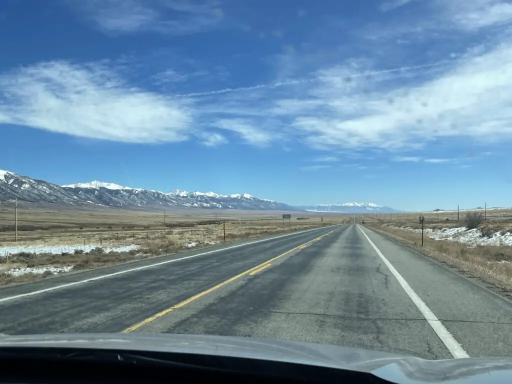
Facebook

Twitter

Instagram

Pinterest