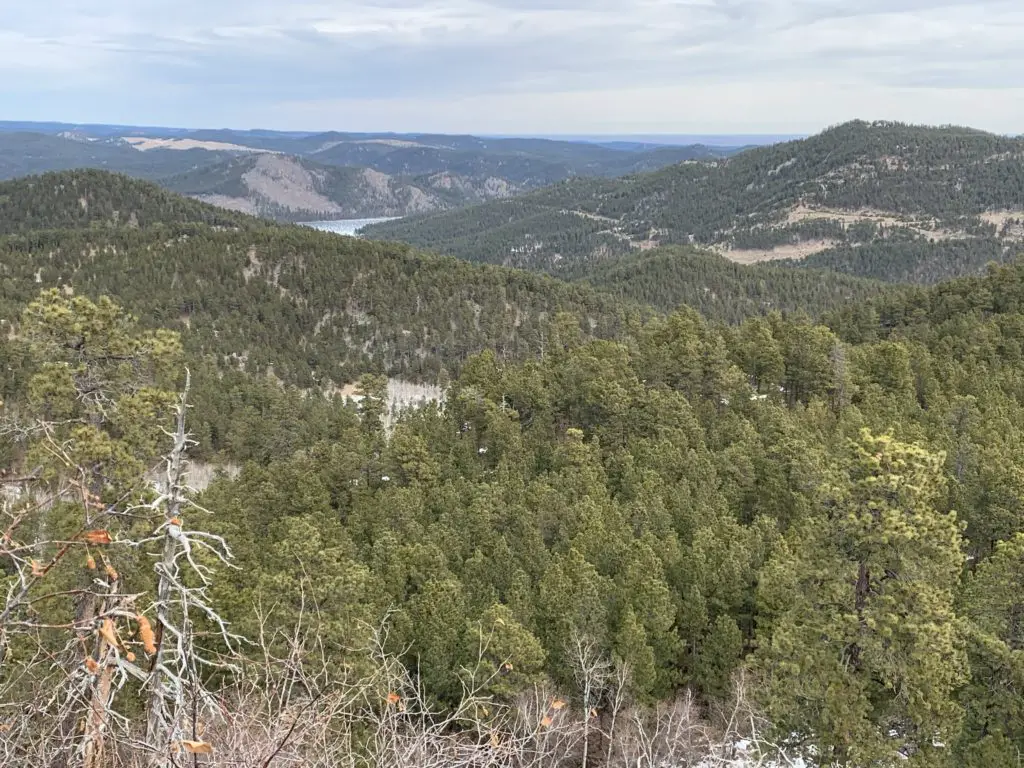
In this post, I review a trail loop we made of the Dakota Point, Flume and Centennial Trails in the central Black Hills.
For another great, Black Hills hike check out a loop that can be made of the Dakota Point, Centennial, and Flume trails near Spring Creek and Sheridan Lake.
It’s funny because we’ve done each of these hikes several times in the past, we just haven’t ever combined them (mostly because water levels on the creek were high or footbridges were out).
The entire loop is between three to four miles in total length.
Where is the Dakota Point Trailhead?
We started and ended our loop at the Dakota Point Trailhead which is located off of Sheridan Lake Road. Dakota Point Road branches off of Sheridan Lake Road and gives access to both the trail and the lake. You will find it about 13 miles west of the Sheridan Lake Road/Catron Boulevard intersection on the southwest side of Rapid City.
This is another, somewhat obscure trailhead found off Sheridan Lake Road, but at least this one has a sign! At certain times, it could be difficult to reach (especially with a regular passenger car) due to mud or snow, as the road to it is not usually plowed (though it is heavily used throughout the year).
What is the Centennial/Dakota Point Loop Hike like?
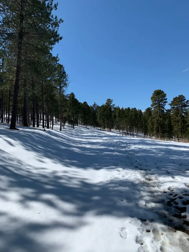
The first portion of this trail is fairly easy. You will follow a rolling route up and down some shorter hills. The majority of it follows old forest roads that are wide, and fairly well-graded. In a few spots the trek reverts back to more of a regular trail, but even these are fairly easy to navigate.
You should be aware, while you can navigate this loop from either direction, both arms basically wander down the side of the hill towards the creek and lake. This means on the return trip, you will be facing a moderately strenuous, uphill climb, regardless of which direction you choose.
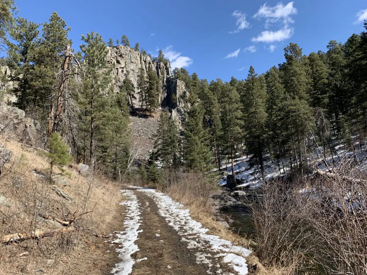
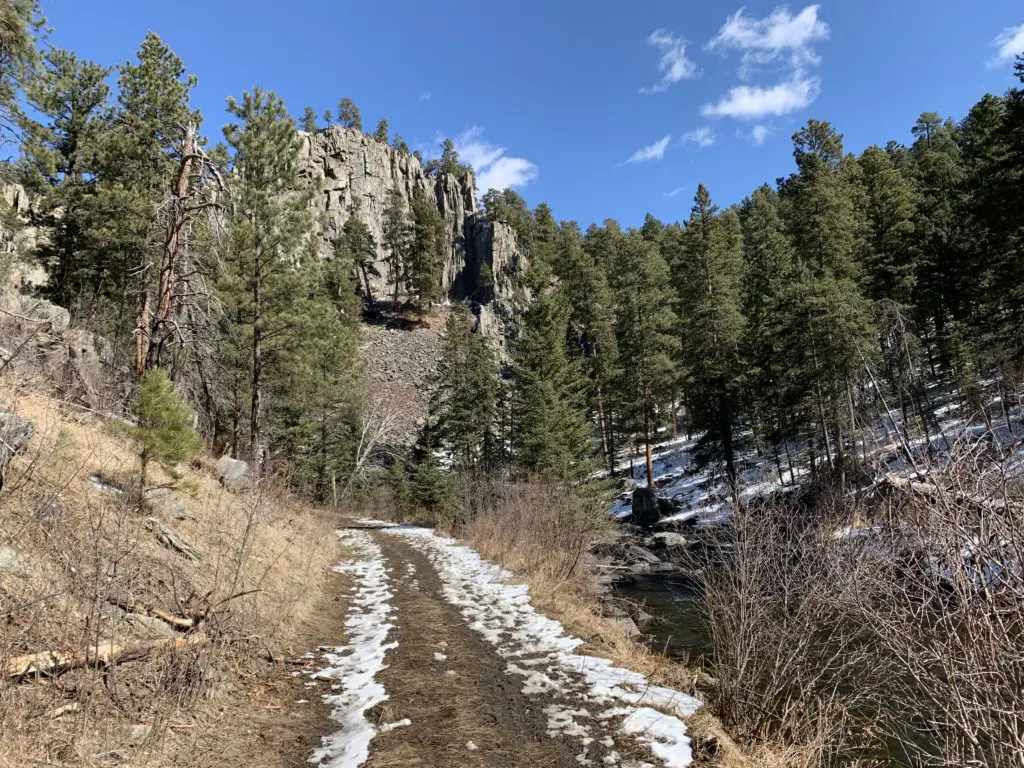
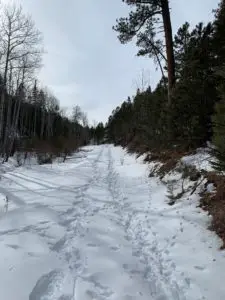
The Dakota Point trail leads you to the dam on Sheridan Lake. This route is very heavily used, especially in the summer. About 1/2 mile into this trail, you’ll come to a fork. If you take the right fork, you’ll continue on the shorter route to Dakota Point. If you take the left fork (which we did) you’ll join the Centennial Trail that runs almost the entire length of the Black Hills.
The Dakota Point trail with snow on it!
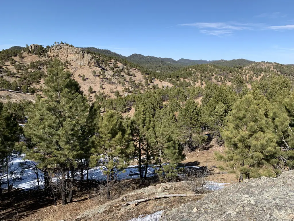
You’ll follow the Centennial Trail for about a mile, traipsing downhill the majority of the time–sometimes steeply–until you join up with the Flume Trail coming from the Spring Creek Trailhead. If you turn left, you’ll go to the Spring Creek Trailhead, if you turn right, you’ll eventually end up at the Sheridan Lake dam.
There are a number of other trails that break off from the dam that join the Flume Trail, in places, and traverse around Sheridan Lake. There is also a loop of the Flume Trail that you can join. As you can see there are many choices for hiking in this area!
Once you cross the Sheridan Lake dam, you will climb the lovely, stone steps, to a picturesque view of the backside of the lake. You can then continue back to the Dakota Point Trail and make the long climb back to the trailhead.
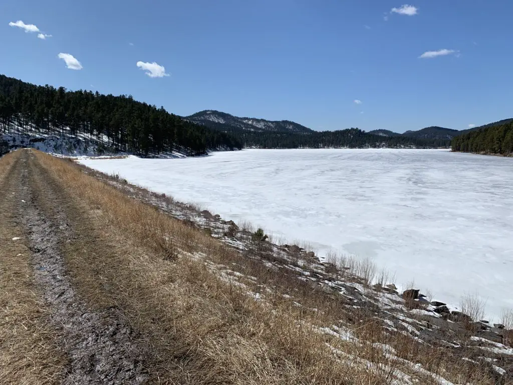
A frozen Sheridan Lake
Footbridges on the Flume Trail, Black Hills
Once you reach the Flume Trail, be prepared for multiple creek crossings. There are usually footbridges that allow you to cross with little effort but be warned, they can be a bit intimidating. They are literally, basically just wide railroad ties that span the creek.
Part of the Flume Trail
There are no handrails on the bridges. You aren’t that high above the water (though it would probably still hurt to fall) but this can cause an intimidating trip across the bridge if you’re afraid of heights. Also, if more than one person is on the bridge at a time, they tend to bounce a little which is even more unnerving.
Often you can cross the creek on foot (unless the water is overly high) but this can be a COLD trip when the weather is cool. Also, every few years, these footbridges tend to wash out when the creek floods. 😝
To Conclude
This is a great trail loop! It isn’t overly long though it is moderately-strenuous. This would be a perfect option for a family hike and it is located close to town so it’s easy to reach. Why not check it out the next time you’re looking for a weekend hike in the Black Hills?
Have you tried any of these trails or done the entire loop? What was your experience? Tell me about it in the comments!
Did you enjoy this post? Pin it!
Like what you read here today? Please feel free to leave a comment, like or share this post! Add your email at the bottom of the page, or the sidebar to the right, to be notified when a new post is published. By signing up for the email list, you will also receive a free copy of the Tranquil Trekker’s Top 10 Tips of Trekking Do’s and Don’ts!
You can also follow the blog on social media by clicking the links below!
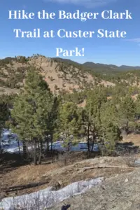
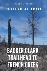
In this post, I review the Badger Clark Trail, which connects with the Barnes Canyon Trail and the French Creek Horse Camp, in Custer State Park, in the central Black Hills.
Looking for a fun, beautiful location to hike that offers both an easier, family-friendly trail as well as a more challenging option? Check out a portion of the Centennial Trailthat runs between the Badger Clark Trailhead and French Creek within Custer State Park!
This post is going to be a little unique as there are two options when hiking this trail.
Option 1: Badger Clark to Barnes Canyon Trail
This is the easiest and most family-friendly of the two options. It is about two-and-a-half miles in each direction.
Where is the Badger Clark Trailhead?
The trailhead is found off the Badger Clark Road, which is situated very near the junction of Route 16A (the southern route) and Route 87 (the Needles Highway). It is also found just to the east of the Legion Lake Lodge. All of these places are located within the central portion of the very large, Custer State Park, in the central Black Hills of western South Dakota.
The trailhead is found at the parking area for the Badger Hole Historic Site, which was the historical retreat of the poet laureate, Charles Badger Clark Jr., during the mid-1900s. He enjoyed vacationing here throughout his final 30 years of life. During the summer months, the home is open for touring, though in the winter, you can only tour the outside grounds.
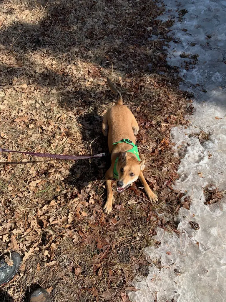
Puppers recommends this trail!
What you will see on the Badger Clark Trail
This is a great trail! It’s got a few lengthy, steep portions, but for the most part, it meanders along through the rolling Black Hills that comprise this portion of the park.
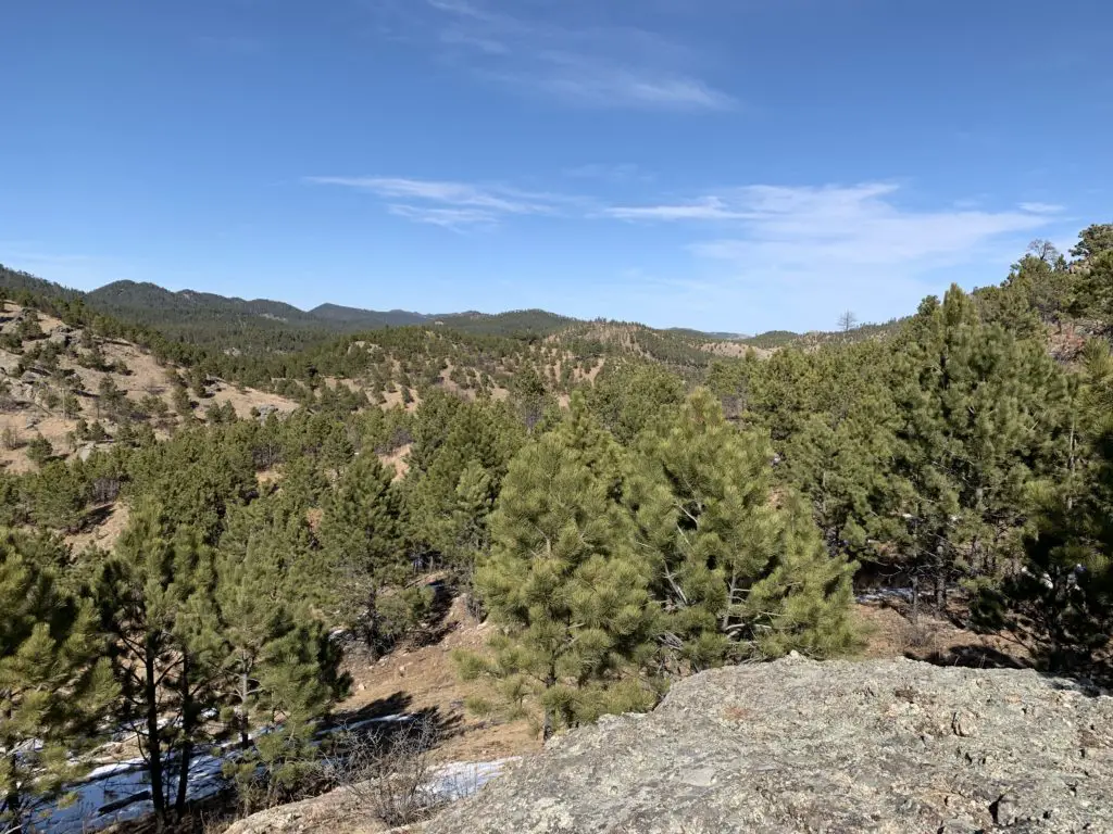
The trail is quite scenic, snaking through forested hillsides and more arid, grassland areas. (This combination of ecosystems is common in this park.) You can also see some of the burn scars leftover from the terrible, Legion Lake wildfire that roared through this area in 2017. Some of the scenic views you will see from the trail include the grasslands of central South Dakota branching off to the east, and the green, pine-covered Black Hills surrounding you in all the other directions.
A view from the trail!
This trail is not one of the more popular ones in the park, so it is fairly lightly-traveled. This is nice as it is quieter and allows you to more easily enjoy the peace and tranquility found in the park’s inner portions. You also won’t miss anything by taking this lesser-traveled trail as you’ll see much of the same scenery that is available throughout much of the rest of the park.
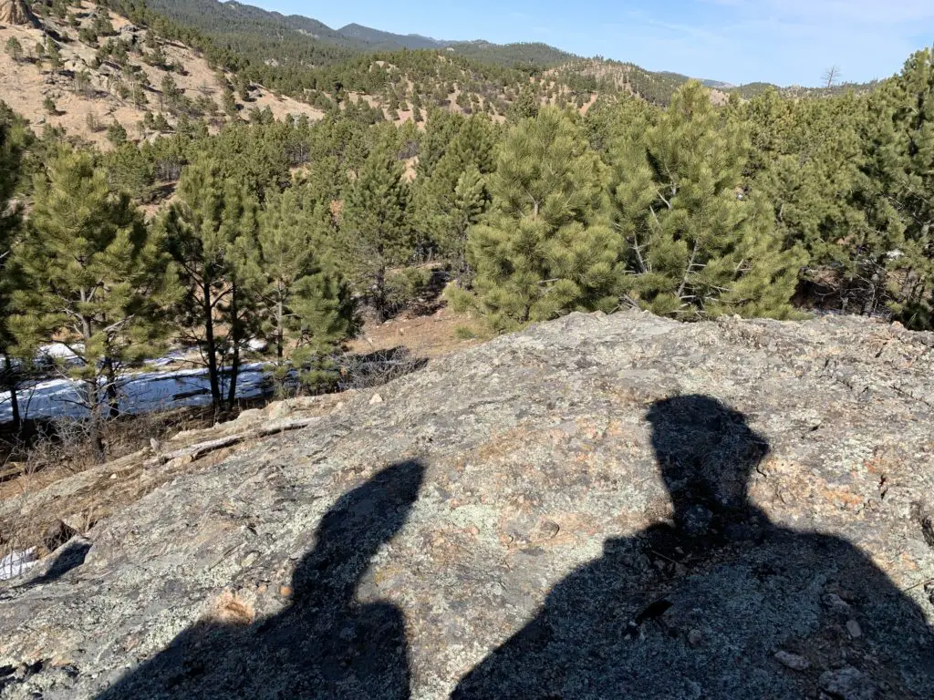
Trekker shadows!
At its terminus, this trail ends at the Barnes Canyon Trail, another great, family-friendly option!
Option 2: Badger Clark Trailhead to French Creek
This is the more difficult of the two options. It is around four miles in each direction. I would NOT recommend this hike in the winter unless you have some serious traction devices, such as YakTrax. (These come in various options which you can check out below.) Several of the steeper slopes are in more shaded areas and/or on slopes that aren’t likely to see much sun in the colder months. Expect these areas to remain icy long after much of the rest of the trail has dried out.
YakTrax options: (†As an Amazon Associate I earn from qualifying purchases.)
This is one of the most difficult sections of the Centennial Trail that the Trekkers have hiked to date. It is VERY pretty but in a few sections, it’s the steepest terrain that we’ve seen on this trail. Be watchful, many of these areas are made slick with loose rocks, gravel, and pine cones that like to stymie your step!
You will see clumps of deciduous trees (mostly along waterways) mixed in with the majority Ponderosa Pines that cling to the hillsides.
This route runs to the French Creek Trail and a VERY nice horse camp located off of North Lame Johnny Road (the Centennial Trail continues to the south from here). There are a few water crossings over French Creek on this portion of the trail, and there are no bridges. Depending on the time of year, this could be problematic. (This is one of the few, local creeks that usually has water in it–depending on what portion of it you cross. We had to rock-skip when we did this route in late November–and that was in a drought year).
Normally, I would STRONGLY advise against crossing creeks during colder times of the year, it’s too risky that you can get wet and cold. But, this particular day we were only planning for a short hike of a mile or two so we knew we’d never be far from the car. It was also almost 70 degrees so it was VERY warm.
Watch signage carefully on this trail. We missed the turnoff for the Centennial Trail once as the sign marking it had been knocked over by a buffalo, scratching an itch 😮–oddly, this is a common occurrence in this park. 😝 So, we ended up on a horse trail, instead.
This is about the point where we lost the Centennial Trail…
Where is the French Creek Trailhead?
This portion of the trail can be hiked from either direction. If you wish to start at the French Creek Trailhead, you can find it at the far end of the French Creek Horse Camp (just follow the main road through the campground till it ends.) There is a sign regarding hiking the Centennial Trail.
To reach the campground take the dirt road marked Route 4 from the Blue Bell Lodge area of Custer State Park (near the corrals used for horseback riding). There are signs pointing towards the horse camp. Note: Use caution on this route in the winter. It is not heavily traveled and it may not be maintained. The Blue Bell Lodge is located on Route 87 on the western side of the park.
This is a great way to see Custer State Park! On your next visit there, be sure to check it out! It will give you easy access to the inner, very scenic portions of the park that not everyone sees!
Have you ever hiked either of these trails? What did you think? Tell me about your experience in the comments!
Did you enjoy this post? Pin it!
Like what you read here today? Please feel free to leave a comment, like or share this post! Add your email at the bottom of the page, or the sidebar to the right, to be notified when a new post is published. By signing up for the email list, you will also receive a free copy of the Tranquil Trekker’s Top 10 Tips of Trekking Do’s and Don’ts!
You can also follow the blog on social media by clicking the links below!
In this post, I discuss how my SAD symptoms decrease with the time change.
It’s that time of year again! We push our clocks forward one hour this weekend (in the US at least)! I know people hate the time change and I know many people have good reasons for feeling that way. (It has even been proven to mess up your sleep.) I actually love time change day (in the spring)! It is the day my SAD (Seasonal Affective Disorder)dies ya’ll!
For those of us in the Northern Plains, the time change really does make the best use of our daylight hours that fluctuate wildly throughout the year. If we stayed on Standard Time all year, it would start getting light at 3:30 am in the summer (no joke). Whereas if we stayed on Daylight Time all year, it wouldn’t get light till after 8 am in the winter. I’m not ok with either of these options.😝 So, I will firmly remain #teamtimechange.
Winter passed quickly
I am always amazed at how quickly the dark winter actually flies by. It always goes more quickly than I think (worry) it will. I’ve been VERY fortunate that my SAD has been super mild for the past few years. I’ve hardly been noticing it at all! It may be a fortunate side effect of my taking high doses of Vitamin D3 for the last several years. It helps that we’ve had fairly mild winters in recent years, too.
I am always amazed at how much better I feel once my SAD symptoms start to ebb. It really gives you an appreciation for how strongly they affect your life. You don’t always notice it while you’re experiencing them. You know that everyone seems to be keen to IRRITATE THE HELL OUT OF YOU! (must they swallow so loudly?! 😂) And you can’t help the tears that come when EVERYTHING YOU TRY TO DO FAILS MISERABLY!!! (Why am I the only one whose life is so difficult?! 🙄😉)
I hope it’s obvious that I’m being sarcastic with these statements. In all seriousness though, I find it amazing how my SAD symptoms cast a shadow on every other aspect of my life. Even though I personally experience it, it’s hard to believe it can cloud your judgment so much on whatever thing you’re dealing with at any given moment. Every problem seems 10x worse when SAD is already weighing you down. Any other stressor you feel is amplified.
As someone who struggles with anxiety throughout the year, the SAD worsens those symptoms, as well. I am a master champion at catastrophizing future events that I’m worried about on a good day. When I’m dealing with SAD, as well, that ability becomes a superpower. 🙄😝
Every fall I swear, I’m not going to let SAD affect me as much this year. I know what’s coming, I know how to deal with it, I know it WILL END, I just have to get through it…and then every spring I’m back to, “Wow! Was all that extra angst I was feeling JUST from my SAD?” Maybe someday I will learn. 😐
Our brains are powerful tools, and they can allow our imaginations to run away with themselves if we permit them. While its important to always be patient and understanding with ourselves, it’s also important to try to reign in the negative thoughts, especially when we can speak the name of the demon they come from (“SAD”). By doing so we can help to lessen its control over us. Fortunately, we CAN control that demon, and it’s time to take our power back!
Do you find the time change affects your mood? Tell me about it in the comments!
Did you enjoy this post? Pin it!
Like what you read here today? Please feel free to leave a comment, like or share this post! Add your email at the bottom of the page, or the sidebar to the right, to be notified when a new post is published. By signing up for the email list, you will also receive a free copy of the Tranquil Trekker’s Top 10 Tips of Trekking Do’s and Don’ts!
You can also follow the blog on social media by clicking the links below!
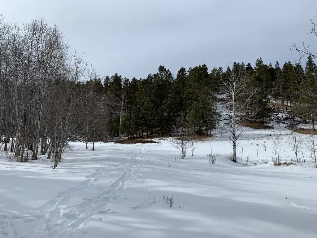
In this post, I review the Deerfield Trail (Trail #40) that traverses a portion of the central Black Hills.
At 23 total miles long, the Deerfield Trail (Trail #40) can be accessed from several trailheads throughout the Black Hills. It begins at Deerfield Reservoir (there’s a spur trail that actually circumvents the entire lake), crosses the Mickelson Trail at about the halfway point, and eventually, spans all the way to the Centennial Trail near Pactola Reservoir.
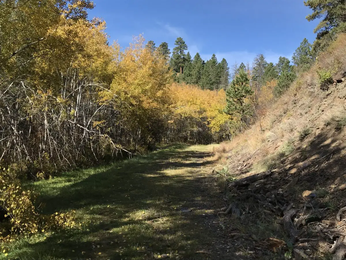
The Deerfield Trail is adorable! It traverses canyons, meadows, valleys, and ridges. Sites that housed old mining camps (and some that are still operating) and the occasional remnants of an abandoned homestead dot its course. This includes one squatter’s paradise that was built directly into the rock! Tailings from old mining sites, remnants of ramshackle cabins, and numerous stream crossings–often with charming, simple, log bridges–are scattered throughout the trail’s length.
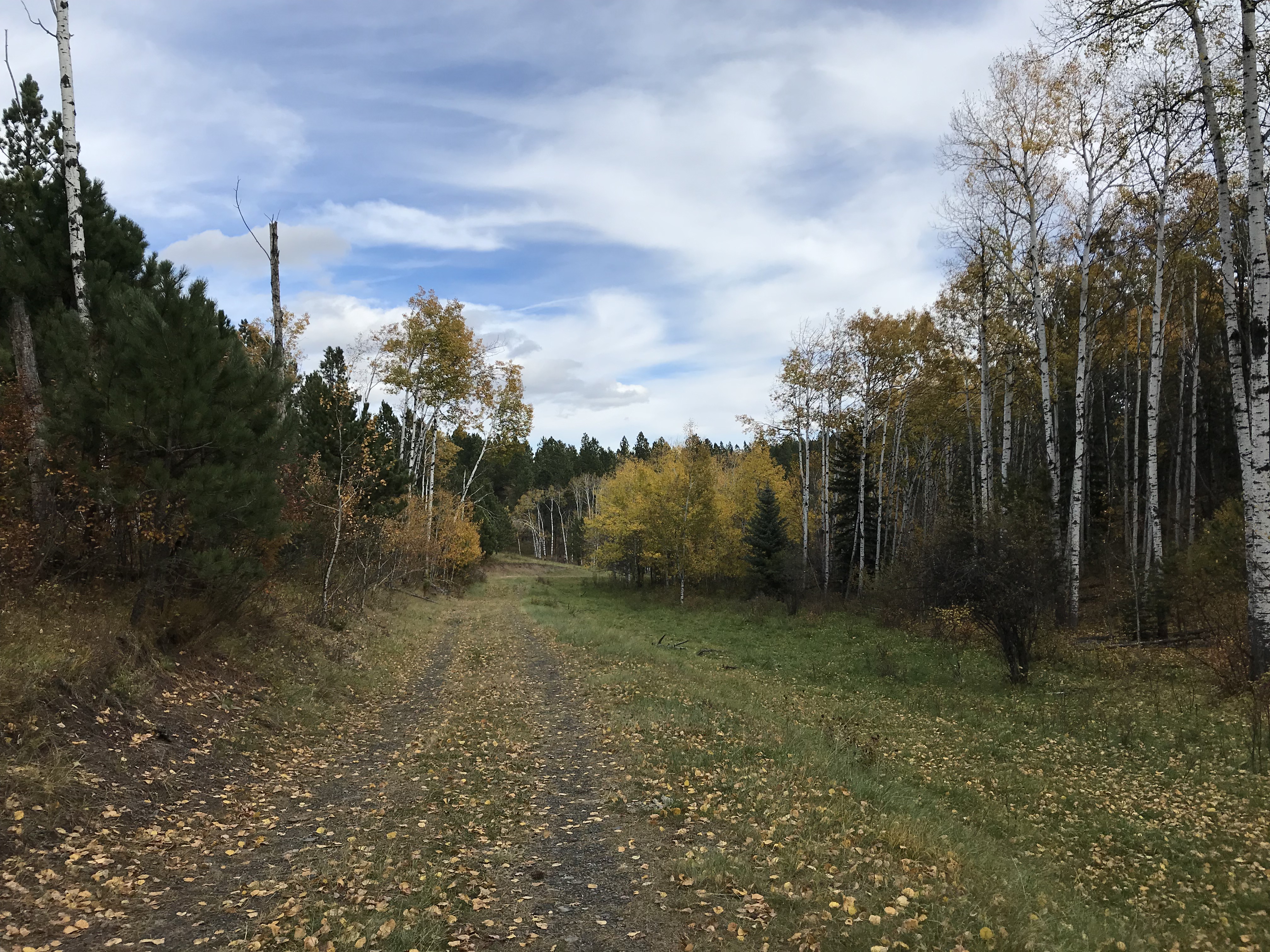
This is one of the forest roads the trail traverses. It was such an iconic site I kept half-expecting to see a horse and cart saunter by! 😂I LOVE the golden leaves contrasted against the still-green grass and the various brown hues of the log and dirt…
Things to See on the Deerfield Trail
The Deerfield Trail runs through several canyons that are similar to those found on Rimrock Trail, that traverses the rim of Spearfish Canyon and others that you see on the Little Elk Creek Trail, near Sturgis. The canyons are especially gorgeous in fall as the never-ending green of the spruces, that blanket the canyon walls, contrasts with the yellow and orange of the aspens and red of the plants that frame the creek.
Several sections of this trail run along ridges that are reminiscent of those found in the Eagle Cliffand Big Hill areas in the Northern Hills.
This is another trail system that crosses multiple ecosystems, similar to the trails that traverse the rim of Spearfish Canyon. The canyon sections are lush and green, while the ridge sections are comprised more of a drier, arid prairie.
Treks on the Deerfield Trail can even include a variety of weather depending on which side of the mountain you find yourself. You may start off your hike in sunny, blue skies, veiled with wisps of cirrus clouds. By the time you reach the ridgeline, a cold breeze can be blowing darker, heavier clouds in. Then, after a quick lunch, you can retrace your steps to the other side of the hill and return to a warmer, sunlit forest.
Things To Do on the Deerfield Trail
The Deerfield Trail is open year-round, for various activities, including horseback riding, hiking, mountain biking, and snowshoeing/cross-country skiing, depending on the time of year.
Large portions of the route follow old logging and forest roads that are wide and well-graded, so travel is often smooth. (Some of these are still in use so keep your ears and eyes open as you may have company on the trail).
While the entire route could be completed in one attempt with an overnight trip–or a VERY long day trip (if you had a car at each end)–it is usually conquered in sections (as the Trekkers are attempting). It should also be noted that some of the trailheads may be difficult–or impossible–to reach in the snowy months (at least with a typical, road-worthy vehicle).
The elevation for this trail is moderate compared to many of the other, longer ones in the Black Hills. While some sections will get your heart pumping, many consist of scenic, tranquil afternoon hikes in the woods.
One of the best features of this hike, for me, is its solitude. Some portions are more heavily traveled than others–namely the canyon sections–but often you’ll find you have the trail to yourself (especially in the colder months). It’s not unusual for the only evidence of others having used the route to be the deer, elk, coyote, and often, mountain lion tracks–usually following the deer tracks! 😳–that remain in the mud or snow. Don’t be surprised if you see the flags of some white-tail deer tails flying high as they dash out of your way as you traverse the trail!
Elk print!
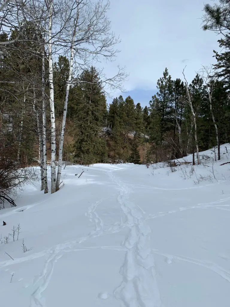
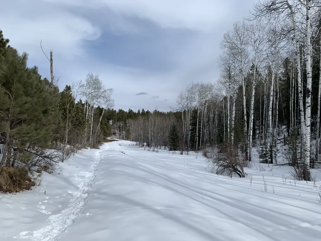
Below is a picture from the same area on the trail, but at different seasons (fall and winter).
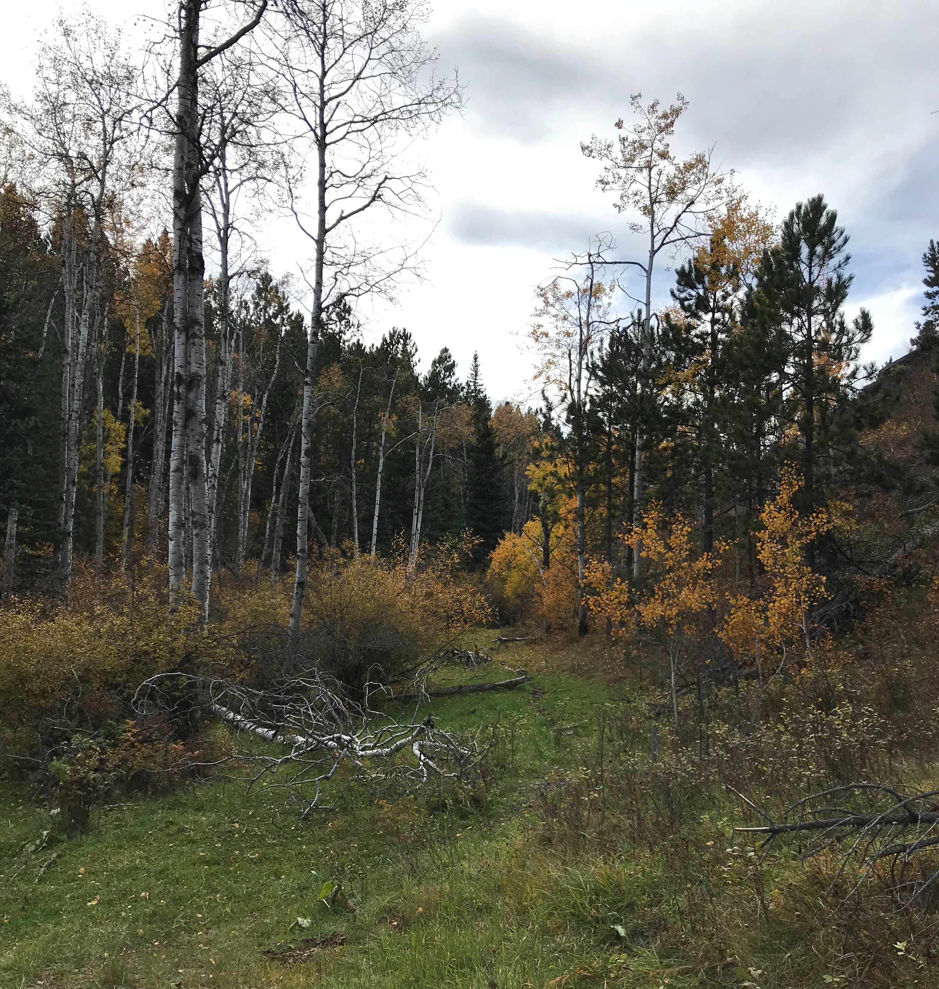
A few more pictures from this scenic trail!
If you’re looking for a peaceful, casual hike through some beautiful countryside, consider giving the Deerfield Trail a try!
Have you hiked portions of this trail? What were your favorite parts? Tell me about them in the comments!
Did you enjoy this post? Pin it!
Like what you read here today? Please feel free to leave a comment, like or share this post! Add your email at the bottom of the page, or the sidebar to the right, to be notified when a new post is published. By signing up for the email list, you will also receive a free copy of the Tranquil Trekker’s Top 10 Tips of Trekking Do’s and Don’ts!
You can also follow the blog on social media by clicking the links below!
Mr. Trekker and I are pretty good about not being glued to our phones. We have a standing rule at our house that there are no phones at the dinner table (with the exception of emergencies/family situations or, sometimes, when making travel plans on the run).
We’ve actually had strangers comment to us (in a good way) how unusual it is to see two people sitting together at a restaurant just talking to each other, with neither of us being on our phones. They always seem so impressed. I hope, by this small act, I can inspire other people to use their smartphones purposefully, as well.
My Week Without a Smartphone
A while back, I lost the use of my phone for almost a week. 😮 I was reminded of what life was like before we all had computers at our fingertips at all times. 🙄
It was due to this weird situation where Verizon pushed an update through and that basically “broke” my cellular ability. So I could use apps when I was connected to a WiFi network, but that was it. I couldn’t make any phone calls AT ALL (which is ironic since wasn’t that the whole point of having phones to begin with?!) After troubleshooting several things I decided that my phone was shot.
Fortunately, I have a warranty so I was able to get a free replacement from Apple. It was the same, old model I already had, and it had a crappy camera that took pictures with pink backgrounds 🙄 but at least it worked. I didn’t want to spend the money on a whole new phone at the time (we had literally just bought one for Mr. Trekker a few weeks before) so this was a good enough replacement.
On a personal note, my local Verizon store was FAR more helpful in dealing with this issue than Apple was over the phone. (The nearest Apple store is almost 400 miles away, in Denver). I’ve had good luck with Apple customer service in the past, but the Verizon store won this round! Apple seemed somewhat confused as to what exactly was wrong with the phone. Even though they told me not to bother with the local store because “the carriers don’t deal with this issue” Verizon was able to understand my problem and diagnose it almost immediately. This potentially saved me $100’s in replacement costs!
Remember the days before Smartphones?
It was weird to be thrown back to a life without a smartphone. I appreciated the break from the constant temptation to check social media or email while doing mundane things like standing in line at the store.
I did feel very isolated though, and cut off from the world. I could contact people via Facebook Messenger if I had a WiFi signal, but I couldn’t text. We haven’t had a landline phone in over a decade so, even at home, I realized I had no way to make a call to 911 if it was needed (fortunately it wasn’t). It was humbling and frustrating.
Part of me would love to throw all this tech garbage away and just go back to an old-fashioned “dumb” phone. I used to love my old flip phones, where I could send a quick text message or write a simple note to myself. I could even take the occasional picture (if it was REALLY important because they were EXPENSIVE!)
I could *gasp!* call someone (or have them call me) if we needed to get in touch. I really miss those simple days, they feel so 2006-ish! (Yeah, I didn’t get a cell phone of any kind until after I graduated college in 2005, told ya I was old-school! 😉)
How to Use a Smartphone Mindfully
Smartphones do have their benefits. They’re pretty handy when I’m away from my computer and need to make an update to my blog or handle other work-related business. A portion of my livelihood is made via the internet so having access to my blog, social media, and email (let alone old-school phone calls) from almost anywhere means I can be far more productive with my freelance work (and it gives me far more freedom to be away from home–the office).
I read the book Digital Minimalism, by Cal Newport, recently as research for another project I’m working on. It was a very interesting read! I’d recommend this for anyone who feels technology has too much control over their life.
In the book, he stresses using technology, such as phones and social media, as minimally as possible to pursue more fulfilling things in life. I don’t feel like I struggle as much as many of the people he discusses in the book, so I didn’t feel the need to implement all of his strategies. However, the book did help me to structure my free time better and prioritize things I really care about.
I pride myself on not being a technophile, but this book really brought home to me the importance of using technology as a tool rather than as a device for entertainment. (It made me think we should view it almost like a pen or a drill, that is needed solely to complete a task.)
As an example, rather than scrolling through my Twitter or Facebook feed, I strive to only check a few, individual people who I follow. This helps me stay up-to-date with family and friends who live far away. I also check a few, specific, news sites so that I remain in-the-know on current events.
There are also a few, individual groups that I am a part of that help me to achieve my blogging and writing goals (I rank these under Professional Development). That’s it. If I’m not using my phone or social media for those purposes, I try not to use it at all.
There are always other free-time options to pursue. I’ve got a stack of books I’m working my way through, I’m also still enjoying the Star Wars, adult coloring bookMr. Trekker got me for Christmas several years ago, and I’ve got other projects to keep me busy.
Our lives are hectic enough! I challenge you to look for ways to reduce your smartphone use. Maybe instead you could interact with some flesh-and-blood humans 😉; take a walk, read a book, or go throw a baseball with your kiddo (or a tennis ball for your pup!) Let’s try to be more mindful and purposeful when using our smartphones!
What do you think? Have you seen any benefit from being more mindful with the use of your phone? Let me know in the comments!
Did you enjoy this post? Pin it!
Like what you read here today? Please feel free to leave a comment, like or share this post! Add your email at the bottom of the page, or the sidebar to the right, to be notified when a new post is published. By signing up for the email list, you will also receive a free copy of the Tranquil Trekker’s Top 10 Tips of Trekking Do’s and Don’ts!
You can also follow the blog on social media by clicking the links below!
In this post, I review the hike on the Centennial Trail from the Samelius Trailhead, heading north to Sheridan Lake.
One interesting hike that is part of the Black Hills Centennial Trail runs from the Samelius Trailhead heading north, toward Sheridan Lake.
This entire section is around seven miles in total length, one-way, we only did about half of that. We have plans to complete the other half, from Sheridan Lake heading southward, at another time.
Hiking North from the Samelius Trailhead
The Centennial Trail runs in two directions from this trailhead, northbound towards Sheridan Lake and south, to the vicinity of Mount Rushmore and Horsethief Lake. These are both decent hikes. We’ve only completed a small portion of the southbound route, so I’ll leave that review for another day.
I would give the hike north on the Samelius Trailhead a moderate rating. The first mile or so it follows an old, forest road so the path is wide, though it’s a fairly steep, uphill climb. From there it ventures back into the woods on a one-track trail. Portions of it are quite rugged as they traverse the rocky landscape that is common in the Black Hills.
This route won’t take you to the summits of any of the major, nearby mountains on its own. There are several in the local area that you can climb to though, if you’re daring enough to trek off-trail. Mt. Samelius is one of these.
This section of the Centennial Trail isn’t quite as scenic as some other parts of the route. It’s a nice hike, you can occasionally catch glimpses of various portions of the Black Hills, and the prairies that stretch beyond them, through the trees. However, for the most part, it is just a rambling, rolling hike through the Black Hills National Forest–albeit a very pleasant one!
After the initial ascent on the forest road, the path levels out into more moderate ups and downs as you traverse the nearby Hills. The path can be challenging, so you need to watch your step (as I found out when I made a misstep on a small rock….)
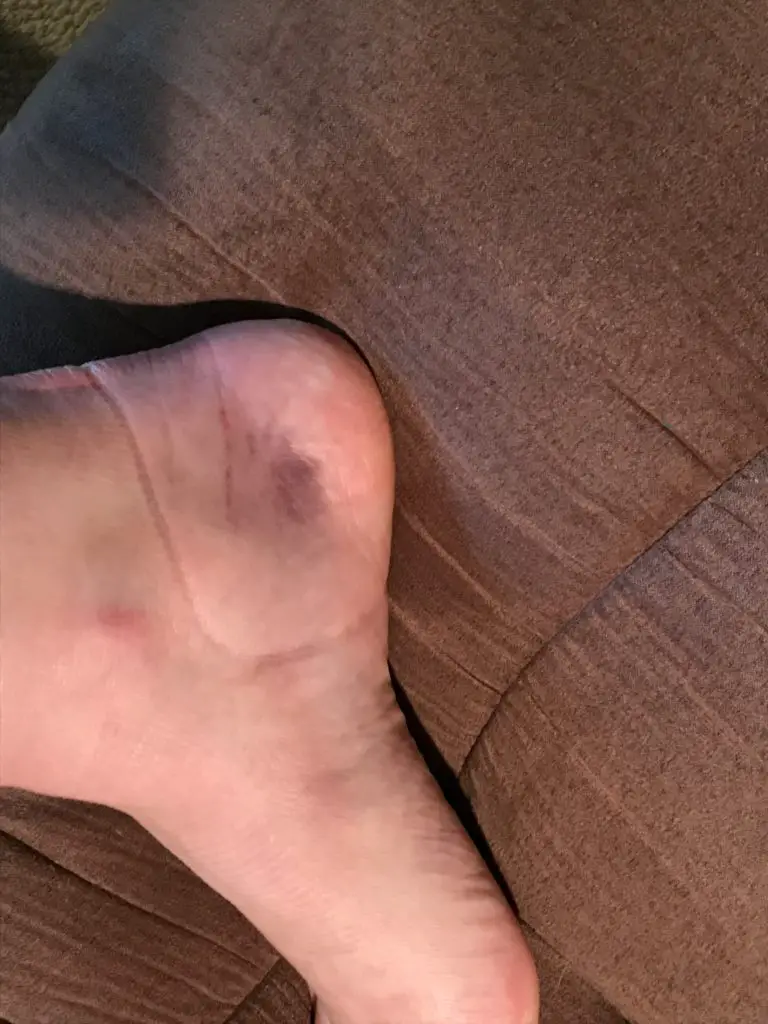
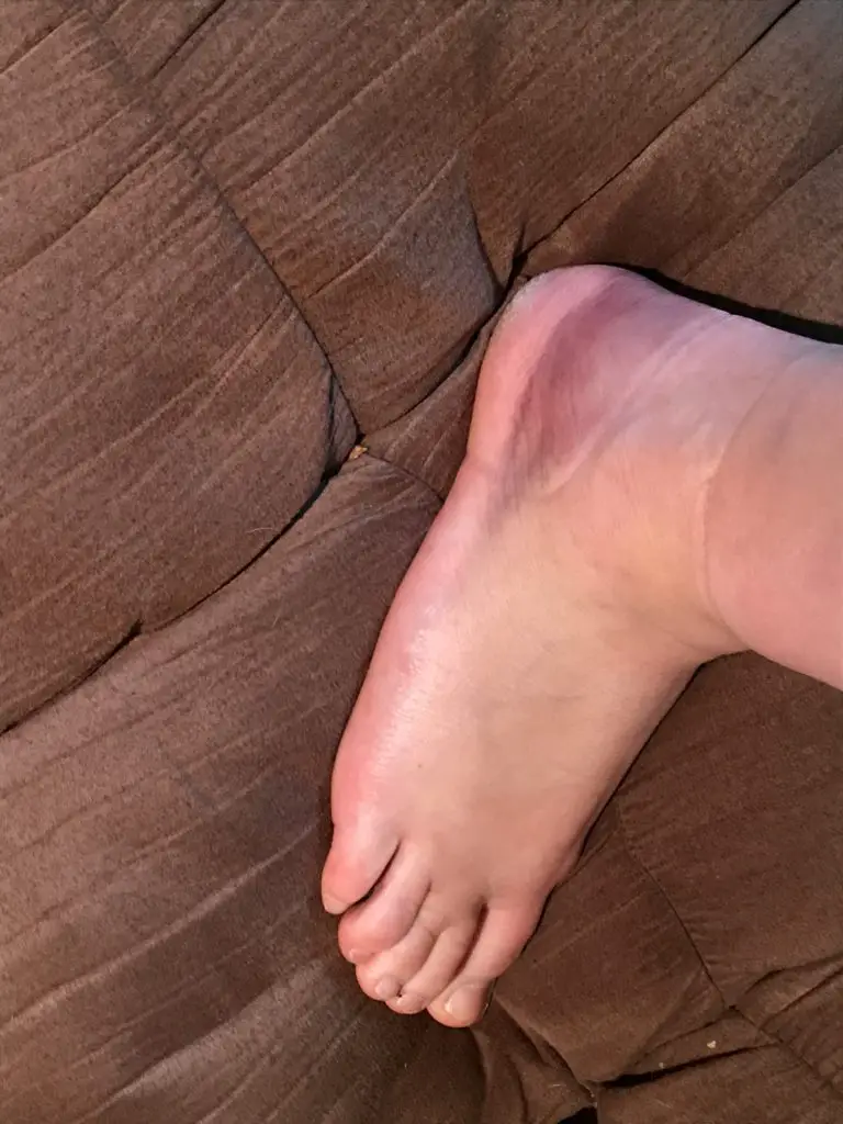
I should have named myself the Clumsy Trekker. 🙄 I rolled my ankle the worst I ever have less than a mile into the hike. At first, it didn’t seem that bad. It really didn’t hurt and there wasn’t any real evidence of bruising or swelling, so I decided to continue on. After we stopped for lunch at our turnaround point is when the stiffness and pain really settled in and I realized I may have pushed on too far. (Of course, we were also several miles from the truck at that point. 😝 ) Fortunately, Mr. Trekker fashioned a perfect hiking pole, for me, out of a downed tree branch we found nearby. It made the trip back far more bearable for my ankle.
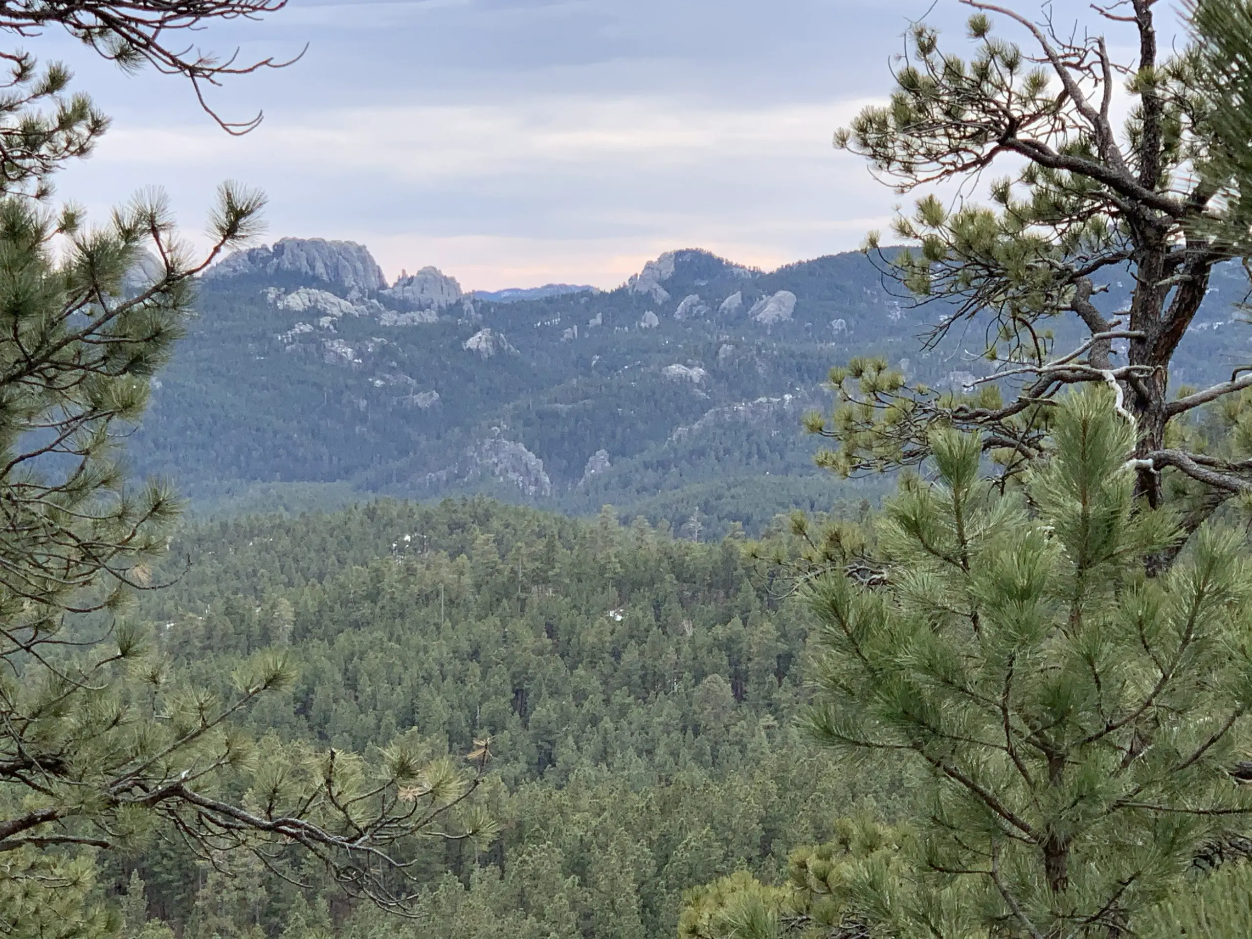
We were able to catch a few shots of Black Elk Peak (formerly Harney Peak) and the Cathedral Spires from the trail. Where we stopped for lunch we were also treated to a great view of a portion of the–then frozen–Sheridan Lake.
If you look closely in the background, you can see a portion of the frozen, Sheridan Lake.
The steepest part of the trail we encountered was near its middle. We hiked to the top of an unnamed peak and enjoyed a windy snack while peering out over the Hills. In addition to catching a glimpse of Sheridan Lake, we also spotted the prairies that extend east of the Hills.
Don’t Hike Alone and Always Bring Extra Gear
My ankle injury is another good example of why I stress that it isn’t safe to hike alone. This isn’t always a popular opinion but I stand behind it. It is always astounding to me how quickly accidents can happen on the trail, and how silly things can cause them. 😔
I didn’t fall (this time) or slip on ice, I can’t even blame the dog for pulling on me too much. We were just walking down a dry section of trail that was relatively flat. It happened to be a bit rocky and I stepped on one of the rocks protruding from the ground wrong, which turned my ankle. Unfortunately, my momentum was already carrying me forward so I proceeded to–heavily–put my full weight on that ankle, and felt a *pop!* (not to mention numbing shocks running from my ankle bone up my shin and down my foot). 😝
Some may argue that my decision to continue hiking was unwise, and they may have a point. The Trekkers have had some First Aid training so we implemented what we learned. The pain subsided fairly quickly, I had full range of motion with my foot and I could put my full weight on it. This suggested I wasn’t hurt too badly and this wasn’t the first time I’ve sustained an injury like this on the trail. (I have a tendency to underpronate when I walk so this happens easily and regularly to me.)
We examined the ankle and it showed no signs of visible swelling or bruising. Since it wasn’t really a struggle to continue hiking I decided to press onward. Some of this was also pure stubbornness. We’ve attempted this trail several times before and have never gotten very far as it always seems to start thundering. We knew that wasn’t going to be an issue today and I really wanted to continue on and keep enjoying the warm weather, so I chose to plod on.
The final result of my injury 😝
As we slowly made our way back to the car, I couldn’t help thinking how things would have been different if it had been just me on the trail. I probably could have gotten back on my own, we weren’t that far out and I wasn’t hurting that badly. However, if it had been just me and the (barely) one-year-old, rambunctious pup…
I did ok navigating the route on my own with a walking stick, but if I had needed to be tethered to an energetic pup in addition, that feat would have been far more difficult (especially if the injury had occurred farther along on the trail where the terrain became more strenuous). So I’ll say it again folks, DON’T VENTURE INTO THE WILD ALONE(and no, your incredibly adorable four-legged companion does NOT count as a hiking partner). 😐
This incident also further demonstrated to me why it’s important to ALWAYS bring extra gear. I almost didn’t bring a warm coat that day, just to save weight and space. Even though it was February 1st the forecast was calling for near 70-degree temperatures (not that unusual to have these warm days occasionally in the Black Hills in the winter!) and I knew this hike wasn’t exceptionally difficult. I did end up–wisely–including my winter “puffy” coat at the last minute, as it’s super light and packs well. I just couldn’t bare the thought of not bringing it along in the middle of winter, just in case.
As it turned out, I didn’t end up using the coat. HOWEVER, if my injury had been worse to the point where I had needed to wait for rescue, I easily could have become chilled and potentially even hypothermic if I hadn’t had a warm coat with me (I was sweaty and it was a breezy day).
Accidents can happen on the trail in a split second folks, and it doesn’t have to be in wet, slippery, cold, or even difficult conditions. A fun walk through the woods on a warm day can become a rescue scenario in a matter of seconds. Please, learn from my experience, and ALWAYS BE PREPARED!!!
To Conclude
Don’t worry, it only took about a week for me to recover from my injury. This is good because I’m TERRIBLE at sitting around and resting. 😉
If you’re looking for a little tougher hike and you want to explore a lesser-known trail in the Black Hills, check out the Samelius Trailhead and have your pick of two portions of the Centennial Trail.
Have you ever hurt yourself while out hiking? Did you learn anything from the experience? If so, let me know in the comments!
If you enjoyed this post, feel free to Pin it!
Like what you read here today? Please feel free to leave a comment, like or share this post! Add your email at the bottom of the page, or the sidebar to the right, to be notified when a new post is published. By signing up for the email list, you will also receive a free copy of the Tranquil Trekker’s Top 10 Tips of Trekking Do’s and Don’ts!
You can also follow the blog on social media by clicking the links below!
In this post, I review several “secret” hiking trails that are found off of Sheridan Lake Road, not far from Rapid City.
If you regularly drive along Sheridan Lake Road, west of Rapid City you may have noticed what look like several random parking areas. You would be right! These are the starting points for several “secret” hiking trails. (They aren’t really a “secret”, they just aren’t as well-known as other local trails).
It is a bit harder to describe how to reach these, as they don’t have signed trailheads (though they do sit right near the road and their parking lots are obvious). I will do my best to give accurate descriptions. All of these routes can be used by hikers, bikers, or horses, and are appropriate for winter sports.
“The Stratobowl, the Quiet Side”
The parking lot for this trail is found just south of the Victoria Lake Road/Sheridan Lake Road intersection, where the road makes a sharp turn. It’s really just a dirt turnoff with room for only a few cars. Just past the parking area, there is a gate that blocks the old forest road, but you are permitted to walk through it.
This is an easy hike as it just follows an old, fire road on an out-and-back route. It takes you to the cliffs on the northern rim of the Stratobowl, which I’ve discussed before. Be aware, this route has very little shade. As it is so exposed to the sun, it can be a very hot hike when the weather is warm. Also, we have seen herds of big-horn sheep near the cliffs, so if you hike with dogs off-leash, make sure to watch for them.
In my opinion, of the several routes I will be discussing today, this trail offers the best views of both the Stratobowl area as well as the canyon that Spring Creek flows through.
“The Sheep Place”
We call it this because there is a sign near the trail that labels it as a “Big Horn Sheep Study Habitat” (funnily enough, we have never seen a sheep here 😝).
The Trailhead
This trail is located almost exactly seven miles from the Catron Boulevard /Sheridan Lake Road intersection. The parking area is on your left before you round a curve and see a sign for the Peace Ranch. Right before you reach this parking area you will pass another small, parking lane on the other side of the road. There are trails here, as well, that are mainly used by mountain bikers (though hikers can also use them). They eventually meet up with the Coon Hollow Trail system.
The Hike
This is a great, local trail. We have always enjoyed it as a quick place to take the dog for a walk on a Sunday afternoon or when you just want a quick jaunt on a cold, windy day. It’s also a good place to sneak in a short hike before a summer thunderstorm (we have raced the thunder back from here on several occasions!)
A series of old, fire, and forest roads offer several different out-and-back options in this area. Be warned, there are no real maps that cover these trails and the roads aren’t reliably signed. On one hand, if you pay careful attention, you shouldn’t lose your way. On the other, if you aren’t paying attention, it is easy to get turned around. Also, the area is surrounded by private ranch land, so it is important to stick to the roads and be respectful of any “private property” signs you may see.
Three Options
The first old road that breaks off to your left is the shortest of the routes. It will take you to the edge of a cliff on the northwestern edge of the Stratobowl.
If you continue past that fork, the next road you come to is longer. It will also, eventually, wind you to the edge of the Stratobowl, but the views aren’t as good as those from the first fork as they are obscured by trees. I have heard a rumor that there may be a way to loop these trails together, but if it exists we haven’t found that route yet.
There is another unnamed trail that continues straight after the second road forks to the left. It eventually works its way all the way down to Spring Creek.
You can’t always access this option as there is a gate that is sometimes closed. I’m not actually sure who controls it (if it is private landowners or the Forest Service). Either way though, if the gate is closed, please respect it and don’t use that route.
This trail is the longest of the three options, and the steepest, as it works its way down the cliff face to the creek, far below. We have yet to complete this entire route but it is on our “to-do” list.
I would rate the first two options as “easy” as they stick to the forest roads and have very little elevation gain. The third is more “moderate” because it wanders into the woods and requires more strenuous hiking when ascending and descending the cliff face. The easier routes are more exposed to the sun, so they can be quite warm in the summer.
The above trails are fairly well known, so expect to have some company on your trek.
I hope you’ve enjoyed my reviews of these many routes found near town. If you’d like to read about other trails that are located close to Rapid City, you can click the links below:
Have you enjoyed any of these trails? If so, let me know in the comments!
Like what you read here today? Please feel free to leave a comment, like or share this post! Add your email at the bottom of the page, or the sidebar to the right, to be notified when a new post is published. By signing up for the email list, you will also receive a free copy of the Tranquil Trekker’s Top 10 Tips of Trekking Do’s and Don’ts!
You can also follow the blog on social media by clicking the links below!
In this post, I review another trail found not far from Rapid City, the Boulder Hill trail.
This post is another in my series of local, easy-to-reach hikes that are not far from Rapid City, the Boulder Hill Trail. One thing I like about this route is that it mostly meanders through the forest, so it’s fairly well-protected from the wind, rain, or snow (until you get to the top). This makes it a good choice for times when the weather is less-than-great. It’s also eerily beautiful in the fog.
Where is the trailhead for the Boulder Hill Trail?
You will find the trailhead on Boulder Hill Road, about halfway between Sheridan Lake Road (west of Rapid City) and Highway 16 (south of town.) You can get there from either route.
The road is dirt but it is wide and well-graded, so it is suitable for any passenger car in good conditions.
If the weather is very wet or snowy it could become impassable. Usually though, a four-wheel drive, high-clearance vehicle can be manage it.
There is a sign at the trailhead, but you won’t see it until after you enter the parking lot, as it sits right near the woods. This is the same parking area that is used for the Flume Loop Trail that I discussed in a previous post.
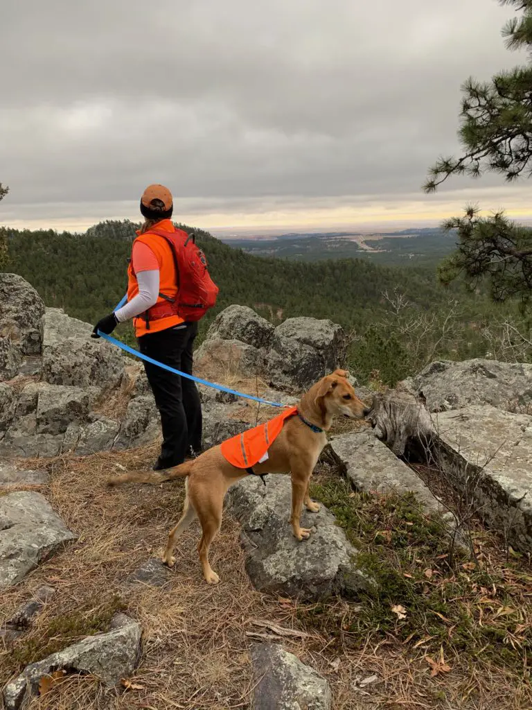
The Pup and I enjoying the trail.
One unique aspect of this hill is that you can actually drive to the summit. There is an old forest road that makes a spur off of Boulder Hill Road. It isn’t marked, so you may miss it if you don’t know where you are going.
We’ve seen passenger cars use the road, but I wouldn’t recommend it. Even during good conditions it is rutted and washed out in places, and it can sport deep mud holes when it’s been wet. We were glad we had Mr. Trekker’s 4WD truck the one time we drove up. It’s not a long route or overly technical, but I find the hike to be far more enjoyable.
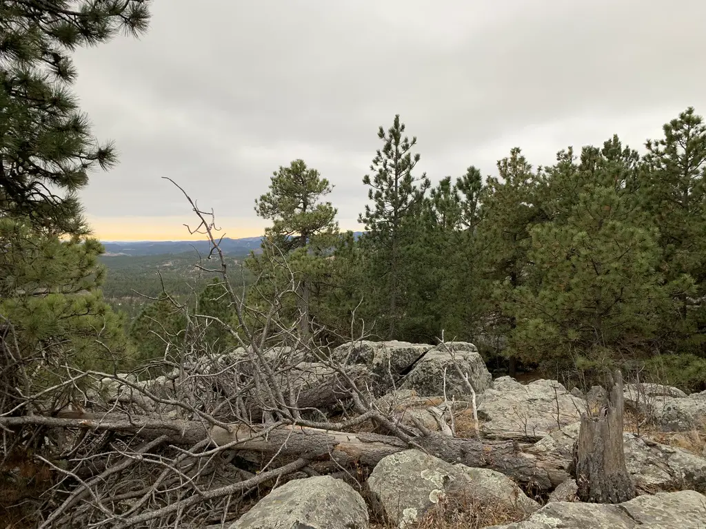
With all the rocks at the summit, you can see how the hill got its name.
The Hike
This hike is a bit more challenging than others in this series. I would rate it as “moderate”. It is not difficult, but it is an uphill climb to the summit of the mountain almost the entire way (at least on the way up 😉). About half-way along, it joins with an old, forest road for a short time. It quickly exits back onto a narrow trail into the woods again, though.
Where it meets the road is also where it joins with the other section of the Flume Trail (the Coon Hollow Trail) that I discussed in this post.
Don’t be surprised if the scolding of squirrels and scurrying chipmunks accompany you on this hike. This is also a great place for rock scrambling over the large boulders (hence how this hill got its name).
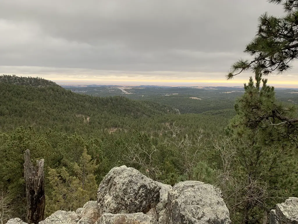
From the summit, you will be treated to views of Highway 16 as you look to the northeast, towards town. Like many of the trails that traverse the eastern edge of the Black Hills, on clear days you can also see the plains that spread east of town. On REALLY clear days, you can see portions of the Badlands that sit many miles to the east.
From the summit, you can see Route 16 heading toward town. You can also see the prairies that extend far to the east.
If you’re looking for a challenging hike that’s easy to reach from Rapid City, check out the Boulder Hill Trail!
Is this a trail you’ve hiked in the past? Tell me about it in the comments!
If you’d like to read about the other trails in this series, you can click the links below:
Like what you read here today? Please feel free to leave a comment, like or share this post! Want to be notified when a new post is published? Add your email and click the “Follow” button at the bottom of the page or the sidebar to the right. By signing up for the email list, you will also receive a free copy of the Tranquil Trekker’s Top 10 Tips of Trekking Do’s and Don’ts!
You can also follow the blog on social media by clicking the links below!
In this post, I review the Coon Hollow Trail, located in the central Black Hills.
Another great spot in my series of trails close to Rapid City is the Coon Hollow trail in the Black Hills!
Where is the Coon Hollow Trailhead?
The Coon Hollow trailhead is located just off of US 16, around eight miles south of Rapid City (from the Catron Boulevard/16 Bypass intersection).
Just past the Rockerville exit, turn right onto Silver Mountain Road. Then, take the first right and turn onto a forest road that runs into the woods. Immediately to your left, you will see a large dirt area where you can park. To reach the trail, cross the forest road and look for the footpath that is clearly marked by “Trail 50” placards.
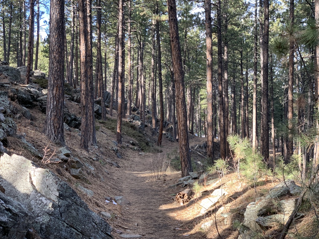
What is the Coon Hollow Trail like?
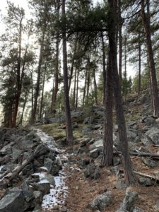
This trail is actually another branch of the Black Hills Flume Trail that I discussed in a previous post. The first 1/4 – 1/2 mile of it is quite steep (and can be downright treacherous in wet or icy conditions). However, once you reach the flume bed, it’s largely flat and wide and is an easy hike.
This portion of the trail is around three miles long, each way. It ends at an old forest road where it meets up with the the Boulder Hill Trail. Usually we walk out and back, though you can make loops if you include some of the local forest roads.
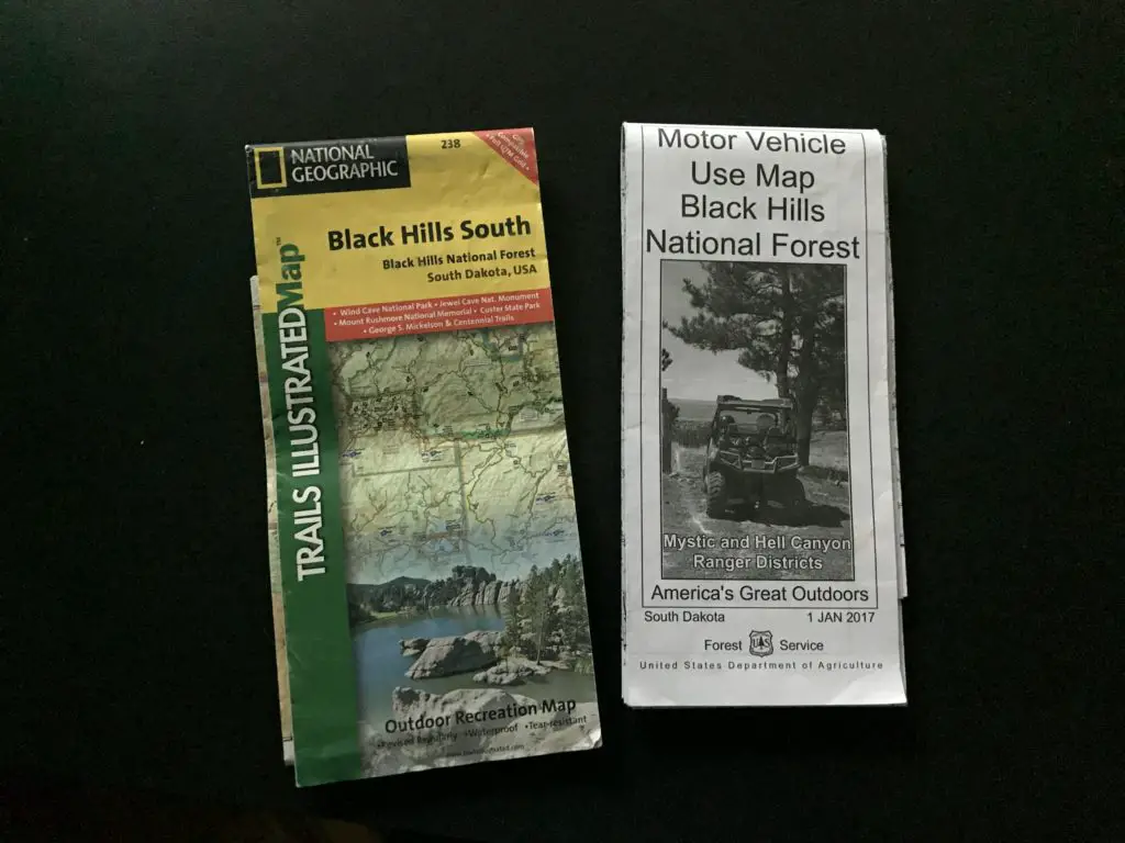
It’s important to always carry updated maps of the local trails and forest roads (like the ones shown below) when you’re out in the woods. This is especially important if you want to combine various routes to make your own loops. The paths are pretty clear in this area, but you can still get turned around if you aren’t familiar with where they all go.
These are the types of maps we frequently use
This is a great trail! I would rank it as “moderate”, mostly due to the initial, steep section. (There are also a few portions of it that traverse low-lying areas which can get slippery in the snow or mud.) However, the majority of it is easy as it just follows the flat, flume bed. Once you reach that part, all members of the family should be able to handle the trail easily (including the four-legged ones. Puppers highly recommends this path, as do several of her friends that we met along the way! 🐶)
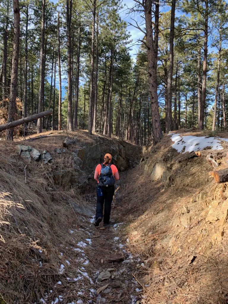
Me traversing a portion of the Flume Trail. Isn’t it beautiful, the way the sun dapples through the trees? (And yes, it was early January and I was wearing shirt sleeves; part of the reason why I love living in the Black Hills!)
There are many great views of the surrounding forestland available from this trail. In a few places, you can see all the way to Rapid City, and even to the prairies that lie farther to the east.
Coon Hollow Offers a Variety of Ways to Enjoy the Outdoors
One thing I really like about this area is that it contains a variety of trails that are good for both hiking and mountain biking. I also like that there are different trails for bikers and hikers, so the two are kept largely separated.
The actual bike trails are mostly one-track, though none of the areas we’ve encountered are terribly steep or technical. The Trekkers (especially me) are novice mountain bikers, and we’ve been able to manage these routes fairly well. There are also old forest (and fire) roads spread around the area which make for easier biking and hiking options.
If you’re looking for another family-friendly trail to hike in the Black Hills, that is close to Rapid City, check out the Coon Hollow Trail!
Is this a trail you’ve tried for hiking or on your mountain bike? Let me know your favorite parts of it in the comments!
If you’d like to read about the other trails in this series, you can click the links below:
Like what you read here today? Please feel free to leave a comment, like or share this post! Want to be notified when a new post is published? Add your email and click the “Follow” button at the bottom of the page or the sidebar to the right. By signing up for the email list, you will also receive a free copy of the Tranquil Trekker’s Top 10 Tips of Trekking Do’s and Don’ts!
You can also follow the blog on social media by clicking the links below!
This has always been one of my favorite holidays, so on this Christmas Eve Day I thought I’d reflect on some holiday memories from my childhood, and some new traditions that Mr. Trekker and I have been implementing into our own, little family.
Trekker Family Traditions
Family Christmas traditions are funny, and growing up, my family was no exception. Time for a bit of a confession…I never really believed in Santa (shocking, I know 😮). Some people think that’s sad, but I was always richly blessed during this time of the year, so I never felt like I missed out on much. Below are some of the reasons why I went without this holiday tradition:
1) We didn’t have a fireplace growing up, so even as a child, my overly logical, skeptical mind was like, “ummm…how would that work?”
2) My mom always put presents under the tree when she was done wrapping them. I’m not sure how this got started, but to me, a tree looks naked if there are no presents under it (and yes, I still do this too.)
Also, I always helped her shop for, and wrap, presents for my cousins, so I kinda figured that if she was “Santa” for them…it’s pretty obvious who Santa was for me! 😉
Also, also, inevitably, I always ended up finding one of my presents before the big day and it was ALWAYS on accident (truly!) One year, my mom sent me to her closet to get something for her, completely forgetting one of my unwrapped presents was hidden in there! 😂
3) I grew up in a very religious family, especially on my dad’s side, so that aspect of the holiday was always stressed more than Santa or the gifts (Grandpa and Uncle were pastors after all 😉). I think this was good though, as it always helped me to keep the commercialism of the holiday in perspective.
One tradition we had for a few years, when the kids were young, is to have a birthday cake for Baby Jesus on Christmas Eve. We even got to sing “Happy Birthday” to Him (and there was cake so…😁!) I think that is such a cool tradition. It’s a fun way to help keep the true meaning of Christmas front-and-center for kids!
Not everyone likes these sweet treats (I do!) but they represent a special memory for me. We would have them every year at my Grandma’s house at Christmas!
4) Most of my Christmas memories from my childhood are from the BIG gatherings we used to have at my grandparents’ house on Christmas Eve. The WHOLE family (we’re talking like 20 people) would gather there, with mounds of presents stacked everywhere. After dinner, we always dressed in our best (I usually got a pretty, new dress each year, several times my mom even made them!) and we went to the Christmas Eve church service, which has always been my favorite of the whole year!
The church would be decked out in beautiful lights and decorations, and it would always end with a moving version of “Silent Night”, lit only by candlelight. Then, the lights would be brought back up, and while we basked in the acrid, sulphuric smoke that wafted from the tips of the blown-out candles (I LOVE that smell), we’d be sent off to a rousing rendition of “Joy to the World!”
Then we’d return to Grandma’s house for…PRESENTS! (This is probably another reason why I never believed in Santa. 😂)
The story my grandfather told me for starting the tradition of opening gifts on Christmas Eve was that my mom and her three siblings used to wake my grandparents up REALLY early on Christmas morning to open presents (of course). The “old folks” didn’t like it, so…they started opening presents Christmas Eve instead, so they could sleep in Christmas morning! 🤣 (To be fair, my mom disputes this story. 😂) I always thought I was lucky, all the other kids had to wait a whole other sleep to get their presents, HA! 😉
Changing Holiday Traditions
As an adult, the holidays always seem a little weird, especially when you move far away and only return home occasionally. They say you “can’t go back again” and in many ways this is true. The experience is never quite the same as the rose-colored memories you have from childhood.
I have SO MANY amazing memories associated with this holiday. I find these days though, my feelings are somewhat bittersweet. I still LOVE all the shiny lights, carols, the beauty and peace of a candlelit church service, and time spent with family…but Christmas doesn’t quite feel the same as I remember as a kid. For the last 20 years, things have been changing, as all of us “kids” have been moving out (and away) and getting busy with our own lives.
You watch once-vibrant grandparents and parents age, slow, and eventually, one year, become only a memory…so all the memories made with them start to dim, as well.
It just never quite feels the same as the days when Grandma would crawl around on the floor with us kids, with silly string in her hair. One year the tree fell over on her as she rooted around for that last Christmas present (true story, there is video evidence of this somewhere! 😁)
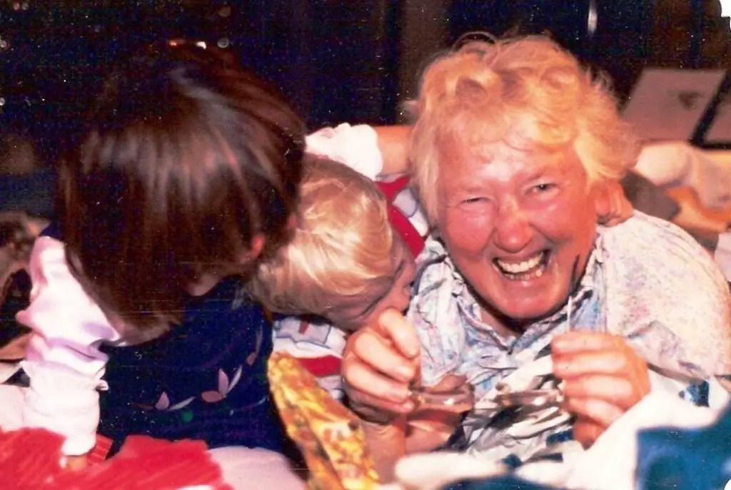
This is my favorite pic of that crazy lady, it shows her in her element…with her grandchildren. This was Christmas, circa 1986, and yes, that brown mop of hair you see on the left would be me.
Relatives or childhood friends you were once almost inseparable from, you may now find you have little to talk about outside the updates you’re already aware of from social media. While some family members are lost, new ones are added (both through marriage and birth). While these are, certainly, blessings, the additional people–and their responsibilities to their own families–create complexities of their own.
Traditions change. What used to be a gathering at Grandma’s house, of what seemed like 100 people (when you were 5), is now a smaller group sitting around another table, or even gathering at a restaurant where you can pay a stranger to cook for you and clean up afterwards! 😉
It’s almost impossible to get everybody together at the same time anymore. Everyone lives all over the country (sometimes all over the world!) and we’re all busy with our own families (and families-in-law). Even on the rare occasions we DO all get together, there are so many other distractions (many of us have young kids of our own now).
It just isn’t the same as when we used to stay up till 3 am on Christmas Eve, my cousins and I, playing with our new toys together, while the adults played cards in the other room…
Your concept of family may change too. It’s no longer just about blood relations (especially as various in-laws or step-family members are added). Not everyone was blessed with a close-knit, loving family. Others may have no close family left or those that remain may live too far away to visit with every holiday. For many, friends make a wonderful, adoptive family.
There is always a sense of loss of family members, and “the old ways”. One of the only real guarantees we have in life is that things WILL change. This can be a good thing, though. We can store up wonderful memories of bygone days, and continue some old traditions from times past while seeking to embrace new practices that will carry with them wonderful memories of their own.
New Traditions
Mr. Trekker and I have started to develop our own traditions. Christmas Eve, I make homemade lasagna, then we open presents with my parents (gotta keep that tradition alive!) and still enjoy a candlelit, church service. We also like to watch a “big” Christmas movie that night, like “It’s a Wonderful Life”. 😁 Then, before bed, we read “The Night Before Christmas”. (When I was a kid we often read the Christmas story out of the Book of Luke, from the Bible, but now we kinda figure we’ve just heard it at church, so… 😉) Then…for the big finale…we have a little slumber party in the living room with the dog, under the glowing lights of the Christmas tree! Who needs kids to have fun?! 😂
When Christmas morning comes, we start it off with homemade treats for breakfast! Then, there’s Facetime chats with Mr. Trekker’s side of the family (we “Zoomed” Christmas morning with relatives who live in far-off places for years, long before COVID made it cool! 😝) Then it’s time for the big, Christmas dinner! Finally, we end the evening on the couch watching “A Christmas Story” (the one with Ralfie…”you’ll shoot your eye out!”)
To Conclude
Change is inevitable, and I will CHERISH those Christmas memories from when I was a kid for the rest of my life. But I am also excited to make new memories, in the new situations we find ourselves, and with the new friends and family who may be joining us in the years to come.
I hope everyone has a wonderful holiday! Enjoy your traditions with your own friends and families (be they blood-relation or otherwise and whether they are in-person or virtual) this holiday. Merry Christmas to you all, andas Tiny Tim would say, “God Bless us, everyone!” 😉
Tell me about your family’s Christmas traditions in the comments!
Did you enjoy this post? Pin it!
Like what you read here today? Please feel free to leave a comment, like or share this post! Want to be notified when a new post is published? Add your email and click the “Follow” button at the bottom of the page or the sidebar to the right. By signing up for the email list, you will also receive a free copy of the Tranquil Trekker’s Top 10 Tips of Trekking Do’s and Don’ts!
You can also follow the blog on social media by clicking the links below!
This website uses cookies to improve your experience. We'll assume you're ok with this, but you can opt-out if you wish. Cookie settingsACCEPT
Privacy & Cookies Policy
Privacy Overview
This website uses cookies to improve your experience while you navigate through the website. Out of these cookies, the cookies that are categorized as necessary are stored on your browser as they are as essential for the working of basic functionalities of the website. We also use third-party cookies that help us analyze and understand how you use this website. These cookies will be stored in your browser only with your consent. You also have the option to opt-out of these cookies. But opting out of some of these cookies may have an effect on your browsing experience.
Necessary cookies are absolutely essential for the website to function properly. This category only includes cookies that ensures basic functionalities and security features of the website. These cookies do not store any personal information.


 The Deerfield Trail runs through several canyons that are similar to those found on


 My ankle injury is another good example of why I stress that