My posts!

Acadia National Park: Sunsets, Lighthouses, Hiking and More!

In this post, I review the second half of our New England road trip, our visit to Acadia National Park!


Acadia National Park in Maine is a great place to visit!

**Author’s note: Just a word of warning, as this is a National Park, no dogs are allowed on any trails (exceptions for Service Animals). They are only permitted in the campgrounds and parking lots.**

Mount Desert Island, Bar Harbor and “the Quiet Side” of Acadia National Park

Acadia is a beautiful park that takes up the majority of Mount Desert Island, on Maine’s coast.  Thanks to the waterways that are found near it, this island is a bit oddly shaped.

If you’re a visual person, like me, this map may make the directions I use throughout the rest of the post more clear. 😇 

The main island is composed of two halves. The eastern half contains Bar Harbor and the majority of the touristy sites–this side is far busier.  It definitely offers the most options in way of shops, lodging and food choices, though.  Also, many of the tours leave from here, but the amount of traffic and people can get a little crazy.

The western half of the island lives up to its nickname as “the Quiet Side of Acadia” as it is far less commercialized and therefore, FAR quieter than the other areas on the island.  This is where we rented our “tiny house” Air B&B for the week, and we enjoyed staying here (we live in one of the least populated states in the country, we’re more into wildlife than people 😛).  If you’re seeking a more relaxing stay, I recommend staying here, or the even more remote Schoodic Peninsula.

A pass is required to access basically any of the park sites.  These are available easily online, but only at a few places on-site (the park gates and the Visitor’s Center).  So if you don’t get a pass online, one of your first priorities after arriving here should be to acquire one. 

Also, parking can be quite a challenge.  The outdoor store, L.L. Bean, has been generous enough to pay for the site’s public shuttles, that run throughout the park and much of the island, making them free for visitors.  Bikes can be transported on these, as well.

Acadia was a bit of a different experience for us.  The national parks out west, that we’ve become accustomed to, are frequently located in the middle of nowhere.  They are also usually surrounded by other public lands (such as BLM land, National Forests, etc.)  Also, most national park boundaries surround one big chunk of land.  I had anticipated that Acadia would fit these characteristics, as well.

Acadia National Park surprised me though.  It is comprised of individual segments of land that are surrounded by residential, privately-owned properties.  Much of the park land was donated to the National Park Service by the famous, Rockefeller family, many years ago.

While most of it is found on Mount Desert Island, some also sits on the nearby Schoodic Peninsula (on the mainland) as well as on several islands that are situated a short distance off the coast.  The park’s more residential location means it offers easier access to civilization (lodging, restaurants, and shops) but it also poses a bit of a challenge for parking and viewing some of the natural areas as you have to skirt the privately-owned land.

The Best Things to Do at Acadia National Park:

This park has been on the Trekkers’ “to-do” list for a while now.  See below for some of the highlights we most enjoyed from our visit…

The Best Sunrise and Sunset spots at Acadia:

Due to the park’s location on the east coast of the US, it is set up much better for viewing sunrises rather than sunsets.  This is mainly due to the open ocean being primarily toward the east, while to the west there are forested hills and mountains.

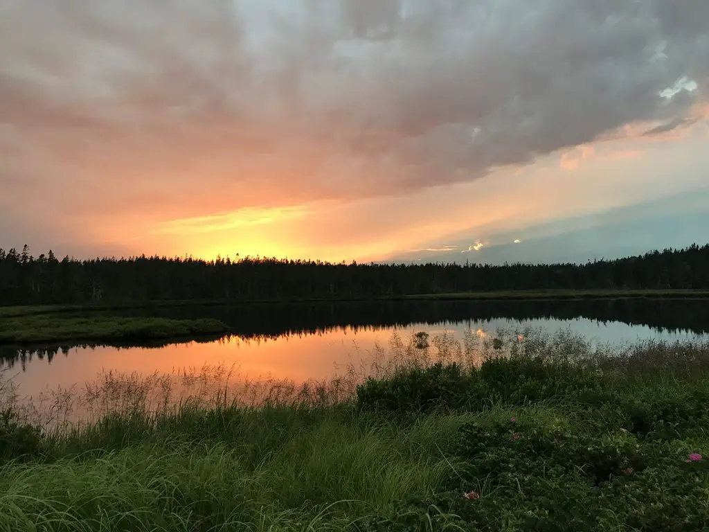
The flat, mirror-like water in a pond reflects the trees that surround it and the pink colors of the setting sun lighting up the gray clouds overhead.

However, if you prefer sunsets, or you want to view both (OR you are lazy, like the Trekkers, and you don’t want to get up at 4 am–or earlier–to go watch the sunrise 😉) I’ll give you some opportune places to catch a nice sunset.

Seal Cove We didn’t find this site till one of our last nights on the island, but it’s a fine place to watch the sunset (and its easy to reach too).  This location is on the southwest corner, of the western half, of Mount Desert Island.  This area is a quiet, peaceful place to watch the sunset, and during low tide, it provides a rocky beach to clamber around on.

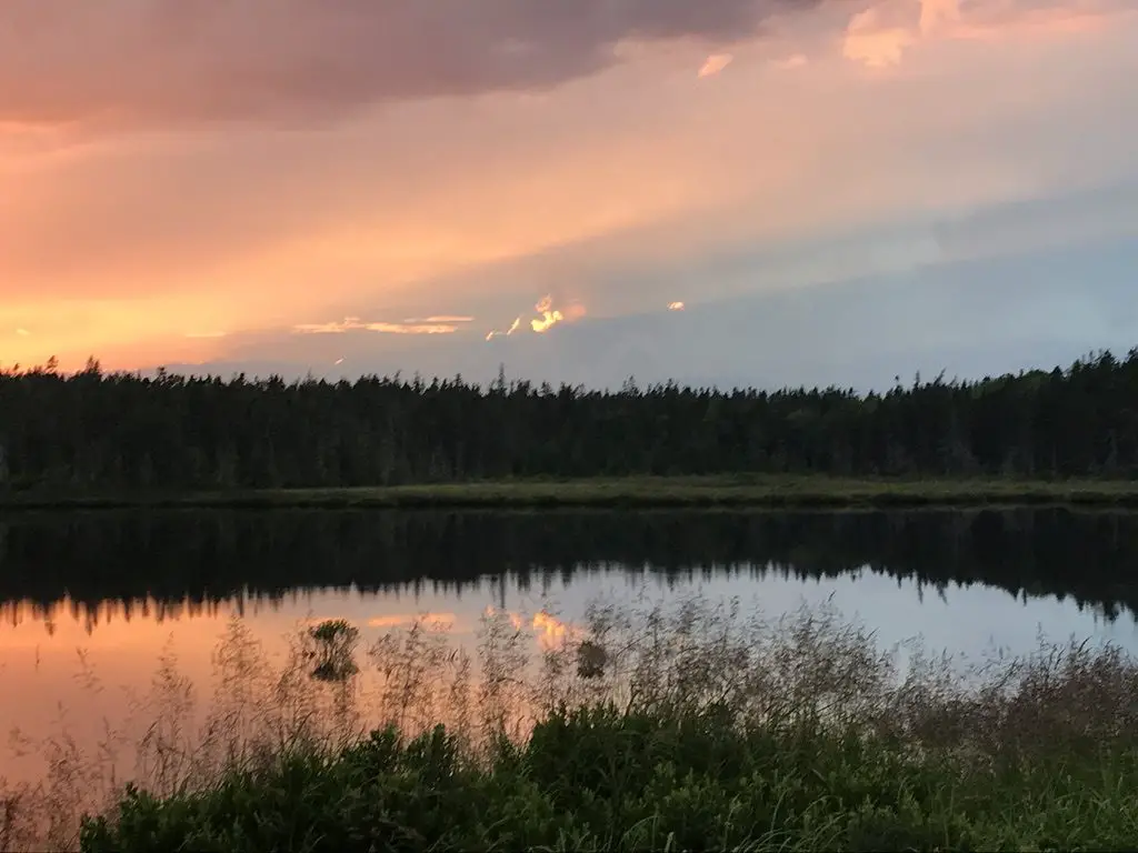
The parking area for the salt marsh, near Seawall:  We saw a GORGEOUS sunset here, over the salt marsh, to the west.  The setting sun outlined thunderheads far in the distance.  This site makes for a fine place to watch the moonrise over the ocean to the east (or the sunrise, if you’re an early bird).  Based on the activities of other visitors that we saw there, this is also a prime spot for clamming during low-tide.  No matter the reason you’re stopping here to visit, be sure to bring the mosquito spray!  This site is found on the southeast corner of the western, “Quiet Side” of the island.

The flat, mirror-like water in a pond reflects the trees that surround it and the pink colors of the setting sun lighting up the gray clouds overhead.
Sunset over the salt marsh near Seawall. Check out those storm clouds backlit by the sun!
The yellow, setting sun shines through the clouds and is reflected on the ocean water. Dark, tree-covered hills are in the foreground
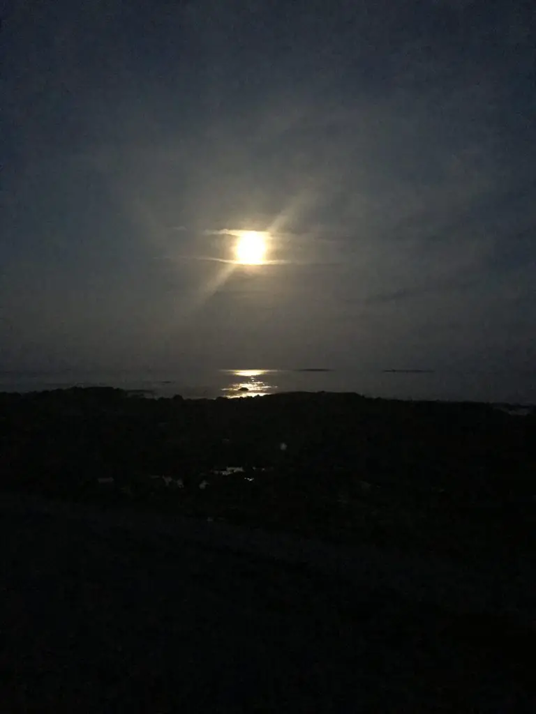
The full moon over the Atlantic Ocean as seen from Seawall

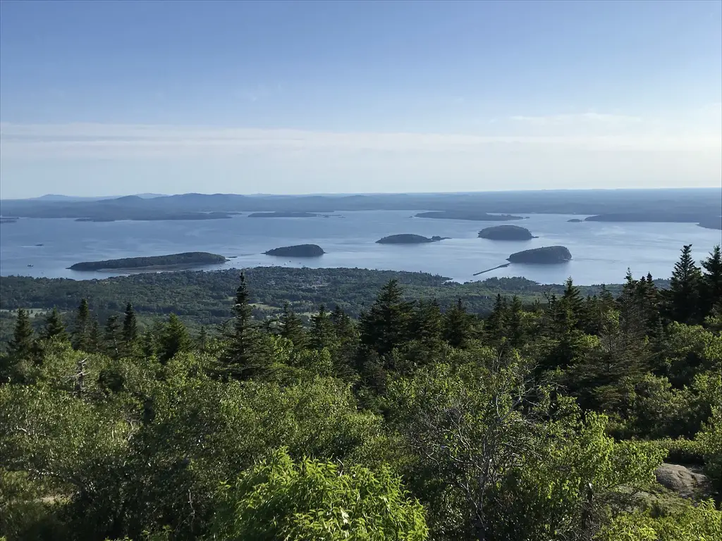
Cadillac Mountain:  This is the highest point on the island and in the park.  On clear days, it allows for FANTASTIC views of the nearby mountains, and, of course, the Atlantic Ocean and the islands that dot its bays.  Sunrise is the busiest time to visit this locale, though the Blue Hill Overlook, found shortly before you reach the summit, would make for a fine place to view the sunset as it faces west.  This site can be reached off the Park Loop Road on the eastern half of the island.

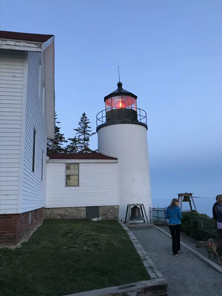
Bass Harbor Lighthouse:  It’s difficult to really see the sunset from here as it faces roughly south and there are hills that block your view to the west.  However, the way the setting sun makes the sky glow, and the way that frames the lighthouse against the rocky shoreline is quite lovely.  This site is found on the southern tip of the “Quiet Side” of the island, south of Southwest Harbor.

In the darkening light, a white building and lighthouse with a reddish-orange light on top. A bell sits in front of the lighthouse tower
Bass Harbor Light, at sunset

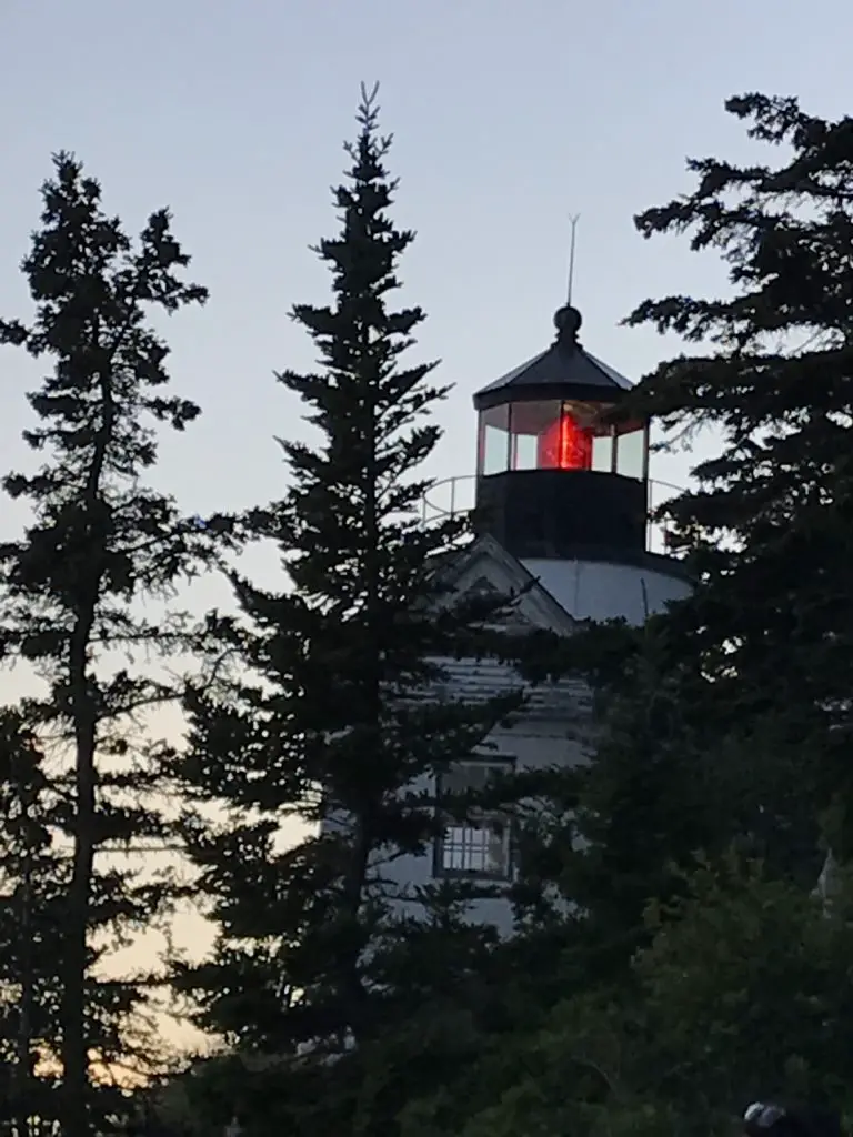
In the darkening light, a white lighthouse tower with a reddish-orange light on top is spotted through the pine trees

Acadia’s Lighthouses

With it’s unique location directly on the coast of Maine, Acadia offers many cool lighthouses to visit!

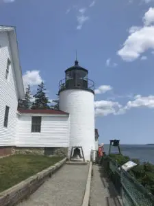
A white building and lighthouse. A bell sits in front of the lighthouse tower

Bass Harbor Lighthouse:  This is the only lighthouse in Acadia that can be easily reached and viewed by car.  It’s also a regularly photographed spot (for good reason.)  It’s manned by the Coast Guard now, so you can’t actually go up it, but you can walk to its base.  There is a short, hiking trail that leads to the rocks on the light’s opposite side, that is nice as well–this is also the viewpoint for sunrise/sunset!  

Bear Island Lighthouse:  This is one of the only other lighthouses near Acadia that can be viewed from shore/by car, and it takes work.  We ended up with a bit of a quest to find it, but we managed, eventually! 

Based on the light’s location on the map, we knew it should be visible from the shore.  So, for several evenings, we drove around trying to catch a glimpse of it.  Alas, all those pesky trees that grow on the East Coast (and some of the privately-owned, residential land) made it difficult. 😉  We DID finally find it though (without trespassing I might add 😉). 

**If you’d like to set out on your own quest to search for it yourself, be my guest.  If, however, you’d like directions on how to find it, scroll to the bottom of this post and I’ll leave them there.** 

If you visit Acadia National Park and enjoy lighthouses as we do, I highly recommend taking a lighthouse boat tour.  Almost all of the structures reside on nearby islands, and some are open for touring, at certain times of the year.  I didn’t realize just how many islands are included within the park’s boundaries (and scattered around the nearby waterways).  This means many of the lights can really only be viewed from the water.

Hiking Trails around Acadia:

There are numerous hikes available at Acadia, ranging from short to lengthy and easy to difficult.  Below are the ones we enjoyed:

The Beehive/Bowl/Gorham Mountain Trails:  The Beehive Trail is an AWESOME hike!  This was on my “must-do” list while visiting Acadia.  This trail is the little brother to the infamous “Precipice Trail”.  Now THAT ONE looks scary.  It was actually closed when we were there (and is for much of each summer) due to it being a nesting area for peregrine falcons. 

We knew this going in, and I was fine with it.  I don’t know that my fear of heights would allow me to complete this scramble up the side of a mountain. 

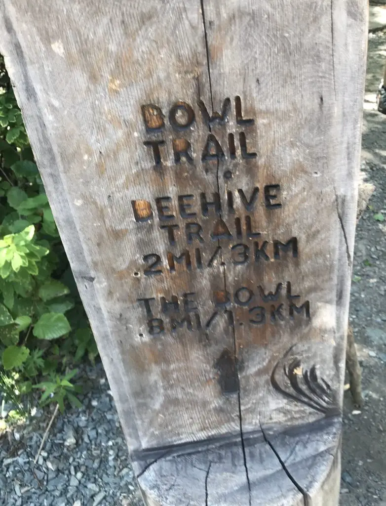
Wooden signpost marks the start of two hiking trails. The sign reads, "Bowl Trail--Beehive Trail 2mi/3km; The Bowl .9 mi/1.3km"

All of these trailheads can be accessed via the Park Loop Road on the eastern side of Mount Desert Island, south of Bar Harbor.

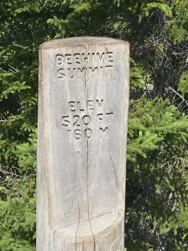
Wooden signpost reads, "Beehive Summit Elev 520 ft/160m

We also combined the Bowl and Gorham Mountain Trails into this hike, as they all connect.  We had intended to make a loop of it by including the Cadillac Cliffs Path, and then take the Ocean Path back to the parking area, but I was starting to have my usual struggles with the heat, so we cut it a bit short.

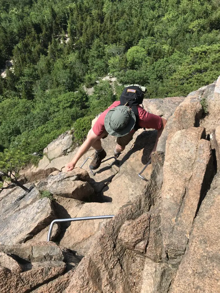
All of these trails were of moderate length.  The Bowl and Gorham Mountain Trails were moderately strenuous.  The Beehive Trail was quite strenuous (though mercifully short) as you basically scramble up the side of the mountain, free-climbing over boulders and using iron rungs that have been strategically placed throughout the route.

The picture below looks pretty terrifying, but it actually wasn’t that bad.  Trust me, I don’t like heights, but there was only one brief moment when I became uncomfortable (and it can be crossed in just a few steps).  The views from the top are INCREDIBLE though, and make the trek worth it!  If you’re hot, you can loop around and take a dip in the refreshing Bowl in the valley below!

A park climbs up a rock wall on metal rungs in the foreground. In the background, green, tree-covered hills spread far below
Mr. Trekker’s brush with death on “The Beehive” (it’s actually not NEARLY as bad as it looks, but this pic is GREAT, right?! 😉)
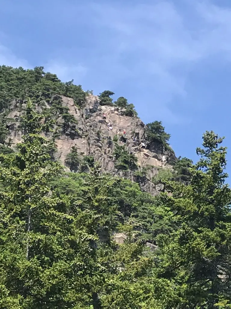
Green trees in the foreground with a rock wall, scattered with trees in the background, all under a blue sky. A line of tiny, multi-colored hikers is climbing the rock wall
A line of hikers ascending The Beehive
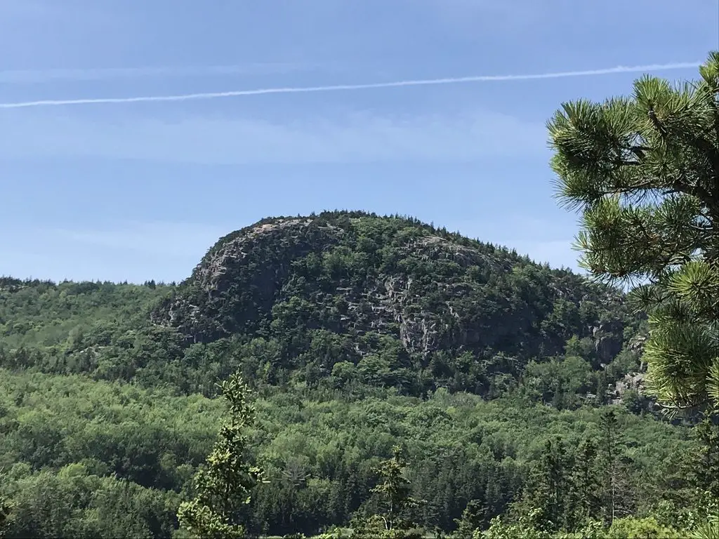
Green trees in the foreground, a green, tree-covered mountain rises in the middle, all under a blue sky
The Beehive as seen from Gorham Mountain
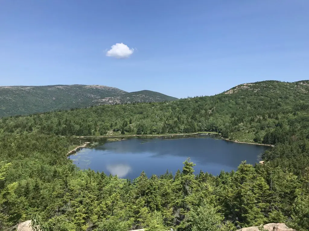
A small lake surround by trees and green, tree covered mountains, all under a blue sky
The Bowl

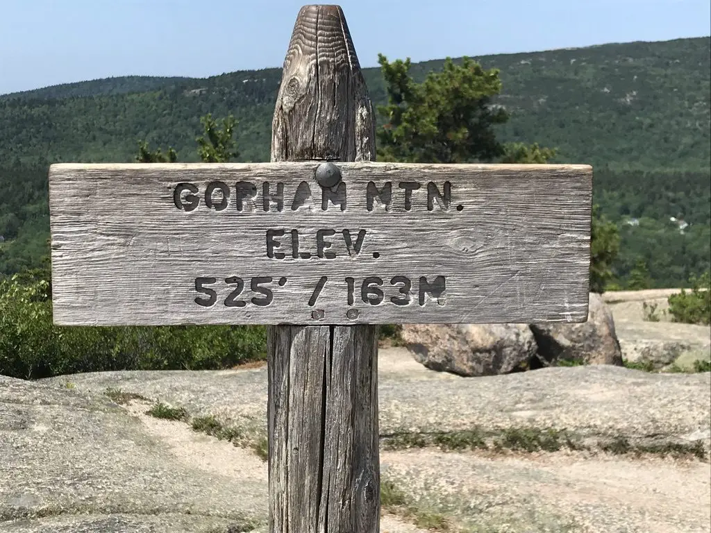
Wooden sign post on a rocky, mountain summit. Green, tree-covered mountains rise in the background. Sign post reads, "Gorham Mtn. Elev. 525'/163 m

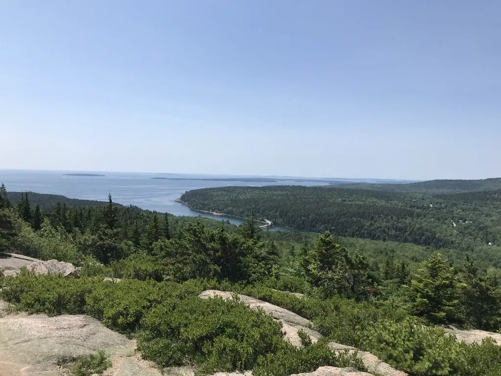
A rocky, mountain summit in the foreground. Green, tree-covered hills stretch to the blue ocean in the background, all under a clear, blue sky
The view from the Gorham Mountain summit

Great Head Trail:  Because we chose to cut the above route short, we were able to enjoy a good portion of this trail that is found in the forest, just to the west of Sand Beach.  Sand Beach can be reached from the same parking area as the Beehive/Bowl trailheads.  This was really convenient as we were able to park the car once and hike for most of the day (just make sure to get there early!)  

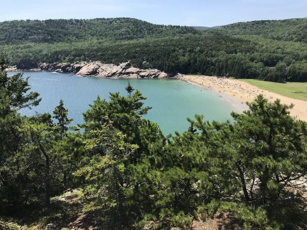
Green trees in the foreground overlook a blue-water bay that leads to a narrow, sandy beach. Green, tree-covered mountains rise in the background
Sand Beach

Wonderland Trail and Ship Harbor Trail:

The Wonderland and Ship Harbor Trails are accessed via Route 102A, on the western side of the island, south of Southwest Harbor.

These hikes were short, easy and VERY enjoyable.  Due to their location on “the Quiet Side” of the island, they were much less busy than other areas of the park. 

Mr. Trekker thought the photography opportunities they offered were comparable to ones we found in many of the more well-traveled sections of the park, as well. 

These routes take you down to the shore where you can walk the rocks and view the organisms living in the tide pools (at low tide). 

Other Fun Things to do at Acadia National Park:

Thunder Hole:  So this place is pretty awesome…when the winds and tide are strong.  When the conditions are right…the wind forces the waves into a small cave on the shore, which then, in turn, forces air out of the cave creating a crashing sound that reverberates off the nearby rocks!

Click here to see its full potential! (Take note, when we visited this site we were standing on the walkway you see at the bottom of the video, and others were standing on the rocks at the top of the frame. 😮–the trail is closed during this type of bad weather.)

When conditions aren’t right…it’s still cool, but not quite the draw it could be.  Fortunately, we were blessed with pretty nice weather throughout our trip.  Unfortunately, nice weather doesn’t bode well to experience the full effect of this location.  When we were there it was more like  “gurgle hole”.  😂

Carriage Roads:  This is another activity I’d put on our “must-do” list if we return to the park in the future.  These gravel roads snake throughout the forests of the interior of the island.  Bike rentals are available, though you still need to figure out how to get the bike to the trails. (I’d recommend bringing your own.  We considered it, but decided not to drag our bikes on a 5000+ mile road trip for one day of biking. 😛)

These trails were used by the Rockefeller family for their carriages when they owned the land–hence their name.  There are also some carriage rides still available through the stables on the island, where your carriage is pulled by beautiful draft horses!

Jordan Pond/”The Bubbles”:  As I mentioned in a previous post, Jordan Pond is again a place where they use the word “pond” when “lake” would make a much better descriptor. 😂  Several carriage roads start from here.  There’s also a restaurant and store in the historic building that was the original farmhouse built on this site.

There is a decent hiking trail that circles the lake.  We only did a portion of it (the easy part that was on a boardwalk).  The other half appeared to be more rugged.  I don’t think it had much elevation gain, just a lot of rocks to clamber over.

We met a lady later in the day, who had actually slipped off some rocks on the harder section and fell in the lake 😮 (she was fine). 

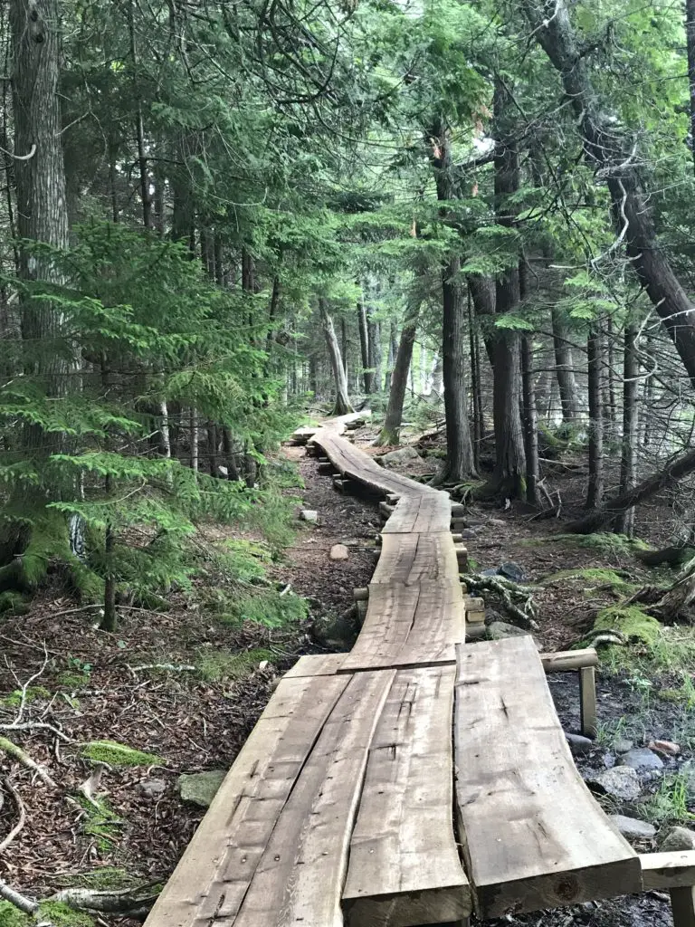
A narrow, wooden boardwalk through the pine trees
The boardwalk on the trail around Jordan Pond

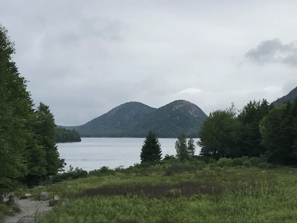
The boardwalk portion is basically completely flat and offers fine views of the lake, the nearby building and “The Bubbles”–I’m not sure who gave this name to these twin mountains.  They looked like something more PG-13 rated to me but…to each their own. 😱

Green grass in the foreground with a large lake in the background, leading to twin mountains covered in green trees
The “Bubbles”. What do these look like to you? I mean, come on! 😝

Cadillac Mountain:  We actually chose NOT to hike Cadillac Mountain on this trip.  This was for several reasons:

–We only had a few days at Acadia and we can hike mountains whenever we want, but we CAN’T visit the beach too often.  So, we chose to spend most of our time there. 

–Also, aspiring hikers should be aware that much of Cadillac Mountain trail has little shade, so it can be quite hot in the summer months. (This was another reason we chose to skip it, as heat and I don’t get along. 😝) 

We did make the easy drive to the summit on multiple occasions.  Sunrise is a busy time here, for obvious reasons, so if you’re choosing to go then I suggest you plan to leave early.  It’s beautiful at any time of day though, so long as the weather is clear. 

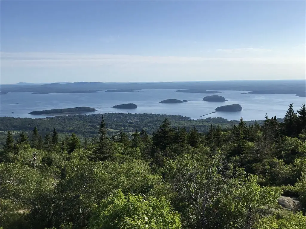
In the far background, several small, green, tree-covered, circular islands sit in a bay of the ocean. Green , tree-covered mountains run to the ocean in the foreground and are in the far background, behind the bay
The islands in the bay as seen from the summit of Cadillac Mountain

The Park Loop Road:  This road basically “loops” around the outer boundaries of the park (hence the name).  It features numerous pull offs where scenic views can be enjoyed, as well as plenty of recreational sites.  There are several picturesque bridges along its length that reminded us of the ones we saw in Virginia on the Blue Ridge Parkway.

Wildlife:  We were told there are bears and moose on the Schoodic Peninsula portion of the park, on the mainland.  Other than that, the majority of exotic wildlife that Acadia offers is sea life.  (This would have been a cool sight as we don’t usually see these types of critters at the landlocked national parks we frequent in the Western US!)

We didn’t see many sea creatures, but this is likely due to the fact that we didn’t venture out on the water.  There are whale watch tours that depart from near the park.  I’ve also heard stories of people who go on sea kayaking tours where seals and dolphins are known to come close and curiously inspect the watercraft. 

As we only had a few days here, we chose not to do these, but if we return for a future visit, they’ll definitely be on our “to-do” list.  If you visit the park, I would encourage you to seek these out as you may see some unique wildlife not always available at other parks.

LOBSTER!!!

I got to enjoy my first lobster on this trip (and my first New England lobster roll!)  I liked it!

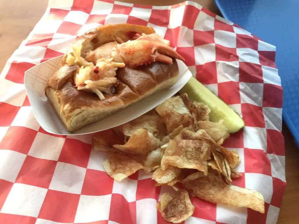
I got a “classic” roll, with the lobster already shelled for you and warmed with butter, on a buttered, toasted roll.  It was easy and delicious!  After watching many of our seat-mates struggling to crack through the shells of their dinner, I was happy to go the easy route.

We enjoyed our meal at Beal’s Lobster Pier in Southwest Harbor.  This place is NOT fancy (and I mean that in a good way).  It was the PERFECT place for us to enjoy our first lobster experience, though.

It’s basically a walk-up counter, and then your number is called and you get your food.  You enjoy it outside, or on a screened-in porch, all on picnic tables.  We absolutely LOVED it! 

If you’re looking for something more up-scale, there’s plenty of options for those as well, but the Trekkers are a casual bunch. 😛

A lobster roll with chips and a pickle on a tray
LOBSTA!

We really enjoyed this trip!  Our goal was to travel as few interstates as possible once we reached “northern New England”, and we felt like we were fairly successful at that.

I’ve mentioned before how much I enjoy taking the slower backroads (and by this, I mean anything from two-lane, US highways to dirt, county and forest roads).  We’re already planning another trip to that area in the next few years, to more fully explore the Adirondacks and Finger Lakes regions of New York, as well as more of Vermont and New Hampshire.  On that trip, we’ll map out “backroads” more before we go, with the goal being to avoid interstates as much as possible once we reach New York! 

I hope you enjoyed my review of Acadia.  It definitely has some unique characteristics as far as national parks are concerned.  We enjoyed visiting it, and would certainly consider another trip.  While we love living in the Black Hills, we both miss easier access to the ocean (especially Mr. Trekker).  Neither of us is really a “beach bum”, but exploring the rugged, rocky shores of Maine is right up our alley!

A few more pics from the trip:

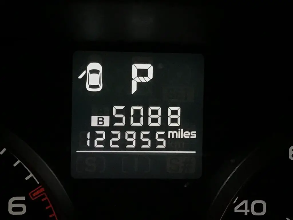
Car consul display reads P (for parked); 5,088 miles
The final mileage tally. And this was about 50 miles short, as we forgot to set it until we got to Wall, SD on the way out of town. 😝
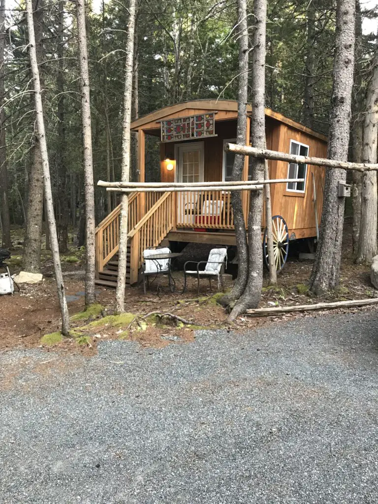
A tiny, wooden, wagon-cabin sits amongst the trees on a gravel road
Our “tiny house” Air B&B for the week
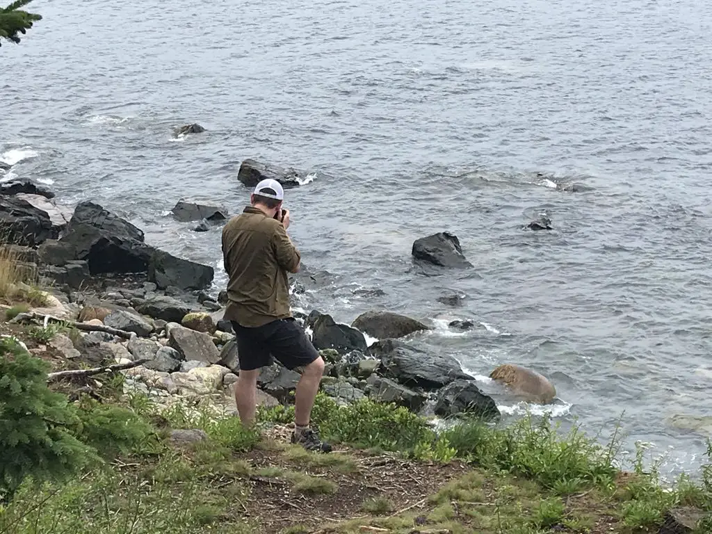
Rear view of a man standing on the rocky shore, taking a picture while looking out into the water
“A wild photographer stalks his prey!” (said in my best “Steve Irwin” voice) 😁
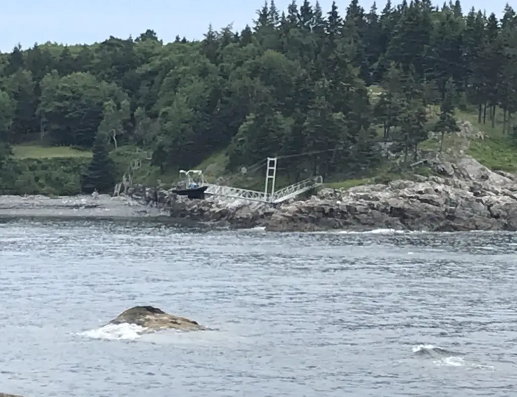
A boat and metal dock rest on bare rocks across a shallow bay. A short, tree-covered, rocky hill is in the background
I call this one, “low tide is weird”. 😝


**SPOILER ALERT!!!**

OK, if you want to know how to find the Bear Island lighthouse, you can spot it, flashing at night, from a public parking lot off of Norwood Road, east of Southwest Harbor.  Good luck on your quest!  I don’t actually know if it’s visible from there in the daylight, we didn’t get over there at that time of day.  If anyone knows of other places to view the lighthouse from public land, let me know in the comments!


Did you enjoy this post?  Pin it!

Four pictures: 1) Several small, green, tree-covered, circular islands sit in a bay of the ocean in the far background. Green , tree-covered mountains run to the ocean in the foreground; 2) View from a rocky cliff looking down into the water far below; 3) A creek runs through a green-grass meadow between tree-covered mountains; 4) View from a rocky cliff looking down to the water far below. Pin reads, "Acadia National Park Sunsets, lighthouses, hiking and more!"


Like what you read here today?  Please feel free to leave a comment, like or share this post!  Add your email at the bottom of the page, or the sidebar to the right, to be notified when a new post is published.  By signing up for the email list, you will also receive a free copy of the Tranquil Trekker’s Top 10 Tips of Trekking Do’s and Don’ts!

You can also follow the blog on social media by clicking the links below!

Facebook

Twitter

Instagram

Pinterest

9 “Don’t Miss” Places for Your Vermont and New Hampshire Road Trip

In this post, I review the New England road trip we took through Vermont and New Hampshire during the summer of 2019.


3 weeks, 13 states, 5,138 miles, and 2 quarts of oil (FYI, Subarus inhale oil) gives you a grand New England Road Trip!  Because, when you live in Western South Dakota, why wouldn’t you drive all the way to the coast of Maine for summer vacation? 😮😛

In 2019 the Trekkers spent three weeks on a whirlwind tour of the Northeast. We spent the first week visiting with Mr. Trekkers’ family in Connecticut, enjoying some of the old haunts from his childhood.  Then we spent a weekend toodling around Vermont and New Hampshire, and then enjoyed several days at Acadia National Park, in Maine.  We finished with a quick visit with my family in Indiana on the way back. Read on for “Don’t Miss” places for your Vermont and New Hampshire road trip! 

Northern New England Countryside

I love northern New England!  After traveling the crazy highways that snake all around its southern section, you hit the Vermont state line and life seems to slow down a little, again.  You find yourself quickly returning to the small-town charm of country towns; earthy, damp smells radiate from the walls of green trees and ferns in the woods that surround you.  It feels different here… most of the trees are deciduous hardwoods, whereas we’re used to the evergreens more commonly found in the Black Hills (and areas of Colorado that we frequent).  It feels almost like a rainforest compared to the more arid land we’re used to.  It reminded us a bit of the Redwood forests in California (except without the Redwood trees 😛).

“Don’t Miss” sites in Vermont and New Hampshire

Below are some highlights from our whirlwind tour…

Route 100, Vermont:

We traversed much of this scenic byway that spans the majority of the state, from north to south.  Several of the locations listed below were found on or near that road.  Throughout these travels, we enjoyed one of Vermont’s prime attractions, covered bridges, as well.  

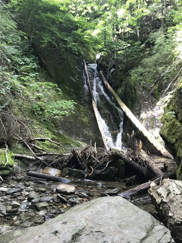
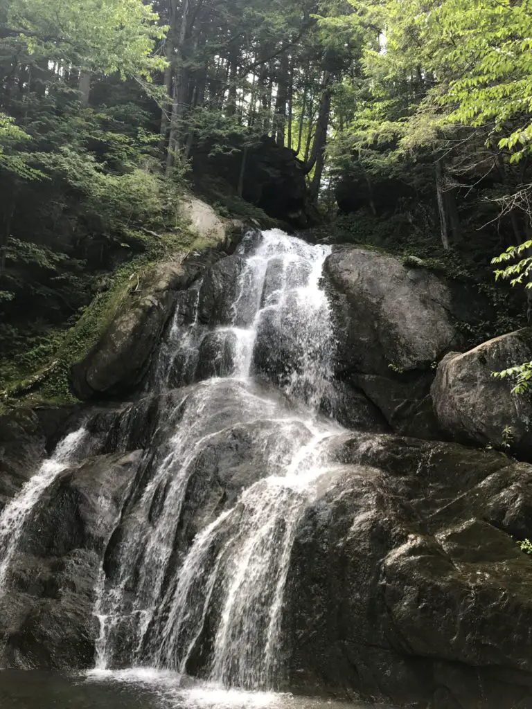
Small waterfall trickles down rocks into a rocky pool of water, surrounded by forest and boulders
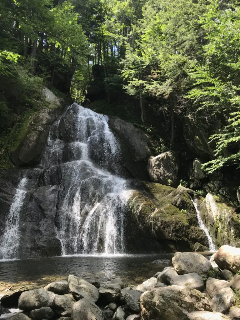
Moss Glen Falls

A waterfall over rocks landing in a pool at the bottom in the middle of the woods


For more pictures of some great waterfalls around New England, check out my friend, Kathy’s blog here.


A waterfall over rocks landing in a pool at the bottom in the middle of the woods. Large rocks sit in a pile near the pool of water

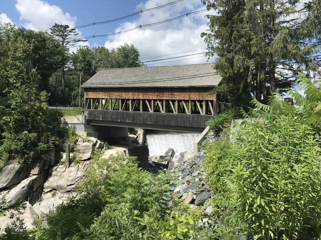
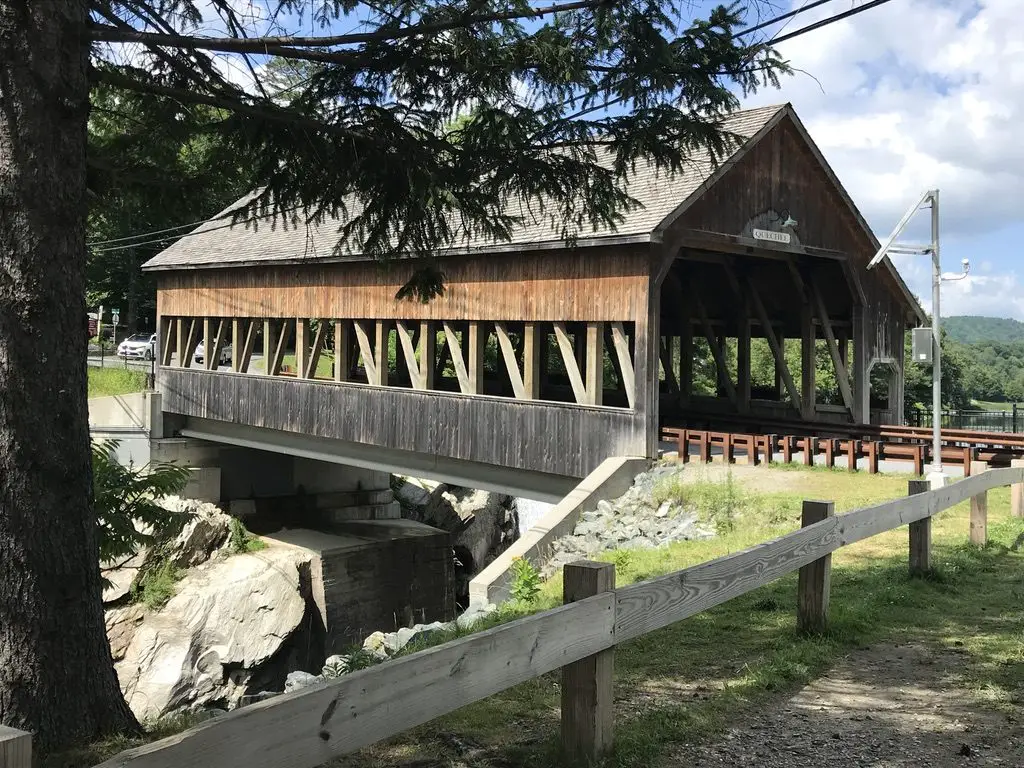
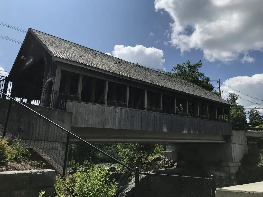
Large, covered bridge spans a river
Covered bridge over the Quechee River

Large, covered bridge spans a river

Ben and Jerry’s Flagship Store, Waterbury Vermont: 

We decided we didn’t have time to actually do the factory tour where you can watch how the ice cream is made (though that would have been REALLY cool).  However, we did get ice cream from the official store, and I’ve got a tie-dyed t-shirt to prove it!  We did take the time to check out a portion of the grounds called the “flavor graveyard”.  It was a little weird 🙃 but it was interesting seeing the various flavor options that have come and gone throughout the years.  Check out the website for the factory here

Cold Hollow Cider Mill, Waterbury, VT: 

Just up the road from Ben and Jerry’s is a cool cider mill.  It specializes in fresh-baked, cider donuts.  I thought they tasted more like spice cake, but either way, they were good! Click here to check out the website for the mill! 

The Vermont Country Store, Weston, VT: 

This place was nice.  It kind of reminded me of Wall Drug, in Wall, SD, but was far less immense.  It was definitely a cute place to pick up some local delicacies and check out some cool, retro toys and games from the ’80s, that brought back memories of our childhoods. 😁

Quechee Gorge, Hartford, VT: 

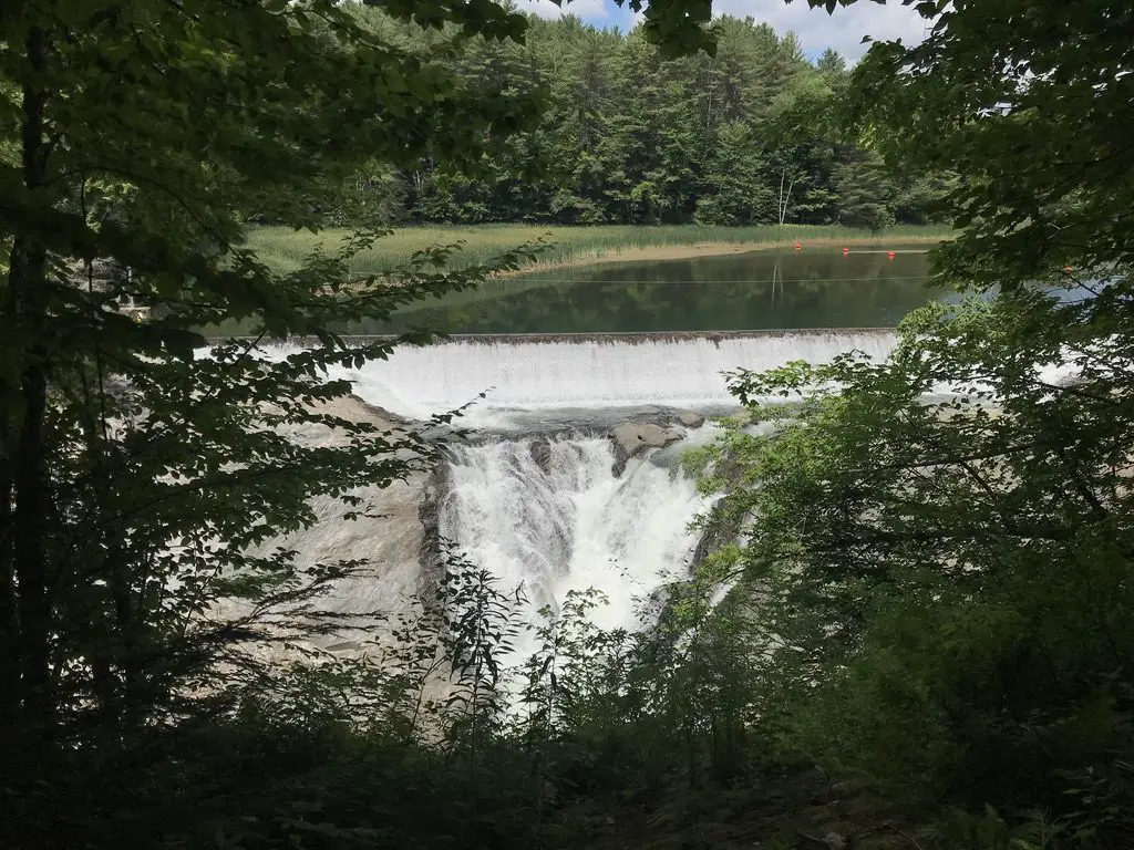
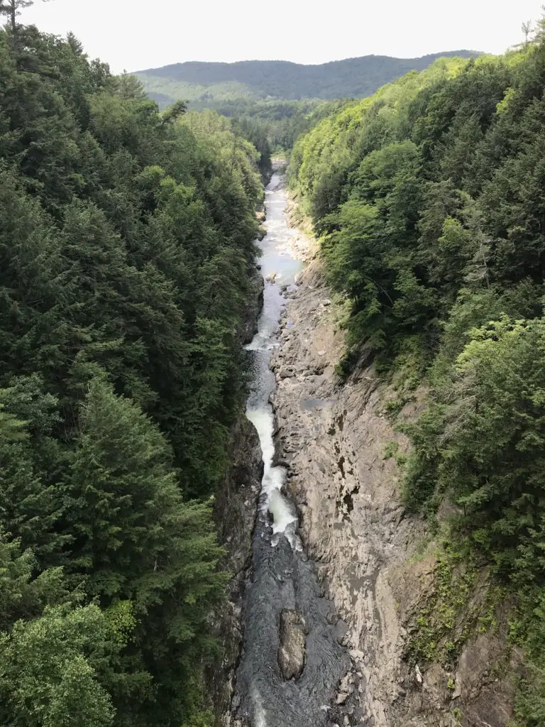
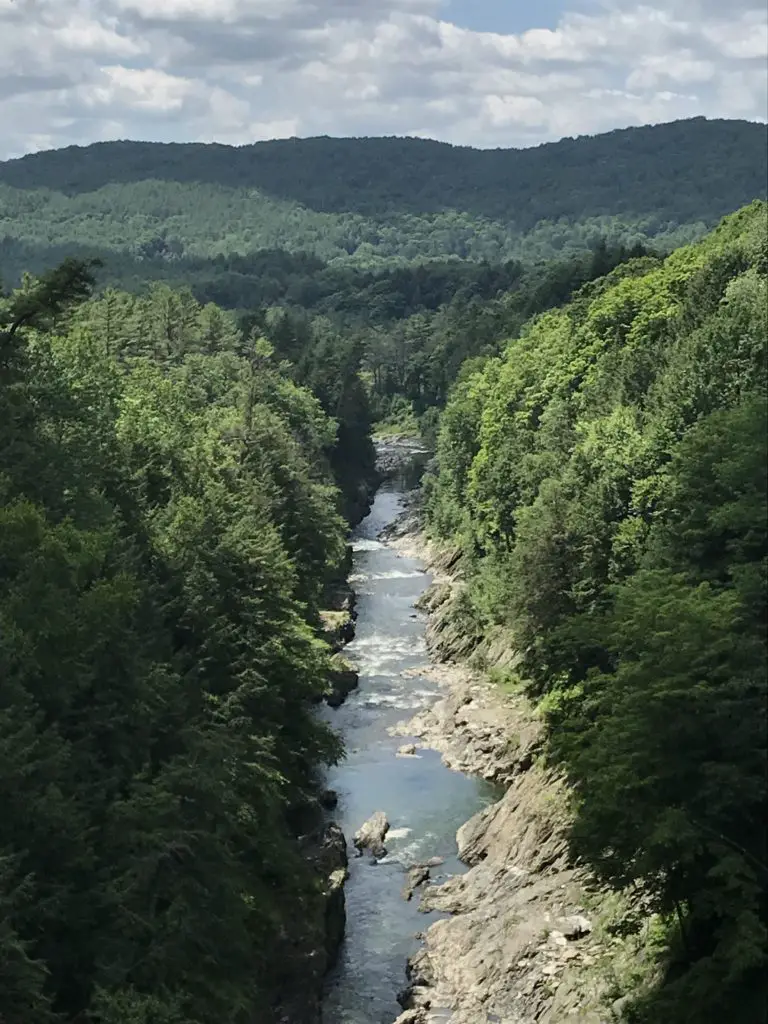
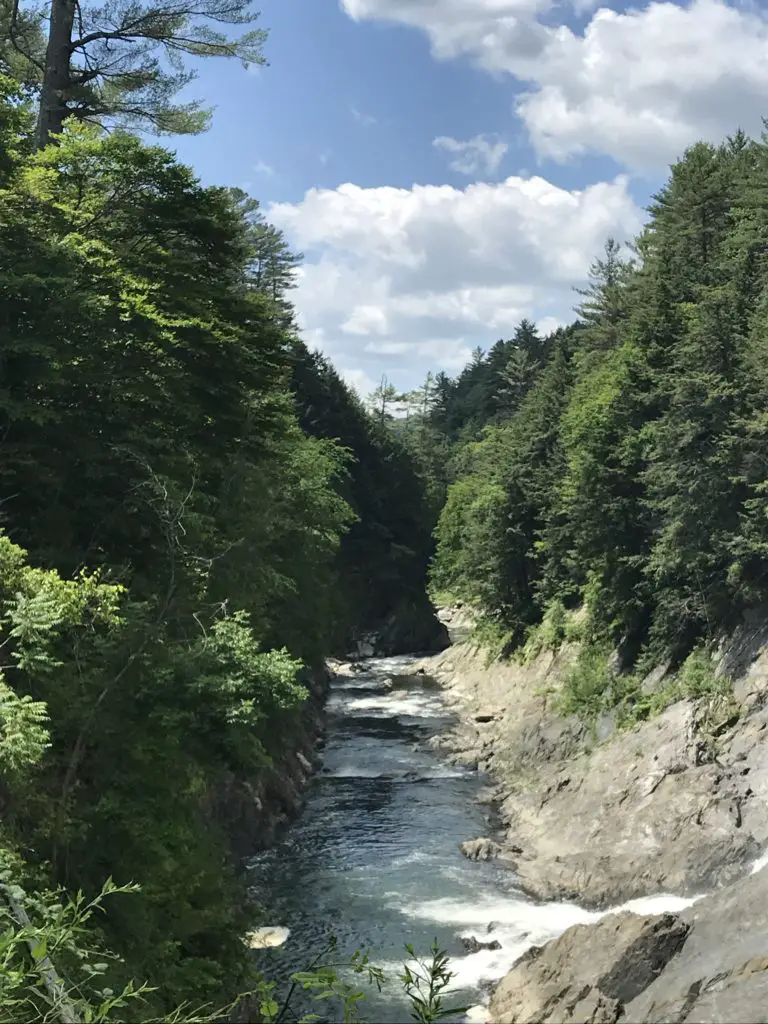
This place was really cool!  The Ottauquechee River cuts through over 100 feet of rock in this area, the result is a GORGEOUS, scenic view.  A hiking trail nearby takes you on an easy hike of less than one mile, to the head of the gorge, where the river is dammed.  This provides a unique view down the length of the canyon. 

The trail also traverses about a mile downhill, the length of the gorge, to where the river emerges from the rock again.  This is a popular swimming area.  Be aware though, as it’s downhill from the main parking lot all the way to the swimming site, you know what that means for the return trip! 😛

Looking through a hole in the trees, a dam in the background narrows into a large waterfall over some rocks
The dam at the head of the Quechee Gorge
Looking down the length of a tree-lined gorge from above. Rocky walls lead to the river far below
This pic gives you an idea of how deep the gorge is
Looking down the length of a tree-lined gorge from above with tree-covered mountains in the background
A view of the gorge from the bridge

Looking down the length of a tree-lined gorge from eye level

Simon Pearce Glass Mill and Store, Quechee, VT: 

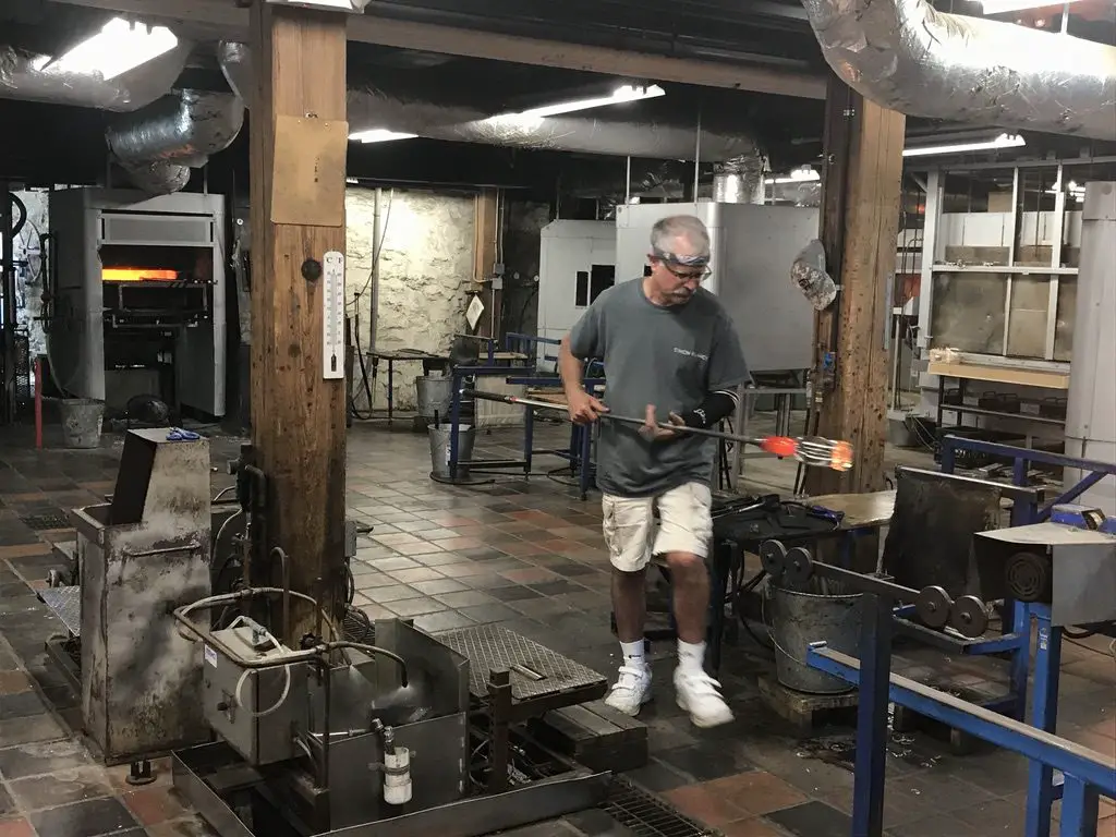
Ran using hydroelectric power from the same river that formed the Quechee Gorge, this place was AWESOME!  We were able to watch the artisans blow and shape the glass in the mill, in the basement, while the final product is sold in the store upstairs.  The shop also features a nice restaurant that overlooks the river. 

We decided the creations (even the seconds) were a little too rich for our blood, especially with the risk of breaking them as it was the middle of a lengthy road trip!

A glass blower crafts red-hot, liquid glass in a workshop
A glassblower craftsman at Simon Pearce

Camping at State Parks in Vermont and Maine

Because we enjoy camping, and it helps to keep costs down when on road trips, we spent a few nights at state parks in both Vermont and Maine. The mosquitoes were bad throughout the trip, but that’s to be expected in the middle of the damp woods. 😉

I’m a nature girl, I like critters, even the slithery, skittering, venomous–if we must–kind, as long as we can leave each other alone.  What I can’t abide are mosquitoes.  Seriously, why, just why?  That will be one of the many questions I have for the “Big Guy” someday. 

What purpose do they serve?  Food for other critters?  That’s fine, but why do they have to suck OUR blood, causing welts that itch to high heaven (and are bigger than the critter that left them) that last for days on end, and can even end up infected due to excessive scratching brought on by the extreme itching (I know from experience).  A bug that DOESN’T carry potentially deadly disease couldn’t fill that spot?  I’m just saying. 😛  They say God doesn’t make mistakes but the presence of mosquitoes makes me wonder a bit. 🤔  

The campsites throughout the campgrounds were largely gravel and flat.  They have large stone hearths to use for fires, we aren’t used to that in the Black Hills.  It made me think of the Flintstones. 😂  Most of the sites were large enough they could fit a small trailer/pop-up camper (we just brought the old, trusty, ground tent for this trip).  There were also flush toilets, electricity, and showers (oh my! 😱)  I can’t remember the last time we had those types of “fancy” amenities when camping! 😉 

This may be because it’s been a while since we stayed at a state park.  We’ve gotten used to national forest sites, with their vault toilets (and that’s it). 😋  Other than their more rustic accommodations though, national forests are still my favorite places to camp.

Below are some of the parks we visited:

Coolidge State Park, Plymouth, VT: 

This is a newer park, and it includes buildings from the historical homestead of the 30th President of the United States, Calvin Coolidge.  This was the first place we camped, and the quietest.  Sites were shaded and well-separated from each other.

A tent sits on a wooded campsite
Our campsite at Coolidge State Park
New Discovery State Park, Marshfield, VT: 

This place was cute.  It rained that night, but not till we were nearing the end of our fire logs, so it was a nice sound to lull us to sleep.  There was a weird bird that kept attacking its reflection in the side mirror of my car, and a garter snake got my heart racing when it crawled out of a hole in our fire hearth! 😱  Other than these visitors, though, it was a decent little campground.

Sebago Lake State Park, Naples, ME: 

Funnily enough, I actually completed a writeup about this park, just a few weeks before we visited, for an online job I had at the time!  This was the busiest park we stayed at, with sites that were placed the closest together.  They were nice, and shaded, and allowed you close contact with all your New Yorker neighbors 😋 (we definitely don’t hear the Brooklyn accent much out in Western South Dakota! 😂)  One unique aspect of this area was all the sycamore trees, with their LARGE, scalloped leaves. 

This park sits on the northern shores of the VERY large, Sebago Lake.  It was cold, but refreshing to swim in.  We enjoyed our almost-lakeside campsite.  It was cool watching the full moon rise over the flat, mirrored waters of the lake after dark.

A full moon in the dark, night sky. It is reflected in the dark water of the lake, below
The full moon over Sebago Lake
A small fire in a rocky hearth in a campground
The cool, rock, fire hearth

Camping in Vermont

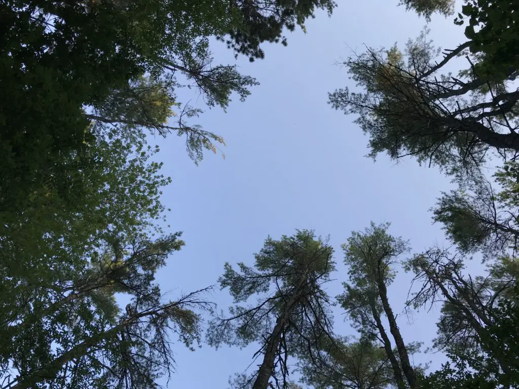
I love camping!  I love the random, natural experiences you have that you don’t notice cooped up in a house…the sun that dapples through the treetops as water droplets dribble and drip from the still-wet leaves after the rainstorm from the night before…you can see blue sky and stars peeking through the crowns of the trees…the sunbeams filter through the crown of tree leaves and slice through the morning mists that rise from the damp ground…you wake up in the morning to the granddaddy-long-leg who waves at you from his perch on the outside of your tent…

Blue sky through a crown of green trees

Vermont state parks are pretty nice.  They have lean-to’s that can be rented out, which we’ve never seen at developed campgrounds before.  They don’t seem like they would provide the most privacy or protection from the weather–or any critters–as it appeared people just set their hammocks/sleeping gear up in the shelter that has a roof, but only three walls.  We did see several people putting up tarps as a fourth wall.

They’re big on their “ponds” in New England, except many of them are bigger than the “lakes”.  Many are as big as some of the largest reservoirs in the Black Hills.  They may need to work on their wording a bit. 😋

Scenic Drives in New Hampshire

As we’ve already driven several of the main scenic routes through the White Mountains in New Hampshire, this time we chose to try out the northern route (US 2 to Route 16).  As it turns out, this isn’t nearly as pretty as the scenic byways that are comprised of Route 112 and US 302, that traverse areas such as Franconia Notch.  Those areas are GORGEOUS!

We then ventured into North Conway for lunch.  This was our second time visiting this little town.  We realized we had been there almost exactly 10 years ago, shortly before we got married! 

We had attempted to hike the infamous Mount Washington on that trip, but we didn’t make it to the summit thanks to several factors (including a certain blogger leaving breakfast on the side of the mountain 🤮).  I want to come back and try it again though, Tuckerman Ravine looks SO beautiful!  Now that we hike more regularly and are FAR more used to higher altitudes, I’m hoping we’ll be able to handle it a bit better.

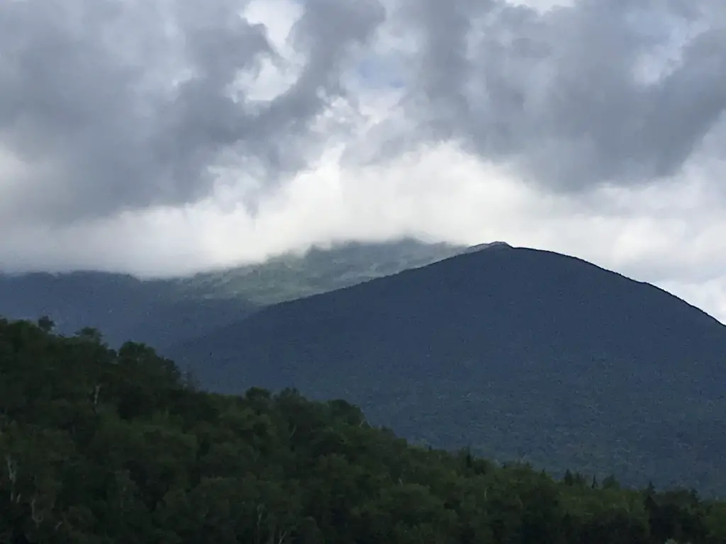
Green, tree-covered mountains cloaked in clouds
Mount Washington, lost in the clouds (it’s the peak you can’t see)

Both of the Trekkers visited New Hampshire several times throughout our childhoods and we always really enjoyed it.   We were surprised to note that, on this trip, we both found the woods of southern Vermont to be more welcoming than the rugged forests of northern Vermont and New Hampshire/Maine. (The northern mountains reminded us of the Black Hills so they didn’t seem as much like a vacation. 😋)  They also reminded us of other northern forests that we’ve been to, such as those in Michigan’s Upper Peninsula, those in Glacier National Park/northwestern Montana, those in the Big Horns, and those in northern Colorado (such as in State Forest State Park).

Looking for more amazing pictures of the New England mountains? Check out the Rusch to the Outdoors blog!

It got us to thinking about how much has happened in 10 years:  we got married; we moved to South Dakota; there were new jobs for both of us; we bought a house…what will the next 10 years bring?  Good things hopefully!

Next up,  Part 2 of our trip, Acadia National Park

Have you ever been to these parts of New Hampshire or Vermont? Tell me about your experiences in the comments! 


Did you enjoy this post?  Pin it!

Three pictures: 1) A waterfall over rocks landing in a pool at the bottom in the middle of the woods; 2) Large, covered bridge spans a river; 3) Looking down the length of a tree-lined gorge from above with tree-covered mountains in the background. Pin reads, "9 'Don't Miss' places for your next Vermont and New Hampshire Road Trip"


Like what you read here today?  Please feel free to leave a comment, like or share this post!  Add your email at the bottom of the page, or the sidebar to the right, to be notified when a new post is published.  By signing up for the email list, you will also receive a free copy of the Tranquil Trekker’s Top 10 Tips of Trekking Do’s and Don’ts!

You can also follow the blog on social media by clicking the links below!

Facebook

Twitter

Instagram

Pinterest

Going to the Sun Road at Glacier National Park

In this post, I review Going to the Sun Road at Glacier National Park.


Author’s Note: Since we visited Glacier in 2016, the Park Service has implemented a complex, ticket system for visiting the park in the summer. To be honest, I can’t make much sense of it as it involves multiple tickets being required to enjoy various activities around the park. For more information on this system, visit the park website and/or contact the park office. 

While on our visit to Glacier National Park, we drove the famed Going to the Sun Road.  We also learned some tips to keep in mind when traversing rural Montana.

Montana

If you’ve never been there, Montana is a HUGE state.  It takes 8+ hours to cross it when traveling 80 mph (the posted speed limit) and that’s on the Interstate!  It’s absolutely beautiful though!  I never realized how many mountains crisscross their way through the rolling prairies of that state. 
Montana DOT could do with some better signage.  Several times we had to turn around and retrace our steps to find the correct turn–either due to a complete lack of, or unclear, signage.  Frequently there would be large signs pointing the way when coming from one direction; and little to no signage when coming from the other.

It was also, often difficult to decipher which “turn ahead” was the right one–one time it would be the turn DIRECTLY after the sign, while others it would be three turns later after passing numerous side streets. 😛 

Information on local services was also lacking.  We limped the car into Missoula the first night, as we failed to realize how far the distance would be on the interstate between reliable gas opportunities–fortunately, gravity was on our side as a steep grade downhill ushers you into town and the CRV gets good gas mileage!

At least South Dakota provides some warning in these situations with billboards containing messages such as “gas now or gas can later”. 

Montana also has a habit of closing rest stops with little or no warning which is especially problematic when each rest stop can be more than 50 miles apart!

Glacier National Park

Glacier National Park is absolutely BEAU-tiful, as is the surrounding area!  It wasn’t nearly as crowded with visitors as Yellowstone–though as we learned later, being there at the end of June put us at just the beginning of the very short, summer season.  Several hiking trails in the higher elevations were still closed due to snow hazards (and this is normal!) 

Part of the reason it isn’t nearly as crowded as other national parks is that it is, quite literally, in the middle of nowhere.  West Glacier (the western terminus) is almost 140 miles from I-90.  It took us over three hours to drive that distance on winding, mountain roads, sometimes traveling 15 mph lower than the posted speed limit while following large RVs.  Likewise, the other side of the park, St. Mary (the eastern terminus) is almost 90 miles from I-15. 

We didn’t camp on this trip.  However, if you’re looking for some great info on camping at Glacier National Park, click here!

The scenery found on all of these drives is incredible though.  I actually recommend arriving at the park from the east side (driving up through the prairie) as you’ll have a commanding view of the Rockies for a much larger portion of the drive.  If you come into the park from the west, the overall drive is prettier–complete with mountain lakes and twisting curves–but the mountain views are largely obscured by trees and other, smaller hills. 

Large tree-covered mountainsides with bits of snow on their rocky tops, all under a clear blue sky. A river runs through the valley below.
Isn’t this gorgeous?!

Limited Services in Northwest Montana

We were also surprised at the limited access to everyday services of this high-tourist area.  Both West Glacier and St. Mary’s appeared to be reasonably sized towns based on the map (and their proximity to the park)–and they are decently-sized as towns in Northwest Montana are concerned–but they lack many basic services.

I personally required some OTC medication thanks to the side effects of antibiotics, and we had to travel an hour out of our way to finally locate a pharmacy to acquire it (a feat that would have been accomplished in about five minutes in most other rural parts of the country).  So something that should have been nothing more than a temporary annoyance ended up causing a real hindrance to the enjoyment of the trip. 

Having never been to the area before, my early online research made St. Mary appear to be far more commercialized than West Glacier; the map indicated this as well…it wasn’t.  St. Mary consisted mainly of one gas station/small supermarket/restaurant/gift shop and a smattering of campgrounds and roadside cafes.

We returned to this area several years later. Below are the posts relating to that trip!:

Ghost Towns in Southwestern Montana
6 Don’t Miss Places for your Western Montana Road Trip


West Glacier at least had two separate gas stations and several restaurants/shops within walking–or a short driving–distance.  I don’t say these things to complain, you are in the wilderness after all, but more as a caution for preparedness.

Going to the Sun Road

Glacier National Park consists largely of the east and west termini, and a road connecting the two, through the mountain passes (Going to the Sun Road) that’s only open about four months of the year.  The rest of the year it’s buried under up to 30 feet of snow (near Logan Pass) and is frequently plagued by avalanches.

While the two towns are only 50 miles apart it can easily take three hours or more to cross the divide (due to other drivers, the slow speed limit forced by sharp turns and steep inclines, and frequent stops at the many lookouts along the way.) 

It’s an absolutely awe-inspiring view though, and I highly recommend taking your time to fully enjoy your surroundings…and possibly stop for a picnic lunch!

Stop at the turnouts and enjoy the roar of the water filtering up through the canyon, as well as the smell of the sweet, clear mountain breezes.  Notice the contrasts in color of the deep grey or brown/red rock and the blindingly white snowfields of the higher elevations, that all stand out against the vibrant green foliage of the lower altitudes.  To top it off the dome of the sapphire blue sky crowns it all (this area is called the Crown of the Continent!)

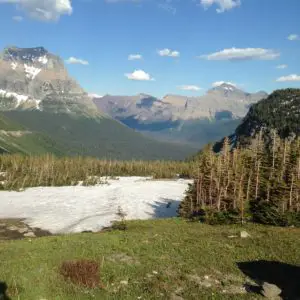
A green meadow with a snow field in the foreground. Large, rocky mountains in the background.
The view from Logan Pass

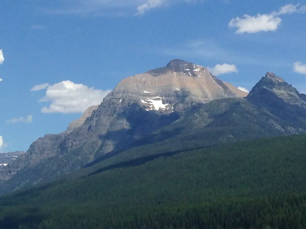
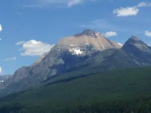
Large, rocky mountain looming over shorter, grass and tree-covered mountains, all under a blue sky dotted with white, puffy clouds.While not as crowded as other parks we’ve been to, there were still plenty of visitors milling about.  Be sure to be watchful for people (and wildlife) that may appear before you around a sharp turn with little or no warning.  There are also many road bikers who must be carefully passed in addition to negotiating the sharp curves.

For someone who is afraid of heights, the trip can be quite anxiety-provoking, especially if traveling west to east (on the outside lane) and if you’re the passenger.  Frequently along the route, the only thing separating you from precipitous drops of 1000 feet or more is a low stone wall! (This also reminded us of Route 550 in Colorado, the Million Dollar Highway!)

I also recommend traveling the road several times, at different times of day, as the light changes the views greatly.  The second time we drove the road was in the evening with the sun at a lower angle, and not only were the colors more vibrant, but subtler details (such as smaller waterfalls) stood out in greater contrast.  I mentioned earlier that we unintentionally arrived early in the busy season.  While this assisted us in beating the crowds, it also had the unintended effect of potentially providing more beautiful views.  We were told by locals that it had been unusually rainy as of late and this, along with late-season snow/glacier melt, contributed to some incredible waterfalls cascading down the steep mountain walls into the canyon.  As the season wanes these falls tend to dry up and become merely trickles.

Related posts:  5 Things you Don’t Want to Miss at Glacier National ParkSwiftcurrent Trail at Glacier National Park and 5 Other “Don’t Miss” Sites!; Gunsight Pass Trail, Glacier National ParkGlacier National Park: Hiking the Apgar Lookout Trail

Are the glaciers melting in Glacier National Park?

Many scientists believe the park will be completely glacier-free within the next 50 years due to warming temperatures.  I hope they are wrong about this as it will have profound effects on the various ecosystems that comprise the park.

You’ll notice as you traverse the road that these systems vary from arid, high plains on the eastern side…to alpine tundra at Logan Pass…to the temperate rainforest at the lower elevations on the western side of the park.  Many of the lakes are fed by glacial springs and/or snowmelt from the long winters.  If these glaciers dry up and/or less snow accumulates in the winter months to feed the lakes, it’s possible they may dry up (or their water levels will significantly lessen) as well.  This will hinder the survivability of the vast array of flora and fauna that make up these ecosystems.

There is already evidence that the warmer temperatures are causing an increase in foliage and subsequent treeline which impedes on the tundra.  Many alpine plants grow only in tundra regions and could become endangered/extinct if these consequences are borne out to their fullest extent.  This could have far-reaching effects that can’t even be fully calculated at this time.

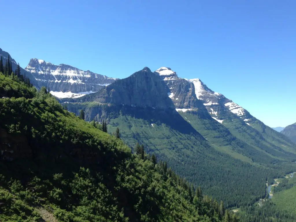
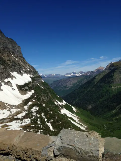
Below is a picture from the Going to the Sun Road.  This was taken near Logan Pass, the highest point on the road, at around 9,000 feet.  Notice the narrow brick wall at the bottom separating the car from the dropoff!

 View from a rocky wall overlooking a vista of a mountain valley with tall tree and snow-covered mountains on both sides, all under a clear, blue sky.

Save

This is one of the most beautiful drives I have ever enjoyed.  Everyone should have Glacier National Park on their Bucket List!

Have you ridden on the Going to the Sun Road?  How was your experience?  Tell me about it in the comments!


Did you enjoy this post?  Pin it!

Large, rocky mountain looming over shorter, grass and tree-covered mountains, all under a blue sky dotted with white, puffy clouds. Pin reads, "Going to the Sun Road: Glacier National Park."


Like what you read here today?  Please feel free to leave a comment, like or share this post!  Add your email at the bottom of the page, or the sidebar to the right, to be notified when a new post is published.  By signing up for the email list, you will also receive a free copy of the Tranquil Trekker’s Top 10 Tips of Trekking Do’s and Don’ts!

You can also follow the blog on social media by clicking the links below!

Facebook

Twitter

Instagram

Pinterest

5 Things you Don’t Want to Miss at Glacier National Park

In this post I describe some of the highlights of our trip to Glacier National Park, in 2016!


Author’s Note: Since we visited Glacier in 2016, the Park Service has implemented a complex, ticket system for visiting the park in the summer. To be honest, I can’t make much sense of it as it involves multiple tickets being required to enjoy various activities around the park. For more information on this system, visit the park website and/or contact the park office. 

Also, just a word of warning, as this is a National Park, no dogs are allowed on any trails within the park (exceptions for Service Animals). They are only permitted in the campgrounds and parking lots.**

Glacier National Park is one of the most beautiful places I have ever visited. The views there are comparable to the ones I saw in the Andes Mountains of Peru when I visited there in 2001.  The Trekkers had an incredible time visiting Glacier (and hope to return someday).  Most people are aware of the park’s acclaimed, Going to the Sun Road, but there are other fun things to do, as well!  In this post, I have outlined 5 not-to-miss sights to see on your trip to the park.

Not-to-Miss Things to See at Glacier National Park

Polebridge, Montana

Author’s note: Technically dogs are allowed in this portion of the Park, however it is recommended that you keep them in your car/camper. There are LARGE bear dogs that roam freely throughout town–to help keep the grizzlies out of town!–that are known to be aggressive with other dogs.

The tiny town of Polebridge sits about 25 miles north of the park, and only around 15 miles south of the Canadian border.  It is located on North Fork Road.

When I say “tiny”, that is not an exaggeration!   Its main draw is the Mercantile (a historic, general store that is known for its DELICIOUS homemade pastries, the Trekkers especially recommend the huckleberry bear claws!).  The tiny community also consists of a saloon where we had lunch (I highly recommend the homemade potato wedges and ranch dressing) and a few cabins available for rent…and that’s it! 😮 

This little village is the starting point for several hiking trails in the area and there are numerous lakes nearby.

An old storefront with "Polebridge Mercantile" on the front and cars sitting out front
Polebridge Mercantile

Bowman Lake

We visited Bowman Lake and hiked a portion of the Bowman Lake Trail there.

The trail was a simple walk through the woods, on a smooth trail, with little to no elevation gain.  It wasn’t crowded, though we did see several other hikers.  Be watchful for bears in this area–as well as throughout the entire park.  We did not see any but did see evidence that they had been nearby in the past.

The Bowman Lake Trail could be made into a full-day excursion to the end of the lake and back (the lake is six miles long) or enjoyed as a multi-day backpacking trip if one wished to take advantage of all the trails that connect to it.

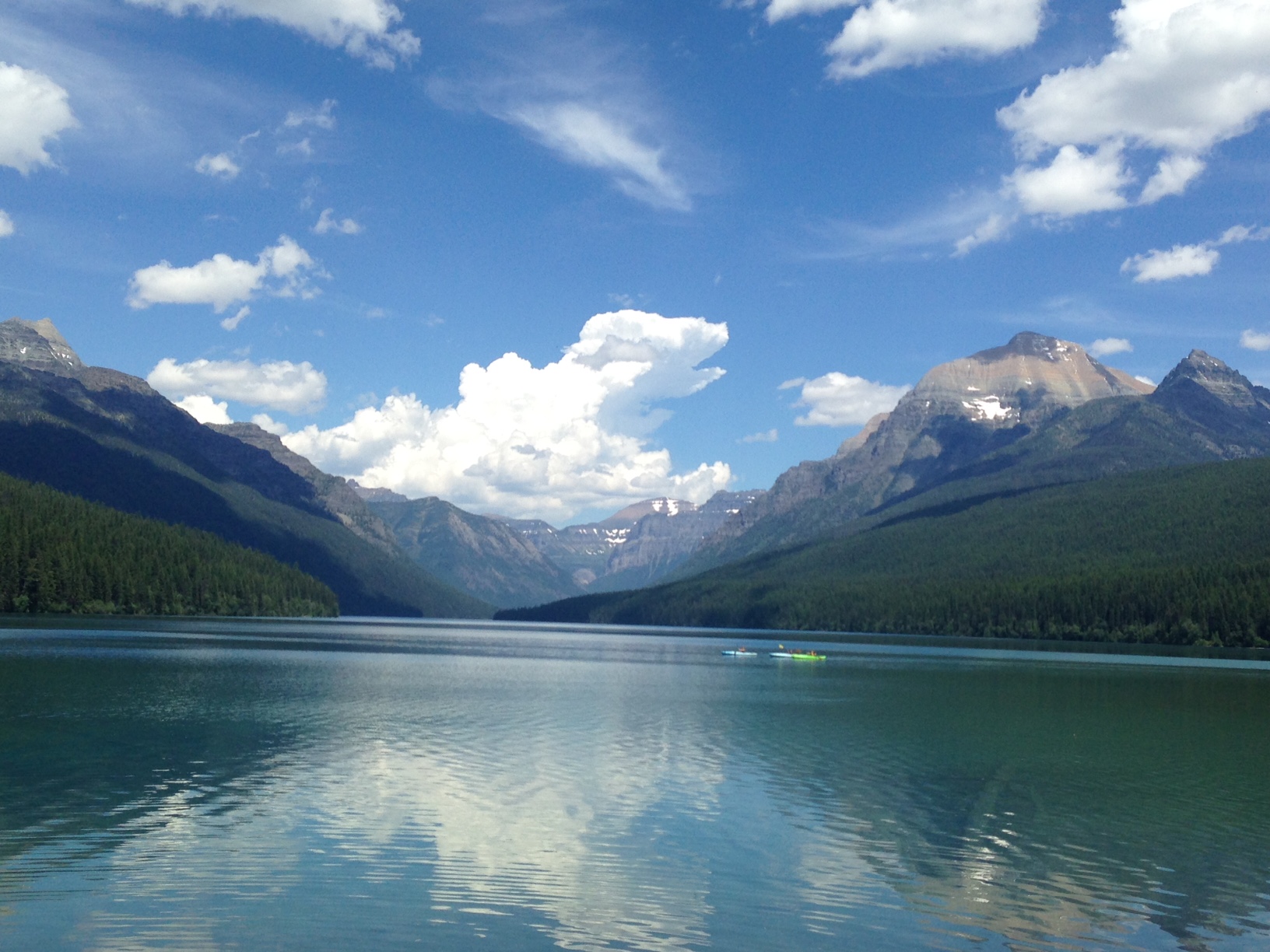
With the gorgeous views afforded here of the mountains and their reflections on the aquamarine water, this is one of the most picturesque places I have ever seen.

Mountain vista across a flat lake with tree-covered, rocky and snow-speckled mountains towering on both sides.
Bowman Lake, the picture does not do the color of the water justice

The Canadian Border

Being that we were so close to the Canadian border we decided we HAD to drive up and say “hello” to our friendly neighbors to the north.  We knew there used to be a border crossing in this area but that it had been closed for many years.  We were expecting some sort of obvious signage indicating the divide between the two countries, a fence preventing entry, something…we were in for a bit of a surprise…

You reach the border by traveling north from Polebridge on a narrow dirt road.  Drive carefully and be watchful as there are sharp turns.  Wildlife–and the few human inhabitants of that desolate region–may be seen on the road, as well.

We encountered a very friendly couple biking with their three dogs.  They encouraged us to check out the border though we thought they were “pulling the tourists’ leg” when they described what we’d find…they weren’t. 

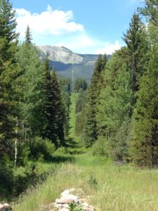
You will know you’ve reached the border when…the road ends…at a gate that looks like something that will close a city park for the winter! 😮  There is also a SMALL sign that reads “no admittance to Canada” and a trench about two feet wide and a foot deep–that you can walk across–that spans the border as far as the eye can see in both directions.  You see a clear line cut through the forest that stretches for miles and continues up the mountains to the east and to the west.

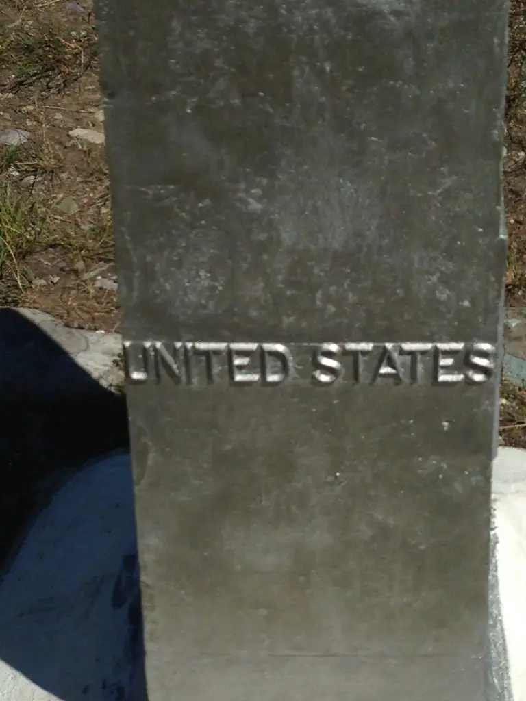
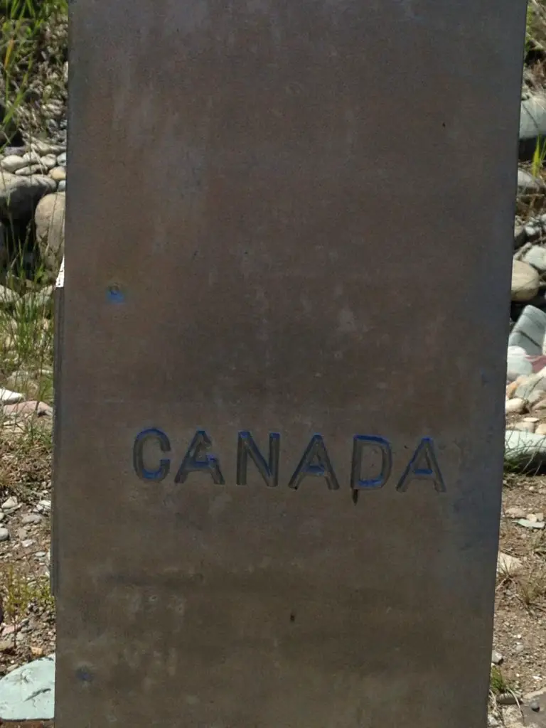
There is also an obelisk that marks both countries and commemorates one of the longest international borders that has been held peacefully, for one of the longest time spans in history.  There is no fence (don’t tell Trump! 😮), though there are security cameras.  We also saw border agents patrolling the area, so I would strongly encourage you to be respectful of the laws of both countries.  Pictures are allowed, but even if you have a passport, this is not an open border crossing.

*I had a bit of a philosophical epiphany while observing the border.  Humans are not allowed to cross freely, but as there is no fence, the animals cross back and forth completely unhindered.  The same forests and mountains reside on both sides of the border and were it not artificially maintained by human hands, one would not know when it had been crossed.  It gives you pause regarding man’s futile attempts to divide humanity based on imaginary lines.  If the animals and trees don’t care which side of a line drawn on a map that they (and their fellow forest inhabitants) reside…should we?

A simple, metal gate over a dirt lane in front of an old barn and trees
The Canadian Border…seriously, that was it.
A wide path through the woods runs to tall mountains on the horizon
The Canadian Border

The pillar shown below marks both countries:

Metal pillar with "United States" written on it Metal pillar with "United States" written on it

Goat Lick Overlook

This is a very neat area located directly off of US 2, on the southern edge of the park, about halfway between West Glacier and East Glacier (this is one of those areas of lousy signage I mentioned in a previous post).  There is a large sign announcing the overlook from the west, and nothing from the east, so be watchful if coming from that direction. 

The Overlook is exactly as the name suggests–it is a canyon where the wild, mountain goats come to lick minerals that seep from the rocks.  We saw a herd of close to 20 goats, complete with adults and babies, scampering with carefree vigor–you could hear them calling to each other from quite a distance. 

Most of the goats stayed on the other side of the canyon, but one mother and baby were camped out very near our location.  These animals are usually fairly harmless, but please, always remember they are wild.  They should be treated with respect and given space.  If they act in any way uncomfortable by your presence, you are too close!  MOVE BACK!  It should always be assumed that any animal (especially a parent protecting a baby) may attack with force, at any time, if they feel threatened.

Related posts: Swiftcurrent Trail at Glacier National Park and 5 Other “Don’t Miss” Sites!; Gunsight Pass Trail, Glacier National ParkGlacier National Park: Hiking the Apgar Lookout Trail

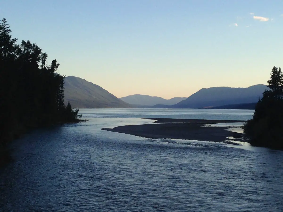
Sunset on Lake McDonald

Our hotel was only a five-minute drive outside the border of the park and only about 10 minutes from the largest lake at Glacier National Park, Lake McDonald.  Every night we enjoyed the sunset on the shores of the lake, in the tiny community of Apgar.

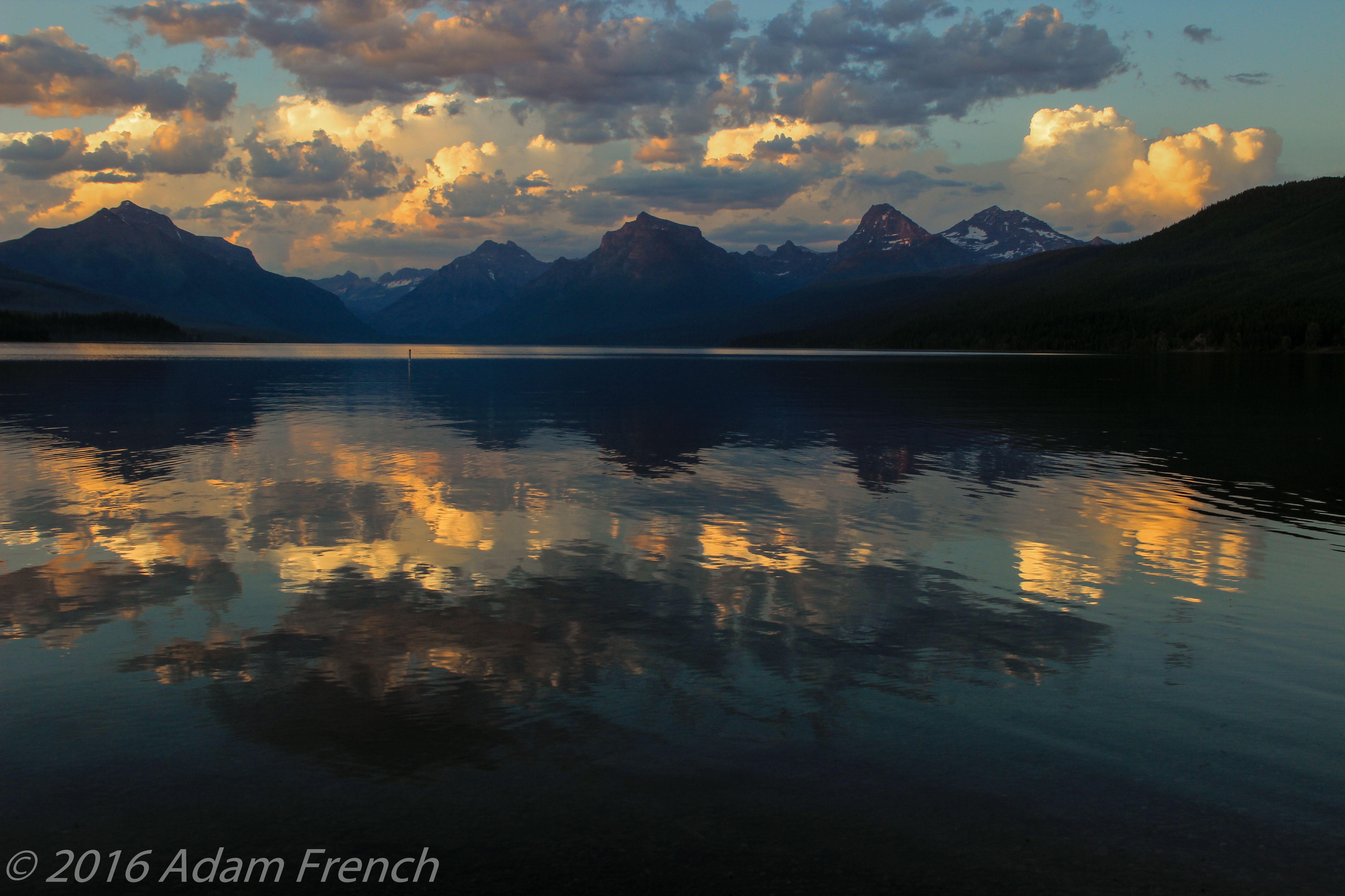
The view faces northeast so you won’t see the actual sun drop below the western mountains.  However, you will see the play of shadows and alpenglow on the mountains to the east and can see their reflection in the lake water (if it’s calm.)  One night we were lucky enough to be able to watch lightning from far-off storms, in the clouds towering over the mountains, in addition to the beautiful sunset.  In addition to the picturesque sunsets, I highly recommend stopping for ice cream at one of Apgar’s several shops before heading to the lake!

Another important note, none of the lodges or motels inside the park or near its entrances have TVs.  This is done intentionally to help preserve the surroundings in a rustic manner.  It was a bit like taking a step back in time and we found it incredibly enjoyable!  People left their rooms at night and gathered in parks and along the lakeside; eating ice cream, skipping rocks, and conversing with each other.  There isn’t much cell service in this area either, so you’re forced to disconnect a bit and commune with nature (or *gasp!*, actually talk to the person next to you! 😮😉)  It catered to a relaxed, communal atmosphere.

Every night a family of ducks would swim by.  They were unique in that they would dive under the water, and remain submerged for tens of seconds, before popping back to the surface quite a distance from where they went under.  The ducklings were especially entertaining to watch.  They would build up speed by quickly skimming the water with their wings–almost to the point of taking flight–before diving below the surface. 

Sunset photo of a flat-water lake with the dark silhouettes of the surrounding mountains and sunset colors in the clouds reflecting in the water
Sunset on Lake McDonald

Aqua-colored Water

The waters in the park (the rivers and lakes) are crystal clear (and COLD!) and tinged with an aqua hue.  This comes from the glaciers that feed them.  I’ve seen pictures of this phenomenon before but had never seen it in person.  It’s one of the most beautiful, difficult-to-describe colors I have ever seen!  One wonders if the glaciers melt, how it will affect this unique quality of the park?

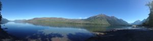
Panoramic view of a flat-water lake reflecting the tree-covered and rocky mountains surrounding it, all under a clear, blue sky.

Save

Save

Glacier National Park truly offers some of the most incredible scenery I have ever seen.  I strongly encourage you to put it on your bucket list.

If you have been to Glacier, what were your favorite parts?  Let me know in the comments!

Did you enjoy this post?  Pin it!

4 pictures: 1) Mountain vista of towering tree-covered, rocky and snow-speckled mountains; 2) An old storefront with "Polebridge Mercantile" on the front and cars sitting out front; 3) Sunset picture of a low river with a sand bar; 4) A wide path through the woods runs to tall mountains on the horizon. Pin reads, "Glacier National Park, 5 Things Not To Miss"


Like what you read here today?  Please feel free to leave a comment, like or share this post!  Add your email at the bottom of the page, or the sidebar to the right, to be notified when a new post is published.  By signing up for the email list, you will also receive a free copy of the Tranquil Trekker’s Top 10 Tips of Trekking Do’s and Don’ts!

You can also follow the blog on social media by clicking the links below!

Facebook

Twitter

Instagram

Pinterest

Rest Areas: a Road Trip Necessity

I’ve been on a lot of road trips, in several countries. So, I’ve stopped at A LOT of rest stops. They’re a necessary evil when traveling long distances by car. In this post, I review some of the most memorable ones I’ve visited.


Many people (myself included) enjoy long road trips.  Those inevitably involve stopping at rest stops in all corners of the country.  Since the Trekkers enjoy these types of adventures so much, we’ve experienced our fair share of rest areas, as well.  I thought it’d be fun to look back on some of the more interesting experiences I’ve had at these little detours, in various parts of the US, and the world.  

I’ve experienced rest stops in almost every state in the country (as well as a few in Canada and South America) so I’ve seen a wide range of them.  Below are some of the more notable ones:

Not-so-nice Rest Areas

Most of the rest stops in many states (such as Wyoming, Montana, many in the Northeast and those along the Eastern Seaboard) kinda suck, unless you’re lucky enough to stumble on a newer Welcome Center.  Most are pretty old-school, they look like they date back to the 1980s.  Many have a few toilets and a sketchy-looking drinking fountain, and that’s about it.  Sometimes you’ll be lucky enough to find one with a 1980’s-era vending machine as well!

Which reminds me…does anyone else remember when you could get a 20 oz soda out of a vending machine for $1?!  Or is that just me? Am I dating myself? 😛  Anyway, I digress…

Mule-Creek Junction near Lusk, Wyoming

One of the most unique rest area experiences I’ve had was near a tiny little town called Lusk, Wyoming.  About 50 miles north of town there is a place called “Mule Creek Junction”.  Here…there isn’t much.  US 18 and US 85 meet at a T-intersection…and that’s about it.  That and the rest stop are the only things of note for miles around (the local cattle notwithstanding). 😛

To set the scene, this facility sits in the middle of the least populated county, in the least populated state, in the continental United States.  It’s a BEAUTIFUL area, but there ain’t much there folks! (Though it is a prime place for storm chasing. 😇) 

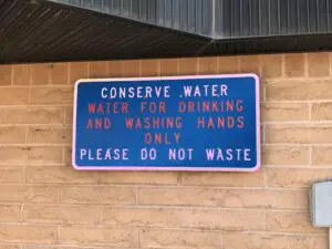
Needless to say, this is one of the few toilets in the vicinity, so by the time you get there, it is sometimes urgently needed. 😋  You can imagine my dismay when I had a compelling need for the services this locale offers on a trip to Colorado, and upon entering the building I noticed a sign that clearly stated, “water is for drinking and bathing”…I thought, “uh oh!”  Welcome to the world of “composting toilets” kids! 😝😳🙄 

Sign that reads, "Conserve water. Water for drinking and washing hands only. Please do not waste."

To be fair, they really aren’t that bad.  The building at the rest stop looks just like any of the others in the state (many of these do have real toilets).  The toilets themselves even look fairly normal, except you don’t flush, the contents of the bowl just go into a pit-like hole–it is FAR more pleasant than a pit toilet, though.  The smell is usually fine too, except on really hot days when you may catch a whiff of “something” in the air. 

This part of Wyoming is pretty arid, so I applaud the creators of this site for “going green” and using resources wisely…but yeah, now that we know what we’re getting into, we try to hold out for the “real” toilets, at the rest stop in Lusk, that’s about 50 miles down the road. 😛

Closed Rest Stops

Then there was the time we were driving up I-85 in Virginia, heading north from the southern state line.  We used to live in Raleigh, North Carolina, so when we’d trek northward to visit Mr. Trekker’s family in the Northeast, this was always a good time to stop for a break. 

One year, there were some budgetary issues occurring with that fair state, and due to this, almost EVERY SINGLE rest stop on that route was CLOSED…and they didn’t bother to post any sort of warning about this, I might add.  Yeah, there were some very “un-tranquil” words coming out of my mouth that day! 😛 (I am not responsible for what I say when I’m stuck in a car with a full bladder. 😋)

Nice Rest Stops

Turnpike Rest Areas

In contrast, some of the nicest stops I’ve seen are on the Indiana and Ohio Turnpikes (otherwise known as the 80/90 Toll Road. )  To be clear, you have to go to the new ones, on the eastern side of Indiana and throughout Ohio.  The old ones, on the western side of Indiana, belong in the category above. 😛 

The new ones are lovely though!  Bright, large, and clean they offer a variety of shops and services, including super easy access to gas. (Of course, this requires you to pay both the tolls to use the road, as well as the higher gas prices that are inevitably found at the toll plazas.  So “pick your poison” I suppose. 😛)

Skyway Rest Area

In Illinois, there are some cool, “Skyway” rest areas.  Whoever invented these was brilliant.  These are nice places that offer a variety of shops and food services that span the highway like a bridge.  This allows people traveling both directions to use the same facilities, and they use space efficiently–absolutely genius! Just be aware, you can get a little dizzy watching the traffic speed along on the highway below you…🤢

Salt-Kettle Rest Area

This rest stop is also in Illinois. It is a Welcome Center and is found on I-74 westbound as you first come into Illinois from Indiana.  It is probably one of the nicest rest areas we’ve ever been to!  There isn’t anything overly exciting about the building per se, but the outside attractions are WONDERFUL!

The green space is large, shaded, and includes picnic tables, a playground, a pond (complete with a fountain) and even a short hiking trail to a historical cemetery! There were even people fishing as we walked around the pond (can’t say I’ve ever seen this at a rest stop before!)

Squatters!

By far, the most unique rest stop I have ever experienced was a “squatter” in South America.  This should go under the “not-so-nice” heading, but it was such a memorable experience, it deserves its own category! 😋

Shortly after graduating from high school, in 2001, I and other members of my church’s youth group went on a mission trip to Peru.  We were traveling from the bustling, capital city of Lima, to a tiny town in the INCREDIBLY beautiful Andes Mountains (this was the first time I ever experienced “big” mountains folks, and I caught the bug!) 

We were quickly ascending to very high elevations, and altitude sickness was a real concern (especially for a group of American flatlanders from Indiana!)  So, our guides had us guzzling a special herbal tea in attempts to prevent the condition.

I have since learned this was likely Coca Tea, used from the same leaf they use to make cocaine…note, the leaves are prepared differently and none of us “got high”, but oh, if only our leaders–or parents–had known! 😂🙃

The good news, the tea worked for most of us.  The bad news…drinking large amounts of liquids leads to other “needs”.  So, we stopped at a nearby “rest area”.  I walked into the little shanty and couldn’t help thinking, “Toto, we aren’t in Kansas anymore!” 😮

A “squatter” is exactly what it sounds like.  It’s a tiny hut or shed, that hangs over the edge of a hill, or cliff.  There’s a hole cut in the floor that your “product” falls through onto the dirt and rocks below.  If you’re a woman or are otherwise unable to pee standing up, you “squat”, and balance over the hole. 

Other than my lack of coordination that hinders my every step 😋, that part wasn’t so bad.  The pièce de résistance of the whole shebang was that–in order to balance yourself–you have to brace against the shed walls. 

I don’t know what was on them, it was too dark to see…moss or algae perhaps?  Sure, let’s go with that! 

All I know was, whatever I was touching was SLIMY! 🤢  Needless to say, the next time we stopped, we were all happy to use the outdoor toilet that basically involved us just openly peeing off the side of a cliff. 😆

I experienced my first mountain, shelf road on that trip, as well.  Have you ever seen any of these “dangerous roads” documentaries?  It was something like that.  We were riding in a bus with LARGE windows which allowed us to fully enjoy all the beautiful scenery…including the 1000+ foot drop–and no guardrail!–that began mere inches from the tires on the bus we were riding.  Why do I ALWAYS end up in the window seat in these situations?! 😛

Roadside Tables

One rest stop activity the Trekker’s have come to enjoy is picnic lunches.  We’ve found it’s quite relaxing to pull out some lunchmeat at the many facilities rest areas often provide.  One site you regularly see in the Great Plains is “roadside tables”.  They’re exactly what they sound like, they’re picnic tables that sit along the road. 😁

I wouldn’t stop at all of them.  Some sit on unshaded blacktop and look like they would be a prime spot to melt. 😅  Others aren’t always well maintained so I’d be worried you may have some unwanted guests joining you for lunch.  I don’t need a mouse, or a SNAKE!, slithering out of the knee-high grass and onto my feet while I’m trying to eat, thank you! 😛 

But most of them are quite nice.  The facilities are often shaded and many offer scenic views of the surrounding countryside (or at least the nearby cows). 😉  This is a good way to get a break from the car, get some fresh air, and let the kids (both two and four-legged) run around a little bit. (For more tips are traveling with your furry friends, click here!) 

We’ve found this method is way more enjoyable and less chaotic than trying to find lunch somewhere, and it’s likely cheaper, quicker, and often healthier, as well.  It doesn’t hurt that we often travel in very rural areas where the nearest lunch opportunity could be an hour or more away.  These aren’t nearly as convenient in January, however…😱

Some rest areas are pretty unique! 

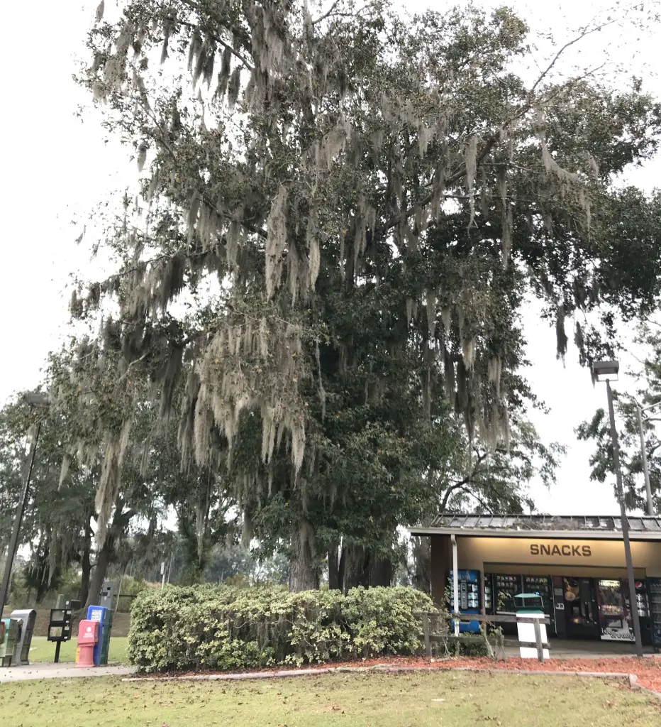
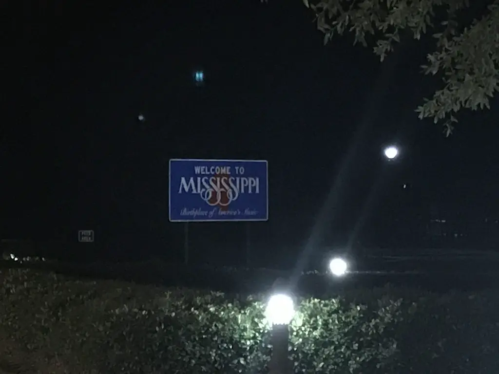
There is a rest stop on I-10, in Mississippi, which doubles as the Mississippi Welcome Center.  It is also at the same location as the INFINITY Space Center.  This site felt like a unique combination of the “Old South” (imagine large houses with Grecian-style columns on the front porch and moss growing on nearby trees) and the future–there’s a park, next door, with a model of the Lunar Module. 

This site will always hold a special place in my heart.  It could be because we were suffering from sleep deprivation at the time, 😴 but I think it’s more that it was very charming.  It also represented a huge milestone for the Trekkers.  This was the place where we could officially confirm we had both been to all of the “Lower 48” US states! 😀 

A "Welcome to Mississippi" road sign is lit up in the dark


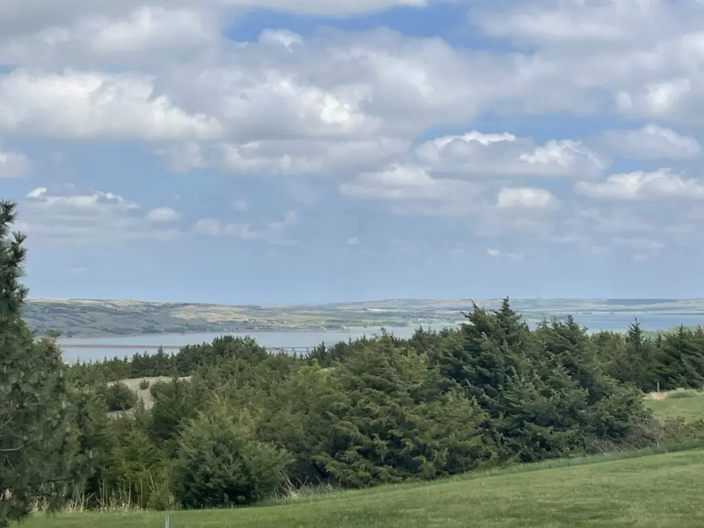
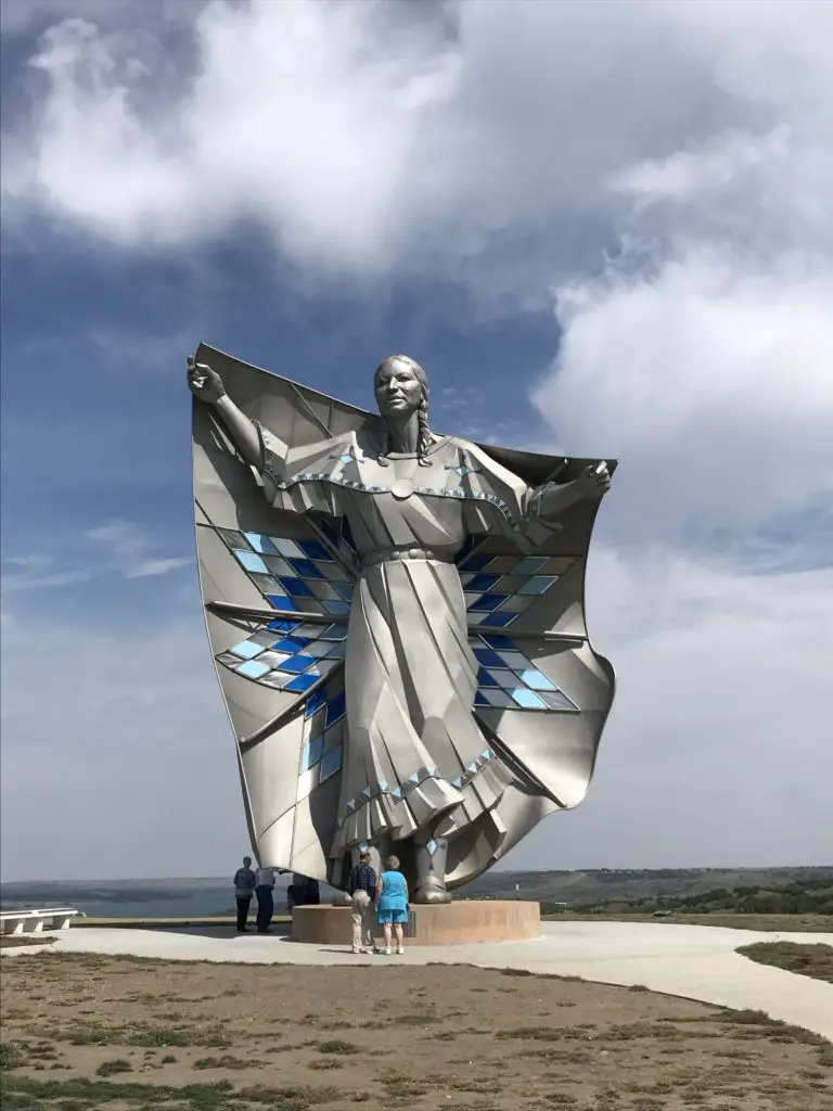
There’s also a cool rest area on I-90 in Chamberlain, South Dakota.  We pull off here a lot.  A large sculpture called “Dignity” was erected here a few years ago and is quite lovely.  It is a statue of an American Indian woman and is meant to honor the culture of the people who first came to this land.  This site also offers a Lewis and Clark interpretive exhibit that is open during the summer months.  There are also walking trails, one of which allows you fantastic views of the nearby Missouri River. 

This area is so unique.  If you’re coming from the east, you meander through the farm fields of eastern South Dakota.  Then, suddenly, the yawning chasm of the Missouri River opens up before you as the bluffs that characterize western South Dakota beckon you onward (that’s the Trekkers’ home baby!)

Picture of a large river with grass-covered bluffs in the background. Green trees and grass are in the foreground.
One of my favorite views of the Missouri as you head into “West River” (western South Dakota)
Large statue of an American Indian woman
Dignity


One rest stop we both enjoy in Wyoming is on the outskirts of Greybull.  It also features a small, airplane museum.  The tiny museum never seems to be open 😛 but you can view most of the planes through the fence that surrounds it.  

Love them or hate them, rest stops are a necessary evil on long road trips.  They can often be a blessed appearance if only to escape the chaos you’re currently experiencing in the car for a few minutes!  So go enjoy the open road, you never know, that side excursion may offer some interesting stories to bring home all on its own!

What unique rest stops have you visited?  Let me know in the comments!

Did you enjoy this post?  Pin it!

Large tree covered in moss next to vending machines. Pin reads, "Rest Areas: A Road Trip Necessity"


Like what you read here today?  Please feel free to leave a comment, like or share this post!  Add your email at the bottom of the page, or the sidebar to the right, to be notified when a new post is published.  By signing up for the email list, you will also receive a free copy of the Tranquil Trekker’s Top 10 Tips of Trekking Do’s and Don’ts!

You can also follow the blog on social media by clicking the links below!

Facebook

Twitter

Instagram

Pinterest


Opening Weekend on Beartooth Pass

In this post, I review a Memorial Day road trip on Opening Weekend of the Beartooth Highway in Montana.


One item you should definitely have on your Road Trip Bucket List is to drive the Beartooth Highway on Opening Weekend.  This route connects Red Lodge, Montana, on the north side; Yellowstone National Park, to the west;  and Cody, Wyoming, to the south.  The route usually opens by the Saturday of Memorial Day Weekend, though this is always weather-dependent.  Also, temporary closures may occur after the opening date, also due to weather.

Click here to watch videos of snowplows clearing the route on YouTube (be warned, they are addictive! 😉)  The Montana DOT often has to clear snowdrifts that are over 20 feet deep in some areas! 

Washoe Ghost Town near Red Lodge, Montana

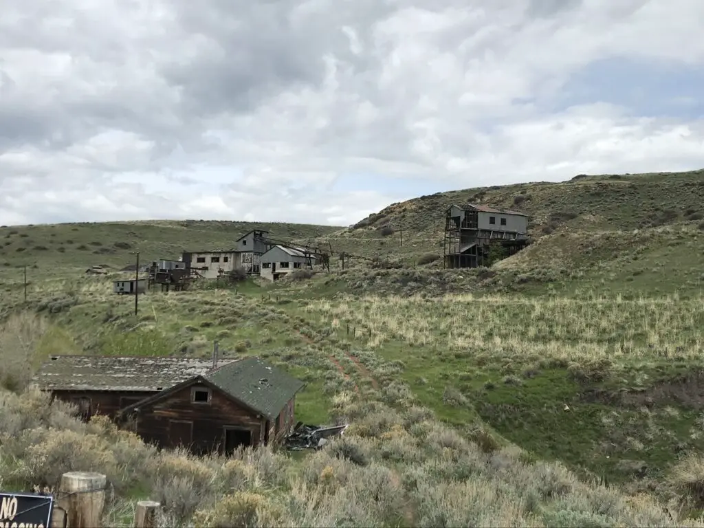
You can travel the road from either direction.  We started in Red Lodge, Montana.  We noted on the map that there was a ghost town not far from our hotel.  The Washoe Ghost Town and mine site is located on Route 308, between Red Lodge and the tiny town of Bearcreek, on the way to Belfry.  The actual site is situated on private land, so you can’t tour it, but it is easily visible from the side of the road. 

This location’s (unfortunate) claim to fame is that it was the site of the worst mining disaster in Montana history in the 1940s. 😐

Scrubbrush prairie dotted with dilapidated buildings
Washoe Ghost Town

Lodging along the Beartooth Highway

We’ve been learning the joy of simple motels on recent trips.  Air B&B’s have become our “lodging of choice”, though we’ve been finding, if we MUST stay in a hotel, the simpler, local options appeal to us the most. 

They have to be clean, and well-maintained, of course, but they often have so much more character than the stale, chain hotels people usually think of.  We also, frequently, stay in smaller towns, where the larger chains don’t often have a large presence.  So, being willing to expand our horizons a bit makes lodging much easier to locate.

We had incredible luck with finding places to stay on this trip.  In Red Lodge, we chose the Red Lodge Inn, which was absolutely ADORABLE. 

It was a simple motel, but it appeared that the rooms had been refurbished recently, and they were quite nice.  We were also impressed by how large they were!  The motel is owned by a young family, and the hosts were incredibly friendly and helpful when we needed information regarding local attractions.

In Cody, Wyoming, we stayed at the Cody Cowboy Village, and it was equally as cute.  This one had more of a “Western” theme, while the room in Red Lodge felt more like a mountain cabin, but both were equally enjoyable. 

At the motel in Cody, large wooden beams made up the small cabins and reminded me of the ADORABLE Grandma’s Cabin that we stayed in, with Mr. Trekker’s family, in Island Park, Idaho, during our Yellowstone trip in 2014!

Places to eat along the Beartooth Highway

We’re also learning that simplicity is our friend when it comes to finding meals out on the road.  We love little cafes and diners, and again, when you stay in small towns, it’s good to enjoy these. 😁 

When in Red Lodge we had dinner at one of our favorite places, Red Lodge Pizza.  The restaurant is housed in the old post office and features creations along that theme such as, the Cliff Claven!  We’ve never had a bad meal there! 

In Cody, we ate breakfast at Our Place, a charming little dive (to be clear, I use that term affectionately) just across the street from our hotel. 

Some of the best meals I’ve eaten at a restaurant were cooked in “dives”.  These places are usually locally-owned by regular, small-town folks.  The owners are often a joy to talk with, and any time the place is crowded with locals, you know you’re in for a treat!

We enjoyed dinner at the Occidental Saloon in Buffalo, Wyoming the final night.  We’ve visited there before and have always been happy with the meals.  This site is attached to a historic hotel in town, where the likes of Teddy Roosevelt, Butch Cassidy, and Calamity Jane once rested their weary feet.  As usual, we ate the final meal of our trip, breakfast on Memorial Day morning, at the Busy Bee Cafe, also in Buffalo.  I’ve waxed lyrical about how much we like this cute little restaurant before.

The drive on Beartooth Pass!

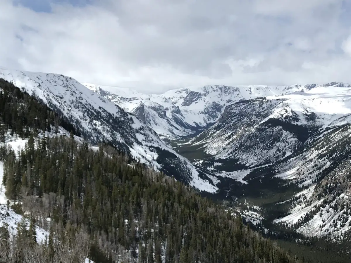
Although weather forecasts made it appear doubtful, we did get to drive the full extent of the road…on the Montana side.  We had to wait 1.5 hours for it to open up but got to enjoy views from one of the main lookout points while we waited.  When we heard whoops of delight from the skiers and snowboarders that were parked near us and saw the snowplows drive by, we knew we were headed to the summit!

Weather had been pretty wild in this part of the country that spring, and this area had received close to a foot of snow just a few days before the road opened. 

The Forest Service had gotten the Wyoming side of the route mostly open, save for the last few miles at the summit.  With the recent lousy weather though, this portion had drifted shut again. Fortunately, we have driven the entire route before (just not on Opening Weekend). 

The weather didn’t seem much different from when we were there in July of 2016, there was just–a little–less snow in the summer.  There were still plenty of gloomy gray clouds, and the temperature was, maybe, only 1o degrees warmer. 😛

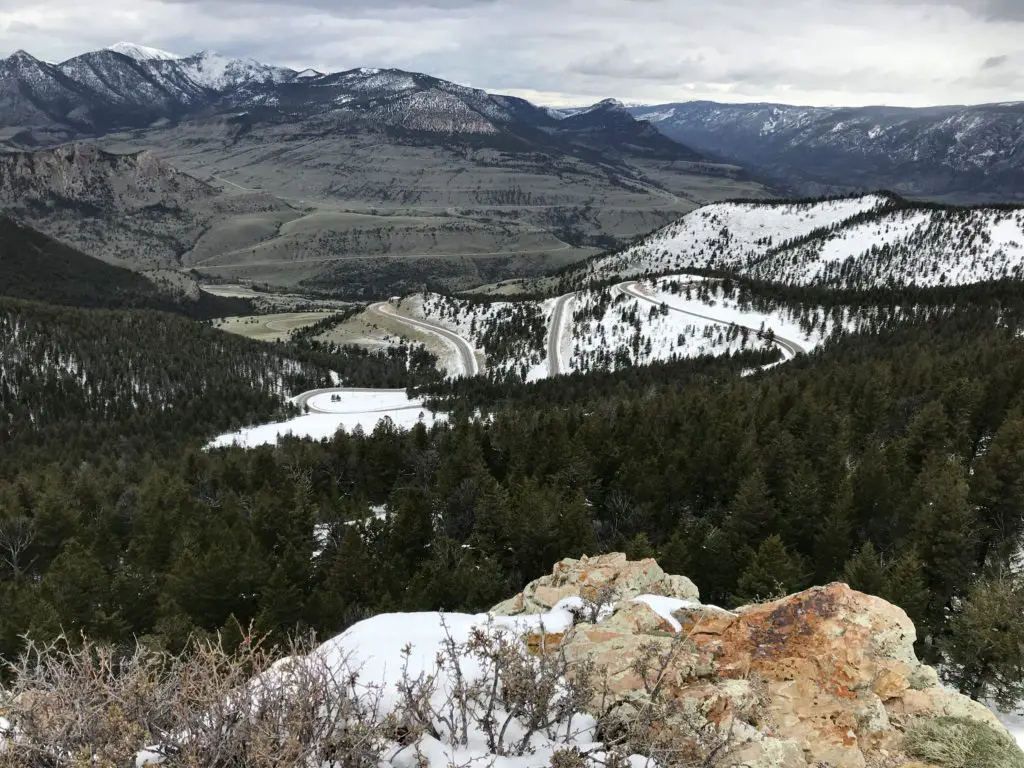
We found it to be almost disorienting near the summit.  The way the white snowfields melded with the pale, gray sky, it was hard to tell where the land ended and the sky began!

To check current conditions on this incredible stretch of road, you can check out these sites:  Montana DOT; Beartooth Highway in Wyoming.

A view over a vista of snow-covered mountains and valleys under a cloudy sky

Because the road was closed, we had to embrace our motto from a previous road trip, and “Just Groove“, and boy, were we glad we did! 

The alternate route we chose was Route 72, south of Belfry, Montana, into Wyoming, and may I say it is absolutely GORGEOUS!  It offers incredible views of the Absaroka Mountains as you drive along their length.

Click here for a video I made of our drive. We definitely saw large piles of snow but didn’t quite get to experience the “snow tunnels” I was hoping for.  I guess we’ll just have to go back and do this route again on another Opening Weekend!

Cooke City, Montana

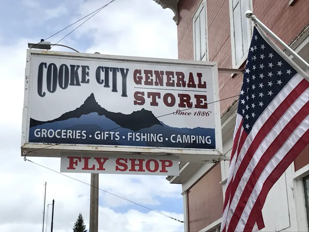
When we reached Route 296, in Wyoming, we took that road (the Chief Joseph Highway) back to US 212 (the Beartooth Highway) on the Wyoming side, as that portion was open.  This takes you all the way to Cooke City/Silver Gate back in Montana, and eventually on to Yellowstone National Park. 

These two, tiny towns had been on our “must visit” list since our Yellowstone TripThe towns were teensy but enjoyable.  They definitely felt like the type of places you’d visit in the high mountains.  For those who may be interested, I should note that there are several campgrounds in this vicinity.  HOWEVER, they only allow hard-sided campers (no tents) due to regular bear activity.  Just something to be aware of. 😳

Store sign on a building near an American flag reads, "Cook City General Store, Groceries, Gifts, Fishing, Camping, Fly Shop"

Storefront of an old, brick building on a city street, with some cars parked near it

View down the street of a small town with small shops and cars lining both sides, under a cloudy sky

Drive the Chief Joseph Highway in Wyoming

I can never get over how beautiful northeastern Wyoming is.  On our trip, everything was so uncharacteristically green!  This is an unusual sight for this normally dry area, but the early season and recent rain had the grass growing well! 

There were some gray clouds (though we enjoyed more sun than expected) and these, contrasted with the vibrant green of the new grass and the steely, dark gray mountains, with snow still capping their summits, made for quite the scenic view!  The somewhat dreary–yet picturesque–image made both of us think of Scotland (or what we imagine Scotland to look like, having never been there…YET!) 😮😉

View from above into a rocky canyon with pine trees and a river far at the bottom
There’s a story that goes with this picture. Mr. Trekker had to take it from the bridge because I was too chicken to stand near the edge!

See below for more pictures of our drive.  As you can see, there was still some snow on the upper peaks:

Brown grass and pine tree-spotted meadow leads to snow-covered mountains in the distance Brown grass and pine tree-spotted meadow leads to snow-covered mountains, with the sun shinning on parts of them, in the distance Brown grass and pine tree-spotted meadow leads to snow-covered mountains, with the sun shinning on parts of them, in the distance A paved road with rocks, grass and pine trees on both sides leads to snow-covered mountains in the distance View overlooking a vista of a flatter pine tree and rock-covered area leading to snow-covered mountains in the distance View over a mountain vista from above. Pine trees and snow cover the lower elevations, brown grass covers the higher elevations that leads to tree and snow covered mountains in the distance.

Buffalo Bill Center of the West in Cody, Wyoming

We eventually made our way back down the Beartooth Highway and stayed in Cody, Wyoming Saturday night.  We’ve stayed there several times as a stopover, and each time we thought we should take the time to visit the Buffalo Bill Center of the West (but never got the chance).  Since this was a weekend of “checking things off the list”, we decided now was as good a time as any!

The museum is actually made up of five different areas.  We both enjoyed the Natural History portion the most.  This section comprises multiple levels, as though you were traversing down a mountain, from the tundra ecosystem near the summit to the prairie/grassland found far below. 

We also enjoyed the firearms museum, that showcased items from around the globe and from a wide range of battles throughout history.  There was also a section regarding the life of Buffalo Bill Cody and his Wild West Show that was quite interesting.

Ten Sleep Canyon, Bighorn Mountains

We took one of our favorite routes home through the Big Horns, US 16 through Ten Sleep Canyon, in Wyoming.  This is, absolutely, one of the most beautiful canyons I have ever seen!

They call this the most scenic route through the Big Horns and I believe it!  Route 14 and 14a are pretty in their own right (and you’re much more likely to see moose on one of these roads) but the southern route through the canyon is one that shouldn’t be missed! 

As you’re driving into the canyon from the west, you have the Absaroka Range in your rearview mirror while the Big Horns loom ever larger in front of you.  This area is quite dry and barren, as it’s in the rain shadow of the Absarokas, adding to its rugged beauty.

I know I’ve mentioned it before, but I can’t get enough of the ruggedness that makes up the Wyoming countryside.  The drab yellow of the badlands that contrasts–this time of year–against the almost florescent, green grass of Spring in the foreground, and the imposing, dark mountains in the background (with their bright white caps).  This area is pretty all the time, but especially so this time of year before the hot summer conditions have baked it dry.

This route is also called the Cloud Peak Skyway Scenic Byway, as it is the main road that runs nearest to Cloud Peak, the tallest summit in the Big Horns (though you can’t actually see the summit from the road as it’s in the middle of a Wilderness Area). 

Click here for a video I made of a Labor Day Weekend drive through the canyon.

View up a brown rock canyon dotted with trees, all under a clear, blue sky View across a blue lake that is surrounded with pine trees with rocky mountains in the background, all under a clear, blue sky

This route is also a beautiful drive down the east side of the Big Horns into Buffalo, WY.  If you’re there at the right time, you may see yaks grazing on the steep hillside near the side of the road! 😮

I recommend everyone check out these drives if they have a chance, as they are all quite beautiful.  There are LOTS of tiny lakes that make for great pictures (not to mention plenty of marmots posing for photos in the higher elevations!)  Be prepared though, winter conditions can occur at any time in that area (we had thunder and slushy snow falling on us in July!) 😮 

Go tour these highways, you’ll be glad you did! 

Longmire Store, Buffalo, Wyoming

Finally, we were able to cap off our weekend in the best way!  Each time we visit Buffalo, I have hoped to stop at the Longmire store, named after the well-known book and Netflix series.  As we learned, it used to ONLY be open during Longmire Days each year in July, as it was just a satellite store.  Well, it is now open all season and we FINALLY got to partake of its wares!  See, persistence pays off. 😁

Have you visited the Beartooth Highway on Opening Weekend?  Tell me about it in the comments! 


Did you enjoy this post?  Pin it!

3 pictures: 1) View from above into a rocky canyon with pine trees and a river far at the bottom; 2) View overlooking a vista of a flatter pine tree and rock-covered area leading to snow-covered mountains in the distance; 3) A view over a vista of snow-covered mountains under a cloudy sky. Pin reads, "Opening Weekend on Beartooth Pass"


Like what you read here today?  Please feel free to leave a comment, like or share this post!  Add your email at the bottom of the page, or the sidebar to the right, to be notified when a new post is published.  By signing up for the email list, you will also receive a free copy of the Tranquil Trekker’s Top 10 Tips of Trekking Do’s and Don’ts!

You can also follow the blog on social media by clicking the links below!

Facebook

Twitter

Instagram

Pinterest

A Day in the Life of a Freelancer

In this post, I detail what I learned from my experience working as a freelancer.


Author’s Note: I wrote this article several years ago when I was working as a Freelancer, writing grants, online articles, and doing some consulting. Unfortunately, COVID brought that opportunity to a grinding halt (though I now have a more typical “9 to 5 job” I’m still blessed that it’s very flexible and it allows me to frequently work from home.) I thought people may still find my Freelance experience interesting though and I do hope to return to this type of work someday. 

I cannot express how thankful I was that I was able to seize this opportunity.  My thanks especially go out to my amazing hubby, as without him this wouldn’t have been possible (both emotionally and financially).  A word of warning, this type of work is not all roses and sunshine.  It’s hard work, there isn’t a lot of job security and it requires a large amount of personal discipline.  But the freedom it gave me to live my life as I chose made it all worth it!

Can you freelance in most professions?

Freelance work covers a wide range of industries.  It can be anything from online writing, web design, or consulting to an artist who is contracted for work or a person selling beauty products or supplements on the side.

A freelancer could be a stay-at-home parent who babysits other people’s children in addition to their own, jobs like Uber, or a dog walker.  Basically, it is any service contracted between you and another party, for any type of payment.

Payment may not even be financial in nature.  While I firmly believe no one should work for “free”, it isn’t unusual to do at least some freelance work for no financial compensation.  Instead, “payment” could include experience earned, connections made, or even just the hope of future dividends paid.  I got started as a volunteer and this eventually morphed into a paid opportunity.  

Freelancing can be a physical job based on a hand-shake with a real human, or a gig in the new, online workforce where you may never meet or even see your client face-to-face.  Literally ANYONE can do this!

Is freelancing a “real” job?

The answer is a resounding YES! (and it can be TOUGH!)  Freelancing often gets a bad rap.  It’s become more and more accepted and normal in the past few years (especially during COVID), and trends suggest this will only continue into the future.

But many people (and even some businesses and potential employers) treat it with condescension.  They think all we freelancers do is sit on the porch all day, sipping on lemonade while we type on our laptops.

To be fair, there is a little truth to this idea (says the woman who is currently typing on her laptop while sitting on the porch. 😇) 

But many don’t realize the effort that goes into freelancing…

A freelance job is stressful

I didn’t fully appreciate just how stressful freelancing would be when I first started.  There are things they don’t tell you about this “dream job”.  For one, you literally don’t get paid unless you’re actively working.  That may seem silly to say, but you don’t realize just how tiring a day of work can be until you don’t make a dime unless the project is delivered and completed, to the client’s liking.  Whether it takes you two hours or two days to complete the project, the payment is the same.  Even if you bill a client on an hourly basis, you have to justify every minute of that hour. 

At a typical hourly (or even salaried) job, you get paid for those breaks you take to run to the coffee machine, or the bathroom, or to stop by a coworker’s desk to discuss a project (and end up shooting the breeze for the next 20 minutes).  As a freelancer, you don’t, you literally have to work for every…single…cent you make.  It’s a wonderful, flexible, exhilarating, rewarding experience, but it’s also tiring.  I can honestly say I felt more tired at the end of the day, working part-time from home as a freelancer, than I almost ever have working a normal, 9 – 5, hourly job. 

There is a lack of job security with freelance work

There is also the financial strain of fluctuating, irregular income, and extreme job uncertainty with freelance work.  While no job is “guaranteed”, people with long-term employment are usually pretty comfortable that their job will still be there next week or next month.  With freelancing, there is virtually no job security.  There are some contracted positions, but those are usually only “guaranteed” until the current project is complete (and as we all learned with COVID you can be laid off at any time, with little to no warning.)  Most freelancers are continuously seeking out new work.

Freelancers work an irregular schedule

You can spend days or weeks with almost no work, and then a big project will crop up with little notice (which is wonderful, for the money and experience, but it can cause a lot of sudden stress and really throw off a family routine). 

Please understand I don’t intend any of these statements as complaints.  I LOVED working as a freelancer and hope to return to it someday.  I am VERY aware of just how fortunate I was to even be allowed this opportunity.  I just want people to understand that just like any job, working for yourself has its challenges, as well.

Freelancer pearls of wisdom

I learned a lot through my freelancer experience, and I know a lot of freelancers who are striving to make their “side-hustles” work, so I thought I’d pass on a few pearls of wisdom:

–Freelance work is INCREDIBLY rewarding.  This was one of the only jobs where  I actually felt like I EARNED every single dime I made (don’t tell any of my “real” bosses I said that! 😛)  That felt REALLY GOOD!

It was ironic, I made less working as a freelancer than I had in more than a decade, but I felt more proud of the work I did and the income I received.  It reminded me of when I first started working in high school.  Even though the checks weren’t large, I knew I busted my butt for every single dime I received (of course, then Uncle Sam comes in and takes his share…😤)

–I find online freelance work can be surreal.  It IS work, it takes time, planning, and mental energy.  But it doesn’t FEEL “real”.  Depending on the type of work you do, tt may not be unusual to only communicate with clients via email or online messaging.  You may never hear their actual voice, or even know what they look like!  Then there’s also the fact that your work is magically sent into the ether that is the World Wide Web, and then, a while later, if the client is pleased, money magically appears in your bank account. 😮

I’ve gotten several jobs through Upwork, a freelance matching service.  There are several platforms like this out there that allow freelancers to connect with potential clients around the world.  I’ve worked with companies as far away as Seattle.  Living in western South Dakota, just a few, short years ago it would have been hard to even connect with a place like this.

–I am still somewhat amazed that you can actually make a decent income, literally working from your backyard.  I have learned that there are actually legitimate companies out there that will pay you a decent wage to work from home.  It takes a little luck to get established and to find some of the connections, but once you get over that hurdle, depending on the time you have available, your internet connectivity, your skillset, and your determination, you can make a decent career for yourself as a freelancer.

–I liked being able to pick and choose what companies I wanted to work with and what projects I wanted to work on.  Obviously, if I was picky, that meant less money in my pocket.  But it enriches your work life when you don’t have a boss forcing you to work on a project you aren’t interested in or being forced to work with a company you don’t respect.

–I had to learn about things like quarterly tax payments to the state, and “estimated tax” to the Federal government.  Ugh, every time I had to deal with the bureaucracy involved with these my Libertarian heart grew a little larger (and I say that as a former State employee living in a business-tax-friendly state! 🤑)

–Then there’s the constant bane of my existence, the one act of blogging that makes me want to rip my hair out and throw the–not inexpensive–laptop across the room…the dreaded coding. 🤮  I HATE coding!  I’m learning to do it, though I’m still an extreme novice, but I HATE it.  I know, this is an unpopular opinion, and I probably just made a bunch of “Women-in-STEM” advocates cringe, 😉 but I can’t help it.  I HATE it! 😋

I find coding is a tedious process.  The more I understand, the more I can use it, but it just doesn’t spark my interest.  A lot of people really enjoy it, and I can kind of understand why.  It is like a puzzle that needs to be solved (kind of like math, which I also HATE! 😉) 

But for me, the time spent trying to figure out why that stupid heading INSISTS on remaining in the middle of the page just feels like a waste of time.  It’s probably mostly that the blog isn’t making much income at this time.  That’s ok, that’s how these things work and I understand that.  The hope is that it will pay dividends in the future.  But I think the stress of spending hours fighting the code would be much easier to handle if a hefty salary came along with it. 😛

Goals I was able to achieve in my attempt at freelancing:

      • I’ve was able to develop a decent portfolio of online travel writing that served me well in long-standing jobs
      • My grant writing career didn’t progress like I hoped it would. COVID, and the resulting economic decline saw to that. I did find  I could only focus on a few projects at once, so having one or two clients I could place all my focus on was much better than having to divide that focus out among numerous agencies.I originally started by providing volunteer services.  I learned A LOT during those years, and am happy to say that knowledge paid off as several grants I submitted were approved for funding.  It’s incredibly satisfying to be able to help local, non-profit agencies that I care about and can see literally helping people in my own community, to be able to continue to provide those necessary services.
      • For a short time, I was able to work as a consultant for a local agency and was able to pull from several previous jobs to succeed in that position.
      • Regarding the blog, I have learned SO MUCH regarding marketing, social media, and coding and I’ve even begun to master the much-dreaded SEO. 😮   Don’t let anybody kid you, maintaining a blog can be a full-time job in itself.  But I’m excited to say I’m finally starting to see some success and growth!

You won’t find a more flexible, family-friendly work environment than that of a freelancer.  But, there’s also the stress that comes from uncertain job security and the financial strain that’s caused when you move away from a steady, full-time income (and benefits).  This is made far easier for anyone who can lean on a partner or spouse for financial support or things like health insurance, but not everyone is in that position, which makes freelancing even more difficult.

To Conclude

Many people pursue freelancing on a part-time basis as the ever-popular “side hustle“.  This is a GREAT way to get started, it’s also far smarter and more secure financially.  But it poses problems of its own…

We’re all busy, trying to carve out time in our days around work, house chores, dealing with kids and/or elderly parents, or working around busy family schedules.  Finding time to fit in an additional job, especially one where you may not make much money for the first several years, can feel like an insurmountable obstacle.

I pursued this endeavor under the best of circumstances (I was financially able to lean on a partner for support and we don’t have kids), and I STILL felt the stress and eventually failed at my endeavor (at least for now. 😉)  I can’t imagine how people who deal with additional stressors manage.  So to all the other freelancers out there, trying to make it as a pioneer in this new, gig economy, my hats off to you!

Have you done freelance work?  What have you learned?  Are you interested in becoming a freelancer?  What additional questions do you have?  Let me know in the comments!

Did you enjoy reading this post?  Pin it!

A laptop, water bottle and drink container sit on a table on the deck of a house. Pin reads, "A day in the life of a freelancer"


Like what you read here today?  Please feel free to leave a comment, like or share this post!  Add your email at the bottom of the page, or the sidebar to the right, to be notified when a new post is published.  By signing up for the email list, you will also receive a free copy of the Tranquil Trekker’s Top 10 Tips of Trekking Do’s and Don’ts!

You can also follow the blog on social media by clicking the links below!

Facebook

Twitter

Instagram

Pinterest

A Sustainable Low-carb Lifestyle

In this post, I review how I’m continuing to implement some low-carb recipes into my everyday diet.


Several years ago I tried to go low-carb as part of my Lenten fast.  I’ve been able to maintain some of the low-carb practices and recipes I learned during that experiment and make them a sustainable part of my everyday life.  I’ve had some interesting results.

The low-carb diet killed my sweet tooth!

It appears that my sweet tooth took a bit of a hit during my low-carb experiment. (I suppose some may consider this a good thing. 😛)  I still enjoy sweets, I just find that my tolerance for them is lower.  Or, at least, that my “palate fatigue” is stronger in regards to sweet treats. (This mechanism was discussed in the Paleo and Keto Diet book I reviewed in a previous post.)  This seems to mean that while I still have a desire for sweet foods, and still enjoy them, my craving for them ends more quickly and it is easier to put them aside.

I also find I no longer have any interest in something that is “just sweet”.  This would be treats such as milk chocolate or plain Rice Krispy squares.  If I’m going to stimulate my sweet tooth these days, I need something with real flavor.  Dark chocolate and/or treats that include peanut butter now seem to be the most appealing.

Better low-carb food choices…

I’m also striving to continue to snack more healthily, and have been attempting to stick with nuts, trail mix, and granola bars, rather than chips or sweet snacks.  I’ve still been trying to keep more whole grains, brown and wild rice, whole-wheat flour, and more “breads with seeds” (as Mr. Trekker calls them 😉) in my diet as well.  One of our new favorites is a rice medley of brown and wild rice that I add edamame to.  Sprinkle a little soy sauce on for added flavor and it is divine!  It’s also filling and really sticks with you! (See the pic above for the finished product!)

Bag of Lundberg Wild Blend rice sitting on a stove

I have been rather proud of myself.  In addition to having less of a sweet tooth, I’m still finding I don’t crave processed foods as much as I used to.  I allow myself to eat these occasionally, but now I seem to be able to make a single bag of Cheetos last SEVERAL weeks when I used to only be able to contain my impulses on these favorite snacks for a few days.  I am also finding that certain “naughty” foods, such as sweets, or fast food items, just don’t taste all that good anymore.  This makes them far easier to say “no” to! 😁
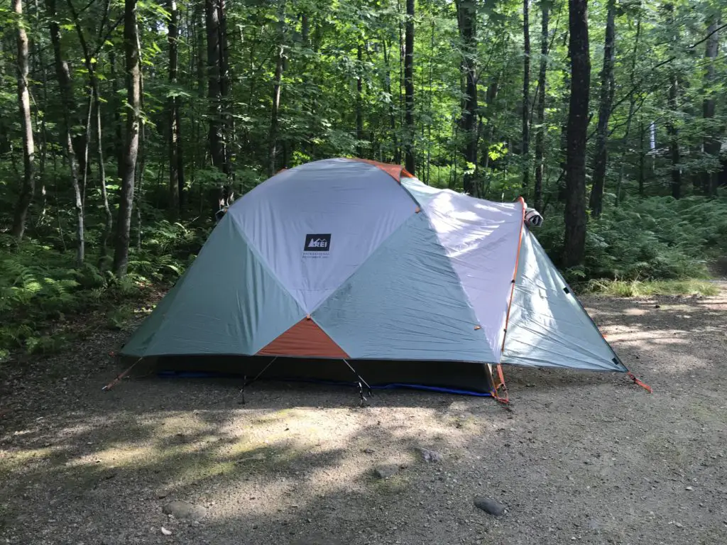
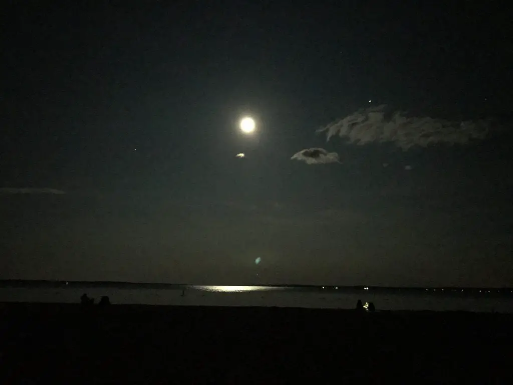
Every now and then I continue to get the occasional, lightly-queasy feeling I mentioned previously, which I’m hoping means I’m still eating fewer carbs than I used to since this seems to be a normal side effect of a low-carb diet.  It usually only occurs when I’m getting hungry, and I’m still finding that a handful of peanuts seems to take care of it rather effectively.
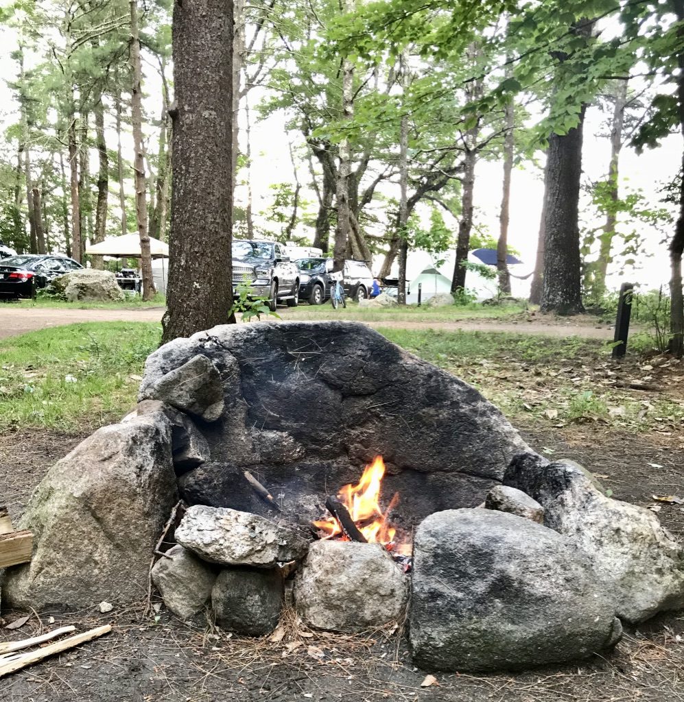
Fasting as part of a healthy diet

I’m also still trying to implement 12:12 fasting as well, where I try to eat mostly between the hours of 7:30 am – 7:30 pm.  This is harder in the summer as it remains light so late.  We tend to be outside in the evening, adventuring, or even just doing yard work, so sometimes dinner hasn’t even occurred yet by 7:30.  This is especially true on weekends, though I tend to be more lenient with myself on those days.

Nausea from too many carbs…

I had an unexpected experience regarding white-pasta.  We had spaghetti one night as well as some breadsticks.  My body had a few things to say about this…

A short time after we finished dinner, the feeling came on fast.  It was kind of like an odd mix of heartburn and an IBS episode, but without any pain.  I just felt very strange.  It felt like there was a giant brick in my stomach, weighing me down.  Then I started to feel a bit shaky.  I was also sweating profusely (with IBS episodes I break out into a cold sweat, get chills, and shake, but I also have intense stomach cramps).  With the help of Tums, some ginger ale, and a little rest, I quickly got to feeling much better.

Related posts: Yummy Low-Carb Foods; Final Thoughts on Low-Carb Lent

This was a one-time occurrence and I haven’t had a relapse.  I’m assuming my body just didn’t know how to handle that large brick of carbs anymore.  I ate white-flour noodles and white-flour garlic breadsticks, and really nothing else.  I had no cheese or protein, and even the sauce I used was a light, Italian sauce.  On the other occasions that I’ve eaten large amounts of carbs, it was always mixed with other proteins or cheeses, such as in pizza.

I will say, I’m used to my stomach doing strange things, but that was a whole new experience. 🤢

Conclusion

My body seems to function best with a higher carb intake (healthier carbs at least) rather than what a typical, low-carb diet allows for.  Overall, I think this crazy diet had a beneficial effect on me.  I’m happy to see that while I’m in no way maintaining a strict, low-carb diet any longer, the experience seems to continue to encourage my appetite to lean toward healthier foods.

What steps do you take to maintain a lower carb intake?  Tell me about them in the comments!


Did you enjoy this post?  Pin it!

Two halves of yellow squash, sprinkled with pepper, sit on a baking pan. Pin reads, "A Sustainable Low-carb Lifestyle. How to lower your carb intake over the long-term."


Like what you read here today?  Please feel free to leave a comment, like or share this post!  Add your email at the bottom of the page, or the sidebar to the right, to be notified when a new post is published.  By signing up for the email list, you will also receive a free copy of the Tranquil Trekker’s Top 10 Tips of Trekking Do’s and Don’ts!

You can also follow the blog on social media by clicking the links below!

Facebook

Twitter

Instagram

Pinterest

Black Hills Blackberry Trail, near Mt. Rushmore

In this post, I review the Blackberry Trail in the Black Elk Wilderness!


The Blackberry Trail is a great hike into the Black Elk Wilderness.  This trail is fairly unknown, which is ironic because it sits directly across from one of the biggest tourist spots in the Black Hills, Mount Rushmore!

Where is the Blackberry Trail in the Black Hills?

The Blackberry trailhead is found in an old gravel parking area (that is sometimes roped off) directly across the road from Mt. Rushmore.

If the gravel parking area is roped off, you can actually park in the Mt. Rushmore parking deck. (This means you will have to pay the parking fee at the site. It used to be that once you bought a pass it was good for a year.  Now it’s only good for the day. 😛–Insert rant here, from Mr. Trekker, about the evil, automated kiosks they installed to replace humans 😂.)

We had interesting weather the day we trekked this trail, typical of spring in the Black Hills.  It was windy, with precipitation varying between light rain, heavy snow showers, and pelting mini-ice balls!  This was all mixed in with blue sky and warm sun, and we experienced all of these conditions within about 30 minutes of each other! 😛

Bring Extra Clothes when Hiking

As we were navigating the route, Mr. Trekker proved why you always bring extra supplies along, especially a change of socks!  You never know when you’re going to slip off a mossy rock and fall knee-deep into a swollen creek!

(I can’t make fun of him too much, he was actually trying to find an easy way across so he could then help me across. 😳  Of course, if he had listened to his wife and taken the route I suggested in the first place…😉.)

The water level seemed much higher than usual, as many of these creeks are just suggestions in drier times.  With the recent snowmelt and wet conditions of spring, the local waters were definitely running higher than normal.
What you’ll see on the Blackberry Trail

This is an absolutely GORGEOUS trail!  While it does climb the majority of the way, the route undulates through the hills and beautiful canyons that are common in the Black Hills National Forest.  There were a few lengthy, steep spots, but for the most part, they didn’t become overbearing.  The first half mile or so of the trail actually runs downhill. (You know what that means for the return trip!  Everyone loves a good, uphill climb to finish! 😛)

We did an out-and-back trek, taking the Blackberry Trail south to where it meets up with the Centennial Trail (just in the last few years, this portion of the route earned the classification of a National Recreation Trail.)  Then we took the Centennial Trail south, to its junction with the Grizzly Bear Creek Trail, which I discuss in this post.

I’m not sure why it’s called Grizzly Bear Creek. There may be been grizzlies in this area at one time, but that was MANY years ago (we’re talking centuries. 😛)
A portion of the way, the path runs along with Grizzly Bear Creek, which helps to make it so picturesque.  There were numerous water crossings and very few bridges throughout the trek.  Again, in drier times of the year, this may not be an issue, but I would recommend wearing either waterproof hiking boots or sandals you don’t mind getting wet if you’re planning to tackle this hike.  Also, be on the lookout for mountain goats and marmots, as they tend to frequent this area!
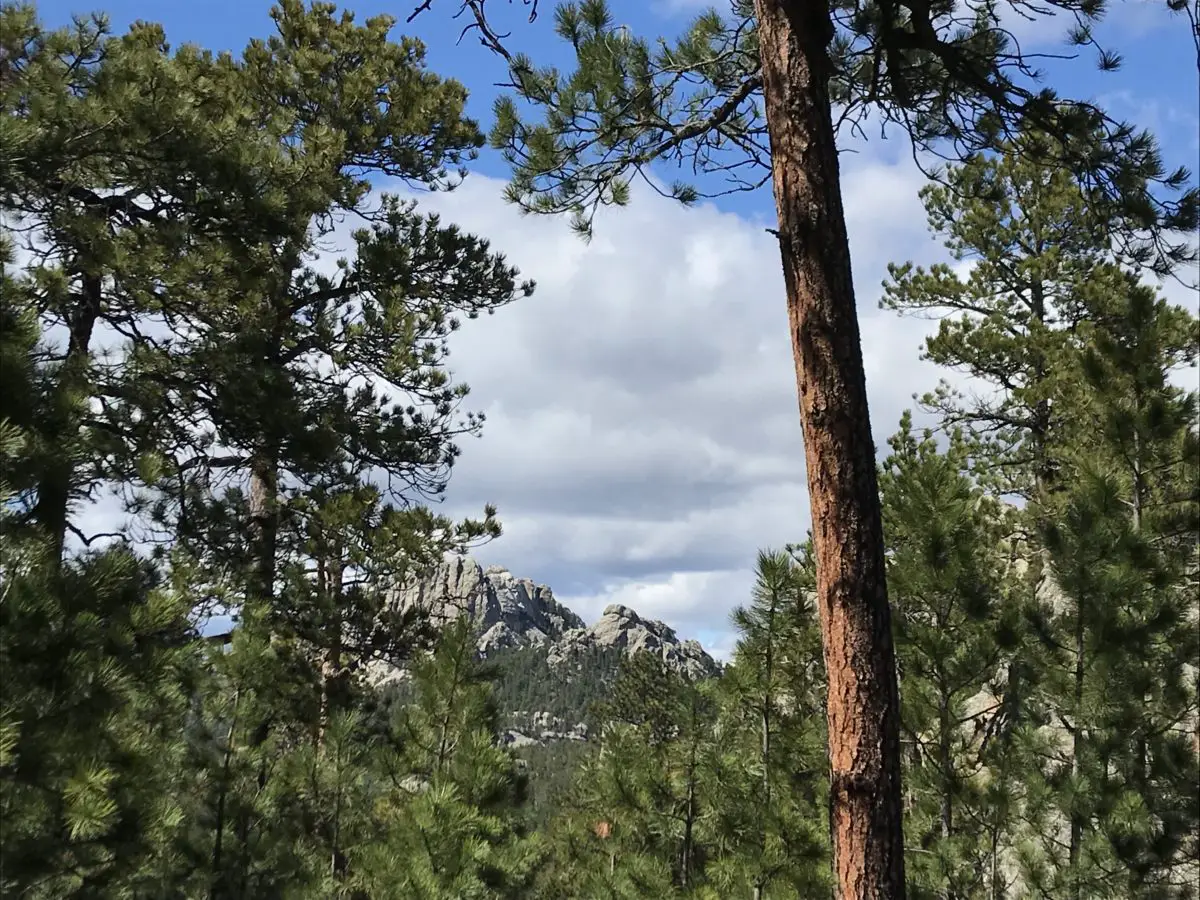
A marmot peaks it's head over some boulders
Marmot!
Mountain goal eating grass on the side of the road
You see these guys A LOT at Mt. Rushmore!
A boardwalk traverses the forest floor
One of the only bridges we encountered. It was quite picturesque!

How Long is the Blackberry Trail?

This route was about eight miles, out-and-back.  Not a bad day’s hike for us, though you could easily make it shorter or longer, to suit your tastes. Depending on how adventurous you are, this is a great area for backpacking, as it would allow you more time to fully explore the various trails that wander through the Black Elk Wilderness Area.  One other unique thing about this trail is that it offers cool views of Mt. Rushmore along the way!

Mt. Rushmore as seen through a break in the trees

Harney Range in the Black Hills National Forest

I know I’ve mentioned it in the past, but I LOVE hiking in the Harney Range.  The granite mounds and spires that are frequently found throughout the area give the region its own, unique flair.  The Ponderosa Pines that grow here allow a lot of light through their branches.  Also, the drier conditions (usually) found in the Hills lend themselves to little or no undergrowth on the forest floor. This means, even in the midst of the forest, you can actually see for quite a distance.

This is pretty unique compared to many forests we’ve visited.  Some areas of Colorado and Wyoming are similar, but these definitely contrast with forests that you find in many other parts of the country.  Most of those are comprised of dark, foreboding woods with trees so thick it’s hard to see between them.  Even in North Carolina, with the almost-tropical plants and ferns that covered the forest floor, it was easy to lose the trail.

There are all sorts of trails winding around the Black Elk Wilderness.  These aren’t the big trails that all the tourists hear about throughout the Wilderness Area and Custer State Park, though many of these do connect with the better-known trails, such as Black Elk Peak Trail, Trail #9 (formerly the Harney Trail) or the Cathedral Spires/Little Devil’s Tower Trails.

But if you’re looking for a nice, afternoon jaunt through the woods on a warm day, these are perfect.  Because they aren’t as well known, they tend to be far less crowded.  They aren’t overly difficult either.  I would give the majority of these side trails a moderate rating, with some strenuous spots.  They are sometimes single-track, rather than wide and graded, and you do have to watch for roots and rocks that you may need to clamber over or around.  But there aren’t any large, rocky areas that need to be navigated.

More pics from our day on the Blackberry Trail!

A dirt hiking trail forms a tunnel between the trees
I LOVE “tunnels”!
Mountain goats on the side of the road with Mt. Rushmore in the background
Our “Greeter” at Mt. Rushmore!

So the next time you’re looking for an interesting hike in the Black Hills, consider one of the lesser-known trails in the Black Elk Wilderness like the Blackberry Trail.  You may be surprised how much you enjoy these hidden gems!

Have you enjoyed this trail or do you have any questions on how to reach it?  Feel free to leave your experiences or any questions in the comments!


Did you enjoy this post?  Pin it!

A boardwalk in the woods with the title "Blackberry Trail"

Like what you read here today?  Please feel free to leave a comment, like or share this post!  Add your email at the bottom of the page, or the sidebar to the right, to be notified when a new post is published.  By signing up for the email list, you will also receive a free copy of the Tranquil Trekker’s Top 10 Tips of Trekking Do’s and Don’ts!

You can also follow the blog on social media by clicking the links below!

Facebook

Twitter

Instagram

Pinterest


Ode to an Old Friend

In this post, I remember the life of a wonderful dog!


After 12 wonderful years, we finally had to say goodbye to our family dog.  We aren’t sure exactly how old she was.  We adopted her as a young adult in 2007 so…she was at least 13 and could have been closer to 15, just based on the information we were given at the time of adoption.  This sweet, spoiled canine led a good, long life!

Allow yourself to feel grief

Sometimes “adulting” is hard.  I’ve spoken before about how we don’t like to experience any pain in the modern world if we can avoid it (and frequently we can).  There’s usually a pill that will at least help to dull the ache.  Pain is never completely avoidable in life, though.  One of those unavoidable heartaches is the loss of close friends (be they human or animal).  Grief sucks…and it HURTS!

We must keep in mind though, that this feeling of loss we are forced to experience from time to time is actually a sign of a good life.  That pain means you had something to love, something that added joy to your life, to begin with.  We should consider ourselves blessed if we have things in our lives that hurt so much to lose.

The Trekkers have been preparing for this eventuality for quite a while.  For the last several years, we’ve watched our dear friend, slow, lose her hearing, and the ability to fully enjoy many activities she used to delight in.  The dog who once–with enthusiasm–drug our butts all the way up and down the 6,683-foot Mt. Mitchell, in North Carolina, became a greying friend who could barely make it around the block. 

Our furry friend led an enjoyable life.  Since 2007 she’s accompanied us on countless hiking and camping adventures, traveled with us to both Indiana and New England to spend holidays with our families, and relocated more than 1700 miles across the country with us when we moved from North Carolina to the Black Hills of South Dakota. (She glared at me from the back seat of my Civic through every mile of that trip 😂!  This is a dog who used to get carsick after less than 15 minutes in a car, which made things interesting those first few years. 😛)

We adopted her from the Wake County Humane Society in Raleigh, North Carolina.  For anyone living in the area, this is an amazing place.  They provide an incredibly comprehensive survey to help match you with your ideal pet, and they provide support services after adoption (such as behavior counseling) if needed.

Happier memories of times past:
Black and tan dog lays on the back cushions of a sofa
She LOVED to sleep on the back of that couch (it did not survive her)! 😂
(View from the rear) Dog walks in front of a woman down a trail in the woods
Dragging Mommy down the trail…
(View from the rear) Dog walks down a snowy trail in front of a man
Dragging Daddy through the snow…
Black and tan hound dog stands on a rock in the forest
She loved getting outdoors!

Black and tan dog panting while standing in the forest

In case it isn’t obvious from the pictures, this pup was spoiled rotten.  😉

We received her terminal diagnosis several months before she died, so we were very blessed to get to spend so much extra time with her.  She ended up outliving the vet’s prognosis by several months!  We were so happy that she hung on long enough to be able to enjoy laying in the sun and rolling in the soft, green grass of spring again.

I have to say a huge, “thank you!” to the staff at Dakota Hills Veterinary Clinic as well.  They took such good care of our friend for the last eight years, she actually enjoyed going there.  On her last day on earth, she happily walked in the front doors, excited to see the friends she had made there.  The staff made a difficult and painful experience as easy as possible to bear. 

We were fortunate to have more than 12 long years with our friend, and I like to think she was pretty happy with her human pack members as well.   

We should all strive to live life like a hound dog!

Black and tan dog lays on green grass with a tennis ball in her mouth Black and tan dog rolls on her side in the grass and snow

Black and tan dog rolls on her side in the grass and snow

Black and tan dog rolls on her side in the grass and snow

Black and tan dog lays upside down in the grass

Goodbye old friend, you are missed but you will never be forgotten…

Black and tan dog lays in the bright, green grass


Like what you read here today?  Please feel free to leave a comment, like or share this post!  Add your email at the bottom of the page, or the sidebar to the right, to be notified when a new post is published.  By signing up for the email list, you will also receive a free copy of the Tranquil Trekker’s Top 10 Tips of Trekking Do’s and Don’ts!

You can also follow the blog on social media by clicking the links below!

Facebook

Twitter

Instagram

Pinterest