“Microadventure” is a term that’s come about in recent years. It basically means you’re going on an adventure that’s close to home, easily accessible, and can be completed in as little as a few hours. It can range from anything from a Saturday picnic in the woods to a several-day long camping trip. It can be enjoyed at any time, though it became increasingly popular during COVID when many people were choosing to save some money, and to not venture too far from home.
Microadventures are a great way to find the hidden gems to enjoy in your local community and region. They’re especially helpful as an escape from everyday stress and burnout when you may not have the time, funds or vacation days for a lengthy trip.
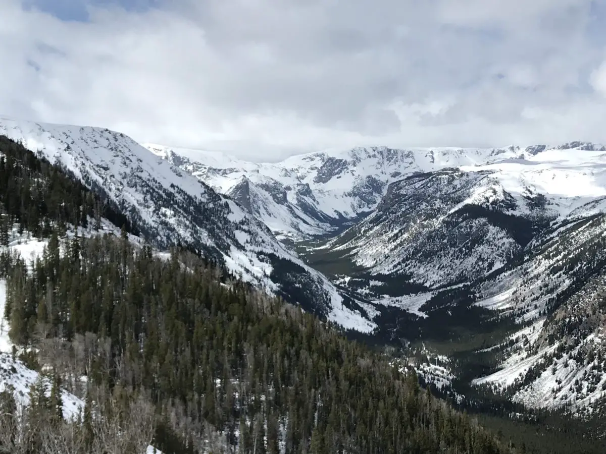
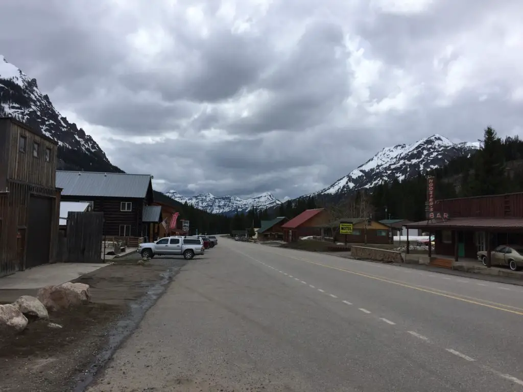
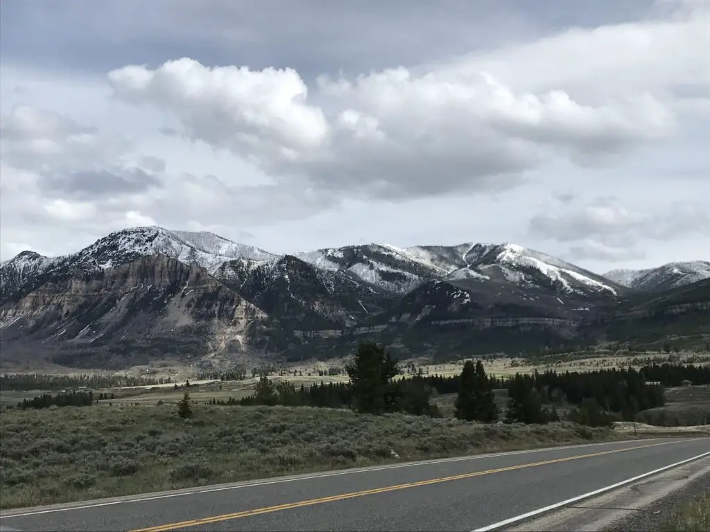
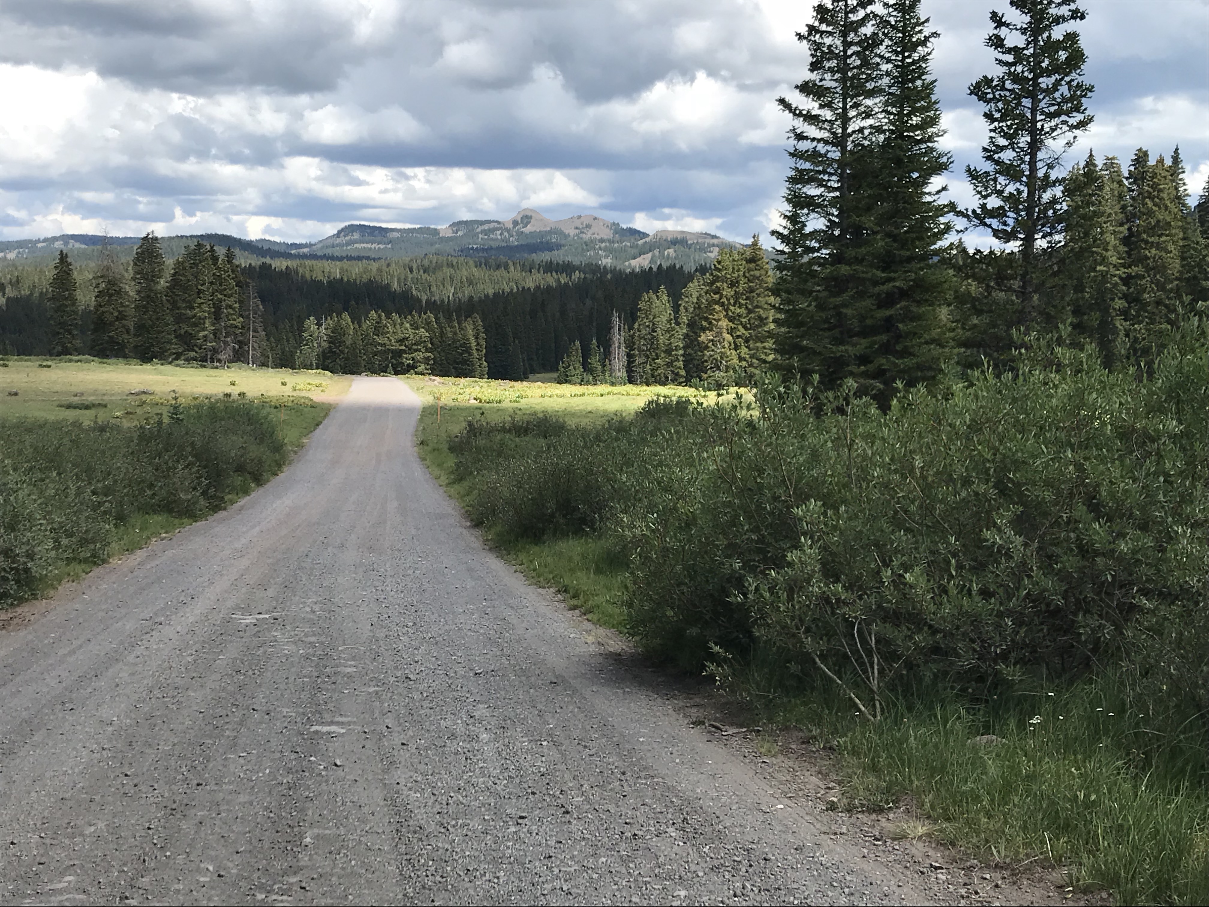
The Trekkers live for microadventures, be those outdoor activities in the Black Hills, or storm chases in the nearby plains!
One of our favorites was several years ago when we “chased” Neowise, the comet that made a surprise appearance in the skies above us!
This wasn’t the first comet I’ve seen in my life. I’m old enough to remember standing outside my childhood home, in the 1990s, with my mom one night, checking out the Hale-Bopp comet through the binoculars.
How do I find a microadventure near me?
It helps that we live in a beautiful place that makes these opportunities abundant and easy to find–though you can enjoy these types of activities in most places if you know where to look. Go to your local community park or just take a drive in the country outside the city lights. So many places have walking paths and greenways now, even in more urban areas. There are also museums, historical and natural sites, and additional recreational activities, such as ropes courses to explore.
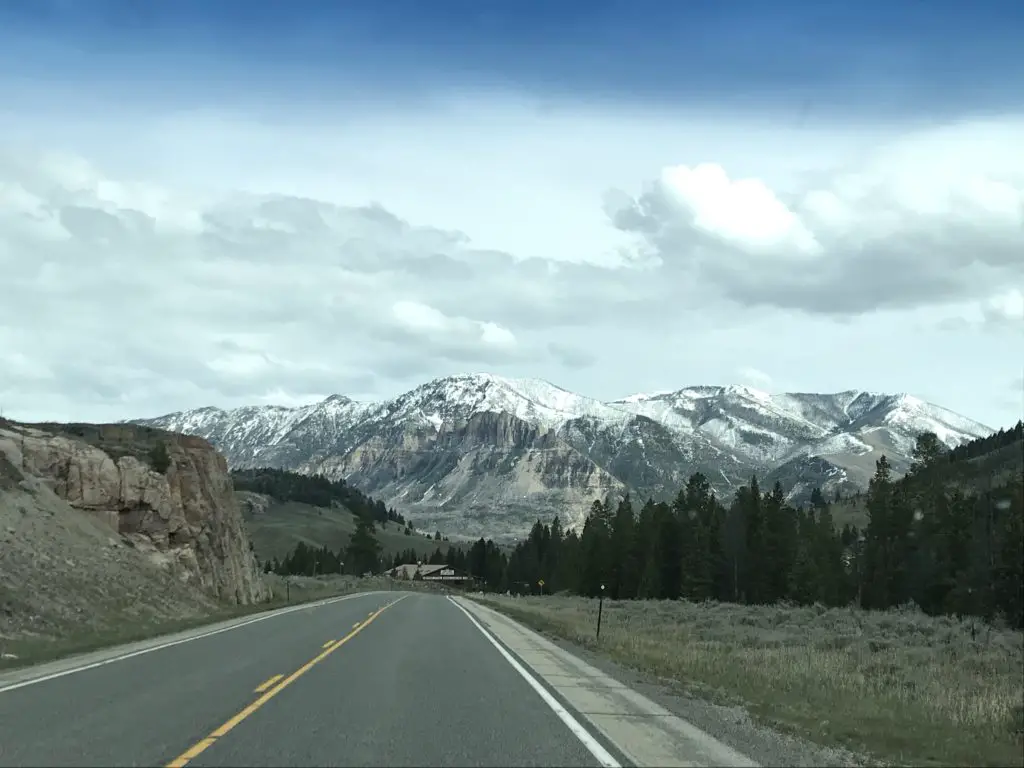
We actually started our chasing adventure on the road that traverses the ridgeback that splits Rapid City in two. Unfortunately, the light pollution from town made it difficult to see the comet. A few evenings later we drove an hour away and visited Badlands National Park, with MommaTrekker and Puppers in tow.
Badlands National Park, by-the-way, is one of the best places to view the night sky that I’ve ever seen. As the park’s location is the epitome of the “middle-of-nowhere” and being that this area is more arid, where clear skies are a common occurrence. This is a place with very little light pollution where you can view the night sky in all its grandeur. It helped that the night we went, the moon wasn’t up yet.
My mom agreed that she had never seen so many stars, and she’d spent the last 40 years living on a farm in Indiana! Several different constellations, planets, and the Milky Way were also easily visible to the naked eye. I can also attest, from previous experience, that this is a GREAT place to view meteor showers! 😮
Several days later, we finished our adventure with a short drive to Pactola Lake which is about a half-hour to the west of Rapid City.
Neowise over the Badlands!
Whether you don’t have much spare time, you prefer sticking closer to home, or if you’re trying to save a little on expenses, try out a microadventure. See what you can discover near you!
What sorts of activities do you enjoy on your microadventures? Tell me about them in the comments!
Did you enjoy reading this post? Pin it!
Like what you read here today? Please feel free to leave a comment, like or share this post! Add your email at the bottom of the page, or the sidebar to the right, to be notified when a new post is published. By signing up for the email list, you will also receive a free copy of the Tranquil Trekker’s Top 10 Tips of Trekking Do’s and Don’ts!
You can also follow the blog on social media by clicking the links below!
In this post, I discuss a delightful holiday pastime, Christmas tree hunting in the Black Hills National Forest.
Well, kids, it’s that time of year again! Thanksgiving is over, the turkey has been eaten, you may have gotten some good deals on holiday shopping…or better yet, you said, “FORGET THAT!” and chose to #optoutside to enjoy some fresh air and work off those Thanksgiving Dinner calories instead. Either way, it is now, FINALLY time to enjoy the Christmas season!
The tree is decorated, the lights are sparkling (both inside and outside the house), and Trans-Siberian Orchestra is booming from the speakers. Christmas has now been fully embraced by the Trekker household!
This time of year the Trekkers take part in what has become an annual tradition: Christmas Tree Hunting in the Black Hills National Forest for the Trekker Family Christmas Tree!
Some years, thigh-high snowdrifts can make the hunt exceptionally challenging (Mr. Trekker plays lumberjack, carrying the tree and saw. 😮)
We load up the “old family sleigh” (otherwise known as Mr. Trekker’s 4WD truck) and head out to our favorite, tree cutting spot (no, I’m not going to tell you exactly where it is. We’ve got our eyes set on other trees up there for future years! 😉)
A Trekker Family Christmas Tree in its natural environment
Where do I get a permit for hunting Christmas trees in the Black Hills?
The Forest Service encourages the practice of hunting Christmas trees in the national forest to assist them in maintaining healthy forest spaces. Also, there is nothing better to compliment the Christmas Season than the smell of pine in your living room!
You do need a permit to cut a Christmas tree in these areas. They are $10 each (max 5 per person) and you have to go to a Forest Service office or certain private vendors to obtain one.
For information on how to go about acquiring these, check the Forest Service website (where you can buy and download a pass online).
There are some restrictions on which parcels of land you can acquire the trees from and all usual restrictions pertaining to vehicle travel still apply. Also, be sure you are on public, Forest Service land and not Private Property when tree hunting.
Something to be aware of if you’re going tree hunting in the national forest…these are not “tree lot” or “tree farm” trees. These are WILD, “free-range” trees. 😮 They haven’t been trimmed and shaped on a farm with others their size, placed a perfect distance apart for ultimate fullness. They’ve been forced to fight for sunlight and nutrients among others of their kind, some that are MUCH bigger.
They may have had to grow around other trees or obstructions or had to survive vicious storms and wind, or the damage caused by animals. Basically, these trees look how they are SUPPOSED to, without human intervention. 😁 The chances of finding “the perfect tree” are pretty slim, but you’ll know when you find the “right” tree. It calls to you. 😉
Where are good places to hunt for Christmas trees in the Black Hills National Forest?
There are a variety of pine trees available in the Hills for this purpose, ranging from the stereotypical, Christmasy, spruce tree to ponderosa pines. I personally recommend the Black Hills Spruce which is usually found on north-facing slopes of hills and wetter, lower-lying areas. We tend to favor the central to northern Black Hills in our searches.
Be warned, many roads in the Hills are Forest Service roads (or old logging roads) which means they are dirt, rutted, and not maintained AT ALL for winter travel. Conditions in this area this time of year can range from dry, dusty forest roads, to mud, to–frequently–several inches or even feet of snow!
I would not recommend driving on them without a four-wheel-drive/high-clearance vehicle. Some of the roads don’t require this but much of it depends upon current conditions and varies year-to-year (or even week-to-week and day-to-day. Heck, let’s face it, in the mountains, it can vary hour-to-hour!)
Usually, the roads are snow-covered, sometimes deeply. Some years (moreso recently) there is little snow and the roads aren’t muddy, so even my all-wheel-drive CRV could suffice, though these are not normal years. Also be aware, as with many places in the Hills, if you were to become stuck or mired…it will likely be quite a hassle (and quite expensive!) to get out–and that’s once you hike somewhere you can get a cell signal to call for a rescue!
Lunch, by Deerfield Lake, after a successful hunt, on a snowy Saturday!
We have a favorite area we frequent (nope, still not going to tell you where it is!) I will tell you this much, the mountains west of Deerfield Lake have an abundance of spruce trees (assuming that’s the type you’re searching for.) Flag Mountain Road is one of our favorite routes that takes you to some good hunting spots. (That’s ALL the helpful info you will get from me!)
The difficulty with this location is that it usually receives some of the heavier snowfall in the Hills. Even if there is little to no snow in the lower elevations, what falls as rain lower down often falls as snow in the higher portions of the Hills. And, as I mentioned previously, as is true throughout the Black Hills, cell service in this area is often spotty (if it exists at all). So if you do get stuck and/or your vehicle becomes disabled, you may have a lengthy walk–possibly in deep snow–before you can call for help. Also, watch your step when you venture off the roads. The deep snow can easily hide stumps, downed trees, and other deadfall that can trip you up.
Our favorite Christmas tree hunting area in less snowy yearsUsually, there are inches to feet of snow in this area.
Mr. Trekker and his truck usually handle the conditions well, we’ve only gotten stuck…a few times. 😇 Mr. Trekker didn’t mind too much though, it gave him a chance to expand his trail, snow-driving skills (and the opportunity to play with his tire chains. 🙄)
To be clear, we know this area well, such as which parts to avoid as the road winds through gullies that tend to drift. We always carry numerous options of recovery gear with us–and yes mom –we always bring extra clothing in case we get stuck out for a lengthy period of time or need to hike out to call for help. We also have bug-out plans if the conditions prove worse than we had anticipated. Click herefor a short video of one wintery trip in the forest!
The truck stalks its prey (said in my best, nature documentary-narrator voice 😉 )
Our usual MO is to wander around one of our favorite hunting sites for a while…until both of us look across the meadow…and see IT, standing on the border between meadow and forest, with its much larger brothers towering in the background. You always have to wait for that “Griswold Family Christmas Tree” moment (and yes, Trekker family tradition dictates we watch that moviethe night we go tree hunting as a necessary part of the Christmas season. )
If you’re really lucky, as you begin the search for the perfect tree it may start to snow gently…then it looks like a Norman Rockwell painting! A word of advice, we’ve learned the trees look smaller in their “natural habitat”, surrounded by their MUCH larger brothers. More than once we’ve had to cut a tree more drastically than we initially thought was needed once we got home and tried to fit it in our living room. We’ve learned if Mr. Trekker’s 6’4 frame can reach the top of the tree…it should fit in the house!
To Conclude
So, if you’re looking for a great place to cut down your own tree, while also helping the local forest stay healthy, don’t be afraid to get your hands a little dirty. Get out to your nearby national forest and get yourself a “free-range” Christmas tree. (It’s more organic than those tree-farm trees! 😉)
Christmas Tree Hunting in the Black Hills (or anywhere really) is an enjoyable, family-friendly experience. I encourage everyone to try it out and as always, be safe and smart when venturing out. The experience of trekking out to the wilds to acquire a tree from its natural habitat is incredibly exhilarating. It speaks to the instinctual lumberjack who’s hiding in the deepest, darkest depths of all of us. It’s also a fun, family activity. As I mentioned earlier, there’s little cell service out there, so gather the kids up in the “old family sleigh” and head out for some good, old fashioned–sans-technology–family time!
…just don’t forget the saw! 🙃
The final product!
Have you ever ventured out to cut down your own family Christmas tree? Tell me about your experience in the comments!
Did you enjoy reading this post? Pin it!
Like what you read here today? Please feel free to leave a comment, like or share this post! Want to be notified when a new post is published? Add your email and click the “Follow” button at the bottom of the page or the sidebar to the right. By signing up for the email list, you will also receive a free copy of the Tranquil Trekker’s Top 10 Tips of Trekking Do’s and Don’ts!
You can also follow the blog on social media by clicking the links below!
In this post, I discuss the Colorado side of Dinosaur National Monument.
**Author’s note: Just a word of warning, as this is a federal, National Monument, no dogs are allowed on any trails (exceptions for Service Animals). They are only permitted in the campgrounds and parking lots.**
In this post, I reviewed the Trekkers’ visit to the Utah side of Dinosaur National Monument. In this post, I’ll be discussing the Colorado side (as the park spans both states).
Scenic Drives on the Colorado Side of Dinosaur National Monument
One of the main things we enjoyed on the Colorado side of the monument was the scenic drives. There are several found throughout this portion of the park, though all but Harper’s Corner Road are suggested for high-clearance vehicles only.
As I mentioned in Part 1, under good conditions most of these roads are great to drive (honestly several of them were less bumpy than some of the paved, county roads we drove on). I would have felt comfortable taking any vehicle with a higher wheelbase on these (such as an Outback), and we saw several SUVs.
I cannot stress enough though, that we were there in the most ideal weather possible. According to the park, several of the roads are completely impassable when wet. This seemed likely as we crossed many dry stream beds that could easily fill with stormwater runoff. It also makes sense that the powdery dirt that covers the surface of many of these routes could quickly turn into slippery ooze when wet. Many of the roads also only have one way in or out, so, if you reach the end, and then a rainstorm comes…you may not be able to get back out again. Several also lead through low-lying canyons which are likely to flood quickly in a heavy rain event. So please, be wary before attempting these roads if any bad weather conditions are present or expected.
Click here for the NPS website for the park which will have up-to-date info on current road conditions.
Harper’s Corner Road
This is the main road through the Colorado section of Dinosaur National Monument. You access it near Dinosaur, Colorado. This is also one of the only paved roads in the park. At the end of it is the Harper’s Corner Trail which offers INCREDIBLE views.
Hiking on Harper’s Corner Trail
This trail is beautiful! At times you are hiking on an almost knife-edge of rock, with the Green River winding along beside you on one side, and the Yampa River on the other. Did I mention you are up to 2500 feet ABOVE these waterways throughout the hike? 😮 It got my acrophobic-heart pumping a bit! (It really wasn’t too bad. I only felt nervous in one spot where you get a healthy view of a chute, down a cliffside. 😋)
I would rate this trail as “easy”. It’s about three miles in total length (out and back) and it doesn’t have much elevation gain. Just about anyone wearing tennis shoes should be able to handle it (though I should note the park is at an altitude of over 5000 feet, so “flatlanders” may want to take it slow. 😉) At the end of the trek you are treated to an AMAZING view down the canyon, and of Steamboat Rock from above, behind which the Yampa and Green Rivers meet.
One of the incredible lookout points from the Harper’s Corner Trail. That’s the Green River far below, you can maybe see how it got its name.Steamboat Rock, from above…
Echo Park Road
This route takes you from Harper’s Corner Road, east, to Echo Park and its campground. This area is called a “park”, like several other locations in Colorado. It is really just a flat, meadow-like area. It was cool! (Hint, it’s called “Echo Park” for a reason, I encourage you to experiment with this 😁.)
This route traverses the lower “benches” of land that can be seen from above when traversing the Harper’s Corner trail. They are called this as they are wide sections of terrain. They literally look like benches, or steps, that rim the lower, river canyons.
The road winds through an incredible canyon where sheer rock towers over you on both sides. From here you can see Steamboat Rock from the bottom, where it’s much more impressive.
There is a short hike along the river’s edge that is around two miles long (out-and-back). It takes you to the confluence of the Yampa and Green Rivers. There is also a place on this road called Whispering Cave. It appeared fairly unassuming, at first, as it’s just a vertical slit in the rock wall of the canyon, that you can stand in. This was until we figured out its secret (and how it got its name). If people stand at either end of this long slit and whisper REALLY quietly…you can hear each other VERY well (thanks to the unique acoustics of the rock structure). And it’s far more effective than if you try the same thing outside (we checked! 😉)
This route takes you from Echo Park Road, east, all the way to US 40 in Elk Springs (though there are a few places you can bug out before you get that far, dependent on road conditions). This was the most difficult route we encountered. The drive was beautiful though, with yellow grassland and scrub brush spread before you, all the way to the rock walls that rise above you on two sides.
Even this road wasn’t bad at this time of year, though I could see it being difficult if it was wet. It was the steepest drive we took and it had the sharpest turns. This was also the longest route we attempted, by far. It was fun, but we covered less than half of it (around 20 miles) and that took almost two hours. This did appear to be the most difficult part of the trek. According to the map, the rest of it looked flatter and easier (and some parts may have been roughly paved). We did finally escape, through a blessed hole in the rock wall called Thanksgiving Gorge (I think I know why they give it that name!) just as daylight was waning. We were rewarded with a herd of elk…and LOTS of cows! 😋
Sunlight is waning on the Yampa Bench Road
Beautiful Canyons in the Colorado section of Dinosaur National Monument
Flaming Gorge Reservoir
On Sunday we took US 191 north of Vernal, Utah, to the Flaming Gorge Reservoir. It was named for its vibrant, red cliffs that were cut by the Green River. The gorge spans both northeastern Utah, and southeastern Wyoming, just to the north. It is absolutely beautiful, and the dam that created the reservoir is pretty stunning, as well.
Flaming Gorge ReservoirThe Flaming Gorge Dam
Gates of Lodore
From the dam, we then continued north on Route 191, just across the Wyoming line, and picked up Brown’s Park Road. This we took east, back into Colorado. From here we followed signs to the Gates of Lodore, another INCREDIBLE canyon that was cut by the Green River. It sits on the northern tip of the monument. This route was a mixture of well-graded dirt and rough pavement, though any passenger car should be able to handle it, at least in good weather.
I was pronouncing this location like “Gates of Mordor”, from Lord of the Rings, but was quickly corrected by a local. Apparently, it’s supposed to sound more like “Gates of la-DOOR”. 😂
There’s an easy, and fairly short, hiking trail that leads to the mouth of the canyon, from the parking area. Due to its sheer, rock walls, there is no access through this rocky cleft, except by watercraft on the river itself.
Gates of Ladore!
Crouse Canyon/Brown’s Park Scenic Backway
We returned back to Vernal by way of the Crouse Canyon/Brown’s Park Scenic Backway. This is another route that cuts through a beautiful canyon, and then a meadowy area.
This road was one of the rougher routes we traveled on and was basically only one lane wide. This was unexpected as it was listed as a scenic drive in one of the local tour brochures, and wasn’t suggested to be high-clearance. Our truck handled it easily but had we known how rough it would be we would have aired the tires down, just for a smoother ride. In good conditions, any SUV with a higher wheelbase should be able to handle it (we passed a CRV or two) but I wouldn’t suggest attempting it in a typical passenger car (just because there were some rocks and ruts that had to be navigated). An Outback probably could have managed it, but we would have been extra cautious.
The drive was BEAUTIFUL though, with the yellow and orange leaf colors set against the red rock of the canyon walls, which contrasted with the blue of the sky above. Click here for a short video of it!
We returned home via US 40 east, through Craig, Steamboat Springs, and Rabbit Ears Pass. This is the one portion of northern Colorado we hadn’t been to yet.
Colorado is one of my favorite places to visit. Click here for more posts on this awesome state!
From there we took Route 14 north to Walden, then headed north to Laramie, Wyoming, and back to the Black Hills. FYI, this is a great way to avoid the traffic in the Denver area, and much of I-25, if you’re heading north from northern Colorado! It offers some great views too!
You won’t find a better time to visit this park than Fall. Tree colors are bright, crowds are light and temperatures are cool. So the next time you’re looking for a good autumn vacation spot, think of the out-of-the-way Dinosaur National Monument!
Have you visited this incredible place? Tell me about your favorite parts of it in the comments!
Did you enjoy this post? Pin it!
Like what you read here today? Please feel free to leave a comment, like or share this post! You can also follow the blog on social media by clicking the links below!
In this post, I give a review of the Utah side of Dinosaur National Monument.
**Author’s note: Just a word of warning, as this is a federal, National Monument, no dogs are allowed on any trails (exceptions for Service Animals). They are only permitted in the campgrounds and parking lots.**
To celebrate our 10-year anniversary, the Trekkers headed to Colorado! We started our trip in Boulder, as Mr. Trekker had some work-related meetings for a few days. Thanks to my flexible job I was able to work out on the balcony of our hotel room. 😋
We spent the remainder of our week at the Dinosaur National Monument, that spans the northern border between Utah and Colorado. This is a cool place that we hadn’t heard of until recently (you can learn more about it at the NPS website here.) It is in a very remote area. In fact, we think we may have finally found a place in Colorado where planes don’t constantly fly over!
Boulder, Colorado
Boulder is nice, for being a larger city. It reminds me A LOT of the place we used to live when we were in North Carolina. I don’t like all the bike lanes, especially when driving Mr. Trekker’s truck, these give me serious anxiety!
I felt like it was just an added stimulus I had to keep track of while trying to navigate the busy traffic and figure out where in the world I was going 😛. There were also A LOT of boulevards. While this is certainly aesthetically pleasing, I find it makes getting around town (or just simply turning around, or getting to a business that’s on the other side of the block) difficult.
I will say this, for a larger city and busier place, I have been pleased with how friendly people are here, especially when driving. I rarely ever get honked at and people are usually willing to let you into a lane quite regularly, even when traffic is heavy.
I hadn’t expected to miss seeing the mountains…being in a town that sits RIGHT NEXT TO the Rockies! 😛 Boulder might actually be closer to these peaks than we are to the Black Hills…and I can see those from our house! There were just so many taller buildings and trees that blocked the view. It seemed kind of sad to me, that people live in such a cool place and you don’t get to enjoy its natural beauty every day…
I can definitely understand why people live in Boulder. It’s very pretty and there’s a lot of culture, nice restaurants, etc. It seemed to cater more to those who ride bikes or walk, which is fine, I’m all about a green lifestyle that’s full of outdoor time and exercise.
It doesn’t help that Boulderites–whether on bikes or walking–don’t seem to understand the laws of physics. They barely watch for vehicles! Yes, I understand you may have the right of way in many situations. However, you should still navigate defensively. If someone in a half-ton vehicle hits you, your “Right Of Way” doesn’t offer any protection whatsoever! 🙄
Boulder seems to be in an odd transition phase. Some parts of it are “old school” and charming, with Victorian-style homes (such as the one used in the tv show, Mork and Mindy, seen here!) There is also A LOT of new construction occurring, of very modern, industrial-looking, apartment, condo, and office buildings. While this type of architecture is cool too, I’m not sure about the mix of the two, especially when they’re squished together like sardines. It kind of felt like a smorgasbord of building design, and I’m not sure how I felt about it…🤔
Parking was definitely a problem though. I’m not sure if this may be due to the fact that the area has grown so quickly? Unfortunately, there were multiple times when I couldn’t get to a business or park that I wanted to visit due to there being no parking available nearby.
As I said, if locals mostly walk or ride a bike, maybe this isn’t a big deal. It doesn’t make a visitor feel very welcome though. I find it INCREDIBLY frustrating when I want to go to a place and all I see are “no parking” signs. 😡Do people just “Uber” everywhere these days? Yeah, I’m a child of the 80s folks, this old dog likes her car and likes to drive herself, thanks! 😉😜
The only real complaint I had about the town (other than the traffic 😇) was when Target charged me 10¢ per plastic bag (and Safeway charged 20¢!) I understand that the overuse of plastic is a problem, but don’t just start charging me for bags without any warning. I don’t even mind using reusable bags that I bring from home, but I wasn’t at home, was I? It just felt, unwelcoming, frankly.
As an example of why, after paying, I realized one of my bags was a little heavy and I would have preferred to double-bag it. So then I was faced with a dilemma…do I “steal” an extra bag? Do I go through the hassle of trying to pay an additional 20¢ for ONE MORE BAG? Or do I just risk there being a hole in my single-layer bag and dumping my glass bottles all over the parking lot? *sigh*
I had an interesting encounter with a Tesla…we were in a tight parking lot and I was getting back in our truck. I was being VERY careful to not bump the fancy, shiny car next to me, when all of a sudden, the computer screen on its dash “woke up” and started scrolling something about “security” (there was no one in the car, mind you).
I’m assuming the machine was “sensing” my presence? It was a little creepy! I felt like I was dealing with Kitt from Knight Rider! 😜 (Yes, that was a 1980s TV reference, I just dated myself again didn’t I? 😋) I may not be cut out for this “brave new world” ya’ll! 😋
Things to do in Boulder, including the Mork and Mindy House!
For those who don’t know, Mork and Mindy was a comedy show starring Robin Willaims as an alien that was on in the late 70s (Note: BEFORE my time folks! 😝)
The show was based in Boulder and the house Mork lived in is still standing. It is located at 1619 Pine St. (I’m telling you this because the info is LITERALLY available on Google. 😇)
And, because we apparently can’t ever go to Colorado for our anniversary without it snowing, this is the–admittedly beautiful–sight we woke up to one morning… 😋 (it was 80 the day before mind you! 😮)…
Dinosaur National Monument
On our route west, toward the monument from Boulder, we drove on I-70 through Glenwood Canyon. That route through the Colorado Rockies has to be one of the prettiest sections of interstate I’ve ever been on. Click here for a video of our trip through the canyon…
As long as you aren’t intending to go on a rafting trip on the river, fall is known as one of the BEST times to visit this park. For one thing, it’s in the desert-scrubland that comprises northeast Utah/northwest Colorado, so it gets HOT in the summer (and you all know how much I “love” the heat 😜). Also, it’s far less busy this time of year and the tree colors are lovely. We, actually, intentionally held off visiting here, until we could go in the Fall.
We spent our first day on the west (or Utah) side of the monument. Here you will find the larger–and in my opinion better–Visitor’s Center. Also, if you’re there for dinosaur bones (and why else would you be visiting?! 😉) this is the side to start on!
The Quarry Exhibit Hall at Dinosaur National Monument
This place was COOL! Just an FYI, there’s only a few established places where you can actually see dino bones at Dinosaur National Monument. The town that holds the name “Dinosaur” is on the Colorado side of the park…but there aren’t many bones actually viewable there. 😋 You have to go to the main entrance, which is found in Jensen, Utah (just a little east of Dinosaur, on US 40). If you’re there when its busy, there’s a free shuttle that takes you to the quarry from the Visitor’s Center. If you’re there on slower days (which we were) you can drive yourself.
We stayed at a lovely Air B&B in Vernal, Utah, which is about a 30-minute drive west of Dinosaur, Colorado. This is the largest town in the local area and we were glad we chose it. It offers easy access to any of the attractions in or around the monument, and also provides the most options for food and lodging. If you’re wanting to camp, there are several campgrounds within the monument itself, and there is said to be a nice RV park in Dinosaur (though I don’t have any personal experience with that).
The Quarry is AMAZING! It’s an enclosed building that was constructed over the site of a former paleontological dig, that contains massive amounts of dinosaur bones. They were discovered in the early 1900’s. After much excavation it was finally decided to preserve the remaining bones as-is, and allow people to view them in their natural state. It’s thought that this was a place where large, flash floods occurred, helping to explain why so many bones ended up in such close proximity to each other. I could have stayed there all day!
At the Quarry. Those are all dinosaur bones from different species that were fossilized in the mud!
From here, you can also hike the Fossil Discovery Trail which shows some fossils that are still embedded in the rocks …
If you look closely, the white arrow is pointing to the fossilized spinal column of a dinosaur!
After leaving the Visitor’s Center, we took Cub Creek Road through the park. This is one of the only paved roads throughout the monument, and even it turns to dirt the final few miles. (This section is well-graded, though, and passable with any passenger vehicle under good conditions.) It offers several opportunities to view petroglyphs and pictographs (these are the drawings and etchings that were left on the rock by the ancient people who first tamed this wild land). I had seen pictures of these creations before, but had never viewed them in person. Some were absolutely AMAZING!
Aren’t these incredible?!
This is the only place in the park where you can see the lizards.
I’m sure they all had perfectly logical explanations (some of them can be found here) but some looked pretty “unique”…(I’m not saying it’s aliens but…😲😉👽🖖)
This road eventually takes you to Josie’s Cabin, where up until the 1960’s, a woman lived, by herself, until she was well into her 80’s. This was without electricity or running water, mind you! We saw a lot of lovely tree colors in this area. There were several easy hikes that ventured into box canyons that are known for being good for fall colors (they run right along rivers and streams and the cottonwoods that grow there are very pretty).
Josie’s CabinSome of the fall colors along the creekbed
Island Park Road
This was another beautiful drive that is located on the Utah side of the park. I thought this area had the BEST petroglyphs that we saw throughout the entire monument.
Island Park Road was dirt, and, according to the park office, is said to be “impassable” when wet. (It is suggested to only take high-clearance vehicles on this route, but, when we were there, any vehicle could have handled the drive).
We got lucky, as conditions were absolutely perfect throughout the duration of our trip, with clear skies. So we were visiting under the most opportune conditions. There were several areas we drove through that appeared to be dry creek beds, and looked like they could flood easily during wet conditions. This is also an area that only has one way in or out, so if you drive in under dry conditions, and then a summer thunderstorm pops up…you could find yourself trapped!
Below are a couple of pictures of the Green River as seen from this road…
…and some of the scrubland around the monument (and thanks go out, as usual, to Mr. Trekker for most of these pics!)…
Sunset over the monument!
Have you visited this incredible place? Tell me about your favorite parts of it in the comments!
Like this post? Pin it!
Like what you read here today? Please feel free to leave a comment, like or share this post! You can also follow the blog on social media by clicking the links below!
We try to camp in the Bighorns, in northeastern Wyoming, at least once a year!
The Trekkers have a tradition of camping in the Bighorns each Labor Day Weekend! Puppers has been a trooper on our camping trips. She enjoys riding in the truck (she doesn’t even mind the BUMPY, jarring journeys we’ve taken her down a few 4×4 roads…too much! 😉) She can keep up with us on the hiking trails and she even handles the tents like a champ (though she needs a little assistance getting in and out of the rooftop tent).
You do have to wonder about people who drive 3+ hours to the wilderness, where they proceed to pee in a bucket and not shower for three days…and call that fun! 🤔😉😎
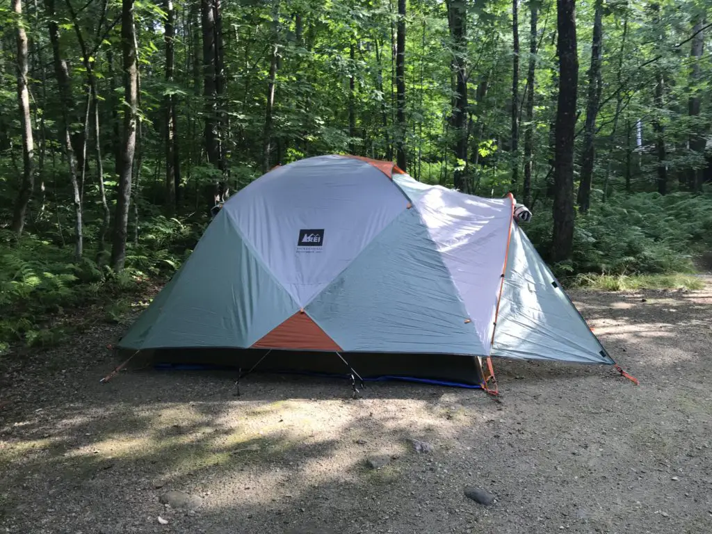
One of our camp setups
We finally caved and bought a privacy shelter for this trip, and we were SO glad we did. It made life SO MUCH easier. In the past we’ve used the vestibule that came with the rooftop tent, this worked ok, but even I couldn’t stand up straight in it (not to mention Mr. Trekker’s 6’4 frame). This could be because we have the tent on the trailer rather than on top of the truck, the vestibule likely works better in that situation. But the shelter worked great for changing, for a bathroom along with our Luggable Loo†, and for a shower using the solar shower. It was so cool to look up at night and see the Milky Way shining over you while you were changing or “taking care of business”. 😇
The Bighorn Mountains
I know I’ve said this before, and I hate to sound like a broken record, 😇 but I LOVE the Bighorns. I always forget we aren’t in the depths of the Colorado High Country when we visit there. I love their stony summits, some still sporting spots of white leftovers from last winter’s snowpack, just above the treeline far below.
I always think of them as their own tiny island of mountains that rises out of the high prairie of northeastern Wyoming, but according to Wikipedia, they’re actually a spur of the Rockies separated from the main mountain chain by the Bighorn Basin.
Though this area is just as beautiful as the Rockies, it is FAR less crowded, which makes it so much more pleasant to visit. 😋 There are no lines of people hiking in the Bighorns like we’ve experienced in various places around Colorado. Also, oftentimes, the lower-elevation plains may be baking in 90-degree weather, while it’s in the 60s-70s, and breezy, in the mountains!
It doesn’t hurt that, depending on which area you are heading to, the Bighorns are a shorter, 3 – 4-hour drive from the Black Hills, rather than the 6 – 8+ hours required to reach the mountains in Colorado ( and that’s just the Front Range, in the east-central portion of the state). You will still have to drive through rural Wyoming whether you’re going to Colorado or the Bighorns. However, to reach the mountains in Wyoming, you drive on I-90 the whole way. It’s a little easier if weather is bad, and you don’t have as much trouble with the Wyoming drivers who like to pass on two-lane roads leaving little room for oncoming cars…(ahem!🤬🤯) ( Of course, all that being said, no one should visit here, ever, it’s just a terrible place to be. 😮😇🙃)
The Bighorns aren’t to be trifled with though. These mountains are rugged, with little accommodations by way of gas, food, and supplies. Small towns, such as Buffalo, Ten Sleep, Greybull, and Sheridan dot the area. But these are few and far between (not to mention pretty tiny, by the standards of “normal” people who aren’t used to the small settlements that are common in the West). 😉 This is a national forest area, not a national park, so even camping accommodations are rustic, rarely offering more than potable water and a pit toilet (and those are the fancy ones)! 😮 So, if you’re looking to visit this area, be prepared to be self-sufficient. The views will make it worth the trial, though!
The night sky in the Bighorns
There isn’t a lot of light pollution in the Bighorns, so on clear nights, you are treated to an INCREDIBLE light show! Once the sun sets, the stars and planets come out in abundance. My whole life, I’ve never seen a night sky that is comparable to what you find in the crisp coolness of the high mountains. The sky actually looks like it has the measles, as there is almost a rash of stars that covers it. The cloudy ribbon of the Milky Way is often clearly visible as it stretches across the expanse of darkness. You can almost sense it glowing from within. It is truly an incredible sight.
Silent Night in the high mountains
Our campsite was at about 7500 feet on this visit (oftentimes we stay much higher, closer to 9000-10,000 feet). We’ve noticed something odd at these high altitudes that we have also experienced in Colorado’s High Country. There is a distinct lack of “night sounds”. You don’t hear the chirping of crickets or croaking of frogs in that thinner air, even on warmer nights, and I don’t know why. Nights tend to be pretty cool in those places, so it may be due to this, or just that there is a very short season where the night air would even be warm enough for the creatures to survive. But whatever the reason, when we’re up so high I do miss the “chirping” sounds of a summer night.
Dispersed camping in the Bighorn National Forest
Sometimes when we head out we Disperse Camp. This is also known as “dry camping”, where you just set up your camp somewhere in the national forest, outside of an established campground. We tried this for the first time in Colorado, at both State Forest State Park and near Crested Butte. On both occasions, we did stay at an actual, numbered campsite, it was just away from any campground and we weren’t able to see our neighbors.
On this trip, there were no numbered sites, but they did request that you stay at an already established campsite (designated by fire rings). I have never experienced such a busy weekend in the Bighorns! We stayed near Circle Park (there are a lot of “parks” in this region, they are basically just large, meadowy areas amongst the forests). It was a lovely site with views of the surrounding mountains, but we could see three other campsites from ours (one had a large group in it). We could hear even more campers, just on the other side of the copse of trees we were camped near. Next time, we’ll have to try going even farther out if we hope to have more privacy! 😉
Moose in the Bighorns!
Ladies and gentlemen, Martin the Moose!
I wasn’t sure if we’d see any moose on this trip since we were sticking mainly to the southern portion of the Bighorns and I wasn’t aware of any waterways running near our campsite (which moose favor). We lucked out though. It only happened one time, but at about 6:30 one morning, as the Pup and I were enjoying her “morning constitutional”, I spotted Martin the Bull Moose sauntering through the “park”, down the hill from our campsite! SUCCESS!!! Puppers wasn’t sure what to make of that LARGE, funny-looking thing!
Hiking Trails
Circle Park Trail:
Sherd Lake
We did this same trail on our first trip to the Bighorns, several years ago, in October. It’s a nice hike, fairly wide and graded, and not terribly steep (though it is quite rocky in several places). We walked to Sherd Lake, which is absolutely GORGEOUS! There are views of several nearby mountains, such as Bighorn and Darton Peaks, from here. This trail is around four miles total, so it’s perfect for a day hike (especially with a not-quite-full-stamina, juvenile, canine friend). 🐶
The trail continues on to several other lakes from there. It also connects with an 8-mile loop that snakes around the nearby mountain peaks, if you’re looking for a lengthy hike (or a good backpacking trip).
Maybelle Lake Trail (off Forest Road 430):
This hike was deceptively tough. It’s only about three miles in total length, but it’s overgrown in many spots, very rocky and there are lots of downed trees. We actually lost the trail several times and had to root around to locate it again. Other parts of it are PERFECT though. They feature a flat, graded path through a moist, pine forest, that is surrounded on both sides by a green carpet of ferns, moss, and soft undergrowth. It almost felt like hiking in the cool rainforests of the Pacific Northwest. It was such an idyllic sight!
The other difficulty is in reaching this trail. You have to drive about 45 minutes (one way) on a rugged, 4×4 road to get to the trailhead. We had done this route several years ago, so we knew what to expect, but this would NOT be appropriate for a normal car, or even just a high clearance vehicle. If you don’t have a 4×4, with gear intended for off-road purposes, you should NOT attempt this road. (As an example, after trying this route a few years ago, we decided skid plates would be an important addition to the truck.) After completing the road on this adventure, there is some paint hanging from the skid plates in a few spots (we sure were glad they were there!) 😋
Maybelle Lake
Tensleep Canyon
I’ve mentioned this canyon before, but this is one of the most beautiful places in the Bighorns. If you are anywhere near this national forest and you have the chance to drive the canyon, you absolutely MUST put it on your list. It is NOT to be missed. This is one of our favorite areas in this national forest, and we try to enjoy it whenever we’re nearby.
The canyon is surrounded by arid, rocky cliffs on both sides, and is located on the southwest side of the Bighorn mountains. One great thing about it is that EVERYONE can experience it. US 16 is the main road that runs through the middle of the canyon. It’s an easy-to-drive, paved byway.
For the best views, I would travel down the canyon, from east to west, on Route 435. This is actually a dirt road that runs parallel to US 16 on the canyon’s southern side. It’s a very well-graded route though, so as long as you don’t mind your car getting a little dusty, any 2WD vehicle can handle it in good weather (beware, the road may be impassable during snowy or muddy conditions. The road is also closed to vehicles November – June).
It’s a two-way road, but it’s fairly narrow, so take your time and be cautious. There is room to pass a vehicle coming the other way but both drivers need to be aware as the lane gets tight.
This route provides better views down the length of the canyon into the dry expanse of Bighorn Basin, that opens up between the western slopes of the Bighorns and the eastern slopes of the Absarokas (near Yellowstone National Park). While the Bighorns provide cooler conditions, even on the hottest days of the summer, the Basin sits on a high prairie that lies in the rain shadow of the larger mountains, to the west, and bakes under the heat waves of the summer sun.
On your return trip up the canyon, take the paved, US 16 for incredible views of the dun-colored rock and sparse, short, green trees and bushes that comprise the canyon walls. They stand out in contrast to the deep blue of the sky above. These views are SO beautiful!
You aren’t very likely to see moose in this area, it’s too dry and hot for the vittles they enjoy dining on. The northern side of the Bighorns, near routes like US 14 and 14A, are prime spots for spotting these ungulates.
For the best light, it’s best to drive up the canyon, west to east, in the afternoon when the sun is at your back! Here is a link to a video I made of our drive up the canyon.
We were glad to enjoy another successful, Labor Day, camping trip to the Bighorns. We really enjoy returning to this area year after year. There are so many things to see here, it can’t all be done in one weekend!
Have you hiked to Sherd or Maybelle Lakes? What did you think of the trails? Tell me about your experiences in the comments!
Did you enjoy reading this post? Pin it!
Like what you read here today? Please feel free to leave a comment, like or share this post! Add your email at the bottom of the page, or the sidebar to the right, to be notified when a new post is published. By signing up for the email list, you will also receive a free copy of the Tranquil Trekker’s Top 10 Tips of Trekking Do’s and Don’ts!
You can also follow the blog on social media by clicking the links below!
In this post, I relate our adventure when we adopted a new puppy!
After our long-time dog crossed the rainbow bridge, we adopted a new, furry family member from our local Humane Society. It had only been a few months since the death of our other dog, so I wasn’t quite sure if I was ready for a new pup just yet.
However, we didn’t want to wait too late into the fall as it would’ve been harder to exercise a young pup during those darker, colder days (we knew we wanted a younger dog). We also didn’t want to have to wait all the way until the next spring to grow our family again.
I’m glad we adopted our new friend when we did though, as she had SO MUCH energy. It was nice that she was able to run around the backyard for a few months before the snow started flying and we were cooped up inside more.
At first, I felt really guilty about “replacing” ourold friend. But seeing the differences in the personalities between the two really helped to ease the pain. Each one is definitely unique! I found that we didn’t “replace” one friend with another, we just made room in our hearts for another who needs us. I can love them both, in different ways.
Our previous dog had a large amount of energy and an incredibly dynamic and dominant personality. Let’s face it, she was a bit of a handful. The new pup has energy too, is more just usual “puppy” spirit. In general, she is more compliant and easier to train. This is lucky for us, as things seem a bit easier. It’s unlucky for her though, as we know better training techniques after being used to a “difficult child”. 😉
Puppy Particulars:
It was a bit of a change, going from a 14-year-old hound dog who was happy to sleep on the couch all day, to a 7-month-old puppy, bounding with energy. We had also been spoiled by our previous friend, she had come to our home fully potty-trained. Puppers didn’t make it that easy on us. Fortunately, she learned quickly that the weird humans she lives with made “happy noises” when she went outside to take care of certain urges. 😋
We don’t know a lot about her history, other than she came from one of the nearby American Indian reservations and her previous owners were kind enough to surrender her to the shelter when they felt they wouldn’t be able to care for her anymore.
She’s a mix of many “flavors” of pup. The vet told us “Shepherd mix”, though apparently, she has “Beagle eyes” (figures, that was the ONE breed I wasn’t crazy about–only because of the bark. Fortunately, now that she’s discovered her voice, I can happily report that it doesn’t appear that she inherited that particular gene. 😅) We also heard she could have Carolina Dog and various Currs in her.
Eventually, we did a DNA test which confirmed…she’s a mutt! 😂 Supposedly she officially has combinations of shepherd, Golden Retriever, St. Bernard! and some drops of cattle dog, among others.
She’s a timid little thing. She’s very sweet, she’s just a little afraid of strangers, and loud noises, and it took her a good while to warm up to Daddy (unless he was sitting on the couch downstairs in which case he made a perfect pillow. 🙄) We get the impression she never lived in a house before, and very likely came from a quiet, secluded area. This is because we noticed she was originally startled at any loud noise, including cars driving past or children yelling from nearby yards.
It didn’t help that we brought the poor thing home during one of the loudest weeks of the year in the Black Hills, the Sturgis Motorcycle Rally. 😝 I can imagine it would have been pretty overwhelming, to move from such a quiet place to the second most-populated region in the state. She did adjust quite well, though.
Puppers enjoys pats from the neighbor kids, though she seems to prefer having a fence between her and them as protection…for her. 😉 She absolutely LOVES other dogs.
The deer, rabbits, squirrels, and birds that frequented our yard were in for a surprise. Previously, they only ever had an elderly, arthritic dog to deal with. She’d put up a good show of chasing them, but everyone knew her heart wasn’t really in it anymore. Now they’ve got a young one with speed, agility, and energy (not to mention a healthy prey instinct) so they’re learning they need to actually move out of her way. 😂
This pooch is also OBSESSED with socks. If I put some outside on the drying rack, she carries them around the yard! 😝 She REALLY loves them if they’re still wet and sweaty. 🤢 She’s also FAST and LOVES to run! She makes good use of our fenced-in backyard!
Our pup doesn’t seem to have quite the same stamina as our old, hound dog, though she enjoys the many hikes we’ve taken her on in the nearby Hills. She has also learned to enjoy cars, including the camping trips, visits to the drive-in and storm chases we’ve taken in them.
Her one nemesis has been doorways. It took her almost a year to stop fearing them (though she LOVES her crate/”she-shed”).
We did have to teach her to walk on a leash. At first, she wasn’t sure about this tether that connected her to these strange people, but with a good harness, some practice, and a lot of patience, she learned that walks can be fun ways to enjoy new smells, people, and especially other doggies around the neighborhood.
Training the Terror: 😂
I have to say, this made me appreciate what the struggle must be in raising human children. I was barely capable of handling a puppy with the energy and mischievousness of a toddler! 😝 She wore me out those first few months! We’re lucky that she slept through the night. It took several months, but she finally stopped waking up around 5:30 am to play.
She was also a digger 😝 in those early days, and she enjoys finding things around the house and yard to chew on that may or may not be potentially harmful to her. Yikes! 😮 I think I’m growing those eyes in the back of my head. 🙃
To give you an idea of her theory on the matter, she believes in using rolled-up newspapers in only one situation. If the puppy goes potty in the house (or otherwise tears up something it shouldn’t) you are allowed to use the rolled-up newspaper to smack yourself on the head and repeat “I need to supervise the dog better”. 😂
I really like this method. It’s essentially based on the idea that a dog is a dog, they’re going to do what dogs do. It is our job, as the species with superior intellect, to show them how to fit into our world. Dogs are never intentionally “bad” or spiteful. All they can do is behave like a dog. They only have bad owners or bad training.
There are no “bad” behaviors, there are only mistakes, miscommunications, misunderstandings, or painful memories of past experiences. Understanding that each animal comes with its own insecurities and histories (some of which may have been pretty negative) helps you to be more patient and understanding when they don’t always behave the way you want them to.
Rescuing a furry friend:
This is the second rescue dog the Trekkers have adopted. Rescuing a pet is an incredible thing but it comes with commitment and understanding.
Usually, a rescue dog brings with it some emotional baggage. Generally, the only way to avoid this is if you get them as young puppies, who were surrendered or found under the best of circumstances. Even then, they sometimes suffer issues from being separated from their mothers too early.
Unfortunately, many of these dogs are older and have been abused, abandoned, or neglected. Some have lived on the street all their lives, fending for themselves and never knowing kind, human hands. That doesn’t mean they aren’t worth your time and effort though. Once they learn to trust you, rescue dogs can be some of the most loyal and loving companions. And sometimes, it can be really nice to get a dog who’s past the chewing, puppy phase! 😝
Our old dog had been with her person for almost two years and was then surrendered to the Humane Society down in North Carolina. We didn’t see any evidence that she’d been abused or neglected, but she had separation anxiety from being left at the shelter (this is common for adult dogs who are surrendered).
She also had a strong fear of children, unless she got to know them well and slowly (there were a few friends’ kids who she got to know as babies that she absolutely LOVED!) We don’t know why she had this fear, but she had obviously had a negative experience with kids before she came to live with us.
Animals aren’t that different from people. They each have their own personalities and their own pasts. We need to be sensitive to that. I don’t say any of this to dissuade anyone from rescuing a pet, they can honestly be blessings to your family, you just have to be prepared for what you may be in for.
You will probably have to clean up someone else’s mess and teach the animals there is a better way of living. But they will ADORE you for the rest of their lives. It doesn’t matter how badly they’ve been treated in the past, all that matters is that you are their opportunity for a brighter future.
There are several rescues around our local area, many of which focus on animals from the local American Indian reservations. Unfortunately, there’s a large problem with strays and pet overpopulation in those areas. Many of the rescues are non-profits, run by volunteer Tribal members who do an incredible job. The adoption fees go to help rescue more animals, as well as to help provide low to no-cost vet care for people who live on the reservations, who want to keep their animals but struggle with vet costs.
We ended up working with the local Humane Society rather than one of the rescues, as that shelter was closer to our location and their adoption procedures are less complex (such as no home visits.) I understand why the rescues make the application procedures strenuous, they want to make sure the animals find committed, forever homes. But with the distance we’d have to travel to access these organizations, we opted for our local site instead. Oftentimes, dogs from the reservation rescues end up at our local shelter when the other rescues are full. The local Petsmart and Petco offer their adoption events through these agencies, as well.
If you live locally to the Black Hills, and you’re looking for a furry friend to add to your family (a cat, a dog, and sometimes other critters such as hamsters, guinea pigs, and even roosters or snakes!) I strongly encourage you to check out one of these local rescues (or Petsmart/Petco on their adoption days):
I’m not into clichés much, but in this case, I’ll make an exception. Unless you’re looking for a specific breed of dog for working or show purposes and you need a breeder, PLEASE, #adoptdontshop! You may be saving a life, and they’ll happily rescue you right back!
Have you ever adopted a pet? What was your experience like? Tell me about it in the comments!
Did you enjoy reading this post? Pin it!
Like what you read here today? Please feel free to leave a comment, like or share this post! Add your email at the bottom of the page, or the sidebar to the right, to be notified when a new post is published. By signing up for the email list, you will also receive a free copy of the Tranquil Trekker’s Top 10 Tips of Trekking Do’s and Don’ts!
You can also follow the blog on social media by clicking the links below!
In this post, I review the New England road trip we took through Vermont and New Hampshire during the summer of 2019.
3 weeks, 13 states, 5,138 miles, and 2 quarts of oil (FYI, Subarus inhale oil) gives you a grand New England Road Trip! Because, when you live in Western South Dakota, why wouldn’t you drive all the way to the coast of Maine for summer vacation? 😮😛
In 2019 the Trekkers spent three weeks on a whirlwind tour of the Northeast. We spent the first week visiting with Mr. Trekkers’ family in Connecticut, enjoying some of the old haunts from his childhood. Then we spent a weekend toodling around Vermont and New Hampshire, and then enjoyed several days at Acadia National Park, in Maine. We finished with a quick visit with my family in Indiana on the way back. Read on for “Don’t Miss” places for your Vermont and New Hampshire road trip!
Northern New England Countryside
I love northern New England! After traveling the crazy highways that snake all around its southern section, you hit the Vermont state line and life seems to slow down a little, again. You find yourself quickly returning to the small-town charm of country towns; earthy, damp smells radiate from the walls of green trees and ferns in the woods that surround you. It feels different here… most of the trees are deciduous hardwoods, whereas we’re used to the evergreens more commonly found in the Black Hills (and areas of Colorado that we frequent). It feels almost like a rainforest compared to the more arid land we’re used to. It reminded us a bit of the Redwood forests in California (except without the Redwood trees 😛).
“Don’t Miss” sites in Vermont and New Hampshire
Below are some highlights from our whirlwind tour…
Route 100, Vermont:
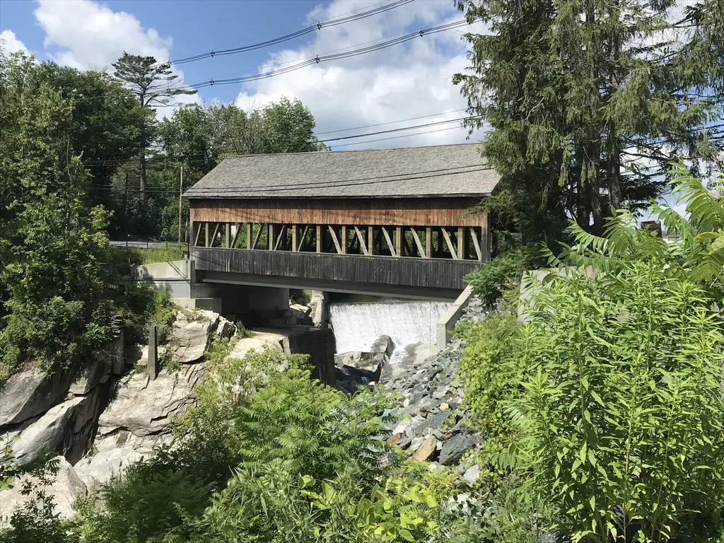
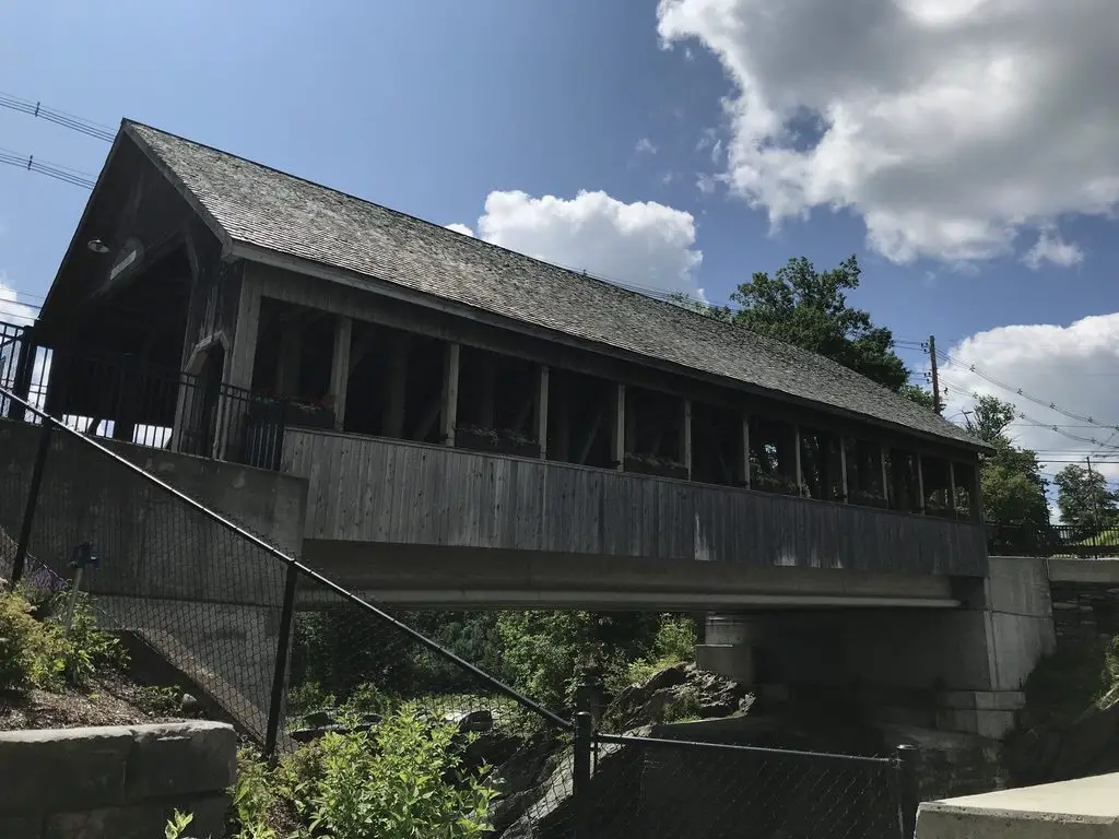
We traversed much of this scenic byway that spans the majority of the state, from north to south. Several of the locations listed below were found on or near that road. Throughout these travels, we enjoyed one of Vermont’s prime attractions, covered bridges, as well.
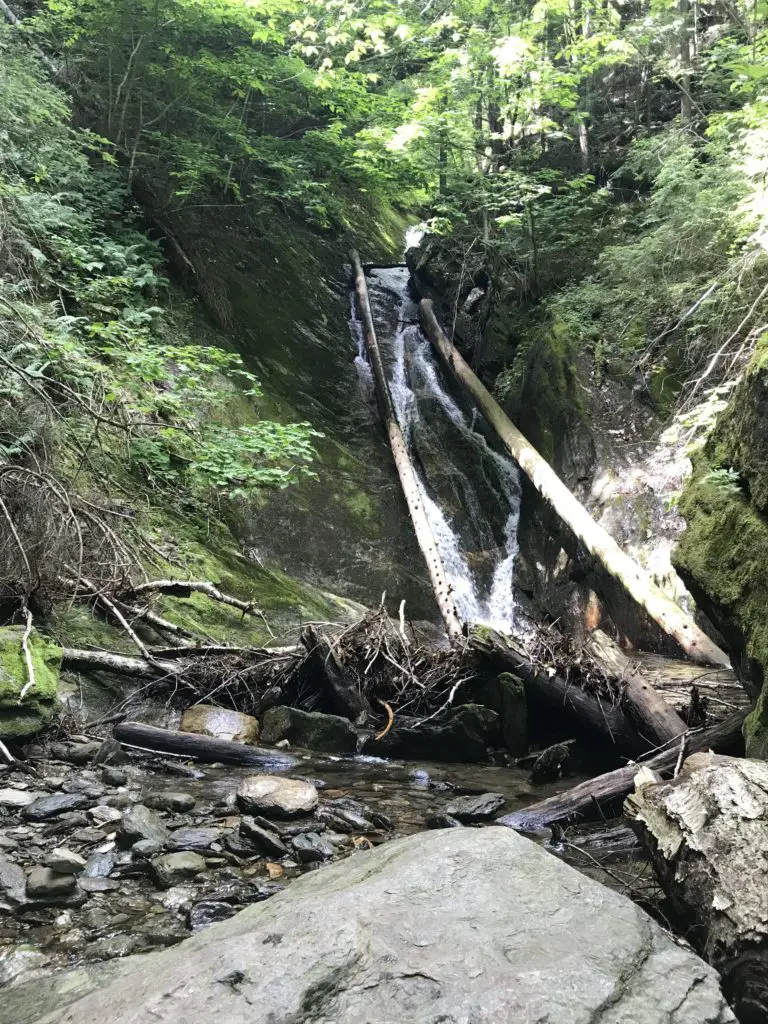
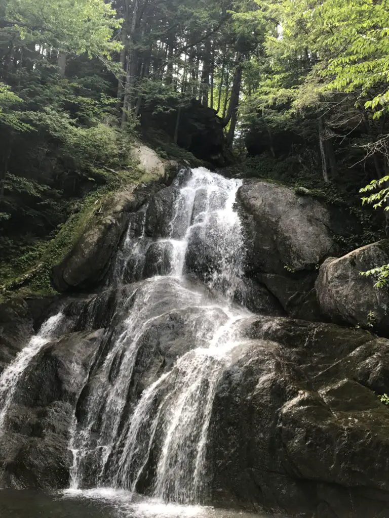
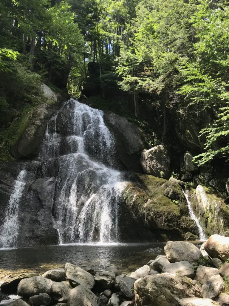
Moss Glen Falls
For more pictures of some great waterfalls around New England, check out my friend, Kathy’s blog here.
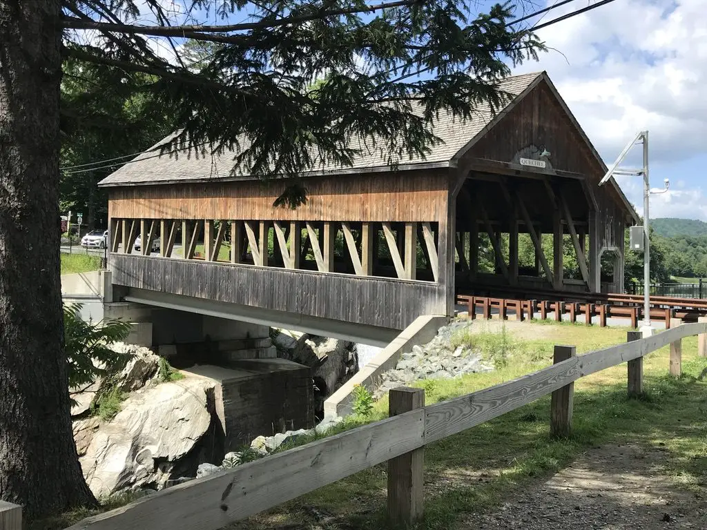
Covered bridge over the Quechee River
Ben and Jerry’s Flagship Store, Waterbury Vermont:
We decided we didn’t have time to actually do the factory tour where you can watch how the ice cream is made (though that would have been REALLY cool). However, we did get ice cream from the official store, and I’ve got a tie-dyed t-shirt to prove it! We did take the time to check out a portion of the grounds called the “flavor graveyard”. It was a little weird 🙃 but it was interesting seeing the various flavor options that have come and gone throughout the years. Check out the website for the factory here.
Cold Hollow Cider Mill, Waterbury, VT:
Just up the road from Ben and Jerry’s is a cool cider mill. It specializes in fresh-baked, cider donuts. I thought they tasted more like spice cake, but either way, they were good! Click here to check out the website for the mill!
The Vermont Country Store, Weston, VT:
This place was nice. It kind of reminded me of Wall Drug, in Wall, SD, but was far less immense. It was definitely a cute place to pick up some local delicacies and check out some cool, retro toys and games from the ’80s, that brought back memories of our childhoods. 😁
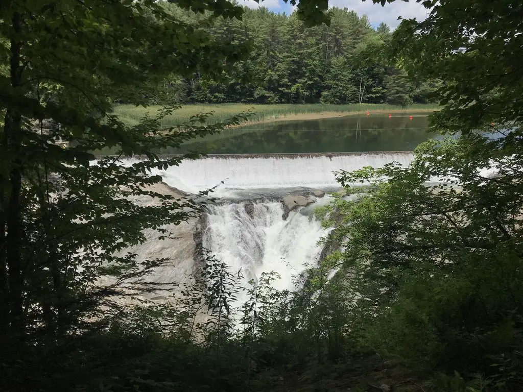
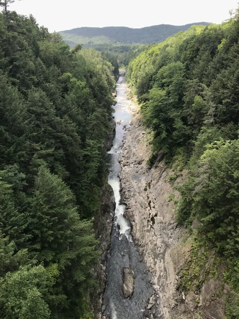
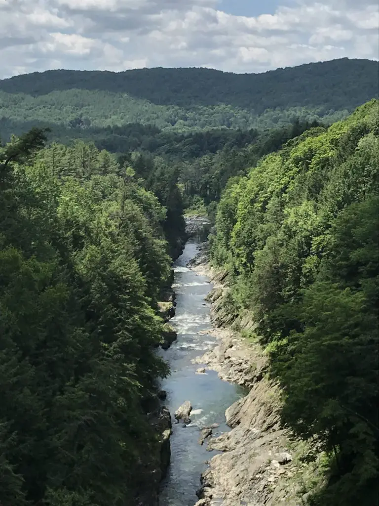
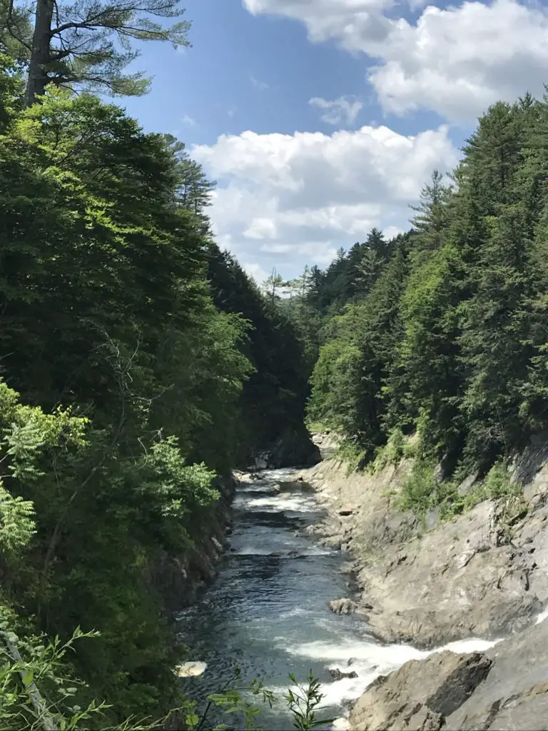
Quechee Gorge, Hartford, VT:
This place was really cool! The Ottauquechee River cuts through over 100 feet of rock in this area, the result is a GORGEOUS, scenic view. A hiking trail nearby takes you on an easy hike of less than one mile, to the head of the gorge, where the river is dammed. This provides a unique view down the length of the canyon.
The trail also traverses about a mile downhill, the length of the gorge, to where the river emerges from the rock again. This is a popular swimming area. Be aware though, as it’s downhill from the main parking lot all the way to the swimming site, you know what that means for the return trip! 😛
The dam at the head of the Quechee GorgeThis pic gives you an idea of how deep the gorge isA view of the gorge from the bridge
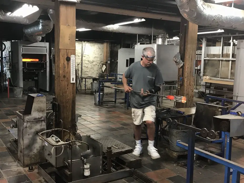
Simon Pearce Glass Mill and Store, Quechee, VT:
Ran using hydroelectric power from the same river that formed the Quechee Gorge, this place was AWESOME! We were able to watch the artisans blow and shape the glass in the mill, in the basement, while the final product is sold in the store upstairs. The shop also features a nice restaurant that overlooks the river.
We decided the creations (even the seconds) were a little too rich for our blood, especially with the risk of breaking them as it was the middle of a lengthy road trip!
A glassblower craftsman at Simon Pearce
Camping at State Parks in Vermont and Maine
Because we enjoy camping, and it helps to keep costs down when on road trips, we spent a few nights at state parks in both Vermont and Maine. The mosquitoes were bad throughout the trip, but that’s to be expected in the middle of the damp woods. 😉
I’m a nature girl, I like critters, even the slithery, skittering, venomous–if we must–kind, as long as we can leave each other alone. What I can’t abide are mosquitoes. Seriously, why, just why? That will be one of the many questions I have for the “Big Guy” someday.
What purpose do they serve? Food for other critters? That’s fine, but why do they have to suck OUR blood, causing welts that itch to high heaven (and are bigger than the critter that left them) that last for days on end, and can even end up infected due to excessive scratching brought on by the extreme itching (I know from experience). A bug that DOESN’T carry potentially deadly disease couldn’t fill that spot? I’m just saying. 😛 They say God doesn’t make mistakes but the presence of mosquitoes makes me wonder a bit. 🤔
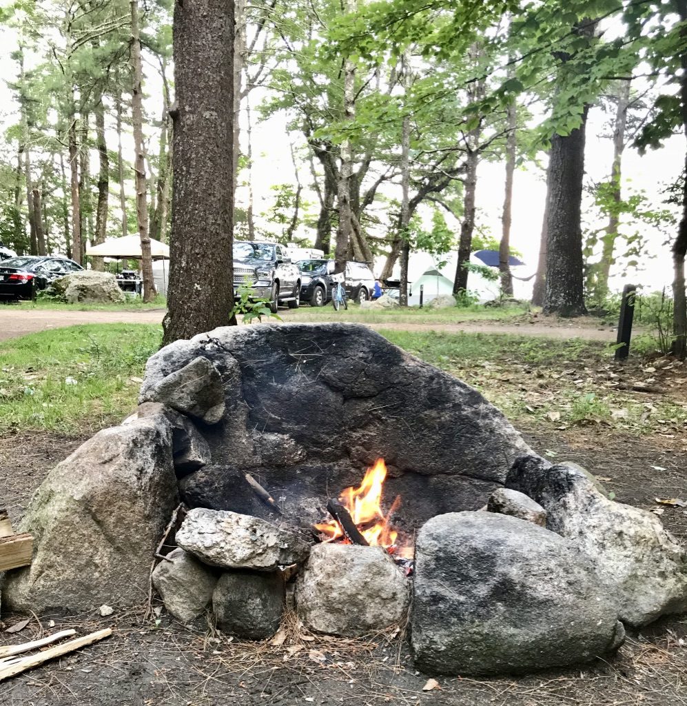
The campsites throughout the campgrounds were largely gravel and flat. They have large stone hearths to use for fires, we aren’t used to that in the Black Hills. It made me think of the Flintstones. 😂 Most of the sites were large enough they could fit a small trailer/pop-up camper (we just brought the old, trusty, ground tent for this trip). There were also flush toilets, electricity, and showers (oh my! 😱) I can’t remember the last time we had those types of “fancy” amenities when camping! 😉
This may be because it’s been a while since we stayed at a state park. We’ve gotten used to national forest sites, with their vault toilets (and that’s it). 😋 Other than their more rustic accommodations though, national forestsare still my favorite places to camp.
Below are some of the parks we visited:
Coolidge State Park, Plymouth, VT:
This is a newer park, and it includes buildings from the historical homestead of the 30th President of the United States, Calvin Coolidge. This was the first place we camped, and the quietest. Sites were shaded and well-separated from each other.
Our campsite at Coolidge State Park
New Discovery State Park, Marshfield, VT:
This place was cute. It rained that night, but not till we were nearing the end of our fire logs, so it was a nice sound to lull us to sleep. There was a weird bird that kept attacking its reflection in the side mirror of my car, and a garter snake got my heart racing when it crawled out of a hole in our fire hearth! 😱 Other than these visitors, though, it was a decent little campground.
Sebago Lake State Park, Naples, ME:
Funnily enough, I actually completed a writeup about this park, just a few weeks before we visited, for an online job I had at the time! This was the busiest park we stayed at, with sites that were placed the closest together. They were nice, and shaded, and allowed you close contact with all your New Yorker neighbors 😋 (we definitely don’t hear the Brooklyn accent much out in Western South Dakota! 😂) One unique aspect of this area was all the sycamore trees, with their LARGE, scalloped leaves.
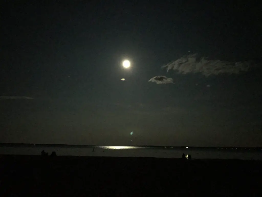
This park sits on the northern shores of the VERY large, Sebago Lake. It was cold, but refreshing to swim in. We enjoyed our almost-lakeside campsite. It was cool watching the full moon rise over the flat, mirrored waters of the lake after dark.
The full moon over Sebago LakeThe cool, rock, fire hearth
Camping in Vermont
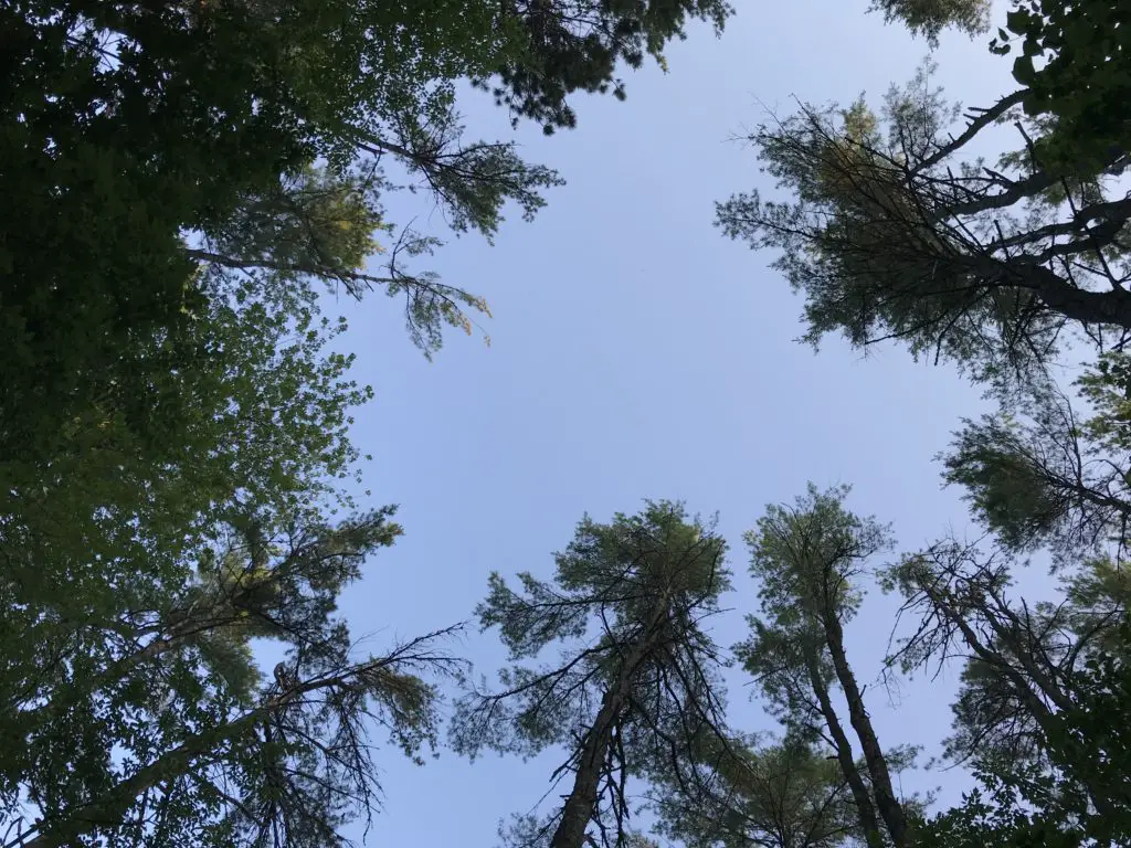
I love camping! I love the random, natural experiences you have that you don’t notice cooped up in a house…the sun that dapples through the treetops as water droplets dribble and drip from the still-wet leaves after the rainstorm from the night before…you can see blue sky and stars peeking through the crowns of the trees…the sunbeams filter through the crown of tree leaves and slice through the morning mists that rise from the damp ground…you wake up in the morning to the granddaddy-long-leg who waves at you from his perch on the outside of your tent…
Vermont state parks are pretty nice. They have lean-to’s that can be rented out, which we’ve never seen at developed campgrounds before. They don’t seem like they would provide the most privacy or protection from the weather–or any critters–as it appeared people just set their hammocks/sleeping gear up in the shelter that has a roof, but only three walls. We did see several people putting up tarps as a fourth wall.
They’re big on their “ponds” in New England, except many of them are bigger than the “lakes”. Many are as big as some of the largest reservoirs in the Black Hills. They may need to work on their wording a bit. 😋
Scenic Drives in New Hampshire
As we’ve already driven several of the main scenic routes through the White Mountains in New Hampshire, this time we chose to try out the northern route (US 2 to Route 16). As it turns out, this isn’t nearly as pretty as the scenic byways that are comprised of Route 112 and US 302, that traverse areas such as Franconia Notch. Those areas are GORGEOUS!
We then ventured into North Conway for lunch. This was our second time visiting this little town. We realized we had been there almost exactly 10 years ago, shortly before we got married!
We had attempted to hike the infamous Mount Washington on that trip, but we didn’t make it to the summit thanks to several factors (including a certain blogger leaving breakfast on the side of the mountain 🤮). I want to come back and try it again though, Tuckerman Ravine looks SO beautiful! Now that we hike more regularly and are FAR more used to higher altitudes, I’m hoping we’ll be able to handle it a bit better.
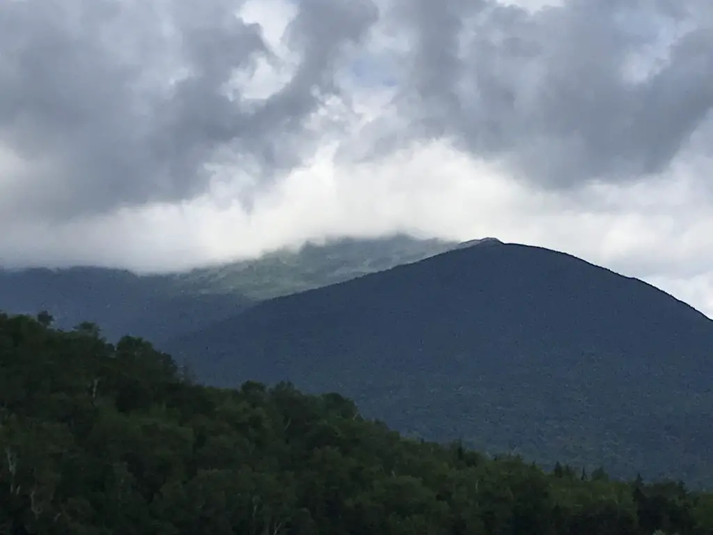
Mount Washington, lost in the clouds (it’s the peak you can’t see)
Both of the Trekkers visited New Hampshire several times throughout our childhoods and we always really enjoyed it. We were surprised to note that, on this trip, we both found the woods of southern Vermont to be more welcoming than the rugged forests of northern Vermont and New Hampshire/Maine. (The northern mountains reminded us of the Black Hills so they didn’t seem as much like a vacation. 😋) They also reminded us of other northern forests that we’ve been to, such as those in Michigan’s Upper Peninsula, those in Glacier National Park/northwestern Montana, those in the Big Horns, and those in northern Colorado (such as in State Forest State Park).
Looking for more amazing pictures of the New England mountains? Check out the Rusch to the Outdoors blog!
It got us to thinking about how much has happened in 10 years: we got married; we moved to South Dakota; there were new jobs for both of us; we bought a house…what will the next 10 years bring? Good things hopefully!
Have you ever been to these parts of New Hampshire or Vermont? Tell me about your experiences in the comments!
Did you enjoy this post? Pin it!
Like what you read here today? Please feel free to leave a comment, like or share this post! Add your email at the bottom of the page, or the sidebar to the right, to be notified when a new post is published. By signing up for the email list, you will also receive a free copy of the Tranquil Trekker’s Top 10 Tips of Trekking Do’s and Don’ts!
You can also follow the blog on social media by clicking the links below!
I’ve been on a lot of road trips, in several countries. So, I’ve stopped at A LOT of rest stops. They’re a necessary evil when traveling long distances by car. In this post, I review some of the most memorable ones I’ve visited.
Many people (myself included) enjoy long road trips. Those inevitably involve stopping at rest stops in all corners of the country. Since the Trekkers enjoy these types of adventures so much, we’ve experienced our fair share of rest areas, as well. I thought it’d be fun to look back on some of the more interesting experiences I’ve had at these little detours, in various parts of the US, and the world.
I’ve experienced rest stops in almost every state in the country (as well as a few in Canada and South America) so I’ve seen a wide range of them. Below are some of the more notable ones:
Not-so-nice Rest Areas
Most of the rest stops in many states (such as Wyoming, Montana, many in the Northeast and those along the Eastern Seaboard) kinda suck, unless you’re lucky enough to stumble on a newer Welcome Center. Most are pretty old-school, they look like they date back to the 1980s. Many have a few toilets and a sketchy-looking drinking fountain, and that’s about it. Sometimes you’ll be lucky enough to find one with a 1980’s-era vending machine as well!
Which reminds me…does anyone else remember when you could get a 20 oz soda out of a vending machine for $1?! Or is that just me? Am I dating myself? 😛 Anyway, I digress…
Mule-Creek Junction near Lusk, Wyoming
One of the most unique rest area experiences I’ve had was near a tiny little town called Lusk, Wyoming. About 50 miles north of town there is a place called “Mule Creek Junction”. Here…there isn’t much. US 18 and US 85 meet at a T-intersection…and that’s about it. That and the rest stop are the only things of note for miles around (the local cattle notwithstanding). 😛
To set the scene, this facility sits in the middle of the least populated county, in the least populated state, in the continental United States. It’s a BEAUTIFUL area, but there ain’t much there folks! (Though it is a prime place for storm chasing. 😇)
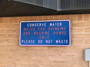
Needless to say, this is one of the few toilets in the vicinity, so by the time you get there, it is sometimes urgently needed. 😋 You can imagine my dismay when I had a compelling need for the services this locale offers on a trip to Colorado, and upon entering the building I noticed a sign that clearly stated, “water is for drinking and bathing”…I thought, “uh oh!” Welcome to the world of “composting toilets” kids! 😝😳🙄
To be fair, they really aren’t that bad. The building at the rest stop looks just like any of the others in the state (many of these do have real toilets). The toilets themselves even look fairly normal, except you don’t flush, the contents of the bowl just go into a pit-like hole–it is FAR more pleasant than a pit toilet, though. The smell is usually fine too, except on really hot days when you may catch a whiff of “something” in the air.
This part of Wyoming is pretty arid, so I applaud the creators of this site for “going green” and using resources wisely…but yeah, now that we know what we’re getting into, we try to hold out for the “real” toilets, at the rest stop in Lusk, that’s about 50 miles down the road. 😛
Closed Rest Stops
Then there was the time we were driving up I-85 in Virginia, heading north from the southern state line. We used to live in Raleigh, North Carolina, so when we’d trek northward to visit Mr. Trekker’s family in the Northeast, this was always a good time to stop for a break.
One year, there were some budgetary issues occurring with that fair state, and due to this, almost EVERY SINGLE rest stop on that route was CLOSED…and they didn’t bother to post any sort of warning about this, I might add. Yeah, there were some very “un-tranquil” words coming out of my mouth that day! 😛 (I am not responsible for what I say when I’m stuck in a car with a full bladder. 😋)
Nice Rest Stops
Turnpike Rest Areas
In contrast, some of the nicest stops I’ve seen are on the Indiana and Ohio Turnpikes (otherwise known as the 80/90 Toll Road. ) To be clear, you have to go to the new ones, on the eastern side of Indiana and throughout Ohio. The old ones, on the western side of Indiana, belong in the category above. 😛
The new ones are lovely though! Bright, large, and clean they offer a variety of shops and services, including super easy access to gas. (Of course, this requires you to pay both the tolls to use the road, as well as the higher gas prices that are inevitably found at the toll plazas. So “pick your poison” I suppose. 😛)
Skyway Rest Area
In Illinois, there are some cool, “Skyway” rest areas. Whoever invented these was brilliant. These are nice places that offer a variety of shops and food services that span the highway like a bridge. This allows people traveling both directions to use the same facilities, and they use space efficiently–absolutely genius! Just be aware, you can get a little dizzy watching the traffic speed along on the highway below you…🤢
Salt-Kettle Rest Area
This rest stop is also in Illinois. It is a Welcome Center and is found on I-74 westbound as you first come into Illinois from Indiana. It is probably one of the nicest rest areas we’ve ever been to! There isn’t anything overly exciting about the building per se, but the outside attractions are WONDERFUL!
The green space is large, shaded, and includes picnic tables, a playground, a pond (complete with a fountain) and even a short hiking trail to a historical cemetery! There were even people fishing as we walked around the pond (can’t say I’ve ever seen this at a rest stop before!)
Squatters!
By far, the most unique rest stop I have ever experienced was a “squatter” in South America. This should go under the “not-so-nice” heading, but it was such a memorable experience, it deserves its own category! 😋
Shortly after graduating from high school, in 2001, I and other members of my church’s youth group went on a mission trip to Peru. We were traveling from the bustling, capital city of Lima, to a tiny town in the INCREDIBLY beautiful Andes Mountains (this was the first time I ever experienced “big” mountains folks, and I caught the bug!)
We were quickly ascending to very high elevations, and altitude sickness was a real concern (especially for a group of American flatlanders from Indiana!) So, our guides had us guzzling a special herbal tea in attempts to prevent the condition.
I have since learned this was likely Coca Tea, used from the same leaf they use to make cocaine…note, the leaves are prepared differently and none of us “got high”, but oh, if only our leaders–or parents–had known! 😂🙃
The good news, the tea worked for most of us. The bad news…drinking large amounts of liquids leads to other “needs”. So, we stopped at a nearby “rest area”. I walked into the little shanty and couldn’t help thinking, “Toto, we aren’t in Kansas anymore!” 😮
A “squatter” is exactly what it sounds like. It’s a tiny hut or shed, that hangs over the edge of a hill, or cliff. There’s a hole cut in the floor that your “product” falls through onto the dirt and rocks below. If you’re a woman or are otherwise unable to pee standing up, you “squat”, and balance over the hole.
Other than my lack of coordination that hinders my every step 😋, that part wasn’t so bad. The pièce de résistance of the whole shebang was that–in order to balance yourself–you have to brace against the shed walls.
I don’t know what was on them, it was too dark to see…moss or algae perhaps? Sure, let’s go with that!
All I know was, whatever I was touching was SLIMY! 🤢 Needless to say, the next time we stopped, we were all happy to use the outdoor toilet that basically involved us just openly peeing off the side of a cliff. 😆
I experienced my first mountain, shelf road on that trip, as well. Have you ever seen any of these “dangerous roads” documentaries? It was something like that. We were riding in a bus with LARGE windows which allowed us to fully enjoy all the beautiful scenery…including the 1000+ foot drop–and no guardrail!–that began mere inches from the tires on the bus we were riding. Why do I ALWAYS end up in the window seat in these situations?! 😛
Roadside Tables
One rest stop activity the Trekker’s have come to enjoy is picnic lunches. We’ve found it’s quite relaxing to pull out some lunchmeat at the many facilities rest areas often provide. One site you regularly see in the Great Plains is “roadside tables”. They’re exactly what they sound like, they’re picnic tables that sit along the road. 😁
I wouldn’t stop at all of them. Some sit on unshaded blacktop and look like they would be a prime spot to melt. 😅 Others aren’t always well maintained so I’d be worried you may have some unwanted guests joining you for lunch. I don’t need a mouse, or a SNAKE!, slithering out of the knee-high grass and onto my feet while I’m trying to eat, thank you! 😛
But most of them are quite nice. The facilities are often shaded and many offer scenic views of the surrounding countryside (or at least the nearby cows). 😉 This is a good way to get a break from the car, get some fresh air, and let the kids (both two and four-legged) run around a little bit. (For more tips are traveling with your furry friends, click here!)
We’ve found this method is way more enjoyable and less chaotic than trying to find lunch somewhere, and it’s likely cheaper, quicker, and often healthier, as well. It doesn’t hurt that we often travel in very rural areas where the nearest lunch opportunity could be an hour or more away. These aren’t nearly as convenient in January, however…😱
Some rest areas are pretty unique!
There is a rest stop on I-10, in Mississippi, which doubles as the Mississippi Welcome Center. It is also at the same location as the INFINITY Space Center. This site felt like a unique combination of the “Old South” (imagine large houses with Grecian-style columns on the front porch and moss growing on nearby trees) and the future–there’s a park, next door, with a model of the Lunar Module.
This site will always hold a special place in my heart. It could be because we were suffering from sleep deprivation at the time, 😴 but I think it’s more that it was very charming. It also represented a huge milestone for the Trekkers. This was the place where we could officially confirm we had both been to all of the “Lower 48” US states! 😀
There’s also a cool rest area on I-90 in Chamberlain, South Dakota. We pull off here a lot. A large sculpture called “Dignity” was erected here a few years ago and is quite lovely. It is a statue of an American Indian woman and is meant to honor the culture of the people who first came to this land. This site also offers a Lewis and Clark interpretive exhibit that is open during the summer months. There are also walking trails, one of which allows you fantastic views of the nearby Missouri River.
This area is so unique. If you’re coming from the east, you meander through the farm fields of eastern South Dakota. Then, suddenly, the yawning chasm of the Missouri River opens up before you as the bluffs that characterize western South Dakota beckon you onward (that’s the Trekkers’ home baby!)
One of my favorite views of the Missouri as you head into “West River” (western South Dakota)Dignity
One rest stop we both enjoy in Wyoming is on the outskirts of Greybull. It also features a small, airplane museum. The tiny museum never seems to be open 😛 but you can view most of the planes through the fence that surrounds it.
Love them or hate them, rest stops are a necessary evil on long road trips. They can often be a blessed appearance if only to escape the chaos you’re currently experiencing in the car for a few minutes! So go enjoy the open road, you never know, that side excursion may offer some interesting stories to bring home all on its own!
What unique rest stops have you visited? Let me know in the comments!
Did you enjoy this post? Pin it!
Like what you read here today? Please feel free to leave a comment, like or share this post! Add your email at the bottom of the page, or the sidebar to the right, to be notified when a new post is published. By signing up for the email list, you will also receive a free copy of the Tranquil Trekker’s Top 10 Tips of Trekking Do’s and Don’ts!
You can also follow the blog on social media by clicking the links below!
In this post, I review a Memorial Day road trip on Opening Weekend of the Beartooth Highway in Montana.
One item you should definitely have on your Road Trip Bucket List is to drive the Beartooth Highway on Opening Weekend. This route connects Red Lodge, Montana, on the north side; Yellowstone National Park, to the west; and Cody, Wyoming, to the south. The route usually opens by the Saturday of Memorial Day Weekend, though this is always weather-dependent. Also, temporary closures may occur after the opening date, also due to weather.
Click hereto watch videos of snowplows clearing the route on YouTube (be warned, they are addictive! 😉) The Montana DOT often has to clear snowdrifts that are over 20 feet deep in some areas!
Washoe Ghost Town near Red Lodge, Montana
You can travel the road from either direction. We started in Red Lodge, Montana. We noted on the map that there was a ghost town not far from our hotel. The Washoe Ghost Town and mine site is located on Route 308, between Red Lodge and the tiny town of Bearcreek, on the way to Belfry. The actual site is situated on private land, so you can’t tour it, but it is easily visible from the side of the road.
We’ve been learning the joy of simple motels on recent trips. Air B&B’s have become our “lodging of choice”, though we’ve been finding, if we MUST stay in a hotel, the simpler, local options appeal to us the most.
They have to be clean, and well-maintained, of course, but they often have so much more character than the stale, chain hotels people usually think of. We also, frequently, stay in smaller towns, where the larger chains don’t often have a large presence. So, being willing to expand our horizons a bit makes lodging much easier to locate.
We had incredible luck with finding places to stay on this trip. In Red Lodge, we chose theRed Lodge Inn, which was absolutely ADORABLE.
It was a simple motel, but it appeared that the rooms had been refurbished recently, and they were quite nice. We were also impressed by how large they were! The motel is owned by a young family, and the hosts were incredibly friendly and helpful when we needed information regarding local attractions.
In Cody, Wyoming, we stayed at theCody Cowboy Village, and it was equally as cute. This one had more of a “Western” theme, while the room in Red Lodge felt more like a mountain cabin, but both were equally enjoyable.
At the motel in Cody, large wooden beams made up the small cabins and reminded me of the ADORABLEGrandma’s Cabinthat we stayed in, with Mr. Trekker’s family, in Island Park, Idaho, during our Yellowstone trip in 2014!
Places to eat along the Beartooth Highway
We’re also learning that simplicity is our friend when it comes to finding meals out on the road. We love little cafes and diners, and again, when you stay in small towns, it’s good to enjoy these. 😁
When in Red Lodge we had dinner at one of our favorite places, Red Lodge Pizza. The restaurant is housed in the old post office and features creations along that theme such as, the Cliff Claven! We’ve never had a bad meal there!
In Cody, we ate breakfast at Our Place, a charming little dive (to be clear, I use that term affectionately) just across the street from our hotel.
Some of the best meals I’ve eaten at a restaurant were cooked in “dives”. These places are usually locally-owned by regular, small-town folks. The owners are often a joy to talk with, and any time the place is crowded with locals, you know you’re in for a treat!
We enjoyed dinner at the Occidental Saloon in Buffalo, Wyoming the final night. We’ve visited there before and have always been happy with the meals. This site is attached to a historic hotel in town, where the likes of Teddy Roosevelt, Butch Cassidy, and Calamity Jane once rested their weary feet. As usual, we ate the final meal of our trip, breakfast on Memorial Day morning, at the Busy Bee Cafe, also in Buffalo. I’ve waxed lyrical about how much we like this cute little restaurantbefore.
The drive on Beartooth Pass!
Although weather forecasts made it appear doubtful, we did get to drive the full extent of the road…on the Montana side. We had to wait 1.5 hours for it to open up but got to enjoy views from one of the main lookout points while we waited. When we heard whoops of delight from the skiers and snowboarders that were parked near us and saw the snowplows drive by, we knew we were headed to the summit!
Weather had been pretty wild in this part of the country that spring, and this area had received close to a foot of snow just a few days before the road opened.
The Forest Service had gotten the Wyoming side of the route mostly open, save for the last few miles at the summit. With the recent lousy weather though, this portion had drifted shut again. Fortunately, we have driven the entire route before(just not on Opening Weekend).
The weather didn’t seem much different from when we were there in July of 2016, there was just–a little–less snow in the summer. There were still plenty of gloomy gray clouds, and the temperature was, maybe, only 1o degrees warmer. 😛
We found it to be almost disorienting near the summit. The way the white snowfields melded with the pale, gray sky, it was hard to tell where the land ended and the sky began!
Because the road was closed, we had to embrace our motto from a previous road trip, and “Just Groove“, and boy, were we glad we did!
The alternate route we chose was Route 72, south of Belfry, Montana, into Wyoming, and may I say it is absolutely GORGEOUS! It offers incredible views of the Absaroka Mountains as you drive along their length.
Click here for a video I made of our drive. We definitely saw large piles of snow but didn’t quite get to experience the “snow tunnels” I was hoping for. I guess we’ll just have to go back and do this route again on another Opening Weekend!
Cooke City, Montana
When we reached Route 296, in Wyoming, we took that road (the Chief Joseph Highway) back to US 212 (the Beartooth Highway) on the Wyoming side, as that portion was open. This takes you all the way to Cooke City/Silver Gate back in Montana, and eventually on to Yellowstone National Park.
These two, tiny towns had been on our “must visit” list since ourYellowstone Trip. The towns were teensy but enjoyable. They definitely felt like the type of places you’d visit in the high mountains. For those who may be interested, I should note that there are several campgrounds in this vicinity. HOWEVER, they only allow hard-sided campers (no tents) due to regular bear activity. Just something to be aware of. 😳
Drive the Chief Joseph Highway in Wyoming
I can never get over how beautiful northeastern Wyoming is. On our trip, everything was so uncharacteristically green! This is an unusual sight for this normally dry area, but the early season and recent rain had the grass growing well!
There were some gray clouds (though we enjoyed more sun than expected) and these, contrasted with the vibrant green of the new grass and the steely, dark gray mountains, with snow still capping their summits, made for quite the scenic view! The somewhat dreary–yet picturesque–image made both of us think of Scotland (or what we imagine Scotland to look like, having never been there…YET!) 😮😉
There’s a story that goes with this picture. Mr. Trekker had to take it from the bridge because I was too chicken to stand near the edge!
See below for more pictures of our drive. As you can see, there was still some snow on the upper peaks:
Buffalo Bill Center of the West in Cody, Wyoming
We eventually made our way back down the Beartooth Highway and stayed in Cody, Wyoming Saturday night. We’ve stayed there several times as a stopover, and each time we thought we should take the time to visit theBuffalo Bill Center of the West(but never got the chance). Since this was a weekend of “checking things off the list”, we decided now was as good a time as any!
The museum is actually made up of five different areas. We both enjoyed the Natural History portion the most. This section comprises multiple levels, as though you were traversing down a mountain, from the tundra ecosystem near the summit to the prairie/grassland found far below.
We also enjoyed the firearms museum, that showcased items from around the globe and from a wide range of battles throughout history. There was also a section regarding the life of Buffalo Bill Cody and his Wild West Show that was quite interesting.
Ten Sleep Canyon, Bighorn Mountains
We took one of our favorite routes home through the Big Horns, US 16 through Ten Sleep Canyon, in Wyoming. This is, absolutely, one of the most beautiful canyons I have ever seen!
They call this the most scenic route through the Big Horns and I believe it! Route 14 and 14a are pretty in their own right (and you’re much more likely to see moose on one of these roads) but the southern route through the canyon is one that shouldn’t be missed!
As you’re driving into the canyon from the west, you have the Absaroka Range in your rearview mirror while the Big Horns loom ever larger in front of you. This area is quite dry and barren, as it’s in the rain shadow of the Absarokas, adding to its rugged beauty.
I know I’vementioned it before, but I can’t get enough of the ruggedness that makes up the Wyoming countryside. The drab yellow of the badlands that contrasts–this time of year–against the almost florescent, green grass of Spring in the foreground, and the imposing, dark mountains in the background (with their bright white caps). This area is pretty all the time, but especially so this time of year before the hot summer conditions have baked it dry.
This route is also called the Cloud Peak Skyway Scenic Byway, as it is the main road that runs nearest to Cloud Peak, the tallest summit in the Big Horns (though you can’t actually see the summit from the road as it’s in the middle of a Wilderness Area).
Clickherefor a video I made of a Labor Day Weekend drive through the canyon.
This route is also a beautiful drive down the east side of the Big Horns into Buffalo, WY. If you’re there at the right time, you may see yaks grazing on the steep hillside near the side of the road! 😮
I recommend everyone check out these drives if they have a chance, as they are all quite beautiful. There are LOTS of tiny lakes that make for great pictures (not to mention plenty of marmots posing for photos in the higher elevations!) Be prepared though, winter conditions can occur at any time in that area (we had thunder and slushy snow falling on us in July!) 😮
Go tour these highways, you’ll be glad you did!
Longmire Store, Buffalo, Wyoming
Finally, we were able to cap off our weekend in the best way! Each time we visit Buffalo, I have hoped to stop at the Longmire store, named after the well-known book and Netflix series. As we learned, it used to ONLY be open during Longmire Days each year in July, as it was just a satellite store. Well, it is now open all season and we FINALLY got to partake of its wares! See, persistence pays off. 😁
Have you visited the Beartooth Highway on Opening Weekend? Tell me about it in the comments!
Did you enjoy this post? Pin it!
Like what you read here today? Please feel free to leave a comment, like or share this post! Add your email at the bottom of the page, or the sidebar to the right, to be notified when a new post is published. By signing up for the email list, you will also receive a free copy of the Tranquil Trekker’s Top 10 Tips of Trekking Do’s and Don’ts!
You can also follow the blog on social media by clicking the links below!
I love going for drives, I absolutely LOVE them. I love lengthy road trips too (as anyone that’s followed this blog for a while should know) but I also love just simple drives around the countryside. It’s hard to describe the feeling of peace and freedom that comes from the open road.
I enjoy drives by myself on winding roads (just me and my Honda, dancing through turns). I also enjoy them with Mr. Trekker, my trusty side-kick, and usually, the primary driver. He’s probably one of the only people I can stand being stuck in a car with for days on end. 😁 (This is another good sign to watch for if you’re considering marrying someone. The question isn’t just can you tolerate, but do you actually enjoy lengthy car rides with your significant other? 😁 )
Can you inherit wanderlust?
I maintain it’s not my fault that I have this crazy obsession with the open road, it’s in my genes. I seem to have inherited my maternal grandfather’s wanderlust. He used to love to “go for a drive”. Oftentimes, he’d invite us grandkids along (it didn’t hurt that this usually meant there was a Wendy’s frosty in your future if you went. 😉) I can remember my grandma asking him, “why are you going this way?” His response was always, “I already went the other way!” (Duh! 😉) I firmly endorse this statement!
Mr. Trekker even knows if he’s driving us somewhere, we can’t go the same way twice. Why would we go home the way we came, we already saw that stuff today?! 😝
Can wanderlust be taught?
I don’t think this desire is all Nature though, I blame Nurture, as well. I went on numerous road trips throughout my childhood, with both my parents and grandparents. I rode along with my paternal grandparents, one year when they returned to their home in Kansas after a visit to Indiana. I also rode to Florida for family vacations several times as a child. I even helped my maternal grandparents drive there on a few occasions, as I got older and they started wintering in the warmer climate. My parents and I also took numerous trips to New England over the years, to visit family.
As it turns out, there were times Mr. Trekker and I may have been quite near each other, throughout our childhood, as he grew up near where the family we were visiting lived–we didn’t actually meet until college though. He also shares my love of road trips, probably due, in no small part, to the highway adventures he enjoyed while growing up. His parents took him throughout New England, as well as to countless Civil War battlefields up and down the Eastern Seaboard.
Songs about the Open Road
There are a few songs that well relate my love of the open road (click on the link on each title to hear the full song):
…Gotta get outta here, get it all off my mind And it makes me wanna take a back road Makes me wanna take the long way home Put a little gravel in my travel…
These lyrics speak to me because there are times when I feel like I need to escape from the stress of daily life.
…Tear down some two-lane country who knows? Get lost and get right with my soul…
We shouldn’t be afraid to go the long way through the countryside, things seem to fall back into balance after spending a little time on the open road.
I’ve been cooped up, tied down ‘bout forgotten What a field looks like full of corn and cotton… …I need the curvin’, windin’, twistin’ dusty path to nowhere…
I, personally, could never forget the sight of a field. I grew up surrounded by them (and still live by the prairie). But that isn’t the case for everyone. A lot of people are constantly surrounded by a concrete jungle. I think this separation between us and our evolutionary roots with the natural world causes angst for people. Getting out on the open road helps us get back in touch with those roots.
In “Backroad”, by Granger Smith, the lyrics state:
Barbed wire fence carving out a hillside, cutting holes in the midday sun Like a postcard framed in a windshield covered in dust I love the rhythm of an old grey blacktop Steer the wheel, one-handed on a two-lane, hugging that line I got the windows down, no one else around singin’…
I used to be incredibly outgoing and extroverted. I would get re-energized just by being around other people. These days, I’m still outgoing, but more and more, I prefer quiet and solitude. Mr. Trekker and I can spend several days in the wilderness, with just each other, the pup, birds, deer, moose, and maybe a bear for company. We head into “town”–that can mean very different things in different parts of the country–to restock on supplies and get a shower, and within a day we’re both ready to get back to the solitude again. These days, I get exhausted being around people all the time.
**Working from home the last several years probably doesn’t help my newfound introverted side much. I spend more time alone (or with just the dog) now than I ever used to, which I am PERFECTLY happy about, mind you. I have actually found, now that I’m not around people as much, my patience for them (in parking lots, while driving, in stores) has actually increased. It’s like less exposure to people increases my tolerance level for them! 😂
We hope to someday get property in the Hills. Maybe we’ll live close enough to our neighbors so that we can actually see their house from ours…maybe. 😝 We currently live in town, but at least in the summer, our backyard is walled in by green trees, shrubs, and bushes. I can at least pretend I’m alone. I see pictures of other neighborhoods where the houses are closer together, or the properties aren’t separated by barriers. Or I see pictures in large cities where big buildings block out the sky unless you’re looking straight up. These images just make me cringe! They get my anxious heart pumping! I need room to breathe, ya’ll! (Again, not really my fault. I grew up as a farm girl in Indiana, it only makes sense that I love wide open spaces.) 😁
Granger Smith goes on to say:
Freedom is the miles I’m rollin’ on… …I feel the wheel like a melody, like a radio dialing in strong The breeze smells like a summertime hay field’s just been cut I got the windows down, way out of town singing…
There is freedom on the open road (and the smell of fresh-cut hay is DEVINE!) Don’t just take my word for it. There have been some famous people who have shared my love of it too. John Steinbeck, for example, in his book “Travels with Charlie” (his poodle) comes to mind. In that account, he and Charley enjoy a country-spanning road trip, sleeping out of his truck camper.
Another song that reflects my love for the open road is “My Church”, by Maren Morris. The lyrics of that song state:
…I find holy redemption When I put this car in drive Roll the windows down and turn up the dial Can I get a hallelujah Can I get an amen Feels like the Holy Ghost running through ya…
…I find my soul revival… …Yeah, I guess that’s my church…
…When this wonderful world gets heavy And I need to find my escape I just keep the wheel rolling, radio scrolling ‘Til my sins wash away…
I get this sentiment. I feel the same way about the open road. I feel refreshed and stimulated when I’m out there. It’s almost a spiritual experience or a spiritual renewal of sorts. I feel so much more relaxed after a good, long drive. It’s like I can breathe again, like I’ve been rejuvenated.
**This is partially why I love being out in nature so much. It’s quiet, it’s natural, it’s solitude, it’s peaceful. You gotta respect it because it can kill you, 😳 but it can also refresh you in a way nothing artificial can. Nature and wide-open vistas are my Xanax!
Oddly enough, I don’t love the Plains because they are too wide open. It’s a bit overwhelming. I love the mountains, but I couldn’t live in them, either. For one thing, the weather can be too extreme. For another, they block the view! I prefer to live in the foothills, they are an almost “Goldilocks”-type region. You get to experience the best of both worlds. The flatter land that leads up to the base of the mountains is open, so you feel like you can breathe, but it doesn’t continue on endlessly. It is reigned in by the rocks (and you can also enjoy mountain views, as well). You also benefit from the protection the monoliths provide from the worst of the weather, and lower altitudes usually also offer more mild weather.
I love taking my car on the winding back roads. It’s fun to drive and it makes you feel like you’re one with the land, it’s like you can finally relax. I LOVE the smells of the country, yes, even “those” smells. Manure is natural too kids! 😉
Below are some more pictures of our travels on the open road. Don’t they just make you feel like you can breathe?:
So, the next time you get the chance, don’t be afraid to get out there and enjoy your own back roads a little!
Do you enjoy long drives in the country? Tell me about it in the comments!
Did you enjoy this post? Pin it!
Like what you read here today? Please feel free to leave a comment, like or share this post! Add your email at the bottom of the page, or the sidebar to the right, to be notified when a new post is published. By signing up for the email list, you will also receive a free copy of the Tranquil Trekker’s Top 10 Tips of Trekking Do’s and Don’ts!
You can also follow the blog on social media by clicking the links below!
We use cookies on our website to give you the most relevant experience by remembering your preferences and repeat visits. By clicking “Accept”, you consent to the use of ALL the cookies.
This website uses cookies to improve your experience while you navigate through the website. Out of these cookies, the cookies that are categorized as necessary are stored on your browser as they are as essential for the working of basic functionalities of the website. We also use third-party cookies that help us analyze and understand how you use this website. These cookies will be stored in your browser only with your consent. You also have the option to opt-out of these cookies. But opting out of some of these cookies may have an effect on your browsing experience.
Necessary cookies are absolutely essential for the website to function properly. This category only includes cookies that ensures basic functionalities and security features of the website. These cookies do not store any personal information.
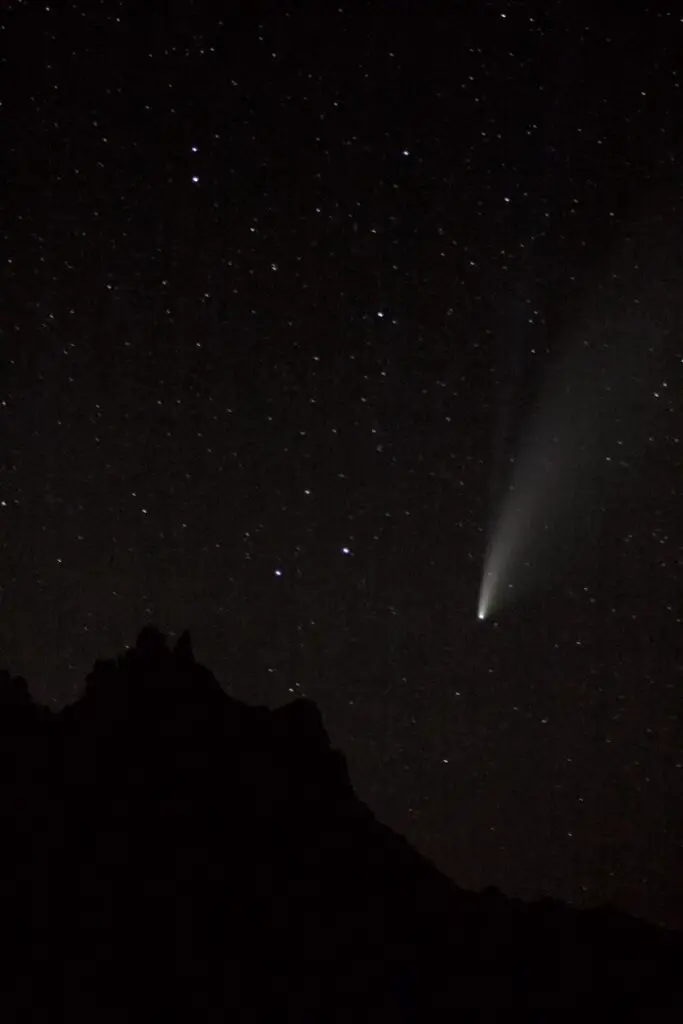
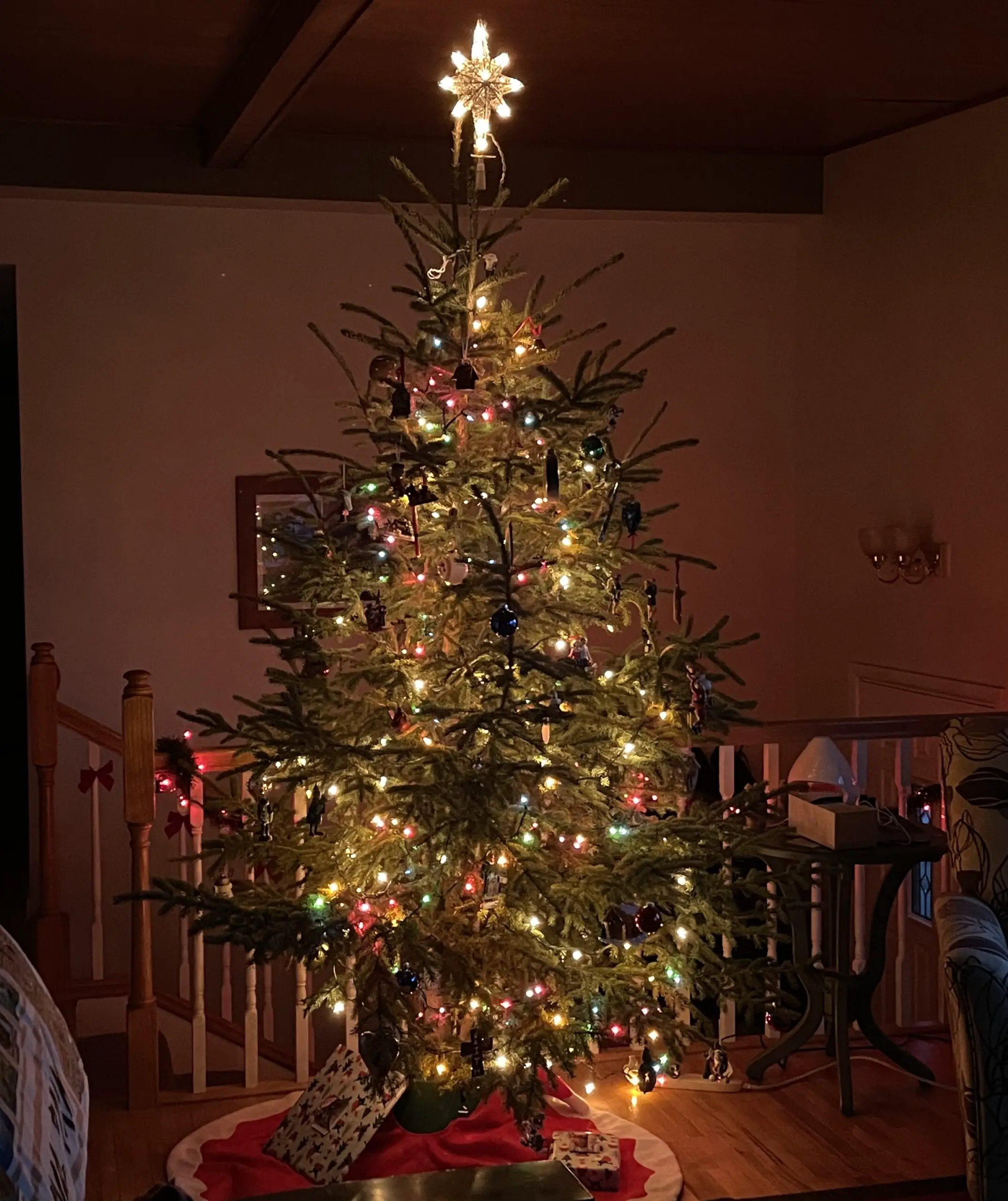
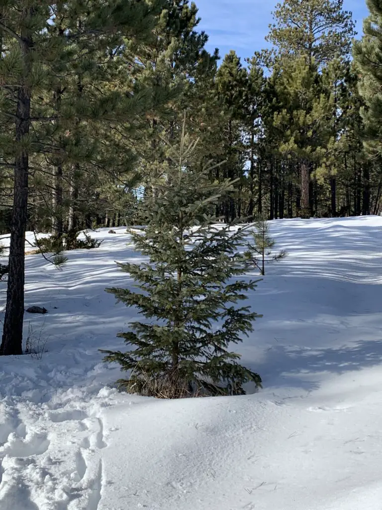
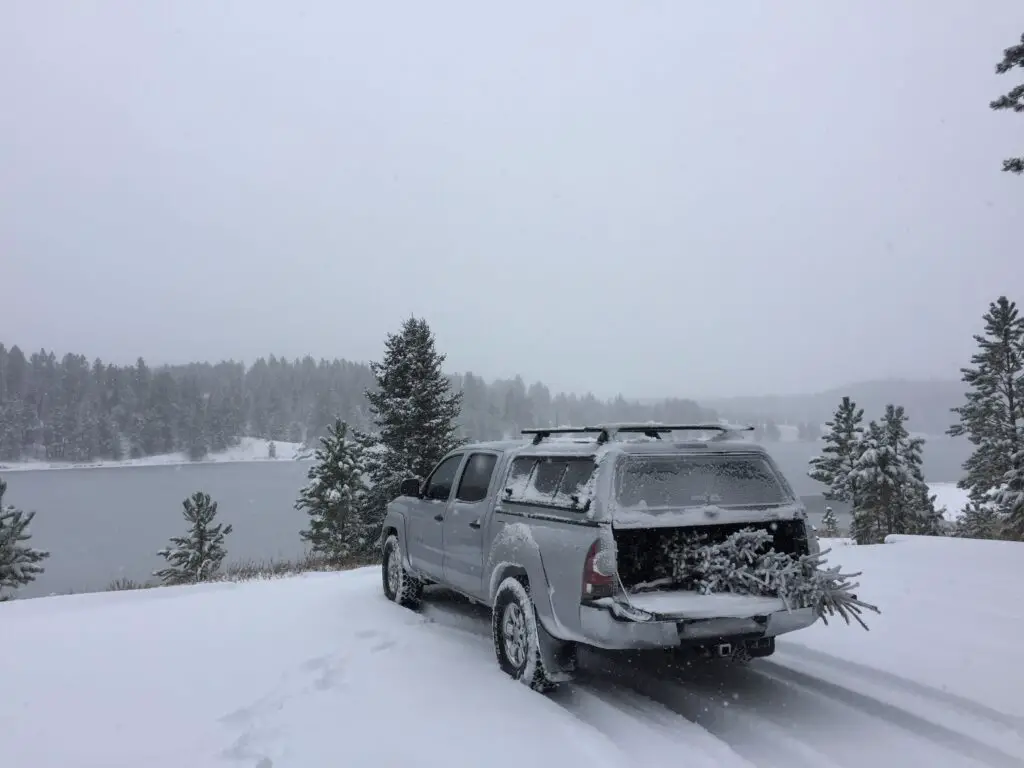
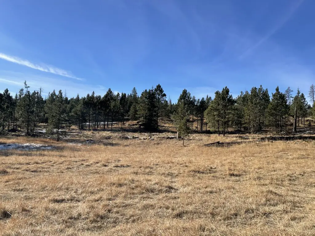
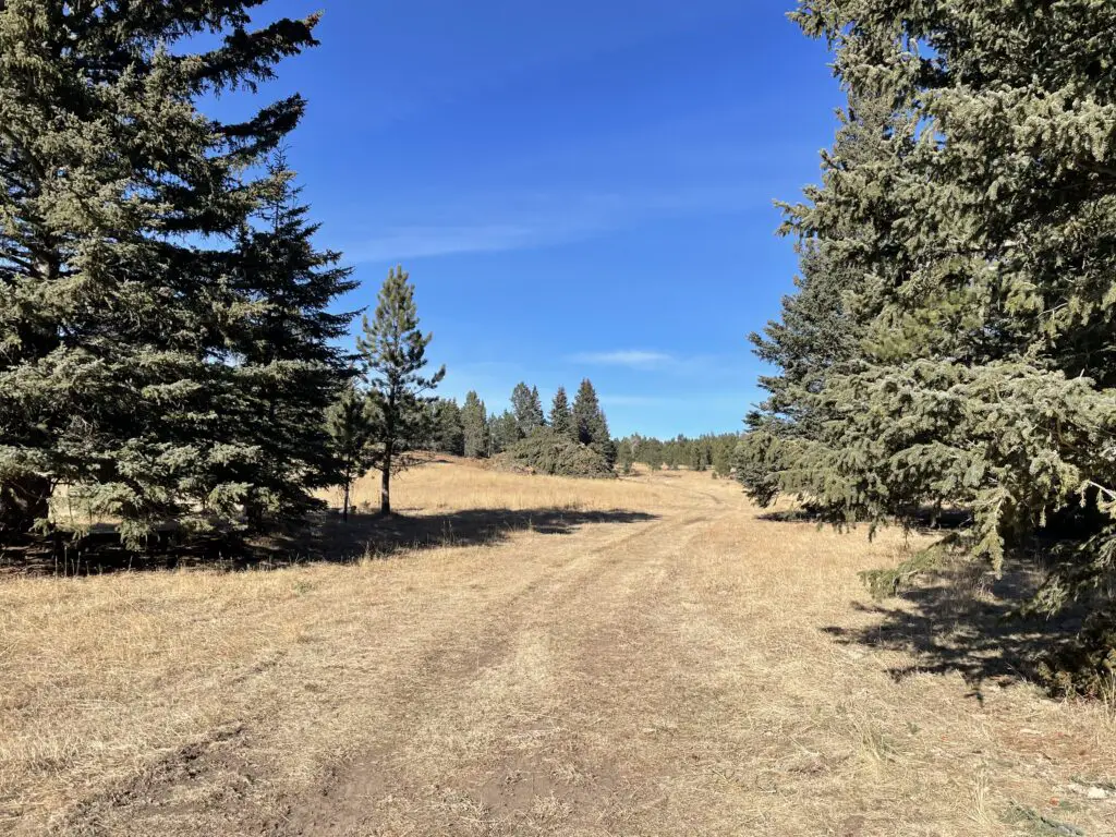
 –we always bring extra clothing in case we get stuck out for a lengthy period of time or need to hike out to call for help. We also have bug-out plans if the conditions prove worse than we had anticipated. Click
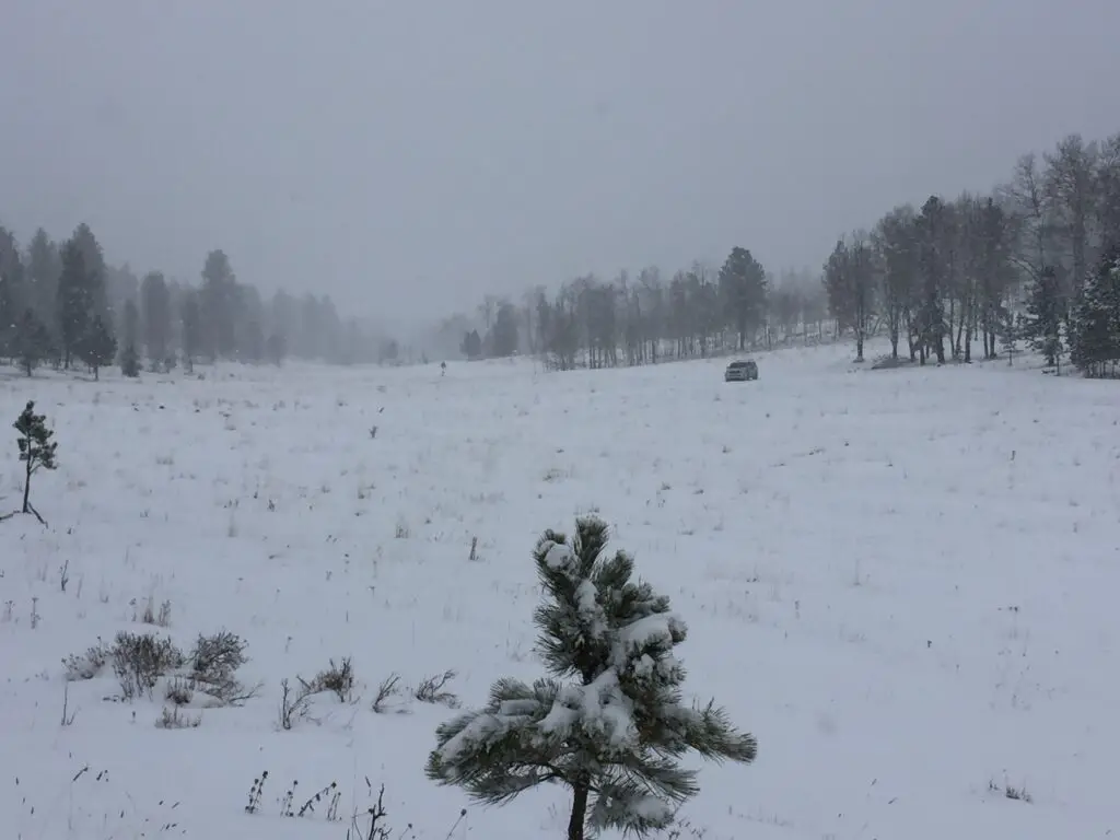
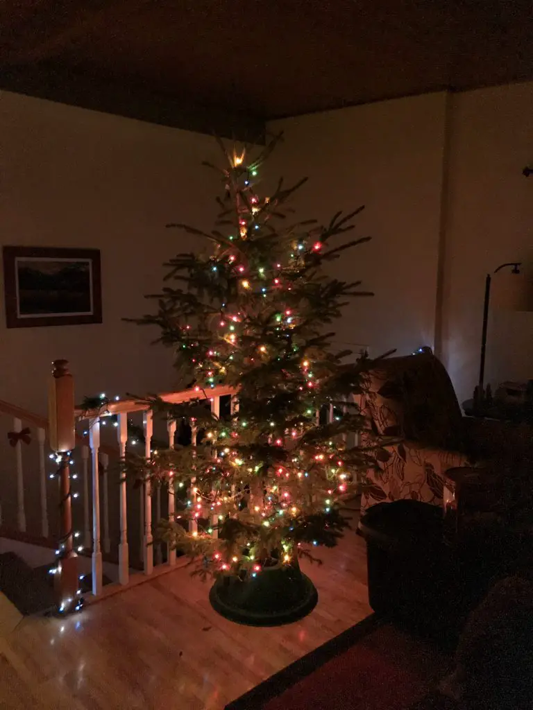

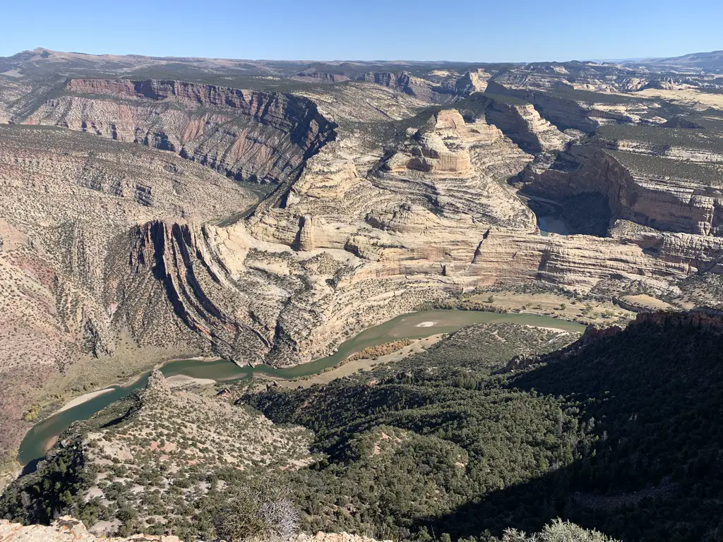
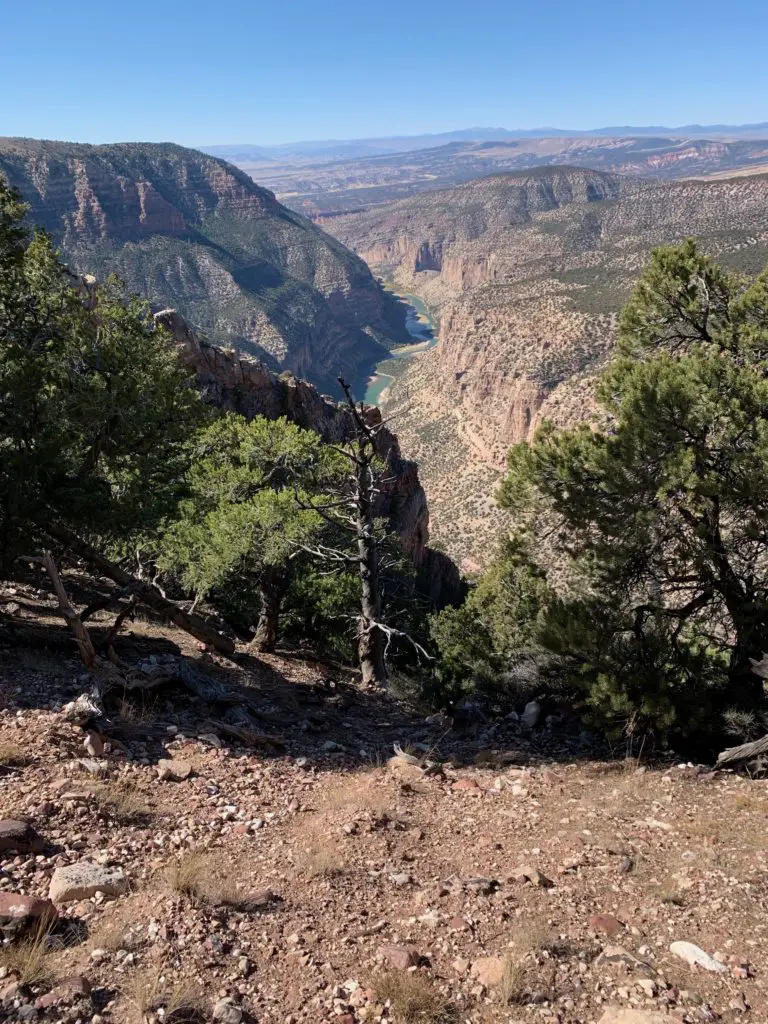
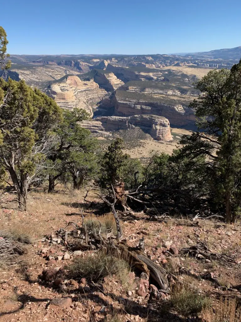
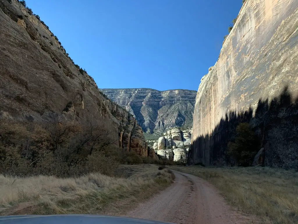
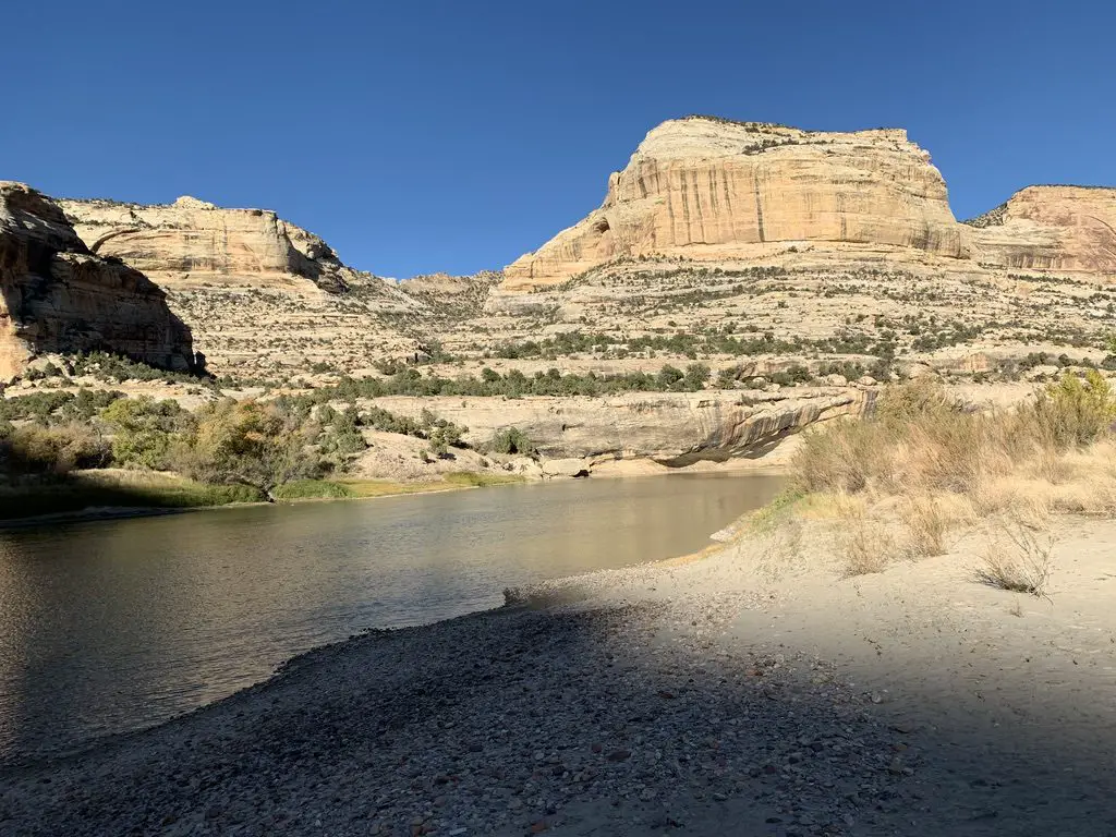
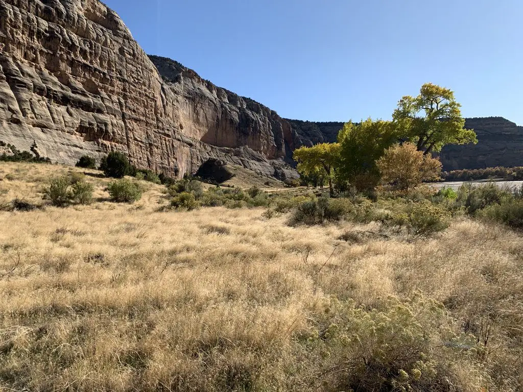
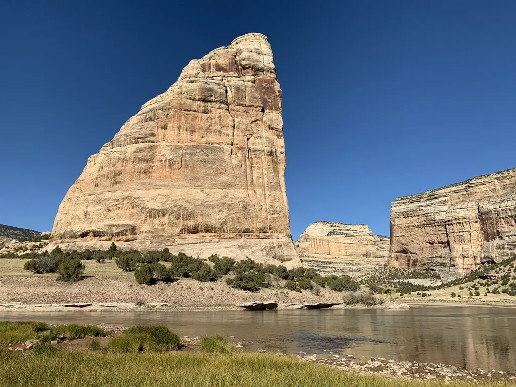
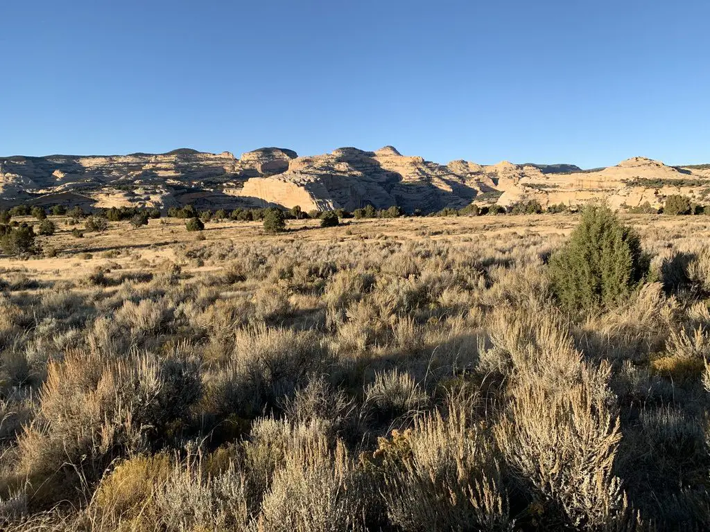
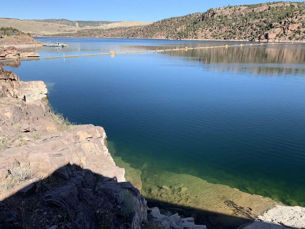
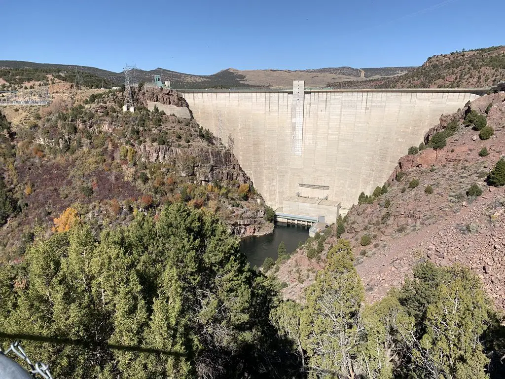
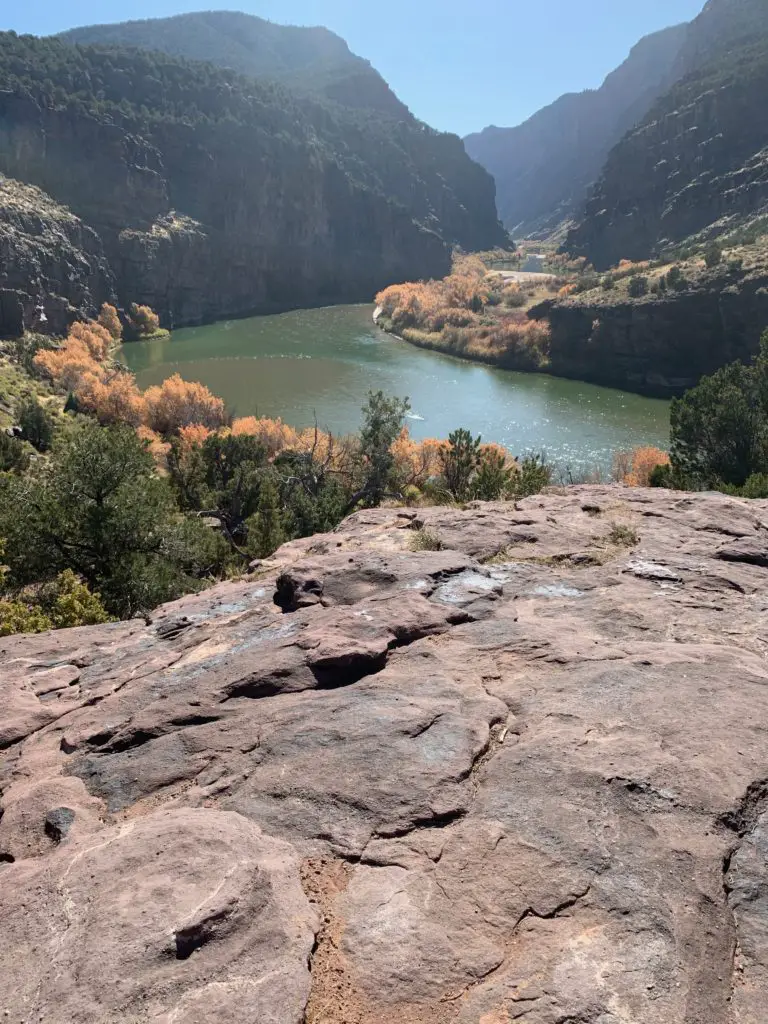
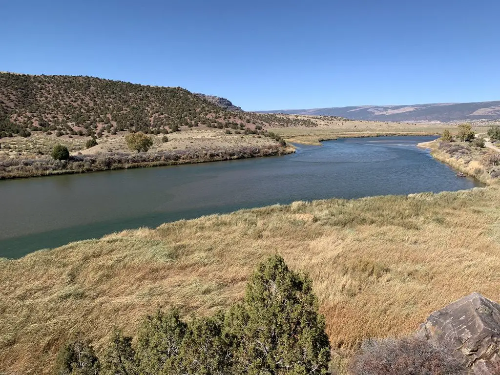
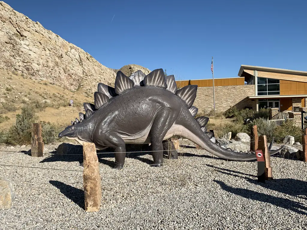
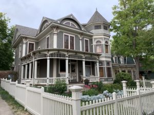
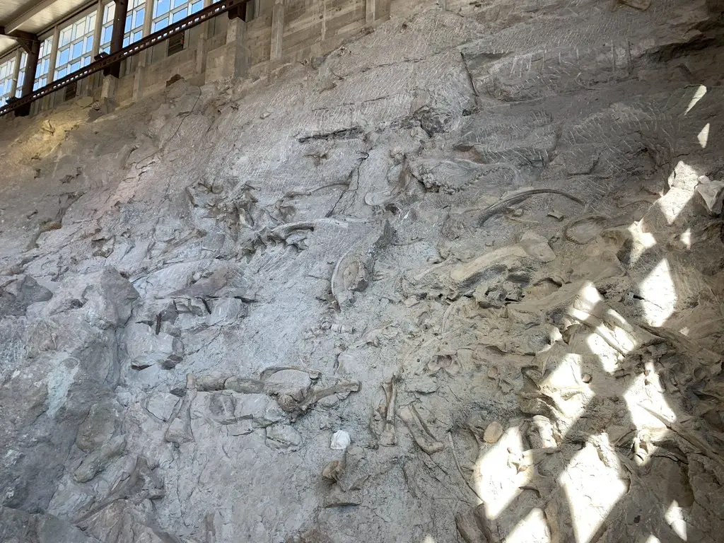
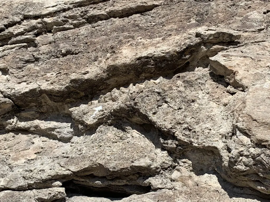
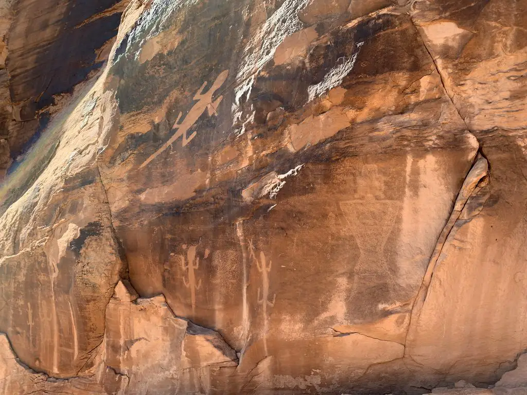
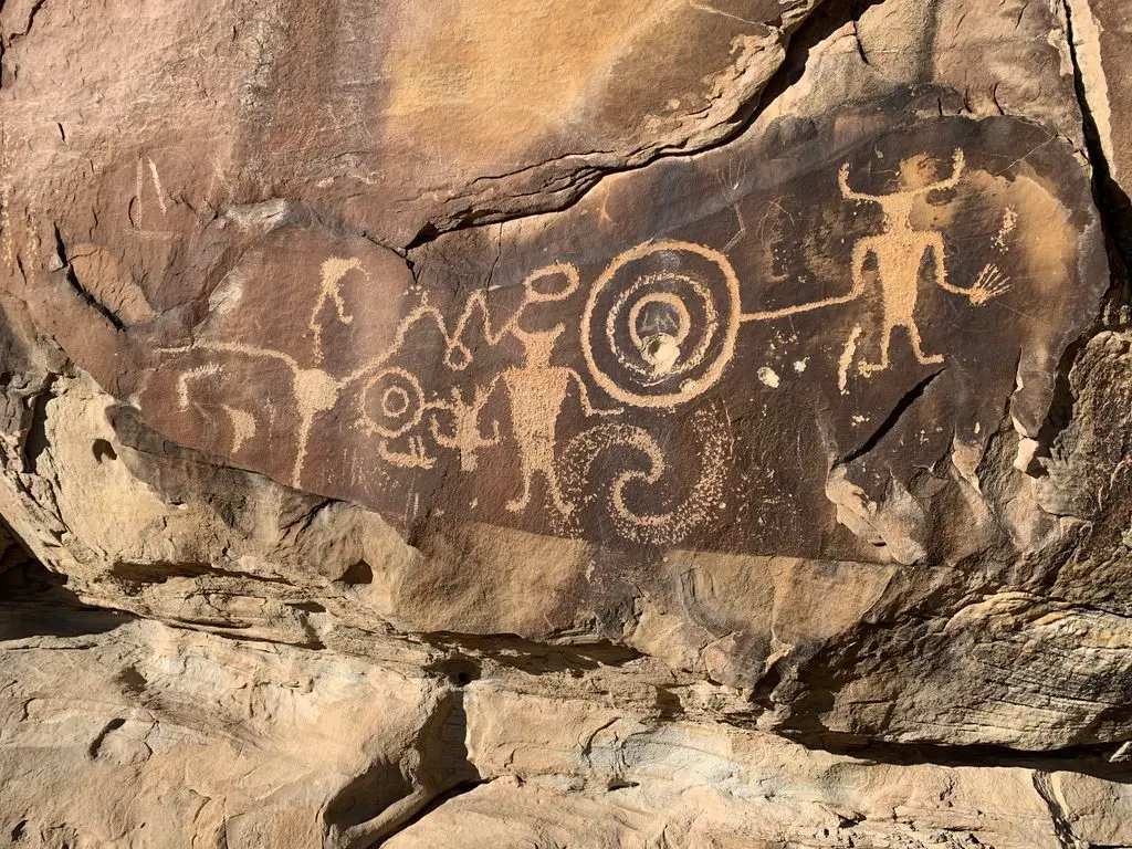
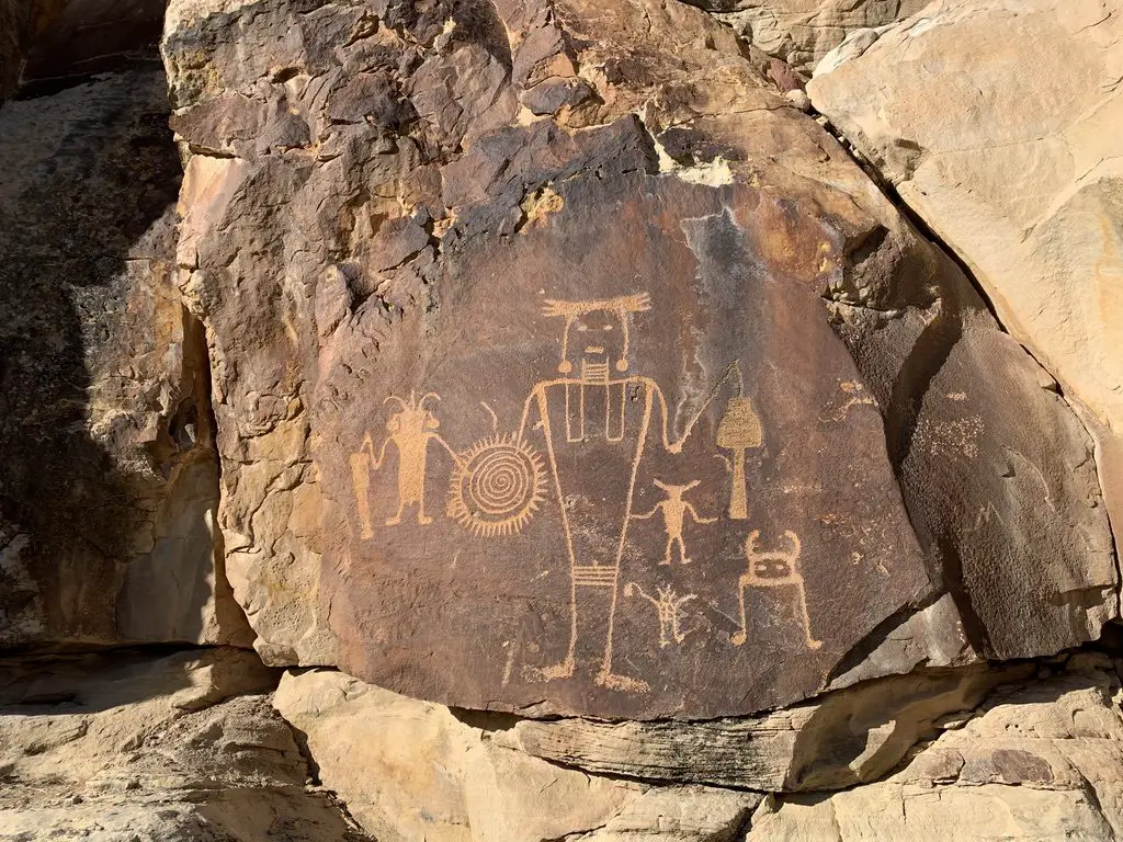
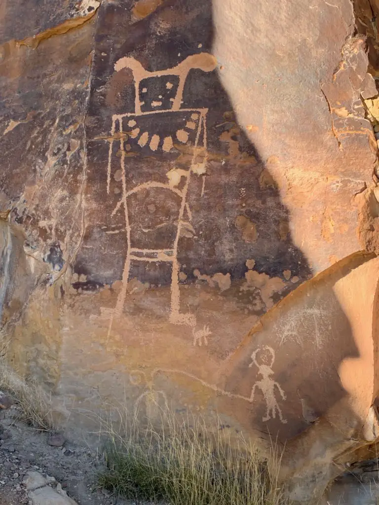
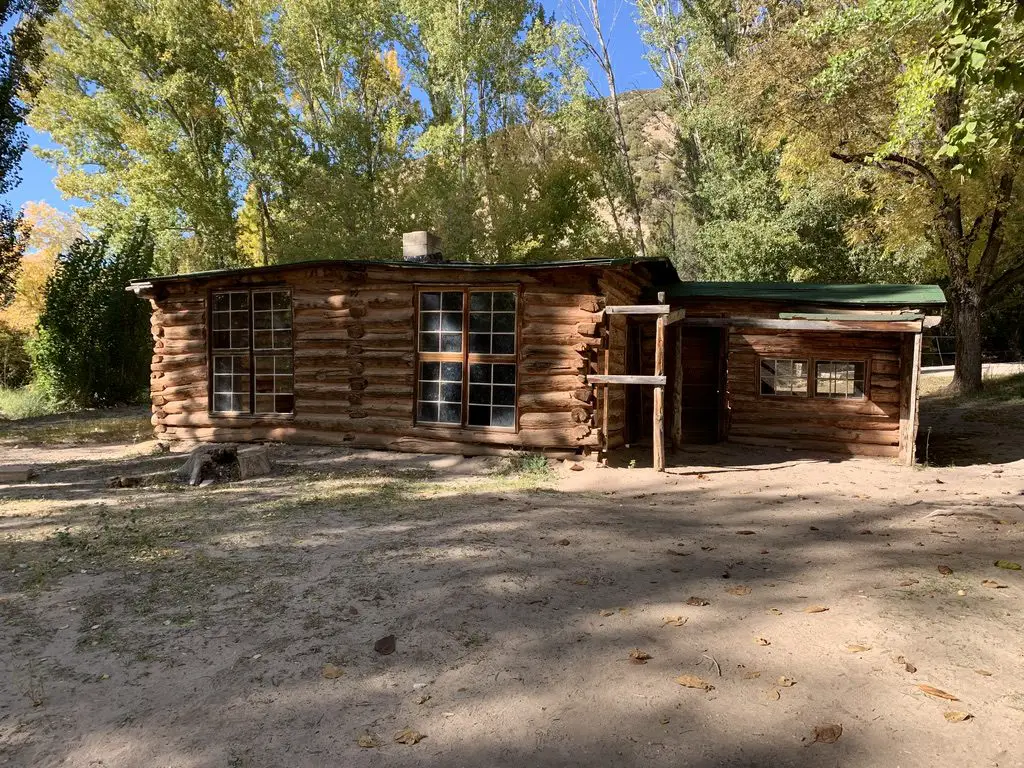
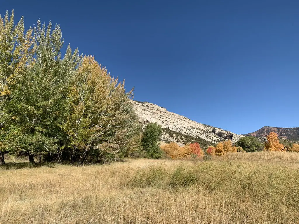
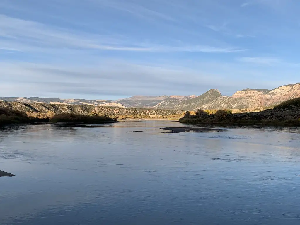
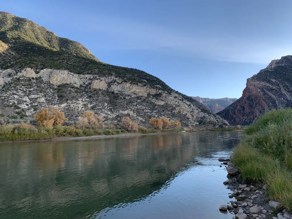
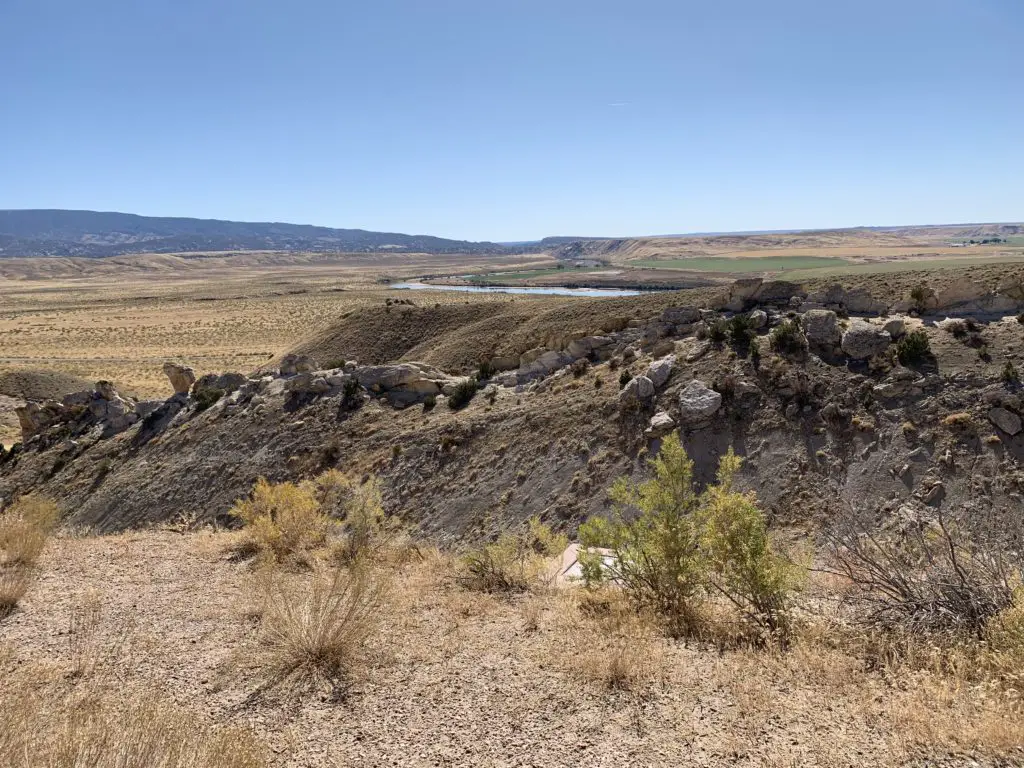
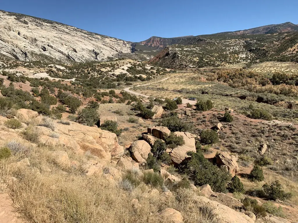
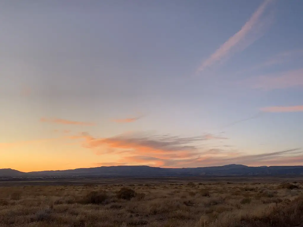
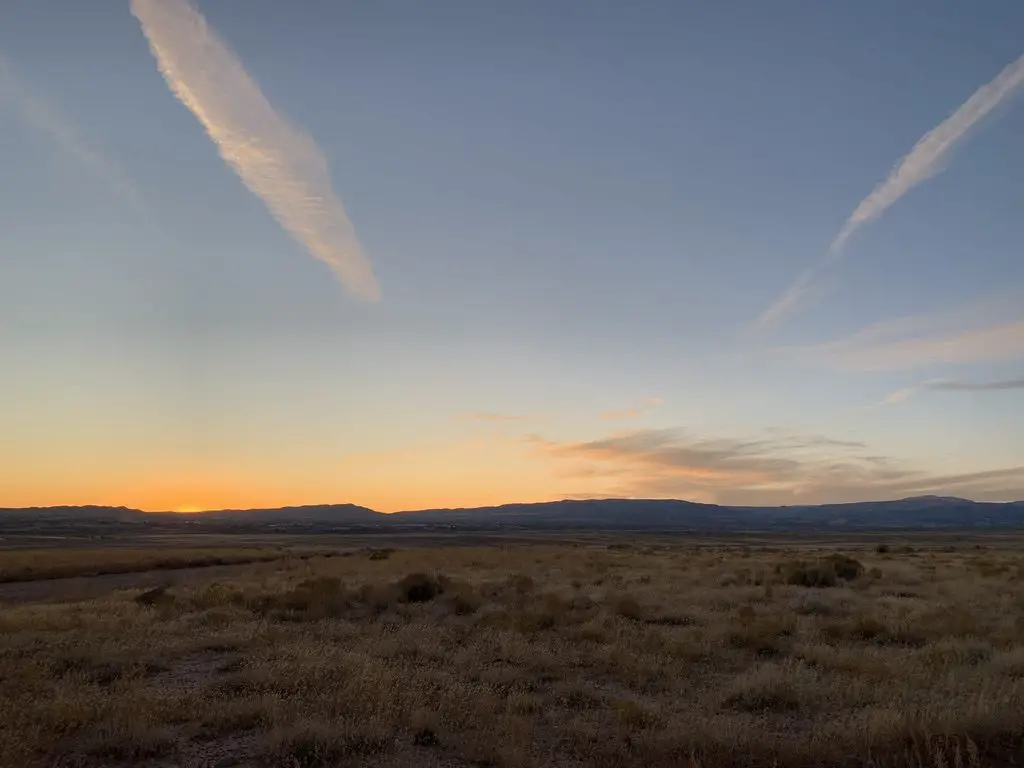
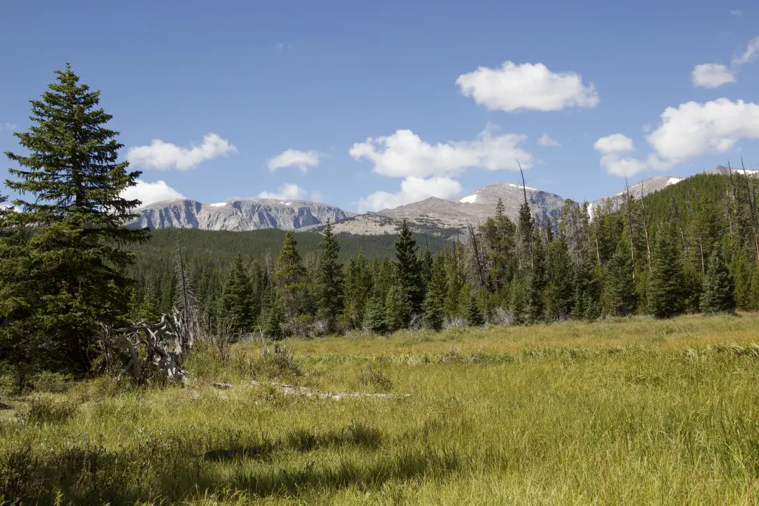
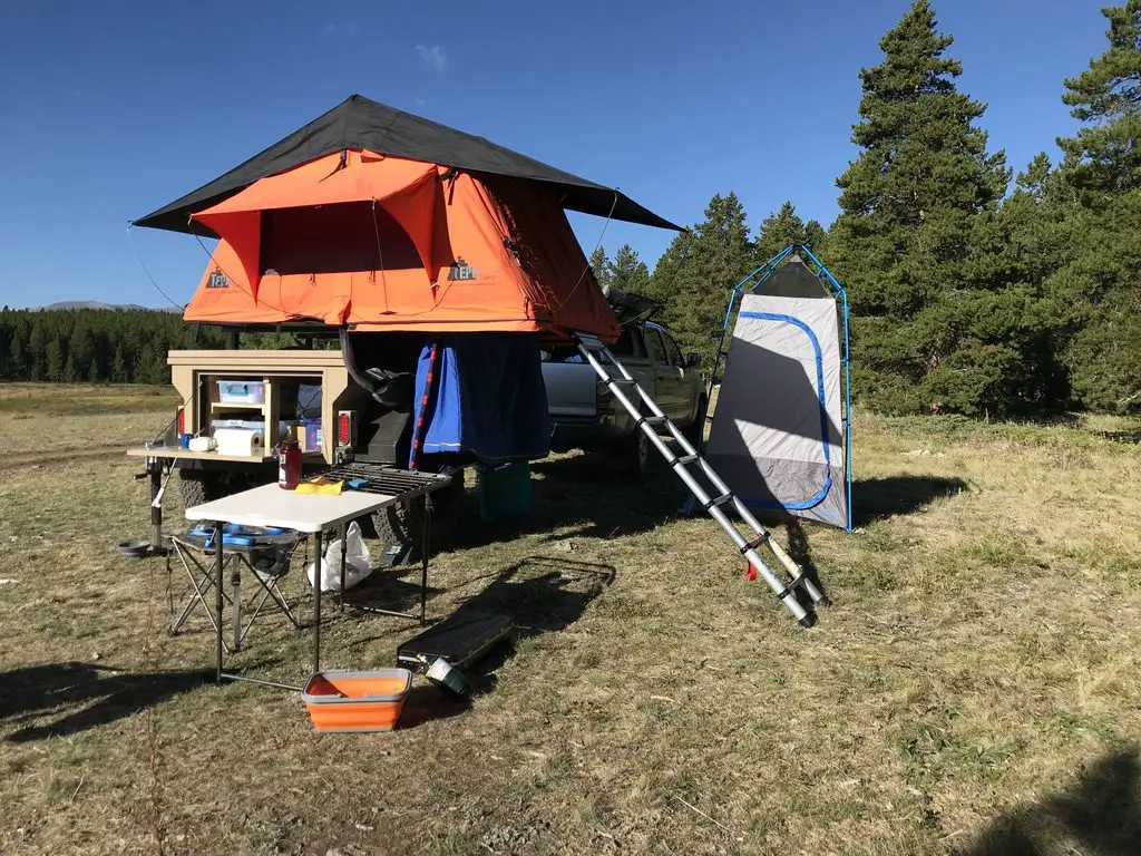
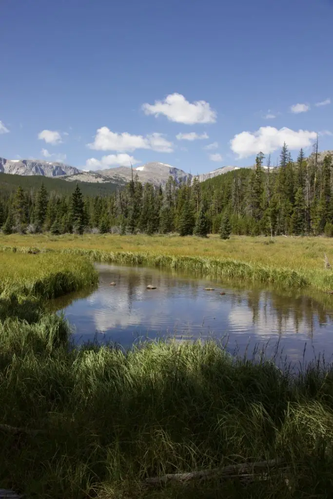 Though this area is just as beautiful as the Rockies, it is FAR less crowded, which makes it so much more pleasant to visit. 😋 There are no lines of people hiking in the Bighorns like we’ve experienced in various places around Colorado. Also, oftentimes, the lower-elevation plains may be baking in 90-degree weather, while it’s in the 60s-70s, and breezy, in the mountains!
 Our campsite was at about 7500 feet on this visit (oftentimes we stay much higher, closer to 9000-10,000 feet). We’ve noticed something odd at these high altitudes that we have also experienced in
 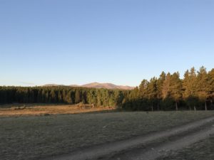 Sometimes when we head out we Disperse Camp. This is also known as “dry camping”, where you just set up your camp somewhere in the national forest, outside of an established campground. We tried this for the first time in Colorado, at both State Forest State Park and near Crested Butte. On both occasions, we did stay at an actual, numbered campsite, it was just away from any campground and we weren’t able to see our neighbors.
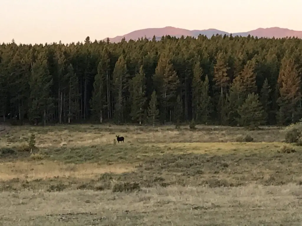
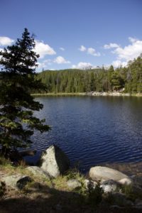
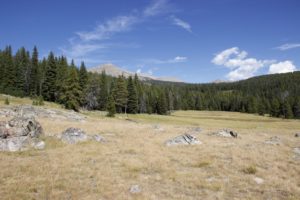 This hike was deceptively tough. It’s only about three miles in total length, but it’s overgrown in many spots, very rocky and there are lots of downed trees. We actually lost the trail several times and had to root around to locate it again. Other parts of it are PERFECT though. They feature a flat, graded path through a moist, pine forest, that is surrounded on both sides by a green carpet of ferns, moss, and soft undergrowth. It almost felt like hiking in the cool rainforests of the Pacific Northwest. It was such an idyllic sight!
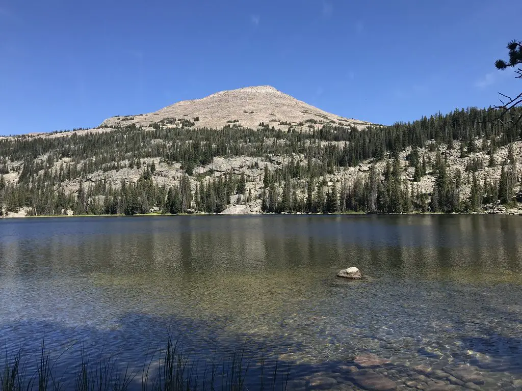
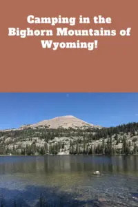
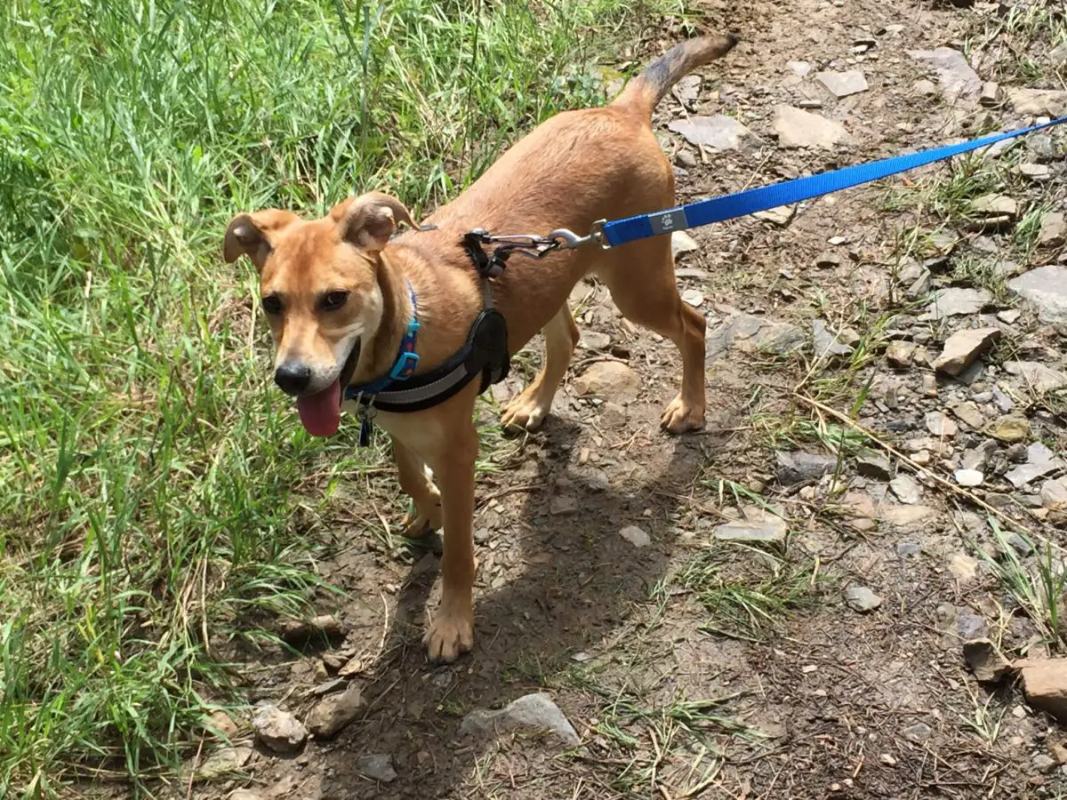
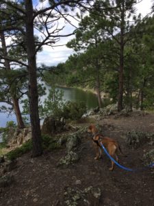 Our pup doesn’t seem to have quite the same stamina as our old, hound dog, though she enjoys the many hikes we’ve taken her on in the nearby Hills. She has also learned to enjoy cars, including the camping trips, visits to the drive-in and storm chases we’ve taken in them.
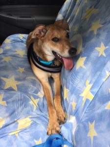 I read a puppy training book called